
After breakfast at the Grande Bretagne, we spent the morning at the Ancient Agora. After lunch, we walked over to the Pnyx for views of the Acropolis and Parthenon. We had a quick dinner on the way back to the hotel, where there was an Easter gift waiting for us!
Morning
After waking up at the Hotel Grande Bretagne, we headed upstairs for breakfast, arriving at around the 6:30am opening time.
We had a similar breakfast to what we had the past two mornings.
We watched as the sun rose and the Acropolis and Parthenon glowed in the morning light.
The scene got brighter and brighter as the sun continued to rise.
Unlike yesterday morning, the sky above and around us was completely clear!
It was pretty quiet across the street in front of the Old Royal Palace.
Monastiraki
After breakfast, we returned to our room before heading out again for Monastiraki.

We passed walked by this interesting section of the Syntagma Metro station. It kind of seems like this is a mirror but it is not.
The metro was pretty empty at this hour.
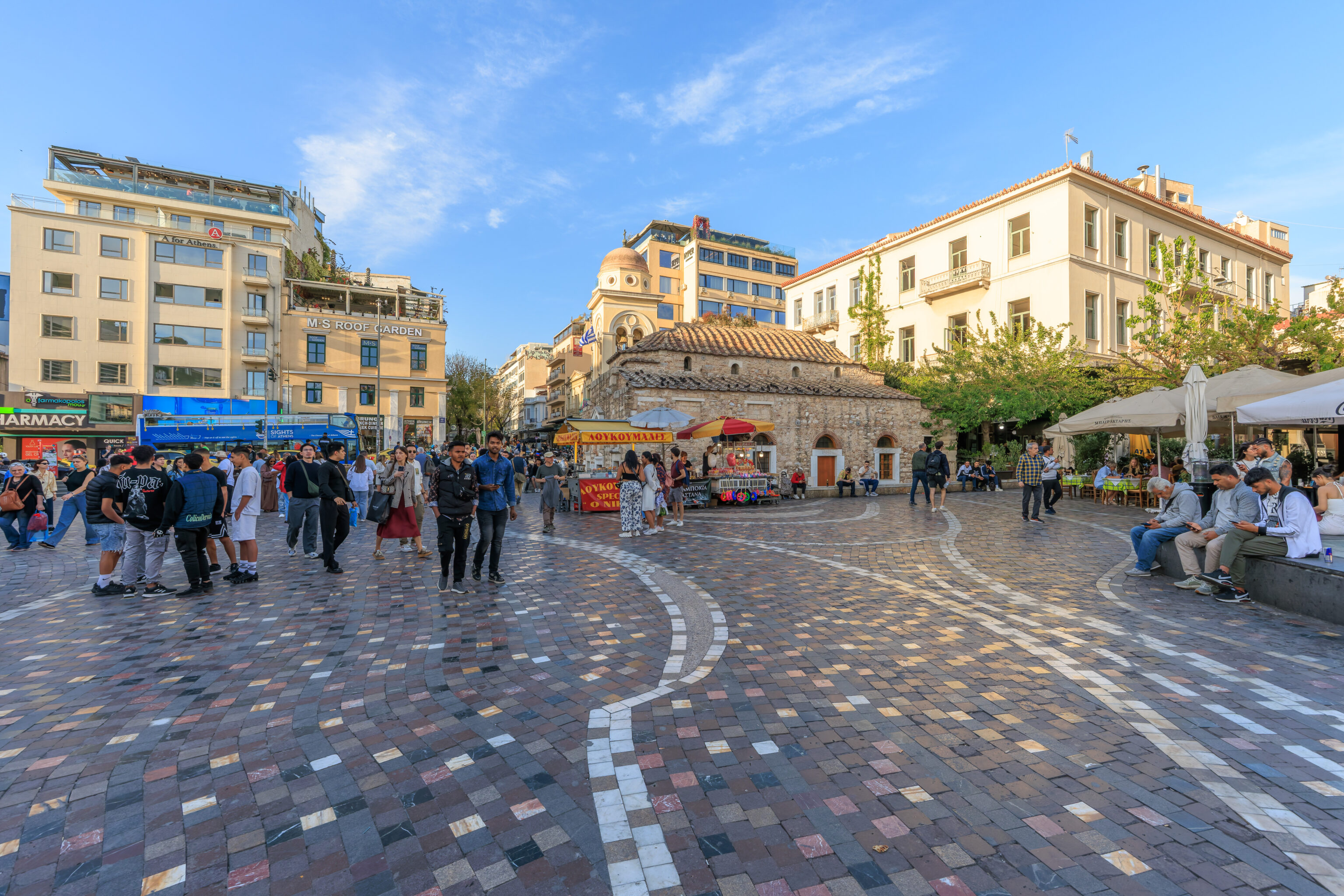
Monastiraki Square was the same way. There were just a few people out and about, very different from the other times we’ve been here so far where it’s always been busy and crowded.
We took a quick look inside the Church of the Pantanassa, the small historic church at the northeast corner of the square. This building is from the 10th century AD and was part of a larger monastery. This square as well as the neighborhood are named after this monastery.
Ancient Agora
We then started to walk to the west to visit the Ancient Agora. We had purchased timed entry tickets for the 8:30am to 10am time slot. We can enter at any time during this period.
Tickets should be purchased directly from Hellenic Heritage.
We walked by Hadrian’s Library, which we visited yesterday.
The view looking back at the nearly empty Monastiraki Square from the entrance to Hadrian’s Library.
The eastern edge of the Ancient Agora was just one large block to the west from Hadrian’s Library.
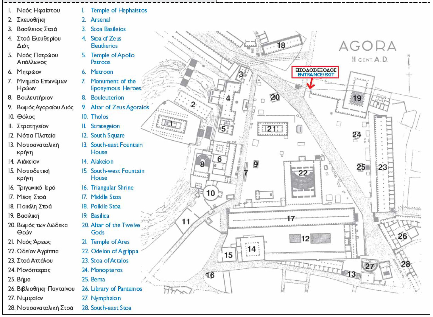
Our digital tickets, in PDF form, included a historical map showing what it looked like here during the 2nd century, AD.
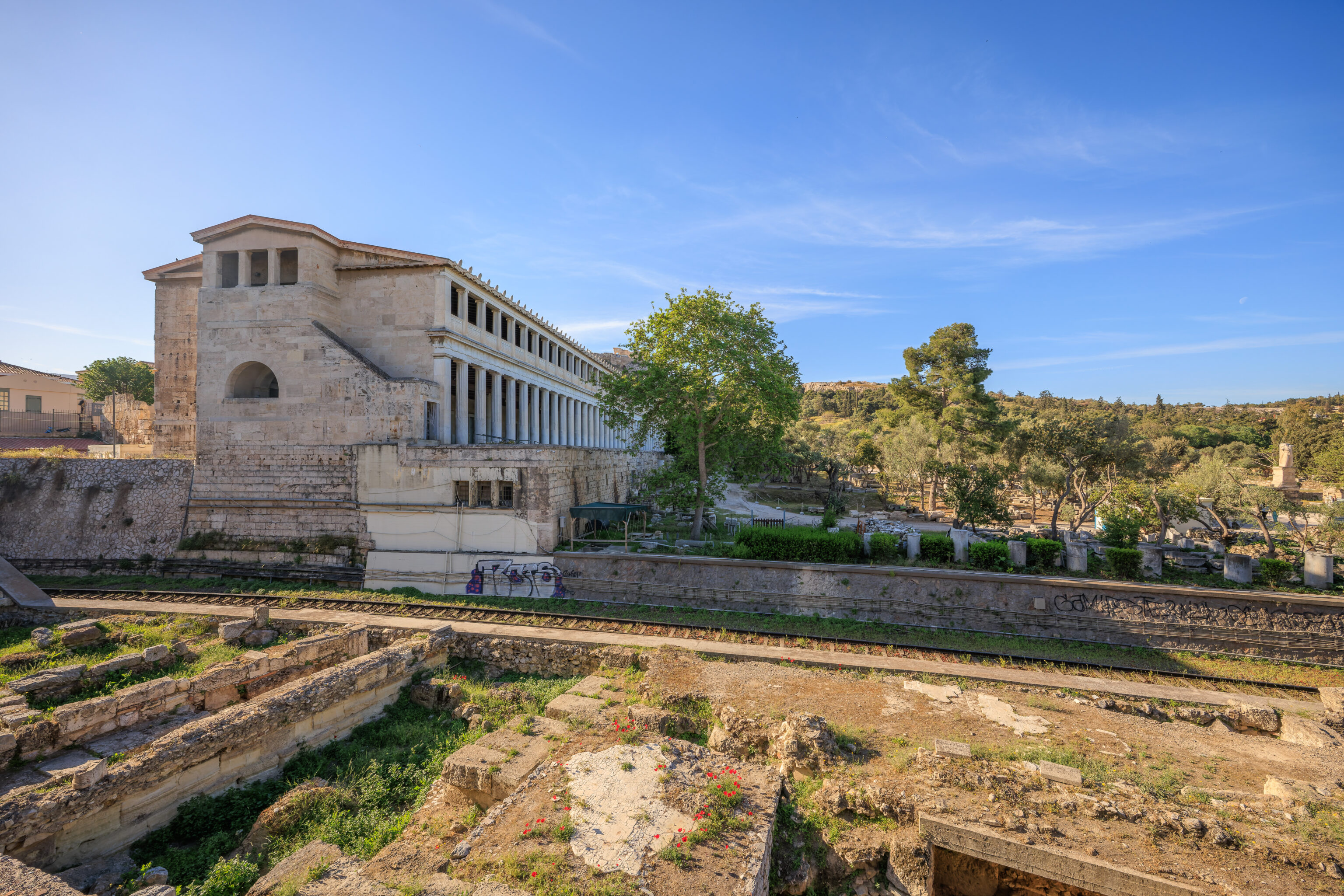
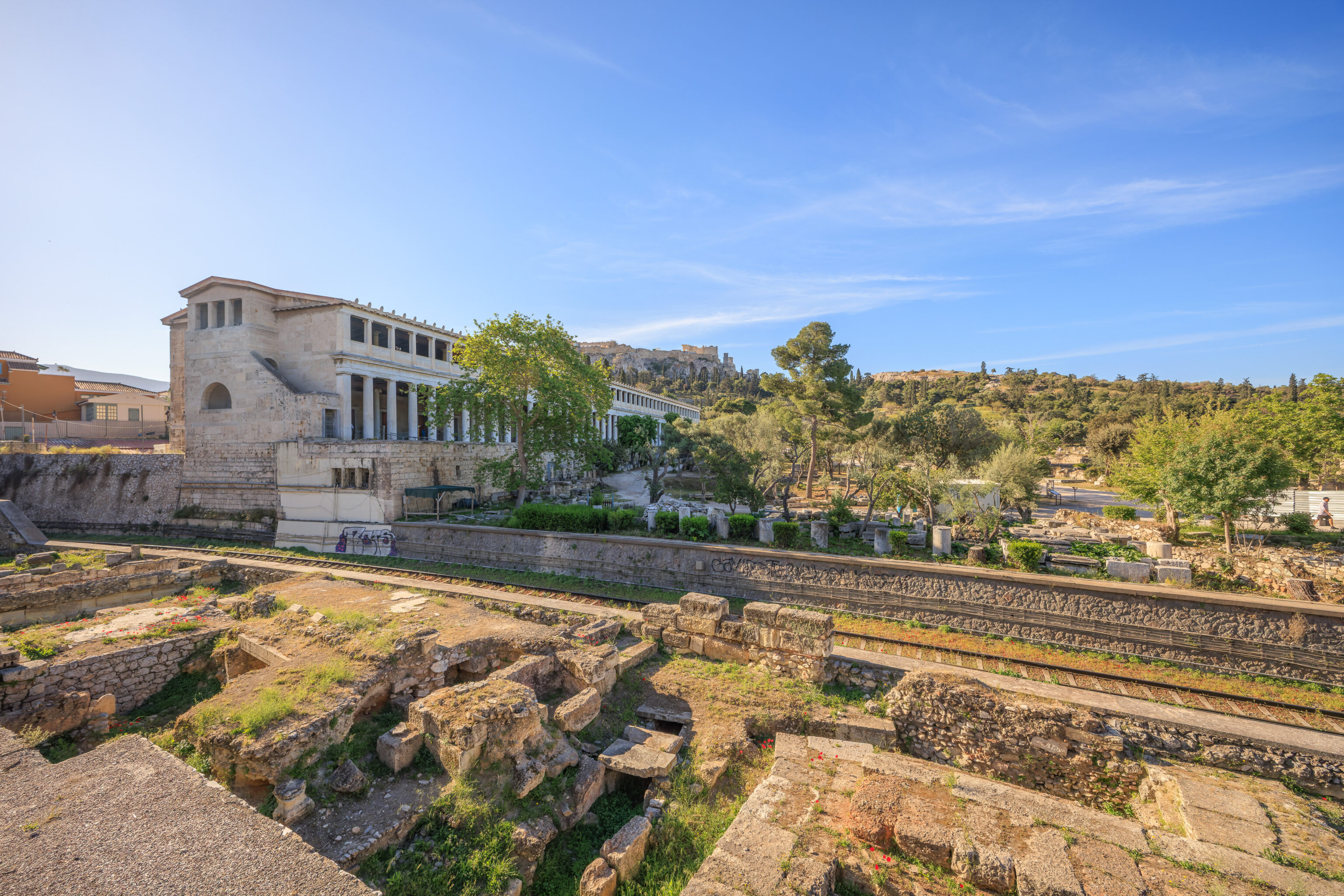

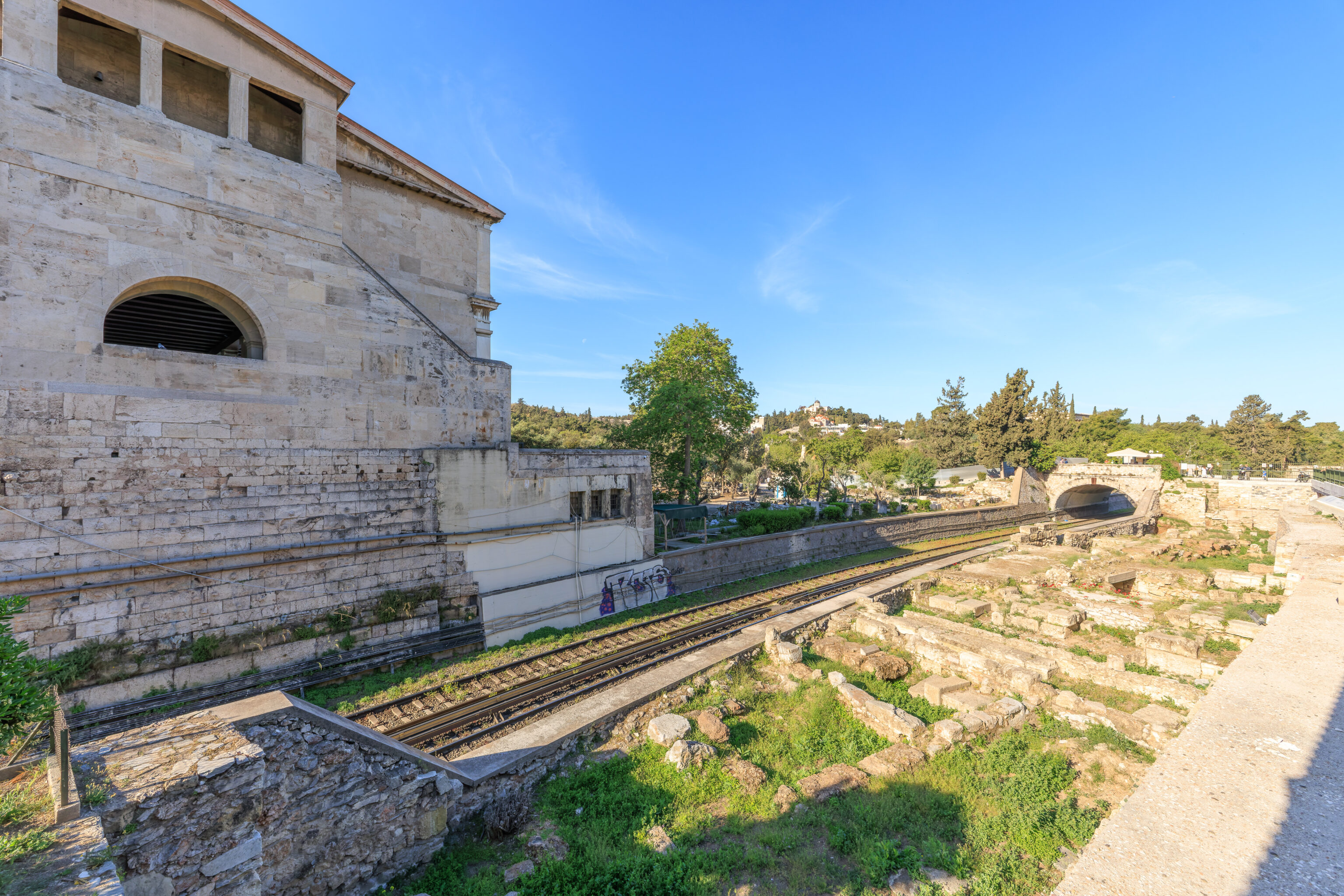
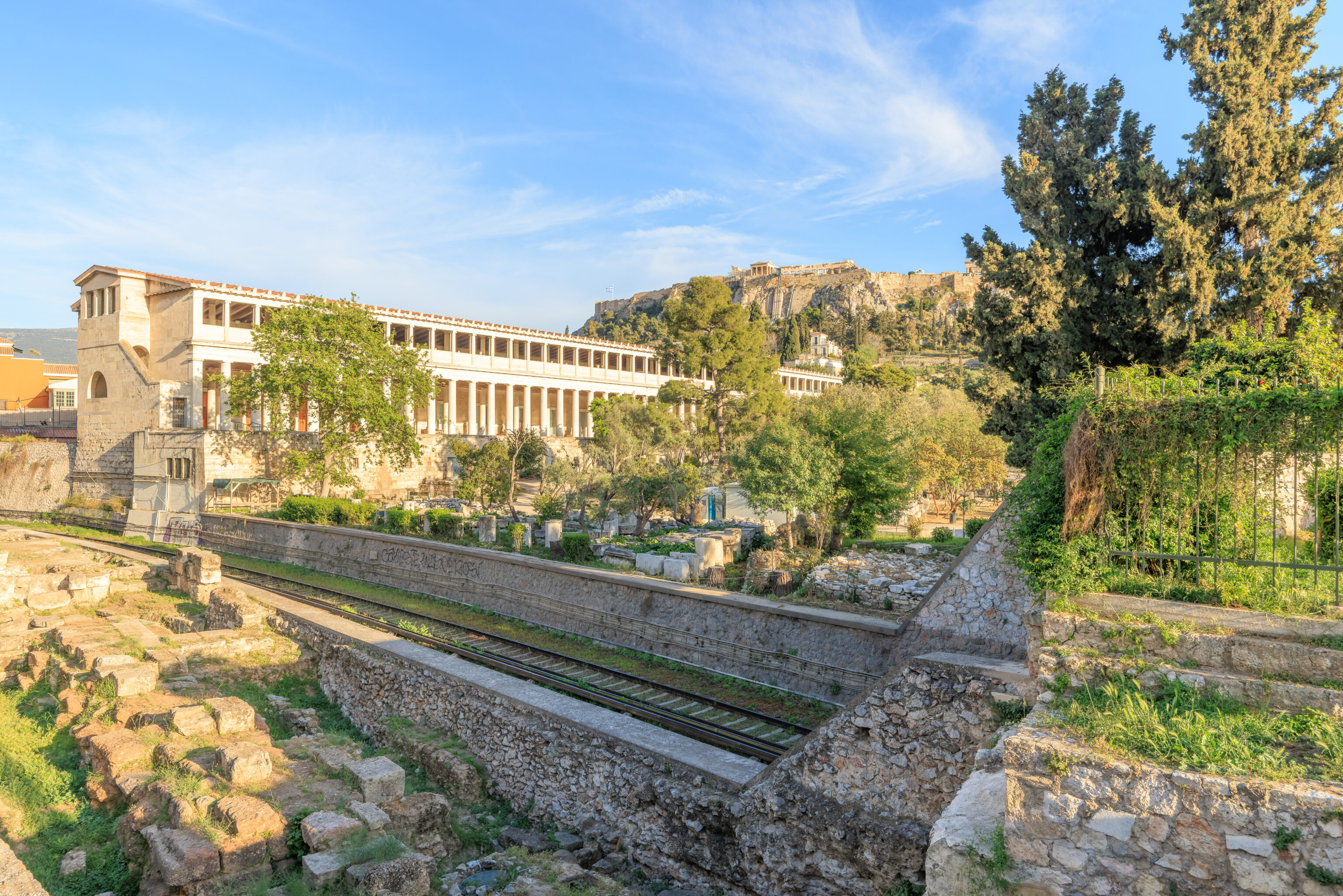
This large building that we walked by is #23, the Stoa of Attalos. The historical site is separated from the road we’re walking on via tracks for the Metro, which a bit below grade here. We had a great view of the Acropolis, which we visited two days ago, in the background.
We crossed over the tracks via a pedestrian bridge and entered using our tickets.
We walked by an ugly metal fence as the path descended to ground level.
A wide path was ahead with the Acropolis in the background. Where to begin?
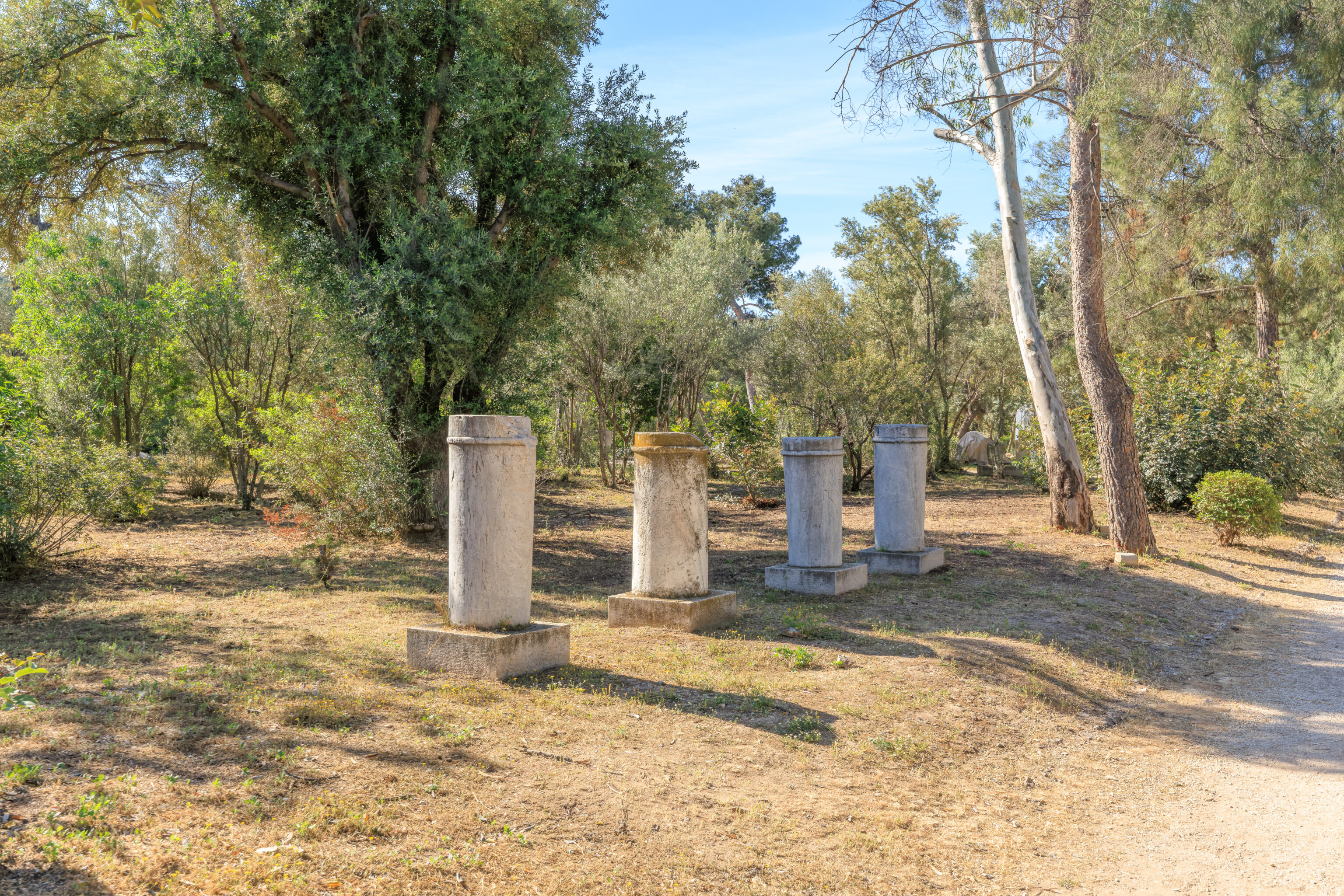
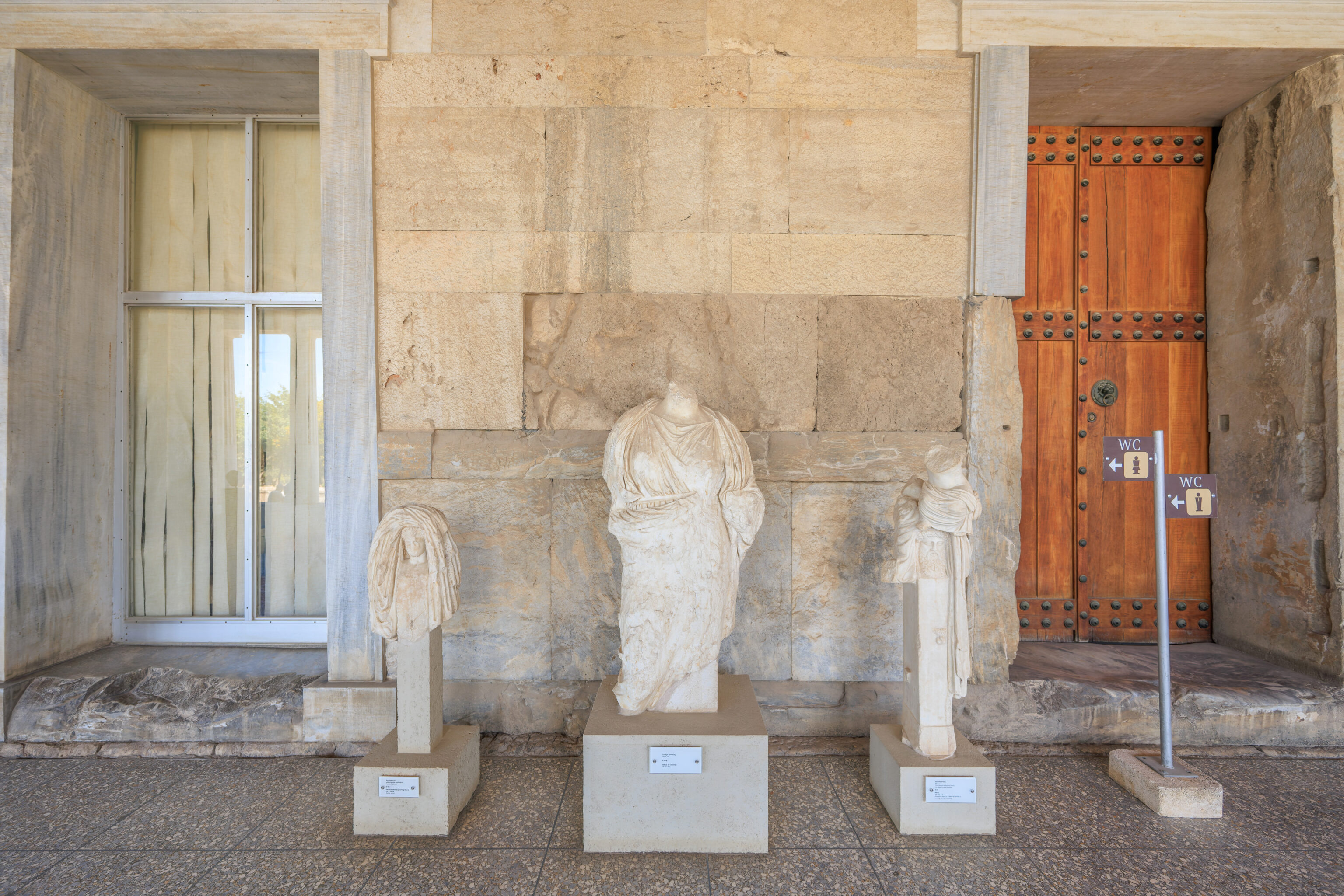
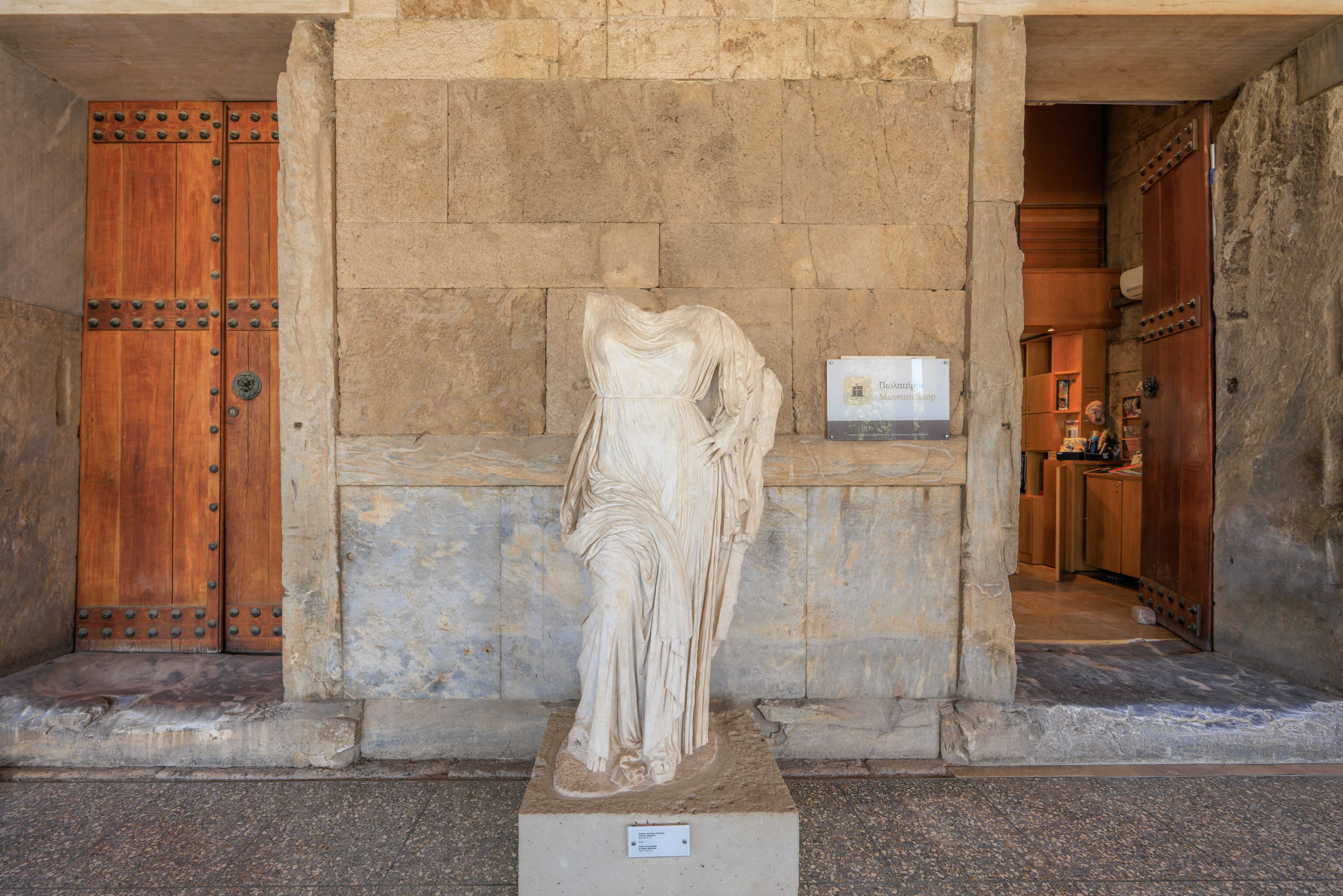
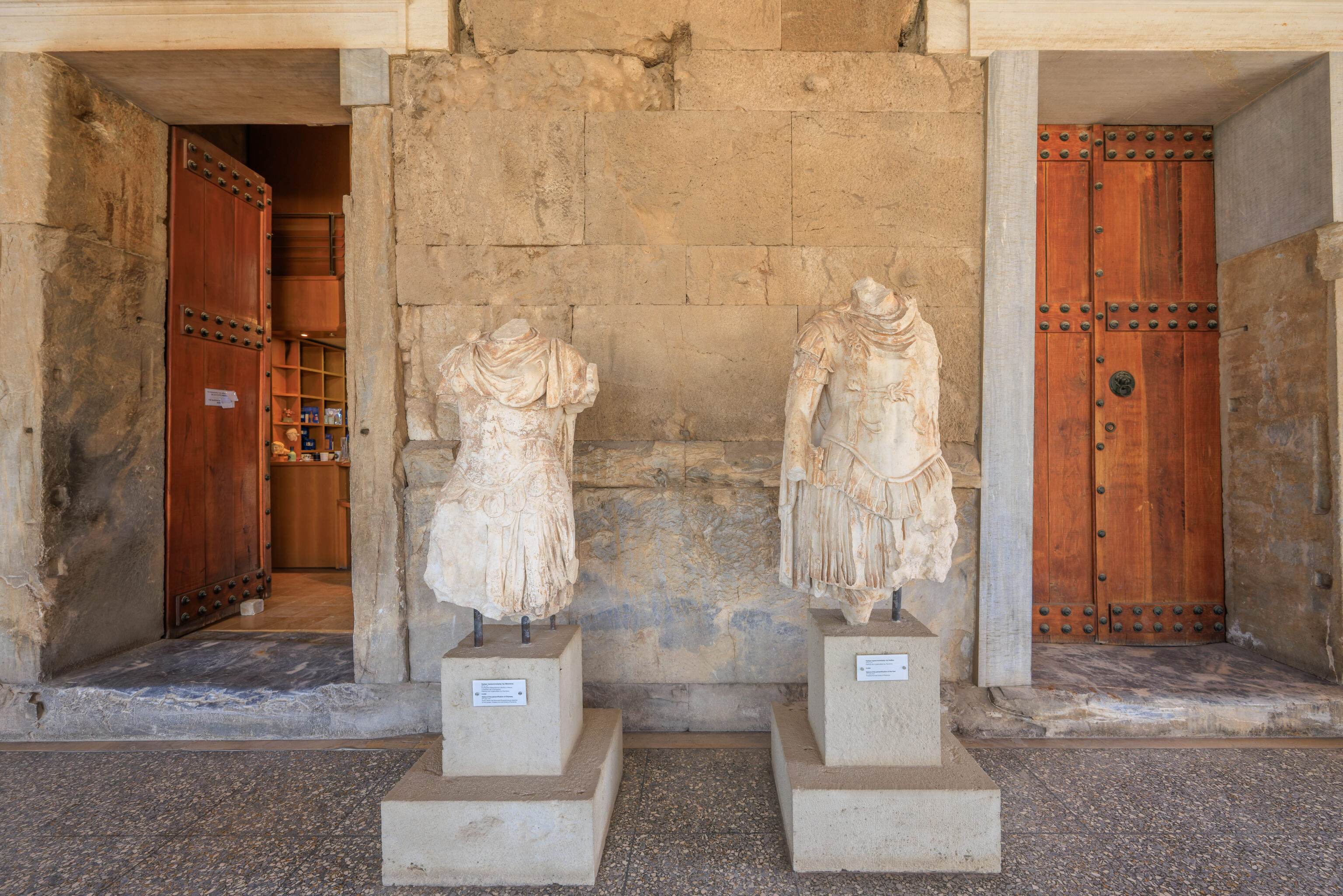
We decided to turn right and walk down a path lined with some tall statues atop large pdestals.
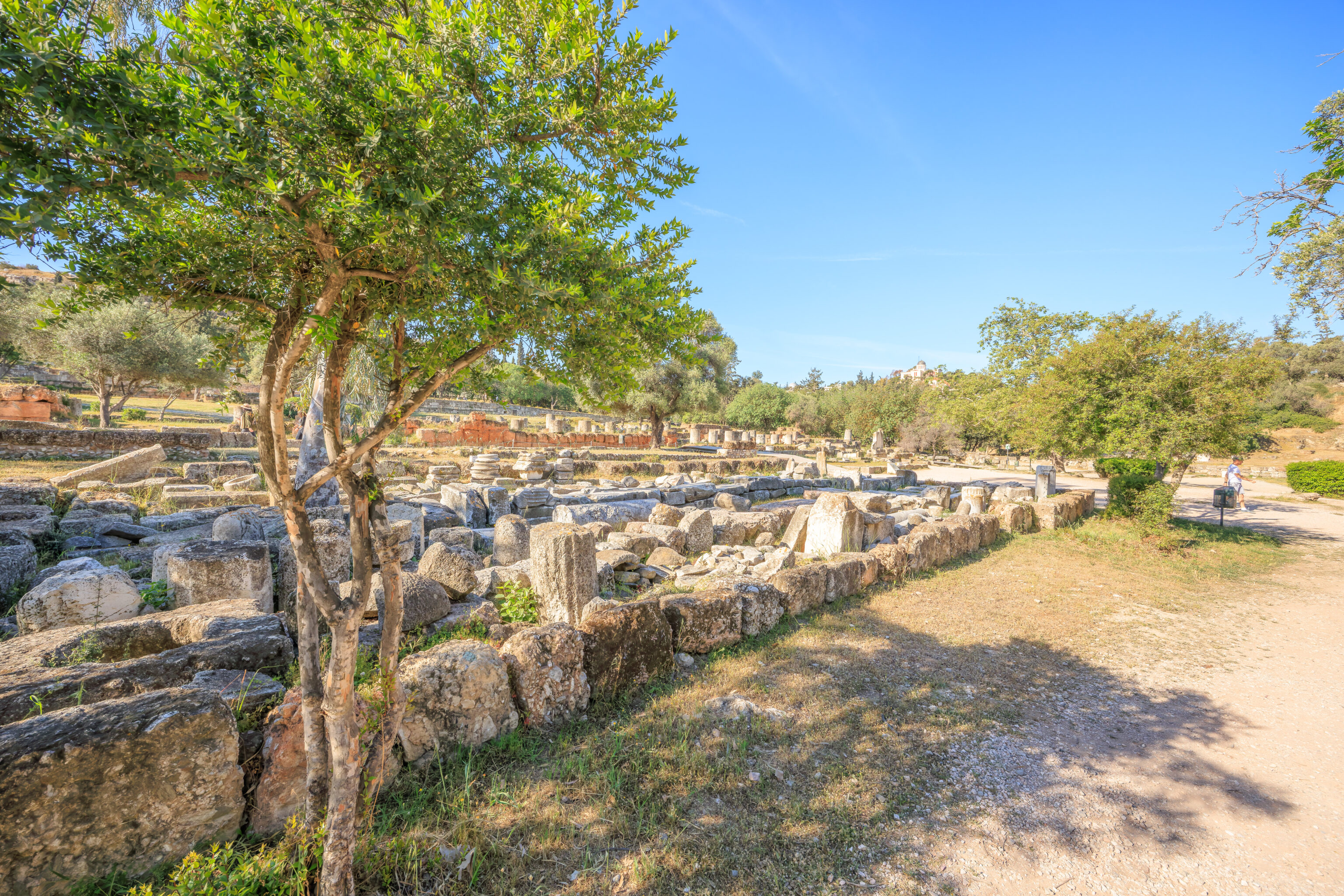
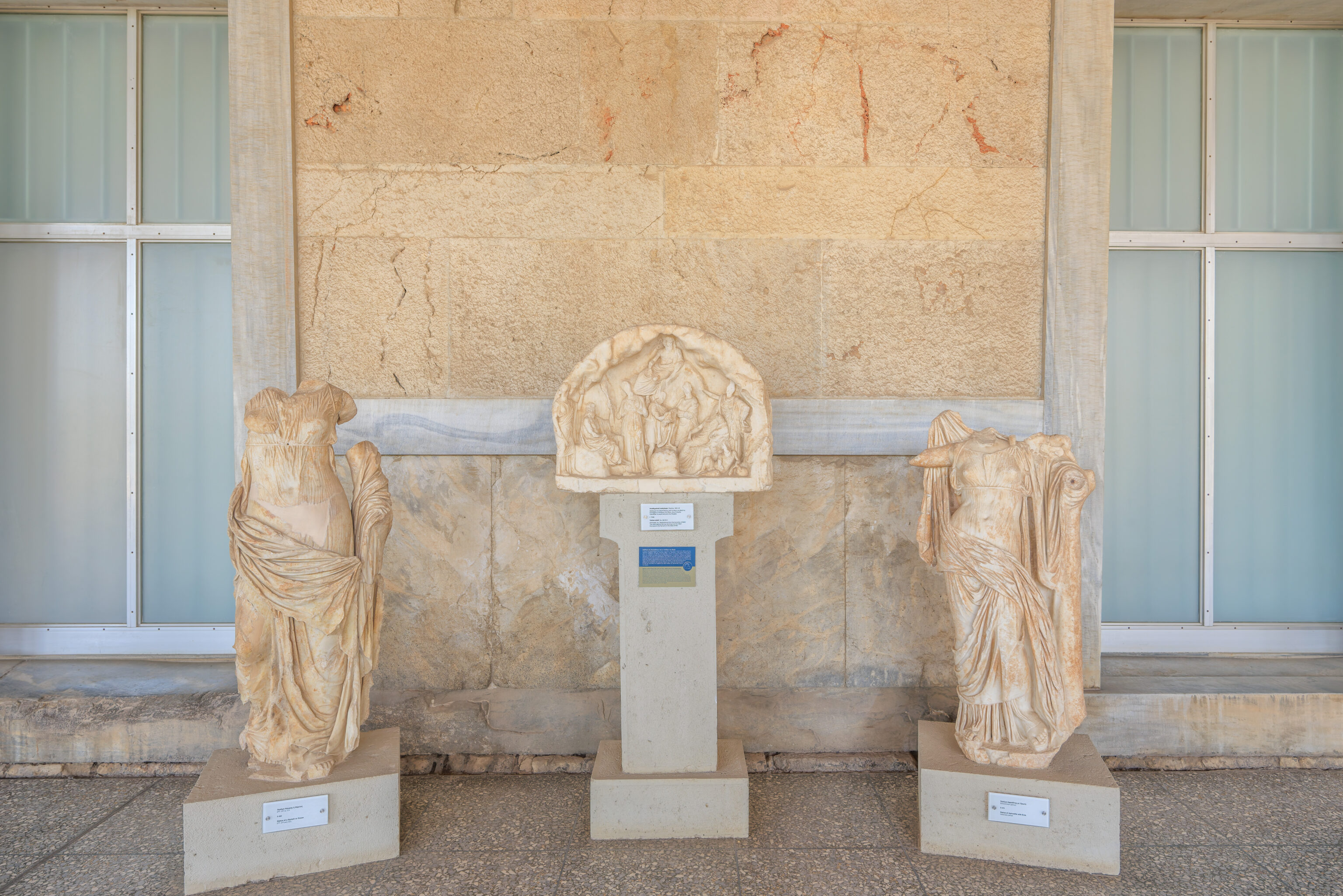
There were other even more ruined statues to the south.
On the north side of the path, there were some column pieces and many pieces of stone in a rectangular pile.
This statue seems interesting.
A nearby sign describes the buildings that were here:
ODEION OF AGRIPPA (ca. 15 B.C.)
The Odeion of Agrippa, a grand and luxurious building designed for musical performances, is known in the ancient sources as the "Odeion", the "Kerameikos Theatre" or the "Agrippeion" after its donor, Marcus Vipsanius Agrippa, son-in-law of the Emperor Augustus. The central part of the building, which rose, as if a separate structure, above a surrounding stoa, included an oblong rectangular stage, a semi-circular "orchestra" and an auditorium built like an amphitheatre, with space for around 1000 persons. The entrance for the audience was formed, on the south side of the building, by the terrace of the Middle Stoa, while a small tetrastyle propylon on the north side led directly to the stage area. The building originally had a pitched roof, without interior support, which collapsed around A.D. 150. Then the building was reconstructed with the addition of a transverse wall that reduced the seating capacity almost by half. The north face took the form of a stoa, the epistyle of which supported six colossal statues of Tritons and Giants. Four of them later adorned the Gymnasium or "Palace of the Giants", which was built over the remains of the Odeion. The building was destroyed by fire in A.D. 267, in the Herulian invasion.

GYMNASIUM OR "PALACE OF THE GIANTS" (A.D. 410-530)
This structure, impressive in its size, included a great section of the central area of the Agora, covering older buildings such as the Odeion of Agrippa and parts of the Middle Stoa and of the South Stoa II. It contained a bathing establishment, surrounded by several rooms, two colonnaded courtyards, and a garden at the south. In all, the complex covered 13,500m2. Its entrance facing the Panathenaic Way was monumental, with a triple opening and four pillars on which were placed the colossal statues of the Tritons and Giants from the Odeion. Originally the building was considered a gymnasium, but it was probably a palace, seat of a high administrative official.
The large statues, or parts of statues, that we see here today lining the south side of the path seem to be the four colossal statues described by the sign as being at the front of the Palace of the Giants.
The view to the northwest.

And the view looking back to the east from a shaded area.
We decided to head south on a path that runs along what may have been the western edge of the Palace of the Giants. From this path, looking to the northeast, we could see the rear of 3 of the four partially surviving statues.
We ended up turning right and then right, basically going west and then north again.
A sign here describes the fauna that live here at the Ancient Agora site:
The picture of the ancient Attic landscape is clearly reflected in archaeological site of the Ancient Agora and the Areopagos Hill (on the North side of Acropolis), after their planting with native trees in the the decade of 1950. The protected environment, which the archaeological site ensures in the heart of the modern city, creates a safe refuge, in which a large number of permanent or migratory birds find shelter, and in which some of them make there their nest.

More than 80 species of birds have been observed in the Agora from time to time: House Sparrows (Passer domesticus), Barn Swallows (Hirundo rustica), Blackbirds (Turdus merula), Hoopoes (Upura epops), Robins (Erithacus rubecula), Goldfinches (Carduelis carduelis), Chaffinches (Fringilla coelebs), Greenfinches (Carduelis chloris), Magpies (Pica pica), Collared doves (Streptopelia decaocto), Rock pigeons (Colomba livia), Starlings (Sturnus vulgaris).

Also in the Archeological site of the Ancient Agora live lizards, such as the Common Wall Lizard (Podarcis muralis) and the Balkan Green Lizard (Lacerta viridis), snakes, for example the Balkan Whip Snake (Coluber gemonensis) and two species of tortoise, the Greek Tortoise (Testudo graeca) and the Marginated Tortoise (Testudo marginata).

Moreover, all the flowers of the area attract an impressive number of butterflies: yellow butterflies with black stripes, which belong to the Swallowtail family, the common swallowtail (Papilio machaon) and scarce swallowtail (Iphiclides podalirius) and the black and red butterfy Red Admiral (Vanessa atalanta). Innumerable ladybirds emerge during spring as do snails after rain.
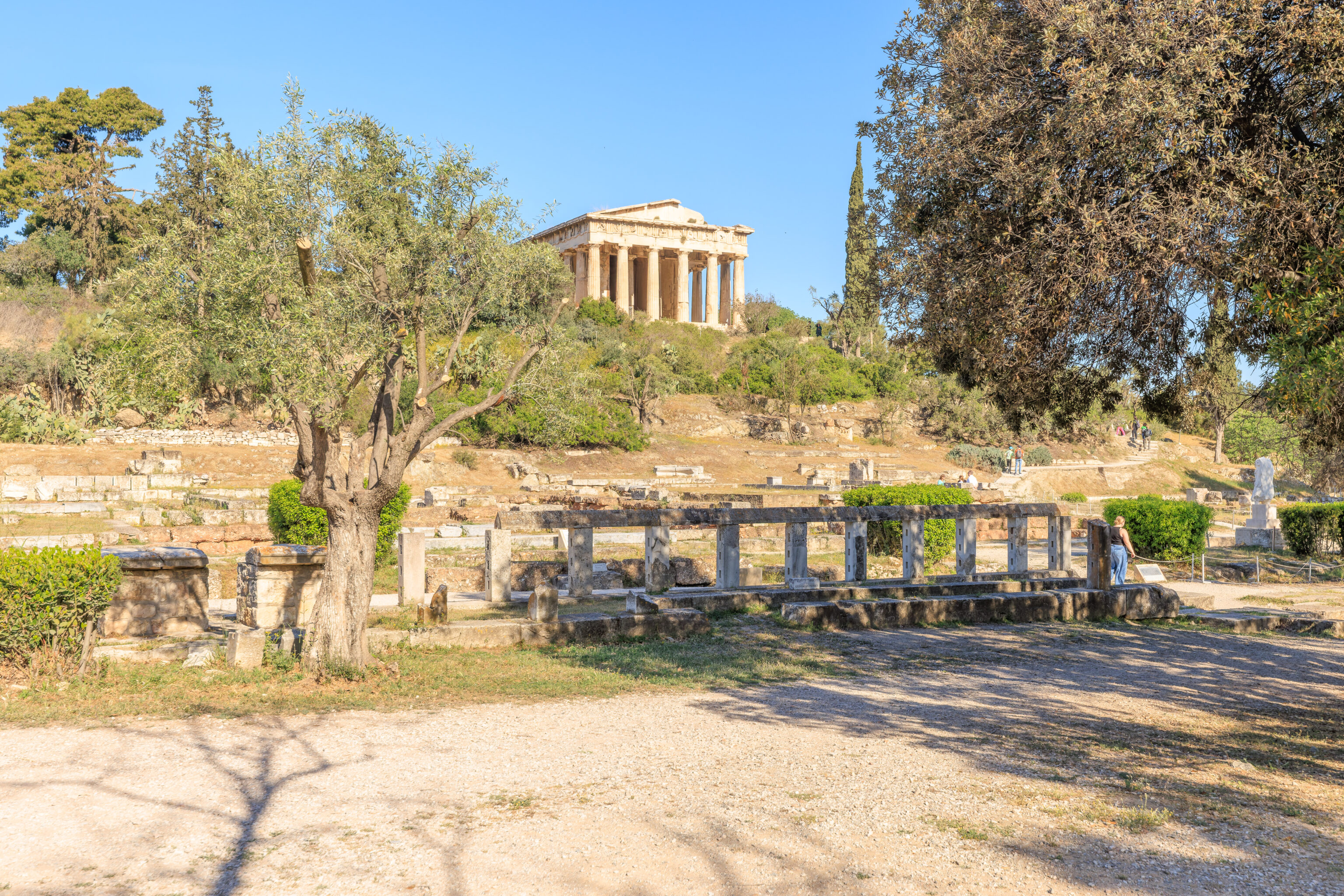
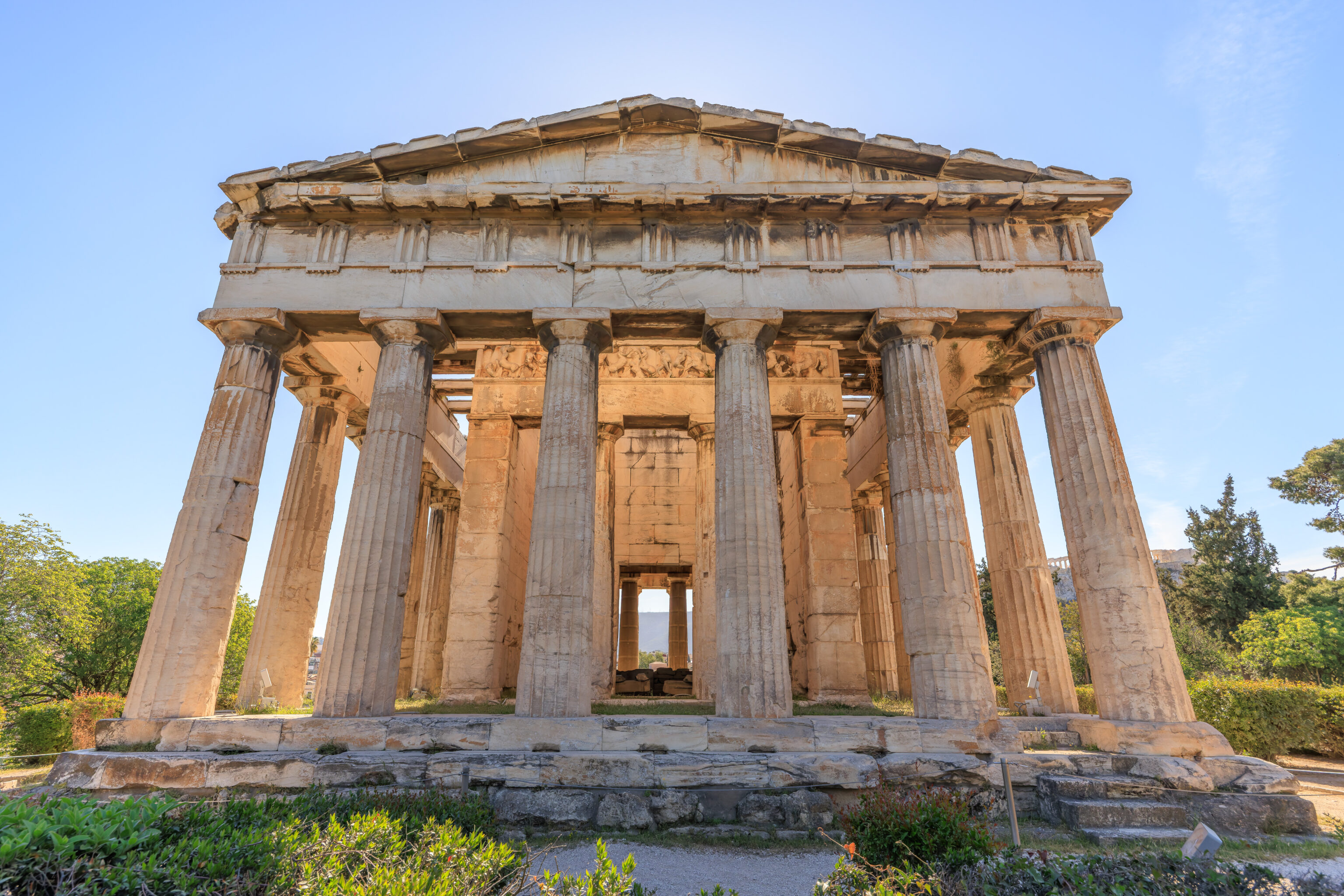
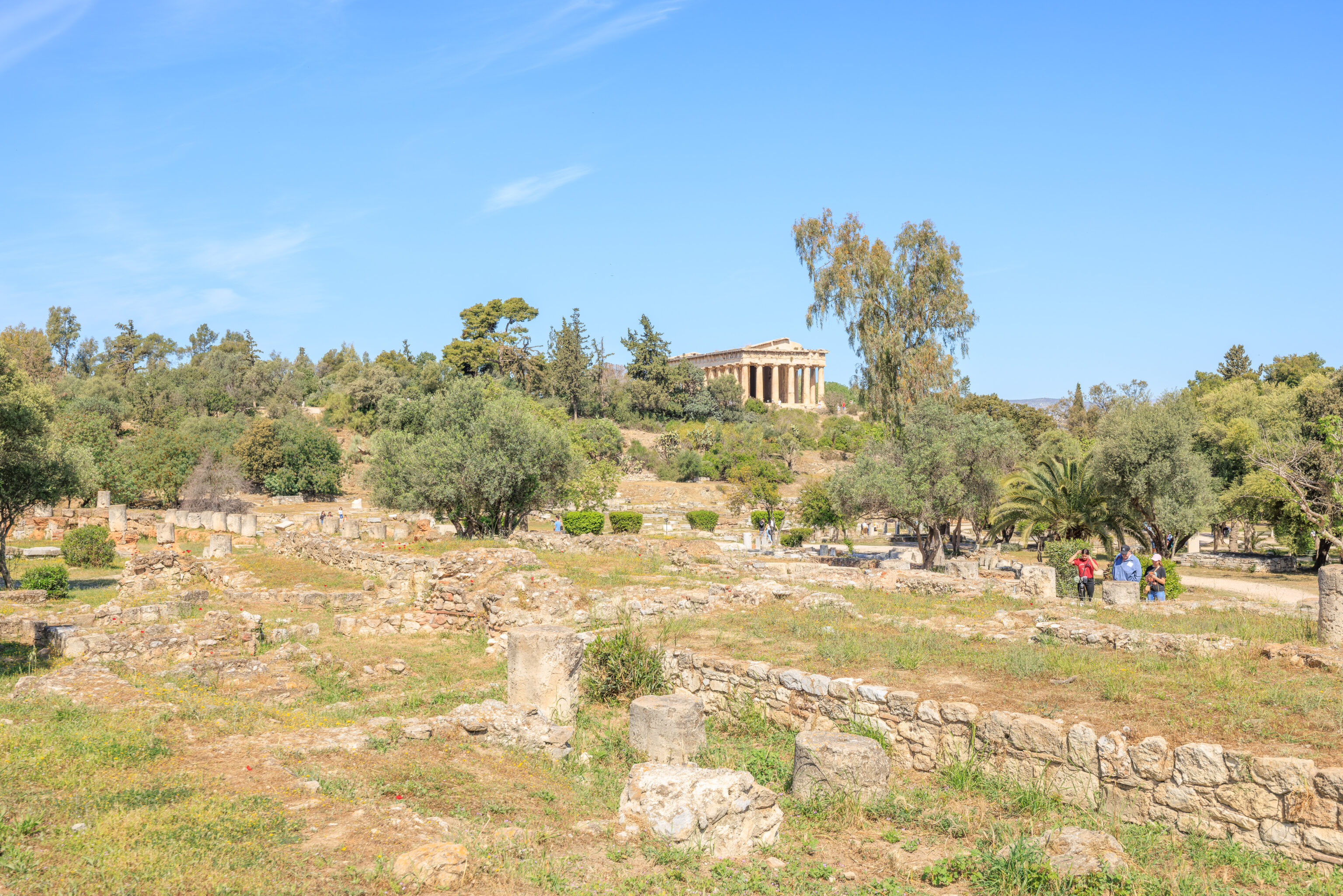
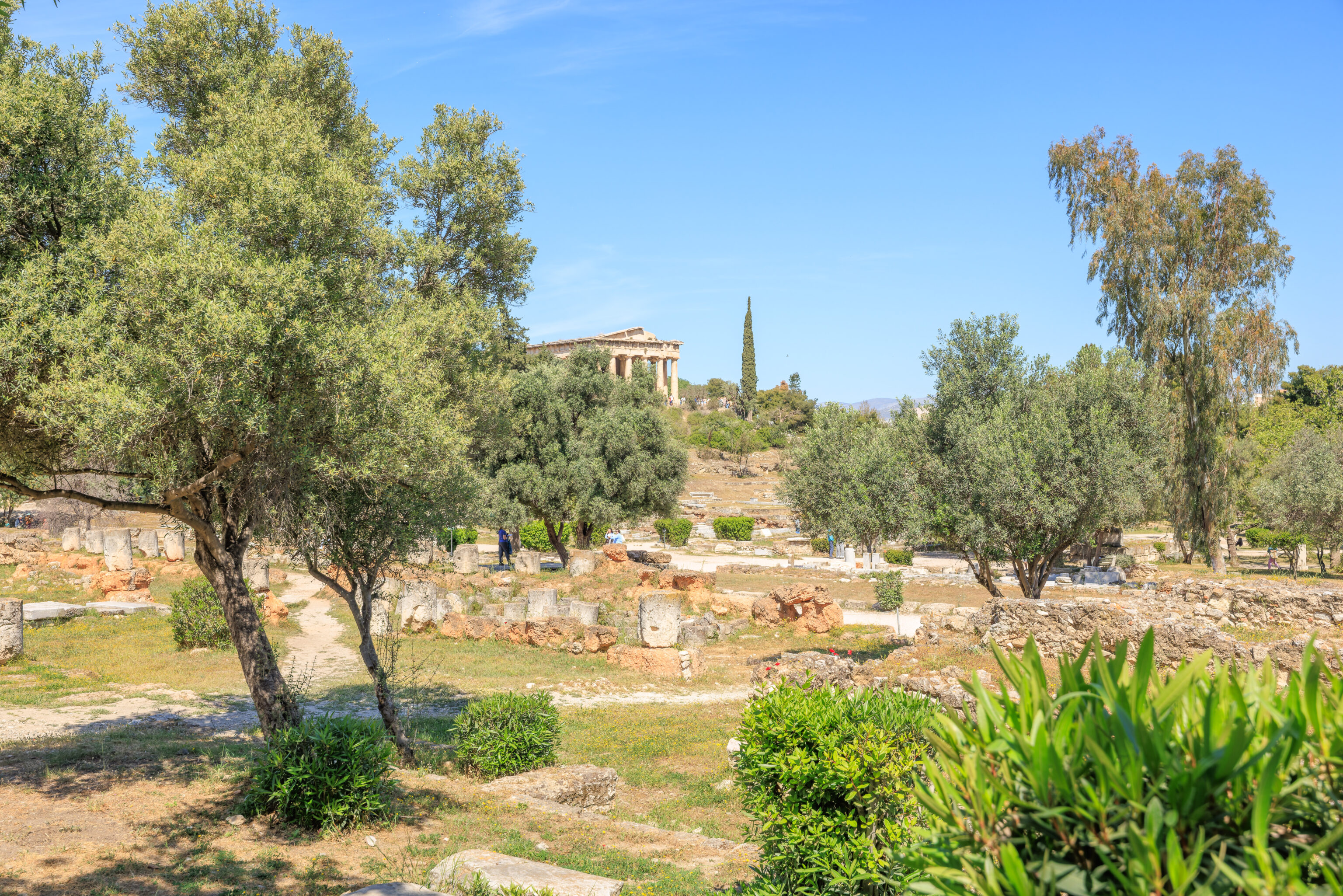
The building on atop the hill in front of us here, which resembles a smaller but more intact Parthenon, is the Temple of Hephaestus. But historically, there were other structures here as well.
A sign describes these other buildings:
TEMPLE OF APOLLO PATROOS (325 BC)
Small Ionic temple, tetrastyle in antis, with pronaos (fore-temple), cella (inner shrine), and an area at the northwest that probably was the adyton. It was dedicated to the god Apollo, who, as father of Ion, ancestor of the Athenians, was the special protector of phratries (groups of related families). Pausanias describes three statues of Apollo in the temple, one in the cella and two in the pronaos. The cult statue, work of the Athenian sculptor Euphranor (mid-4th c. BC), was found in the excavations in 1907 by the Athens conducted Archaeological Society and today is on display in the Stoa of Attalos. The temple stood over an earlier apsidal building, most probably a temple, traces of which are preserved under the floor of the cella.

TEMPLE OF ZEUS PHRATRIOS AND ATHENA PHRATRIA (350 BC)
Small, single-chamber structure, with a porch added around the mid-2nd c. BC, dedicated to the two phratry-protecting divinities of the original sacred phratries or gene of the Athenian citizens. In this function Zeus and Athena were linked closely with Apollo Patroos.

BENCHES OR "SYNEDRION" (2nd half of 5th c. BC)
Four rows of stone seats, partially preserved on the east slope of the Kolonos Agoraios Hill, where in early times the Boule (Council) or some judiciary body met.
Another sign describes the Stoa of Zeus Eleutherios, which was just to the north of where we are standing:
STOA OF ZEUS ELEUTHERIOS (430-420 BC)

A I-shaped stoa, the north wing of which was partly destroyed in 1891 during the construction of the electric railway. It had a double colonnade, Doric on the outside and lonic on the inside. Akroteria with representations of the Nikai (Victories) crowned the eaves of the roof; one of them is on display in the Stoa of Attalos. On the interior the stoa was decorated with wall-paintings by the artist Euphranor, described by Pausanias. It housed the cult of Zeus Eleutherios and served as a place for meeting friends and strolling about. The philosopher Sokrates is said to have frequented the site.

In the early Roman period two adjacent rooms were added to the rear of the west part of the stoa; they had separate entrances opened into the rear wall of the stoa. This addition was made probably so that they could be used as shrines for the worship of emperors such as Augustus and Hadrian, who were connected with Zeus Eleutherios and given his epithet. The stoa was built atop a building of the 6th century BG, possibly an earlier shrine of Zeus Eleutherios. Today a pile of rocks shows the position of the great altar east of the stoa.
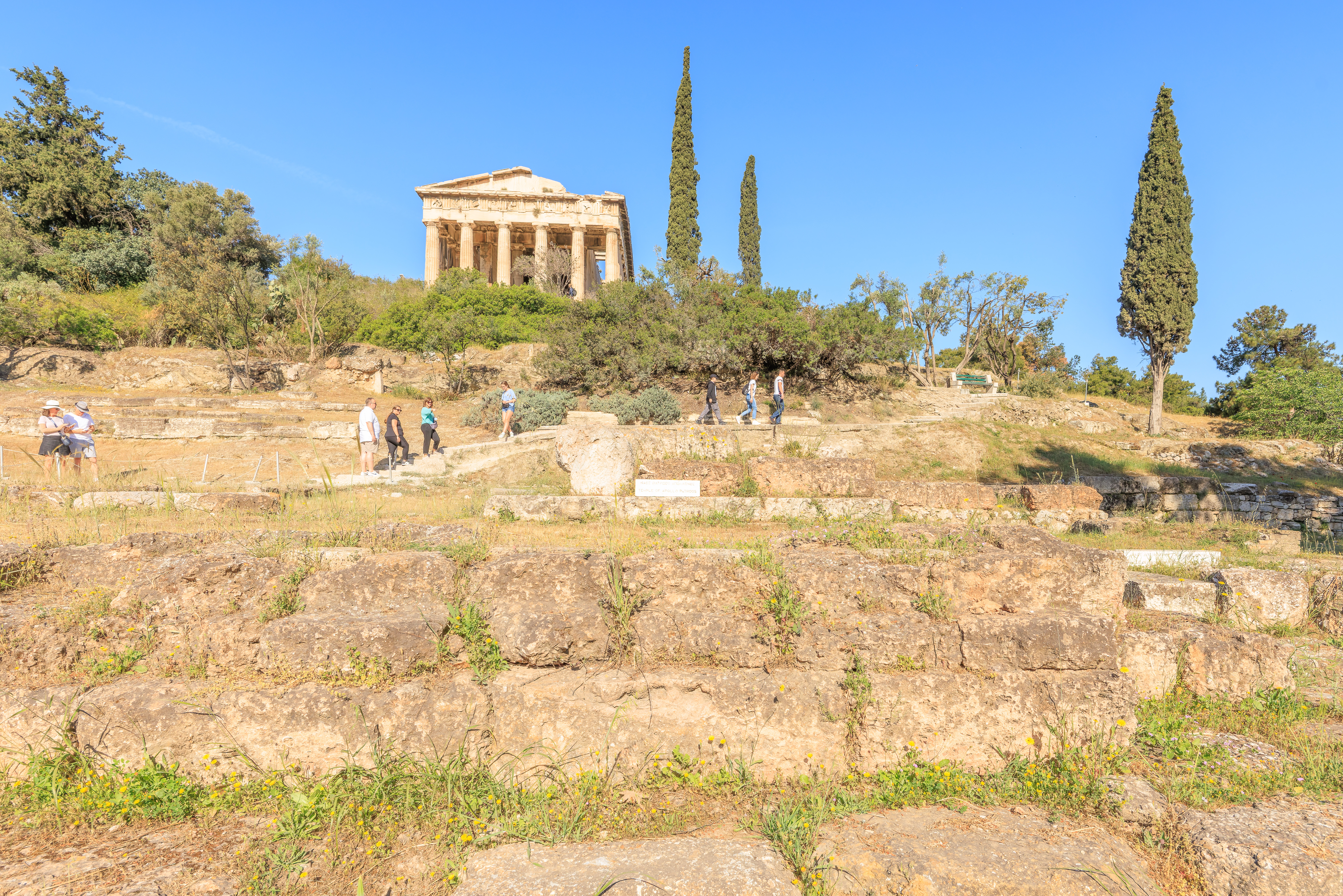
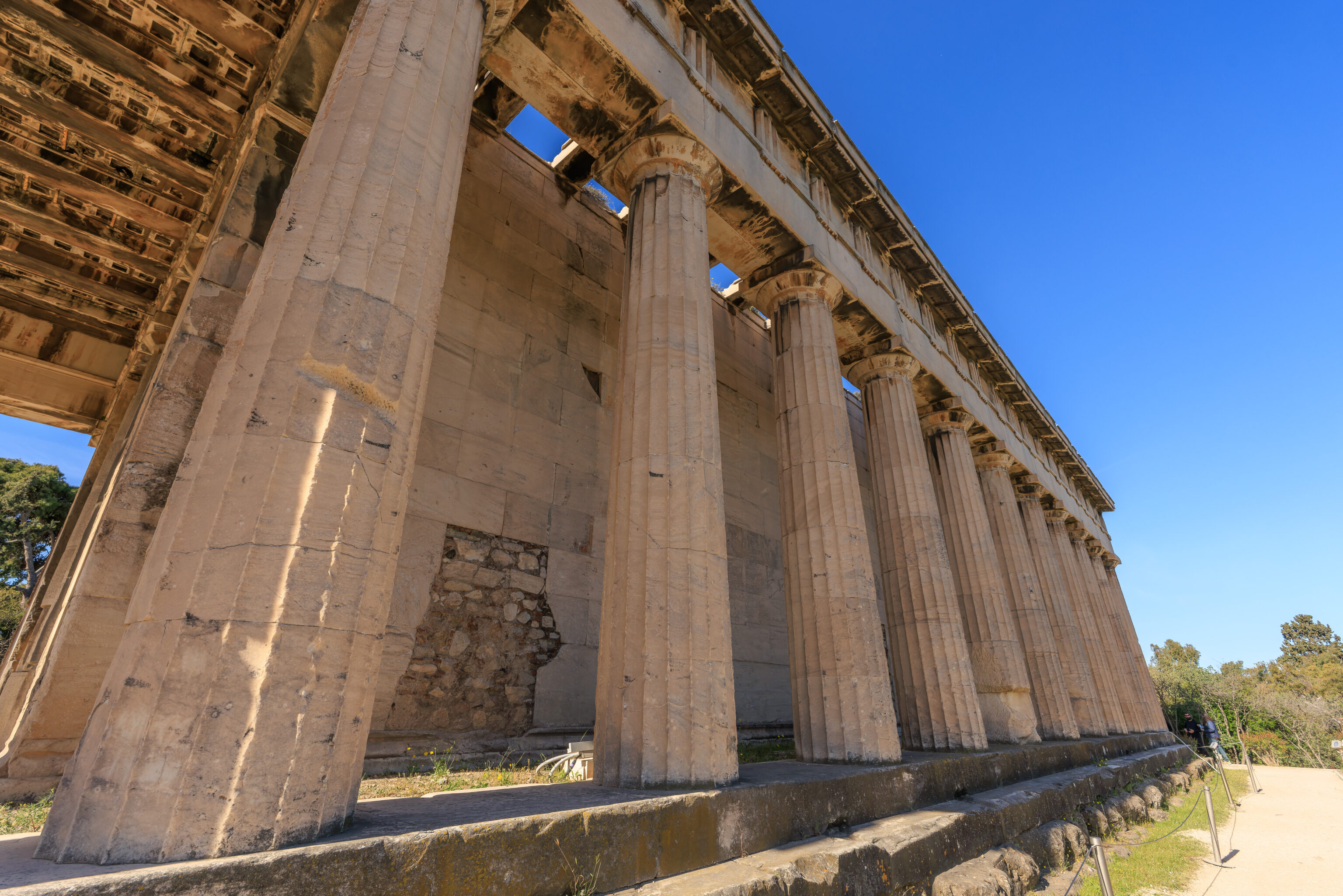
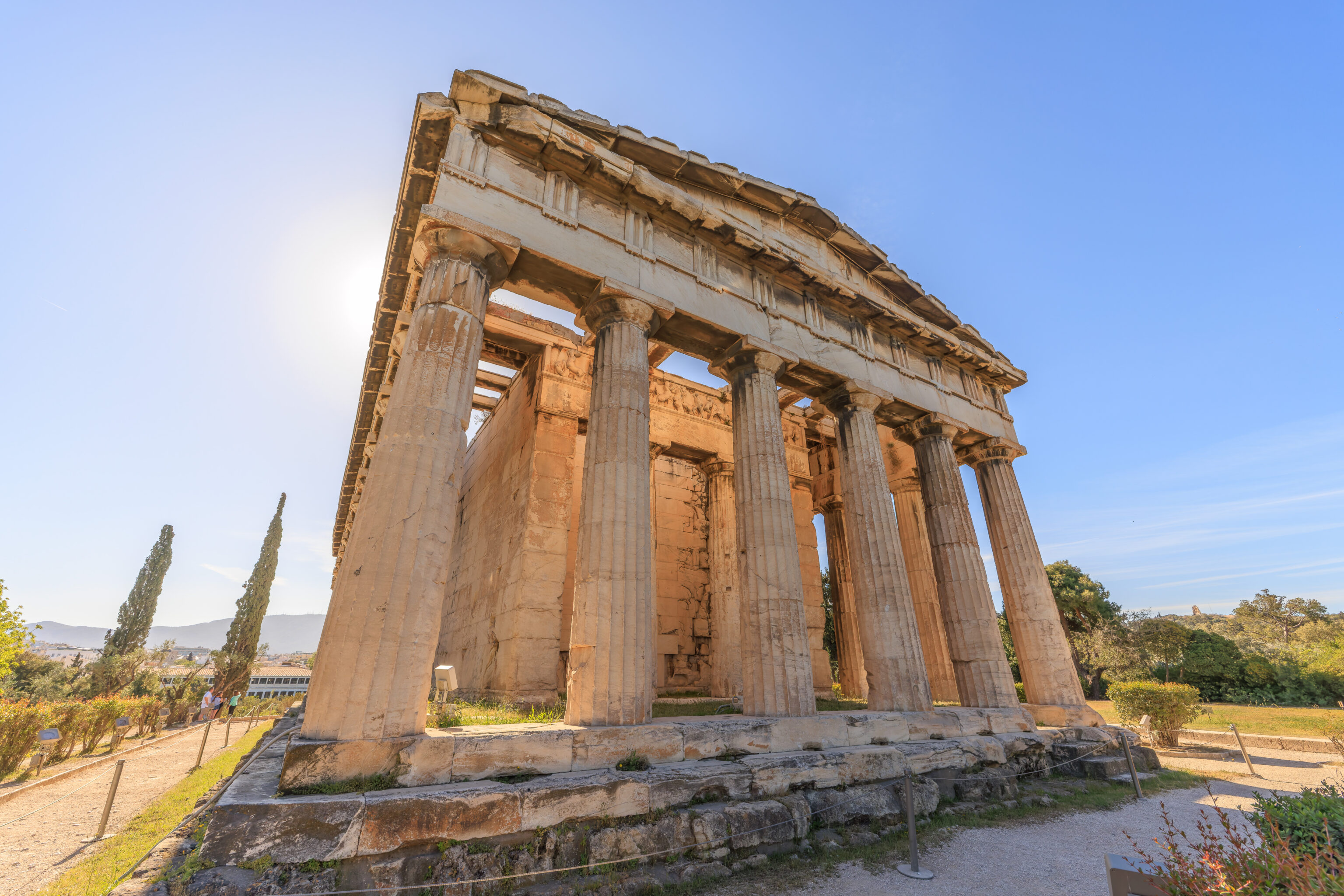
We walked up the hill to the Temple of Hephaestus.
There isn’t much room here on the east side of the temple. We could only really see it from up close.
A sign describes the temple, which dates back to the 5th century BC:
TEMPLE OF HEPHAISTOS (ca. 460-415 BC)

A Doric peripteral temple, with pronaos (fore-temple), cella (inner shrine), and opisthonaos (rear temple), the best preserved of its type in the Greek world. The facade of the pronaos and opisthonaos, to the east and west, are distyle, and the inner shrine had an interior colonnade. It occupies the crest of the Kolonos Agoraios Hill and was designed by an unknown architect probably in honor of Hephaistos, patron of metal-workers, and Athena Ergane, patroness of potters and crafts in general. It is built mostly of Pentelic marble, with its decorative sculpture in Parian. The east side, which faces the Agora, received special attention: it has ten metopes showing the Labors of Herakles, and the four easternmost metopes of the longer north and south sides show the Labors of Theseus. From these last the temple and its surroundings took the name «Theseion» in recent years. The frieze above the pronaos shows a scene from the Battle of Theseus and the Pallantids, with gods present, and that of the opisthonaos shows the Battle of the Lapiths and the Centaurs. Fragments of sculpture from the pediments are on display in the Museum of the Stoa of Attalos. The east pediment seems to have shown the Deification of Herakles, his entry onto Mount Olympos, and the west, a scene from the Battle of the Lapiths and the Centaurs. The two bronze cult statues of the cella are believed to be the work of Alkamenes (prob. 421-415 BC). In the 3rd century BC a garden with small trees and shrubs was planted around the temple.

The temple was converted into the church of St George probably in the 7th century. In the early 19th century the church was used as a burial place for Protestants and for many European Philhellenes who died in the Greek War of Independence in 1821. The building remained in use through 1834, when it was the site of the official welcome of King Otto, the first king of the modern Greek state. Since then until the 1930's it was used as a museum.
The elevated position atop a hill offers a great view of the Ancient Agora below and the Acropolis in the background.
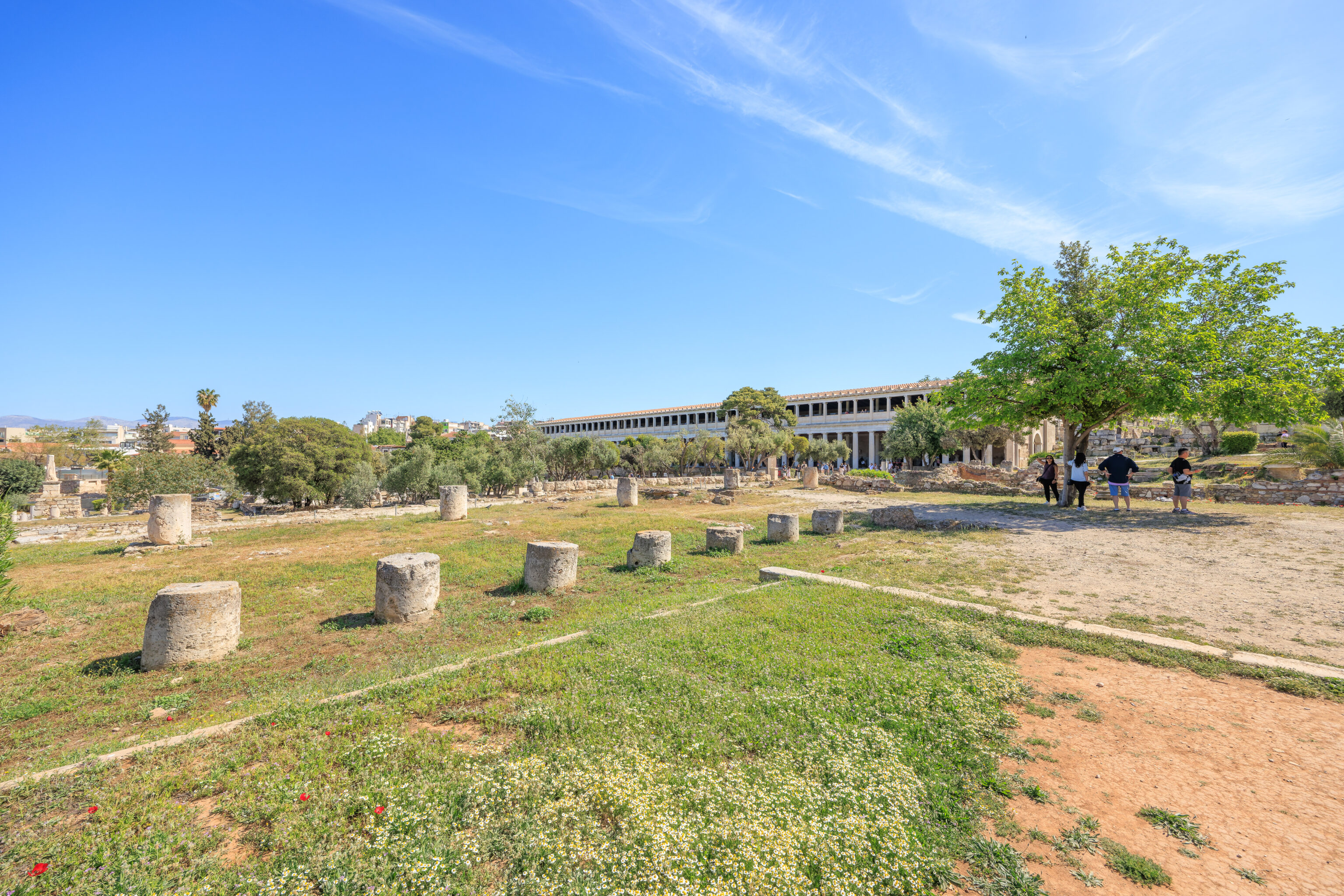
The Stoa of Attalos, on the left, is a very long building!
We could see the Lycabettus, which we visited yesterday, in the background to the east north east.
We walked around the north side of the temple to reach its western end.
We followed a path that led to the south along the western boundary of the Ancient Agora site. There wasn’t too much here, mostly some columns pieces and other artifacts.
We did come across a modern fountain, made to look not so modern.
There was a closed gate ahead of us.
The view to the north along the path that we just walked on.
We found a junction where we turned and started walking to the southeast.
There was another junction where we turned to head south. The path then started to curve to the left. The area to the southwest, containing various ruins, was inaccessible.
There was another junction with what seemed like a dry stream below. Rather than continue ahead, we turned to the right.
Yesterday, we visited the Prison of Socrates at the Philopappou, a neighborhood and hill to the south. But that Prison of Socrates was not actually a prison and had nothing to do with Socrates at all.
His actual prison may have been here, the State Prison, where he stayed for a month before his execution by poison after a trial. Historians aren’t entirely sure this is the correct place though.
A sign explains:
STATE PRISON

The long, narrow structure was built in the mid-5th century B.C. It was entered at its north end from an important ancient street leading toward the Piraeus Gate. The plan comprised two rows of square rooms, five in one, three in the other, separated and served by a corridor leading south to a large open courtyard. Incorporated in the northeast corner of the building is a semidetached unit consisting of four rooms. Some archaeologists identify the building with the state prison of the city of Athens. The state prison of Athens is best known from the casual references to it in Plato's Phaedo. This dialogue tells of the month Socrates spent in prison between his condemnation and his execution by drinking hemlock (399 B.C.). Our structure appears to satisfy the requirements, being close to the Agora, dated in the 5th cent. B.C., having this peculiar plan. In addition, among the ruins of the building were found 13 small terracotta bottles used for drugs, which in this case may have been intended to hold the juice of the hemlock plant. Part of a small marble statuette possibly of Socrates, was found in the ruins of the building. It must have been put there by the Athenians after they realized their mistake to poison their great philosopher. According to another view, many features of the building are appropriate to a commercial/industrial complex.
These ruins, protected under a canopy, are identified as the South Roman House.
The remainder of this path that we are on inaccessible. A sign earlier identifies it as the Road to Peiraieus, the main port city of Athens.
We backtracked and turned right, heading east along the path we were on before. This is the view to the southwest with the State Prison just right of center.
There was a bath here, just a few steps to the east along the path.
We continued following the path to the east. The building at the top of the hill to the southwest of us is the National Observatory of Athens. The building to the right of it is the Agia Marina Church.
We ended up continuing to the east on a smaller path.
There was another bath to the south of the path. It was identified as a Roman Bath. Just beyond, we saw a fenced path. While it sort of seems like the path we walked on yesterday to get from Monastiraki to the Philopappou Hill, it is not.
We ended up returning to a wider path which continued to the east. It was elevated on the Acropolis hillside a bit above the rest of the Ancient Agora to the north. This gave us a nice view looking northward.
We also got a good view of the Stoa of Attalos, now to the northeast of us.
We continued walking to the east towards the Church of the Holy Apostles, near the southeast corner of the Ancient Agora site.
This path here to the south is definitely not the path we walked on yesterday.
The church was locked shut and a cat was resting in front.
A sign in front of the church, visible at its bottom right corner, reads:
CHURCH OF THE HOLY APOSTLES (ca. A.D. 1000)

It is situated partly over the Nymphaion (2nd cent. A.D.). The original floor-plan of the church was that of a cross, with apses on the four sides and a narthex on the west side. Four columns supported the dome. The altar and the floor were of marble. The disposition of tiles on the outer walls show "Cufic" decorative patterns of eastern origin. Four building phases are recognized from the repairs and reconstructions over the years. Among the many mediaeval monuments known to have existed in the Agora, it is the only one preserved. It was restored to its original form in 1954-1957. The few surviving wall-paintings in the central aisle are of the 17th cent. Wall-paintings from other nearby churches have been placed elsewhere in the church.
Looking to the southeast, with the Acropolis in the background, we saw quite a few stone building pieces in locked shelves on the right. That’s something we haven’t seen before.
The view to the northwest from the church.
There were more stone building pieces laid out next to the church.
This fountain seems to be dry.
The Hadrianic Aqueduct was somehwere here.
The church, as seen from its southeast side.
This is the eastern boundary of the Ancient Agora site. The Roman Agora, which we visited yesterday, is about 100 meters beyond.
The Church of the Holy Apostles, as seen from the northwest, as we continued on.
There was a water mill here according to the small stone sign. From here, the Stoa of Attalos was now to our north.
And the Temple of Hephaestus was to the northeast.
A sign here describes some of the buildings which would have been in front of us:
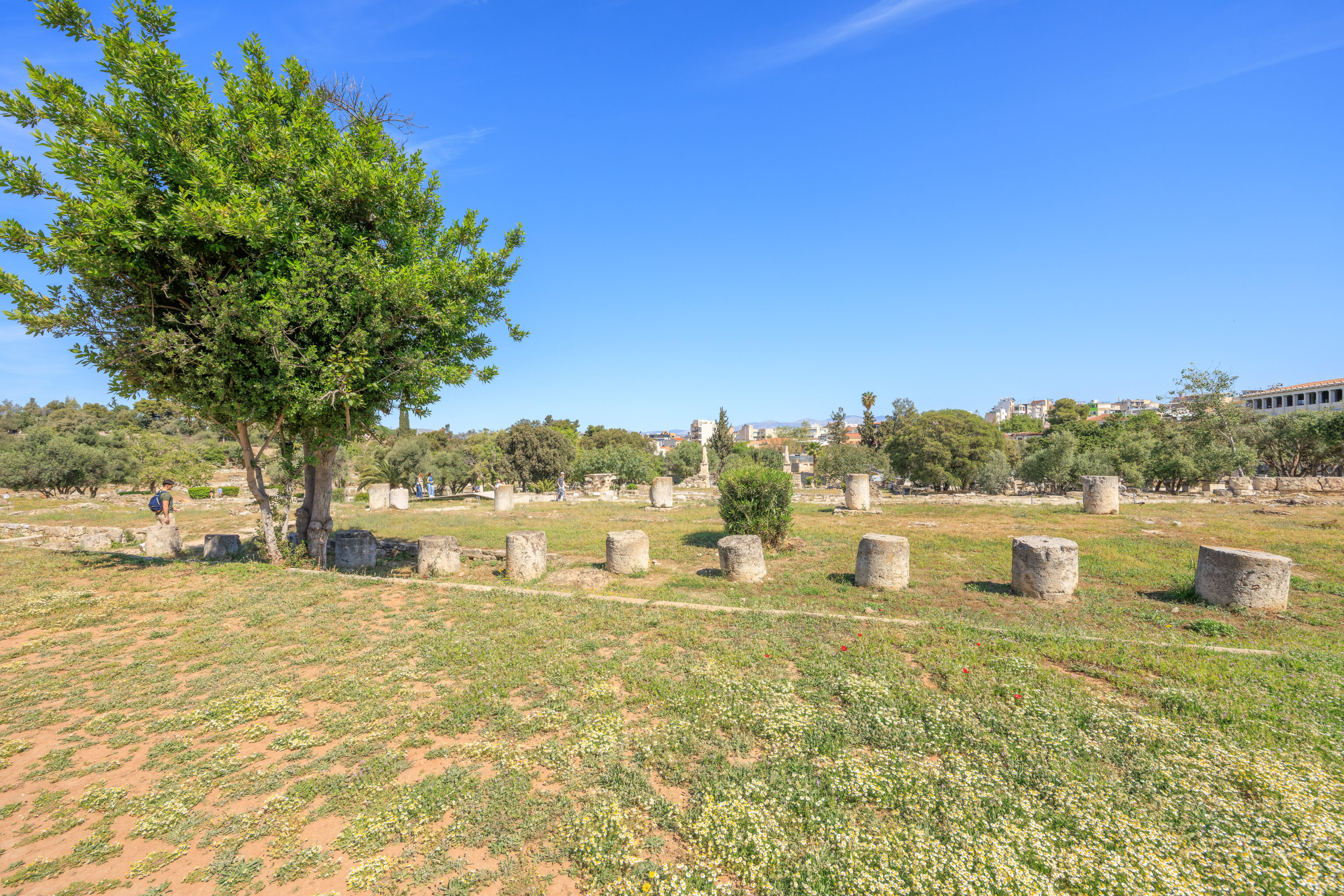
The South Square and the East Buidling

In the first half of the 2nd century B.C. three buildings (Middle Stoa, East Building and South Stoa II) were laid out in a planned complex which cut off the south half of the square of the Agora from the north. The complex is called South Square.

The East Building, which connected the two new stoas at their eastern end, was a relatively small building (12 by 40m) divided longitudinally into the east half facing the Panathenaic Way and the west half opening onto the square to the west. The east half is a single long room, with a mosaic floor of marble chips. Set into this floor at regular intervals are marble base blocks with cuttings for the feet of tables or some similar piece of furniture. Only four base blocks are preserved, though originally there were twelve, set 3m apart. The floor level of the west half of the building lies ca. 1.7m lower than the east half; here there were five square rooms, with the central one serving as a staircase joining the two levels.

Regarding the function of the South Square various suggestions have been made: Gymnasium, law-court complex, and sanctuary: The best suggestion is to consider the South Square as a commercial center and the two new stoas as market buildings. If so, the tables in the East Building should perhaps be thought of as the bankers' tables where moneychangers conducted business in a convenient location for those entering the market area from the Panathenaic Way. The Mint lay nearby and the tables may have been the place where the bronze coinage was actually put into circulation.

The activity of bankers in the Agora is mentioned since the 5th cent. B.C. As it is referred by Plato (Apology 17C), Socrates haunted the money-changers' counters at the Agora. The seat of the bankers was the South Stoa since 430 B.C. and from the middle of the 2nd B.C. the East Building. The stones located in the north part of the building belong to an oil press installation dated in the 6th c. A.D.
We ended up sort of backtracking a bit as we hadn’t walked by an area to the west of the Church of the Holy Apostles. This area was below the path that we were on to reach the church. It contained the South Stoa I, from the 5th century BC, and South Stoa II, from the 2nd century BC.
There was a very faded sign here on the ground which could be read with difficulty:
South Stoa I was a large public building that served mainly an administrative function. The stoa was of Doric order outside and consisted of a double colonnade with sixteen rooms along its south wall. The lower parts of the walls were built of large squared blocks, but the upper parts were of simple sun dried mud brick. The rooms of the stoa were all designed so as to fit seven dining couches. It seems that they were built to serve as dining rooms in which the archons were fed at public expense. South Stoa l served also an official commercial function, while it was the seat of the Metronomol, the inspectors of weights and measures, responsible to ensure that the salesmen use honest standards.

At about 150 B.C. South Stoa l was dismantled to make way for South Stoa II, which replaced it at a slightly different orientation to form the southern limit of the "South Square". This stoa too was of the Doric order with only a single colonnade and no rooms behind. A small fountain was built into the back wall set in an apse. South Stoa II also seems to have served a commercial function. It was destroyed by the Romans under Sylla in 86 B.C. During the 1st cent. AD the site of the stoa was occupied by industrial installations, that wore demolished at the beginning of the 2nd cent. A.D. The back wall of the stoa, still visible on the site, was rebuilt to serve as part of Hadrian's Aqueduct of Athens.
The view to the northwest from here.
We returned to the church and headed northwest from it. This was the view looking to the southwest after walking a very short distance. The canopy above the stoa ruins that we just came from can be seen on the left. There are three levels here – the ground level where we are now, the stoa ruins which are up a bit, and the path we came on which is further up.
These ruins were to the northeast.
We walked a bit further to the northwest and were a bit surprised upon seeing these two statues. Is the guy on the right Asian? Possibly Chinese?
Luckily, there was a sign:
Socrates and Confucius: An Encounter
Artist: Wu Weishan, 2021

Confucius (55l BCE - 479 BCE), a great thinker, philosopher and educator in the Spring and Autumn Period of China.
Socrates (469 BCE - 399 BCE), a great thinker, philosopher and educator of ancient Greece.

Wu Weishan captures, through sculpture of a freehand style peculiar to the artist, the wisdom and grandeur, spirit and thought of Confucius and Socrates, who are in an otherwise impossible "dialogue". With a sublime view of time and space, the artist engages the two great thinkers, each representing a different culture, in a conversation thousands of years after their time, embodying not only the mutual learning and common development of the two civilizations but also a shared fate of humanity.

Wu Weishan (born 1962) is the Director of the National Art Museum of China, President of Chinese Academy of Sculpture, a Corresponding Member of the Academie des Beaux - Arts, and a Member of the Accademia delle Arti del Disegno.

The work is exhibited in the Ancient Agora within the framework of the cultural exchanges during the Year of Culture and Tourism of Greece and China (September 2021 - September 2022).
We continued on, walking to the west.
We came upon the ruins of a water clock.
A sign explains:
WATER CLOCK

This monumental water clock was constructed at the end of the 4th cent. B.C. in a prominent location at the southwest corner of the Agora square, against the north face of the stepped foundation of Aiakeion. Water was drawn by the recently built great stone aqueduct of the city. The device was at first a simple outflow clock, a stone tank or cistern accessible through a flight of steps, with a small bronze outlet hole at the bottom which allowed the tank to drain slowly in 17 hours. Some flotation device would record the passing hours as the water level fell. The plug would be pulled at dawn each day.

The Agora clock was modified in the 3rd cent. B.C. due to great innovations made in the technology of water-clocks in Alexandria. Using auxiliary tanks (ß,Y) and valves that ensured constant water pressure, time measurement was now achieved with greater accuracy by gradually filling the main tank (a). At the end of the day the main tank (a) would be emptied through a large outlet hole set at its bottom (2).

This water installation was dismantled in the 2nd cent. B.C.
We turned to the right after the water clock and started walking to the north.
The sign identifies this here as the Tholos. It was a circular building that housed the official weights and measures. It was also used by members of the Boule, who were appointed to basically serve as administrators. A number of them would eat and sleep at the Tholos every night to ensure there was always someone around if needed.
A sign describes the Tholos:
THOLOS OR SKIAS (470-465 BC)

One of the more significant public buildings of the Agora is the Tholos, a round structure with six interior columns and a propylon at the east that was added in the 1st century BC. It was the headquarters of the 50 prytaneis who served as the executive committee of the Boule (Council) for an interval of 35 or 36 days, after which they were replaced by prytaneis from another tribe, so that by the end of the year representatives of all ten tribes had a turn in the administration. Those in office dined in the Tholos, with one-third (i.e. 17) of them spending all night in the building so that there were always responsible officials on hand. In the Tholos were housed the official weights and measures of the Athenian state. It was built atop a pre-existent building complex of the mid-6th century BC, which had a similar functional purpose, and went out of use around AD 400.
This is the House of Simon. It is supposed to have belonged to a shoemaker named Simon from around the 5th century BC. Yes, he was not just any shoemaker as he even has his own Wikipedia page! Fordham University has a photograph in their library collection showing items that were collected from here.
The New Bouleuterion, the building where the 500 member Boule met, was here in front of us. It seems to be more or less equivalent to a building where Parliament or Congress meets.
A sign describes what was here:
NEW BOULEUTERION AND PROPYLON (late 5th c. BC)

Rectangular prostyle building. It served as a meeting-place of the 500-member Boule (Council), made up of fifty citizens from each of the ten Athenian tribes, chosen by allotment each year. As a legislative body the Council prepared the bills that afterwards were voted on in the Assembly of all citizens (Ekklesia of the Demos). For a time the New Bouleuterion functioned along with the Old Bouleuterion, which apparently because of a lack of space came to be used only as a repository of state archives. The partial preservation of the New Bouleuterion at ground level makes it difficult to establish the arrangement of the benches on the interior. In the second half of the 4th c. BC the entranceway acquired a monumental propylon of the Ionic order, that stood immediately south of the Old Bouleuterion.
The Old Bouleuterion was somewhere here by the New Bouleuterion. The Metroon, a building which had a temple but also stored public records and other documents, was also here.
A sign describes these two buildings:
OLD BOULEUTERION AND METROON

OLD BOULEUTERION (early 5th c. BC)
A large, nearly square building situated in part over an earlier building complex (early 6th c. BC) that may have served as a meeting-place of an early Council. In the Bouleuterion (Council House) met every day the 500-member Cleisthenic Boule (Council), which had replaced an older, 400-member body. This group prepared the legislative bills that were normally voted on in the Assembly of the People (Ekklesia of the Demos). The building was the site of the worship of the Mother of the Gods and housed not only her cult statue (attributed to Agorakritos or less probably to Pheidias), but also the public archives of the city. Its foundations are preserved under the Metroon, a building of the 2nd c. BC.

METROON (150 BC)
A prostyle building with four rooms, inside which were kept public documents: decrees, law codes, financial records, catalogues of ephebes and of votives, along with legal documents. Also, the second room from the south housed the temple of the Mother (Mêtêr) of the Gods, from which the name of the building, Mêtrôon, derives. Her altar probably stood immediately east of the Metroon, on "West Street". From its destruction in AD 267 by the Heruli until Byzantine times, parts of the building probably served as a tavern, a synagogue, and an oil-press.
This is Emperor Hadrian, the British Wall guy. Or at least, part of him.
This ditch was basically an ancient sewer.
A sign explains:
Drain with width and breadth of 1m., its side walls of polygonal masonry, with a tiled bottom and large covering slabs. Its purpose was to convey to the Eridanos River waste from the buildings of the Agora and rainwater from the surrounding hills. Its main channel crosses the west side of the Agora from south to north beneath the paving of the «West Street». At the beginning of the 4th cent. B.C. two branches were added immediately south of the Tholos, one to the southeast and one to the southwest, to bring rainwater and waste from a broader section of the Agora into the main channel. In later antiquity the statue of the emperor Hadrian, set up on the «West Street», was used as a cover slab for the drain.
The statue of Emperor Hadrian that the sign says was used as a cover for the drain might be the one we just saw?
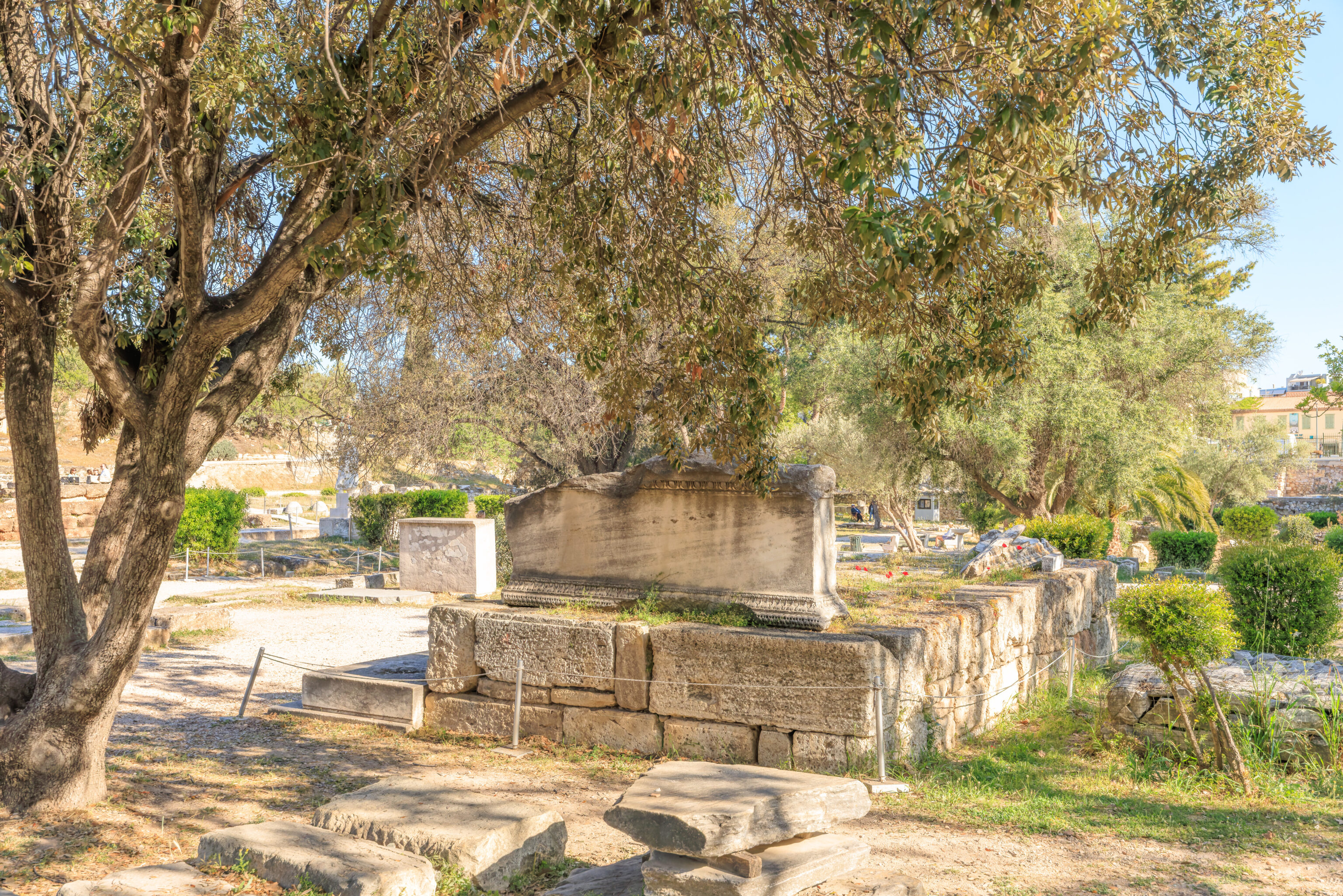
We actually saw this structure earlier in the day when we were in this area, though we looked at it from the other direction. It turns out this a fence that surrounded the Monument of the Eponymous Heroes, a wide pedestal upon which stood statues of heroes from the ten tribes of Athens. It was also used as an ancient bulletin board.
A sign provides more detail:
THE MONUMENT OF THE EPONYMOUS HEROES (ca. 330 BC)

A pedestal, ca. 16 m. long, enclosed by stone posts connected to one another by three wooden beams. It bore the bronze statues of the mythical heroes of each of the ten Athenian tribes, divisions into which, for administrative and political reasons, Kleisthenes in 508 BC organized the citizens of Athens. A fluctuation in the number of tribes over the years necessitated the removal or addition of statues. On the sides were hung wooden boards with announcements meant for the citizens of Athens, legal decrees coming up for vote, lists of citizens conscripted into the army, civic honorary distinctions, forthcoming lawsuits. The original position of the monument must have been somewhere else, probably at the west end of the Middle Stoa.
These seem like statue bases. Given their location, they may have been part of the Monument of the Eponymous Heroes? The monument is depicted as having one large pedestal rather than multiple smaller ones for each statue so it might not be, but the drawing on the sign of the pedestal does depict it as interconnected sections so it might be!
This was the location of some civic offices.
A sign briefly explains:
CIVIC OFFICES (2nd cent: A.D.)

The building consists of two wings, the west having four rooms and the east, one. Between them is a small colonnade.

North of the structure on a stone base has been set up a pair of marble official standards for the manufacture of terracotta roof-tiles, used for the control of commerce.
The building here with all the columns was the Middle Stoa. We actually walked to the west via its southern side earlier when walking away from the Church of the Holy Apostles.
A partially faded sign near the ruins describes it:
MIDDLE STOA

It is the largest building in the Agora, 147m. wide and 17.5m. deep, oriented east-west, with a Doric colonnade on each of its four sides. It is assumed that at the two corners of the monument the inter-columniations were covered with high, thin panelling like that of the interior Ionic colonnade, which separated the Stoa into two passageways of equal width. The Stoa was built of poros stone. Only the metopes of the frieze were of marble; together with the terracotta sima they bore a painted decoration. In the east section, steps and three column-drums are preserved in their original position. Visible at the west are its solid foundations' of red conglomerate stone. In Roman times the flat terrace at its north was used as the shortest way of crossing the Agora from east to west. It was destroyed by fire in A.D. 267.
We walked to the east on the north side of the ruins of the Middle Stoa. This was the view looking north towards the entrance path to the Ancient Agora site.
And, the view to the southeast with the Acropolis in the background.
A pretty well preserved column piece.
A square pile of stone. Does its footprint mark something?
The view looking towards the Acropolis as we reached the eastern end of the Middle Stoa ruins.
Its almost time to visit the Stoa of Attalos, the only building that one can enter here. We decided to walk to its northern end first to see if there is anything interesting in that area, which we haven’t walked through yet.
The path that we are walking on was part of the Panathenaic Way. It was a wide road of about 1km in length that ran through the Ancient Agora and up to the Acropolis entrance.
A sign explains:
PANATHENAIC WAY

The road was also known as the «Dromos» and had a total length of 1.050 m. It extended from the Dipylon Gate in the Kerameikos to the entrance to the Acropolis, cutting diagonally through the central square of the Agora. The width of the road, fluctuating from 10-12 m to as much as 20 m, was maintained even in Roman times.

Its surface was mainly graveled, but in the 2nd century A.D. the section in the northeast corner of the Agora and that along the west side of the Eleusinion was paved with stone.

It was one of the most significant thoroughfares and served the needs of the civic and commercial center of the city from the 6th century B.C. up through the first centuries after Christ. Alongside the road were significant religious structures (altars, temples), and buildings both public (the archons' offices, lawcourts) and private (shops). Already in the 6th century B.C. the famous procession of the Festival of the Great Panathenaia, depicted in the frieze of the Parthenon, followed the course of the road.

During this festival, foot-races and chariot-races were held on this road in honor of the goddess of the city, Athena. The winners in the Panathenaic games were awarded olive oil stored in prize amphoras. The Panathenaic Way constitutes a monument of unique and lasting significance, a main artery for traffic, in use from antiquity to our own times.
This may be a well?
There were many stone building pieces lying on the ground here near the northern end of the Stoa of Attalos. This is also right by the entrance path to the Ancient Agora site.
We walked back to the south along the side of the stoa. The only way to enter is from the south side of the building.
This stone contains an inscription from when the Stoa of Attalos was dedicated in the 2nd century BC.
A dusty, or perhaps sandy, sign describes this stoa, which is a reconstruction:
STOA OF ATTALOS (159-138 B.C.)

The Stoa, on the east side of the Ancient Agora, was the gift of Attalos II, King of Pergamon, as a fragmentary inscription on the epistyle of its lower colonnade indicates:

"ΒΑΣΙΛΕΥΣ ΑΤΤΑΛΟΣ ΑΤΤΑΛΟΥ ΚΑΙ ΒΑΣΙΛΙΣΣΗΣ ΑΠΟΛΛΩΝΙΔΟΣ"
"King Attalos, son of Attalos and of Queen Apollonis"

The building is 120m. wide and 20m. deep and had two floors with a second series of columns on the interior and 21 shops at the back of both floors. On the ground floor the exterior colonnade was Doric and the interior Ionic, without fluting. On the upper floor the exterior colonnade was Ionic and the interior had capitals of a Pergamene type. The Stoa of Attalos was a place for Athenians to meet, walk and to do business. The Heruli in A.D. 267 destroyed it and its ruins were incorporated into the Late Roman Fortification Wall. The restoration, based on studies by the architect John Travlos, was carried out in 1953-1956 by the American School of Classical Studies, with the financial support of John D. Rockefeller, Jr.
We walked into the stoa and its mix of modern yet ancient appearance. It was nice and cool inside, very comfortable after spending so much time outside under the hot Athenian Sun. We ended up sitting on a bench for awhile.
There are various stone sculptures in the colonnaded ground floor of the stoa.
There is an arched doorway on the south end of the stoa, though it was blocked off.
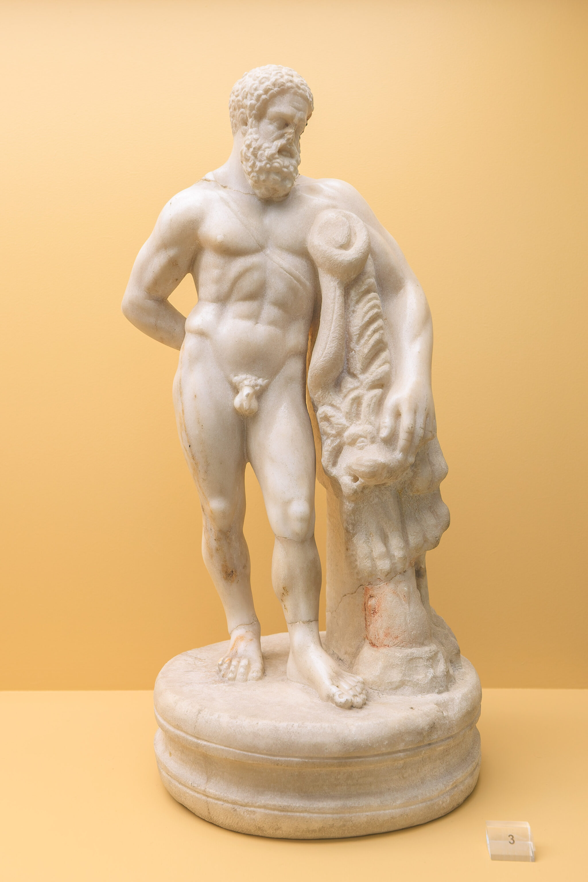
This statue was to the right of the doorway.
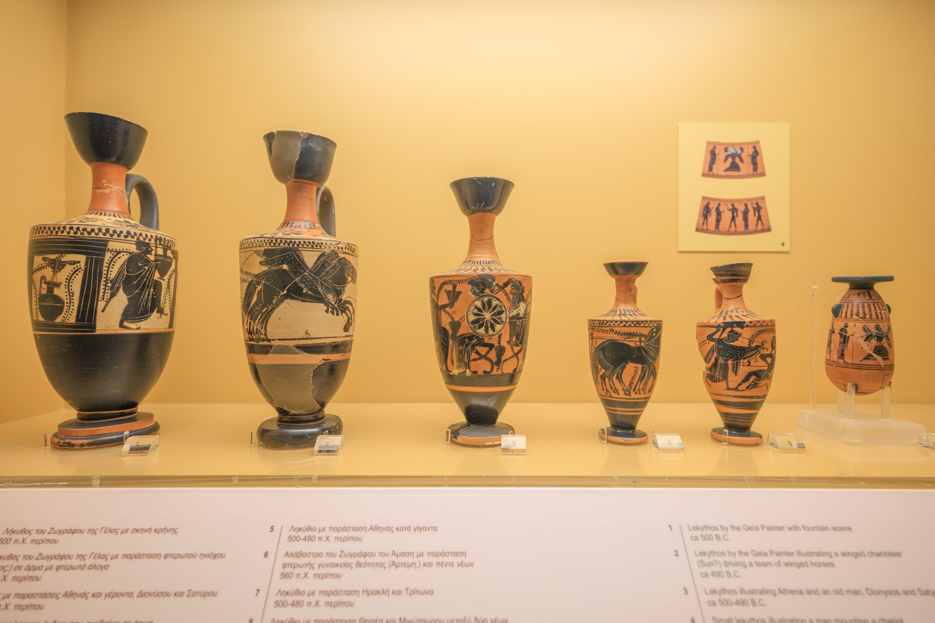
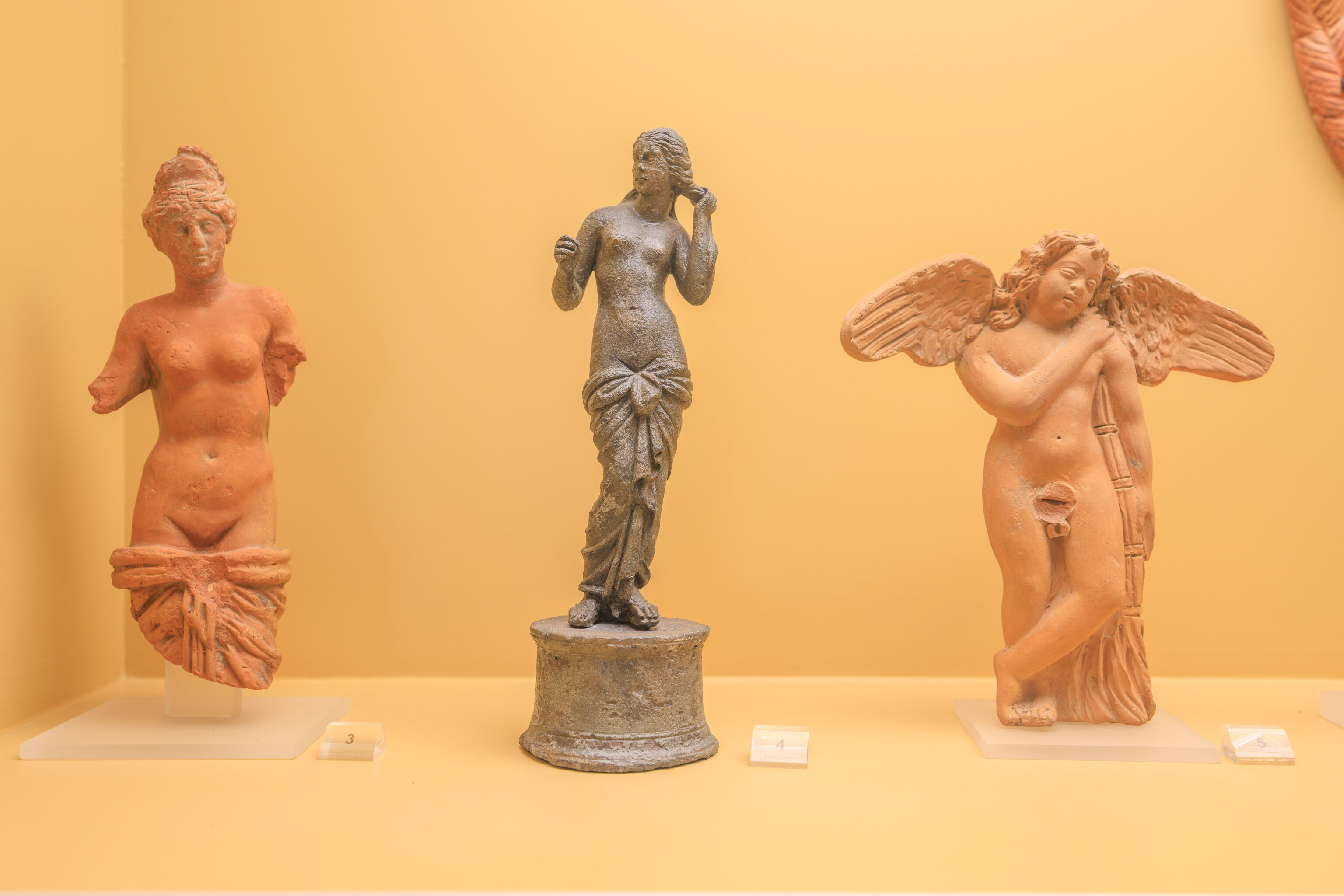
We went into a museum space in one of the rooms in the stoa.
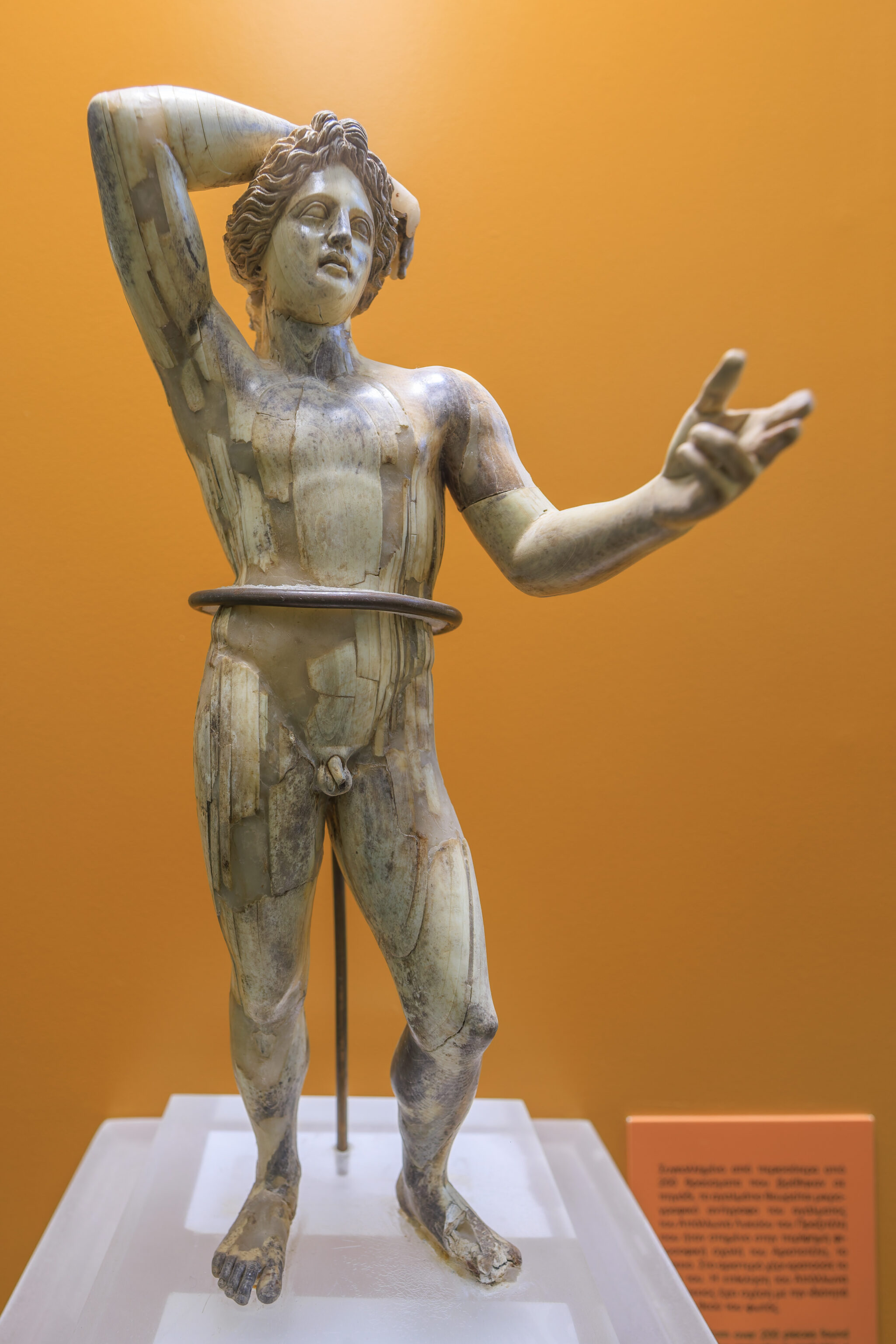
This sculpture, from the 5th century BC, is believed to be one of two that stood atop the Temple of Hephaestus. The image in the background shows what it may have looked like with both sculptures present.
A sign elaborates further:
Akroterion, probably the Nereid Thetis
Parian marble, ca. 420-410 BC

The figure is striding to the left with its head turned in the opposite direction, towards a second figure which has not been found. The size and pose of the figure show that it stood as a central akroterion. Recently, the hypothesis was made that the group represented the Nereids Thetis and Eurynome that crowned the roof of the Temple of Hephaistos.

According to Homer, when Hera enraged threw the lame Hephaistos from mount Olympos into the sea, it was the Nereids Thetis and Eurynome, the daughters of Ocean, who rescued him. For nine years in their sea cave Hephaistos practiced his art until he returned to the palaces of the gods, to free Hera from the magical throne with which he had trapped her.

The god reciprocated with gratitude when Thetis visited him to ask for the new armor with which her son Achilles entered the battle of Troy.
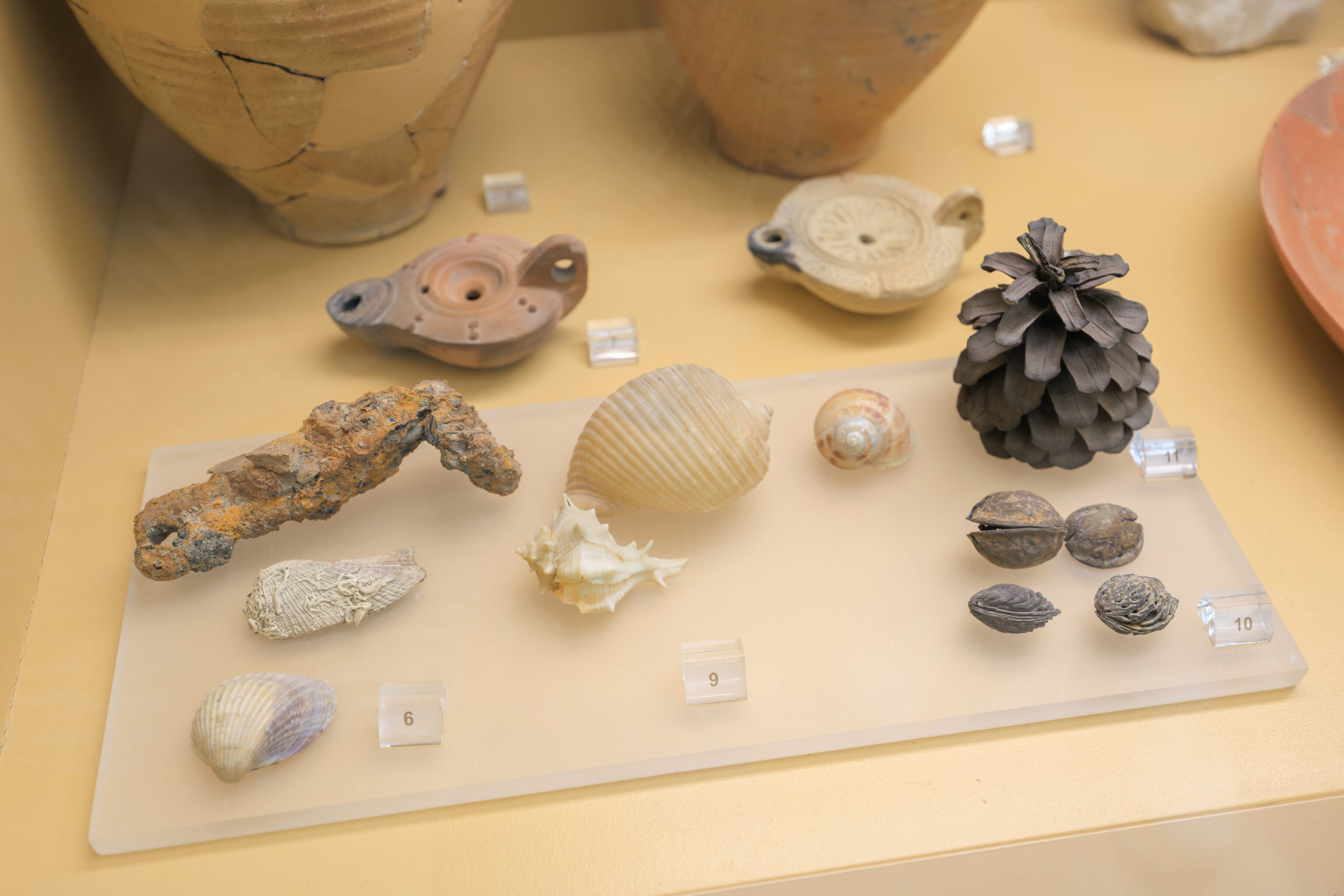
The museum held many artifacts from the Ancient Agora.
This stone tablet is particularly interesting as it was a kleroteria, a device used to determine jury service.
A sign explains how it worked:
Kleroteria were allotment machines made from slabs of wood or stone. In the face of each slab were columns of narrow slots aligned in horizontal rows. Into the slots were inserted the bronze identification tickets (pinakia) carried by the citizens who were eligible for jury service. On the left side of the face there was a metal tube the top of which terminated in a funnel shaped mouth. Into the tube were poured a number of black or white bronze balls in random order. By means of a crank the balls could be released one by one. Depending on whether a white or a black ball emerged all the citizens represented by one horizontal row of pinakia were accepted or rejected for jury service that day. Kleroteria stood at the entrance to every court.
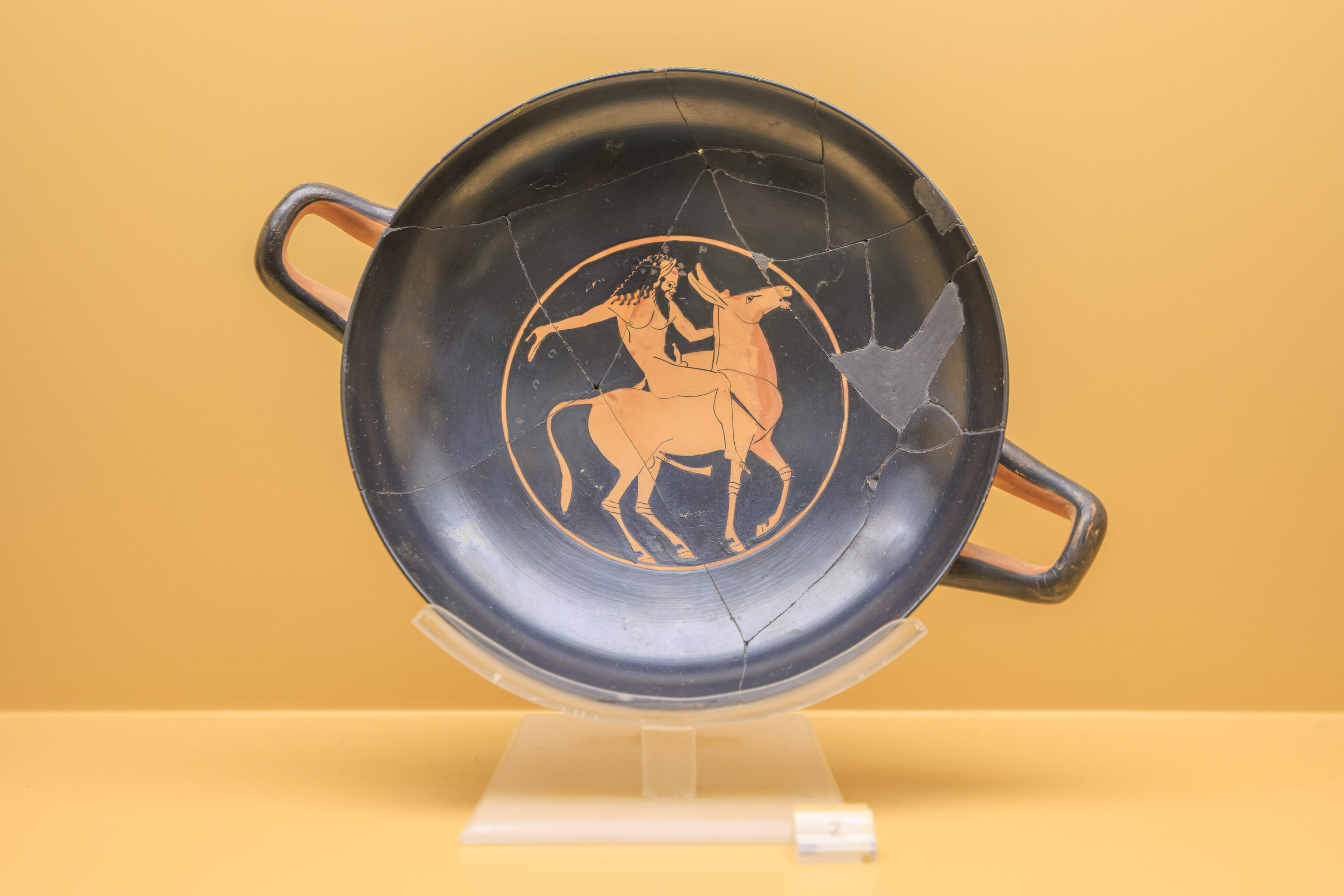
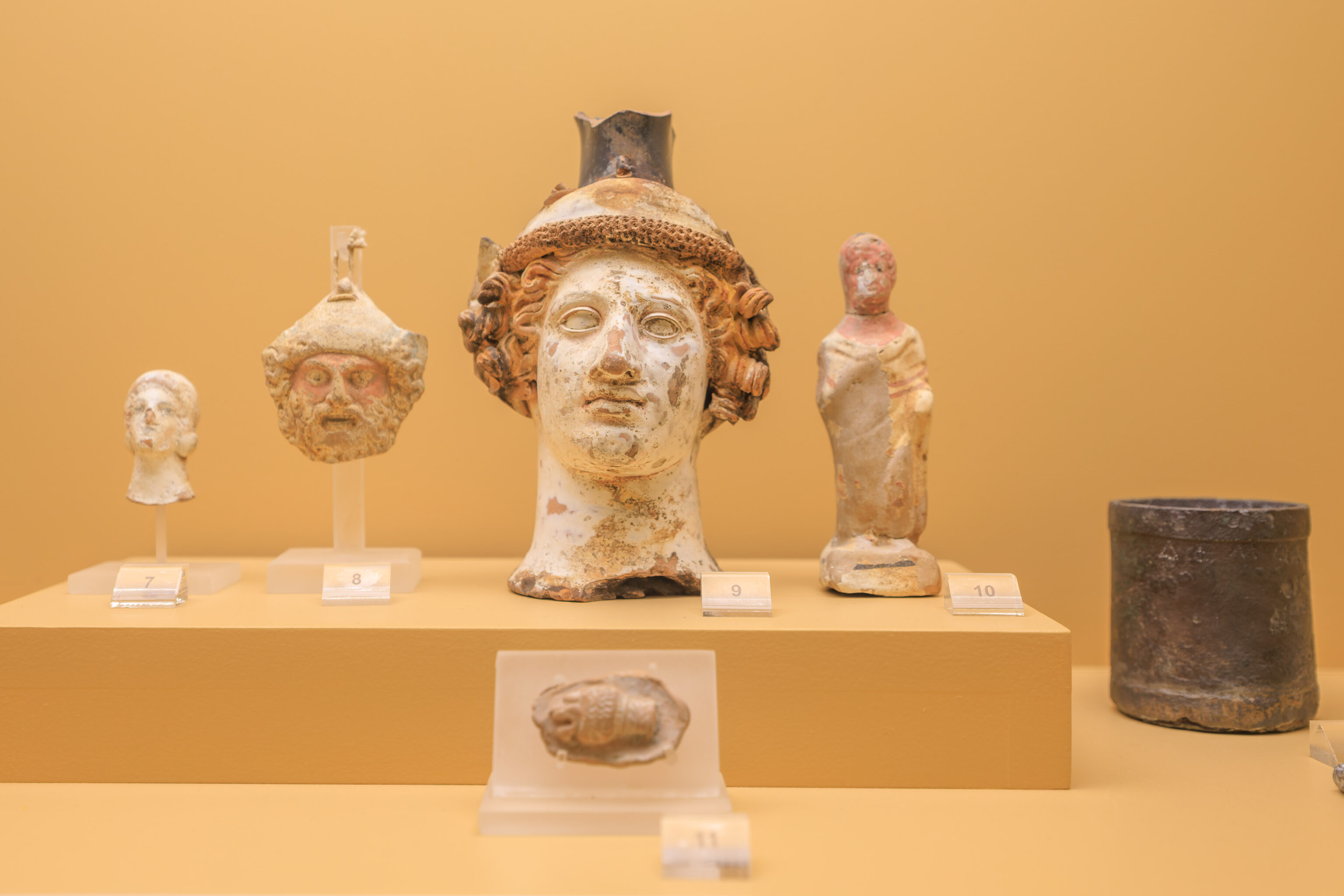
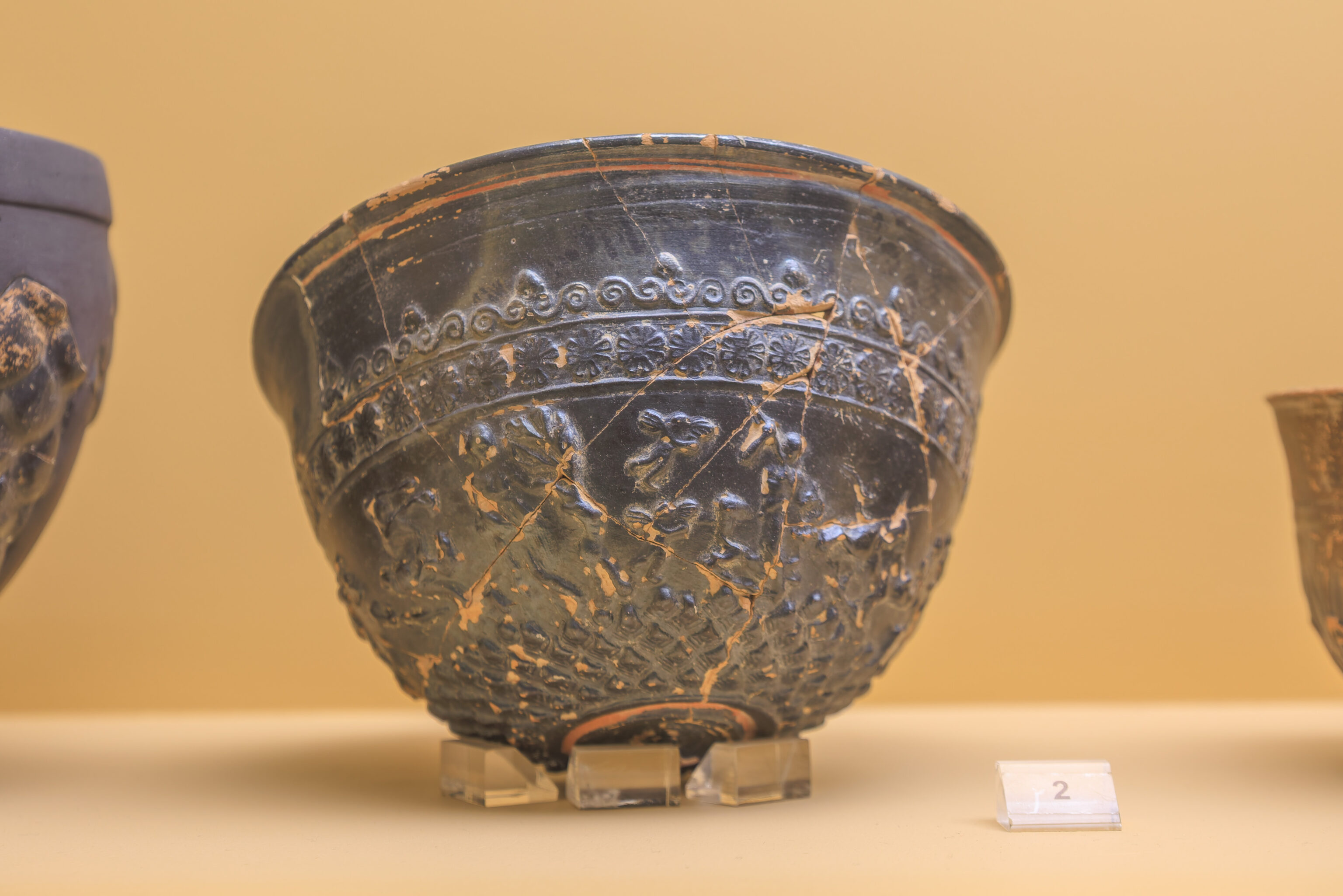
We quickly glanced at everything in the collection. There was too much to spend much time looking at each individual piece.
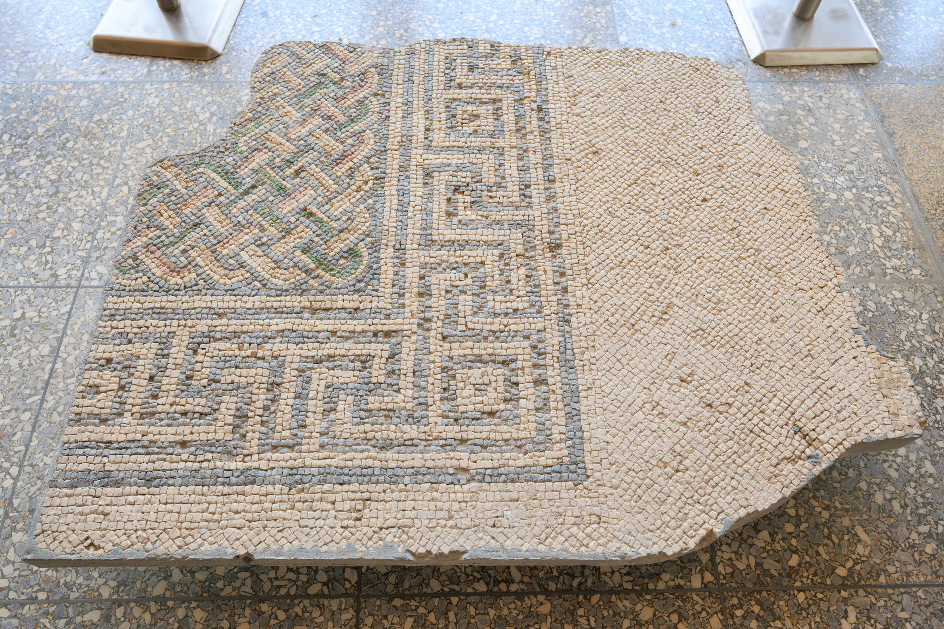
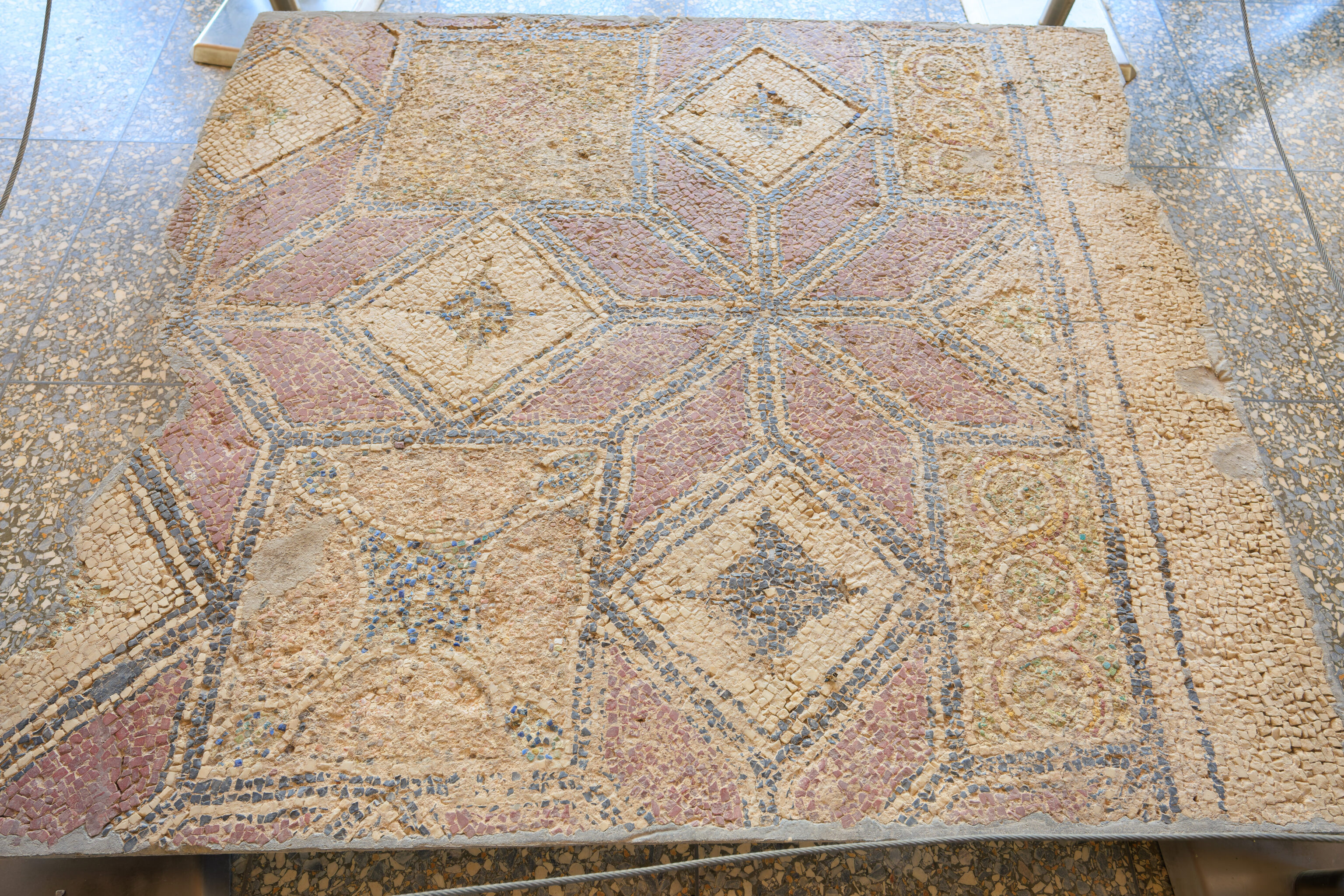
There were two sections of floor mosaics.
The view from the north end of the stoa included the Temple of Hephaestus in the background.
This statue, from the 2nd century AD, is of Emperor Hadrian. It looks very much like the one we saw outside next to the ancient drainage ditch.
Another partial statue that was near the emperor.
It would have been a good idea to photograph the signs that went along with these busts so that we would know who they are. Oops!
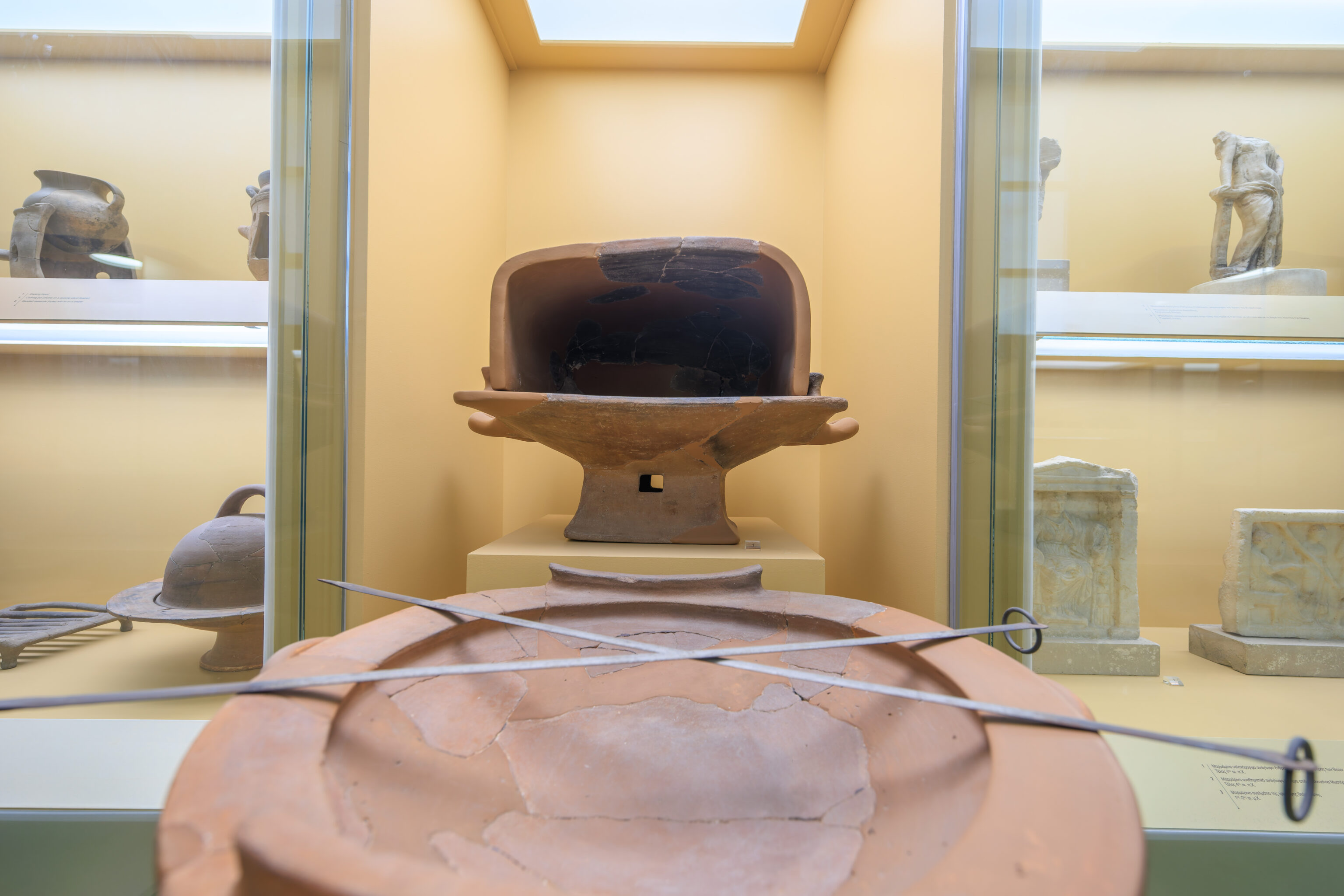
The second floor had another long room filled with various artifacts. It also had some nice views to the west.
Some of the rooms on the east side of the second floor were visible through windows. These two rooms were used for storage.
Another view to the west.
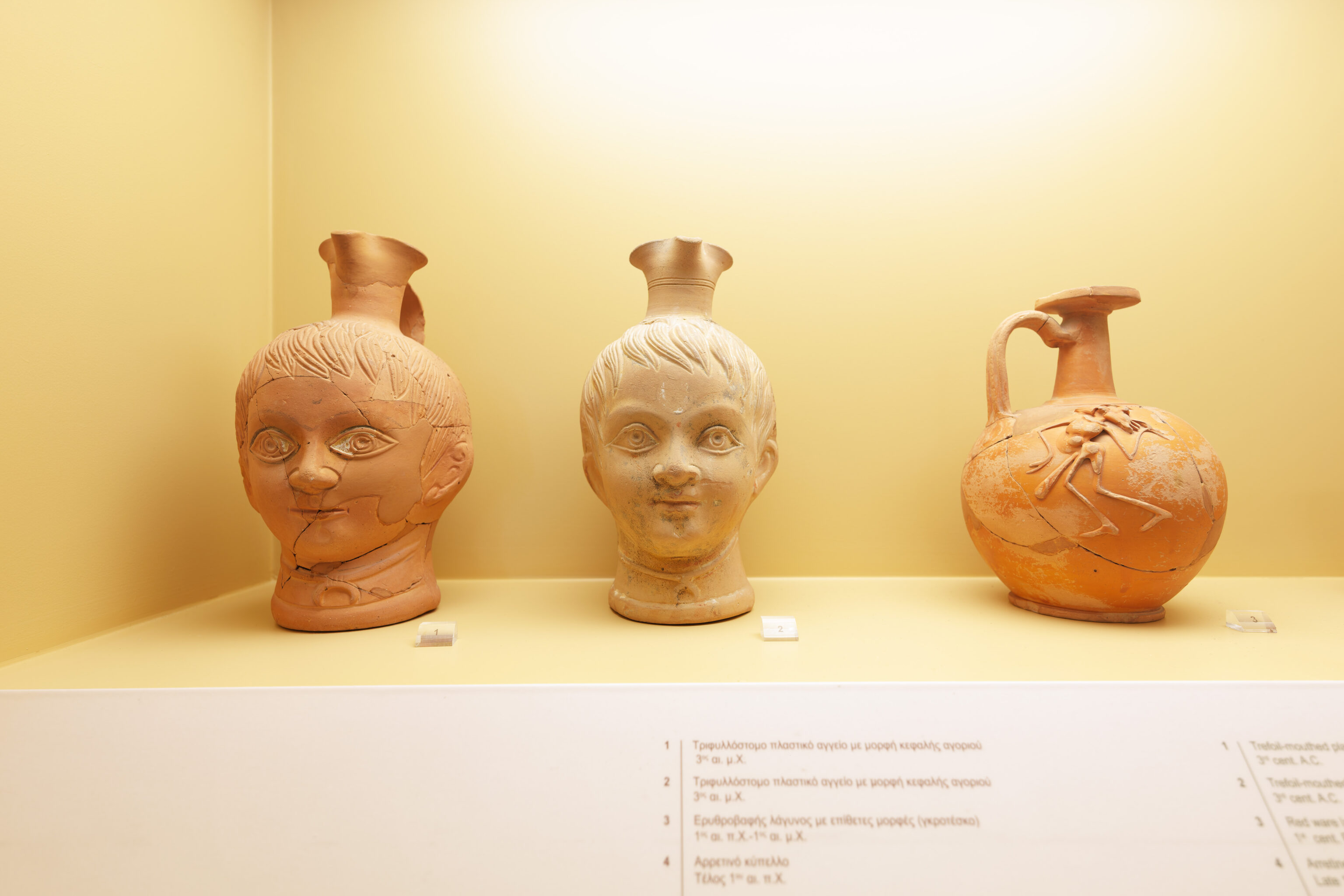
More heads…
And more views!
We headed down via stairs on the south side of the stoa. There was a column on display in here! Seems like a reasonable place to put something tall.
We exited the stoa and walked towards the exit.
A train passed by as we were crossing over the railroad tracks.
One final look back! We didn’t photograph the actual entrance and exit area but it was extremely busy when we left with people queued to buy tickets. There were actually people queued for tickets when we arrived, but the line wasn’t this long. This shouldn’t be a particularly busy time of the year so it seems buying tickets in advance is the way to go here. We’re glad we did!
Lunch
It was around 1:40pm when we left the Ancient Agora. Lunch time! We decided to try to eat somewhere in the area.
This little section of ruins is separated from the main Ancient Agora site by the Metro and a road. It contained the Stoa Poikile.
It is currently still being excavated according to a sign:
CURRENT EXCAVATIONS IN THE NORTHWEST CORNER OF THE ANCIENT ATHENIAN AGORA


The remains of the building that is being excavated to the north of Adrianou street are tentatively identified as those of the Stoa Poikile (Painted Stoa), dating to ca. 475-465 B.C. In Greek architecture, a stoa was any long colonnaded building; this one had Doric columns outside and Ionic columns within.

The Stoa Poikile was named from the handsome wooden panel paintings that adorned it, done by the best artists of Classical Greece: Polygnotos, Mikon and Panainos. A description written by the traveler Pausanias in about A.D. 150, tells us that they depicted Athenian military triumphs, both mythological and historical. By A.D. 400 a Roman proconsul had removed the paintings and they do not survive.

The building was used as a popular hangout and attracted huge crowds. The philosopher Zeno (ca. 300 B.C.) so preferred the Painted Stoa as his classroom that he and his followers became known as the "Stoics".

Behind the stoa is a commercial building originally built ca. 420 B.C. and used, with alterations, until the 5th century A.D. Both the stoa and the shops it housed were abandoned by the 6th century A.D. and after several centuries their remains were covered by a neighborhood of houses and shops dating from the 10th to the 12th centuries A.D.

The area is part of the ancient Athenian Agora, which has been under excavation since 1931 by the American School of Classical Studies at Athens, in cooperation with the Ephorate of Antiquities of Athens of the Ministry of Culture. Funding comes largely from private American sources, especially the Packard Humanities Institute.
We headed down this narrow but clean alleyway. We arrived at the Nissos Seafood Tavern, just a few short blocks away from the entrance to the Ancient Agora.
We started the taramosalata (fish roe salad), which is kind of like hummus but with mostly different ingredients, including fish roe. We weren’t really sure how the Greek usually consume this, if they eat it just like this or put it on bread or a pita like we would in the US. We ended up asking for bread. It was very good.
We also got the grilled fresh stuffed squid, which is stuffed with a pasty feta cheese. I don’t think we’ve ever had feta cheese like this before.

The last dish was shrimp saganaki which is basically shrimp in a thick and slightly spicy tomato sauce. It was a very good lunch!
There are quite a few restaurants in this area due to its proximity to Athens’ major tourist sites.
We were really surprised to see a po’ boy restaurant! It seemed to claim to be a BBQ restaurant and the majority of its menu does seem to be barbecue related. It does at least serve a po’ boy though. We were curious but not curious enough to actually go and try a place like this!
To the Pnyx
We decided to head to the Pnyx next, a hill to the west of the Acropolis, southwest of the Ancient Agora, and north northwest of the Philopappou Hill. We decided to walk rather than take the Metro just one or two stops which would get us a little bit closer but not by much.
We started by walking to the west. We came across large murals on some buildings to the right as we reached an intersection.
We then walked down a road with graffitied buildings. Graffiti is everywhere in Athens. This city has by far the most graffiti we’ve seen anywhere. The painting on the buiding and construction site at the center of the photo is kind of neat because the image on the the perpendicular walls line up perfectly from this perspective.
We quickly reached the edge of the Keramikos Ancient Cemetery, also referred to as the Keramikos Archeological Site.
The road we were walking on to the west was long and mostly straight and without any shade in the hot afternoon sun.
There were almost no visitors at the Keramikos site. This was on our list of places to visit, however, we may not get the chance.
We walked onto a bridge that crosses over the Metro tracks.
This was the view from the bridge looking back to the east. The foreground isn’t particularly scenic, though we do see the Lycabettus in the distance.
After crossing over the tracks, we turned left to walk through a residential area.
We walked past two church buildings. It seems likely they’re both part of the same church, the Church of St. Athanasios.
We turned to the right here in front of the larger of the two church buildings.
This narrow road led south.
After a few blocks, the road ascended steeply up a hill. The sidewalk had stairs at the very end, though they aren’t visible from this perspective.
Continuing on, we reached the Agia Marina Church. Its exterior looks very different from the ones that we’ve been to before.
There is a small plaza on the north side of the church.
Unfortunately, it looks like the church is not open all of the time. It was not open when we arrived, though it seems like it might be open later in the day.
The church had a floor mosaic with a deer.
There is a Sanctuary of Zeus somewhere to the east on the large block on the right. It was downhill and not in the direction we wanted to travel so we continued to the south instead.
We walked on a road that continues uphill behind the church.
There was a somewhat open view above and behind the church where we could see the Lycabettus in the distance.
We walked up a driveway which leads to a small parking lot for the National Observatory of Athens, which was on our right.
We walked up a pedestrian path that led to the southwest and then to the south.
We reached a small observatory building which contains the Dorides Telescope. According to the National Observatory of Athens, this was the largest telescope in Greece for 57 years.
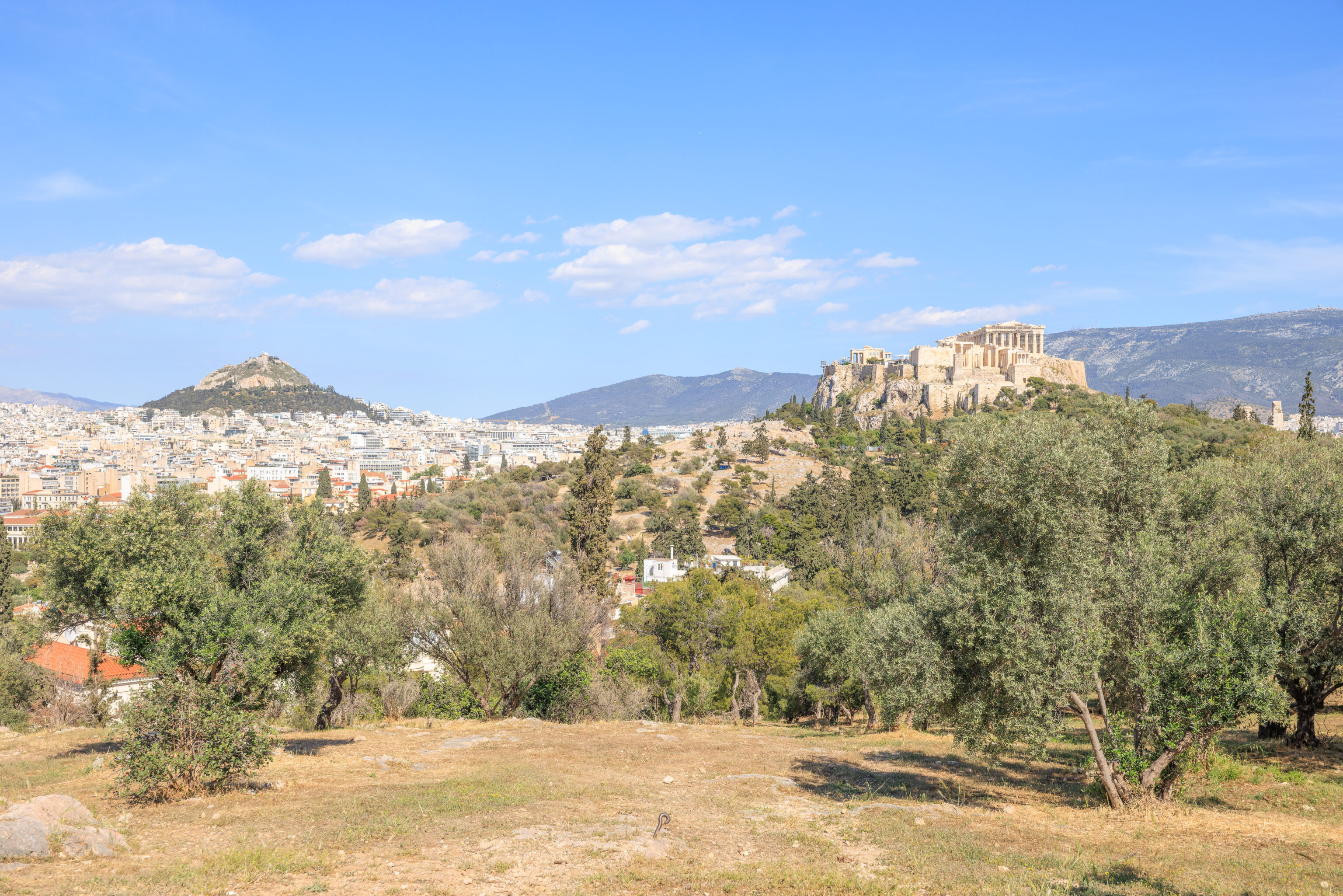
The area around the telescope is mostly open with a few trees and has an excellent view of the Acropolis! The entrance to the Acropolis, the Propylaea, occupies much of the west side of the Acropolis from this perspective.
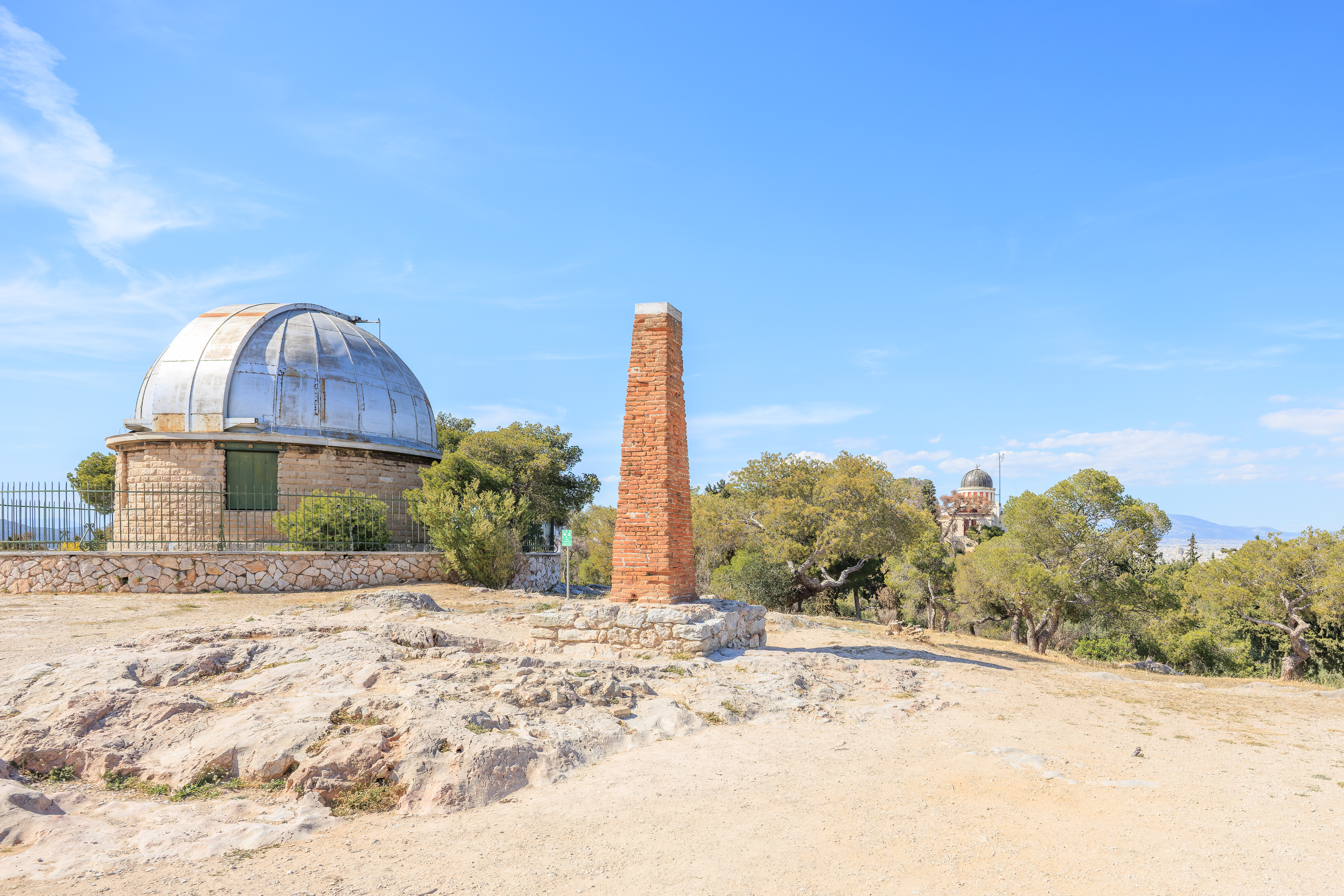
We don’t know what this brick obelisk is doing here. It almost seems like it could be a chimney but that seems unlikely.
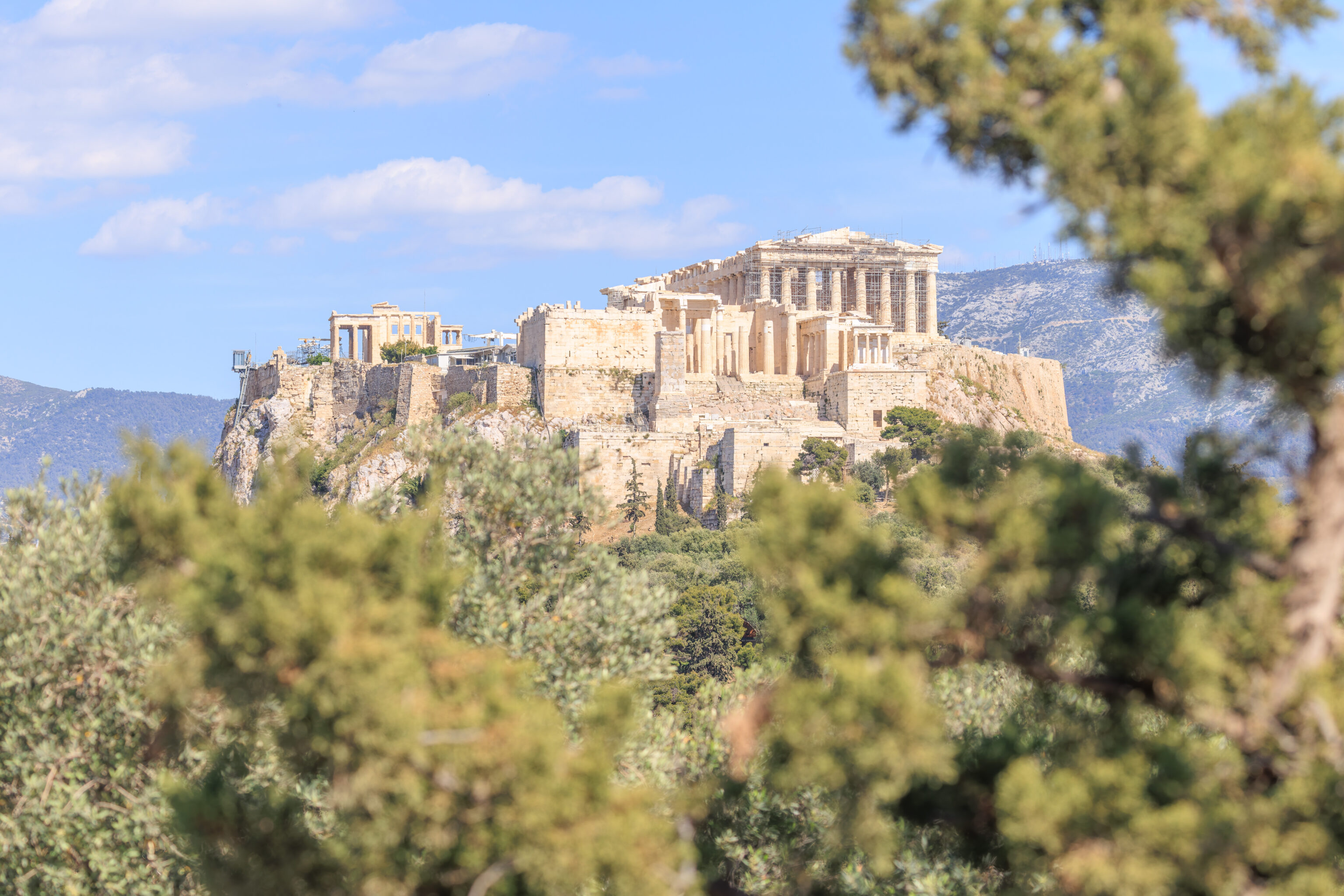
We switched to the telephoto lens to take a closer look at the Acropolis. This perspective makes it look very different compared to the other directions that we’ve viewed it from so far. The Parthenon and Propylaea look like they occupy most of the top of the hill when in reality they do not.
We also looked at the Lycabettus.
The Areopagus is another smaller hill that is almost directly between us and the Acropolis.
This larger building, which is part of the National Observatory of Athens, is the Thissio Visitor Center.
We could also see a bit of the top of the Agia Marina Church.
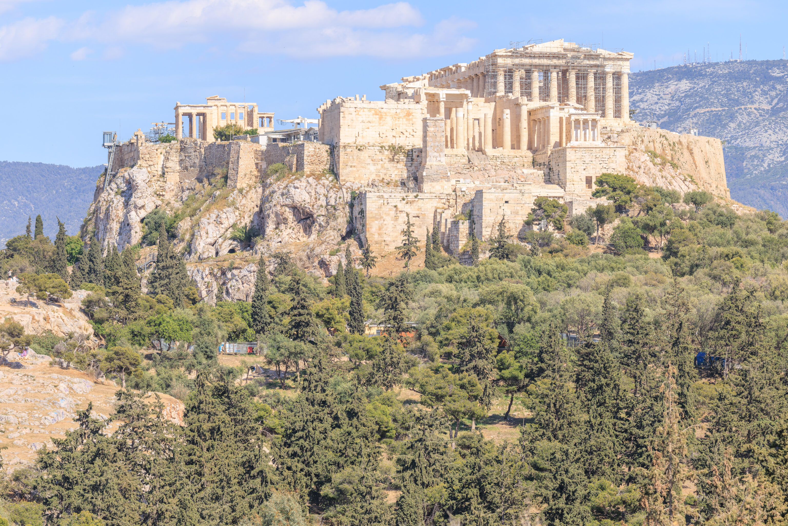
We continued walking to the southeast. Our view of the Acropolis changed a bit from the difference in perspective.
We could also see the Philopappos Monument, which was south southwest of us.
Again, a slightly different perspective as we walked a bit further to the southeast.
We were able to find the Stoa of Attalos to the northeast.
We didn’t realize it when we decided to come here but there is a whole big ruin up here. The hill we are on, the Pnyx, actually was the meeting place for the Ecclesia of Athens. This was the Ekklesia of the Demos that we saw referenced on some signs in the Ancient Agora. This site has gone through three phases of construction and is believed to have been able to seat 13,500 people at the end. It seems to have decayed over more than 2,000 years as it was replaced by the Theatre of Dionysus.
We sat here on the stones for awhile under the shade of a tree.
We enjoyed the view of the Acropolis from here, again just ever so slight different from the previous Acropolis photo that we took.
We watched this magpie for awhile as it seemed to hunt. This seems to be a Eurasian Magpie. As its name suggests, it can be found in Europe as well as a band of Asia stretching to the Pacific and including the northern parts of China.
We were able to find the upper part of the Temple of Hephaestus.
This ruin, appearing to the right of the Acropolis, is the stage building of the Odeon of Herodes Atticus.
We decided to walk around a bit. We’re not sure what the stones ahead of us were for but it is clearly a man-made feature. It may be part of the Themistoclean, the ancient Athenian city wall?
The view in the direction of the Philopappos Monument using the wide angle lens. It looks much further away now! It is only an 8 minute walk away according to Google Maps.
This view, from the west a bit, gives a better overview of how the area looks.
A sign here describes the Pnyx:
The Pnyx functioned as a place of assembly (ekklesia) of the Athenian citizens at approximately the end of the Archaic period (around 500 BC) and is linked with the political reforms made by Kleisthenes. It functioned as an assembly place till the end of the 4th c. BC, until its activities were transferred to the Theatre of Dionysos (on the South Slope of the Acropolis), consequently losing its primary political significance. This might explain why the ancient periegetic writer Pausanias did not make any reference to it, when he visited Athens in the 2nd c. AD.

The first to investigate the area was George, Earl of Aberdeen, who revealed the Bema of the Pnyx and the rock-cut niches of the Sanctuary of Zeus Hypsistos. In 1835 the archaeologist K. Pittakis discovered a boundary stone bearing the inscription «HOROS ΠΥΚΝΟΣ».

The assembly (ekklesia) met ten times a year. The epistates (superintendent) of the prytaneis (the executive committee of the boule) presided over these meetings, assisted by a secretary and a herald who made the announcements. Sacrifices were offered to Zeus Agoraios before the commencement of the assembly, for its smooth conduct. While the orator spoke from the bema, the audience sat on the rock surface but later wooden benches were added. The corps of the prytaneis, who were assisted by archers, was responsible for the maintenance of order and sat on the lower tier of the speaker's platform.

The Pnyx includes three architectural phases:

During phase I (6th-5th c. BC), a semicircular auditorium was created, defined by a rectilinear wall to the north. The bema (the speaker's platform) was placed on the north and the orators had their backs turned to the Acropolis. The seating capacity is estimated at 5,000 people. This is the Pnyx of Aristophanes, where speakers like Miltiades, Themistocles, Aristides and Pericles swayed the populace and influenced the fortunes of the city.

During phase II (end of 5th c. BC), the auditorium was enlarged and a major retaining wall was erected to the north. Two stairways led from the northeast into the auditorium. The bema was moved from north to south. This transformation is attributed to the Thirty Tyrants of 404-403 BC (Plutarch, Them., 19). The seating capacity at this phase is estimated at 6,000 people. The orators Demosthenes, Aeschines and Isocrates spoke here.

During phase III (4th c. BC), which is visible today, the general orientation remained the same but extensions to the auditorium were made on a grand scale. A new monumental retaining wall was erected, made from immense blocks. Its main access was an enormous staircase set in the middle of the concave arc. The maximum seating capacity of the concave, with a depth of 70 m, and diameter 120 m., is estimated at 13,500 people. The bema of the third period, the famous "Lithos" (stone), survives intact and is the most distinctive monument of the site. Its façade, carved on the rock, is 9 m. long. Three steps lead to its top level (I.10 m. in total). The Gallery where the proedroi (leaders) of the ekklesia sat was set higher. The big rectangular cutting above the bema for the Altar of Zeus Agoraios (patron of the orators) also belongs to the third period. At the time of Augustus (Ist c. BC), this altar was moved to the Agora and set up in front of the Metroon. It appears that at this phase the upper terrace, south-west of the Pnyx, was constructed.

The ambitious plan of reconstructing the Pnyx III, which included the erection of the East and West Stoas to accommodate large numbers of people, never materialised, possibly because in the same period the construction of the Theatre of Dionysus was completed and consequently the assembly was transferred there. Another aspect of happening this was the construction of the Diateichisma. This phase dates back to the time of the orator Lycurgus, in 330-326 BC.

Meton's Sundial
South of the Altar of Zeus Agoraios the rock-cut base of the Sundial, a type of solar clock, survives. It was constructed by the renowned astronomer and geometer Meton (433/2 BC).

Sanctuary of Zeus Hypsistos
East of the speaker's platform, on the face of the rock, on the first level of the Pnyx plateau, many rock-cut niches of various shapes and sizes were made to receive votive inscribed plaques of human limbs, as offerings to Zeus Hypsistos. These surround a large central niche where the statue of the God was allegedly placed. The open sanctuary was established in the Roman period, possibly at the end of the Ist c. AD, when assemblies were no longer held on the Pnyx and its political significance had diminished.
This is where Meton’s Sundial was located.
We decided to leave by a different path and first started walking to the southwest. From here, we still had a nice view of the Acropolis to the east.
This perspective, from a little bit further to the southeast, looks straight into the Acropolis’ Propylaia.
We turned and followed a path that started to descend to the north.
From this path, looking to the leeft, we could see the bema, the podium that the speakers would have stood on. The stairs of this bema still survive.
We don’t know the function of this stone structure on the side of the hill.
There is mention of a retaining wall being constructed at the Pnyx. This might be it?
A sign nearby describes the Pnyx:
The Pnyx - Entrance 3 :

The three hills west of the Acropolis, comprising an area of 670.000 m2, have monuments that are homonymous. Characteristic too are the many cuttings in the rock that were made for constructions of various types as well as other signs of habitation dating from prehistoric to Byzantine times (2800 B.C. - 12th century A.C.).

The area is connected with the mythical fight of Theseus against the Amazons. From archaic times (6th century B.C.) on there is evidence that the Ekklesia (assembly) of the Demos gathered on the hill of the Pnyx. There were also the sanctuaries of Zeus and the Nymphs on the hill of the same name and the "road by way of Koile", known from Herodotos. It was cut into the rock and it was the main commercial and military roadway connecting the Acropolis with Piraeus, running through the deme of Koile. With the inclusion of the hills within the Themistoclean circuit wall of the city (479/8 B.C.) and the construction of the Long Walls by Pericles protecting the connection of the city with the ports of Piraeus, this area formed one of the main junctures and most densely populated sections of ancient Athens, taking in the well-known demes of Melite and Koile.

The building of the diateichisma or cross-wall (end of the 4th century B.C.) reduced the extension of the city toward the west, lessened the importance of the ancient road, led to a gradual abandonment of the two demes and to the establishment of cemeteries along the roads during Hellenistic and Roman times. From the 2nd century on, the grave monument of Philopappos dominated the hill of the Muses. The historical development of the hills is seen also in the Byzantine monuments of St. Demetrios Lombardiares (16th century A.C.) and St. Marina above the Theseion (13th-19th centuries A.C.), the neoclassical style building of the Observatory (1842) and the artistic landscaping of the architect D. Pikionis (1954-1957) in this environment of natural beauty.

From this point, the visitor enters the Pnyx Hill, which is dominated by the monumental complex of the Ekklesia of the Demos (Assembly place), with the supporting wall of the cavea of its IlI building phase during the archonship of Lykourgos (330-326 B.C.), built of stones quarried in the terracing of the monument. The cutting of a stepped pathway below the retaining wall belongs to the Il phase of the monument, around 400 B.C.

The stone water-channel at the NE is part of the Peisistratid aquaduct. The many cuttings for houses, roads cisterns and sanctuaries as Zeus Hypsistos and Pan show that the area of the deme of Melite was densely inhabited.

The implementation of the work "Complete Display of the Archaeological Site of the Philopappos hill" in the framework of the programme of Unification of the Archaeological Sites of Athens, with funding from the 2nd and 3rd Community Support Framework (1998-2004), has revealed its ancient topography and displayed the monuments, promoting the cultural significance of the declared archaeological site of the three Western Hills.
This would have been a useful sign to have when we first entered the Pnyx. We didn’t see such a sign there, though it is always possible we simply missed it.
We started to walk back to to the Grande Bretagne via Monastiraki. We saw what appeared to be a small house for feral cats as well as some water and food.
This was the East Road to Pnyx. There are also two cats here!
We walked to the north along a wide pedestrian road. This section overlooks the Ancient Agora. Our relatively low elevation limits what can be seen but the Stoa of Attalos can be clearly seen here.
Back to the Grande Bretagne

We stopped at Kasata Gelateria, an ice cream shop that was on the way. We got three scoops of melon, Belgian chocolate, and peanut butter and jelly. All of the flavors were very good!
Afterwards, we wanted to eat before returning to the hotel. We found a restaurant on Google Maps near the Thiseio Metro station that serves mostly gyros and souvlaki. However, we could not find it. We were going to eat somewhere else when we saw a restaurant that we might want to eat it. It turned out to be Gyristroula, the restaurant we were looking for. The Google Maps marker was off by 100 feet or so.
We ordered a pork souvlaki…
And a pork gyro. Both were good but the skewer was particularly good!
We walked by the Ancient Agora on our way back to Monastiraki. We could have just taken the Metro but decided to walk over.
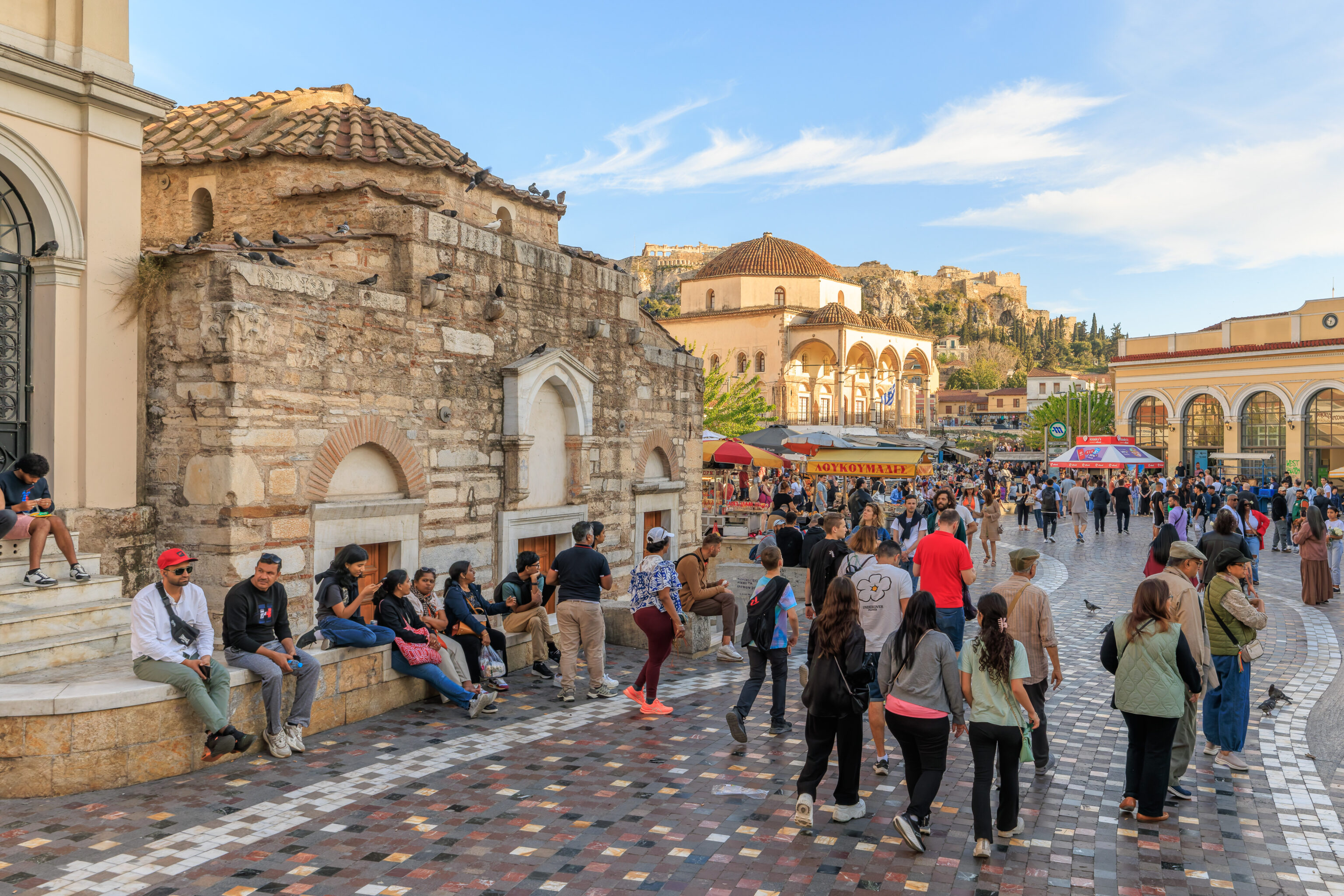
Monastiraki Square was much busier than it was in the morning when we were here!
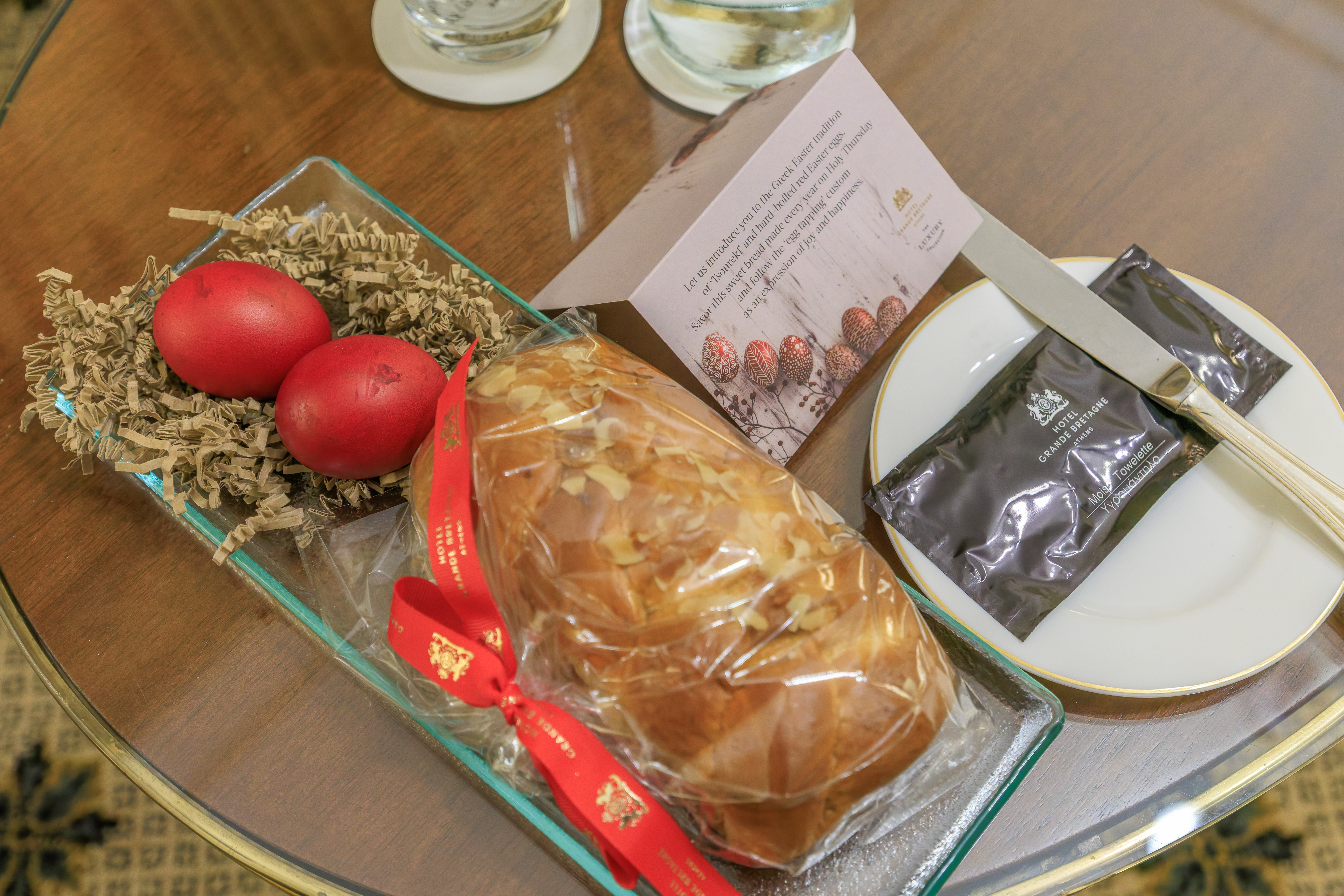
Upon returning to the Grande Bretagne, we noticed that there was something new on the table. It contained an Easter bread, tsoureki, and two red hard boiled Easter eggs. The tsoureki is simple, its bread, you eat it. However, there is a game you’re supposed to play with the eggs.

The note refers to this game, tsougrisma, as the egg tapping custom. Each person takes a red egg. The eggs are always red as it symbolizes the blood of Christ. The two eggs are then tapped, or perhaps smashed, together. The winner is the person whose egg does not crack. Winning grants good luck for the next year.
The Greek Orthodox and Catholic churches have different ways of determining which Gregorian Calendar date Easter falls on. This year, they happen to be tomorrow, April 20th.
Changes
- July 24th, 2025: Fixed the spelling of Pnyx! It is not Pynx!