

After arriving in Frankfurt, we took the train over to Rüdesheim, a town on the Rhine. We then took a small gondola up to the Niederwald, a forested area above the Rhine Valley. We hiked to the west, eventually descending via a small chairlift into Assmannshausen, an even smaller town. Afterwards, we returned to Frankfurt to have a very late lunch and to walk around a bit.
Frankfurt Airport
We started the day around 7am when we landed at Frankfurt Airport. After 30 minutes, we had entered Germany and were trying to find the entrance to the Frankfurt Airport Marriott. The entrance that we ultimately found was on the upper level walkway to the Fernbahnhof, or long distance train station. We were too early to get our room but we left our bags for the day. We then headed downstairs to the Regionalbahnhof to catch a train to Wiesbaden and then onward to Rüdesheim.
Wiesbaden
While at Wiesbaden, we had a bit of time between trains. We walked around the station a bit and briefly took a look outside. After coming back inside, we decided to get some snacks from Le Crobag, a German chain that sells French baked goods.
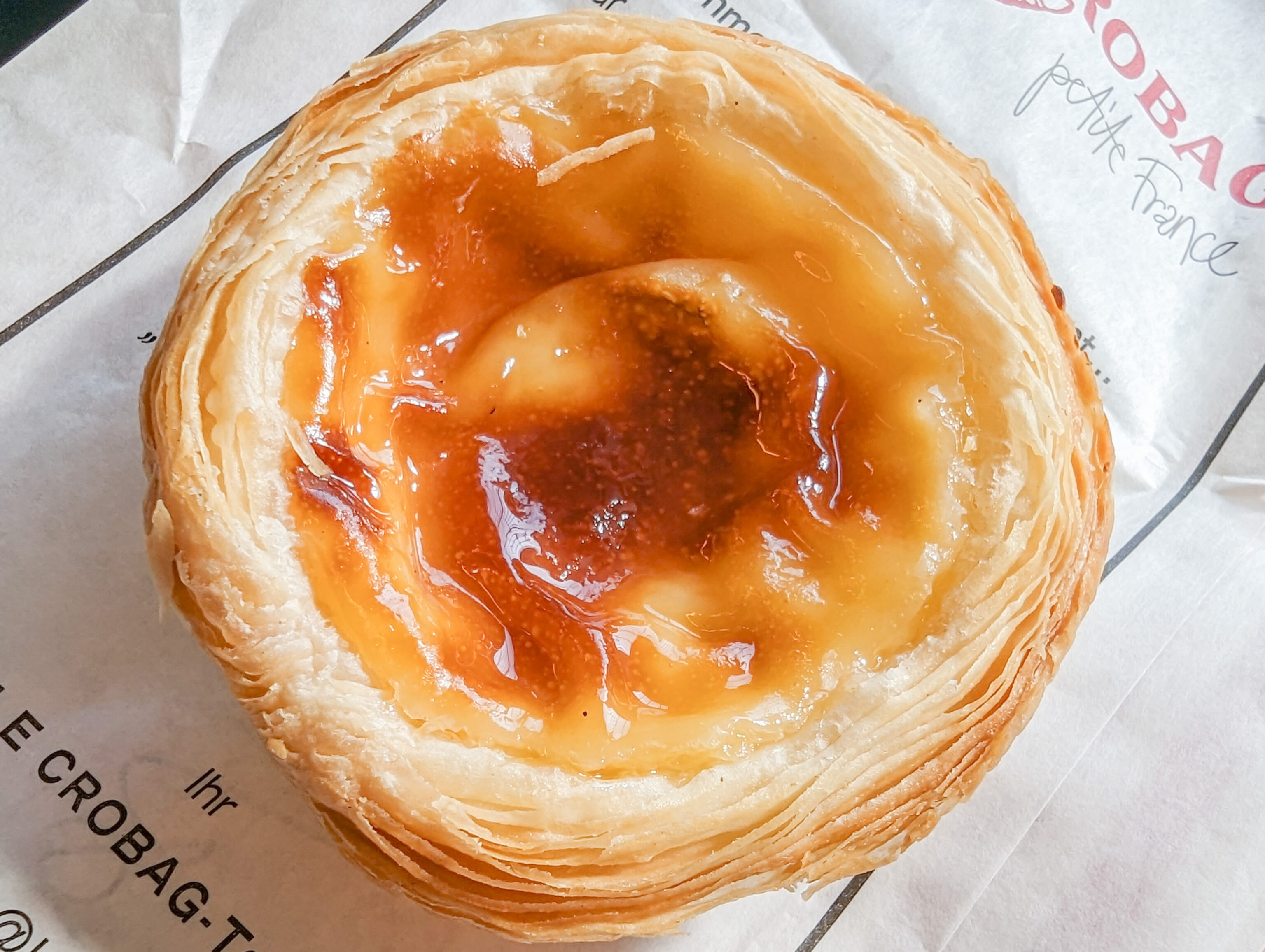
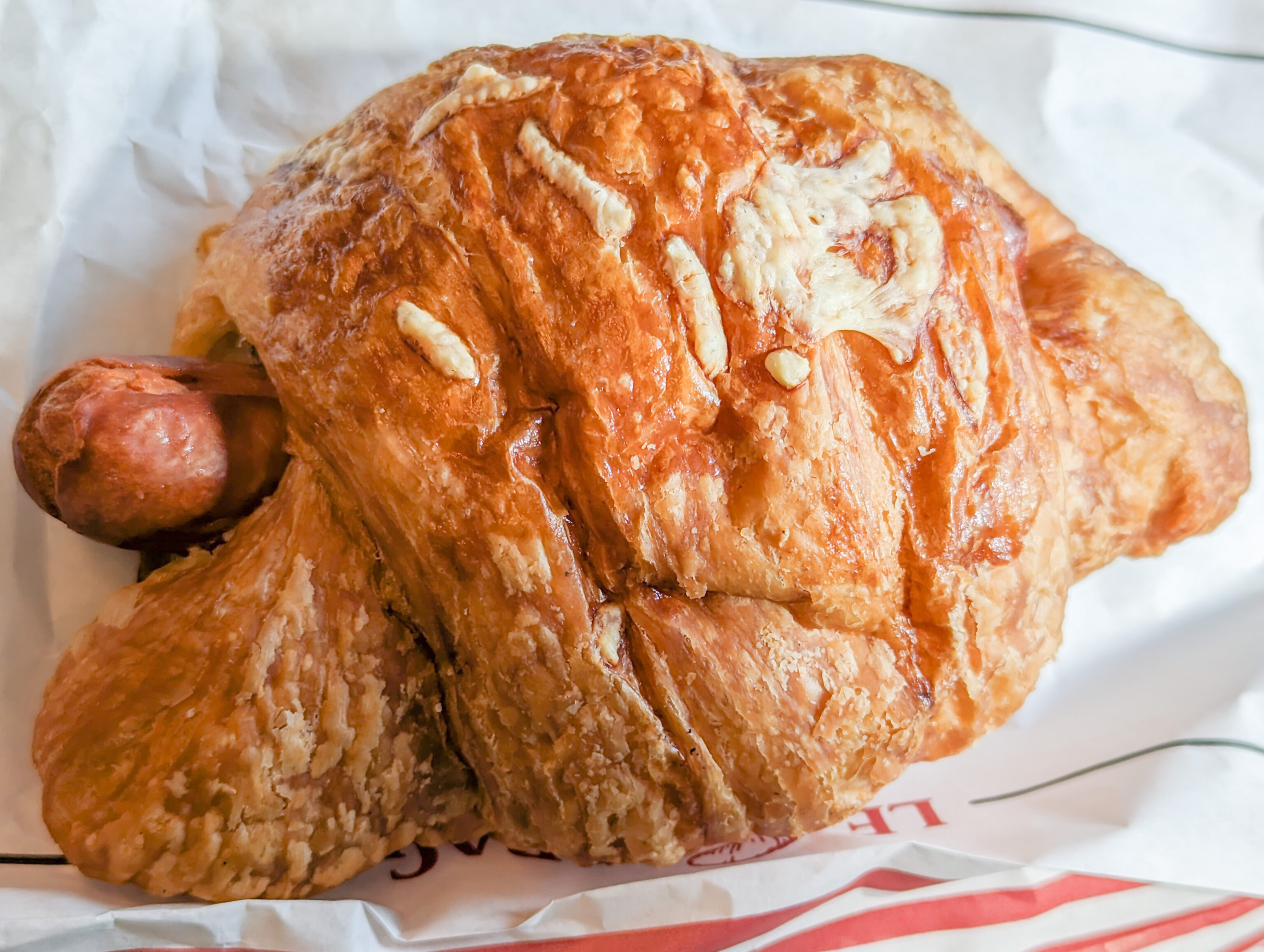
We got a pastel de nata, which is a Portuguese dessert. It wasn’t as good as the ones we make at home and also wasn’t as good as the fantastic ones we got in London a few months ago. We also got what is supposed to be a wurst in a croissant. While it wasn’t the worst, it wasn’t great either.
Soon, ourtrain pulled into the station and we were on our way once again.
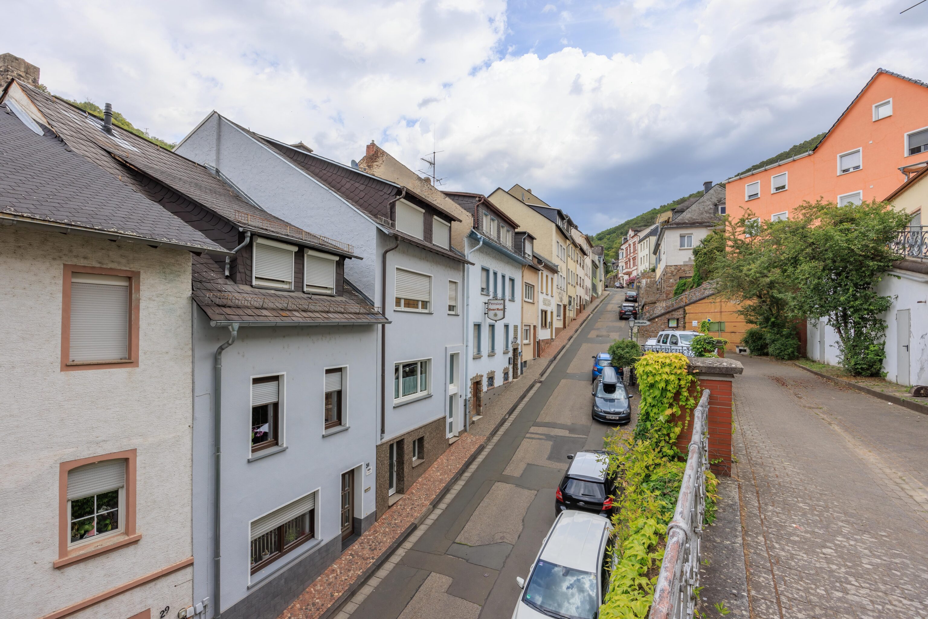
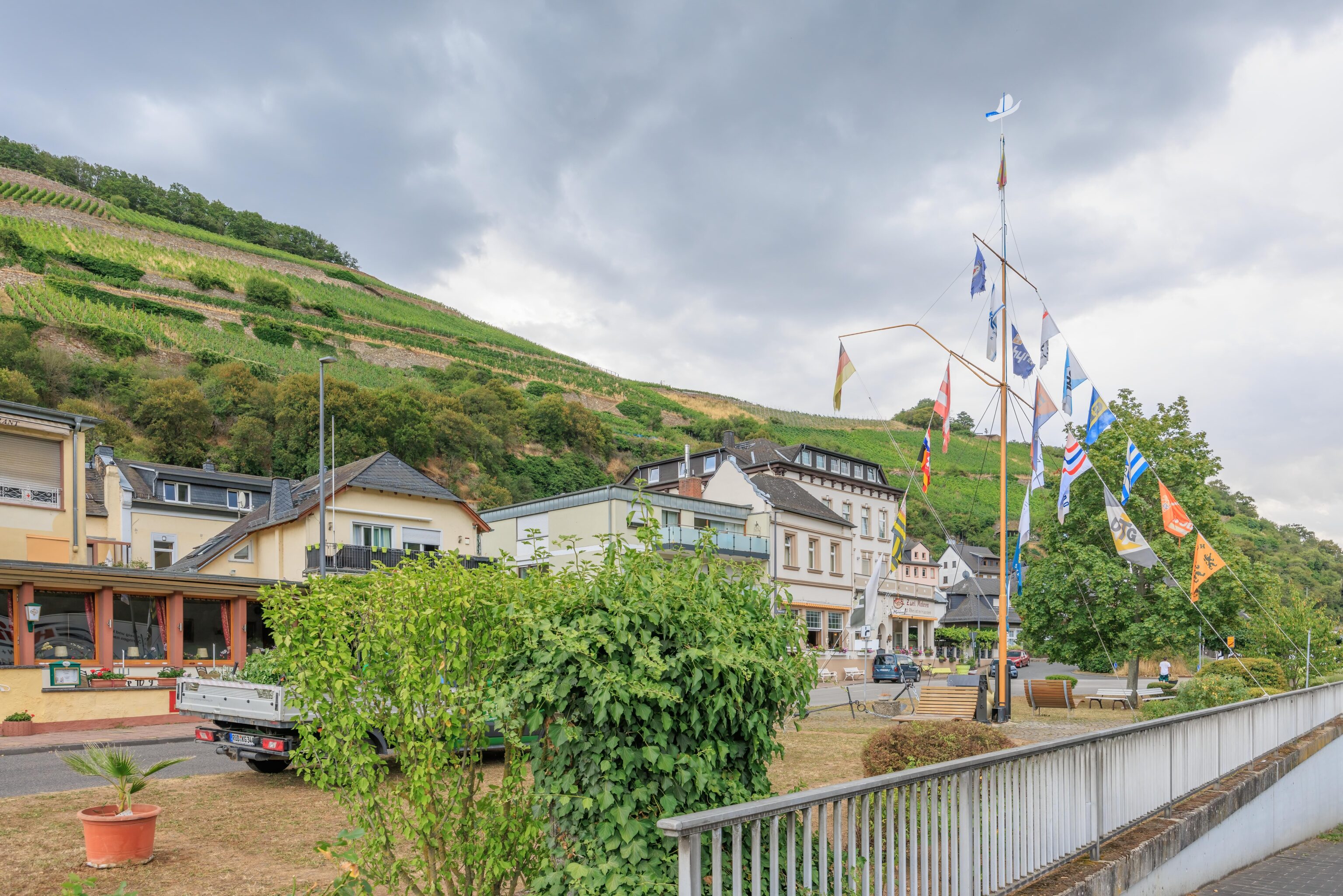
Rüdesheim
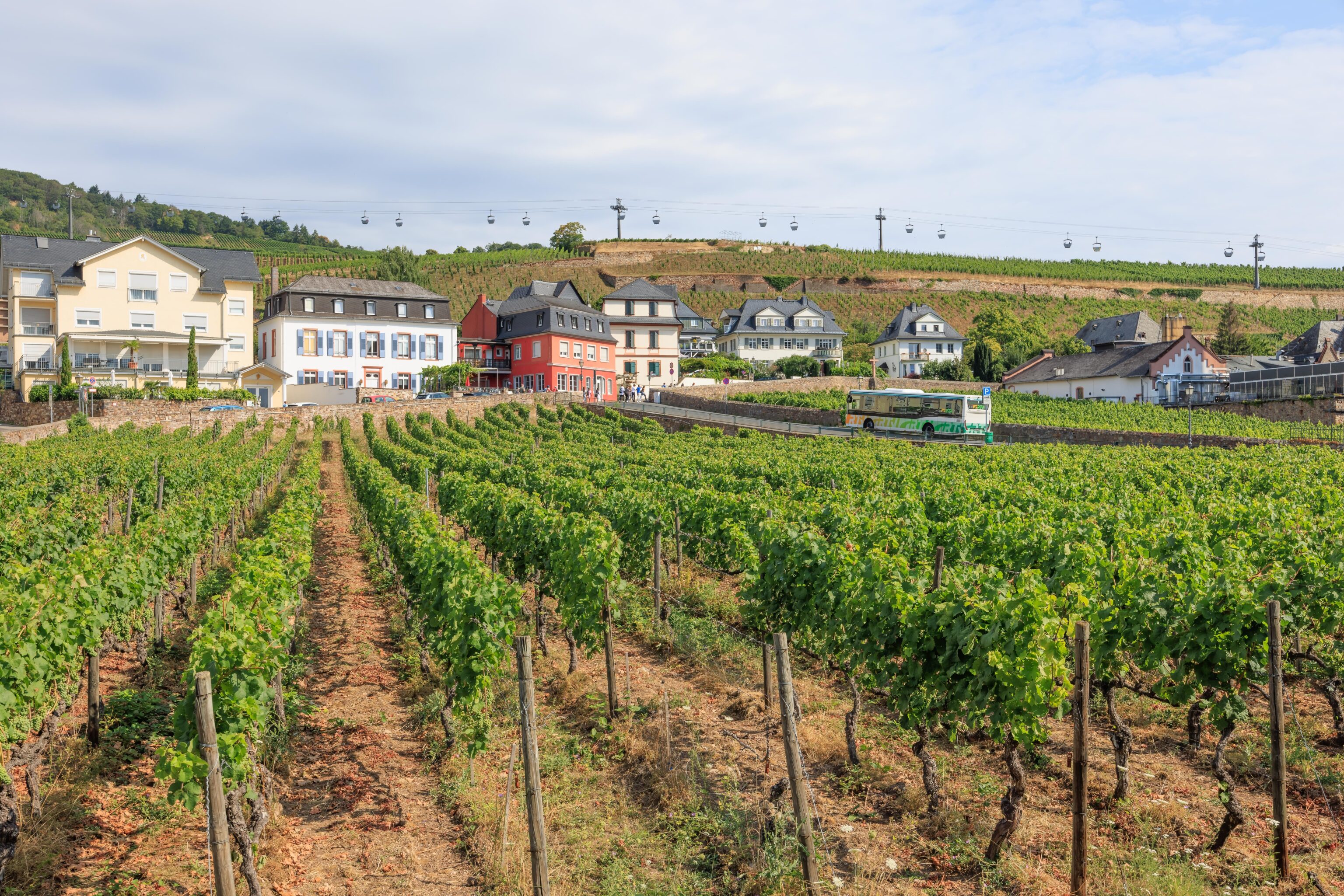
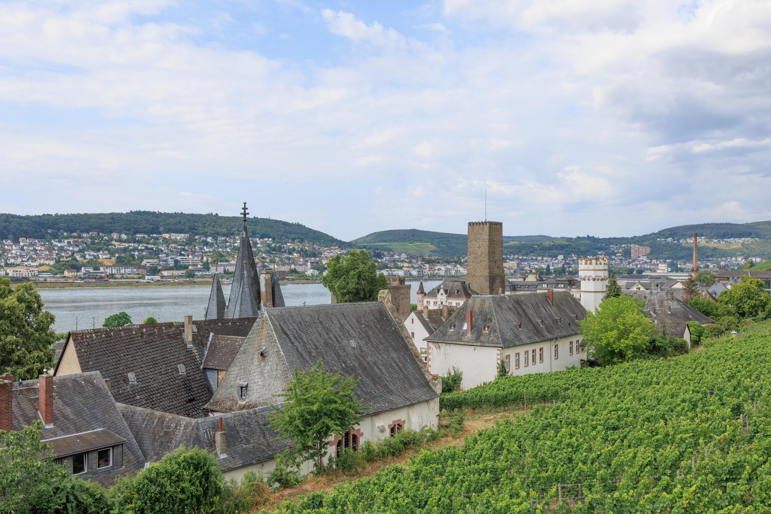
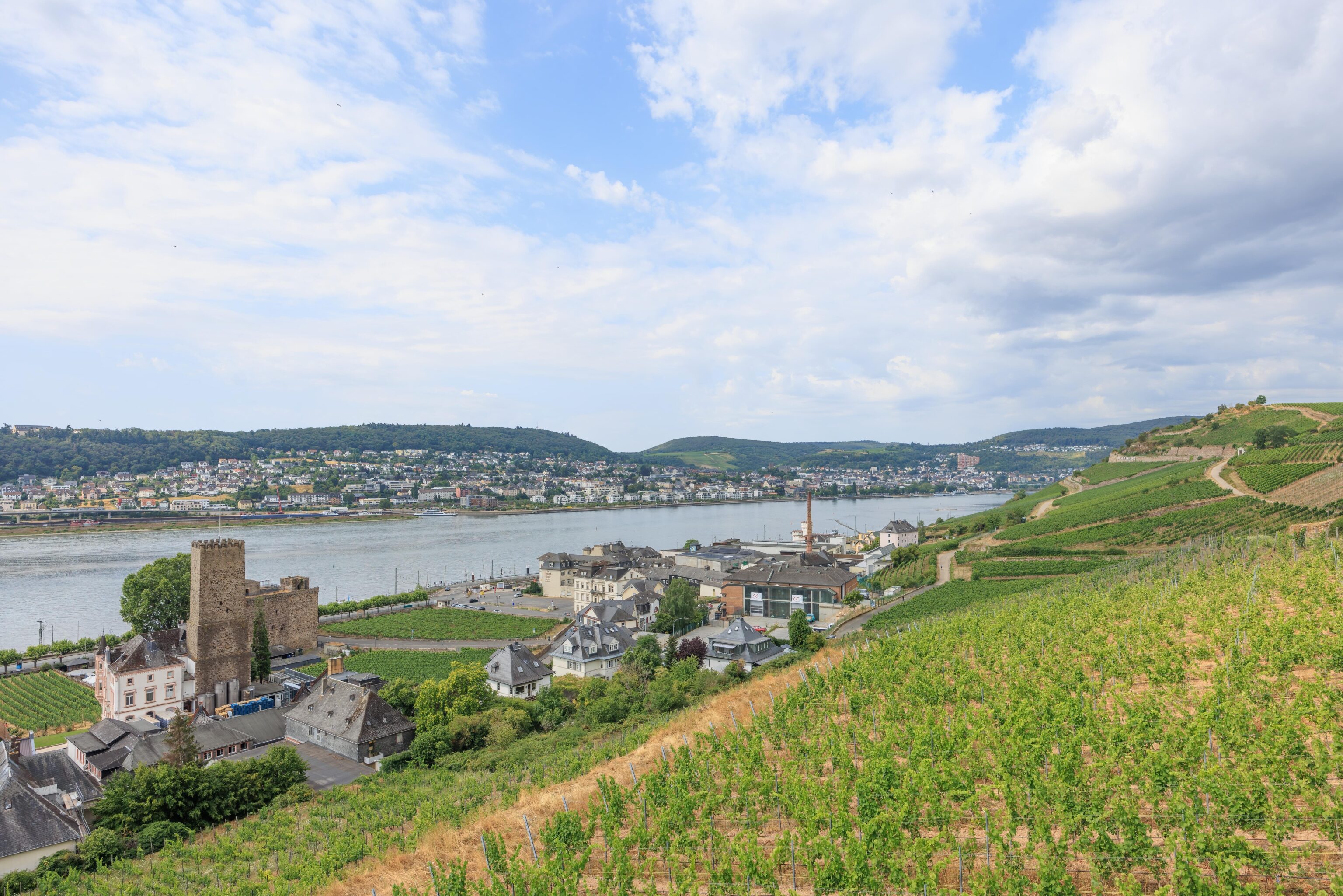
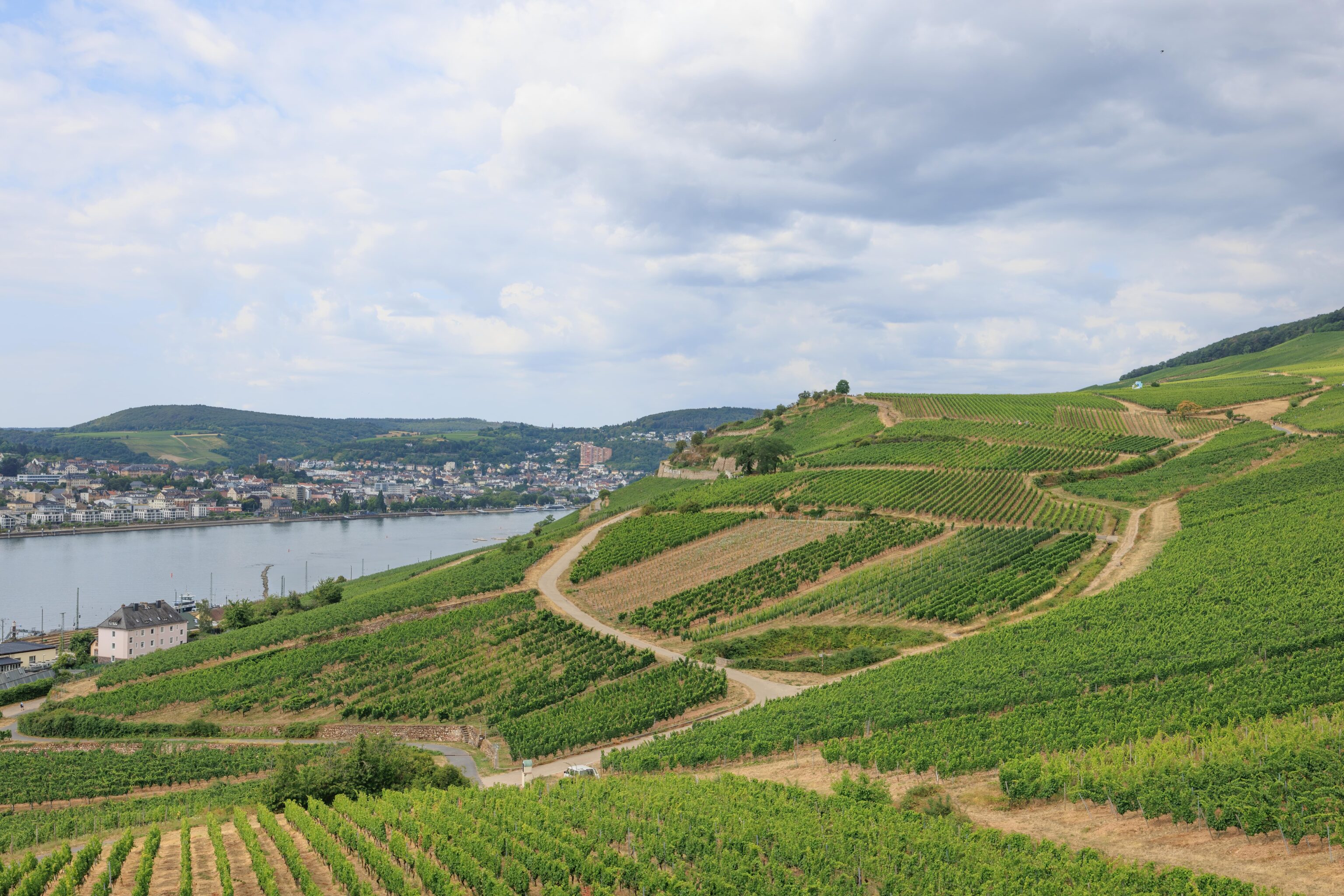
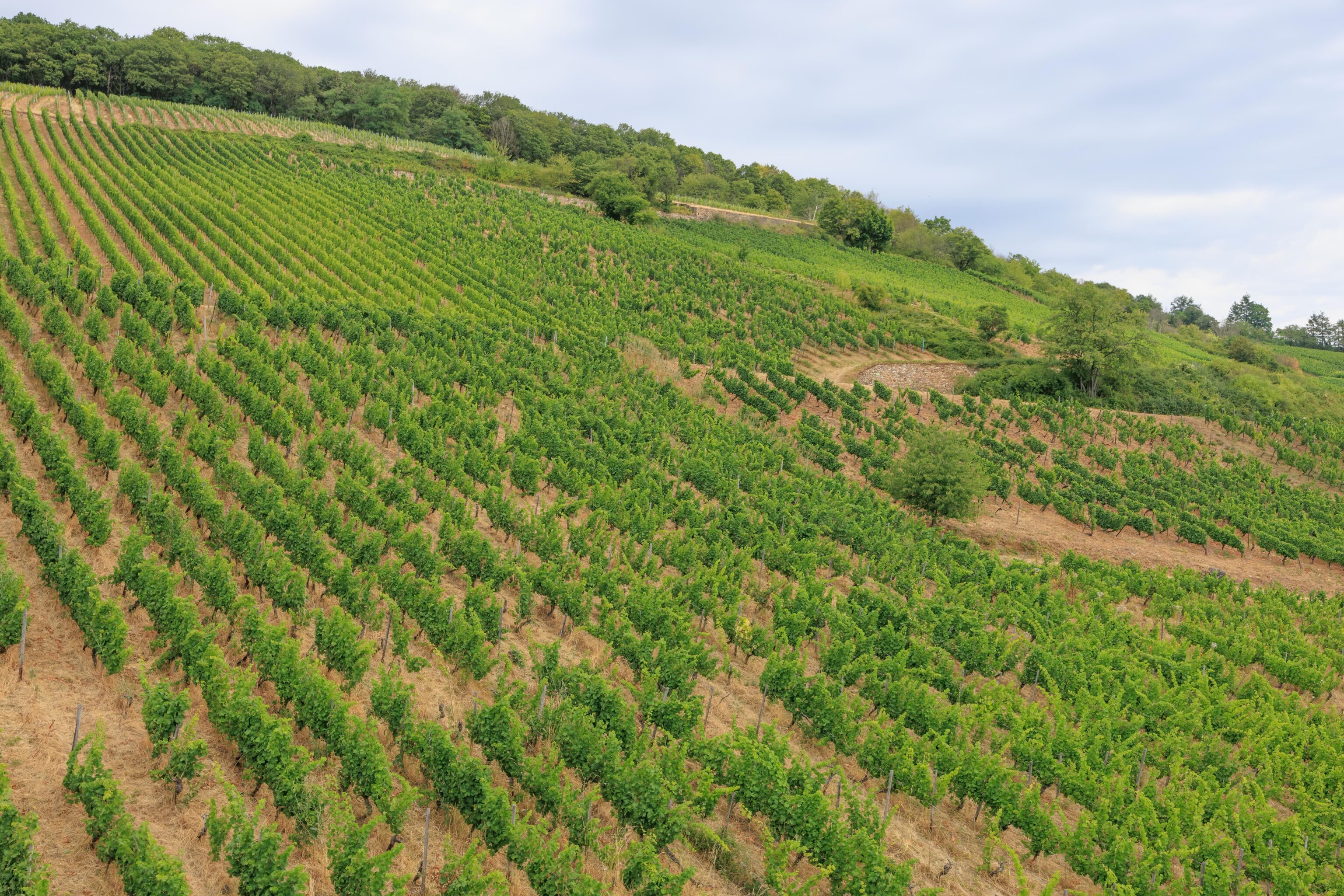
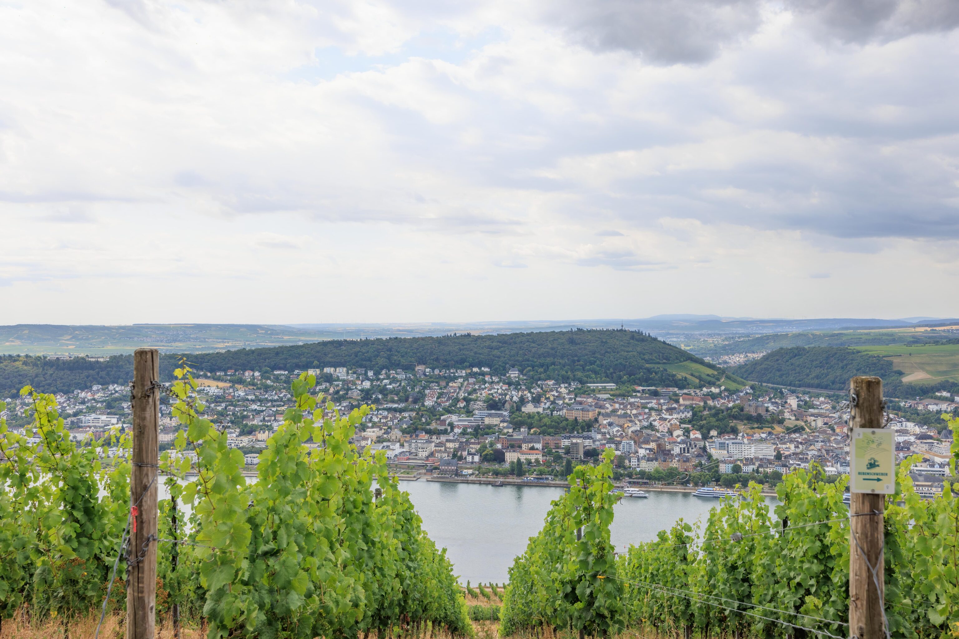
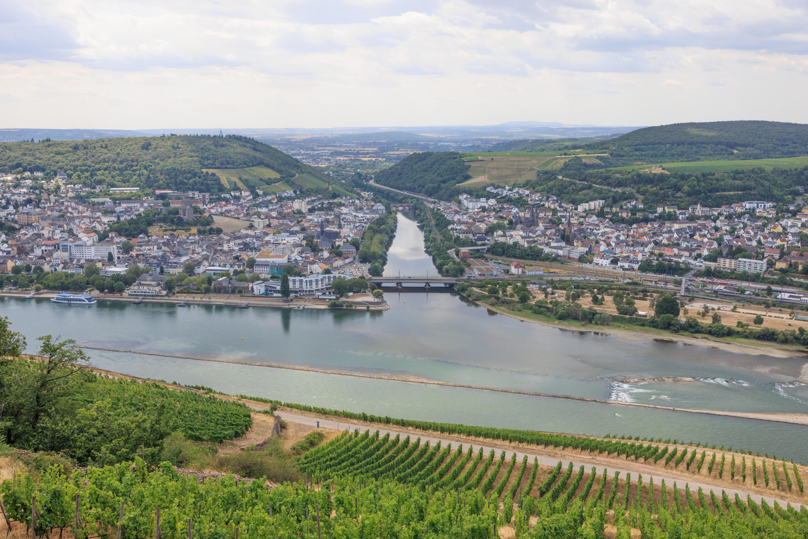
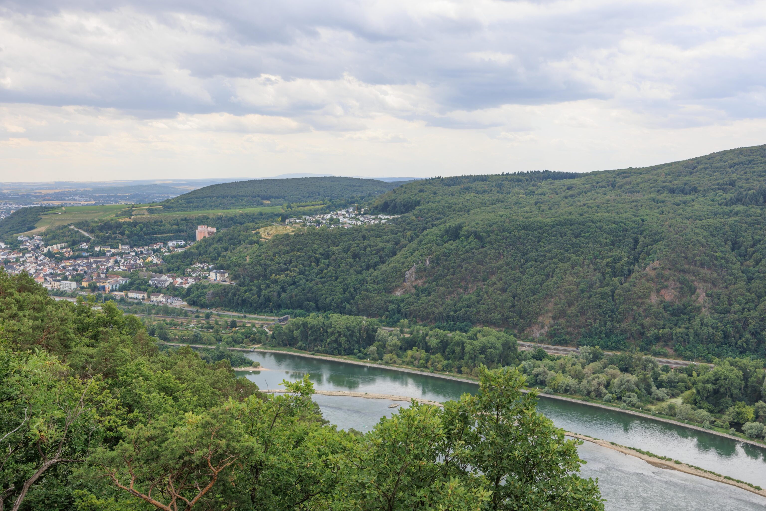
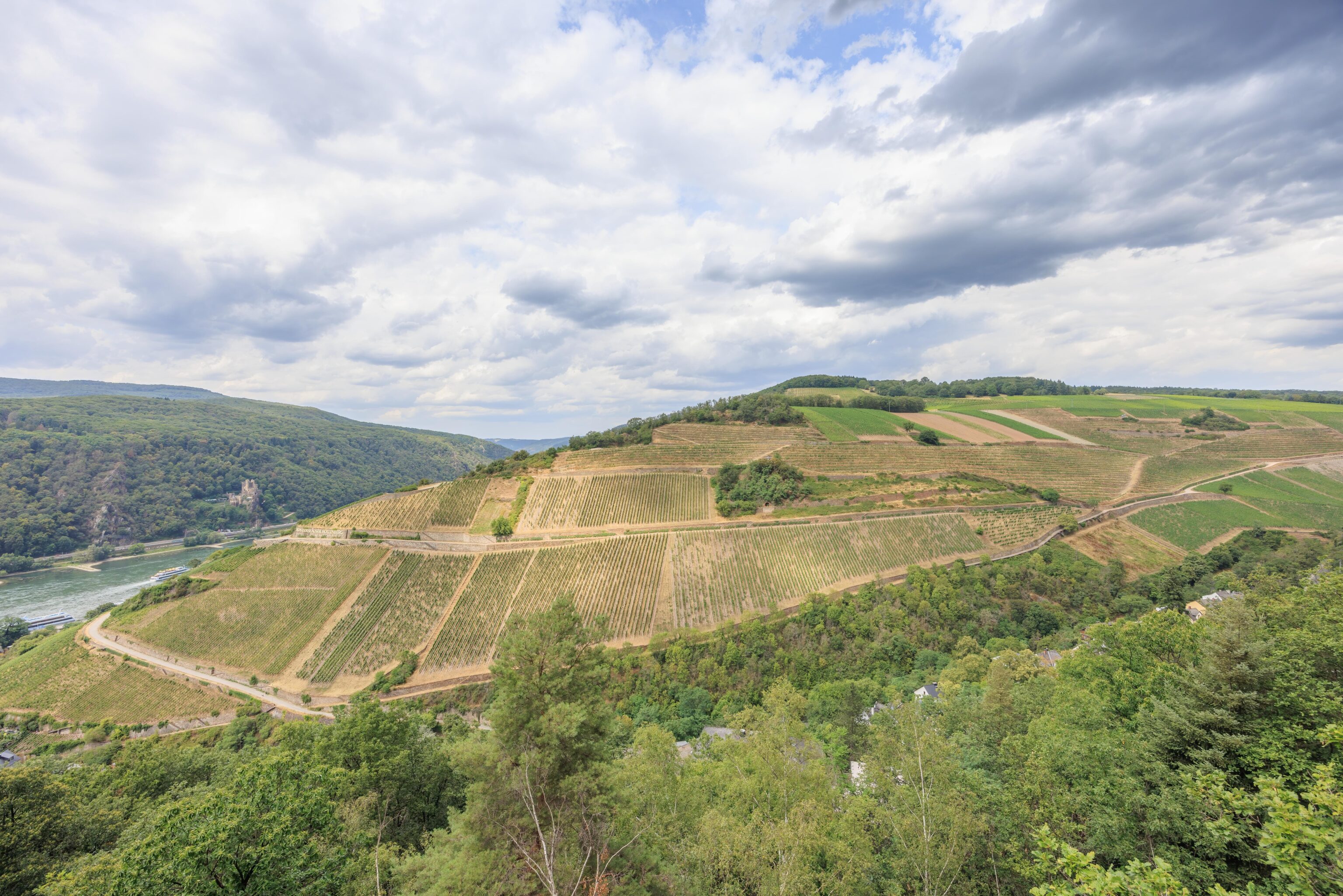
After getting off the train at the western edge of Rüdesheim, we walked to the east to get to the gondola station. Looking inland, we could see the hills lined with vineyards. The gondola was visible as well, just above the town.
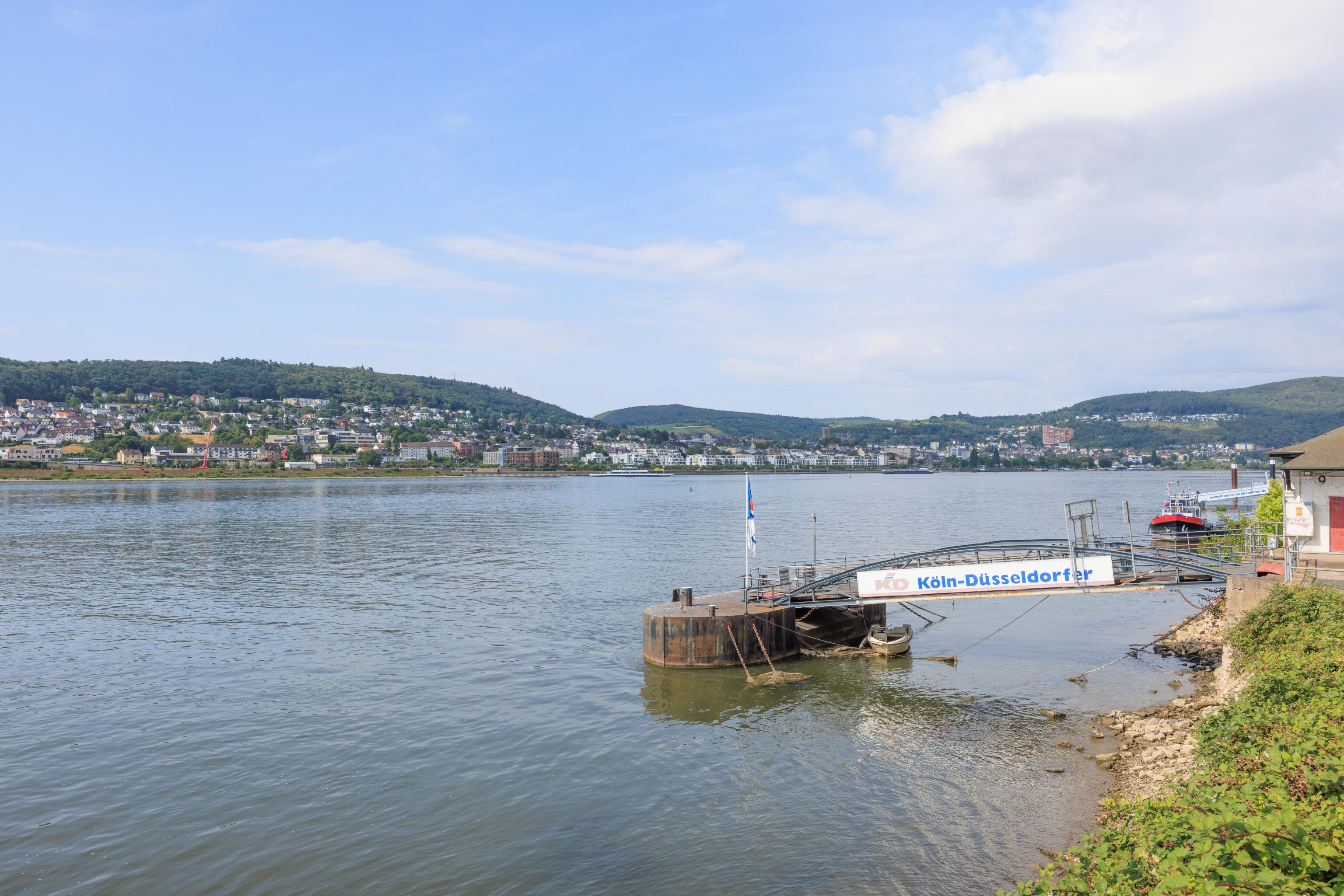
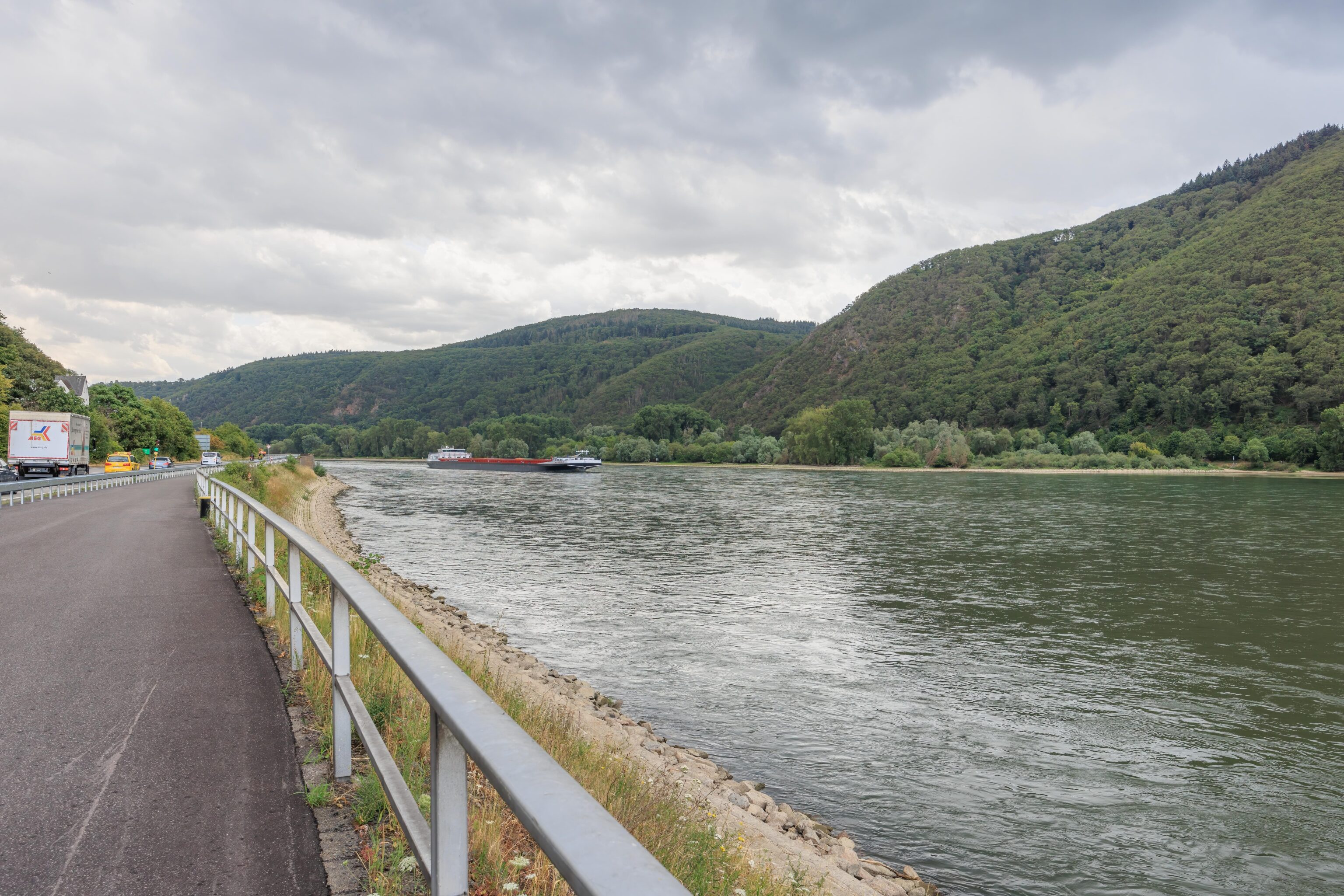
Here, the railroad runs between the town and the Rhine. We briefly crossed over to take a look at the river. The town on the other side, Bingen, appears to be larger.
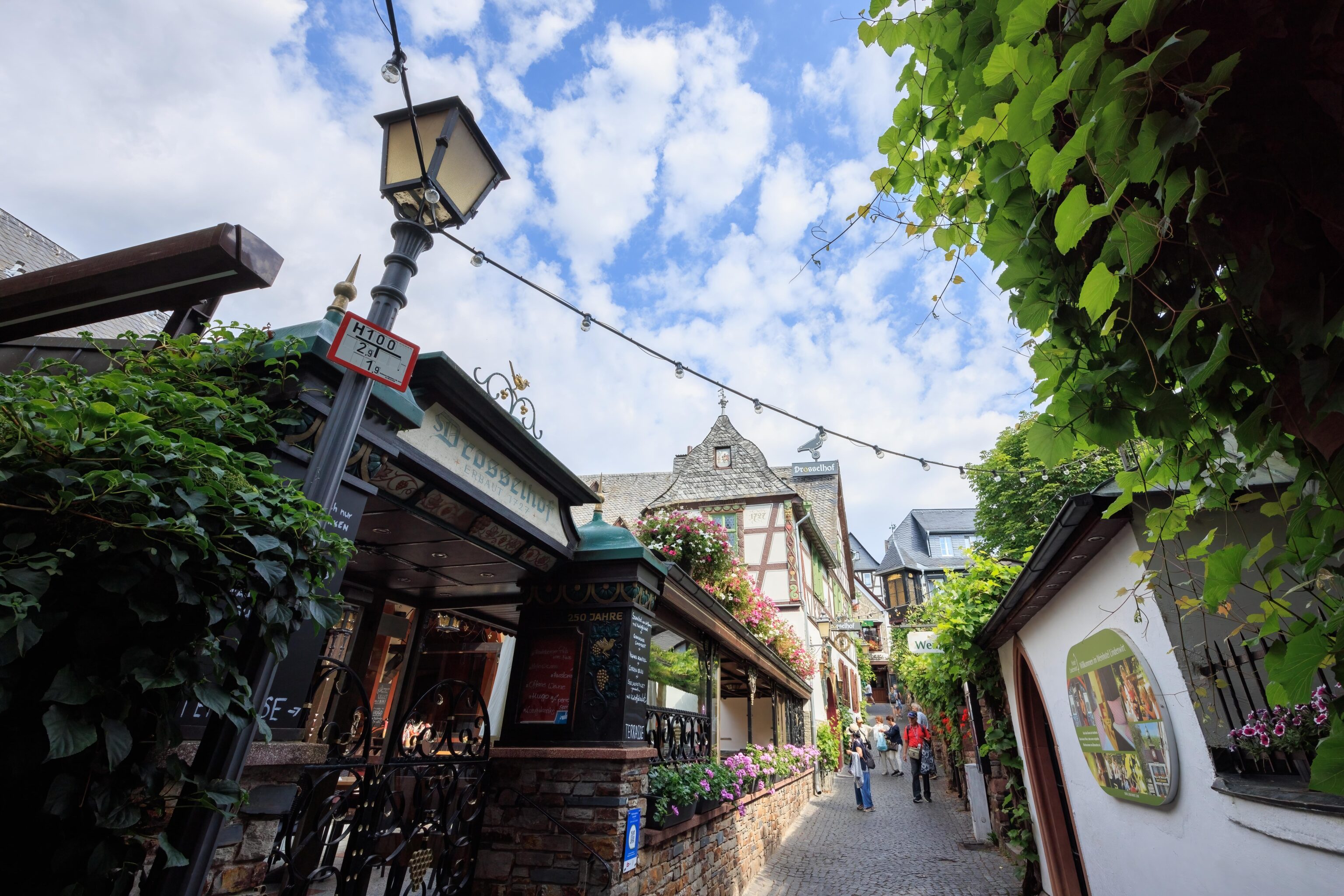
We then headed inland towards the gondola station. We chose a narrow pedestrian walkway that was lined with various shops. It didn’t take long to reach the lower terminal of the gondola.
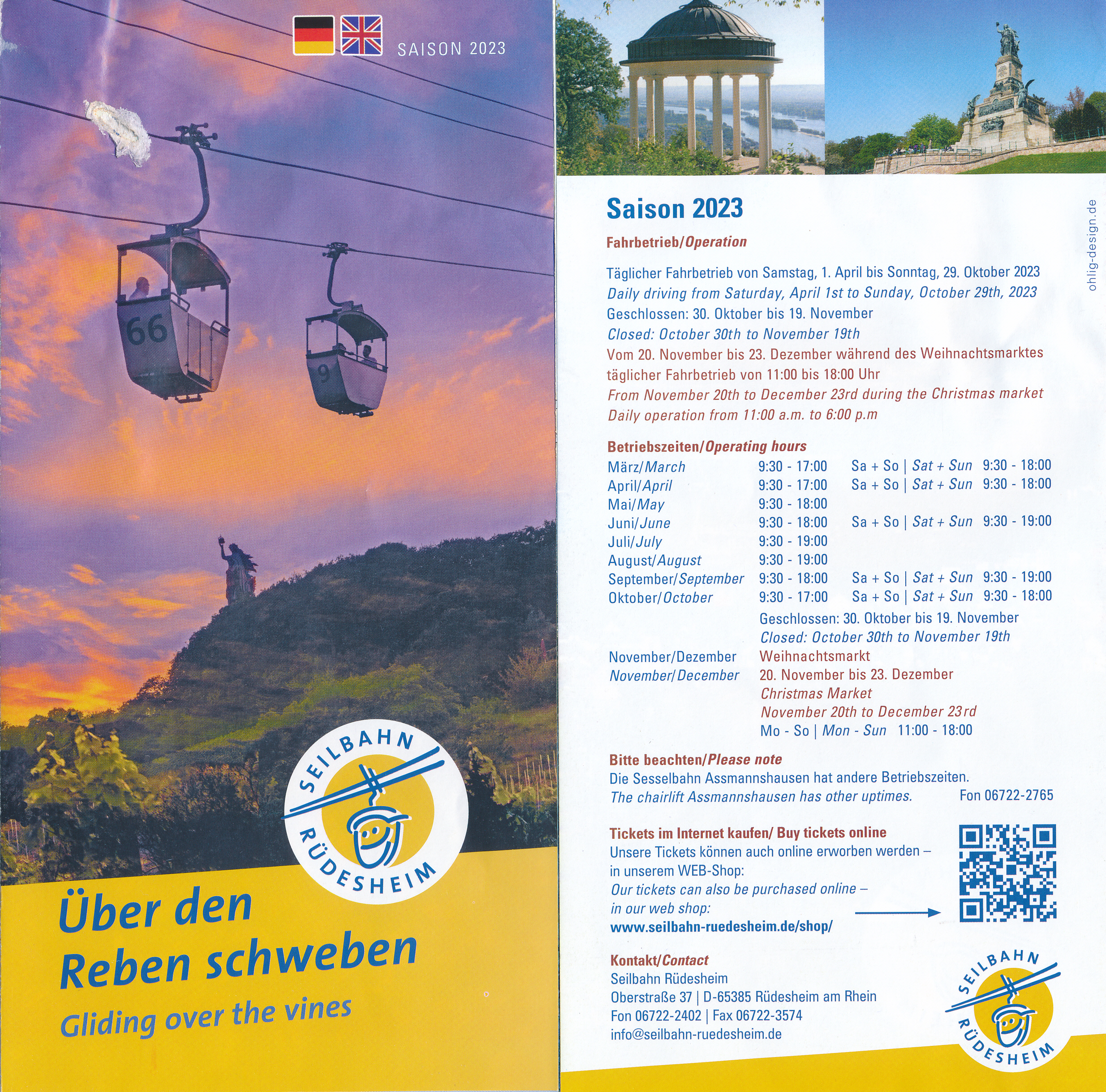
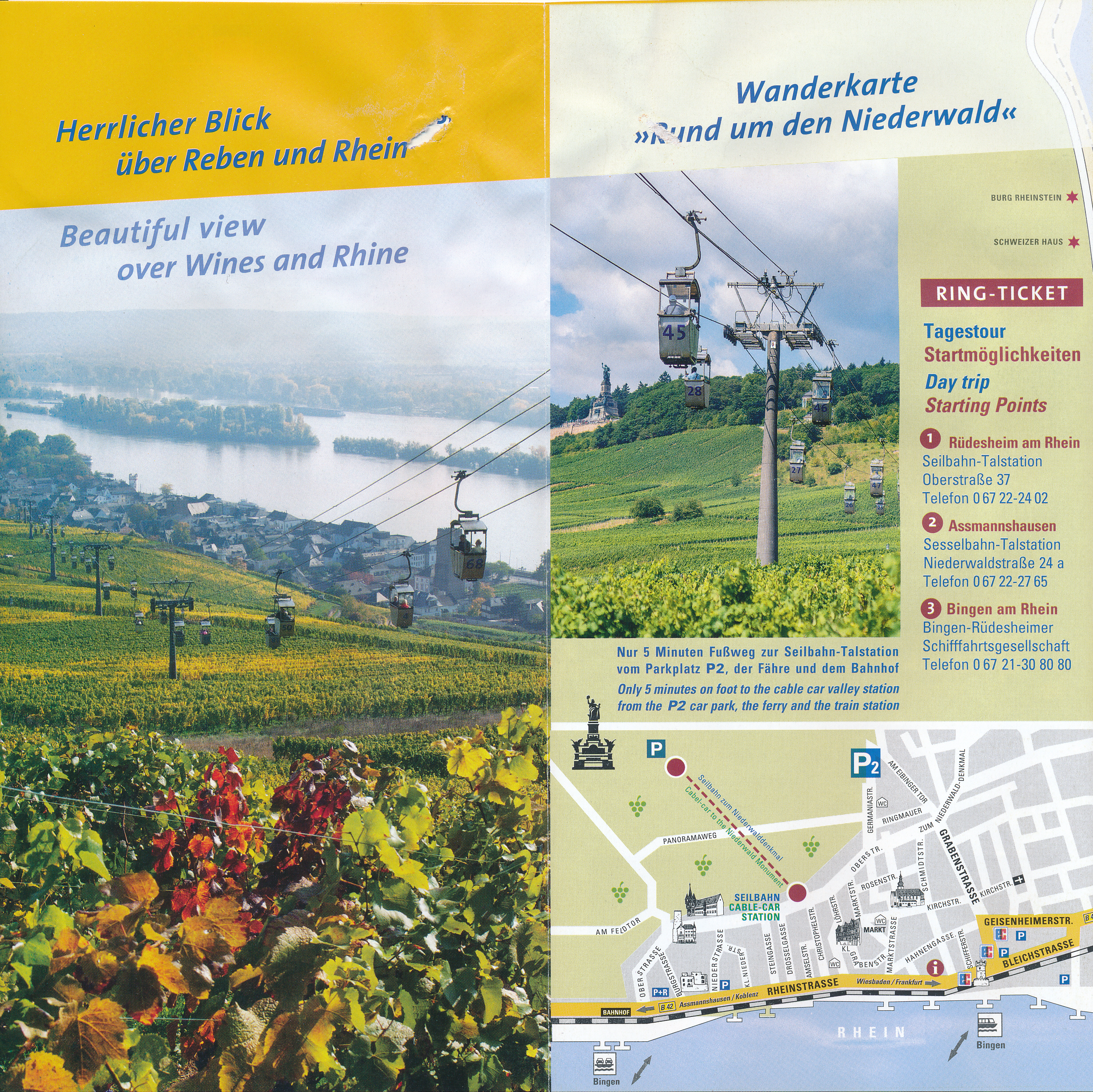
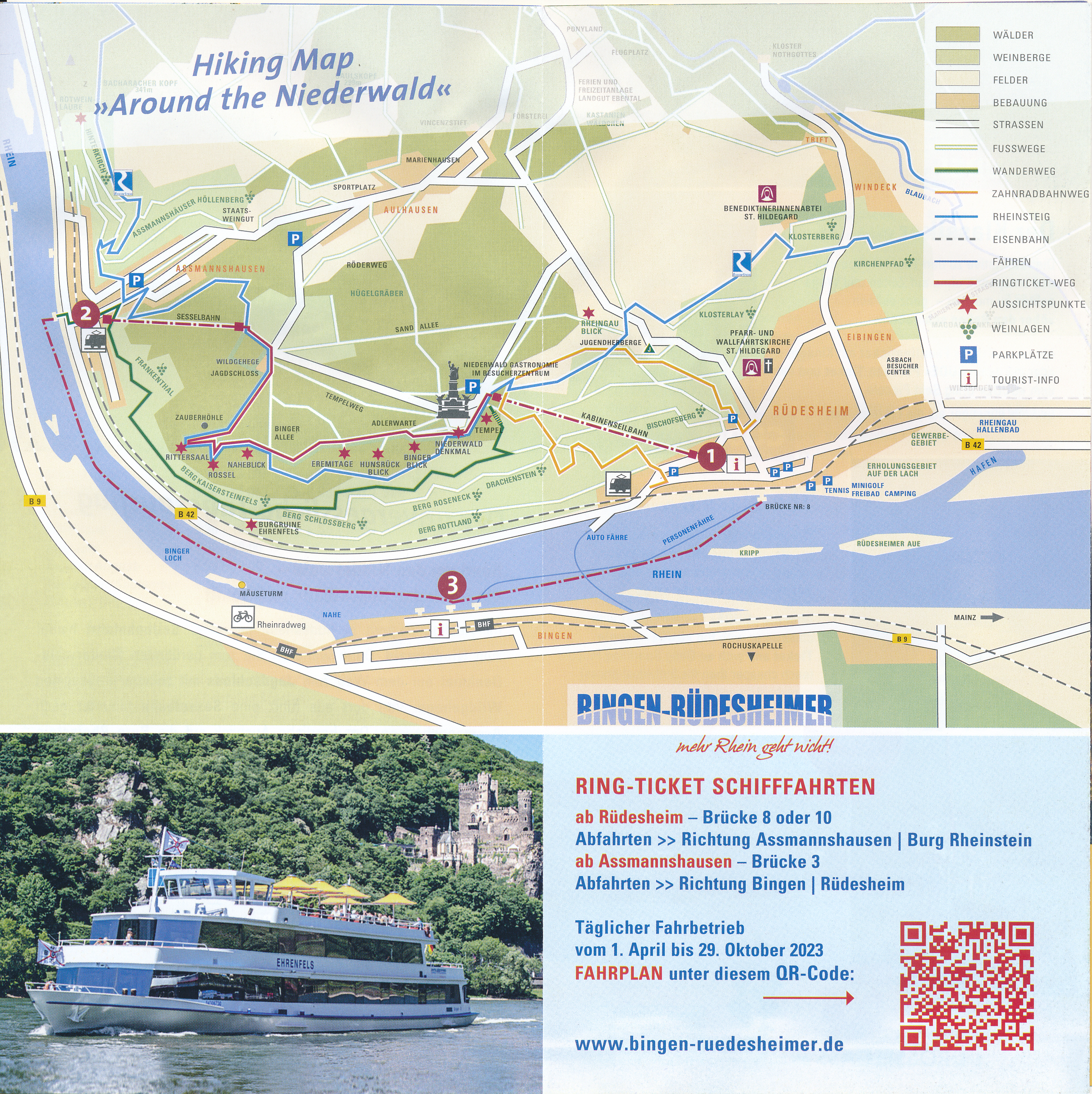
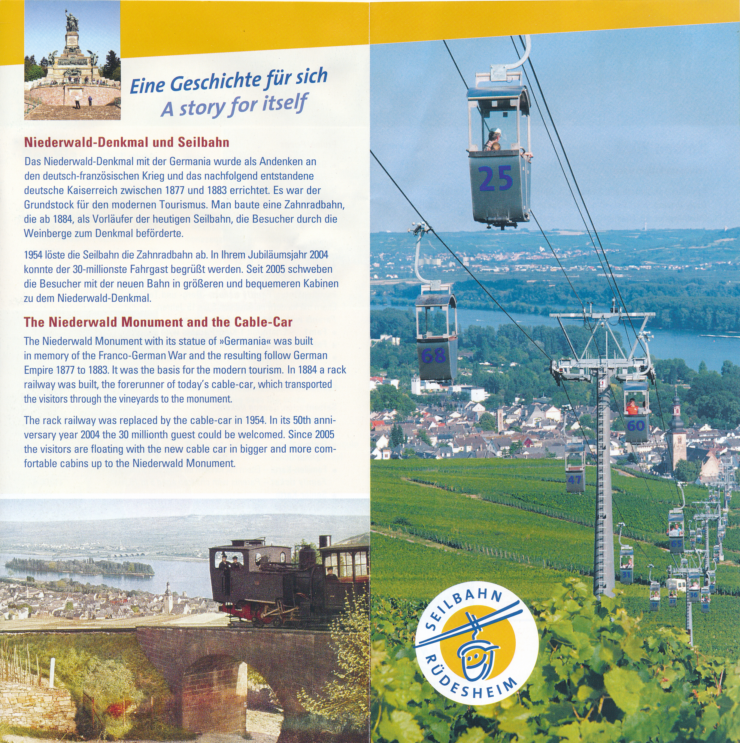
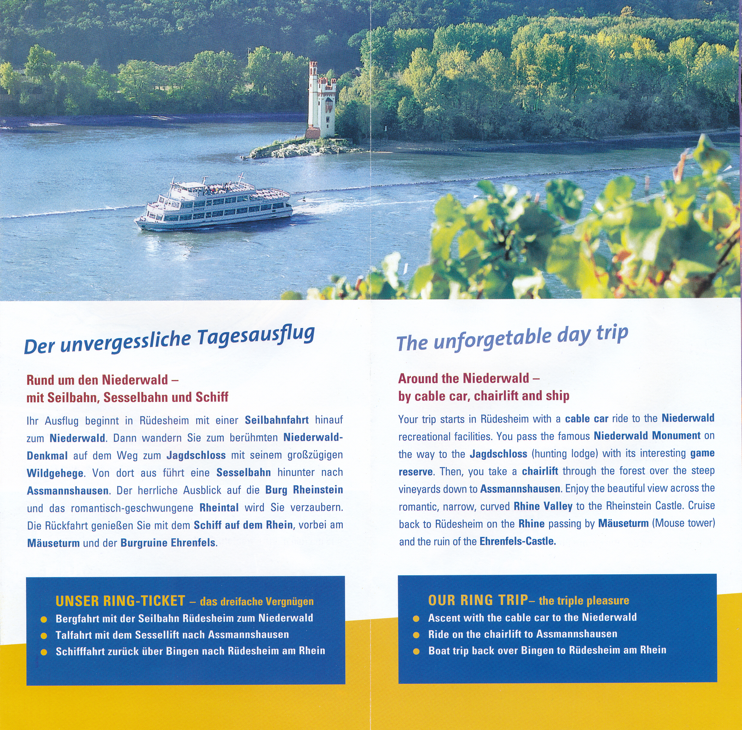
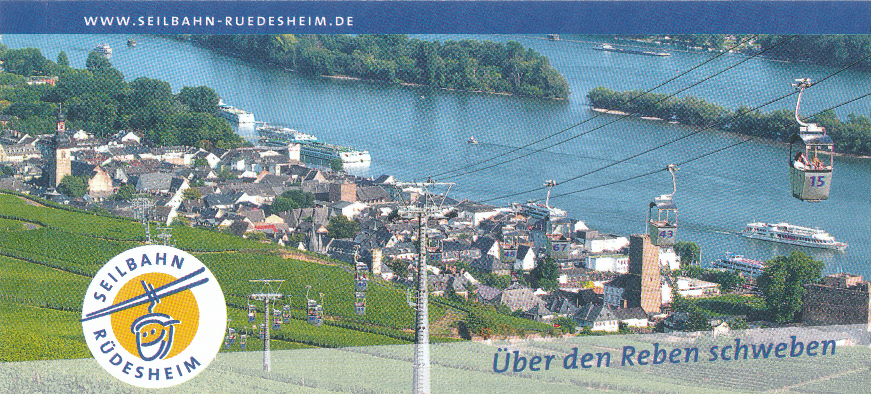
We picked up a brochure and brought our tickets. There are various options, some including a boat ride on the Rhine as well as visiting a castle. We planned on taking the gondola up, walking along the blue colored route to the chairlift, and then taking it down where we would catch a train.
The gondolas are tiny with just two single person seats facing each other. Once we got on, we slowly ascended away from town.
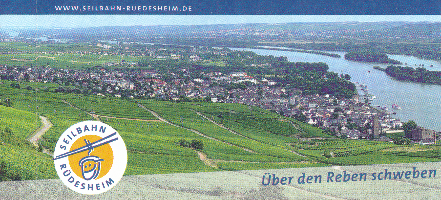
We got a nice view of the Rhine!
We crossed over some narrow roads as we continued to ascend the vine covered hill.
Looking to the right, in the direction of travel, we were still lower than the rest of the terrain.
Niederwald
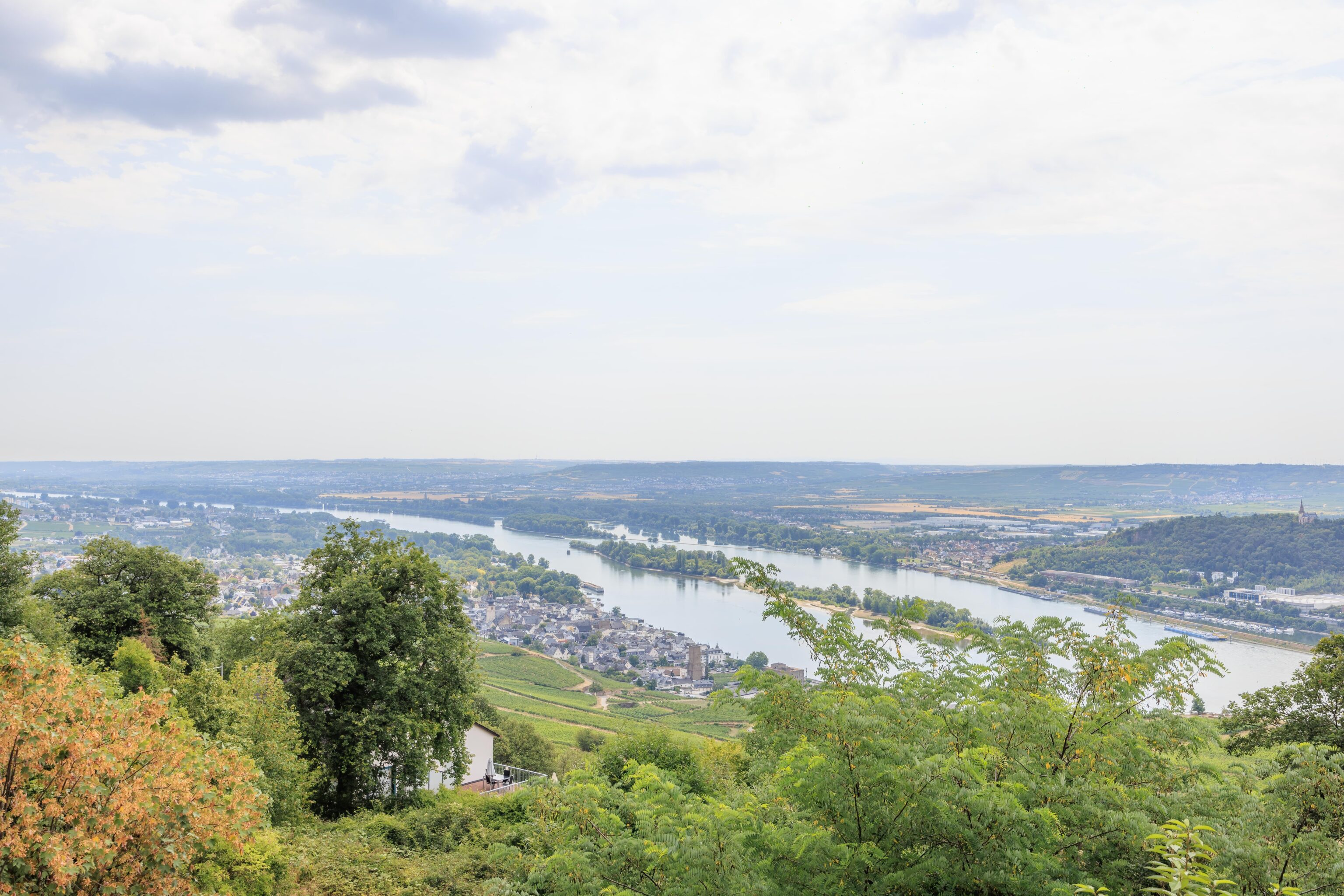
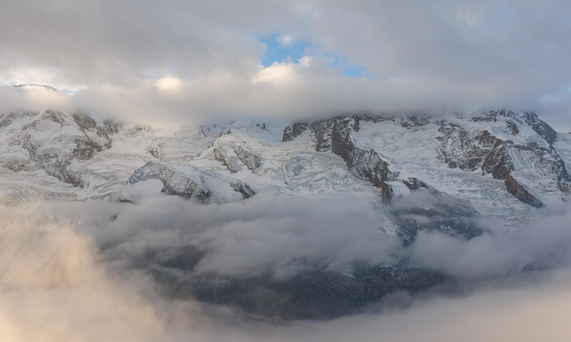
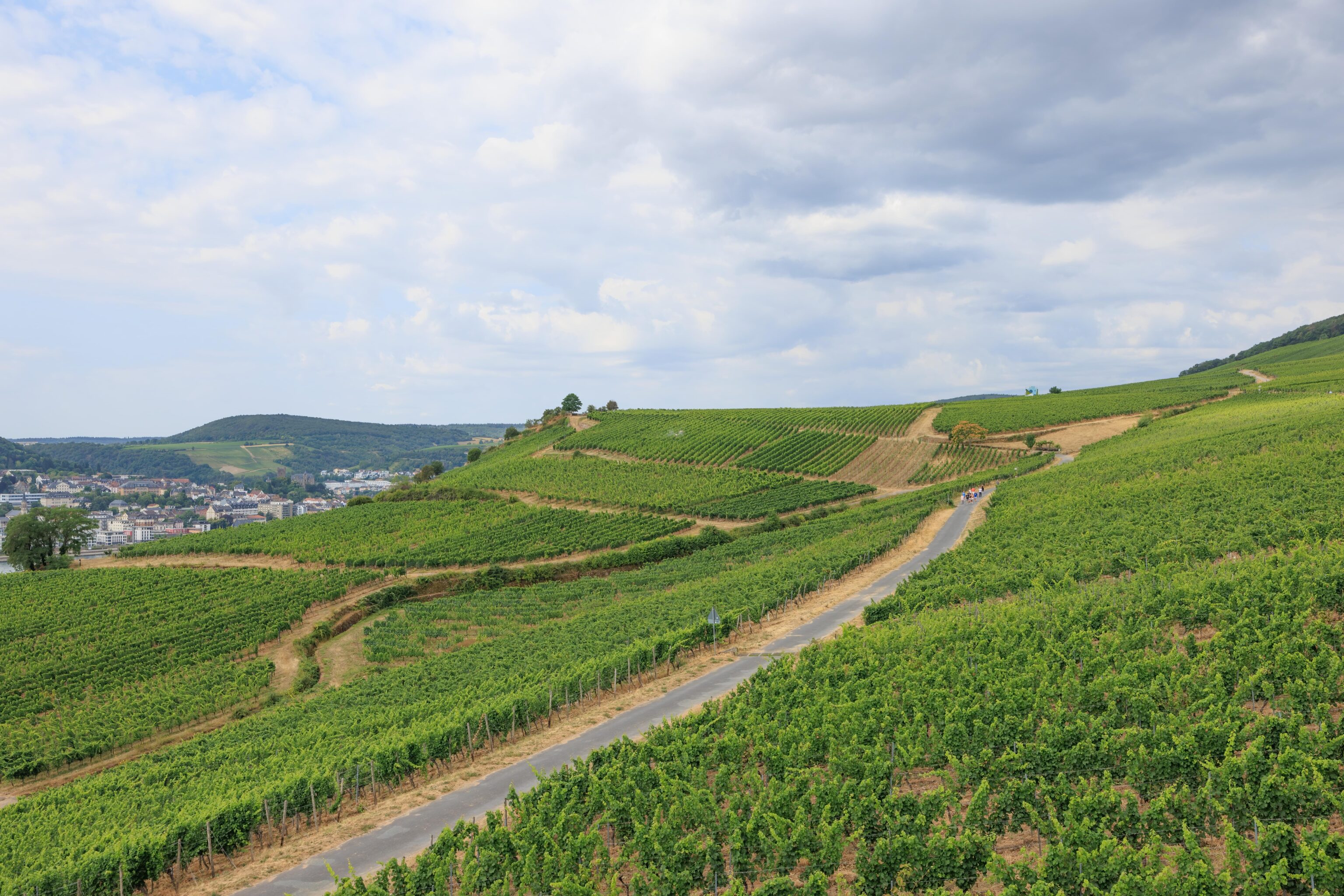
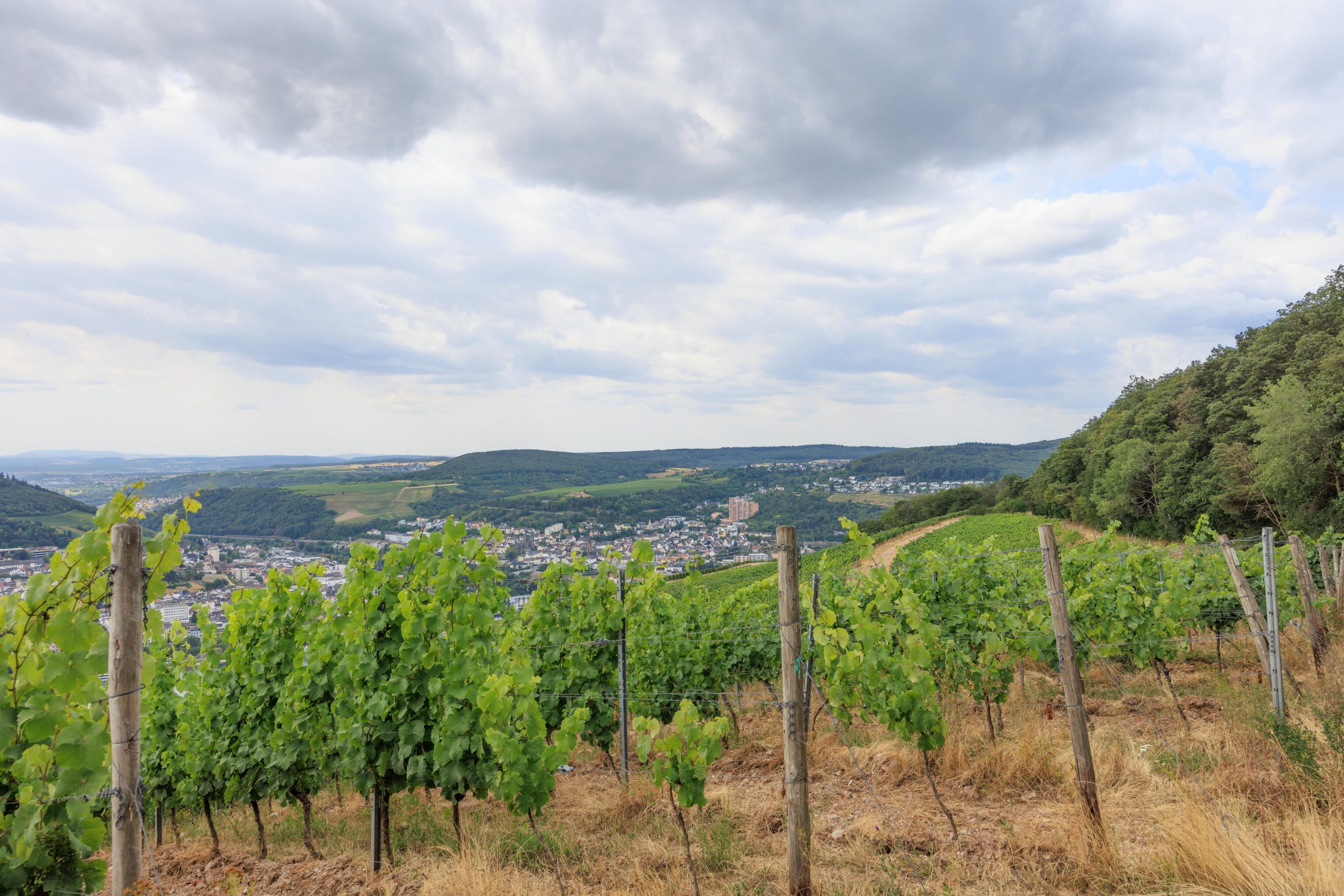
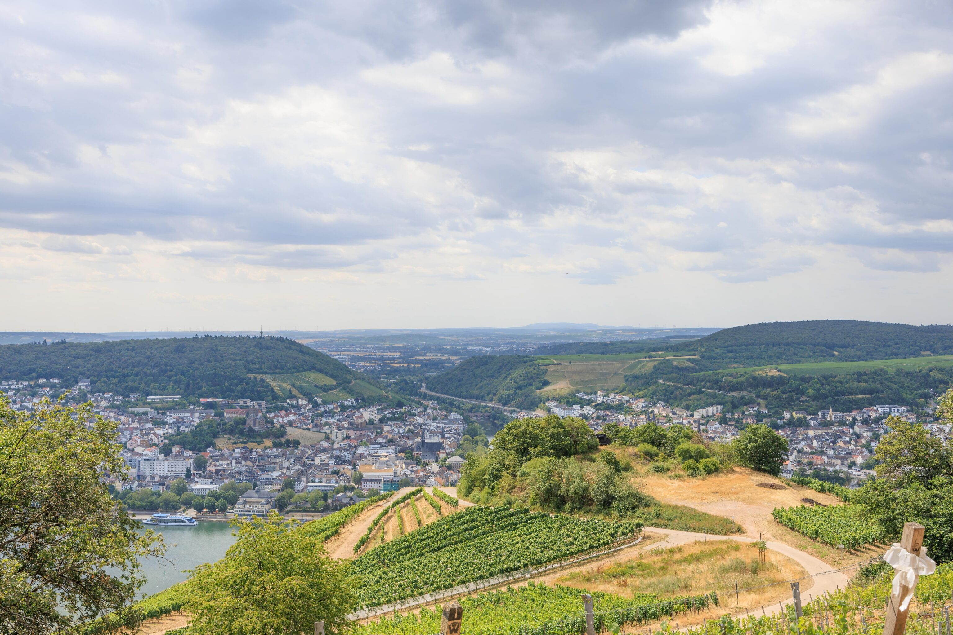
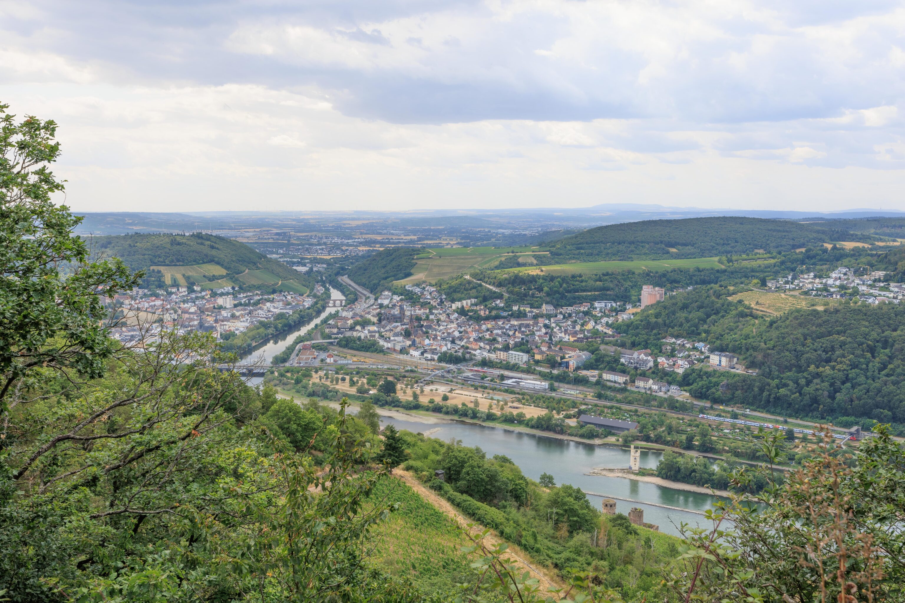
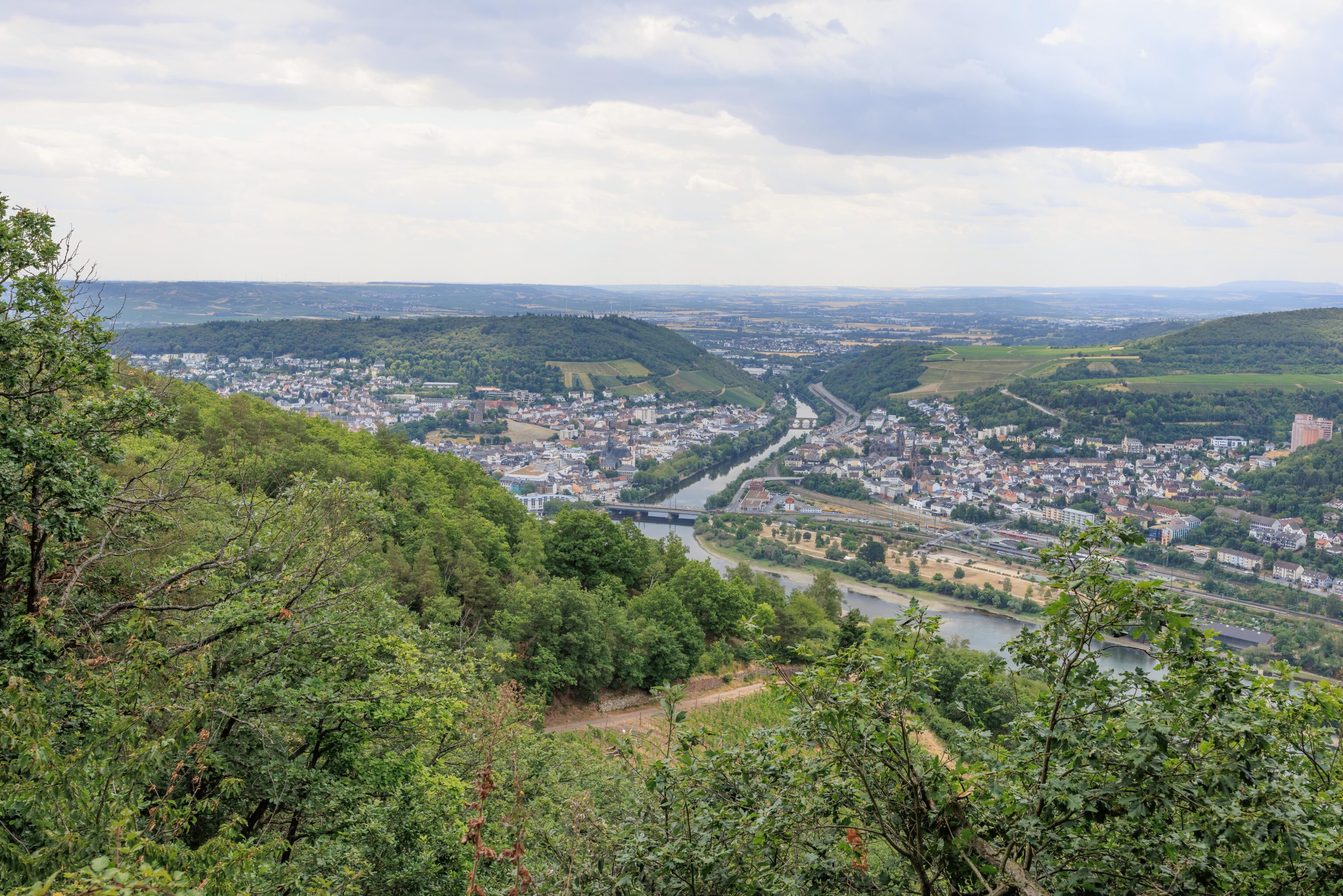
We eventually reached the top of the hill, or at least, as high as the gondola went. There isn’t really any view from the gondola station as it is in a forested area. We walked a short distance along a path to the west where we could see out above the trees. We could see Rüdesheim down below us to the east.
To the west, our view was blocked by trees. All we could see below us was vineyards. Bingen occupied the opposite bank of the Rhine.
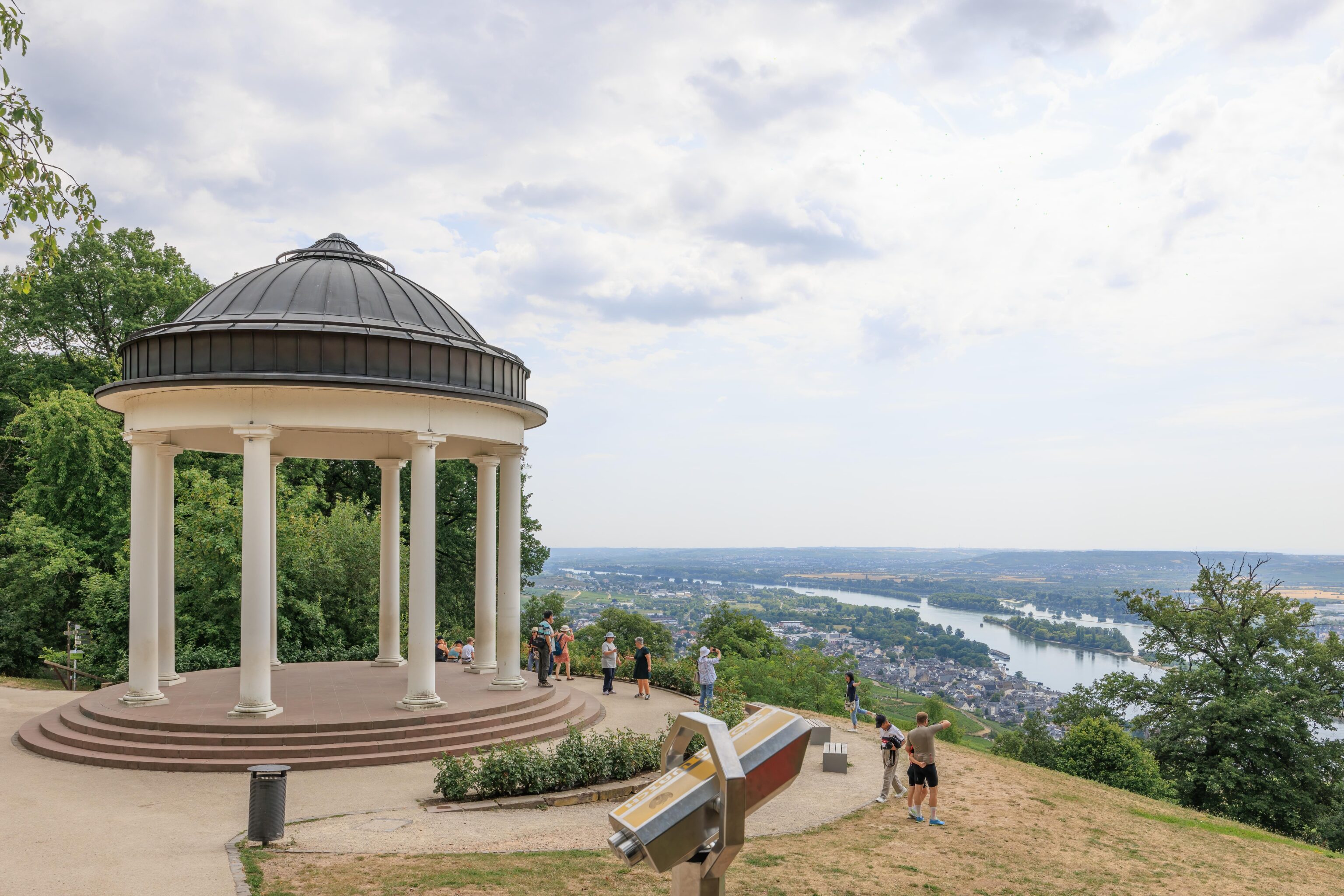
This structure, the Niederwald Temple, was at the viewpoint. An informational sign explains:
Count Ostein also gave his own interpretation to the view across the gently rolling hills of the Rheingau and down into the idyllic valley with the broad river Rhine: the temple he had built here in 1790 in the style of a Greek monopteros immediately conjured associations of Arcadia and became one of the most popular motifs in paintings of the Niederwald forest.
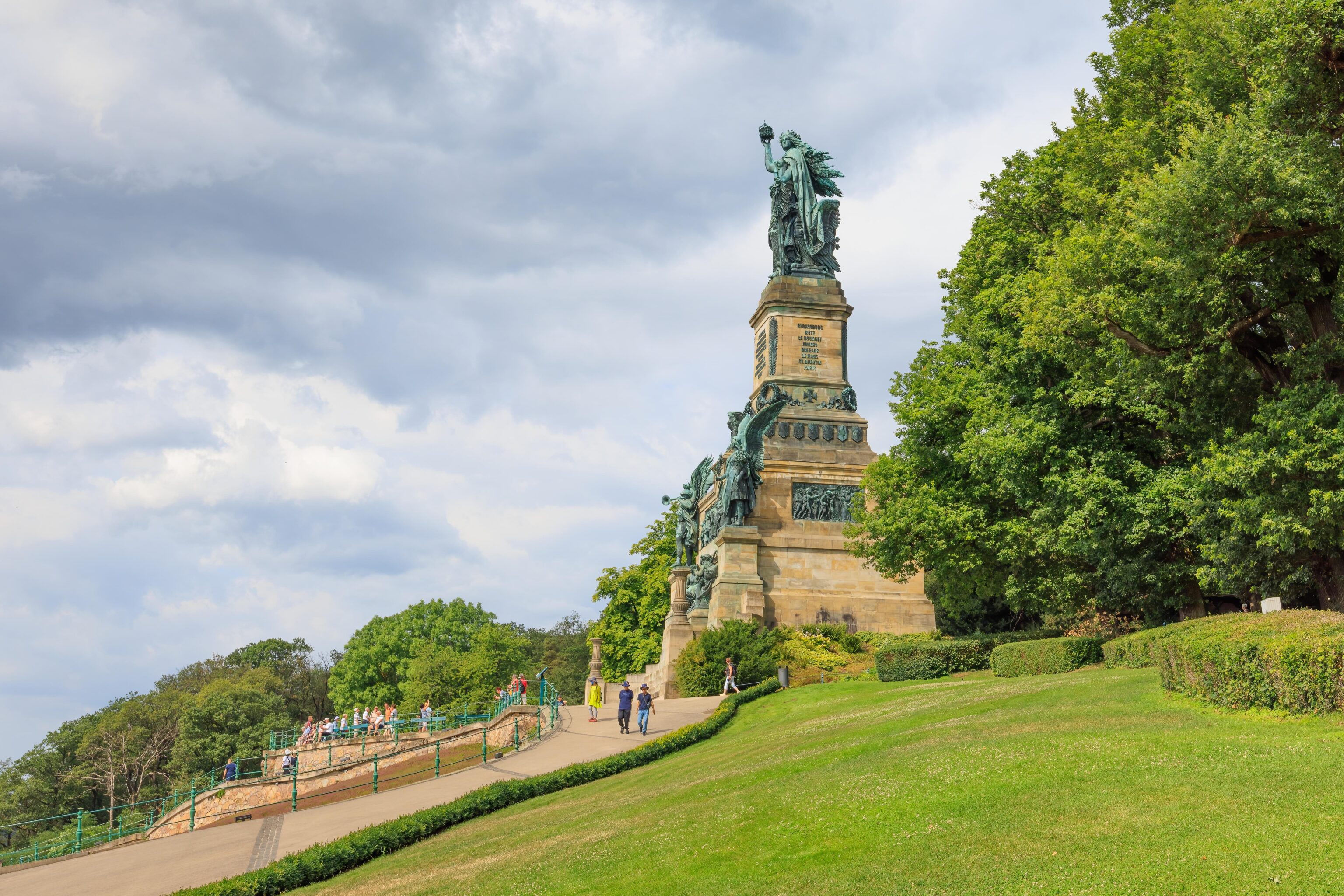
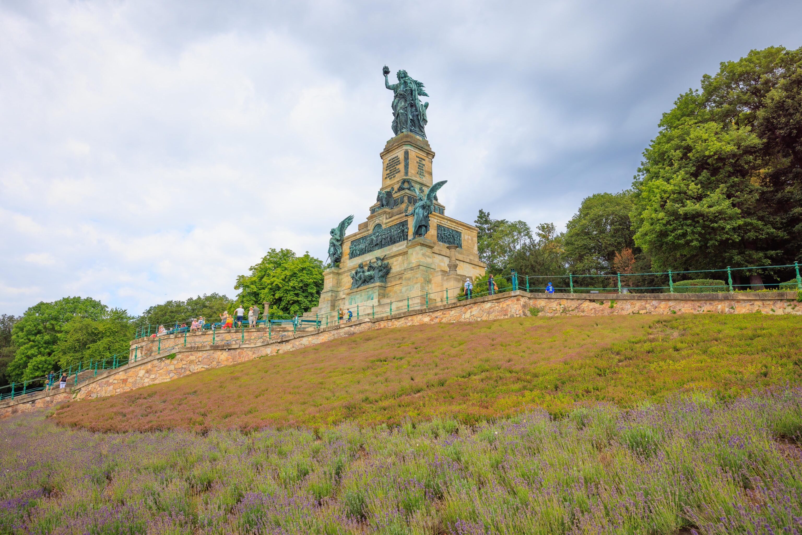
We continued walking to the west. The Niederald Monument soon came into view. There is a series of signs that explain:
THE RACK RAILWAY
Early on during the construction phase of the national monument, it became clear that providing organized passenger transportation to and from the Niederwald would be essential. In 1882, the Royal Prussian State Government granted a licence to operate a "railway to be powered by horses or locomotives".
Construction came to a close on Easter 1885 and the rack railway commenced its treck of 2.3 kilometres between the Niederwald and Ruedesheim. The first four locomotives to be put into service were called "Kaiser Wilhelm", "Bismarck", "Moltke" and "Germania". They were able to tackle the 223 meters elevation gain and drop thanks to a gear drive with a power of approximately 250 hp. Around 150 passengers could be transported in three passenger cars in one go..
In 1917, during the Great War, the operation of the rack railway had to be interrupted due to lack of personnel and coal. Eight years later, and following an overhaul to ensure repairs, it was put back into service. After a large portion of the workforce was drafted into service by the army administration or the Wehrmacht, the rack railway was finally closed down in August 1939.
The rack railway was considerably damaged during WWII. Technical innovations afforded alternative solutions, making it unnecessary for the rack railway to be rebuilt. After a transitional phase, during which visitors were transported by bus to the Niederwald Monument from 1949 to 1954, the cable car that is still running to this day was inaugurated. The cable car was renovated in 2005.
From 1886 onwards, another rack railway operated between Assmanshausen and the Niederwald Hunting Lodge. It ceased to be operated at the beginning of the 20th century and in the 1950s the chair lift, which is still in use today, was built.
THE BEGINNINGS
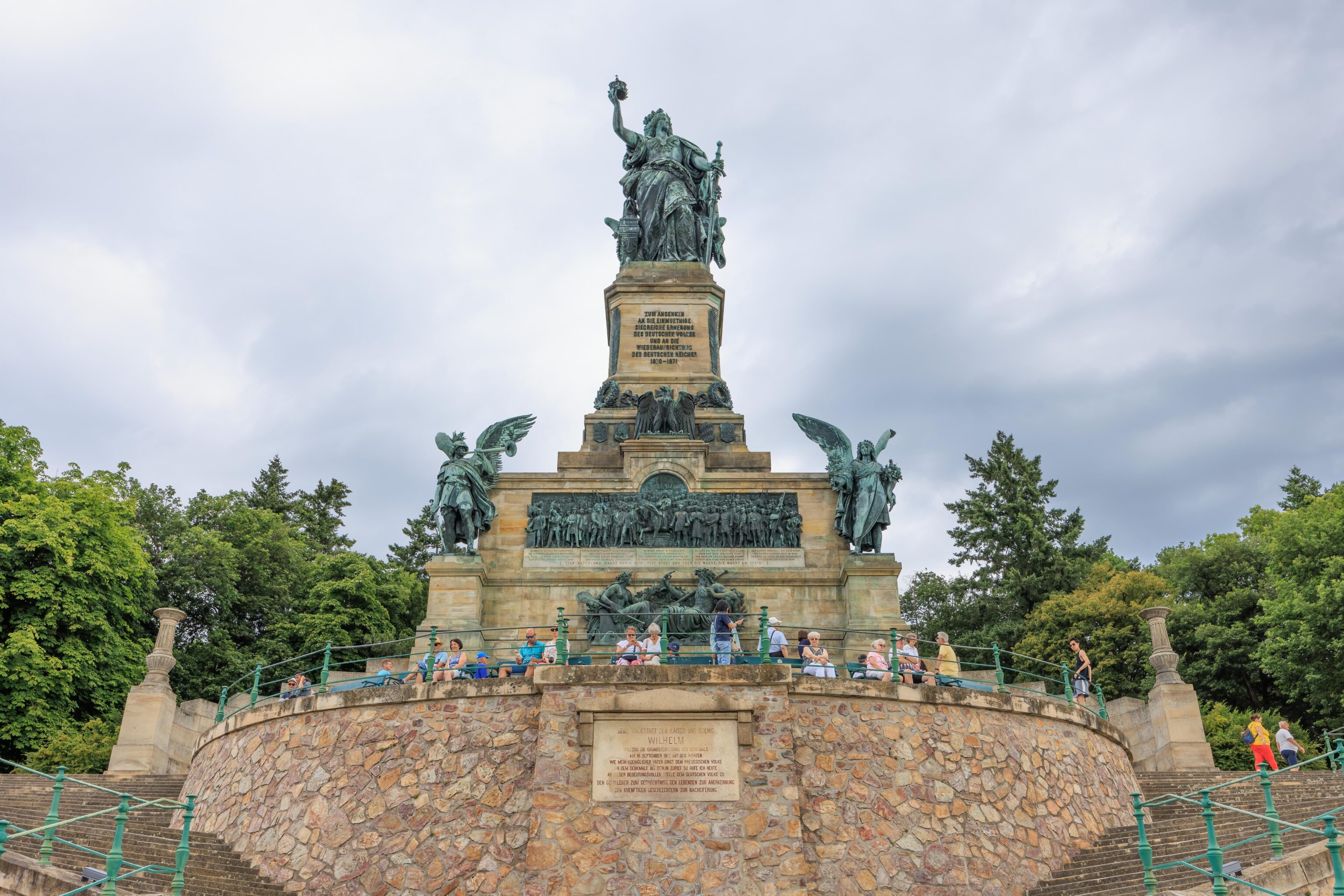
A visit to the Niederwalddenkmal is a journey through German history. Situated at one of the most scenic lookout points of the Rhine Valley, the monument commemorates Germany's victory over France in the Franco-Prussian War of 1870-71 and the subsequent foundation of the German Empire. The main inscription on the pedestal of the statue of Germania reads: "Zum Andenken an die einmuethige siegreiche Erhebung des deutschen Volkes und an die Wiederaufrichtung des deutschen Reiches 1870-1871." ("In memory of the unanimous, victorious uprising of the German people and the re-establishment of the German Empire 1870-1871.") Before this time, Germany had been divided into numerous independent states, but with the proclamation of King Wilhelm I of Prussia as German Emperor in January 1871 the foundation of a unified nation state succeeded for the first time. The Niederwalddenkmal - popularly referred to simply as 'Germania' is not so much a victory monument as a German national monument.
The creation of a new external unity had to be followed by a process of internal unification, as most people continued to think of themselves first and foremost as Prussians, Bavarians or Saxons, and only secondly as Germans. The erection of national monuments such as the Siegessäule (Victory Column) in Berlin (1873), the Hermannsdenkmal (Hermann Monument) in the Teutoburg Forest (1875) or the Germania monument near Rüdesheim (1883) was therefore intended to awaken German national feeling. During the public debate on the question of a suitable location for a monument to commemorate the events of 1870-71, Ferdinand Heyl (who later became spa administration director in Wiesbaden) made a suggestion that proved to be decisive. In an article published in the "Rheinischer Kurier" newspaper on April 13, 1871, Heyl recommended an area above the ruins of Ehrenfels Castle in the Niederwald forest as a suitable location.
There were a number of good reasons to erect a memorial near Rüdesheim am Rhein. In 1870-71 the soldiers going off to war had travelled via the nearby railway junction at Bingerbrück. For Heyl, the rapids of the Rhine at Binger Lodl symbolised the German people's desire for national unification, and in addition, the Niederwald forest - situated at the "actual midpoint of the whole river" - and the neighbouring wine-growing areas were already very popular visitor destinations.
DESIGN AND CONSTRUCTION
Once Emperor Wilhelm I and Chancellor Otto von Bismarck had given their approval, the plan to erect a monument to commemorate the foundation of the German Empire was put into action in September 1871. The competition to create the memorial was won by Johannes Schilling, a sculptor from Dresden, in spring 1874 with his design for a monumental statue of Germania.
With three hammer blows struck on September 16, 1877, Emperor Wilhelm I himself laid the foundation stone for the Niederwalddenkmal. The construction of the colossal monument, which has a total height of 38.18 metres, took six years; the 32,000 kg sculpture of Germania alone took the Ferdinand von Miller & Söhne foundry in Munidl two and a half years to produce. Approximately one third of the metal used in the Niederwalddenkmal consisted of scrap bronze from the cannon foundry in Spandau. Out of respect for the former enemy in the war of 1870-71, none of the captured French gun barrels were melted down for this purpose.
THE INAUGURATION
September 28, 1883 was a momentous day in Rüdesheim. Most of the population of the Rheingau region turned out to celebrate the inauguration of the Niederwalddenkmal in the presence of Emperor Wilhelm I. The guests of honour were driven up to the festival ground some 225 metres above the Rhine in a procession of 113 carriages, whereby the monarch only narrowly escaped an assassination attempt by anarchists. After Wilhelm I and District President Count zu Eulenburg had made their speeches, the main relief panel of the Niederwalddenkmal was unveiled by the sculptor Johannes Schilling.
As one of the most important German monuments of the 19th century, the Germania sculpture contains numerous historical references and connotations. The figure of Germania - for whom, incidentally, Schilling's daughter Clara was the model - personified the German nation. In France, Great Britain and Switzerland the symbolic figures of 'Marianne', 'Britannia' and 'Helvetia' served very similar purposes.
THE MEMORIAL
Her battle won, the Germania on the Niederwalddenkmal stands in front of a throne adorned with figures of eagles on the right and left, and is poised to take her seat upon it. Crowned with an oak wreath as a symbol of victory, she wears a cuirass with an embossed imperial eagle on the front and a brocade robe with animal motifs from German myths and legends (such as the dragon from the Nibelungen saga) woven into it. As a symbol of truce, the sword Germania holds in her left hand is lowered. In her right hand she holds the new imperial crown aloft, ready to place it upon her own head. Her gaze is not as is often mistakenly assumed - directed westwards toward France in a provocative manner; in fact Germania faces to the east, towards the Rheingau, and presents the imperial crown to the German nation. At the base of the pedestal upon which Germania stands is a frieze with the imperial eagle at the front and the coats of arms of the 25 unified states in the German Empire.
THE MEMORIAL
The above-mentioned main inscription on the pedestal of the statue is an example of deliberate historical misrepresentation. The use of the term "re-establishment" is intended to place the Wilhelmine German Empire within the tradition of the Holy Roman Empire of the German Nation (which had come to an end in 1806) in an attempt to construct its own historic allegitimacy. And there is even less justification for the reference to a "unanimous, victorious uprising of the German people": the foundation of the German Empire was by no means the result of a popular uprising 'from below; in fact it was achieved by a small power elite 'from above'. The German people play a minor role on the national monument, appearing only on the two relatively small relief panels on either side of the base. The relief on the left-hand side, entitled "Departure of the Soldiers", depicts a Bavarian cavalryman, a Prussian infan-tryman and a north German Landwehr soldier bidding farewell to their parents, wife and children respectively (L-R).
The war these soldiers are about to fight in is represented by a colossal figure bearing the attributes of the Archangel Michael, which is placed at the front western corner of the monument. With wings made of eagle feathers and a sword in his right hand, the archangel is blowing hard into the clarion that is pointing in the direction of the main relief panel. Here, the army commanders are gathering around their supreme commander, King Wilhelm, as they prepare to wage war against France. The almost 11-metre-long and approx. 2.6-metre-high relief panel on the front of the Niederwalddenkmal portrays most of the 133 nearly life-size figures with portrait-like accuracy. In a central rotunda we see the proud figure of Wilhelm on horseback, surrounded by the ruling princes and the highest- ranking military commanders. To his left is the bareheaded figure of Otto von Bismarck holding the charter that confirms the foundation of the empire. The north German generals are shown on the right-hand side of the relief, the south German ones on the left. A few simple soldiers can also be seen at the outer edges of the panel.
THE MEMORIAL
Inscribed on granite slabs below the main relief is the text of the song "Die Wacht am Rhein" ("The Watch on the Rhine"), shortened by one verse. Taken from a poem written by Max Schneckenburger in 1840, it called upon Germans to defend the border against the expansionist ambitions of their neighbours to the west, and was quickly adopted as a national battle hymn. The fourth verse, which directly named France as Germany's adversary, was deliberately omitted on the Niederwalddenkmal, and in the second last verse the word 'Welscher' (= Frenchy) was replaced by the less specific term 'Feind' (enemy). These textual modifications toned down the aggressive stance towards France taken in the original poem.
The chorus of this popular song extends across the full width of the relief panel, underlining the main message of the Niederwalddenkmal: "Lieb' Vaterland, magst ruhig sein: Feststeht und treu die Wacht. Die Wacht am Rhein!" ("Dear Fatherland, no danger thine; Firm stand thy sons to watch the Rhine!"), Below the main relief on a projecting base platform, allegorical figures representing the rivers Rhine and Mosel recall the annexation of Alsace-Lorraine - agreed in the Treaty of Frankfurt on May 10, 1871 - as Germany's most important territorial gain. Father Rhine hands over the watch-horn, and thus the job of guarding the western border of the German Empire, to his daughter, the Mosel.
The eastern side of the Niederwalddenkmal pays tribute to the end of the war and to peace. The relief on the right-hand side of the base depicts the long-awaited "Return of the Soldiers". Four palm branches on the edges of the pedestal are dedicated to the more than 40,000 German soldiers killed in the war of 1870-71.
Around 80,000 lives were lost on the French side. As a counterpart to the allegory of war, Schilling placed an allegory of peace at the front eastern corner of the monument. Crowned with a floral wreath, the angel of peace holds a sprig of laurel in his right hand and a fruitfilled cornucopia in his left. His wings are made of swan feathers.
Viewed as a whole, the Niederwalddenkmal is based upon an overall concept that has been carefully devised in terms of form and content. In a horizontal line from west to east, the elements of the memorial recount the history of the Franco-Prussian War: the departure of the soldiers, the allegory of war, the unification of the army around Wilhelm, the allegory of peace and the return of the soldiers. The results of the war of 1870- 71 are displayed in a vertical line: the changing of the guard between Rhine and Mosel, Wilhelm I on horseback, the imperial eagle taking flight and Germania personifying the nation state. Emperor Wilhelm I stands at the point where these two lines intersect.
SINCE THE INAUGURATION
Following the inauguration in September 1883, visitors flocked in droves to the Niederwalddenkmal; from 1884/86 onwards they could travel there by rack railway from Rüdesheim or Assmannshausen. Generations of visitors enjoyed the Rhine romanticism and the scenic charms of the Ostein Park in the Niederwald forest with its "Zauberhöhle" (magic cave), "Rundtempel" (round temple) and "Rossel" (an artificial ruin). The national monument, on the other hand, was only rarely in the focus of public attention. Following the abdication of Emperor Wilhelm II and the proclamation of the German republic in November 1918, Germania no longer seemed to be in keeping with the times.
CHRONOLOGY
1870-71 Franco-Prussian War
1877 Laying of the foundation stone for the Niederwalddenkmal
1883 Inauguration of Germania
1884/86 Opening of the rack railway lines from Rüdesheim and Assmannshausen to the Niederwald
1923 During the French occupation of the Rhineland, the idea of blowing up the Niederwald- denkmal is considered
1933 National Socialists hold the Saar rally at the Niederwalddenkmal
1944 A heavy air raid on Rüsselsheim results in slight damage to the Germania monument
1949 Buses are run to the Niederwald forest
1954 A gondola cable car service is introduced in Rüdesheim
1968 Establishment of the eagle observatory
1983 Alfred Grosser, a professor at the Sorbonne University in Paris, gives the main speech at a ceremony to mark the centenary of the Germania monument
2002 The Upper Middle Rhine Valley is listed as a UNESCO World Heritage Site
2006 Reconstruction of the "Rundtempel" (round temple) in the Ostein Park
2008-09 Renovation of the Niederwalddenkmal
COUNT OSTEIN'S NIEDERWALD
Count Ostein's Niederwald is a garden monument dating back to the late 1700s. In 1763, Johann Friedrich Karl Maximilian Amor Maria Count of Ostein (1735-1809) inherited the 304 hectare area, which had up until then been used for forestry and agriculture, and spent the next several decades transforming part of it into a Lustgarten or pleasure garden. As of 1764, the Count had a summer residence built in the southern part of the beech and oak forest that perches on a mountain plateau between Ruedesheim am Rhein and Assmannshausen. He also commissioned an impressive access road leading up to the residence, as well as a network of paths that meanders through the forest and a dozen curious, richly detailed buildings strewn across the park.
The last male representative of a distinguished family of imperial counts invested a large amount of his fortune so as to be able to enjoy the forest as he saw fit - and make it accessible to visitors. Going against the popular trend of English landscape gardening-which revolutionized garden design and sowed the inspirational seeds of the sentimental- style gardens that sprouted across Germany- the Count was not interested in a large-scale transformation of the site. Instead, he went off of what was already there, honing in an particular details that caught his eye,
Count Ostein had the part of the forest known as the "Zierwald" (ornamental forest) excluded from forestry use so as to let that part of the woods grow wild. Thus the Niederwald was left to grow quite dark and untamed for a time, before the Count began erecting small building staffages throughout. In combination with new tree species, shrubs and other ornamental plantings, these constructions functioned as 3D paintings. They were charged with stories, illusions, atmospheres and particularly with references to history and historical myths. While the temple above the Rheingau harkened back to ancient Arcadia, Count Ostein paid homage to the Middle Ages with the artificial ruin "Rossel", the house on the cliff (the "Klippe") and the magic cave.
The way in which the various vistas and panoramas of the Rhine were factored in and made possible by finding ways to dissolve the forest line, was impressive. The course of the river makes for staggering views from afar due to the natural contrast between the lovely Rheingau and the narrow valley behind the Binger Loch, which at the time was perceived as being ceric. Most of the architecture was created on the hillside: some was located within the forest, but always coupled with views of the Rhine.
Already during the Count's lifetime, the Niederwald developed into a supra-regional tourist attraction, the reverberations of which could still be felt during the Romantic Era. With the construction of the Niederwald Monument, however, the Niederwald's significance sunk into oblivion. Only after a period of revitalisation that was undertaken from 2012 to 2016 by the Verwaltung der Staatlichen Schlösser und Gärten can it now once again be experienced as a garden phenomenon. The Niederwald is part of the UNESCO World Heritage Centre Upper Middle Rhine Valley.
THE FIRST STAGE OF CONSTRUCTION
On the occasion of the celebrations of the 125th anniversary of the Niederwald monument, the state of Hesse has started to repair the monument and the open spaces. The overall measure is divided into three construction phases, the first of which was already completed by the anniversary celebrations in September 2008.
The first construction phase carried out this year serves in particular to restore traffic safety on the path areas and to reconstruct the historically documented design based on a situation plan from 1881. At the beginning of the construction work, the footpaths around the monument were in poor condition. Numerous bumps and holes in the surfaces, non-functioning drainage and damaged brickwork represented a high potential for accidents. The flight of stairs below the monument was also in urgent need of renovation. Some of the steps had already settled and shifted against each other.
In the past, depending on the requirements, modern changes, additions or repairs (sometimes to a considerable extent) were carried out in almost all areas, which were in no way brought into line with the original design of the outdoor facilities. Gradually, the historical design was lost.
The renovation of the Niederwald monument in the first construction phase improves the design and usage quality of the open spaces considerably. In addition, the original path geometry was reconstructed directly at the monument and the necessary distance to the base was restored. In this way, the monument will be presented in an appropriate setting for its birthday.
On August 28, 1933, the National Socialists used the historically significant site for a mass rally focussing on the "return of the Saarland", at which Adolf Hitler gave the main speech. The rack railway, having been shut down at the beginning of the Second World War in September 1939, finally had to be dismantled following a heavy air raid on Rüdesheim in November 1944. Visitors returned to Rüdesheim soon after the war ended. In April 1954 a cable car service began from Rüdesheim up to the Niederwalddenkmal. Today the monument is part of the Upper Middle Rhine Valley area that was listed as a UNESCO World Heritage Site in 2002. Every year, around 1.8 million tourists visit the world-famous Niederwalddenkmal and enjoy the spectacular views over the Rhine Valley.
Note that the final section is Google Translated, due to inadvertently photographing the German rather than English text. The text was all copied from the signs using Google Lens, which works quite well once the photos were corrected for perspective. Google Lens works terribly if the text is at an angle.
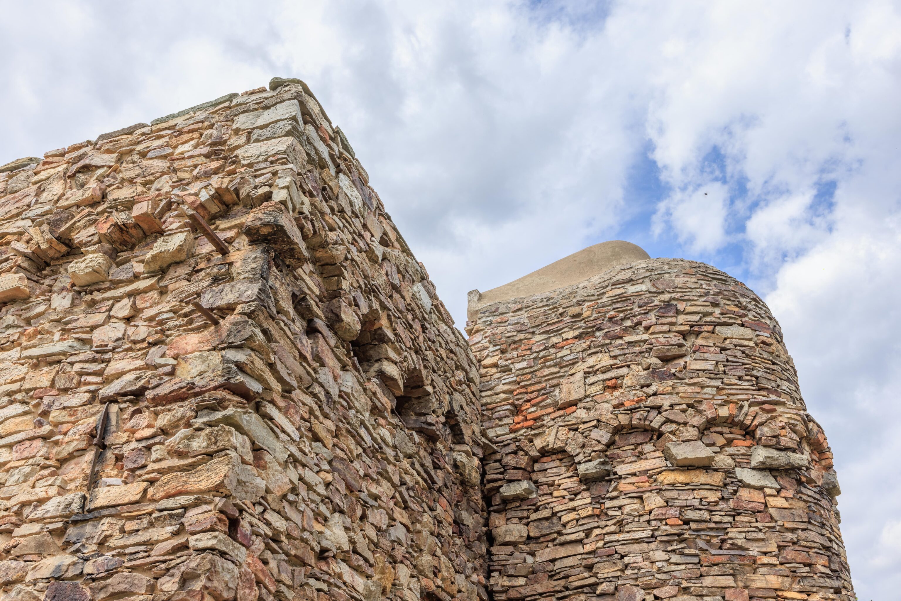
After reading some of the signs, we stated walking closer to the monument on the lower path where we were.
The monument from directly in front.
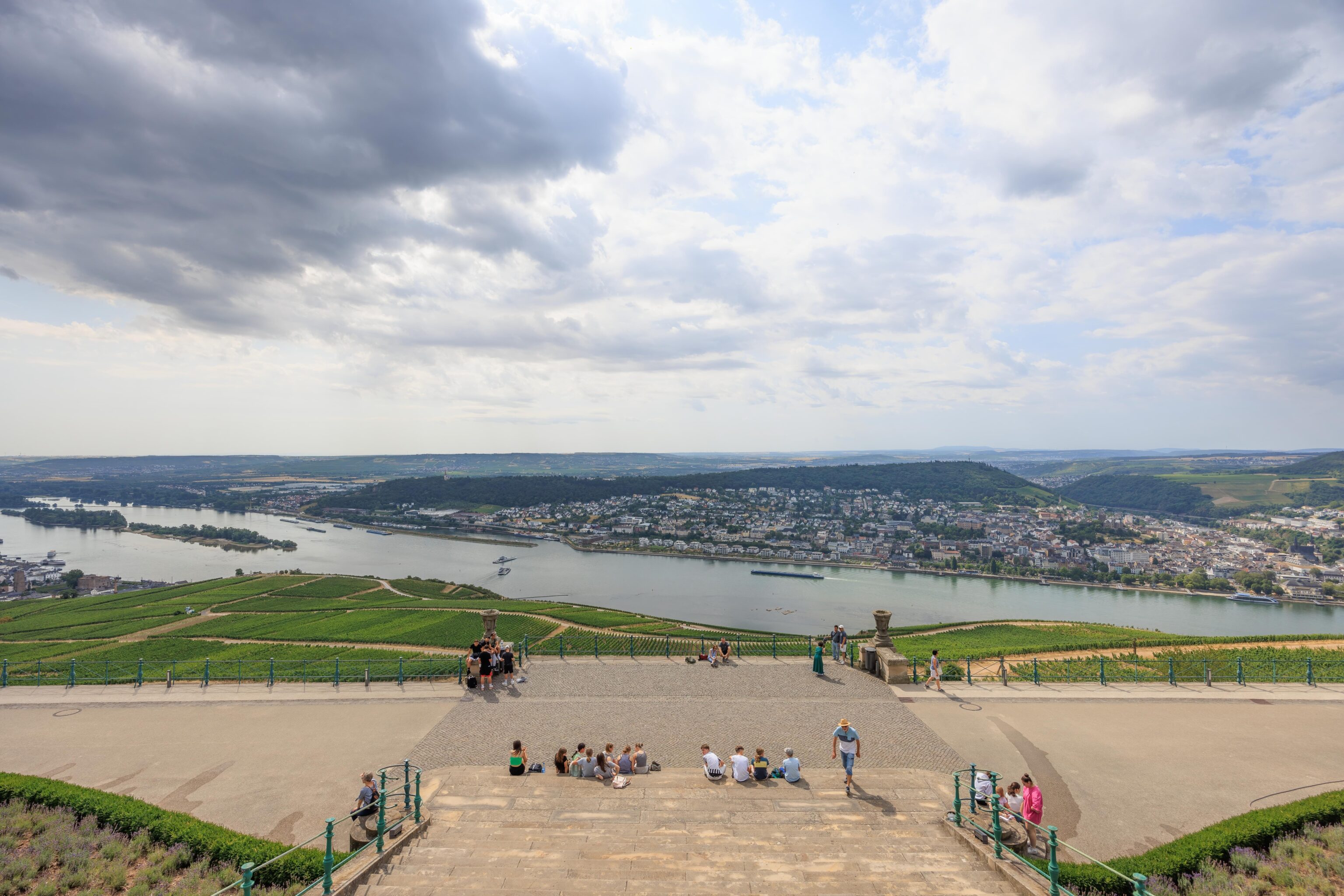
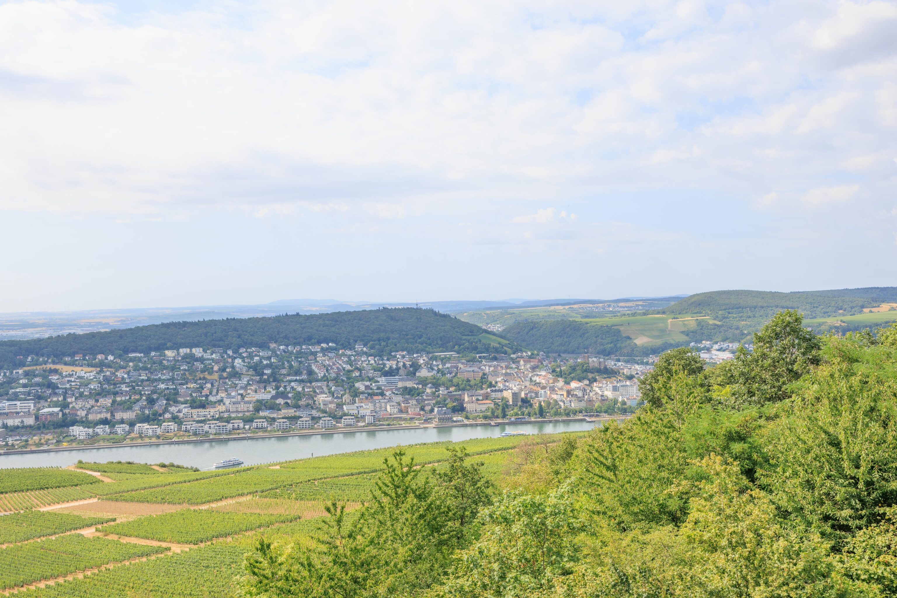
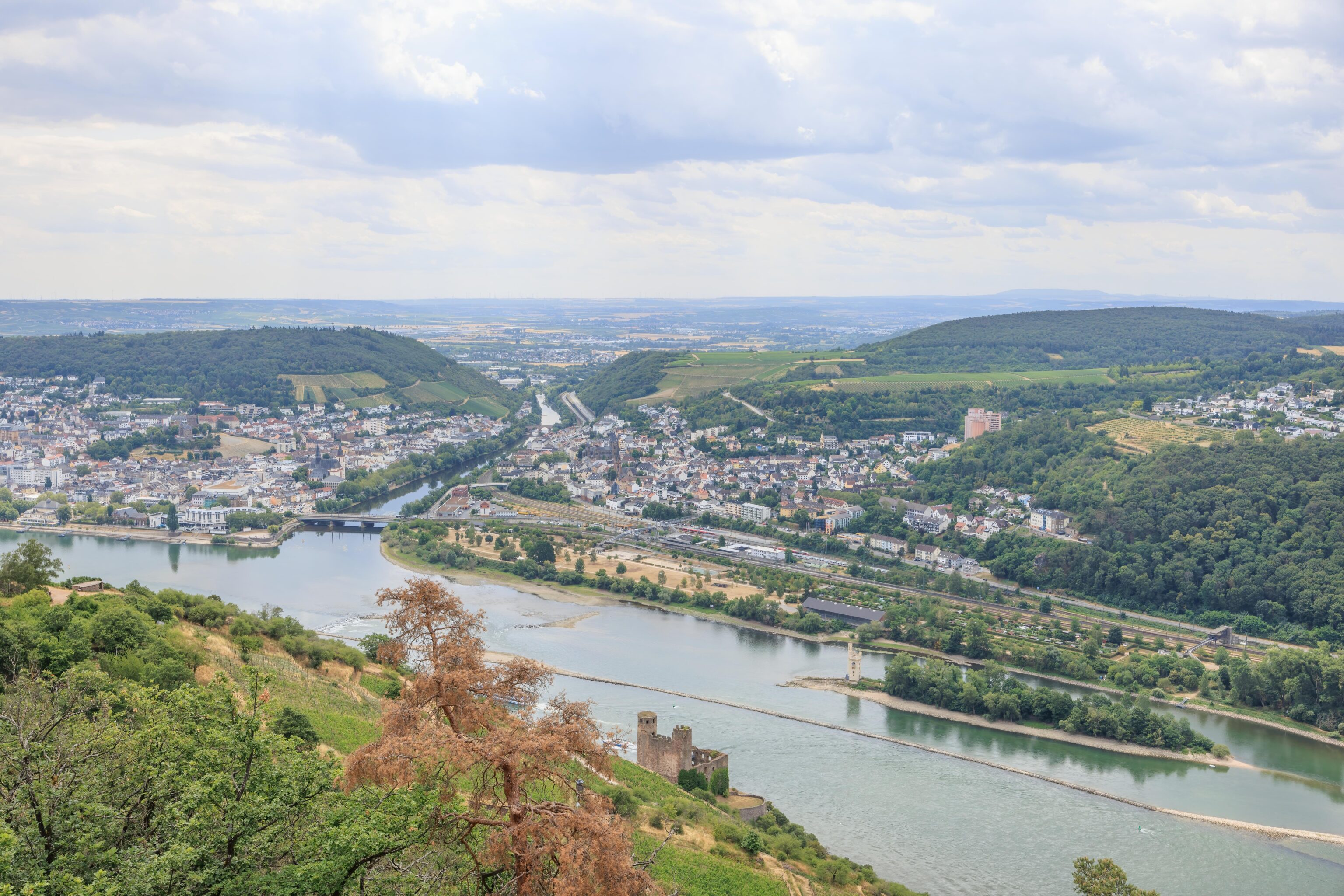
We walked up to the upper platform. A beautiful view of the Rhine below us and the lower path where we walked up from. The western edge of Rüdesheim, where we got off the train, is visible on the very left edge.
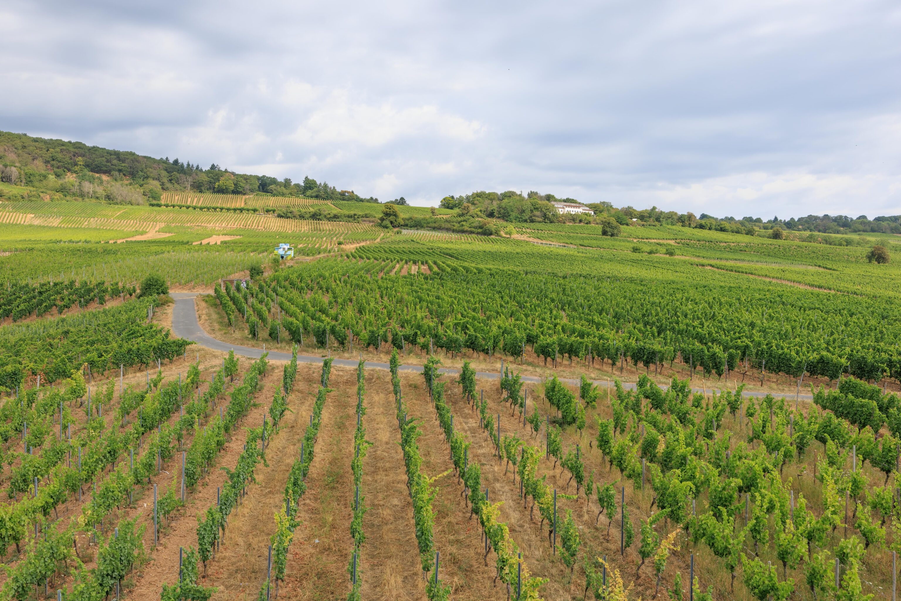
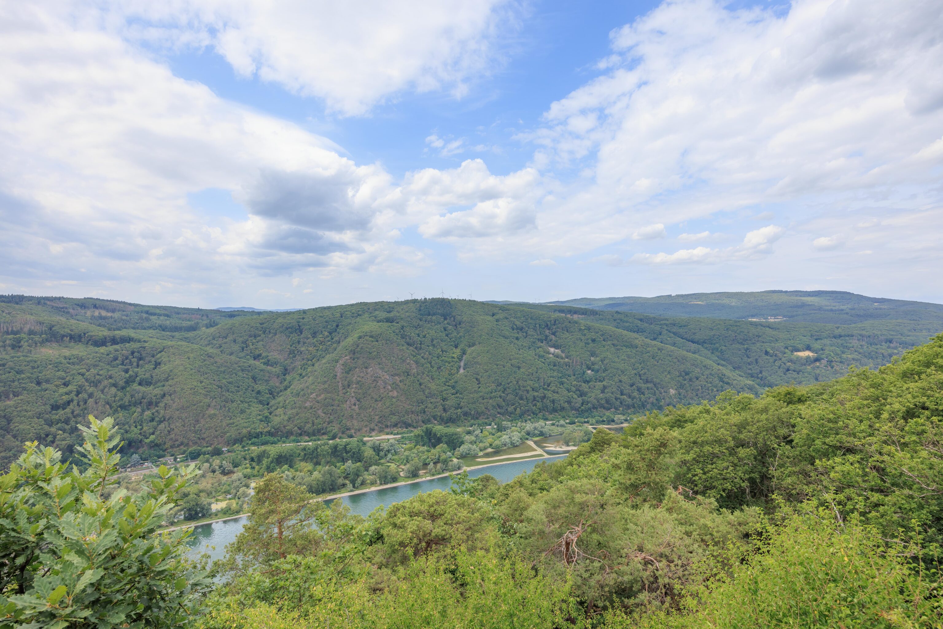
After enjoying the view, we went back down to the lower path and walked through a forested area. Eventually, we found ourselves back above the vineyards and the Rhine.
We were roughly as high as the vineyards went.
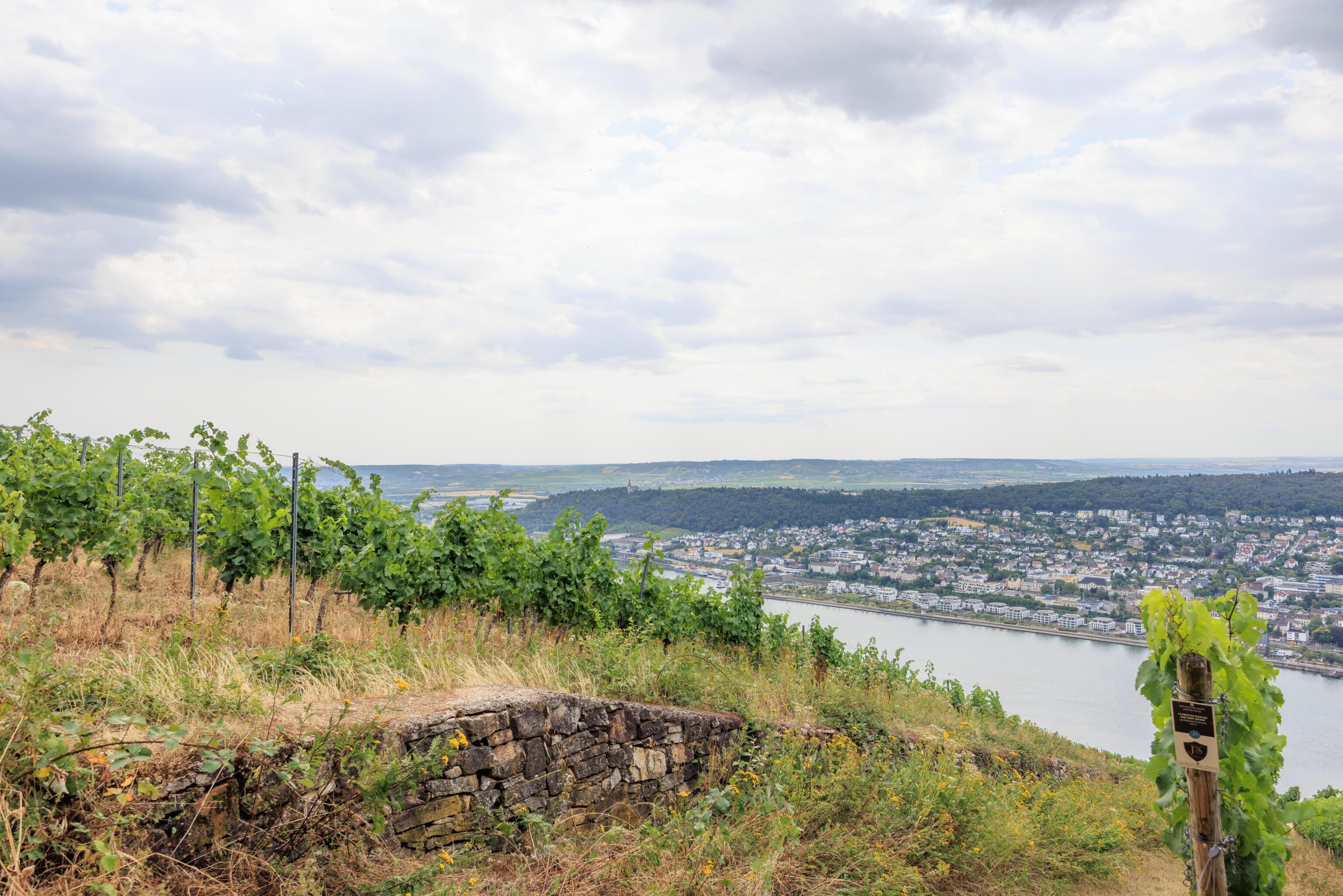
This appears to be a wall that separates two different vineyards. There are signs that we think indicate the owners.
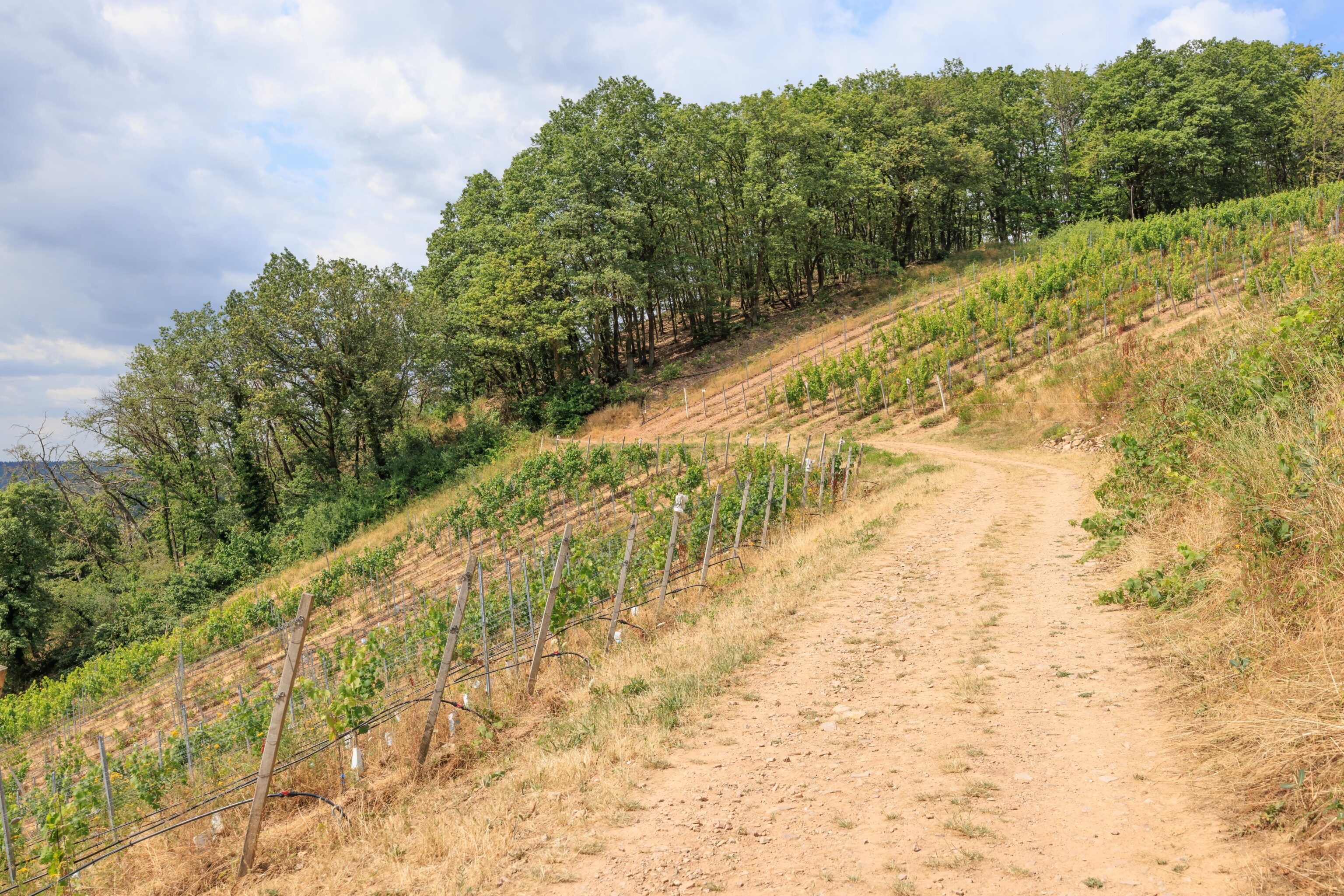
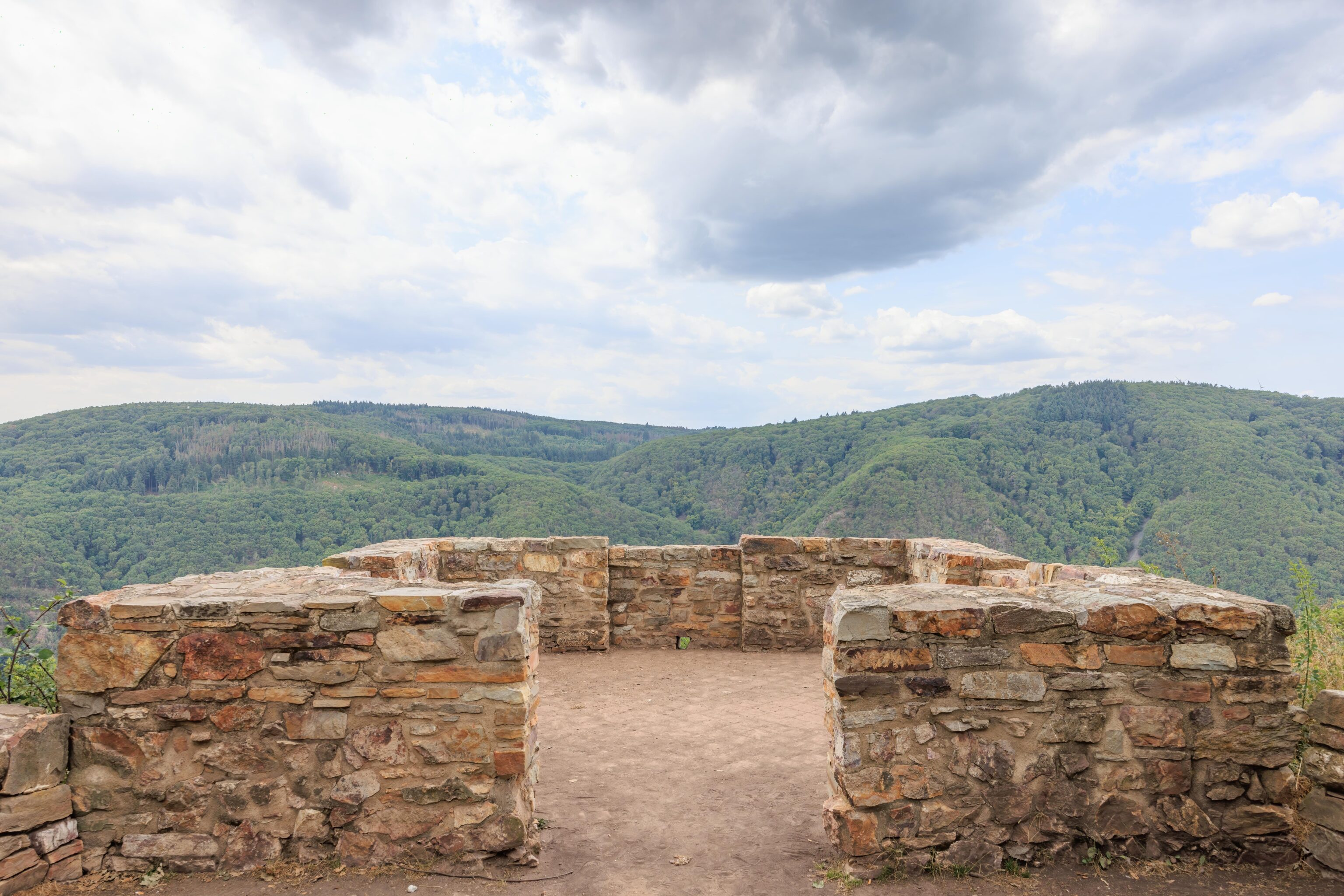
There were multiple path options, including backtracking. We choose to go this way.
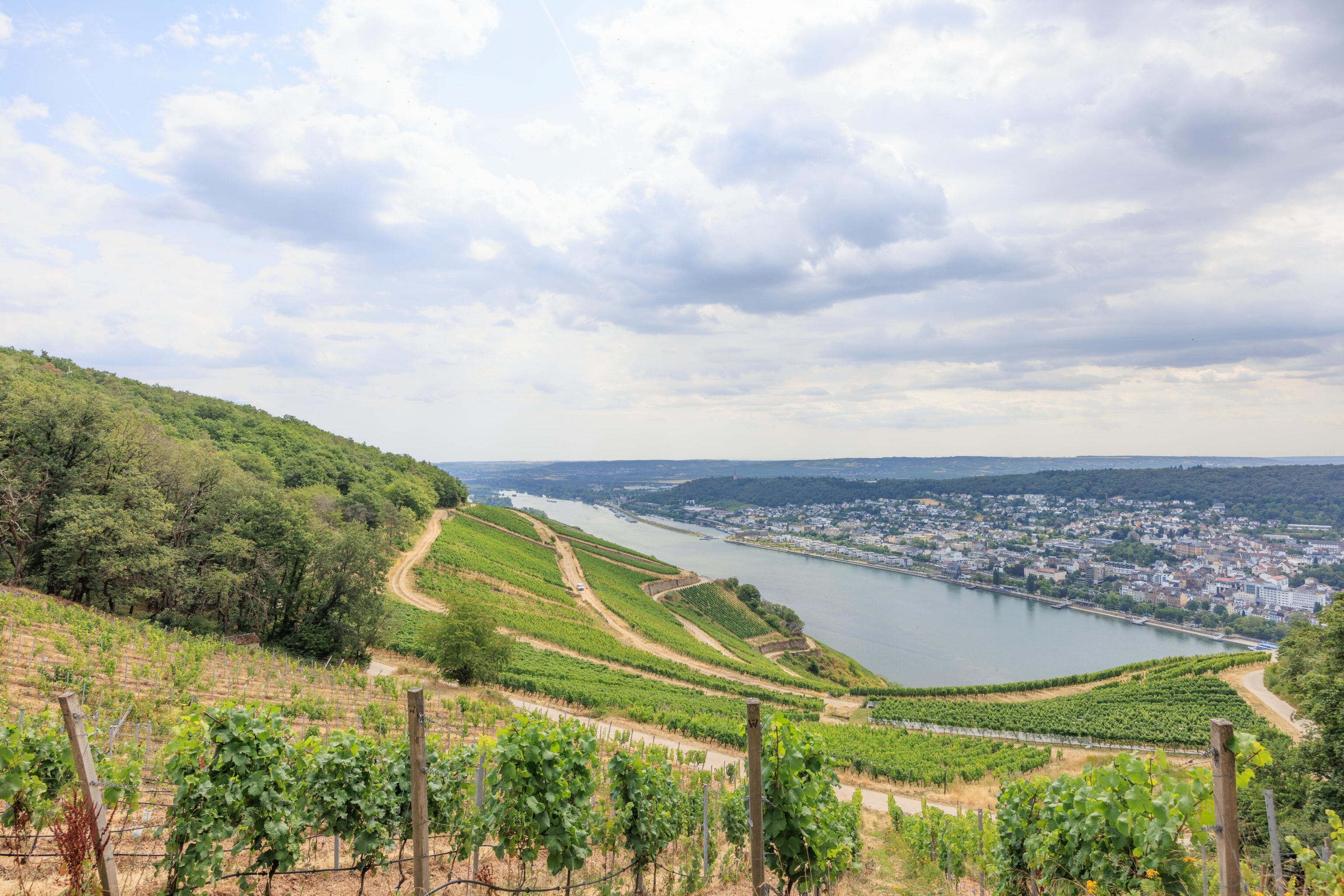
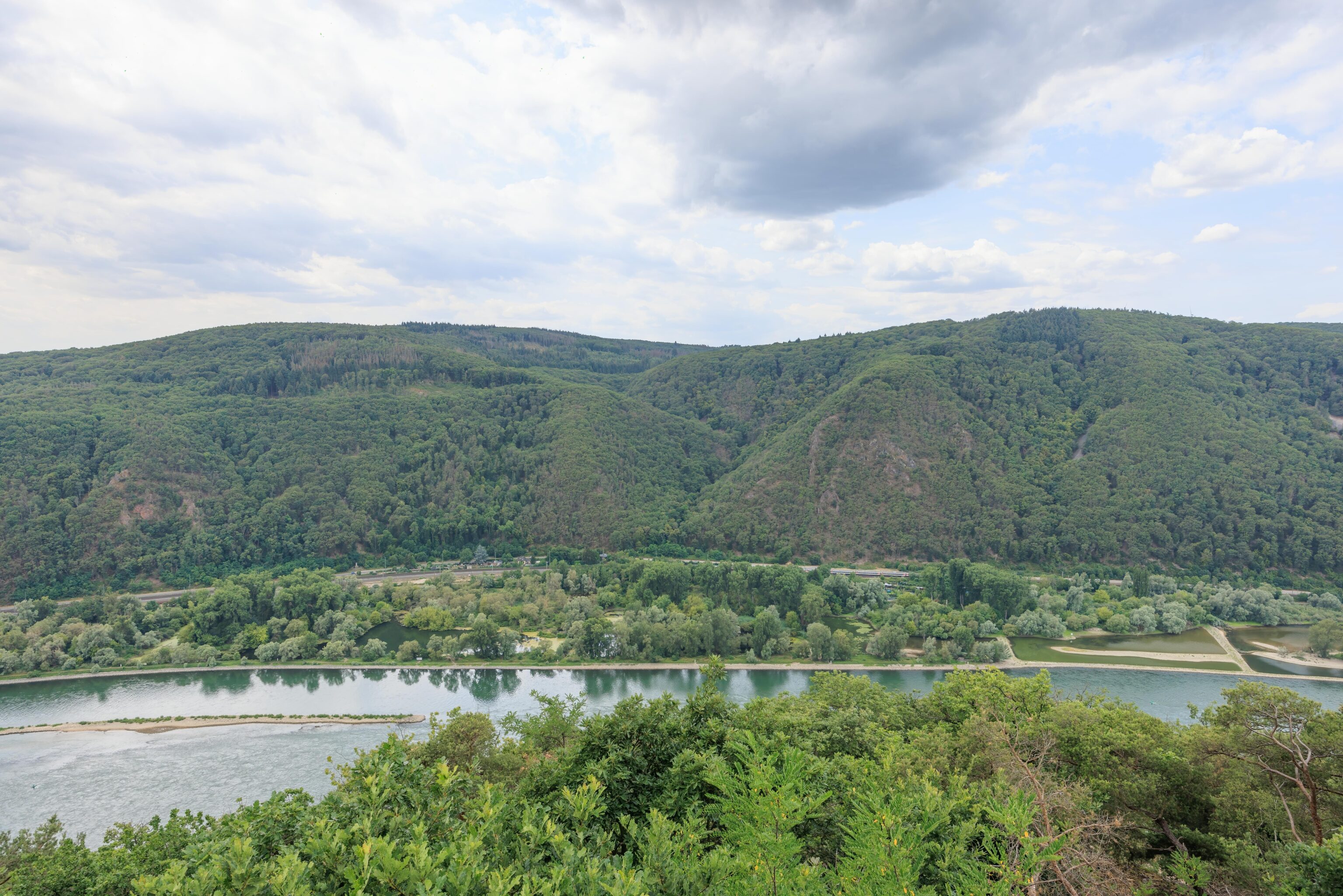
As we continued to walk to the west, we could no longer see Rüdesheim. Bingen occupied the entire opposite bank of the Rhine.
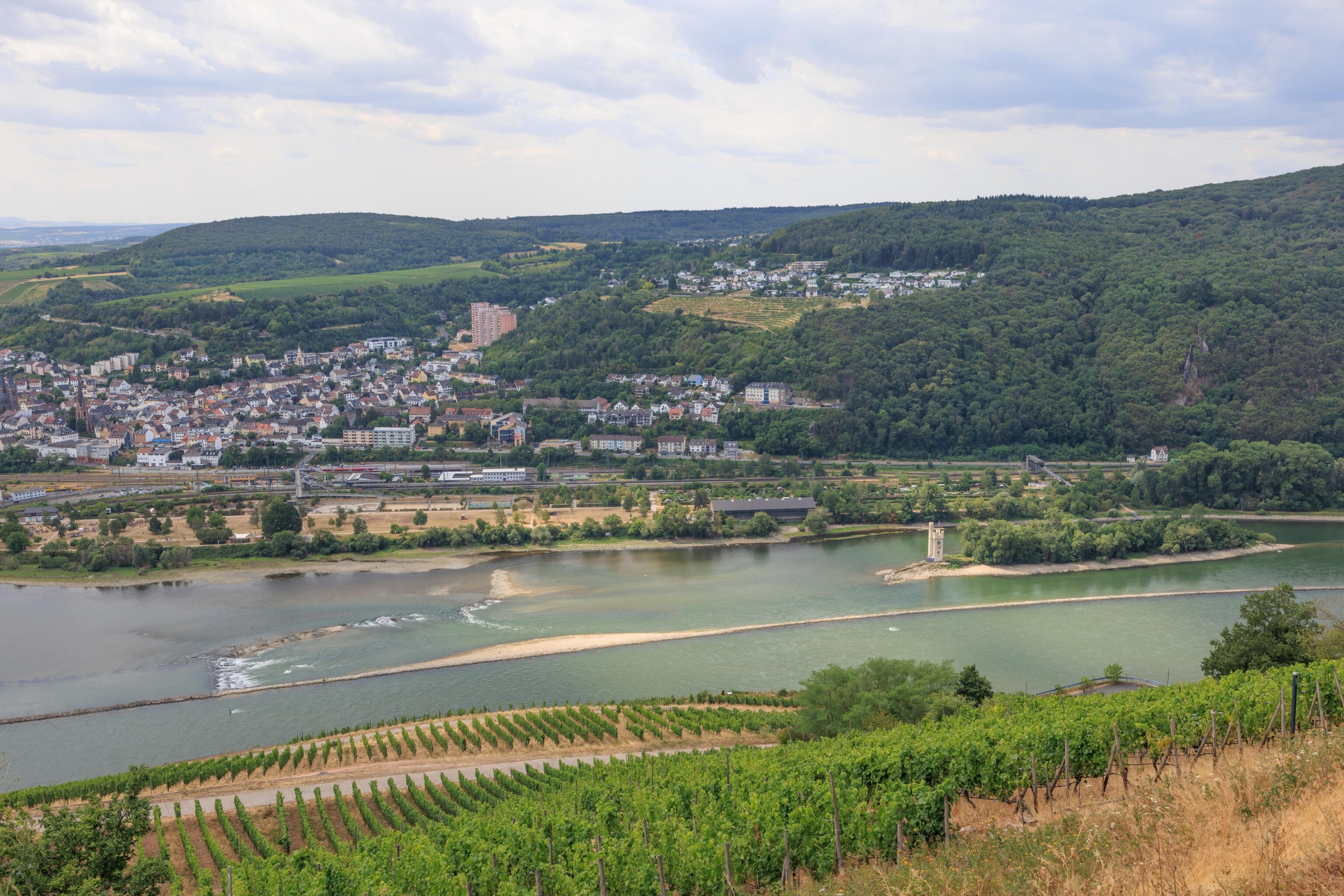
After walking a bit further, the Mäuseturm, on a small island in the Rhine, came into view. I read somewhere that when the Rhine is very low, it is possible to walk to the tower. However, I can’t seem to find this reference again. There normally is no public access to the island or tower.
A bit to the east, the Nahe flows out into the Rhine. There was a historic bridge, the Drususbrücke, about 1km upriver. It was blown up during World War II in 1945. The current bridge was built at some time after that.
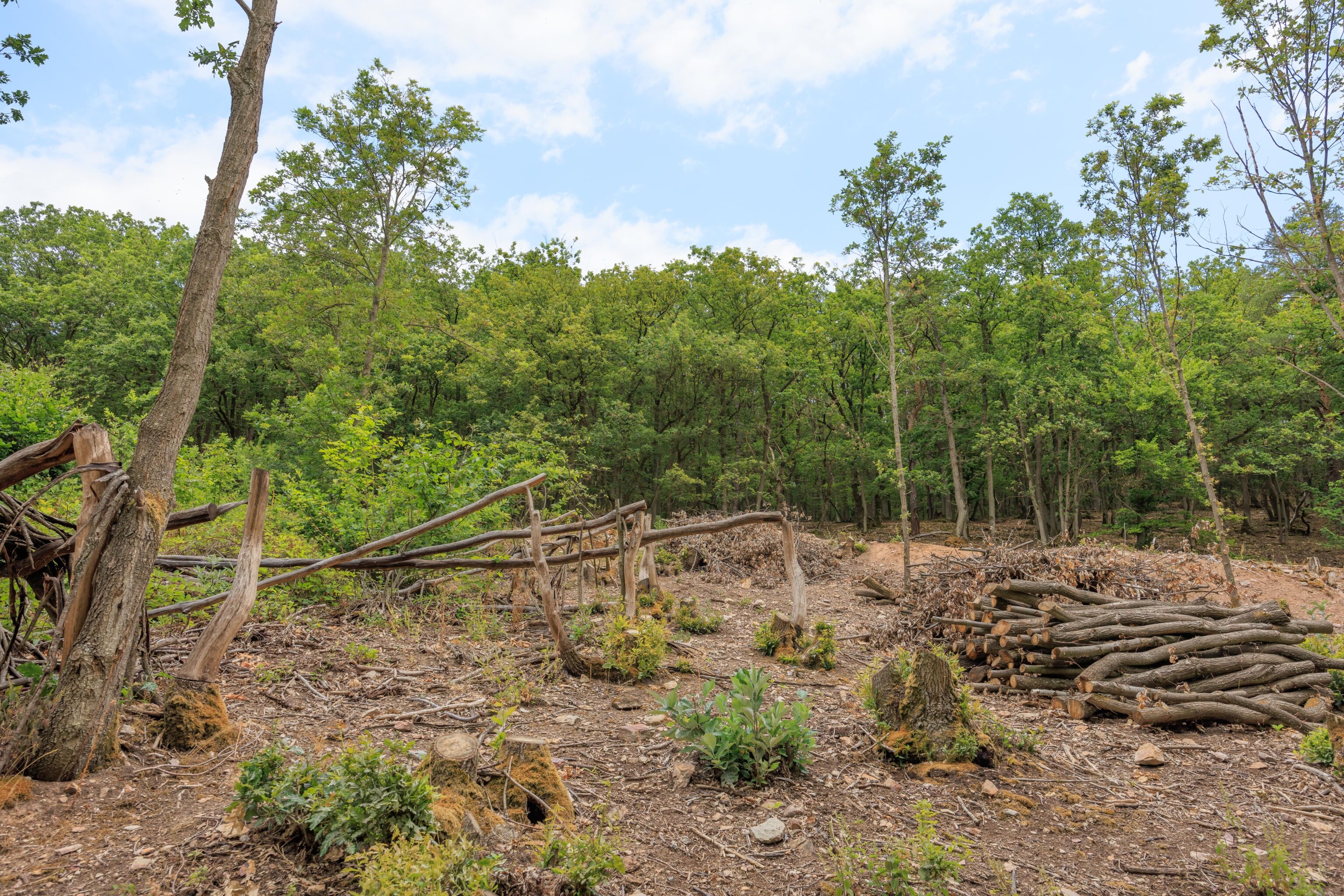
This small area seemed to have some partially cut trees as well as others lying on the ground. A sign, in German, explained the scene. It was a bit much to read at the time but after translating it, it reads:
Historical forest use in the Rheingau - The coppice economy

The slopes of the Middle Rhine Valley World Heritage Site are characterized by old low forests. Tree species such as oak, hazel or hornbeam have good resilience and were put on the stick (cut off) in the spring when the trees were in full sap.  The bark, which was easy to remove at that time, was peeled from the trunk with a wooden spoon and used as tan (bark containing tannic acid) for leather tanning.  The bark was a valuable commodity up to the end of the 19th century.  The wood was used as firewood or for vineyard poles.  The coppice forests were used collectively and were an important part of local supply cycles.

Due to the small-scale, periodic management, a mosaic of different lighting conditions was created.  This richness in structure made possible a great variety of species.  Many species disappeared from our cultural landscape due to the abandonment of the use of coppice forests, because today the landscape is mainly characterized by dark, closed high forests.

In front of you you will find different stages of a regenerated coppice within the nature reserve "Coppice". What can you discover from the trail?
Google Search, with unlinkable results from Oxford Languages, defines coppice as a British word:
an area of woodland in which the trees or shrubs are periodically cut back to ground level to stimulate growth and provide firewood or timber.
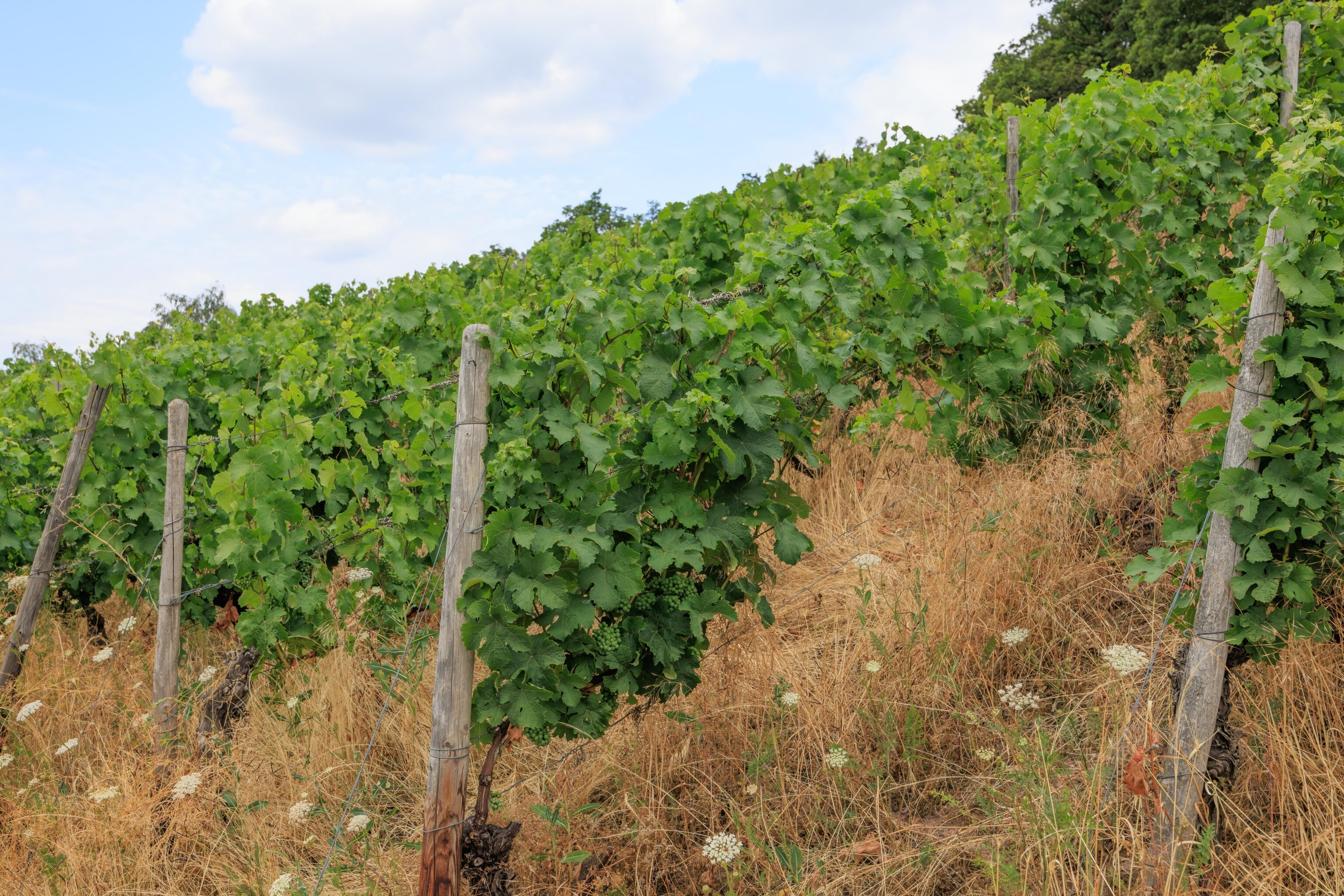
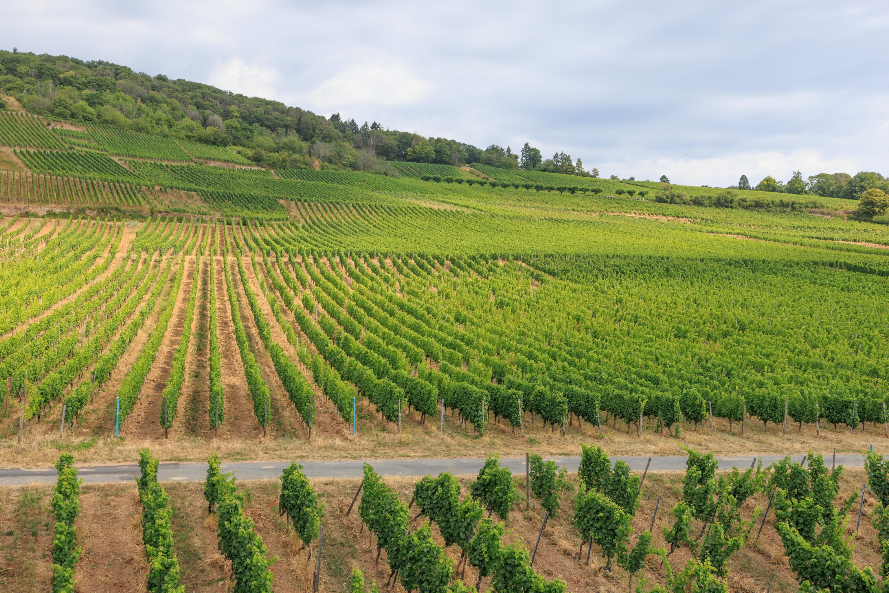
We continued past the coppice. At some point, we realized that the grape vines all had grapes! They’re pretty small and the same green as the leaves.
The path was relatively flat with an overall slight decline as we continued to walk. Eventually, we reached a short but steep uphill section.
We soon reached Rossel Castle. It an artificial ruin built in 1774!
There is a small viewing platform in front of the castle that offers beautiful views of the Rhine below us. At this point, we’ve walked well past the Mäuseturm. Another structure became visible below us, the real ruins of Ehrenfels castle. It is only possible to view the castle from outside. There was no easy way for us to get closer as we were high up on the hills above!
Previously, when looking to the right, the Rhine was flowing to the west. But now, due to a bend in the river, it is flowing to the north. Here, we are beyond the town of Bingen on the opposite bank.
We continued walking past Rossel Castle. A short downhill side trail lead to this viewpoint.
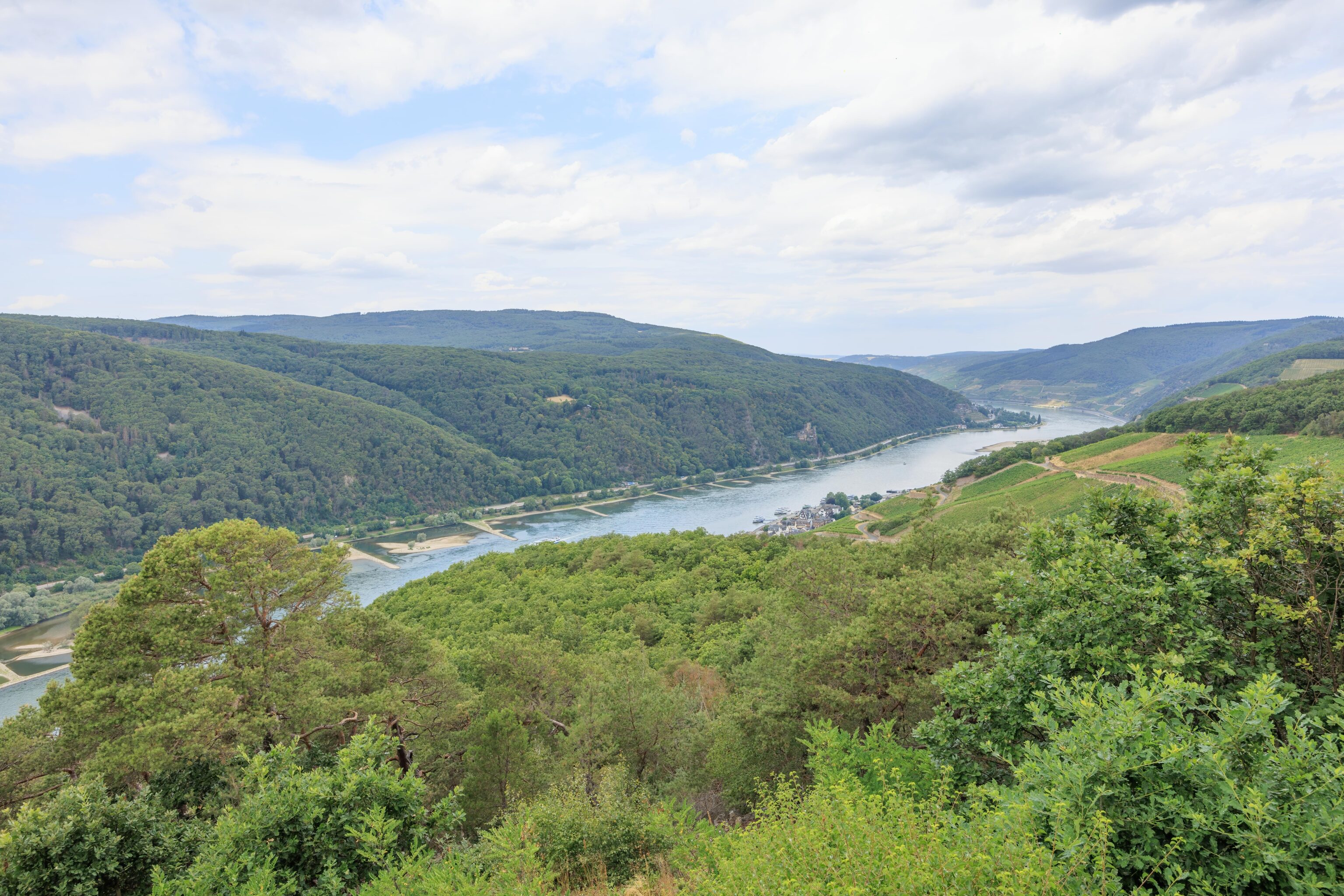
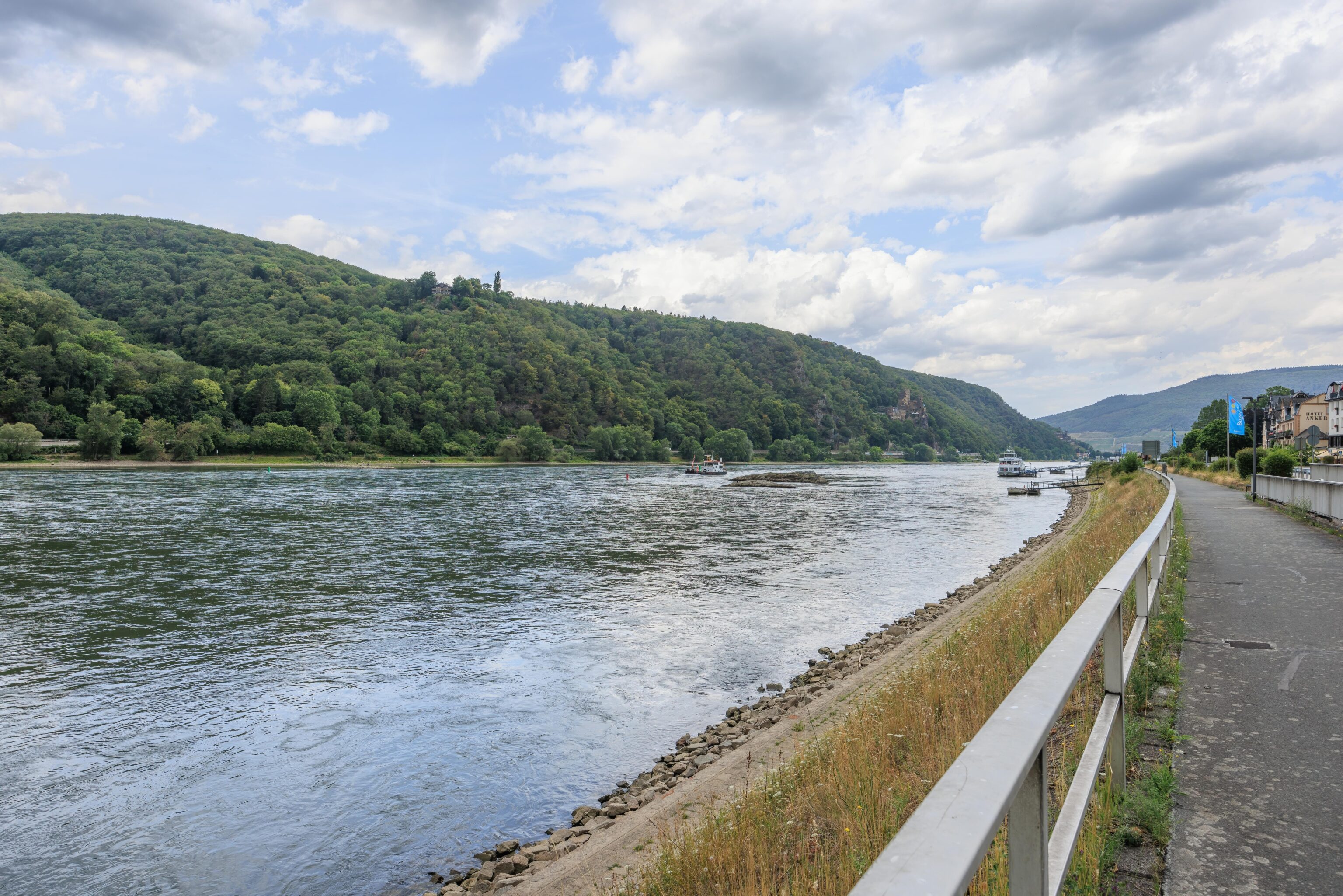
This viewpoint offered fantastic views! From here, a portion of the town of Assmannshausen can be seen to the north. It is where we are headed. Bacharach, which we visited back in March, is about 10km to the north along the Rhine.
After leaving the viewpoint, we started walking inland and uphill a bit.
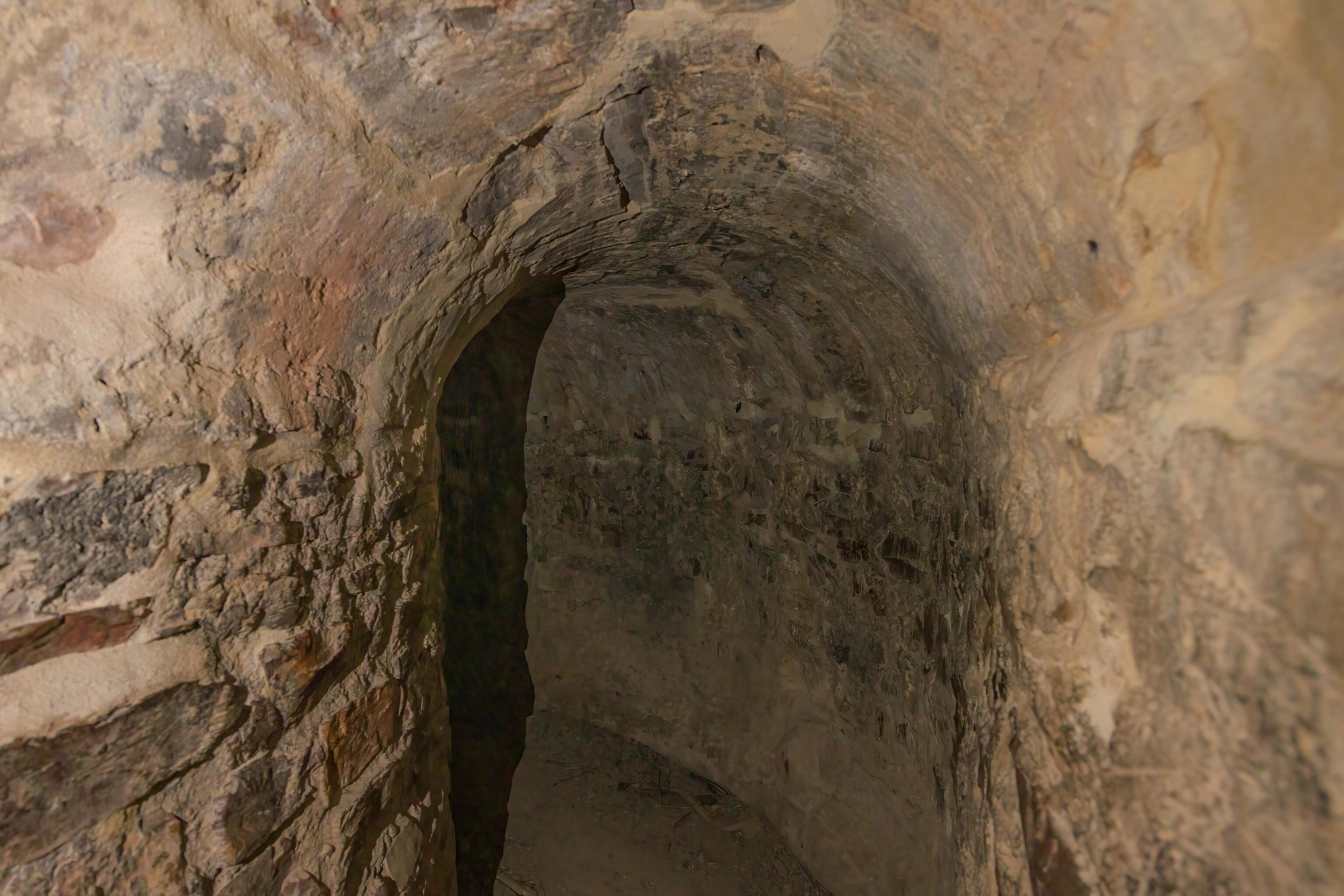
We eventually reached the Zauberhütte which had an entrance to the Zauberhöhle. We were thinking this was going to be a tunnel to a viewpoint or something. But it ended up just coming out a little bit further up the walking path! It is basically a little curved tunnel. Rather unexpected!
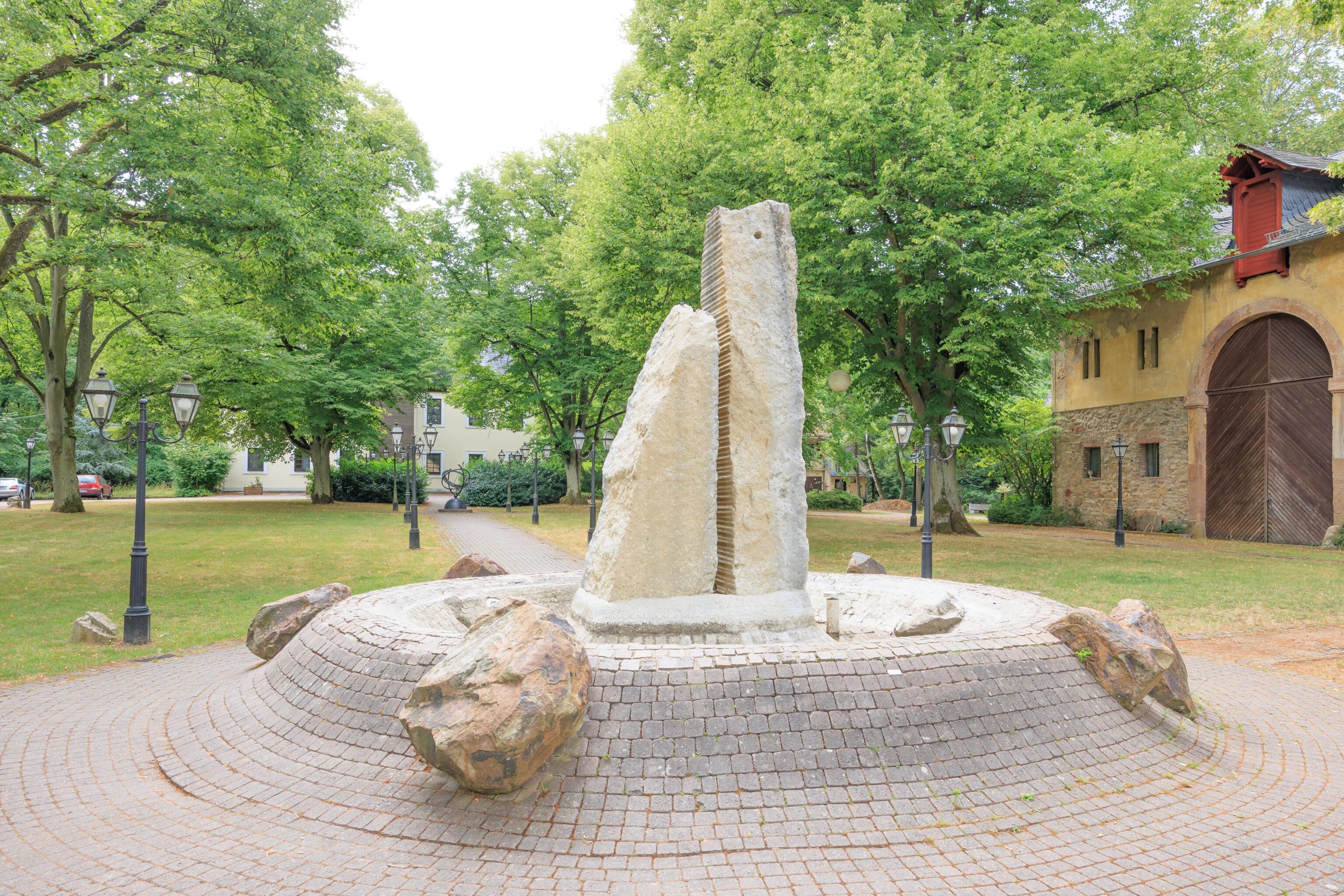
We continued walking to the north until we reached a hotel and restaurant as well as a few other buildings. This sculpture was in a courtyard, more or less, between the buildings. We didn’t find any information about it on any signs.
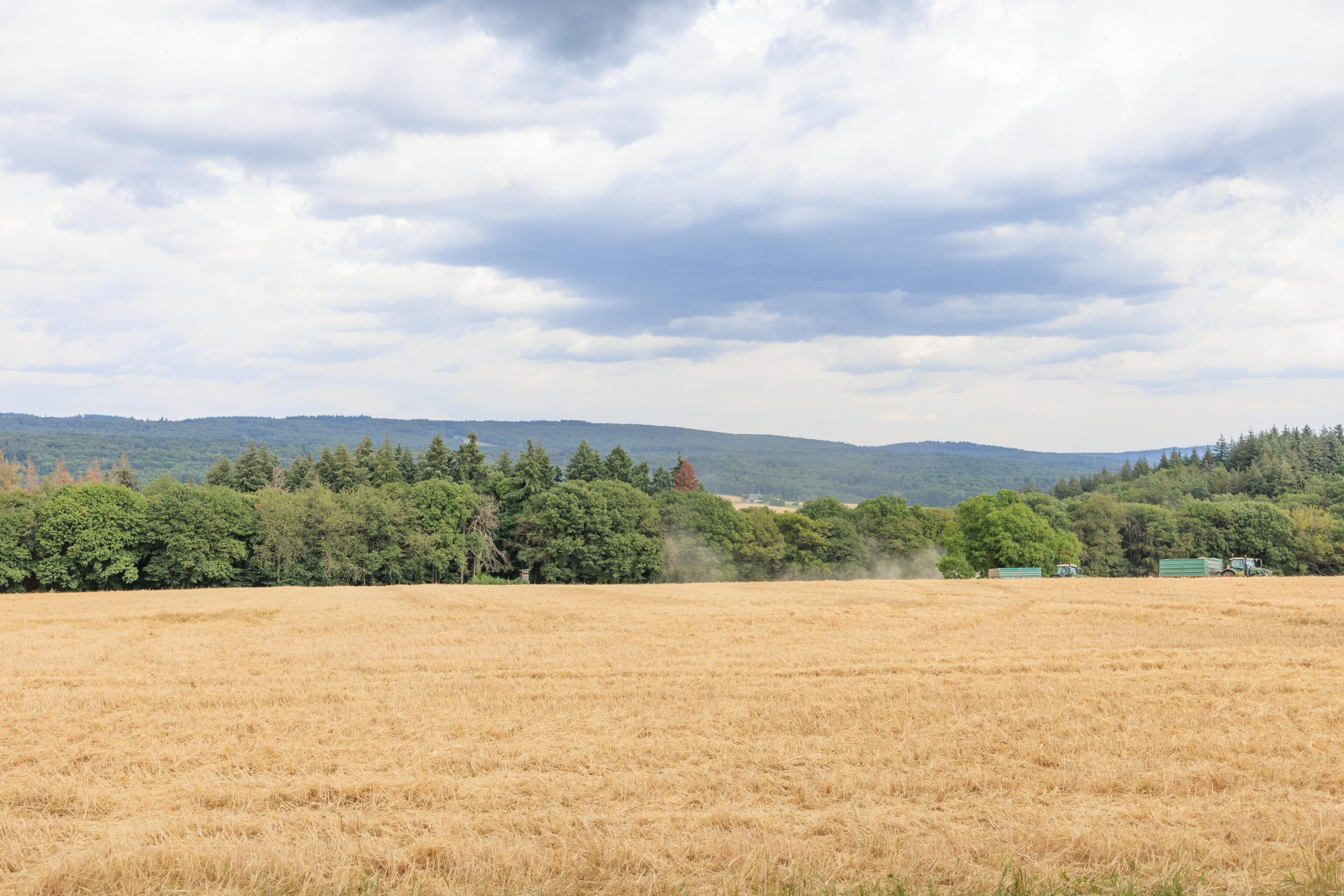
There were some fields to the north that were completely surrounded by forest. There seemed to be some farming activity going on at the time. There was also a vending machine similar to the capsule machines in Japan that contain small toys or other items. Except this one was giving seeds!
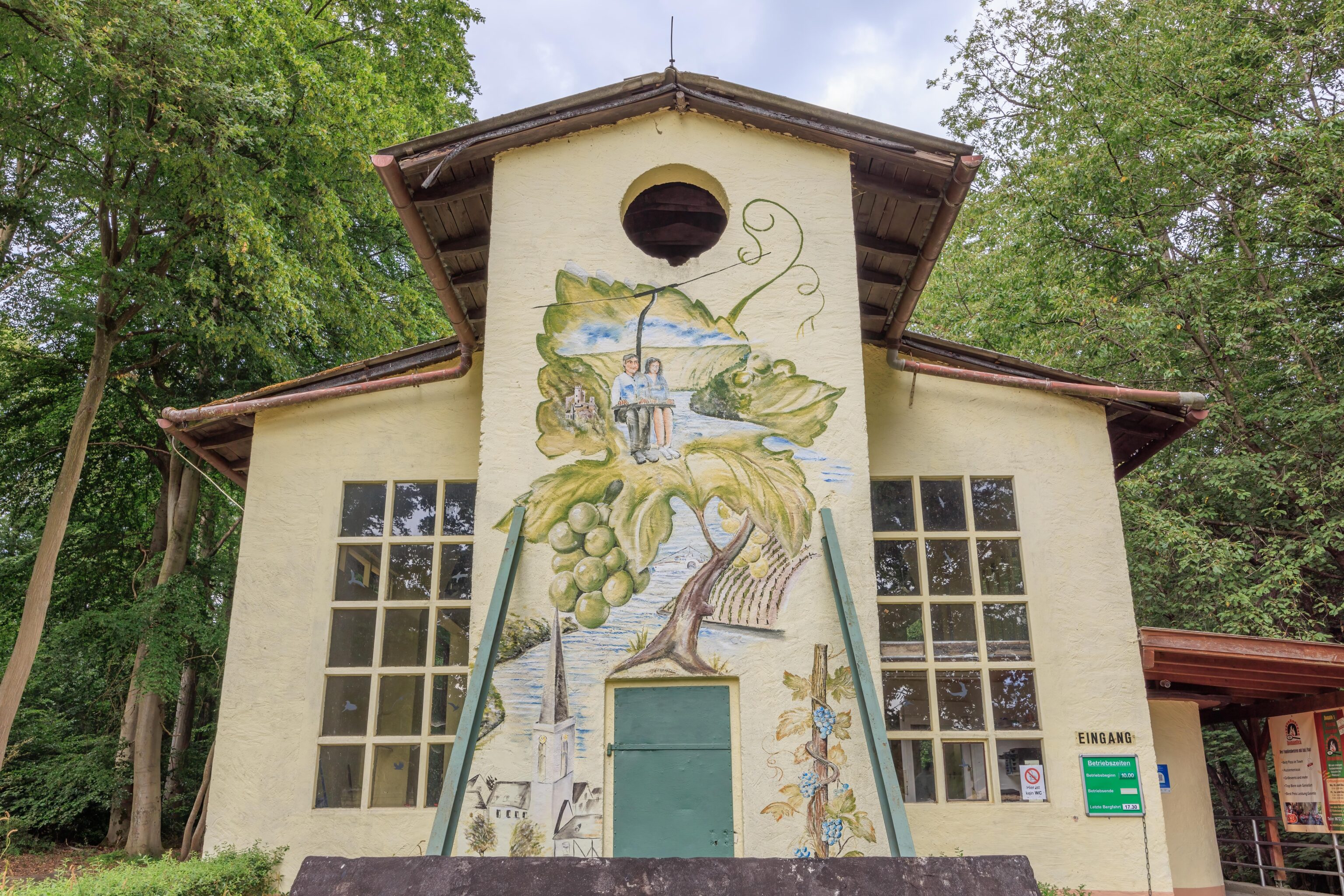
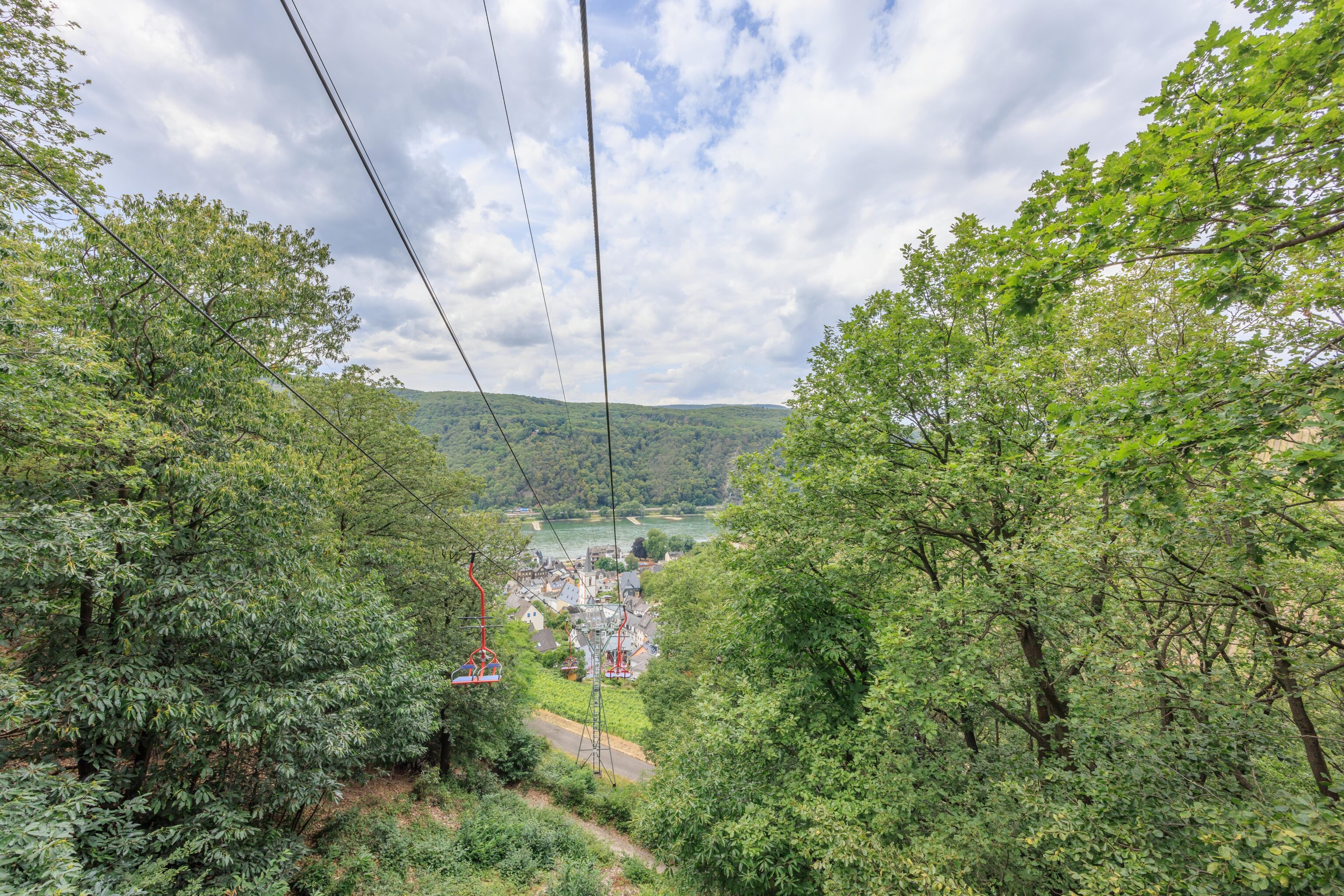
After a short walk by the field, we reached this building. It is the upper terminal to a chair lift that heads down to Assmannshausen. The mural is quite nice!
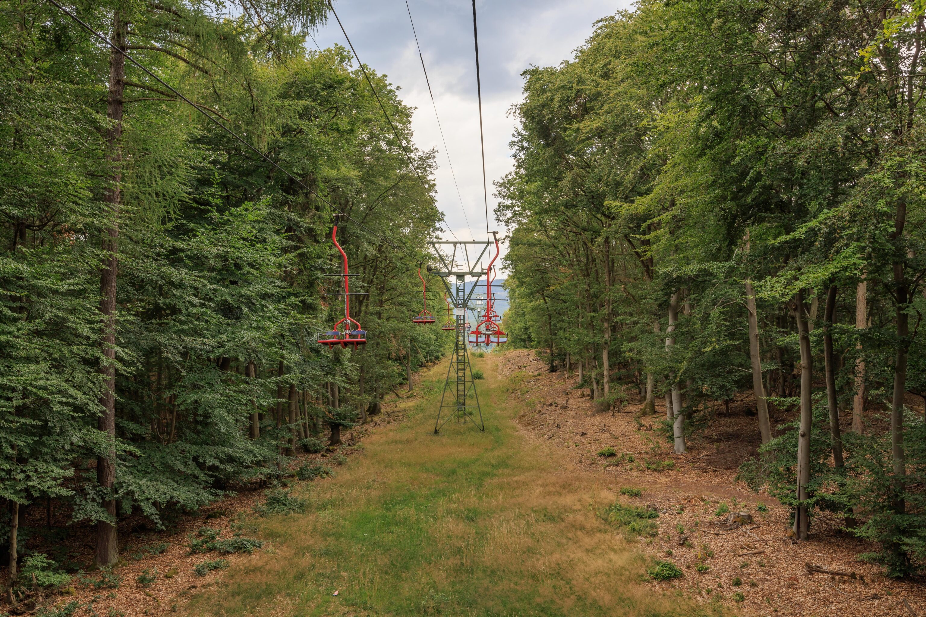
There wasn’t really anyone else around at the time. We boarded the lift to head down. The chair is a very minimal structure but does have a safety bar. The safety bar is probably required as the lift attendant lowers it immediately after you sit down.
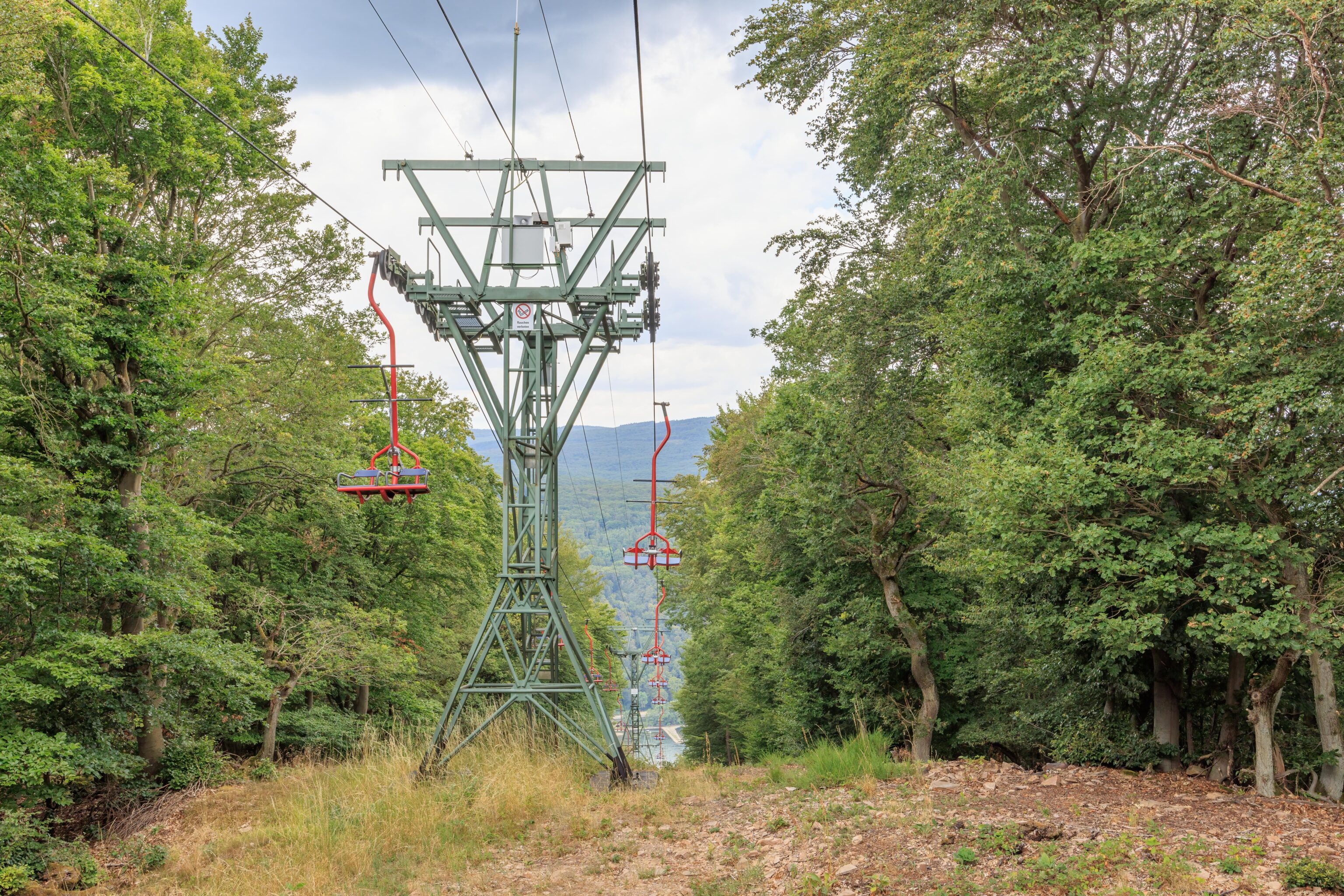
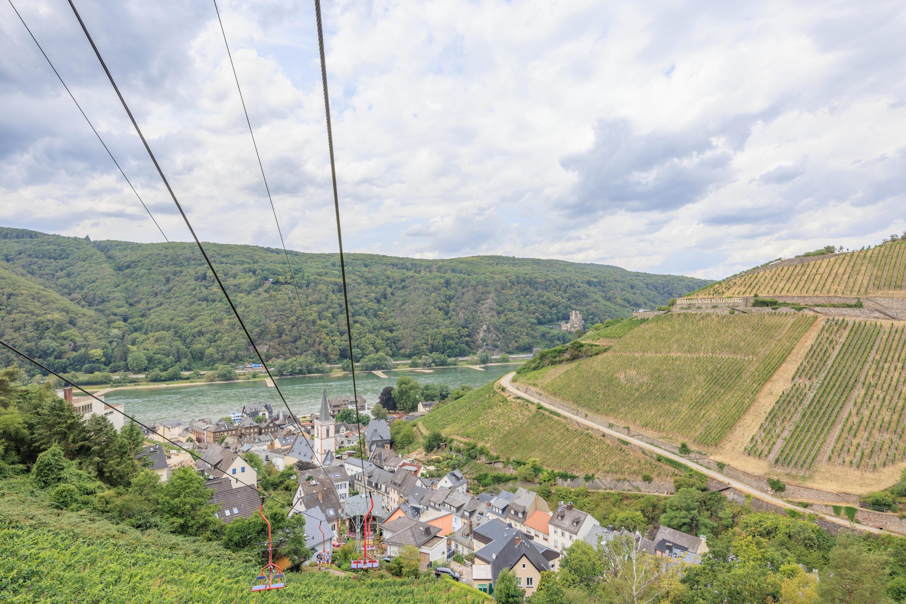
The fixed grip lift was extremely slow, probably the slowest lift we’ve ever been on. It took what felt like forever to get past the initial flat portion of the route. But eventually, we got closer to where the ground seemed to drop away.
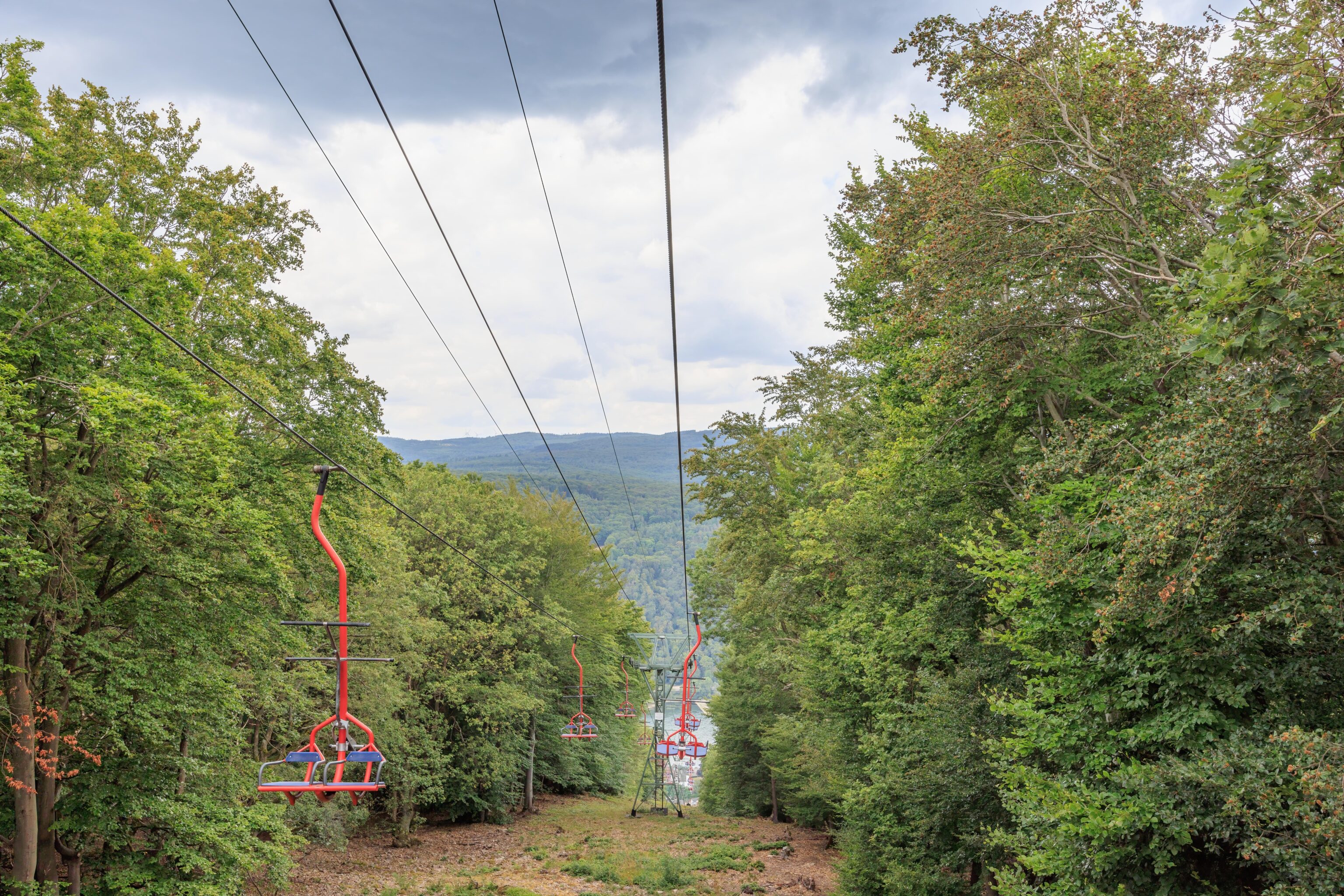
The descent looked like it would get steeper and steeper as we went.
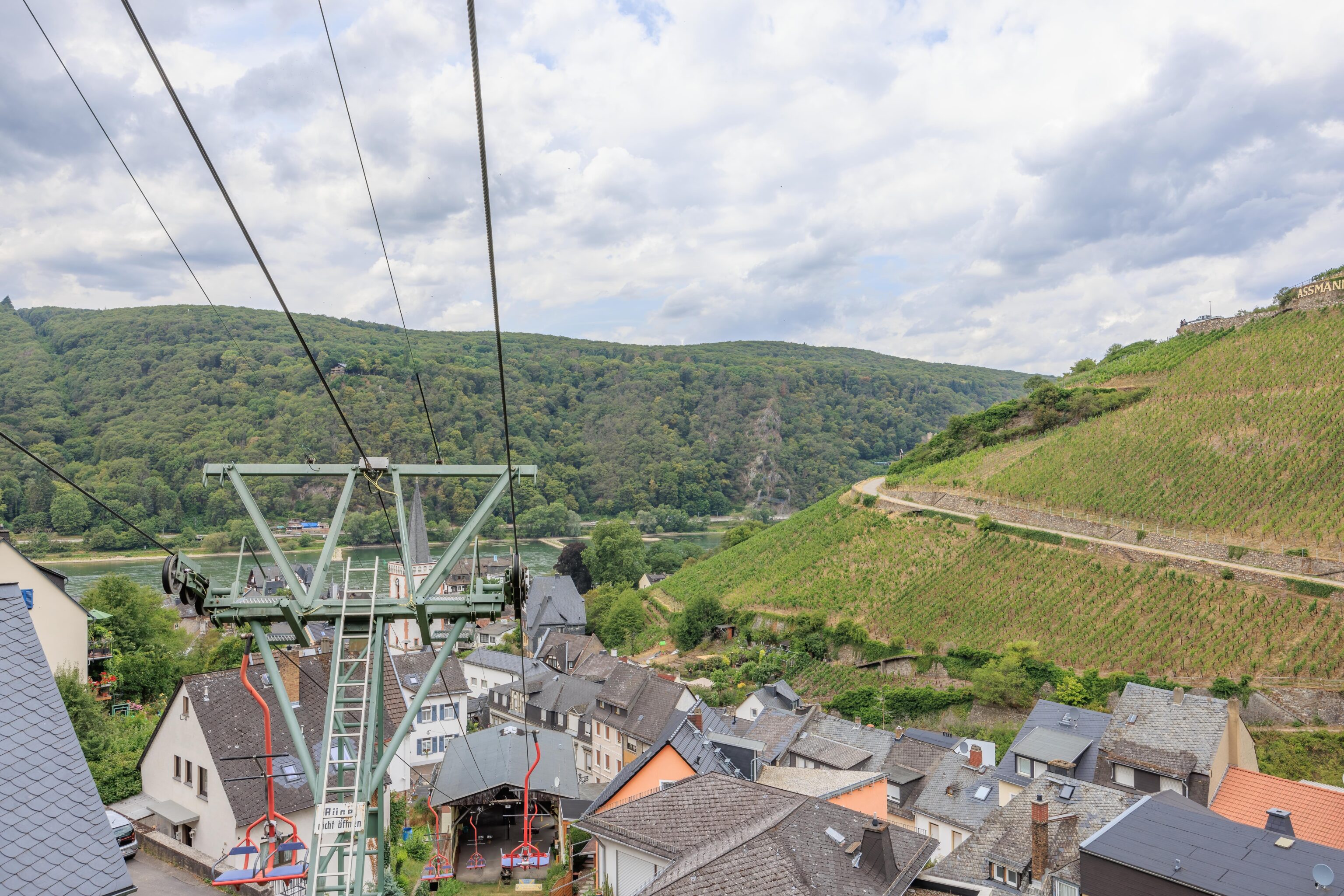
We could see more and more buildings in Assmannshausen as the route got steeper.
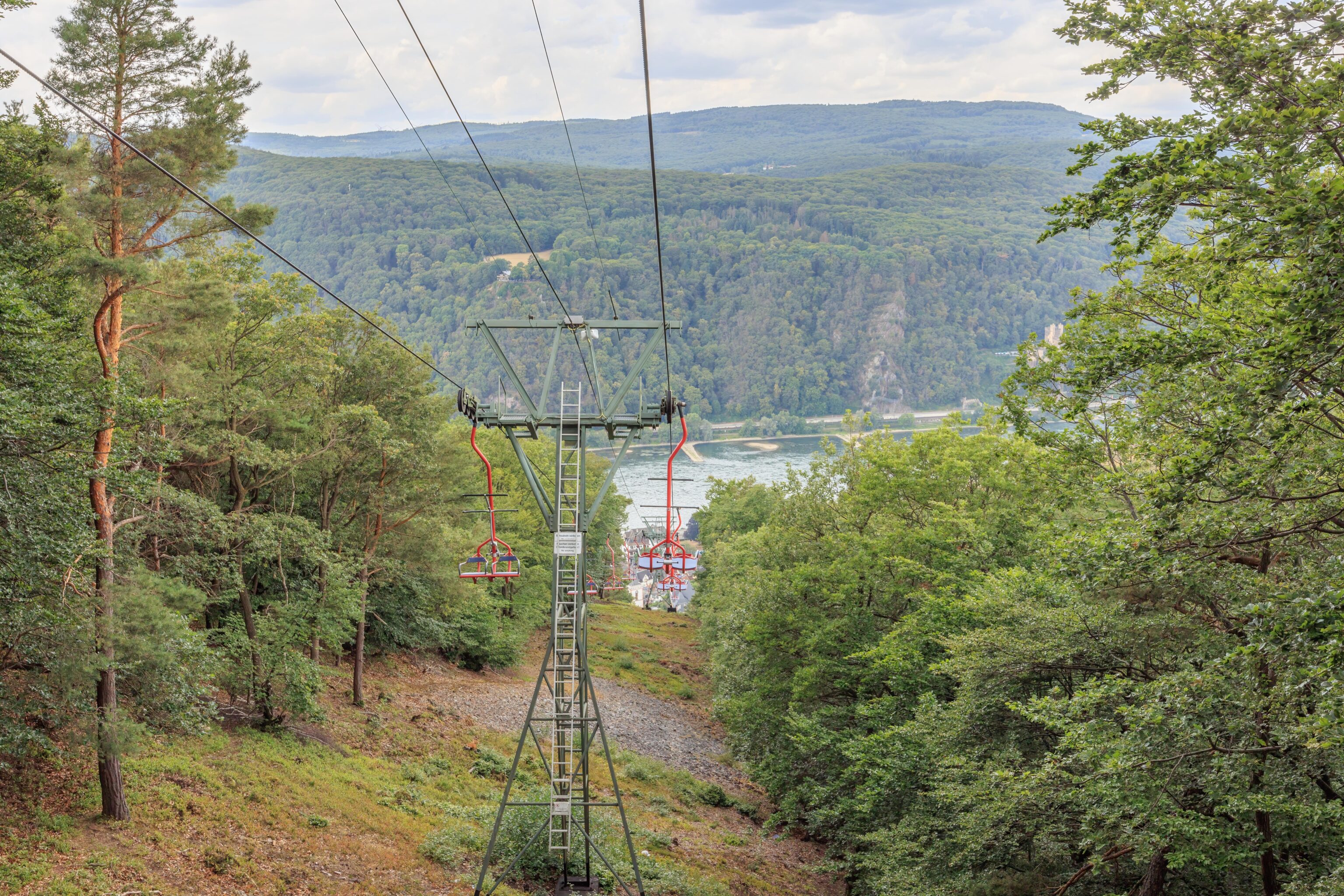
Soon, to the right, we could see a valley and the hills rising again just beyond.
It was almost all vineyards on the hill to our right.
Just a few more trees to go before we reach town!
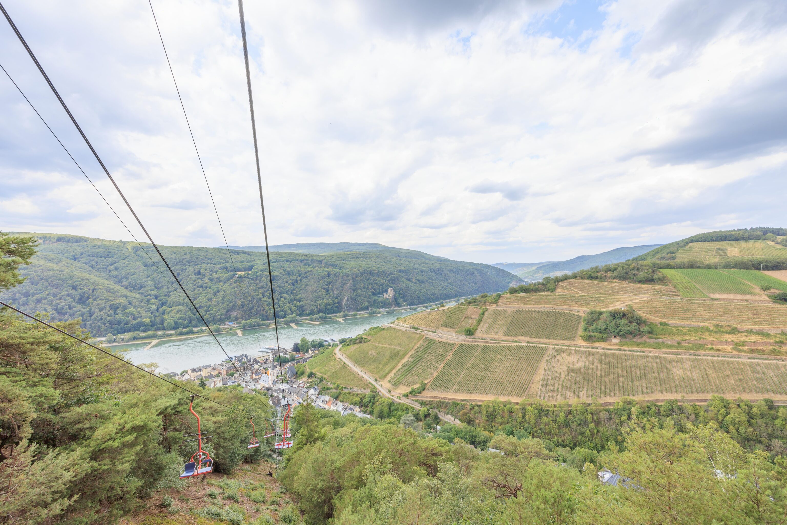
Finally, the little town spread out in the narrow valley in front of us.
Almost there!
Assmannshausen
The lower terminal of the chairlift was on a rather steep road. We descended via stairs.
We considered eating in one of the few restaurants in town but decided to head to Frankfurt instead. We walked towards the Rhine and eventually reached an underpass that went under the railroad near the river’s edge. We could see a steep hill and vineyards behind the town.
The Rhine! We took a quick look down and upriver before heading back under the rails.
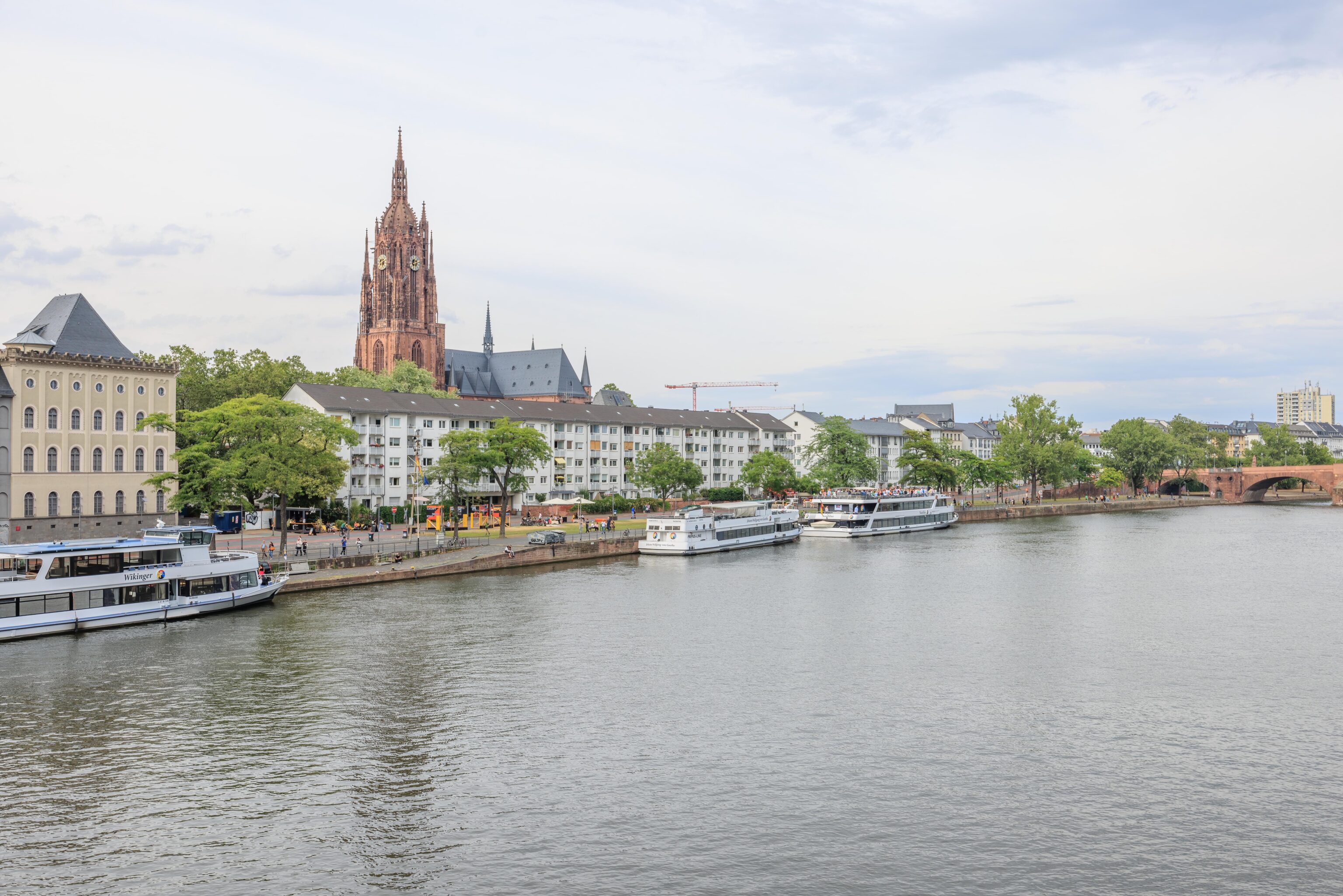
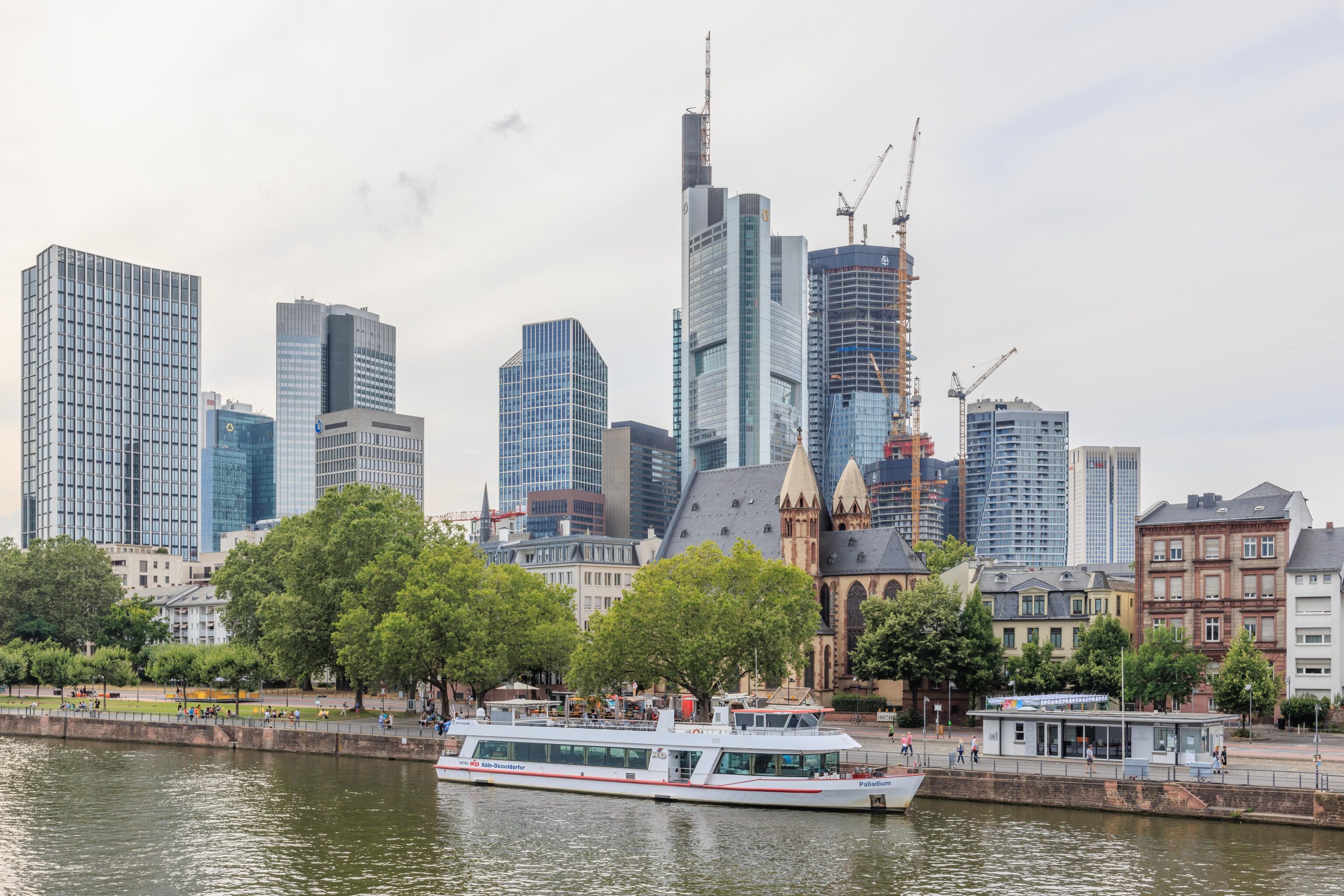
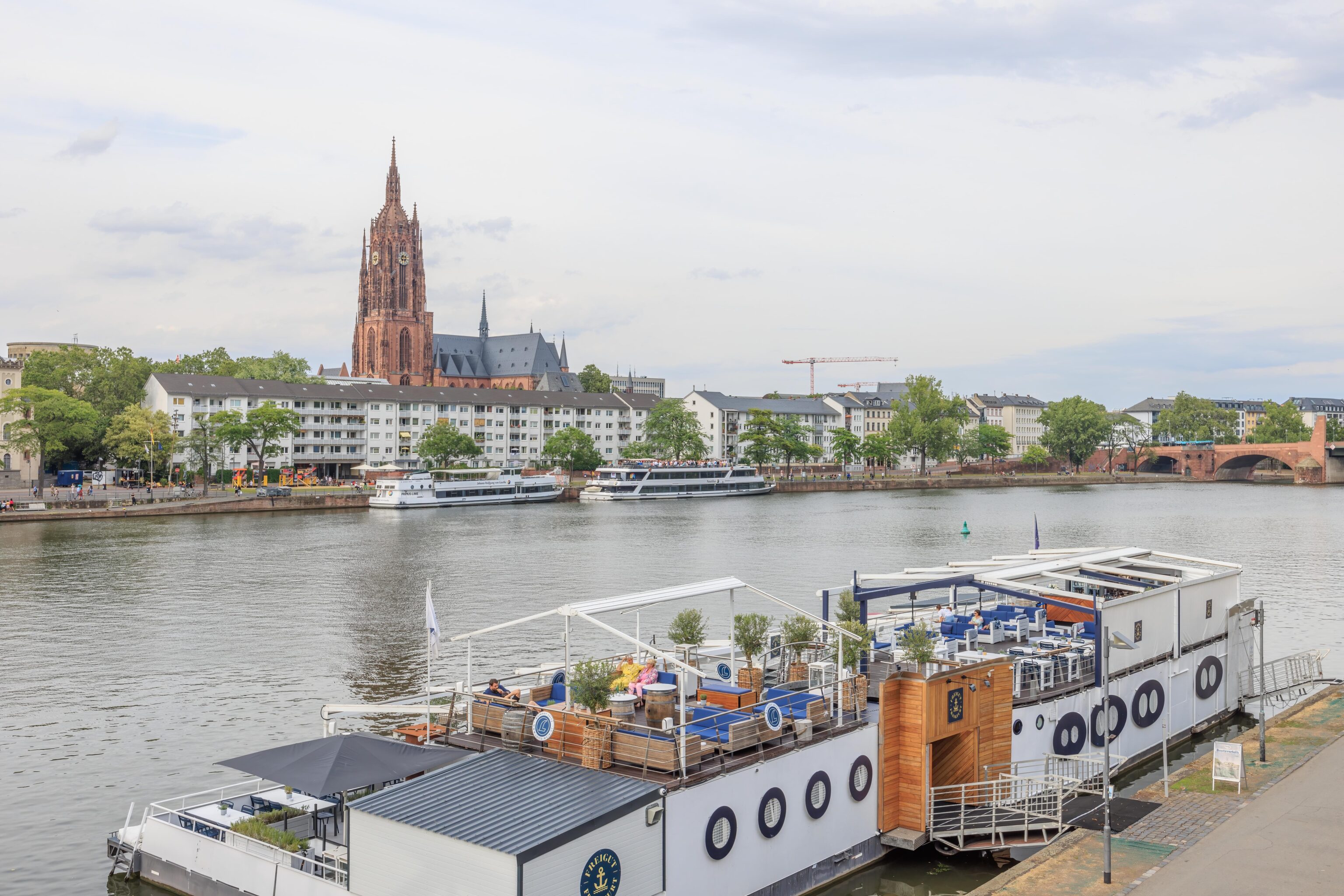
Frankfurt
Our trip to Frankfurt was uneventful. Nothing exciting like soccer riots causing delays like we experienced on our last trip in March!
We headed over to Konstablerwache to have a late lunch, or perhaps more accurately an early dinner. We decided on 12 Apostel, a restaurant that we had wanted to visit during our last visit but didn’t.
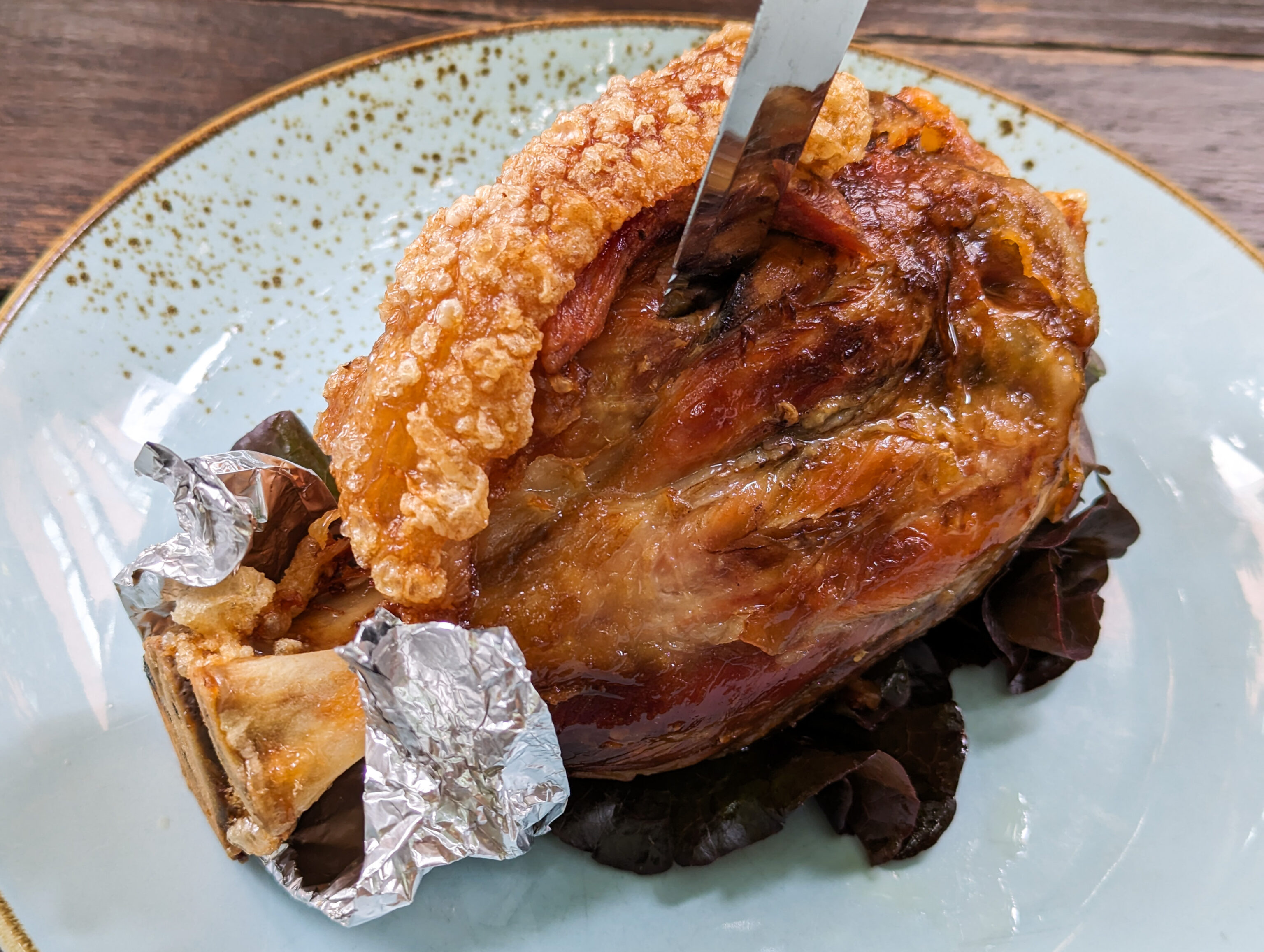
We decided to order the roasted pork knuckle as we haven’t had it roasted before, or at least, we don’t think we have. It was pretty good with a nice crispy section of skin. We’re not really into the German rye bread though. Just not our thing. We didn’t even photograph it!
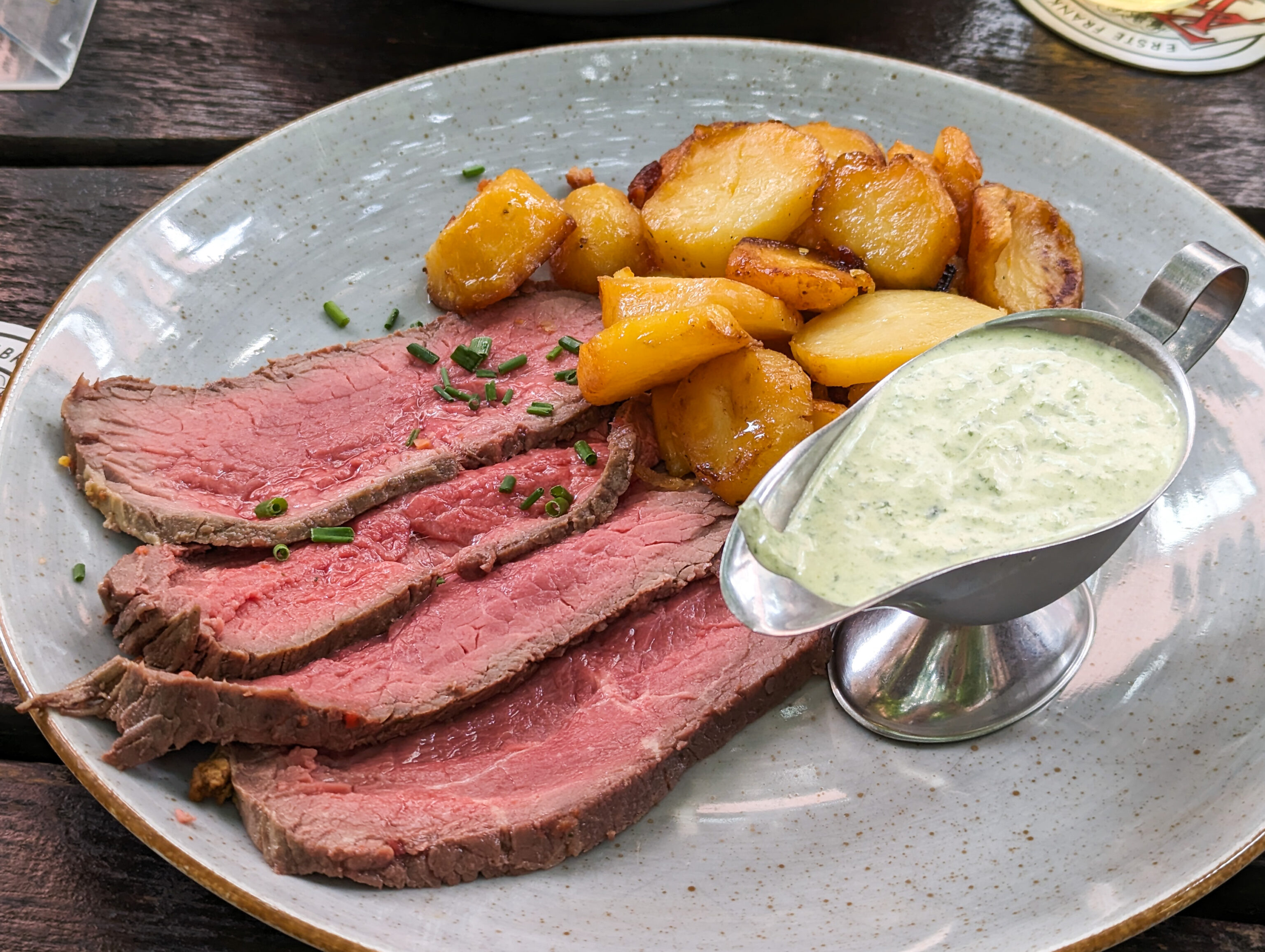
We ordered the roast beef to try out the green sauce, a Frankfurt specialty. This seemed like it would be rather refreshing on a hot day. The roast beef was pretty good as far as roast beef goes, though this normally wouldn’t be a dish we would order.
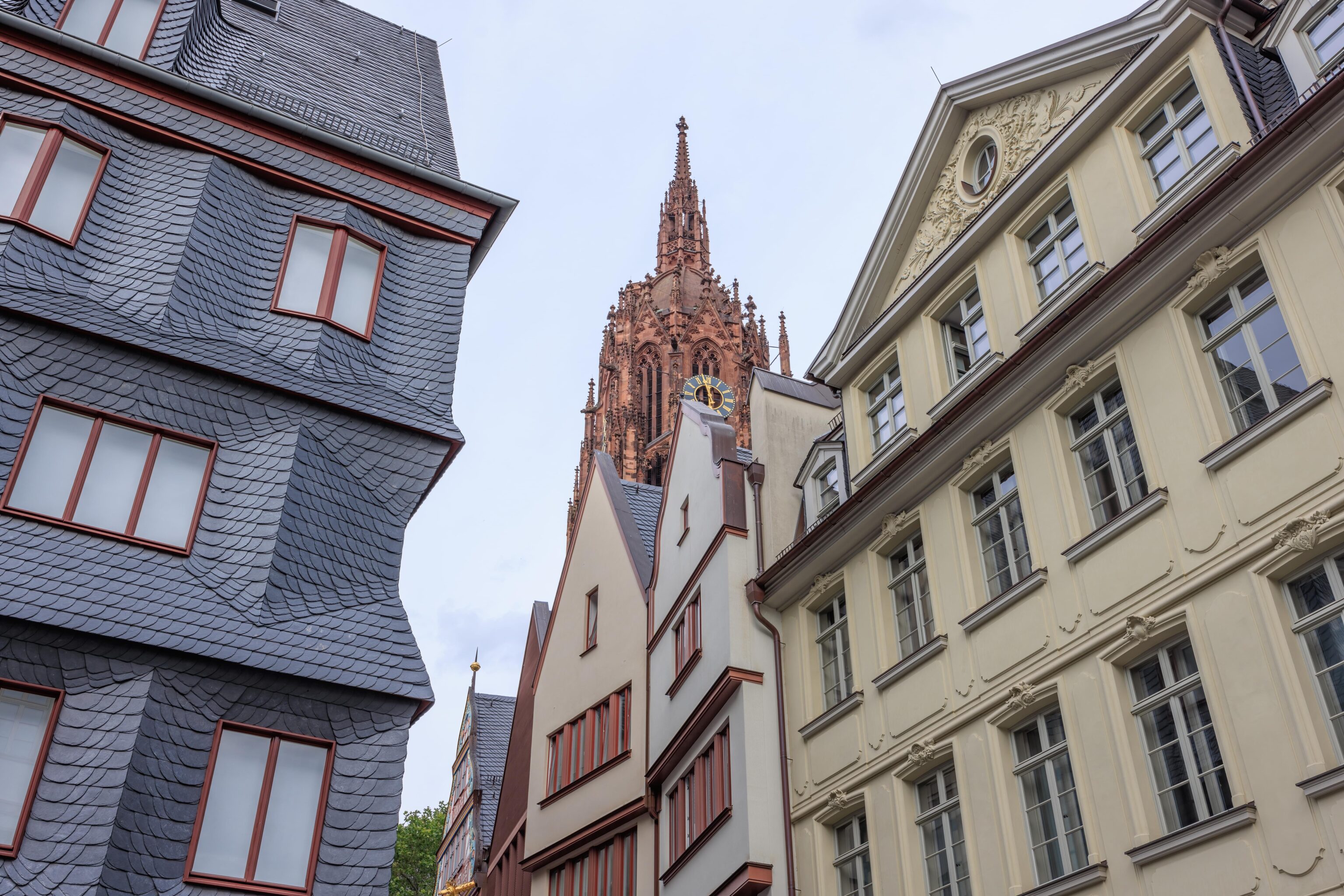
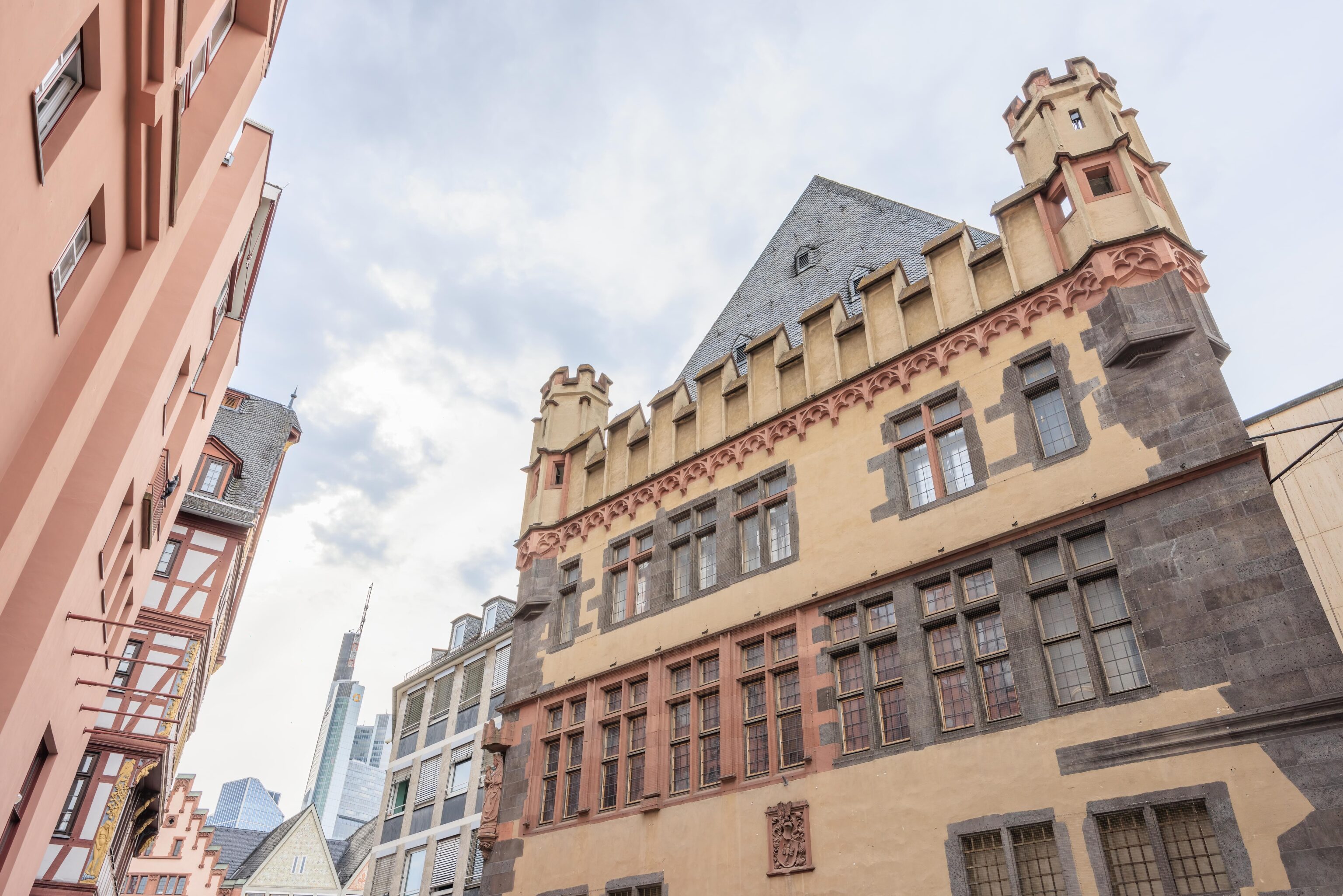
After eating lunch, we walked over to the Altstadt, or Old Town. We were here last time so just planned on mainly taking a quick look around. During that visit, we walked by Goldene Waage a few times. It always seemed very busy. We tried going there once but couldn’t find seating. At the time, they only had indoor seating as it was winter. Today, there was outdoor seating and we were able to easily get a table.
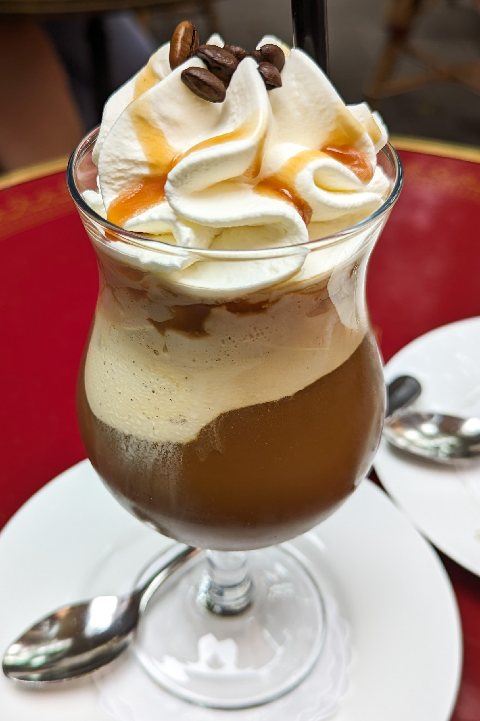
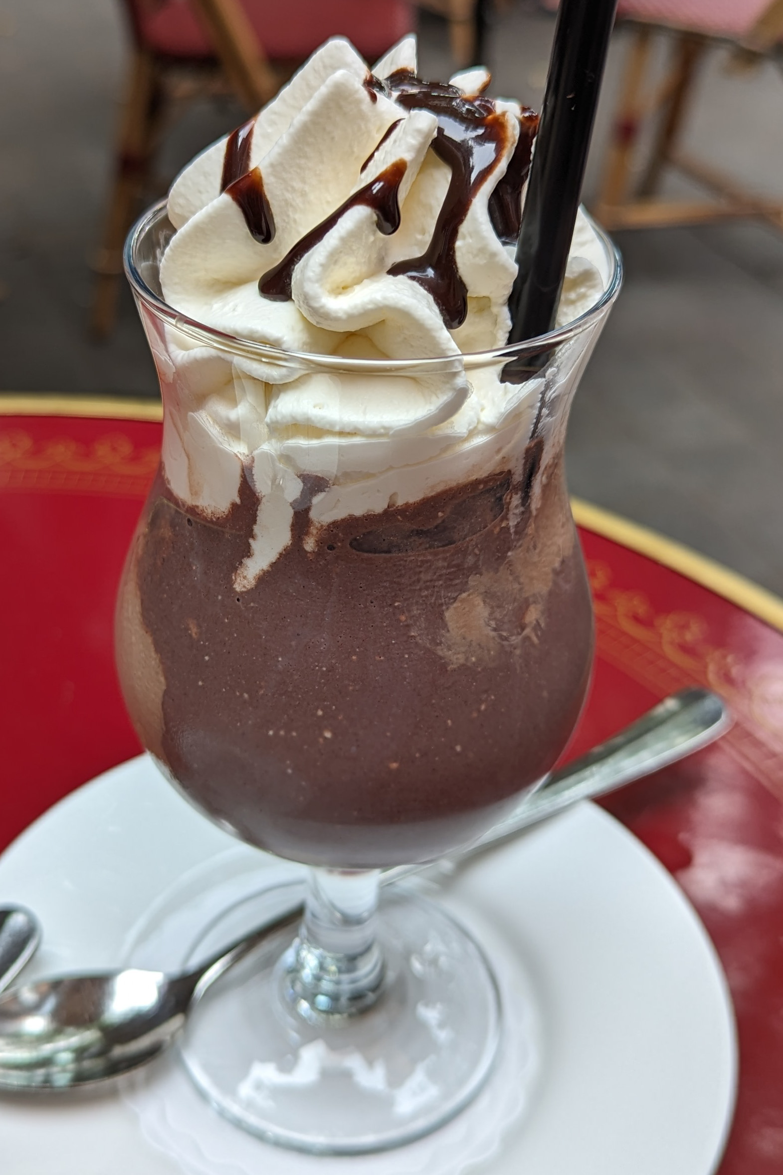
We ordered a eisschokolade and an eiskaffee. The eis in the name refers to ice cream. Both were good and quickly consumed!
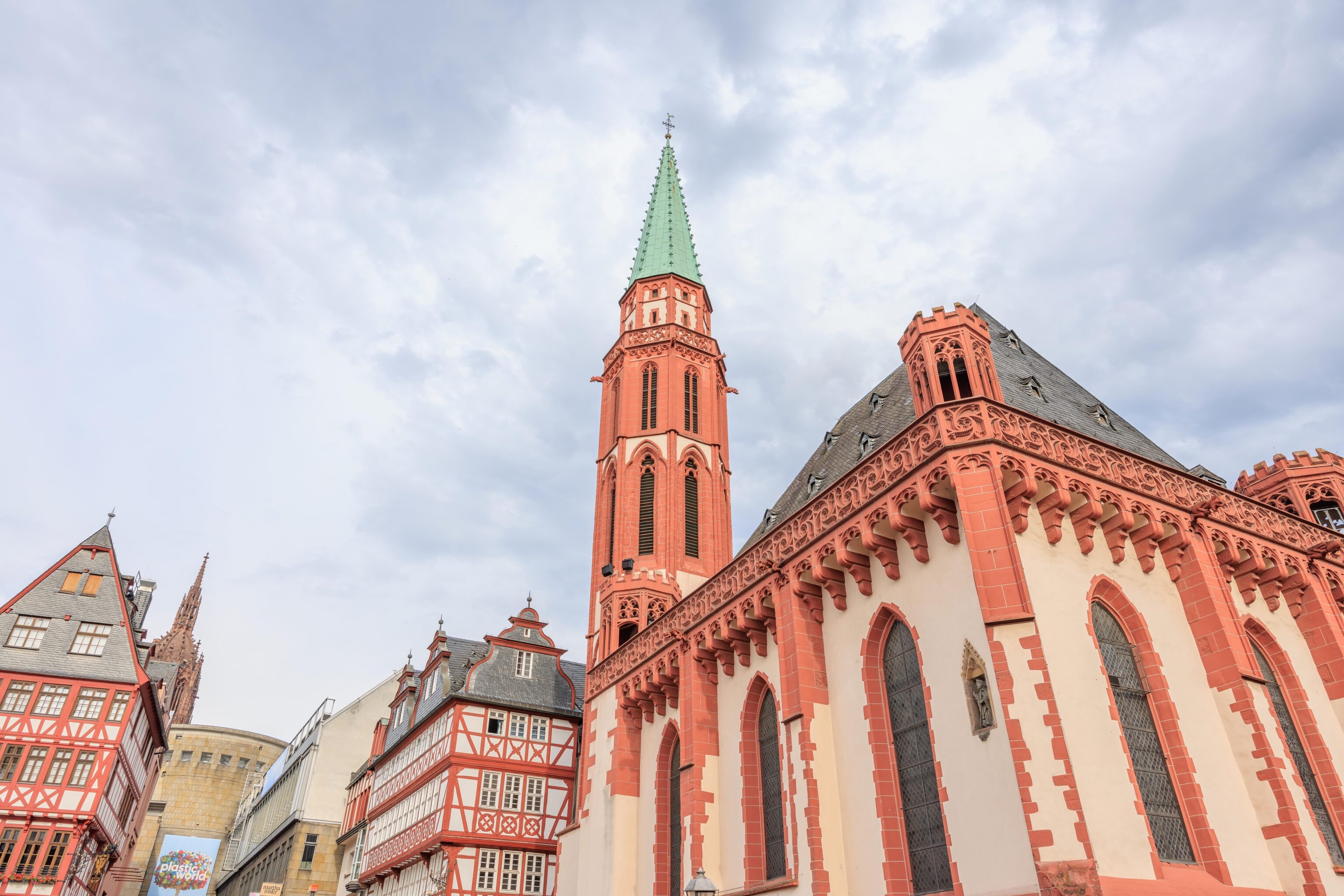
After our quick dessert, we continued walking around the area. Much of it looks the same in the summer as the winter.
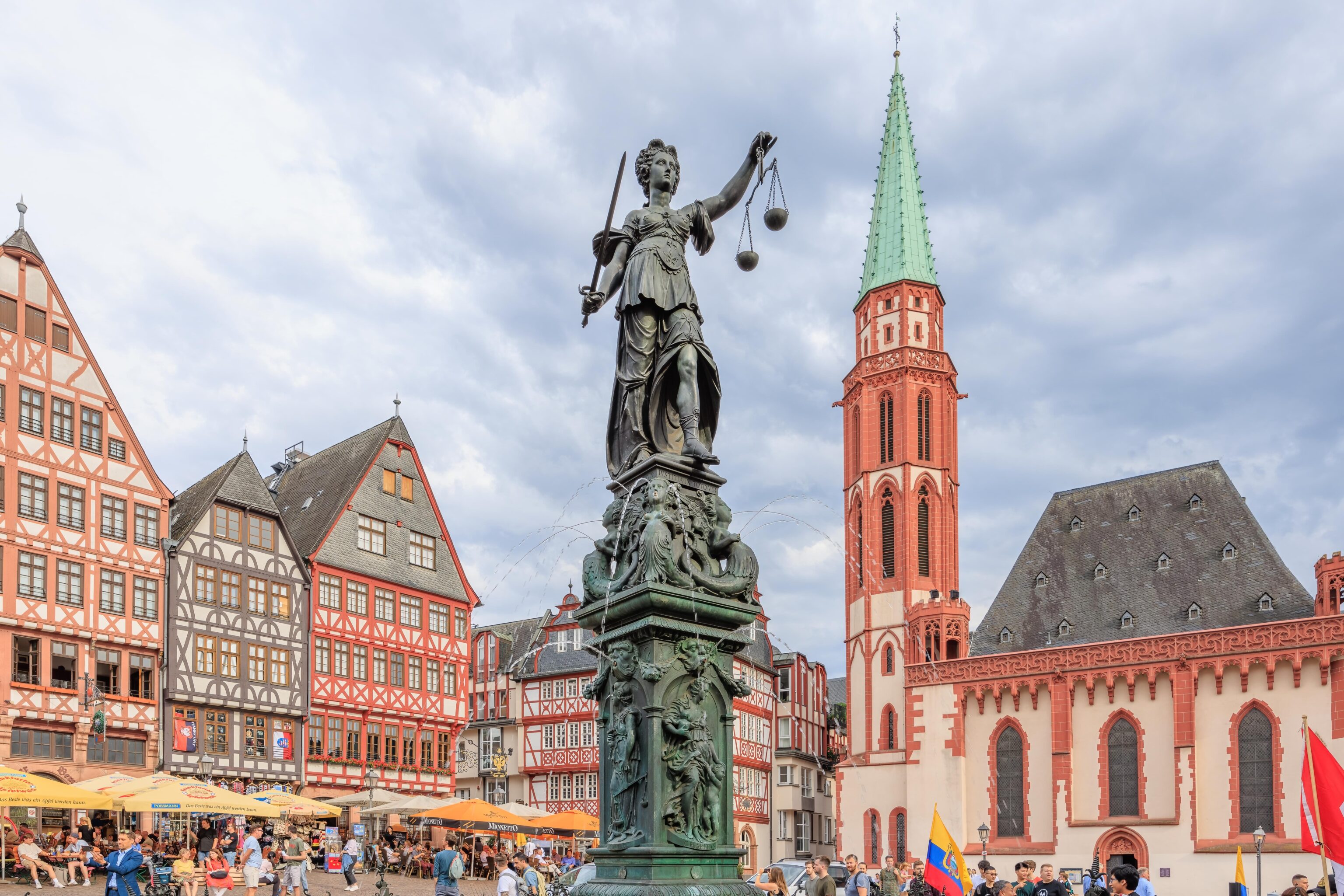
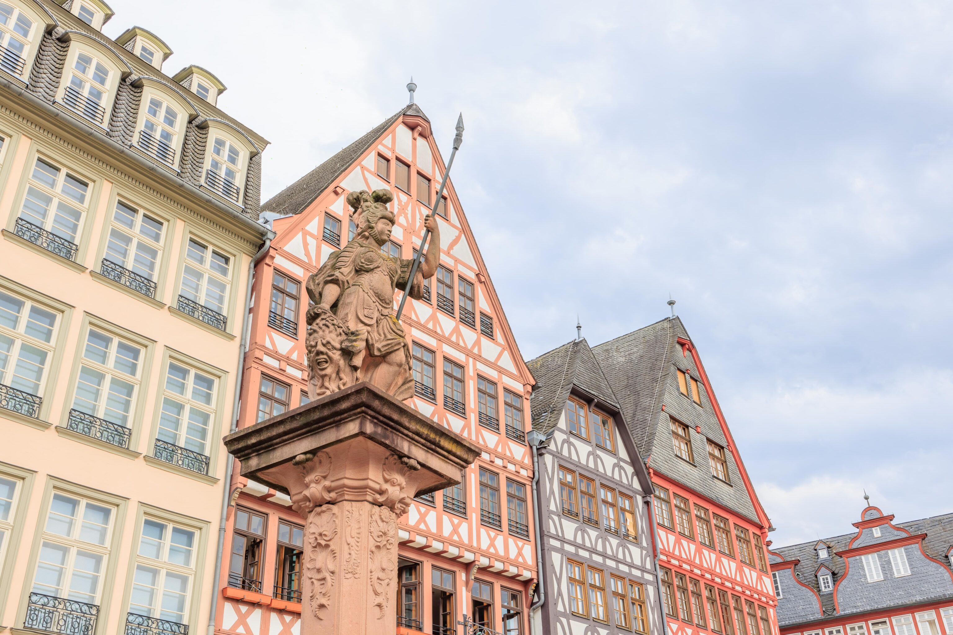
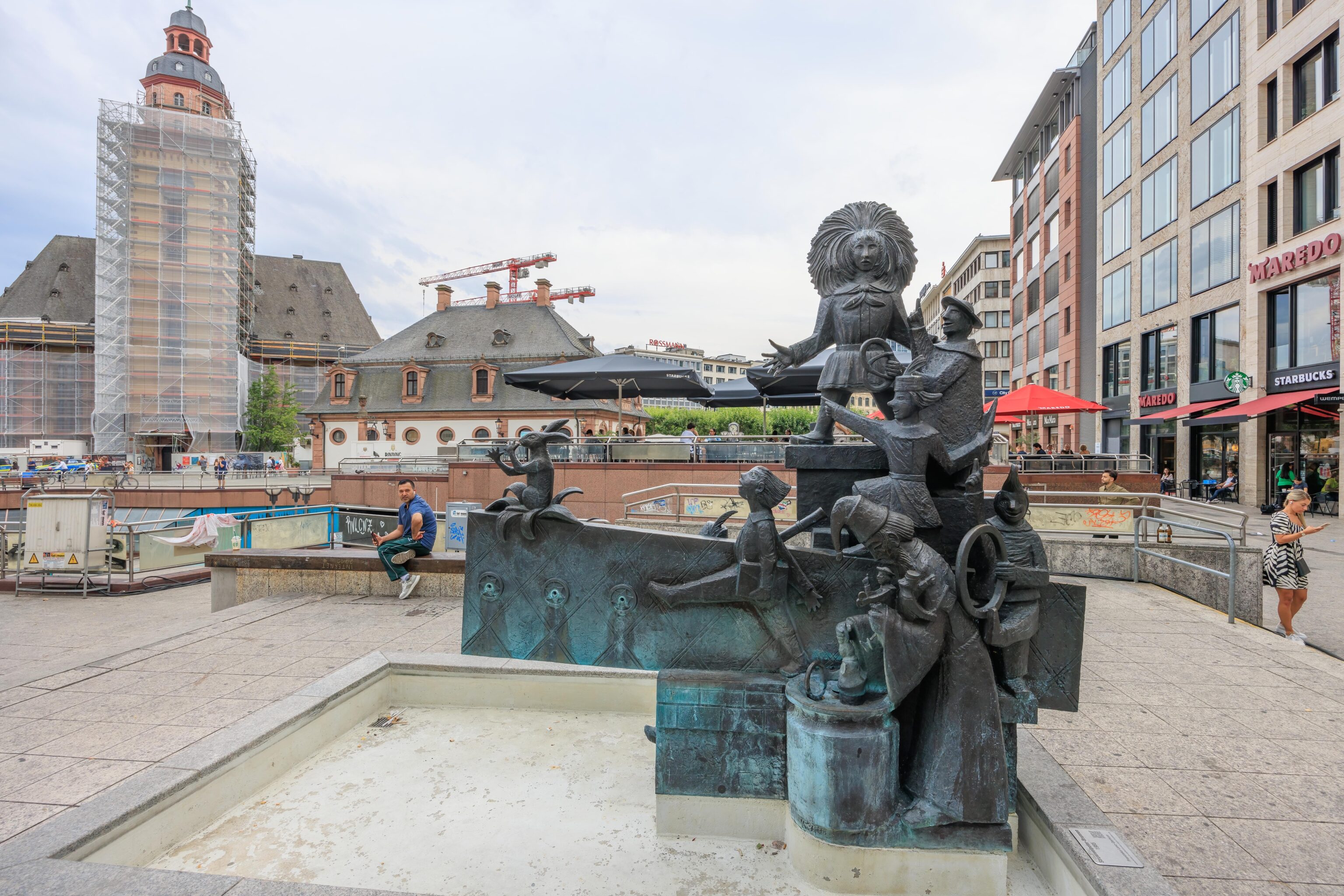
This water fountain was functional this time though! It is definitely interesting if you take a close look at it!
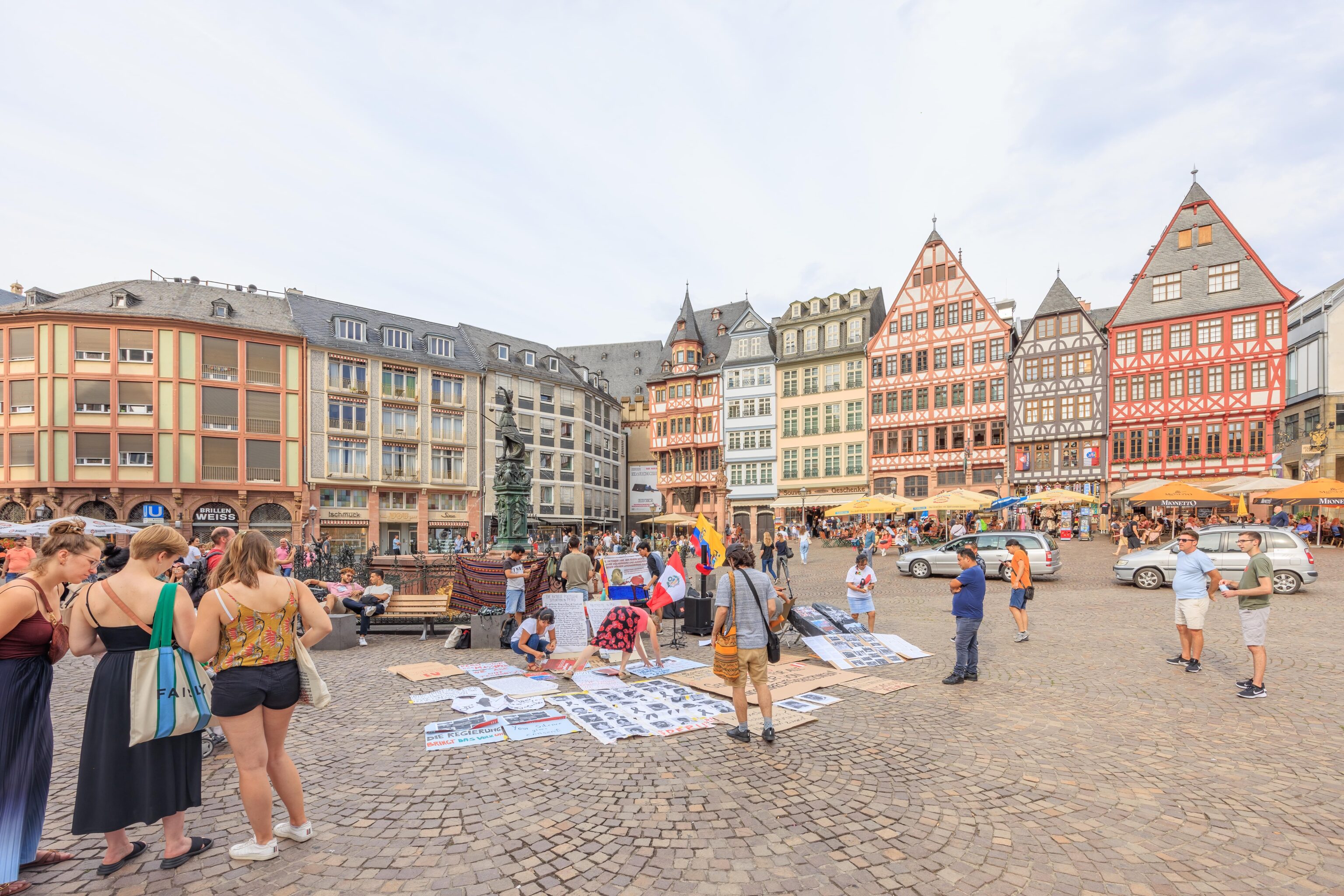
There was a peaceful protest taking place related to the current political troubles in Peru. Not sure exactly what the messaging was as it was all in German.
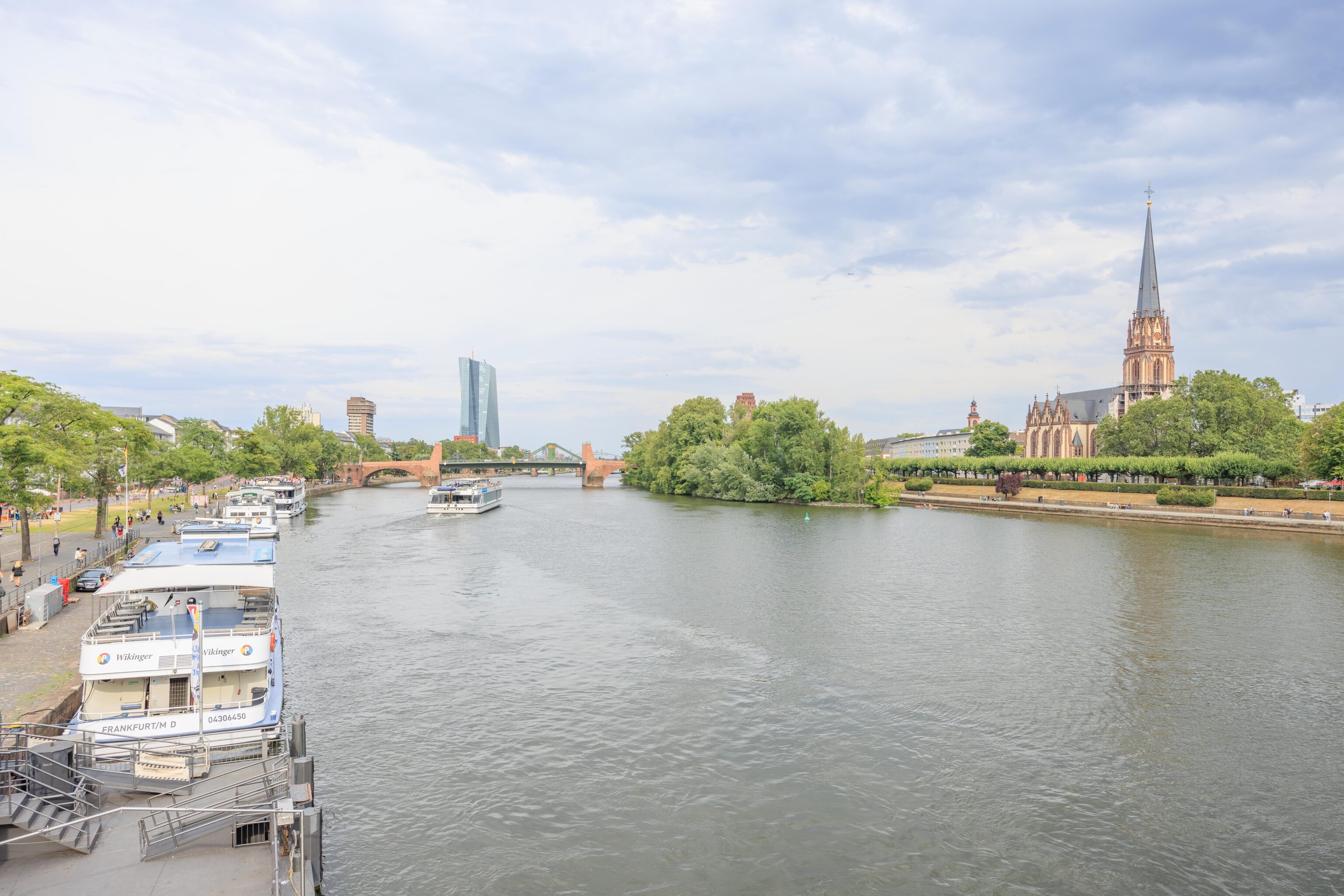
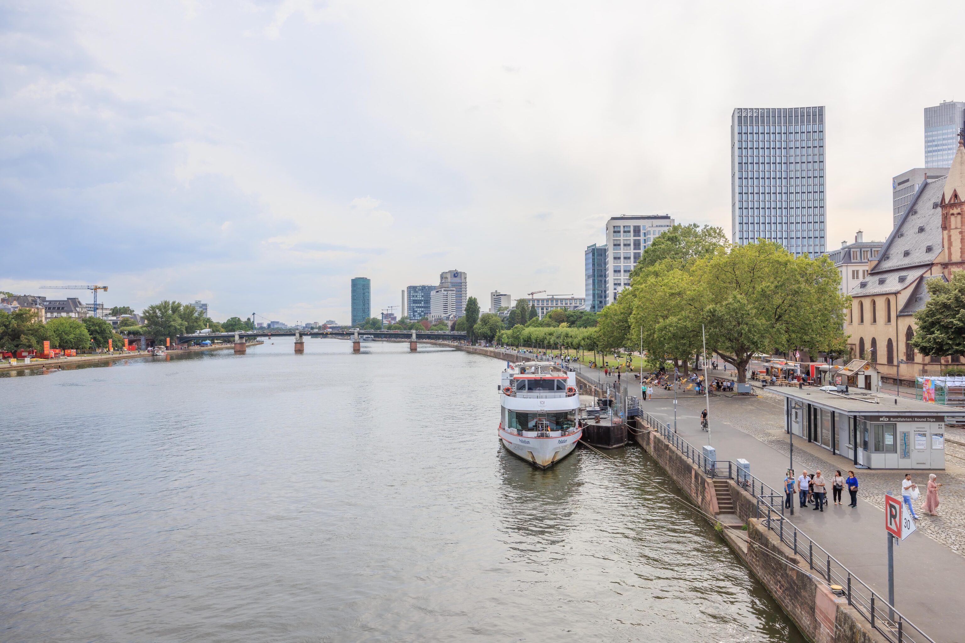
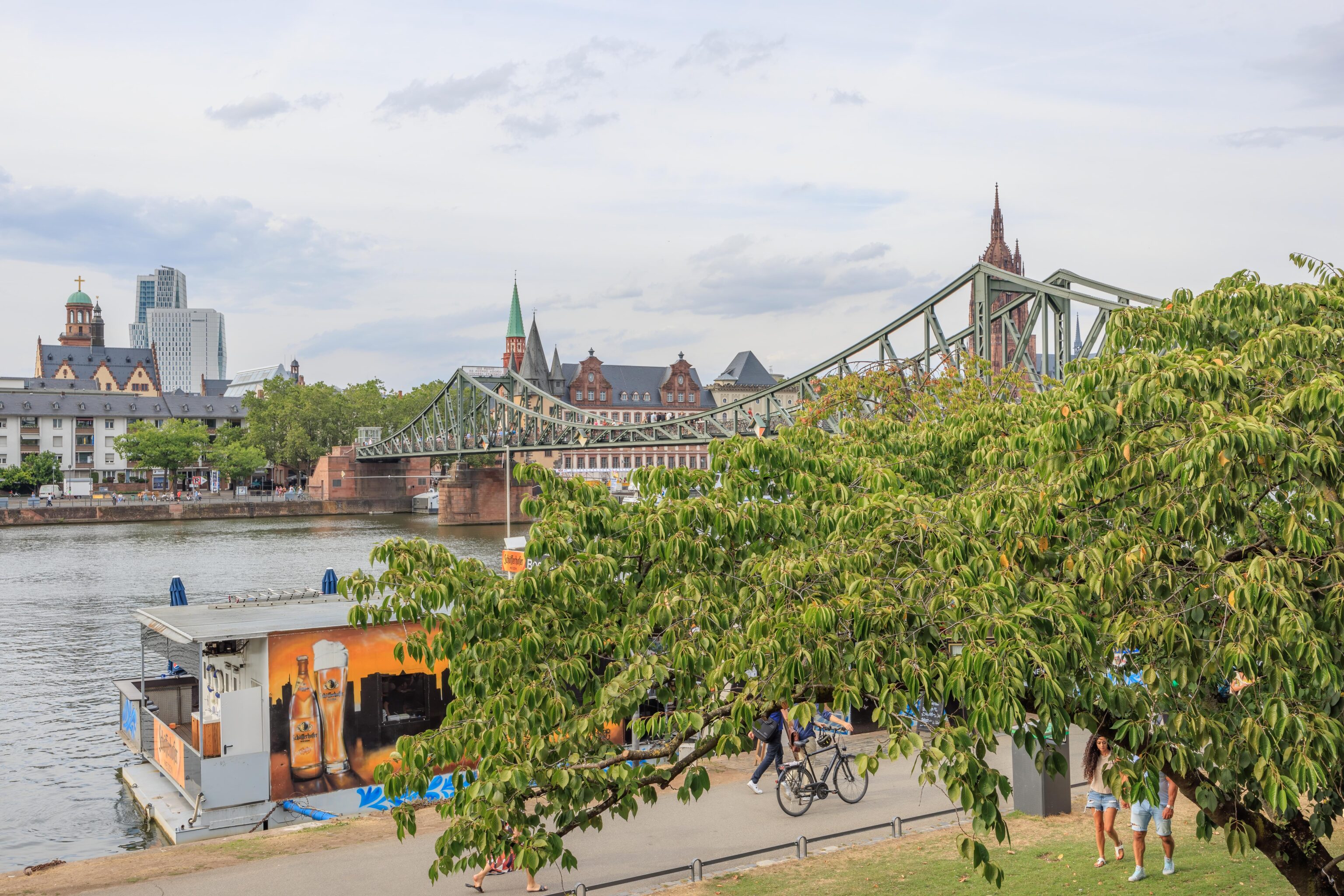
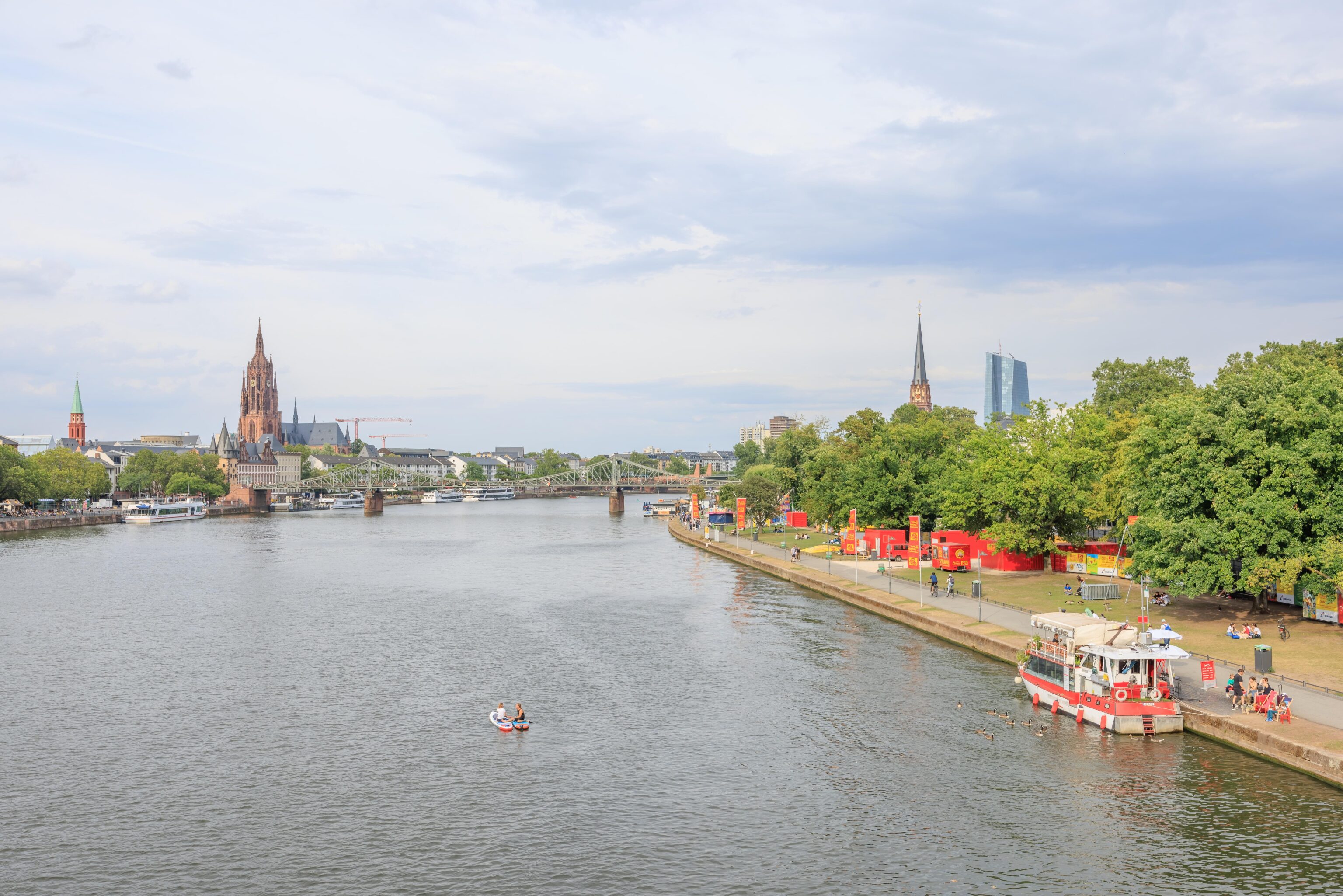
We continued on to the Eiserner Steg, or Iron Footbridge. It was quite pleasant! And the riverside scene was much prettier with leaves on the trees.
We crossed the bridge to the south side of the Main.
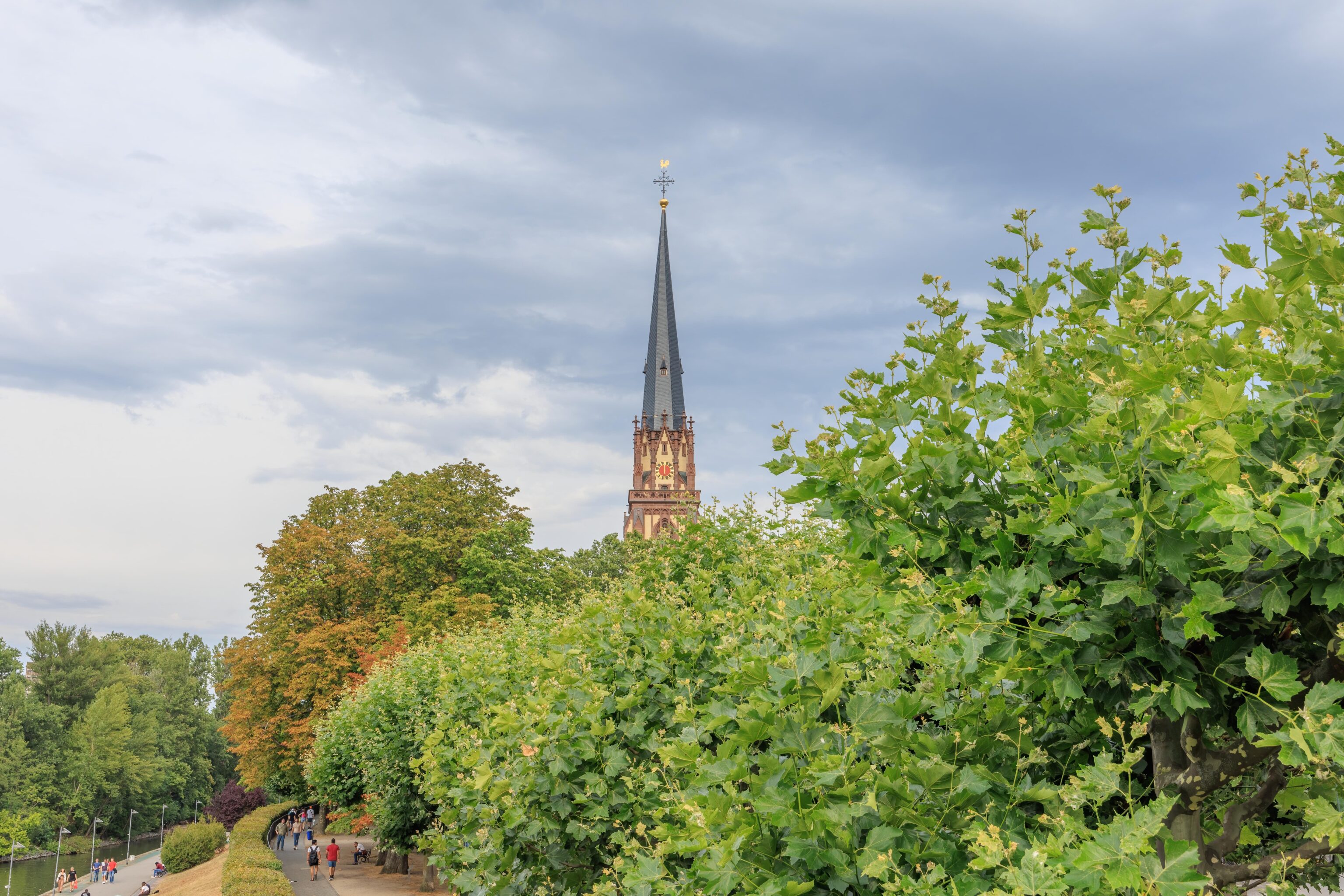
So much green!
We decided to walk to the west to the next bridge. The last time we walked here, it was cold and pouring rain.
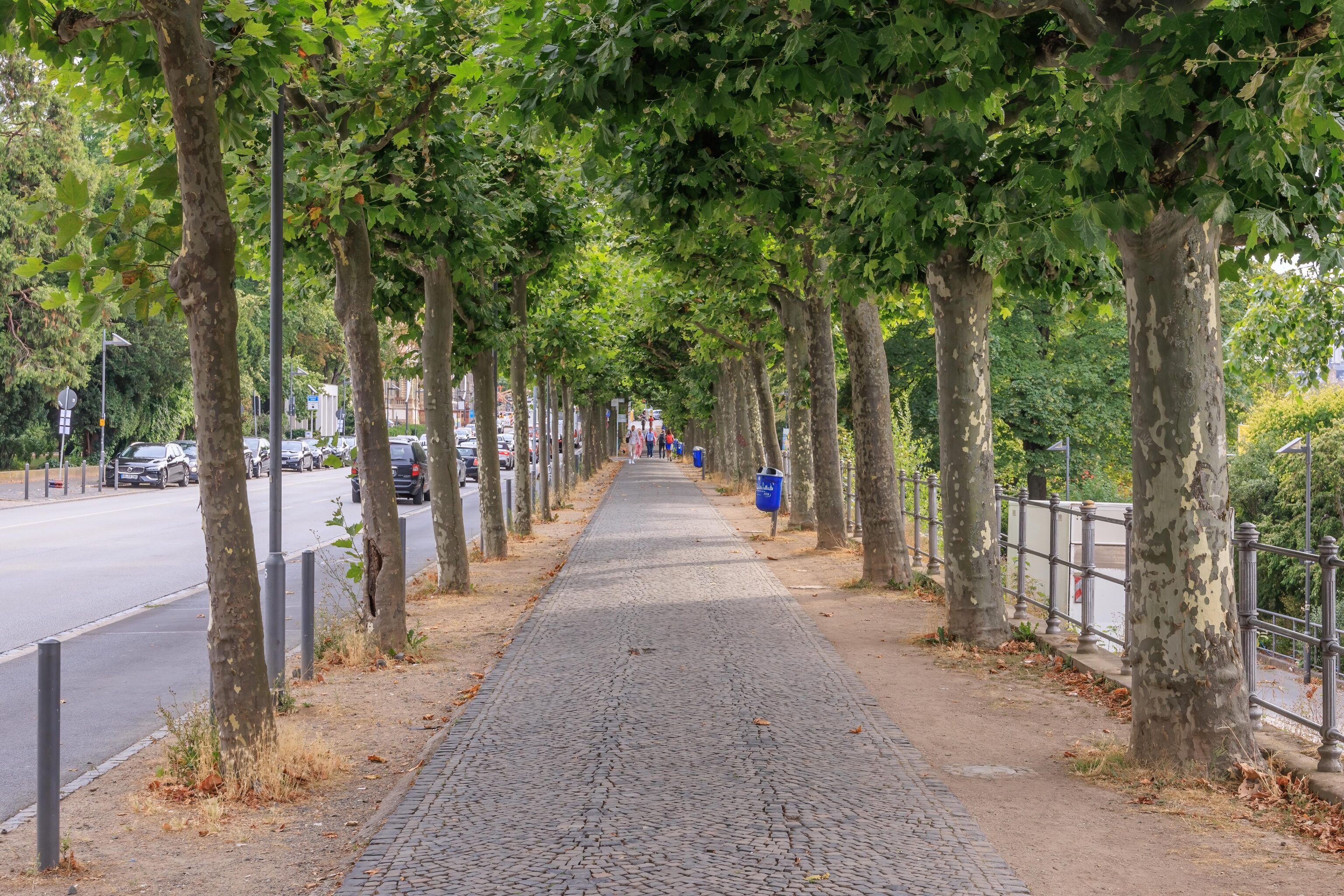
There was a nice tree lined path between the road and the Main.
We crossed back over the next bridge.
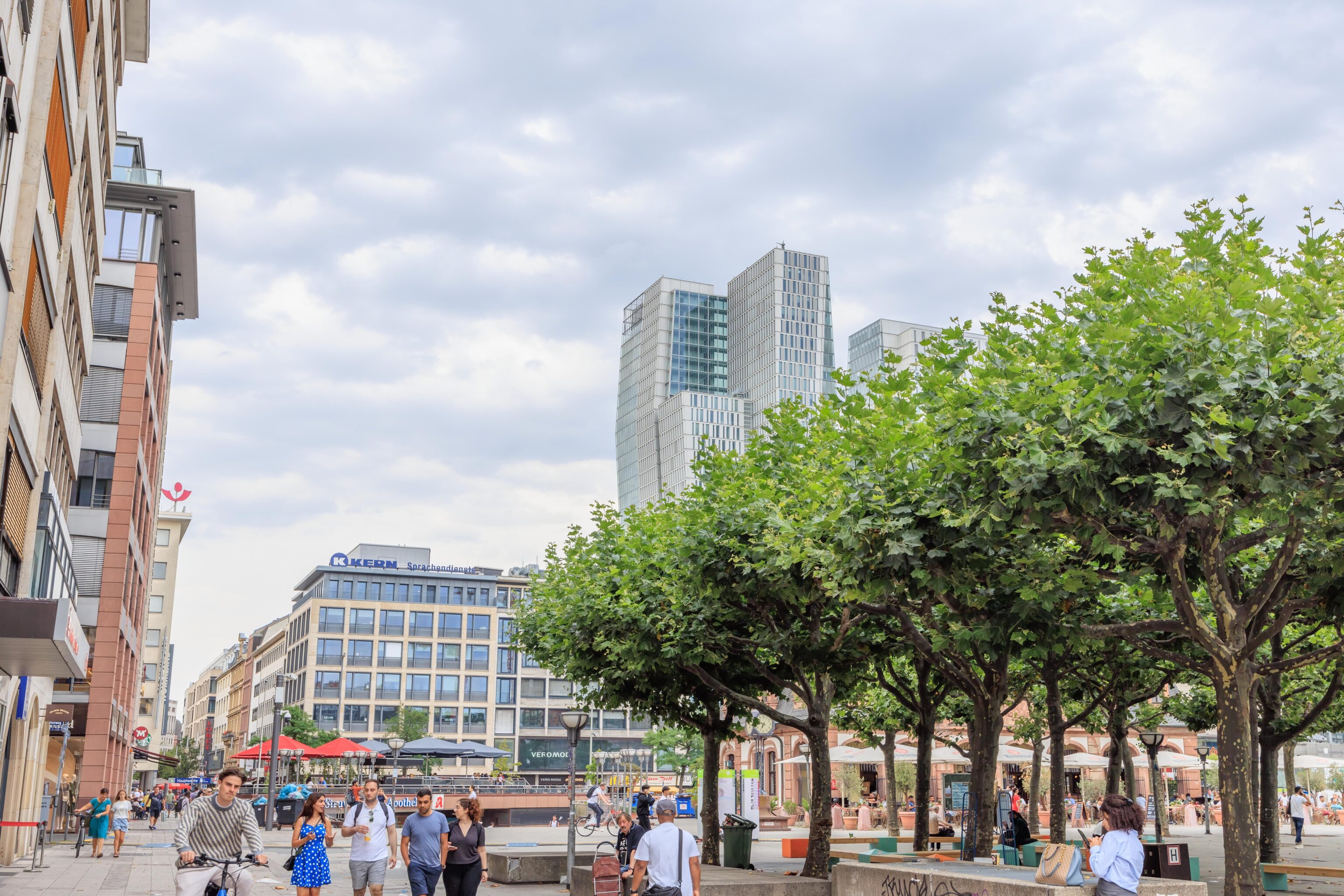
We then walked over to the Hauptwache. Much nicer with people everywhere and leaves on the trees! There was also a protest taking place here. It was a bit louder with slogans being shouted but we had no idea what it was about. There was just a tiny crowd.
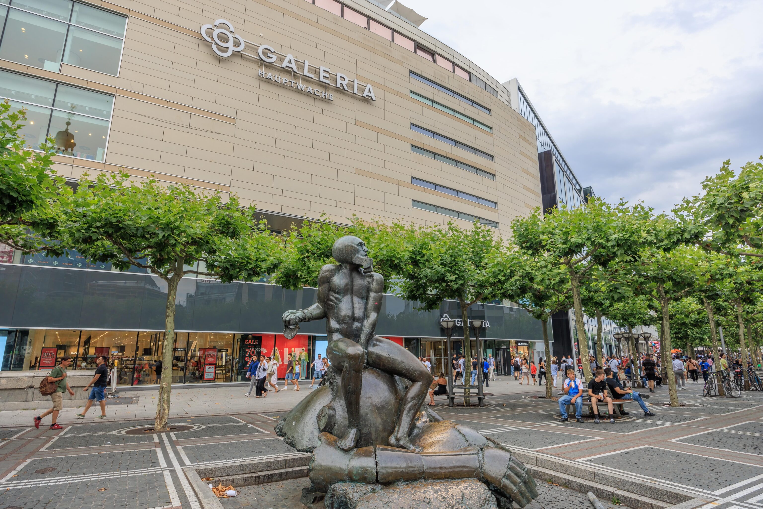
This seems like it should be a water fountain but it wasn’t functional.
We didn’t spend too much time here at the Hauptwache. After taking a quick look around, we headed down into the S-Bahn station to head to our hotel at the airport.
Frankfurt Airport Marriott
We picked the Marriott at the airport due to its location. It is attached to the long distance and regional train stations and the airport. The hotel is actually a combined Marriott and Sheraton, though they do have separate rooms and front desks. The lounges and restaurants are shared between the two.
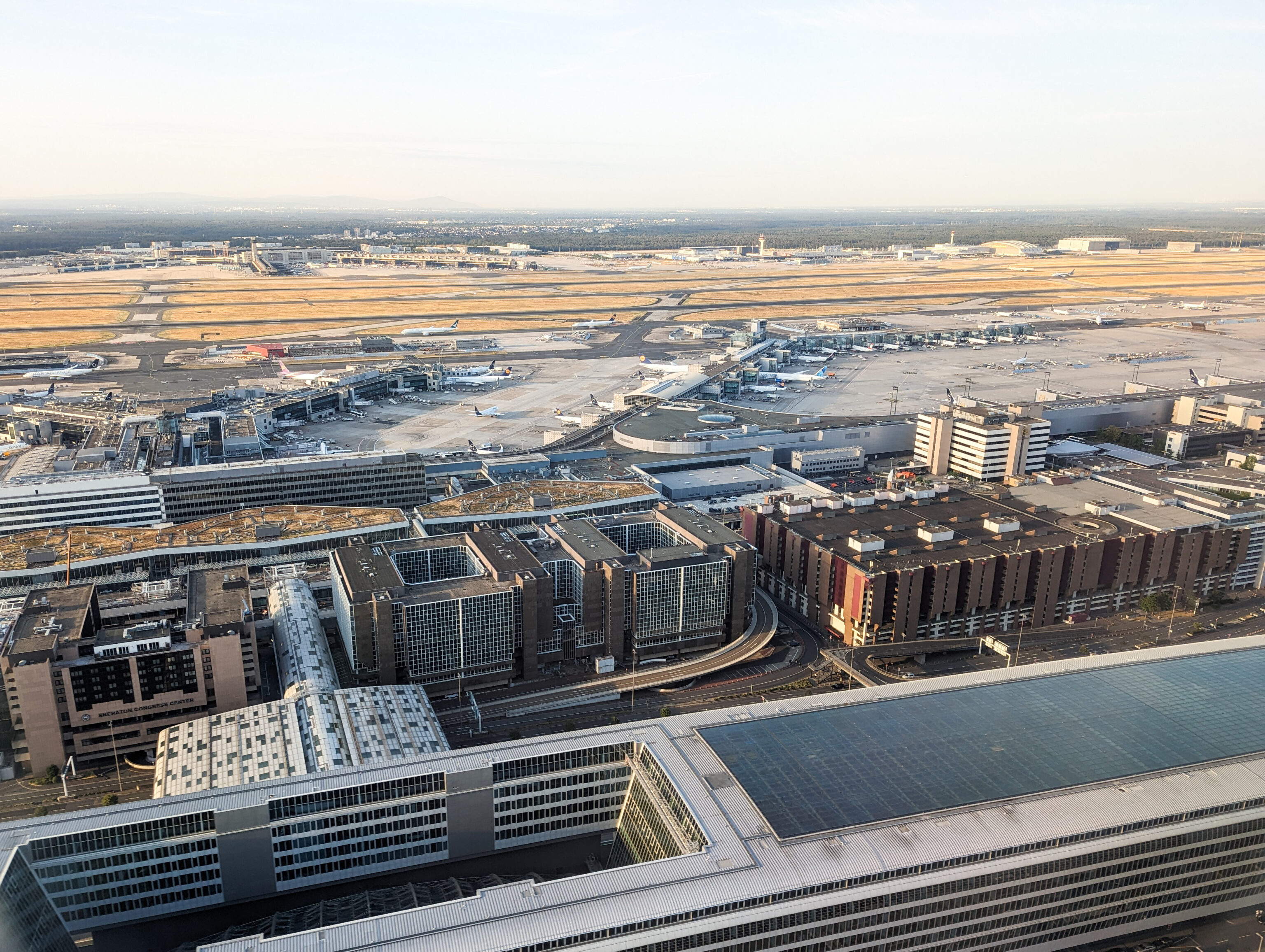
We actually saw the hotel on the way in. It is the building on the left with the text, Sheraton Congress Center. The hotel was formerly just one Sheraton before being redeveloped into the Marriott and Sheraton combination. The long distance train station is underneath the huge building at the bottom. The regional train station is, more or less, under the hotel.
The Marriott’s M Club is at the top floor while the Sheraton’s lounge is behind the lobby. The M Club is a bit odd as it seems to be placed directly in the hallway rather than being in a dedicated room. The Sheraton lounge is larger and more standard in design. It has a small selection of hot food in the evenings, though we arrived too late to see the offerings.
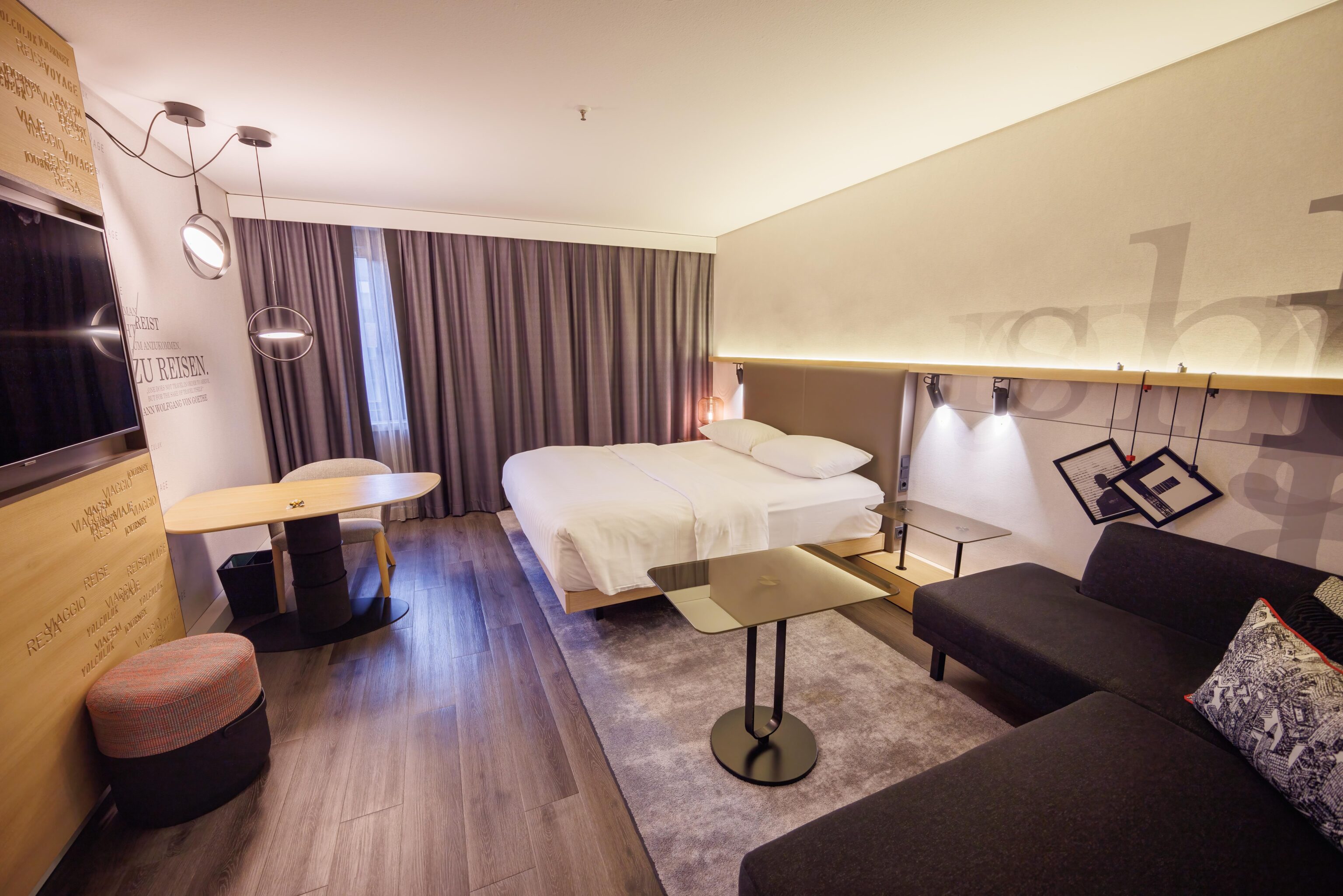
The hotel opened in 2020 after a renovation and still looks new. The design is definitely modern in appearance. The wall has some travel related text including a quote from Johann Wolfgang von Goethe who was from Frankfurt.
There was no view from this room. The lounge, on the 9th and highest floor, has a north-facing view of the long distance train station, though there isn’t really much to see. It doesn’t seem like the building is tall enough to have much of a view in any direction.
We booked a standard Deluxe room and received an upgrade to an Executive room at check-in, though the rooms are likely exactly the same with the only difference being the Executive rooms include club access, which we receive regardless of the room we’re in due to having Platinum or higher status with Marriott’s Bonvoy program.
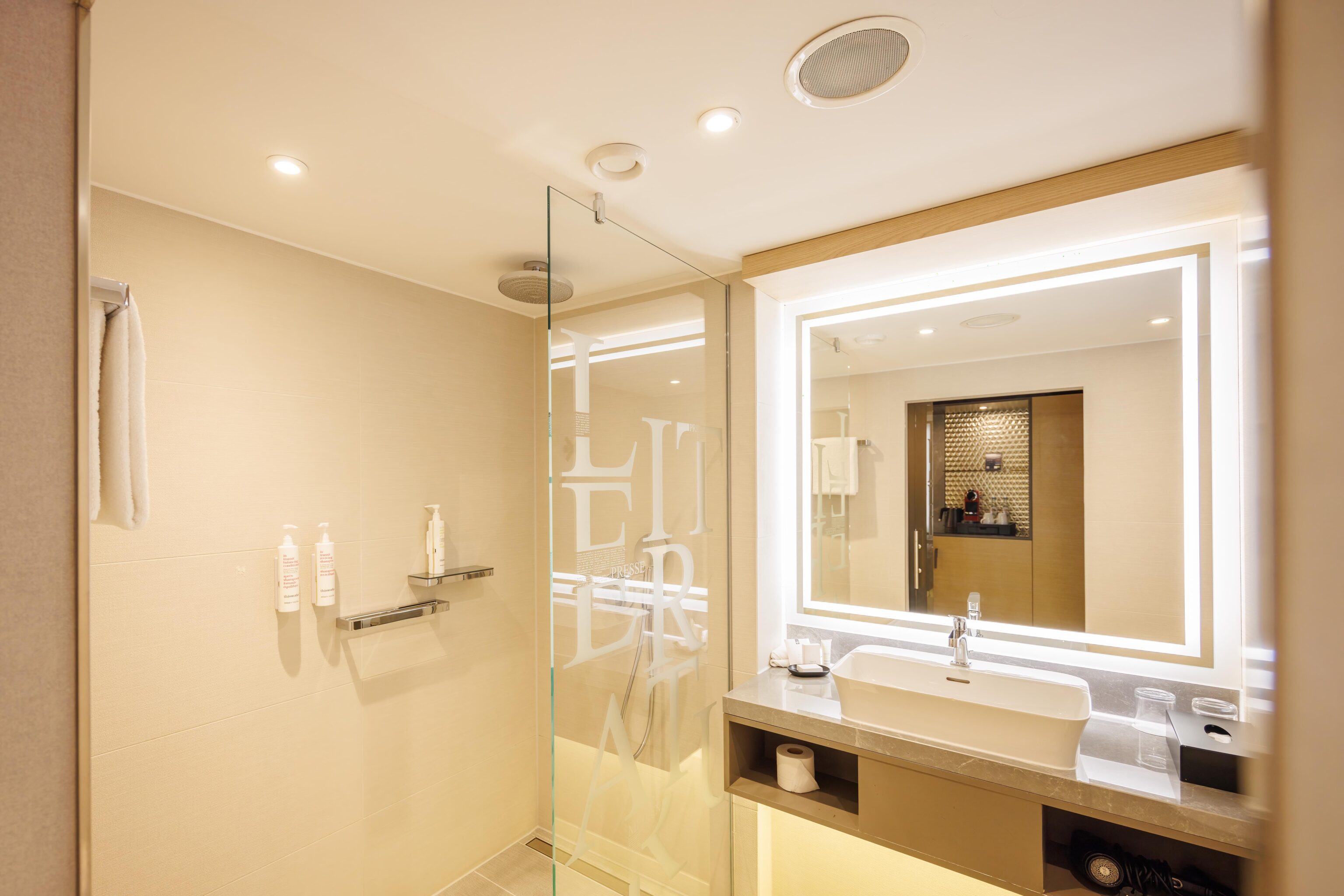
The bathroom has a very typical modern Marriott appearance. It has soap, shampoo, and conditioner bottles glued to the wall, though one of them was no longer attached. The text on the glass reads, literatur, German for literature. Not really sure why, perhaps due to nearby Mainz being the home of Johannes Gutenberg, inventor of the moveable type printing press? While we did visit Mainz back in March, we were there on a day when the Gutenberg Museum was closed so did not get to see it.
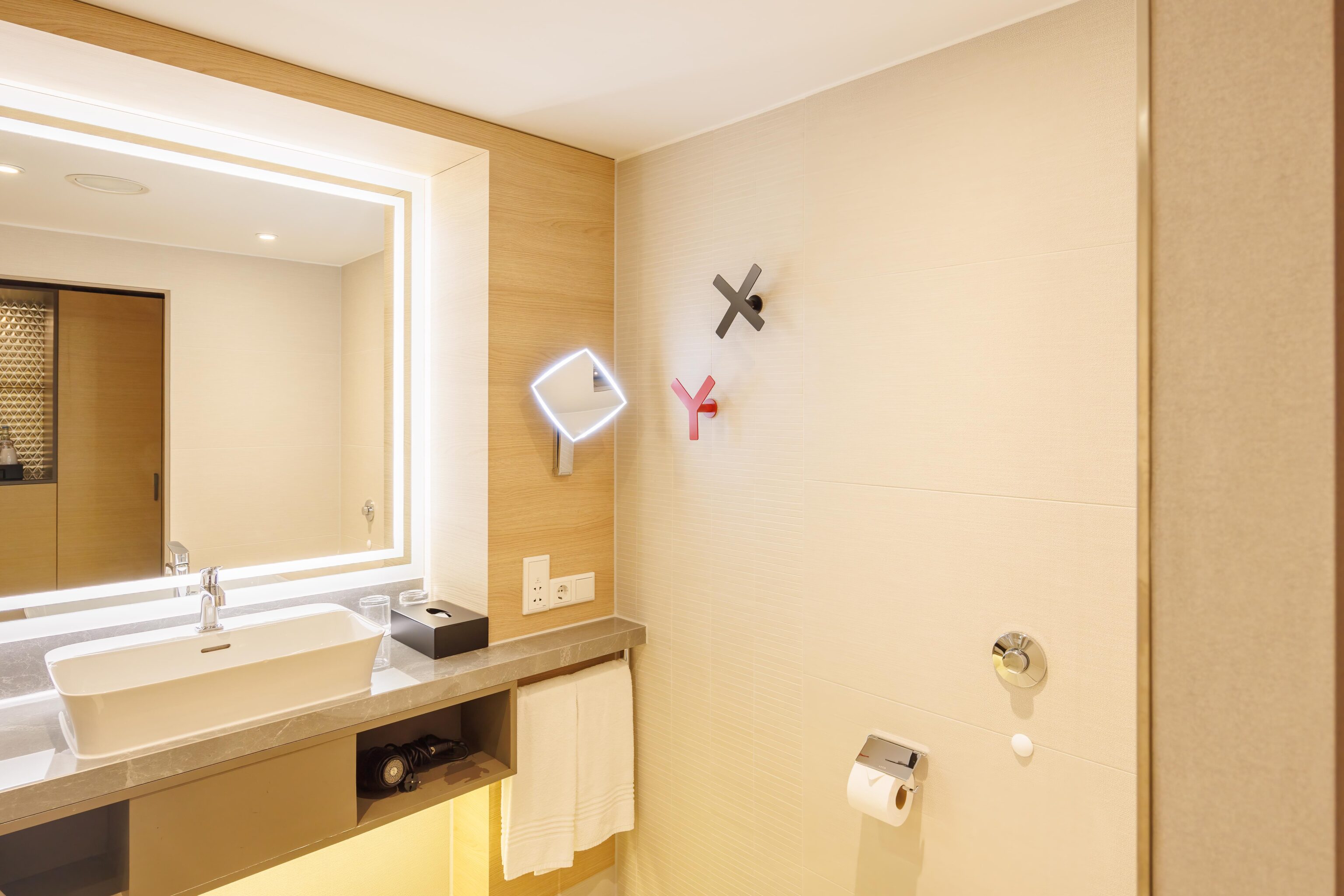
X and Y hooks on the walls for towels or bath robes.