We headed out for a road trip through a bit of southern Utah and northern Arizona along Route 89 and 89A. Route 89 and its alternate routing meet in Utah in the town of Kanab and in Arizona near the town of Page. There are quite a few interesting sights to see along the way, plenty more than can be visited in a day! Though, having a knee injury means many of the sights were unfortunately off the table for this trip.
Glen Canyon Dam
The construction of the Glen Canyon Dam on the Colorado River just north of Page, Arizona, resulted in the creation of Lake Powell behind the dam. We visited just a small area near the dam.
Lake Powell is the huge lake behind the Glen Canyon Dam. The Wahweep Overlook, located on a hill by Route 89, has a great view of a very small portion of the lake.
There is also some nice mountain scenery all around!
As well as an obscured view of the Glen Canyon Dam and adjacent bridge.
The Glen Canyon Dam has a visitor center that offers tours during normal times. Unfortunately, the entire building is closed due to Covid-19 and tours are currently not offered. The parking lot is open though for close up views of the dam.
There is an overlook downstream from the dam in Page. The view is supposed to be excellent with a clear view of the Colorado River and the dam. Unfortunately, despite my best efforts, I wasn’t able to make it down with my knee injury. While the path down has a metal railing along the entirety of the route, the sloped slickrock wasn’t something I could do. This is the best photo I was able to get!
Horseshoe Bend
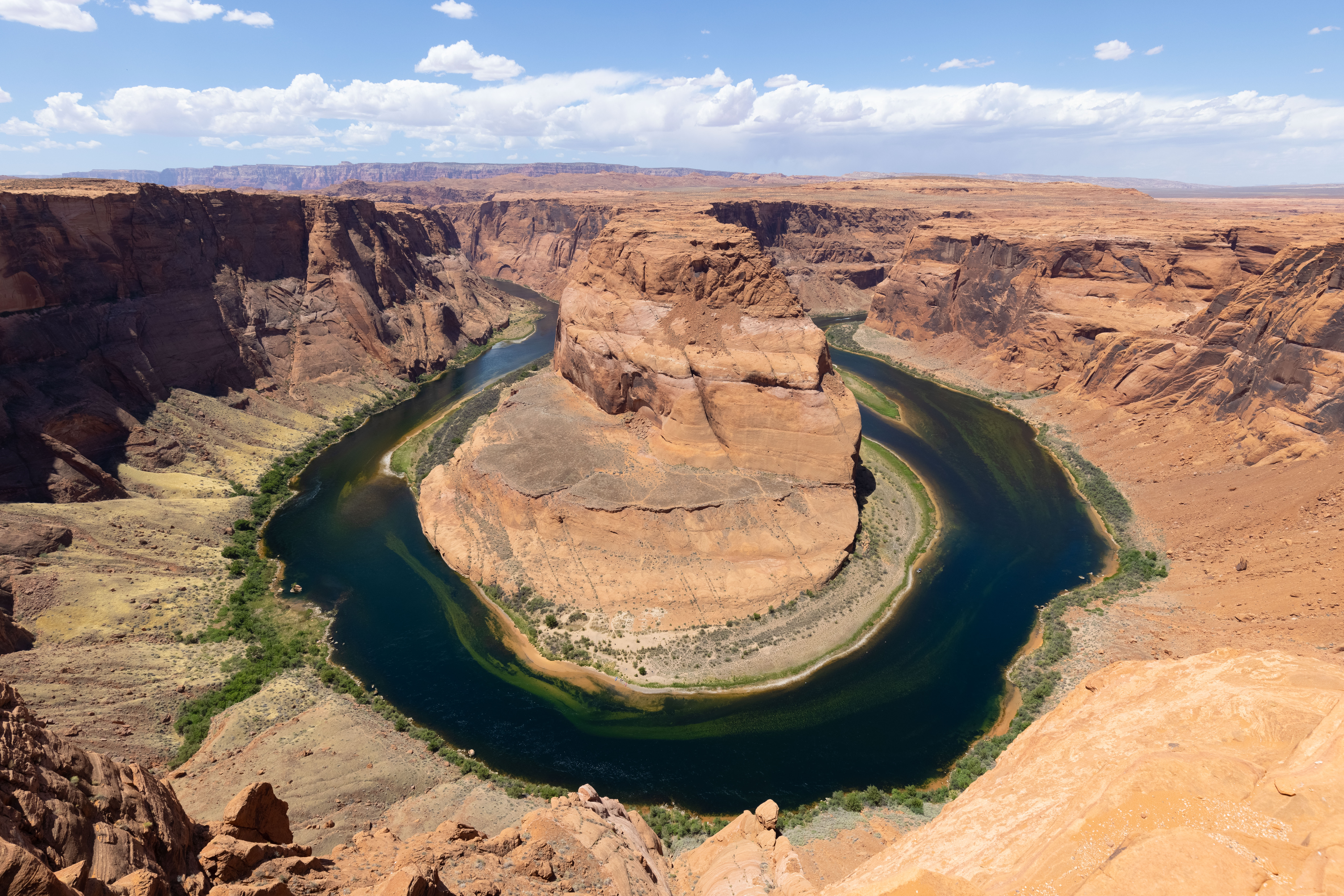
Horseshoe Bend is an extremely famous spot along the Colorado River! While the actual feature is within the boundaries of the Glen Canyon National Recreation Area, parking and access is managed by the city of Page. It’s a pretty ridiculous cash grab by the city at $10 per vehicle and has become quite a tourist trap. Consider that $35 provides access to one vehicle for a week to the Grand Canyon!
This is the most famous view and photo that everyone walks away with! It’s no longer original at all and hasn’t been for a long time now. Until today though, I’ve only seen this scene from above 30,000 feet. The viewpoint has a small area protected by a metal railing but visitors are free to roam the cliffs to either side. Unfortunately not something that can be done safely when walking with a crutch!
Horseshoe bend isn’t really visible until you’re right on the edge of the cliff! This is about all one can see on the short trail that leads to the viewpoint. You can tell there is something there, but no indication of the beautiful view at all!
The paved trail to the viewpoint offers typical Arizona desert views. It is completely exposed but there are three well constructed rest areas with overhangs for shade.
Lees Ferry
Lees Ferry is the entry point into the Colorado River for trips through the Grand Canyon. We watched as one group of rafts, along with two kayaks in the water as well as more kayaks carried on the rafts, started their trip. It looked like a pretty tough start as they had to paddle against very high winds that were blowing upstream! There were many other rafts and boats getting ready as well on the beach.
There were some interesting rock formations on the road down to Lees Ferry caused by rocks that fell from the mountain above. As they hit the ground, the compressed the ground underneath. This compressed ground has resisted erosion more than the rest of the surrounding land resulting in these formations.
Navajo Bridge
Navajo Bridge dates back to the 1920s and crosses the Colorado River downstream from Lees Ferry. A new bridge for vehicle traffic was built parallel to the historic bridge. Currently, there is a small visitor center on the west side and the bridge can be walked across. The views of the Colorado River from the bridge are fantastic!
Vermilion Cliffs National Monument
The Vermilion Cliffs National Monument is a large remote park managed by the Bureau of Land Management. We only visited a very tiny portion of it, primarily to try to find California Condors!
Views of the cliffs that give the Vermilion Cliffs National Monument its name!
We drove 3 miles along House Rock Valley Road, an unpaved road that runs up the west side of the monument, to reach the Condor Viewing Site. California Condors, the largest bird in North America and a species brought back from near extinction, have been reintroduced in this area. They have been living atop the cliffs to the east! We were really happy to be able to see at least 6 or 7 of them, if not more! They were still pretty far away, even with a telephoto lens, and the hot weather didn’t help as heat distortions were negatively effecting photography.
We saw some small bird species as well that were unfamiliar to us. The bird atop the bush appears to be a Cassin’s Kingbird. The second bird that is seen standing on rocks and chasing another bird away appears to be a male Horned Lark.


