


After breakfast at the InterContinental Lyon, we headed down to Vienne by train. Once there, we visited the Cathedral, Musée Gallo-Romain, and various ruins of the Roman Empire, including the city’s Ancient Theatre. We ended the day back in Lyon with dinner at Le Bouchon des Cordeliers.
Morning
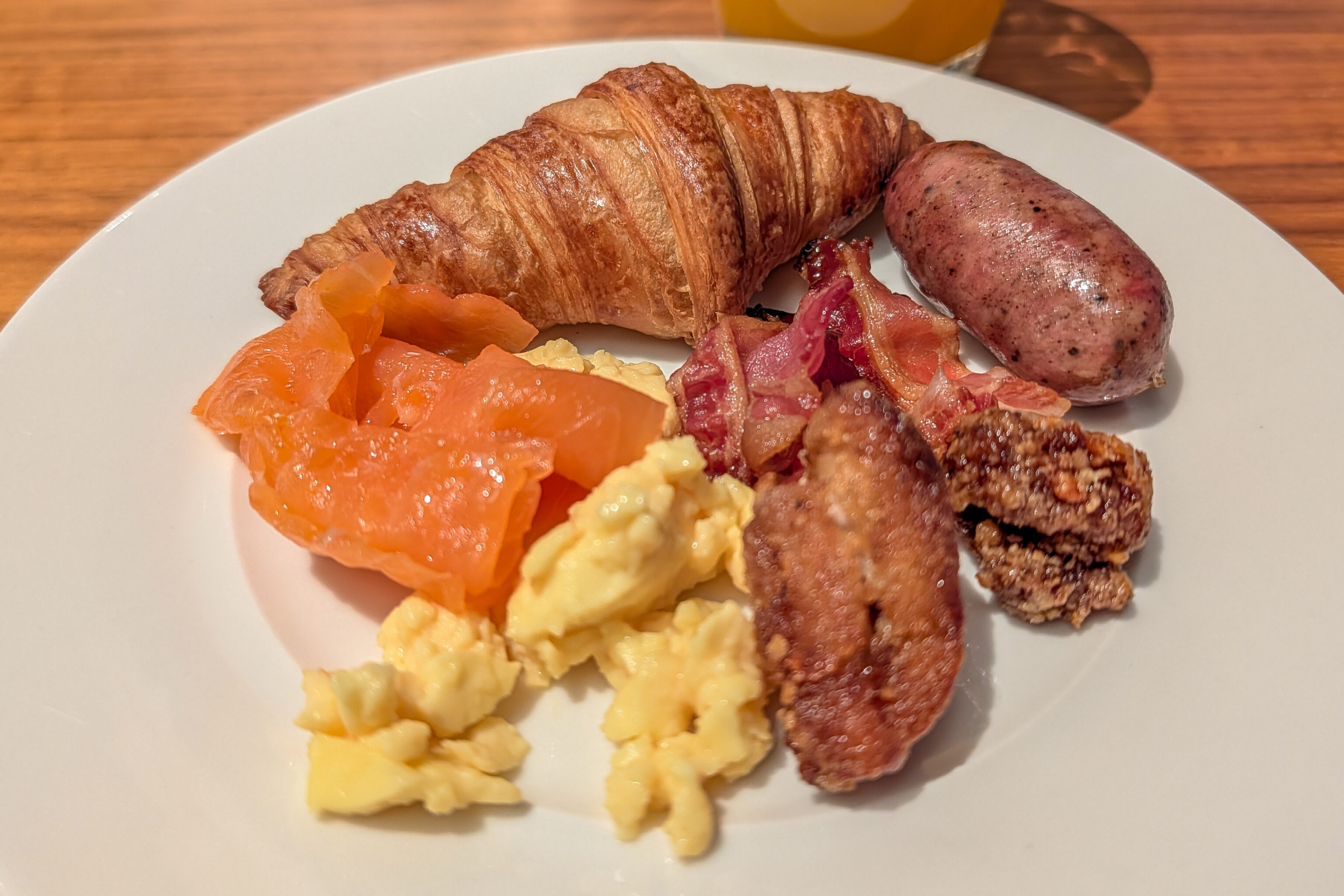
We had our usual breakfast at the InterContinental Lyon Hotel-Dieu in the morning.
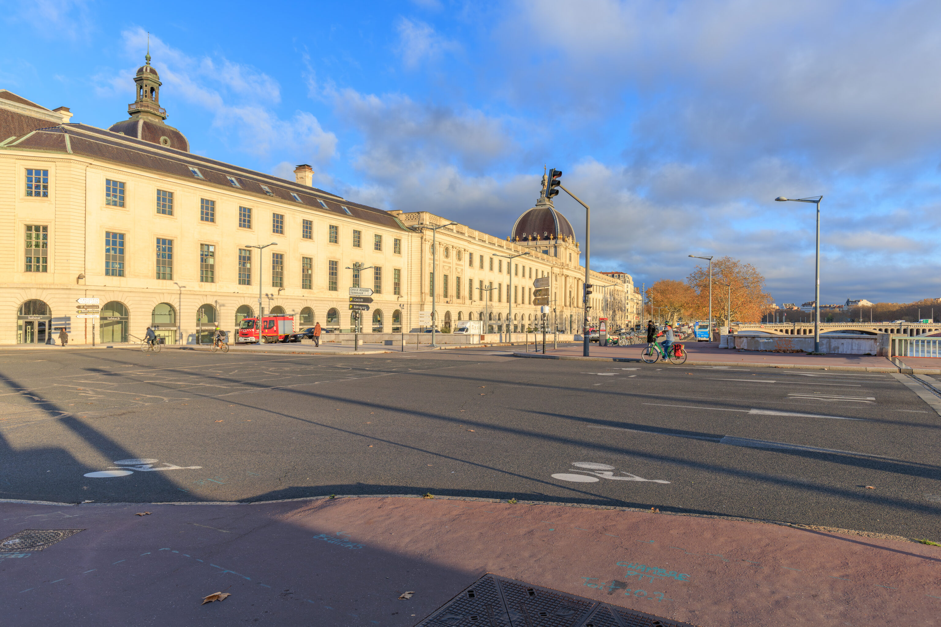
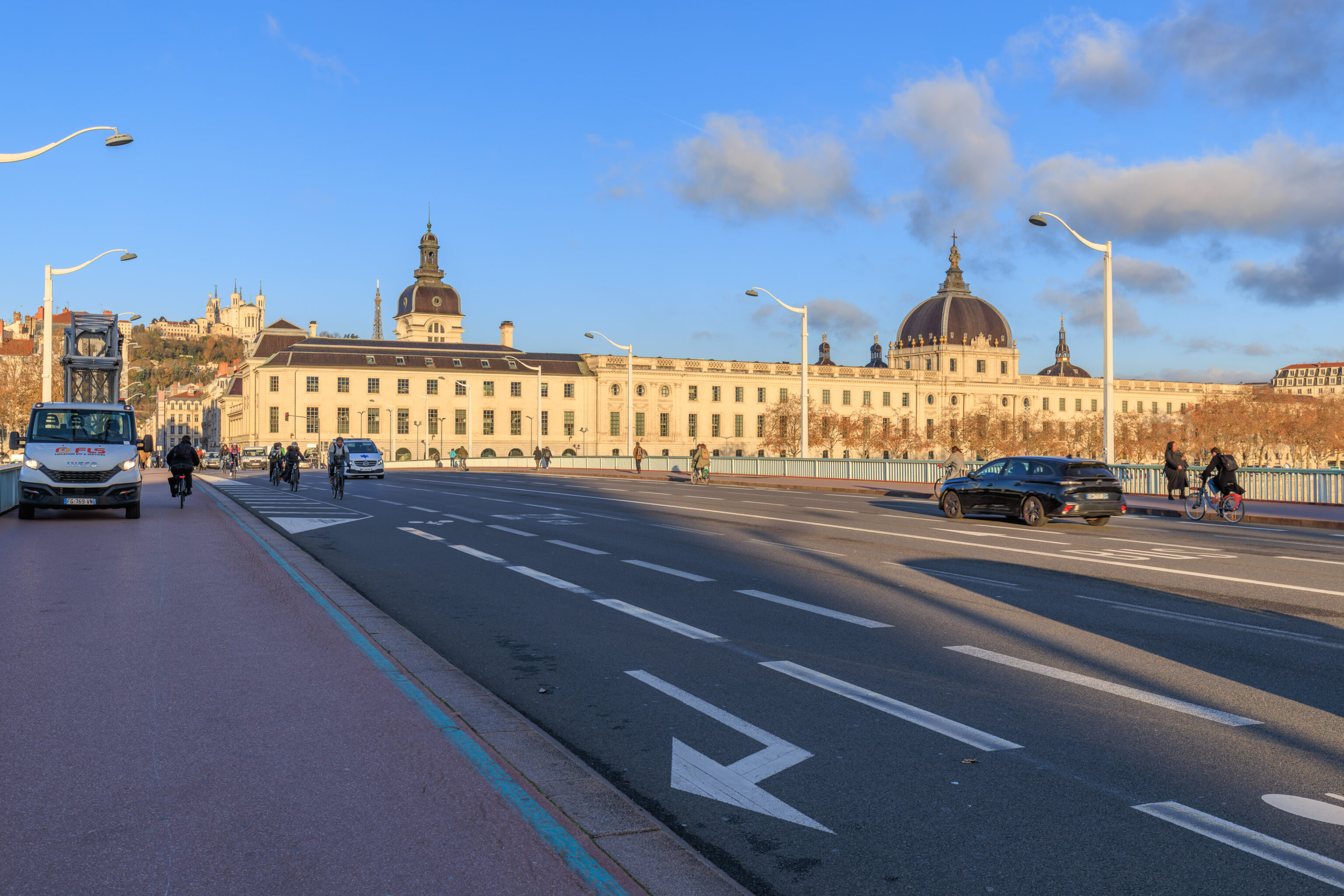
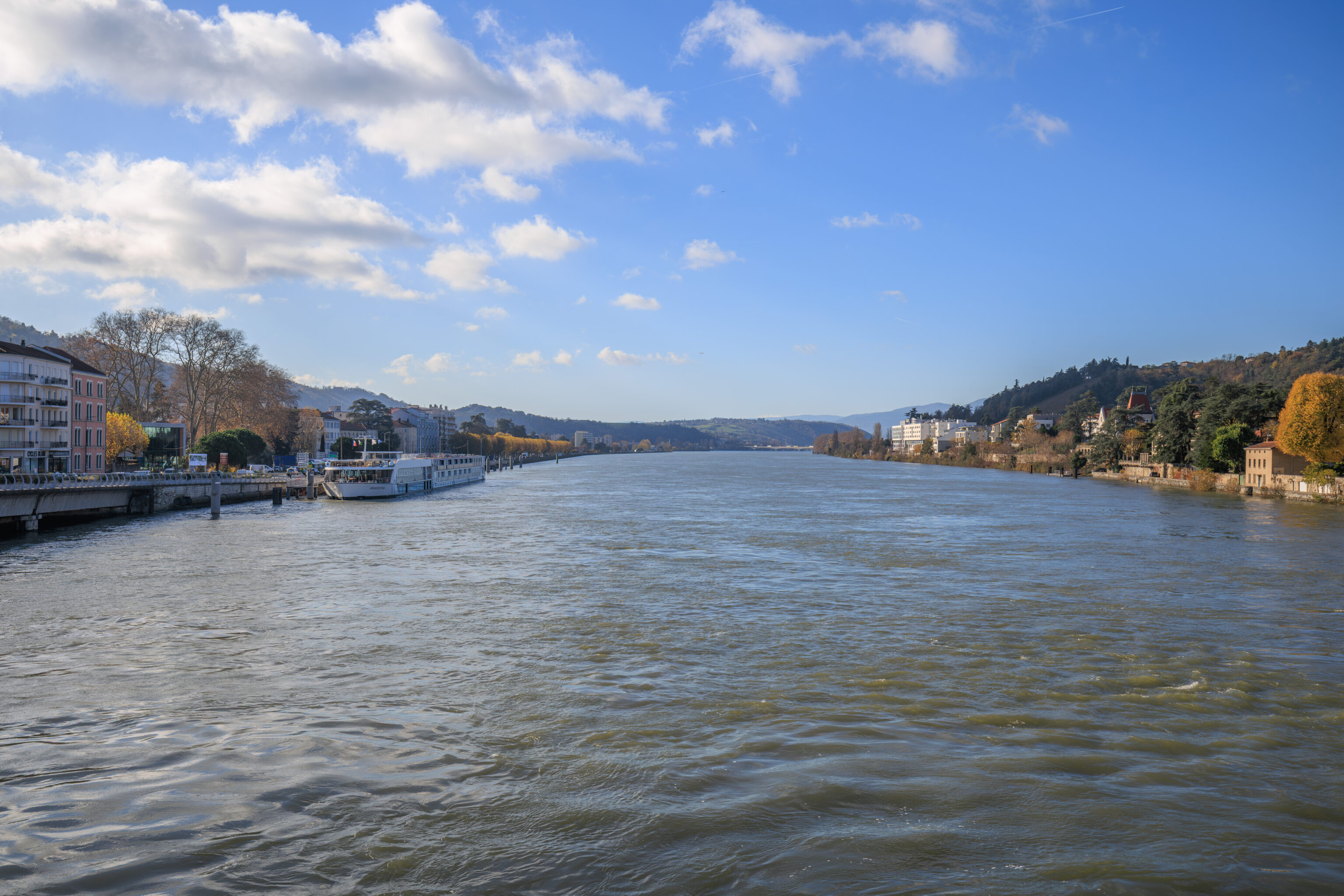
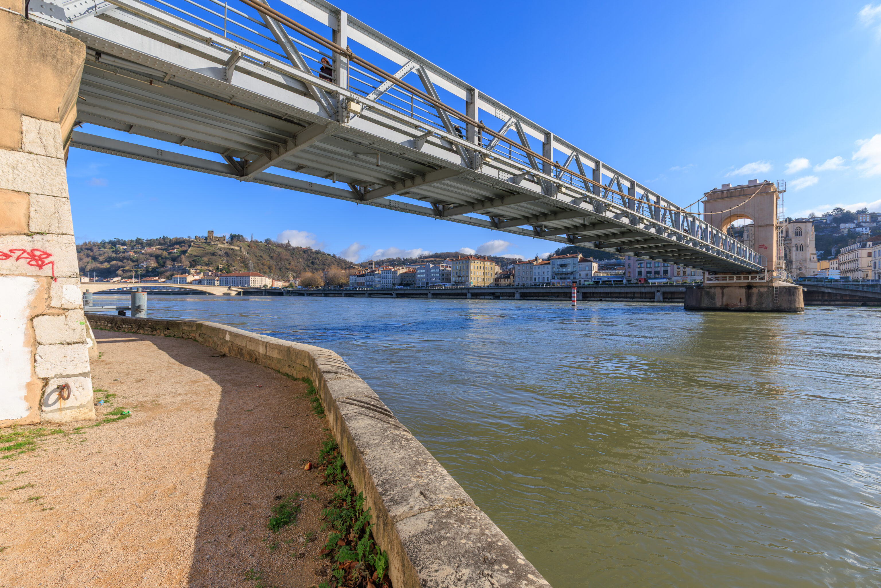
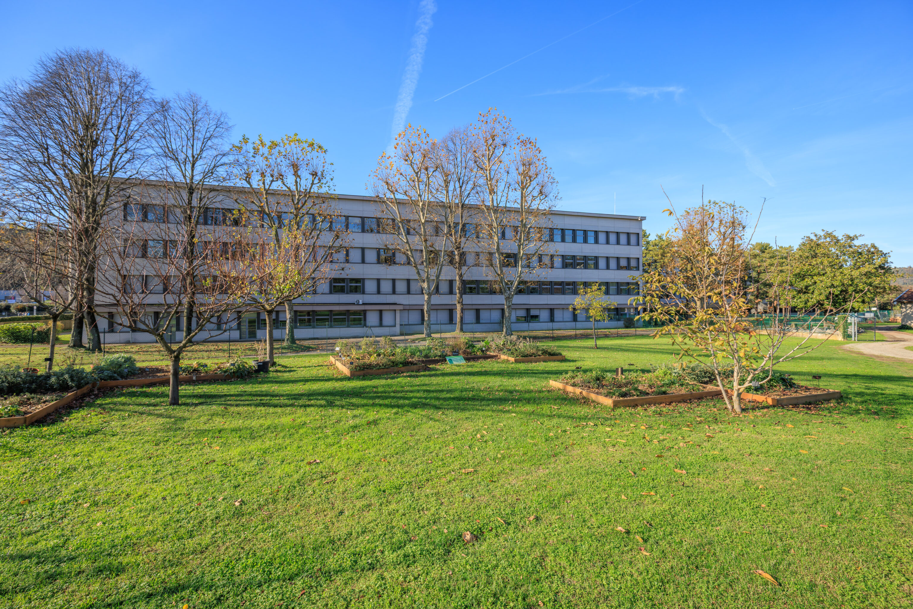
We headed out at around 8:30am to catch the next train to Vienne, a town about twenty minutes away by train. We decided to cross the Rhône via the Pont de la Guillotière, the bridge just to the south of the hotel, seen here from the southwestern corner of the bridge.
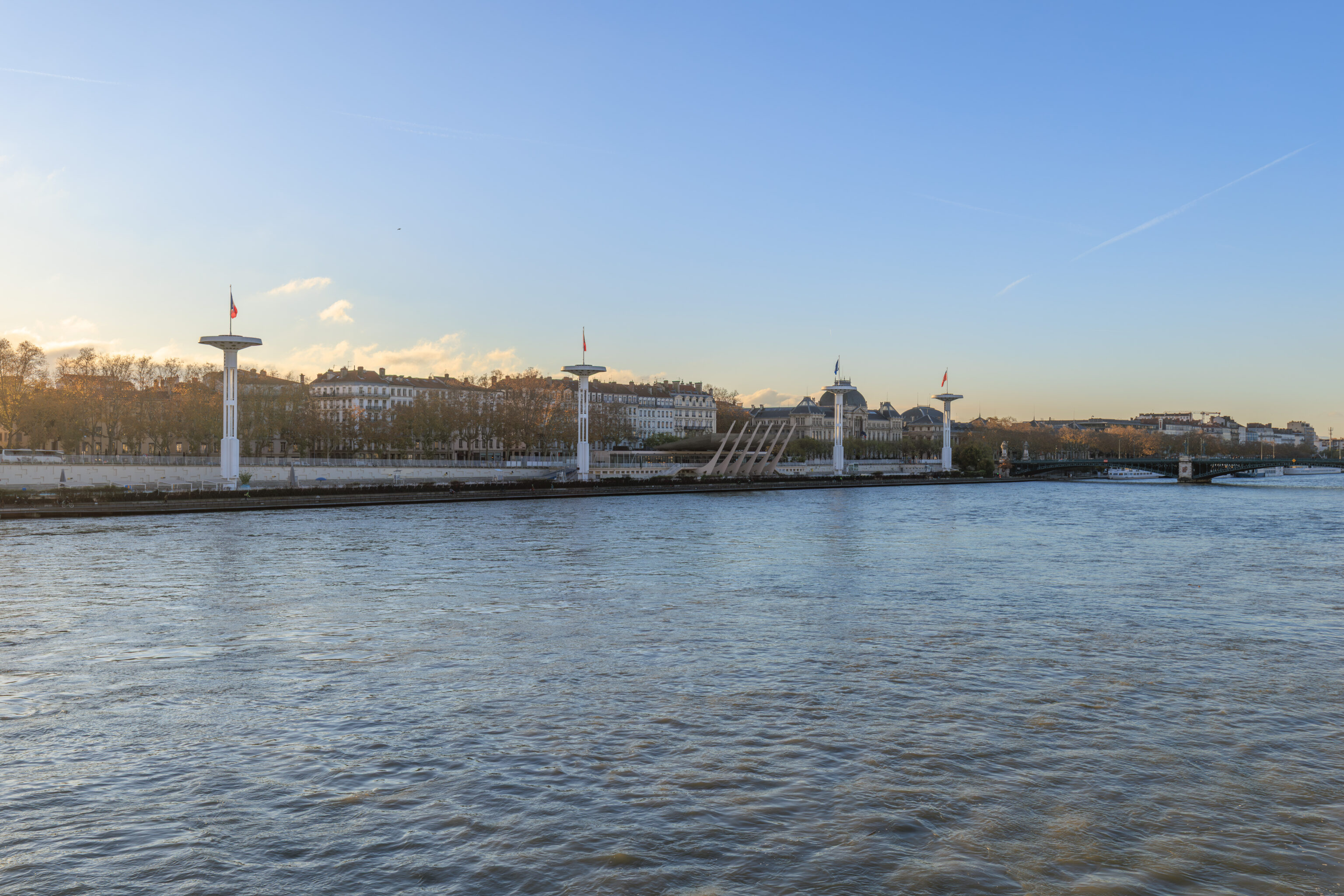
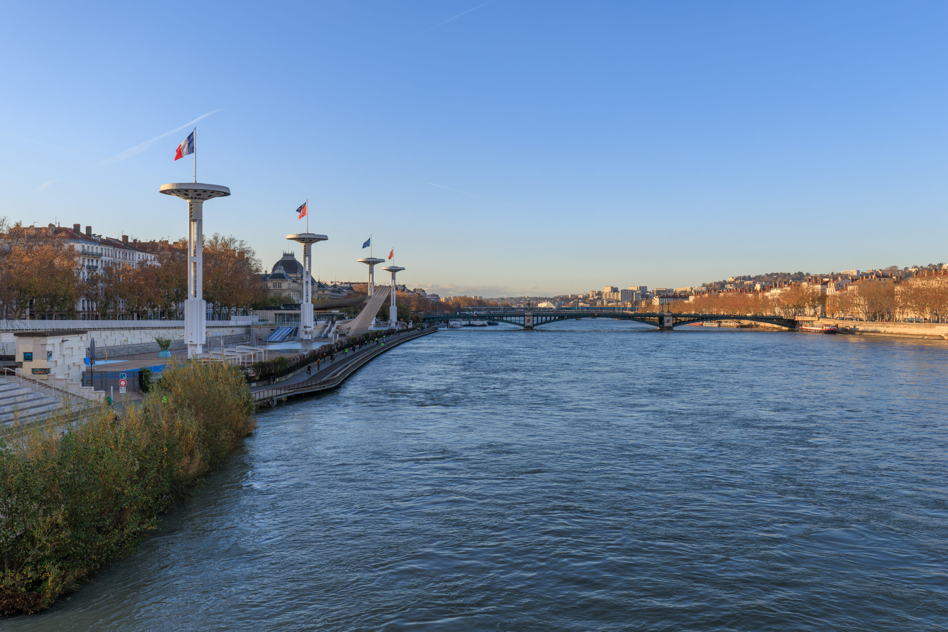
Looking to the south, we had a nice view of the Centre Nautique Tony Bertrand and its four towers.
The view looking back from the far end of the bridge.
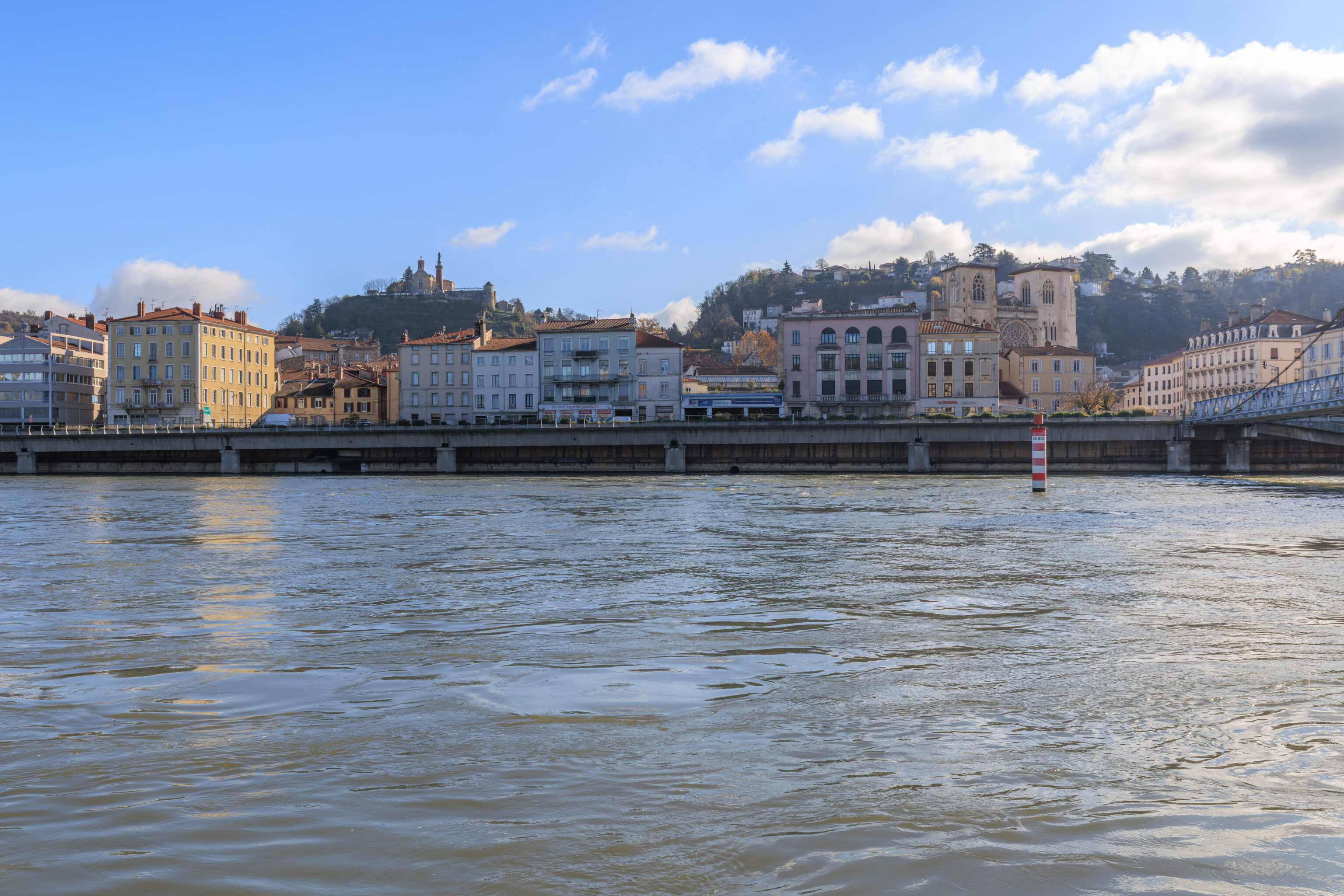
The view looking downstream.
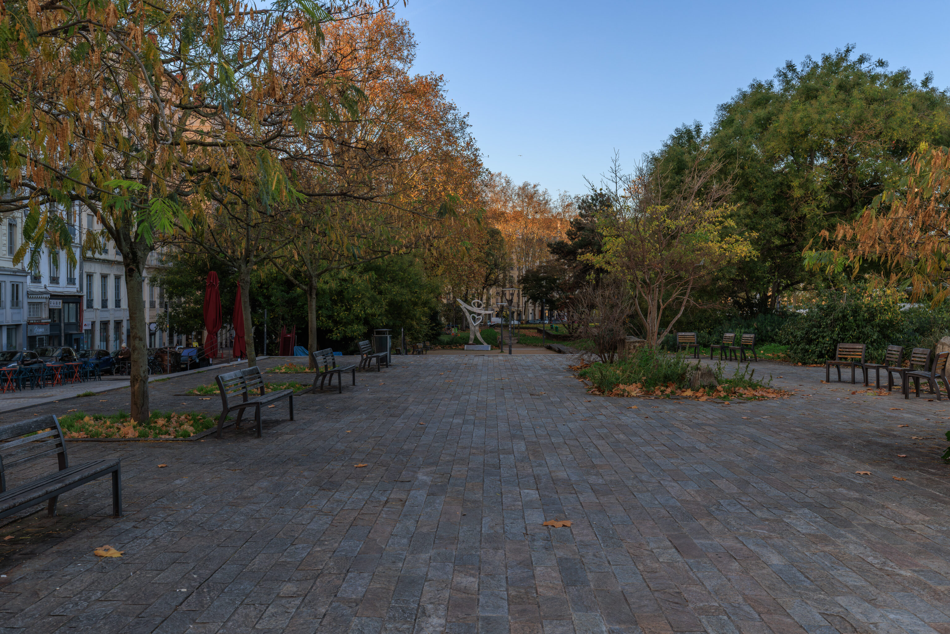
We noticed an interesting sculpture to the south just past the bridge. But perhaps not interesting enough for a closer inspection as we kept on going.
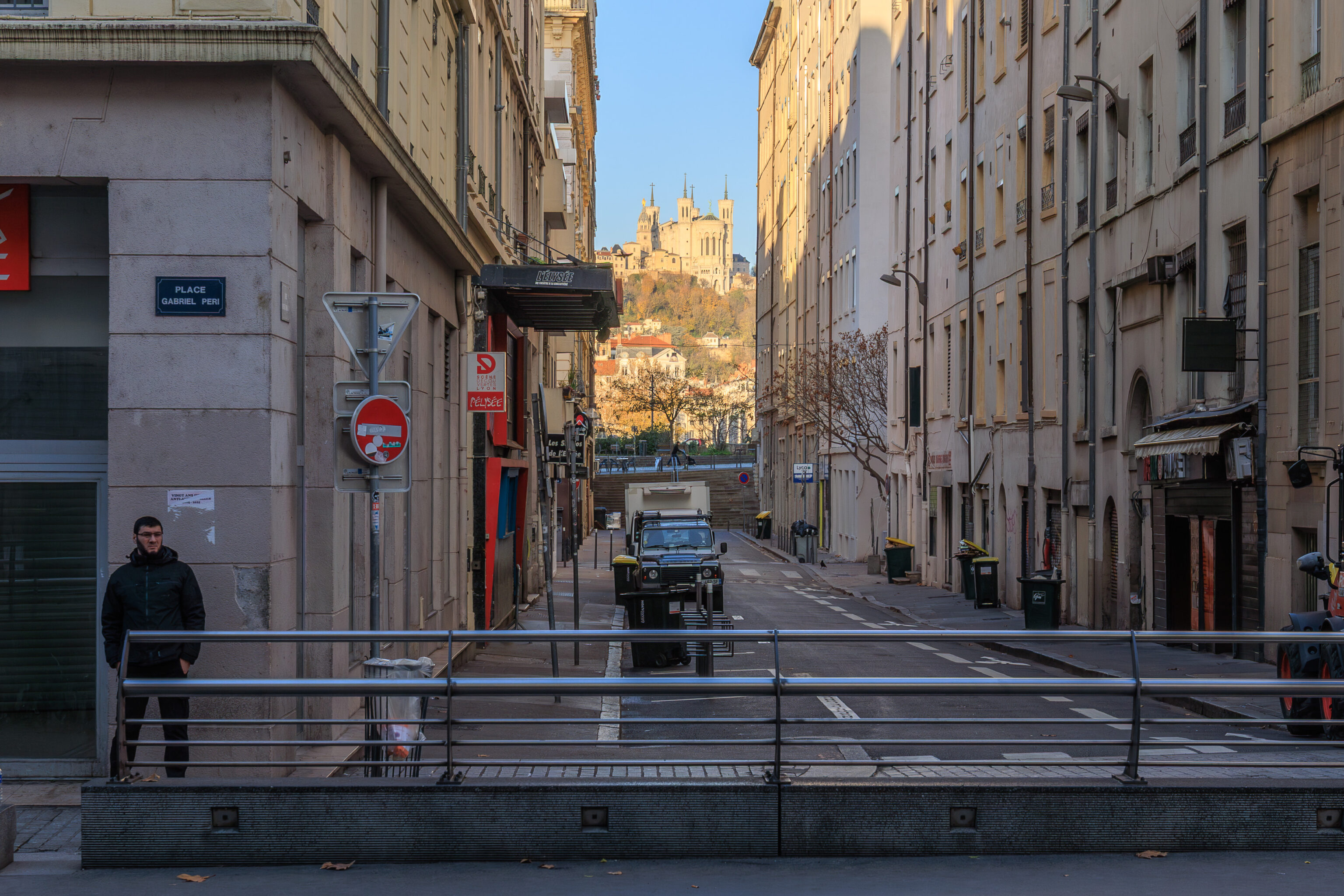
We had a good view from the Guillotière Gabriel Péri tram stop to the west with the Basilique Notre-Dame de Fourvière nicely framed in the background.
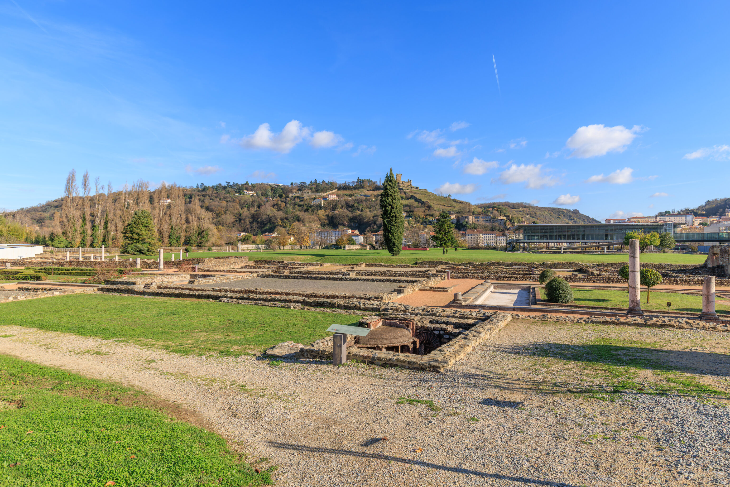
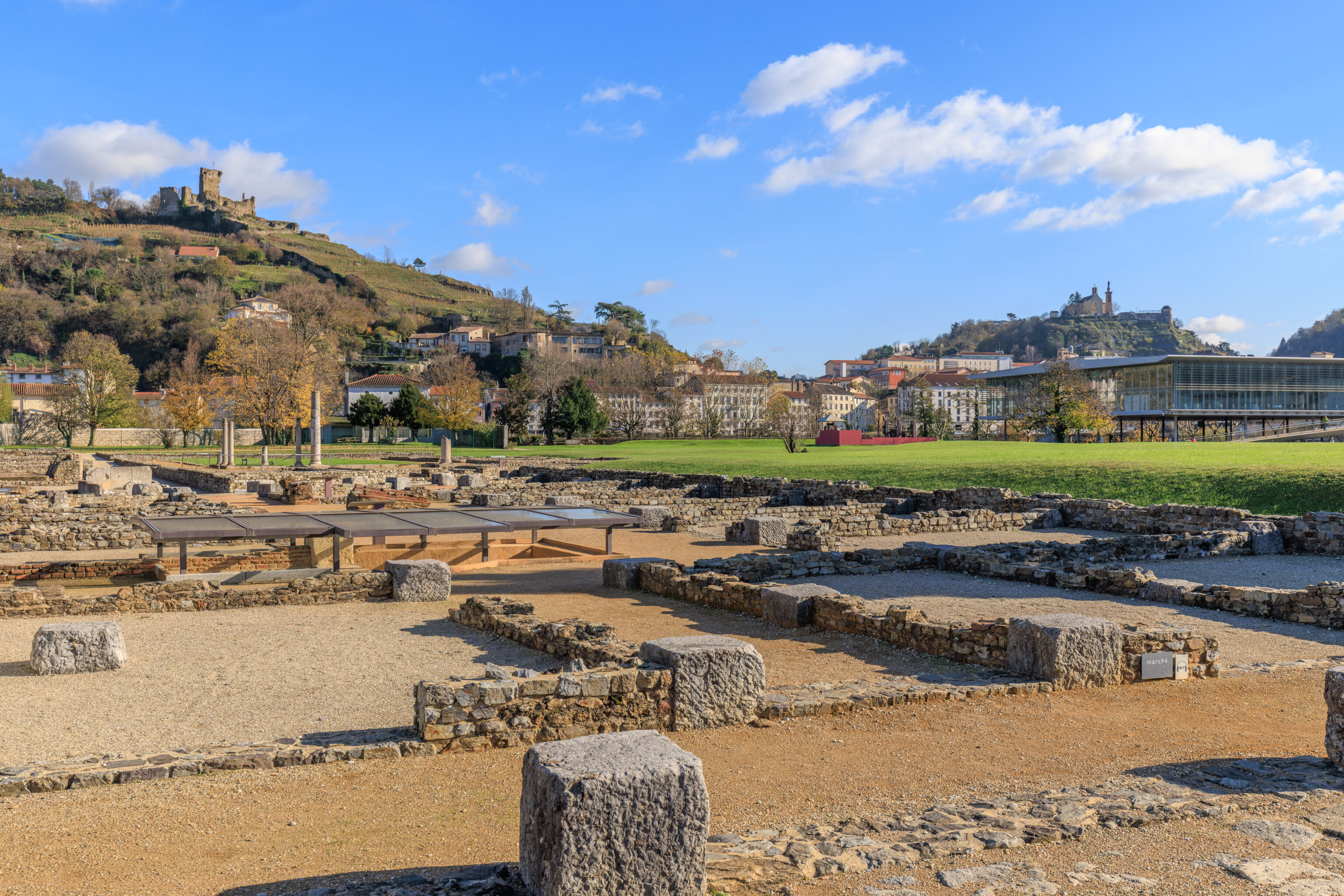
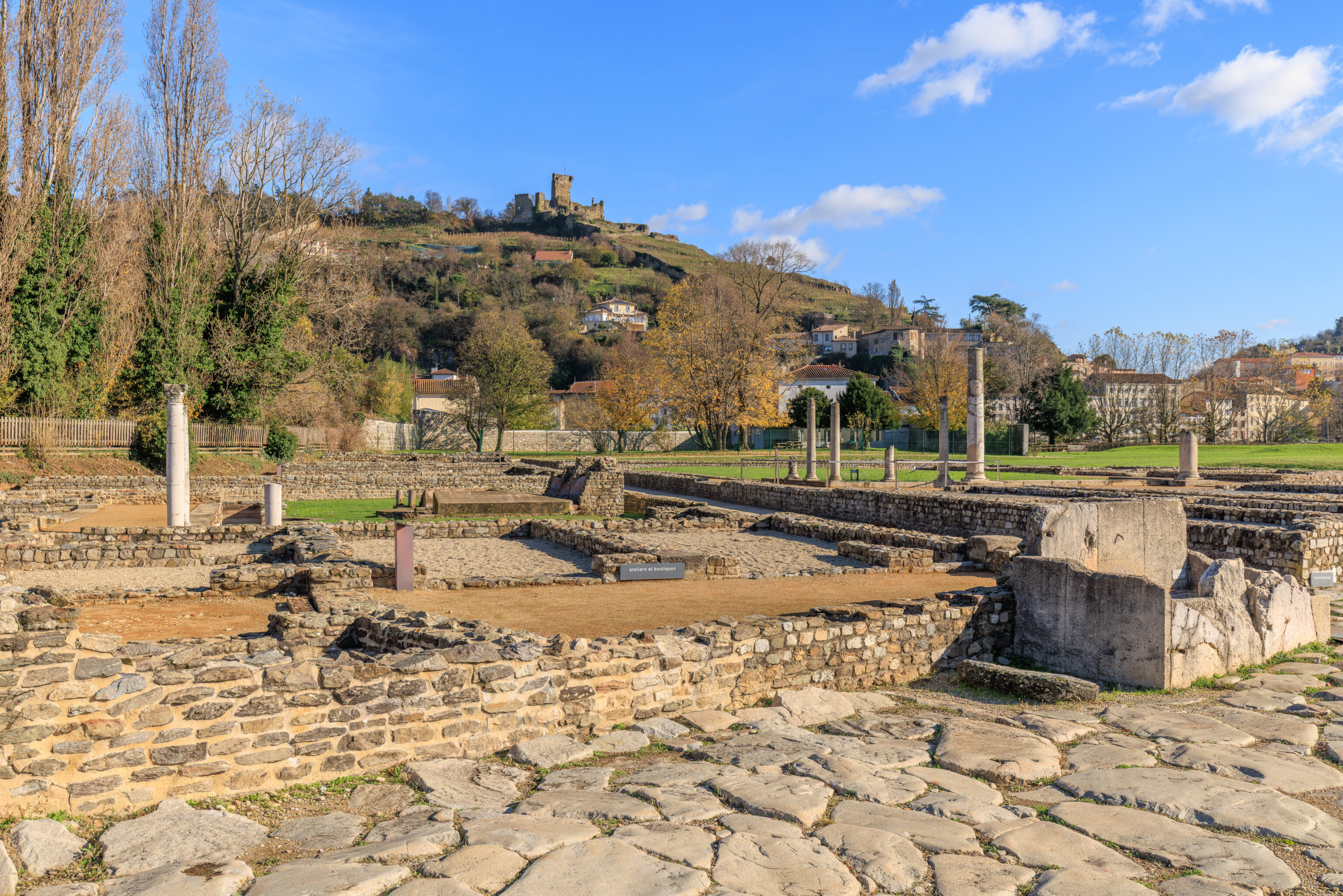
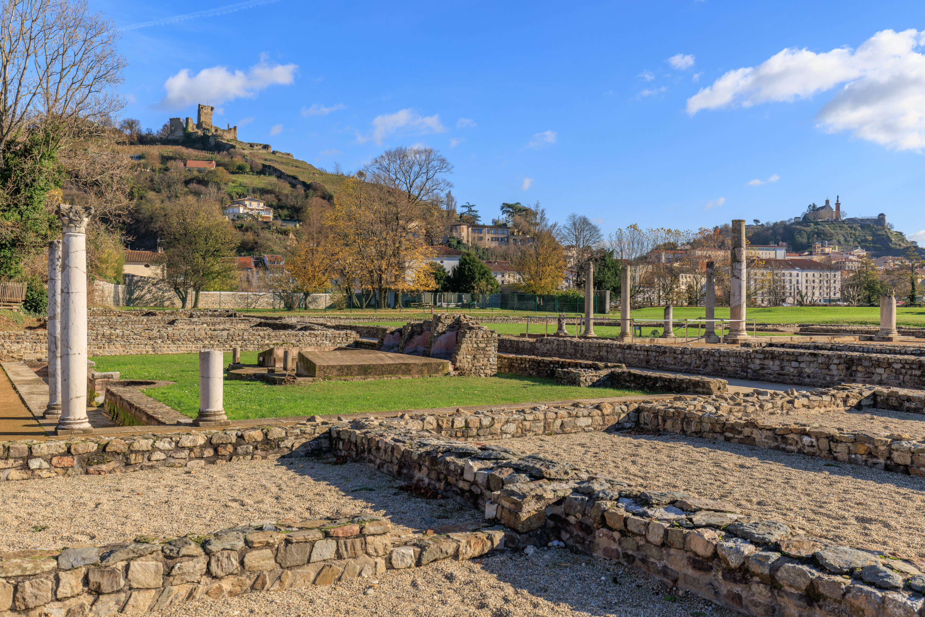
Vienne
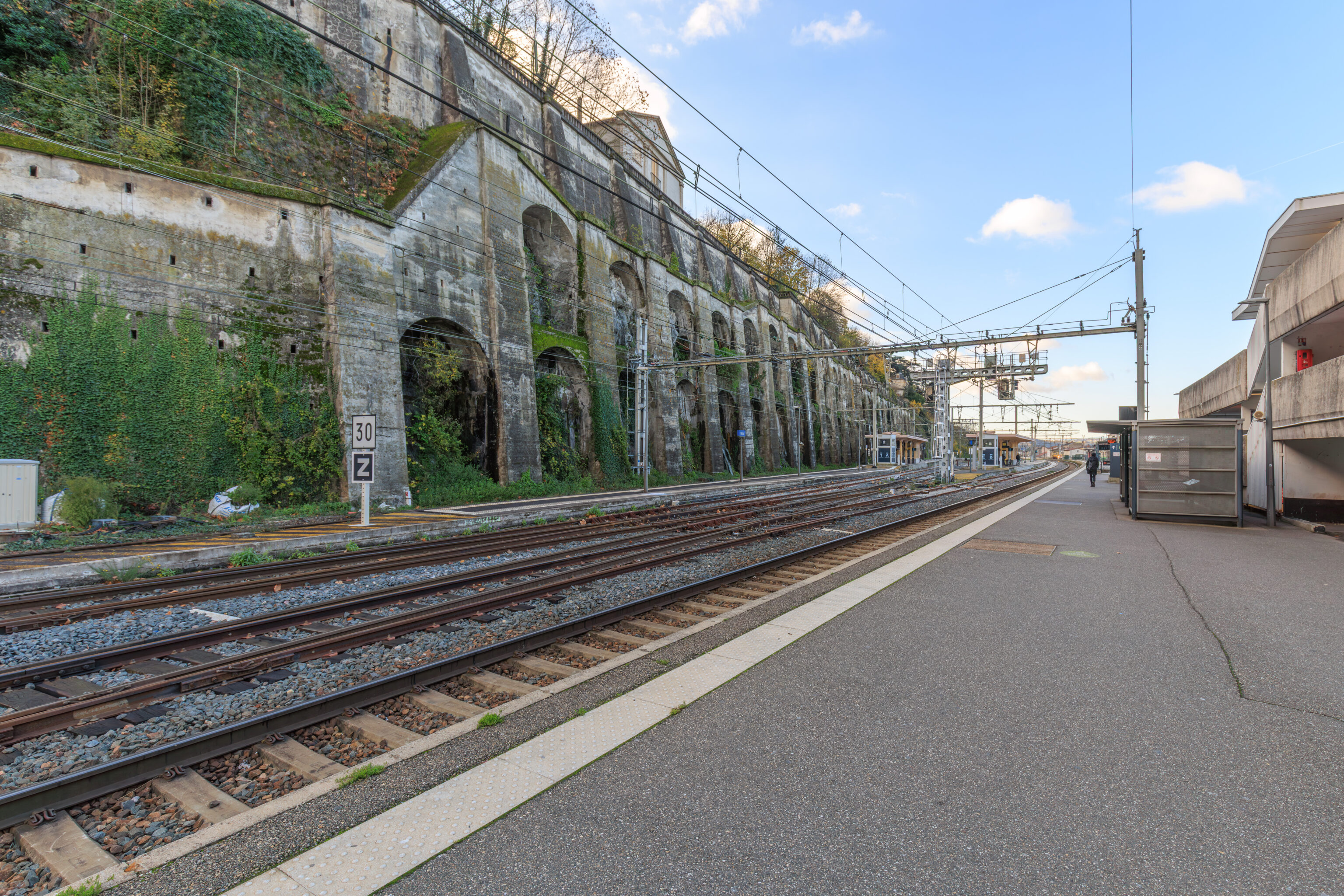
We arrived at Vienne at around 9:45am. The train station sits between a narrow slice of land between the Rhône and this hill to the east.
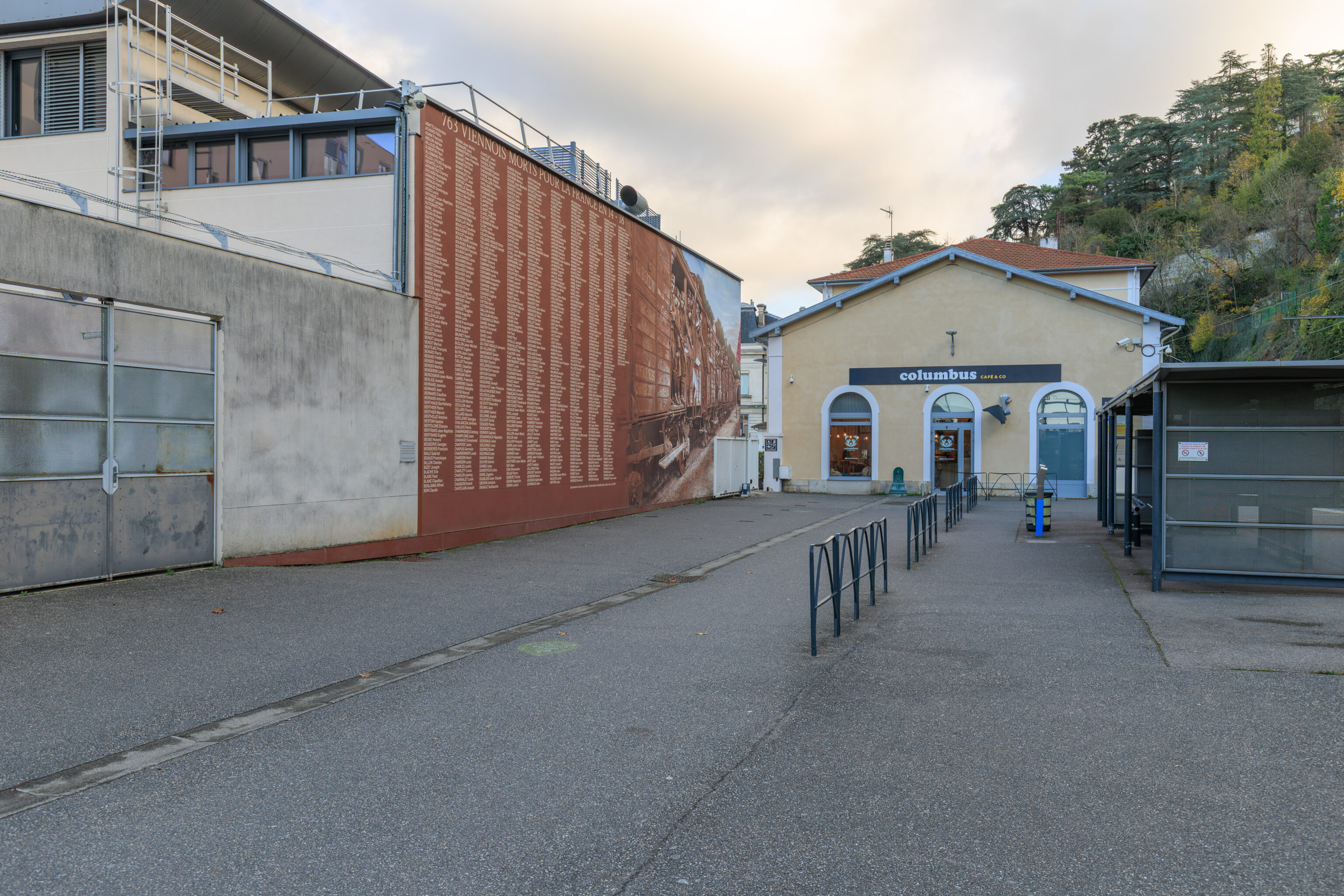
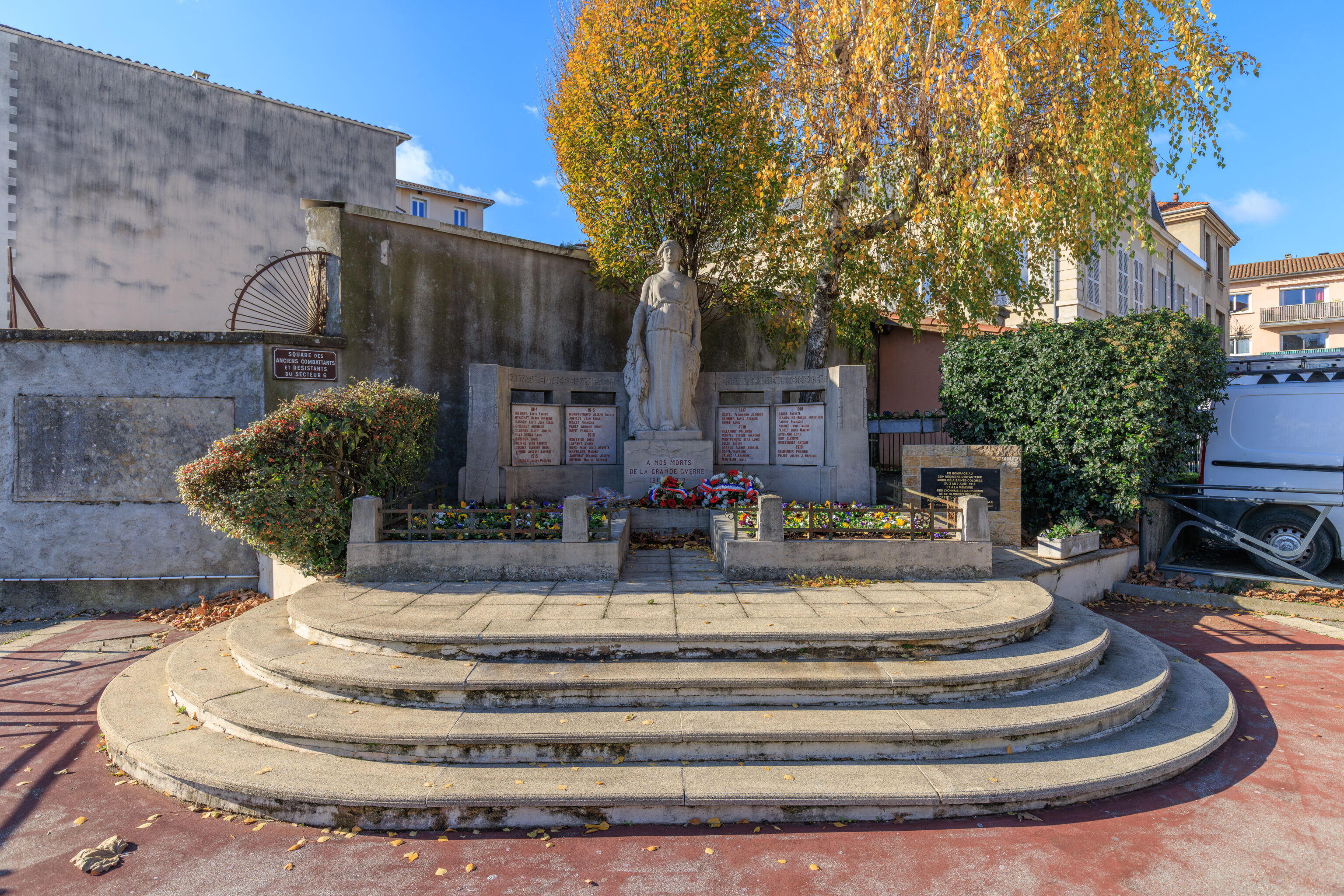
From the train station, we started walking towards the north to visit the first of many historic sites that we are planning to visit. The mural on the left is a memorial to the 763 residents of Vienne who died during World War I.
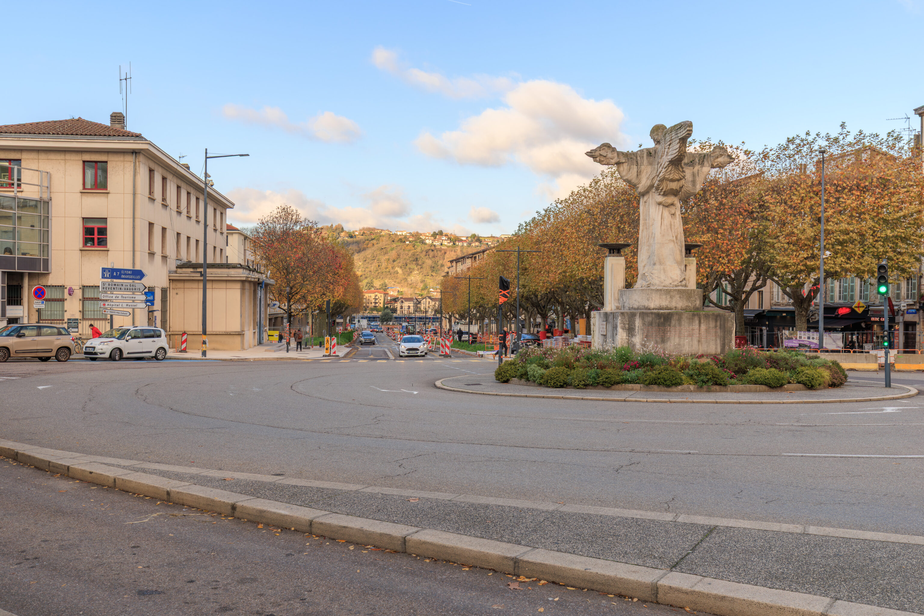
We passed by a traffic circle by the station with a winged statue in the middle. This statue is a World War I monument created in 1923.
We visited La Gâterie Adrien Bachelier, a pastry shop near this circle. We ended up buying snacks for later in the day.
Temple d’Auguste et de Livie
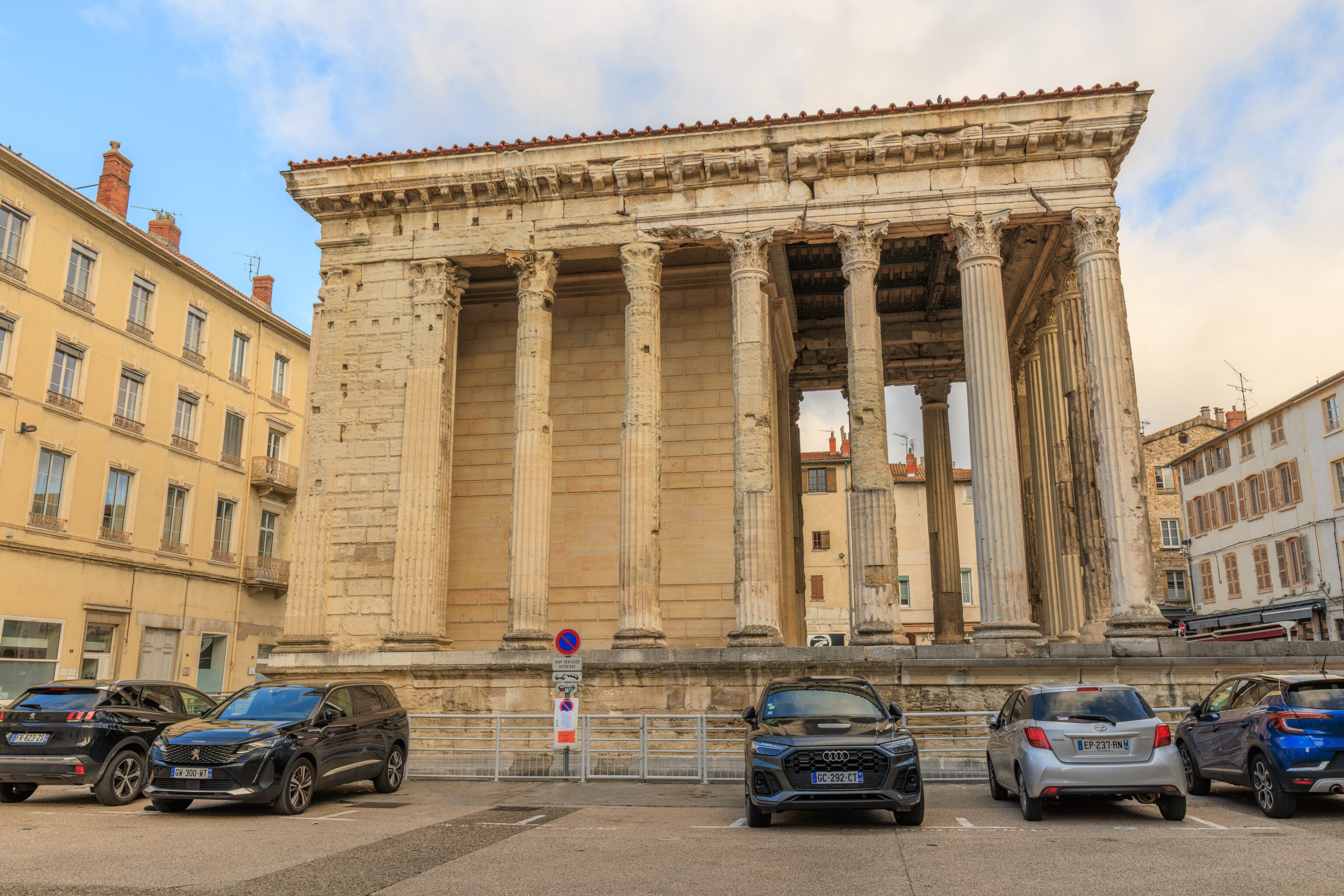
We continued walking down a city street to reach the Temple d’Auguste et de Livie (Temple of Augustus and Livia).
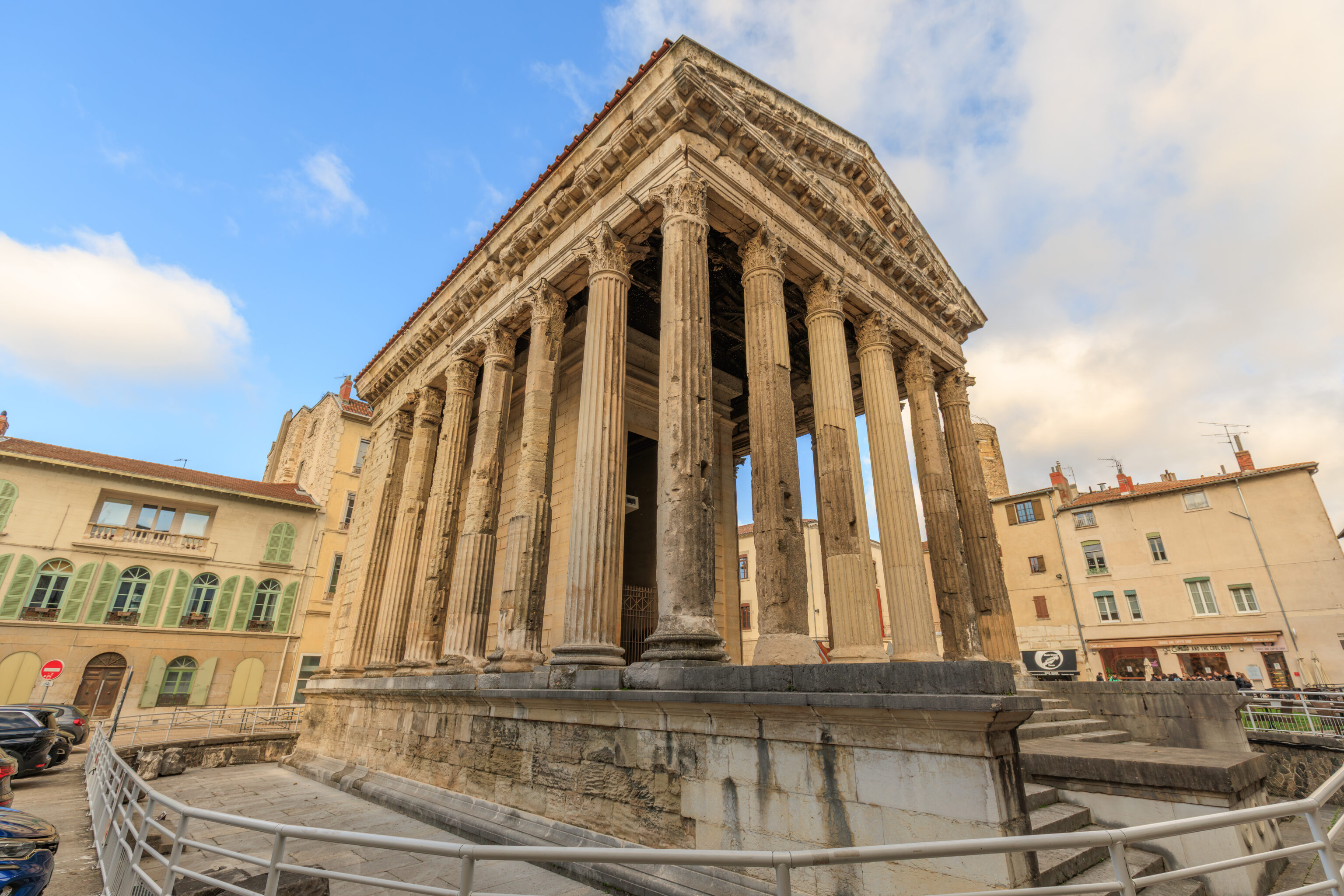
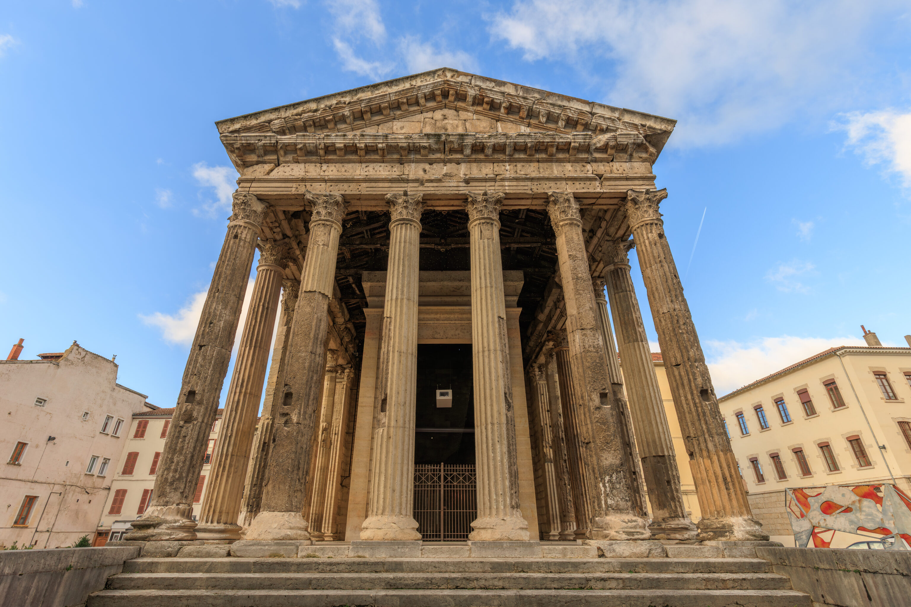
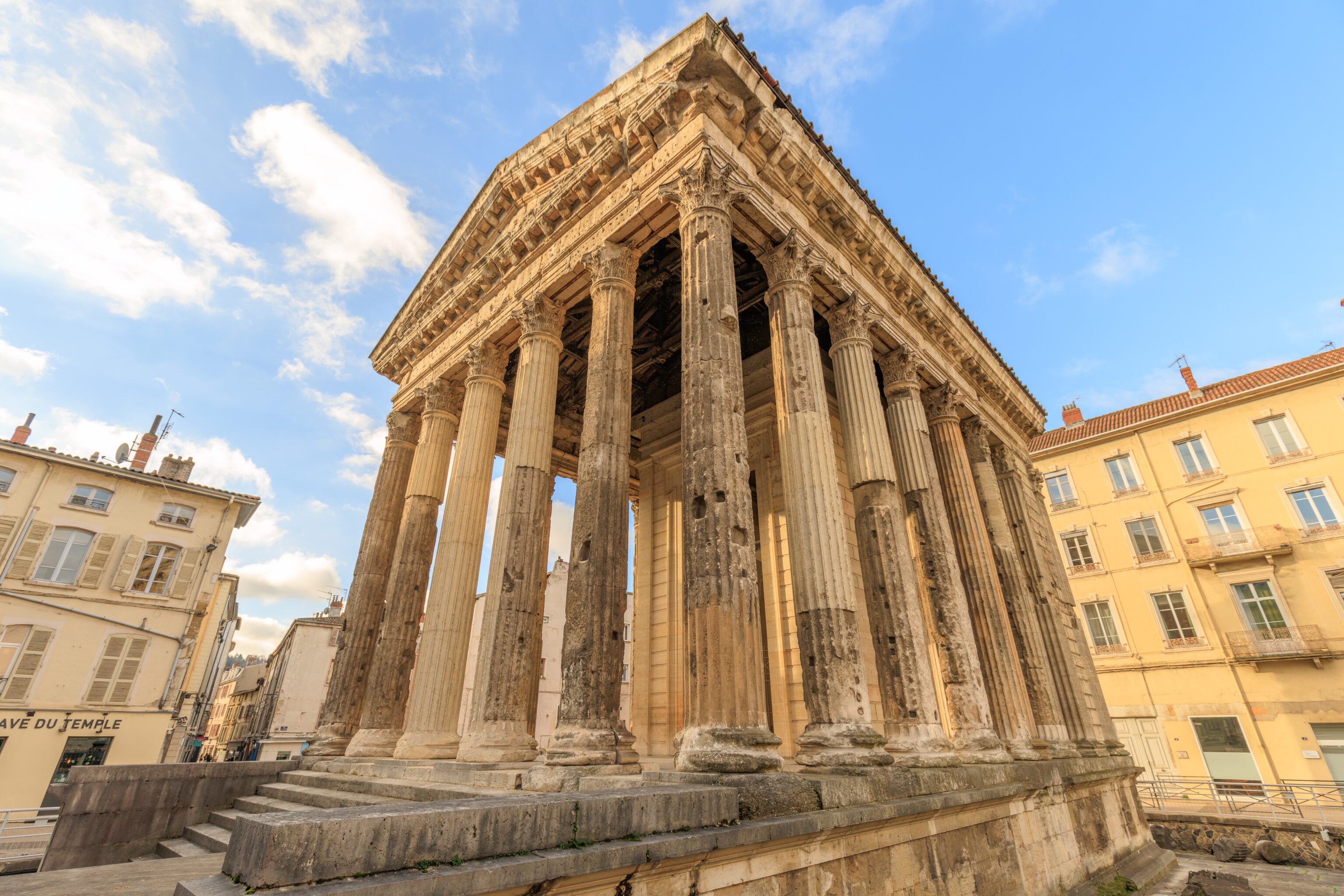
This ancient temple from the 1st century BC definitely reminded us of Rome and Athens!
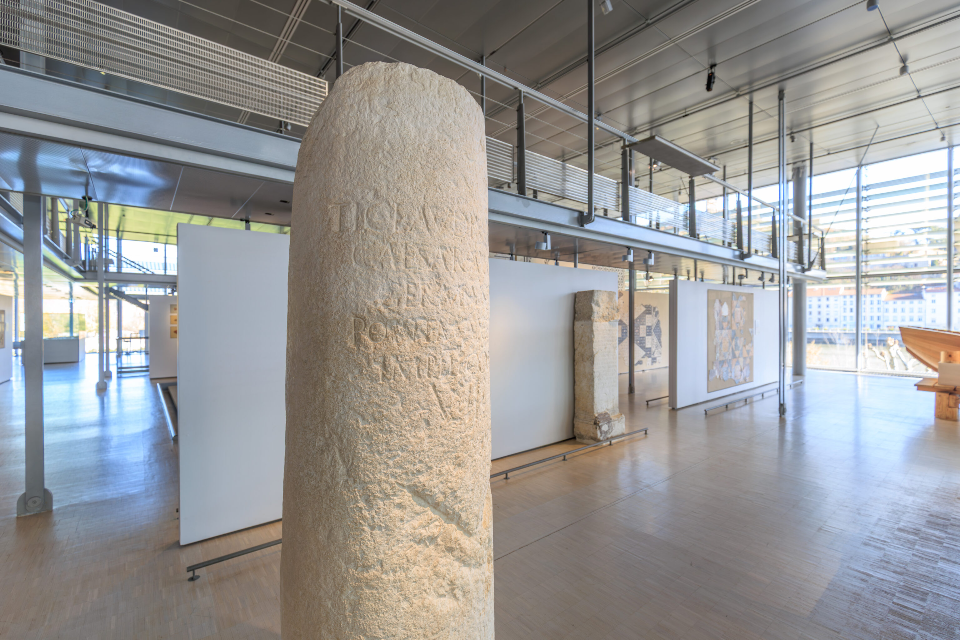
THE TEMPLE OF AUGUSTUS AND LIVIA

The temple was built during the reign of Emperor Augustus, with a second phase added about 40 A.D. The dedication to Augustus and his wife Livia can be made out in the letters on the Eastern frieze.

The forum temple was the place where imperial power used to be recognised. Only the priests were allowed inside the temple, whilst the population attended ceremonies on the paved forum.

The forum was located just below a rocky spur, worked on by man since Celtic times (under the Court of Law).

Vienne's temple owes its survival to the fact that it was transformed into a church. Named as an ancient monument as early as 1840, it is one of the two Roman temples remaining in France, together with the "Maison Carrée" in Nimes. The room of the statue (cella) and the altar are reproductions.
– Vienne Heritage sign
A French language sign provided a more detailed description:
The construction of the temple around 20-10 BC is attributed to the beginning of the reign of Emperor Augustus. A second phase of construction took place around 40 AD.

The temple in the forum was the place where the population recognized imperial power. The dedication to the deified emperor can be discerned from traces of letters on the east frieze. Later, the dedication to Livia, wife of Augustus, was added below, on the architrave. The ceremonies were celebrated by the priests, who alone had access to the temple. The population watched from below the temple podium, on the forum paving.

The Gallo-Roman forum formed a vast public complex, enclosed by colonnaded porticoes, where all civic, administrative, and religious functions were carried out. Around the imperial temple, the sacred area was established below a rocky spur, which had been developed since the Gallic period (beneath the Palace of Justice). To the east lay the wider esplanade of the forum. The two arcades still visible in the Garden of Cybele formed its southeast corner.

The temple of Vienne owes its survival to its transformation into the Church of Notre-Dame-de-la-Vie. Classified as one of the first Historical Monuments in 1840, it is one of only two Roman temples preserved in France, along with the Maison Carrée in Nîmes. It was restored between 1852 and 1880: the church elements were removed, and the statue chamber (cella) and the altar were reconstructed.
– Vienne Heritage sign, translated using Google.
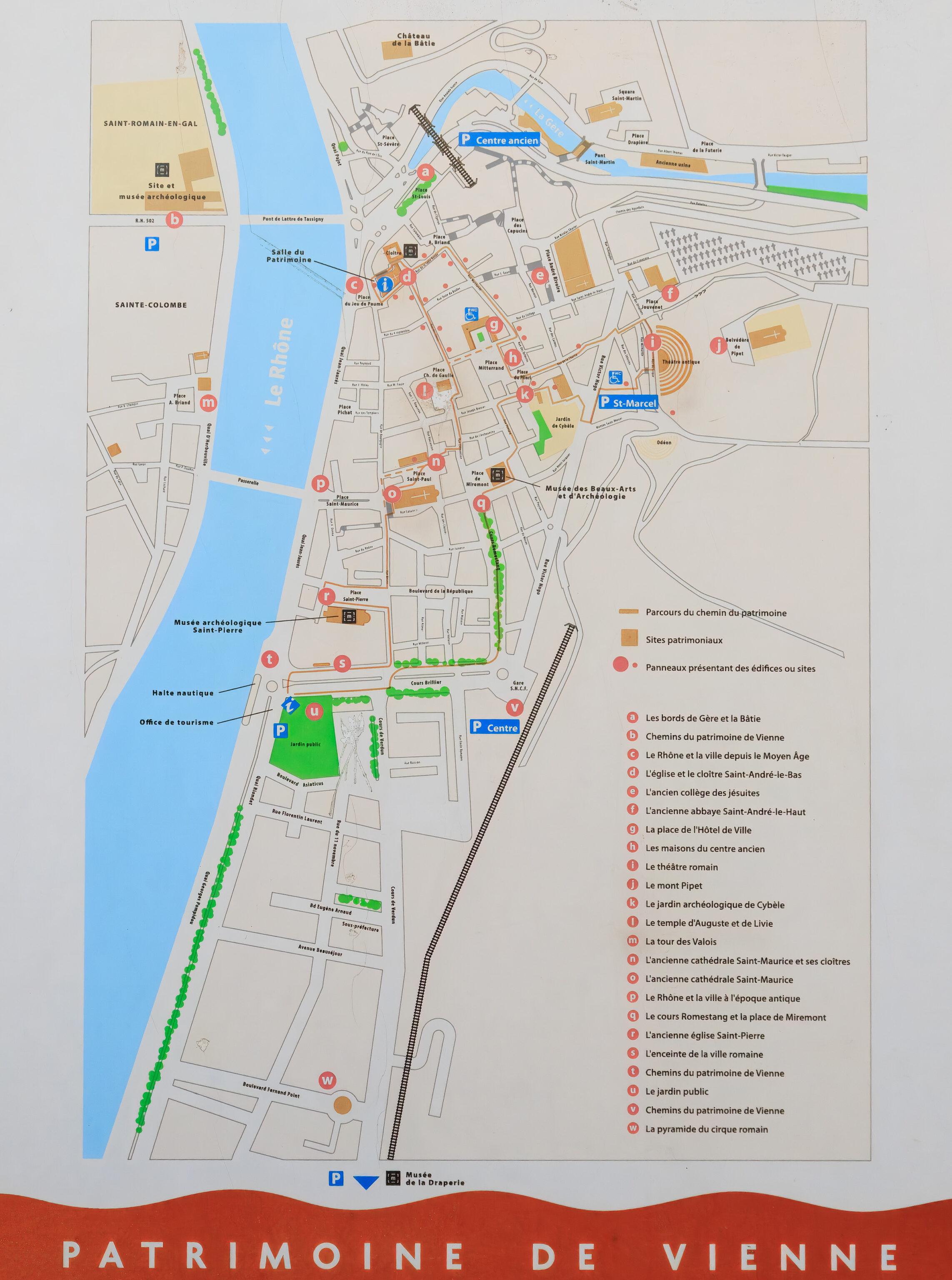
This sign provided a useful map of Vienne, although the font is unfortunately a bit small.
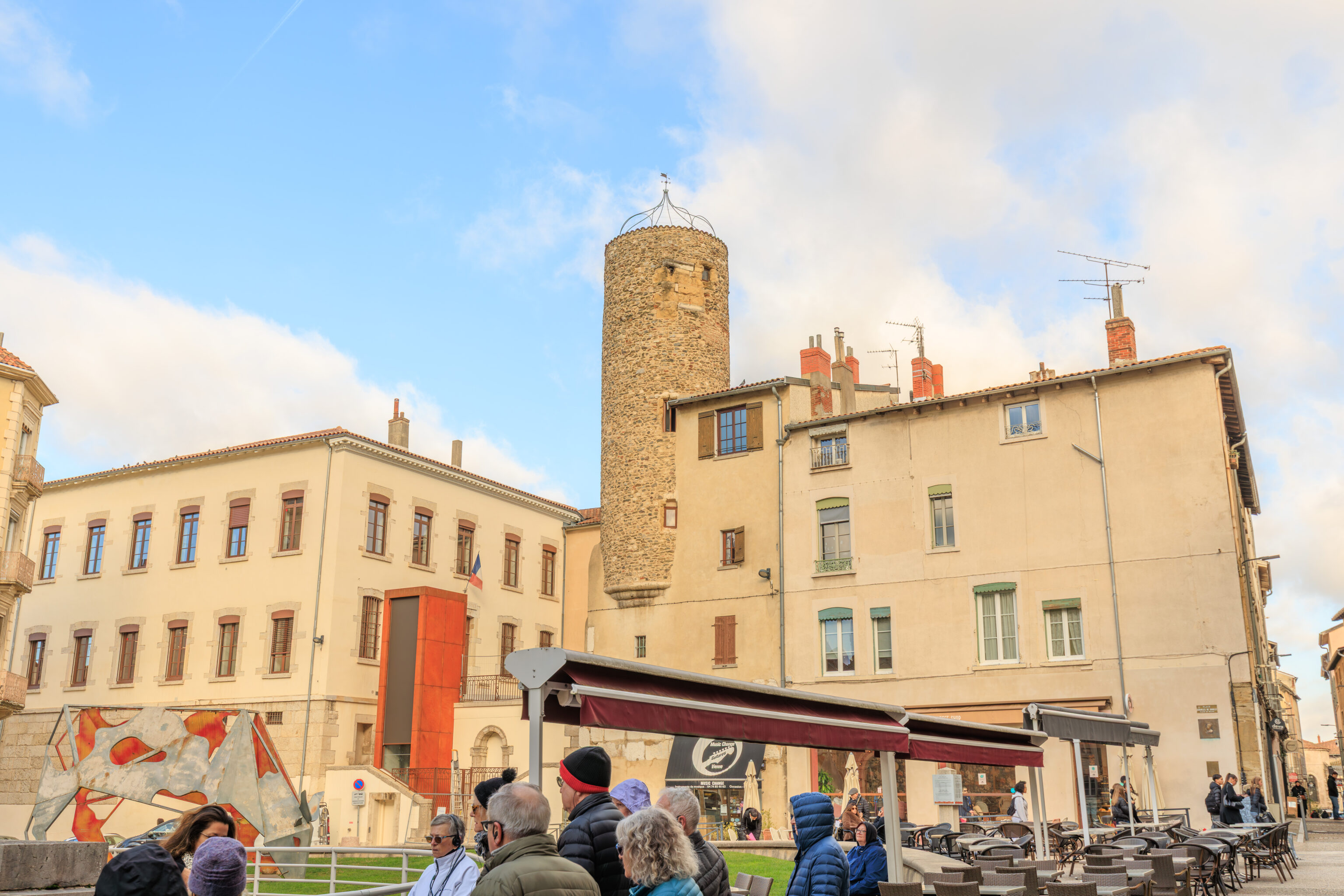
While the area wasn’t busy at all, there was a small tour group present when we arrived. One of the nearby buildings, seen here in the background, had a tower built into it. This tower seems to be from the 16th century. Other than the tower, there is also something interesting here on the left!
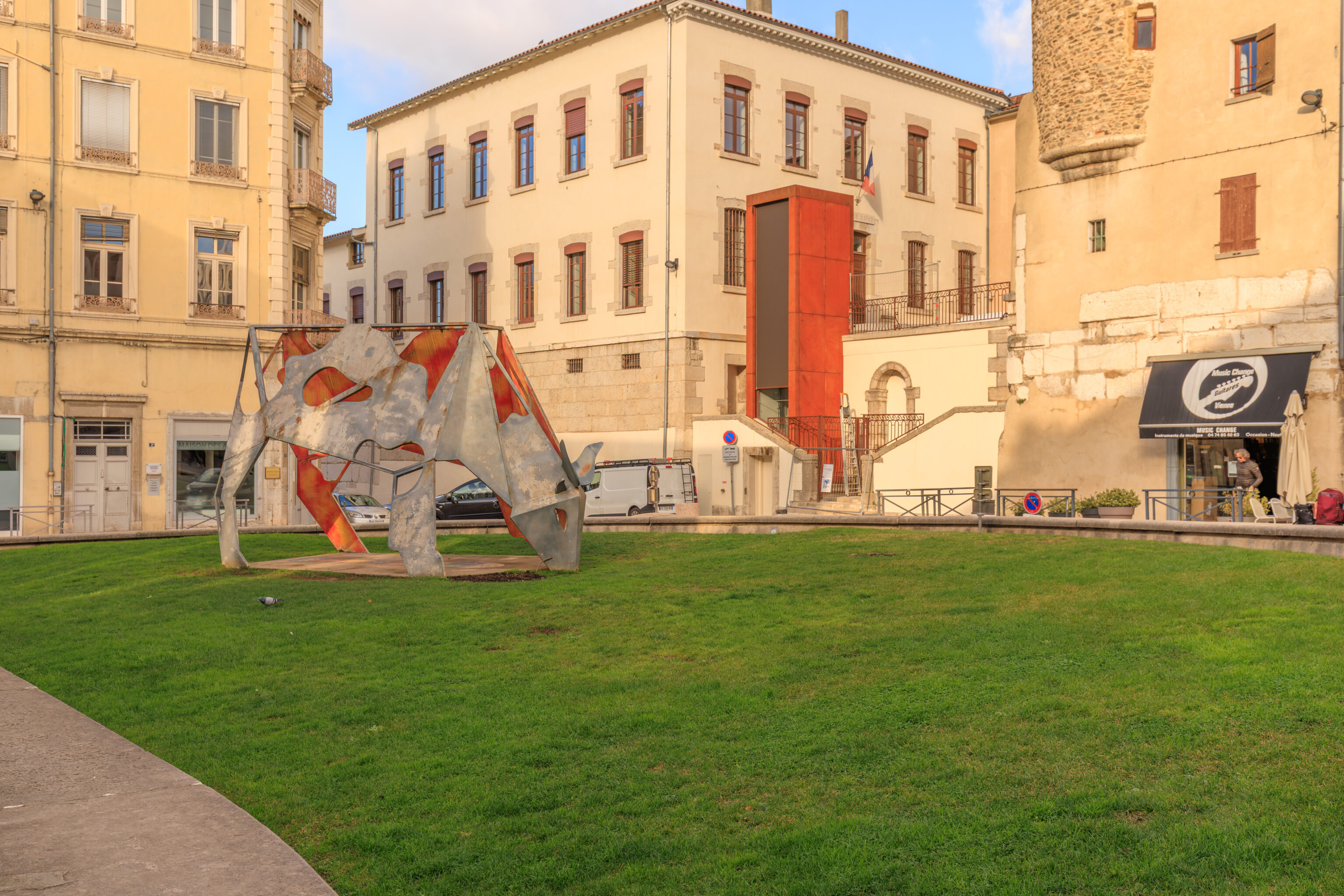
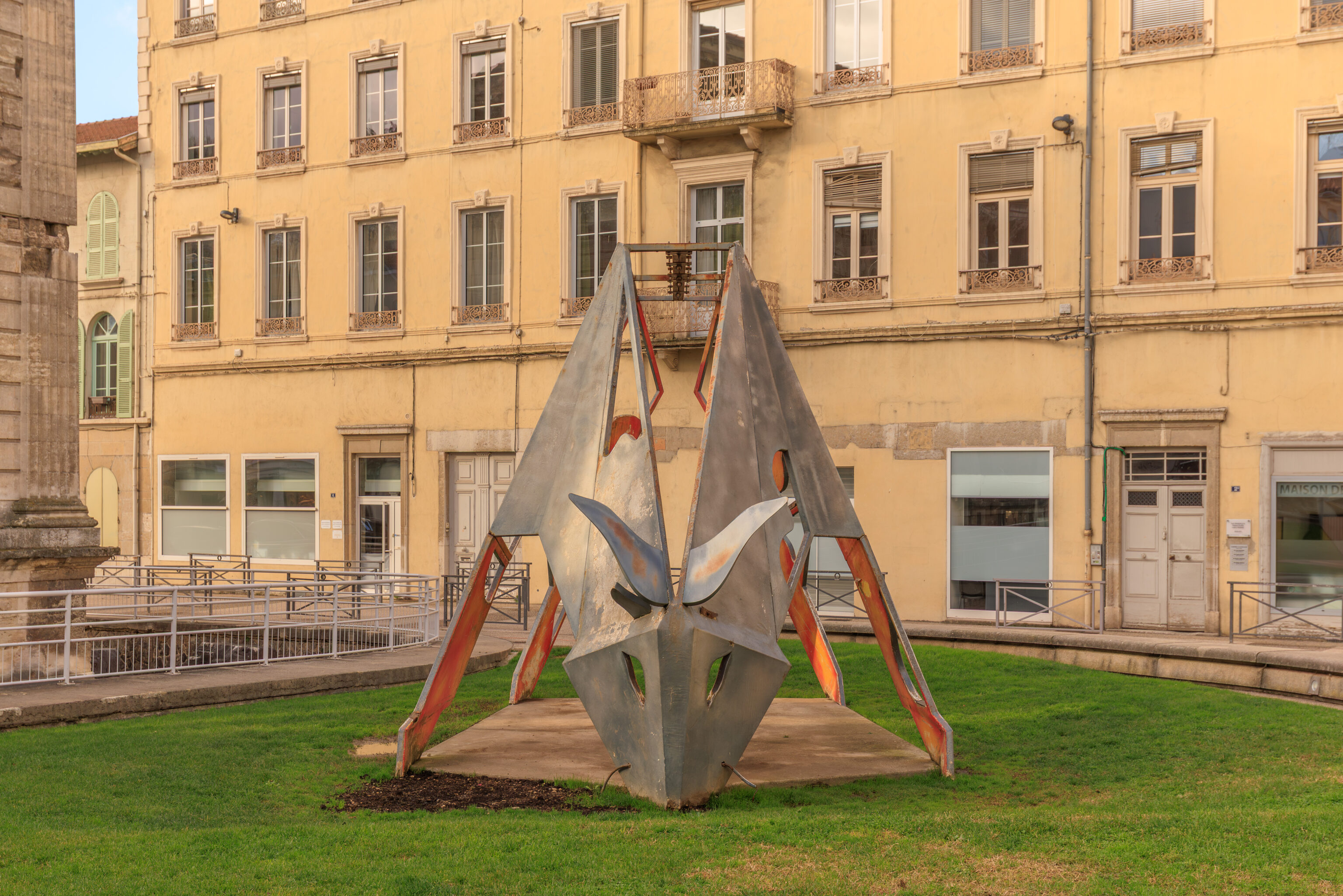
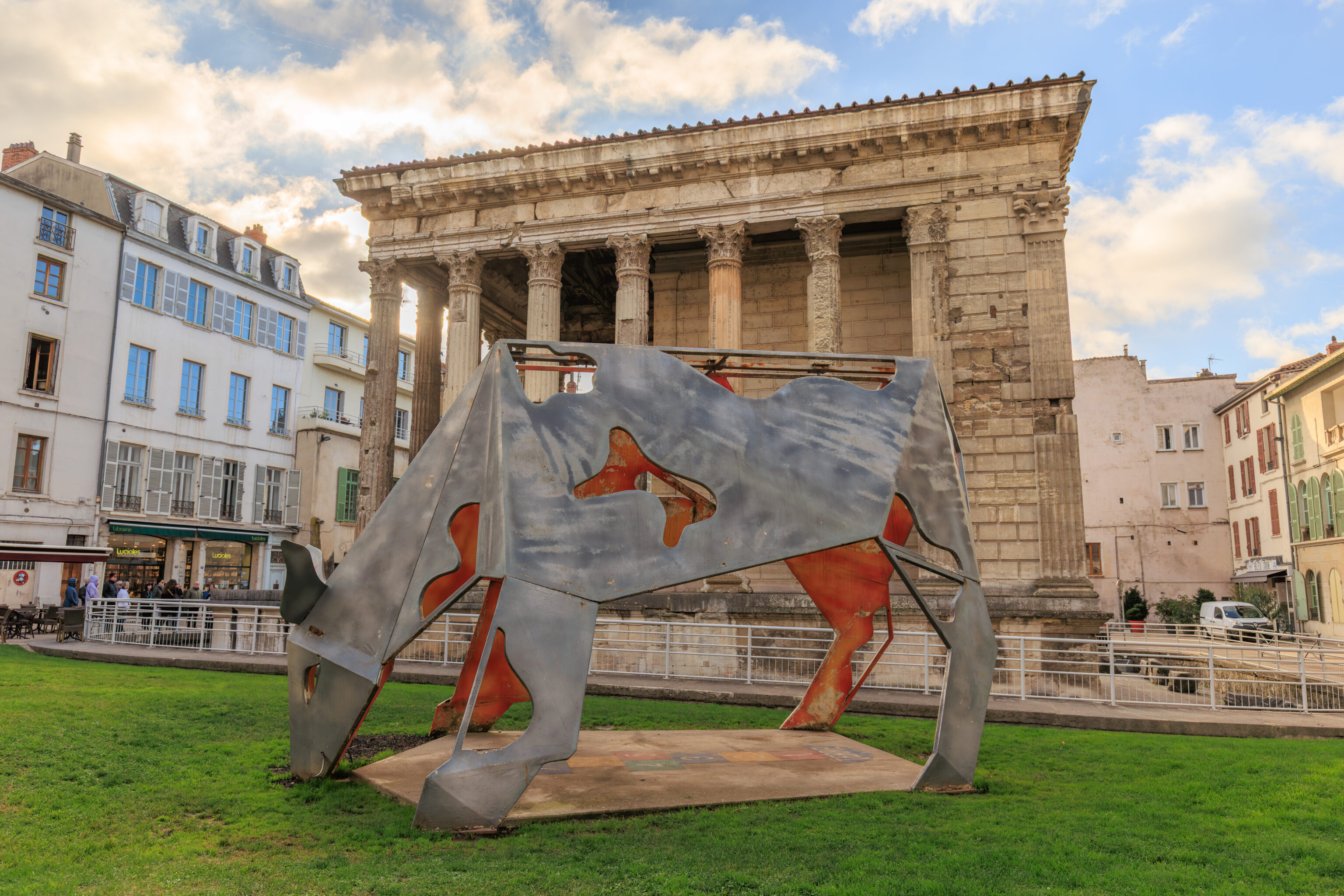
This cow sculpture was gifted to the city by Yoplait for its 50th anniversary. One of the brand’s original factories is here in Vienne.
Créatile No. 1 Marguerite (1/8)
Gad Weil, Laurence Médioni, Benoît Afnaïm
Donated by Yoplait to the city of Vienne (38)
– A weathered plaque, translated using Google
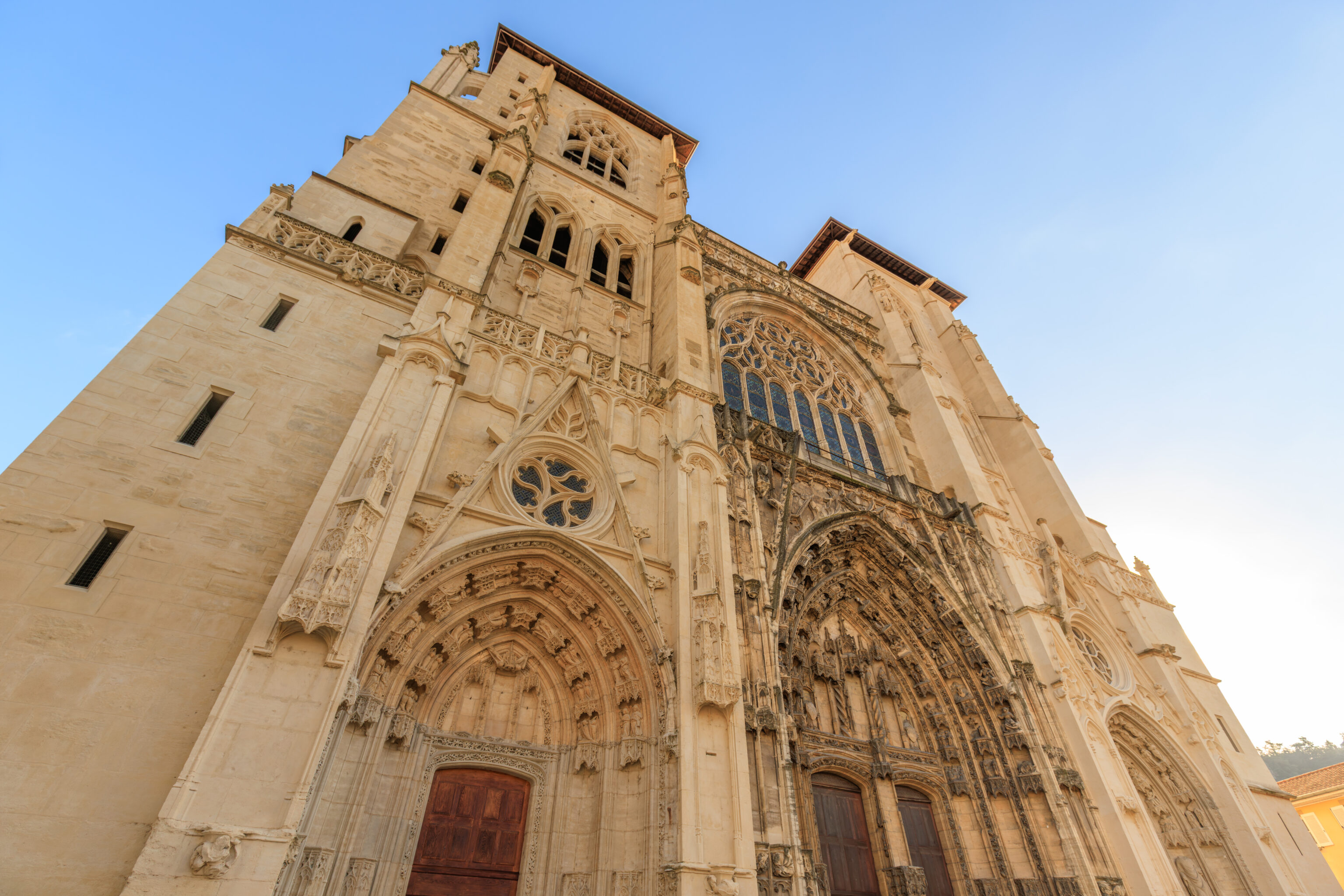
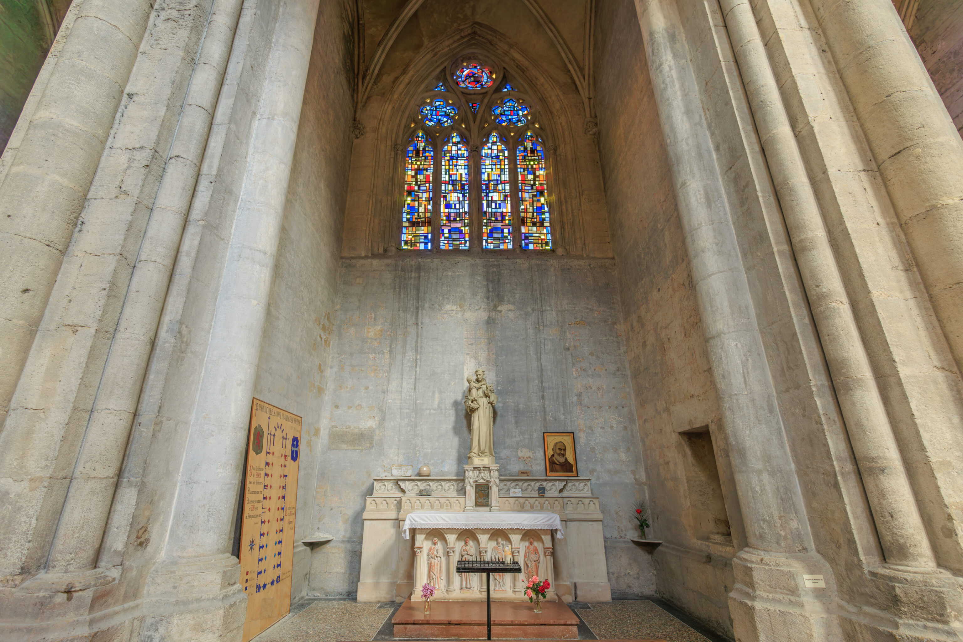
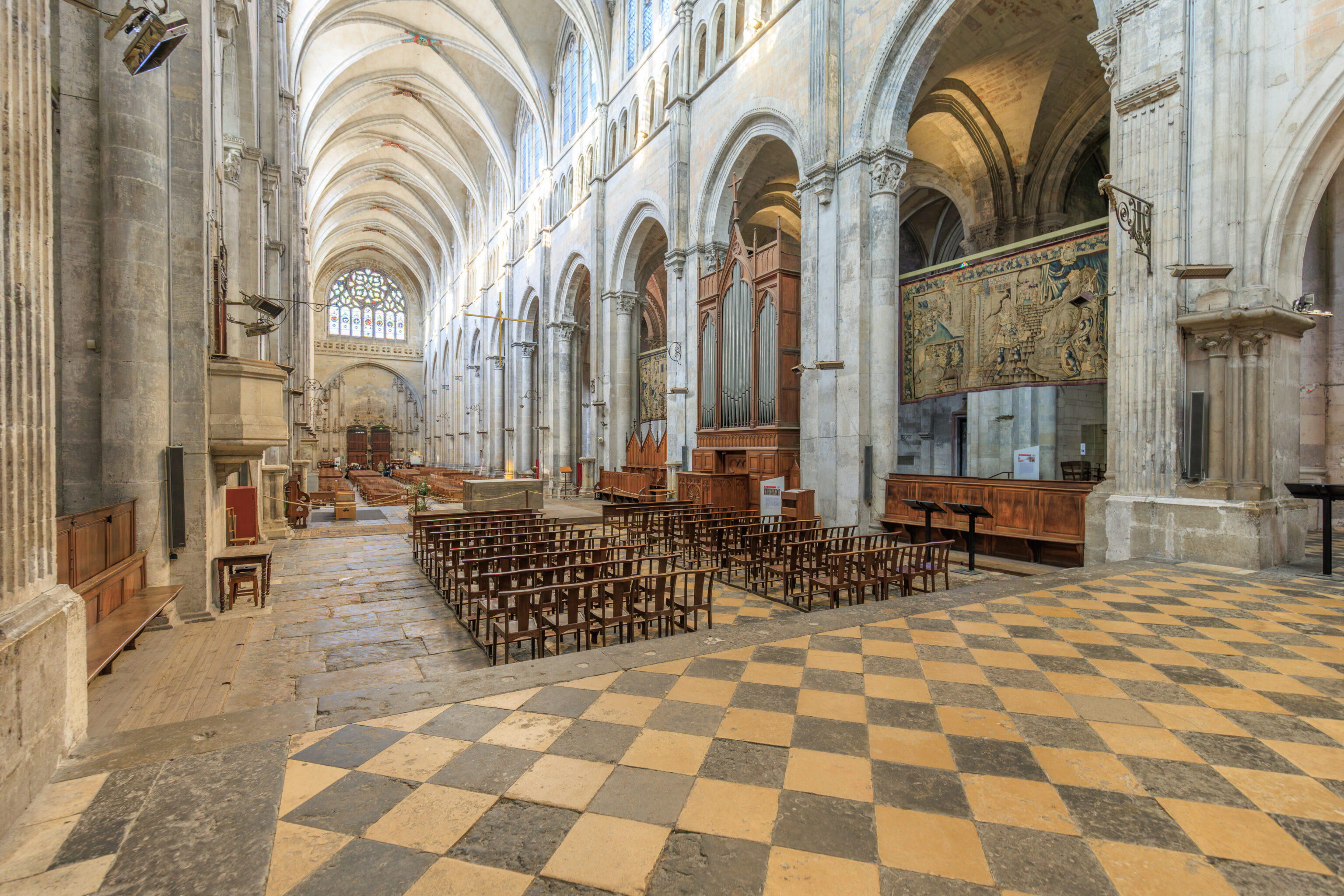
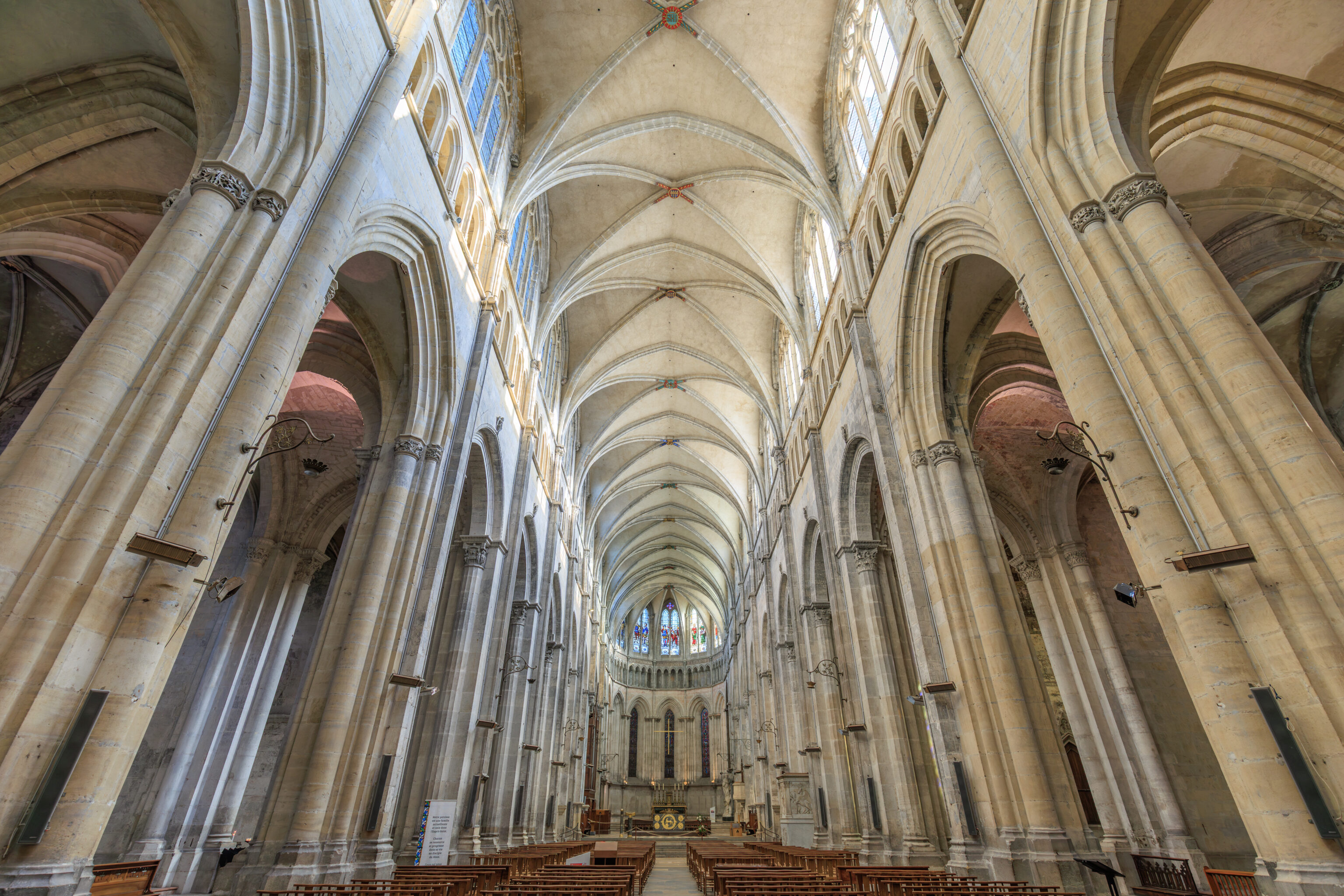
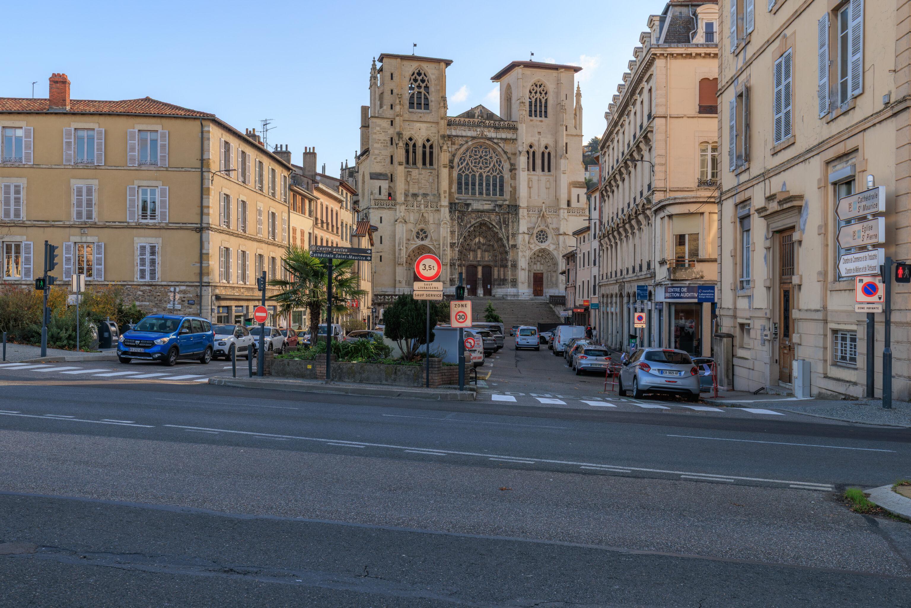
Cathédrale Saint-Maurice de Vienne
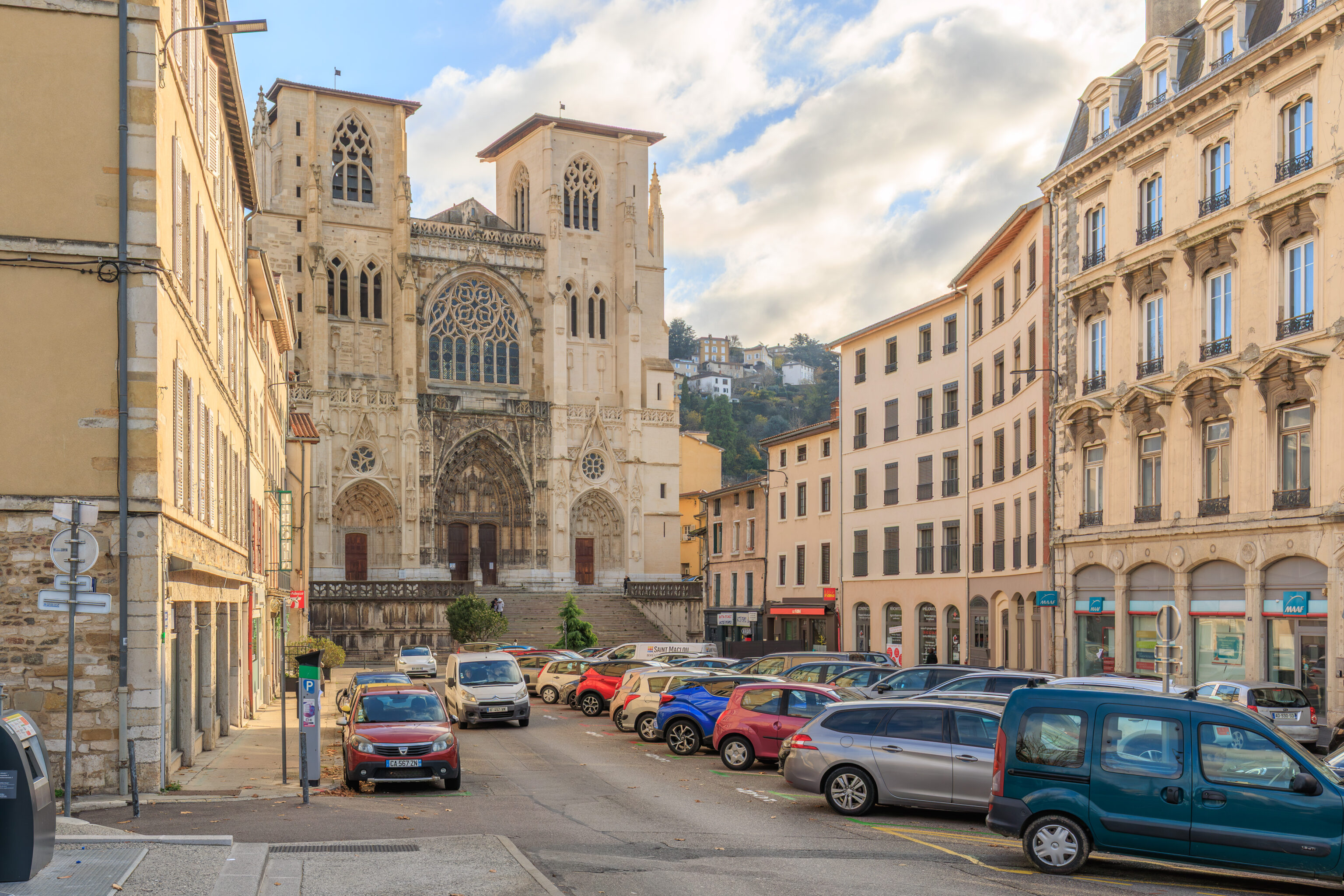
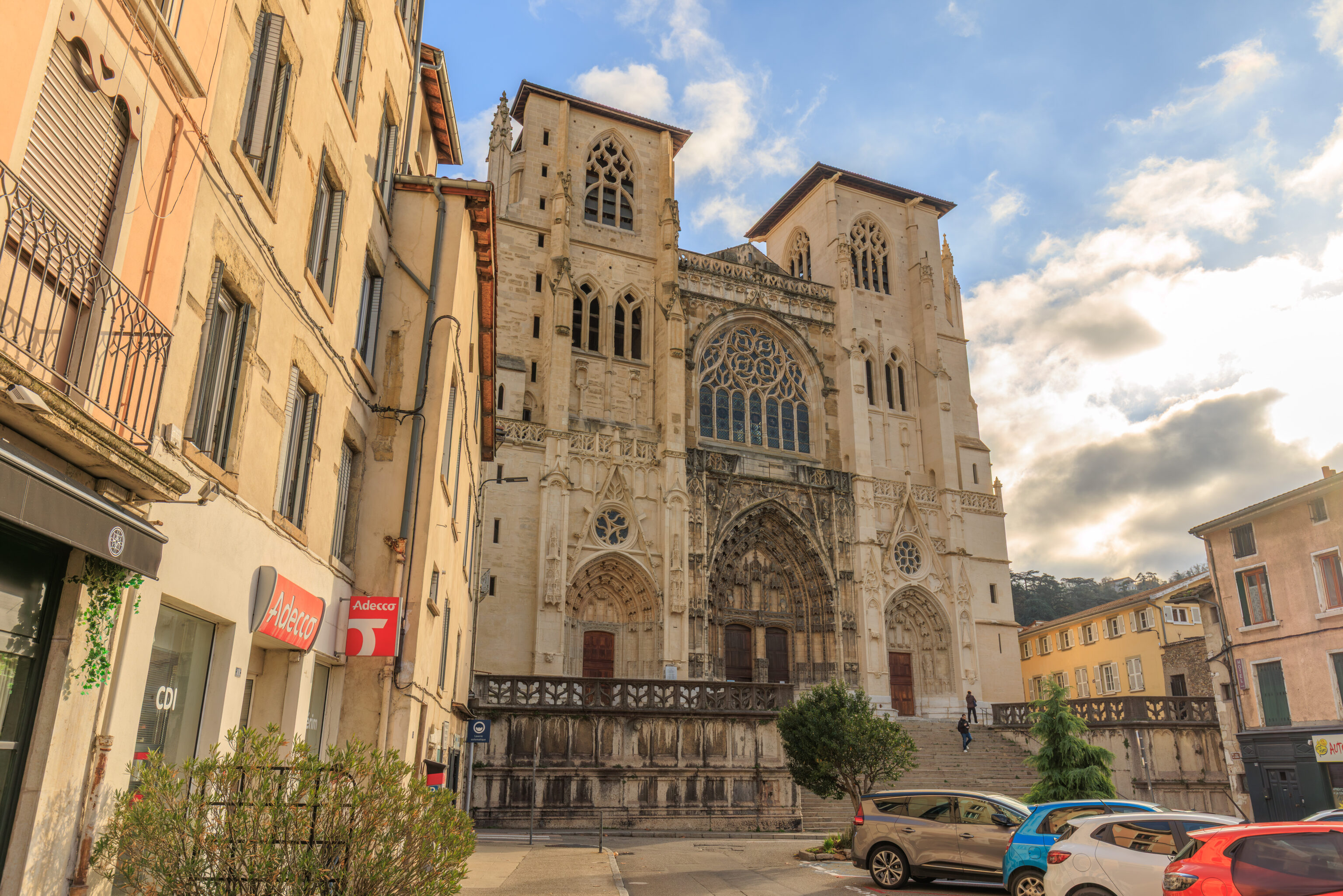
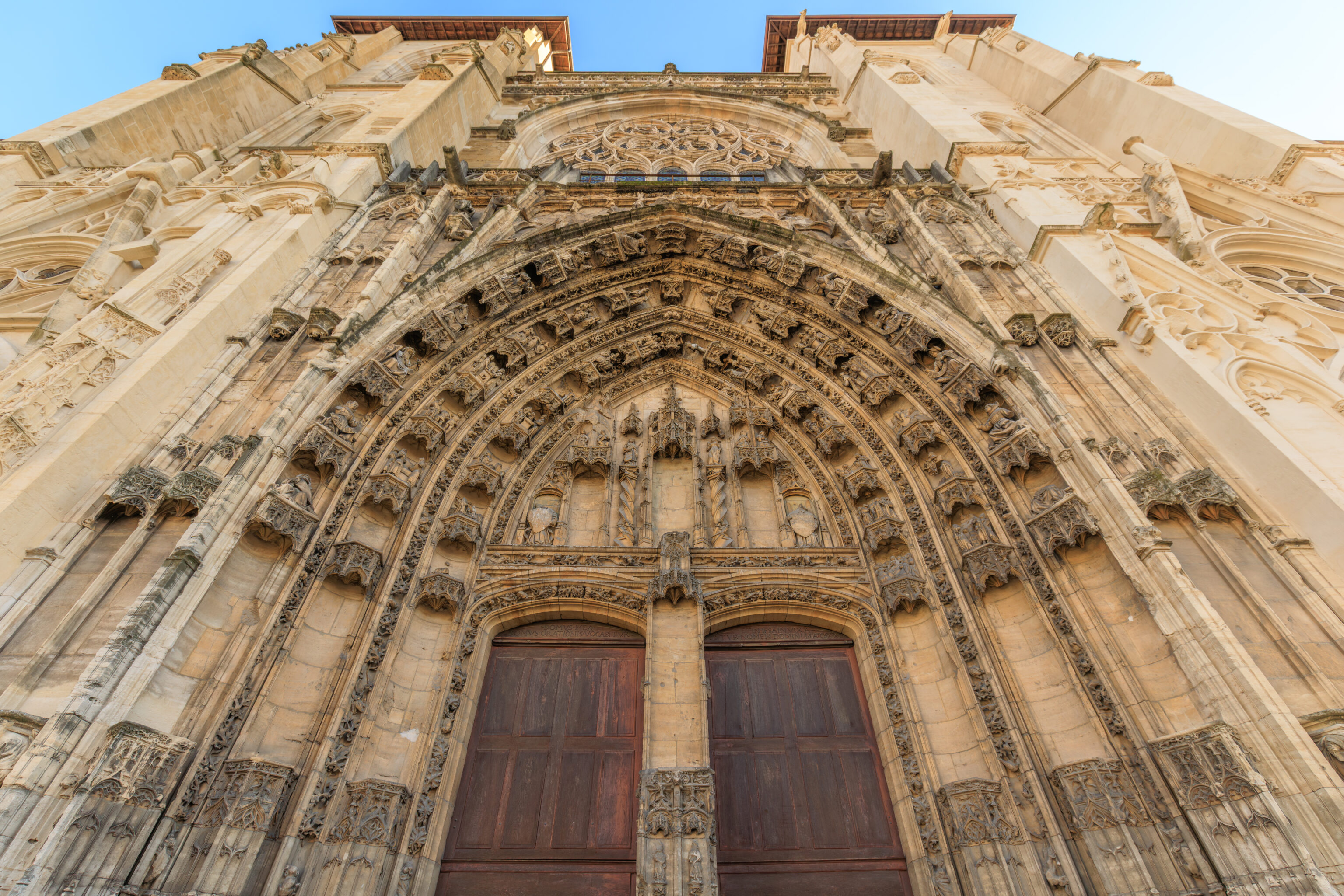
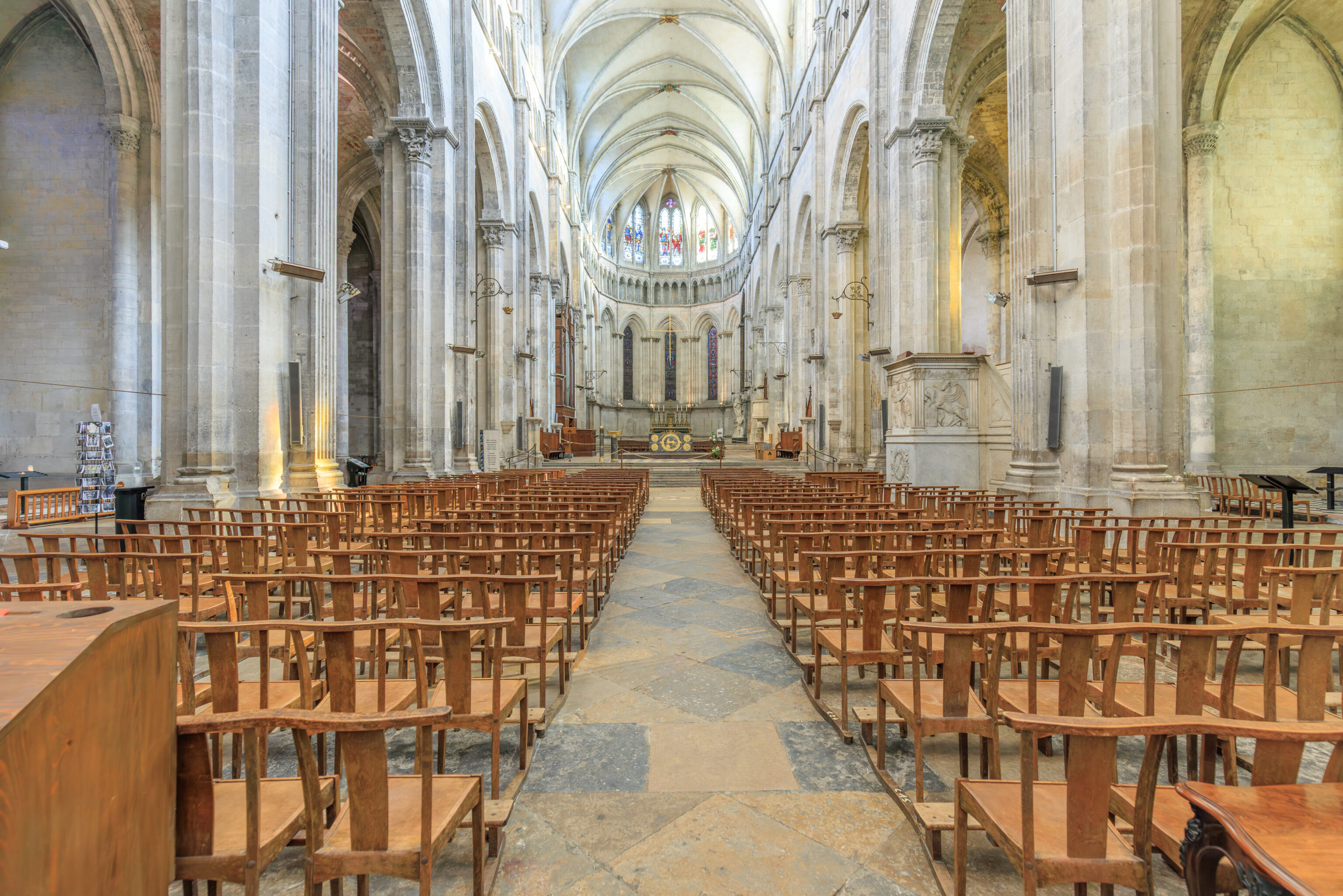
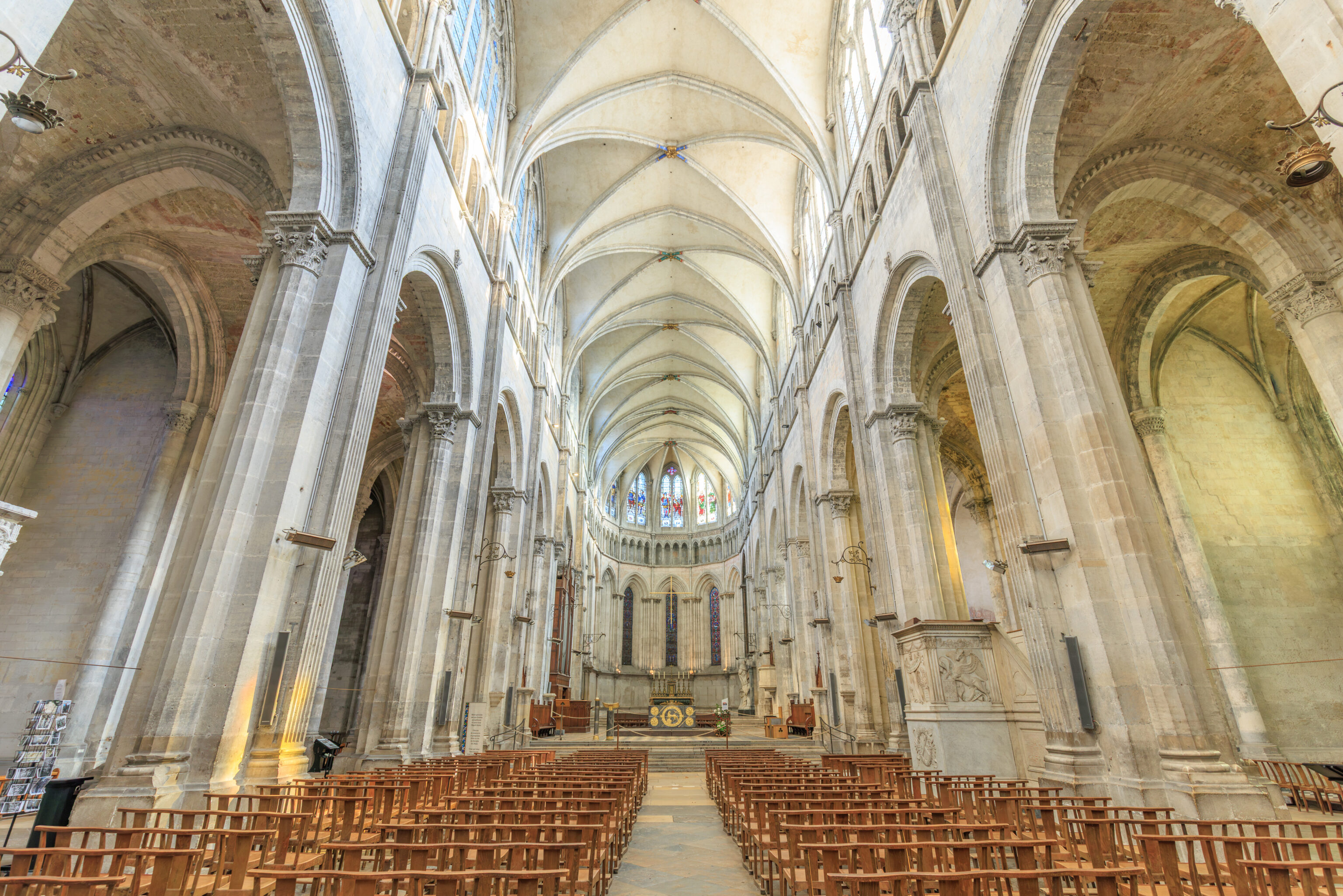
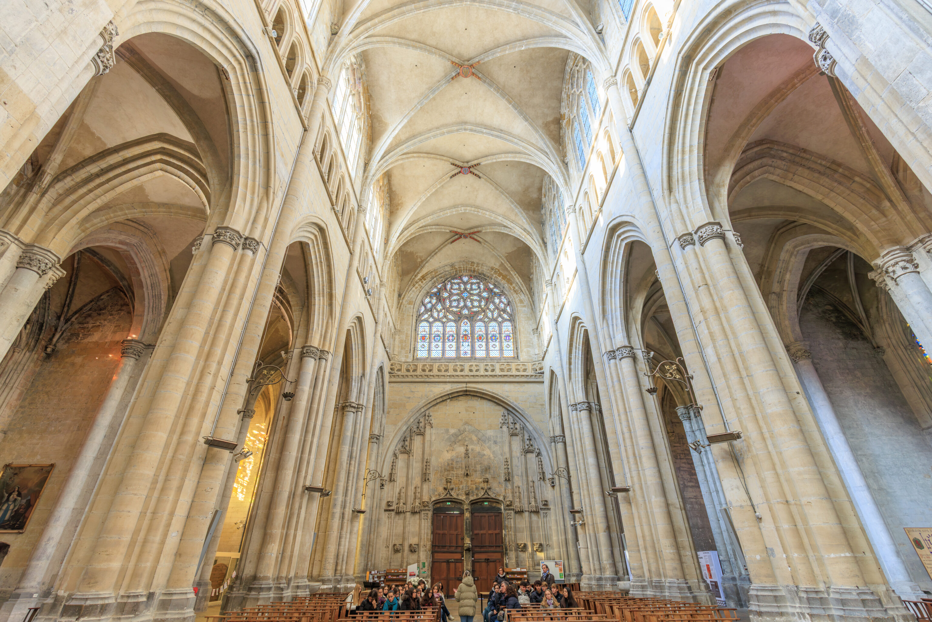
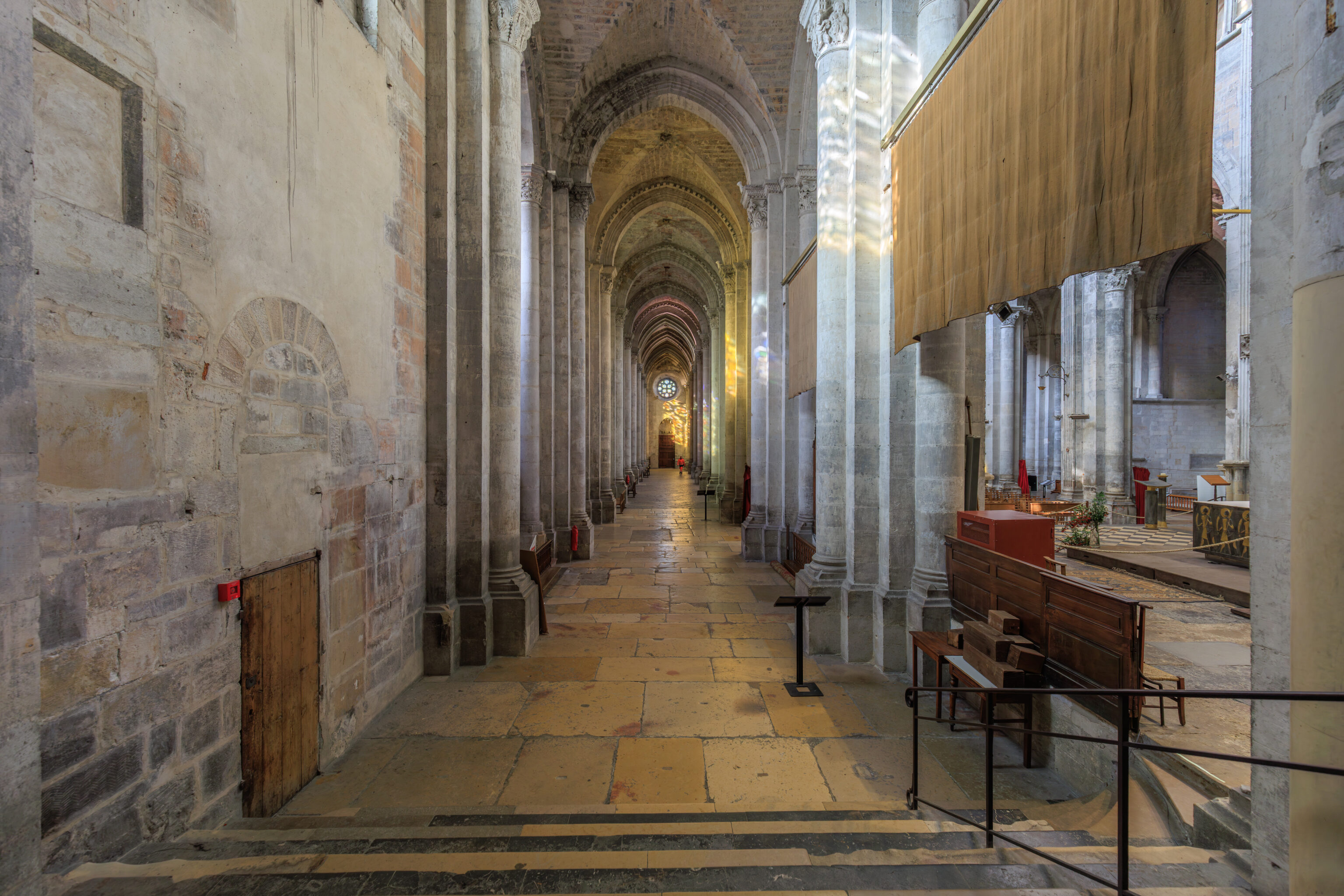
We walked to the west and south to reach the nearby Cathédrale Saint-Maurice de Vienne (Saint Maurice Cathedral of Vienne). We ended up taking an indirect downhill route to reach the west facing front of the building.
THE OLD CATHEDRAL OF SAINT-MAURICE
Vienne's Christian community came into being as early as the 2nd century A.D.
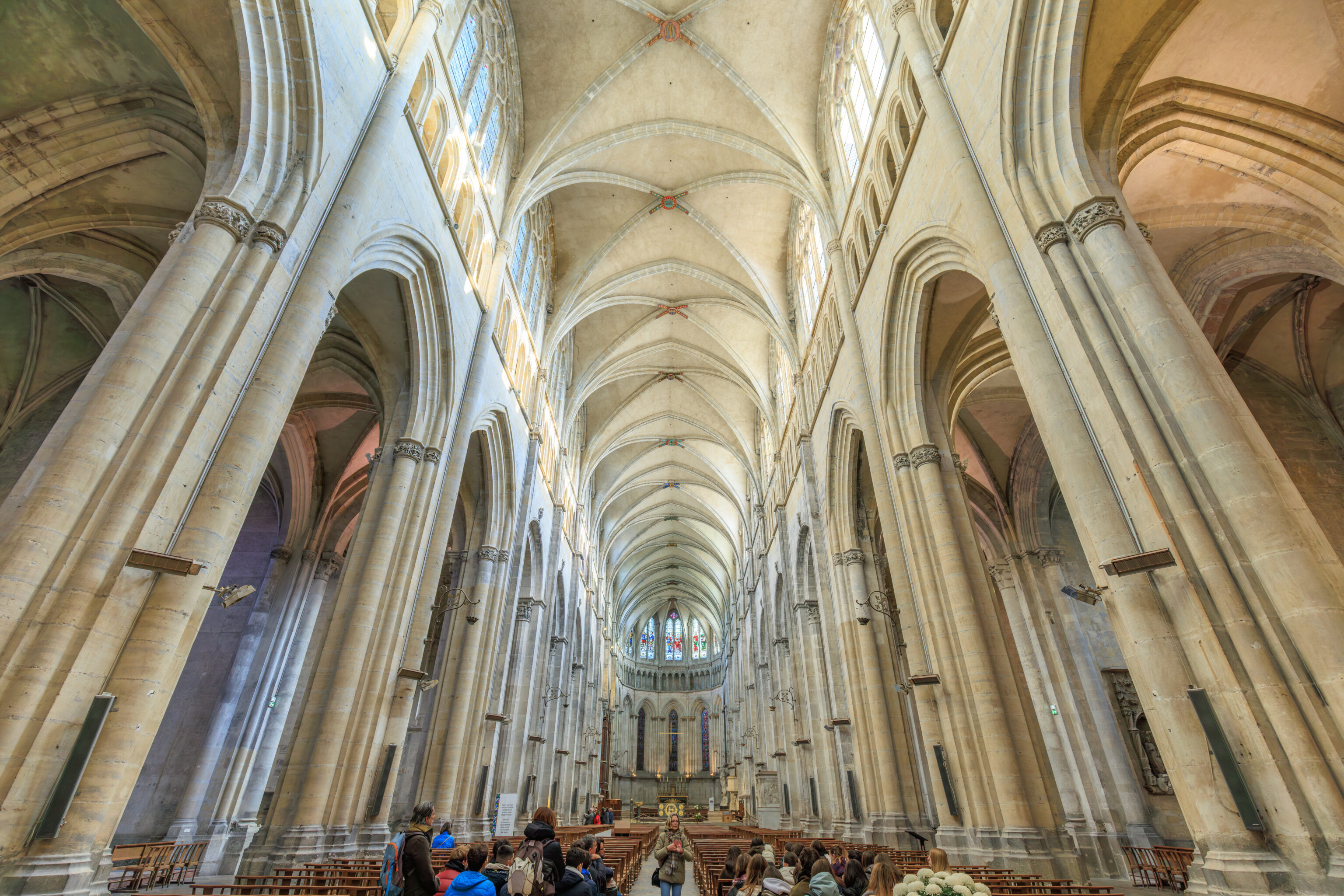
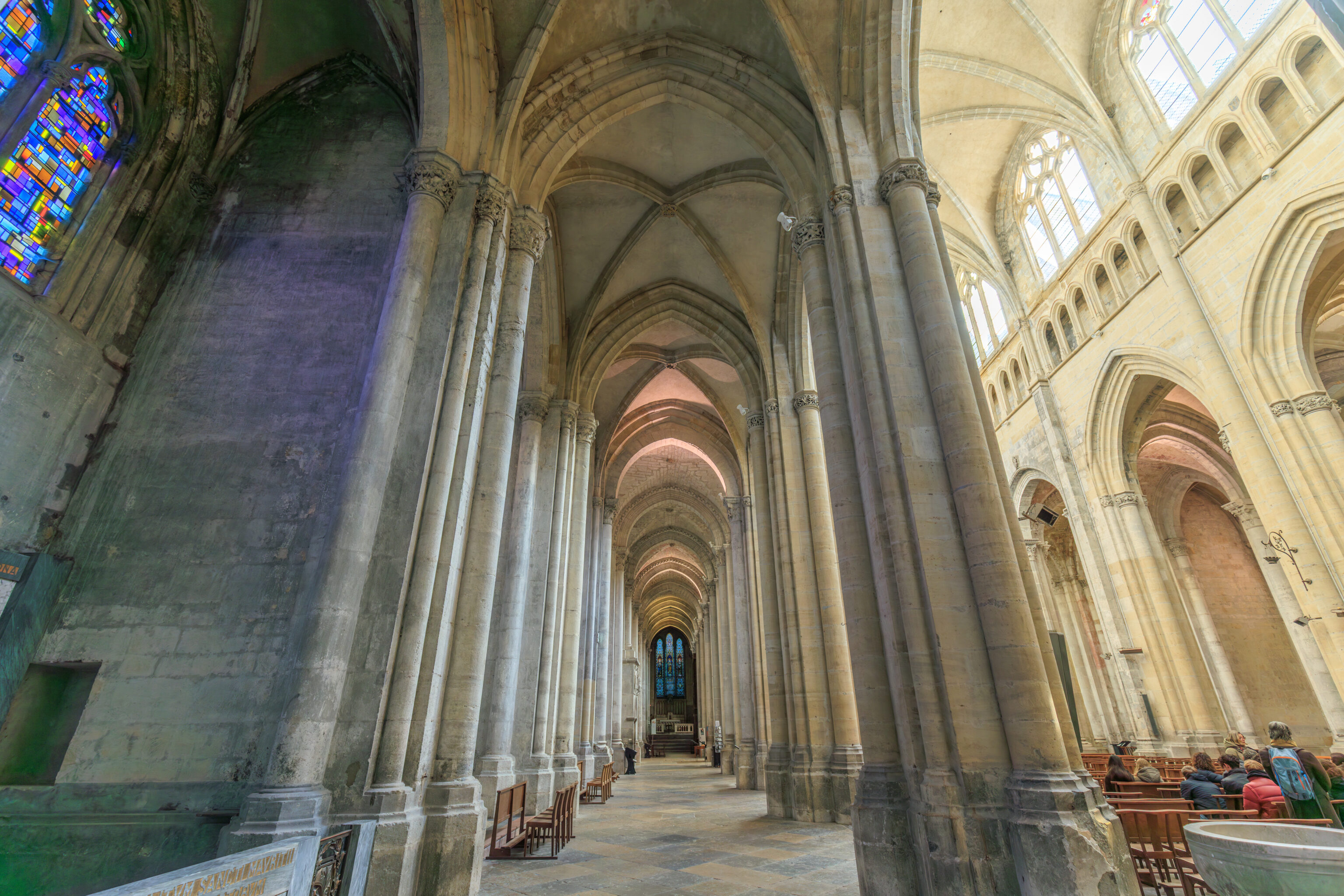
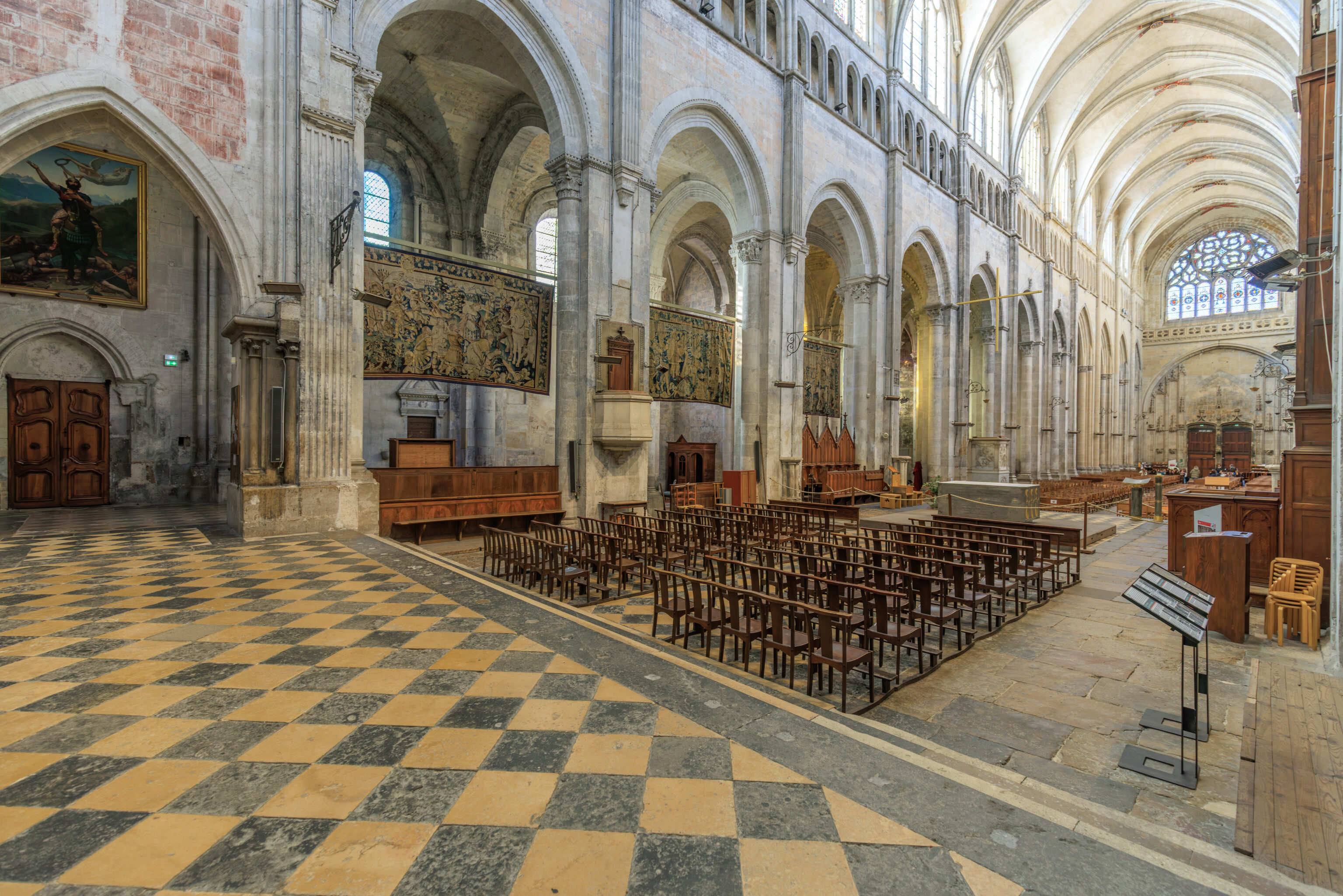
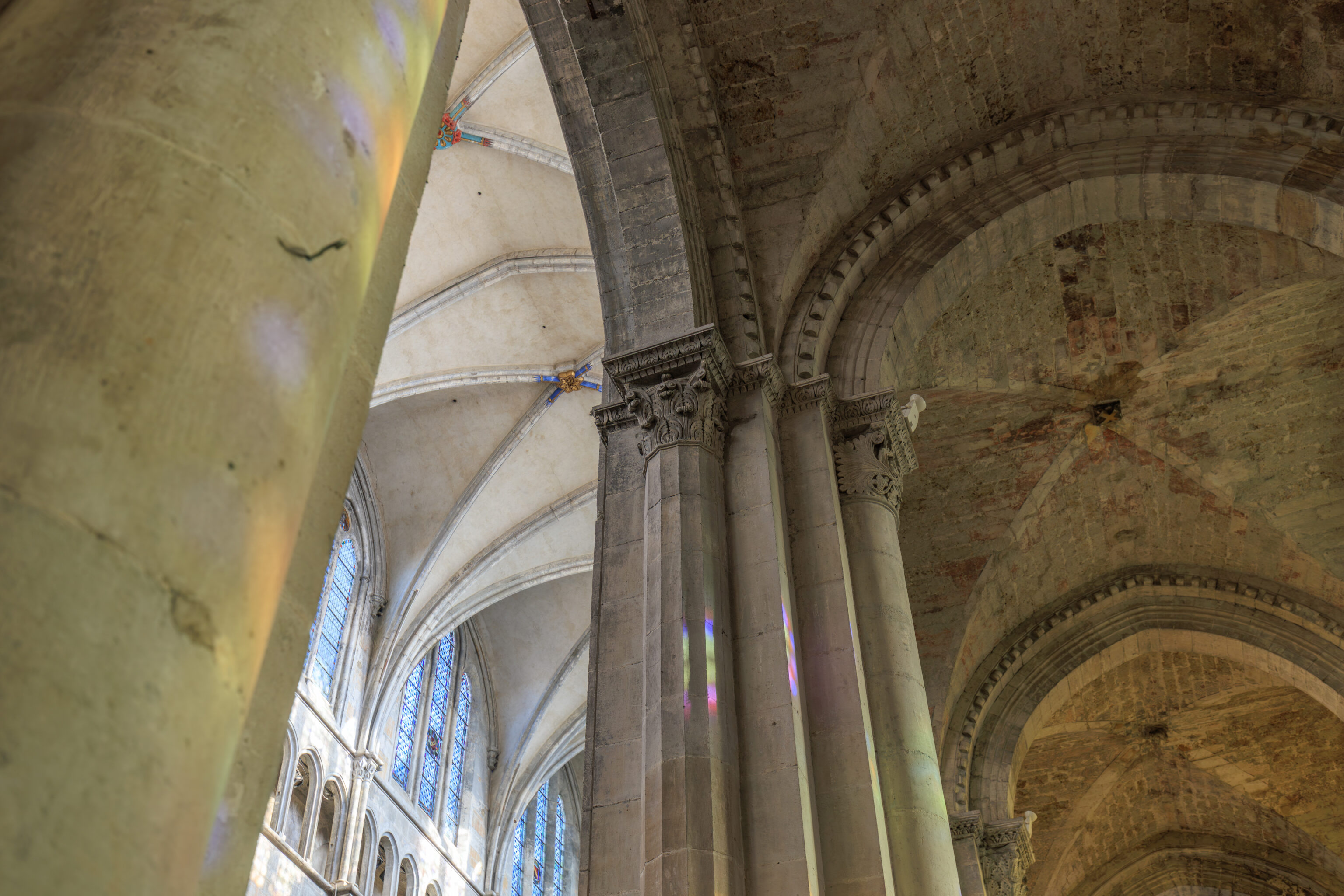
The cathedral church, which succeeded the cathedral group at the beginning of the Middle Ages, was transformed in the 12th century. The seven Romanesque bays (on the eastern side) with their 59 capitals date back to this period.
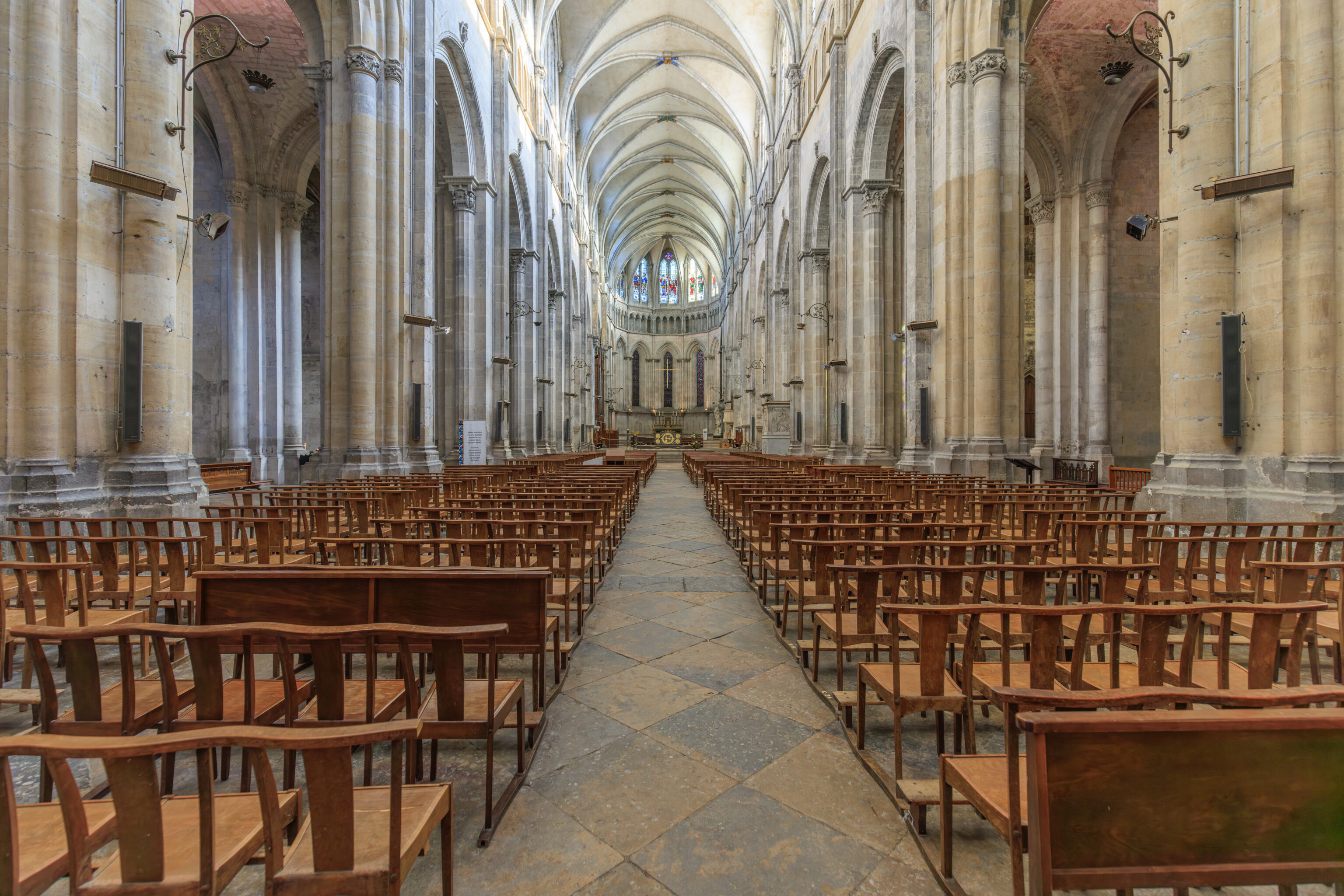
In the 13th century, the archbishop Jean de Bernin rebuilt the choir. Four bays were added on the western side during the Gothic period and the whole building was built higher and vaulted.
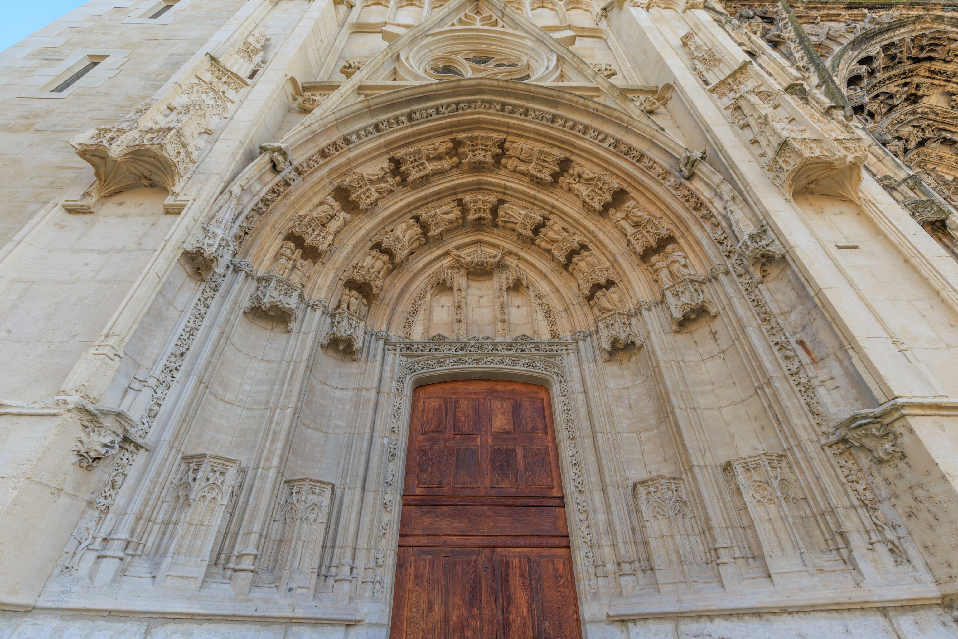
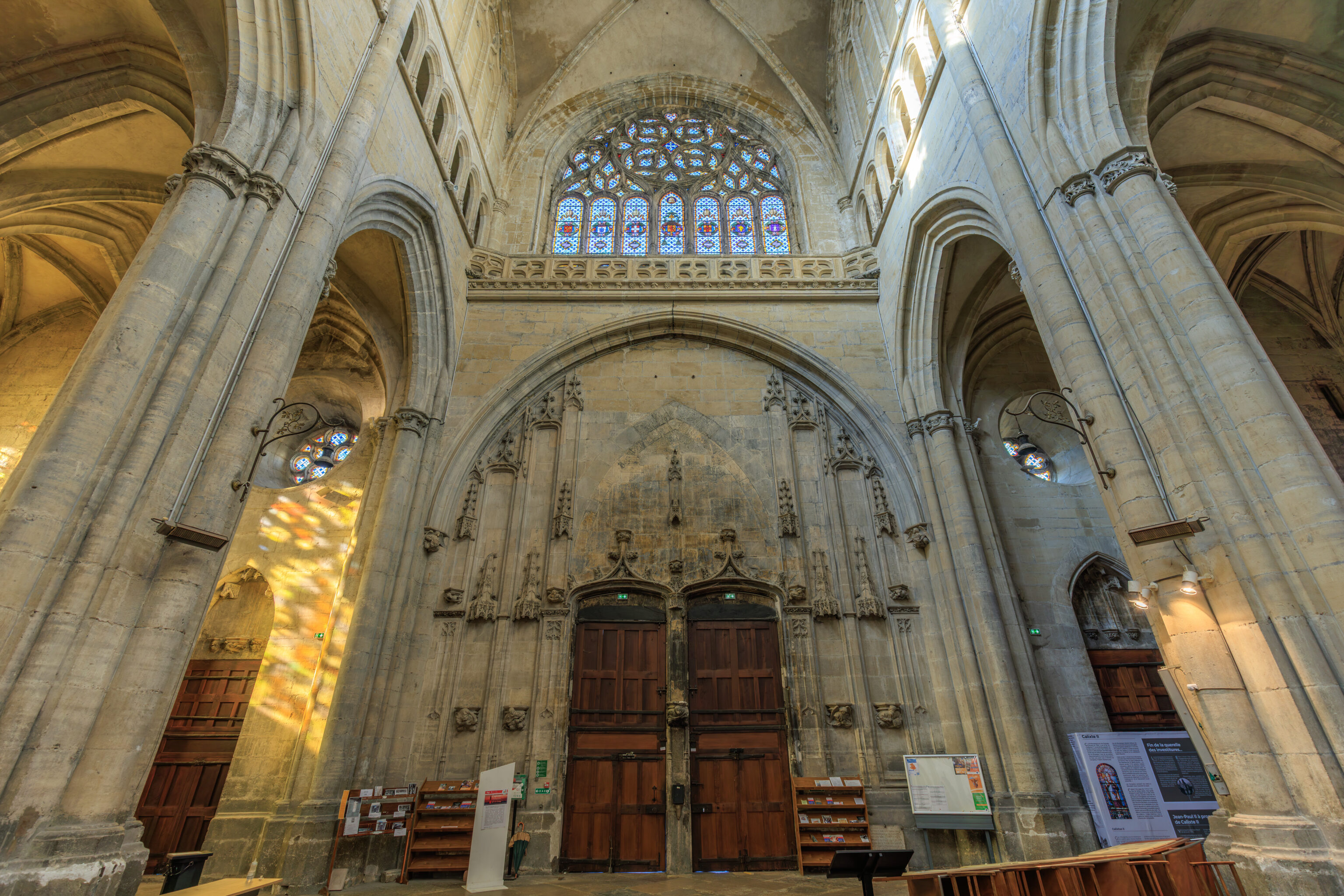
The portals on the west facade date back to the 14th and 15th centuries. The sculptures on the main doors were destroyed during the Wars of Religion.
After the disappearance of the diocese of Vienne in 1790, Saint-Maurice was reduced to becoming merely a parish church.
– Text from a sign outside of the cathedral.
We went in to take a look. There were informational signs near the entrance:
Since the 4th or 5th centuries, the cathedral has undoubtedly occupied the same site. Of this long history, the present-day building retains no evidence prior to the year 1000. Only a schematic plan, engraved on the paving stones of the central nave, allows us to locate the site of a chapel erected in the second half of the 9th century; dedicated to the Holy Sepulchre, it was like a reduced replica of the structure built over the tomb of Christ in Jerusalem. This chapel was preserved inside the cathedral until the 16th century.
“Cathedrals are not only the most beautiful ornaments of our art, but the only ones that have remained in keeping with the purpose for which they were built.” Marcel Proust, The Death of Cathedrals, 1904
THE CATHEDRAL FROM ITS ORIGINS TO THE PRESENT DAY
FROM ROMANESQUE TO GOTHIC
The Romanesque Cathedral
The date of the start of the reconstruction in the 12th century remains uncertain: around 1120 or 1140? The possibility that the work continued into the end of the 12th century cannot be ruled out. There is no proof that this unfinished cathedral was already covered with vaults before the early 1200s.
Fluted pilasters punctuate seven preserved bays, from the main nave to the sanctuary; high arcades resting on engaged half-columns connect the nave and the side aisles. The capitals still in place attest to the importance of the sculpted decoration. These are supplemented by sculptures reused and repositioned later in different parts of the cathedral, both inside and outside (north side), as subsequent construction progressed.
The Gothic Cathedral
Under the episcopate of Jean de Bernin (1217-1266), a new architectural approach was chosen: a new choir, expansion with side chapels, westward extension, and pointed arch vaulting. Construction continued for over 300 years, until its completion under the episcopate of Pierre Palmier (1527-1556), in the Flamboyant Gothic and Renaissance styles. Written sources and the coats of arms of donors (on the keystones and the façade) provide valuable chronological markers.
The work was financed by donations, bequests, and contributions, both voluntary and mandated, from the clergy, canons, and prominent families. To the west, the three portals of the facade, although executed successively over nearly a century, present themselves as a frontispiece, with sculpted imagery illustrating the biblical message centered on the history of Salvation, from the prophets of the Old Testament to Christ and the queenship of Mary in heaven.
FURNITURE AND LITURGICAL PRACTICES
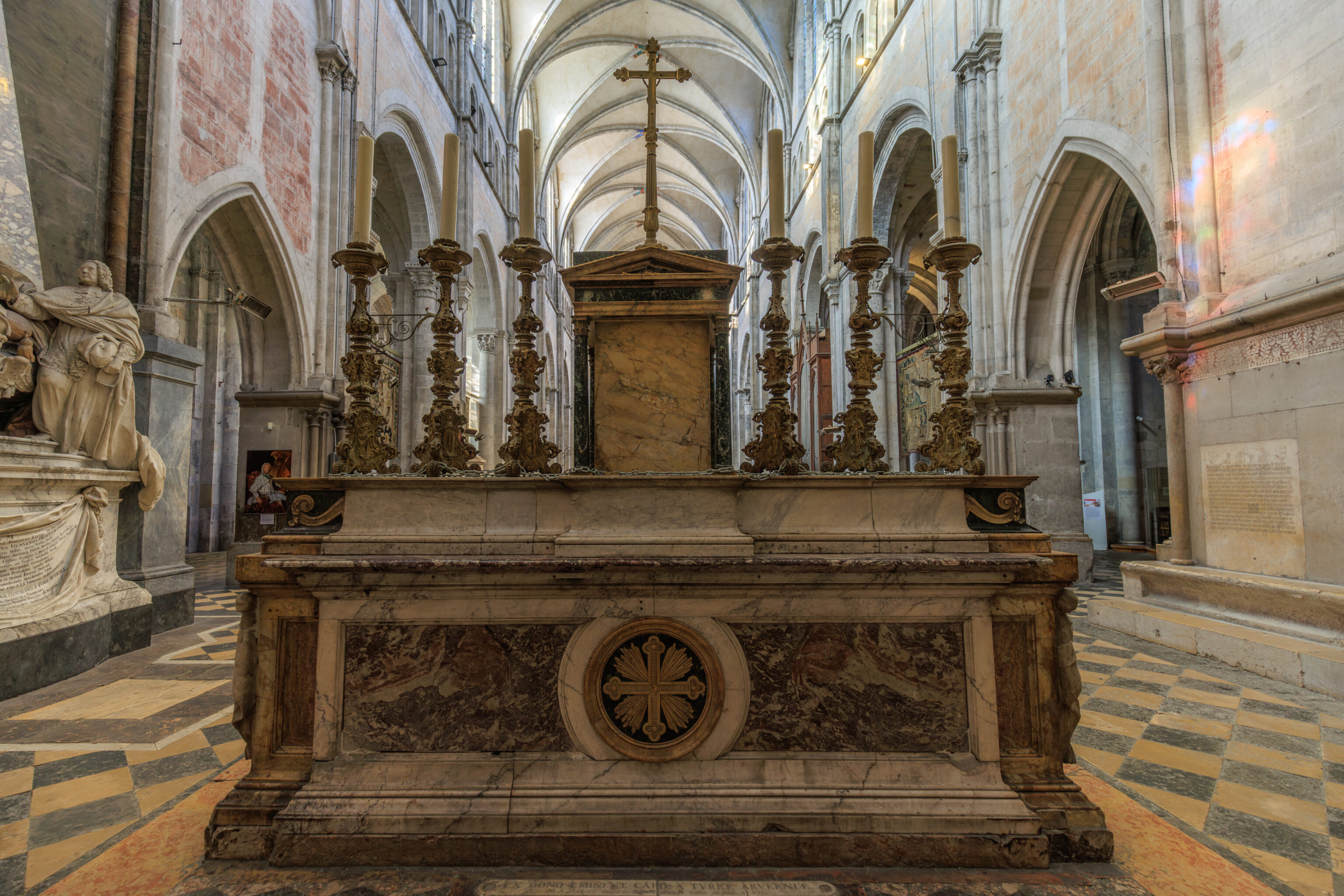
Over the centuries, the evolution of liturgical practices, changing fashions, the violence of the destruction perpetrated by Huguenot bands, deliberate demolitions (for example, the rood screen), the suppression of the Viennese bishopric (1790-1801), the malicious destruction of furnishings (paintings, altars, statues), and their removal or abandonment have altered the interior appearance of the cathedral. Almost no evidence remains of the liturgical furnishings prior to the 19th century (except for the marble high altar at the rear of the choir). In contrast, the episcopal chair (cathedra), a relic from the early Middle Ages, has been piously preserved in the apse, even though it is no longer in use.
– Sign, translated using Google.
Saint-Maurice
At the end of the 3rd century, a legion led by Maurice came from Egypt to reinforce the Roman army. Emperor Maximian ordered them to massacre the people of Octodure (now Martigny in Switzerland) who were suspected of betrayal. The legion refused to persecute a group of Christians. The rebellion saw the emperor order the Theban legion to be massacred.

King Sigismund of Burgundy, the son of Gundobad, had an abbey built on the site of the chapel housing Maurice's relics in 515. Avit, bishop of Vienne, inaugurated Saint-Maurice d'Agaune Abbey.

Some of Maurice's relics were transferred to Vienne in 718. Vienne Cathedral was devoted to the Maccabean Brothers and Theban Legion at the time.

Avit, Clotilde and Clovis
Bishop Avit was the confidant of Clotilde, the Vienne princess and daughter of King Chilperic of Burgundy. It was the late 5th century. Both of them worked to convert Clotilde's husband to Catholicism. Clotilde's husband was Clovis, King of the Franks. His baptism in 496 made France "the Church's Big Sister" and he became the country's first Christian king.

A Buried King
Boso I, King of Burgundy and Provence, Duke of Italy and Count of Vienne among others made Vienne a capital. He was buried in Vienne Cathedral when he died in 887.
– Sign
Calixtus II
Guy of Burgundy was Archbishop of Vienne for 31 years. He was crowned Pope Calixtus II at Vienne Cathedral in 1119. The first 9 Knights of Our Lord Jesus, the future Templars, appeared that same year.

Calixtus II was only pope for five years but he was behind a multitude of initiatives including the standardisation of the Camino de Santiago, the end of the Investiture Controversy at the Concordat of Worms in 1122, the victory of spiritual power over temporal, clerical celibacy and the first Cistercian chapter.

In 1992, John Paul II stated that Calixtus II "didn't spare himself any pain to obtain guarantees of independence for the Church", making him one of the greatest popes in the history of Christianity. He died in December 1124 and was buried in the Basilica of St John Lateran in Rome.
– Sign
The end of the Templars
The Templars appeared the year that Pope Calixtus II was crowned at Vienne Cathedral and their order was finally eradicated in the same cathedral 200 years later at the Council of Vienne in 1311-1312 during the reign of Pope Clement V and in the presence of King Philippe IV of France.

Essentially, the Archbishop of Bordeaux Clement V wanted to be crowned pope in Vienne, "Rome's equal" he believed. But the King refused as Vienne was a city in the Holy Roman Empire. He was crowned in Lyon. He became the first pope in Avignon.

A long history...
Vienne Cathedral as been "home" to the greatest bishops and archbishops for almost a thousand years: Mamert, Avit, Adon, Barnard, Léger, Guy of Burgundy, Jean de Bernin, Pierre Palmier and more. Some of these archbishops were Counts of Vienne as Rudolph III, the last ruler of the Burgundy-Provence kingdom, left the city to St Maurice, therefore the Church, in 1023.

Episodes in the history of this incredible site involves Charlemagne donating some of his inheritance to its construction and King Henry II who left the heart of the Dauphin and son of King François I in the cathedral's choir.

Holy Vienne
"You couldn't find a holier land" wrote Pierre Cavard in the mid 20th century.

Joseph Méry, a 19th century writer. wrote the following about a daytripper: "Everything tells him that something mysterious and incredible happened here" ...
– Sign
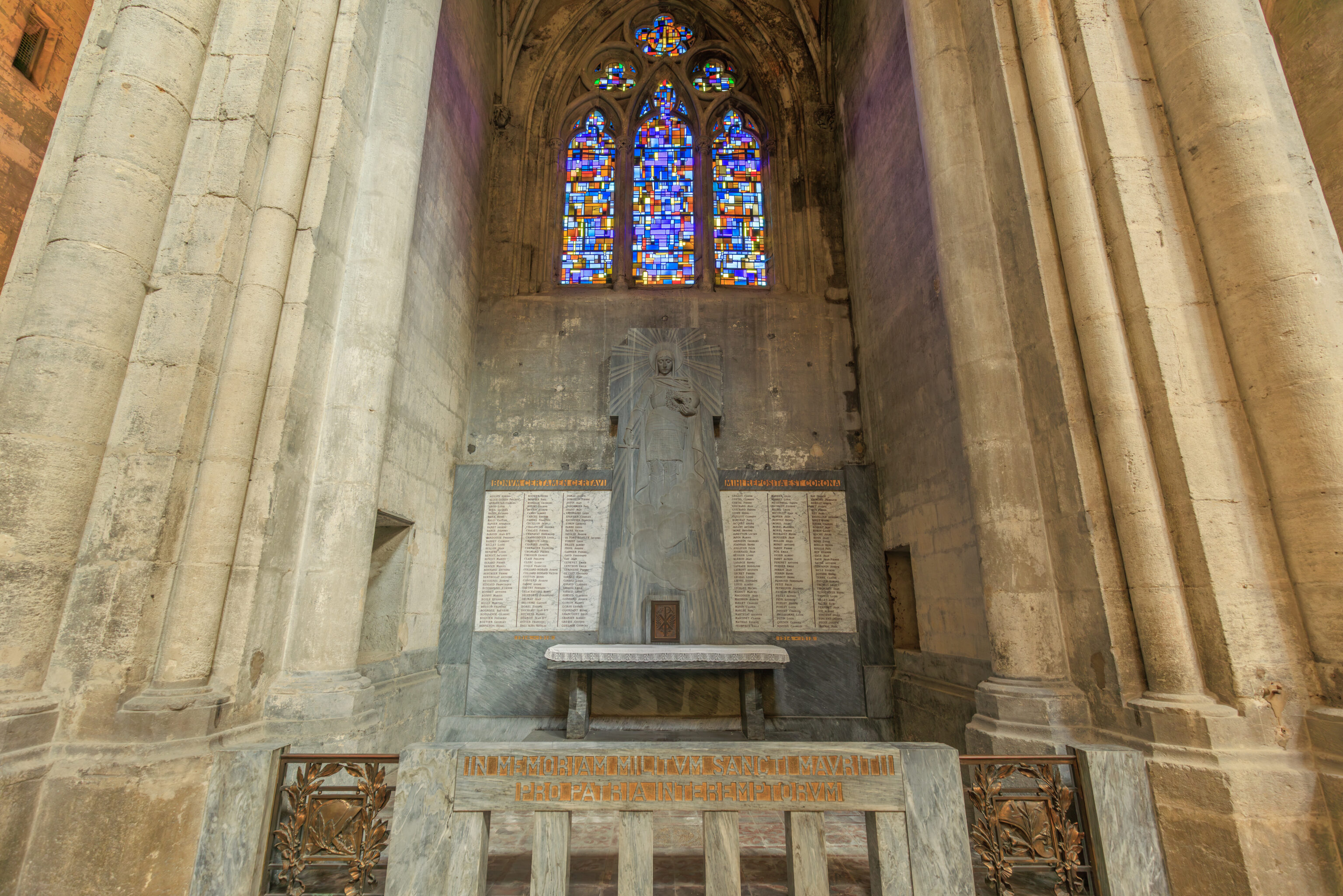

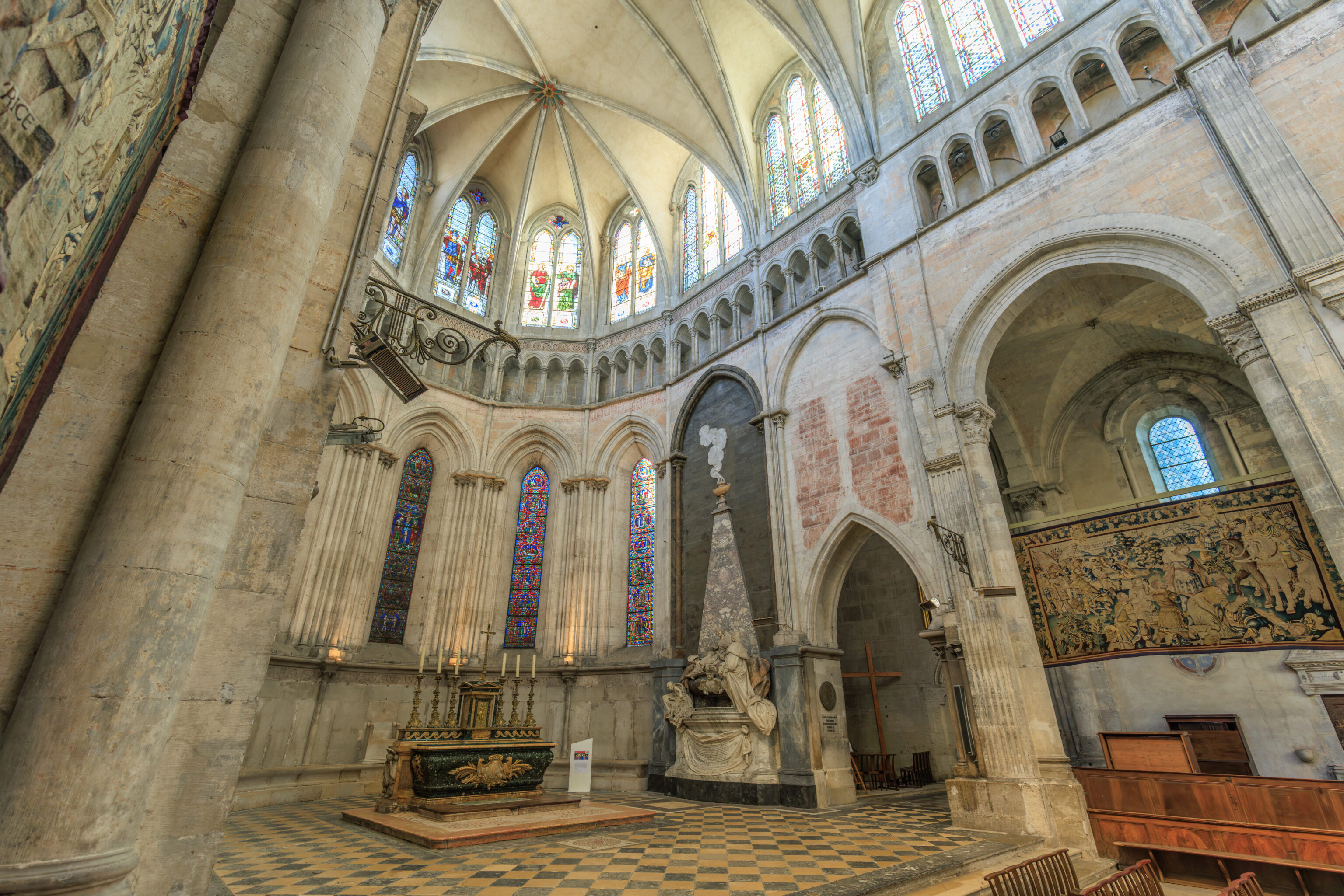
The marble sculpture to the side of the altar is a mausoleum for two archbishops:
THE MAUSOLEUM OF THE TWO ARCHBISHOPS
Cardinal Henri-Oswald de La Tour d'Auvergne, Archbishop of Vienne from 1721 to 1745, commissioned in 1740 the mausoleum intended to honor his predecessor, Armand de Montmorin, who died in 1713. In Rome, where he met the French sculptor Michel-Ange Slodtz, he entrusted him with the execution of the monument, which was created in the sculptor's Roman workshop. The mausoleum was not installed in the cathedral until the end of 1747, after the cardinal's death. In March 1748, the ashes of the two archbishops were reunited in the same vault. From the top of the pyramid of purple breccia burns a perfume vase. Bishop Armand de Montmorin is half-reclining on his tomb; With his right hand, he points to the mitre and crosier that will pass to his successor, who solemnly approaches him, wearing his heavy cope.

To the left, a genius, according to one interpretation, is preparing to inscribe the new name on the episcopal list. On the base, the marble drapery bears a Latin eulogy of Armand de Montmorin.

The "Cardinal of Auvergne" belonged to a prominent family of Auvergne origin, linked to a branch of the princely Hohenzollern family (in the Holy Roman Empire).

A high-ranking ecclesiastical dignitary, he was made a cardinal in 1737, first chaplain to King Louis XV, and Commander of the Order of the Holy Spirit.
– Text from a sign, translated using Google.
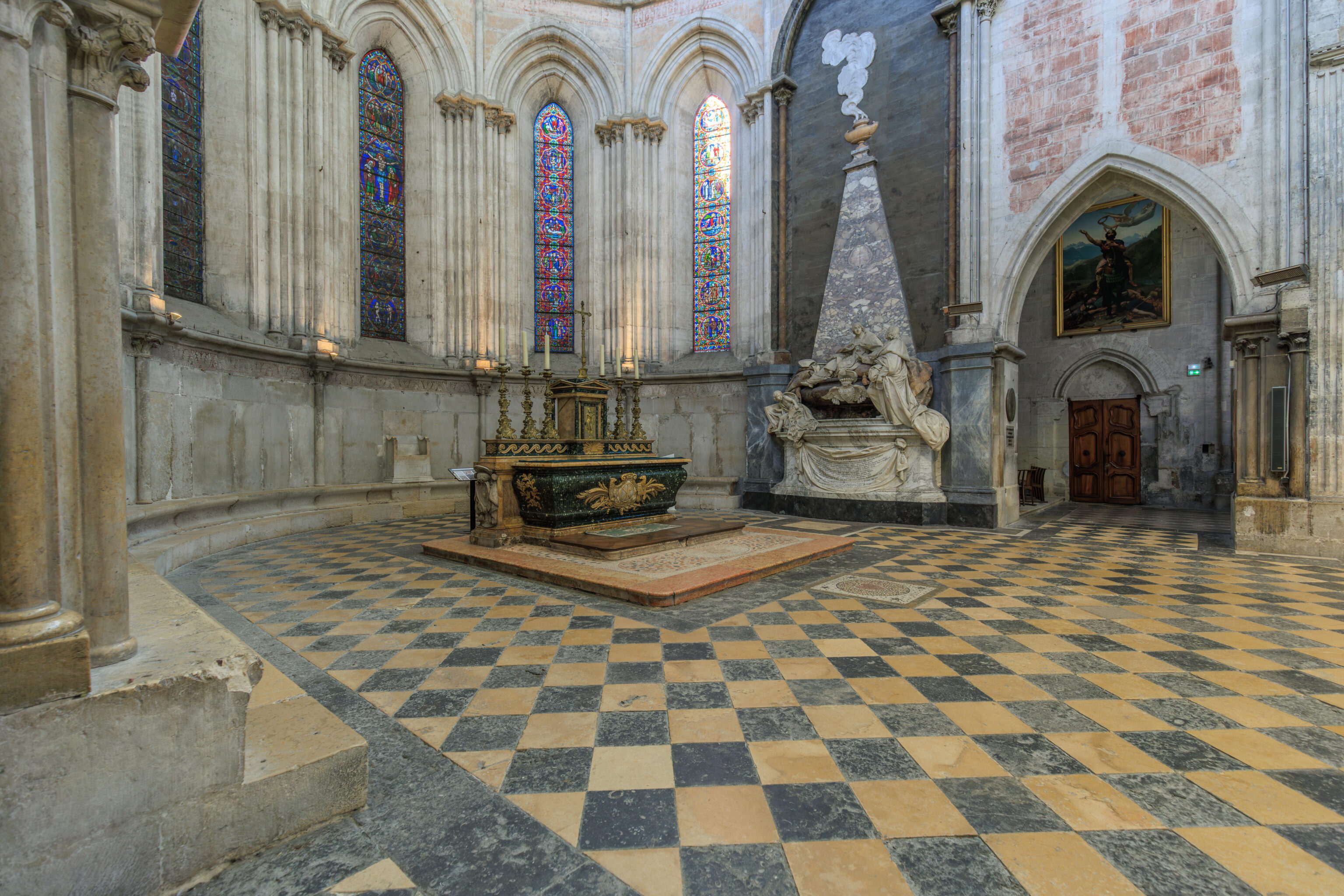
There is a mosaic heart on the ground here in front of the altar:
THE HEART OF THE DAUPHIN FRANCIS
In front of the altar, a mosaic heart on the floor commemorates the fact that in 1548 the heart of the young Dauphin and Duke of Brittany, Francis (eldest son of King Francis I of France and Claude), was laid to rest in this very spot. The heart was given to the city of Vienne by his younger brother, King Henry II of France. Francis had died in August 1536 at the Château de Tournon, following a game of tennis played in Lyon a few days earlier in intense heat; at the time, this sudden death was considered suspicious and attributed to poisoning.
– Text from a sign.
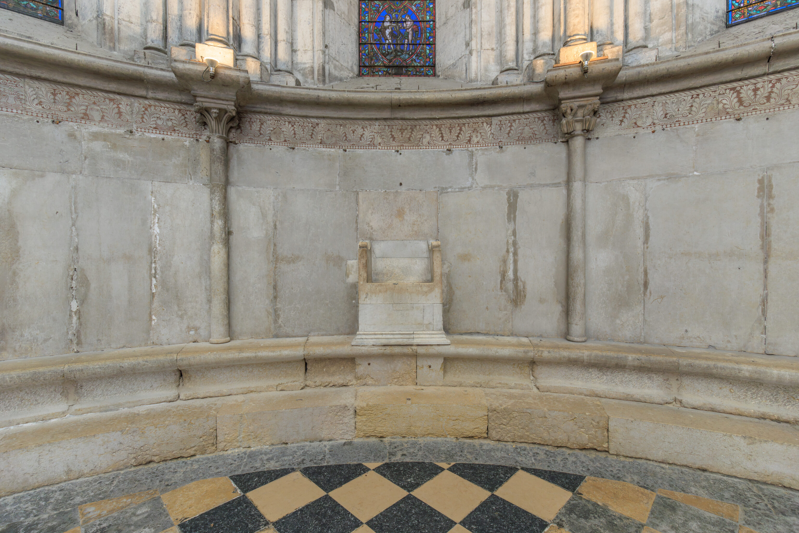
This marble chair is the cathedra, the Bishop’s seat:
The Cathedra
The cathedra was the bishop's presidential seat (the name is the origin of the adjective "cathedral" and subsequently the noun "cathedral"). Here, it is devoid of ornamentation except for the molded base of the plinth and the armrests. A short flight of steps, now gone, made it easily accessible. Its current arrangement is a sign of the desire of the clergy to preserve, beyond the vagaries of history, an ancient element belonging to the symbolic heritage of the cathedral; it is generally attributed to the Romanesque cathedral. Or perhaps it is even older?

This polished white marble throne is placed against the walls of the apse, made of large upright slabs. On either side, the limestone presbytery bench was reserved for the concelebrating clergy.
– Text from a sign, translated using Google.
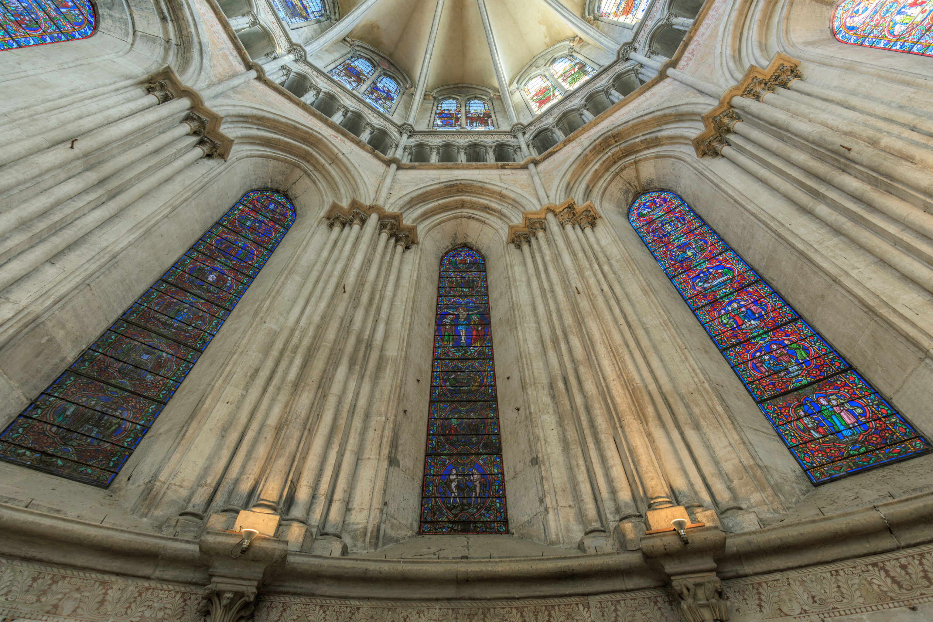
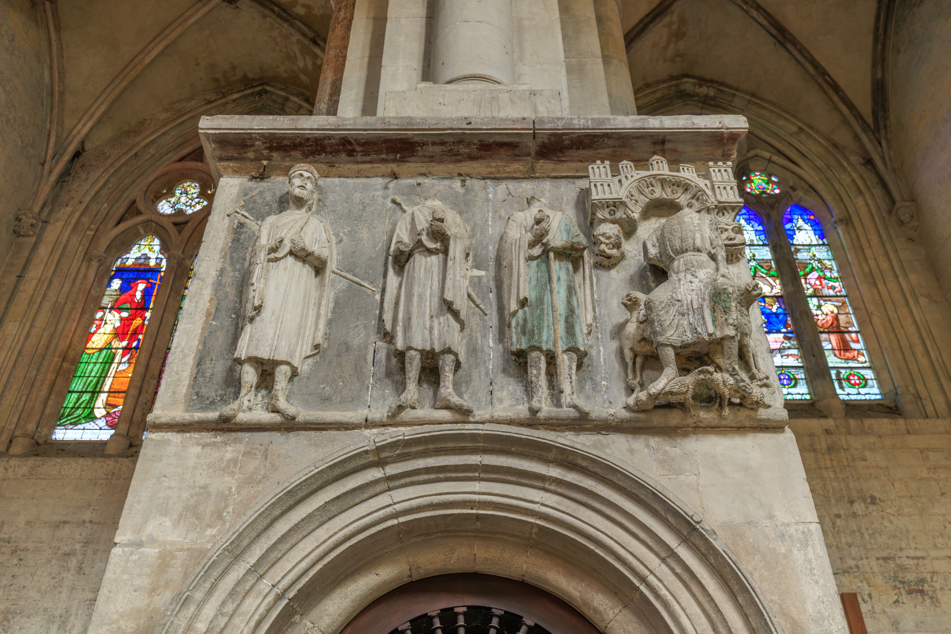
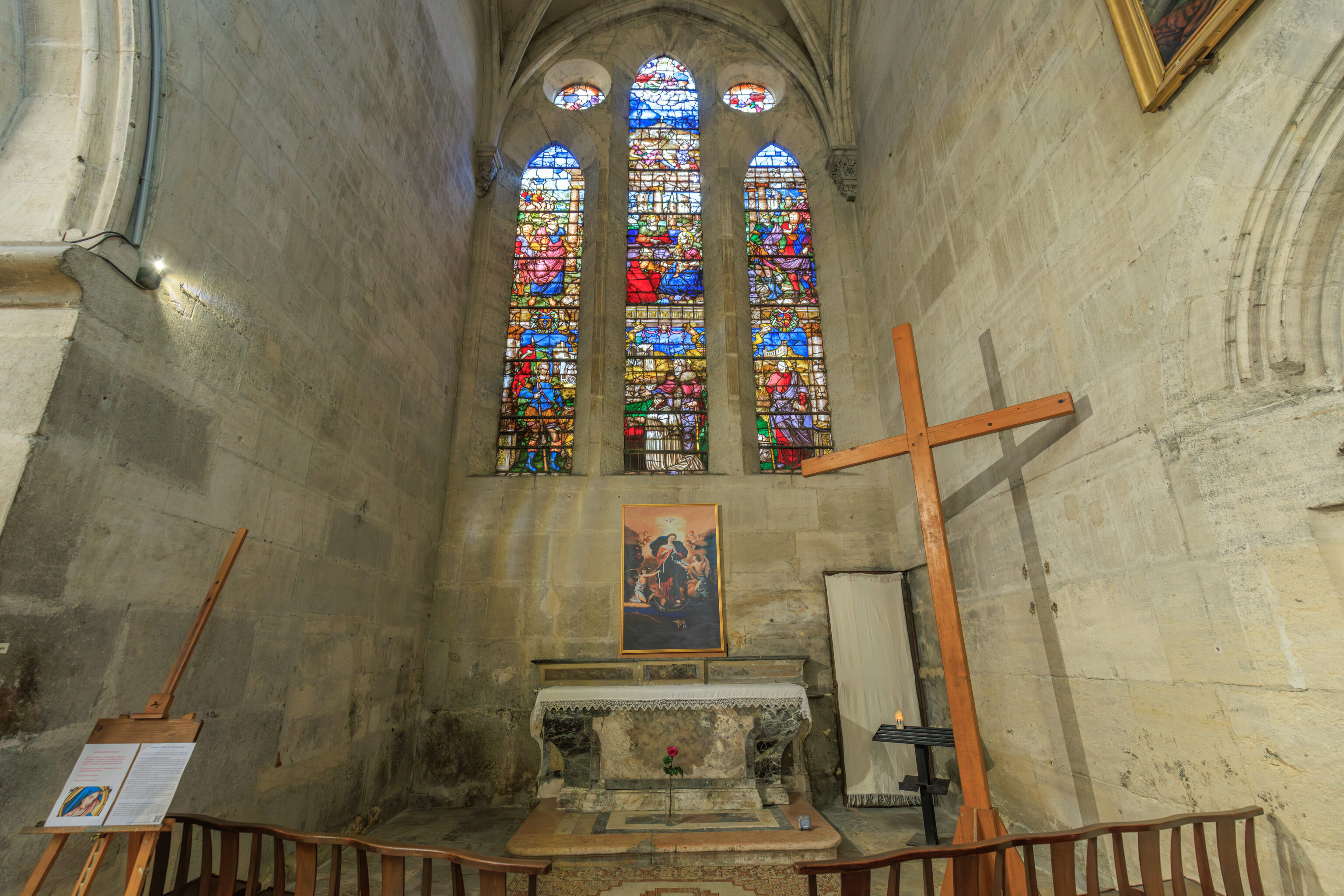
THE CHOIR'S STAINED-GLASS WINDOWS
The stained-glass windows in the choir were created in 1898 by the workshop of the Lyon-based master glassmaker Lucien Bégule.

His prolific and varied work in the Lyon region, which began around 1880, reflects the revival of stained glass that had been underway in France since the mid-19th century. Here, the artist created compositions in the style of medieval stained glass: the figurative scenes are contained within circular, oval, or polylobed medallions, which are superimposed in several registers. Brief captions identify the figures that illustrate the history, real or legendary, of the Church of Vienne.

The central bay acts as the axis of symmetry of this visual narrative: it is dedicated to the cycle of Redemption, from the original sin of Adam and Eve to the Ascension of Christ and centered on the Crucifixion. It is a condensed version of the Christian faith, a program more fully developed on the Romanesque capitals or on the central portal of the facade.

On either side of the central stained-glass window and from bottom to top:

From Bishop Mamertus (late 5th century) to the Council of Vienne convened by Pope Clement V (1311-1312), which brought an end to the trial of the Templars;

the legendary origins of the Church of Vienne, from Crescent, disciple of Saint Paul (allegedly the first evangelizer of Vienne), to the arrival of the relics of Saint Maurice at the beginning of the 8th century;

the martyrs of the Viennese Church, from the first Gallic martyrs of Vienne and Lyon (177), including Sanctus, deacon of Vienne, Blandine, and Ponticus, to the two Viennese companions, Julian and Ferréol, who died martyrs, one in Brioude and the other in Vienne, at the beginning of the 4th century;

the religious figures who have accompanied Viennese history from the 5th century (the Indian priest Severus destroying a pagan temple) to the Middle Ages (with the Capuchins caring for plague victims).
– Text from a sign, translated using Google.
We spent about half an hour in the cathedral before moving on.
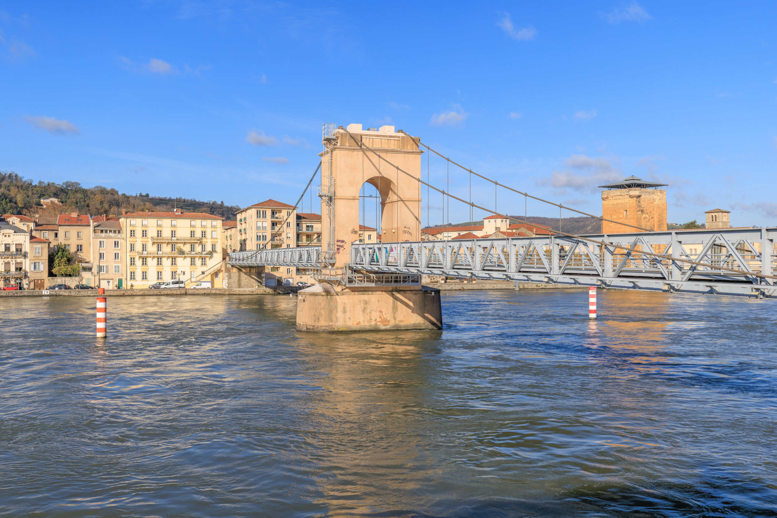
We walked over to the left bank of the Rhône to reach this pedestrian bridge. The far side of the bridge is Sainte-Colombe in the Rhône department.
THE RIVER RHÔNE AND THE TOWN IN ANTIQUITY
The Rhône has hollowed out a gorge through the Massif Central in Vienne. Five hills follow each other on the left bank and the right bank is dominated by the mount Pilat hills.

In Celtic times, Vienne was a crossroads between the Mediterranean world, the Alps, Northern Gaul and western Gaul. The Rhône flooded the whole plain and the town was located on a rock promontory (below the Court of Law). In the 2nd century B.C., the Rhône became narrower; the settlement spread down into the plain and became the capital of the Allobroges.

In Gallo-Roman times, the town was able to spread even further on both banks of the Rhône due to the large embankments that had been built. Amongst these new districts were to be found the riverside warehouses on the left bank (4 to 6 hectares), used for storing the "annona" (an imperial tax for supplying corn to Rome).
– Text from a sign across the street from the river.
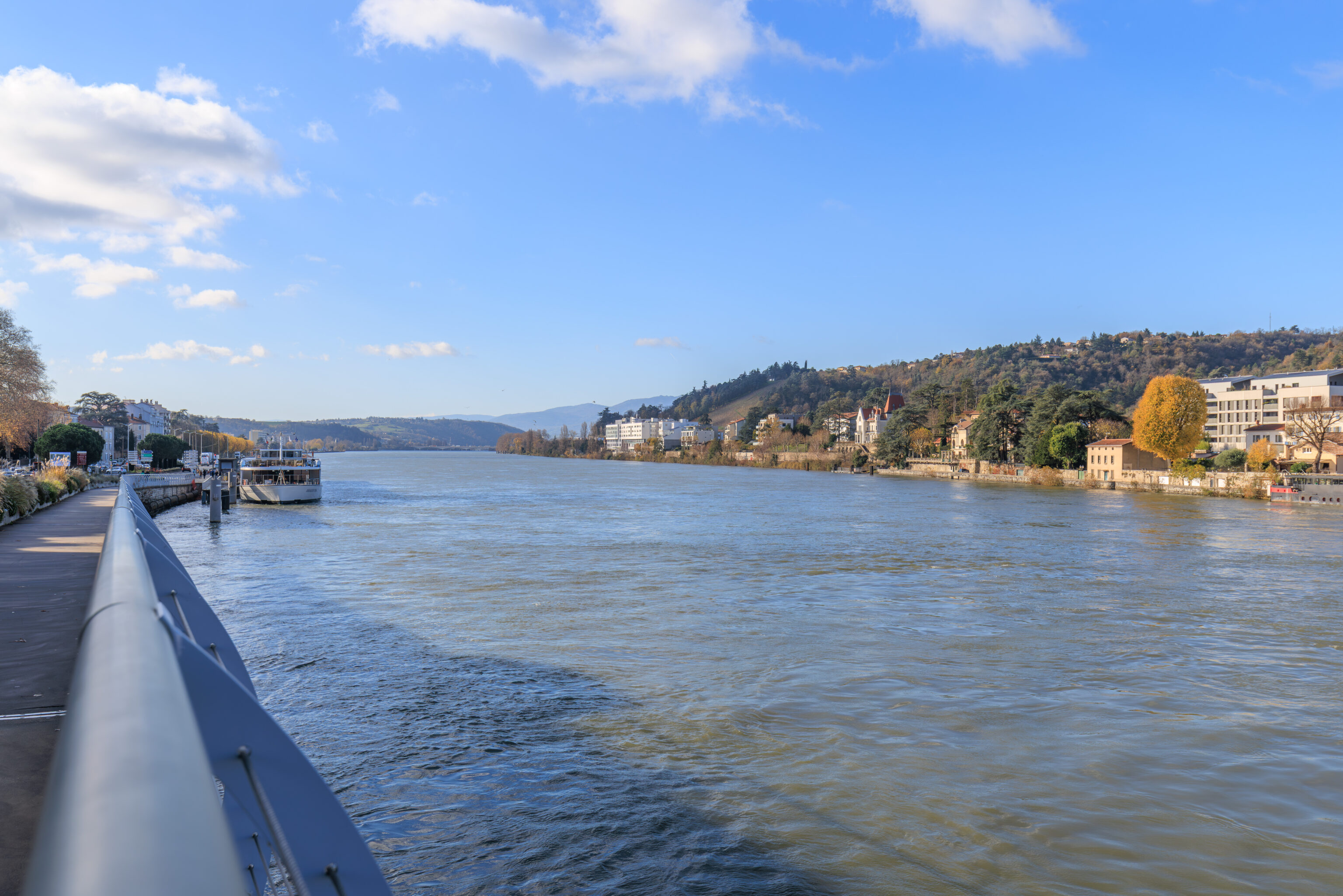
There was a river cruise boat docked not far to the south of us on the Vienne side of the river.
The view looking back at the Cathedral from the bridge.
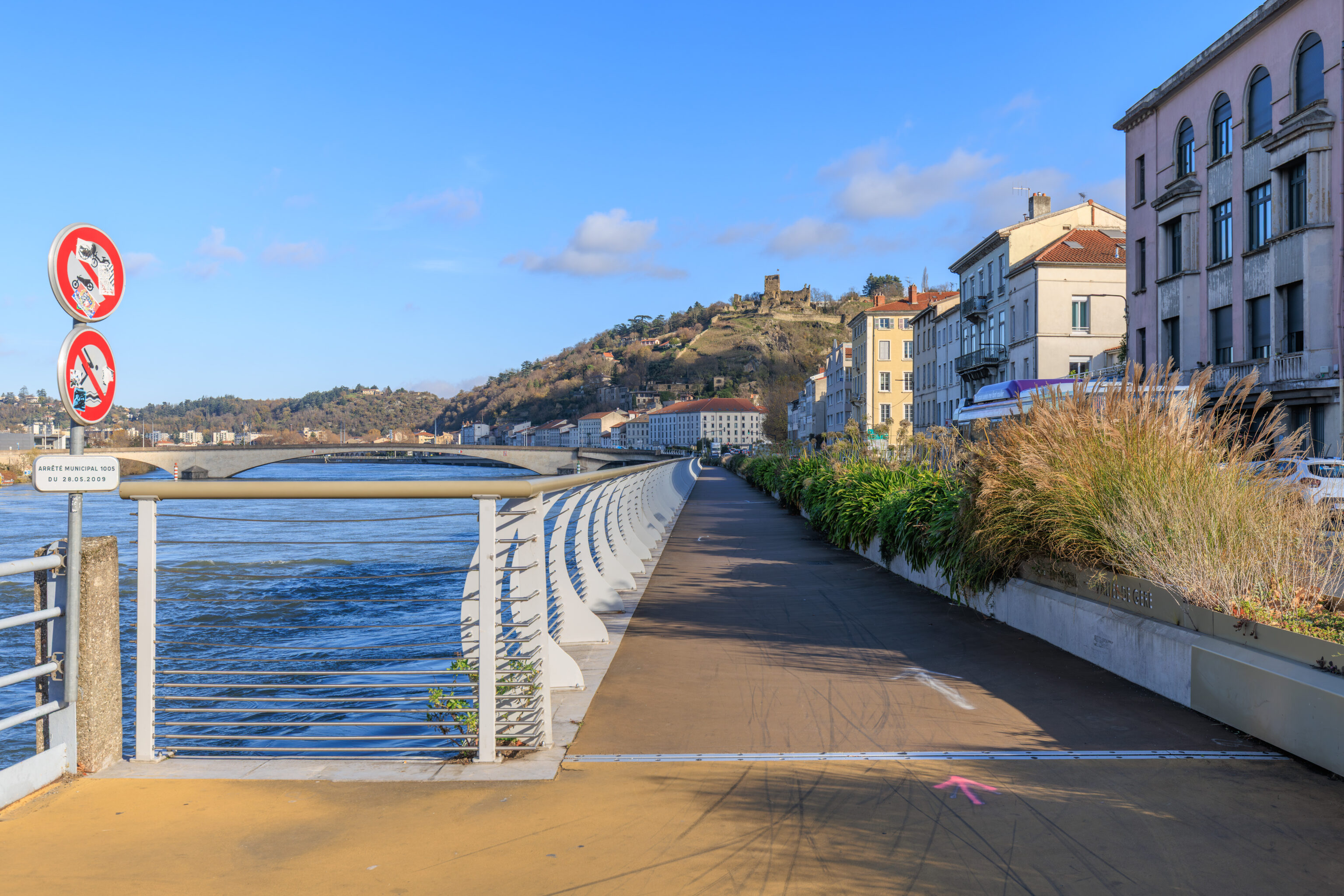
Looking to the north, we could see the ruins of a castle on the hills above Vienne. These ruins are the Château de la Bâtie. The castle was built in the 13th century.
We started to cross the bridge to get to the other side of the river.
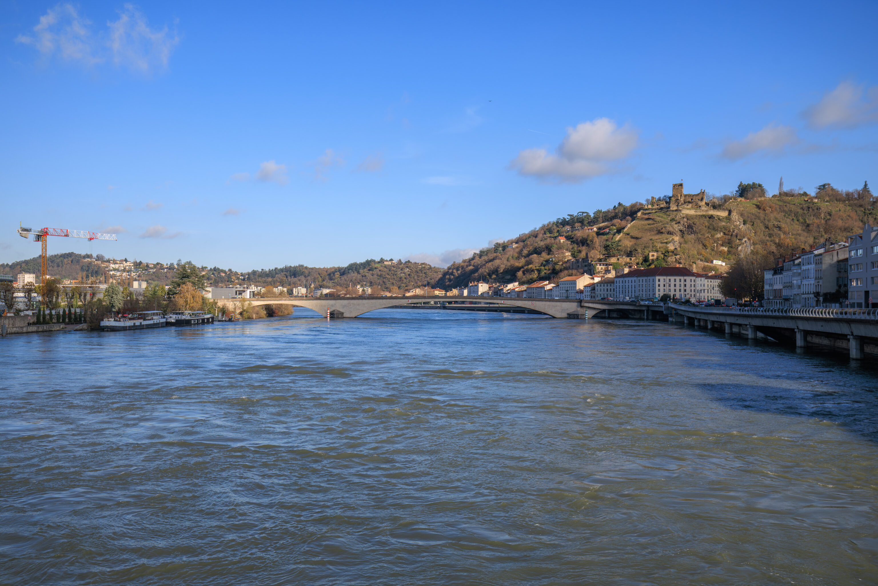
The bridge we are on and this larger bridge to the north are the only ways across the river in this part of Vienne.
From mid-river, we can see that the river cruise boat on the left is the AmaKristina.
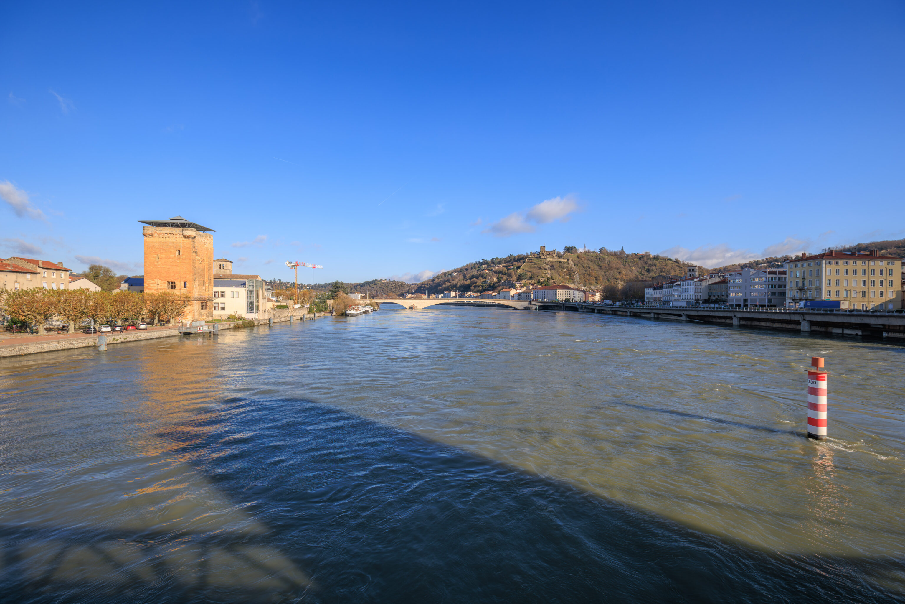
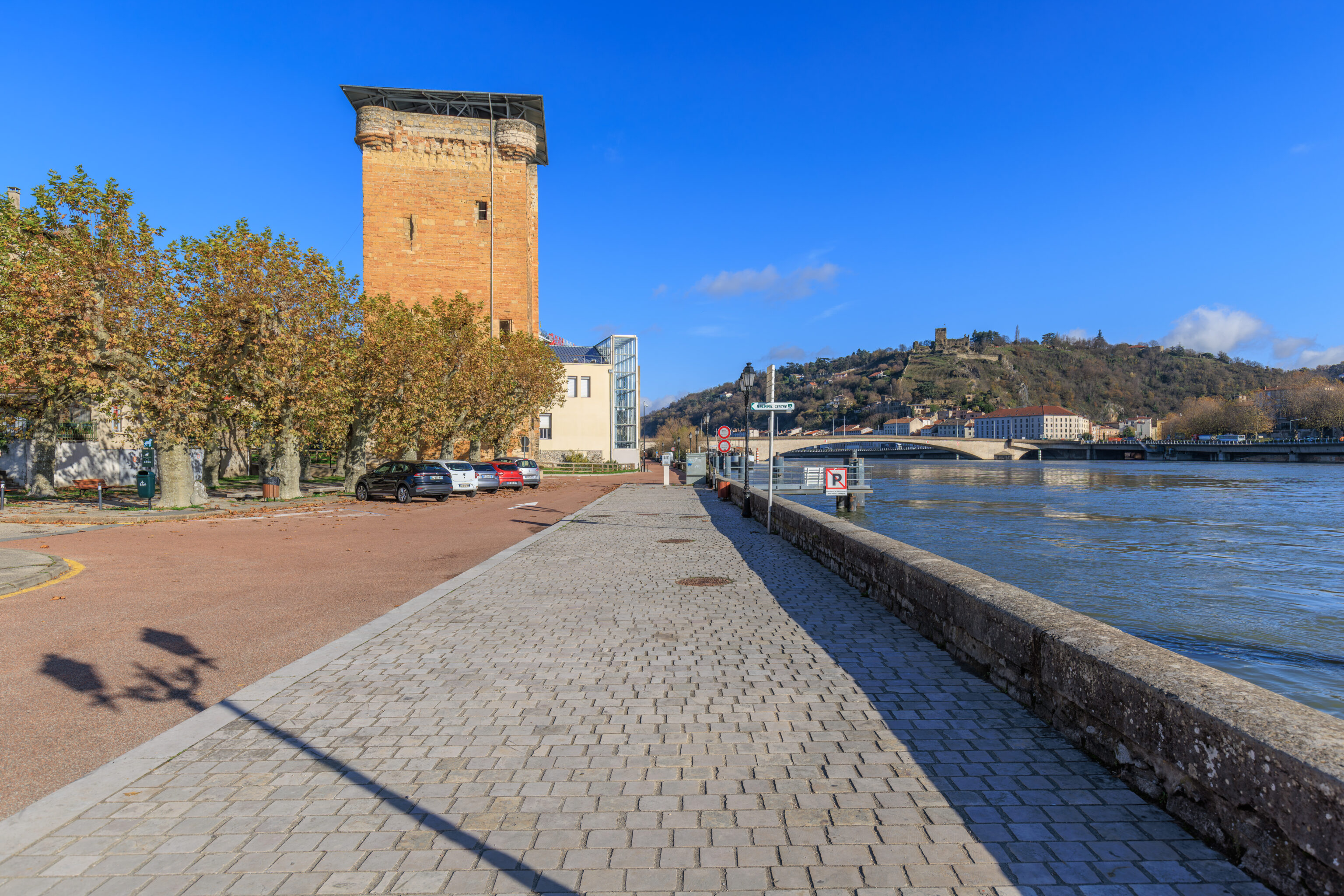
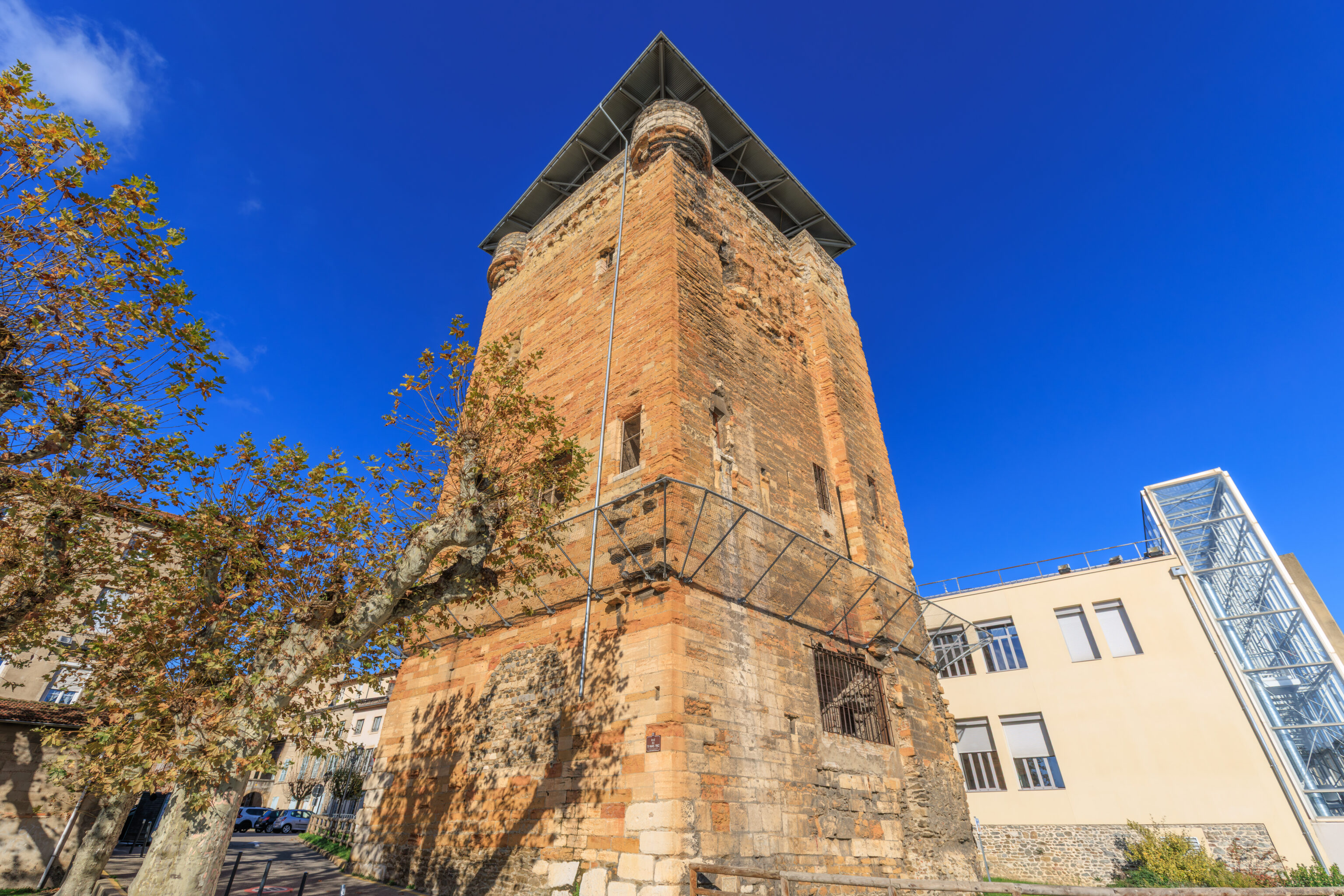
There is a large tower to the northwest.
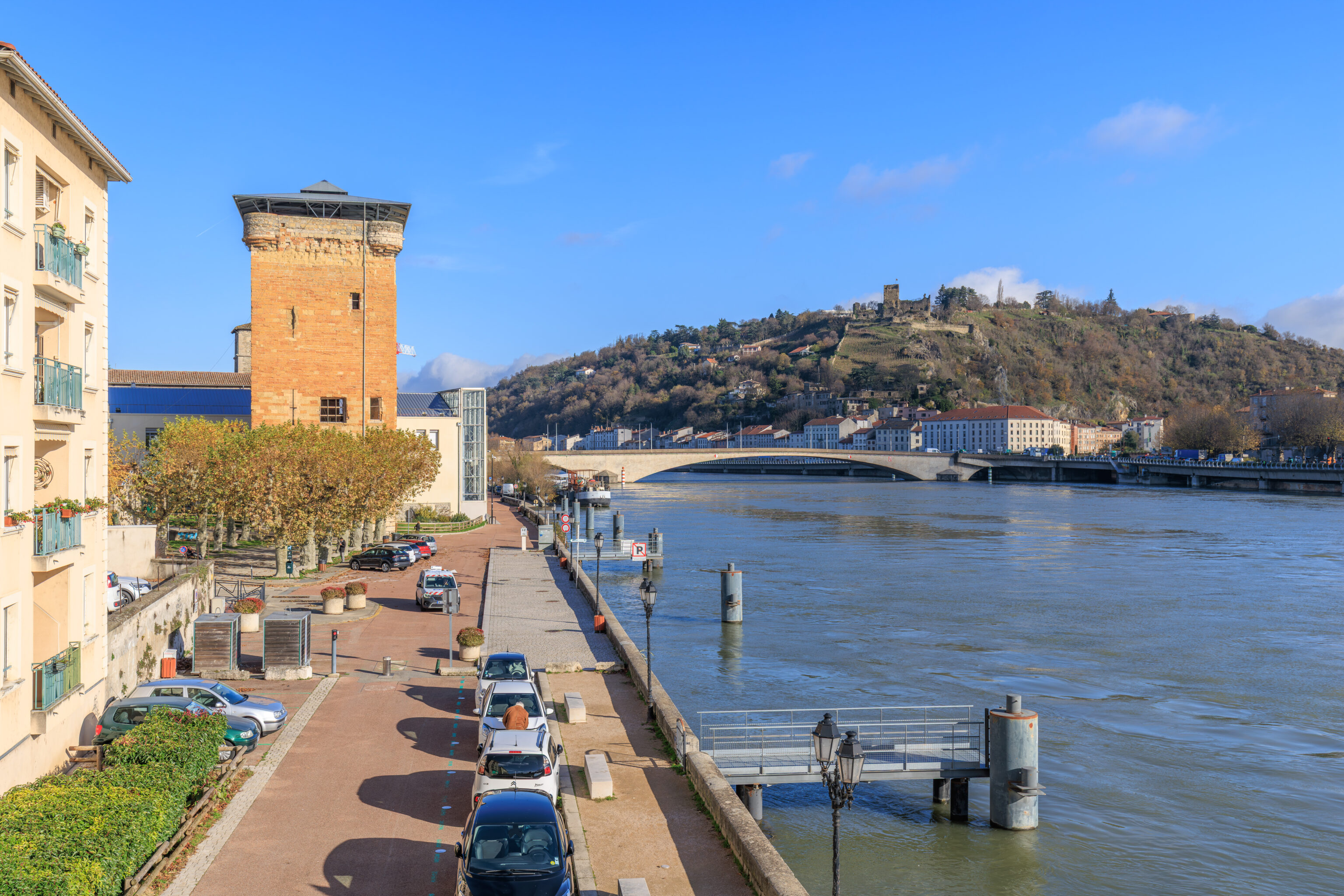
The tower is the Tour des Valois (Tower of Valois). It is the only remaining portion of the fortifications that were here in what is now Sainte-Colombe.
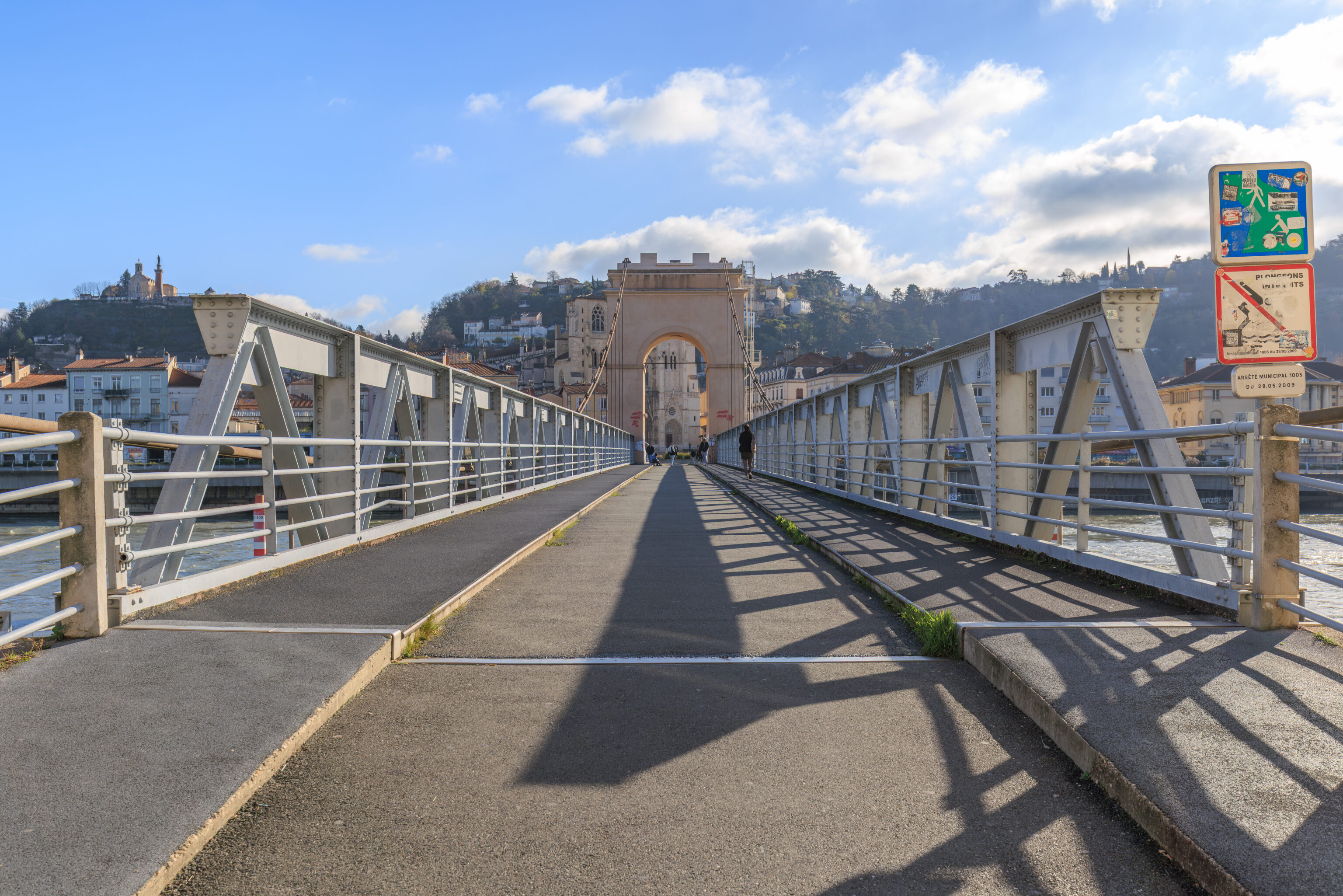
The view looking back across the bridge from the western end.
After walking down to street level on the south side of the bridge, we crossed underneath the bridge to head north.
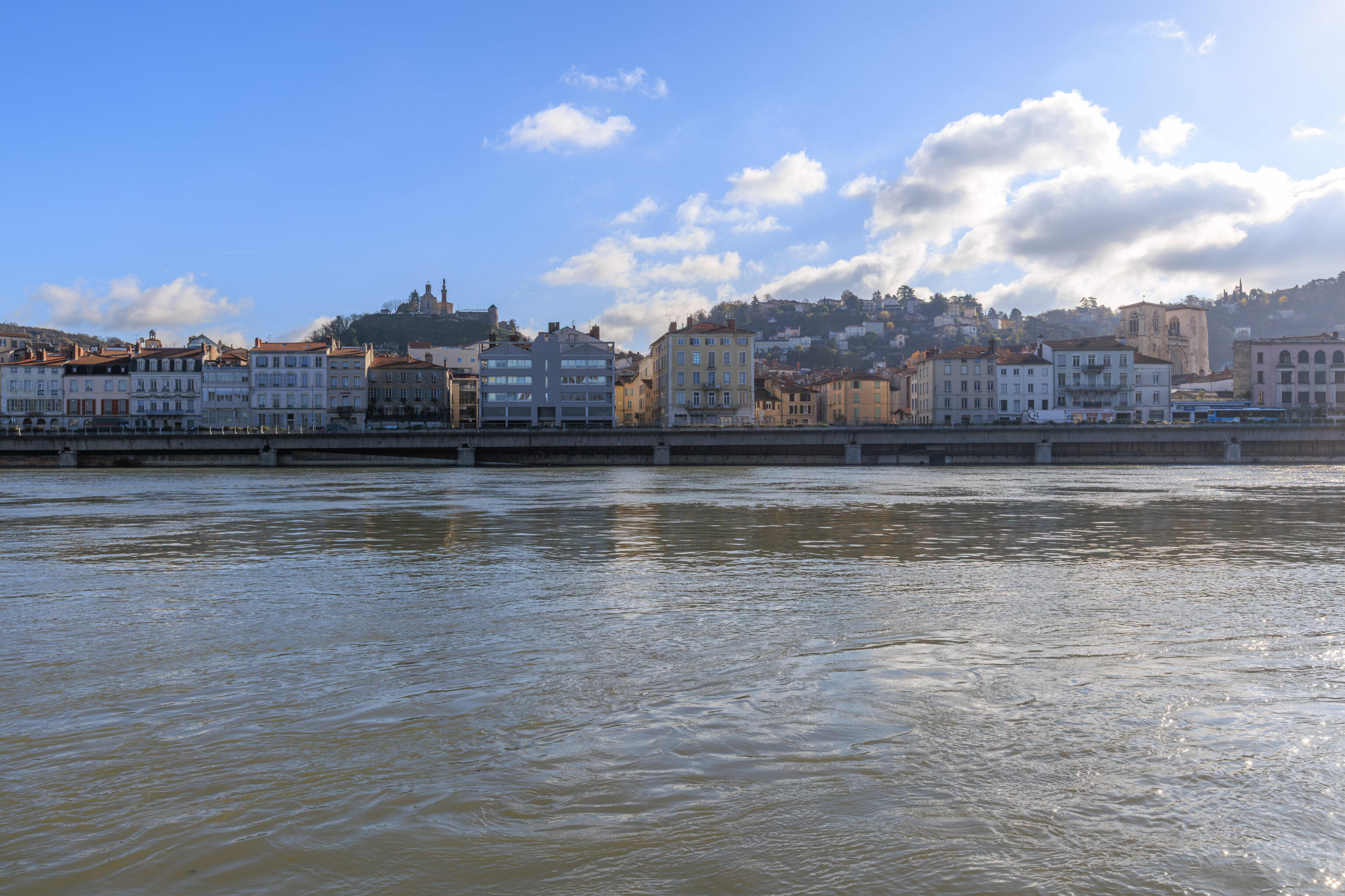
Looking back to the east across the Rhône, we could see the cathedral on the right. On the left, there is a chapel at the top of a hill behind the lower portions of Vienne. The chapel is dedicated to the Notre-Dame de La Salette. The hill it sits upon is the Pipet.
We continued walking to the north along the river.
We walked by a World War I memorial. According to the plaque on the right, it is dedicated to the 299th Infantry Regiment, which was mobilized here at Sainte-Colombe in 1914.
THE VALOIS TOWER
Ancient Vienne, whose prosperity depended on its strategic position on the river Rhône, stretched out over an area which is now the urban districts of Vienne, Sainte-Colombe and Saint-Romain-en-Gal.

The town abandoned its urban areas on the right bank of the Rhône around 250 AD and concentrated its activities around the administrative and religious centre on the left bank of the river.

In the year 1260, the Cordeliers built their monastery in Sainte-Colombe and the village became part of the realm of France in 1335. Philippe VI de Valois surrounded it with ramparts and had a tower built at the entrance to the old bridge (washed away in 1651). The present parish church which used to be the old church and part of the Cordeliers' convent was rebuilt in the 17th century.
– Text from a sign by the tower.
The view looking directly across the river.
Musée et Sites Archéologiques de Saint-Romain-en-Gal
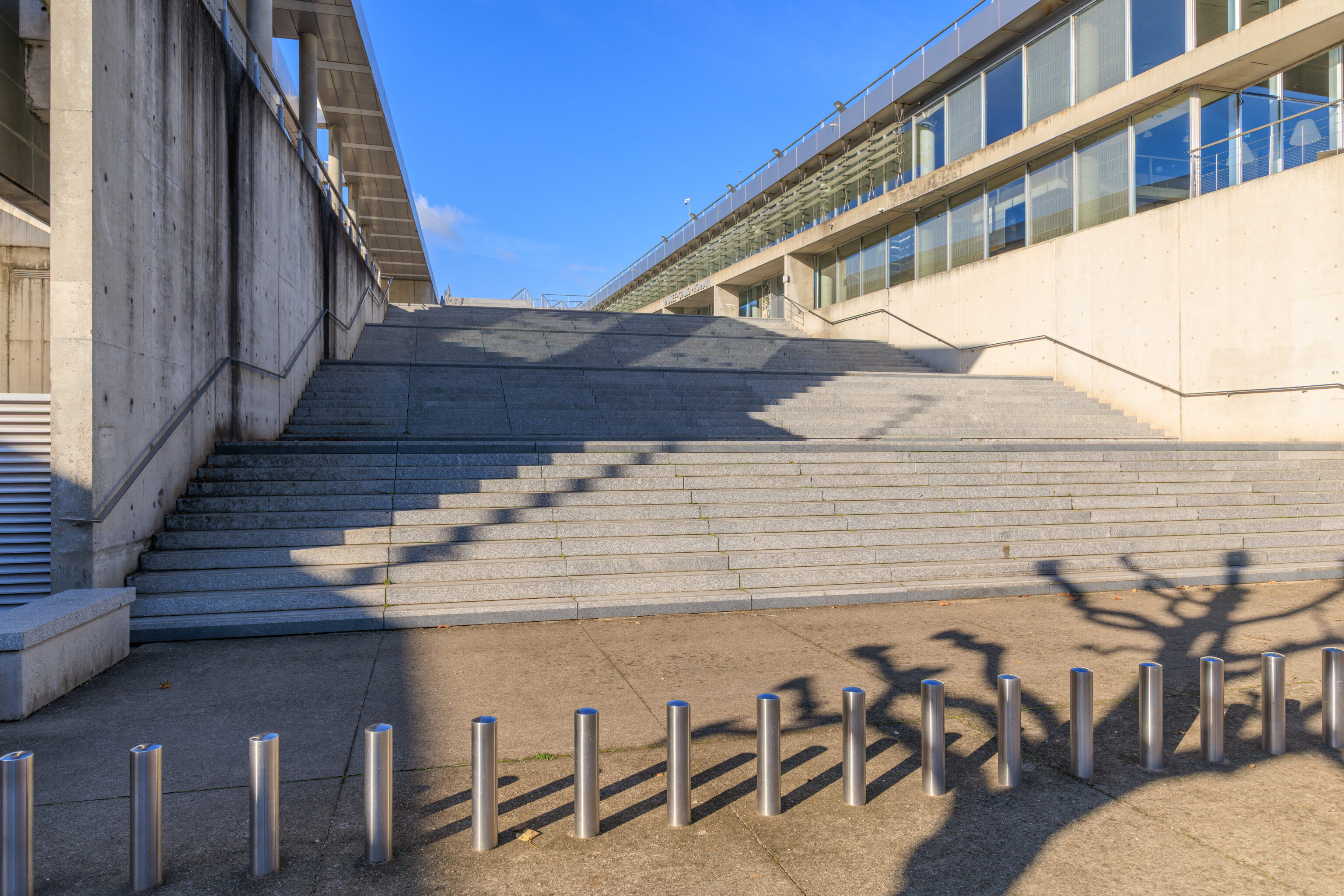
We continued walking a bit further to the north to reach the Musée et Sites Archéologiques de Saint-Romain-en-Gal (Museum and Gallo-Roman Sites of Saint-Romain-en-Gal). As the name suggests, there is a museum here at an archeological site in the town of Saint-Romain-en-Gal, just to the north of Sainte-Colombe. We walked up these stairs to get to the museum’s entrance.
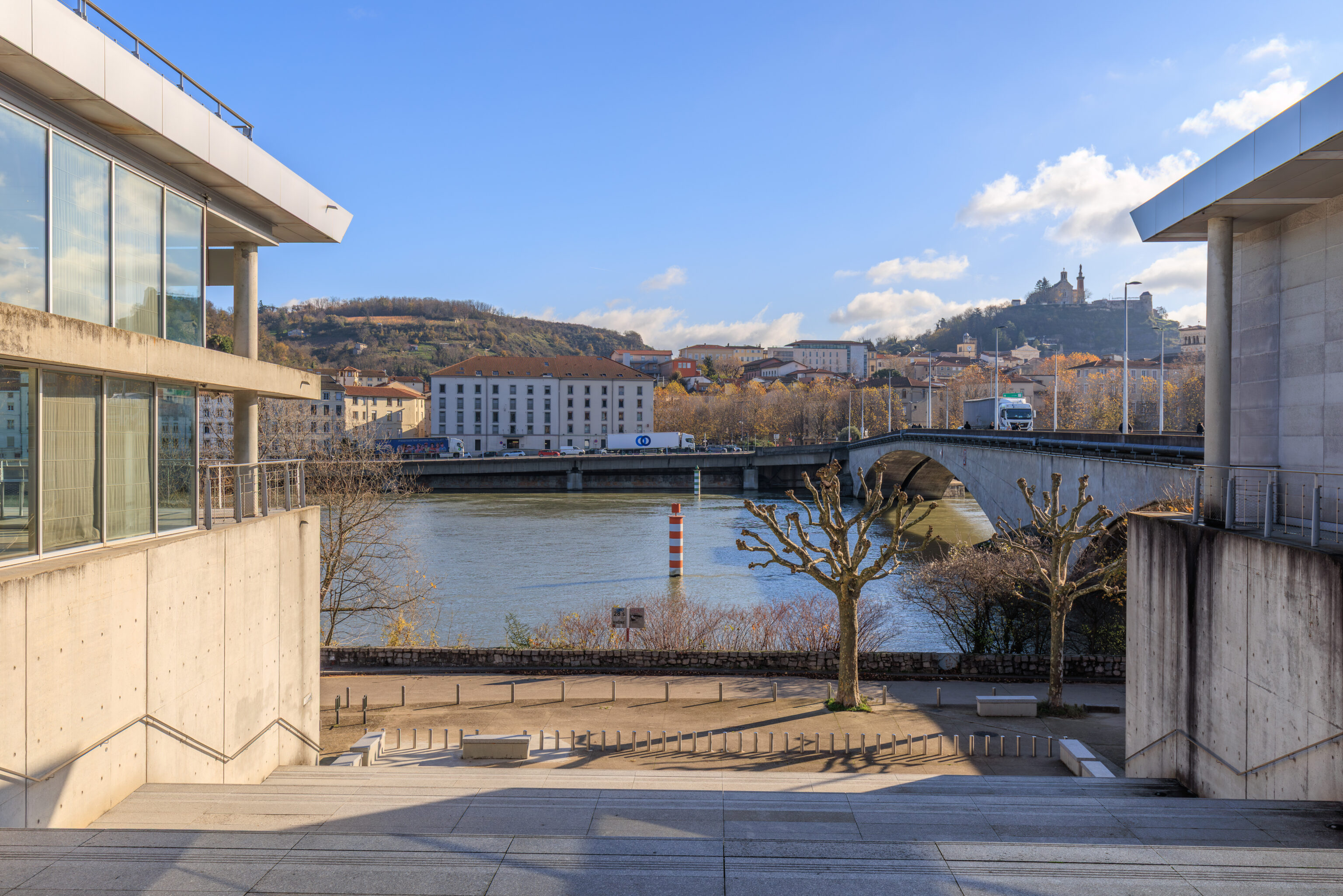
The view looking back from the top of the stairs.
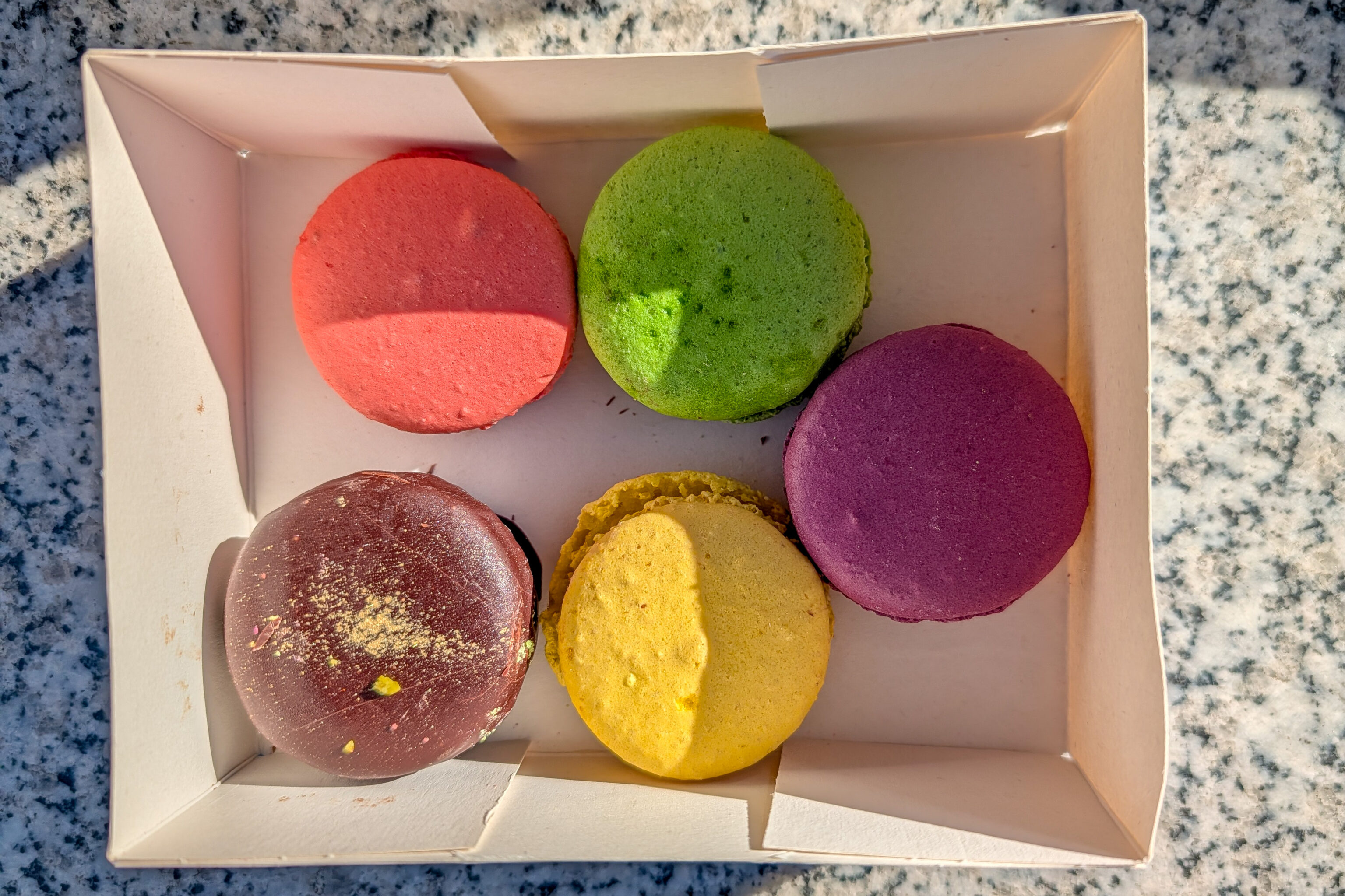
Before entering the museum, we decided to eat the snack that we got earlier at La Gâterie Adrien Bachelier. We got four macarons and a dark chocolate covered macaron. They were pretty good, still quite sweet but not excessively.
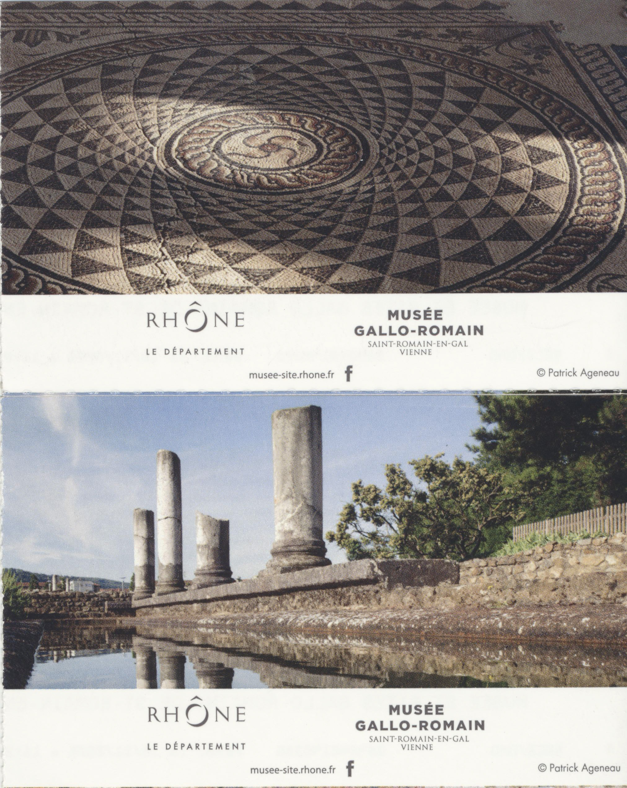
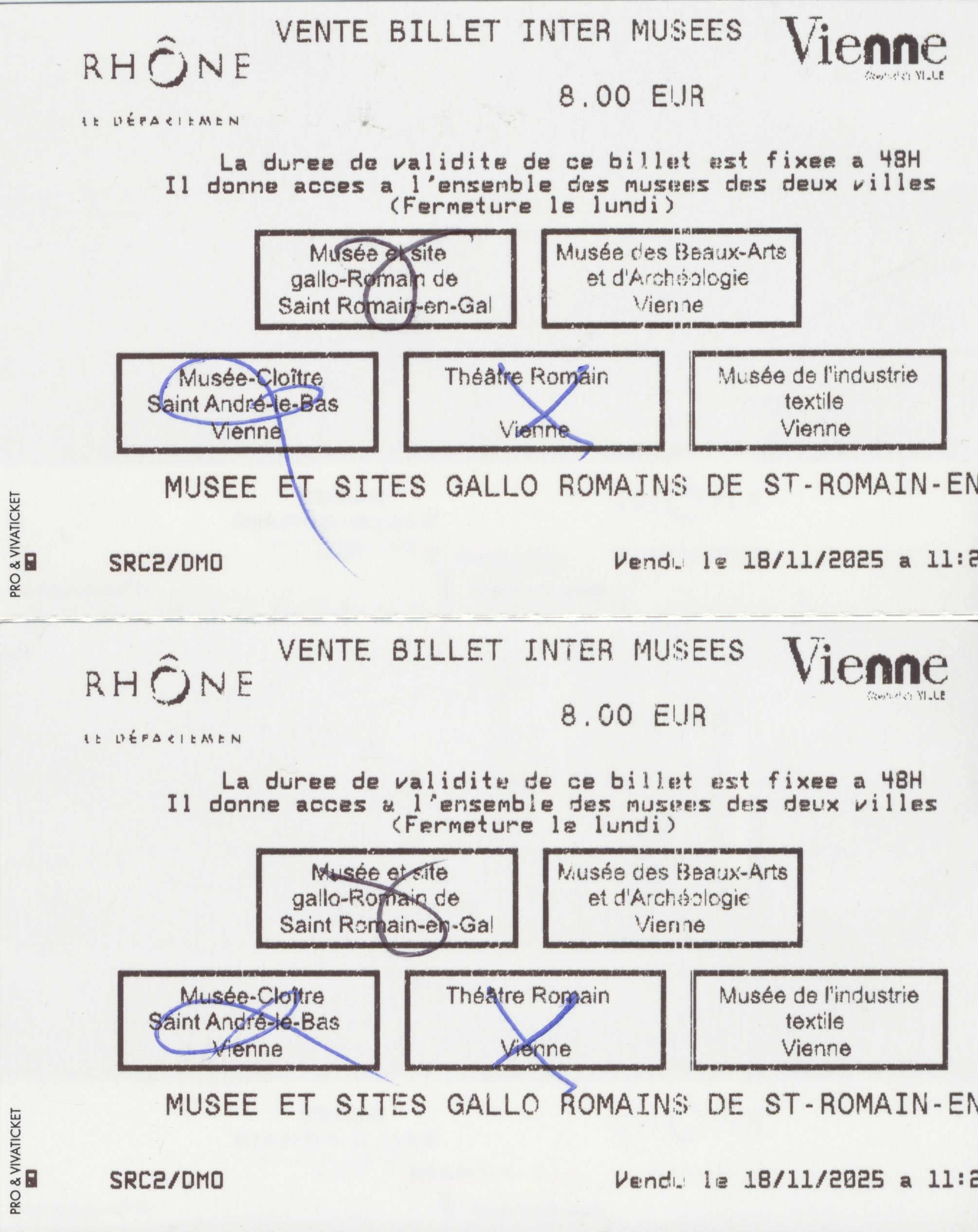
The entrance fee was 8€ and included four other historic sites in Vienne.
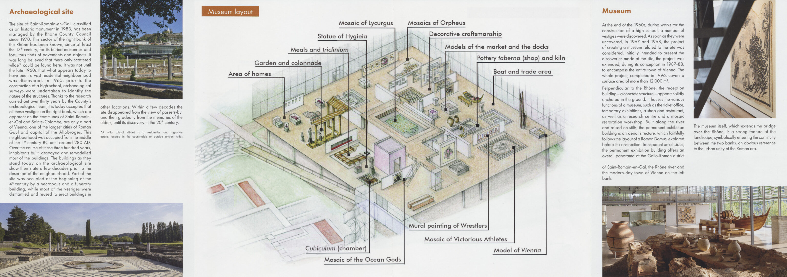
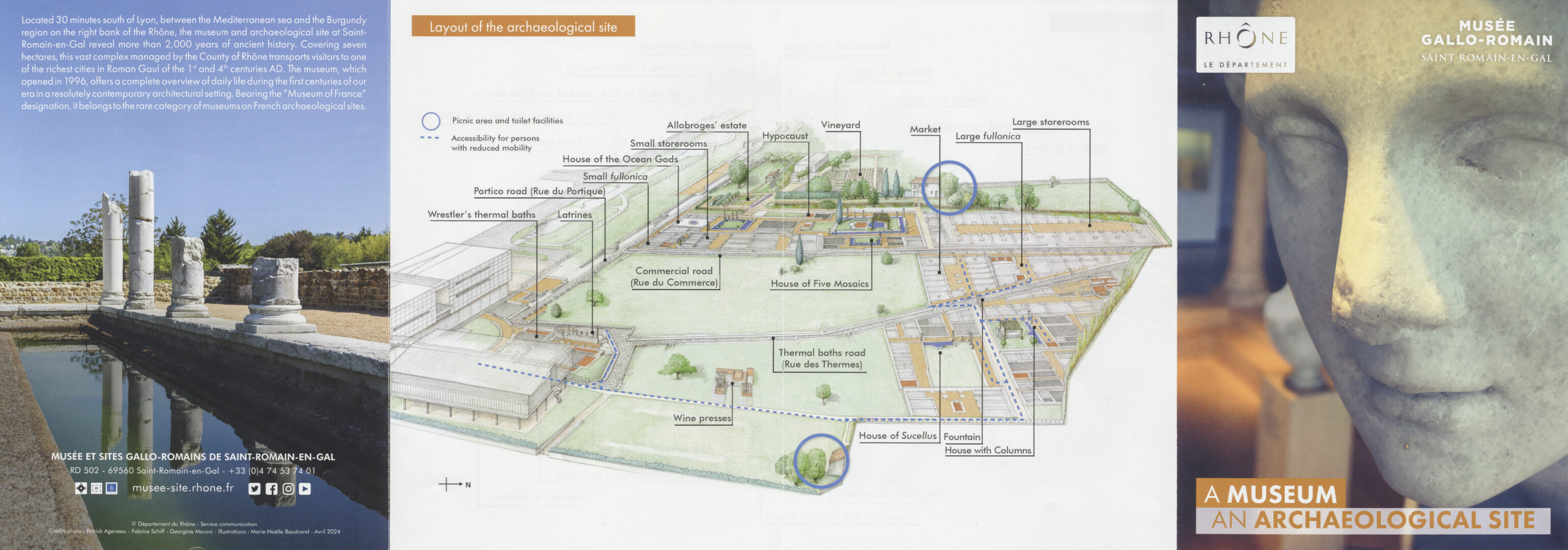
We also picked up a map of the museum and archeological site.
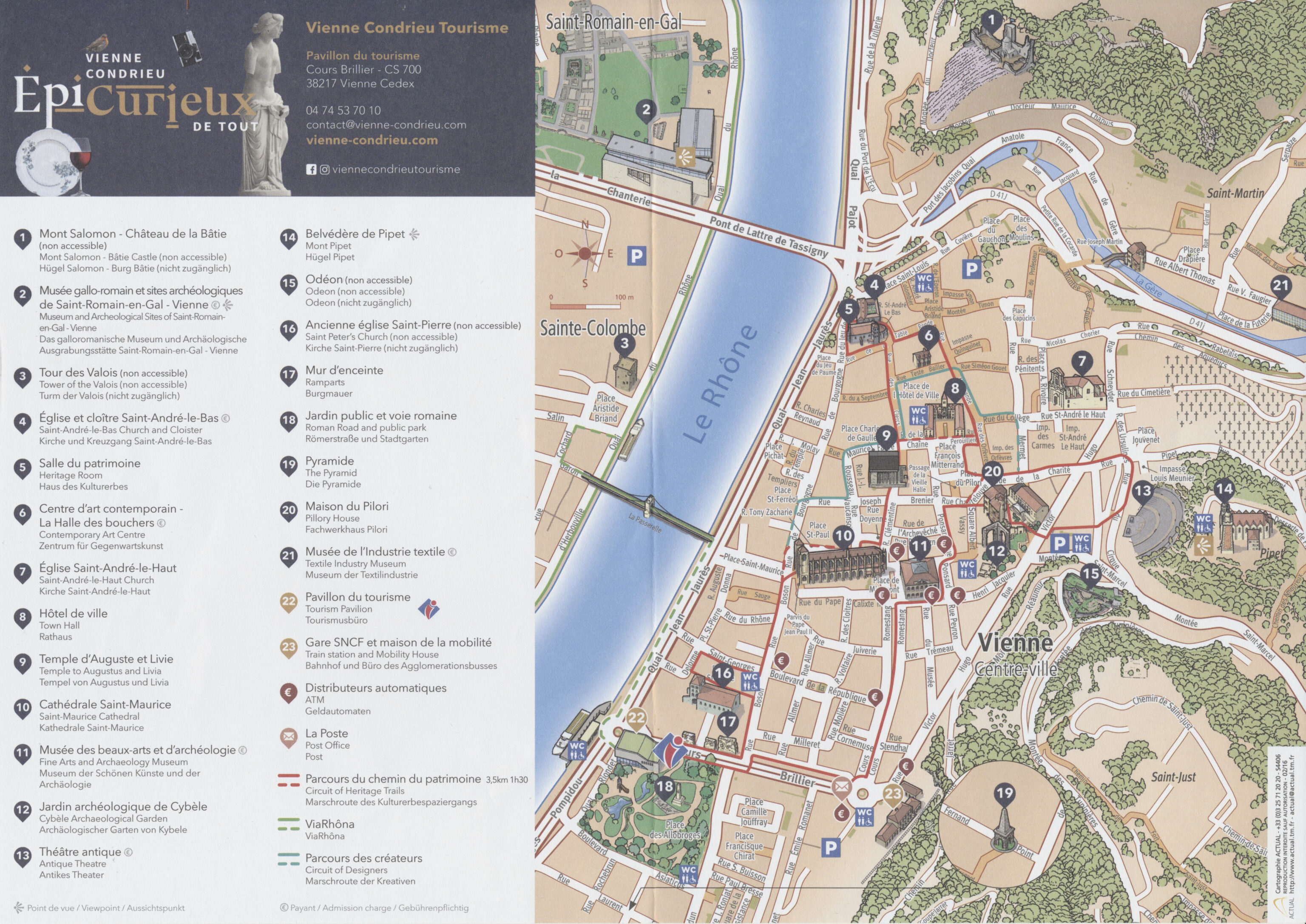
We also picked up a map of Vienne which included a walking route. While we won’t have time to visit everything on this map, we are planning on visiting many of the marked sites.
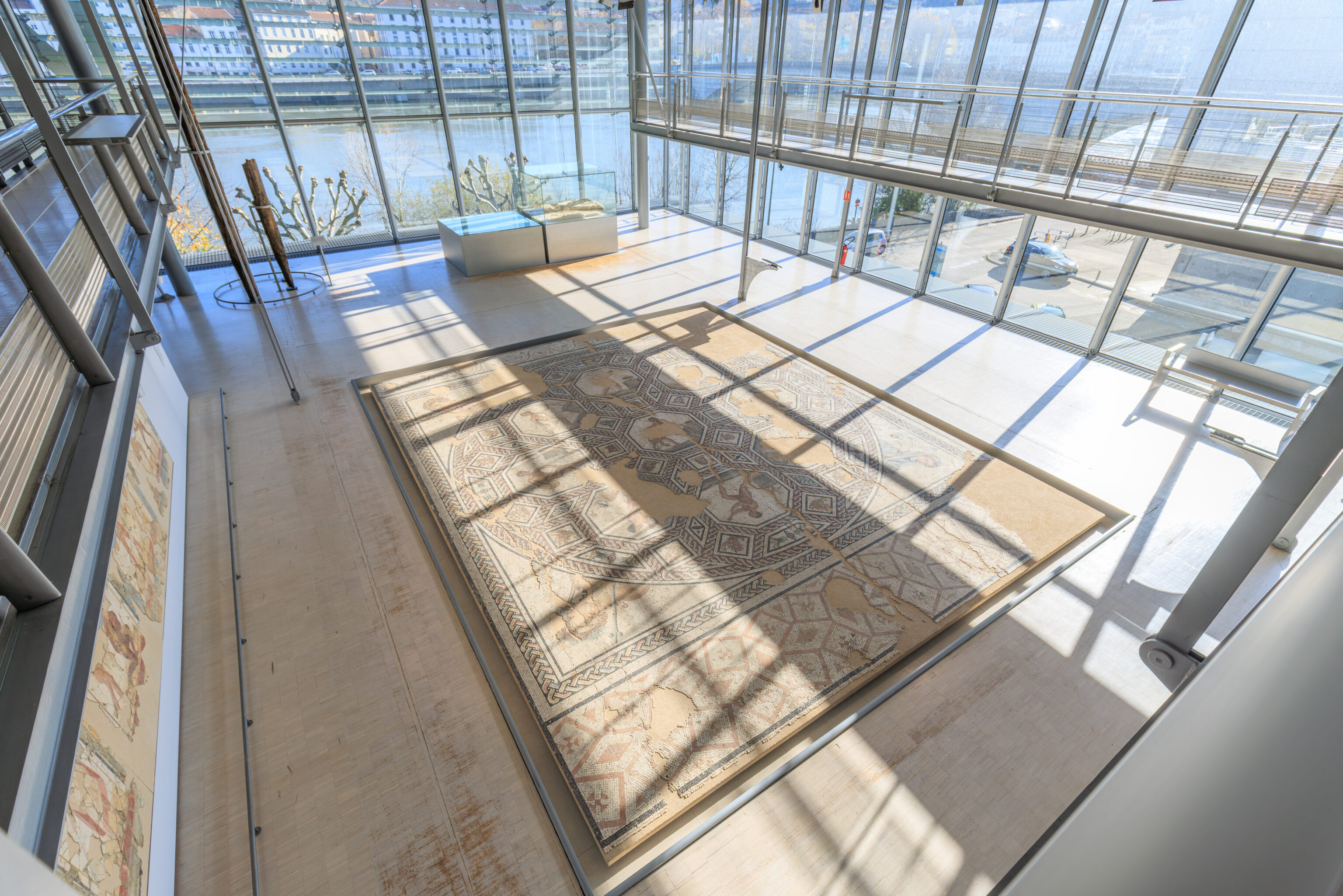
Mosaic of Hylas and the Nymphs
Early 3rd century AD
4.85 x 4.80 m
City of Grenoble Collection

Discovered in 1902 north of the Saint-Romain-en-Gal site, it likely belonged to a luxurious dwelling, as several other mosaics have been found in the same area. The emblem inscribed in the central circle depicts the abduction of Hylas by the nymphs. A companion of Heracles, the young and handsome Hylas participated with him in the Argonauts' expedition in search of the Golden Fleece. During a stopover on the coast of Mysia (the region of Pergamon in northwestern Turkey), Hylas was sent ashore to fetch water. But, captivated by the young man's beauty, the nymphs of the spring where he was drawing water pulled him underwater, much to Heracles' despair.

The central circle is surrounded by four flowers and four semicircles, each containing a conch shell, while the spandrels are decorated with craters. The restoration carried out in 1906 is clearly visible across the entire height of the mosaic.
– Text from a sign, translated using Google.
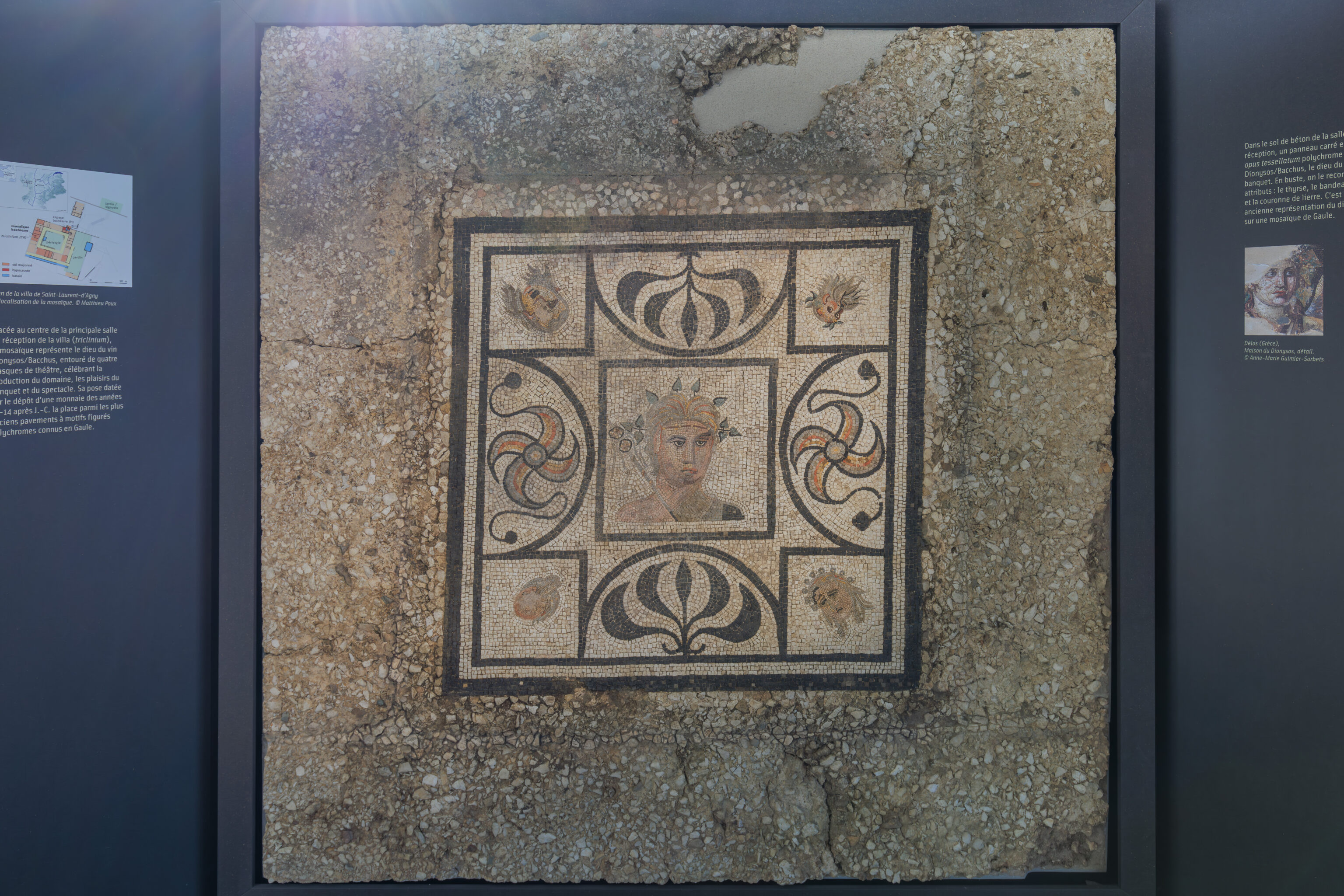
The Bacchus Mosaic
This mosaic was discovered in 2009 during excavations at the villa of Saint-Laurent-d'Agny (Rhône). Founded between 40 and 30 BC on the territory of the colony of Lugdunum, by a veteran of the civil wars originally from the Benevento region in Italy, it displays, at the beginning of our era, all the attributes of the Roman way of life: vineyard, gardens, winemaking facilities, reception rooms, private baths, ornamental pools…

Located in the center of the villa's main reception room (triclinium), the mosaic depicts the god of wine, Dionysus/Bacchus, surrounded by four theatrical masks, celebrating the estate's production and the pleasures of banquets and entertainment. Its placement, dated by the presence of a coin from the years 10-14 AD, places it among the oldest known polychrome figurative mosaic pavements in Gaul.
– Text from a sign, translated using Google.
A Deep Romanization
In conquered Gaul, the administration of the provinces was directly under Rome's control, but the management of the cities was entrusted to local authorities. The wealthy Gauls, heavily Romanized, competed to beautify their towns. The establishment of Roman civilization, centered on urban life, is marked in Vienne by major architectural achievements. Among the most prestigious public monuments, the forum and the Temple of Rome and Augustus, built from the end of the 1st century BC, are closely linked to the practice of political life and the official religion.

The numerous public baths also confirm the adoption of the Roman way of life by the local population. These baths were not limited to hygiene: they were also places of intense social and cultural interaction. At the site of Saint-Romain-en-Gal, in the Baths of the Wrestlers, the paintings on the walls of the latrines depict athletes competing under the watchful eye of the referee. This same theme also appears on a mosaic: victorious athletes surround Hercules, the invincible hero, in the reception room of a large Viennese house. These references attest to the deep assimilation of Greco-Roman culture by the local population.
– Sign, translated using Google.
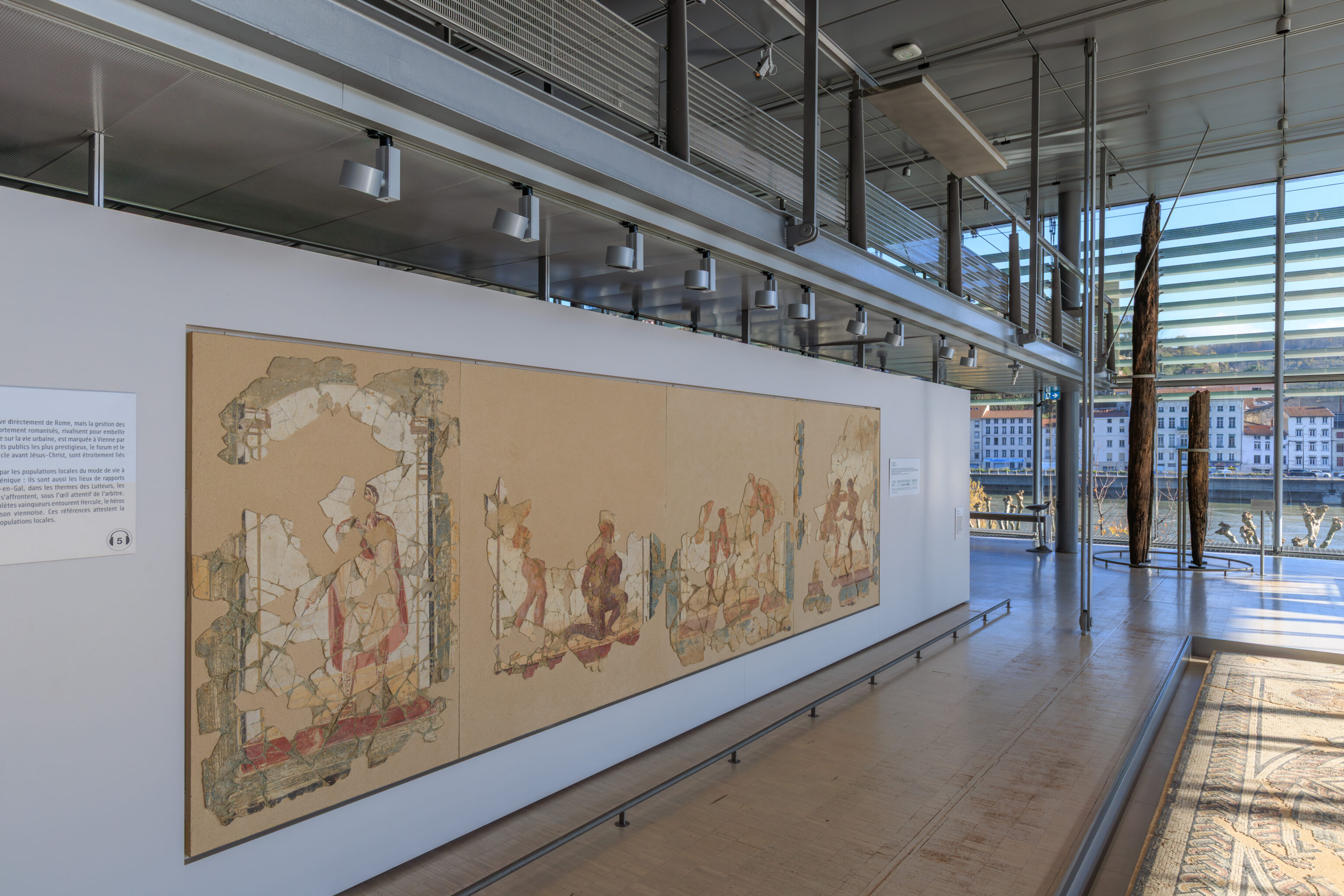
Another sign describes the paintings on the wall seen in the three above photographs:
The Games of the Palaestra
Wall Painting
Saint-Romain-en-Gal Site (Rhône)
3rd Century AD
This painting decorated the walls of the latrines in the Baths of the Wrestlers, which were luxuriously adorned with marble, paintings, and fountains. The paintings are presented as a series of panels. Arches symbolize the portico that surrounded the palaestra, the area of the baths reserved for athletic exercises. Only a few panels have been reconstructed. They depict naked athletes competing in pairs in various events of the pentathlon: bare-handed wrestling, boxing, pankration, and discus throwing. A clothed figure occupies the last panel: this is the referee, the agon, who points the way to the baths.
– Sign, translated using Google.
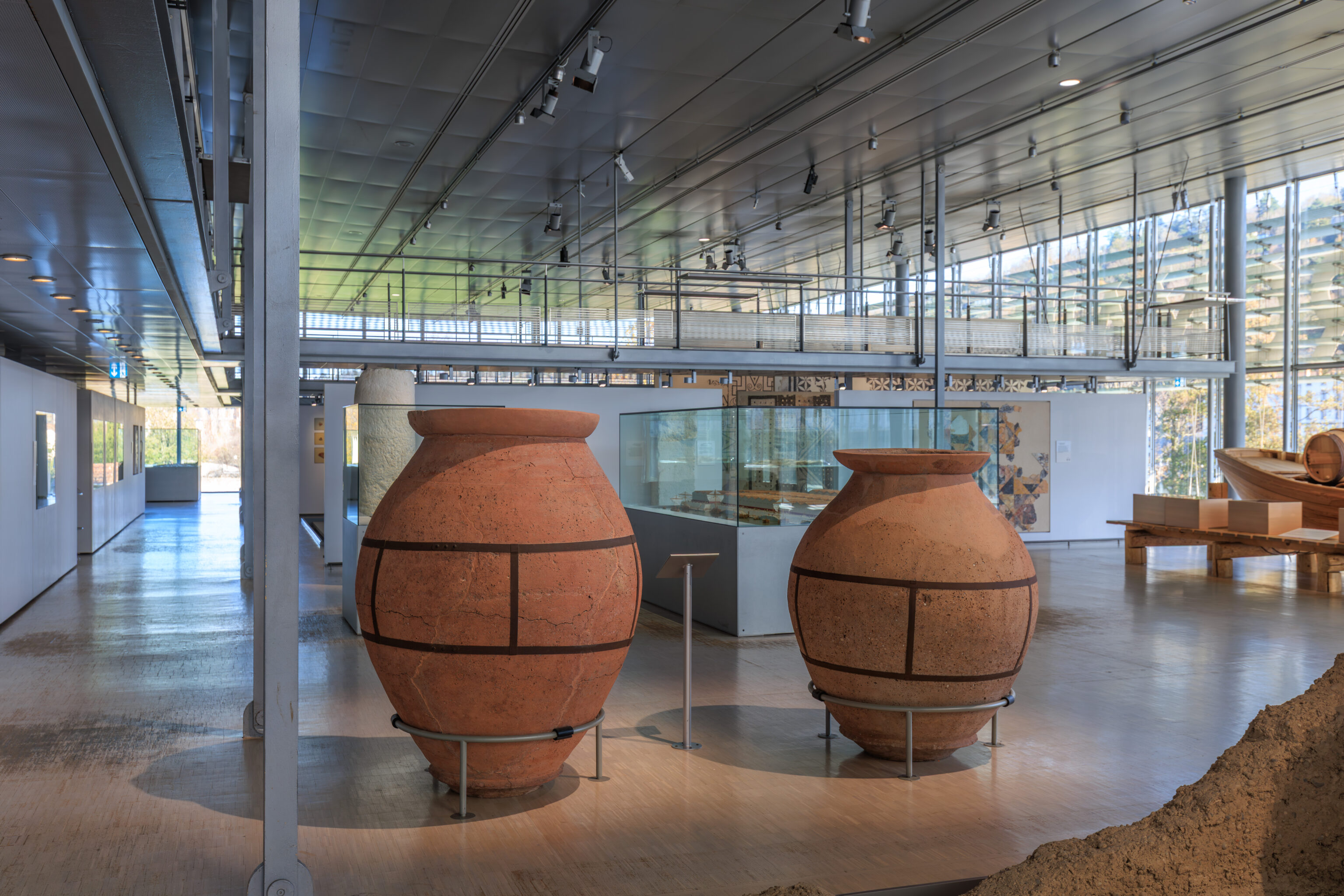
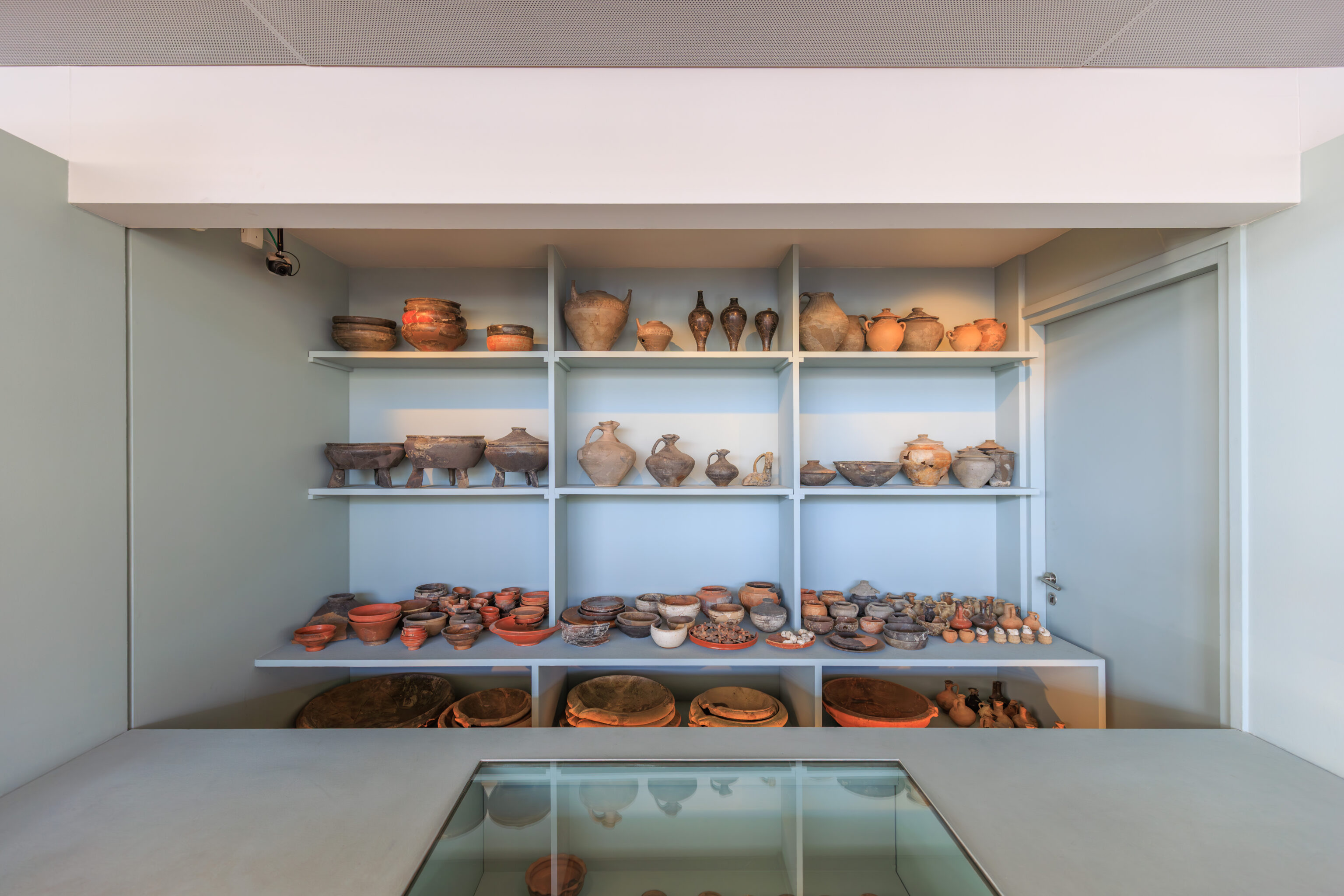
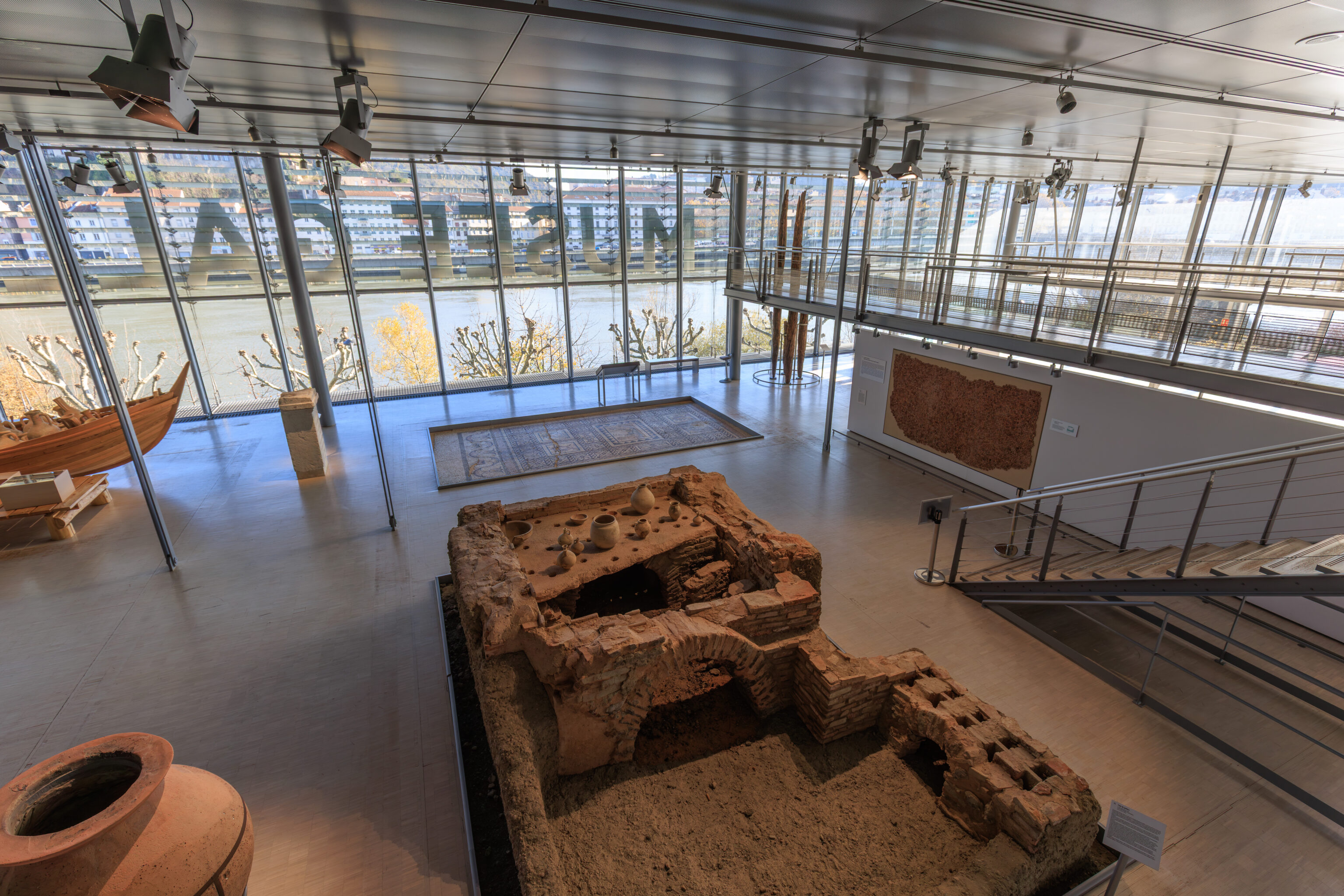
No museum featuring ancient artifacts is complete without jars. In this case, two rather large ones.
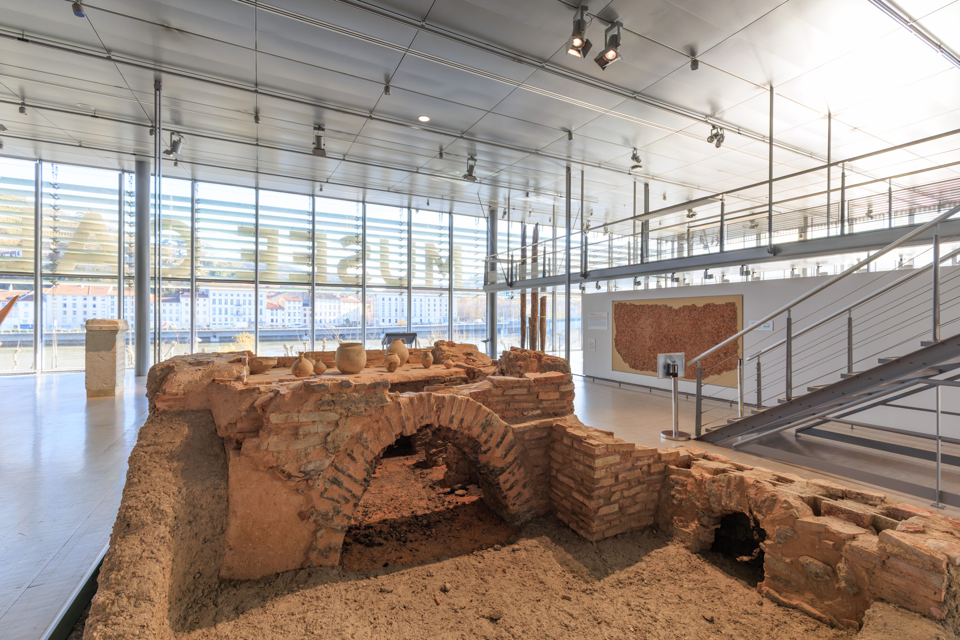
Potters' Kiln
1st Century AD
Saint-Romain-en-Gal Site (Rhône)
3.25 x 3.20 x 1.30 m

Drainage work carried out in 1977 by the Compagnie Nationale du Rhône, slightly north of the listed site, revealed a 1st-century AD pottery workshop comprising at least 12 kilns, not all of which were in operation simultaneously. It produced common, light-bodied ceramics, mostly jugs and pots, but also, in smaller quantities, mortars, large bowls, containers resembling salt cellars, and candlesticks.

The earliest pottery kilns combined the firebox and the firing chamber in a single enclosed space, with an opening at the base for fueling the fire and another at the top for venting combustion gases. In this primitive model, the heat was not distributed evenly, and cooking accidents were frequent.

A less rudimentary structure, which appeared as early as the 4th millennium BC in the East, made it possible to limit these drawbacks. The oven was divided into two superimposed spaces by a perforated intermediate level, the hearth. The lower part was the firing chamber; the upper part, the cooking chamber, contained the load to be fired. The fire was lit at the entrance of a tunnel, the firebox, which opened into the firing chamber. Depending on the size of the oven, the embers were pushed inwards, where the fire was simply maintained in the firebox, built on a slight slope to direct the heat flow towards the firing chamber. The combustion gases were distributed there before rising through the perforations in the hearth, the flues, and escaping through openings in the oven roof. They thus circulated more evenly throughout the laboratory, and the pottery was no longer in direct contact with the firebox.

A third type of kiln completely isolated the firing process from the combustion gases, which passed through the laboratory in pipes opening directly to the outside. The heat was then transmitted solely by radiation; the atmosphere of the laboratory was stable and no longer dependent on the conditions of combustion.

This model appeared during the Roman period, but it remained reserved for specific types of production such as terra sigillata. Kilns of the second type were the most widespread throughout Roman antiquity.
– Text from a sign, translated using Google.
More jars!
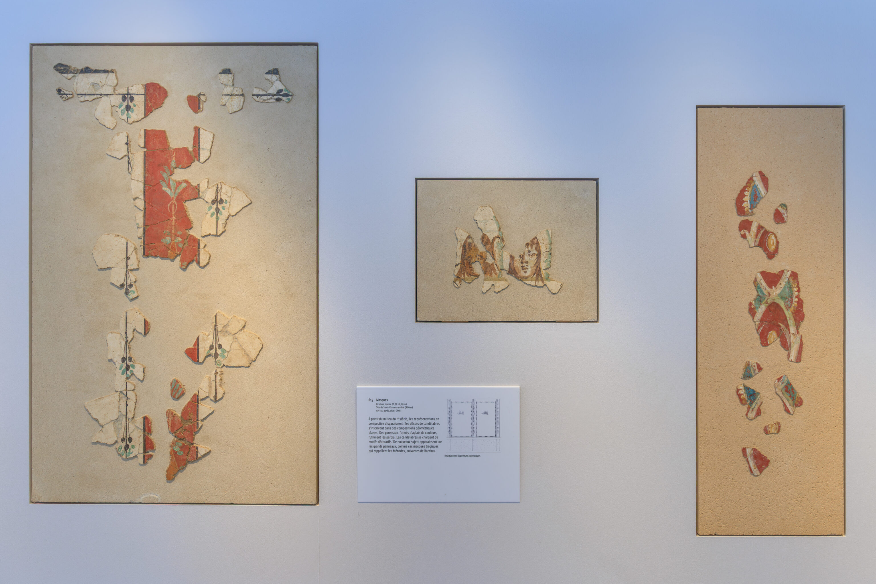
Masks
Wall painting (0.37 x 0.29 m)
Saint-Romain-en-Gal site (Rhône)
50-100 AD

From the mid-1st century AD, representations in perspective disappear: the decorations on candelabra become part of flat geometric compositions. Panels, made up of flat areas of color, rhythm the walls. The candelabra become adorned with decorative motifs. New subjects appear on the large panels, such as these tragic masks reminiscent of the Maenads, followers of Bacchus.

Interlacing Patterns
Wall painting (0.42 x 1.13 m)
Saint-Romain-en-Gal site (Rhône)
Late 1st century AD

In the 2nd century, a clear preference emerged for monochrome backgrounds against which panels defined by border bands stood out. These are sometimes enhanced with decorative motifs, often drawn from an older repertoire. Here, for example, these openwork borders were created at the end of the 1st century.

At the end of the 2nd century, networks formed by adjacent or intersecting geometric figures (circles, octagons, etc.) developed on the walls. These covering motifs, previously reserved for ceilings, often imitated coffered ceilings: each figure was adorned with decorative motifs (plants, animals, or figures). These compositions are frequently used for the decoration of bathhouses.
– Text from signs, translated using Google.
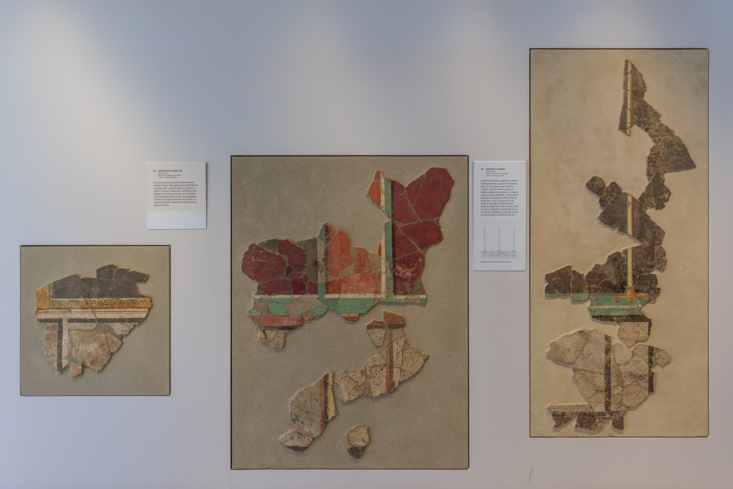
Trompe-l'œil Architecture
Mural Painting
Saint-Romain-en-Gal Site (Rhône)
5 BC - 15 AD

These two paintings are among the oldest known in Vienne. They depict trompe-l'œil architecture. The plinth forms a marble podium. Above the panels, bordered by bands of contrasting colors, orthostats (upright stones) imitate a wall of large blocks. The relief is emphasized by colored lines. These lines convey the effects of light and shadow on the edges of the stone.

Candelabra with Wheels
Wall Painting
Saint-Romain-en-Gal Site (Rhône)
5 BC - 15 AD

The decorative motif of candelabra, metal structures designed to support oil lamps, is very common in Roman painting. The plinth imitates a marble podium surmounted by a cornice, on which the base of the candelabrum rests. The shadow cast by the feet on the base enhances the perspective effect. This particular candelabra, typical of the Viennese school, has small balls at its base that resemble wheels, but to date this feature has never been found on actual candelabra. The simplicity of the decoration is characteristic of the early Roman period.
– Text from signs, translated using Google.
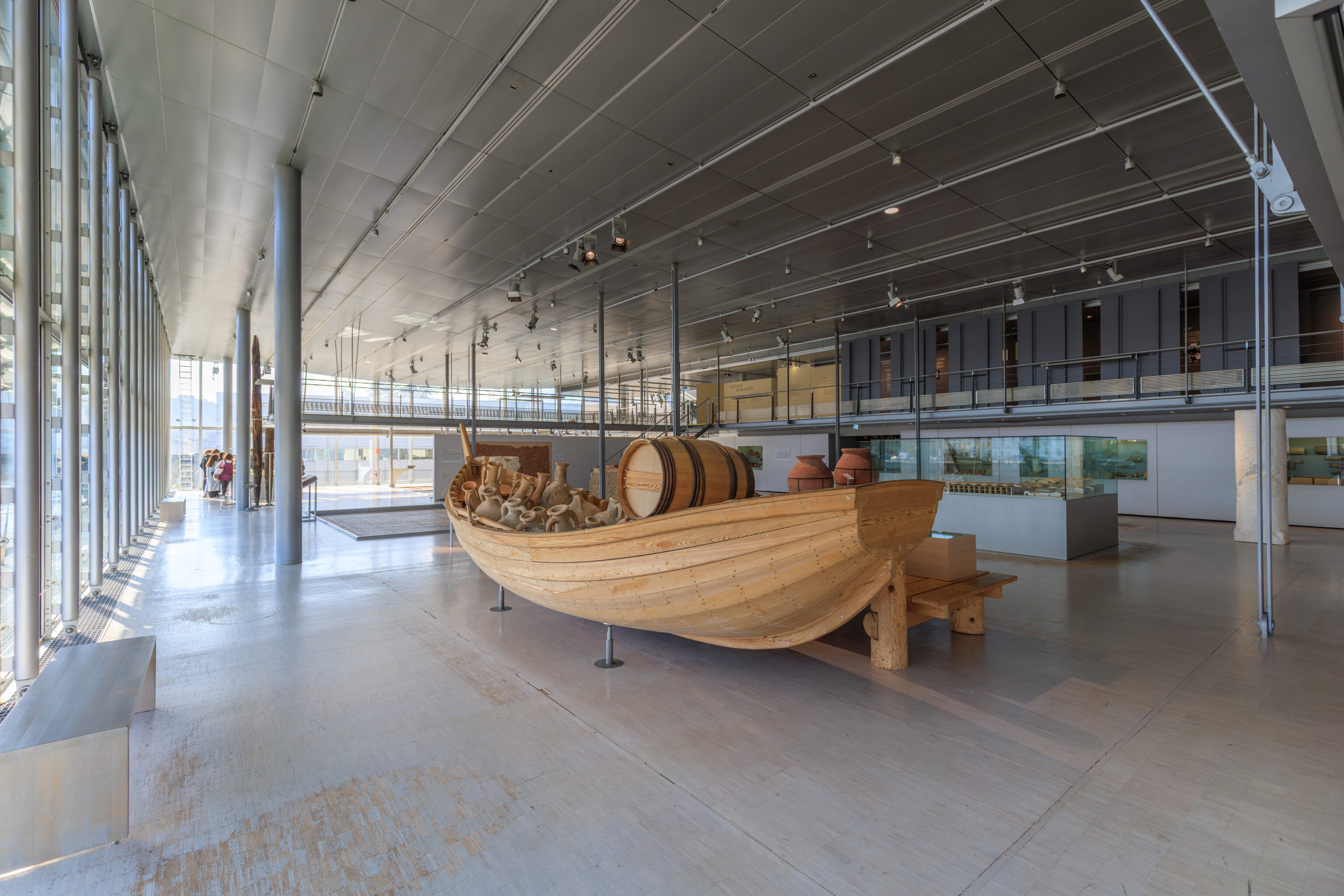
The museum even has jars in a boat! Or rather, jugs, because they have handles?
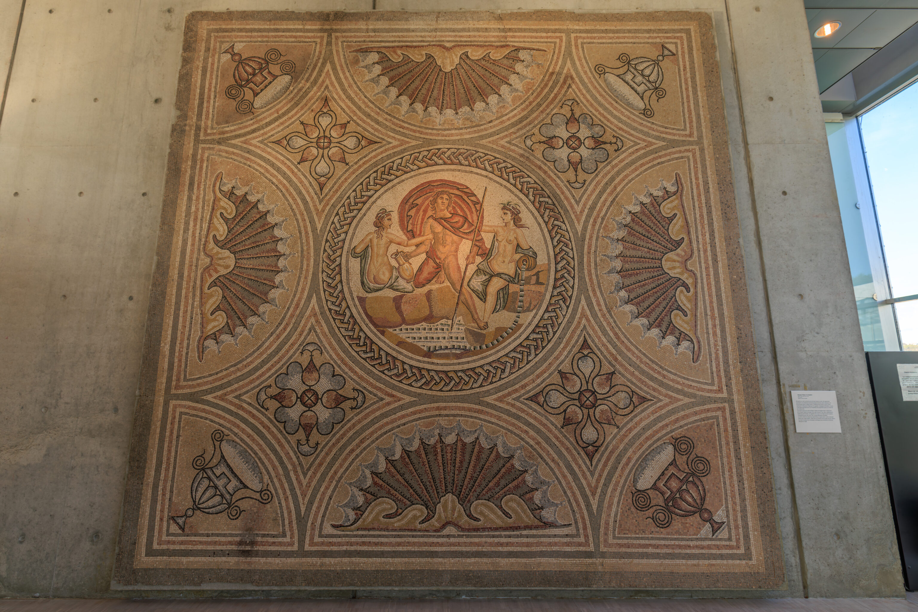
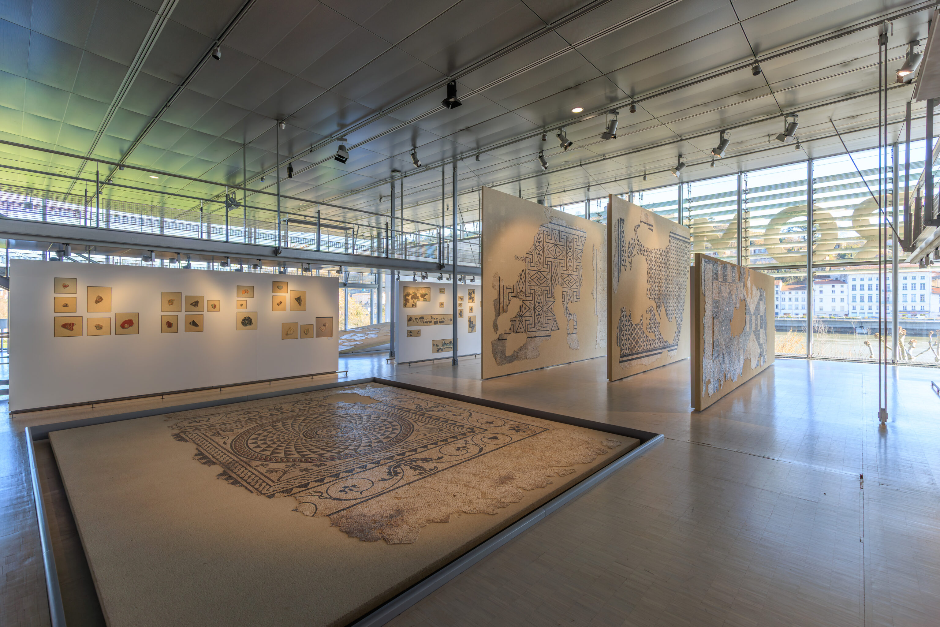
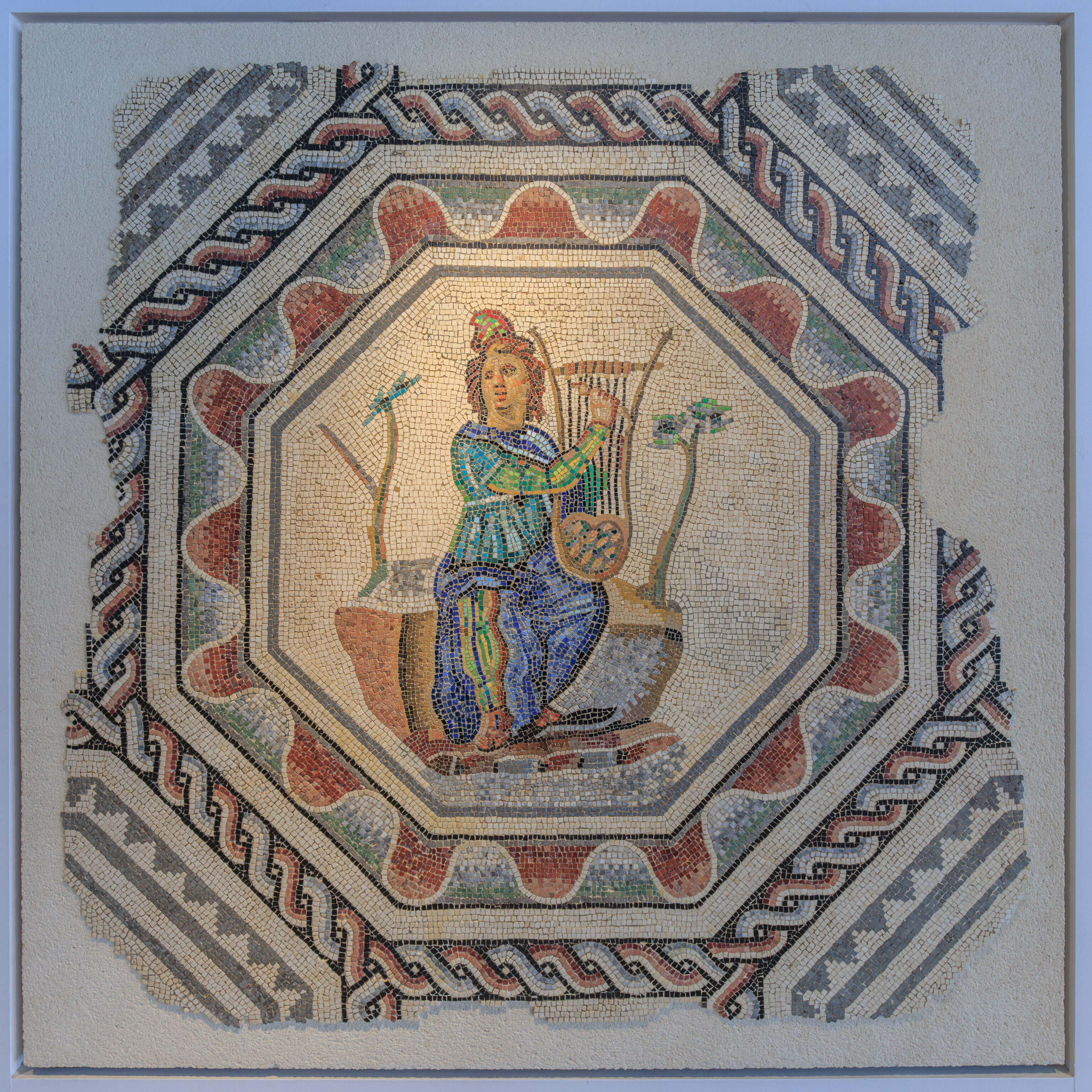
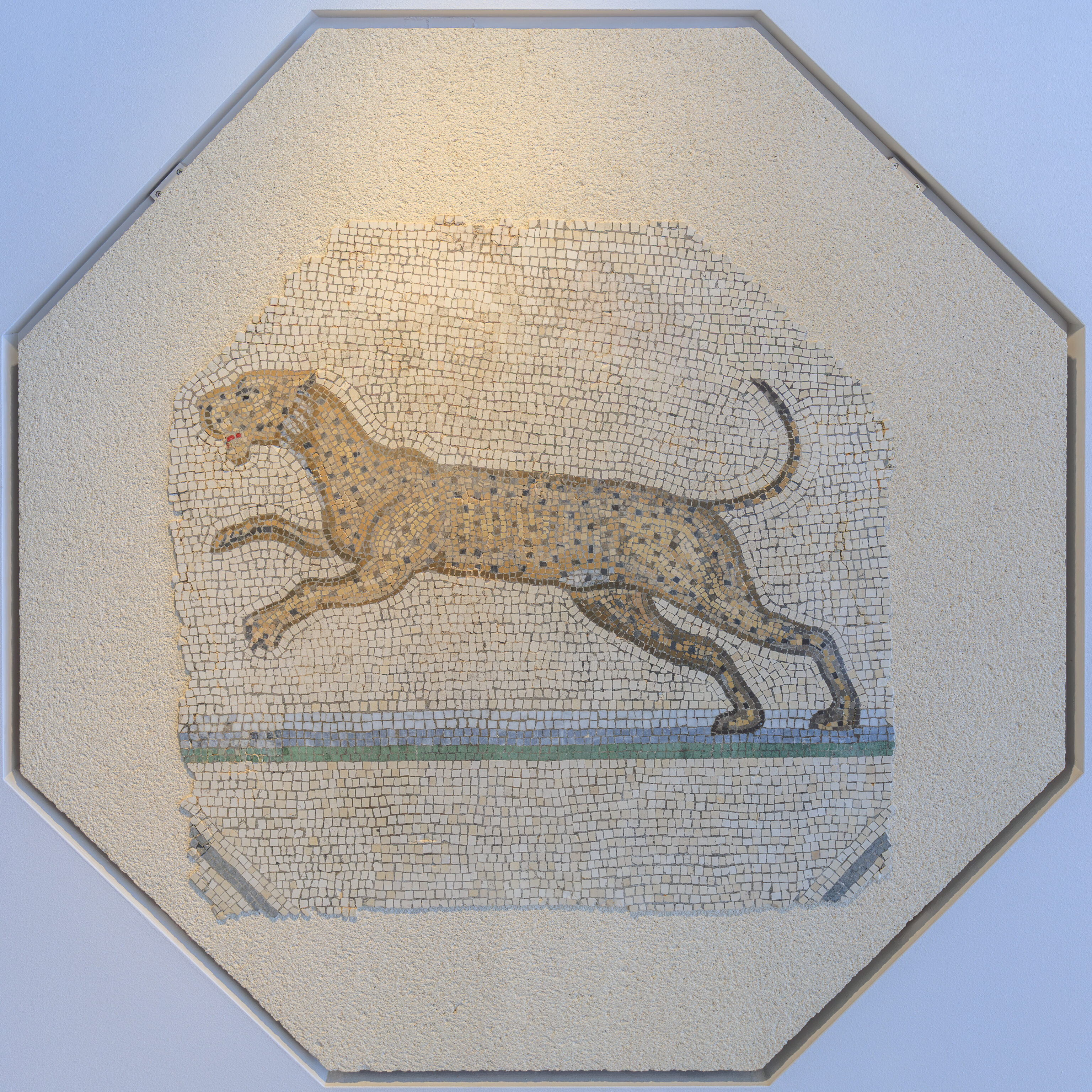
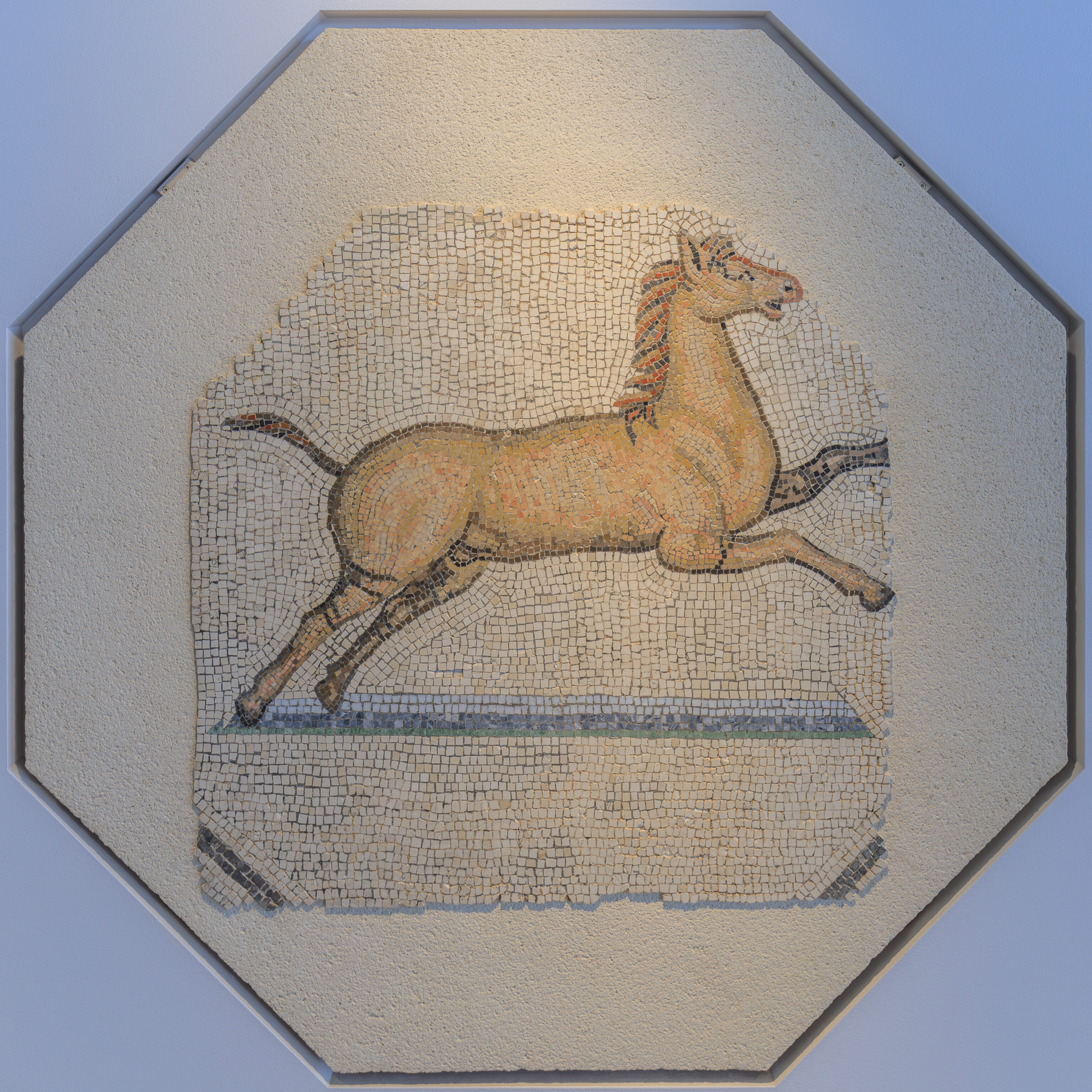
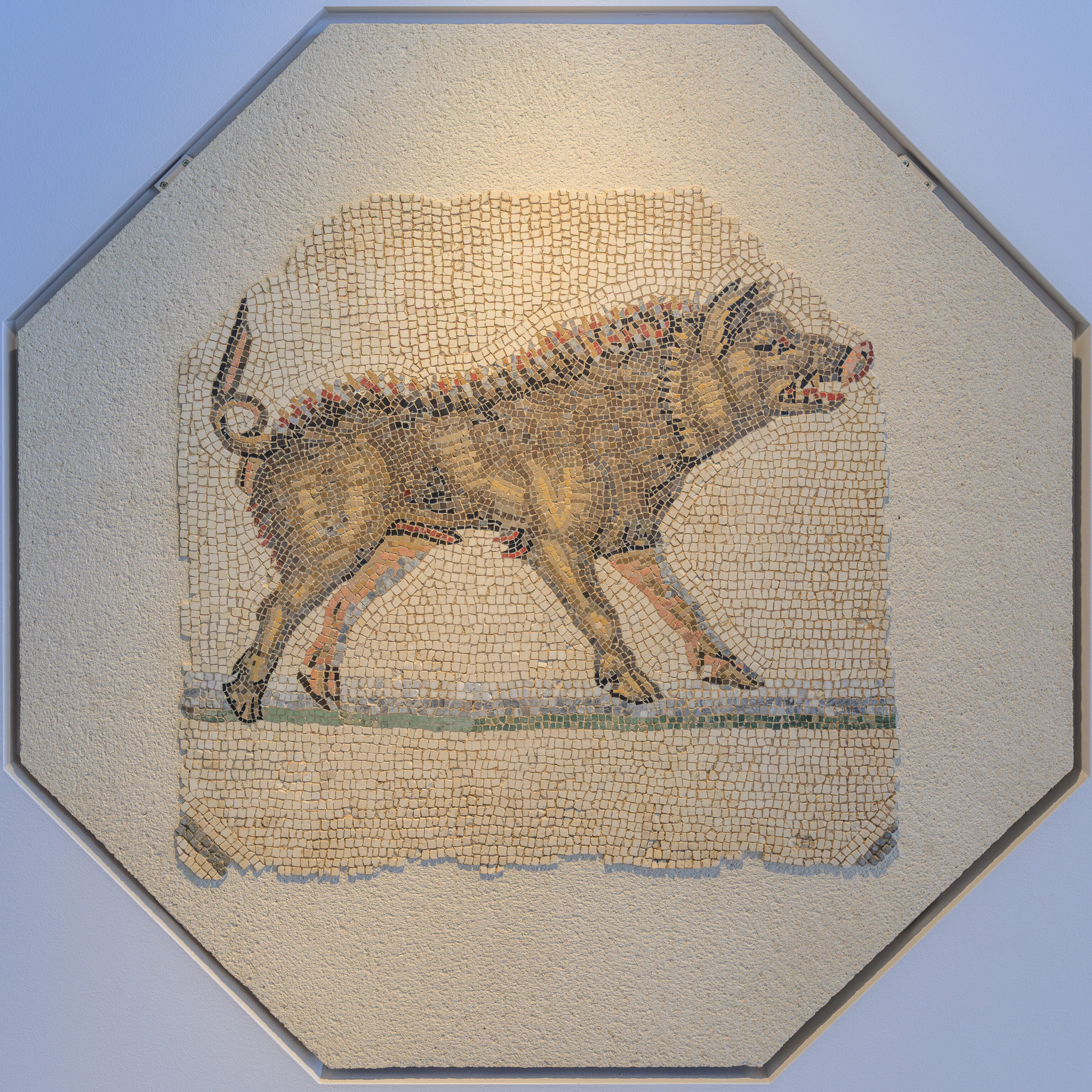
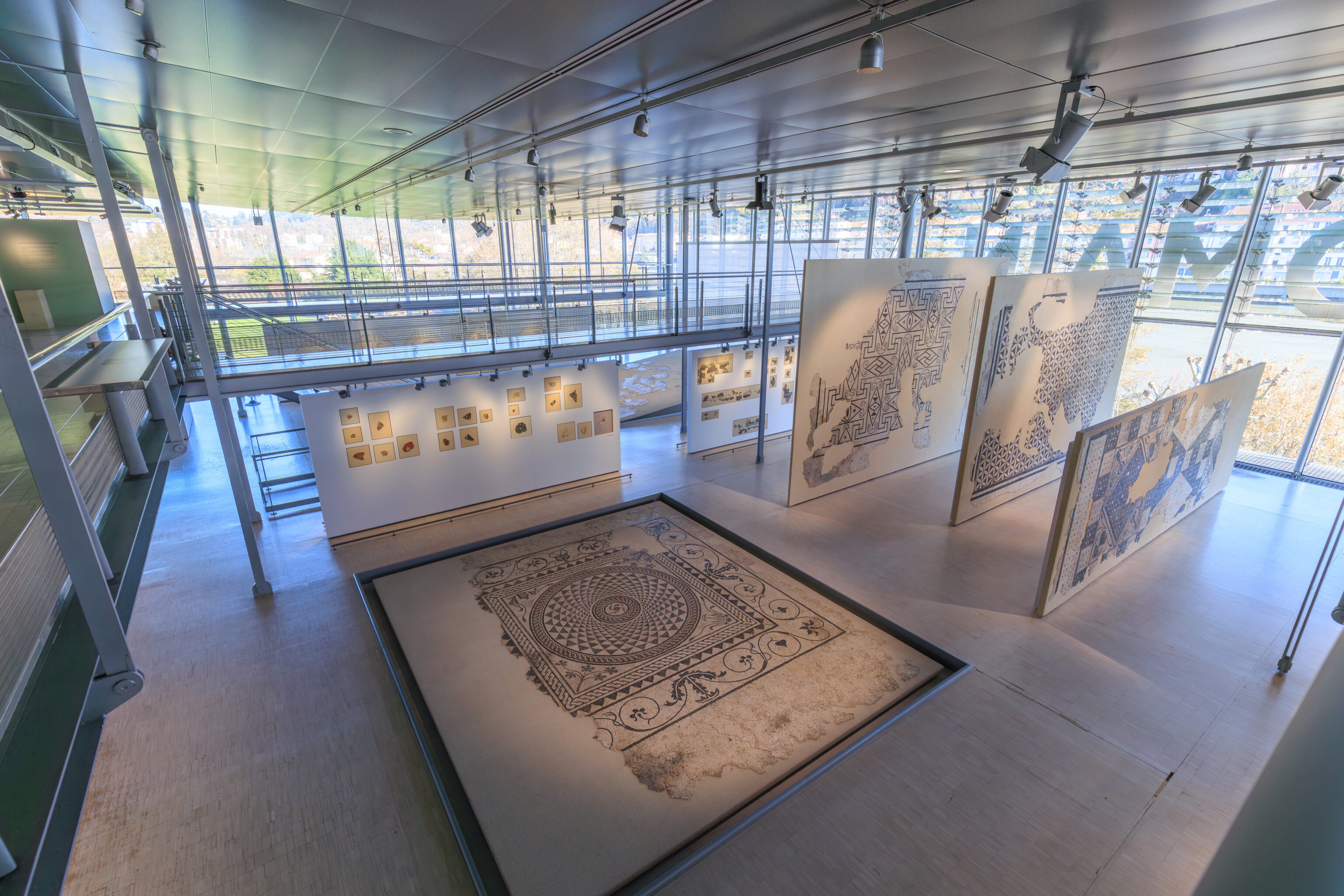
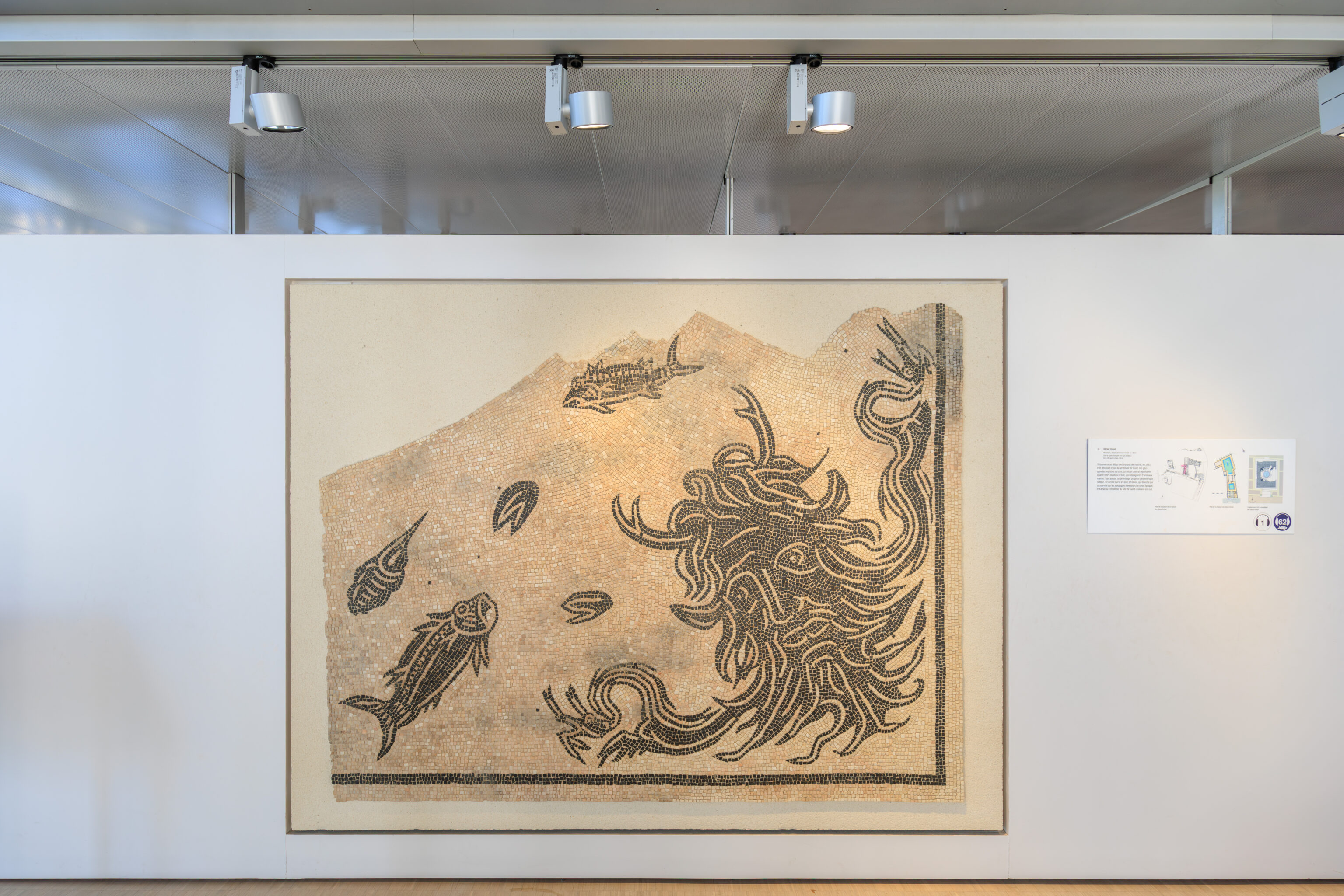
Orpheus Charming the Animals
Mosaic (7.06 x 4.88 m)
Vienne (Isère)
Late 2nd century AD
On loan from the City of Vienne
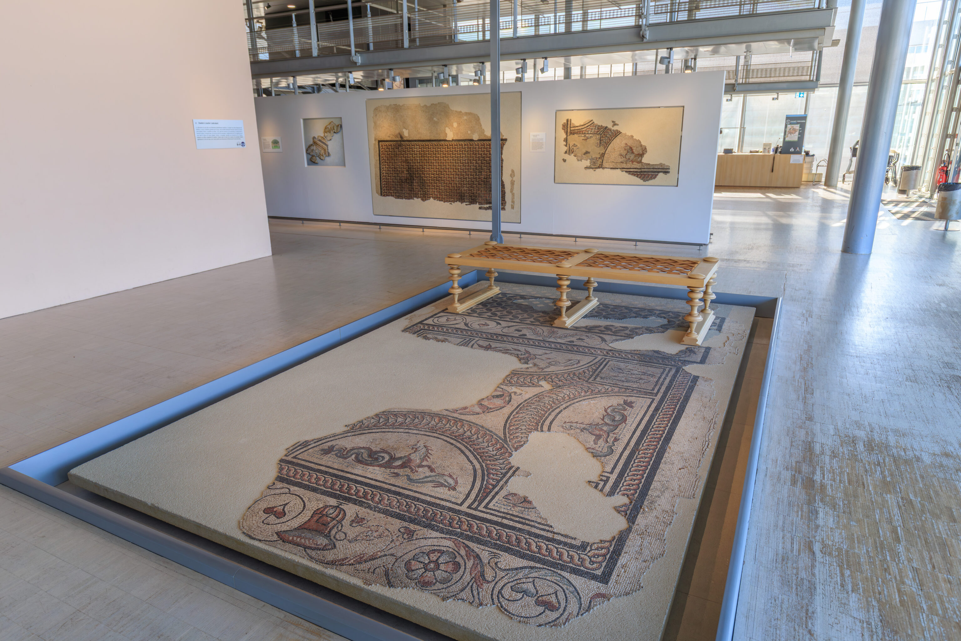
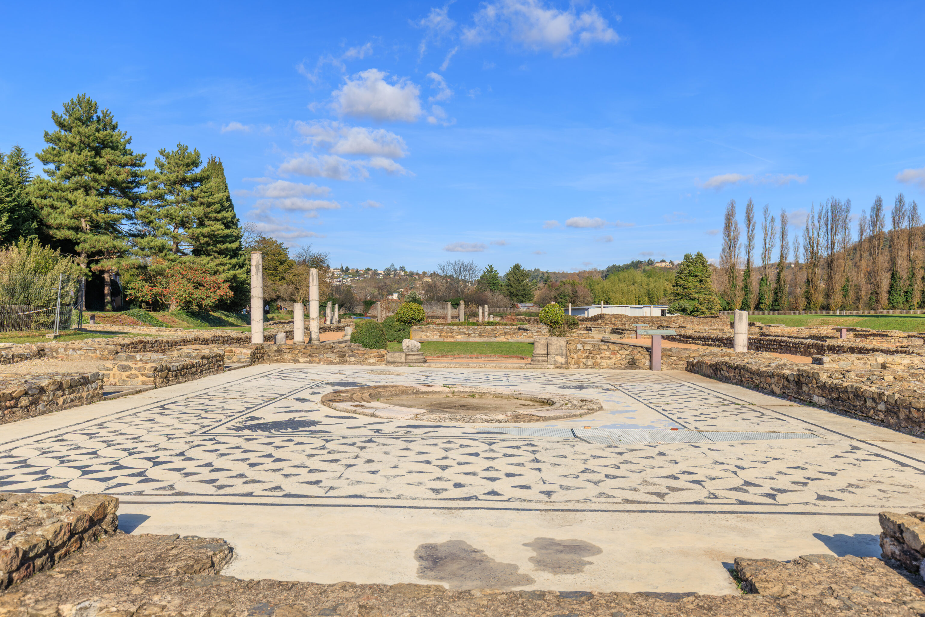
It comes from the heated living room of the House of the Water Lilies, in the southern part of Vienne (see the model shown below). The mosaic is very fragmented, as it collapsed into the void beneath the floor (heated by a hypocaust). It is a composition of octagons and squares. In the center, Orpheus, seated on a rock, charms the world with his lyre. The plant world is symbolized here by florets. Only one tree is depicted. The quadrupeds, mostly of African origin, surround Orpheus. The birds are located at the periphery of the composition. Theatrical masks, both comic and tragic, symbolize quarrels and human passions. The theme of Orpheus lends itself perfectly to the decoration of a living room, a privileged space for conversation and reading.
Preventive excavation of the Water Lilies, rue du 11 Novembre, 1985.
– Text from a sign, translated using Google.
Orpheus is visible in the photograph near the top of the mosaic. He is a hard to make out without looking closely.
Orpheus Charming the Animals
Mosaic
Vienne (Isère)
Late 2nd century AD
City of Vienne Collection

This mosaic pavement decorated the floor of a drawing room. The central octagon depicts Orpheus playing the lyre. His music charms the animals that adorn the peripheral octagons (boar, panther, lion, onager) and the squares (duck, parakeet, partridge). The theme of Orpheus, a symbol of culture, was commonly used to decorate drawing rooms: three other examples exist in Vienne.

Discovered in 1859 during excavations in the Champ de Mars, in the House of Orpheus.
– Text from a sign, translated using Google.
These three mosaics are part of the same larger mosaic as the Orpheus tile above.
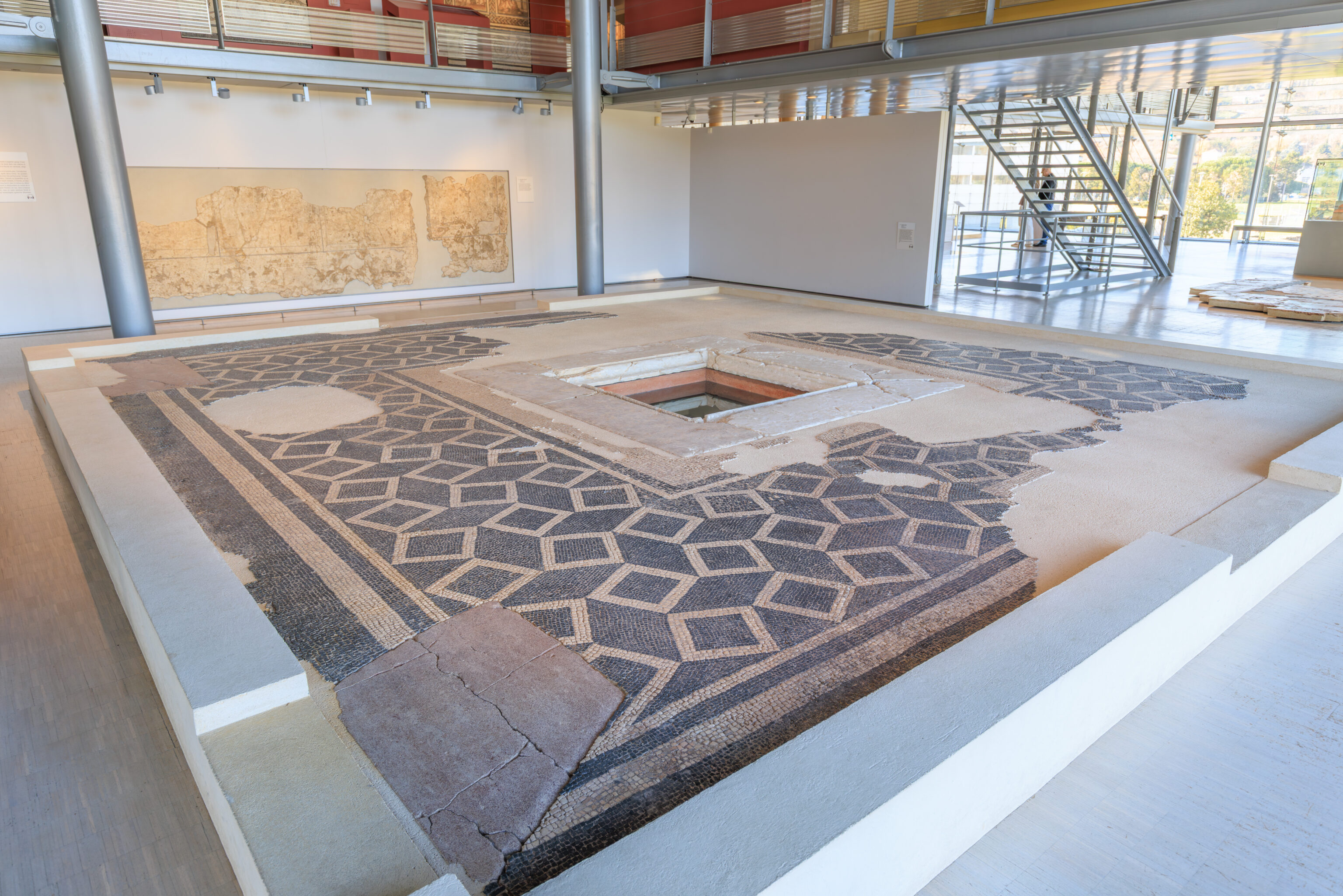
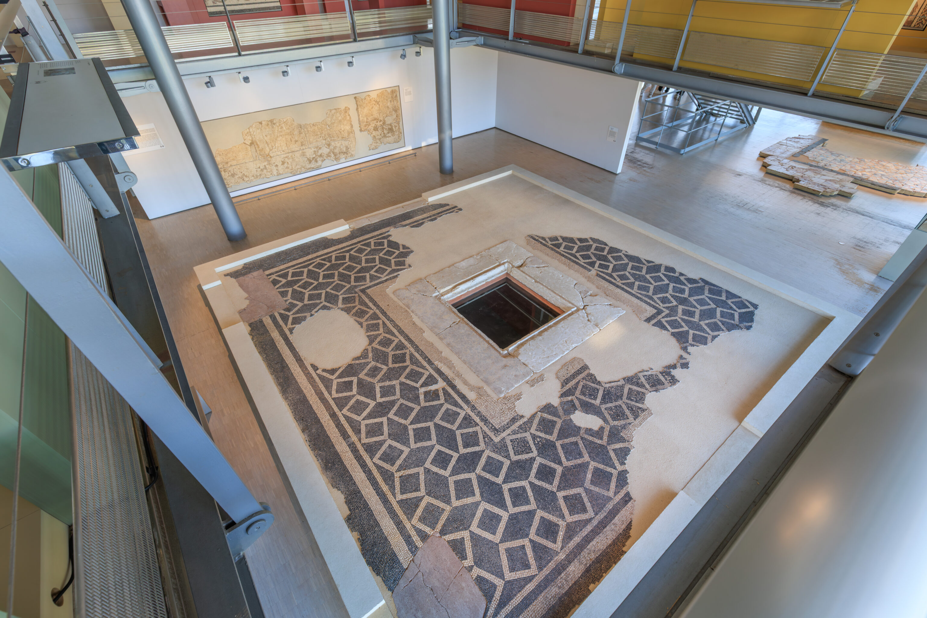
Marble pavement (opus sectile)
Vienne (Isère)
First quarter of the 2nd century AD
City of Vienne Deposit

This pavement comes from the so-called House of the Water Lilies (see the nearby model). The yellow and blue paving covered the entire surface of the room, forming crosses inscribed within squares. It is exceptional to discover marble floors in such good condition: most of these expensive materials were salvaged after the buildings were abandoned.

Preventive excavation, Water Lilies site, 1977.
– Sign, translated using Google.
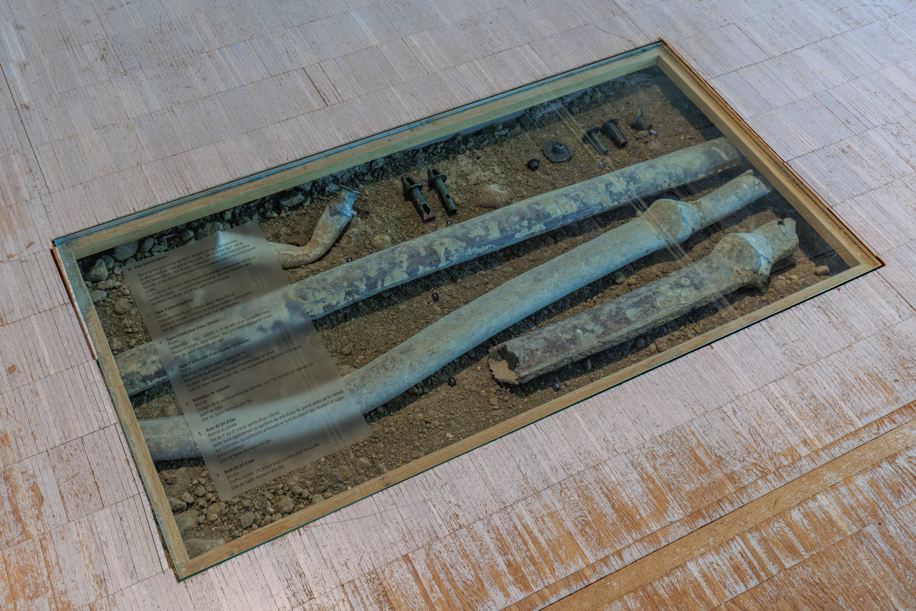
Water in the Home
In the early days of the Saint-Romain-en-Gal district, the inhabitants obtained water from wells. From the beginning of the 1st century AD, water supply networks were installed in the streets, and the wealthiest houses already had private water supplies. In the 2nd century, all the large houses in Vienne had at least one basin, often with three narrow, deep branches. Fountains and water jets were very common.

1 Water supply pipe
Lead
First half of the 2nd century AD.
Incised numbers CCIIX on the simple solder joint, without a bead.
Site of Saint-Romain-en-Gal, rue des Thermes.

2 Water supply pipe (fistula)
Lead
Stamp C. SOLL. LVCENT. V. F., within a smooth cartouche
Simple weld, without a bead. Olive joint.
Saint-Romain-en-Gal site.

3 Stamped water supply pipe (fistula)
Lead
Late 2nd or 3rd century AD.
Incomplete stamp C'M(MARCVSVF)
Weld with a bead. Olive joint.
Saint-Romain-en-Gal site, rue du Commerce (technical gallery).

4 Tap valves
Bronze
This is the moving part of the tap, which was closed by turning it a quarter turn.
Saint-Romain-en-Gal site.

5 Water jet nozzle
Bronze and lead
Late 1st or 2nd century AD.
This nozzle belonged to the water jet system in the large garden of the House of Columns. The collar was flush with the bottom of the basin that received the supply pipe.
Saint-Romain-en-Gal site.

6 Water jet nozzle
Bronze
Incised numeral, XII, placed below the molded collar.
Saint-Romain-en-Gal site.
– Text on the glass in the photograph, translated using Google.
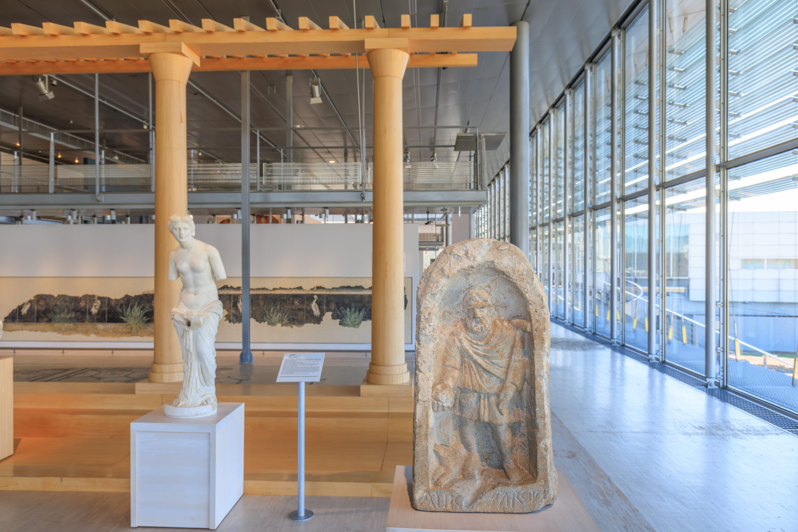
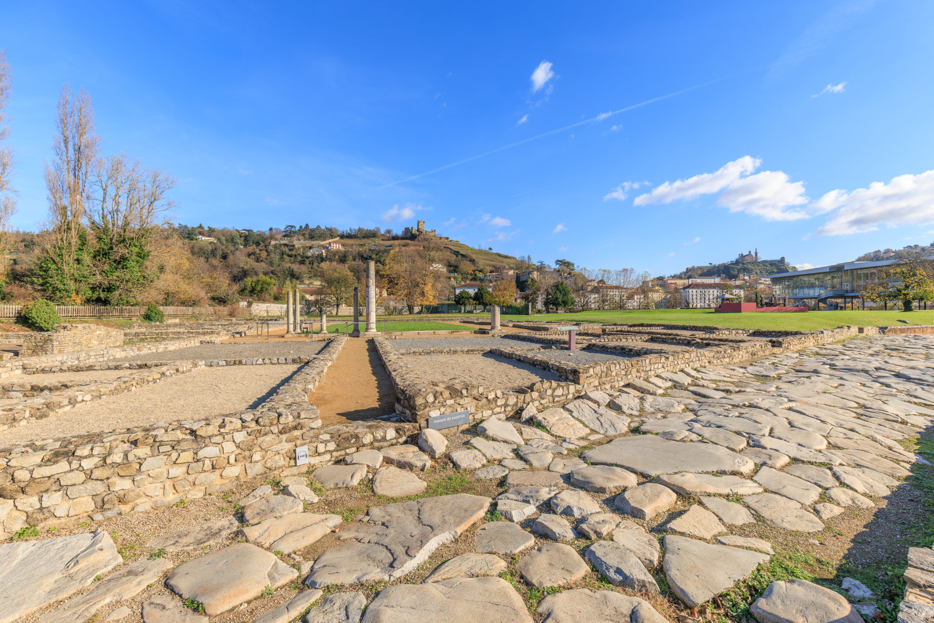
STATUE OF SUCELLUS
Limestone
Saint-Romain-en-Gal Site
Roman Period

This high-relief epigraphic stele was discovered near one of the large houses of the archaeological site to which it gave its name. It depicts the Gallic god Sucellus with a mallet, wearing a beard and dressed in the Gallic style with a short tunic and cloak. The deity's right hand holds a small pot (olla) and his left hand a mallet resting on his shoulder. A dog lies at his feet. This statue was polychrome, and its face was painted in gold.

The base of the relief bears an inscription:
ATTICVS SARCIS {filius} D(onum) R(eddit)
Atticus, son of Sarcus, made this gift in return.

(Sign, describing the stele on the right, translated using Google)
– Text from a sign describing the stele on the right, translated using Google.
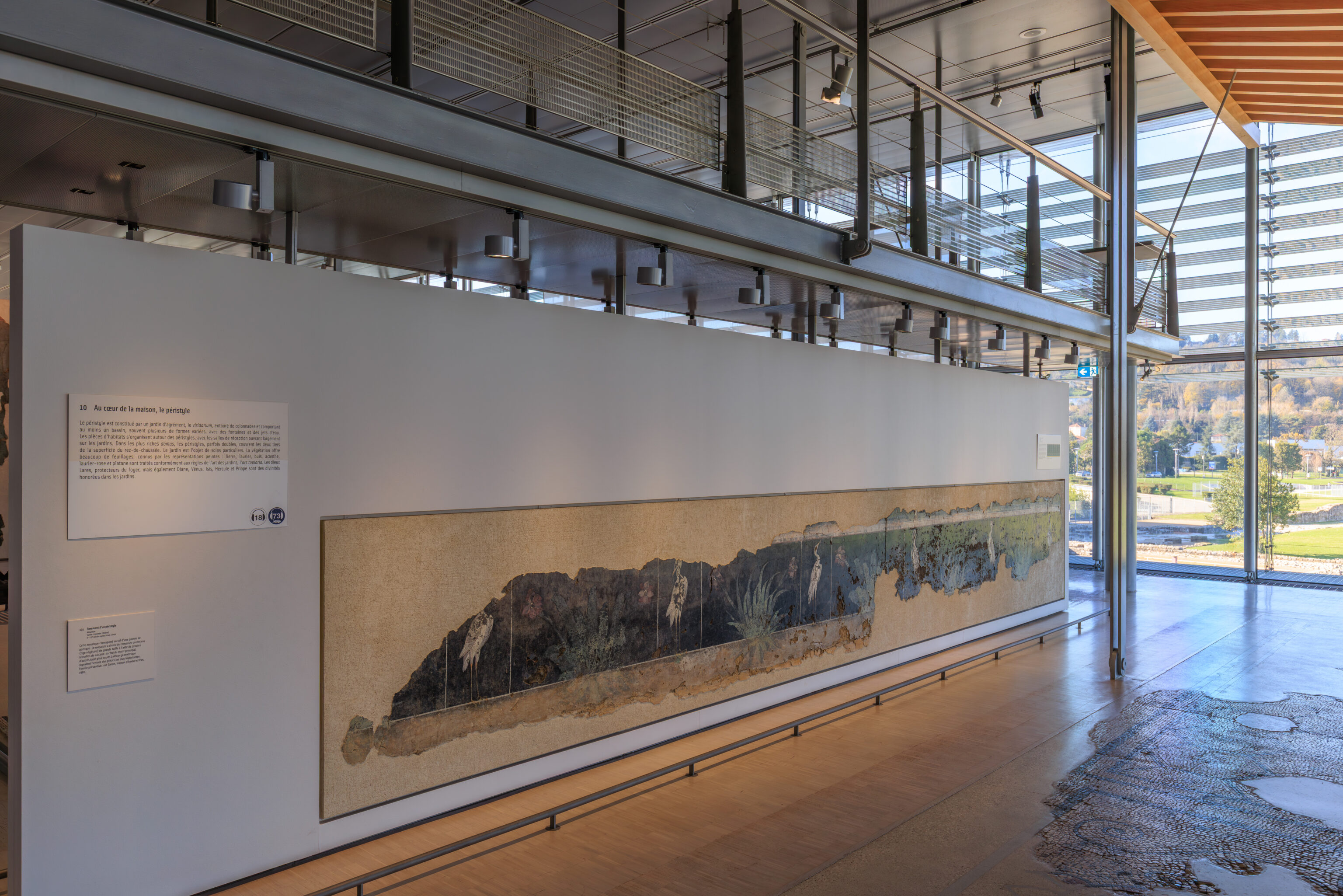
At the heart of the house, the peristyle
The peristyle consists of a pleasure garden, the viridarium, surrounded by colonnades and featuring at least one pool, often several of varying shapes, with fountains and water jets. The living quarters are arranged around the peristyles, with reception rooms opening widely onto the gardens. In the wealthiest domus, the peristyles, sometimes double, cover two-thirds of the ground floor area. The garden receives special attention. The vegetation offers a variety of foliage, known from painted representations: ivy, laurel, boxwood, acanthus, oleander, and plane tree are treated according to the rules of the art of garden design, the ars topiaria. The Lares, protectors of the hearth, as well as Diana, Venus, Isis, Hercules, and Priapus, are deities honored in the gardens.

Woodfowl and Winged Genius
Wall Painting
Vienne (Isère)
1st century AD
City of Vienne Collection

This painting with a black background decorated the peristyle of a house in the southern districts of Vienne. The plinth, with wadingfowl and foliage, was still in place on the wall, which was preserved to a height of one meter. The upper sections, decorated with candelabra and a winged genius, were found in fragments. Birds and marsh plants are often depicted in the porticoes surrounding gardens and their ponds. As for the winged genius holding a stem in each hand, it represents a deity of vegetation.

Discovered in 1977 at the Nymphéas site, rue du 11 Novembre in Vienne.
– Text from a sign, translated using Google.
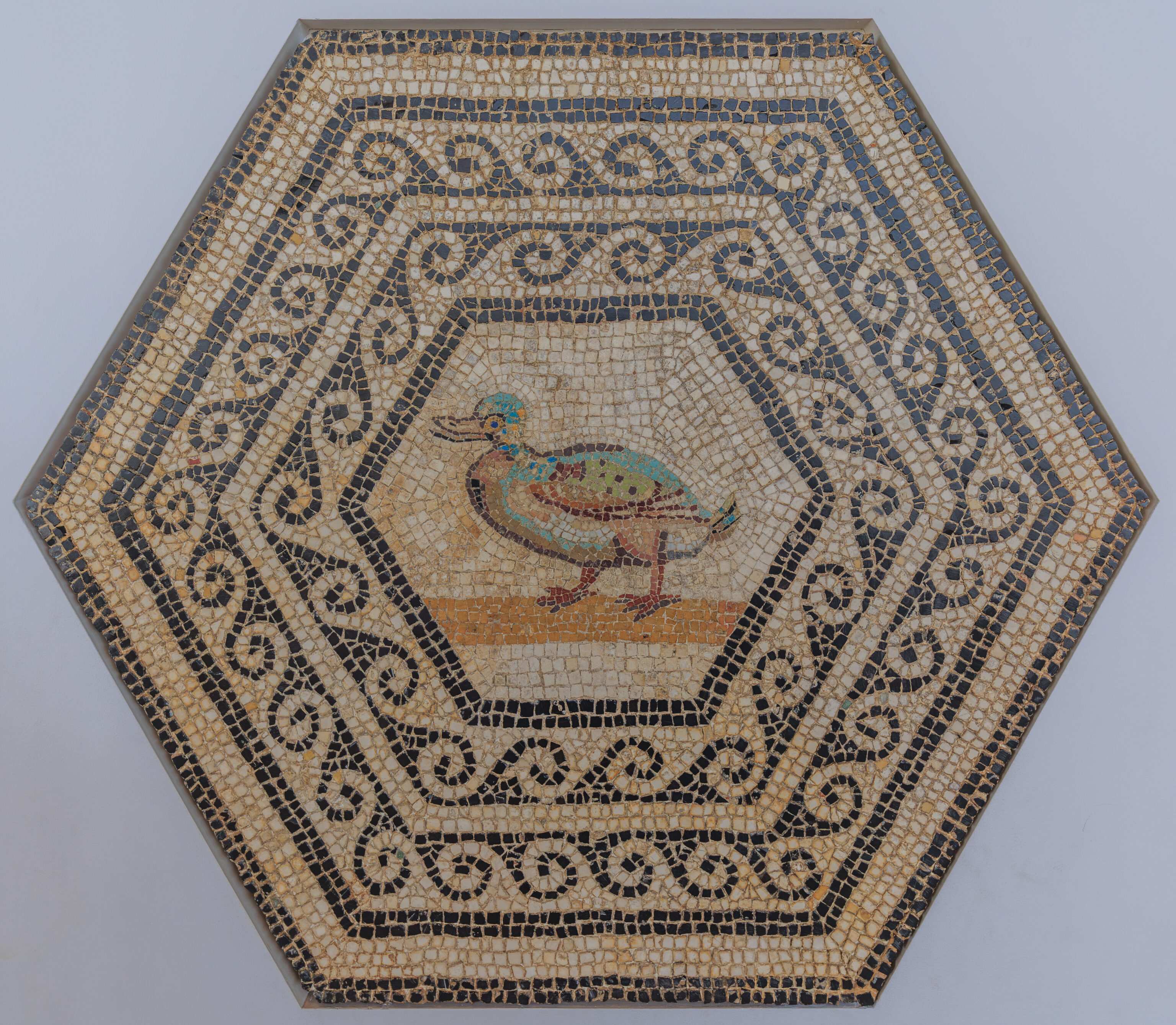
Duck
Mosaic
Sainte-Colombe (Rhône)
Late 2nd century AD
City of Vienne Collection

This medallion comes from a mosaic discovered in 1876 in Sainte-Colombe, during the construction of the railway line. It is a honeycomb composition, made up of juxtaposed hexagons. Inside, there are various motifs (animals, tableware, etc.) which may suggest a dining room. This duck is remarkable for the vibrancy of its colors, achieved using tesserae of glass paste.
– Text from a sign, translated using Google.
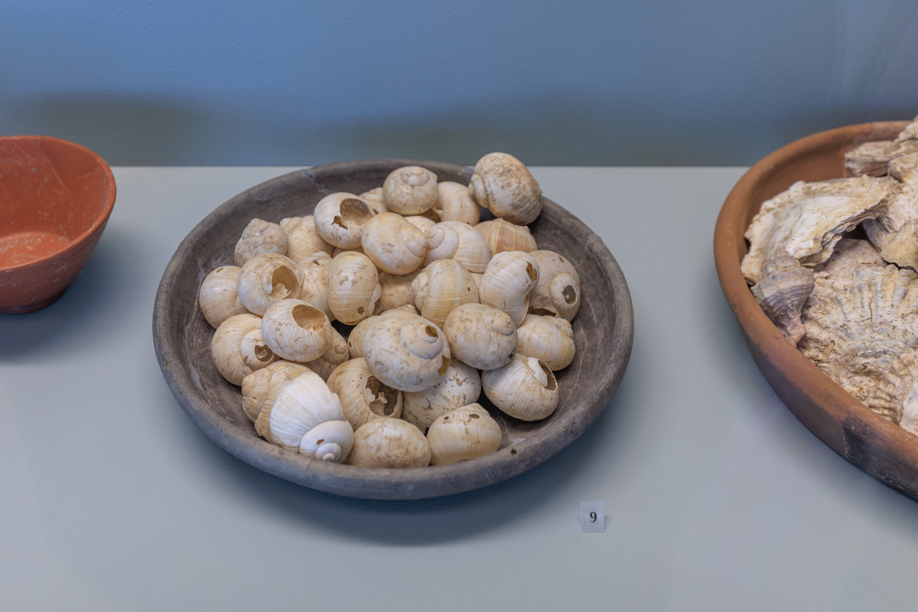
Dish
Dark black ceramic
2nd century AD
Saint-Romain-en-Gal site

In Roman times, snails were considered to have aphrodisiac properties. Apicius advised fattening them with flour moistened with milk for several days before frying or roasting them.
– Text from a sign, translated using Google.
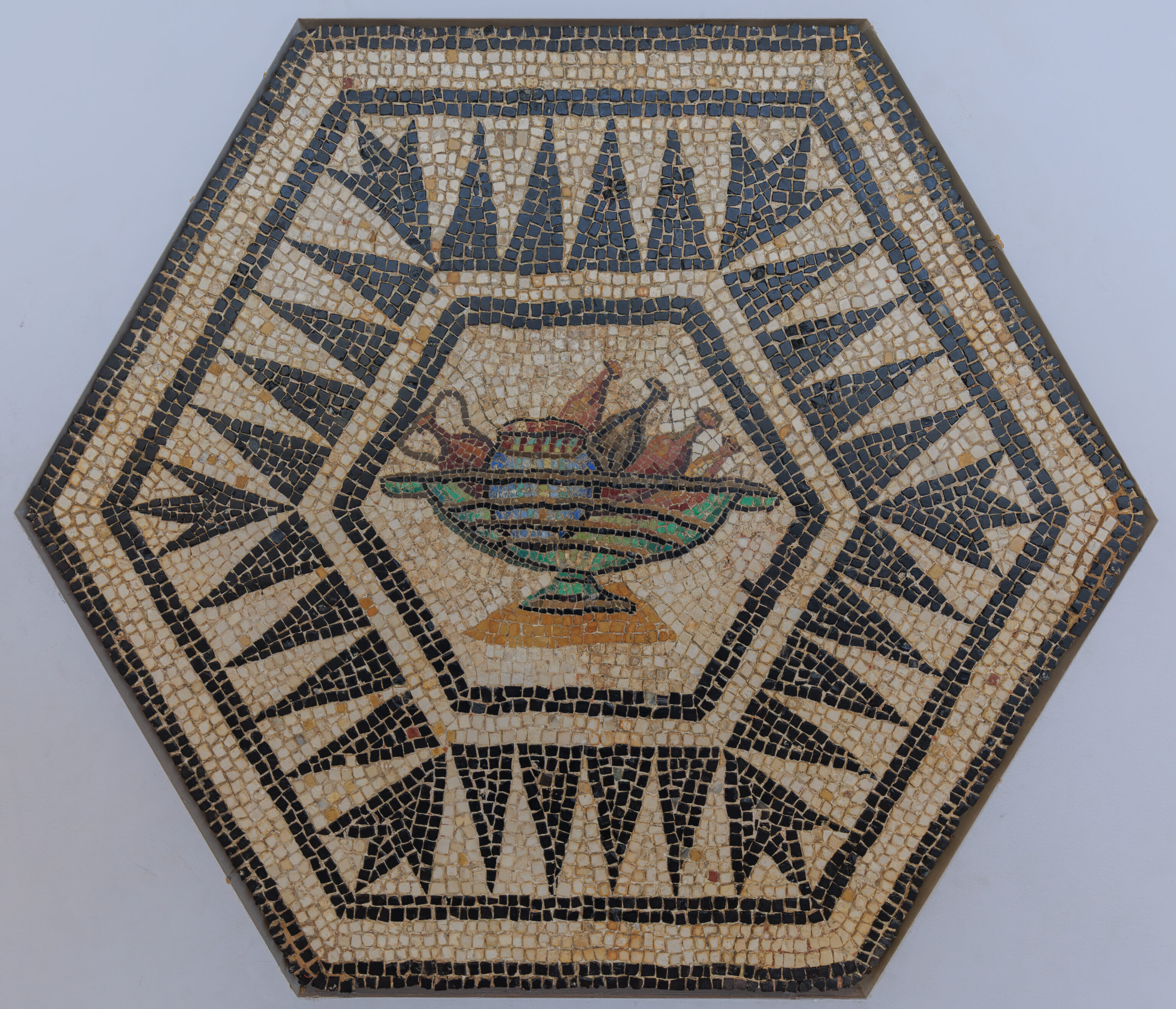
Cooler
Mosaic
Sainte-Colombe (Rhône)
Late 2nd century AD
City of Vienne Deposit

This medallion comes from the same pavement as the one with the duck. It depicts a glass bowl in which flasks, an amphora, and a jar are being chilled. It is a rare mosaic subject that evokes the pleasures of the table. It is one of the museum's works most frequently loaned for external exhibitions.
– Text from a sign, translated using Google.
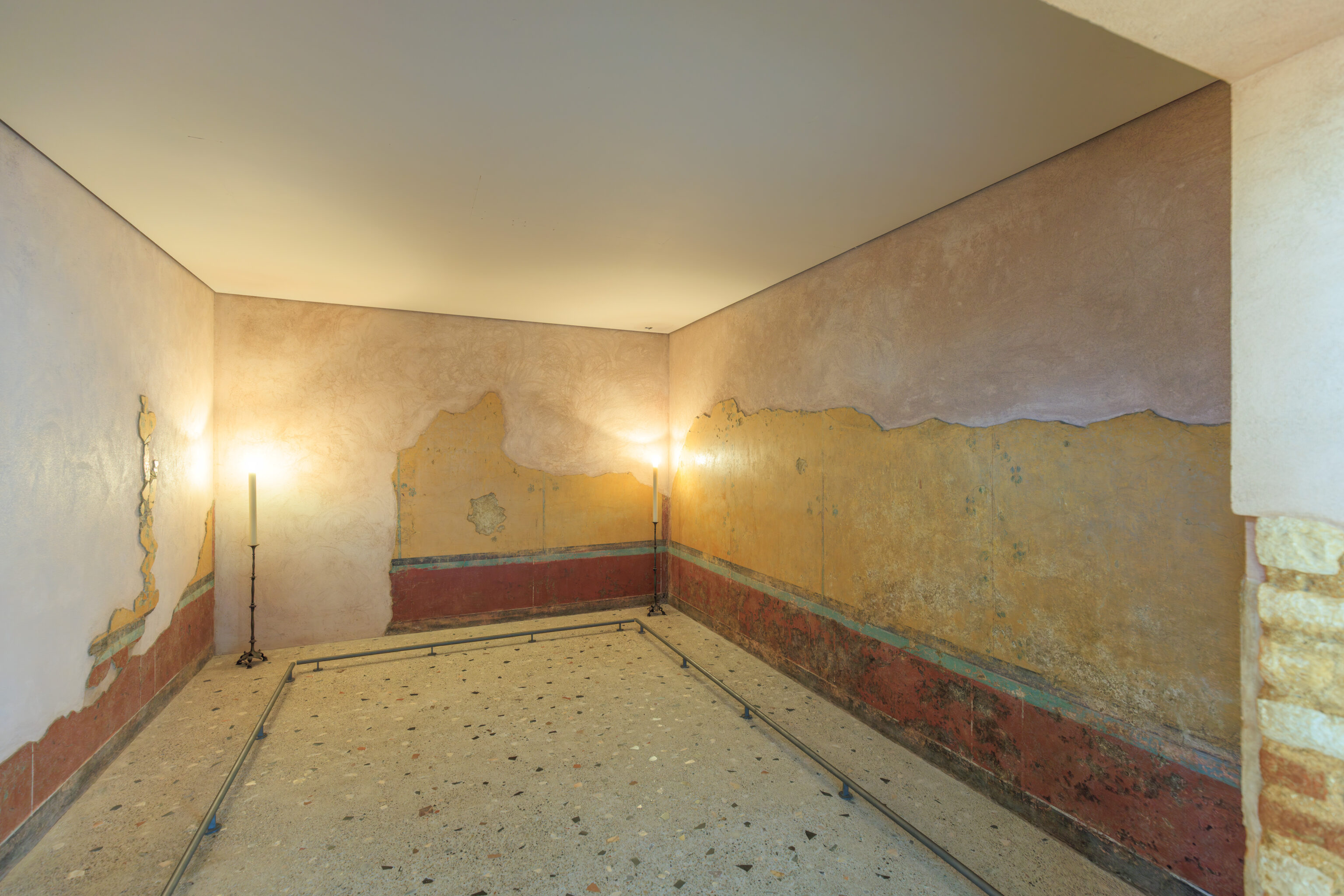
Yellow Room
Wall Painting (4.90 x 3.51 m)
Sainte-Colombe (Rhône)
1st century AD

While most paintings are found in fragments in fill, this painting was still in place against the walls of the room it decorated. Probably a living room. On a red plinth, bordered by a green band, a large yellow field unfolds, punctuated by slender columns adorned with bouquets of leaves and fruit.
– Text from a sign, translated using Google.
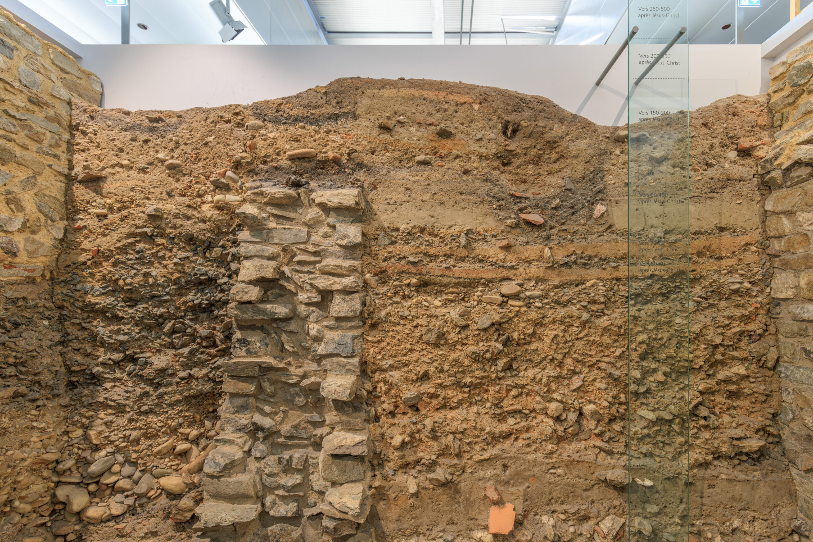
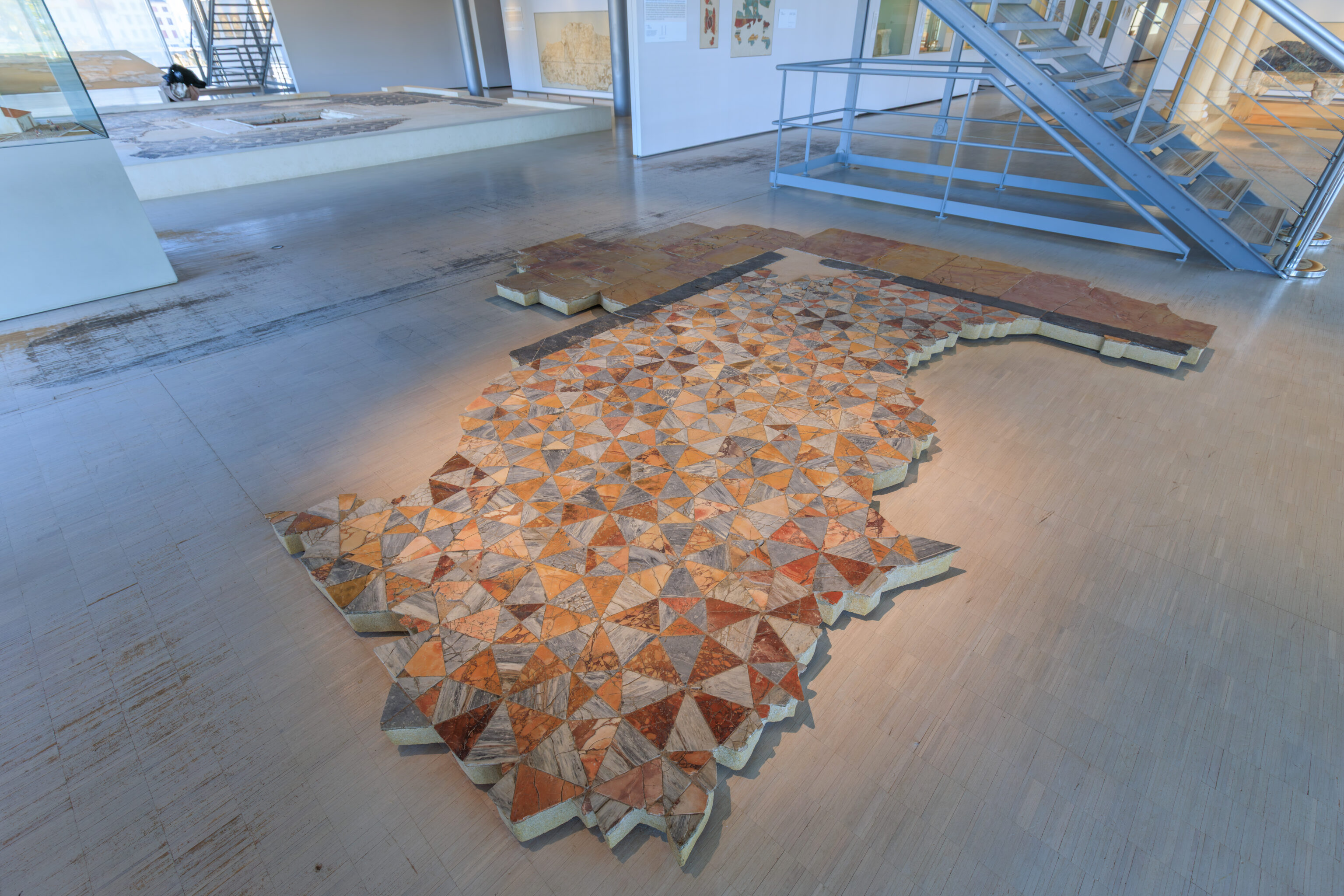
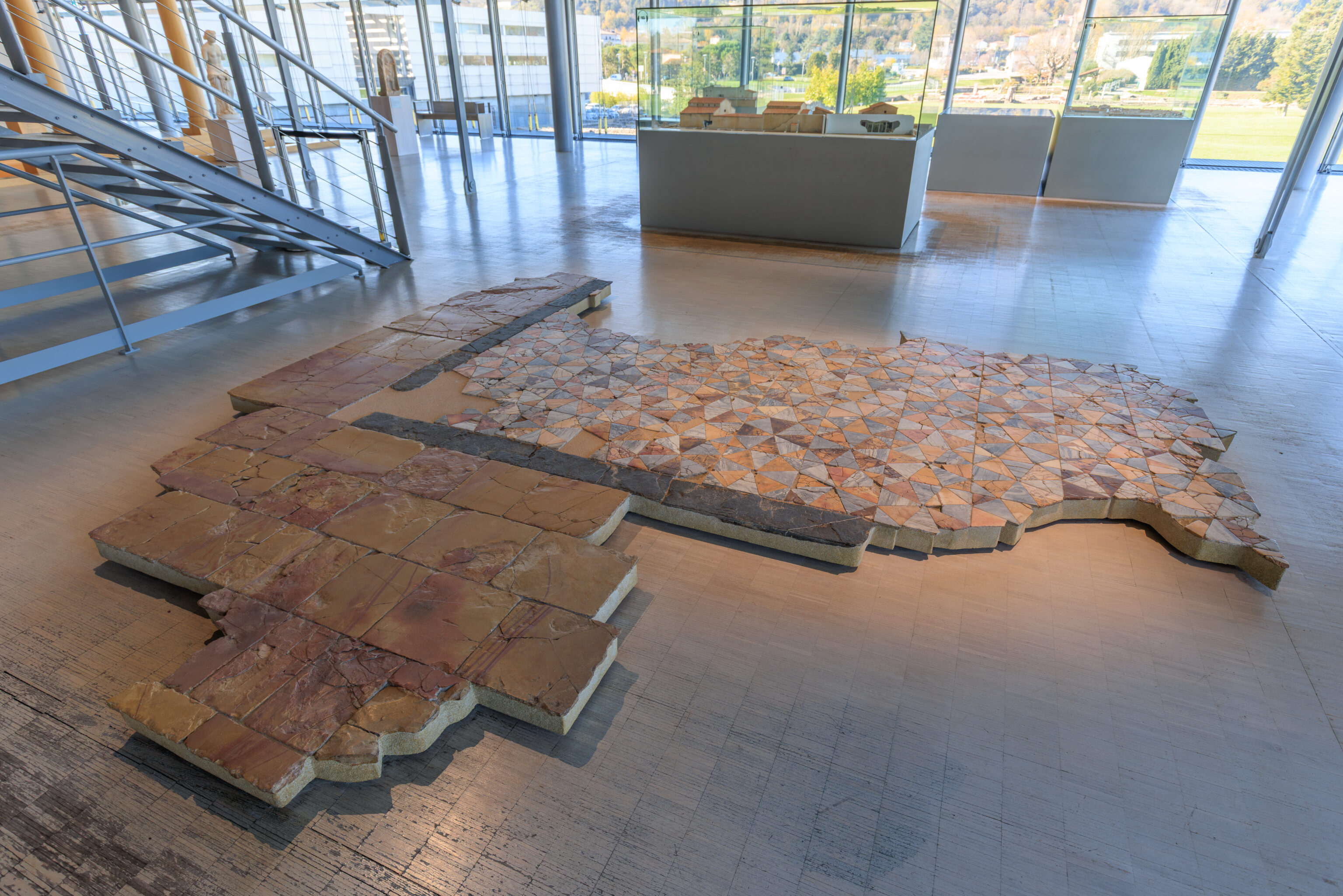
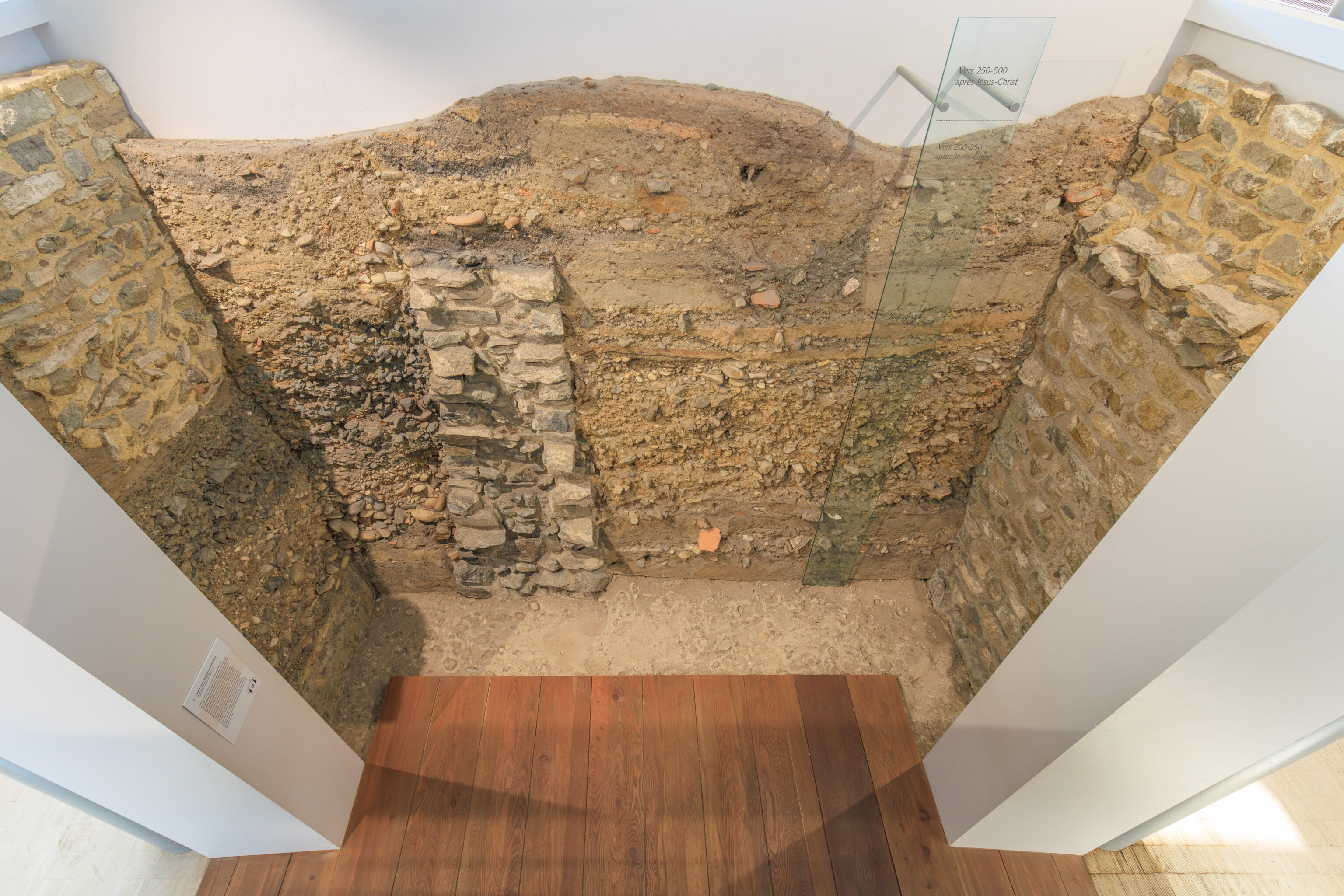
Cross-section through archaeological deposits
Saint-Romain-en-Gal site (Rhône)
1st century BC - 3rd century AD

This cross-section comes from the Saint-Romain-en-Gal site. It is a section of a test pit that archaeologists excavated in 1989 near the northern baths. This excavation was limited in area, but it revealed all traces of the successive developments that this site underwent. This history, which lasted nearly 250 years, from the beginning of the 1st century to the 3rd century AD, is evidenced by layers of fill, beaten earth floors, remains of hearths, and also masonry, deposited one on top of the other. Gradually, this accumulation caused a rise in the ground level, which here reaches nearly 4 meters. This section of land was consolidated, then cut into slabs and reassembled in the museum, like a mosaic floor, by the Interdepartmental Restoration Workshop of Saint-Romain-en-Gal.
– Text from a sign, translated using Google.
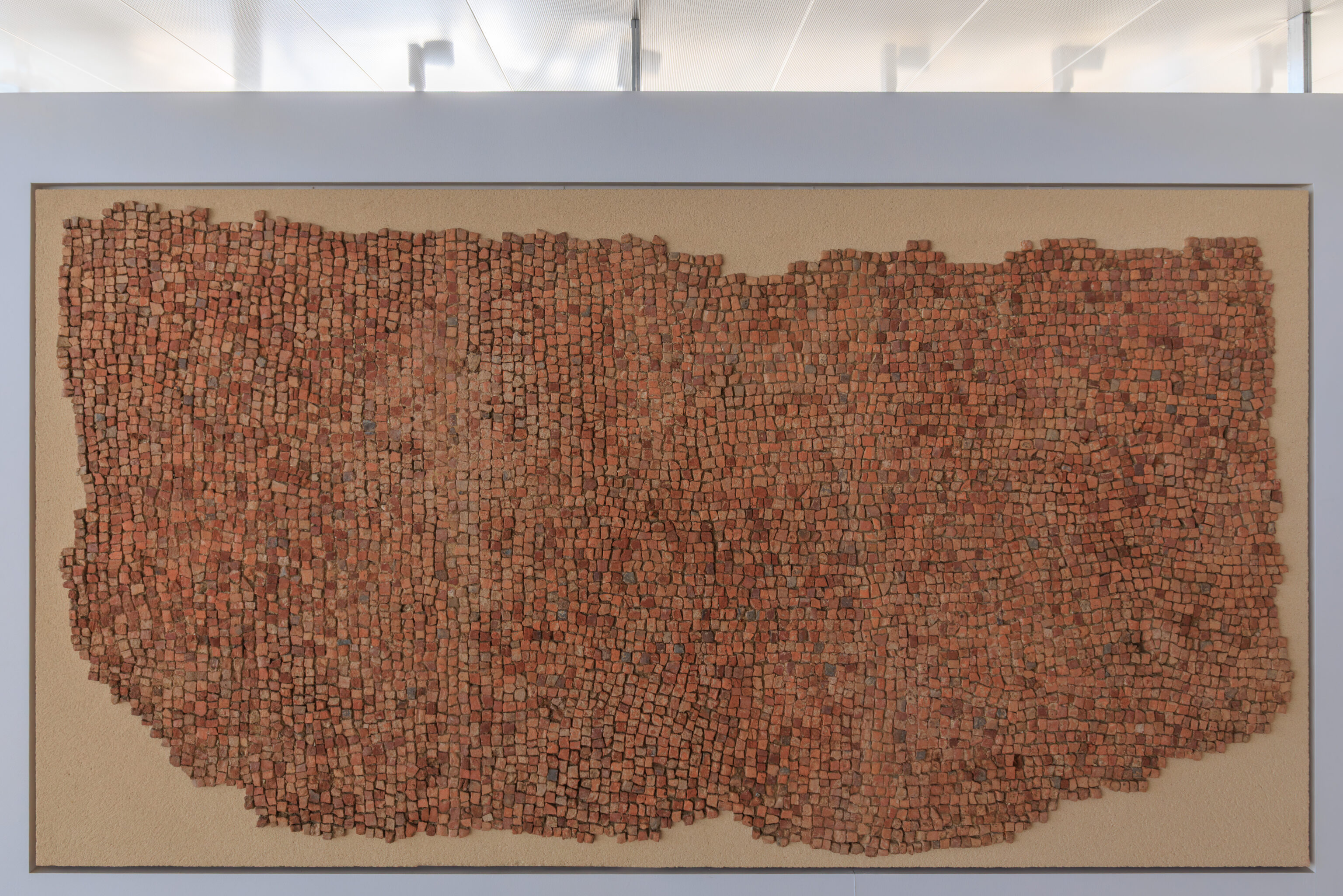
Its not clear if the sign quoted below is describing the tiled panel above:
Terracotta mosaic border
Vienne (Isère)
3rd century AD
City of Vienne Collection

This is the floor of a dining room: the couches of the guests were arranged around the perimeter in a U-shape, paved only with terracotta cubes. The central section was covered with a decoration that has since disappeared.

Preventive excavation, Place Camille Jouffray, 1985.
– Text from a sign, translated using Google.
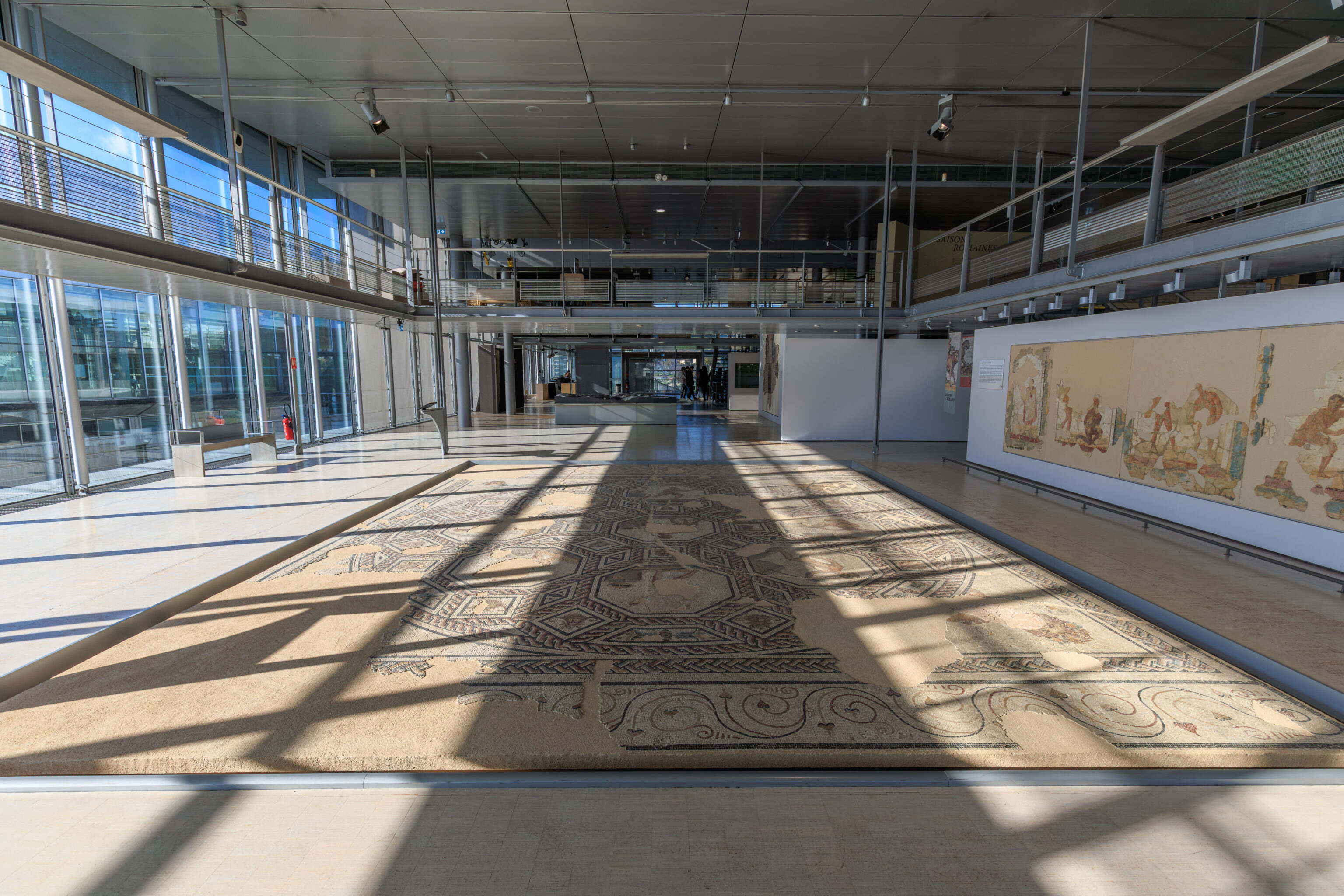
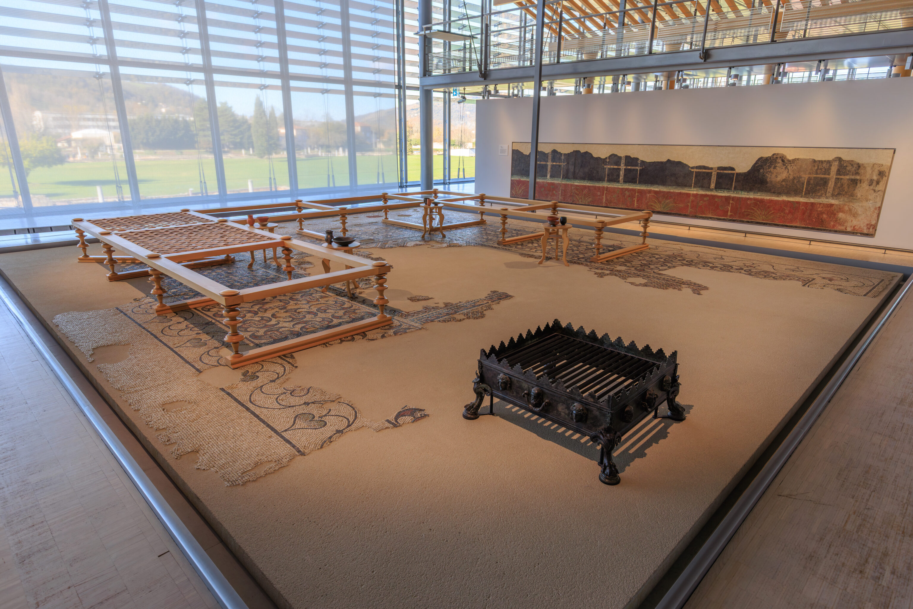
We walked upstairs to the second floor, which overlooks the floor below in many places.
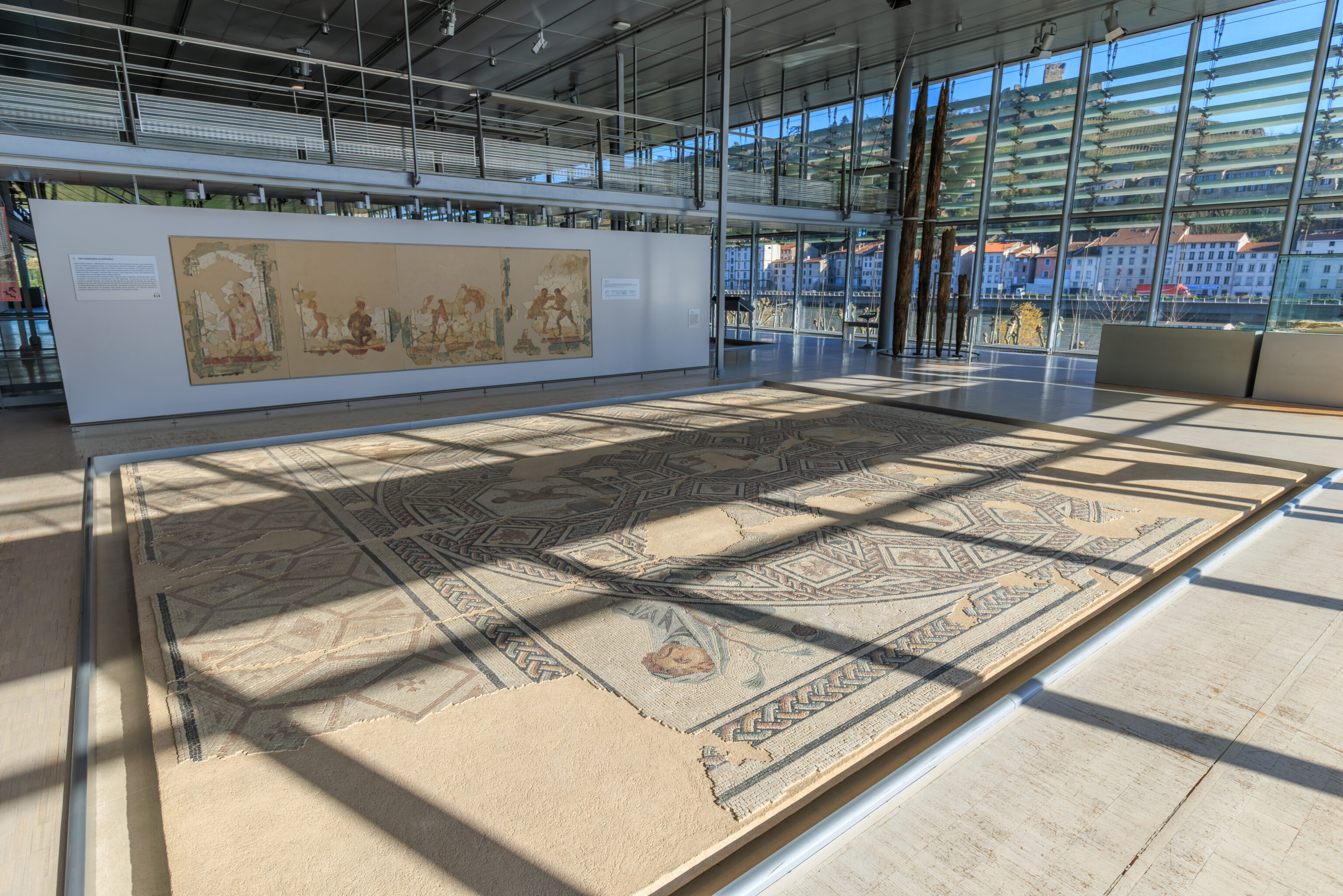
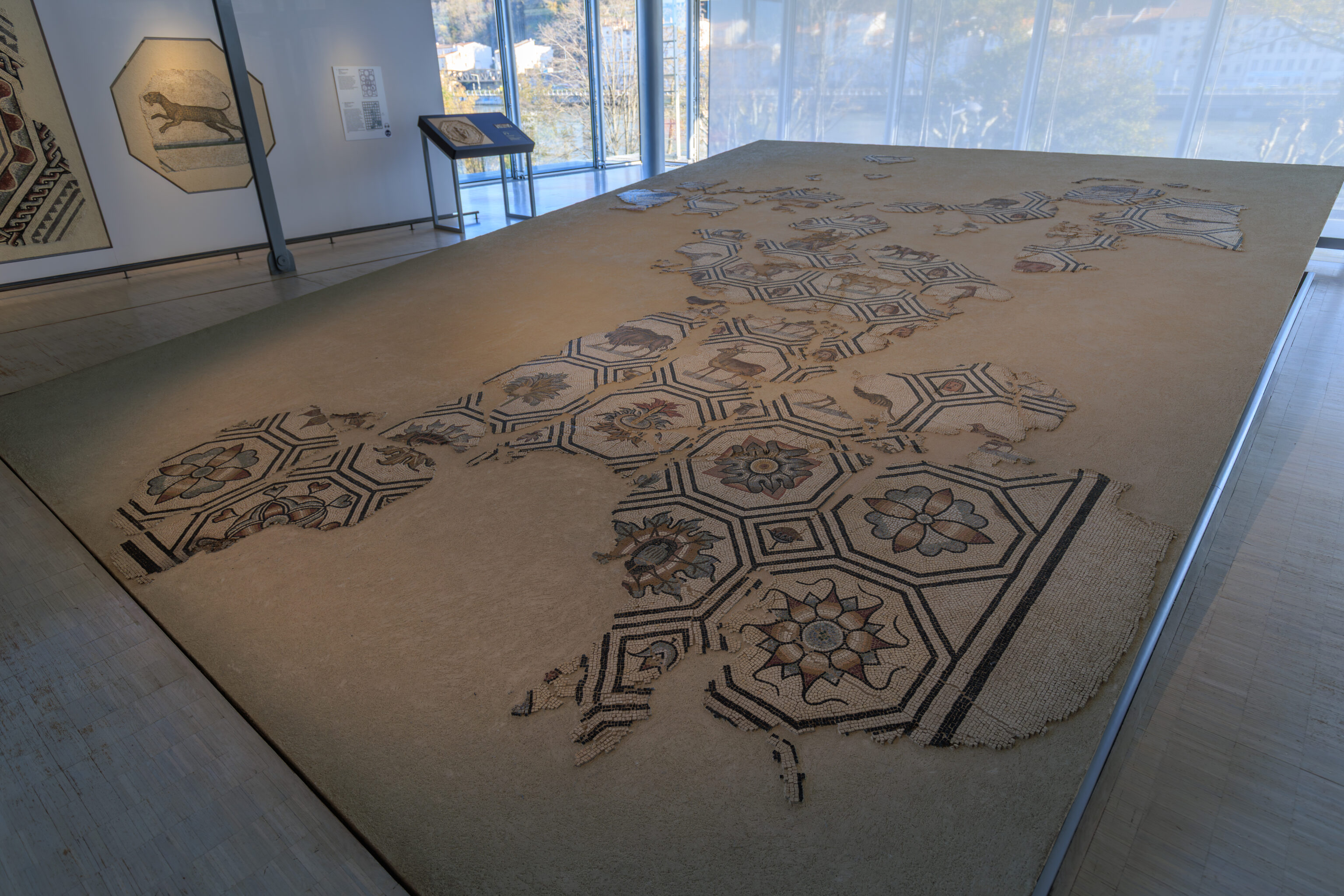
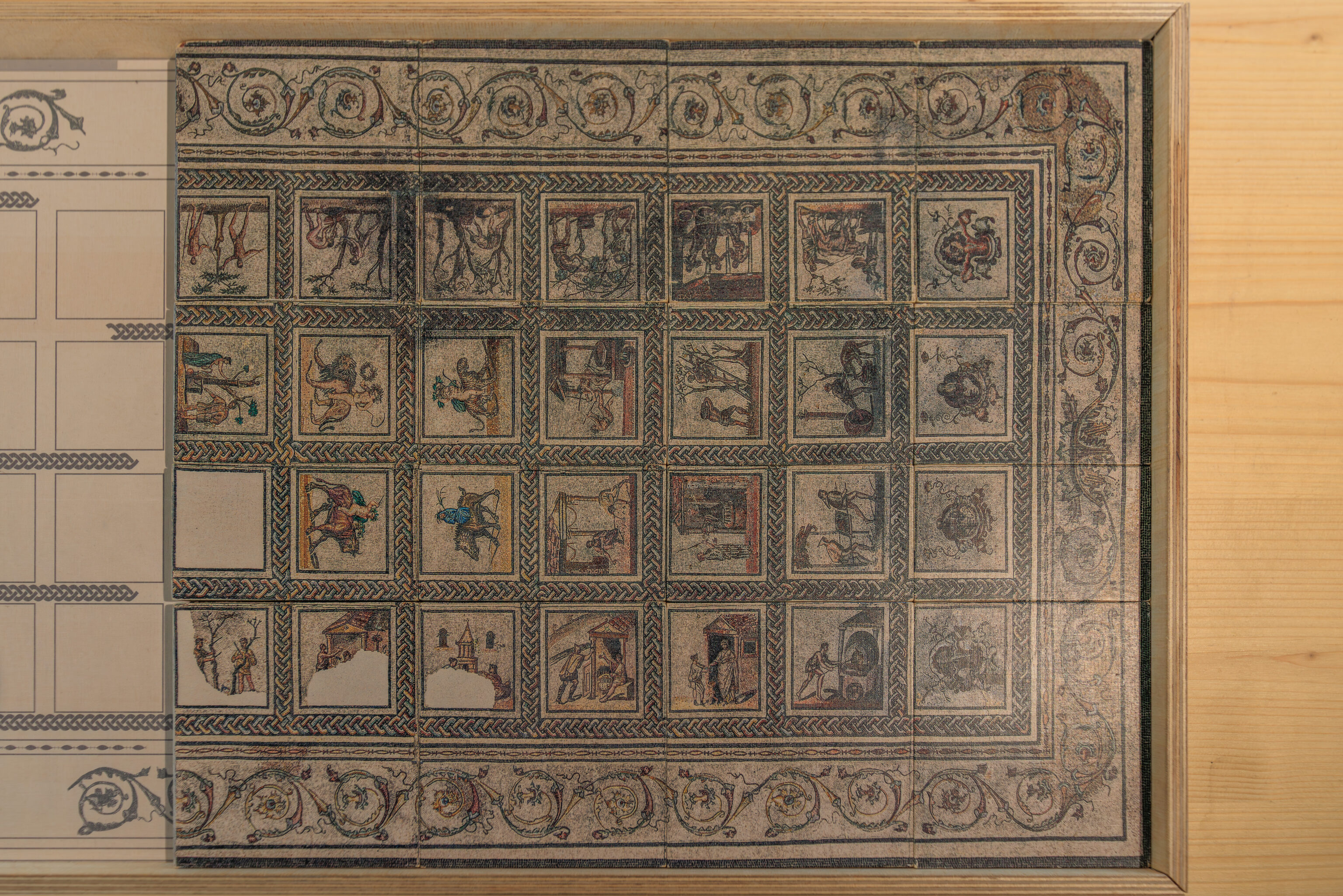
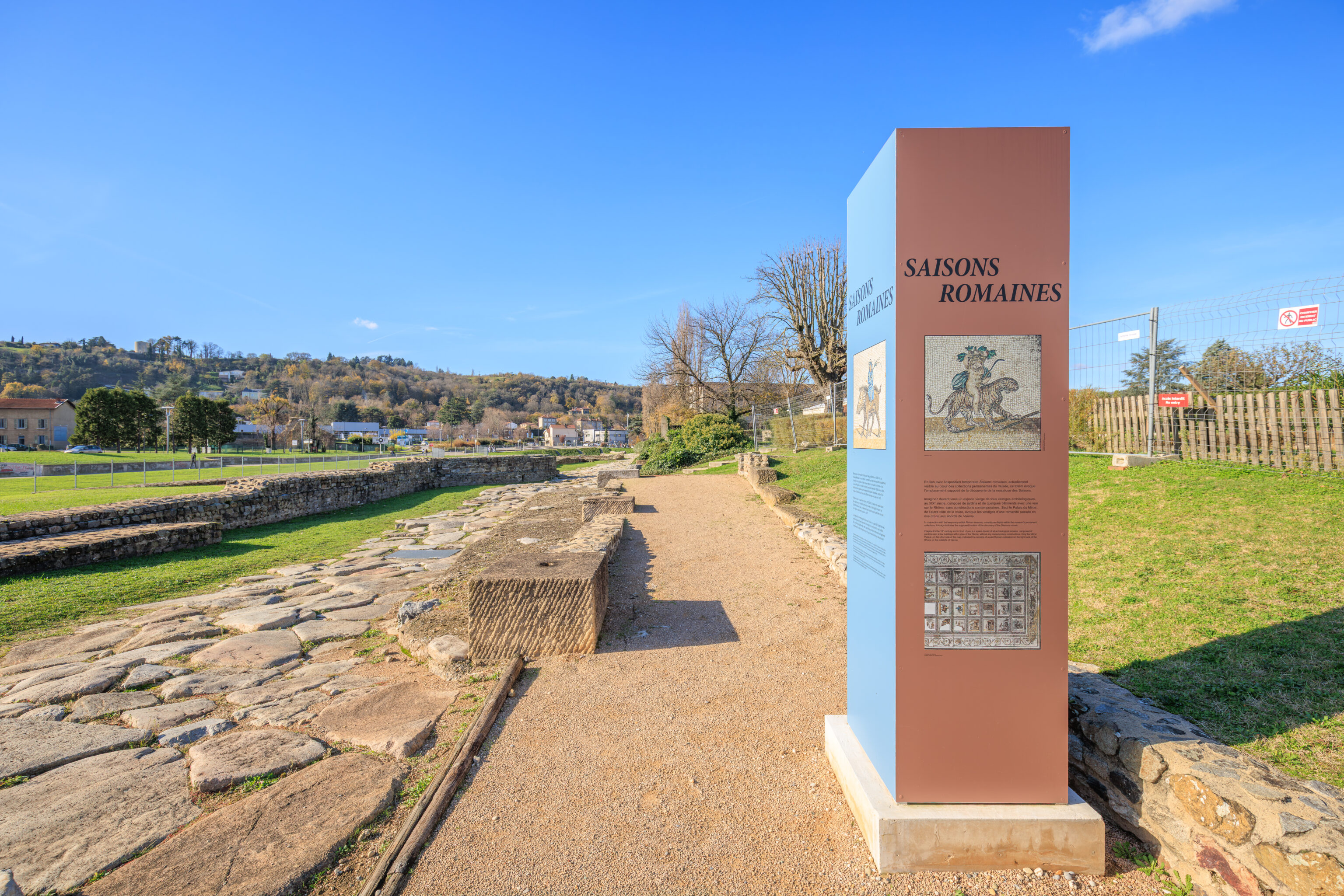
Other than overlooking the floor below, the primary feature of this area is the Saisons Romaines (Roman Seasons) mosaic:
ROMAN SEASONS
Since the 18th century, accidental discoveries and archeological excavations in the heart of Ancient Vienna have continued to unearth exceptional vestiges, providing this region with the most significant body of mosaics discovered in France. However, the history of these collections is complex. Many of them were dispersed through collectors and antique dealers or their acquisition by major national or international museums.
Also known under the name of the "rustic calendar," the Seasons mosaic, discovered in 1890 on the current archeological site of Saint-Romain-en-Gal, was not immune to this process.
Acquired by the Louvre in 1892 and exhibited at the Musée d'Archéologie nationale - Domaine national de Saint-Germain-en-Laye since 1935, it was restored within the mosaics and painted plasters restoration workshop at the Gallo-Roman museum and archeological site of Saint-Romain-en-Gal as of 2022. A collaboration between these institutions made it possible, for the first time, to present the Seasons mosaic in the location where it was first discovered.
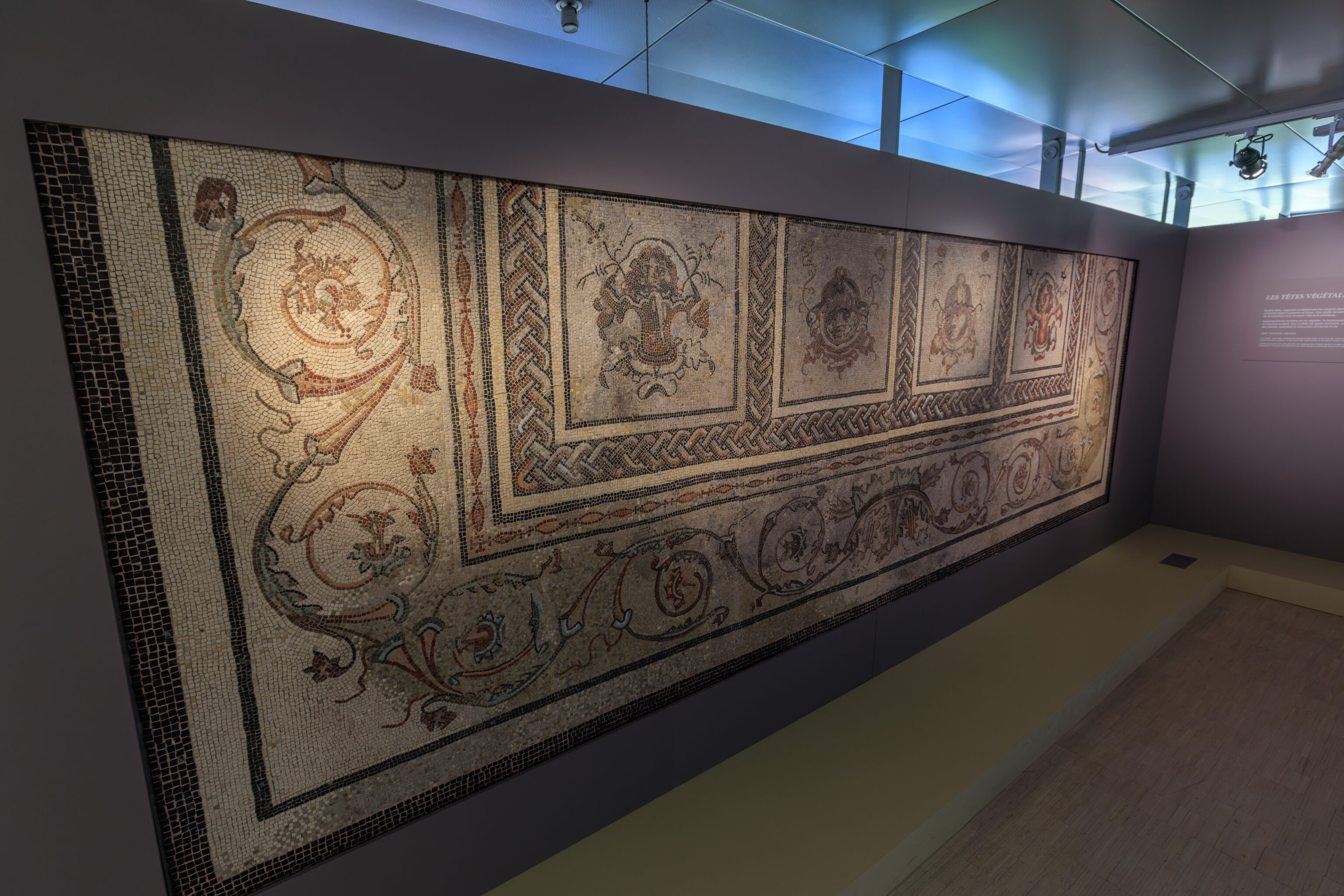
THE SEASONS MOSAIC
This mosaic, from the 3rd century CE, was probably composed of forty panels. Today, only twenty-seven remain.
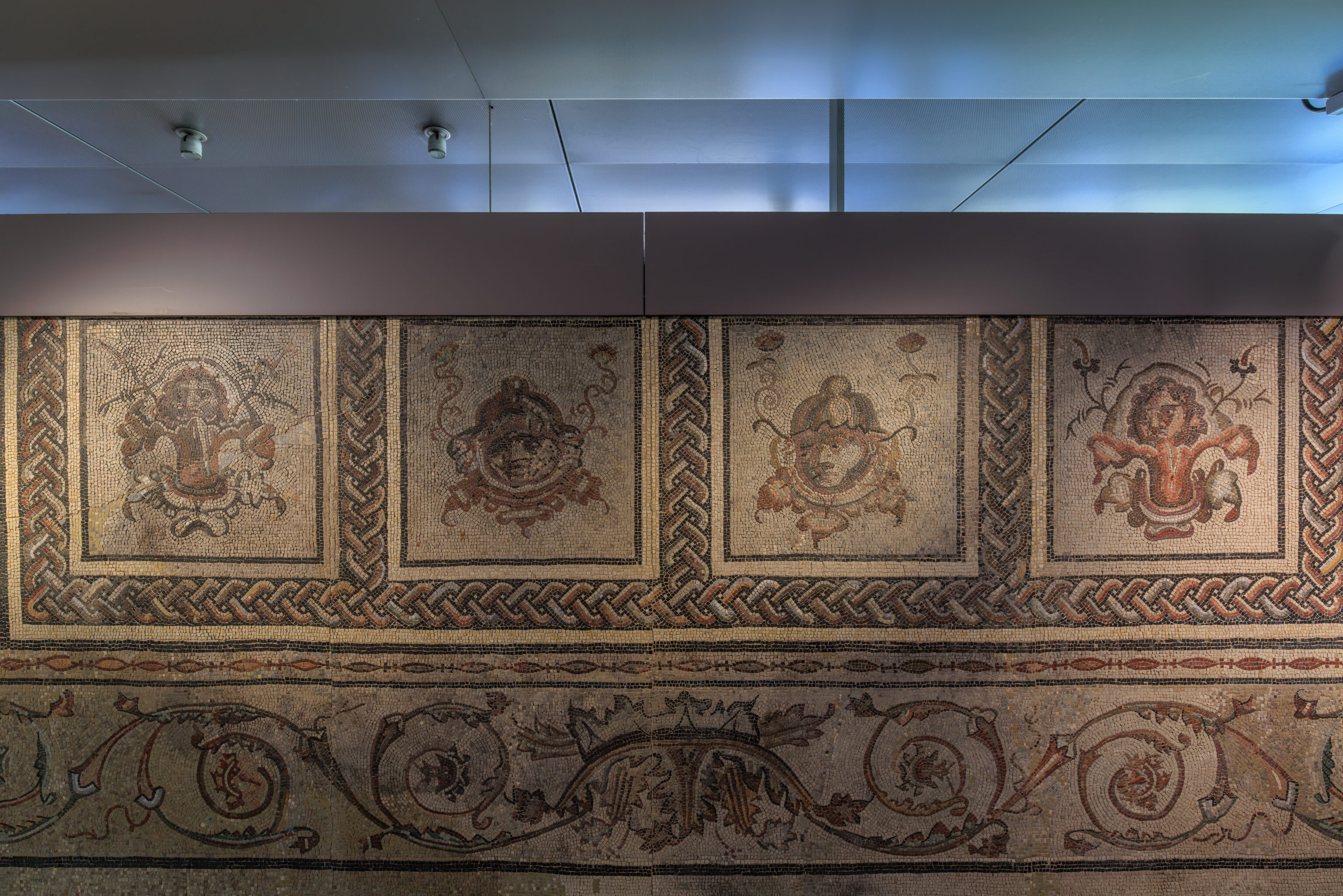
The four seasons are depicted on central compositions and personified by small figures. Agricultural and religious scenes associated with the seasons are organized around the periphery, bordered on one side by four vegetal heads. The entire floor mosaic is surrounded by a polychromatic acanthus scroll.
The systematic organization of the mosaics enables us to imagine that the panels were placed symmetrically. Consequently, it is possible to reproduce four other vegetal heads and thirteen compositions depicting scenes from spring and summer.
THE DISCOVERY OF A NEIGHBORHOOD IN VIENNA
Saint-Romain-en-Gal's la Plaine sector, on the right bank of the Rhône River, has long been famous for its wealth of antiquities. In 1775, Pierre Schneyder, founder of the Vienne museum, conducted the first excavations in the hamlet of La Chantrerie, in the location of the current archeological site.
In the 19th century, accidental discoveries and private excavations in the surrounding farmland unearthed rich archeological furnishings near the ruins of the thermal baths known as the "Mirror Palace".
In 1967, the construction of the Vienne high school uncovered vestiges of a vast urban district in la Plaine. To date, excavations have revealed approximately twenty mosaics from various houses.
THE ROMAN COUNTRYSIDE IN IMAGES
This mosaic, today considered to be a major work from the Roman era in the Rhône region, illustrates the agricultural world at the turn of the second and third centuries. The analysis of the iconography makes it possible to address several aspects that are not apparent at first glance. Rereading this floor mosaic thereby offers the opportunity to understand an entire section of society based on themes of daily life in the countryside, religious life and the conception of time.
The mosaic depicts the activities of the four seasons, but does not function like a real calendar. Indeed, contrary to the representation of the painted calendar of Tongeren (Belgium), the names of the months are not cited and the festivals and rituals are not clearly identified. It is also impossible to define a system that explains how the festivals and types of activities represented are organized throughout the floor mosaic.
– Text on a wall.
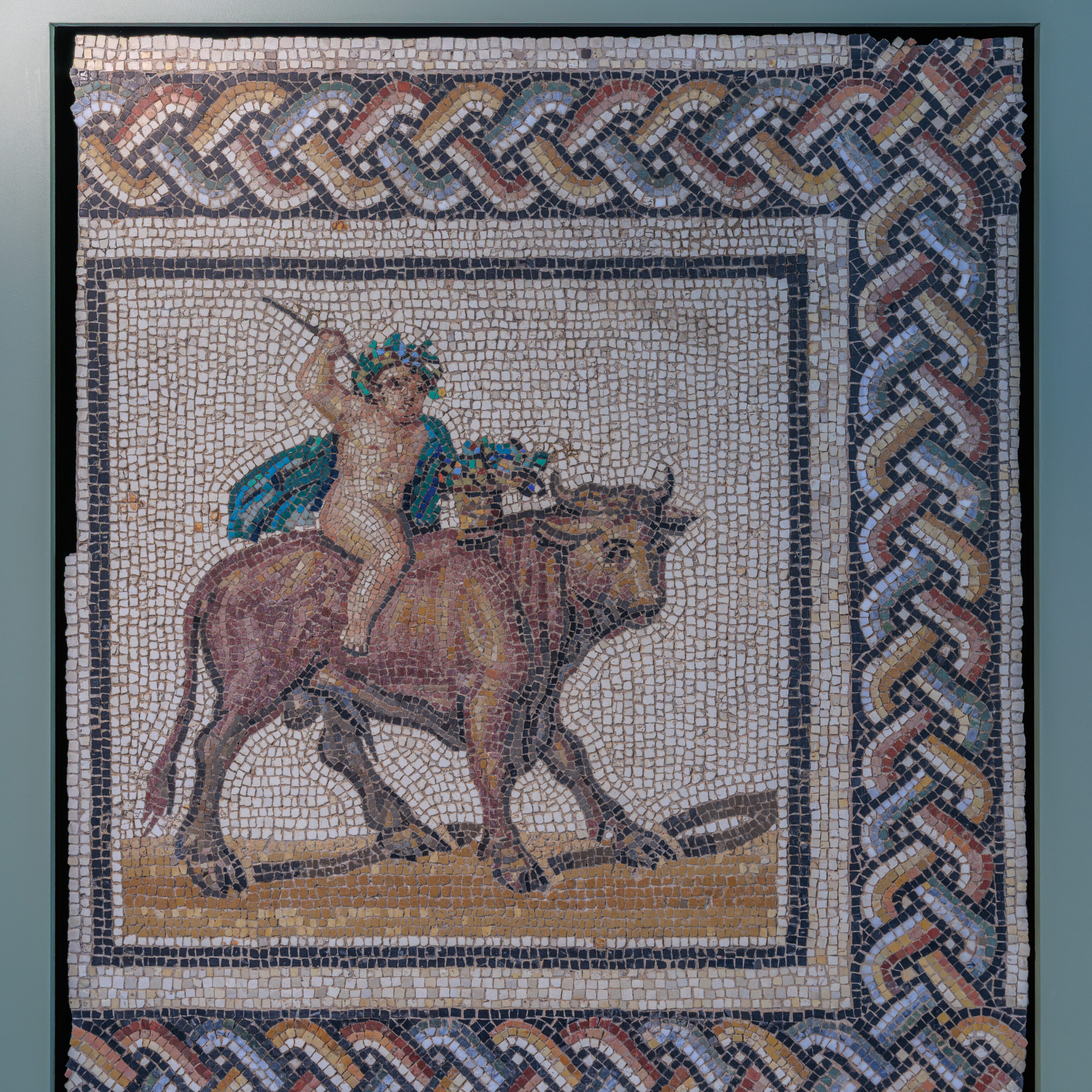
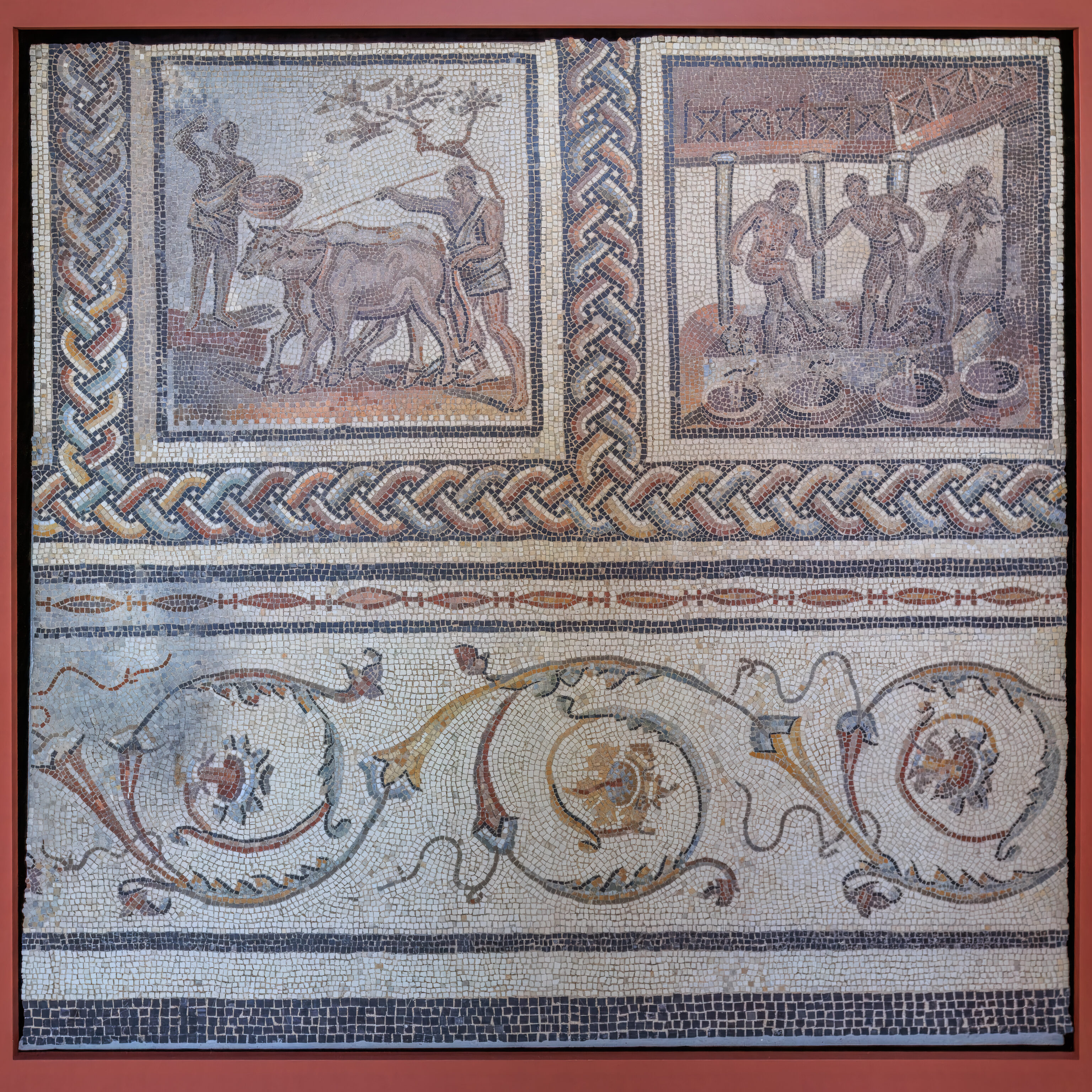
SPRING
Spring is represented by a male figure mounted on a bull, which refers to the zodiac sign and announces the return of spring. Crowned with a leafy wreath, the child, dressed in green - the color of emerging leaves - excites, with his stick, the powerful animal with large dewlaps, a symbol of fertility. He balances a basket of flowers on its backbone.
– Text from a sign.
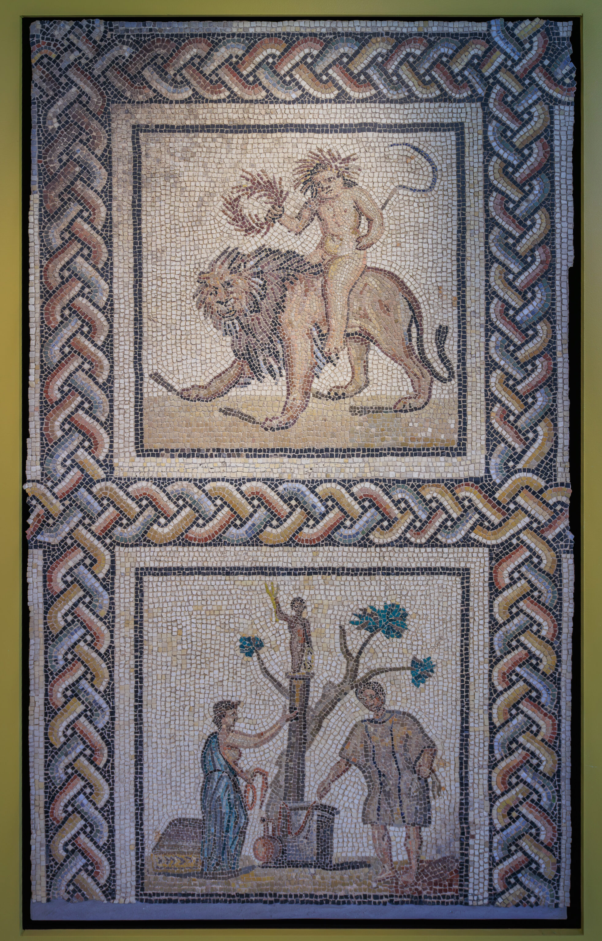
SUMMER
The personification of summer sits astride a lion, symbol of the zodiac sign. Completely naked, in his right hand, the child carries a crown with ears of wheat while others adorn his head. In his left hand, he holds a long sickle. This farming tool with a very slender curved blade is generally used to harvest grain. It is the typical symbol for summer and here it represents the summer harvest.
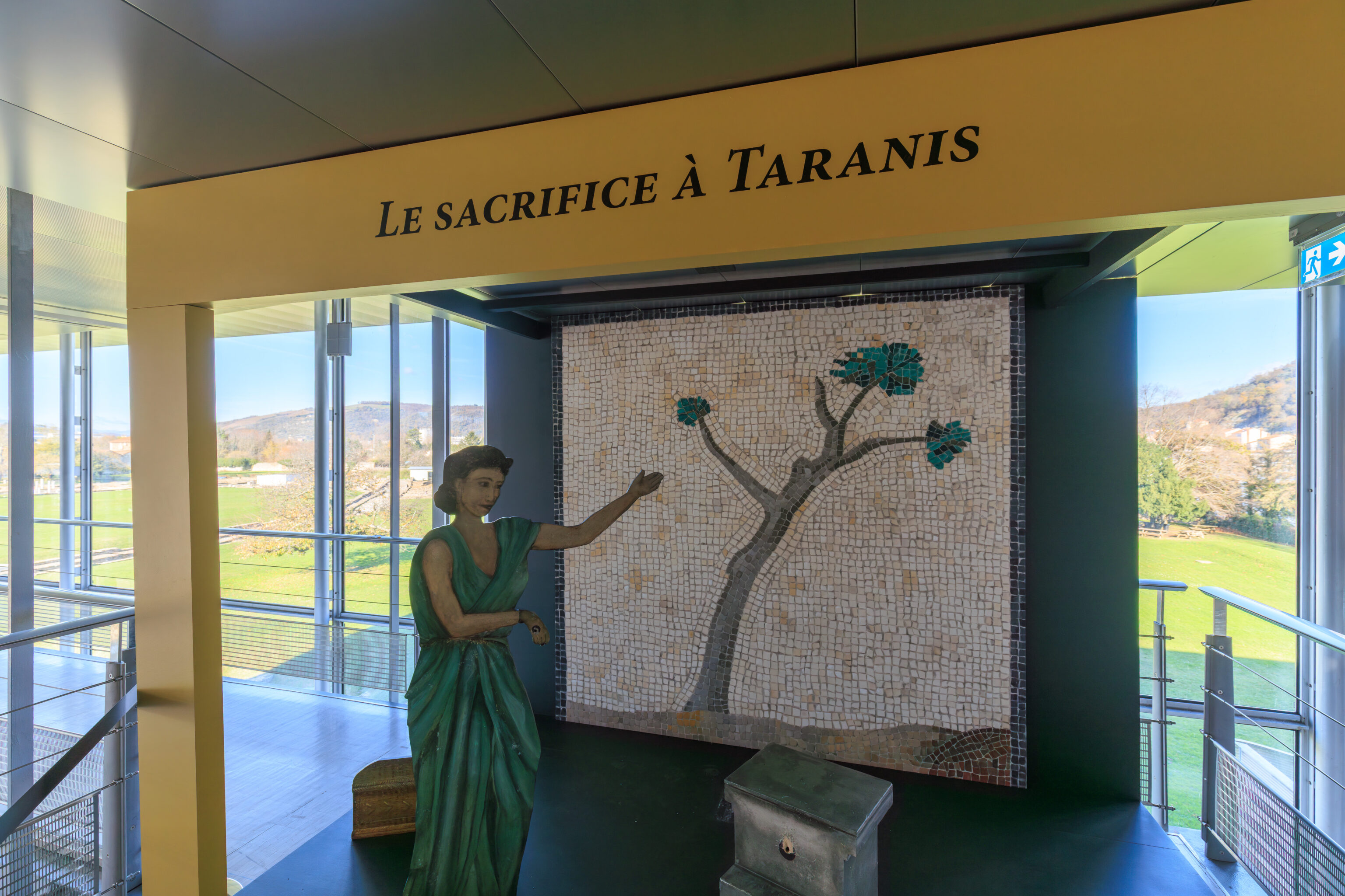
THE SACRIFICE TO JUPITER-TARANIS
A sacrificial scene takes place at the foot of a column, on which the statue of the honored divinity stands. The god holds a lightning bolt in his right hand and a wheel in his left hand. This must be Jupiter-Taranis, who appears here as the god of the sky and lightning, responsible for alternating between good and bad weather. It is logical to invoke him in the summer, a delicate time for crops.
– Text from signs on the wall.
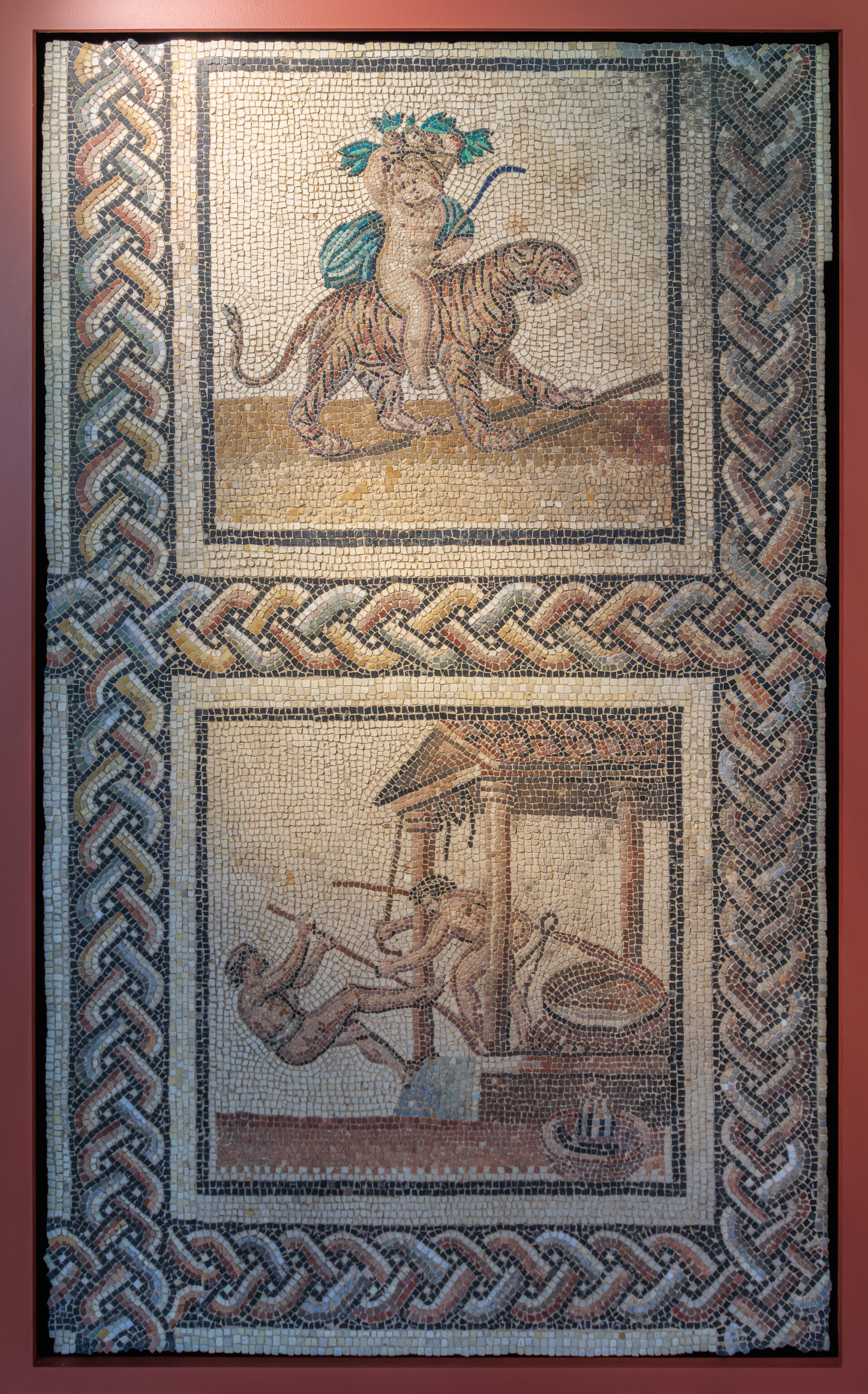
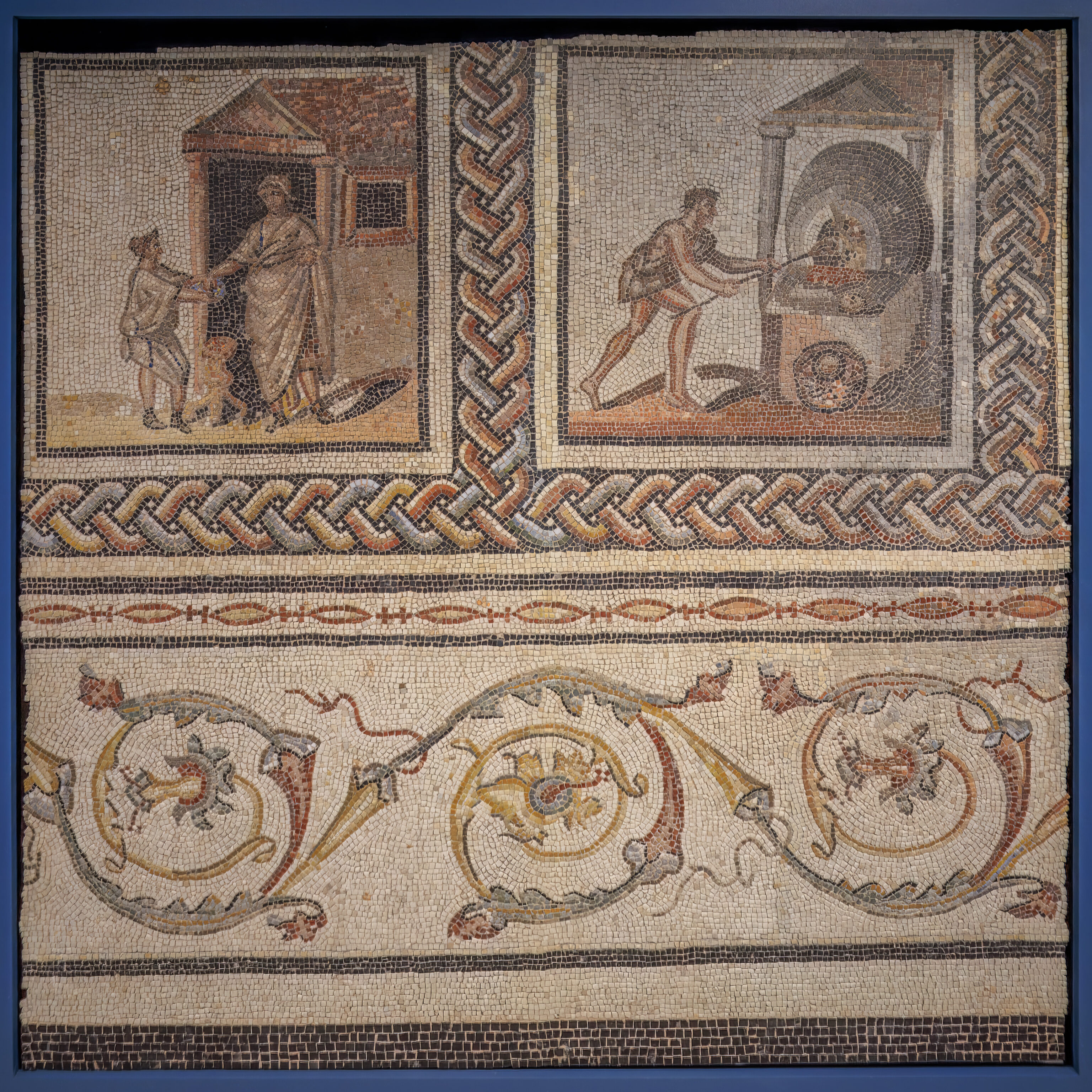
AUTUMN
Autumn is personified by a child seated on the back of a male or female tiger. The mosaic's restoration revealed black lines under the feline's stomach, which could allude to mammary glands. Since autumn is the season of the grape harvest, the figure carries a basket decorated with grape leaves and a curved instrument reminiscent of a pruning knife, a tool used by grape harvesters. This season, just like the tiger is often associated with Dionysus/Bacchus.
PRESSING THE GRAPES
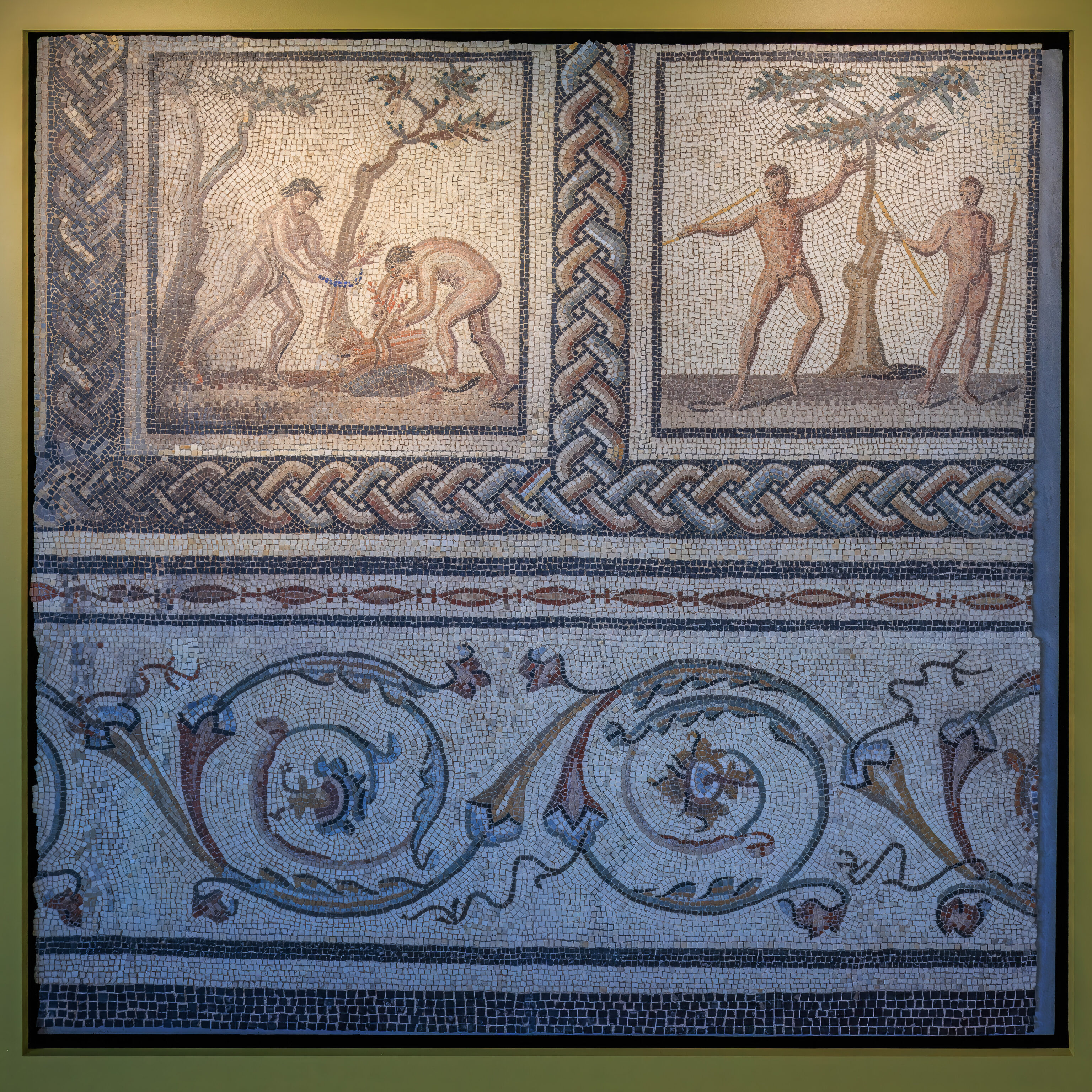
Formerly identified as an olive press, this winepress is made out of stylized pans, making it difficult to understand how it worked. Two figures actuate a lever that is used to operate an invisible capstan, pulling the system of ropes and straps and increasing the force of the press shaft. The function of the other lever is difficult to understand due to its size and starting point. The juice trickles into a recipient placed on the ground.
– Text from signs on the wall.
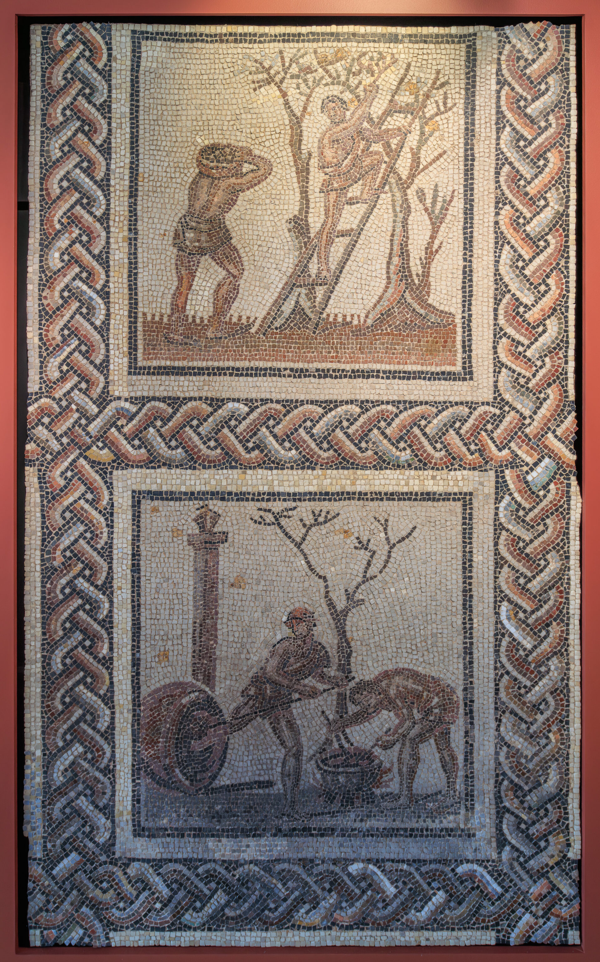
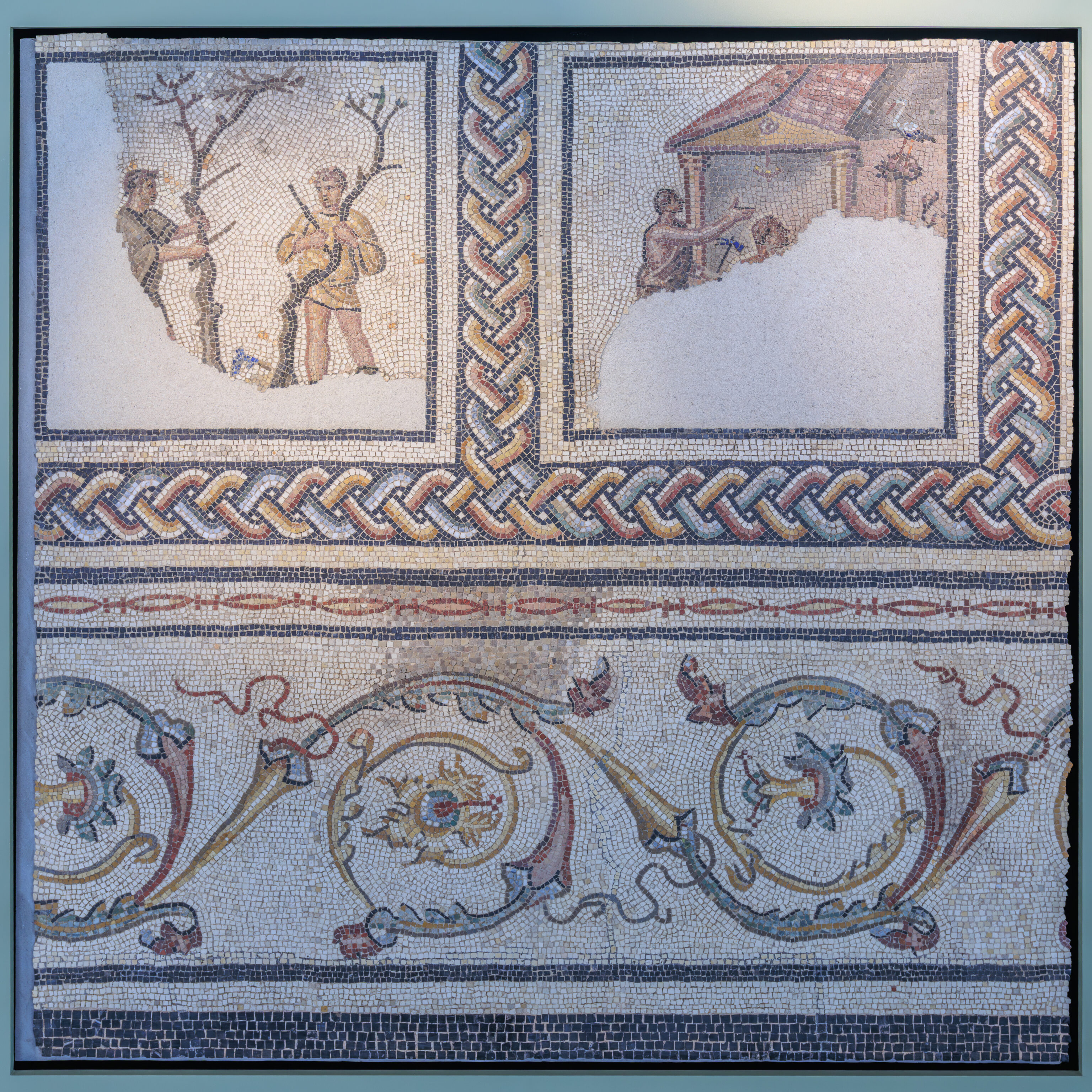
THE FRUIT-PICKING SCENE
Here, the trees are pruned and trained to grow upwards. The harvest thereby requires a ladder in order to pick the fruit carefully. This seems to indicate that the fruit was then saved for as long as possible or sold. One of the two figures advances, bent under the weight of a basket full of fruit, while his companion tums towards him, halfway up the ladder. Their demeanors provide a genuine impression of movement to the scene.
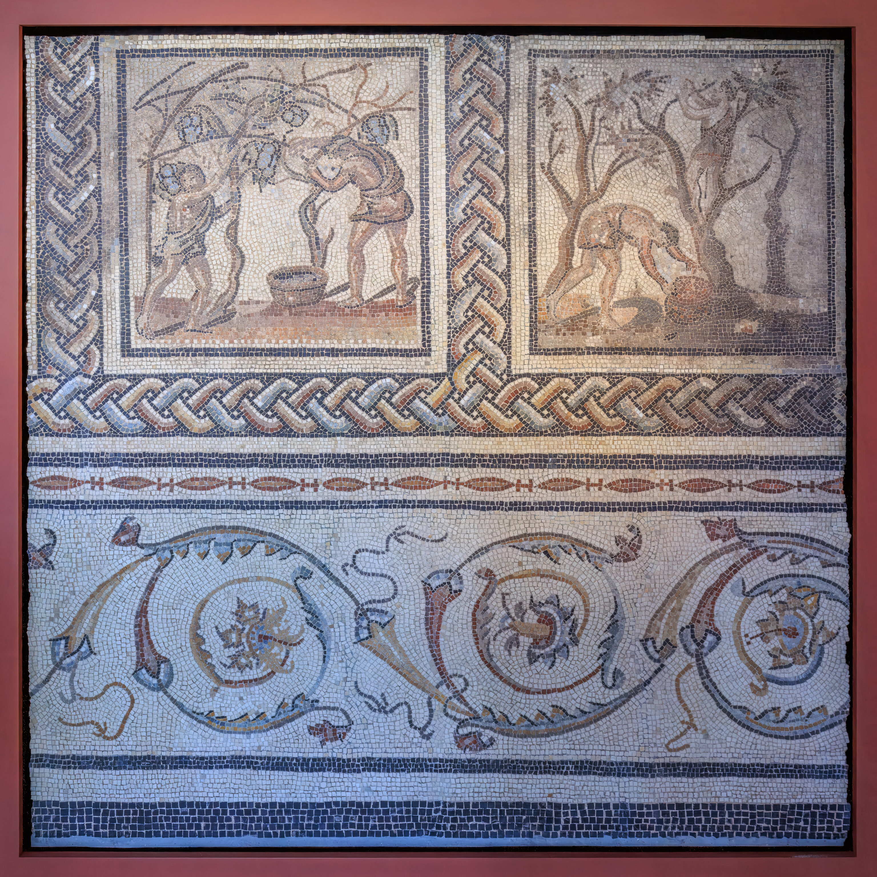
COATING JARS WITH PITCH
Two men coat pitch on a wine jar, or dolia, previously thought to be an oil jar. This plant-based tar was obtained by distilling conifers over a fire. Stored in its solid form. it had to be melted first before it could be used. After removing the pitch from the previous year, a new layer was applied onto the jar's interior in order to keep it watertight. Coating of the jars would take place during the summer before the grape harvest.
– Text from signs on the wall.
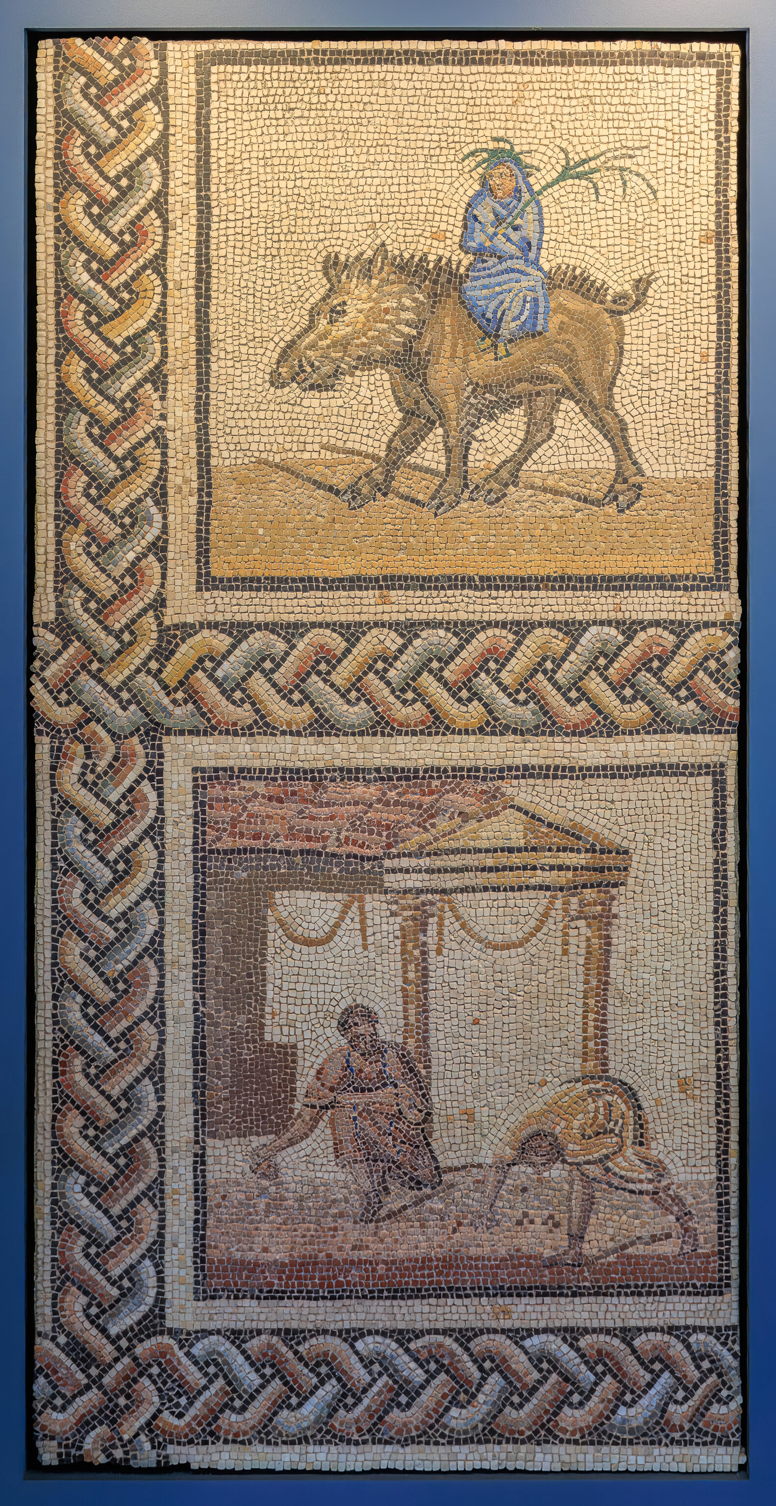
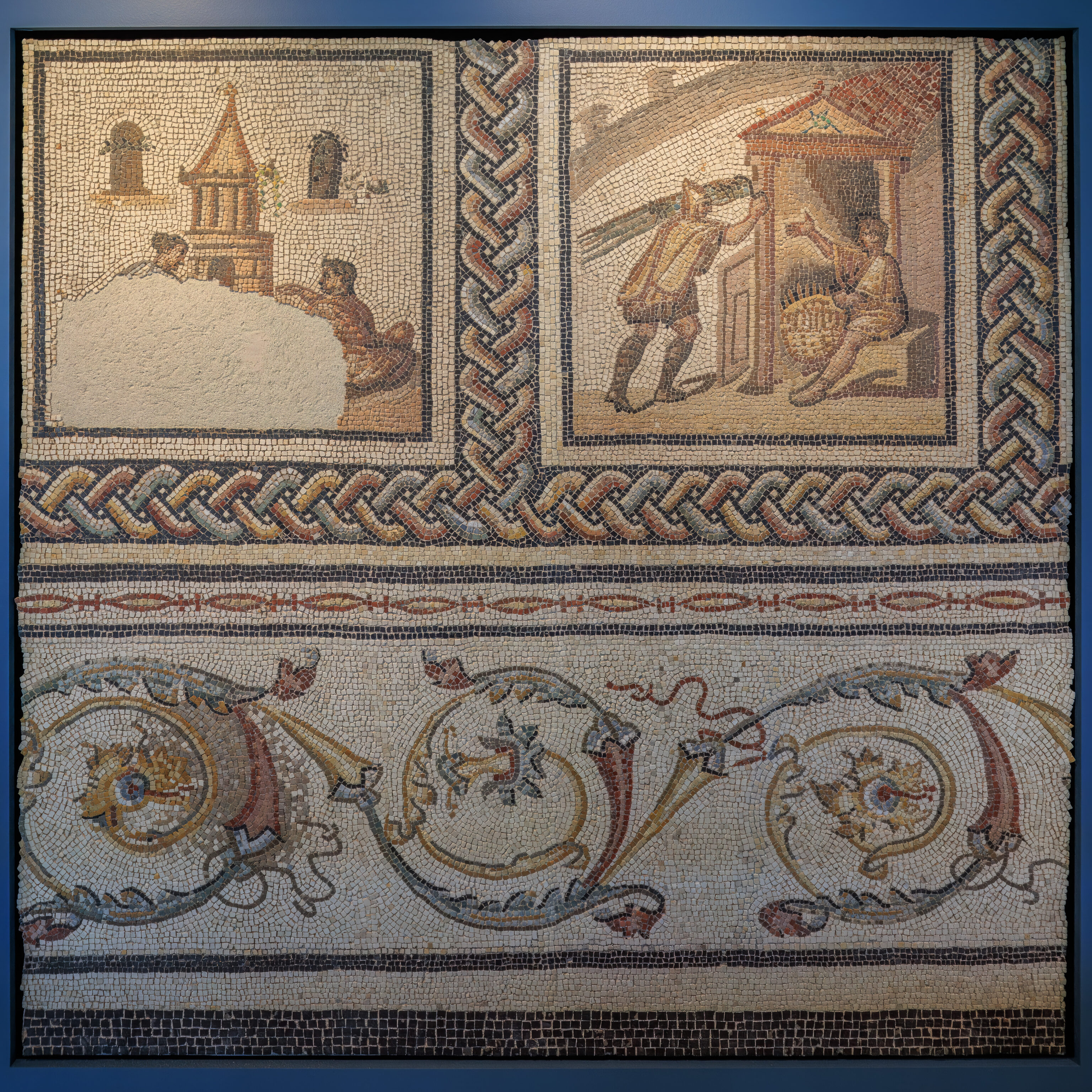
WINTER
The personification of winter, probably female, is depicted seated on the back of a wild boar, warmly wrapped up in a blue coat. She carries a long reed, symbol of the season, the leaves of which crown her head. The wild boar illustrates both the season and the wild winter game that lived in the wet marshes. Its fur and tusks are both well defined. The detail of its red tongue was revealed during the mosaic's restoration.

RITUAL SOWING SCENE
Two men seem to be busy sowing seeds in front of a temple-like building. This is a scene depicting the sowing of beans, traditionally done in December. However this agricultural activity is difficult to reconcile with the incongruous clothing worn by the seed sowers. Instead this appears to be a symbolic practice alluding to the first day of January, a festival dedicated to Janus, the god of doorways: the scene's location right in front of the temple then takes on its full meaning.
– Text from signs on the wall.
MILLING
The scene takes place under a two-sided roof supported by three columns. A woman dressed in a tunic carries a stick in her right hand and guides a donkey, which is turning a mill. The animal, ears drooping, is blindfolded. A harness could be depicted by the four lines of tesserae between its neck and the millstone.

THE MILL
The "Pompeian-type" millstone was made out of a fixed conic-shaped block (meta) upon which is placed a biconical turning stone (catillus). A cylindrical masonry base served as the foundation for the whole mechanism A wooden funnel, placed above the catillus, made it possible to introduce the grain into the upper part of the millstone so it could be ground via a rotating motion. Lines of white and grey tesserae represent the flour flowing under the catillus.

TRANSPORTING A BRAZIER
Two figures, wearing a hooded coat (cucullus) and ankle boots, exit an agricultural building formed by two posts and, in all likelihood, a thatched roof. Seeming to be in a hurry, they transport a brazier placed on a handbarrow. Thanks to the mosaic's restoration, it is now possible to distinguish a pile of black and red tesserae in the middle of the handbarrow. These are intended to be embers used to warm up the vines in case of frost, contrary to the former theory that privileged the transportation of manure.
– Text from signs on the wall.
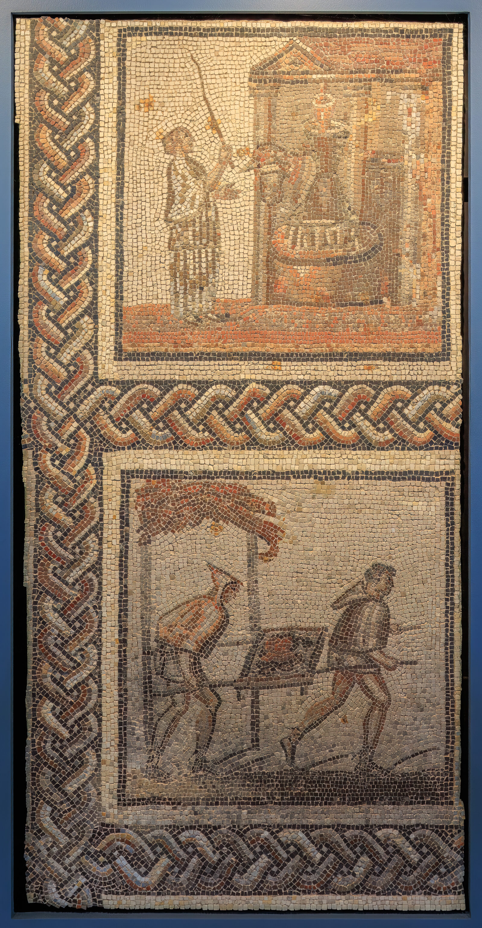
SACRIFICIAL SCENE
This scene takes place in front of a building with a tile-covered pediment supported by two columns. A window suggests that this is a home. In front of the porch, a child or slave presents a vessel to a warmly dressed man.  The latter takes grains of blue-colored incense and throws in the embers of a sacrificial tripod. This scene depicts a master arriving to his estate and performing the sacrifice to the deities protecting his household.

BAKING BREAD
A man with bare feet, wearing a tunic, holds a bread peel In front of the oven's mouth. The latter is protected by a Iwo-sided roof supported by two columns with capitals. This scene depicts the loading or emptying of the oven before or after the bread is baked
– Text from signs on the wall, with minor corrections.
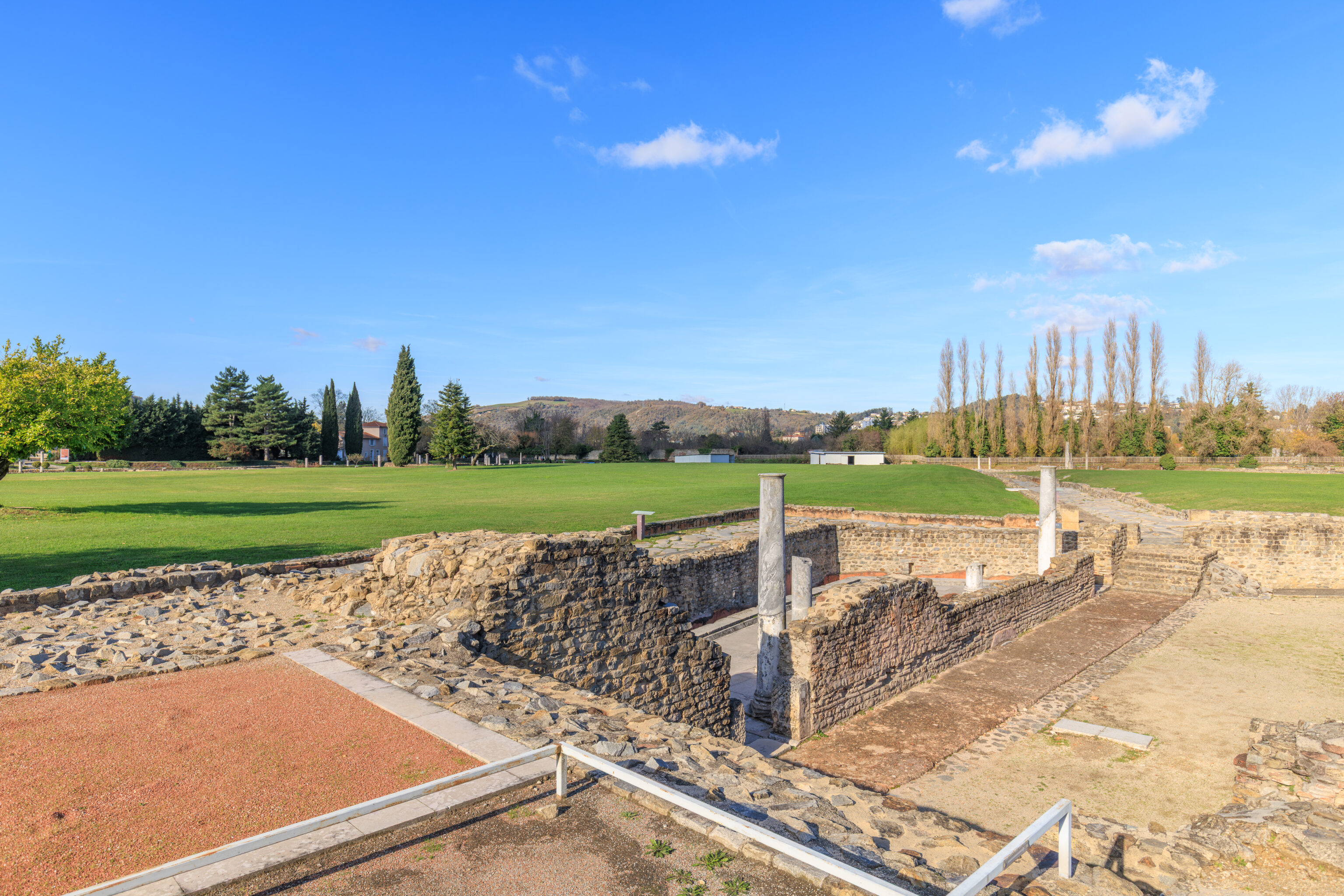
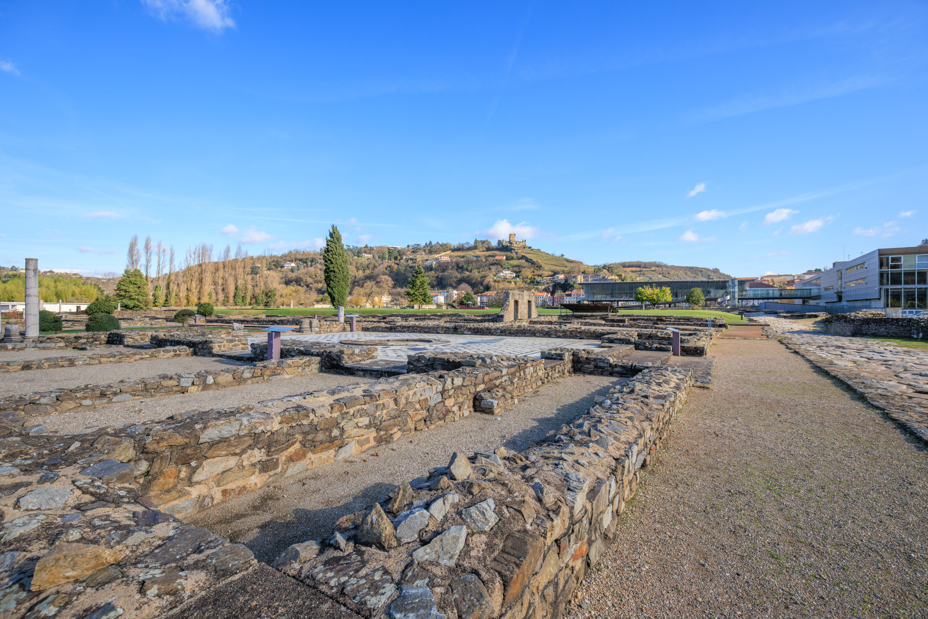
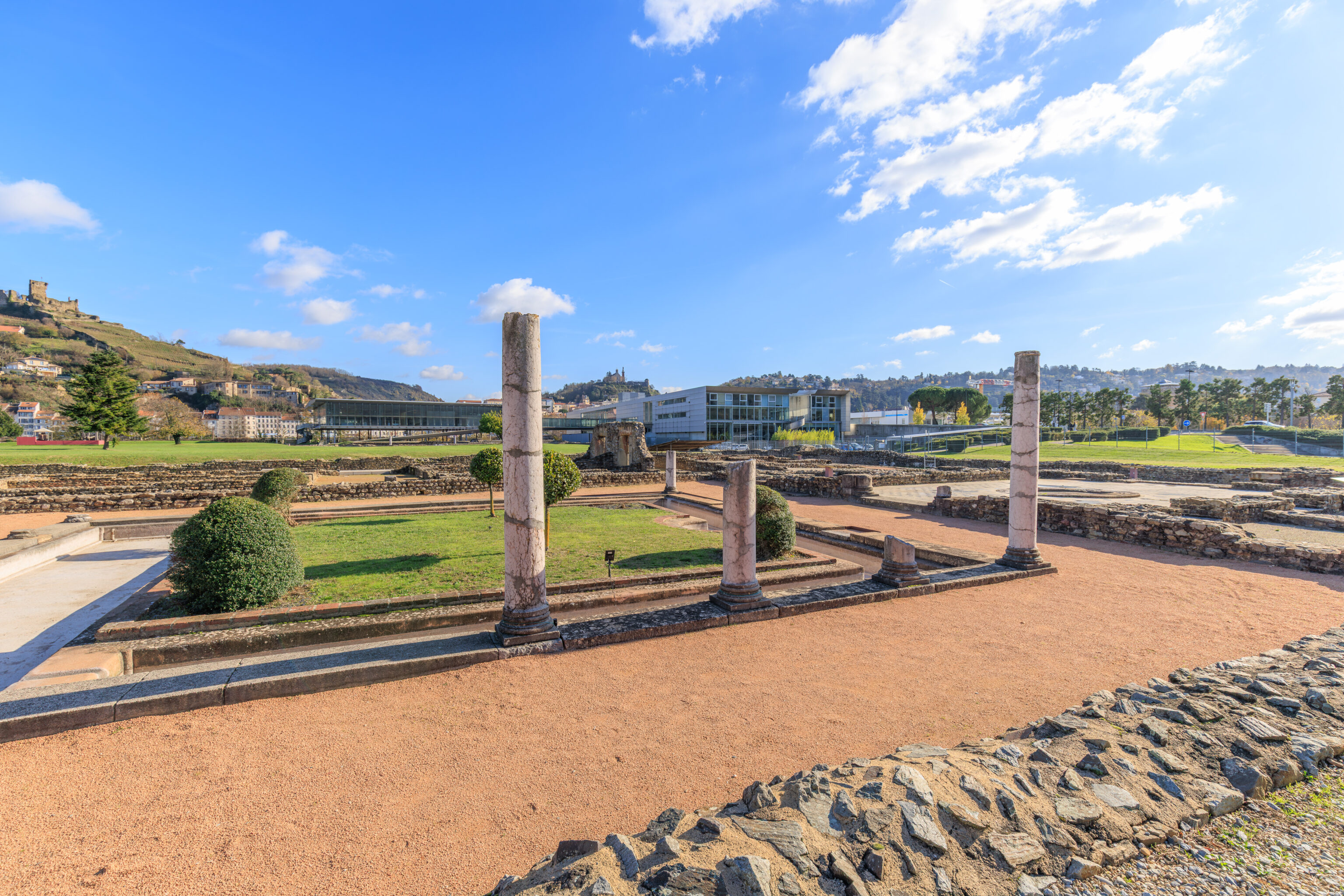
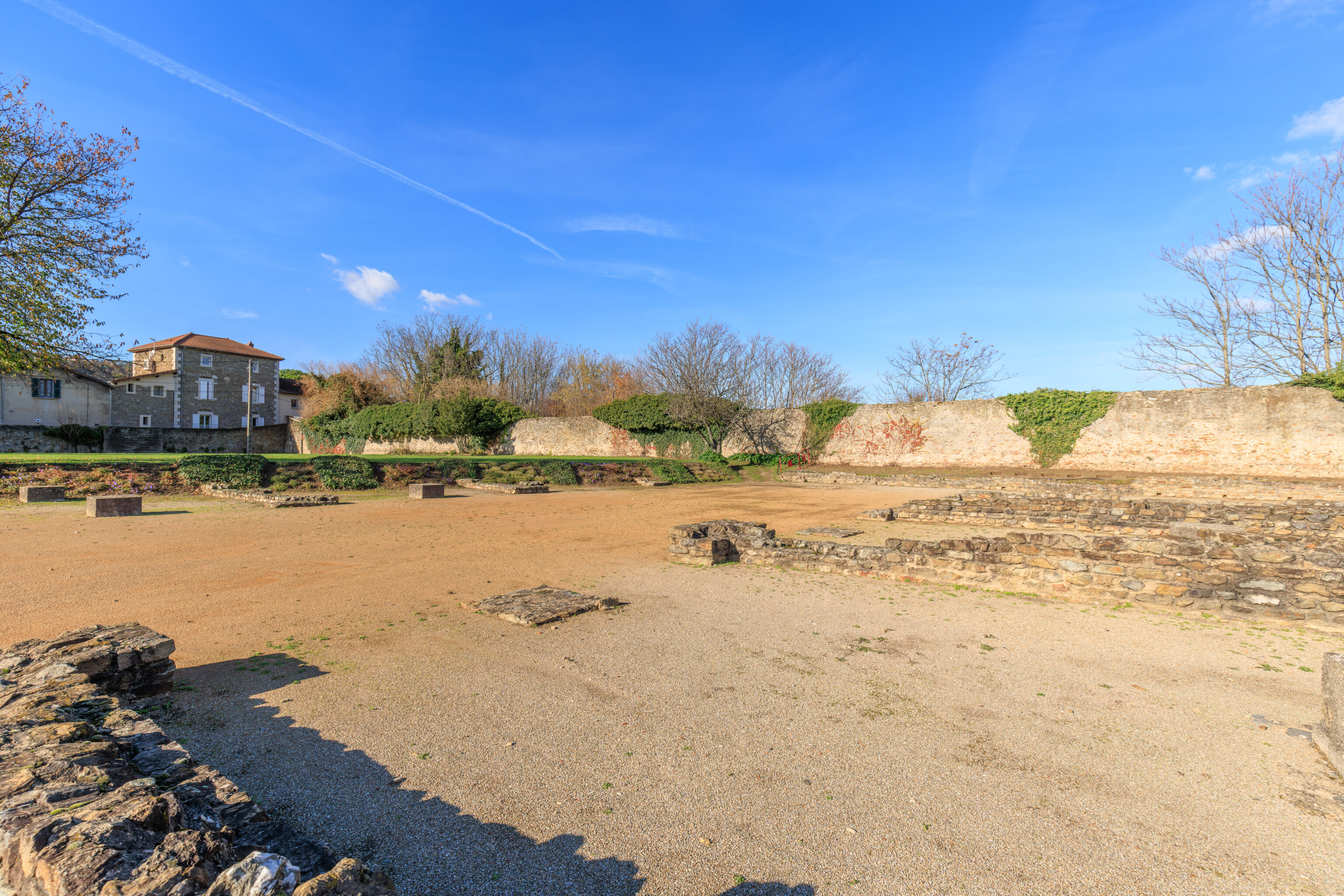
After we finished walking through the interior of the museum, we headed outside to take a look at the ruins.
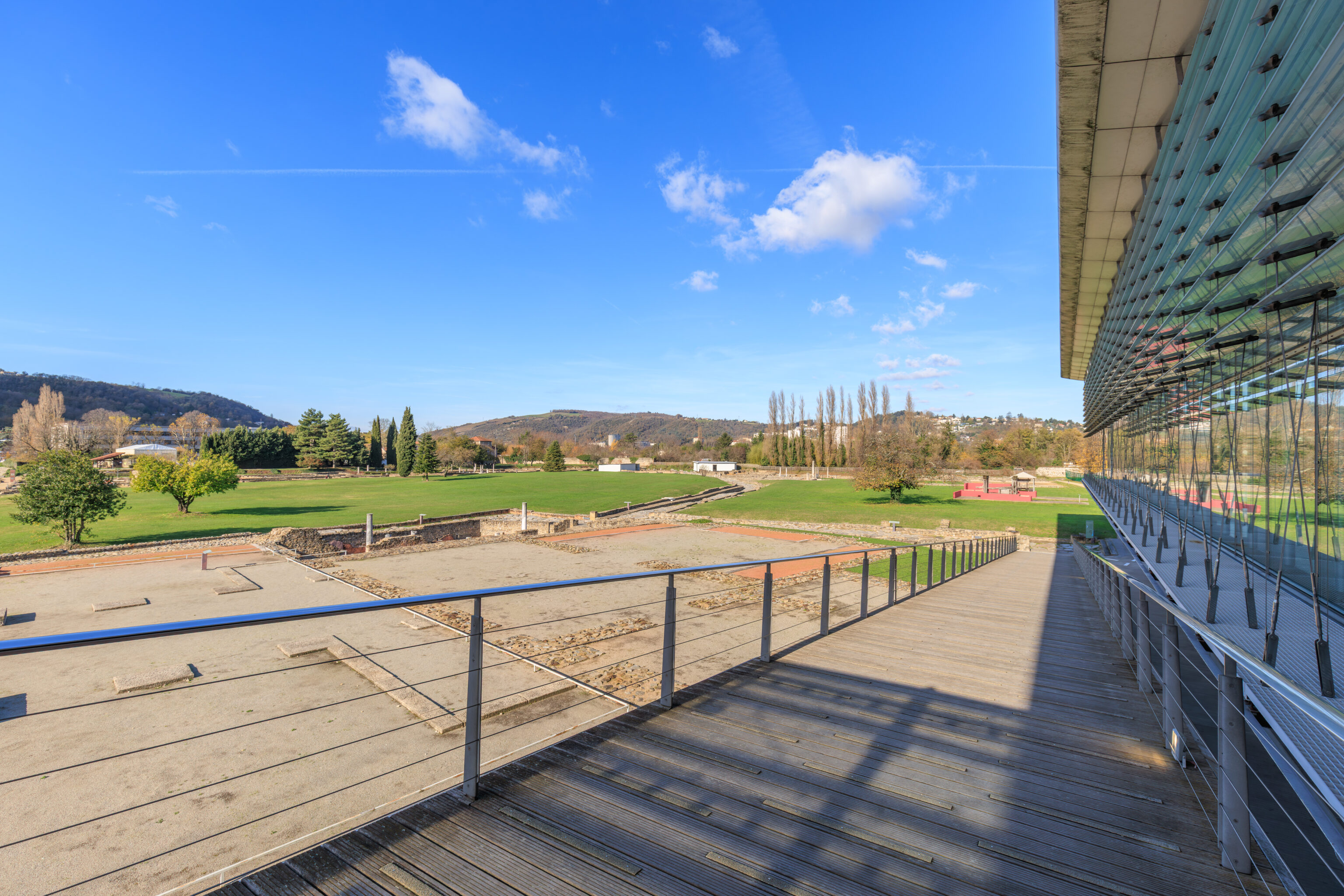
After exiting the museum building, we turned onto a ramp that leads down to ground level.
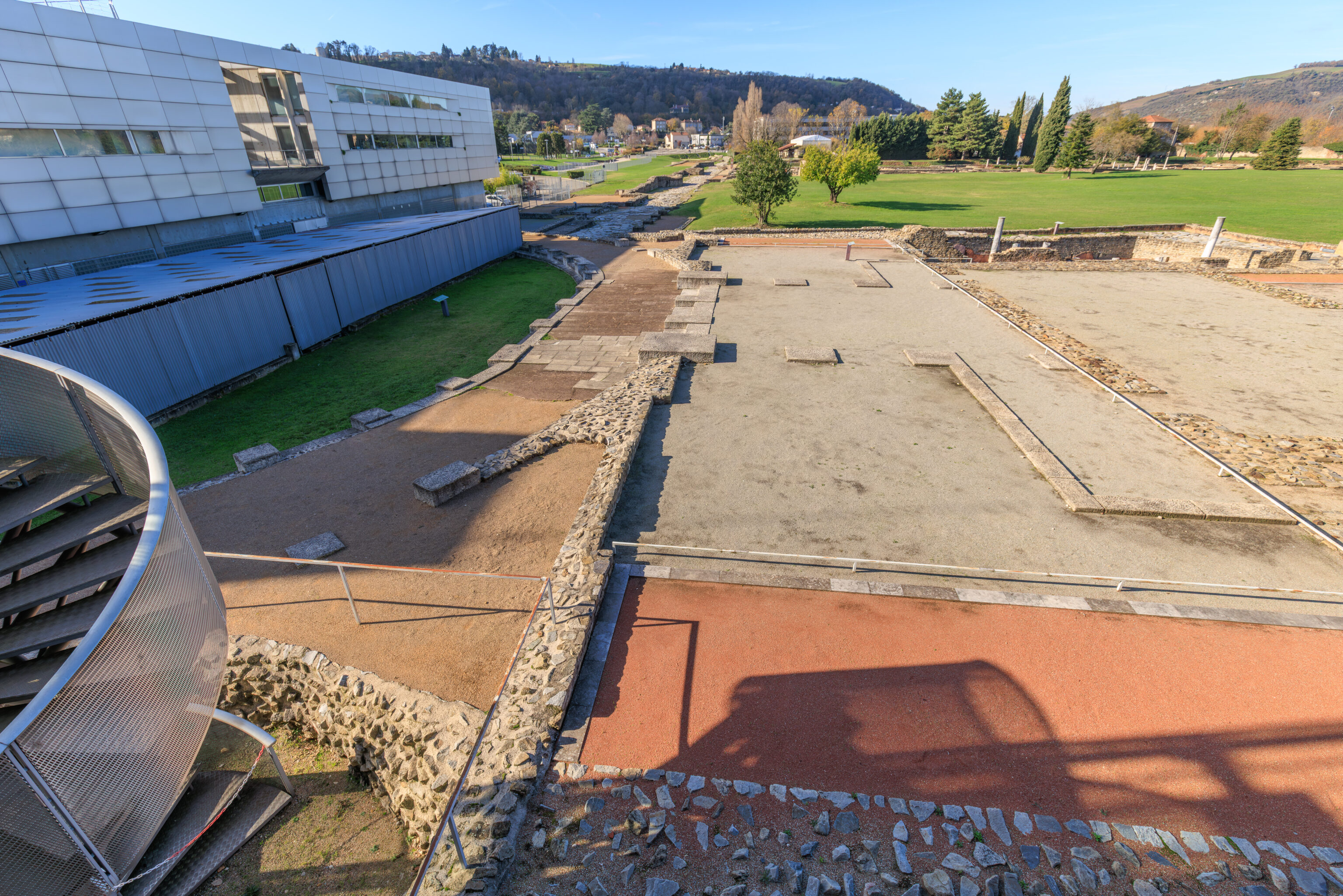
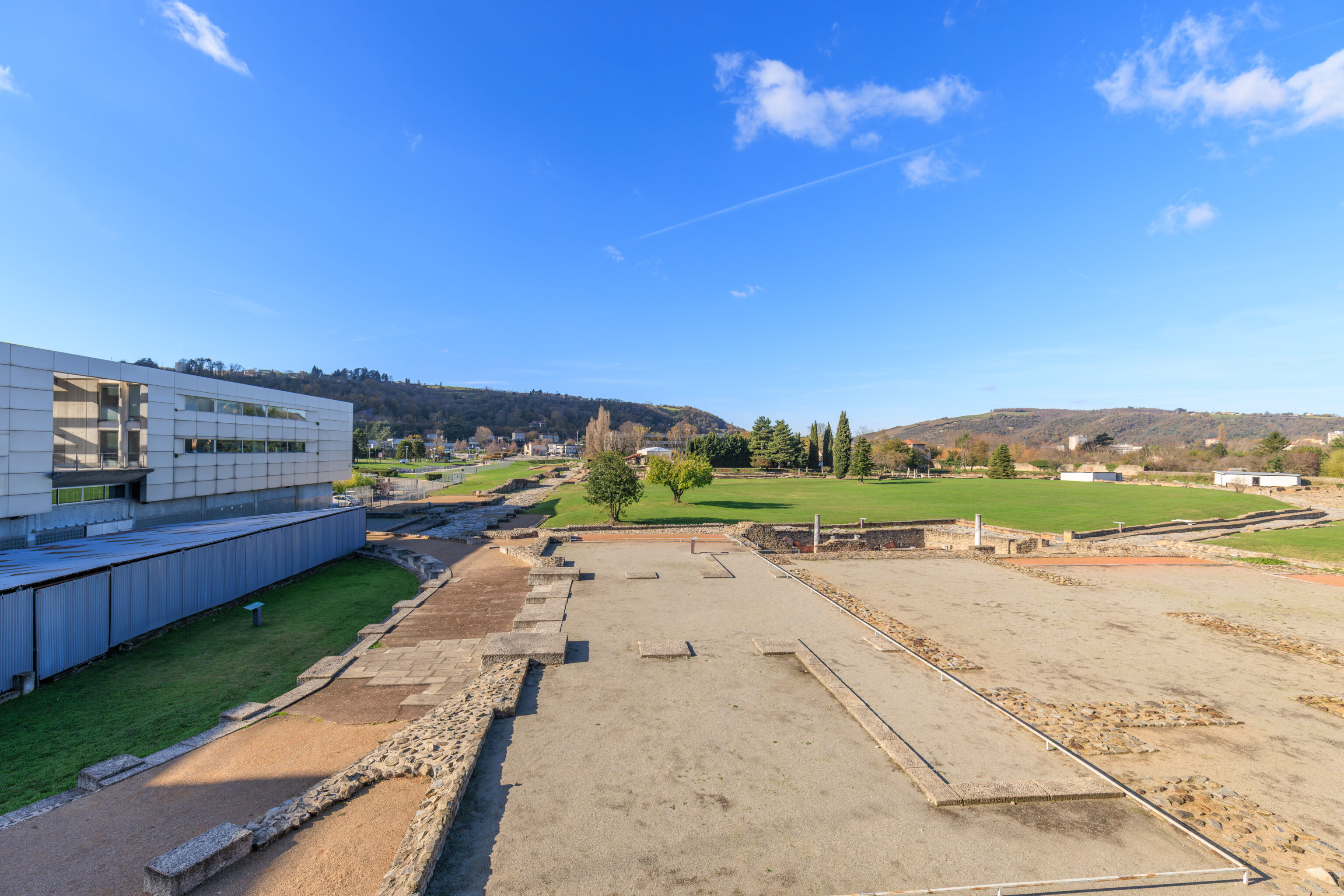
The view to the west from the ramp.
The museum is actually completely elevated off of the ground!
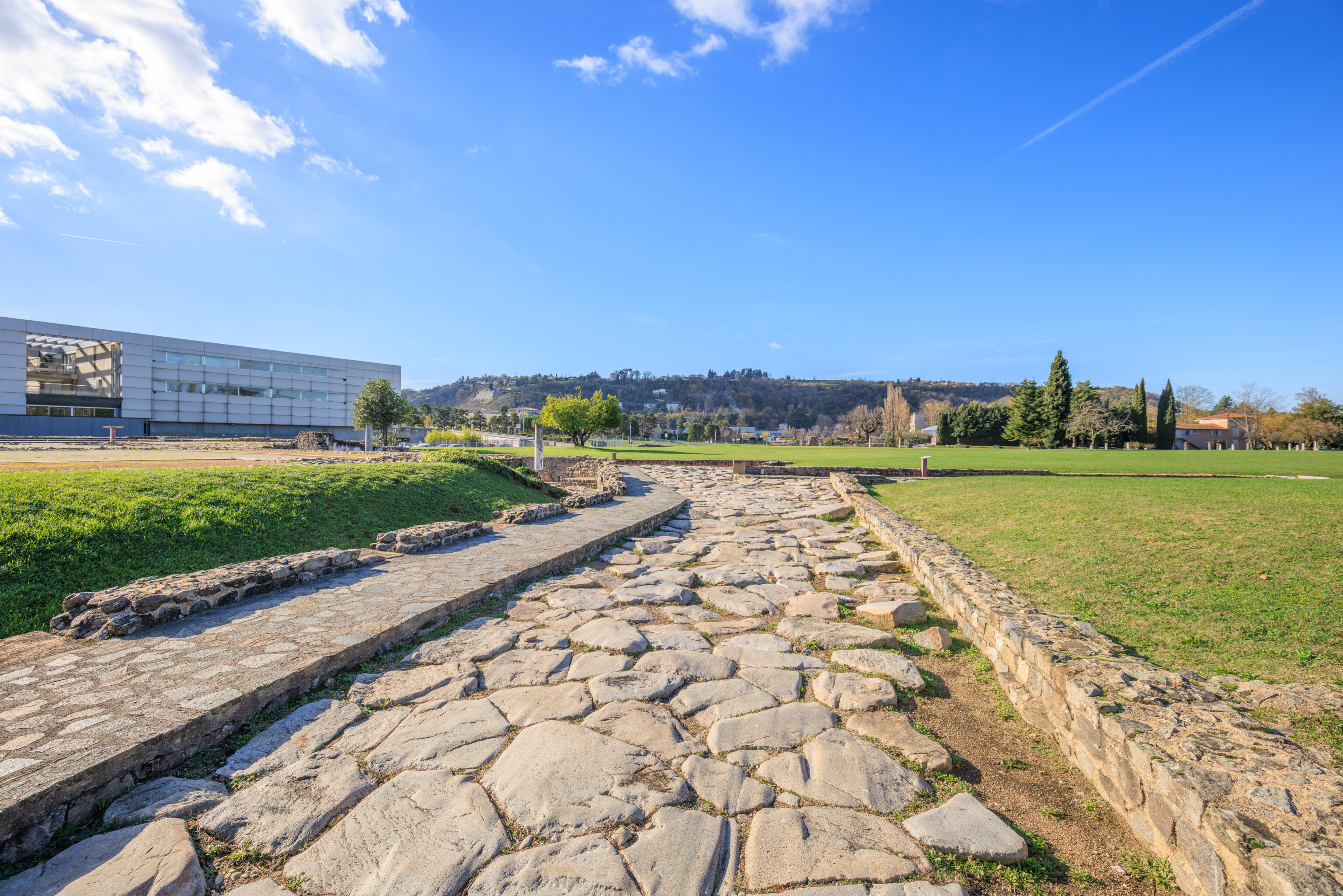
We decided to walk to the west first.
IN ANCIENT VIENNA, ON THE RIGHT BANK OF THE RHÔNE
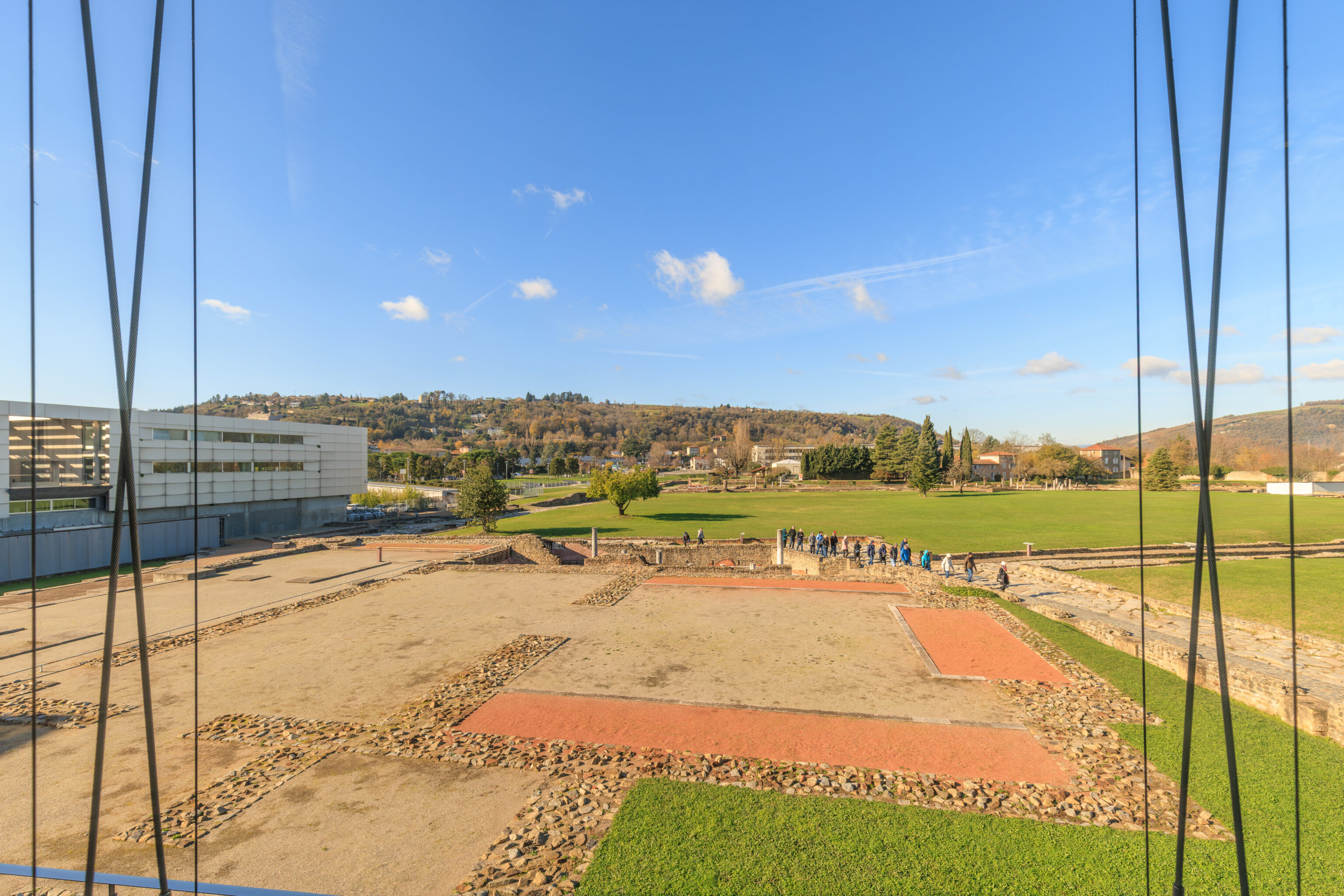
The site of Saint-Romain-en-Gal developed between 30 BC and the mid-3rd century AD. These three hectares of unearthed remains attest to the prosperity of Vienna and its expansion on the right bank of the Rhône, estimated at its peak to cover more than one hundred hectares.
Vienna is located north of Narbonensis, a province whose territory was annexed by the Romans as early as 121 BC. Having become the capital of the Allobroges, a Gallic people who occupied then the Dauphiné and Savoy regions, Vienna received the title of Roman colony towards the end of the 1st century BC. At that time, artisans, mostly potters, settled on the right bank of the river.
From the beginning of the 1st century AD, a neighborhood began to take shape with streets and houses in the Roman style. But the real urban development of the site occurred around 60 AD. Wealthy merchants built vast residences here, alongside the warehouses, workshops, and shops that they owned. For two centuries, trade along the Rhône Valley flourished. It was a key route through which all goods exchanged between Gaul, the north of the Empire, and the Mediterranean passed.
With the economic crisis that struck the Roman world in the 3rd century, the district was gradually abandoned, with Vienna becoming confined to the left bank. The buildings served as quarries for materials, and then, from the 4th century onwards, the site was partially occupied by a necropolis which would be used throughout the Early Middle Ages.
Meanwhile, the area was brought back into cultivation... In the 18th century, the plain of Saint-Romain-en-Gal was the subject of the first excavations under the impetus of P. Schneyder, founder of the archaeological museum of Vienna. From the mid-19th century onwards, numerous mosaics enriched the museums of Vienna and elsewhere.
It was in 1967 that the site was truly unearthed. Since 1981, archaeological research has continued within the framework of planned excavations. The visible remains have been consolidated and partially restored. Streets and buildings now bear distinctive names assigned by the archaeologists.
– Text from a sign describing the ruins, translated using Google.
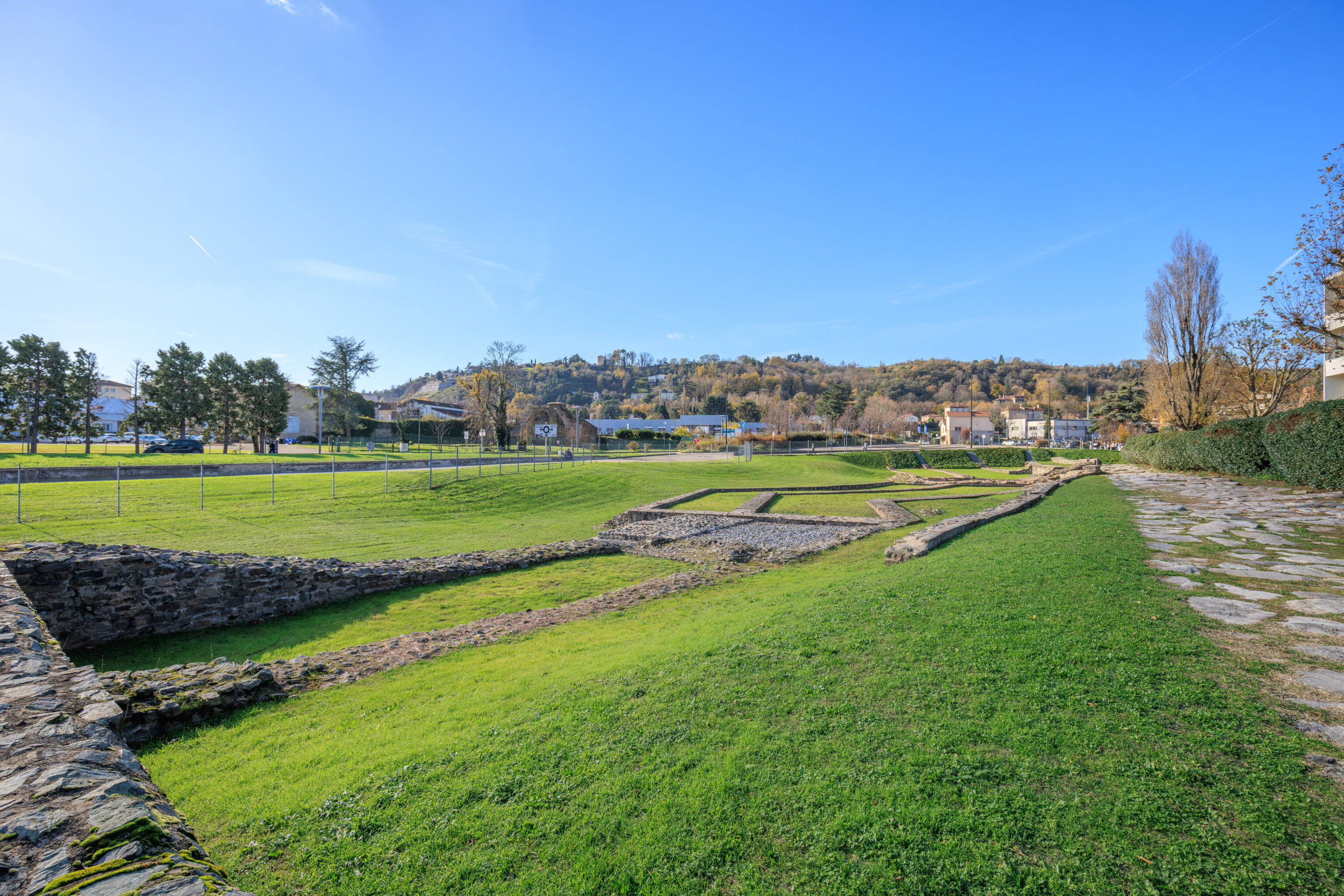
The Triangular Square
MORE THAN THREE CENTURIES OF URBAN PLANNING
Excavations carried out in this square have revealed traces of a settlement and a bronze workshop dating back to 10 BC, as well as the numerous transformations this area has undergone through successive development programs.

This square and the neighboring streets were built around 60 AD, at the same time as the Baths of the Wrestlers. Before this date, the layout of the streets was very different. The Portico Street was straight as far as the Rhône River, and the Baths Street joined it. Both were lined with houses and workshops that were destroyed and filled in to a height of approximately 1.80 meters, at the time of the construction of the bath complex. When it was first created, the Triangular Square was largely occupied by masonry, the connection of which to a sewer indicates that it was a hydraulic structure, probably a water tower. Located prominently at the corner of Rue Neuve and Rue du Rhône, this structure was destroyed towards the end of the 11th century, and its foundations were covered by the granite roadway. Only the sewer access point in the center of the square remains. As you walk along Rue du Rhône, you will notice the deep ruts carved into the paving stones by the heavy loads of wood used to fuel the fireplaces of the baths.
– Text from a sign describing this immediate area, translated using Google.
The Baths of the Wrestlers
A KEY PLACE IN DAILY LIFE
The baths were among the most frequented public facilities during the Roman era. All social classes visited them regularly to bathe, but also to play sports, relax, meet friends, and discuss business.

Built around 60 AD and modified several times, these baths, covering 3,300 m2, are of average size: by comparison, the Baths of Caracalla in Rome were five times larger. They nevertheless remain a major building in Vienna.

Two staircases provided access to the building from the south. They opened on either side of the cold-water pool onto a terraced courtyard, paved with white limestone. In the center of the semi-circular gallery, a monumental portico marked the entrance to the cold room (frigidarium), the lateral ends of which were occupied by rectangular pools. The central section of the building housed two large rooms heated from the basement: the caldarium (225 m²), lined with bathtubs placed above the furnaces or their outlets, and the tepidarium (a warm room of 178 m²). On their eastern side, two smaller hot rooms could have served as a second tepidarium and a dry steam room.

To the north of the site, located below the heated rooms, a service area supplied the hypocaust furnaces. It was accessible from the small courtyard bordering the western side of the bathhouse and from a staircase leading to the street opposite the Rue des Thermes. In this courtyard, a secondary furnace supplemented the heating of the warm room. Unlike typical bathhouses, these baths did not have an open-air space for physical exercise (a palaestra). The paved, terraced courtyard was too small to fulfill this function, which was intended to be served by the vast esplanade of the monumental complex.
– Text from a sign, translated using Google.
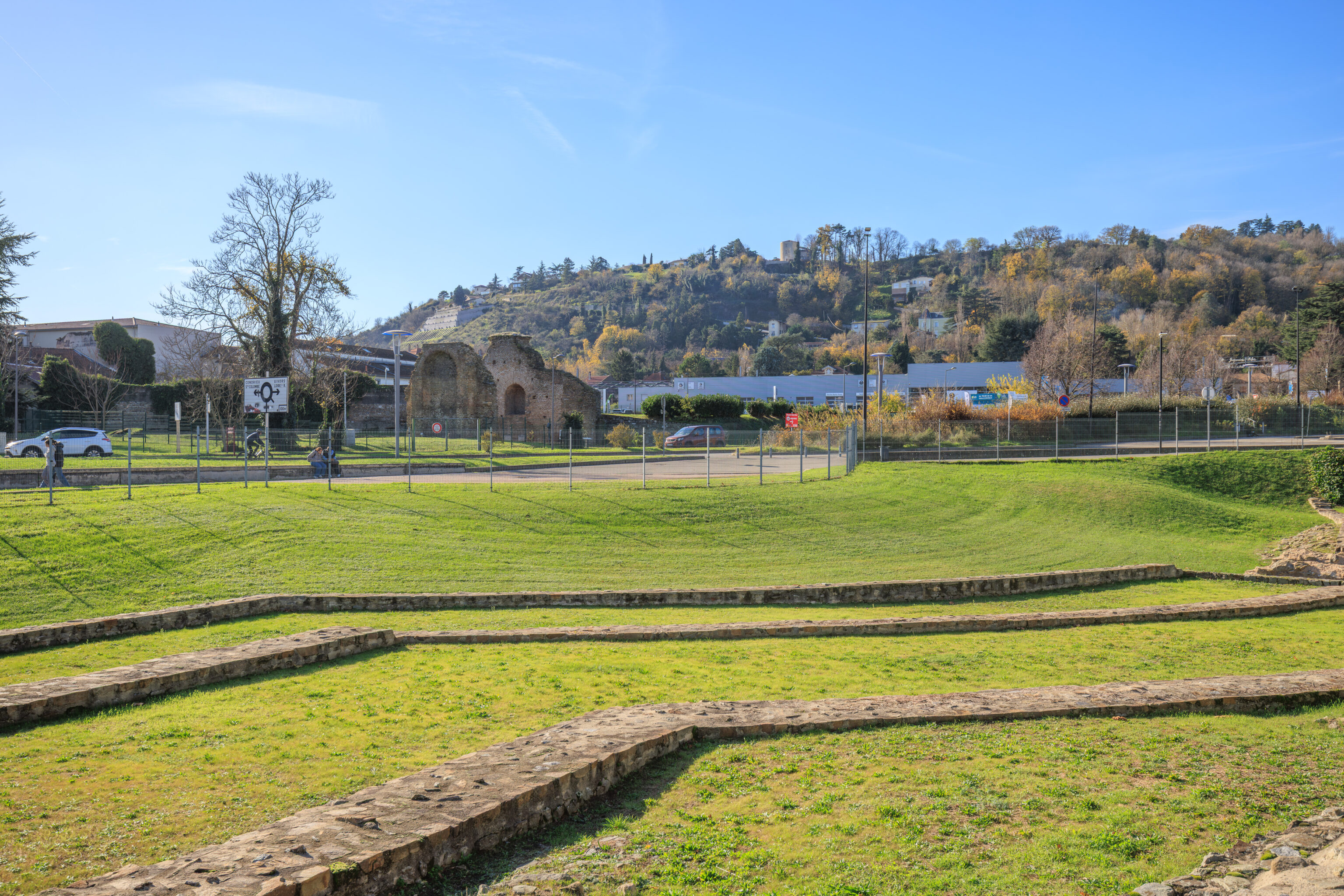
A sign to the west of here described the necropolis that was once here. We didn’t see anything that was related to the description on the sign.
Carolingian Period
TOMBS ON THE RUINS
A necropolis developed from the 8th to the 10th centuries on the ruins of funerary buildings erected between the 4th and 6th centuries.

In the first third of the 7th century, the Saracens advanced up the Rhône Valley and caused widespread destruction. The pillaging and the reconquest of the region by Charles Martel led to the disappearance of several monasteries established on the right bank of the Rhône.

After this dark period, a new necropolis developed on the site of the one that had been located on the baths of the Wrestlers since the 4th century. The tombs also covered the North Portico and extended westward as far as the House of the Gods Ocean.

Dug directly into the ground, the graves were simple. Most often, stacked stones, arranged around the perimeter of the pit, delimited the space allotted to the body and served to support the flat stones that sealed the burial. Men, women, and children were all buried in the same way. No objects were placed with the deceased.

The necropolis appears to have been regularly: used until the end of the 9th century, then burials became less frequent during the 10th century. In the 11th century, the site lost its funerary function. From then on, the site was used solely for agriculture, which continued until the middle of the 20th century.

Between the 8th and 10th centuries, a necropolis developed on the ruins of funeral structures that had appeared on the same site between the 4th and 6th centuries,
– Text from a sign, translated using Google.
A sign in this area describes a public water fountain that was nearby:
The Public Fountain on Rue du Portique
EXCHANGE AND FREE WATER
In the 2nd century AD, public fountains (lacus) provided free water for daily needs to the less fortunate classes of society.

Located a stone's throw from a major intersection, in the heart of the neighborhood, the fountain on Rue du Portique leans against the blank, and imposing wall of the North portico.

Anchored to the edge of the road, on the side opposite the front porticoes of the private properties where we are standing, it does not obstruct traffic in any way. Its basin is made up of an assembly of large slabs of white limestone, lined inside with tile mortar.

This public amenity is easily recognizable easily thanks to the material used, which contrasts sharply with the schist, gneiss of the surrounding masonry, and the granite slabs of the road. It is therefore visible to all. Serving a large and diverse population, it constitutes a privileged meeting place and forum for exchange.

The basin, of considerable dimensions [3.20 m x 1.70 m. Estimated height of the basin: 1 m], suggests the presence of two jets placed near the lateral sides, thus facilitating filling containers. The overflow is located in the center of the long side of the tank. It allows the excess water, flowing continuously onto the road, to be cleaned before being discharged through the central opening of the limestone cover slab of the manhole located nearby.

A second fountain is visible 250 m from here, at the intersection of the Rue des Jardins and the Rue des Thermes. It supplies water to the northern sector of the site.
– Text from a sign, translated using Google.
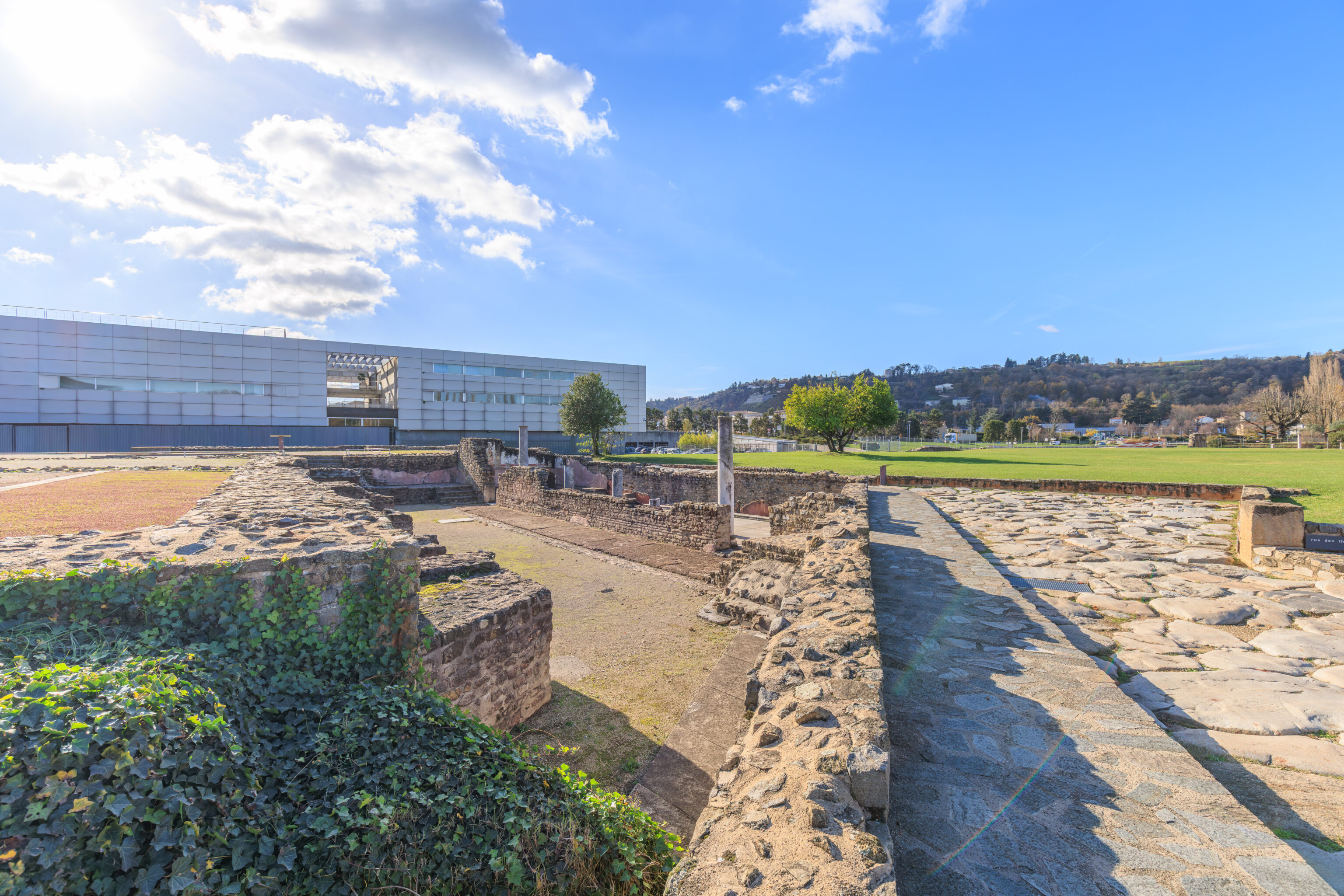
Fulling workshop
A WATERPROOF MATERIAL: TILE MORTAR
The plaster covering the workshop's basins, remarkably well preserved, was made from lime, brick fragments, and crushed tiles. These waterproof mortars were used for constructing hydraulic systems.

This textile washing workshop includes two basins, in which the various washing and rinsing operations took place. The basins were sealed with tile mortar, which is intact here and identifiable by its pinkish color. The workshop also includes a hearth and an amphora placed in the ground, the upper part of which has been cut off to create a reservoir water. To the left of the workshop, the shops and back rooms were surmounted by a living floor which was accessed by wooden staircases whose locations are still visible.
– Text from a sign, translated using Google.
The two basins referenced on this sign might be the two visible rectangular areas in this photograph?
The House of the Ocean Gods
THE LARGEST PROPERTY ON THE SITE
Spacious reception rooms adorned with mosaics and marble, gardens featuring pools, fountains, and water jets: this property of over 2,500 m² is characteristic of the grand residences of the Roman Empire.

Stretching for nearly 100 meters, the plan of this house alternates between two buildings and two large gardens surrounded by colonnades (peristyles).

These gardens occupy nearly two-thirds of the total area. The remaining third, approximately 800 m2, housed the reception rooms, service rooms (baths, latrines, kitchen, and offices), and the bedrooms. Their limited number on the ground floor suggests, in some places, the existence of an upper floor. Lacking any trace of Gallic influence or adaptation to the climate, this house testifies to the impact of Romanization, which led local elites to adopt house models from Italy.

The House of the Ocean Gods represents the final remodeling, around 160 AD, of a dwelling built around 60 AD and continually updated by its owners.

The 80 test pits excavated at the site have revealed, beneath its foundations, the remains of four earlier dwellings, the oldest of which dates back to the 20s BC.
– Text from a sign, translated using Google.
The marker here on the right indicates the estimated original location of the Roman Seasons mosaic that we saw on the upper floor of the museum earlier.
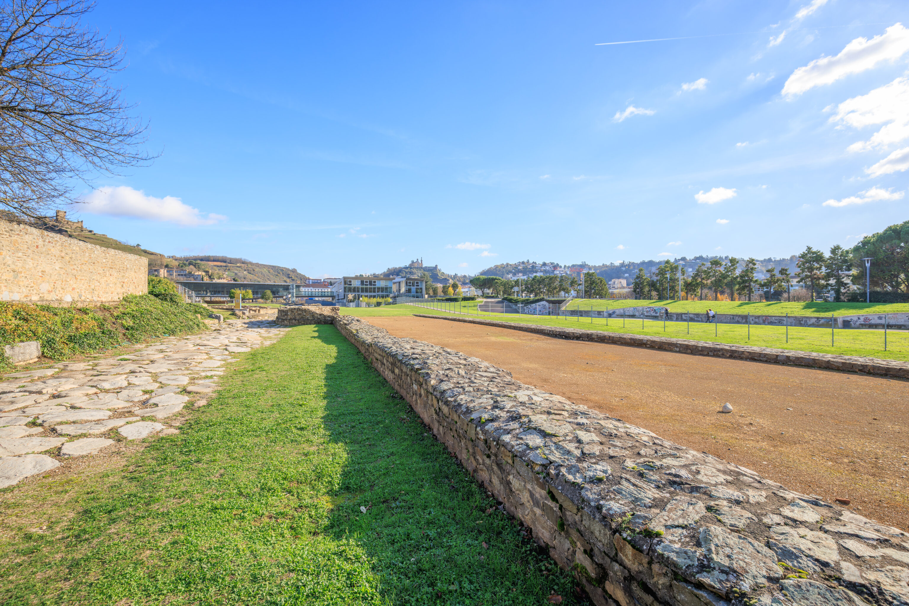
The North Portico
COLONNADES TO ENHANCE PUBLIC SPACE
These two parallel walls, bordering the current site, are the remains of a 190-meter-long portico, built around 60 AD. On the south wall, a series of marble columns lent the place a solemn monumentality.

The portico bordered the north side of a monumental complex of nearly 90,000 square meters, consisting of a vast esplanade around the perimeter of which baths and porticoes alternated. Eight meters wide and over seven meters high, this structure was punctuated in the center and at its ends by projecting podiums that likely supported pediments.

The few blocks found during the excavations allow us to imagine the south wall, punctuated along its entire length by columns 60 cm in diameter made of bluish marble, topped with white limestone capitals. In contrast, the north wall, built entirely of small rubble stones, completely obscured the view from Portico Street.

Like this portico, the complex The monumental structure formed a veritable barrier that bisected the right bank from the river to the foot of the hill, isolating the residential quarter from the southern part of the plain.

This division was further reinforced by the difference in elevation of more than 2 meters that existed on either side of the colonnade and which is still visible in the landscape. It resulted from a vast artificial embankment created in the 1st century AD.
– Text from a sign, translated using Google.
It isn’t really clear which parallel walls the sign is referring to as the remains of the portico. Perhaps this one by the dirt path and the other along the base of the hill on the left? That seems to best match the description on the sign.
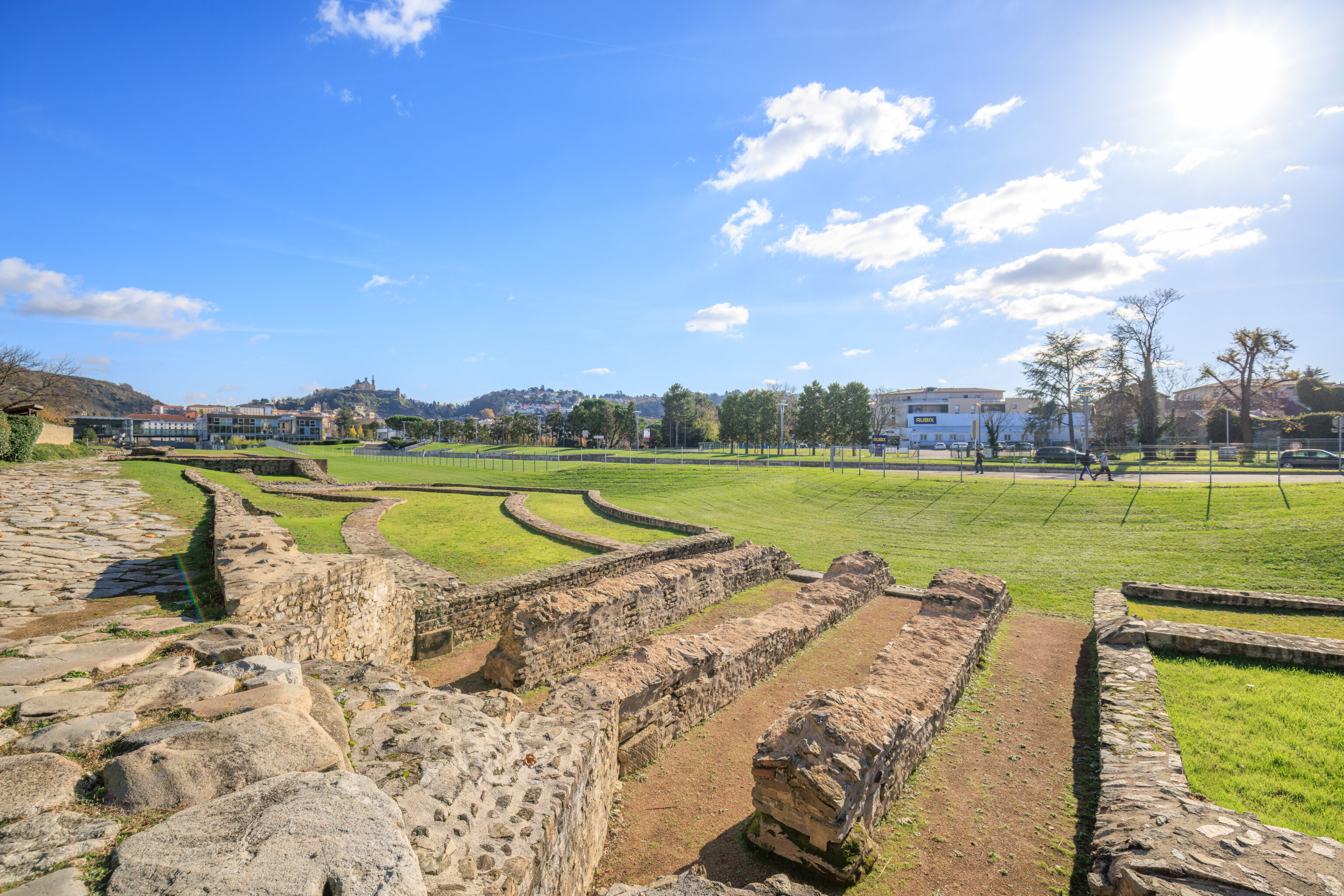
The Western Hemicycle
A HEMICYCLE SURMOUNTED BY COLUMNS
The portico was flanked at its western end by a vast hemicycle made up of three concentric walls. The southernmost wall supported a curved colonnade.

The western hemicycle of the Portico dates from the end of the 1st century AD. It is set within a - circular plan 55 meters in diameter, terminated by two straight wings. The columns rose from the south wall in a curve.

In front, stepped podiums supported decorative elements. This structure is reminiscent of the architecture of the grand seaside villas depicted in Campanian paintings.

In the center of the esplanade, a basin or artificial watercourse was fed by four underground vaulted channels that passed under the street and through the hemicycle. The floors, the vaulted roofs of these channels, and the upper part of their walls have now disappeared.
– Text from a sign, translated using Google.
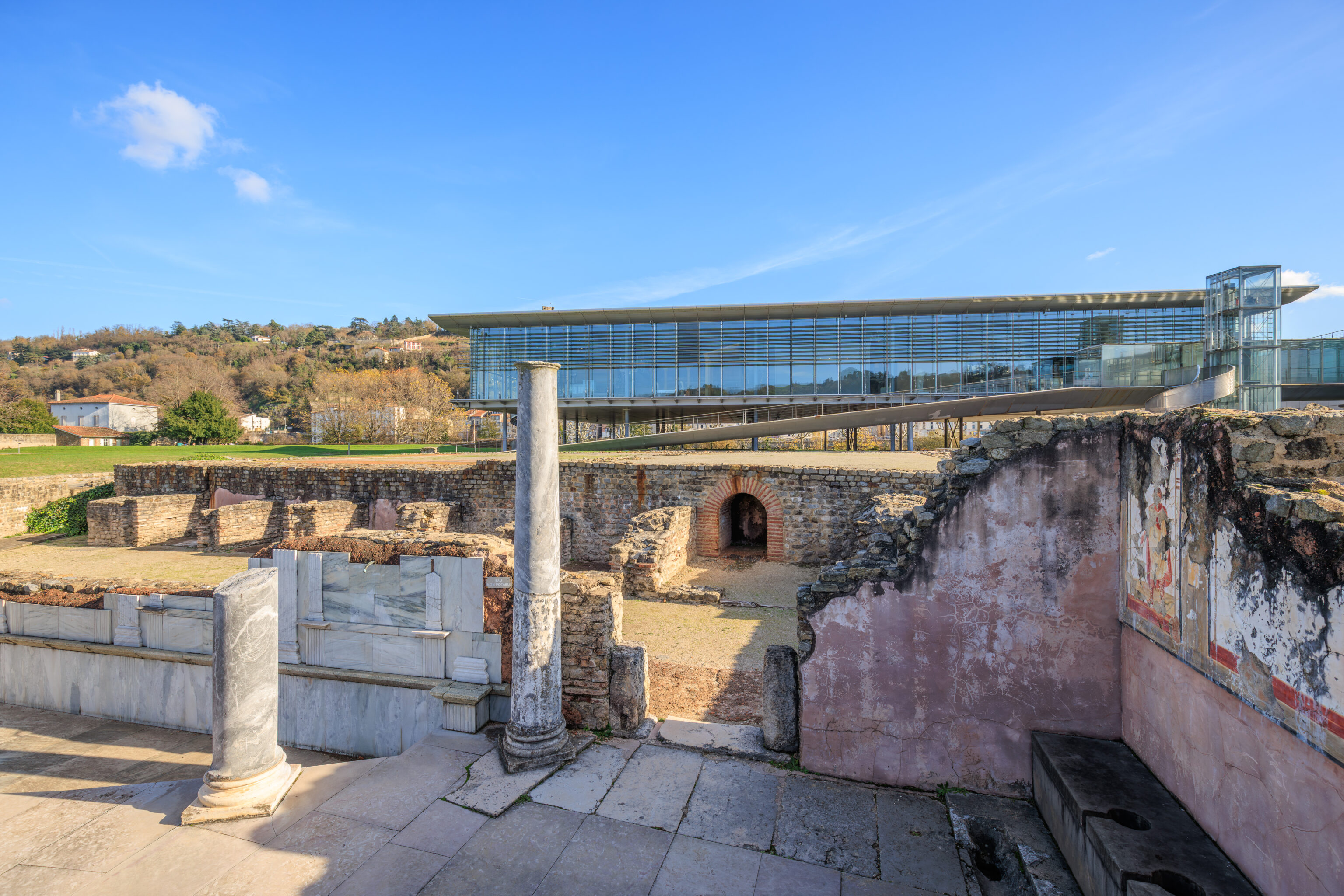
The Baths of the Palace of the Mirror
THE HIGHLIGHT OF THE MONUMENTAL COMPLEX
Located 4 meters above the esplanade, the Baths of the Palace of the Mirror occupied the western side of the monumental complex. Adjacent to the natural alluvial terrace, retaining vaults created an artificial promontory upon which this building, approximately twenty meters high, stood.

These majestic baths held an important place in the complex of buildings surrounding the vast 5-hectare esplanade. The highest point of the monumental ensemble, it was undoubtedly not its founding element, as its orientation differs markedly from that of the other buildings.

The North Portico and the Baths of the Wrestlers, on the north side, as well as the Rhône Portico, on the east side, were laid out parallel to the road or the river, according to perpendicular orientations that gave the esplanade a simple and regular shape. The West Hemicycle and the baths of the Mirror Palace were not built according to this layout plan, presumably for topographical reasons which remain to be specified.
– Text from another sign, translated using Google.
While we could make out the hemicycle referred to on the first sign quoted above, it isn’t clear if any remnants of the baths from the second sign are visible.
This was as far west as we could go. We backtracked a bit here and turned to the left as soon as we could.
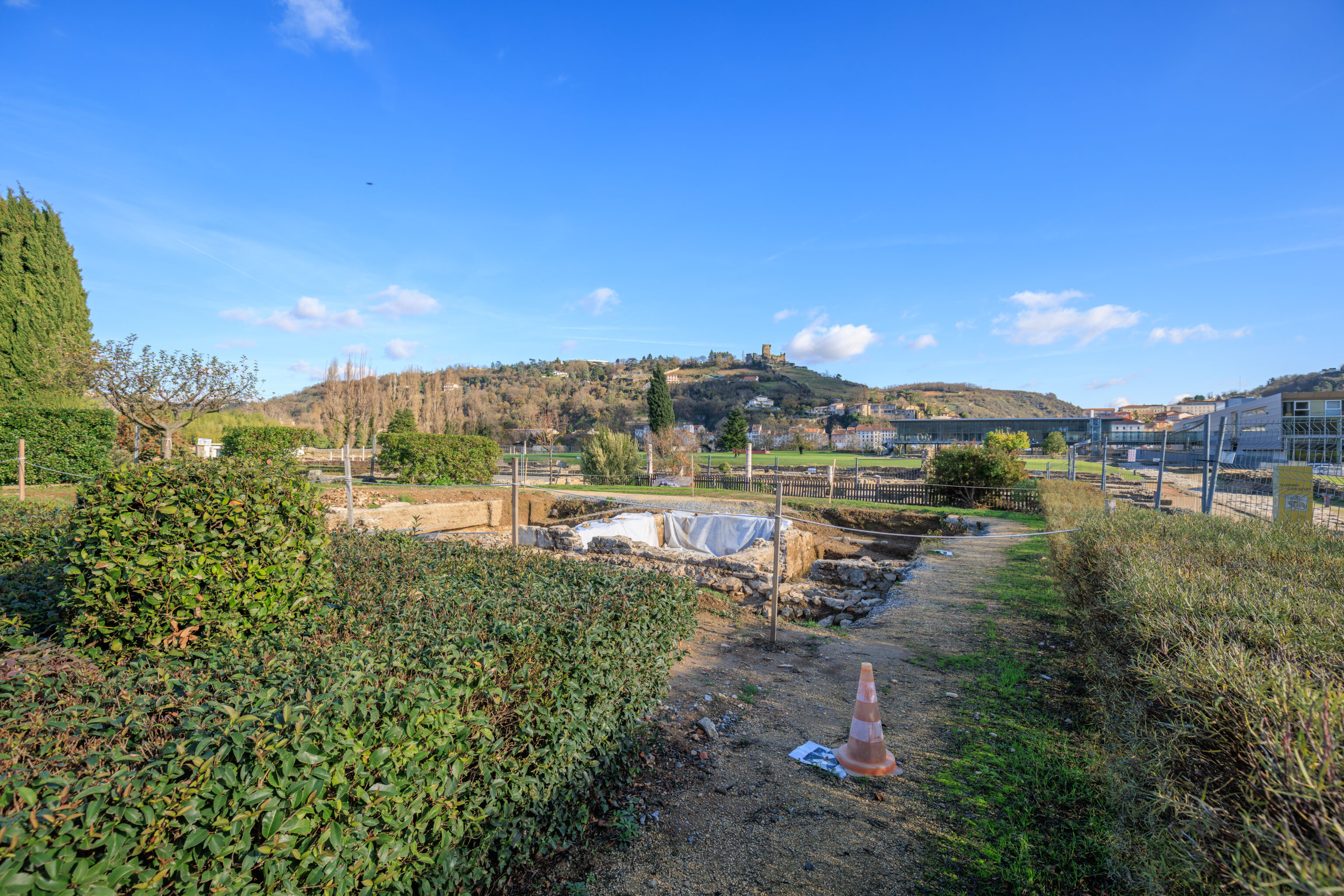
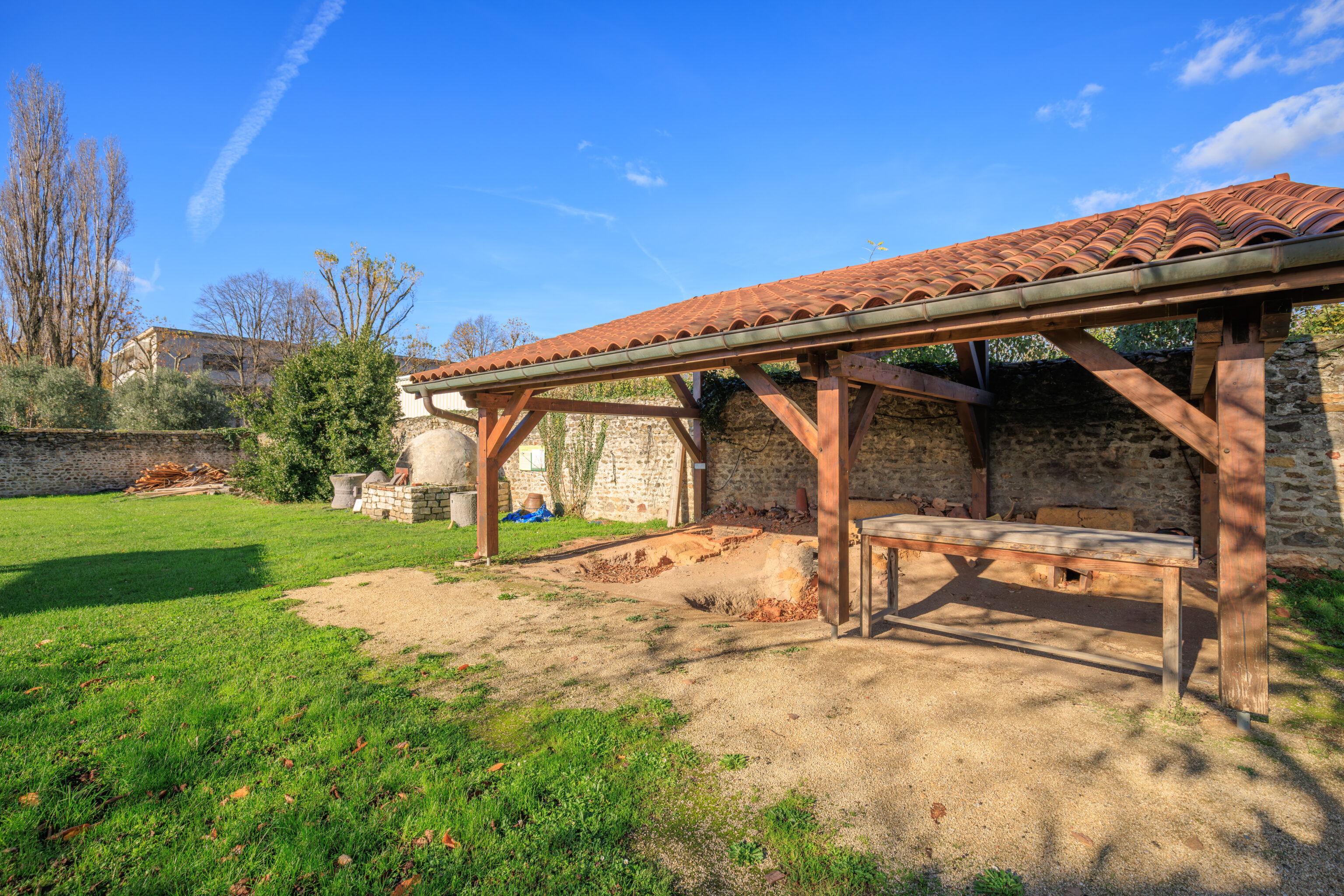
A small path led to an area that seemed to be undergoing minor archaeological activities.
This area is the Domaine des Allobroges (Allobroges Estate). We came across an introductory sign as we were walking away from this area. The text from the sign is quoted below:
The Allobroges Estate
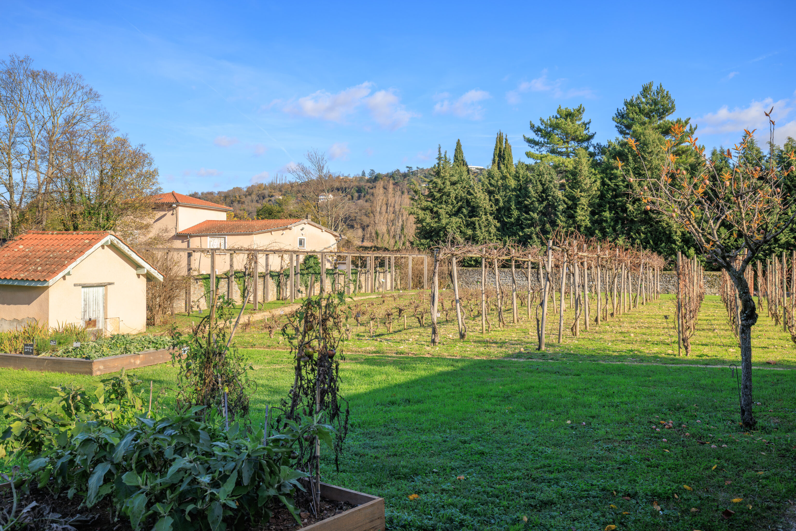
a living history reconstruction
You are entering the "Allobroges Estate." This collection of reconstructions was created in the early 2000s on an unexcavated section of the archaeological site. Here you will find a botanical garden, a vineyard, and several types of kilns. Both experimental and fun, this space will allow you to discover A vivid portrayal of various aspects of life in Roman Gaul. The Allobroges is the name of the Gallic tribe that occupied the region and whose capital was Vienne. After the conquest in 121 BC, they adopted the traditions and way of life of the Romans.
Who are the Allobroges?
"The Allobroges, who once undertook so many expeditions with armies of several myriads of men, are now reduced to cultivating this plain and the lower valleys of the Alps. Generally, they live scattered in villages; however, all the nobility resides in Vienne, a simple village in its origins, although it already bore the title of metropolis of the entire nation, but which they eventually made into a city. It is situated, [as we have said,] on the Rhône."
Strabo, 4, 1, 11
– Text from a sign, translated using Google.
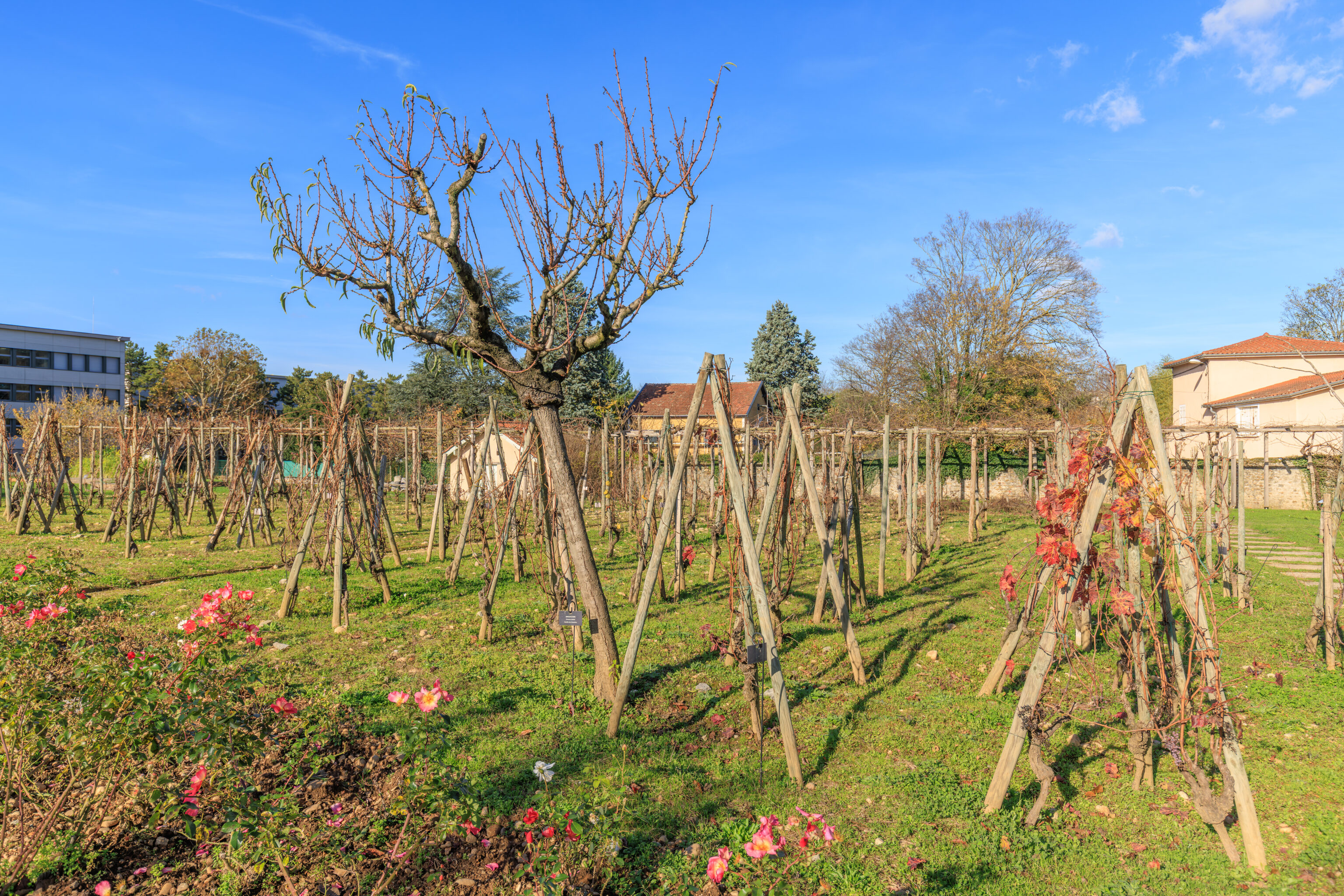
The Allobroges Estate
The Vineyard
It was the Greeks, arriving in Marseille around 600 BC, who first introduced vine cultivation to Gaul. After the Roman conquest, vineyards developed, first in the South of France during the second half of the 1st century BC, and then throughout Gaul. Gallic wines were renowned as far as Rome, especially those produced in the Vienne region.

This wine comes from a local grape variety, Allobrogique. The vineyard you see here is not a faithful reconstruction of the vines of Roman times, as the ancient grape varieties have disappeared. It is a selection of ancient grape varieties preserved by the National Institute for Agricultural Research (INRA). They illustrate different vine-growing methods that were practiced 2,000 years ago. Several plants that can intervene in the preparation of wine, to facilitate its conservation or modify its taste,
like fenugreek or orris root.
– Text from a sign, translated using Google.
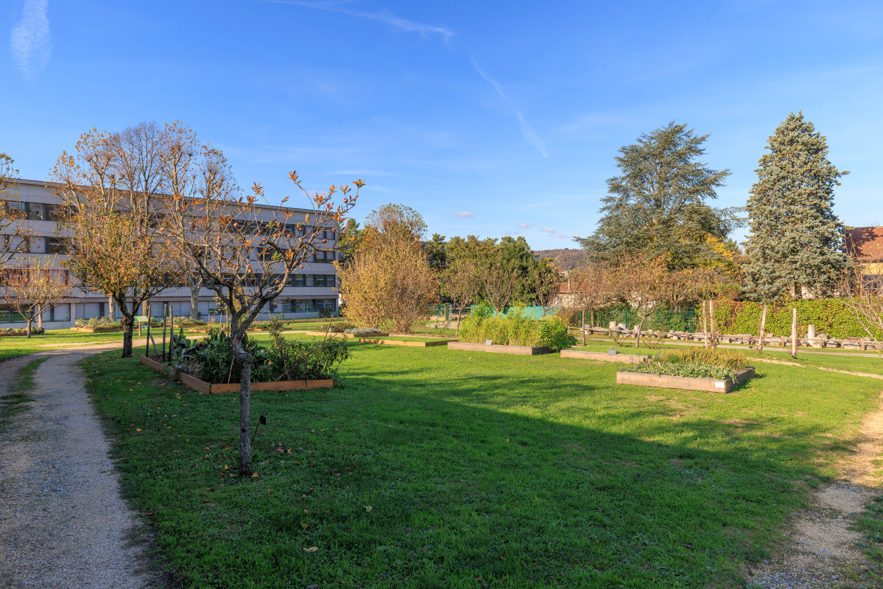
The Allobroges Estate
Fruits from Gardens and Orchards
We know from texts, murals, and mosaics that many varieties of fruit were consumed in Rome and Italy, but it is difficult to know precisely all the species cultivated in Roman Gaul. Archaeological discoveries provide valuable information: the existence of orchards is attested by traces of tree planting, while the pits and seeds of fruits can be preserved under specific conditions (charred remains, humid environments). In Gaul, fruit trees well-suited to the climate were cultivated: apple, pear, and plum trees, among others. Some Mediterranean species, such as the fig and almond trees, were certainly present in the Rhône Valley.

It has been suggested that the cultivation of the olive tree, benefiting from a milder climate than today, may have spread as far as Vienne, but this has not been proven. Finally, the gathering of wild fruits (blackberries, hazelnuts, chestnuts...) is a traditional activity that remains very important.

Some Roman Desserts...
"The wine that hasn't aged long is taken away and set aside for a few moments to make room for the second course. Then appear nuts, figs mingled with wrinkled dates, plums, fragrant apples in large baskets, and grapes picked from vines with purple leaves. In the center is a white honeycomb; but to all this is added something even better: kind faces and a welcome that smacks neither of indifference nor poverty."

Ovid, Metamorphoses, 8, 673-678
Fruit bowl, after the mosaic at Xenia (Saint-Romain-en-Gal)
– Text from a sign, translated using Google.
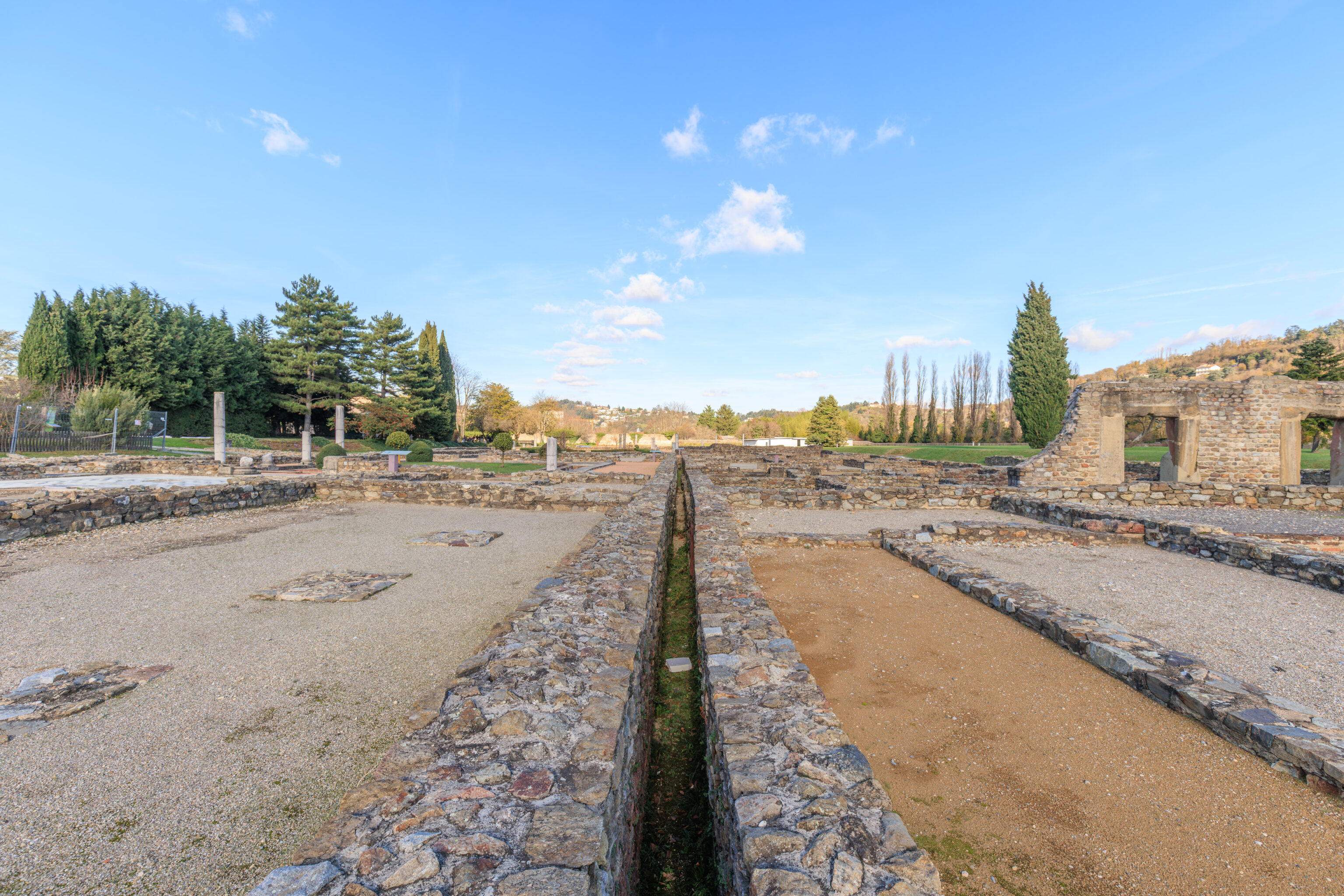
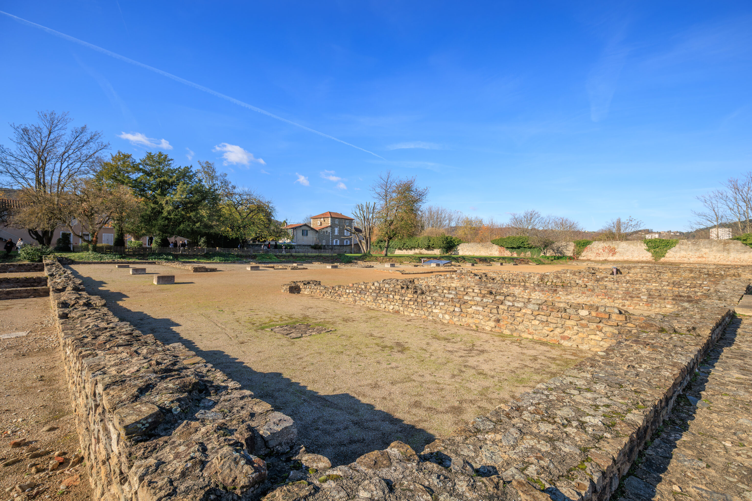
After walking through this agricultural area, we proceeded into the central part of the ruins here. It isn’t always obvious exactly what the various signs that we encountered were referring to in the ruins. We’ve tried to present them with a related photograph but they might not match up perfectly.
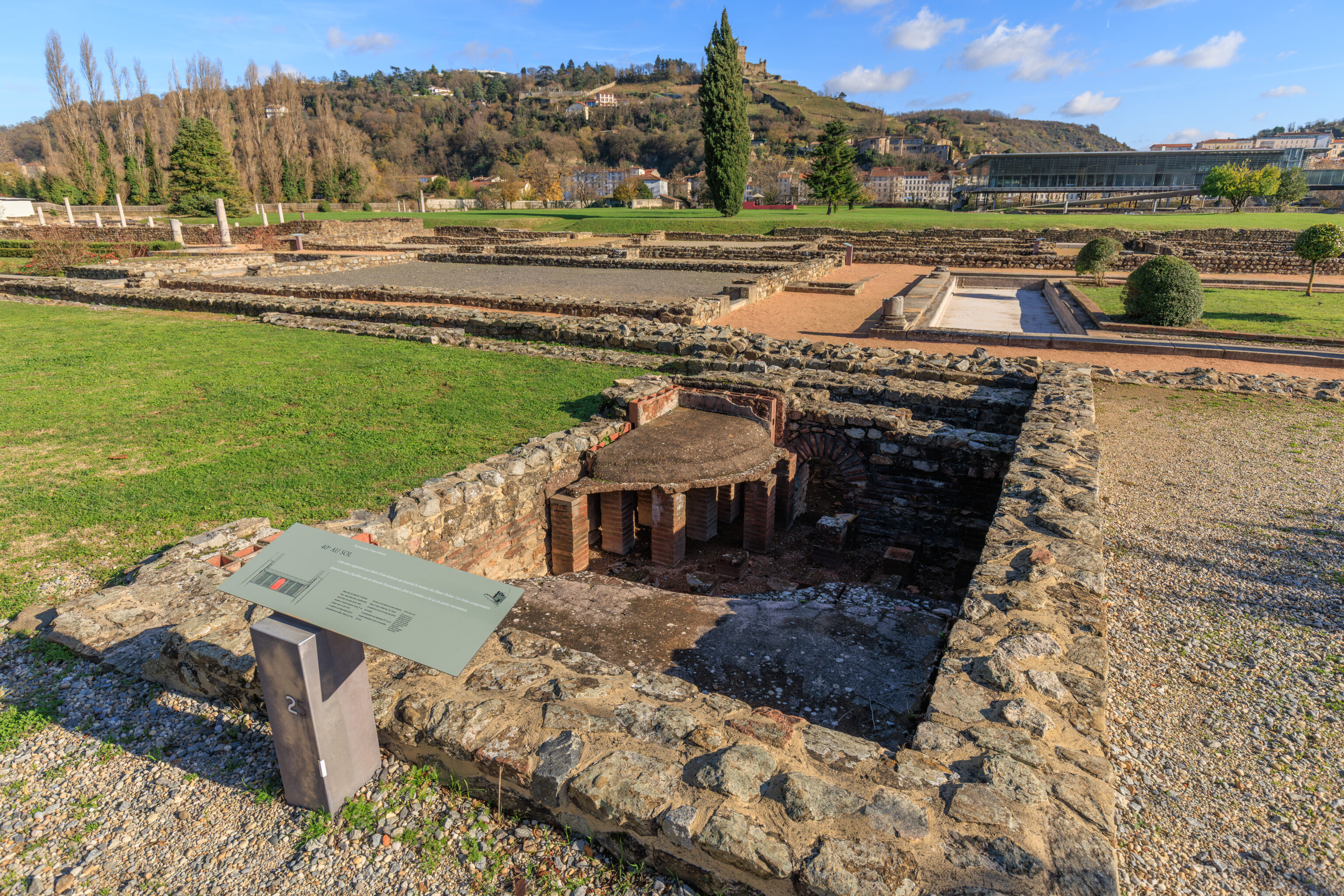
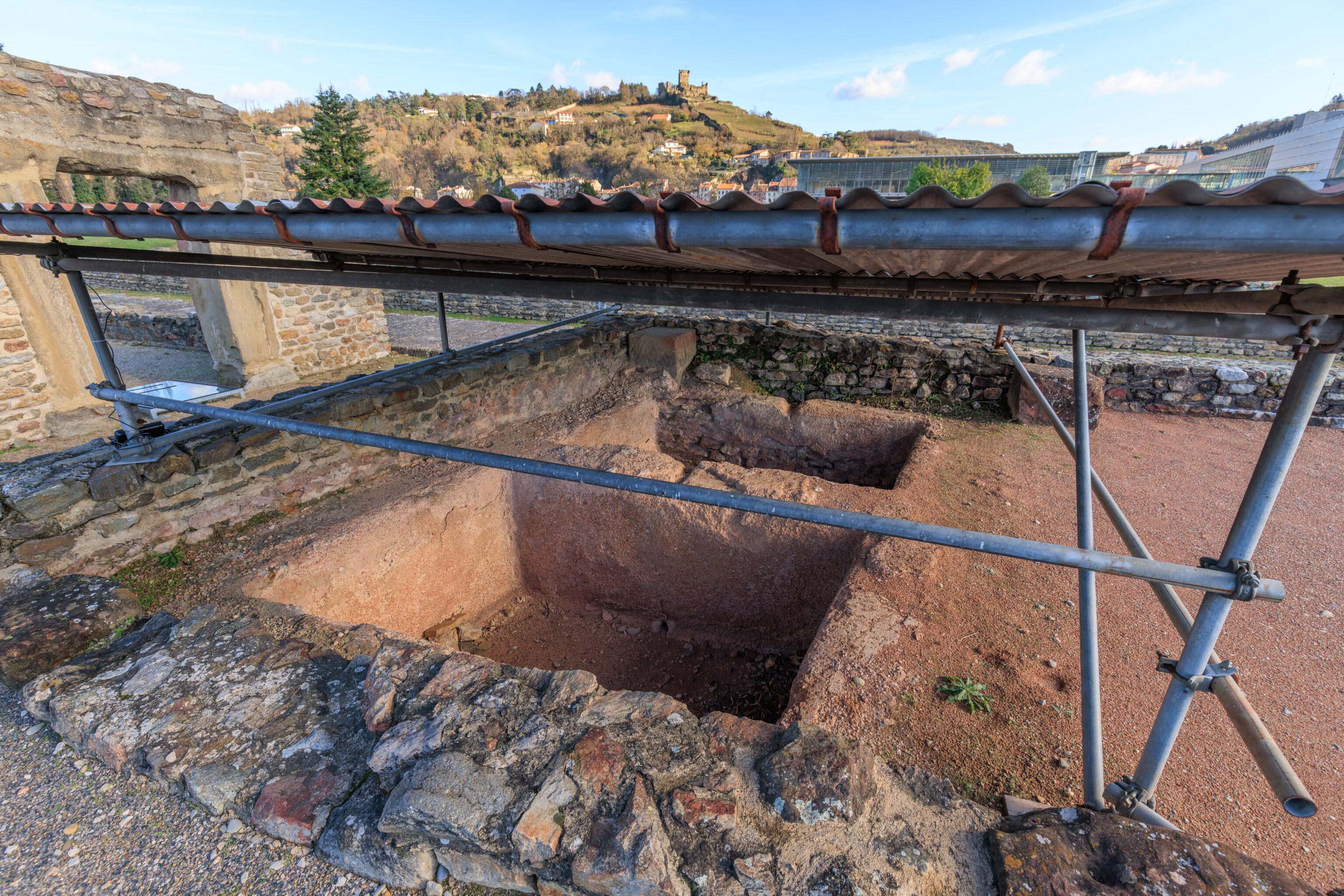
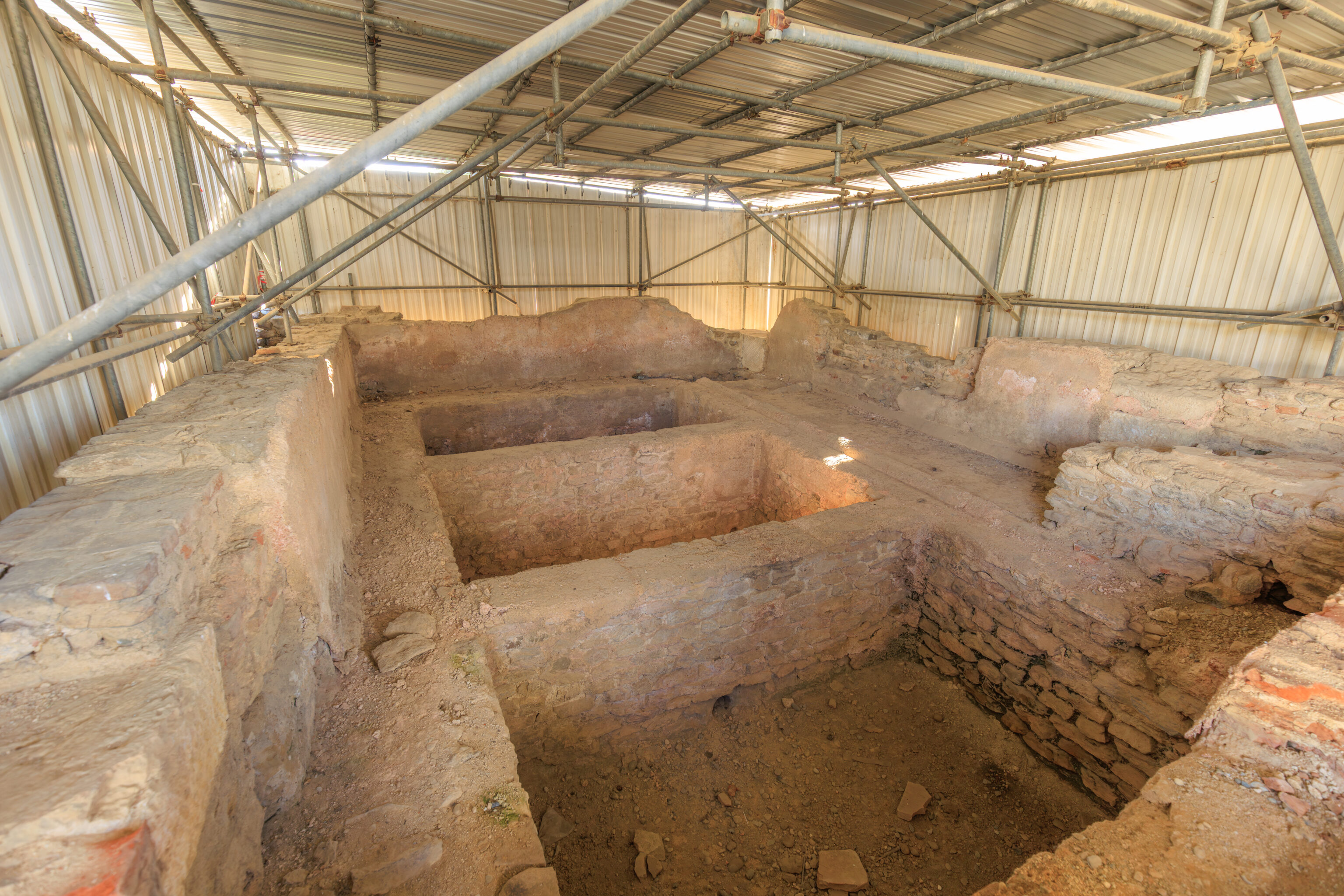
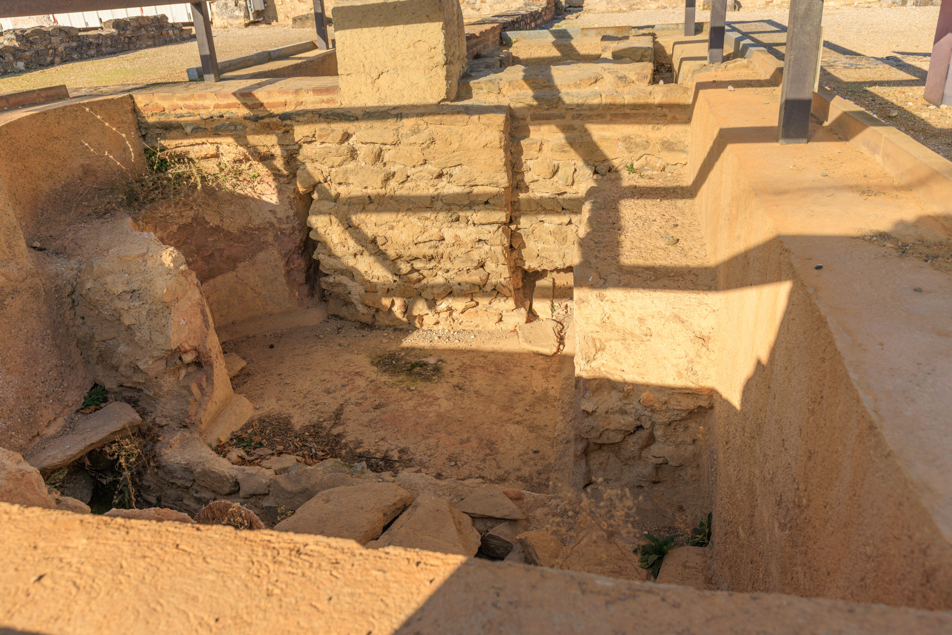
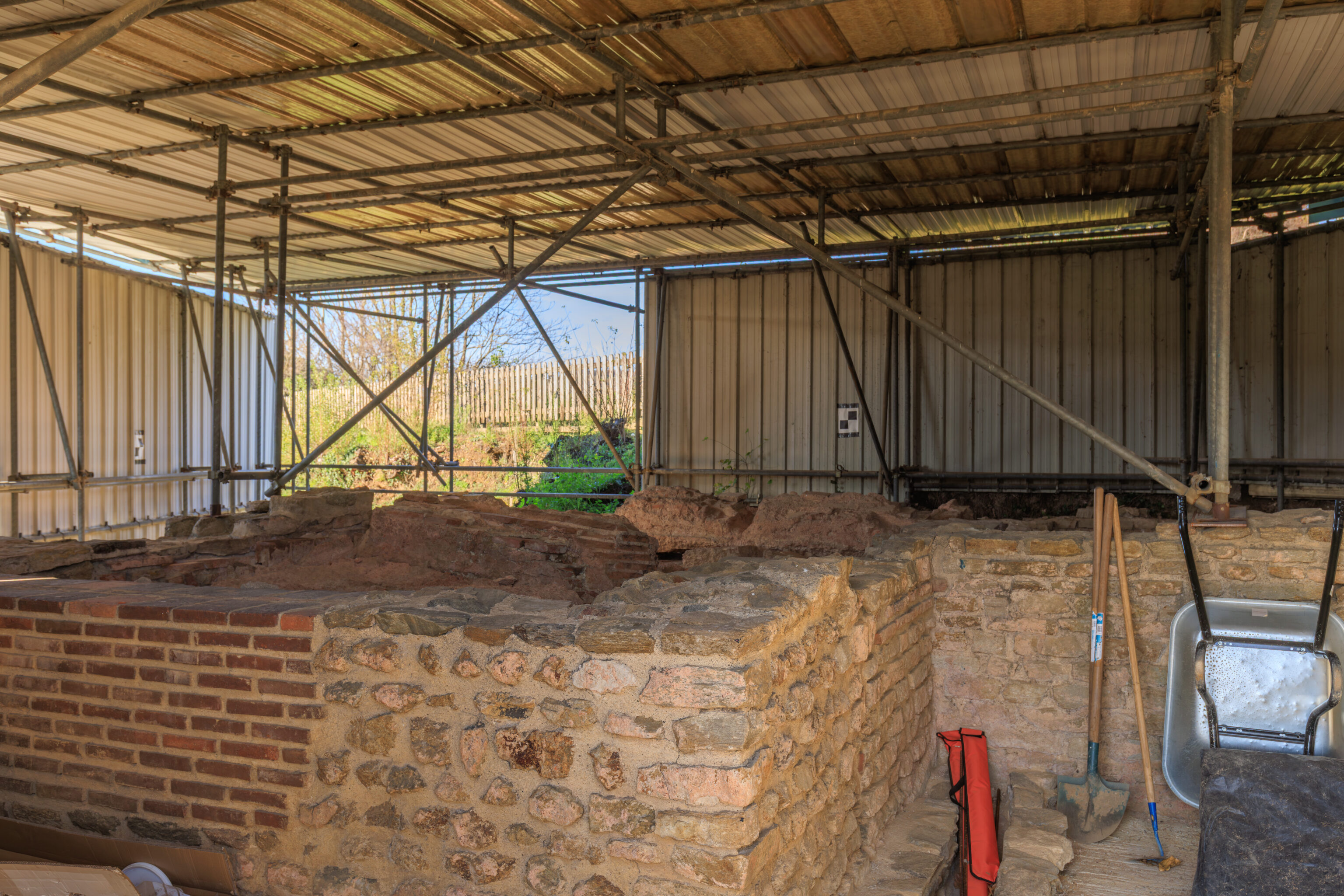
Hypocaust of a house
40° FLOOR
This room belongs to the baths of a residence that adjoined the House of the Ocean Gods. These baths comprised several rooms heated from below (hypocaust), the system of which has been partially reconstructed here.

Without any trace of a bathtub or running water, this small heated room was undoubtedly a dry sauna, where people would sweat before plunging into a cold bath. The hypocaust system is particularly evident here. Thanks to a fire of wood or charcoal maintained in an underground hearth, hot air circulated towards the floor and along the walls of the room.

The floor temperature, which exceeded 40°C, may have necessitated the wearing of wooden shoes.
– Text from a sign, translated using Google.
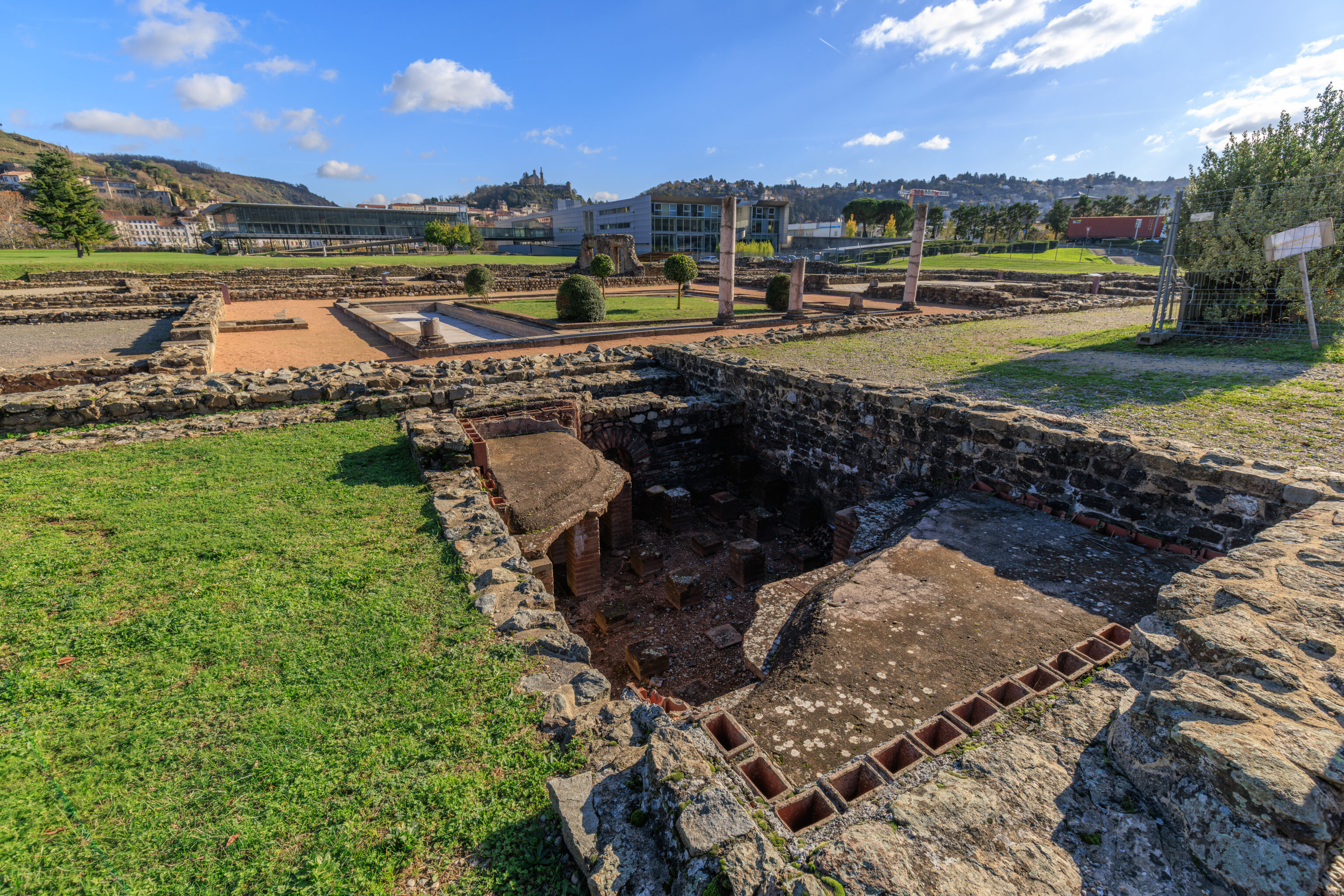

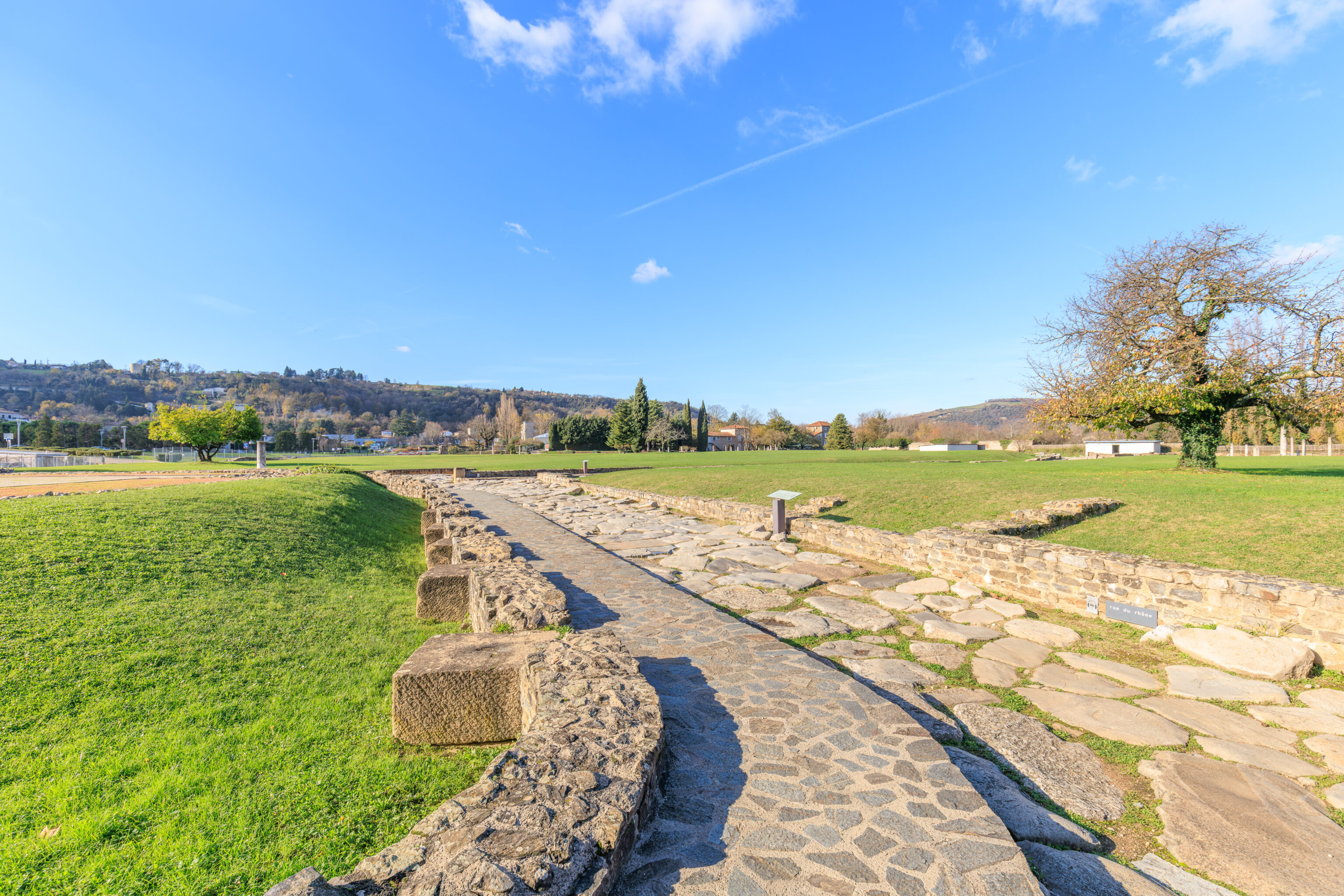
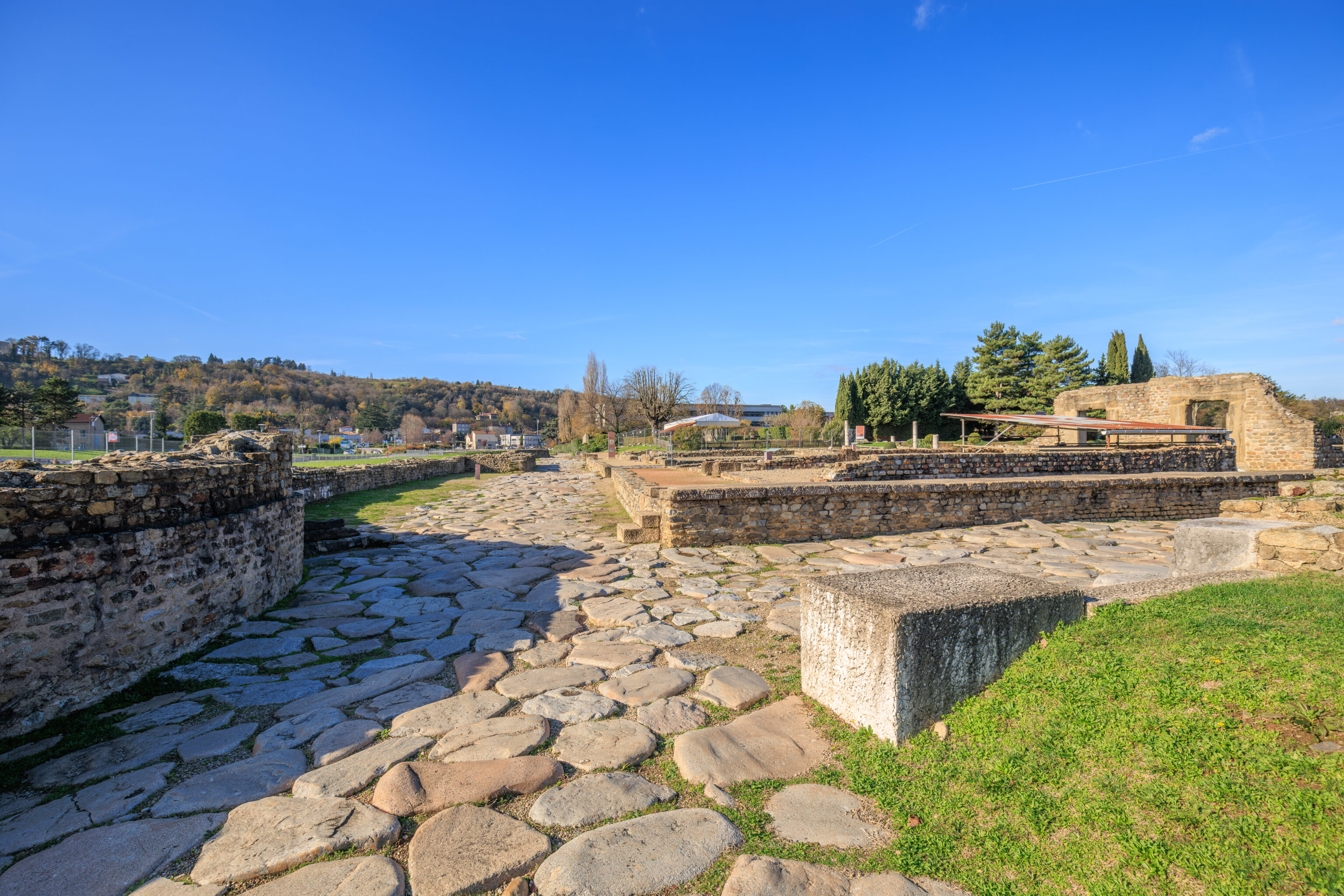
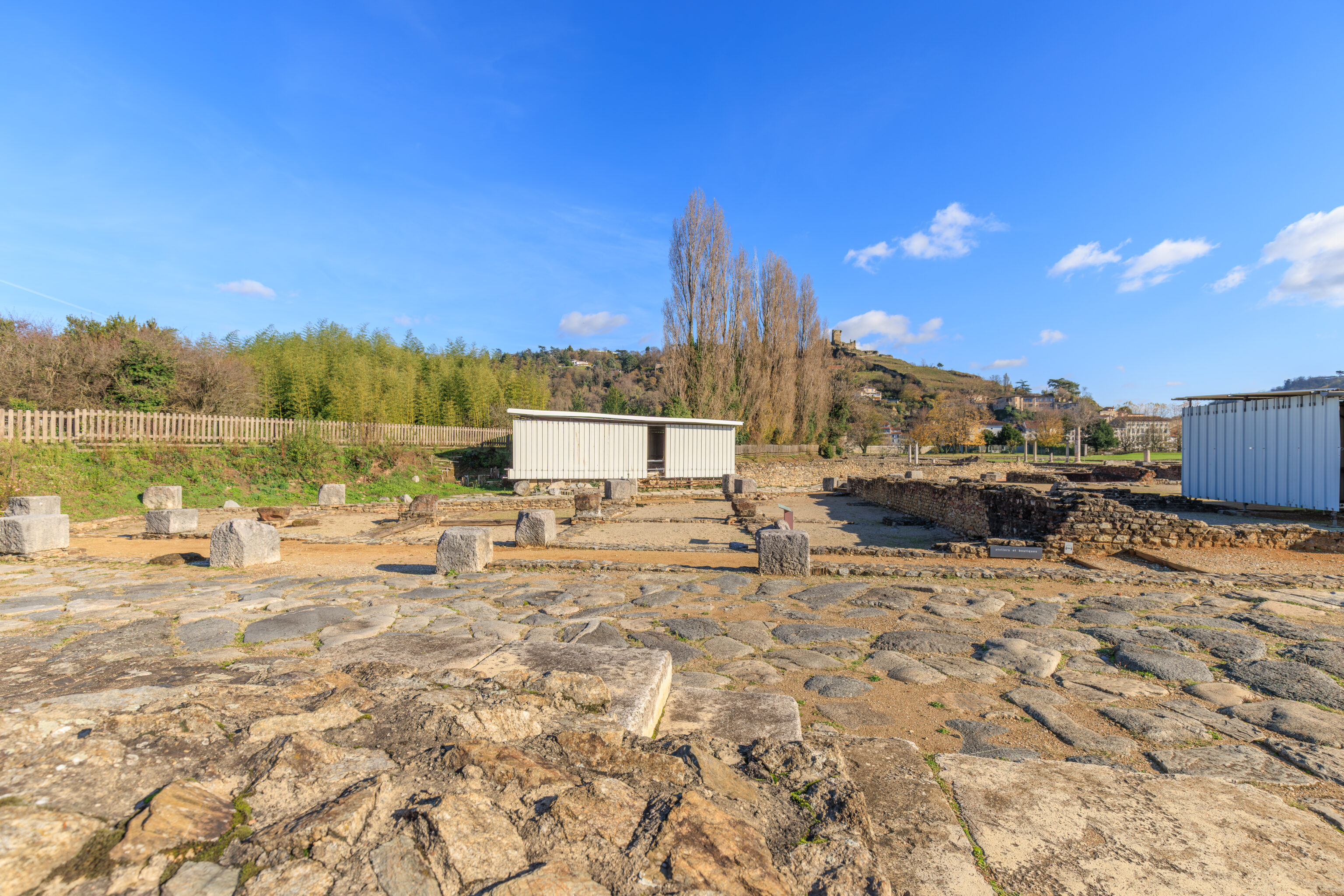
Commerce Street
A BUSY STREET
This paved street was undoubtedly one of the busiest in the neighborhood. It served warehouses, workshops, and shops, before joining the Rue des Thermes and continuing towards Lyon.

Created in the 1st century AD on the site of older buildings, the Rue du Commerce was originally paved with gravel, until the granite paving was laid in the 3rd century. Pedestrians walked on a sidewalk raised 1.70 meters wide, it runs continuously along the west side. To the south, it covers a masonry channel which collected runoff and insulated the facades from the dampness of the subsoil. As in the Rue des Thermes, a vaulted underground sewer 1.65 meters high, paved with bricks, runs its entire length; it carried wastewater to the Rhône. One could descend into it from the street via inspection chambers, a kind of well covered by perforated slabs.
– Text from a sign, translated using Google.
The Great Warehouses
EVIDENCE OF INTENSE COMMERCIAL TRAFFIC
These 2,600 m² warehouses, used for storing goods, were built in the mid-1st century AD, when a vast urban development project began across the entire site.

You entered this vast building through its single entrance. Following a perfectly symmetrical plan, a central courtyard leads to two rows of rooms, each 84 square meters.

Each of the fourteen shops still has two pillar bases visible on the ground, likely intended to support the floor of a story. In the middle of the In the courtyard, the basin was the only source of water. It was here that the bust of Hercules, now on display in the museum, was discovered.

Closely linked to the development of the district, these warehouses were probably private. Nothing has survived of the objects stored there, but we know that Vienna was then an important stop on the trade route. Rhône. Amphorae of oil and wine, barrels, crates, bales of textiles, and sacks of grain undoubtedly passed through here, before being sold in the shops on the site or in the surrounding area.

After the warehouses were abandoned in the 3rd century AD, several rooms were hastily converted into dwellings.
– Text from a sign, translated using Google.
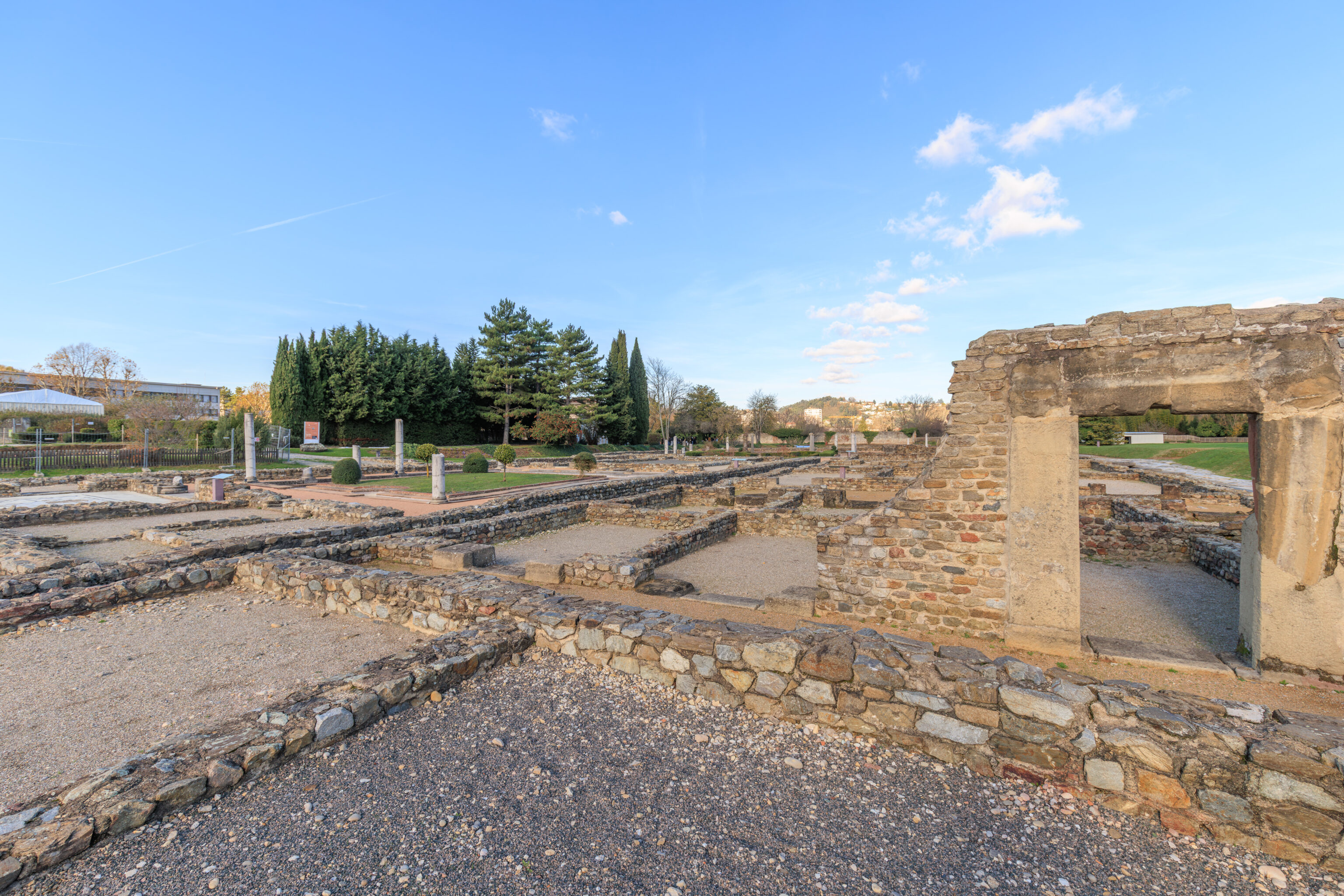
The Artisans' Quarter
A HOUSE DISCOVERED UNDER THE MARKET
Excavations have unearthed the remains of a house destroyed during the construction of the Market at the beginning of the 2nd century AD. They confirm that this district of Vienna has evolved throughout its three centuries of history.

The exploration of the Market's foundations revealed the existence of the House with the Painted Portico. It owes its name to the columns of its peristyle, built of brick and covered with painted plaster green and black.

Here you can see part of the apse-shaped basin that decorated its central garden. It was filled in with rubble from the demolition of the walls.

On the right side, the builders of the Market founded a pillar directly on the bottom of the basin. On the left, the walls of the water feature were cut into to create a drain that collected wastewater from the shops.
– Text from a sign, translated using Google.
The Artisans' Quarter
AN ARTISANAL AND COMMERCIAL COMPLEX
You are here in the heart of the Market. It alone occupies half of the 2,000 m² of this area, where shops and workshops are concentrated, bearing witness to intense commercial activity. No equivalent example has yet been discovered in Gaul.

The shops open on either side of a central, open-air courtyard, forming a passageway between the two main streets of the neighborhood. The inhabitants used to buy local or imported goods, food or manufactured products there. In each shop, to the left of the door, a masonry structure supported A wooden staircase directly accessible from the outside. The merchants and craftsmen probably lived above their shops, in a single room.

In the middle of the courtyard, two massive structures supported hearths perhaps intended for communal cooking. Traces of iron oxide, the hearth, and the water reservoirs discovered in one of the Pieces attest to the existence of a forge. Built at the end of the 1st century or the beginning of the 3rd century AD, the Market was destroyed by fire in the 3rd century. Traces of molten bronze, visible on a limestone block, and the red color of some stone blocks—originally grey—testify to the intensity of the fire.
– Text from a sign, translated using Google.
An urban crossroads
BETWEEN PUBLIC BATHS AND SHOPS
At the intersection of the Rue des Jardins and the Rue des Thermes began a pedestrian passageway that led, to the north, to the Rue du Prunier. It was undoubtedly very lively, lined on the right by a series of shops and on the left by the public baths.

The public fountain, to your left, was supplied by a lead pipe It is located at the southern tip of an island that extended beyond the current fences. It was bordered, to the north, by the Rue du Prunier, of which only a few meters have been excavated behind the baths.

To your right, the rooms opening onto the street could have housed workshops, shops, and an inn. At the back of each of them, runs a gutter that carried wastewater into the sewer of the alley of the Gardens. These commercial buildings date from the 1st century AD. At the beginning of the 3rd century, they were equipped of a portico on the facade that was destroyed around 160 AD, during the construction of the baths. Only two stone bases were preserved in the center of the passageway to support the awning of a shop.

To the left, one accessed the small public baths.
– Text from a sign, translated using Google.
Northern Baths
HOT AND COLD BATHS, COMMUNAL SAUNA
Heating rooms from below (hypocaust) was a common system in large houses as well as in public baths. In these modestly sized neighborhood baths, residents came to relax, wash, and enjoy steam baths.

Built around 160 AD and remodeled at the beginning of the 3rd century, these small baths are presented in the state as they were discovered.

The entrance opened onto a small courtyard, then a staircase led to the changing room, whose floor still bears traces of a mosaic. From this room, one could access a semi-circular cold bath than to the heated rooms. Walls and ceilings were decorated with painted plaster (b).

The very thick floor of the heated rooms was supported by small brick pillars between which hot air circulated. Set into the walls, rectangular pipes distributed the heat along the walls, also ensuring the draft of the fireplace. This was supplied wooden doors leading from a gate on the street of the Baths.

Near the hearth, the hottest room was equipped with a bathtub (a) and perhaps a steam room.

Next to the warm room, a third heated room can be seen. Smaller, it was probably equipped with a separate hearth and could have served as a dry steam room.
– Text from a sign, translated using Google.
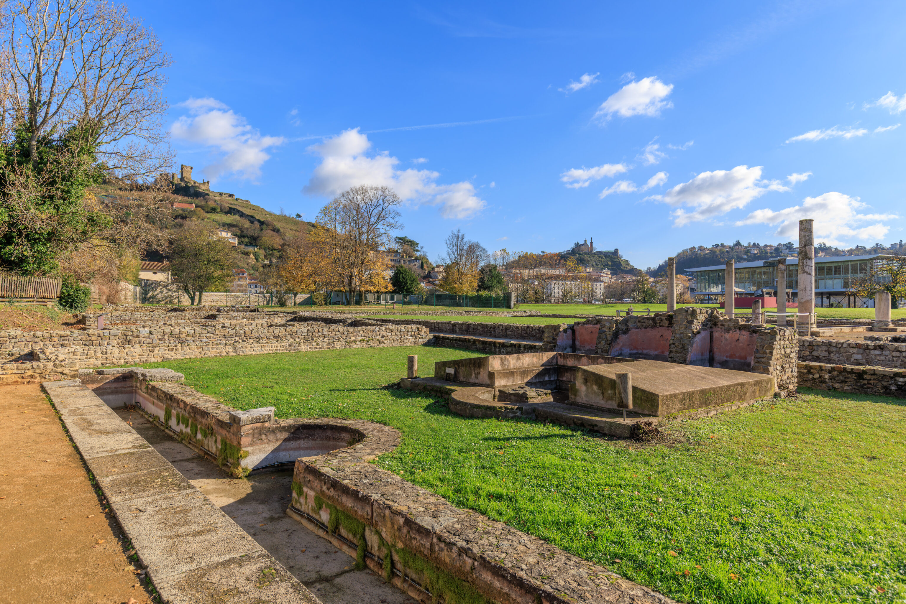
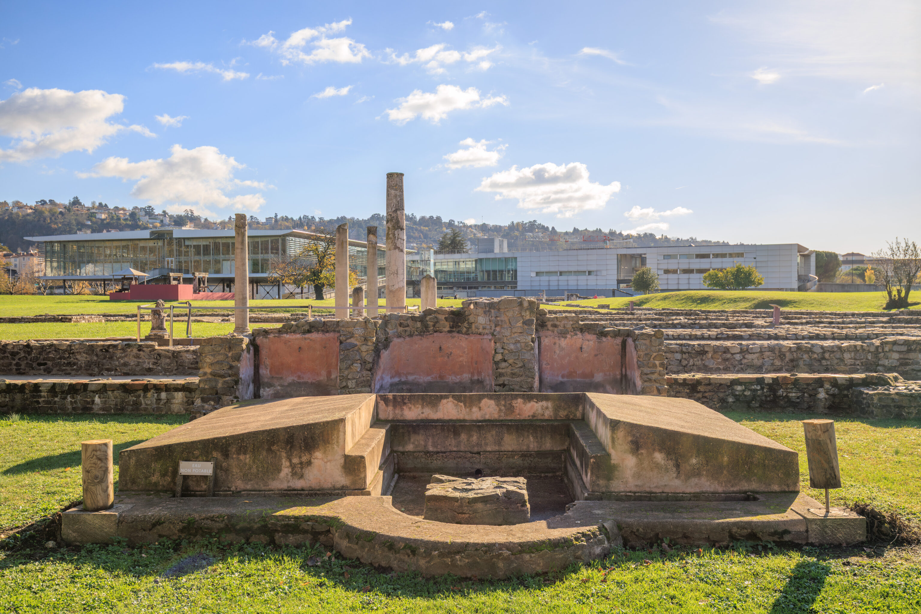
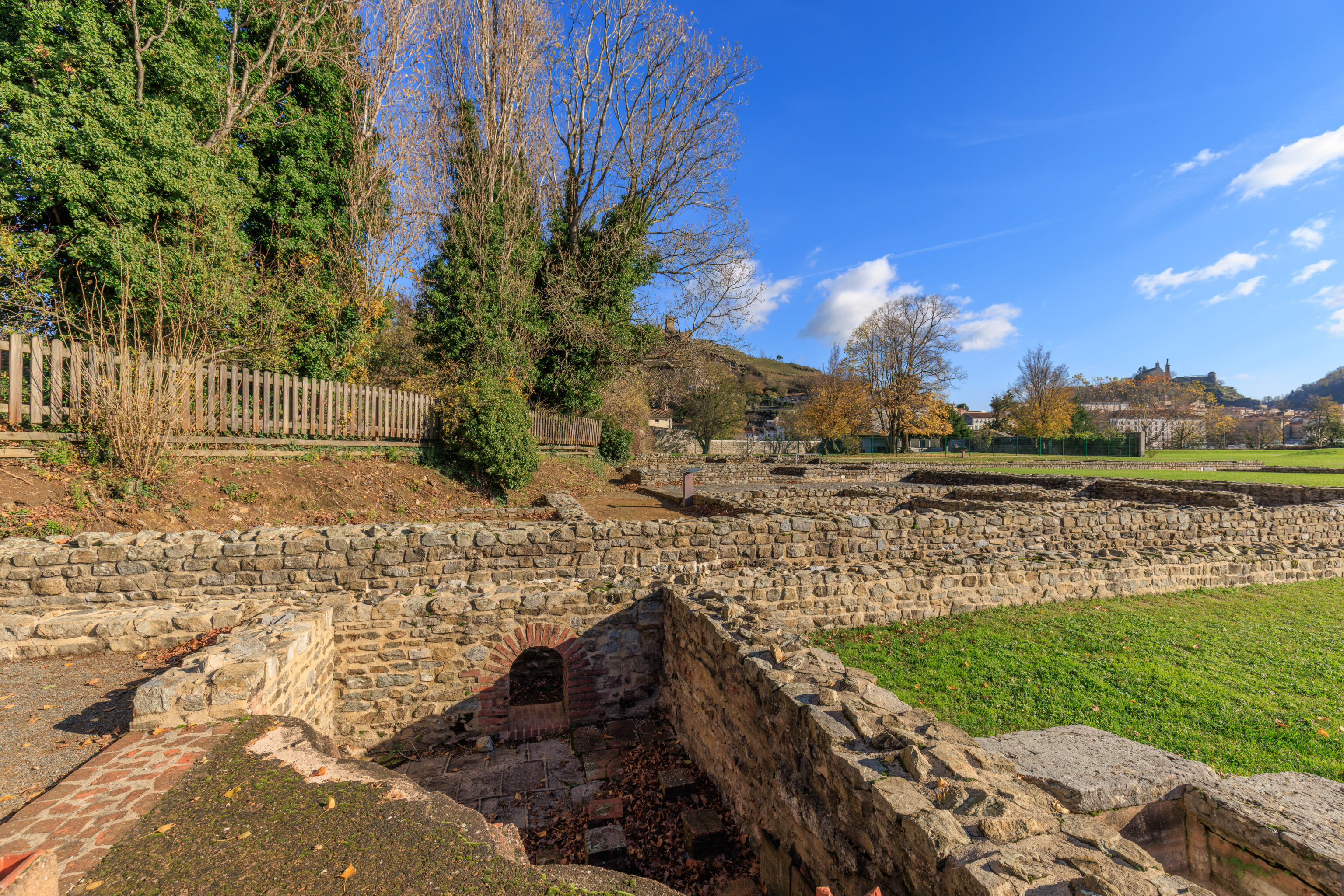
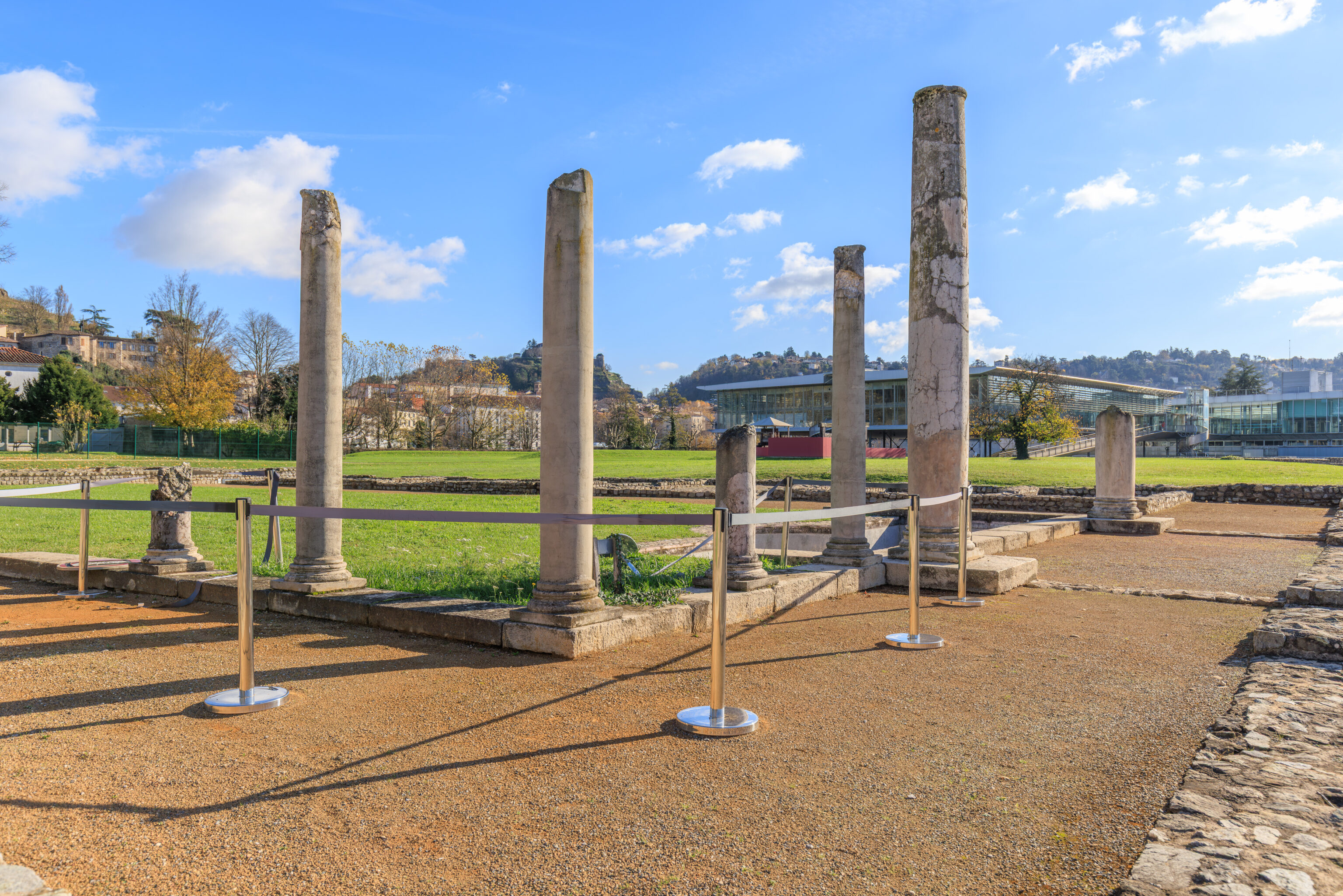
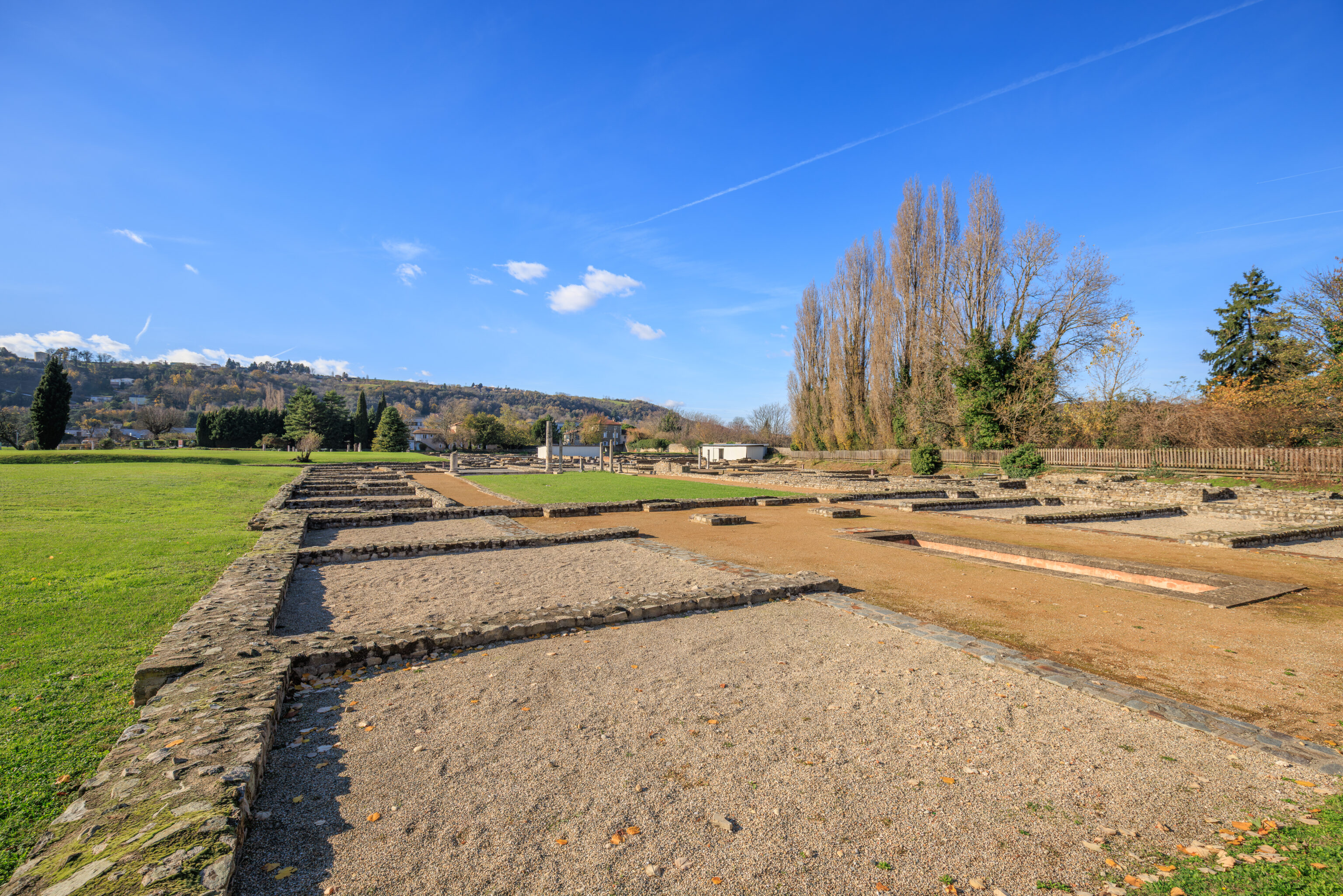
The Pillar Building
AN EXAMPLE OF ARCHITECTURAL EVOLUTION
In the 1st century AD, this space and that of Sucellus's house formed a single residence: the House of the Fishpond. A century later, it was divided in two. The eastern part was used for commercial purposes.

With a central courtyard bordered by small rooms of similar size, the layout of this building evokes warehouses or a cluster of several shops, as can be seen elsewhere on the site, in the Market or the Great Warehouses.

The division of the house at the Fishpond into two buildings was achieved by the construction of a thick party wall, reinforced by pillars. This wall had no openings. The Pillar Building was accessed via a street located on its eastern facade.
– Text from a sign, translated using Google.
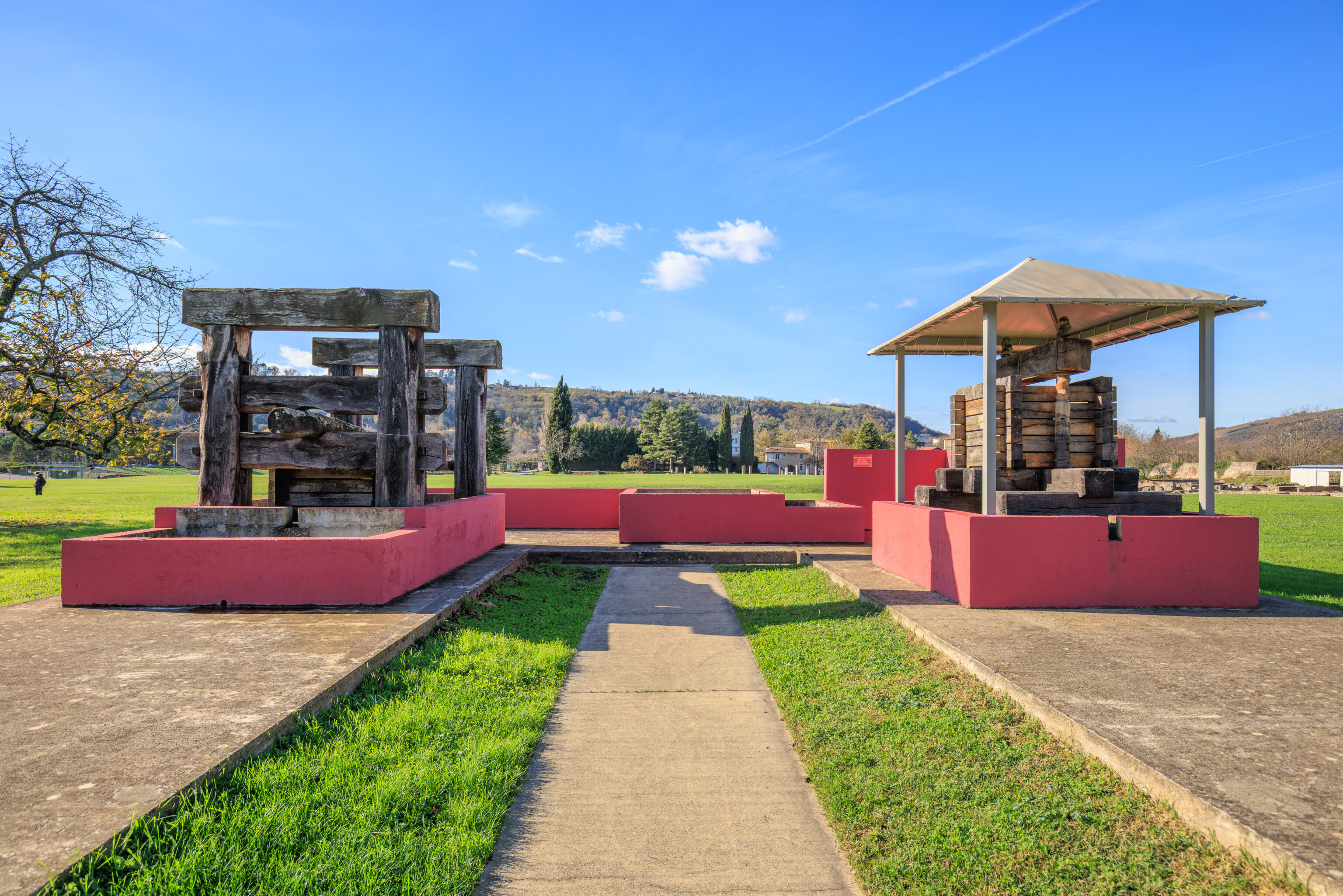
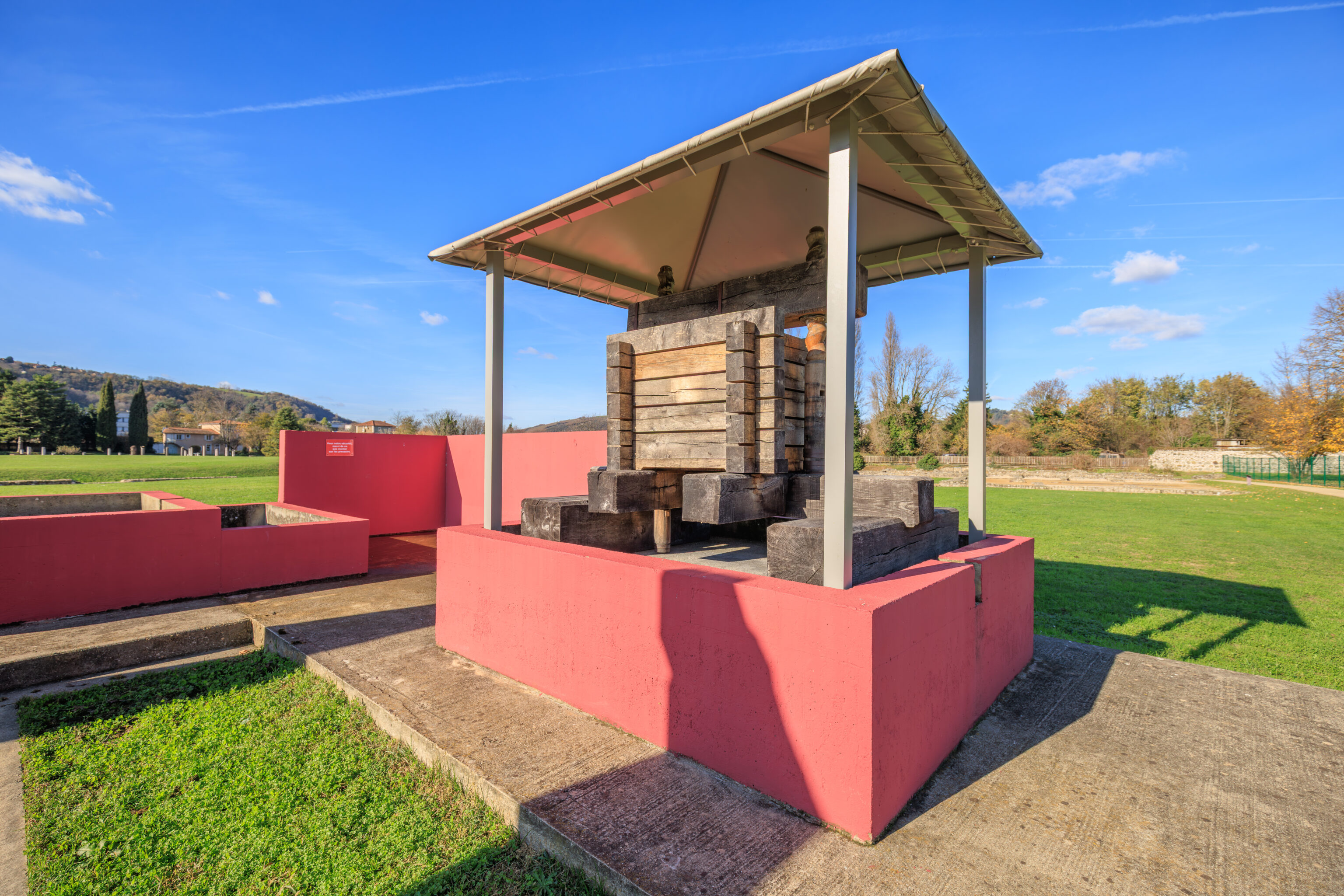
Reconstruction of a wine cellar
This reconstruction presents the different types of presses used in Gaul

Digger press
This is the oldest system, known in Italy well before the conquest of Gaul. It is described by Cato (234-149 BC), landowner, businessman, and political leader, and author of a treatise on the management of an agricultural estate (De agri cultura). The grapes are crushed by the pressure of a heavy wooden beam tensioned at one of its ends by cables moved by a winch fixed between two wooden uprights. In detail, the bunch grapes, after crushing, are placed in the central hopper and covered with pieces of wood that transmit the pressure from the beam

Screw press
Here the grapes are crushed by the pressure of the piece of wood located at the top of the machine, which is driven downwards by the movement of two wooden screws. This press represents a significant technical advance compared to the previous one; it takes up less space and, above all, it is easier and less dangerous to operate. This type of machine is described by the architect Vitruvius in 20 BC.

Between the two presses, one can see the vat in which the grapes were trodden by foot. Instead, they were immediately taken to the press without prior fermentation. The juice from the pressing (must) filled dolia (semi buried terracotta vats) in which fermentation took place.
– Text from a sign, translated using Google.
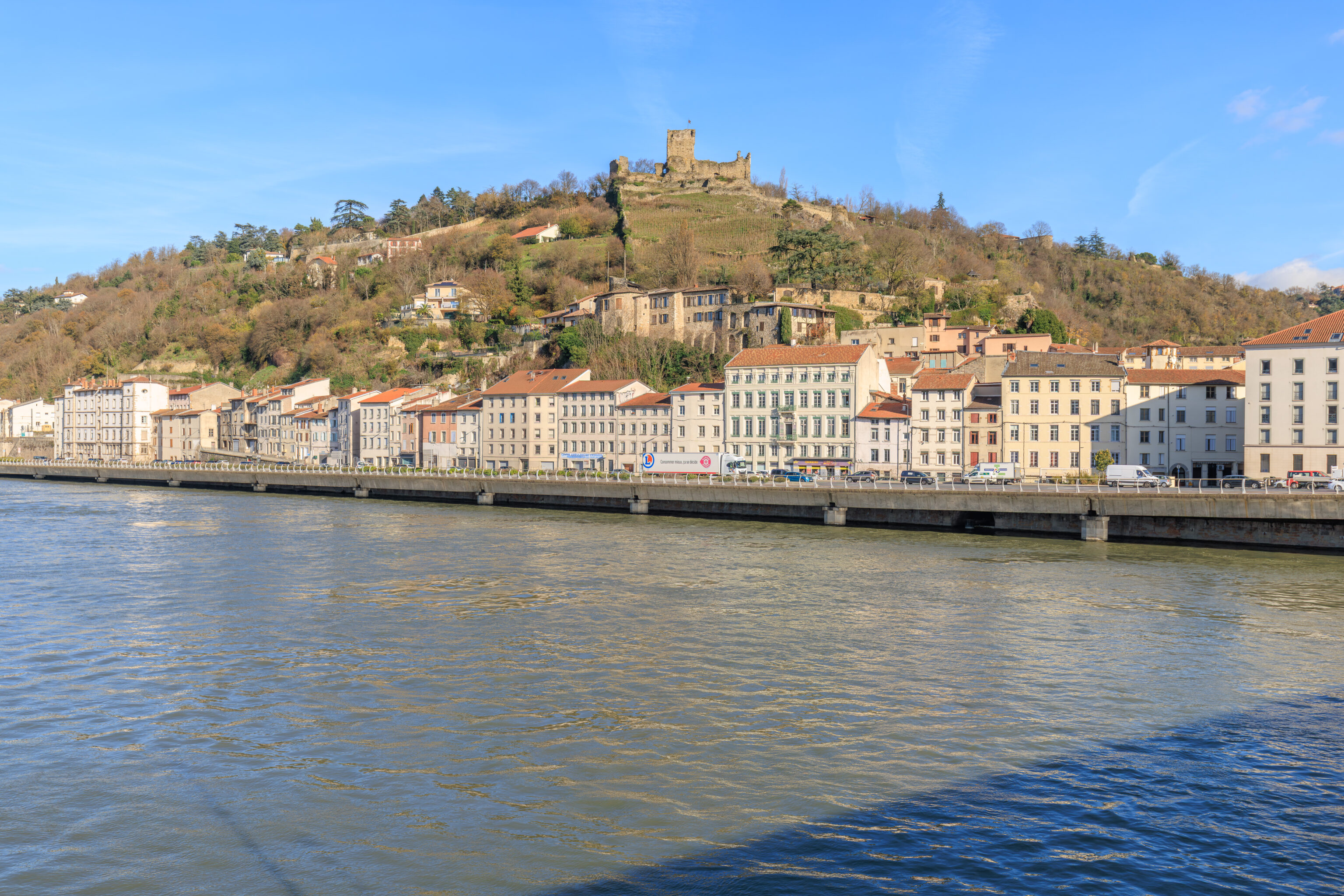
After leaving the ruins, we crossed over the Rhône on the bridge adjacent to the museum. Looking to the northeast from the northern side of the bridge, we had a nice view of the ruins of the Château de La Bâtie.
VIENNE'S HERITAGE PATHS
For over 2,000 years, Vienne and its surrounding area have developed due to its geographical position at the crossroads of several routes on the banks of the river Rhône.

Even before it became a metropolis during the Roman Empire and the seat of a powerful Catholic diocese, Vienne was the capital of the Celtic tribe of the Allobroges whose territory went from the river as far as the Alps with a bridge-head on the right-hand bank of the Rhône. The heritage of the Vienne area as regards archaeology and monuments is one of the richest in France. Much of it can be seen in several museums, through the large number of ancient monuments or simply by taking a walk along the heritage paths.

Visitors have a fine view from the heights of Vienne's Mont Pipet - the Roman theatre, mediaeval and modern churches, the staircase towers of the Renaissance houses, the industrial valley of the river Gère, the river Rhône in all its majesty, the Saint-Romain-en-Gal - Vienne museum, the hillsides with their world-famous vineyards and the hills of Le Pilat in the heart of its regional natural park.
– Text from a sign betweem the museum and bridge.
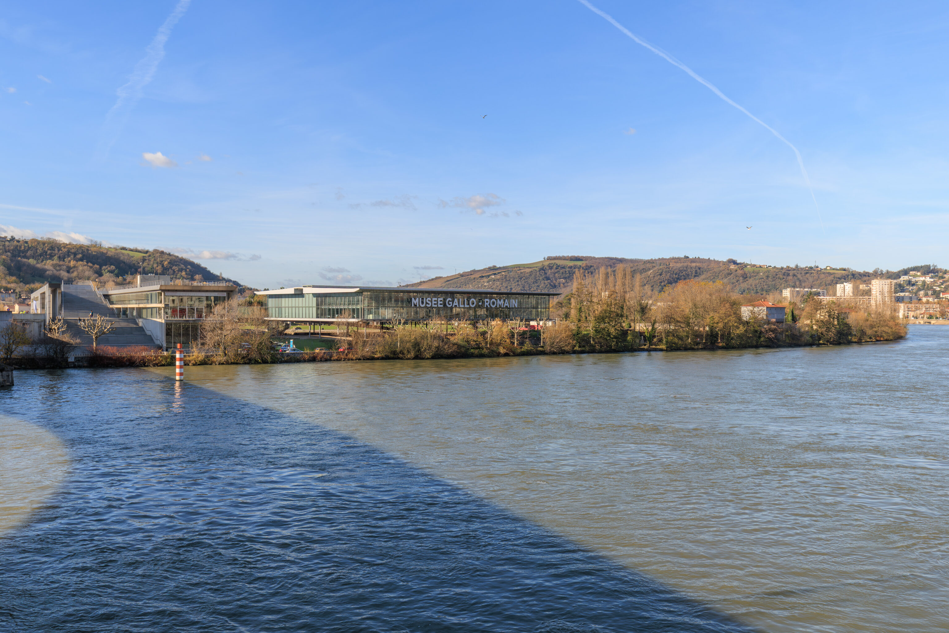
Looking back, we could see the modern design of the Musée Gallo-Romain.
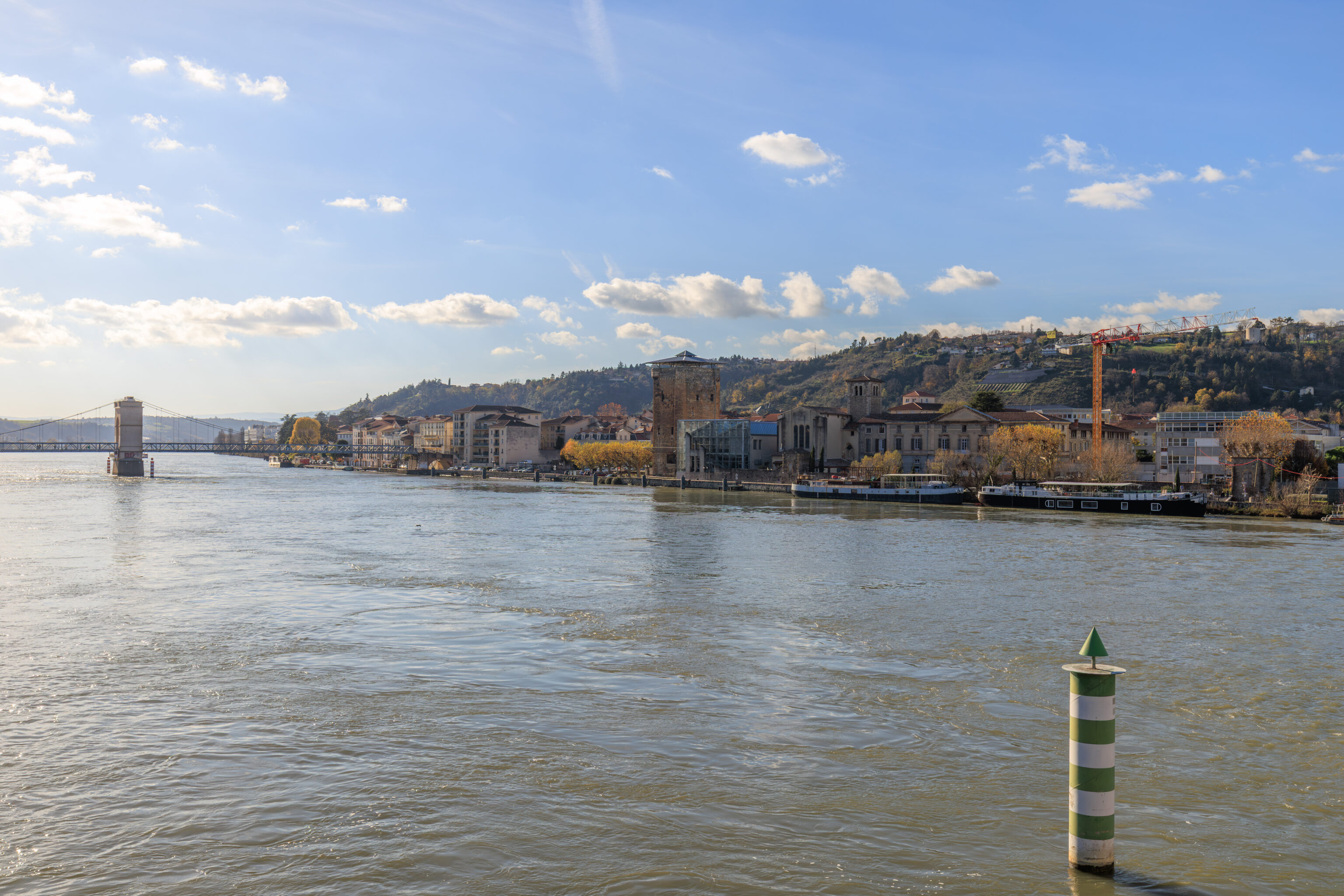
After crossing the river, we crossed over to the south side of the bridge to take a look. We had a view of the pedestrian bridge that we crossed over earlier in the day as well as the large Tour des Valois at center.
THE RHÔNE AND THE CITY SINCE THE MIDDLE AGES
In the Middle Ages, the river marked the border between the Kingdom of France, on the right bank, and the Holy Roman Empire, on the left bank. On the Vienne side, the opening of each street was a "port." The five-arched stone bridge, mentioned from the 13th century onwards, and defended on the royal side by the Valois Tower in the 14th century, was destroyed by a Rhône flood in 1651.

From 1750, the construction of the quays along the Gère and then the Rhône facilitated crossing Vienne and protected the city from flooding. In 1829, the suspension bridge made of wire (a new technology) connected Vienne's metallurgical industry to the coal mining center of Saint-Étienne. After 1830, steam navigation replaced the bargemen. At the beginning of the 20th century, floating washhouses were moored along the quays.

In 1949, the Pont Neuf (New Bridge), later renamed Pont Maréchal-de-Lattre-de-Tassigny, was completed.

Automobile traffic, for which the Rhône quays were doubled and the confluence of the Gère River was covered in 1967, distanced the city from its river. In 1980, the Reventin hydroelectric dam and the improvements made by the Compagnie Nationale du Rhône (National Rhône Company) raised the river level and allowed for the continuation of navigation (barges, river tourism).
– Text from a sign, translated using Google.
Abbaye de Saint-André-le-Bas
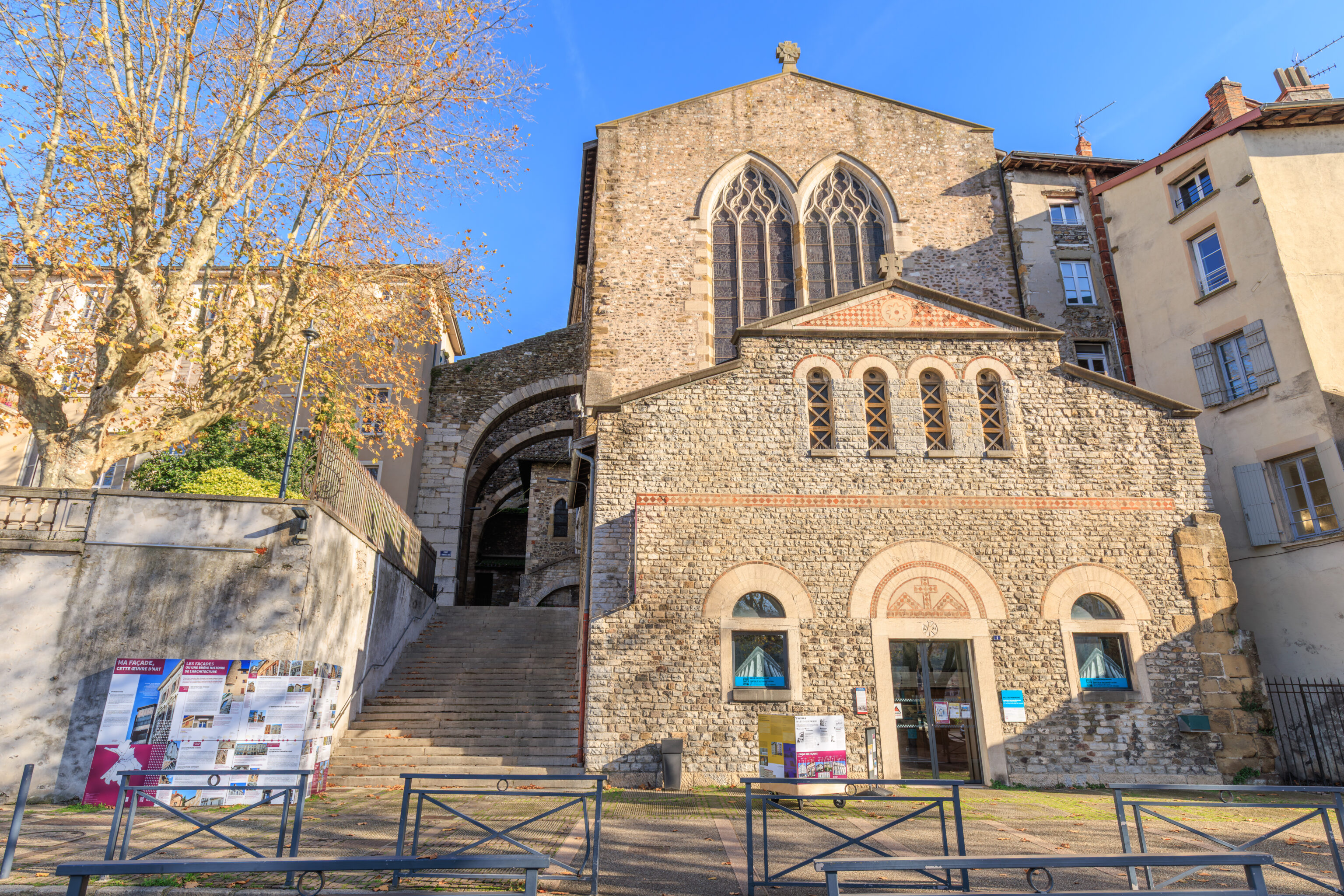
We crossed the street to reach the Abbaye de Saint-André-le-Bas (Saint André-le-Bas Abbey). There is a small museum here, although it wasn’t obvious where to enter. We went inside the door seen here at ground level to ask for directions.
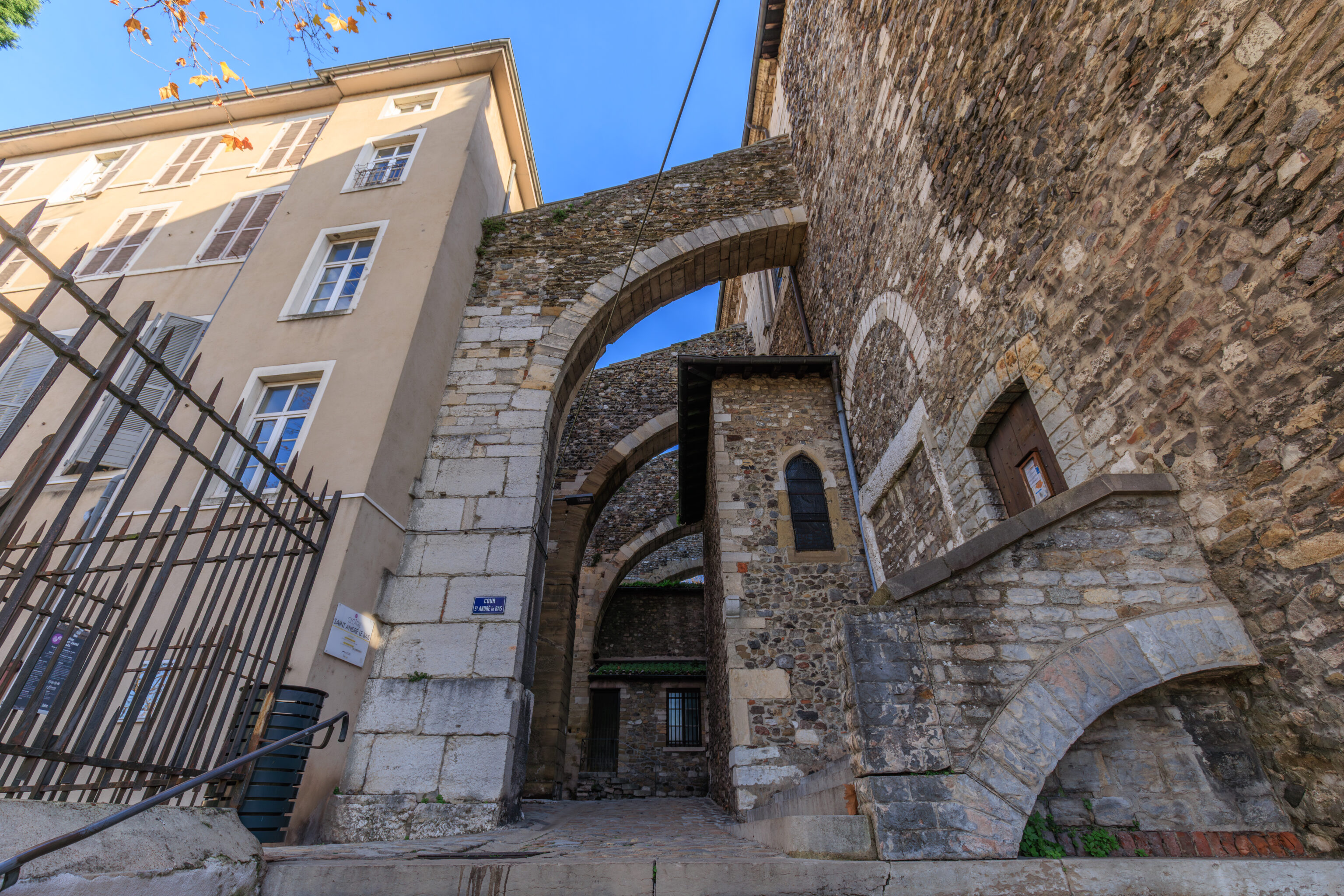
We walked up the stairs…
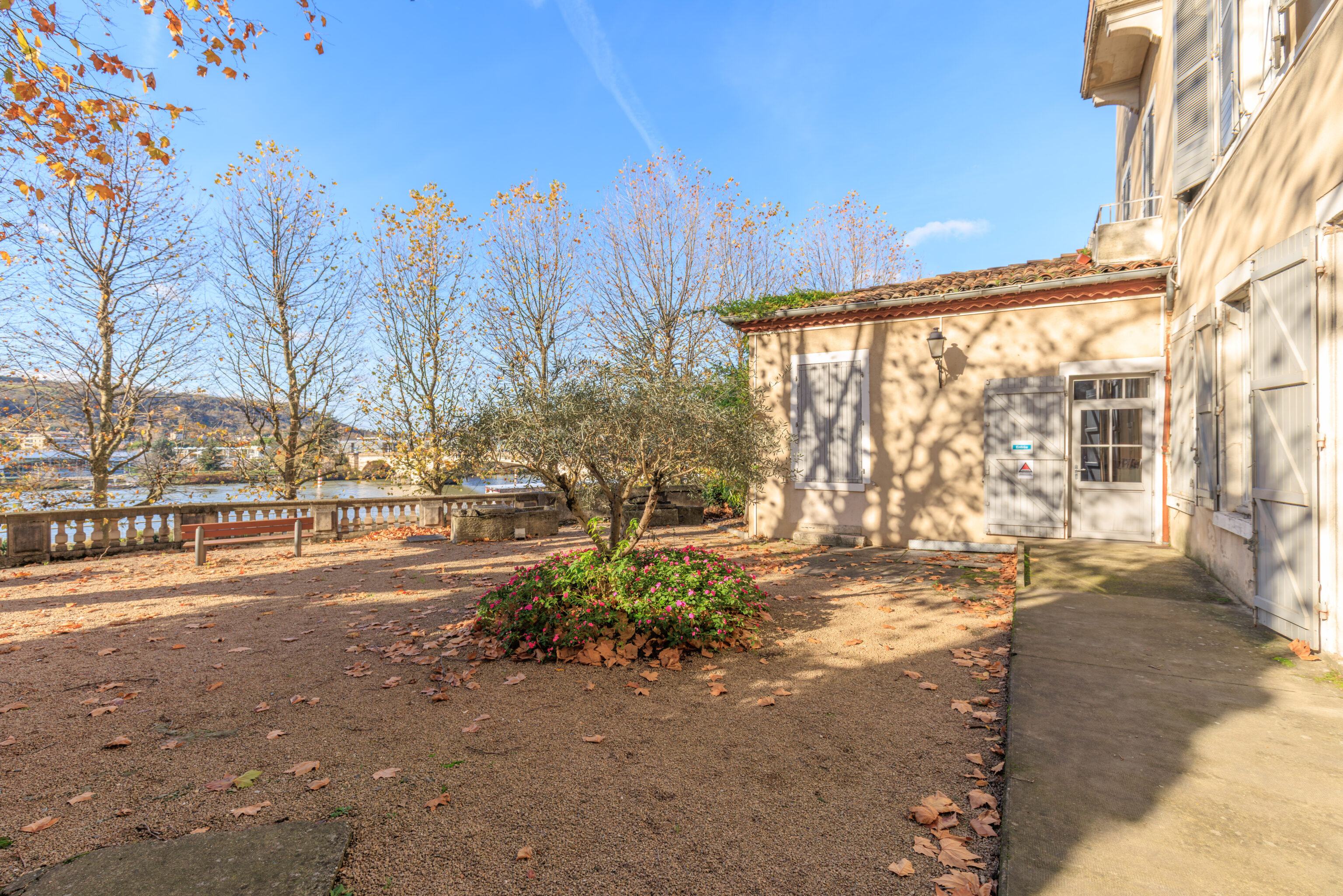
And found the entrance.
We showed our tickets from the Musée Gallo-Romain to enter. An informational pamphlet in English was provided.
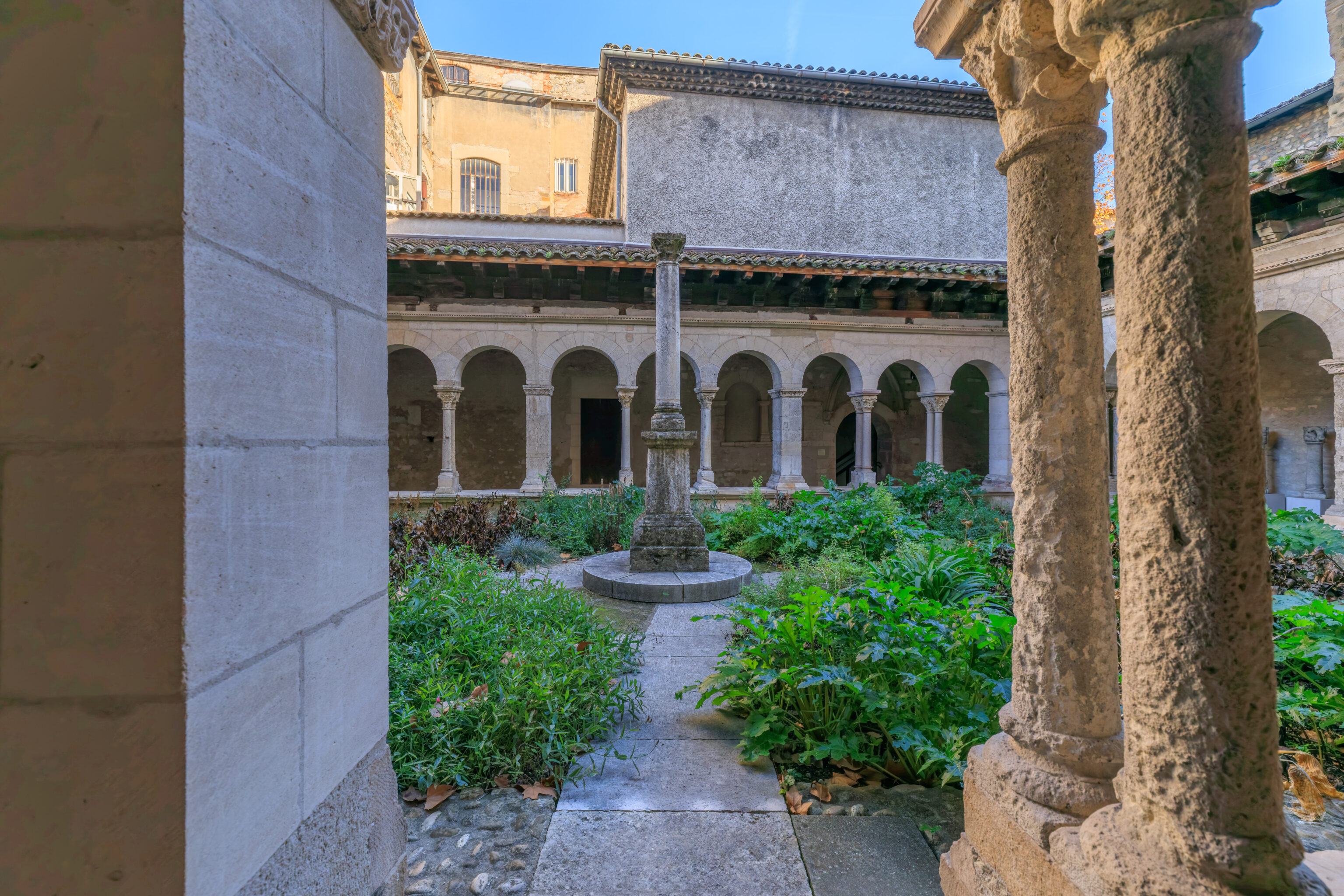
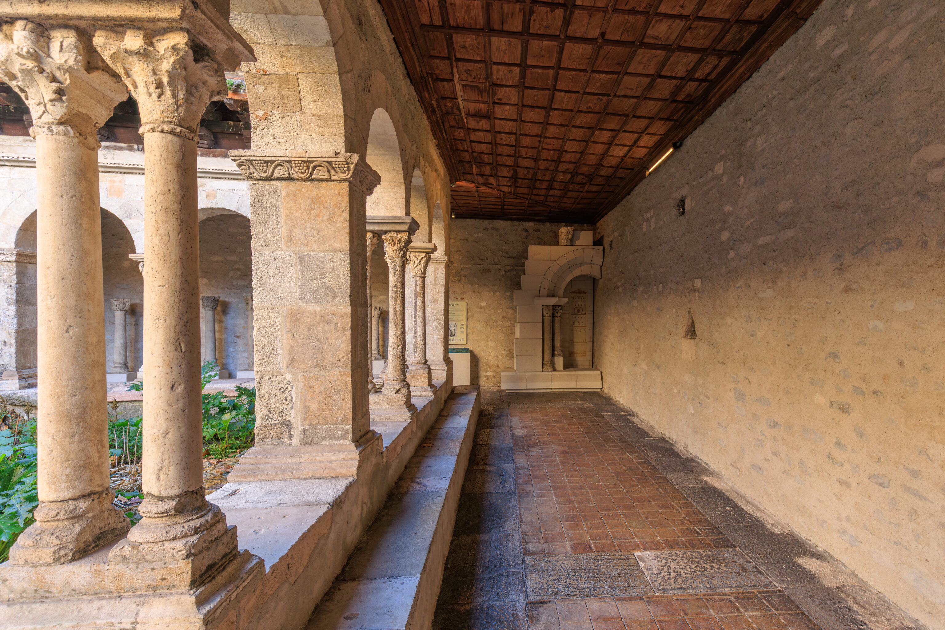
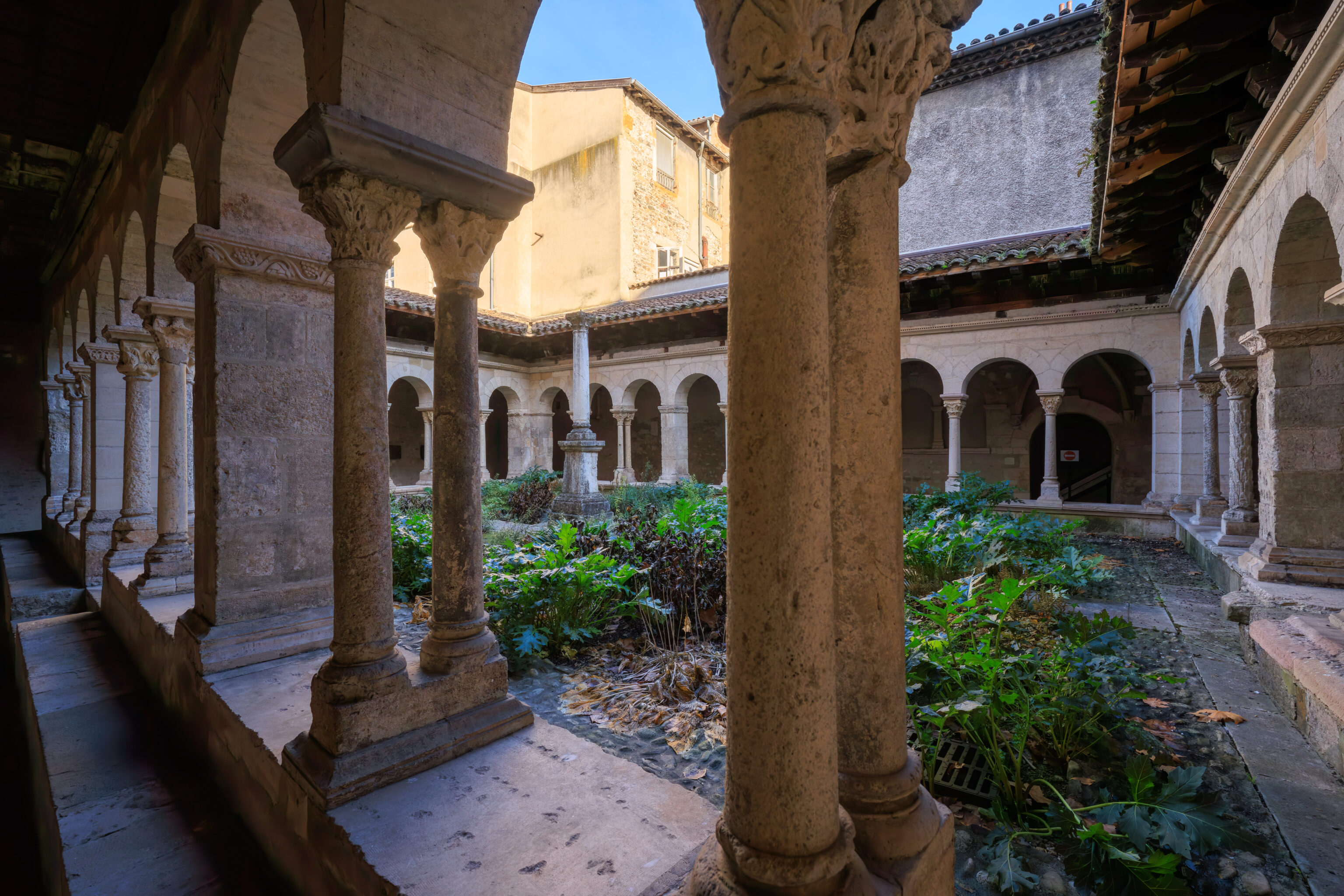
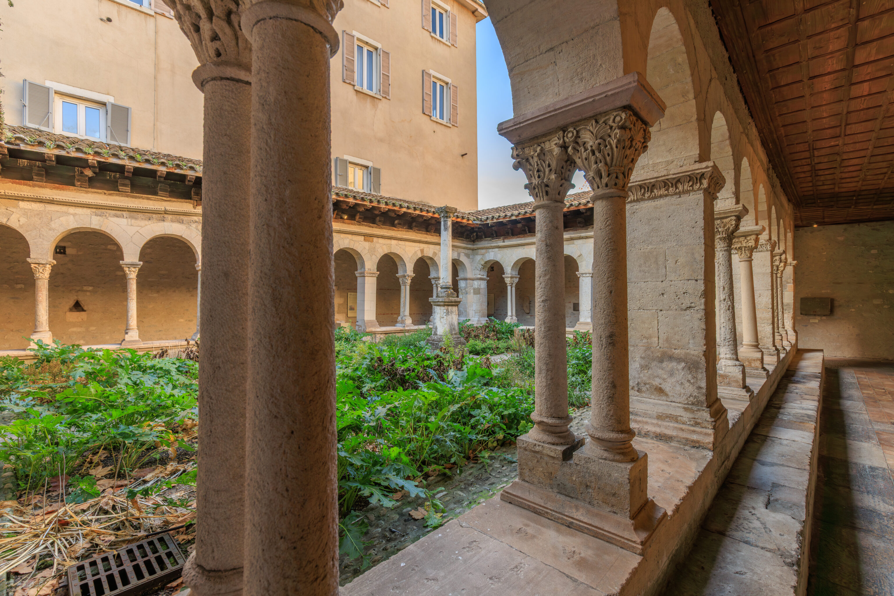
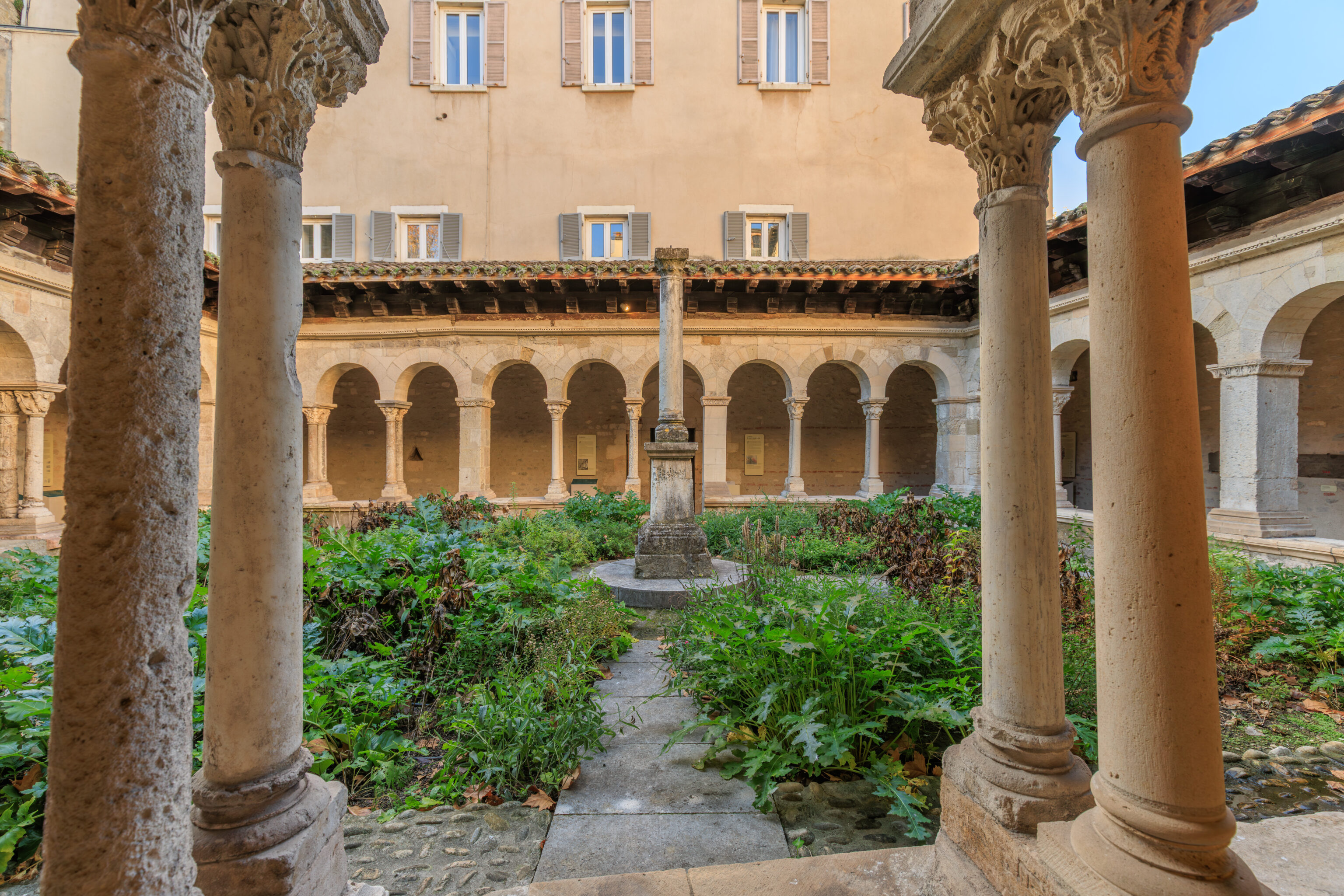
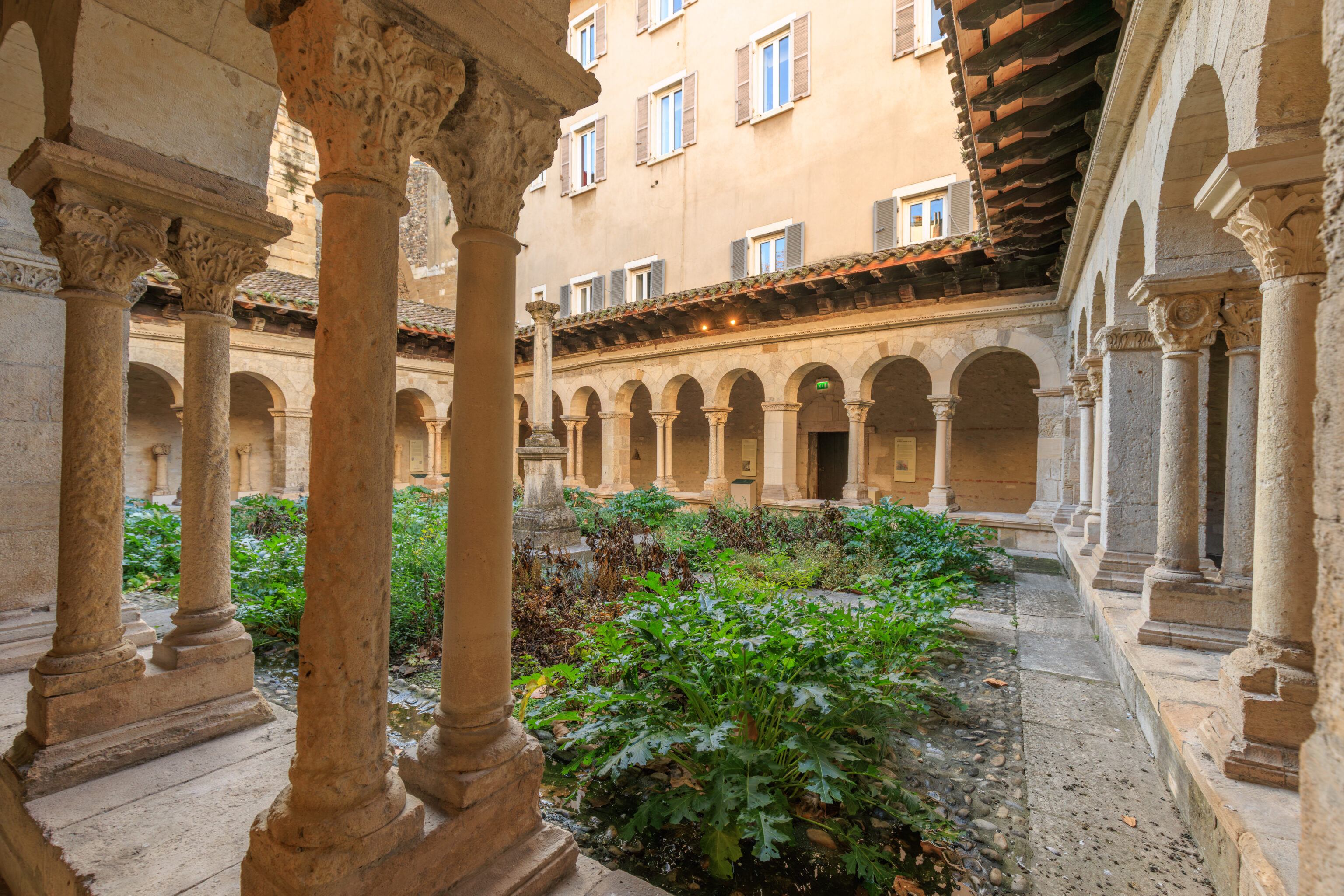
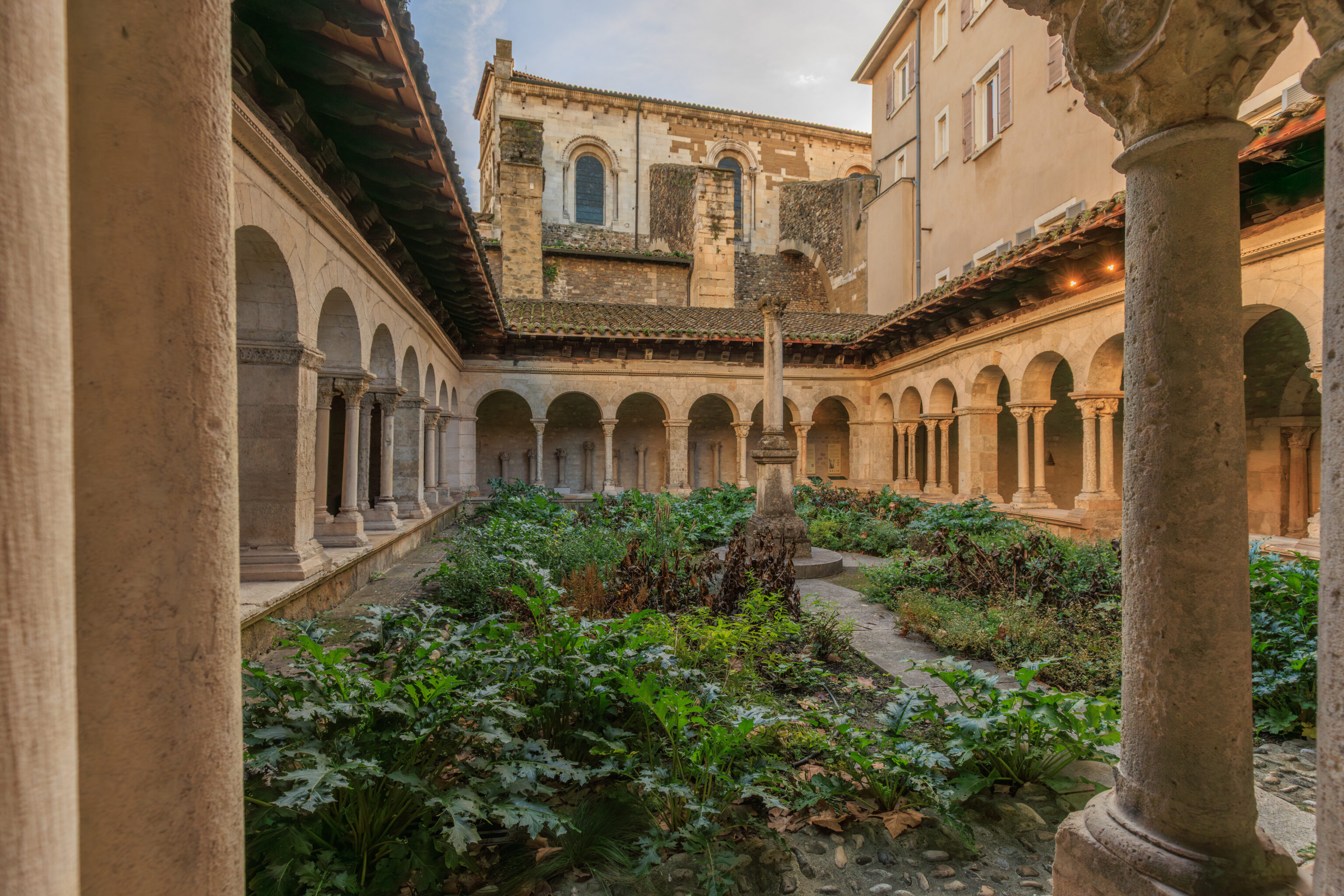
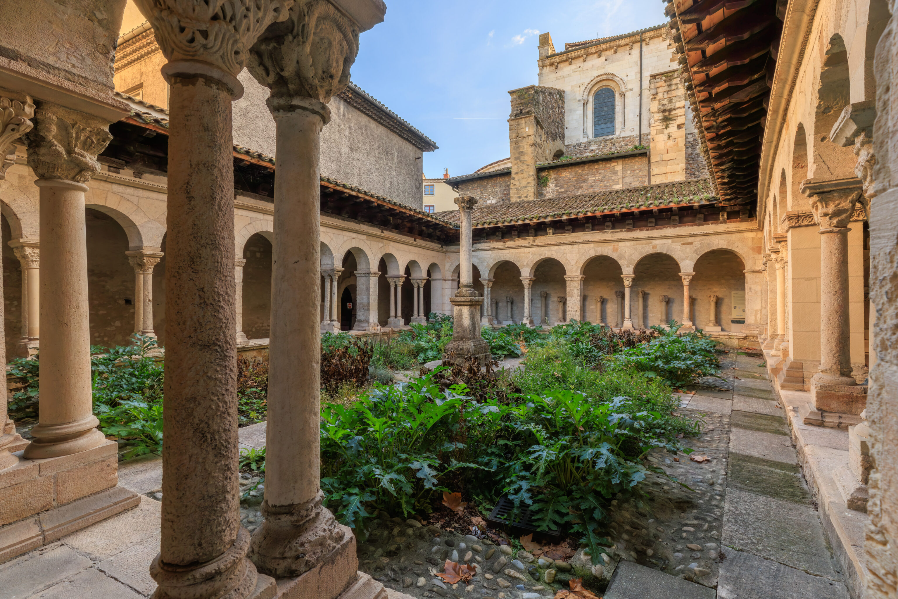
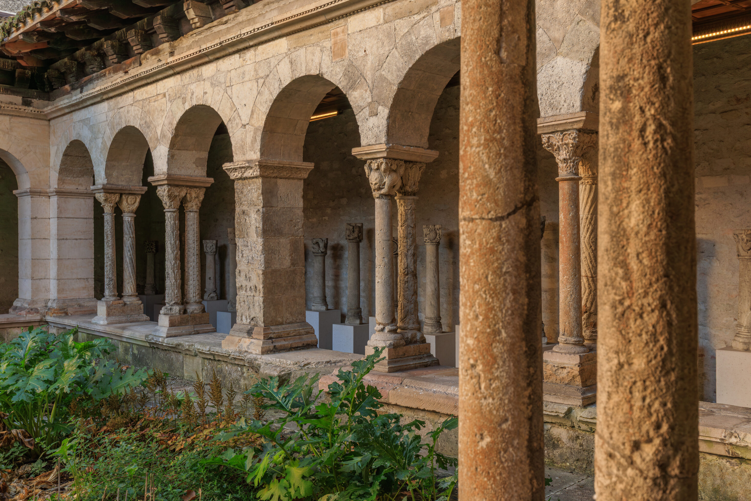
The primary feature of this museum is this 12th century cloister.
THE CLOISTER
At the heart of the convent buildings, the monks' living quarters, the cloister is both a thoroughfare and a place for meditation. The cloister of an urban abbey, it is modest in size and irregular in plan (see tactile panel: floor plan of the cloister). Built in the second half of the 12th century, it is the only element of the convent buildings to have survived to this day. It is the oldest cloister preserved in the Rhône-Alpes region. It has undergone several alterations since its construction, notably a complete reconstruction at the end of the Middle Ages, but retains much of its original sculpted decoration (see tactile panel: breakdown of a small column into base, shaft, and capital).

THE RESTORATION BY JULES FORMIGÉ
The 1937-1938 restoration allowed for the uncovering of the columns by removing the walls, doors, and windows that filled the spaces between the columns, and for the reconstruction of the southern gallery, which had been dismantled. The sculpted elements of this gallery, which were then kept in a private collection, were reinstalled at that time thanks to the efforts of the Society of Friends of Vienne. Nothing remains of the medieval garden and the lavabo, which were replaced by the current garden, in the center of which Jules Formigé placed a later column whose exact provenance is unknown. The cloister is not vaulted but has a panelled ceiling (see tactile panel: elevation section of a cloister gallery), which is a regional characteristic: the cloister at Notre-Dame-de-l'Isle in Vienne also had this feature, as did those at Ternay (Rhône), La Motte-en-Galaure (Drôme), and Saint-Donat-sur-l'Herbasse (Drôme). Some painted elements remain partially in the current ceiling: chevron and star motifs, notably painted in black on a white background. Jules Formigé describes the coat of arms of Abbot François de Martel (1439-1461), which has since disappeared, but which allows us to date this decoration. In the 18th century, the cloister had an upper floor (two-level galleries).

THE CONVENTIONAL BUILDINGS
Two semicircular arched doorways still remain, to the north and west, which opened onto the monks' living quarters. A third door, located in the southeast corner, led to the chapter house.
– Text from a sign, translated using Google.
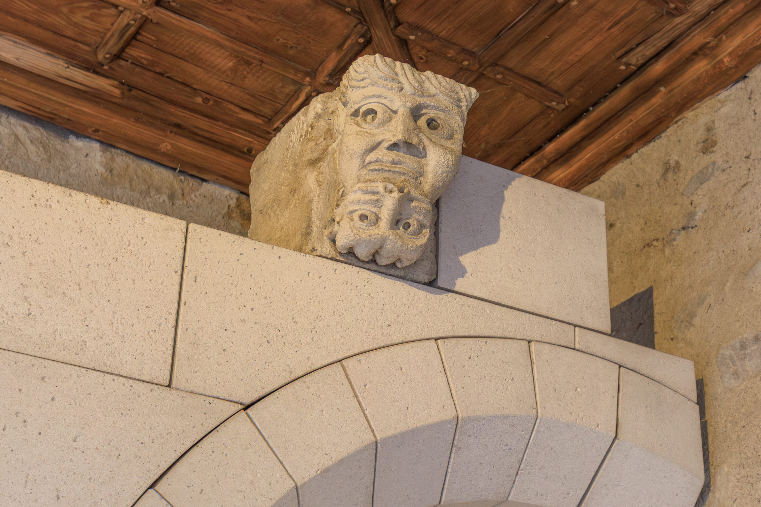
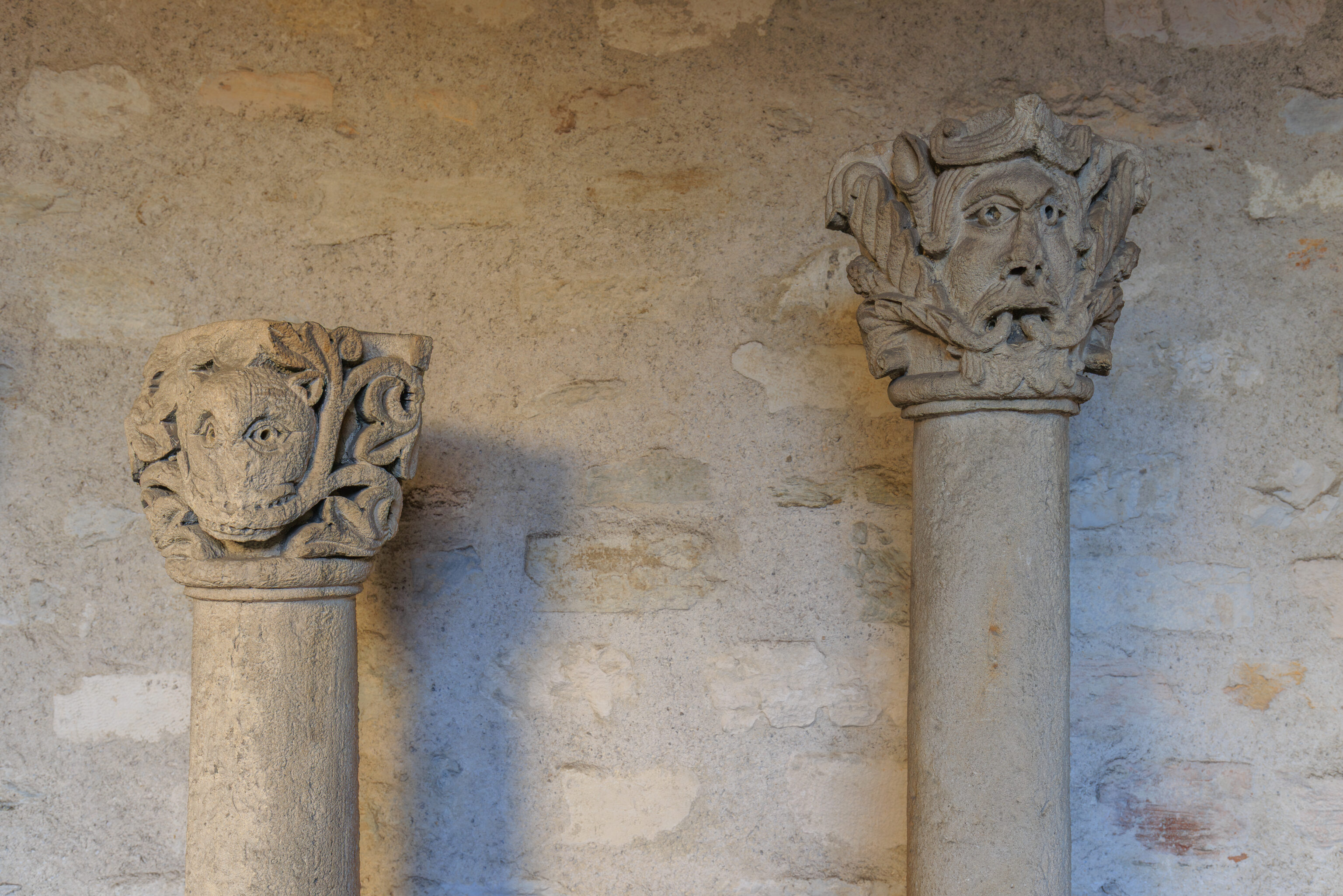
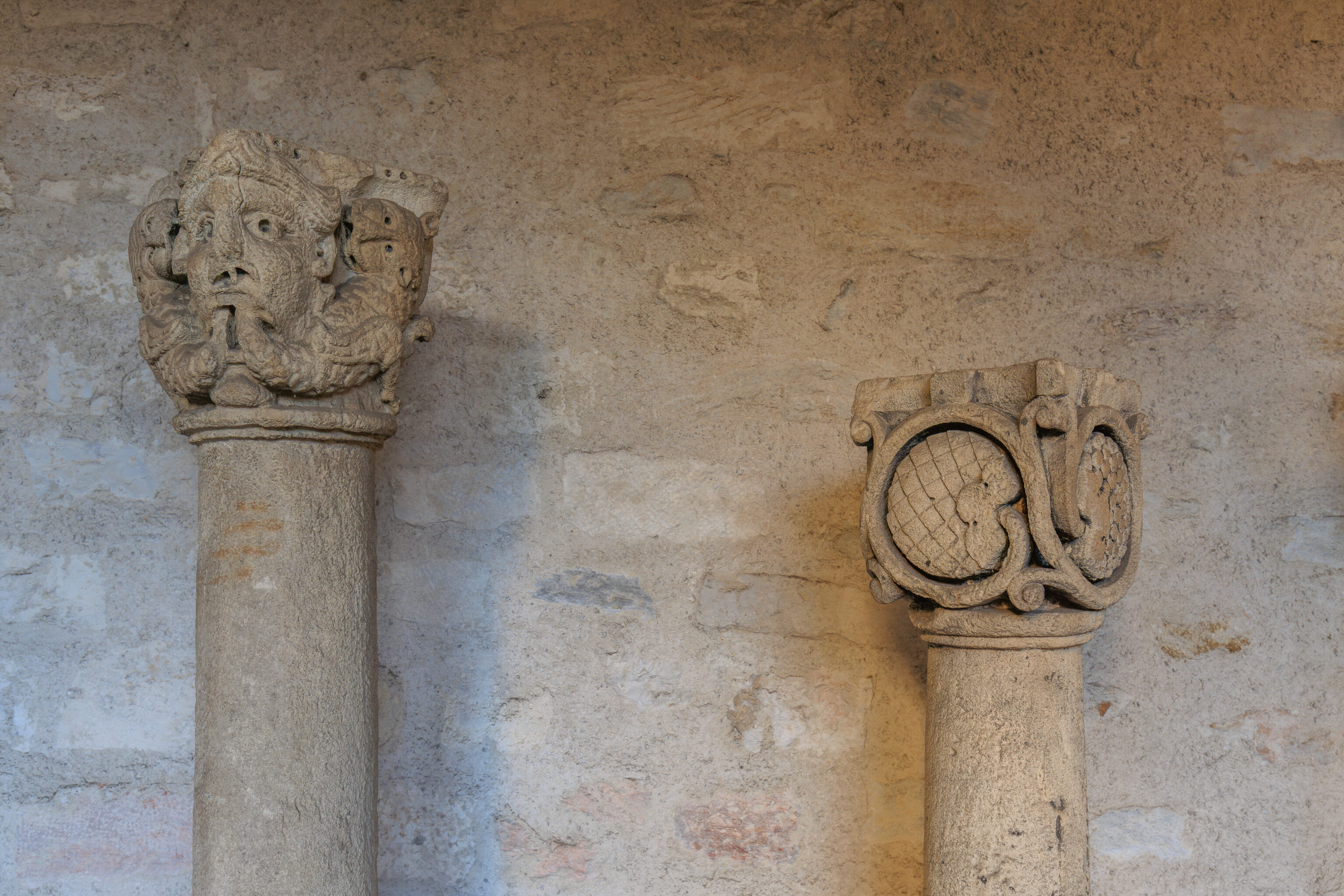
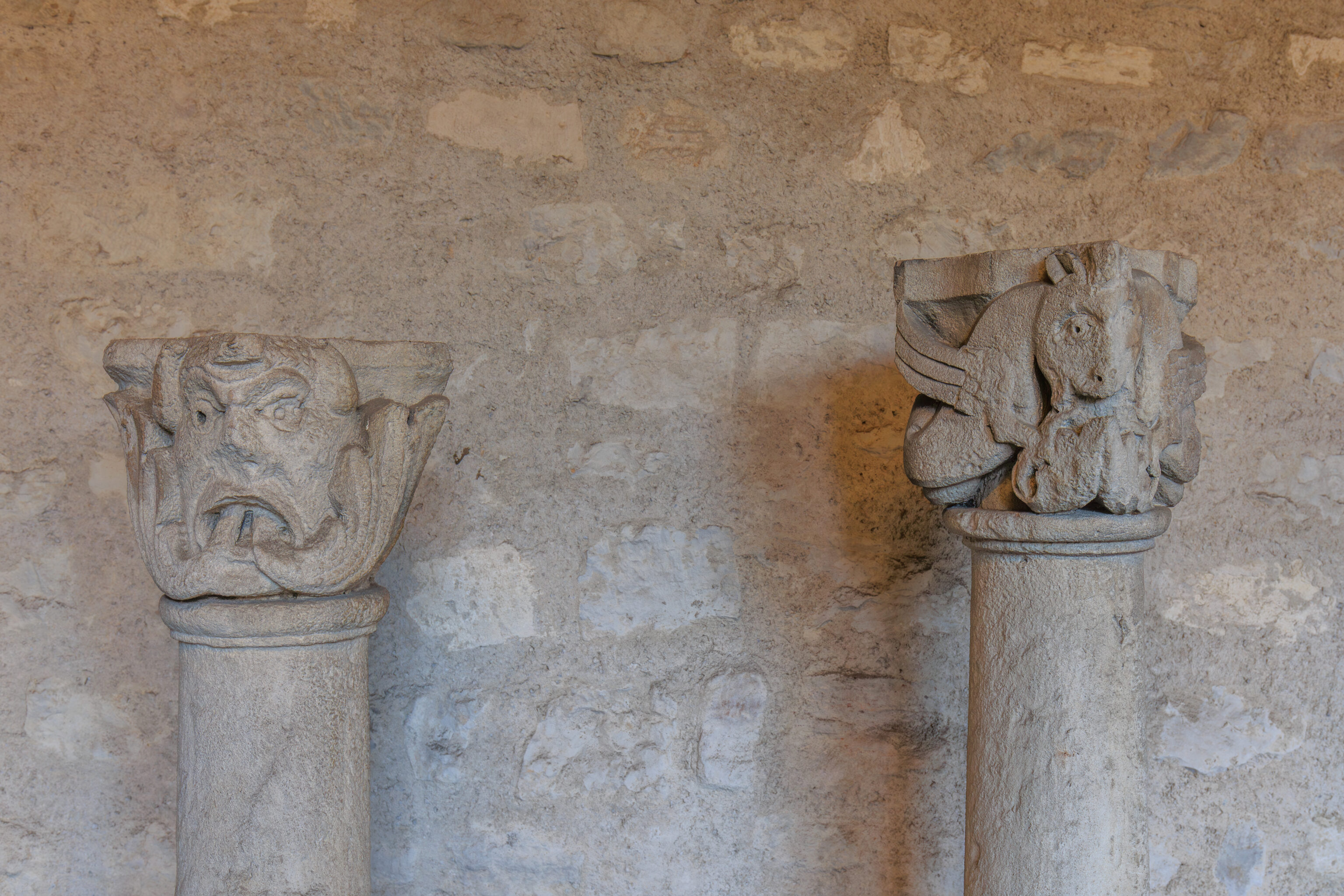
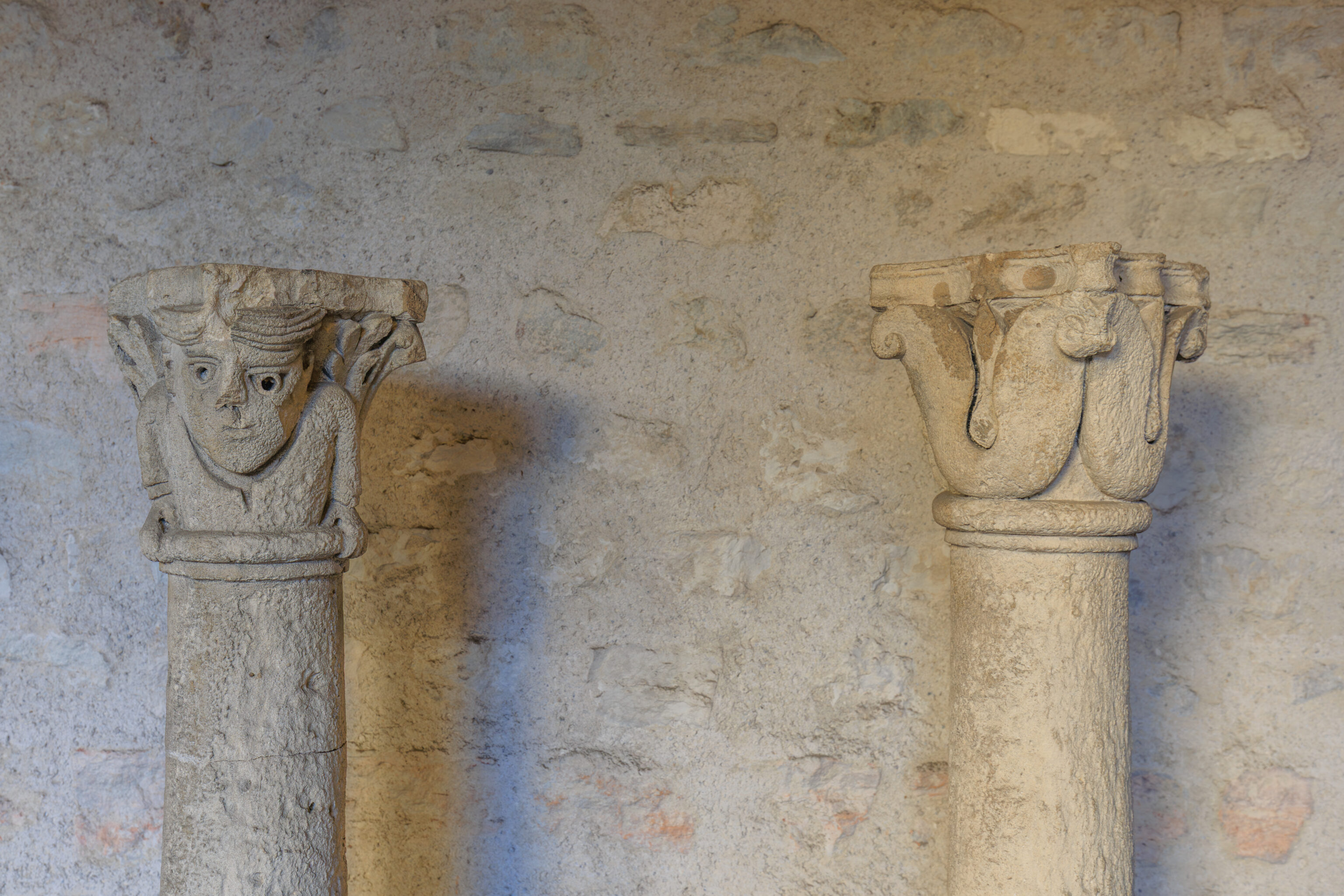
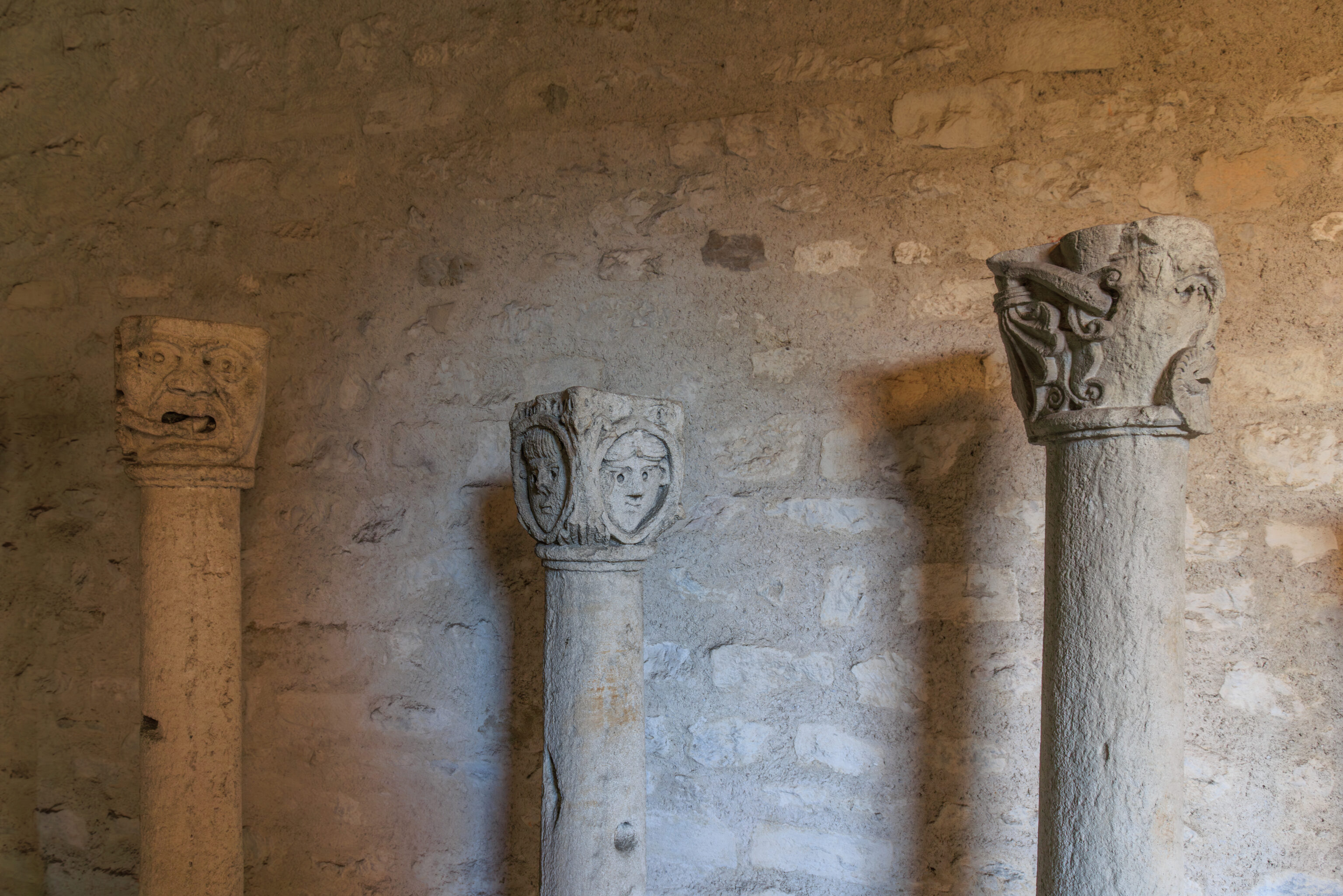
The cloister contains many columns with varied decorative carvings at the top.
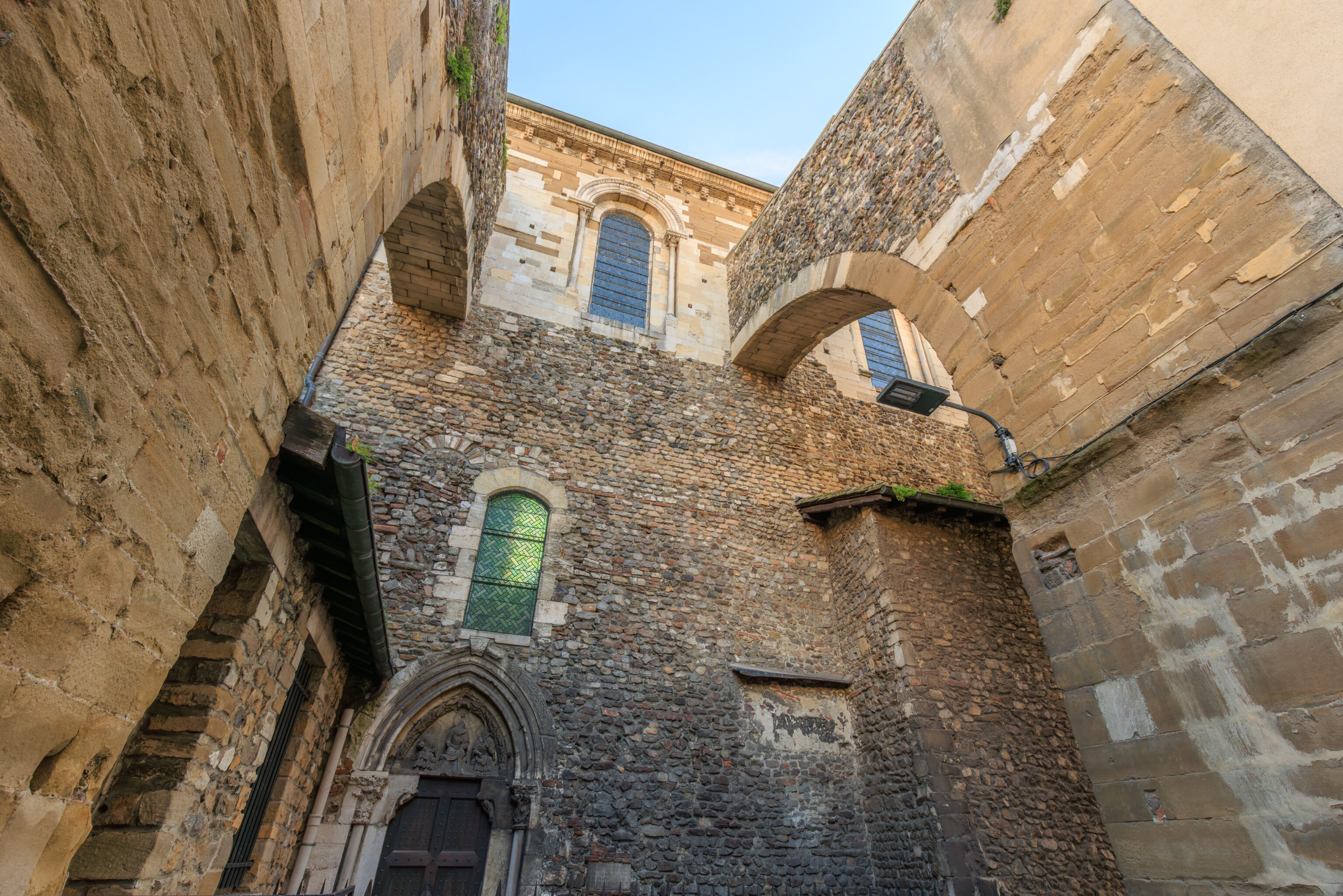
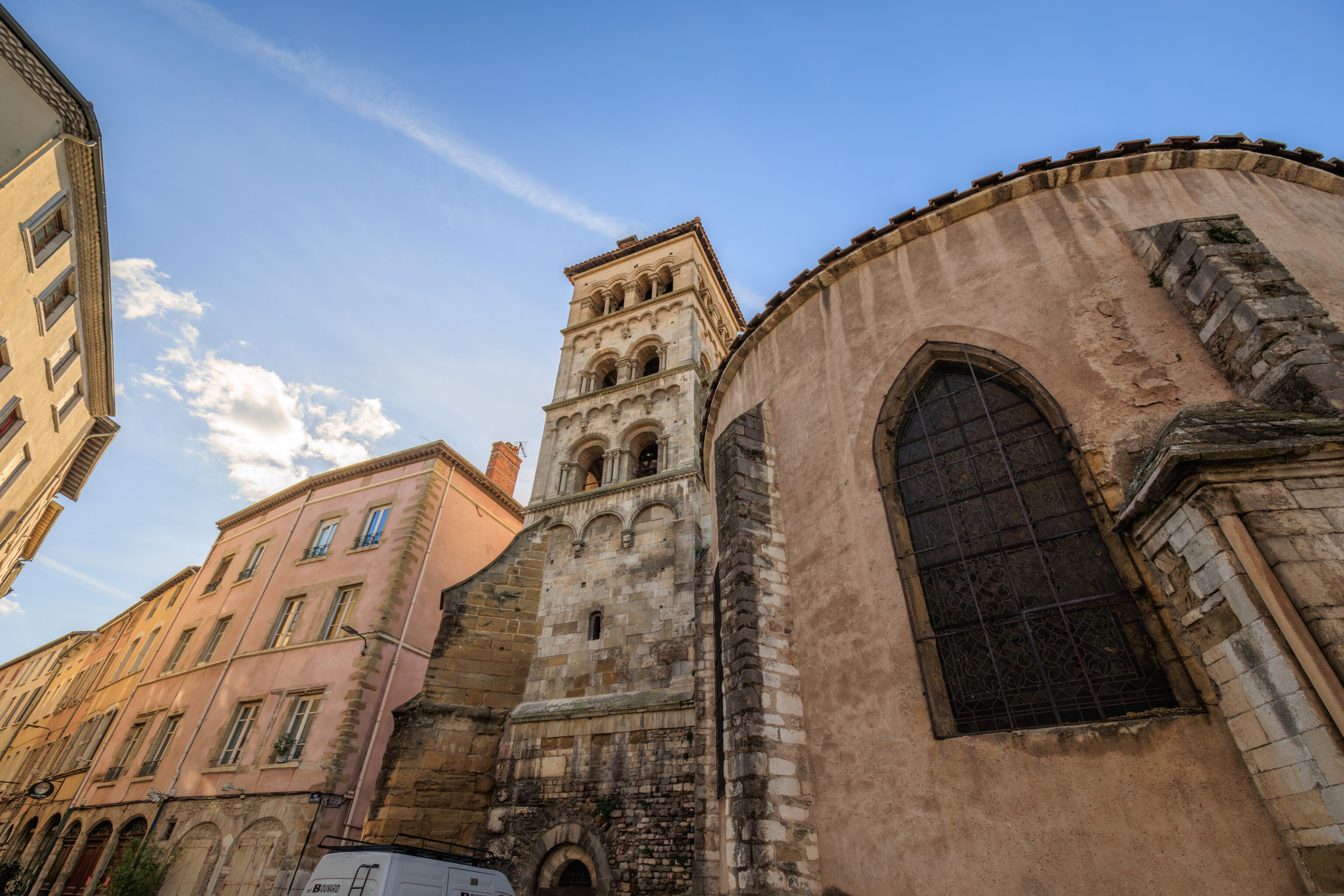
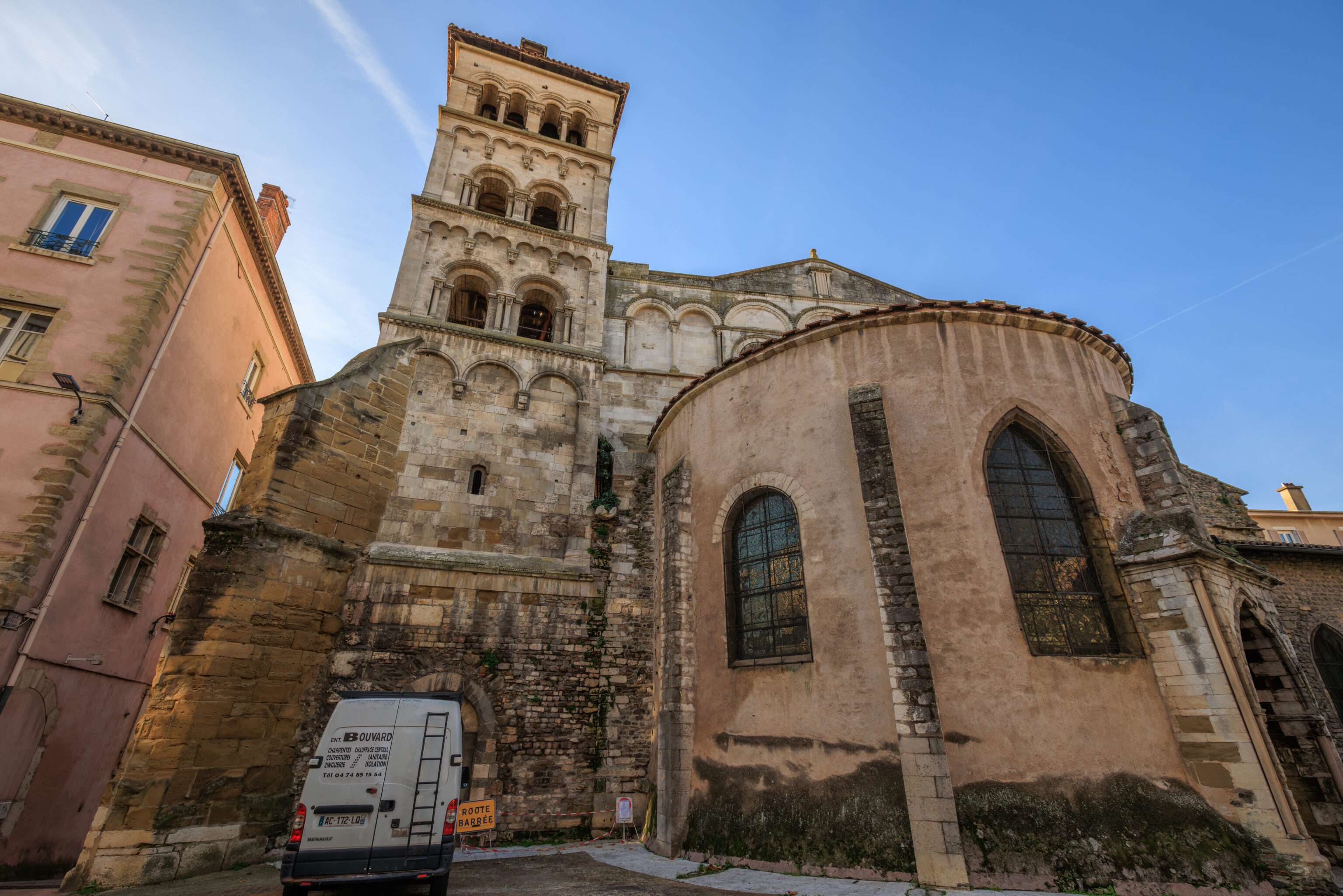
After leaving the museum, we exited to the south and continued on.
Gère
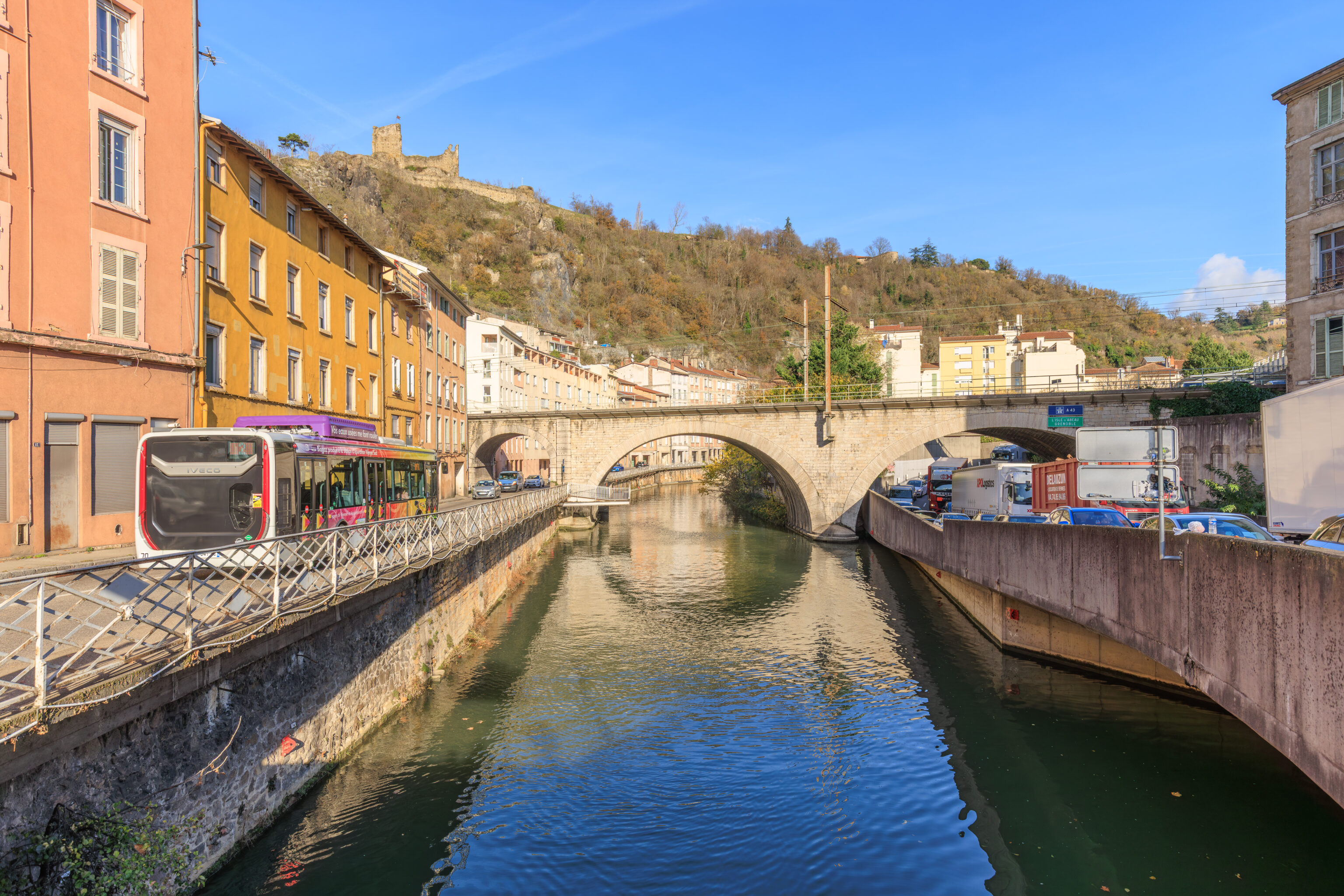
We walked a short distance to the north to reach the river Gère. The Gère flows into the Rhône near the bridge we crossed over.
THE BANKS OF THE GÈRE RIVER AND LA BÂTIE
On Mount Salomon, Jean de Bernin, archbishop from 1217 to 1266, built the Château de la Bâtie and the new city walls, which incorporated sections of the Roman rampart. This location was safer than the episcopal residence near the cathedral. Indeed, the archbishop, count of the city since 1033, did not own the old castles, which belonged to the canons at the beginning of the 16th century, the Sainte-Anne bastion, designed for artillery warfare, was built further east.

The banks of the Gère River provided shelter for boats in case of flooding from the Rhône and the polluting activity of the slaughterhouses. The meat is sold in the butchers' market (rue Teste-du-Bailler, formerly rue des Bouchers).

In the Middle Ages, the old road from Lyon to Provence passed through the small rue des Quatre-Vents (actually rue des Quatre Voies), the Gère bridge, and rue de l'Éperon. The violent floods of the Gère River led the consuls to build the quays of Gère as early as the 16th century. In the 18th century, the construction of the quays on the Rhône, along with the new Demi-Lune bridge, improved the northern entrance to the city but eliminated several small "ports."

Since 1967, the confluence of the Rhône and the Gère has been obscured by the covering of Place Saint-Louis between the two bridges.

VIENNE HERITAGE
– Text from a Vienne Heritage sign, translated using Google.
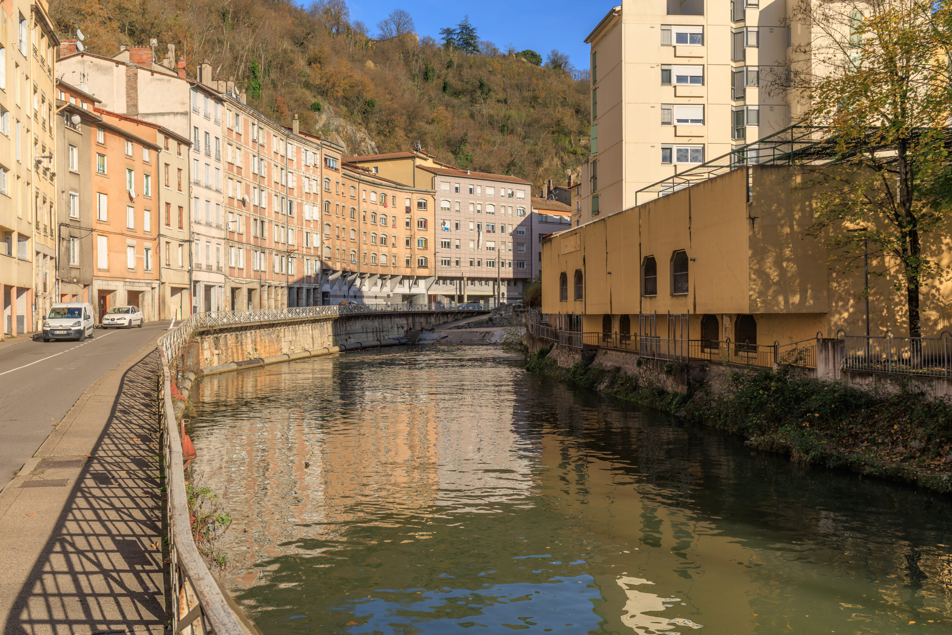
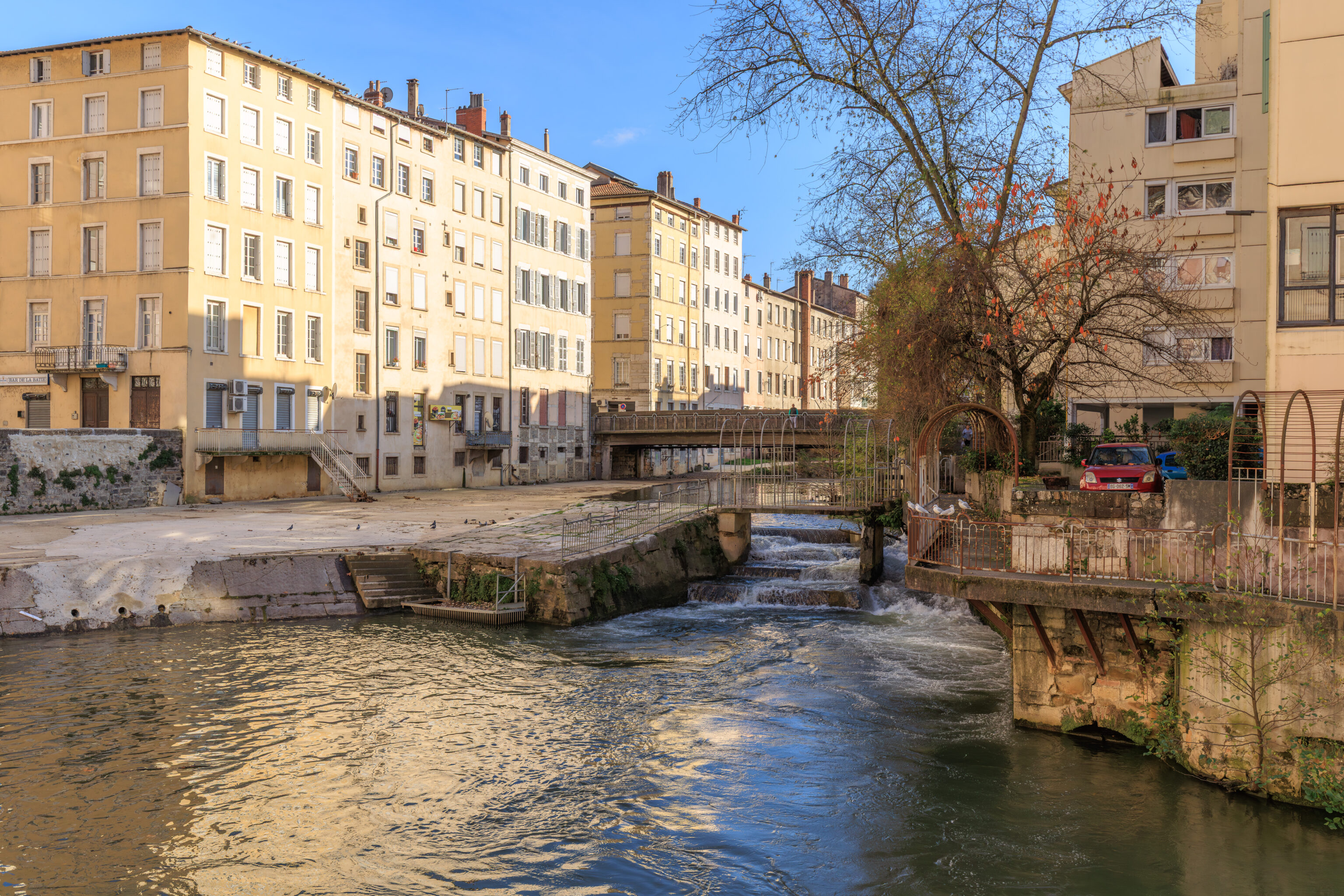
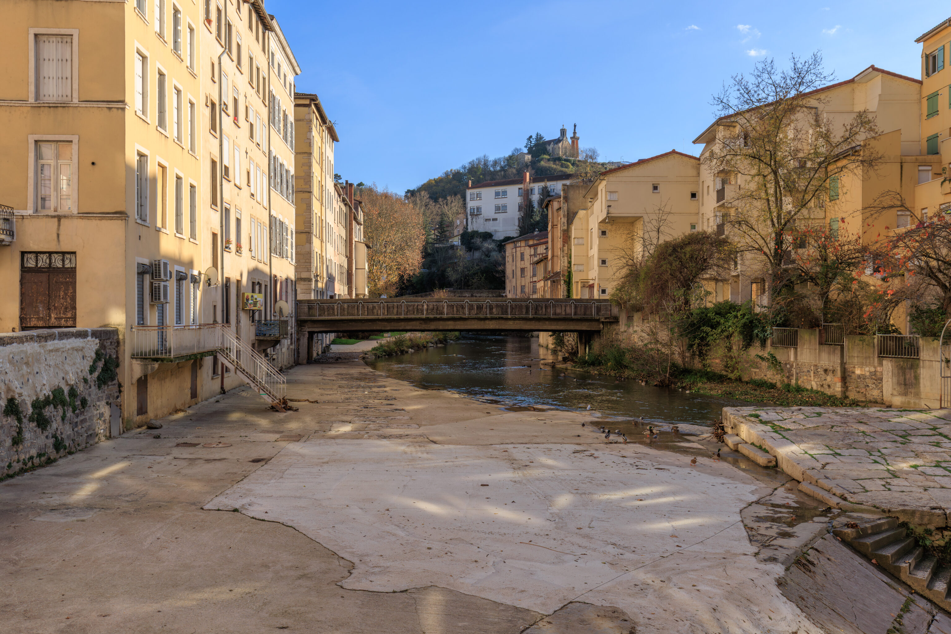
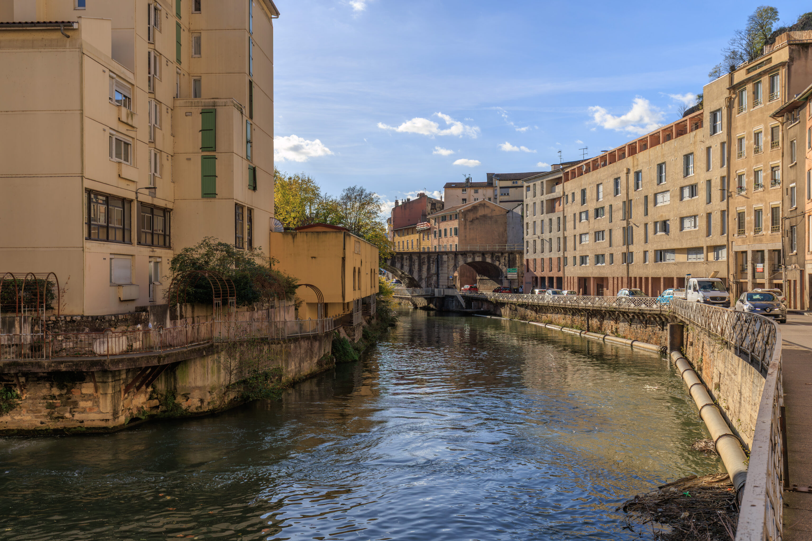
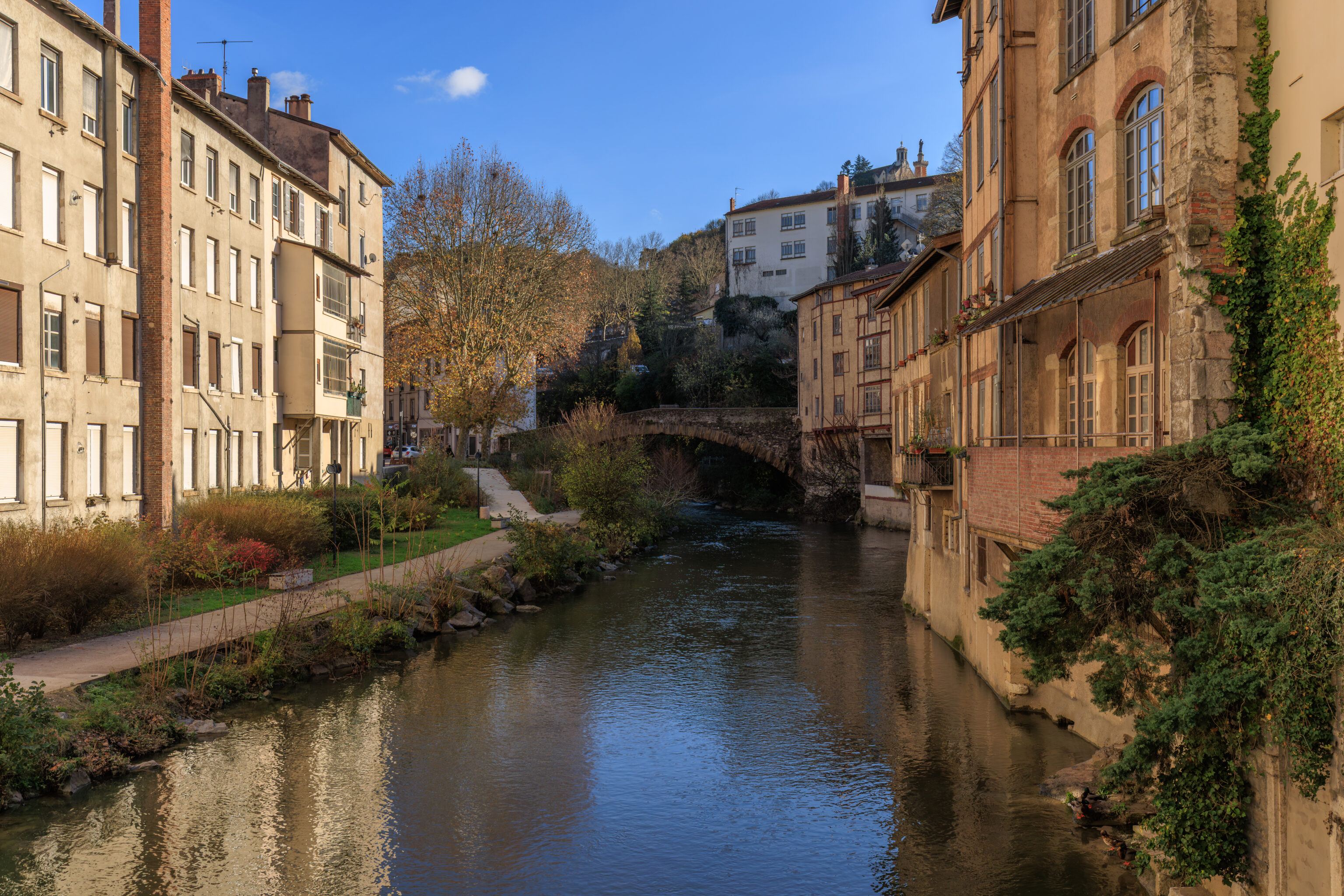
We walked along the northern bank of the Gère.
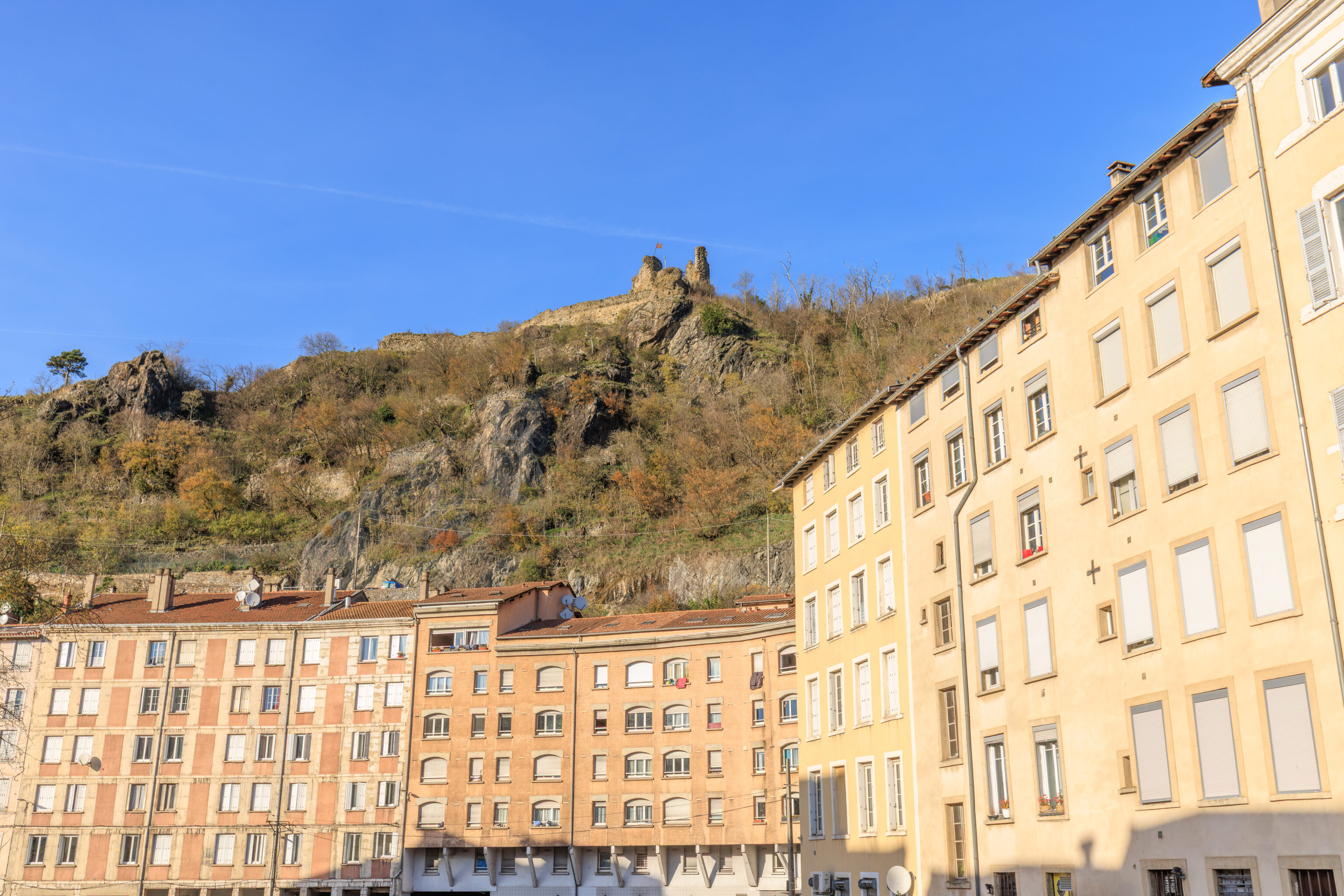
The river runs below the Château de La Bâtie. This is about as close as one can get without being higher up.
We were a bit hungry and decided to visit a boulangerie, Fournil’in. We actually were intending on visiting a different boulangerie further down the road but ended up here due to not paying attention to the shop’s name or our exact location. How many boulangeries could there be here in this little neighborhood? Apparently more than one!
We got a strawberry croissant and some cheese pastry. We had the cheese pastry heated. It was terrible. The strawberry croissant was much better, but not really French good. Unfortunately, while woman running the shop was friendly, this is a place to skip. The Google Maps reviews aren’t great either with a 3.5 overall rating and many 1 star reviews.
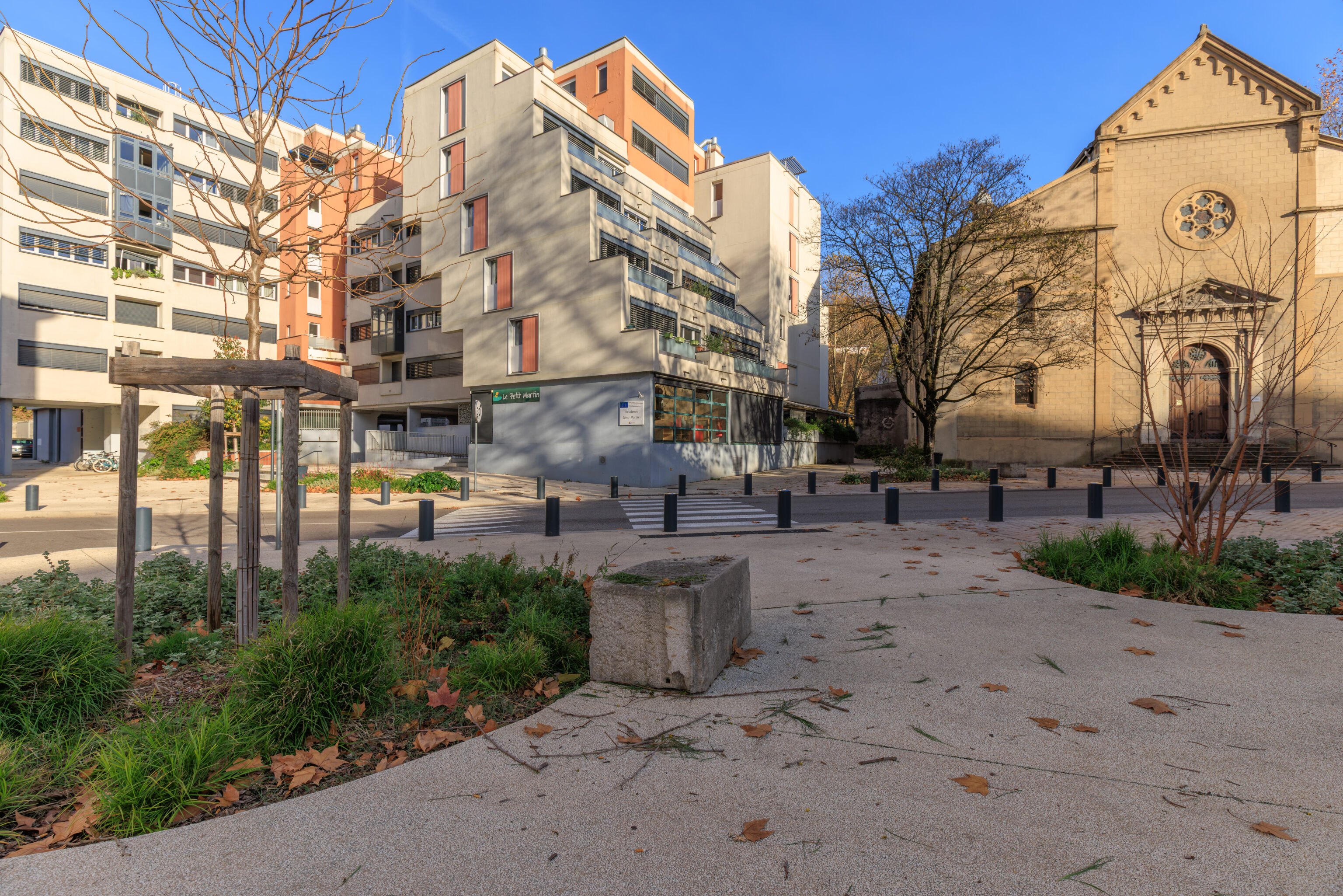
This was an interesting looking residential building that we walked by. Across the street, where we are standing, there were some benches as well as informational signs.
THE GÈRE VALLEY FROM ANTIQUITY TO THE RENAISSANCE
During Roman times, the Gère Valley was an urbanized area along the main Alpine road. Near its confluence with the Rhône, houses with mosaics stood alongside monumental complexes (such as the Faun's Hall). Throughout the valley, craftsmanship is evidenced by workshops and hydraulic structures. In Late Antiquity, religious establishments were founded, and craftsmanship continued to thrive.

The Gère Bridge (Place Saint-Louis) existed in Roman times at the start of the road to Lyon; other bridges are mentioned in the 10th century. The Saint-Martin Bridge was restored by Archbishop Jean de Bernin (1217-1266). Destroyed by a flood in 1381, it was rebuilt in 1400. A stone cross stood in the middle, the base of which can still be seen. A square tower, the Rochette Gate, commanded it to the south; it was demolished in 1648.

In the Middle Ages, housing and crafts retreated within the walls, defended to the north by the Serpaize Gate and to the east by the Fûterie Gate; beyond, on the road to Grenoble, a suburb was defended by the Orose or Servageot Gate (Place Louis-Revol). A hospital was founded in 1265 near the Church of Saint-Martin. The banks of the Gère River were home to a variety of activities: inns, slaughterhouses, mills, forges... Houses from this period are preserved on Rue du Port-de-l'Écu, Rue de la Petite-Cocarde, and along the Gère riverfront.

VIENNE HERITAGE
– Text from a sign, translated using Google.
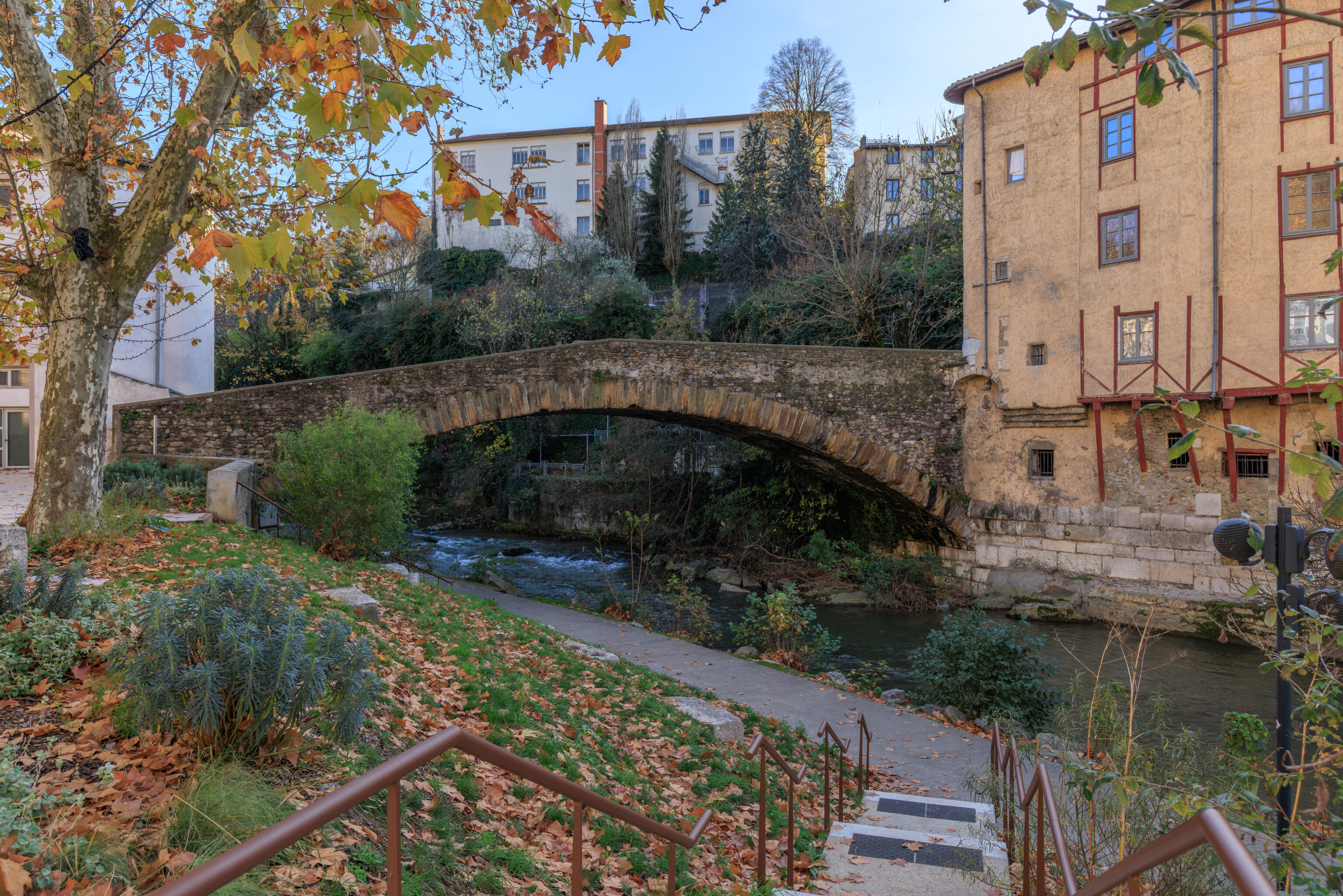
The Saint-Martin Bridge mentioned on the sign quoted above is right here! This bridge was built in 1400.
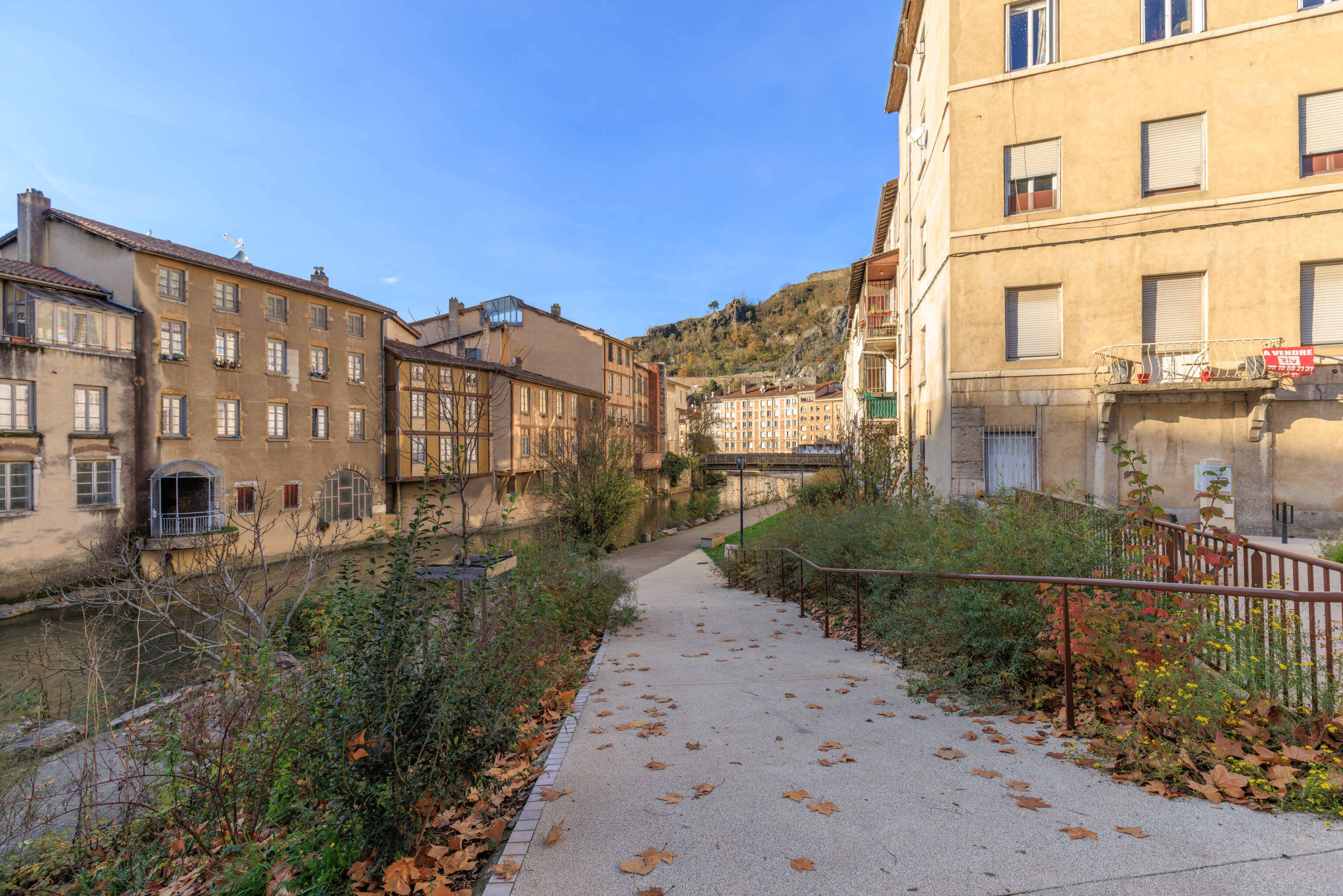
The downstream view.
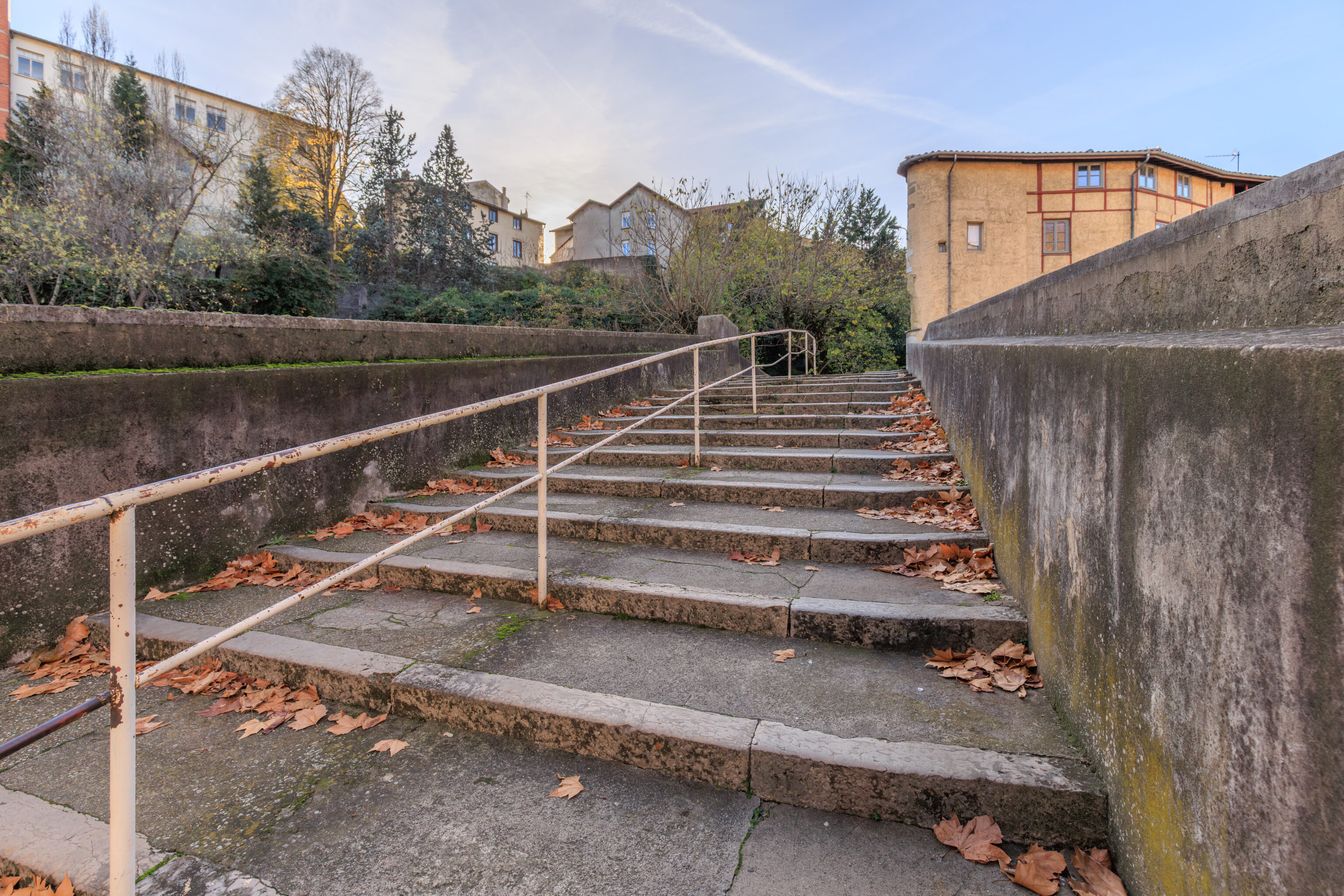
We went to cross over the bridge. The north side consists of stairs and a modern metal railing in the middle.
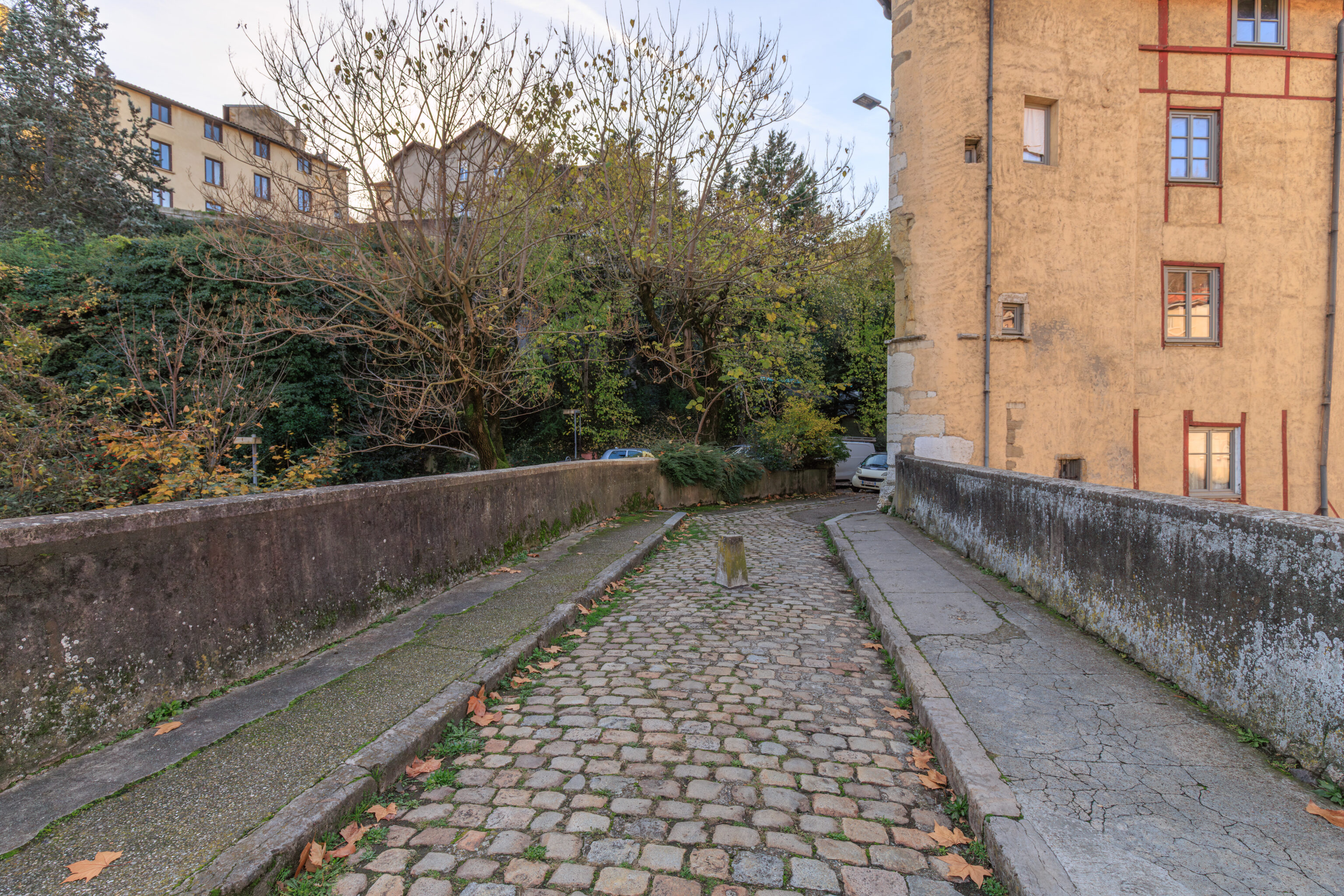
The middle of the bridge has a narrow stone roadway with small sidewalks on either side.
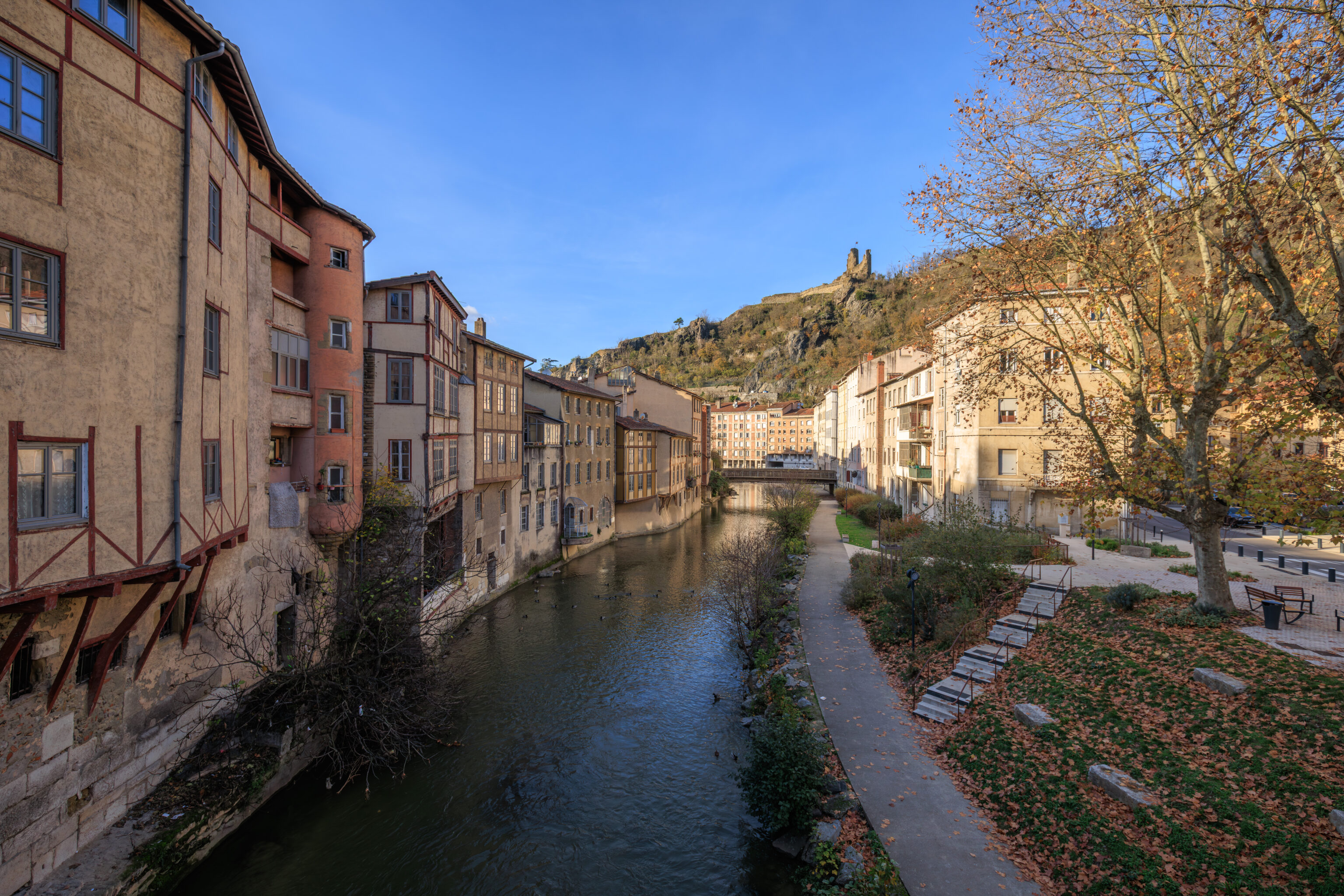
The view looking downstream.
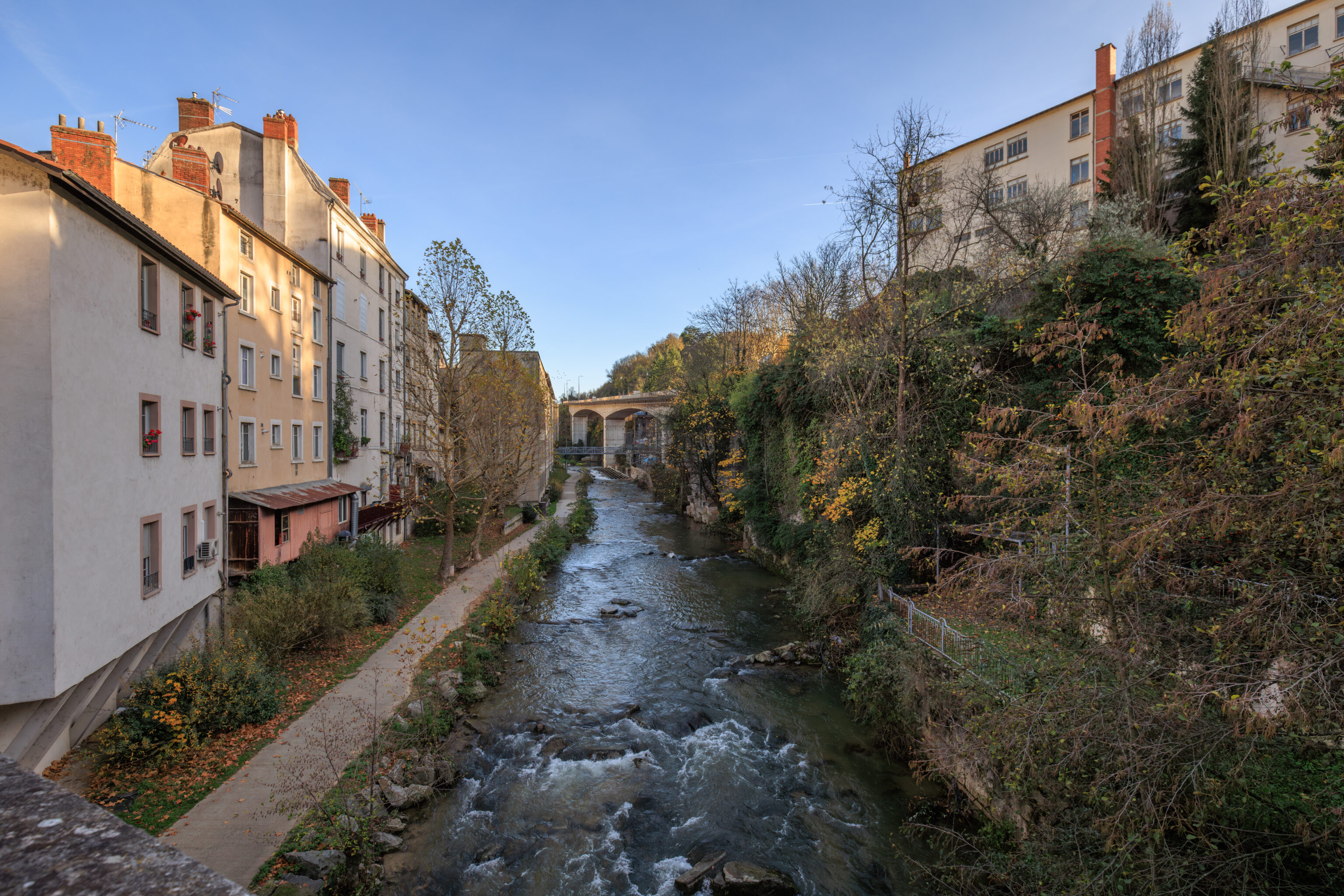
The upstream view.
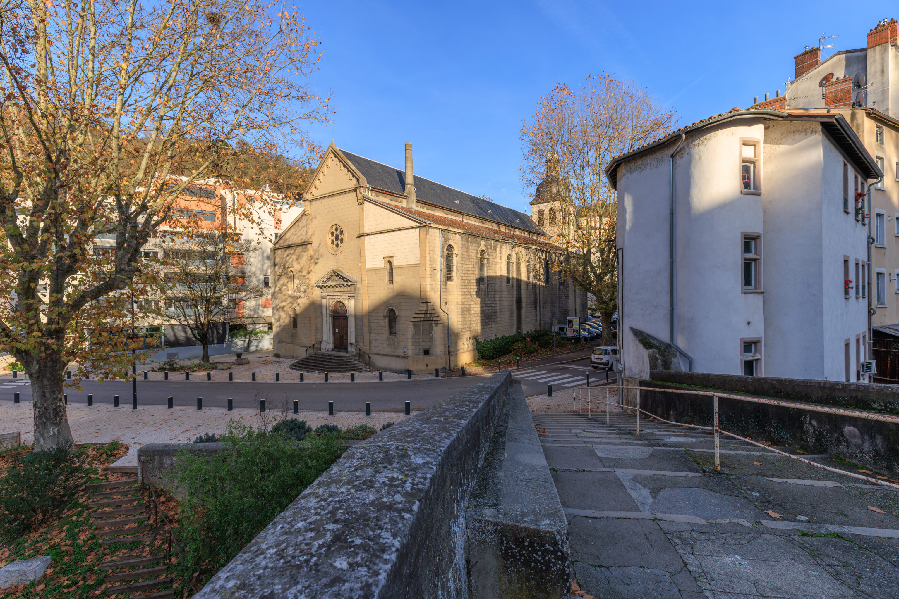
Rather than cross the bridge here, we decided to head back to the north side of the river and continue on.
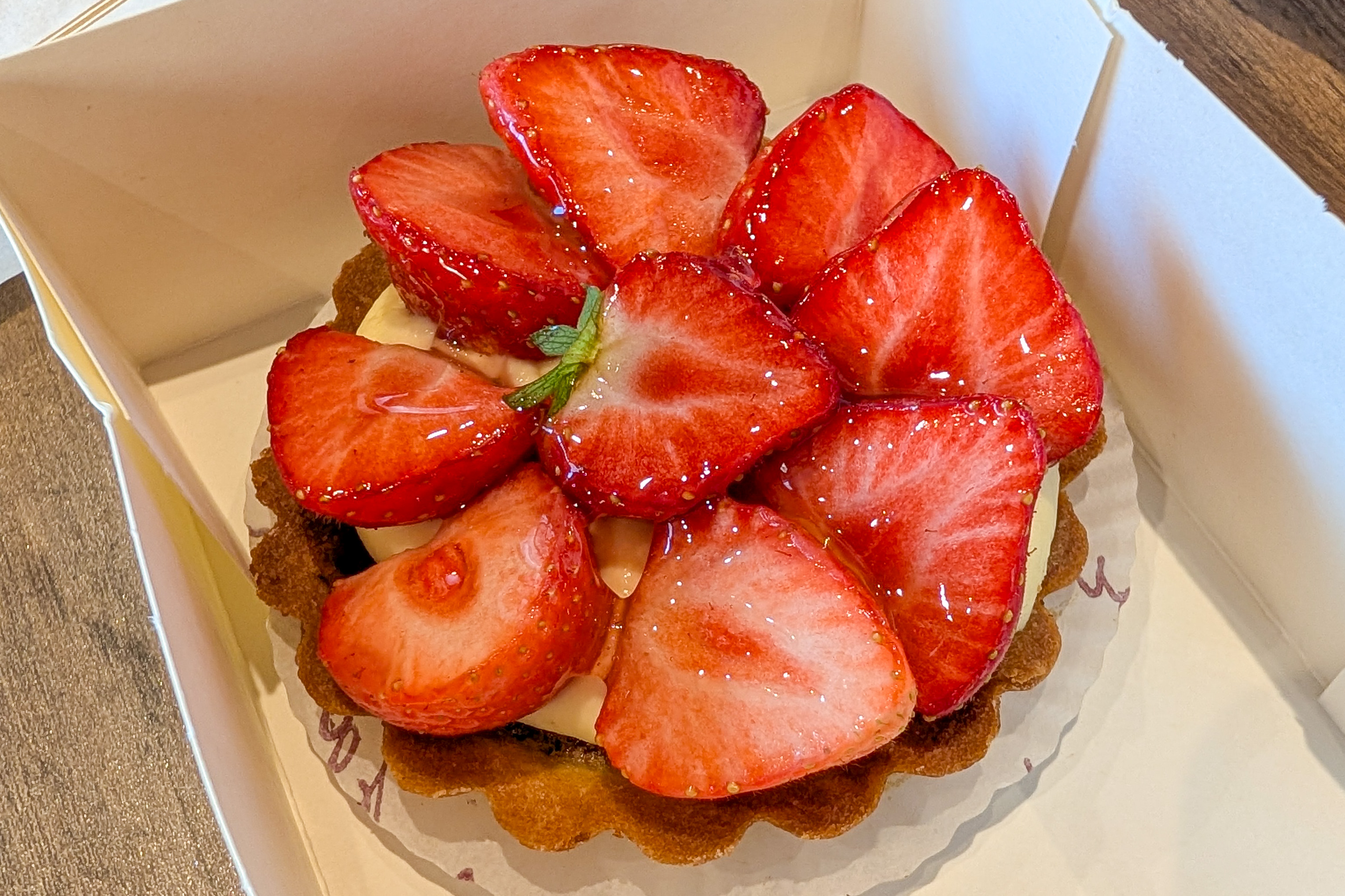
We walked a bit further and decided to visit La Martine, the boulangerie and patisserie that we wanted to visit earlier, and got some snacks. We got a strawberry tart and an unknown pastry. The pastry had a chocolate filling, though it was pretty dry. The strawberry tart was excellent.
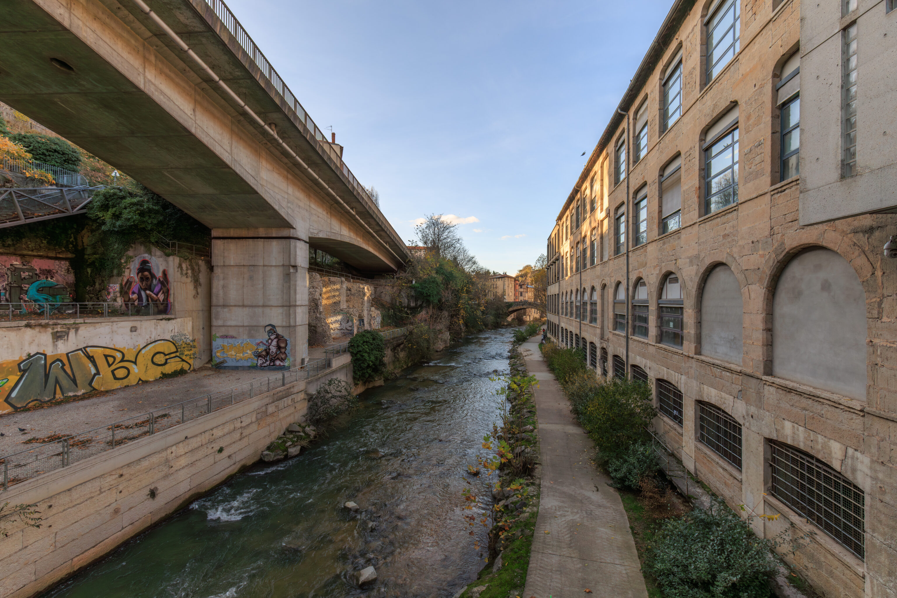
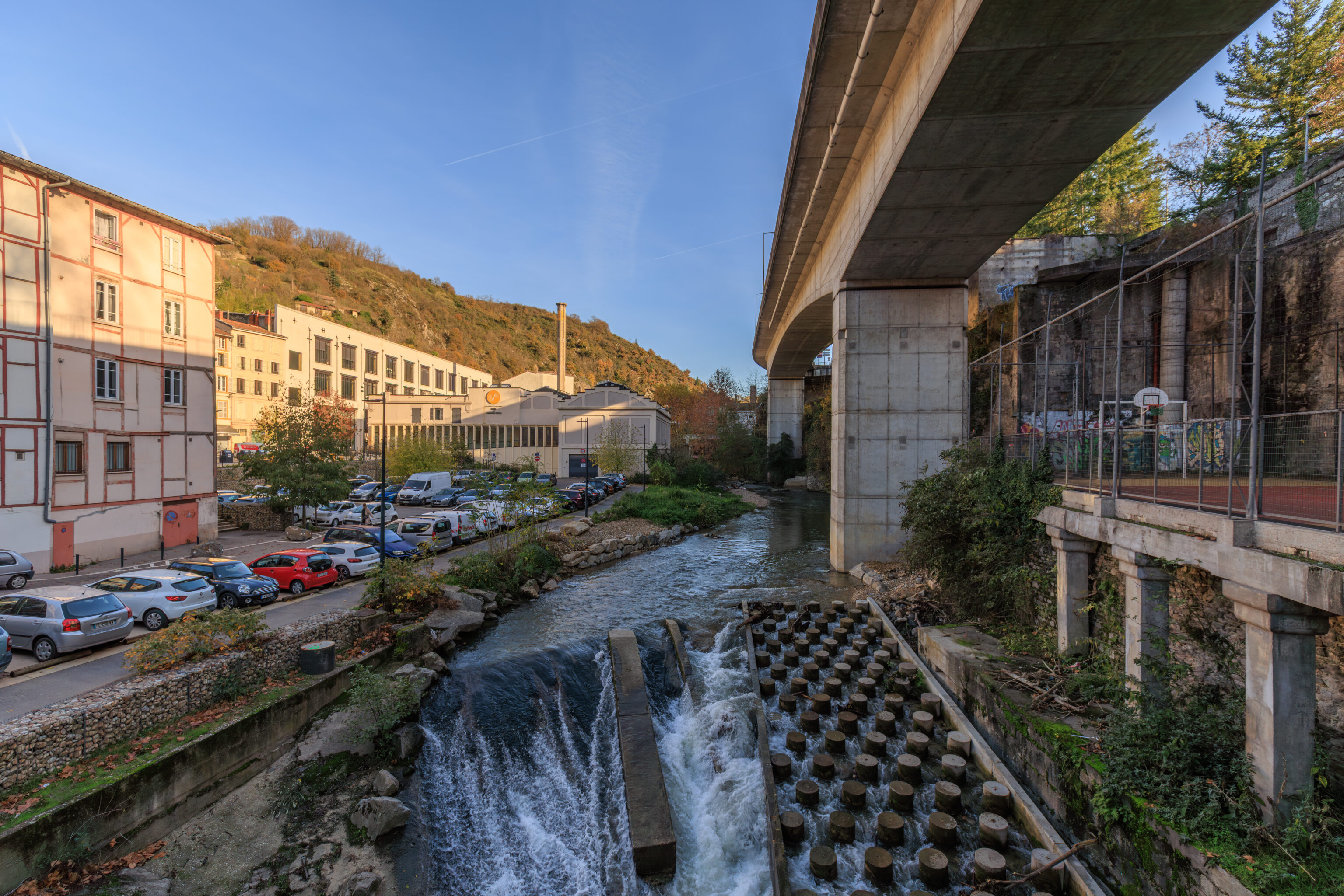
We decided to cross over the river from a pedestrian bridge across the street from La Martine. There is an elevated highway which runs above this crossing.
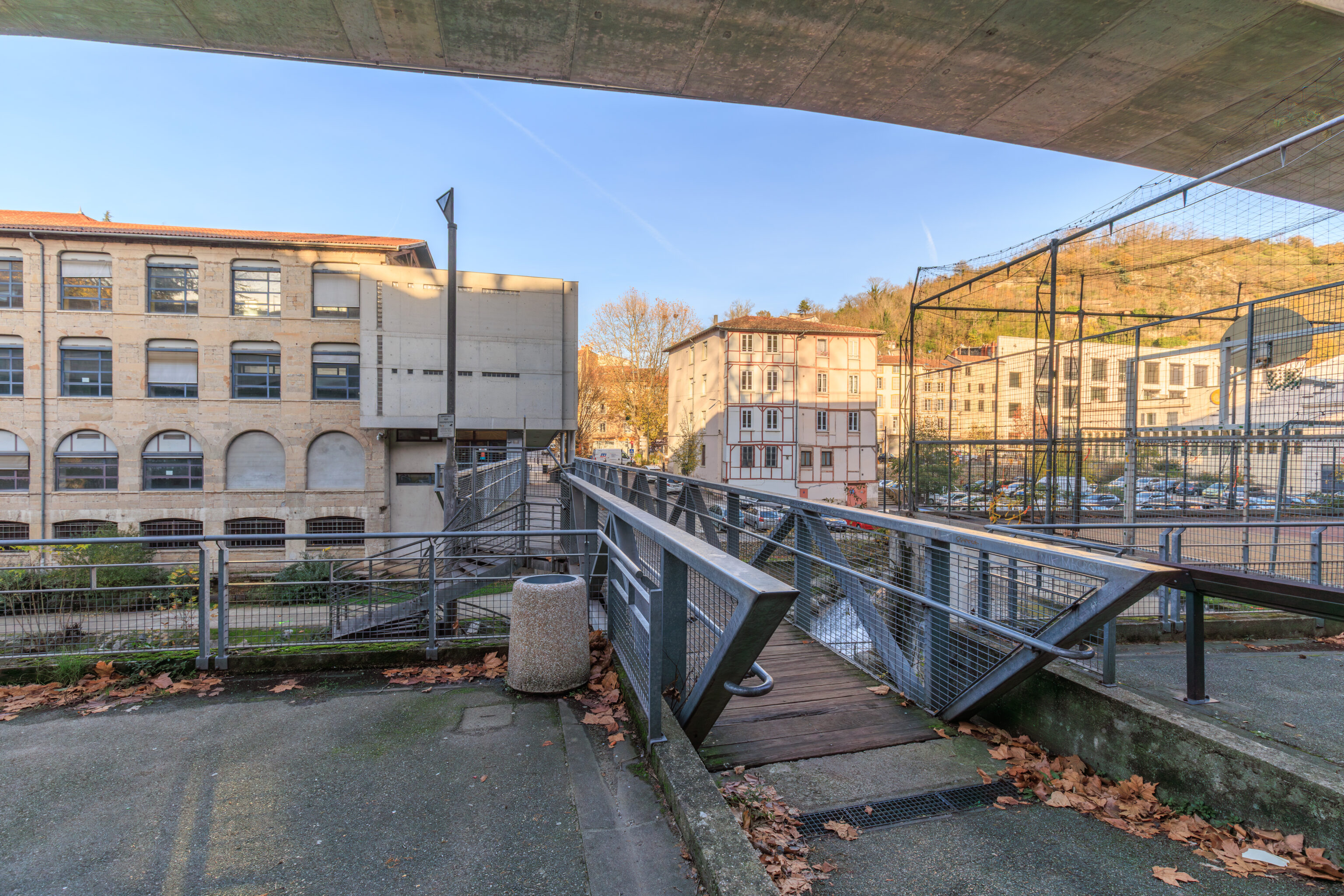
This area isn’t particularly attractive, it is just functional infrastructure to get across the river.
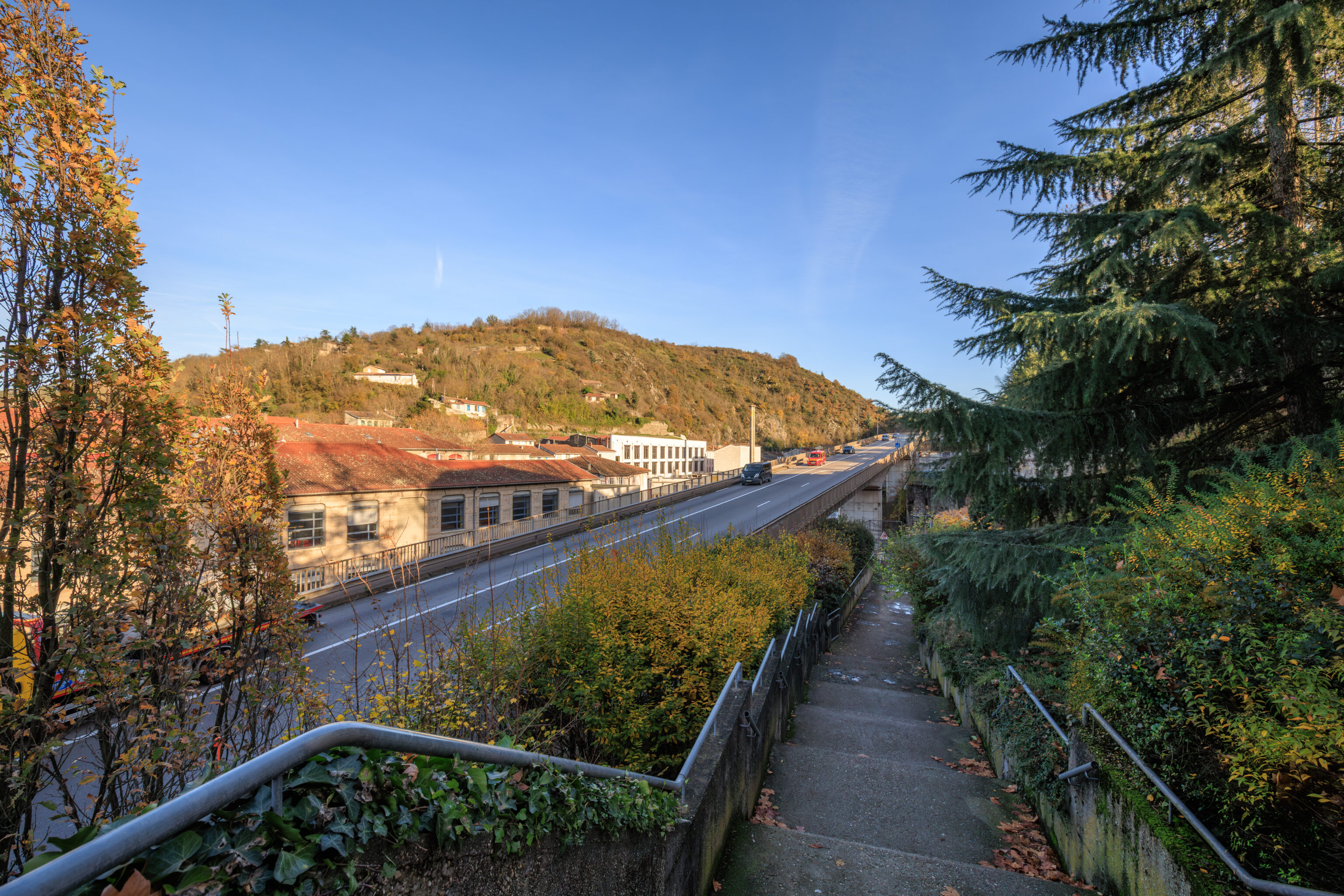
We had to climb up a number of stairs on the far side of the river to get to street level above. From here, near the top, we could see the elevated highway below us.
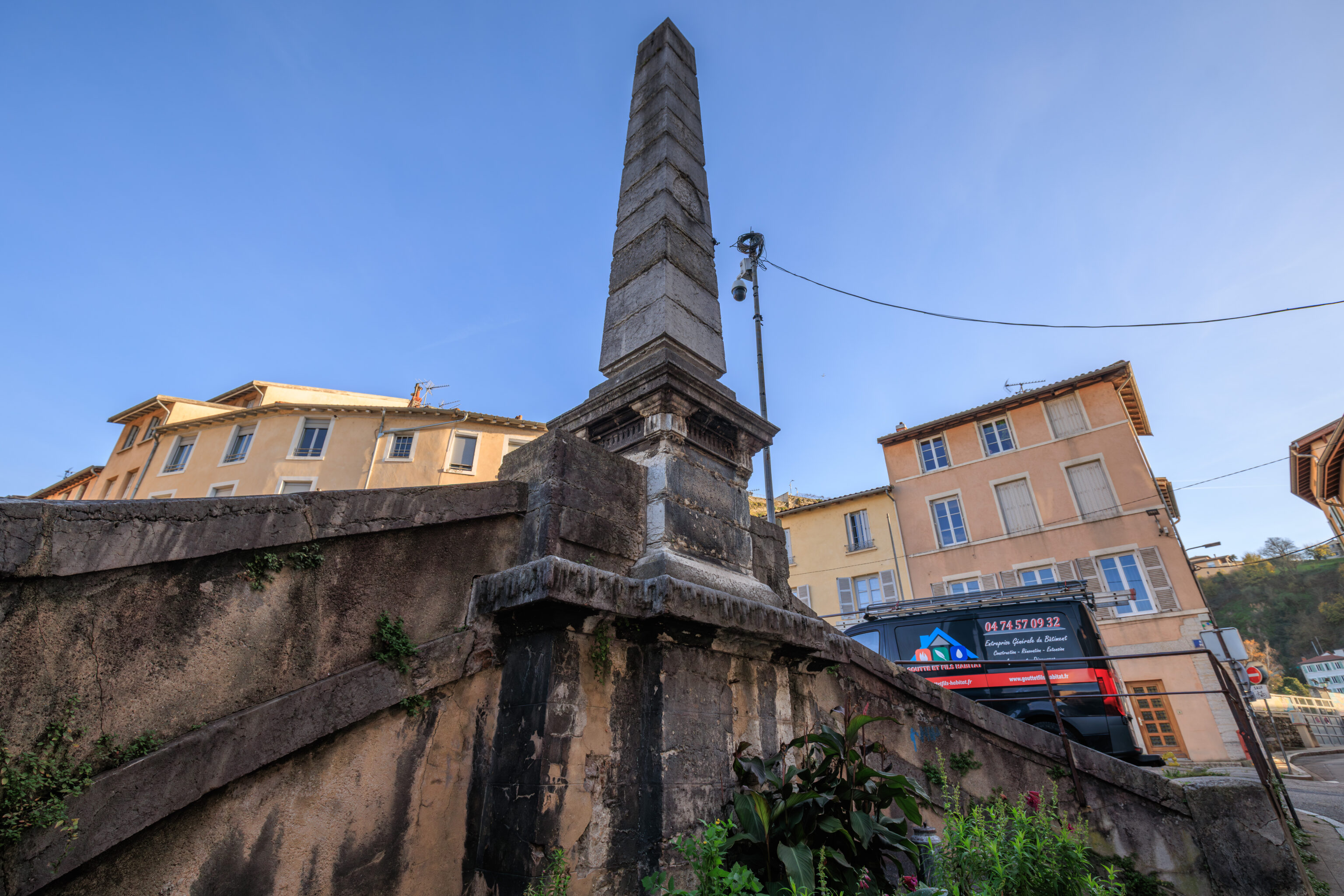
There was an old looking marker at the top of the stairs.
We then walked a few blocks to the south.
Théâtre Antique de Vienne
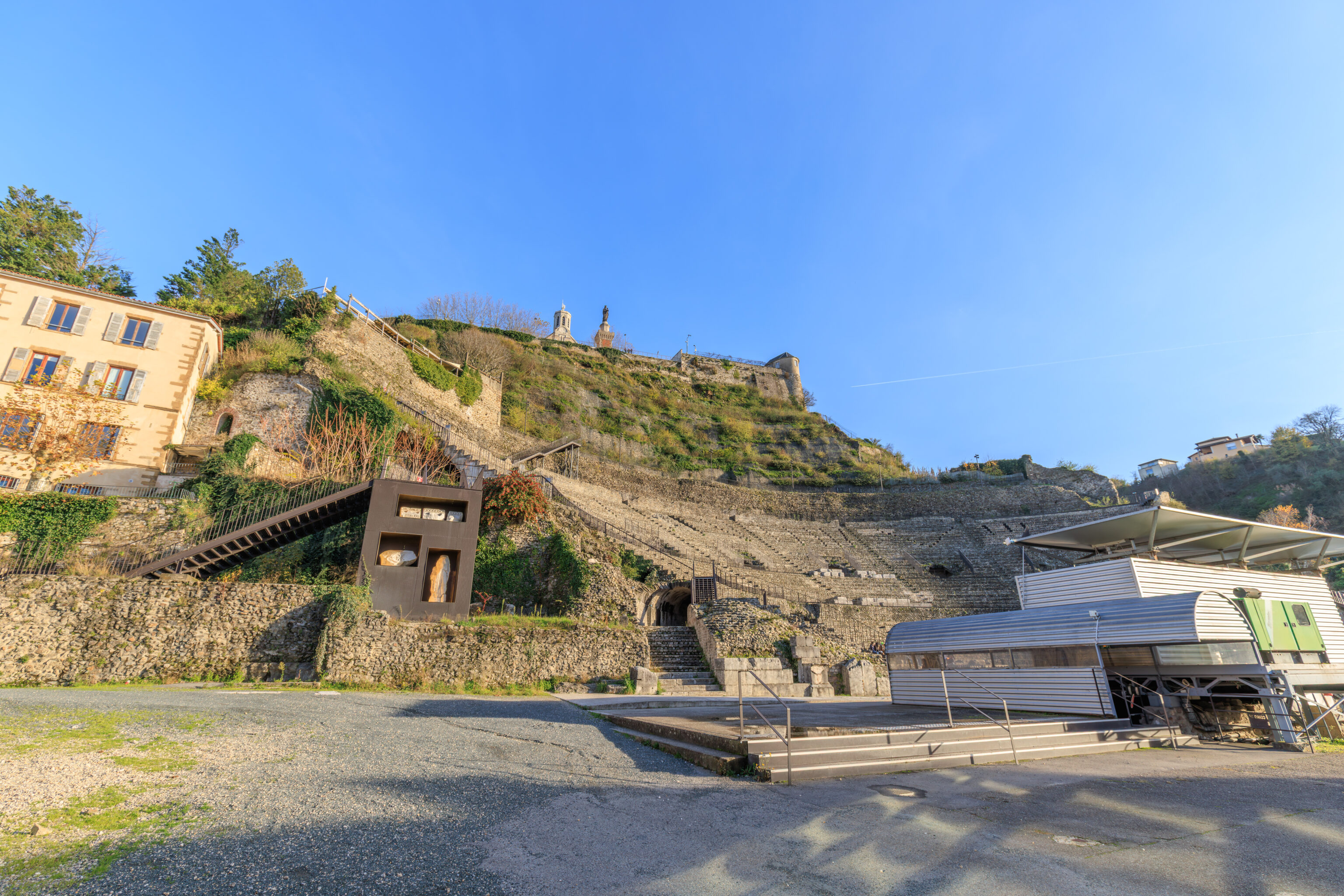
It didn’t take long to reach our next destination, the Théâtre Antique de Vienne. This ancient Roman theatre from the 1st century operates as a musical venue today and also as a museum.
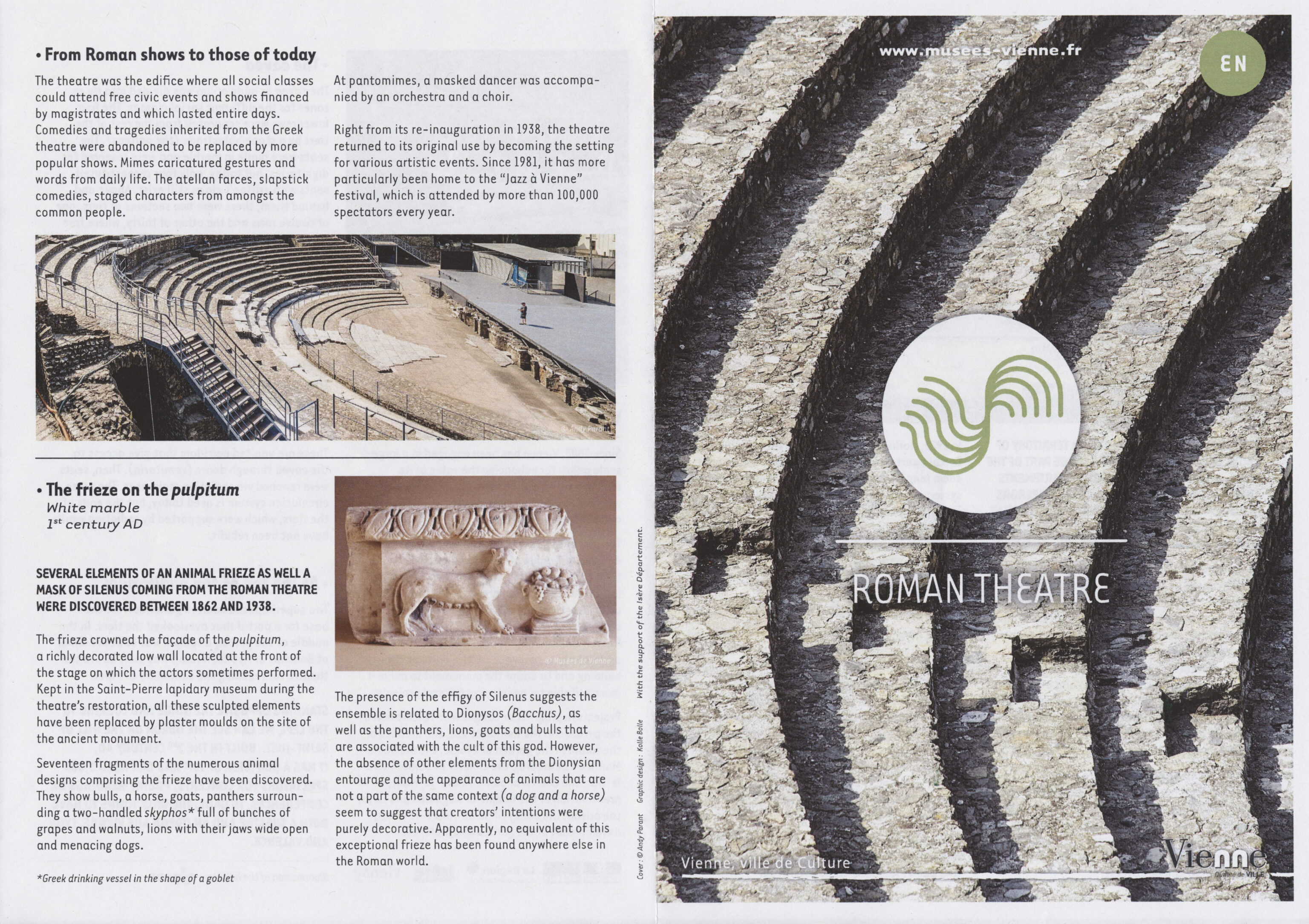
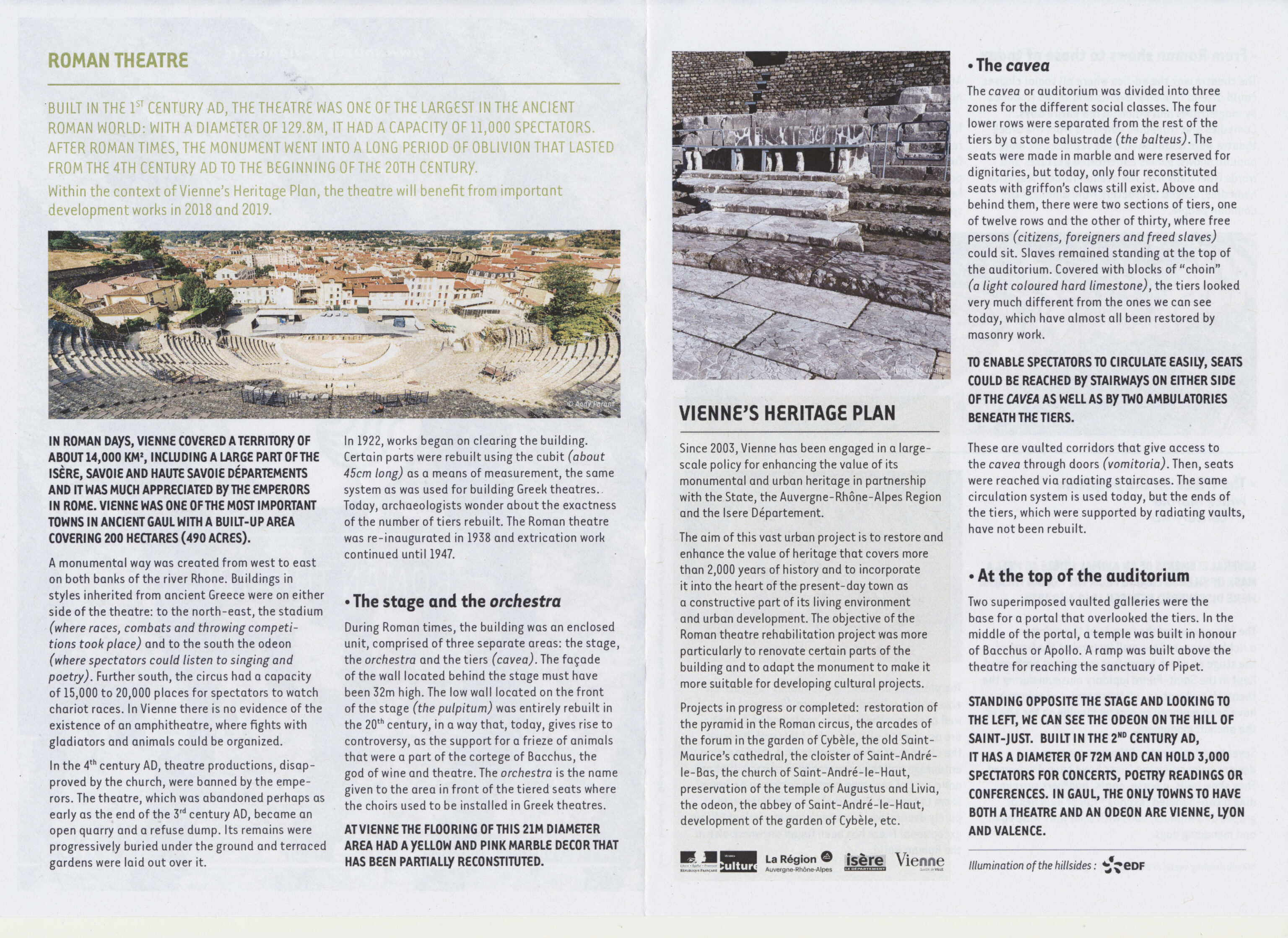
We showed our tickets from the Musée Gallo-Romain to enter. An informational pamplet was provided.
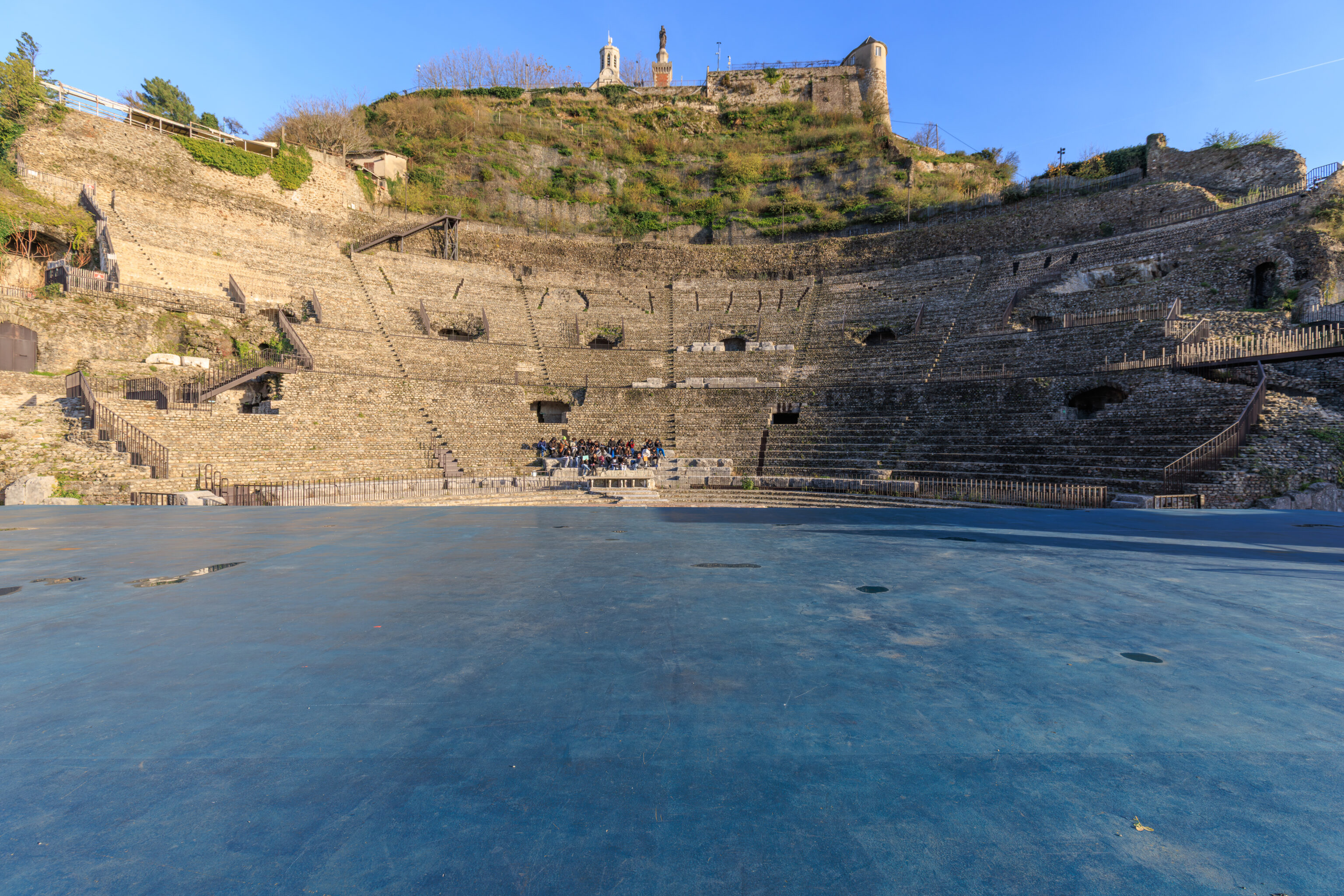
Other that what looked like a school group, seen here seated at center, there was no one else present when we arrived.
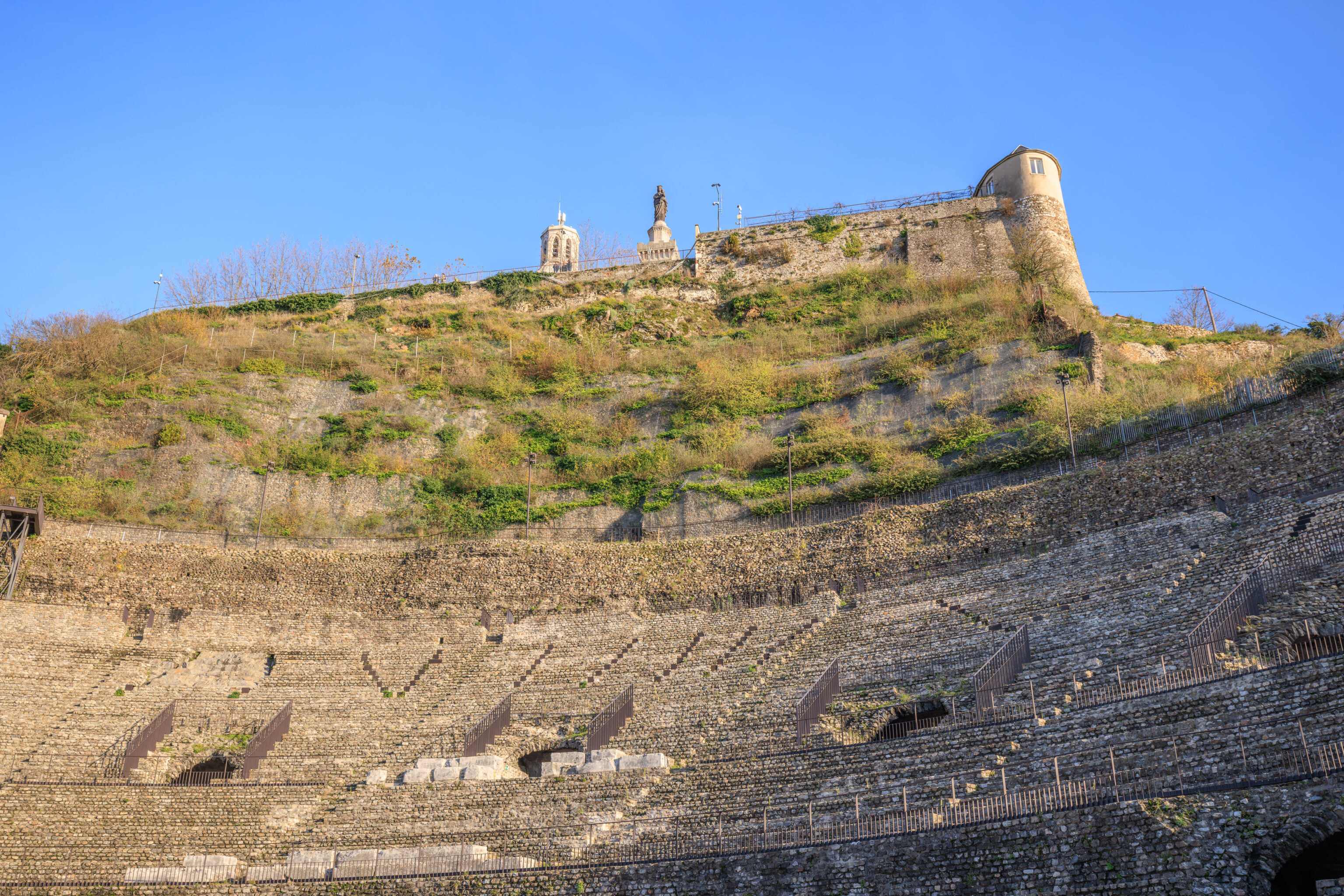
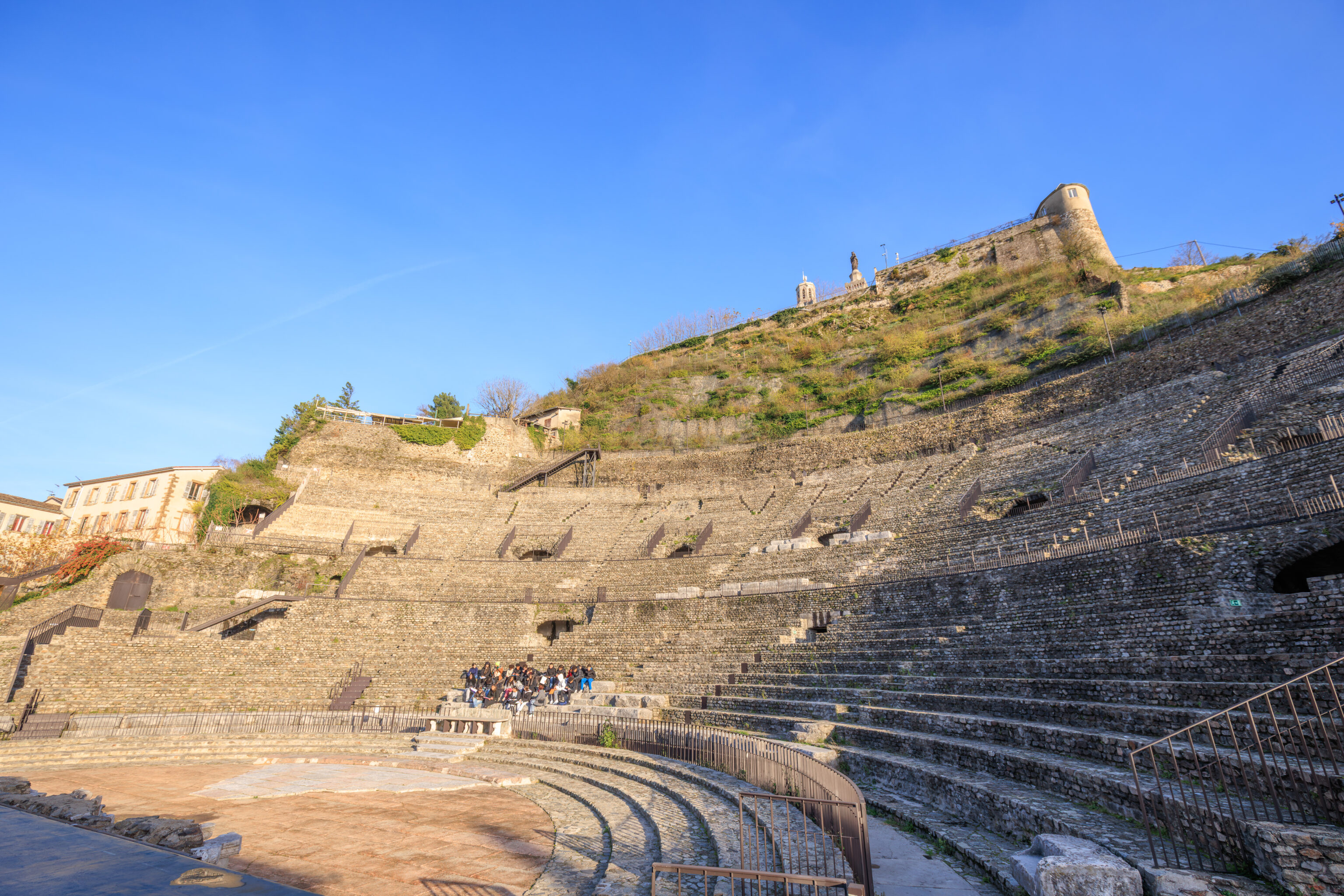
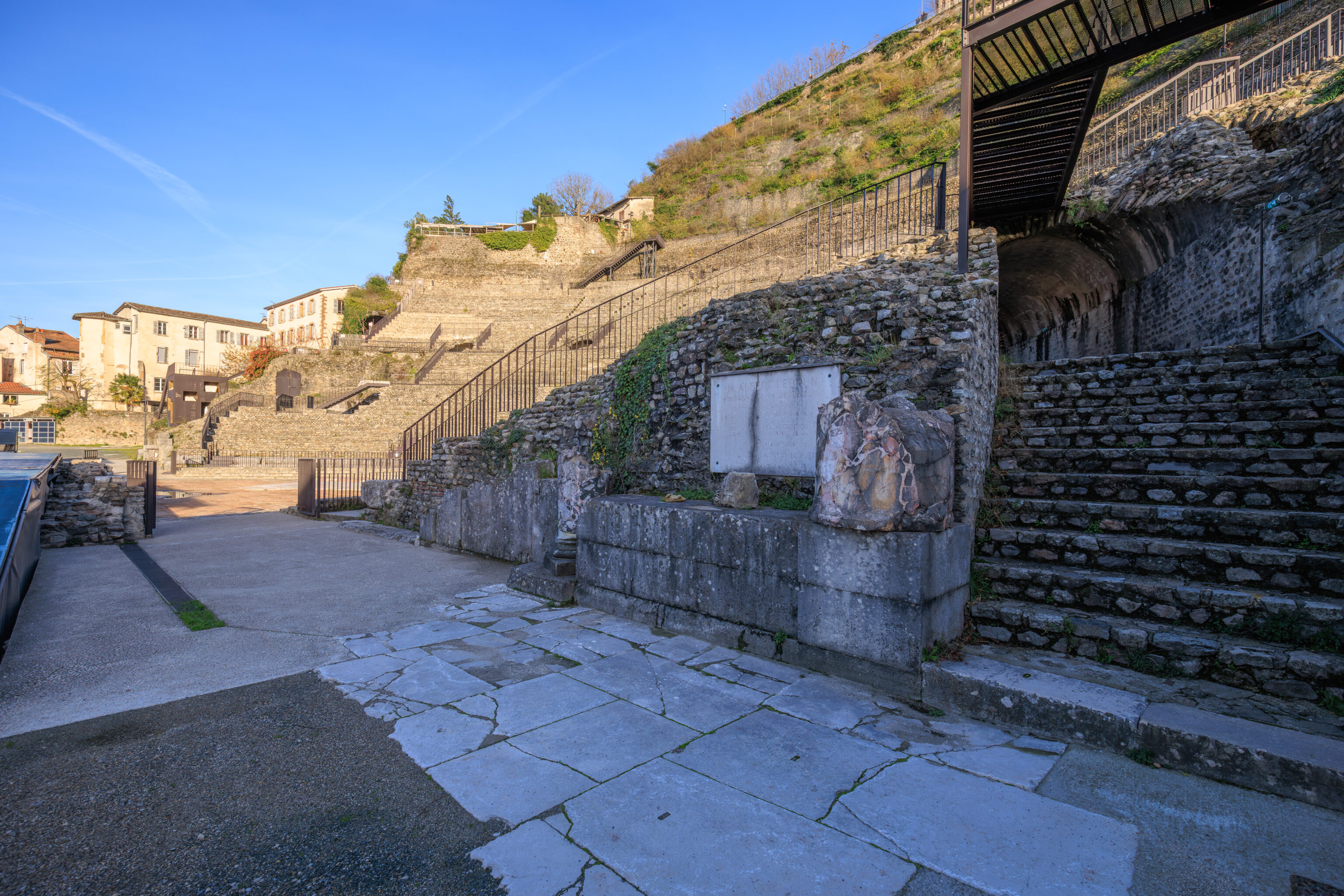
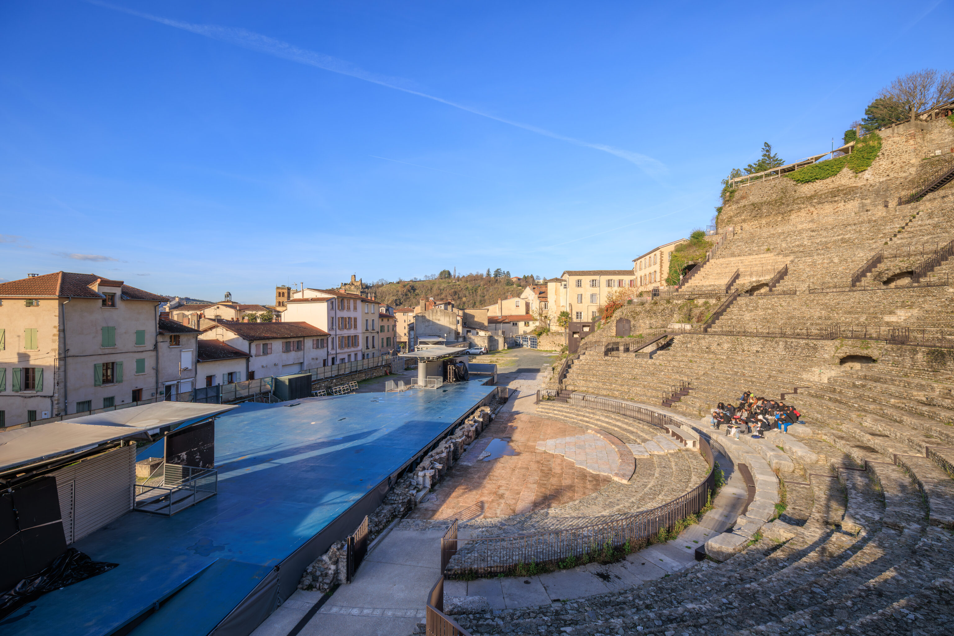
It is possible to walk around the entire seating area, which makes sense as this site is still in use today.
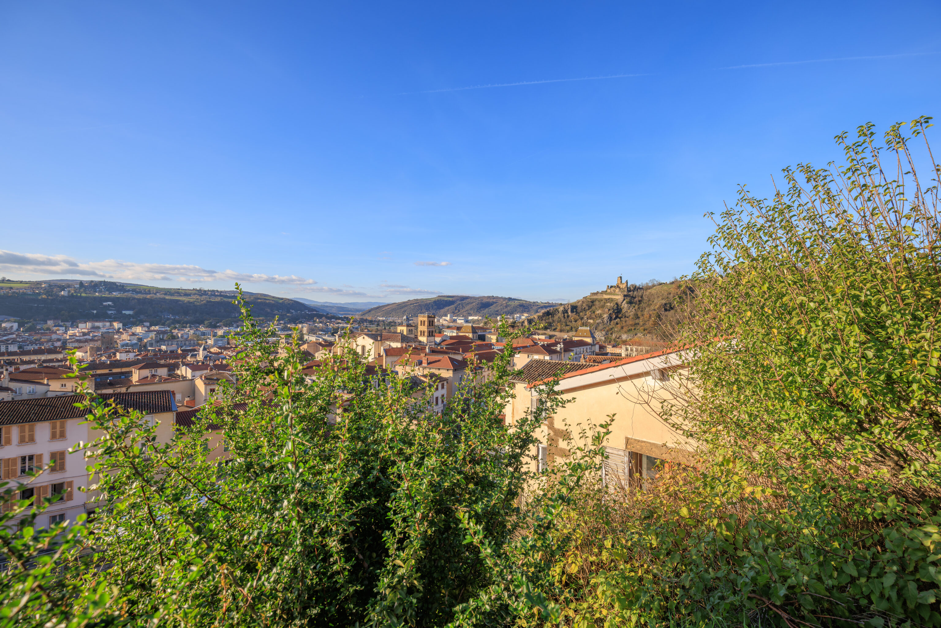
The view from the top to the north towards the Château de la Bâtie.
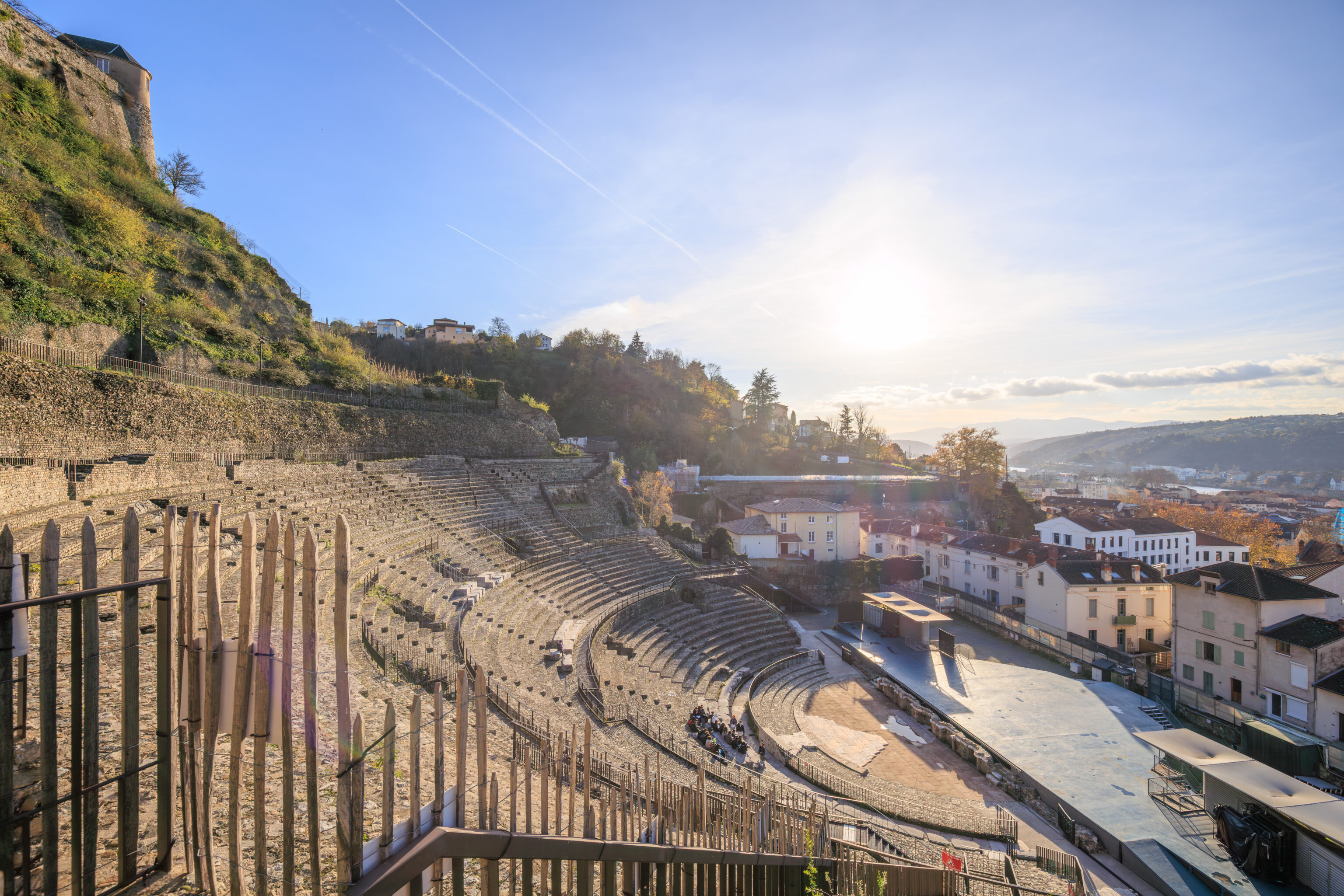
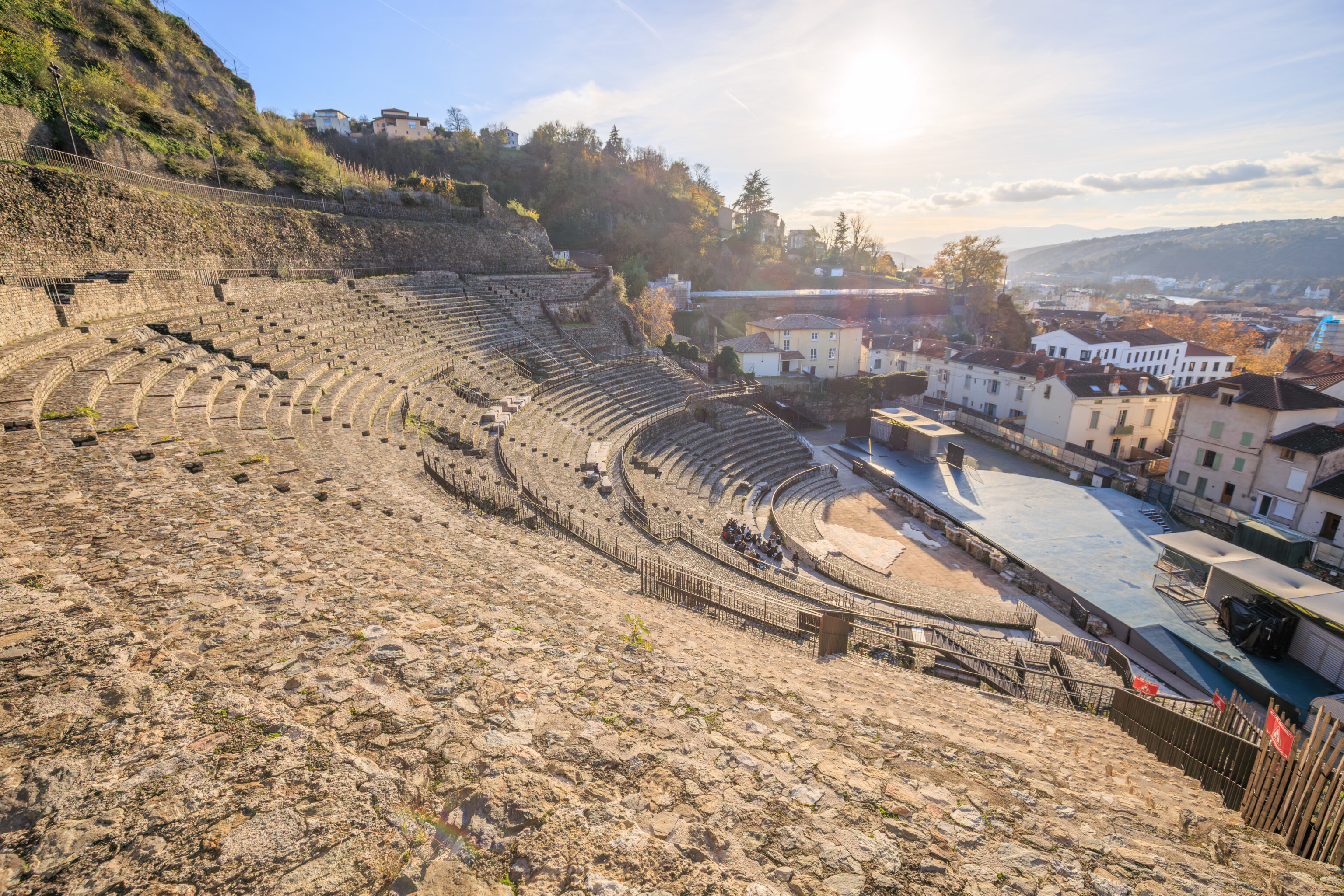
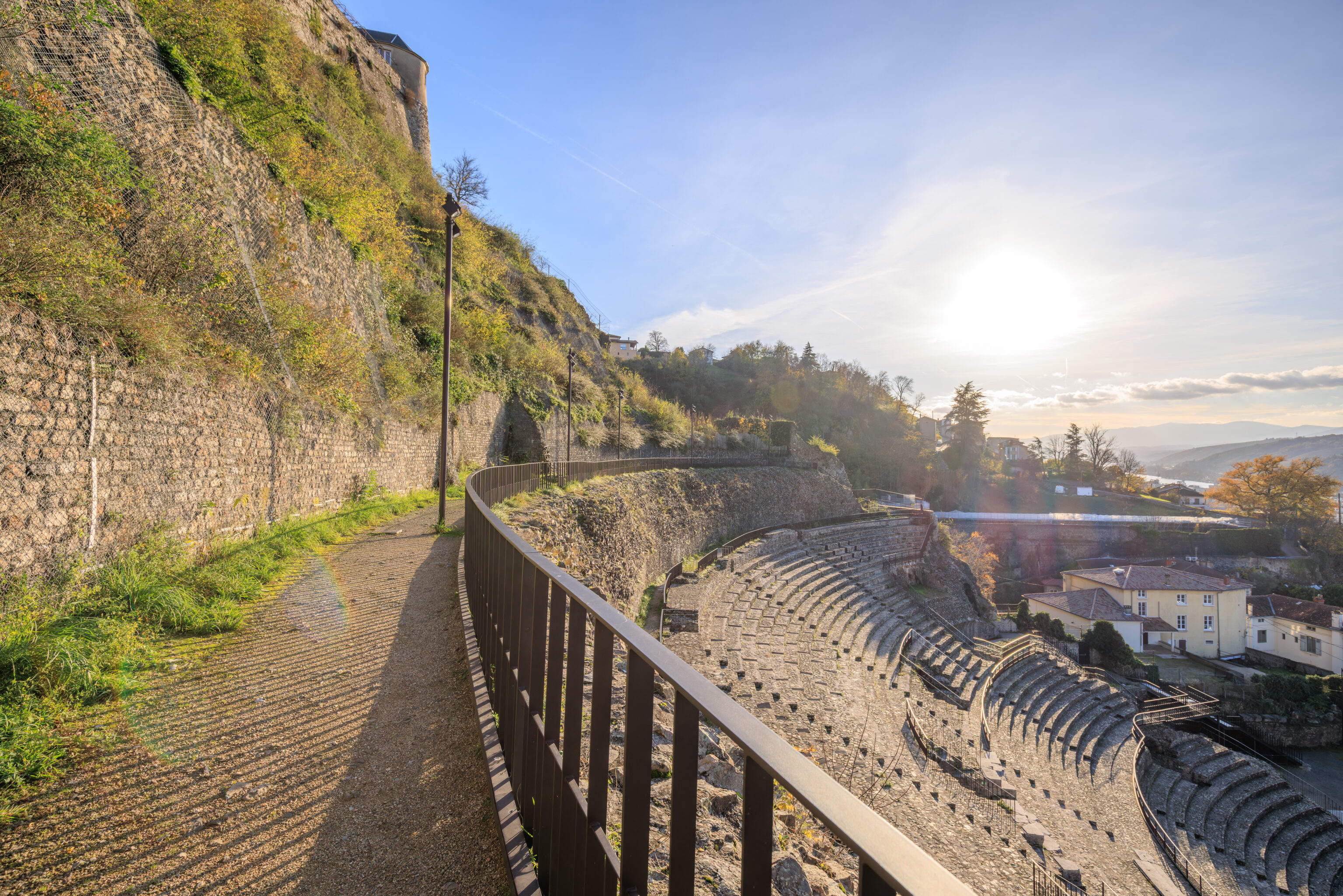
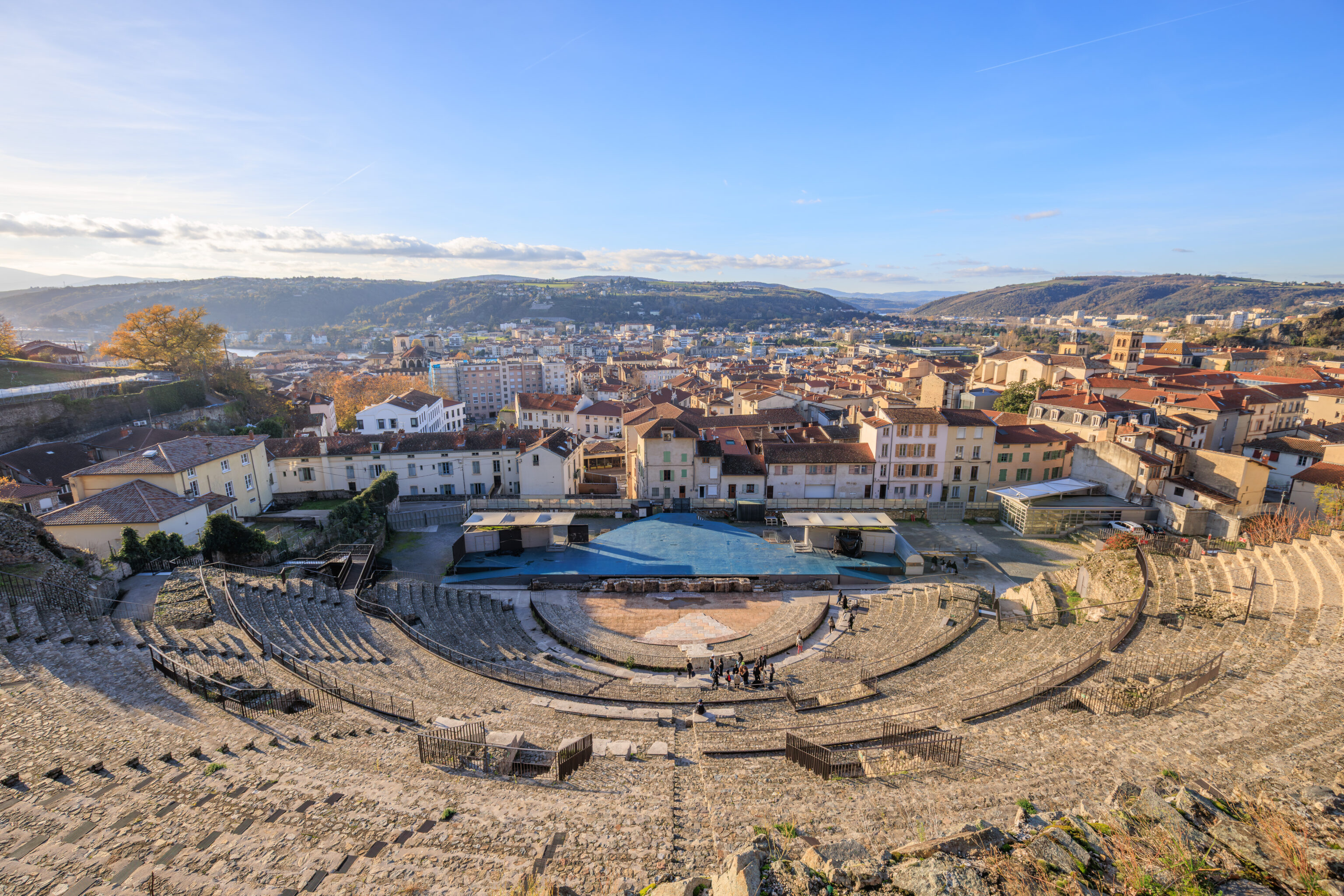
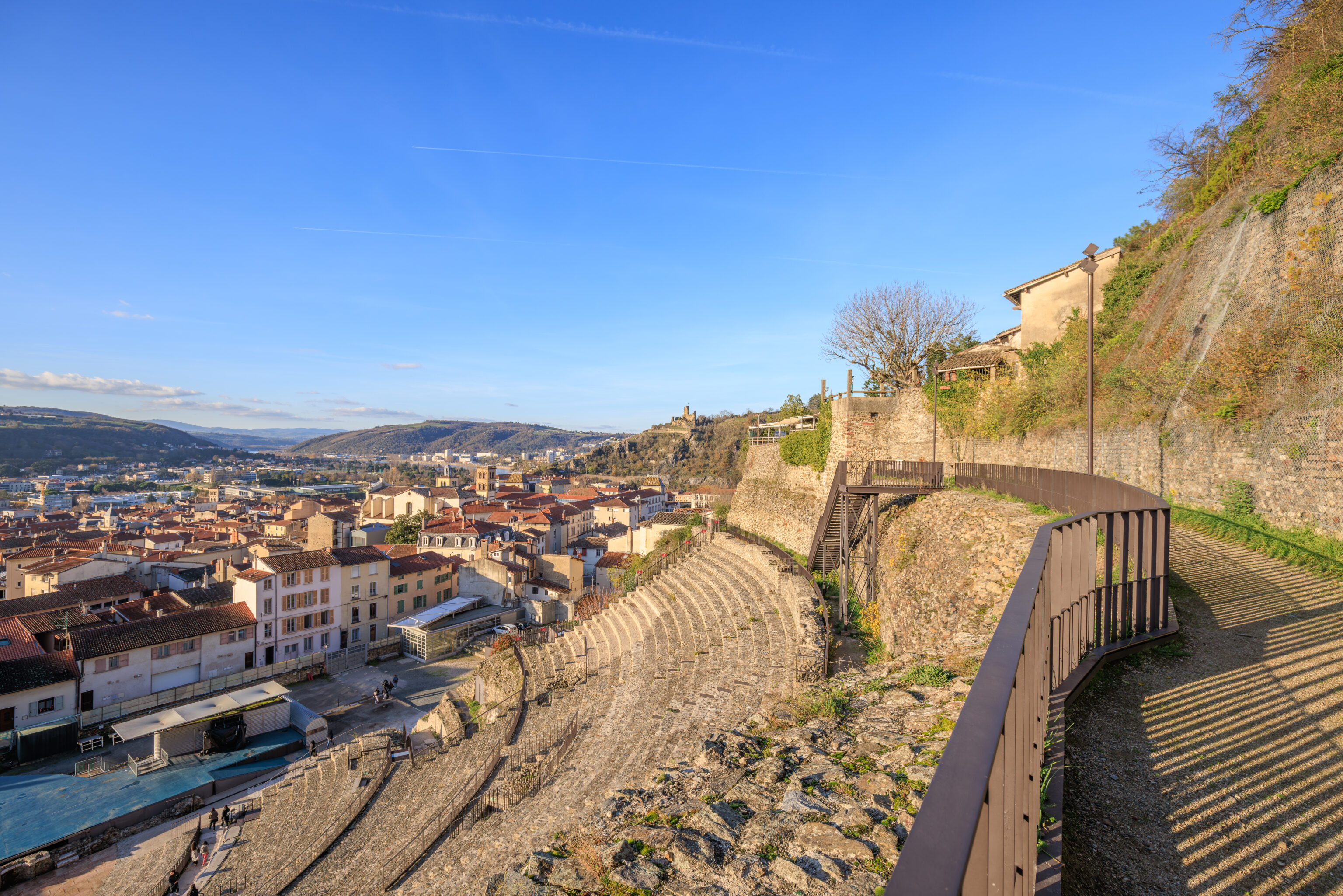
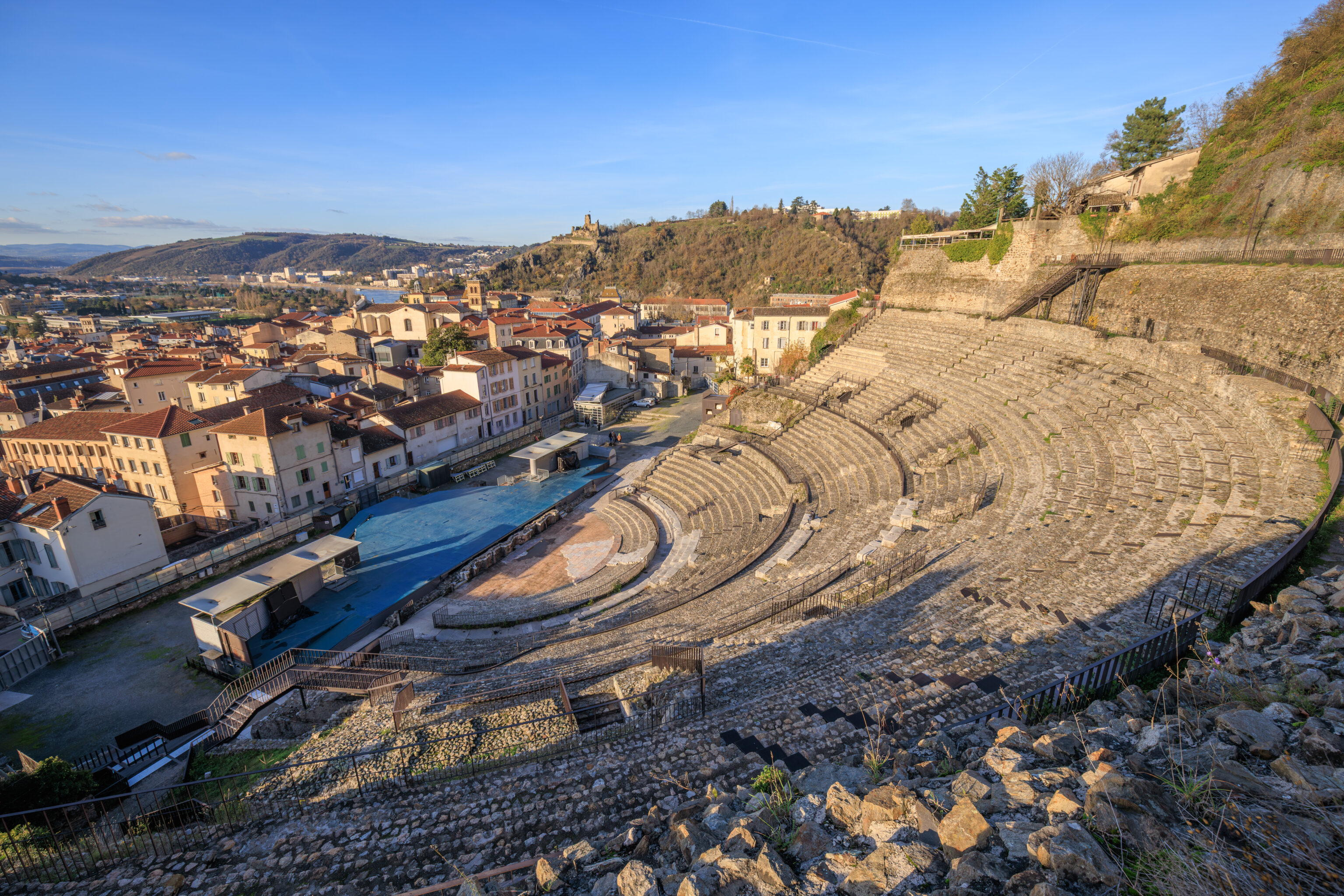
The view from the top of the theatre. There is a hill, the Pipet, behind the seating area with an overlook at the top. By now, around 3:30pm, the sun was starting to get low on the horizon. There was not much time remaining to visit any other locations of interest.
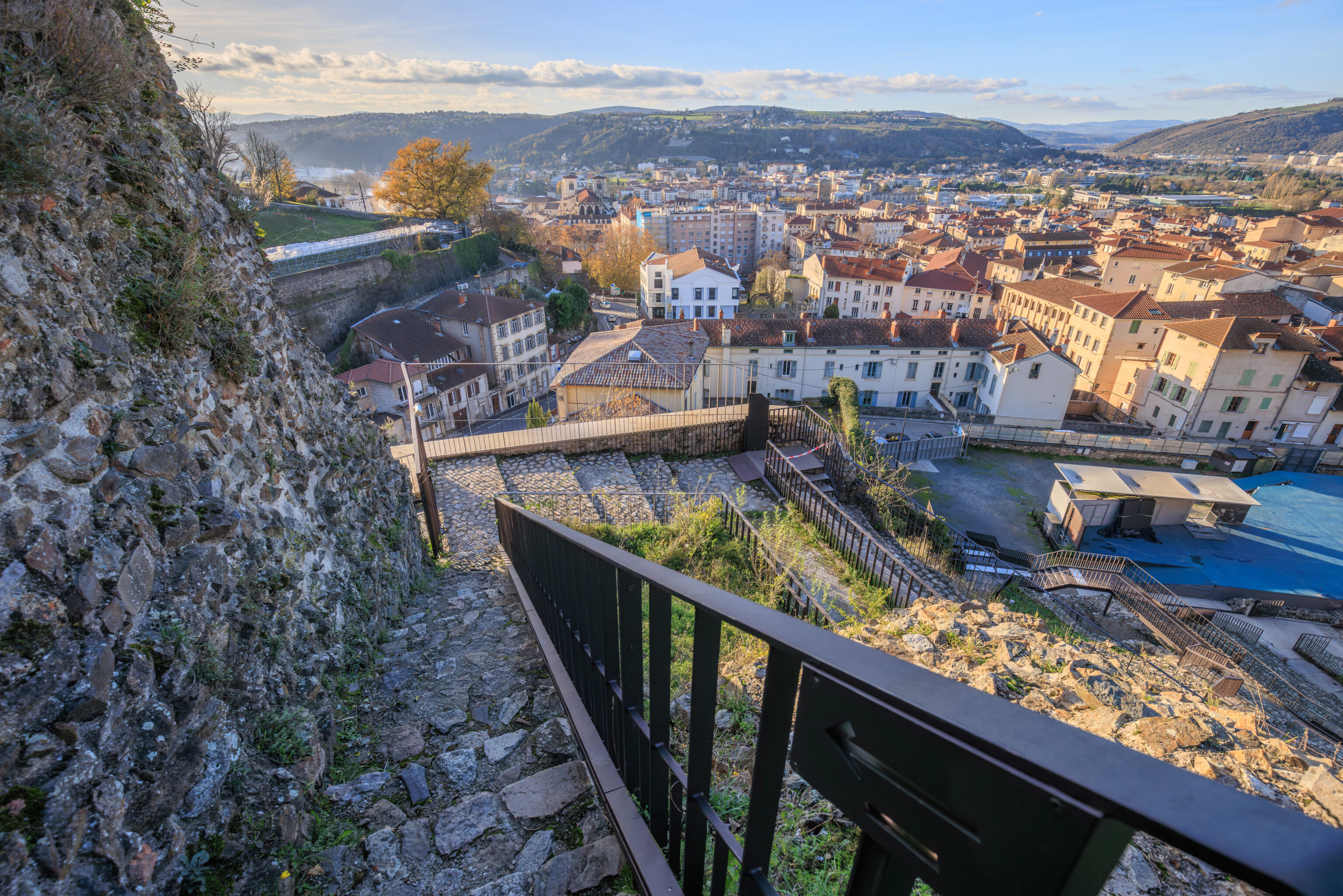
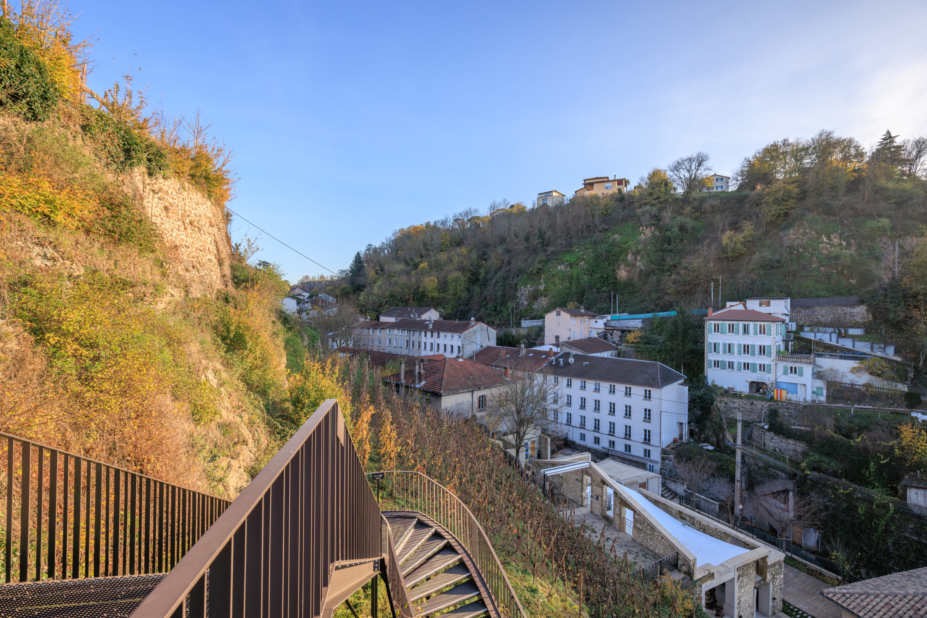
Its easier to walk down these more modernly designed stairs at the far edge of the theatre than the stairs through the seating areas.
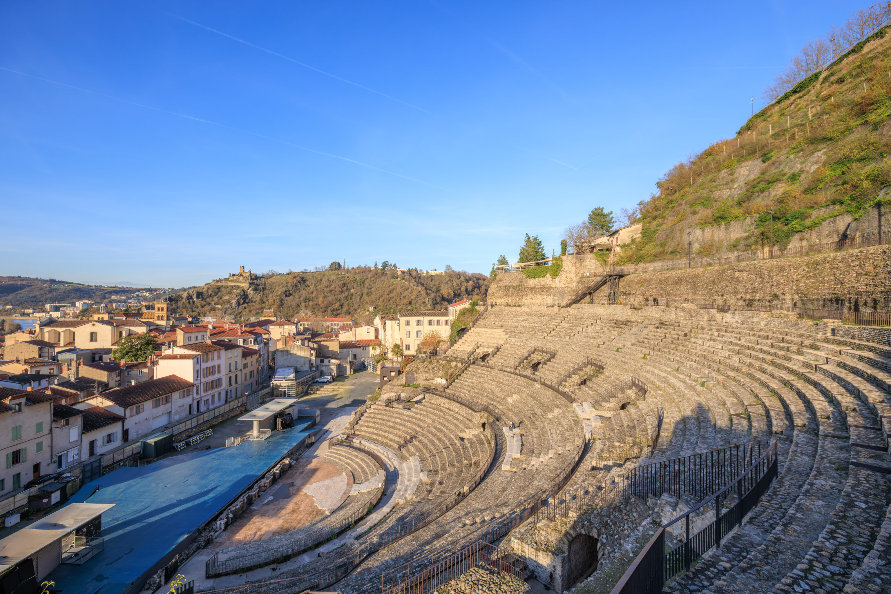
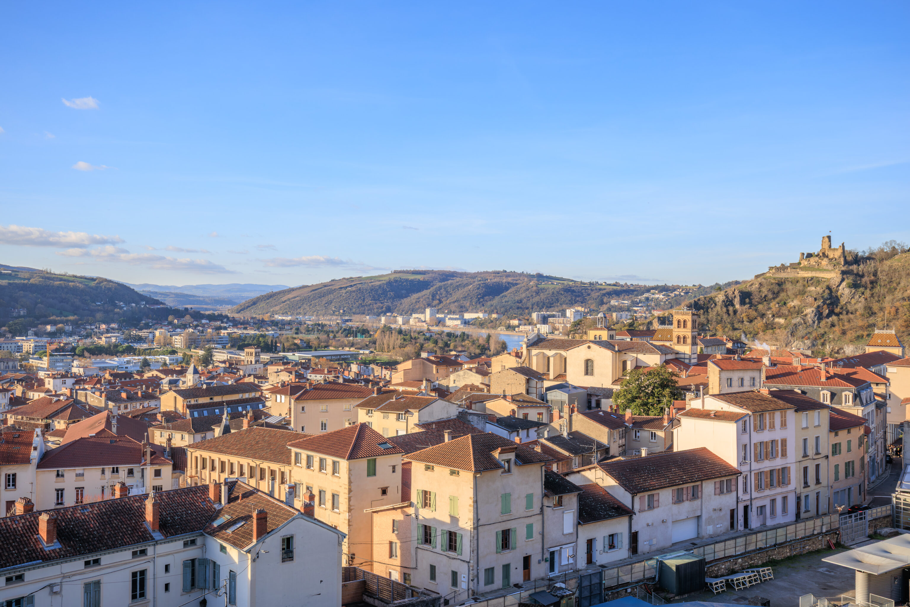
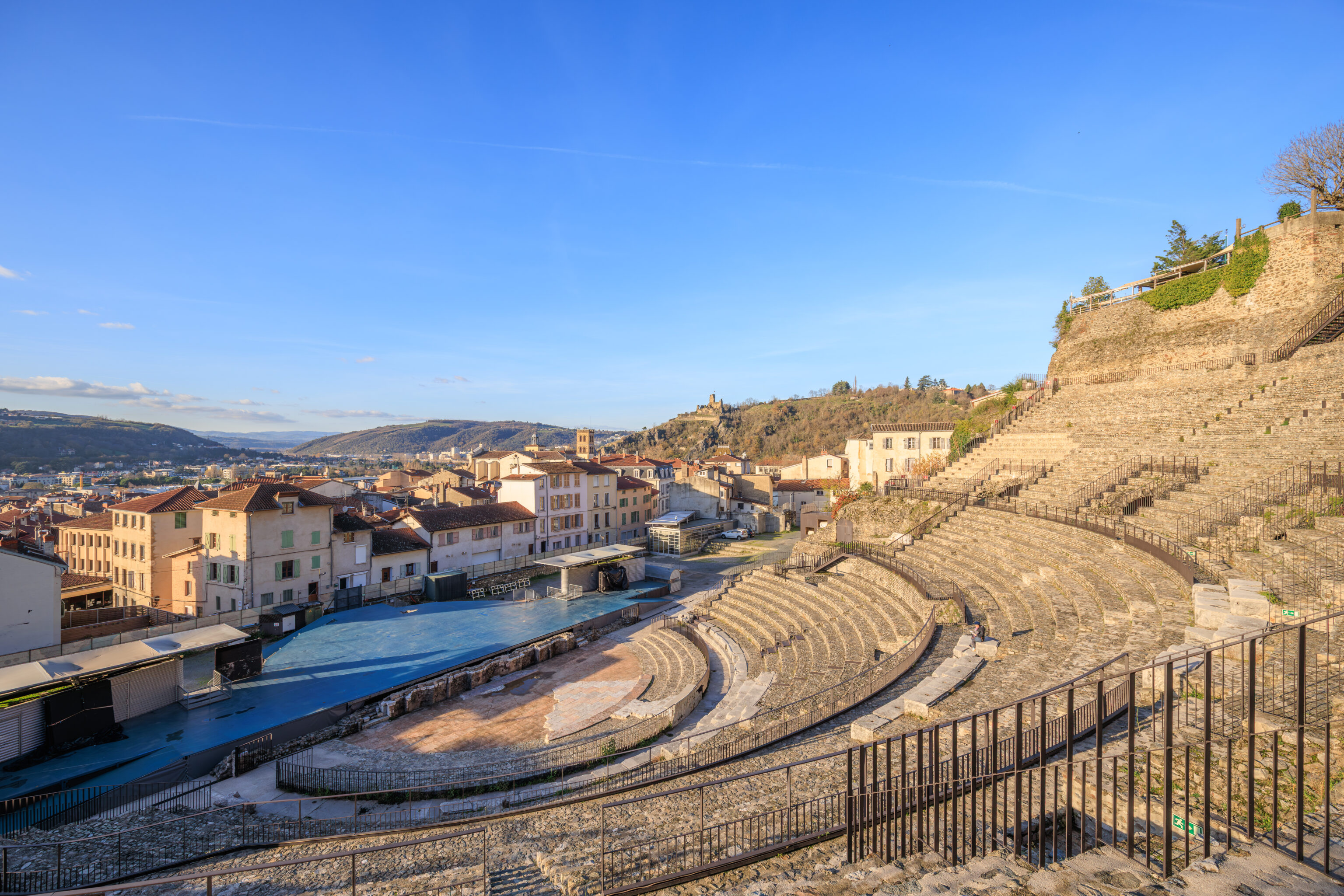
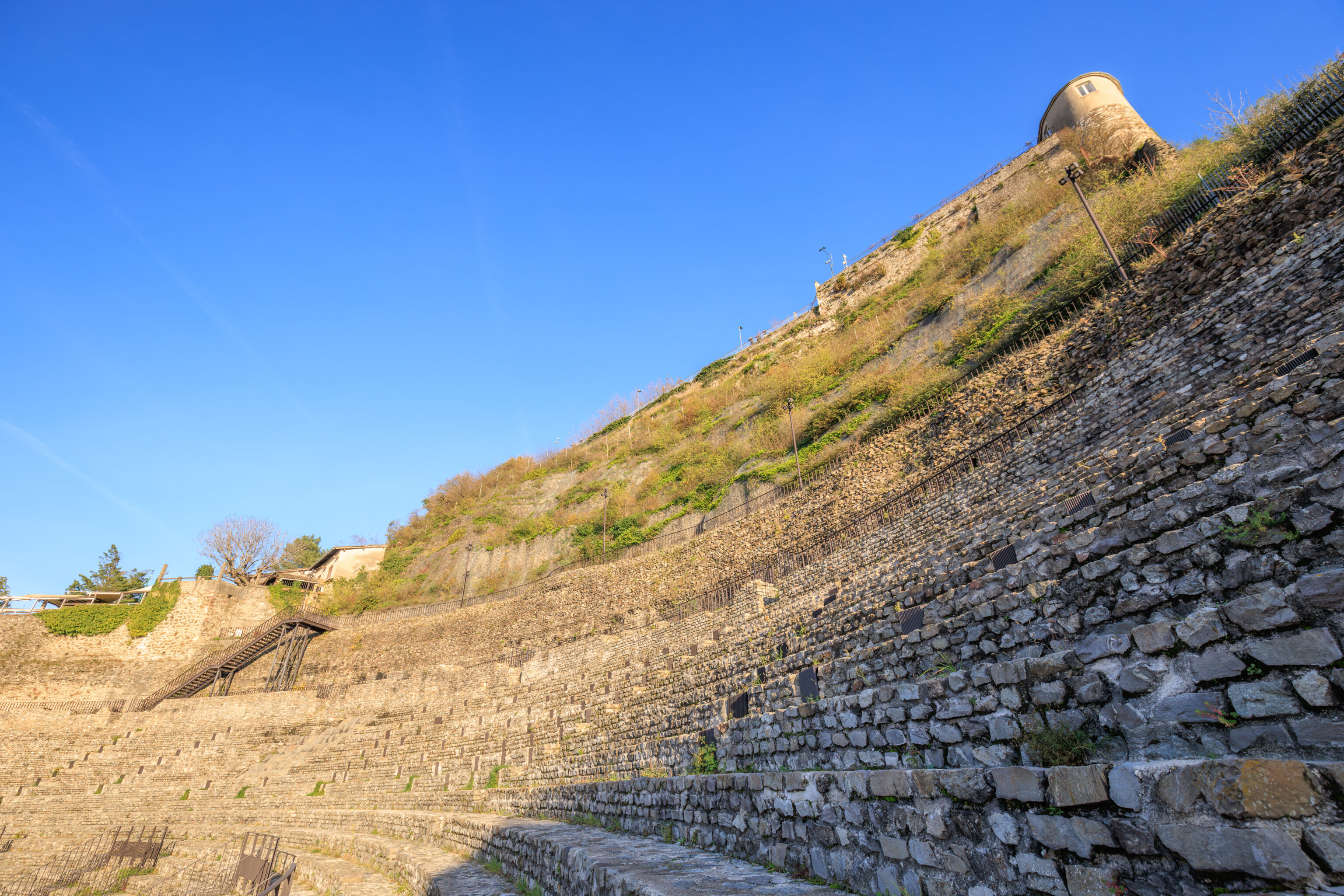
Various views from the southern end of the theatre on the way down.
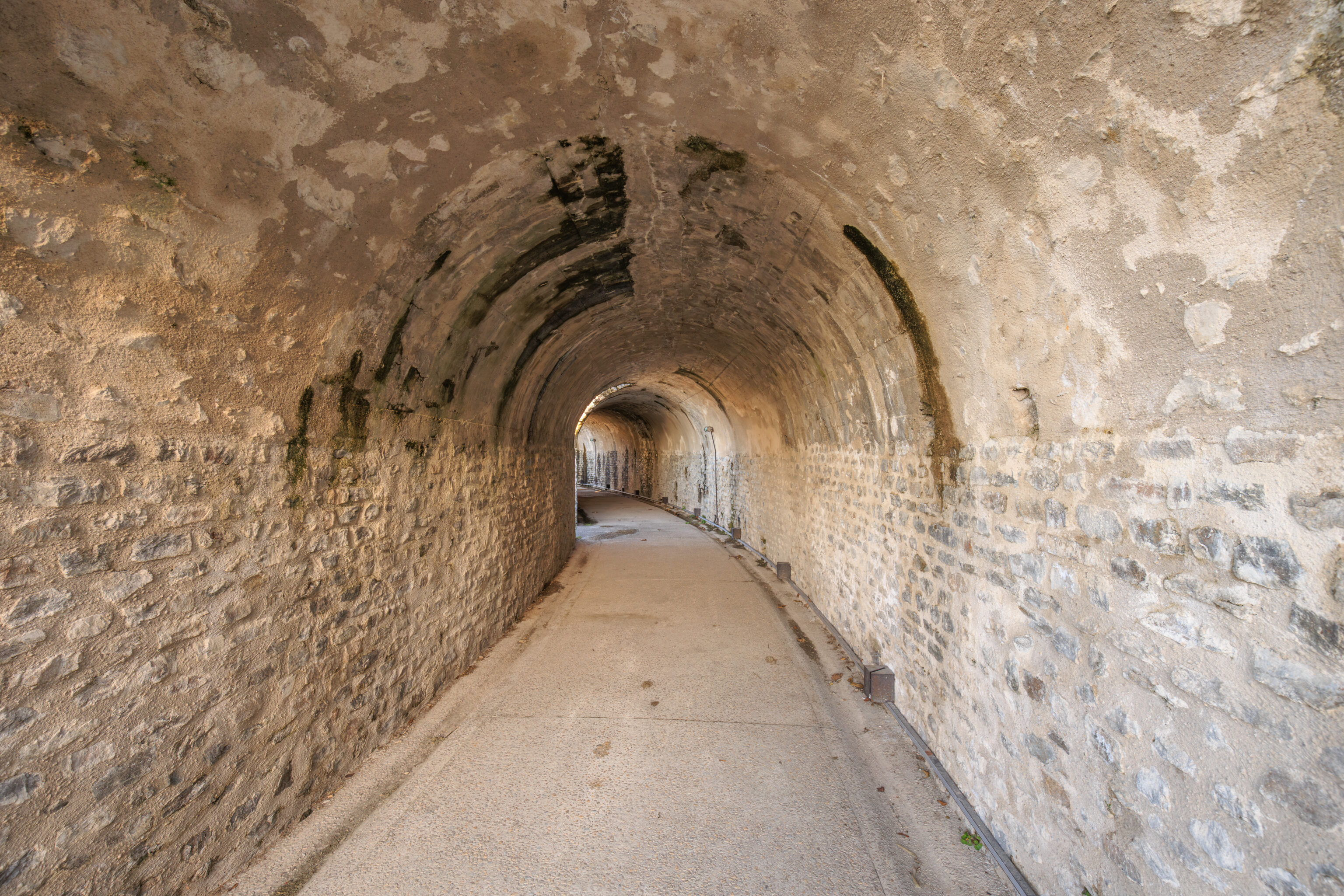
There are tunnels underneath the seats above.
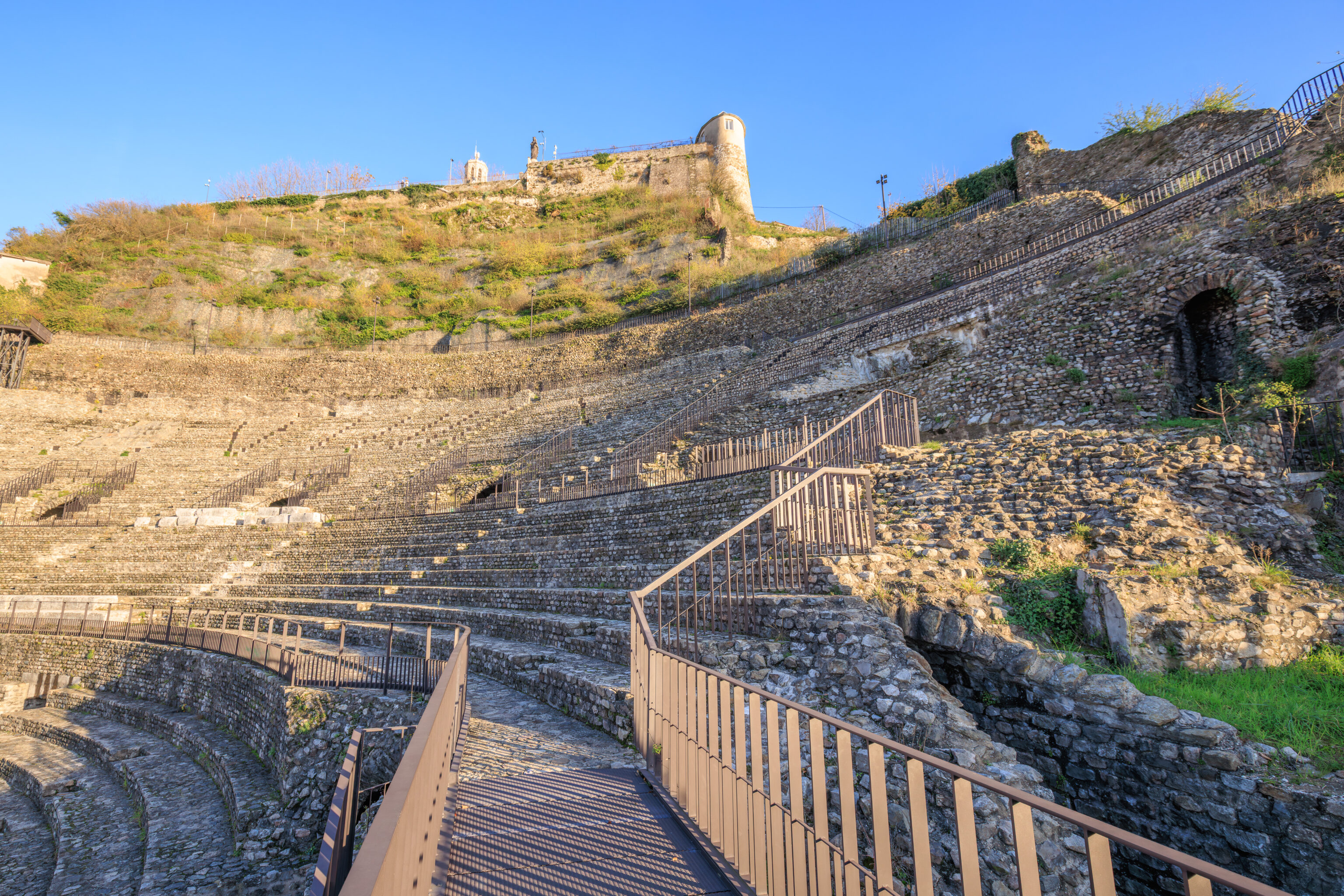
This view from near the bottom shows the overlook above at the top of the Pipet hill.
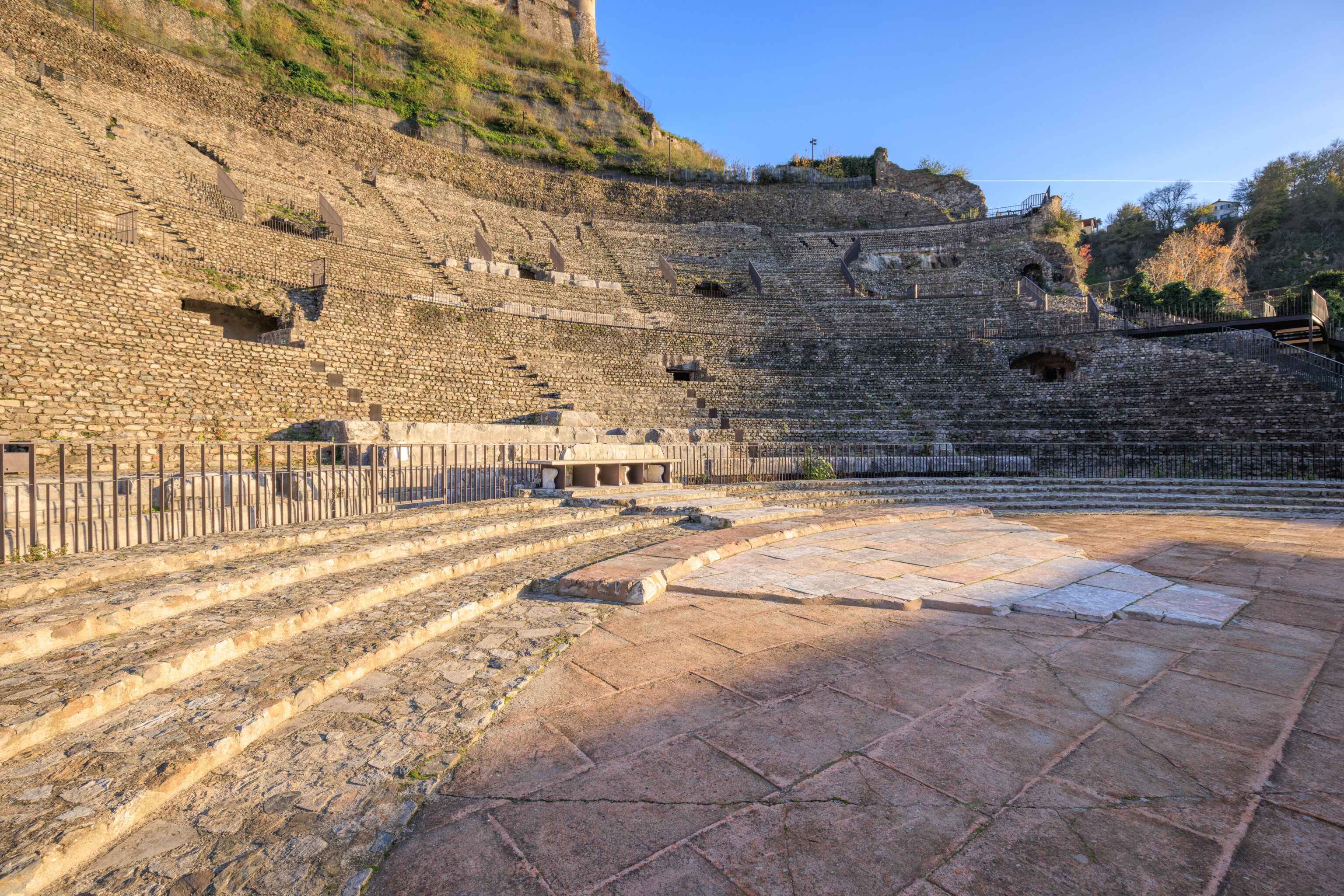
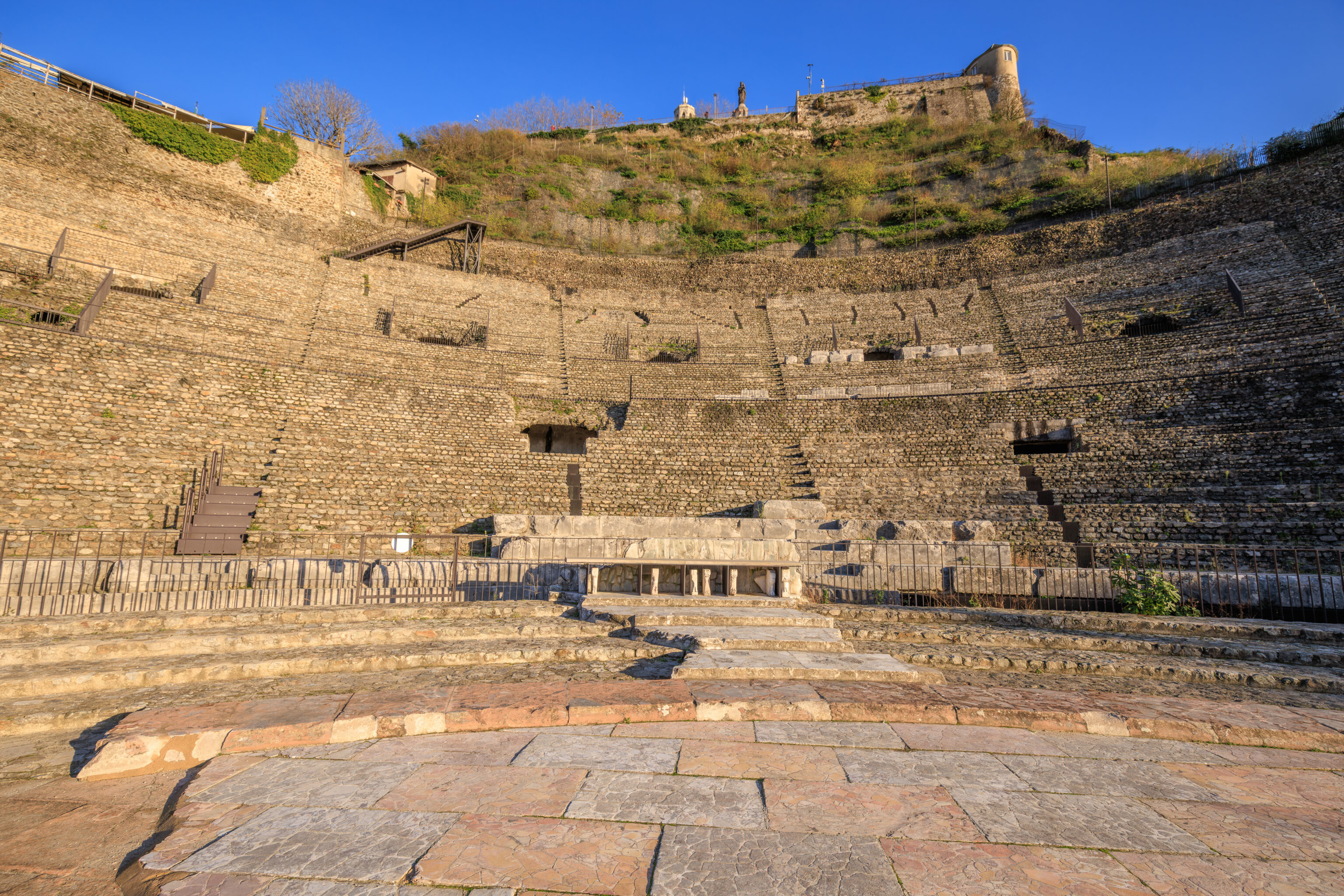
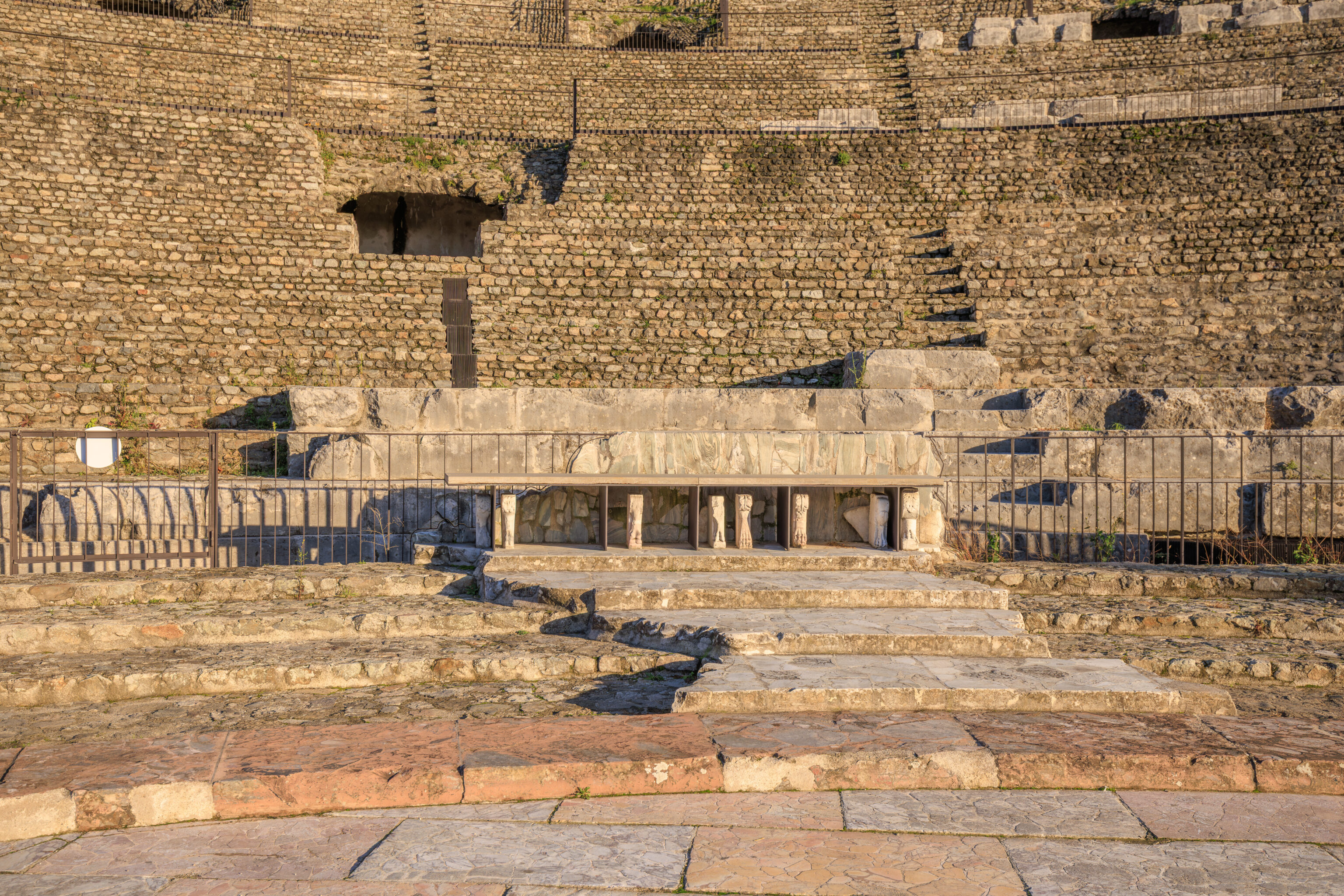
These four marble seats at the bottom center of the theatre would have been for the most important guests.
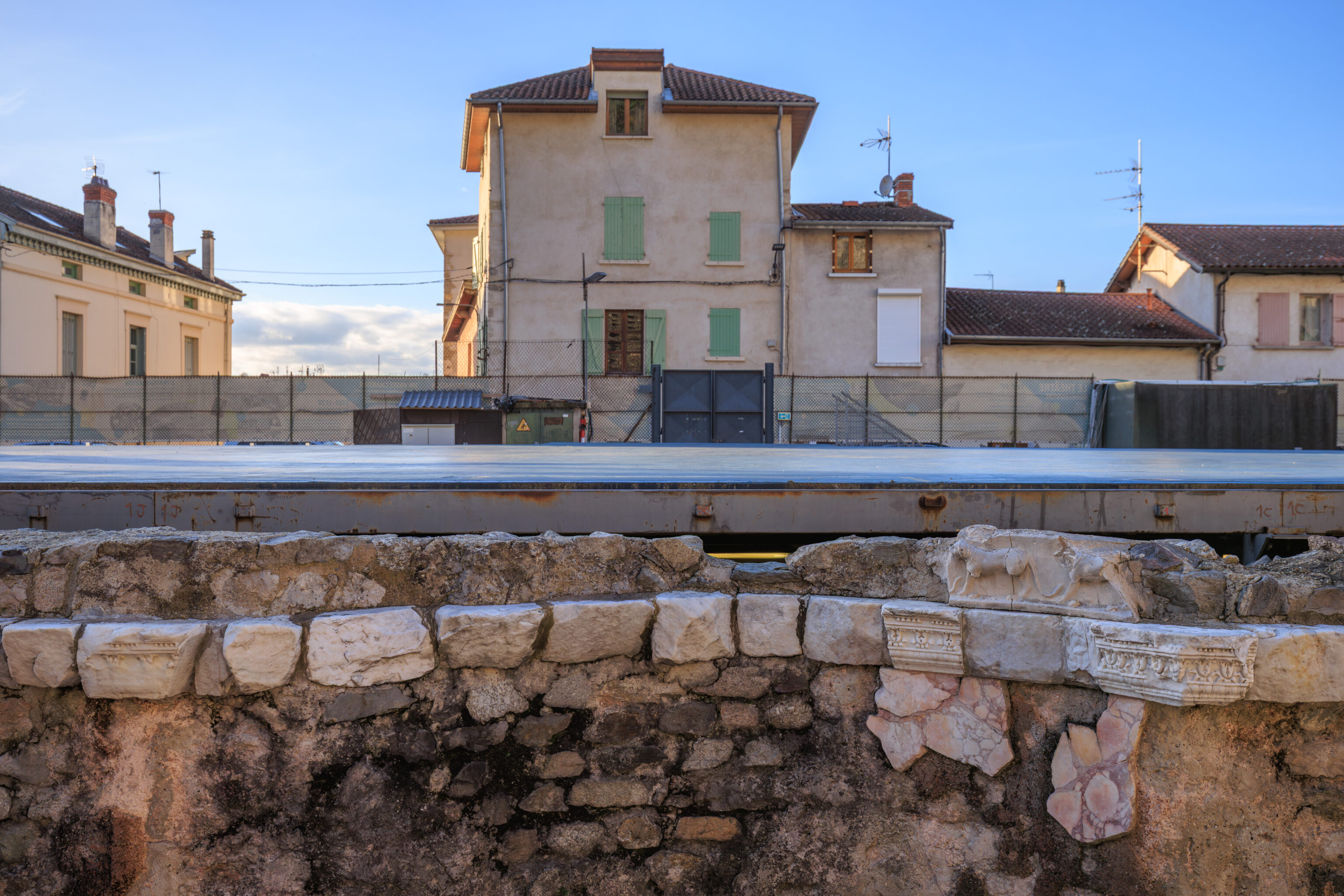
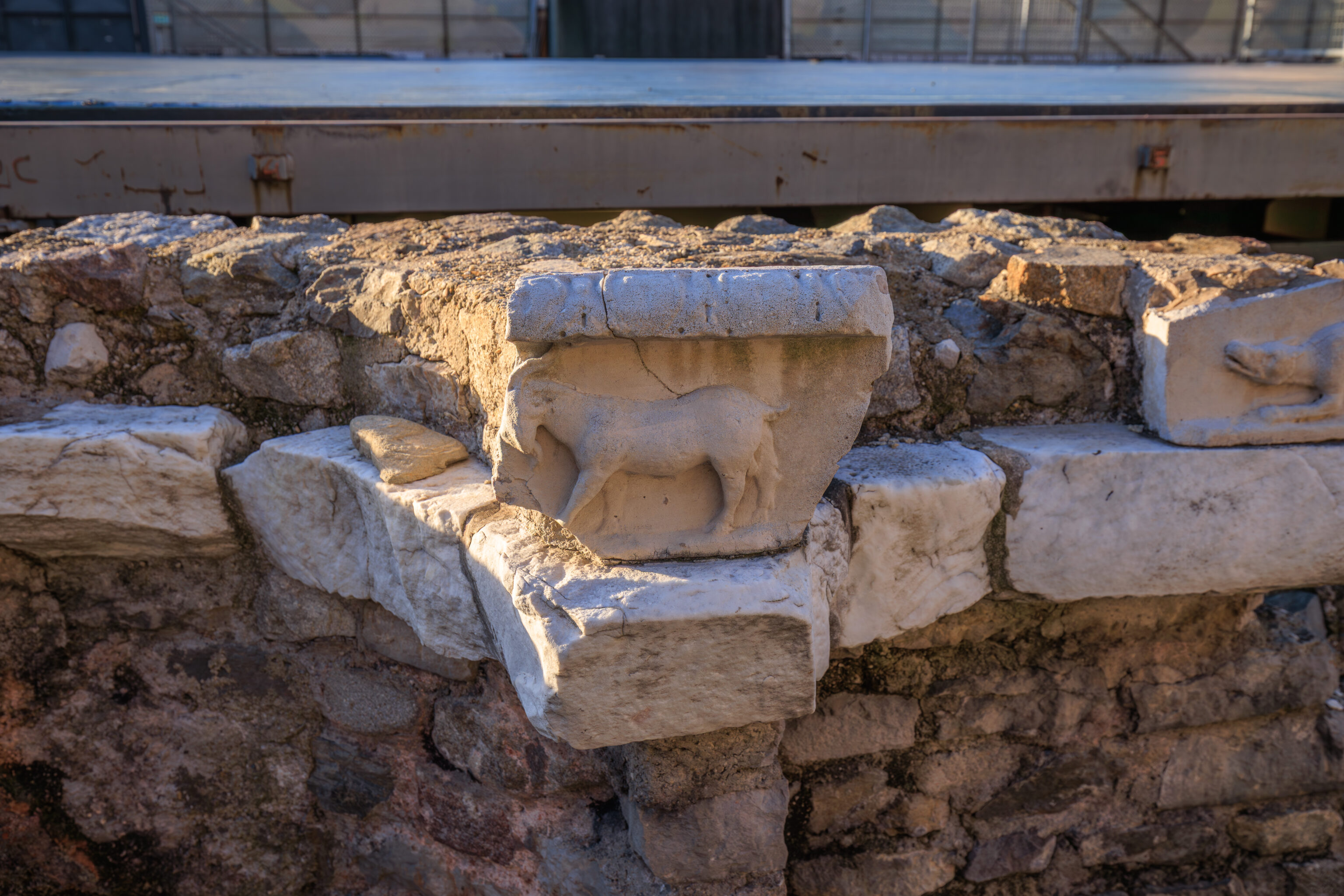
This marble frieze featuring sculpted animals is from the 1st century. The originals are in the Saint-Pierre Archaeological Museum here in Vienne.
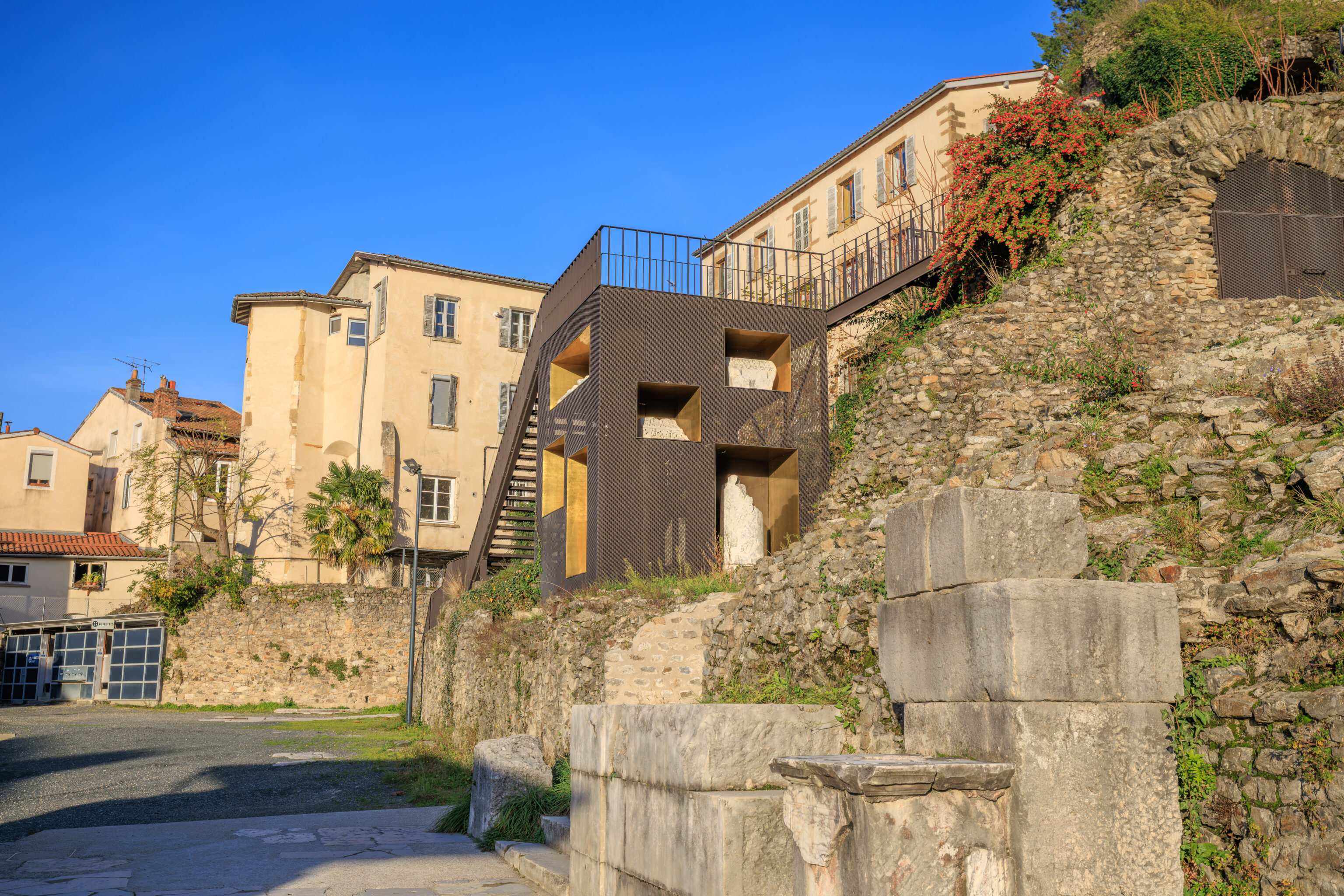
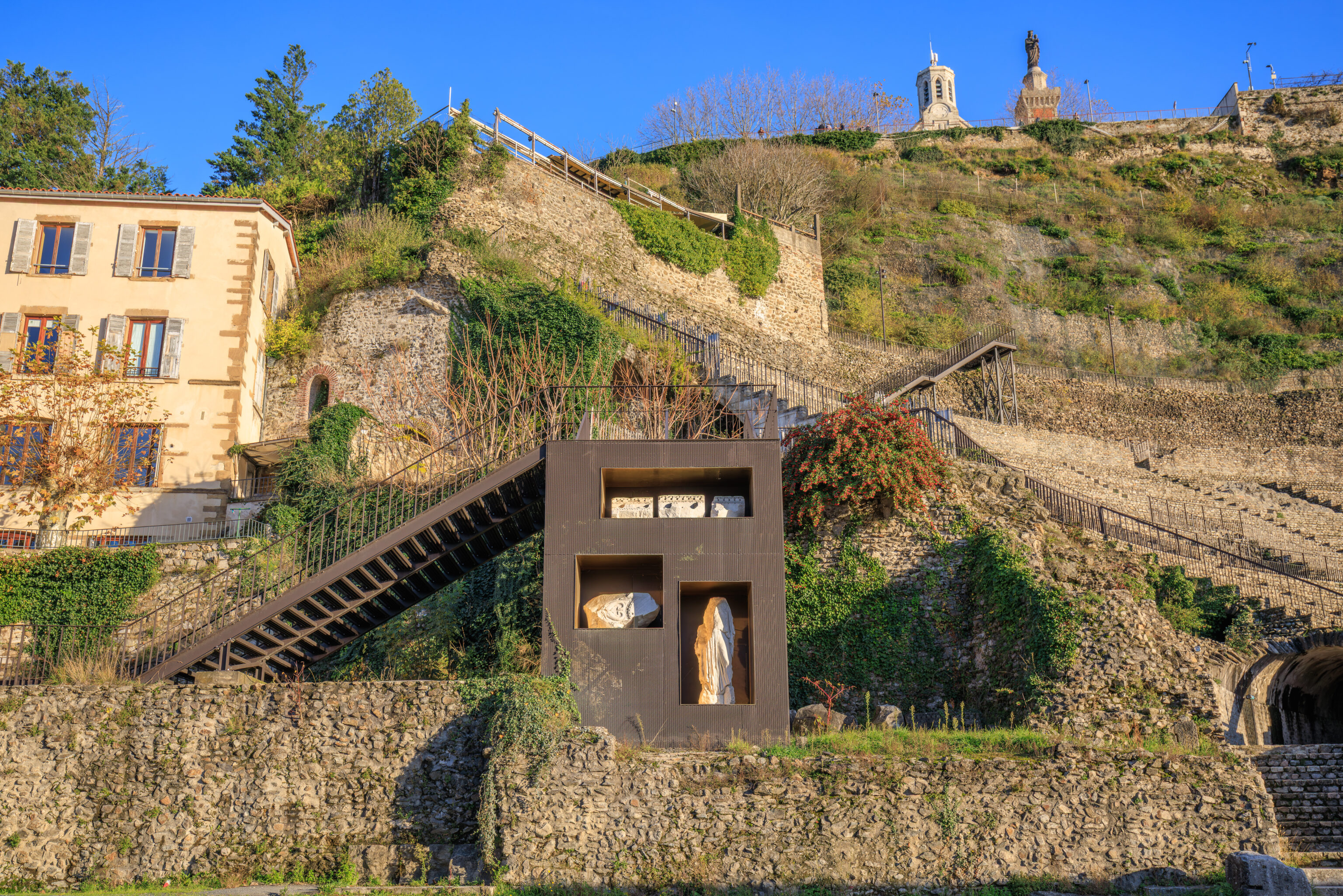
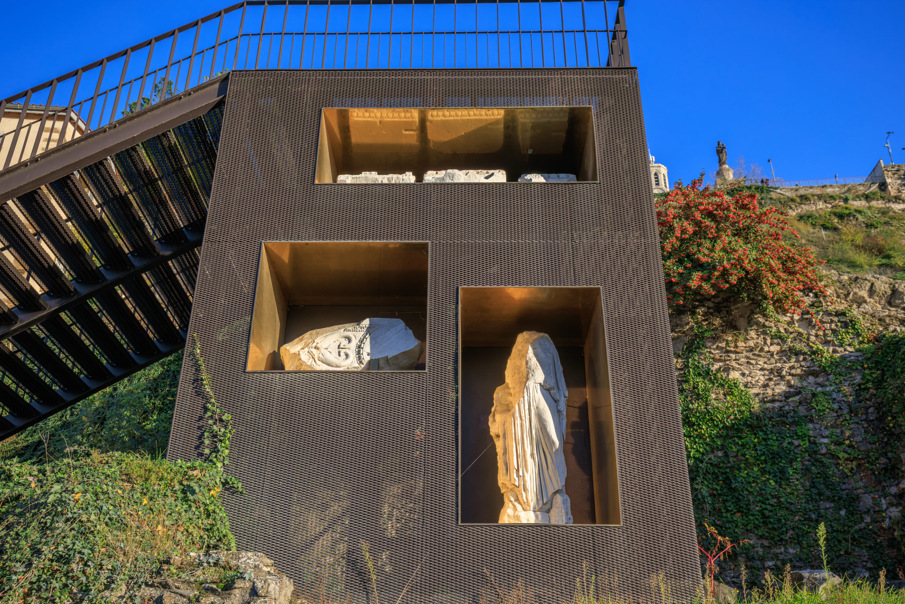
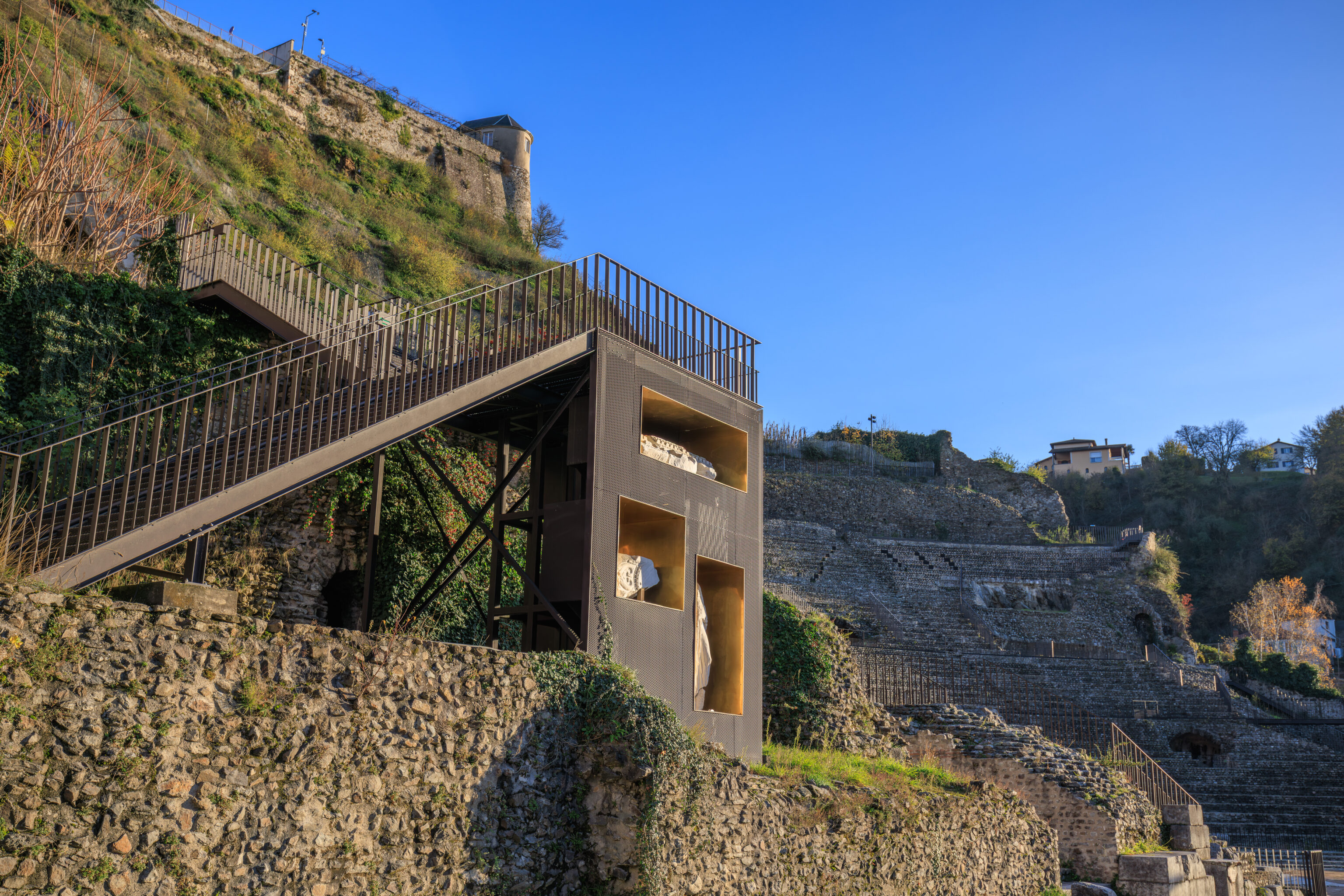
Some sculptures are on display here integrated into a modern stairway here on the north side of the theatre.
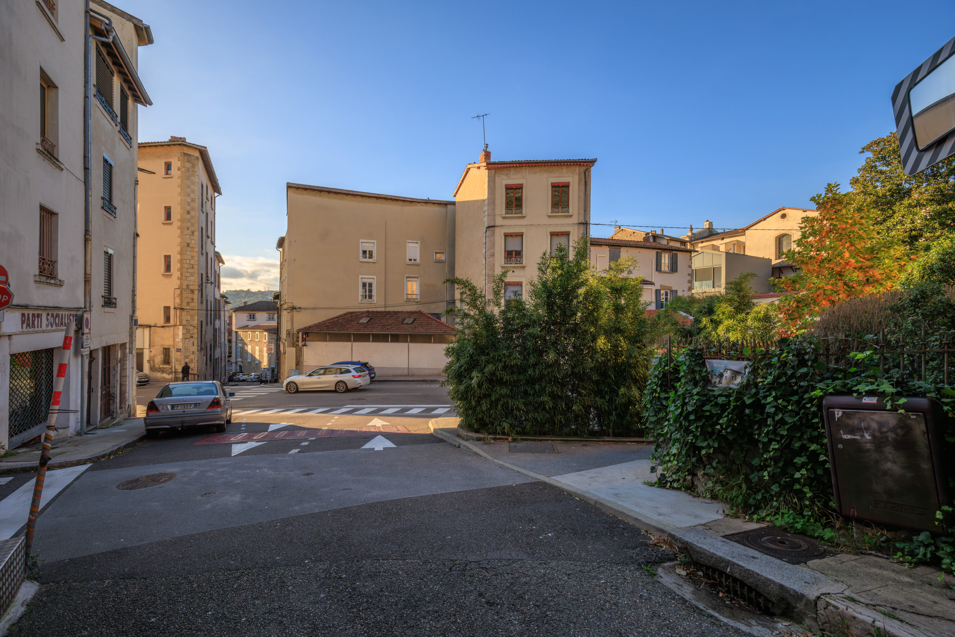
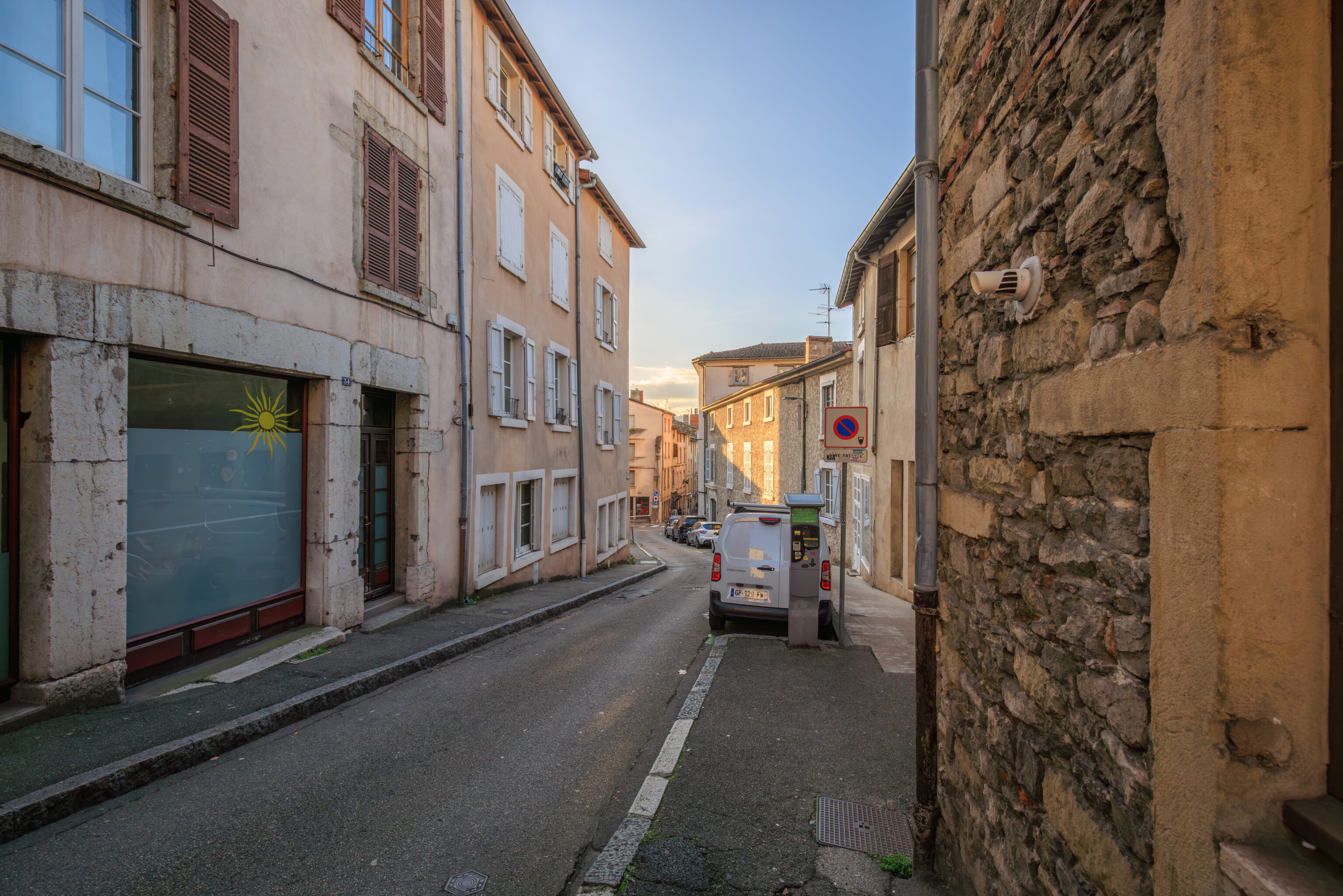
After leaving the theatre, we started to make our way back to the train station.
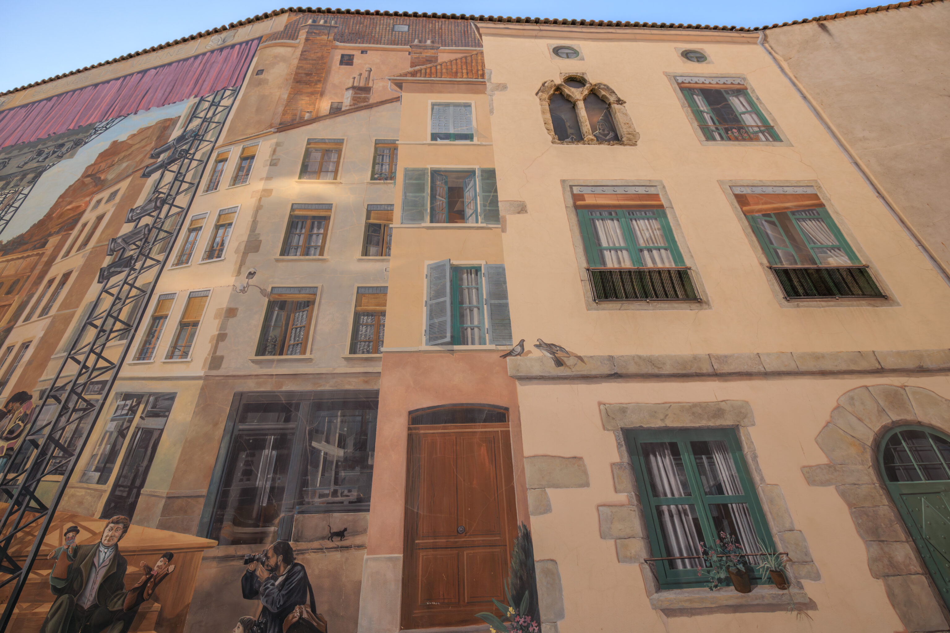
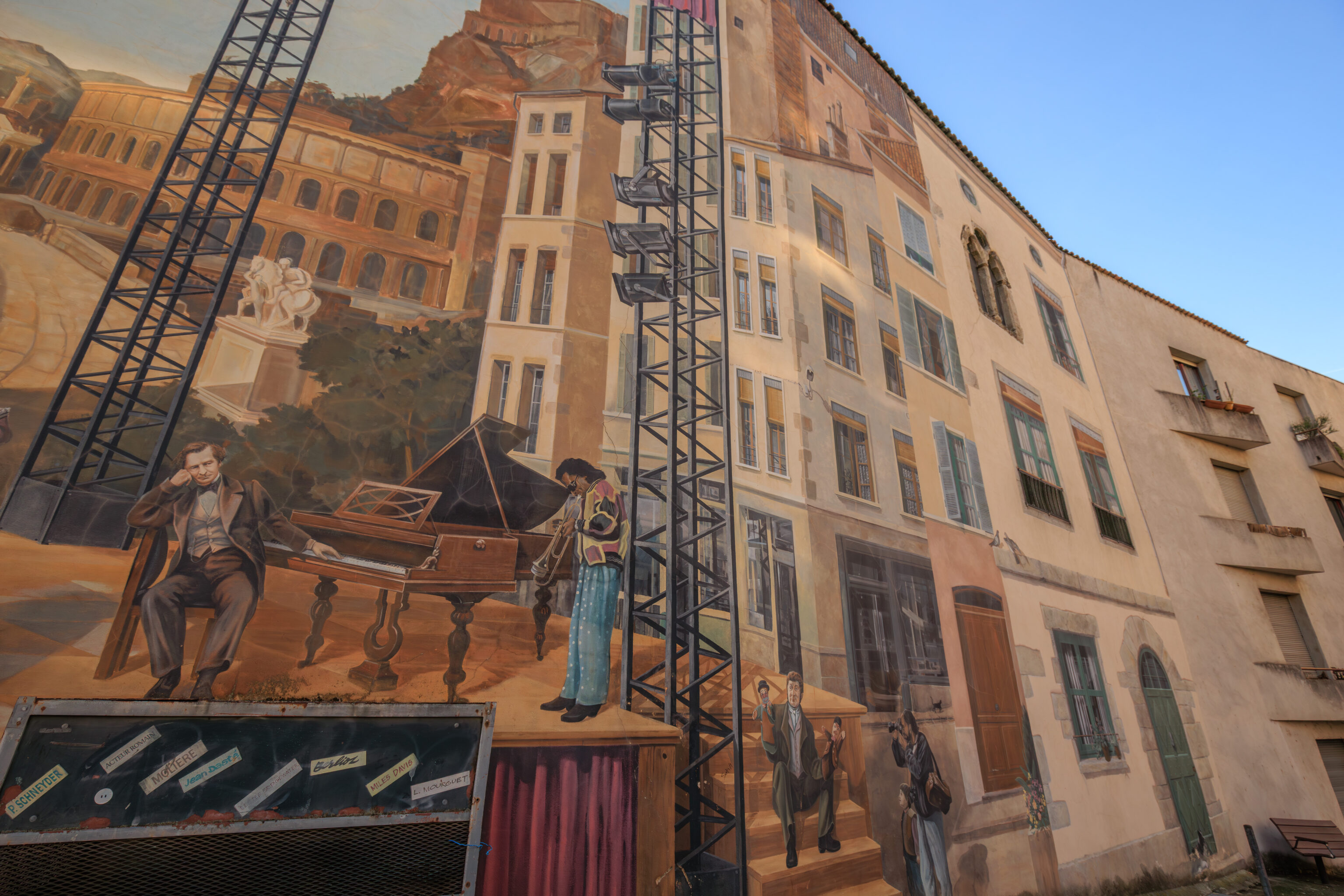
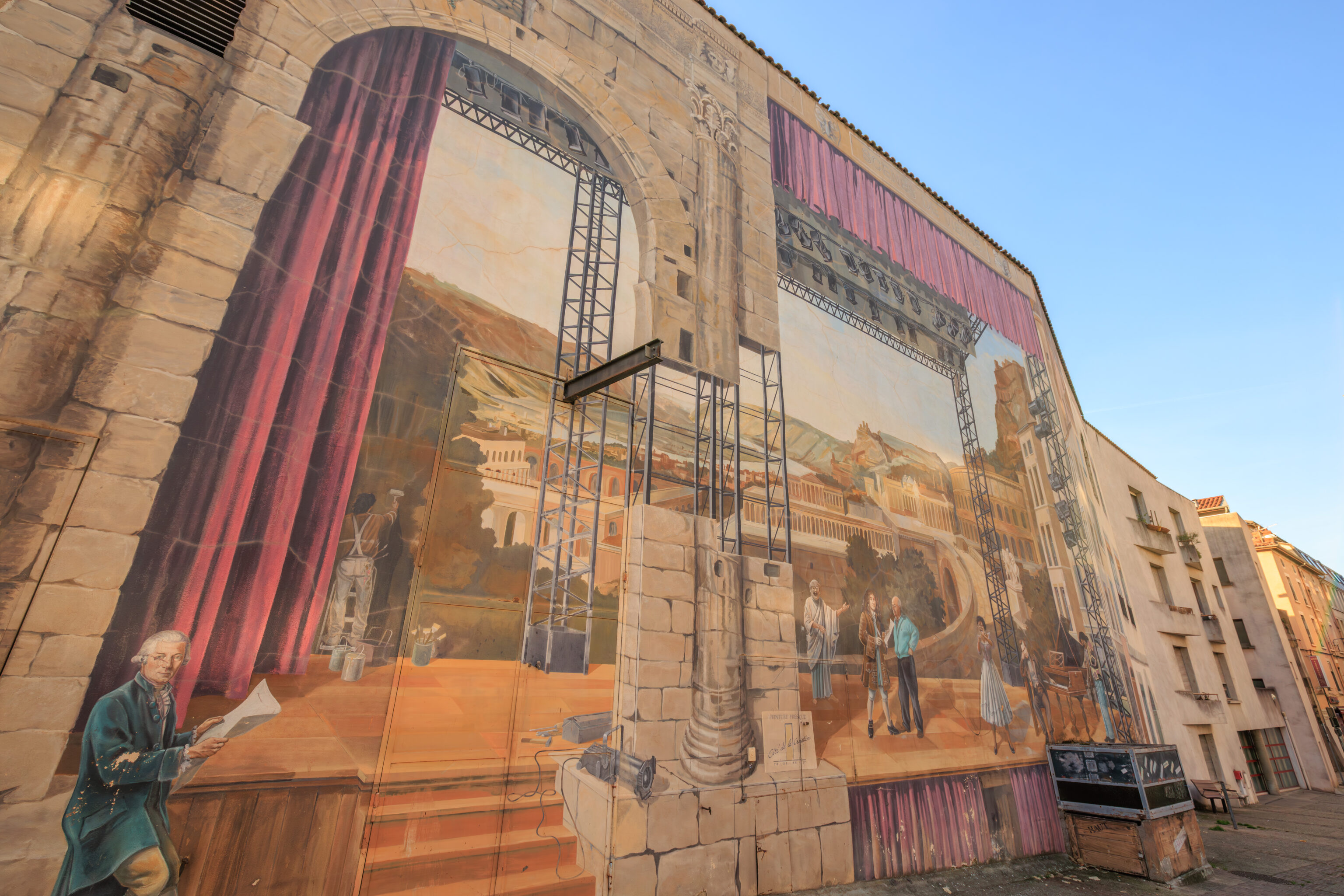
This trompe-l’œil from 1995 is on the eastern side of the Théâtre François Ponsard. It depicts famous visitors of Vienne. It was created by CitéCréation, the same group that made the Fresque des Lyonnais in Lyon, which we saw a few days ago.
Jardin Archéologique de Cybèle
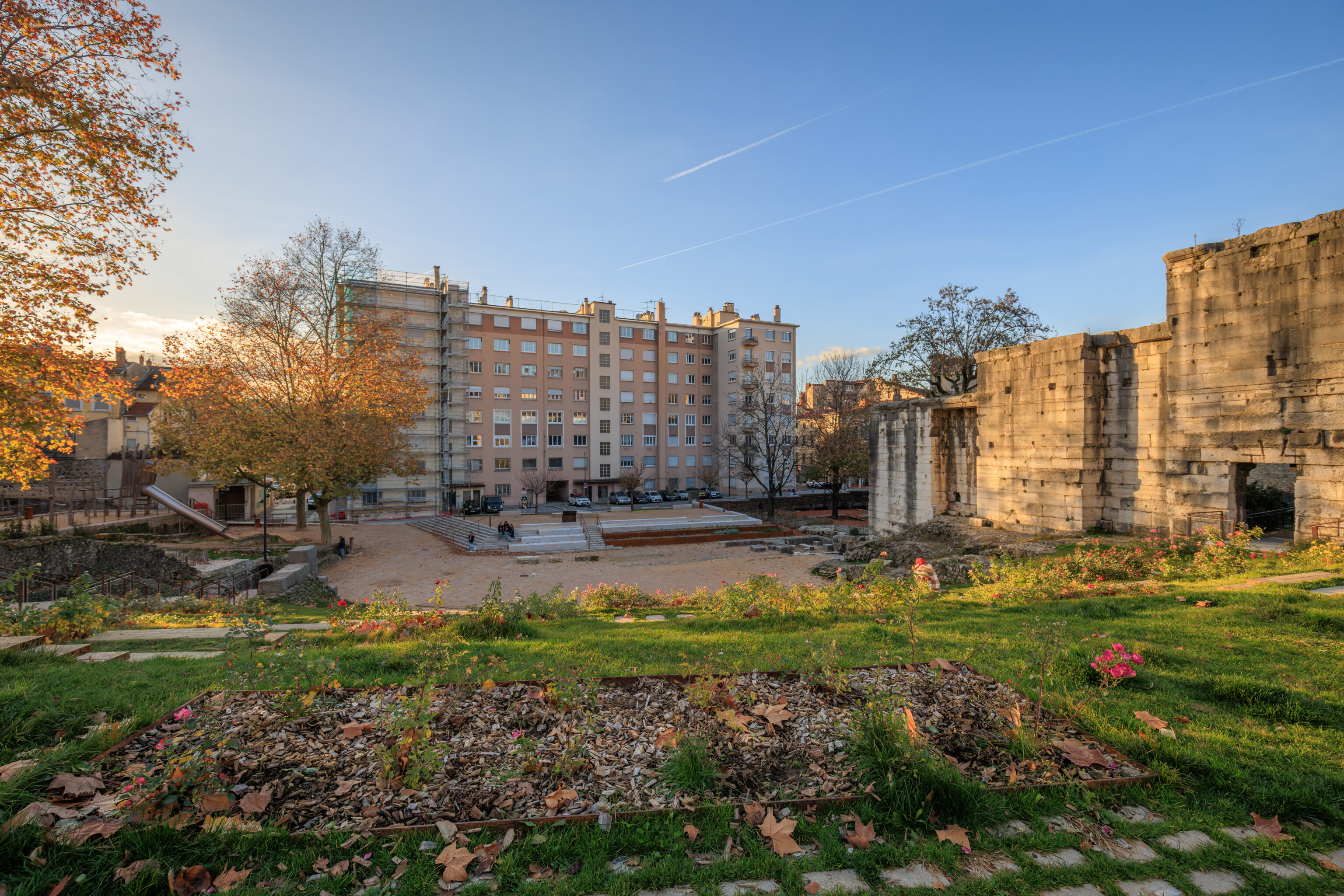
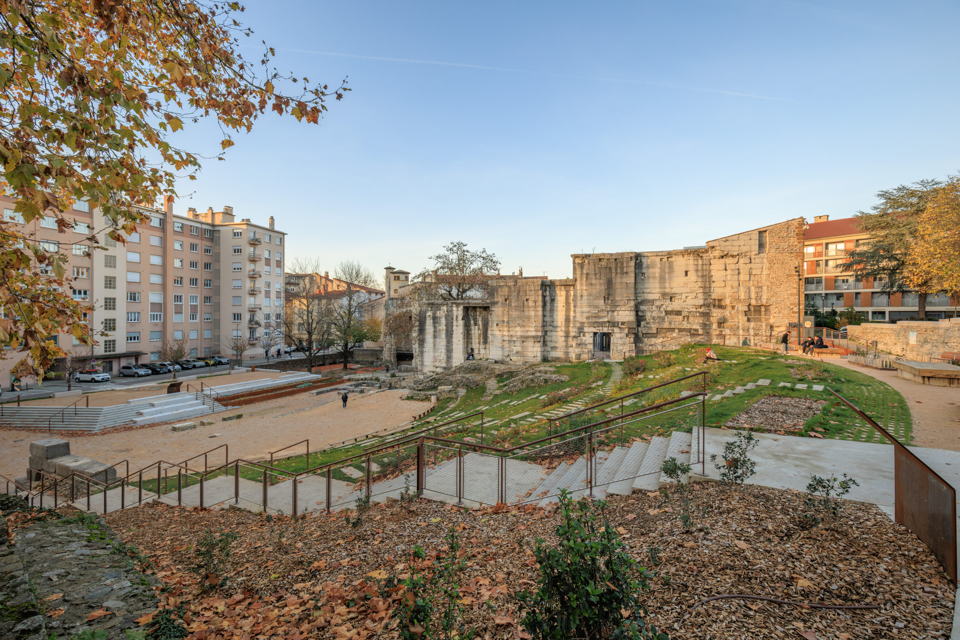
Just past the mural, we came upon the Jardin Archéologique de Cybèle (Cybèle Archaeological Garden). This garden contains remnants of the Roman forum that was here.
THE GARDEN OF CYBELE, A HISTORICAL MILLE-FEUILLE

A SITE IN THE HEART OF THE ANCIENT CITY
Most of the visible remains in the archaeological garden of Cybele
belong to three Gallo-Roman complexes.

To the north of the garden, two archways mark the southeast corner of the ancient forum, the civic, legal, administrative, and religious heart of the city. One served as a monumental passageway to the esplanade of the Forum where the Temple of Augustus and Livia stood; the other provided access to the bay of the basilica, the Roman tribunal.  At the foot of these archways, steps and a paved floor still remain.

Finally, to the south of the garden, between two steep alleyways, lay a residential area consisting of shops and two houses. One of them, whose foundations and steps are still clearly visible, is nicknamed the House of the Oscilla, after the sculpted marble discs suspended in Roman houses, which were discovered during excavations.

In the center of the garden, a tiered structure capable of seating 800 people, has been identified as an open-air citizen assembly hall. 40 meters long, its imposing northern wall still dominates the site.

ANCIENT REMAINS INSIDE THE MEDIEVAL CITY
After the fall of the Roman Empire, the site was occupied by a fortified house, the Palace of Canals.

This palace, whose name is thought to derive from the presence of a network of underground galleries interpreted at the time as pipes supplying the Gallo-Roman city, ensured the preservation of the ancient remains for centuries to come. The palace had two towers: one to the west, the Orange Tower, built on the two arcades of the ancient forum, and one to the east, incorporated into the medieval rampart. These towers overlooked a courtyard whose shape can still be discerned today. It was bordered by the high assembly wall and a polygonal enclosure still standing to the north of the garden.

In addition to these high walls, the Palace of Canals ensured the preservation of ancient bas-reliefs. A testament to this is the sculpted head from the Late Roman Empire at the top of the arcades. It has long stood alongside ballistic penetrations, gun ports, and the bust of a hooded figure (late Middle Ages).

In the Middle Ages, the Almshouse, then the Saint-Paul Almshouse, and finally the Hôtel-Dieu (hospital) were built against the arcades of the forum. Occupying a large part of the site, the institution then housed the city's poor and destitute.

BETWEEN COURTYARD AND GARDEN, THE SITE'S NEW LIVES
In 1771, the relocation of the Town Hall to its current location allowed for the dismantling of the fortified house.

In its place, the archaeologist Pierre Schneyder, using his own funds, built a 350-seat Italian-style theater. Unfinished, the building remained without a facade for decades, until 1931, when the architect Albert Pin added an Art Deco facade, reflecting the style of the 1930s.

That same decade, the relocation of the hospital to Mount Salomon led to the demolition of the Hôtel-Dieu. The site, intended to become a garden in the heart of the city, was excavated, and its ancient remains were uncovered. On this occasion, a paved path was reconstructed under the direction of Jules Formigé using slabs partially recovered from the site. A bas-relief depicting Cybele, goddess of nature and fertility, was also unearthed. This discovery gave its name to this garden, which has since, excavation after excavation, revealed many other secrets...

UNDER YOUR FEET PRESERVED HISTORY
HISTORIC MONUMENTS
1840 - North wall listed as a historical monument
1906 - Arcades listed as a historical monument
2012 - Entire site listed as a historical monument

The Cybele Garden is a space dedicated to the enhancement, study, and conservation of Vienne's archaeological heritage.

On the surface, the remains are the subject of regular preservation work, such as in 2007, when the arcades were restored under the direction of Chief Architect of Historic Monuments Alain Tillier, as part of the Heritage Plan*. The improvements carried out between 2023 and 2025 further enhance the presentation of the remains: access to the portico is facilitated, an open-air theater evokes the footprint of the ancient assembly's seating, and the foundations of the House of the Oscilla, now transformed into a playground, are harmoniously integrated into the site.

In parallel, preventive excavations have accompanied each stage of the work. Led by the Archeodunum company under the supervision of the Regional Archaeology Service, these excavations have expanded our knowledge of the southern part of the site. The 310 square meters excavated have allowed archaeologists to identify the different phases of occupation of the House of the Oscilla. In the vestibule, five construction campaigns have been identified. A major discovery was also made to the west of the house: the foundations of a large public fountain dating from the late 1st to early 2nd century. Some blocks bore epigraphic inscriptions mentioning public figures, such as Titus Decidius Domitianus and Licinia Optatina, enriching our understanding of the elites of ancient Vienne. After scientific surveys, the fountain was protected and reburied in situ. It is now part of the remains hidden beneath your feet, both those already known and those yet to be discovered.
– Selected text from the sign above, translated using Google.
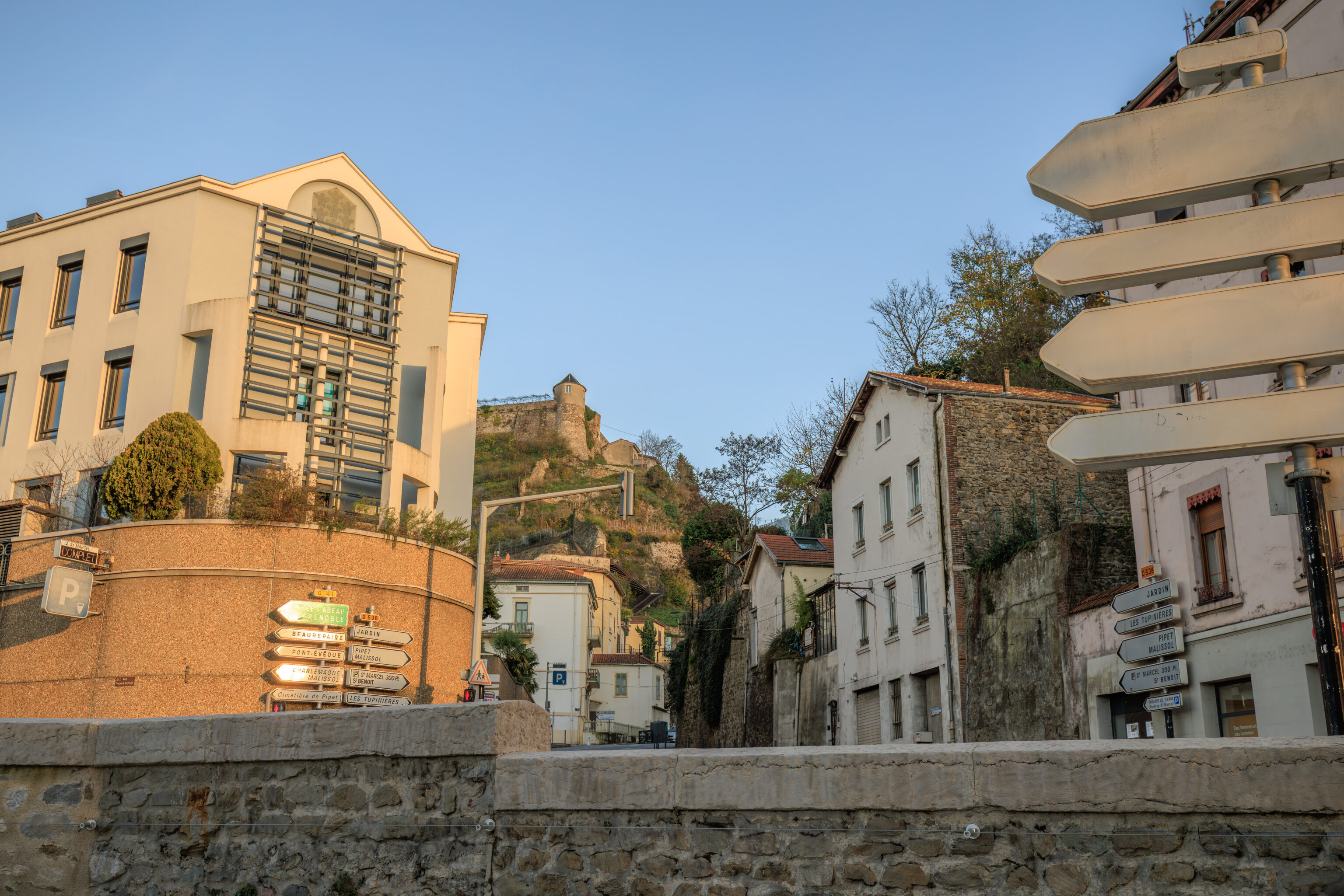
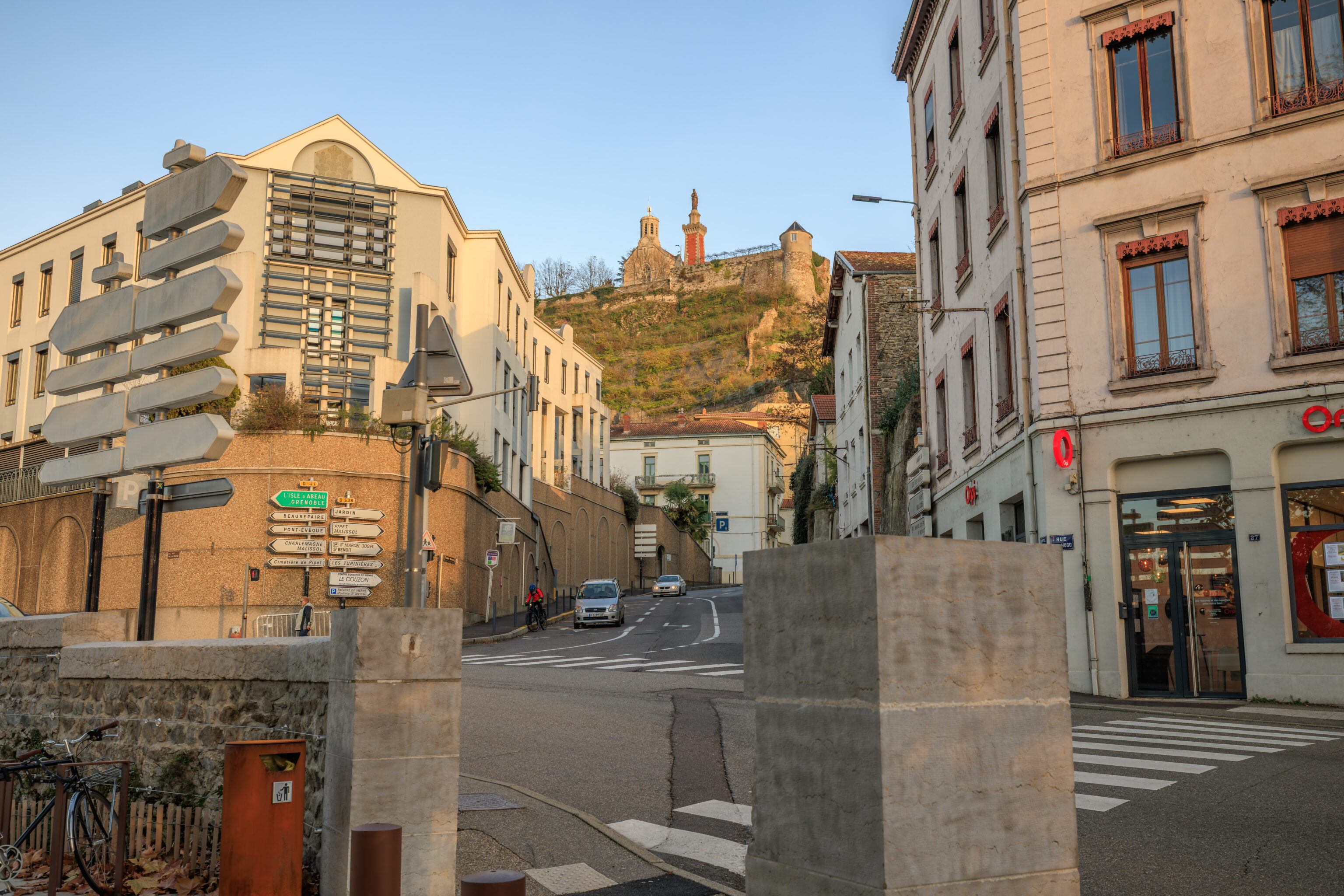
The top of the Pipet hill as well as a bit of the upper portions of the Théâtre Antique are visible from here.
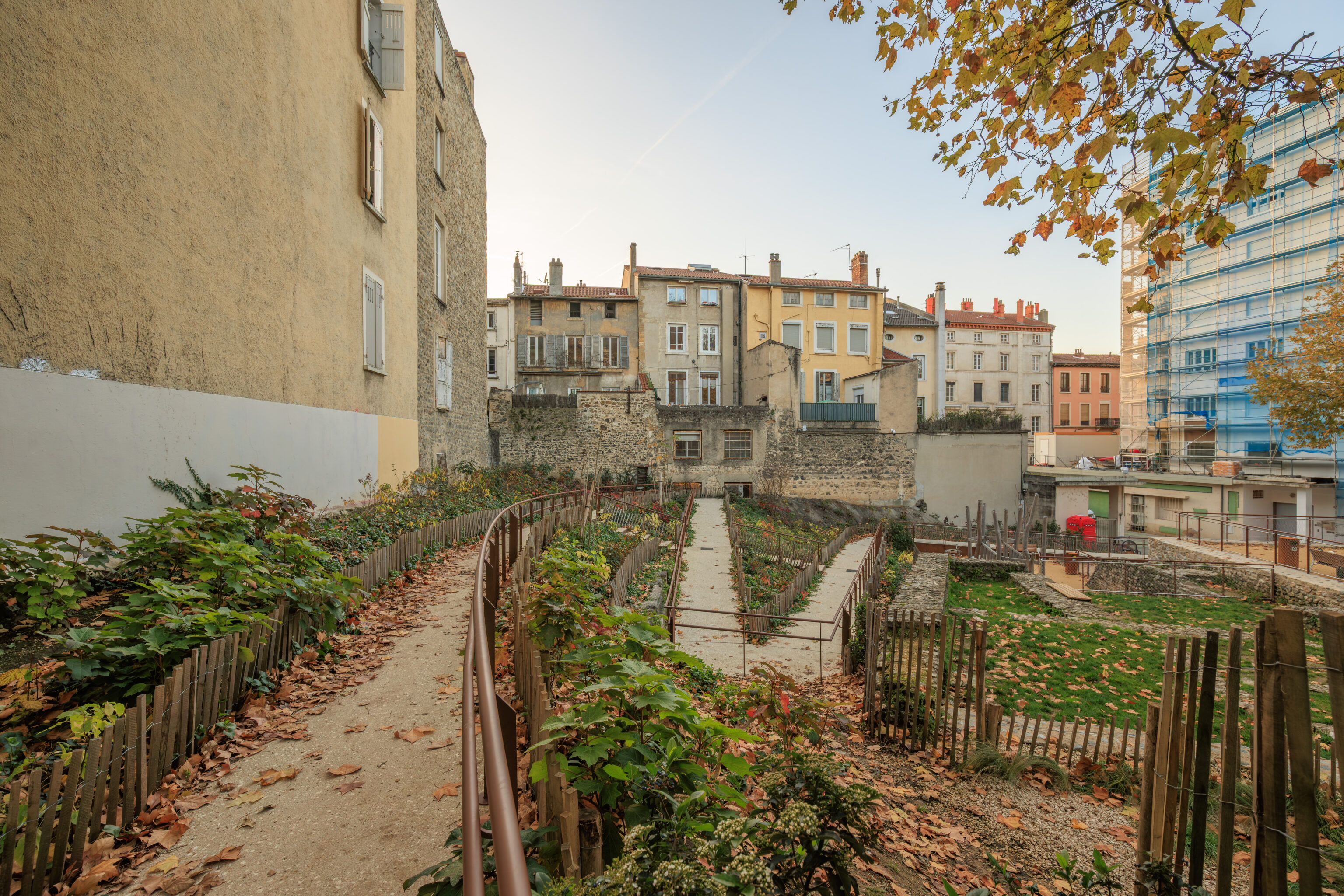
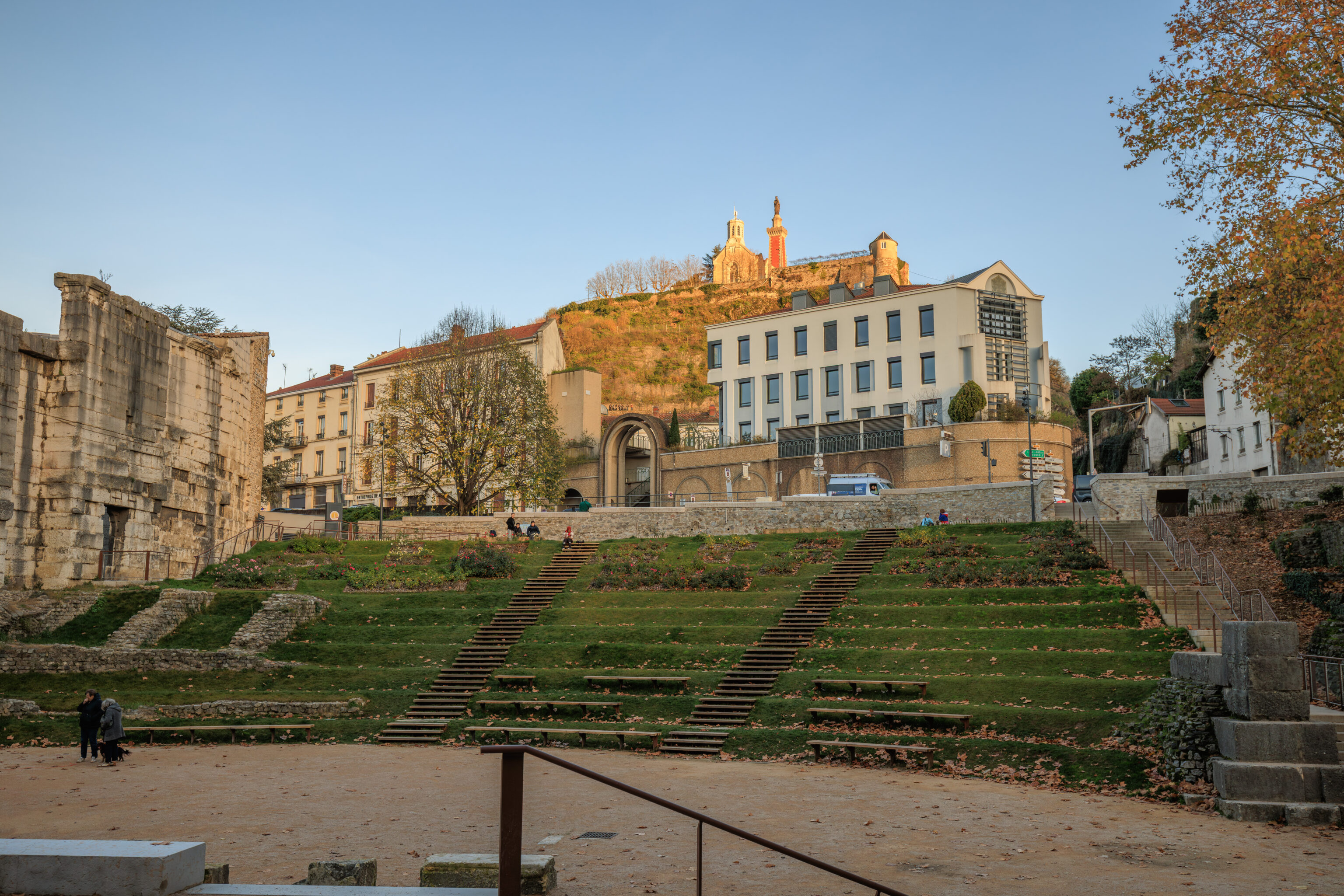
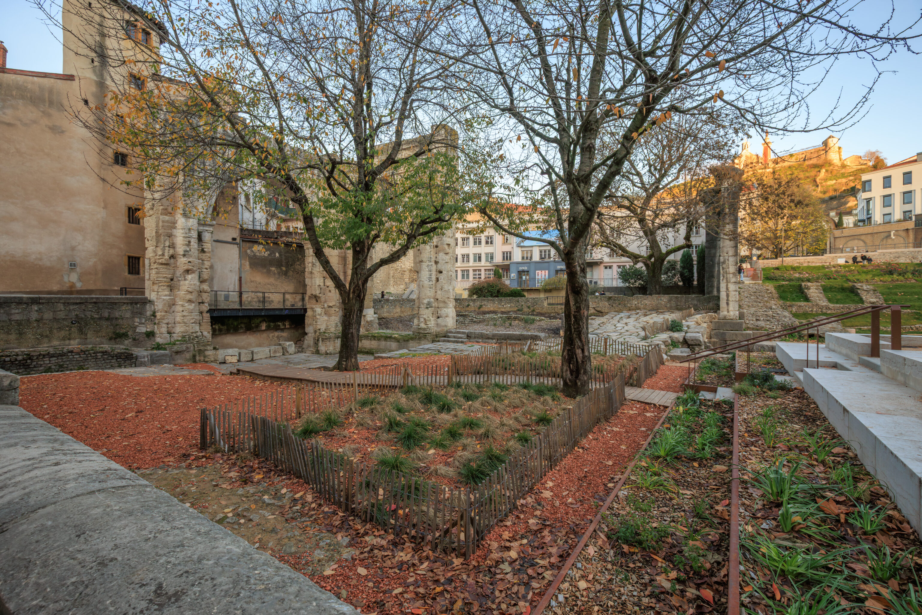
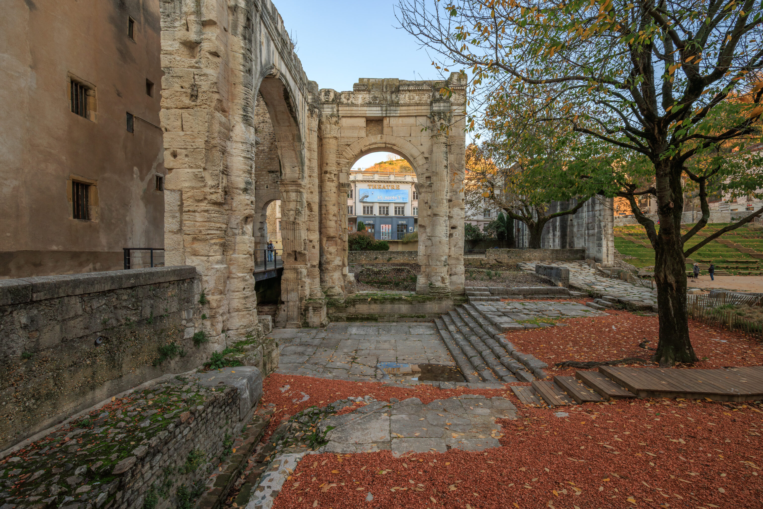
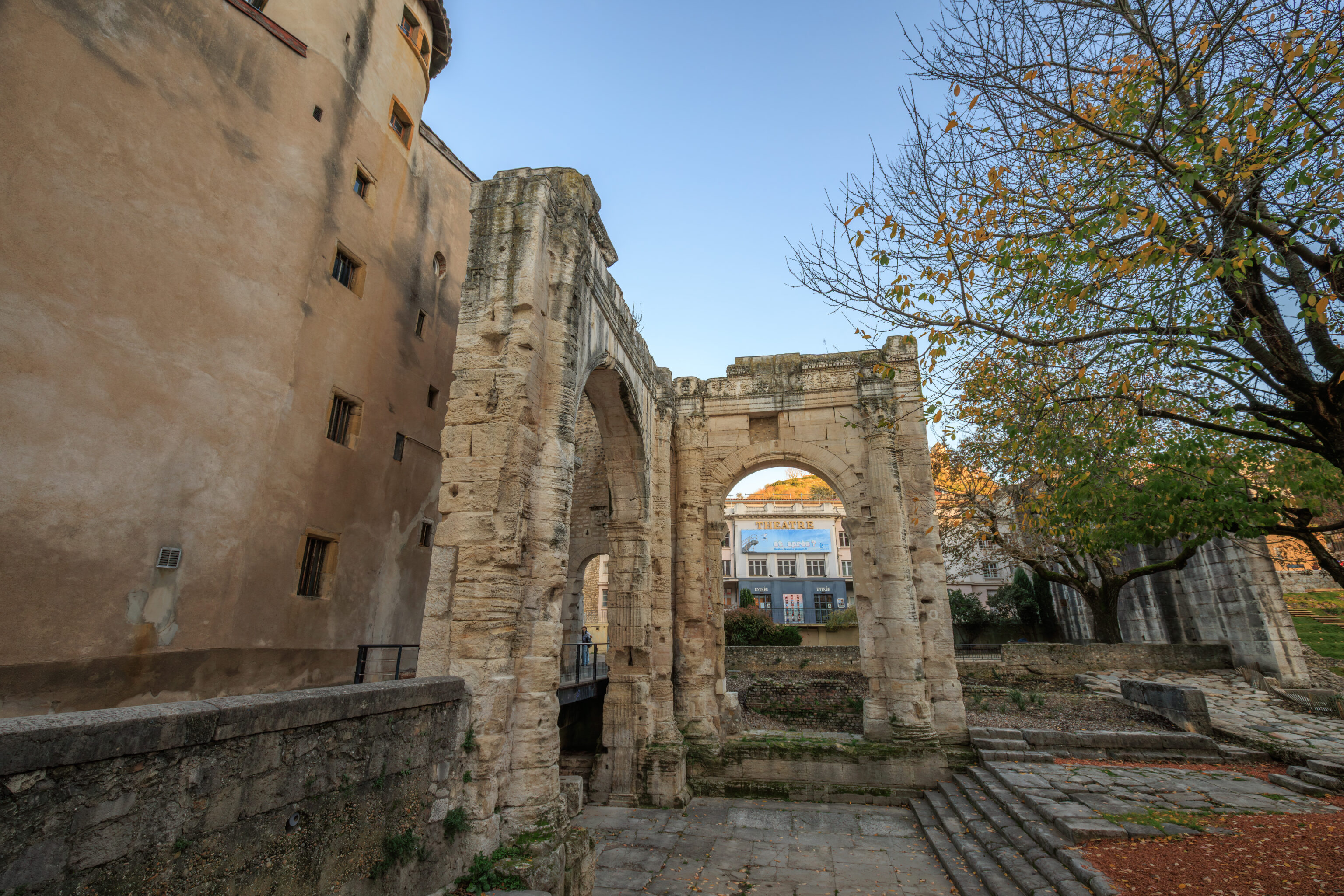
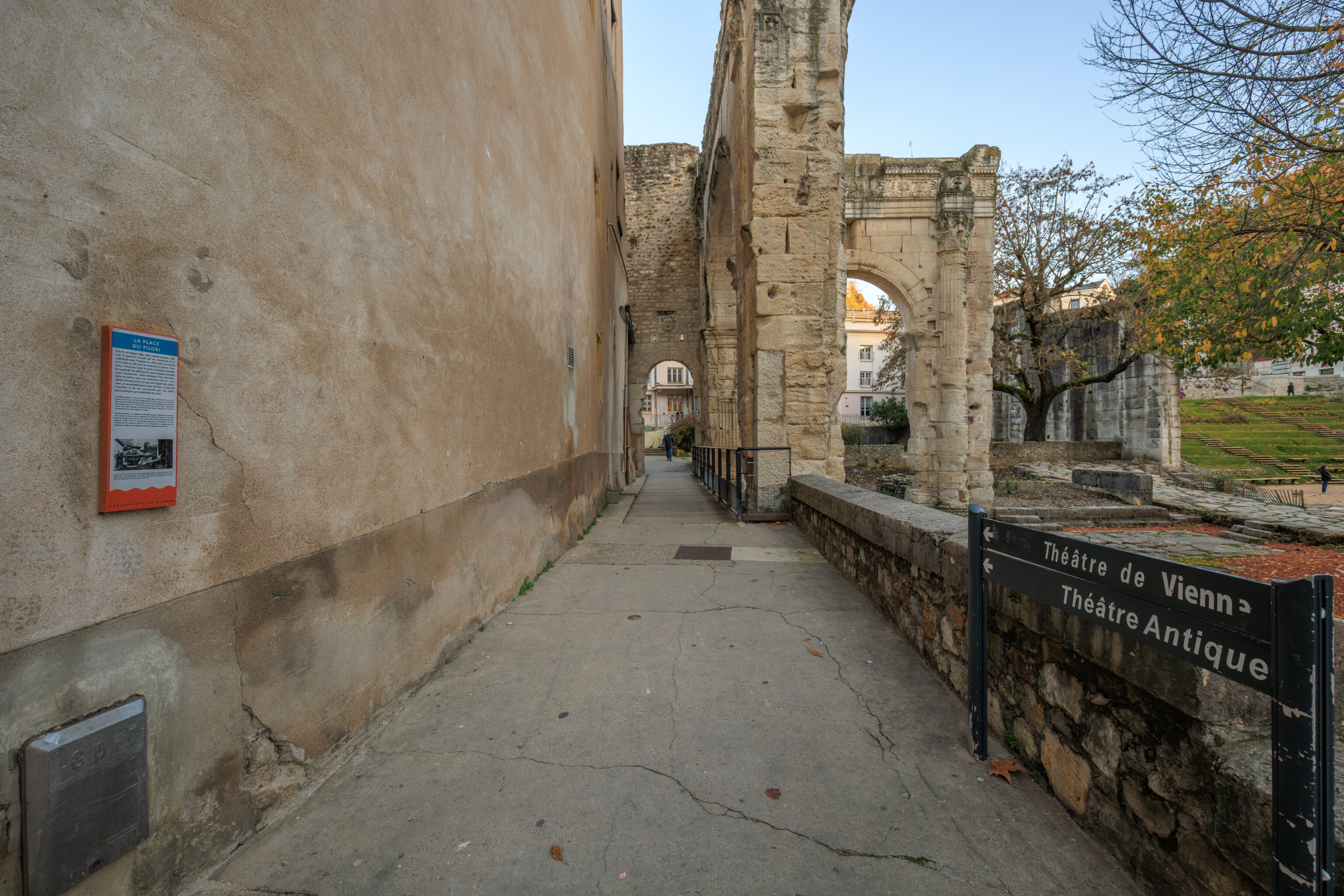
We walked to the west through the garden.
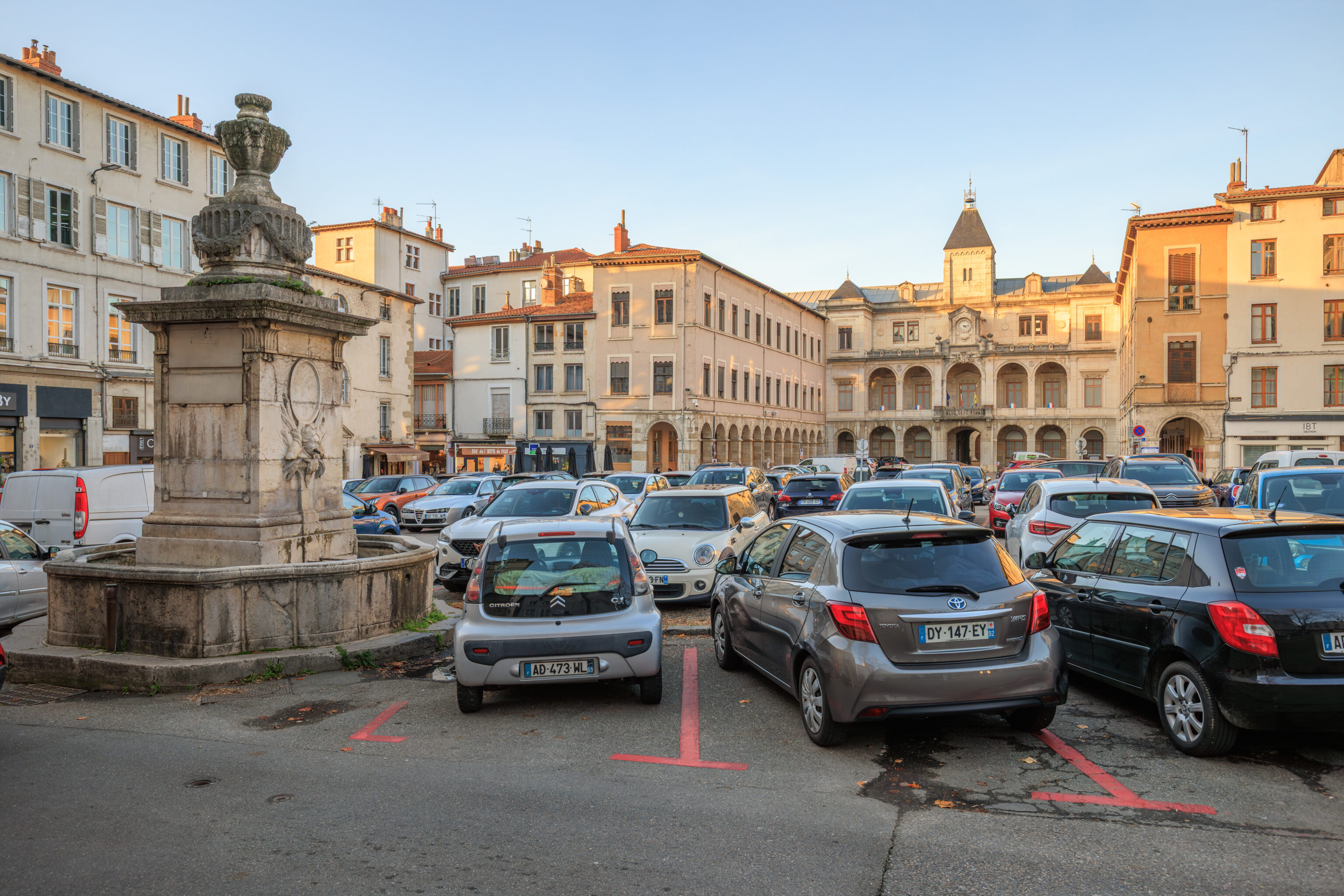
After walking past the garden, we passed by in front of the Hôtel de Ville (City Hall).
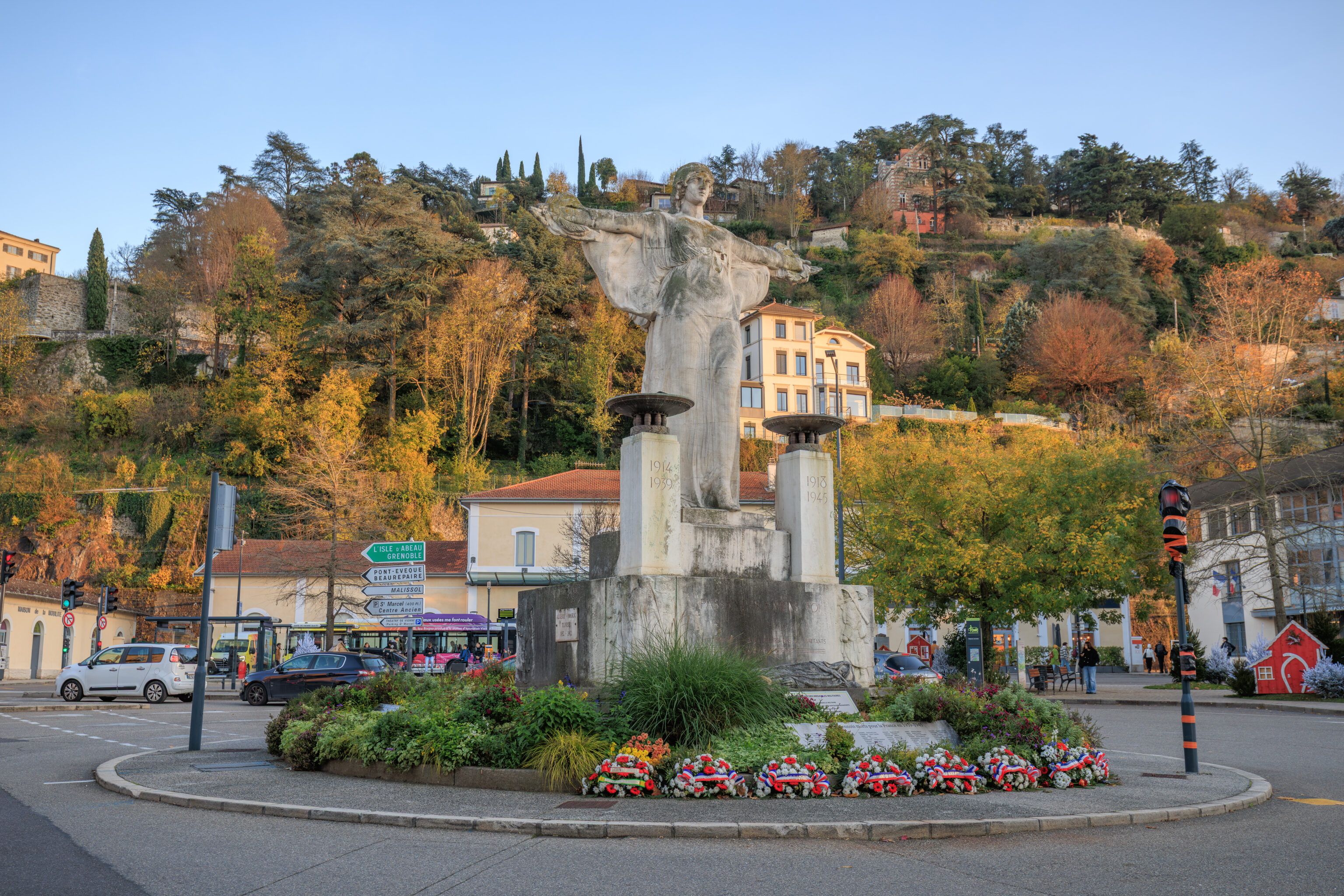
We continued on to the south, returning to the traffic circle by the train station.
We decided to turn to the west to see a bit more before leaving. There are fragments of the Vienne city walls still remaining. One such part is here, to the west of the train station and partially integrated into a modern building.
THE ROMAN CITY WALLS
The walls of Vienne were built by imperial decree, probably at the beginning of the Empire (not all cities enjoyed such a privilege). The ramparts encircle the five hills and likely follow the Allobrogian line.

Built for political rather than military reasons, the structure stretches for nearly 7 km, with walls and 58 towers clinging to the slopes or crowned the hills. Only the section along the Cours Brillier is on flat ground.

The walls do not encompass the entire urban area; excluded are, on the one hand, the southern plain where dwellings, large warehouses, and the circus were located, and on the other hand, the districts beyond the Rhône (Saint-Romain-en-Gal and Sainte-Colombe).

The southern part of the walls, visible here, was situated between two gates. The wall, nearly four meters wide, was faced with dressed limestone blocks which have disappeared. On the hills, the walls were thinner and must have reached more than eight meters in height.

Part of the Gallo-Roman enclosure was reused in the Middle Ages and until the end of the 18th century. The current Rue Boson is a repurposed section of the main north-south axis (Grand'Rue) which was closed off to the south by the Avignon Gate.
– Text from a sign, translated using Google.
The wall remnants are not particularly scenic today.
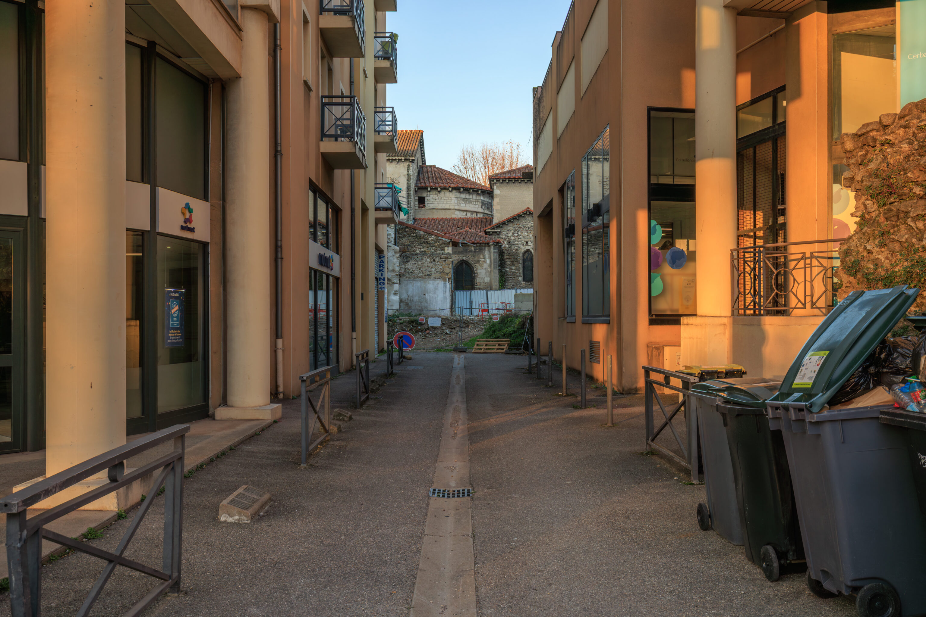
The structure here in the background seems to be the rear of the Église Saint-Pierre (Saint Peter’s Church), built in the 5th century. This church is currently the Saint-Pierre Archaeological Museum. It has been undergoing renovations since the end of 2022, scheduled to finish in 2027.
The renovation began on October 31, 2022, and is expected to last until at least the end of 2027.
– https://whichmuseum.com/museum/musee-archeologique-saint-pierre-de-vienne-41674
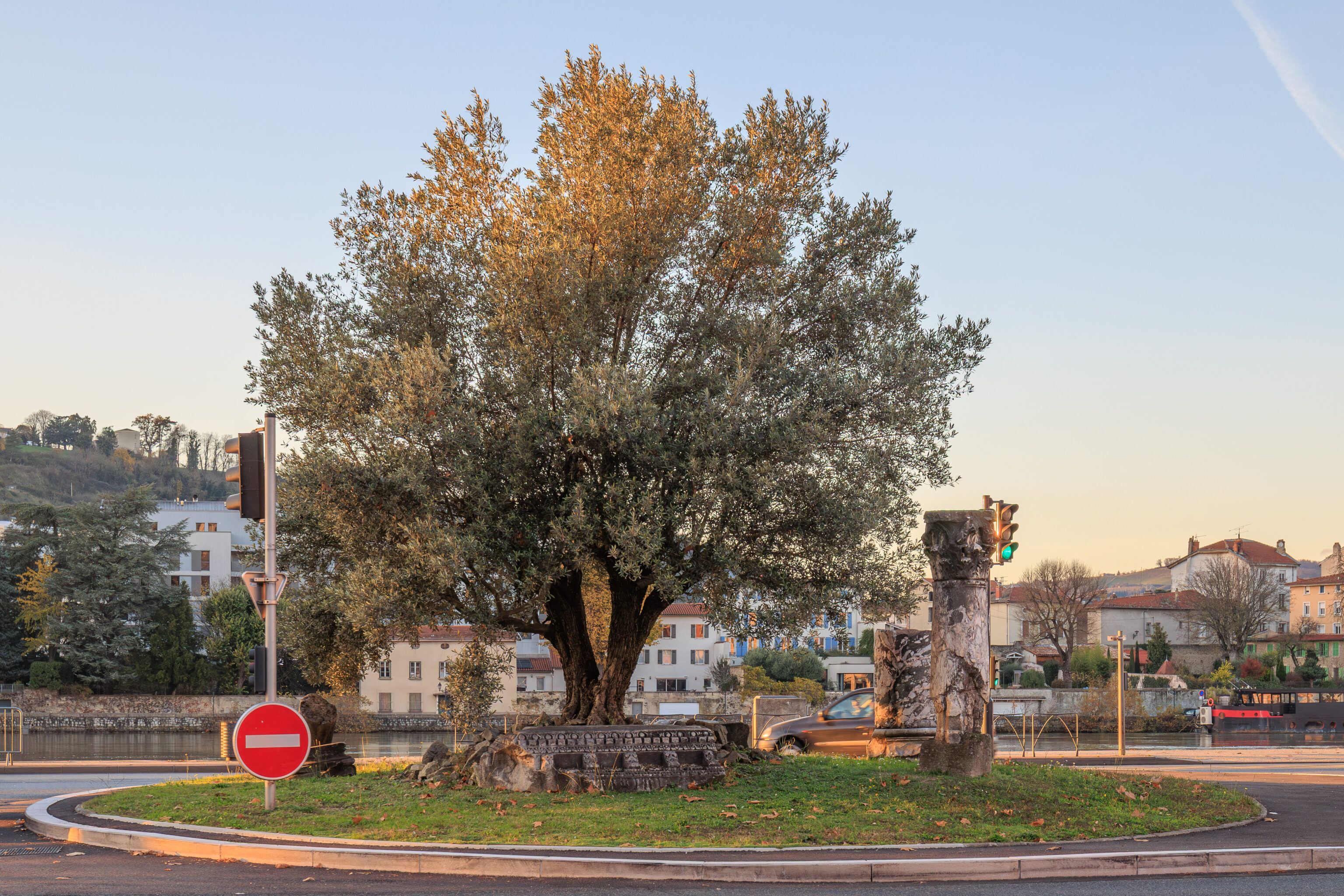
We continued to the west, reaching a traffic circle at the western shore of the Rhône. There were pieces of ruins within the traffic circle.
Jardin de Ville
The Jardin de Ville (City Garden) is supposed to have some Roman artifacts within it. The entrance here near the traffic circle wasn’t obvious as it was on the side of the Pavillon du Tourisme.
Not sure what this sculpture is supposed to be! A rabbit? A dog?
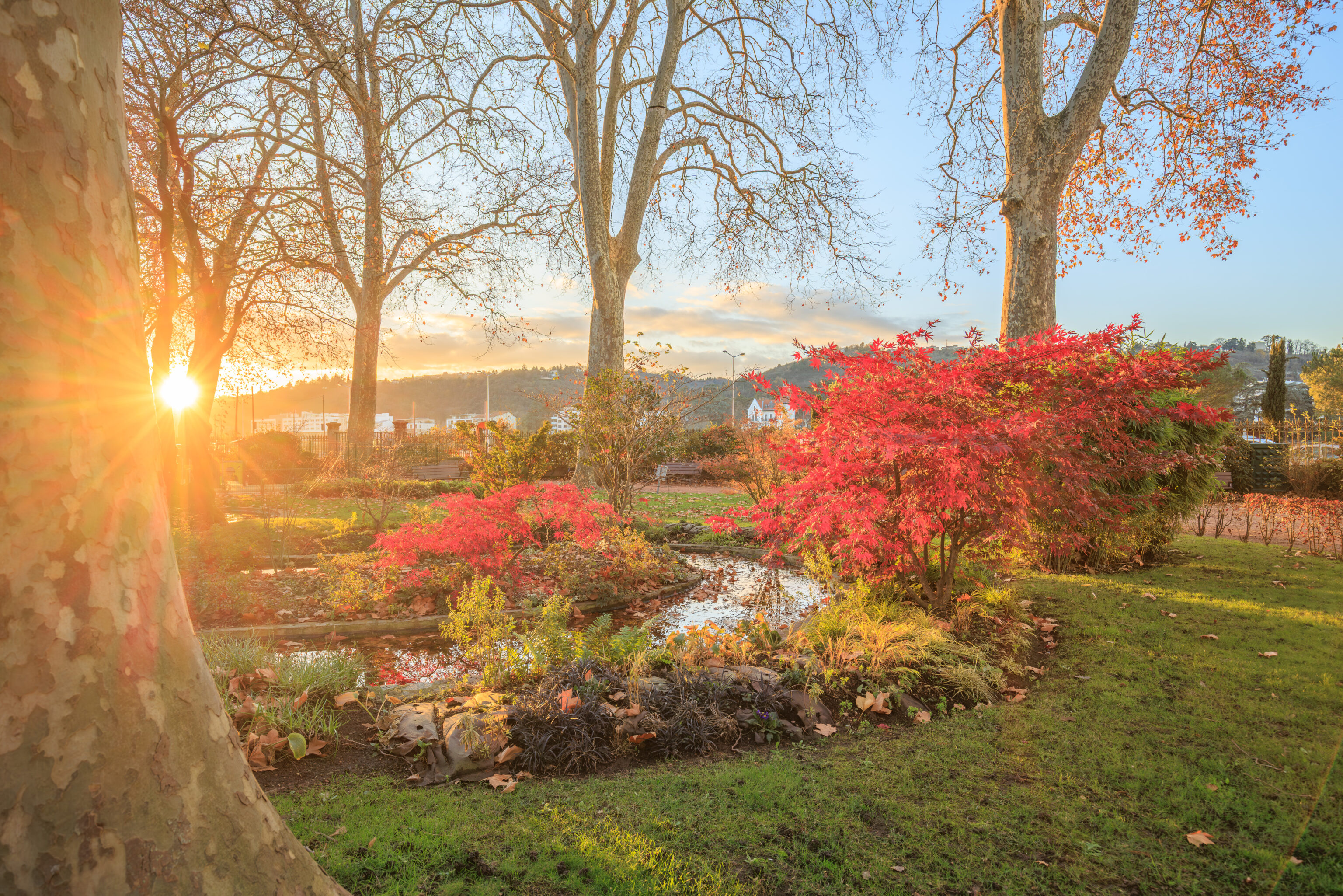
We walked by a small pond near the western edge of the garden.
A monument to Andre Rivoire, a poet and playwright who was born here in Vienne.
We walked past an insect house. These things seem to be fairly popular these days.
A few pieces of ruins in the foreground with a large sculpture in the background.
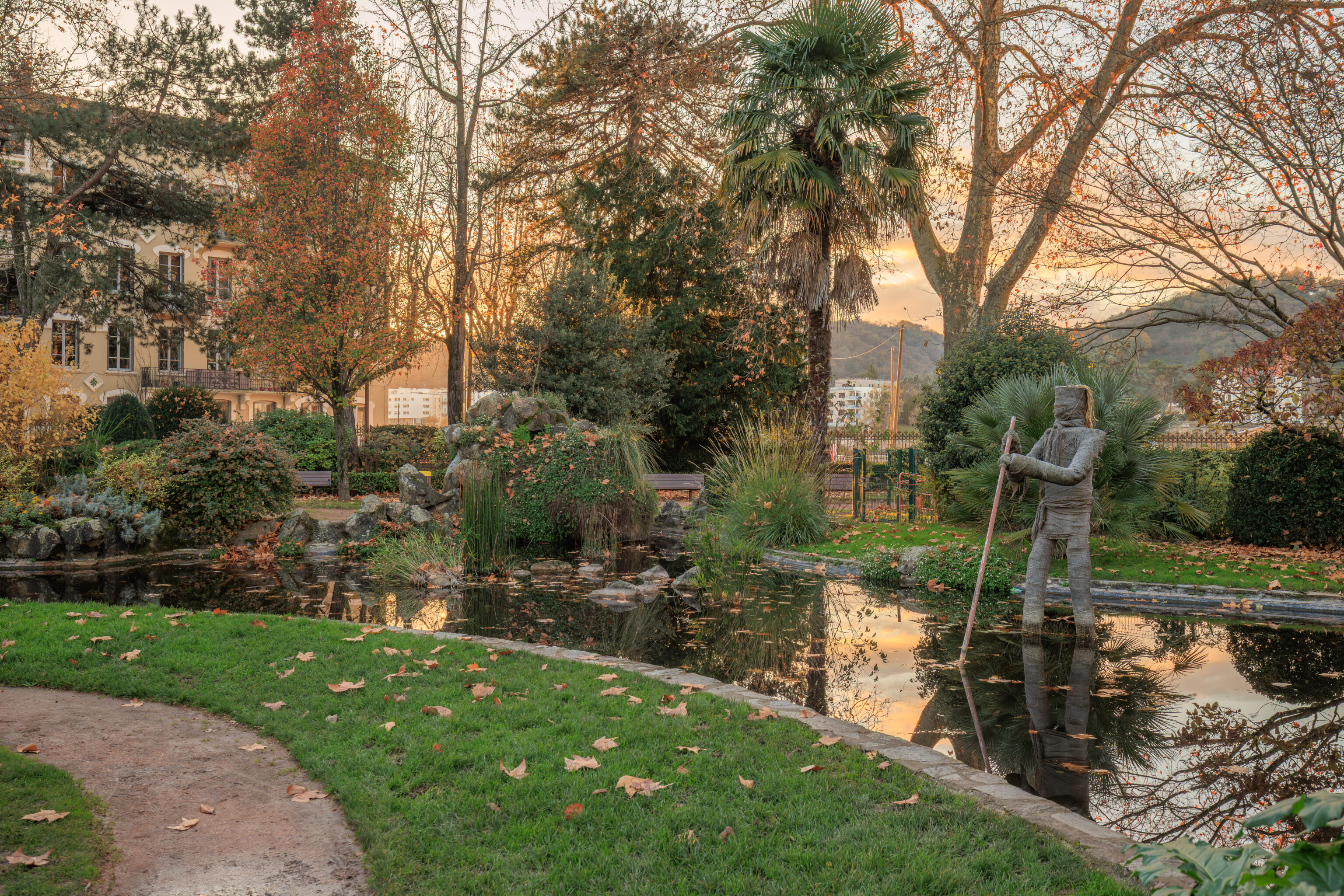
An interesting sculpture on the right! Its worth mentioning that something stank extremely bad here in the garden. We don’t know what it was, rotting plant matter or perhaps dog poop.
An old Roman road discovered in 1895.
We quickly walked through the remainder of the garden, passing by the large sculpture that we saw earlier on our way. As international tourists, this garden was definitely skippable, or at least, not worth going out of the way to visit.
Lyon
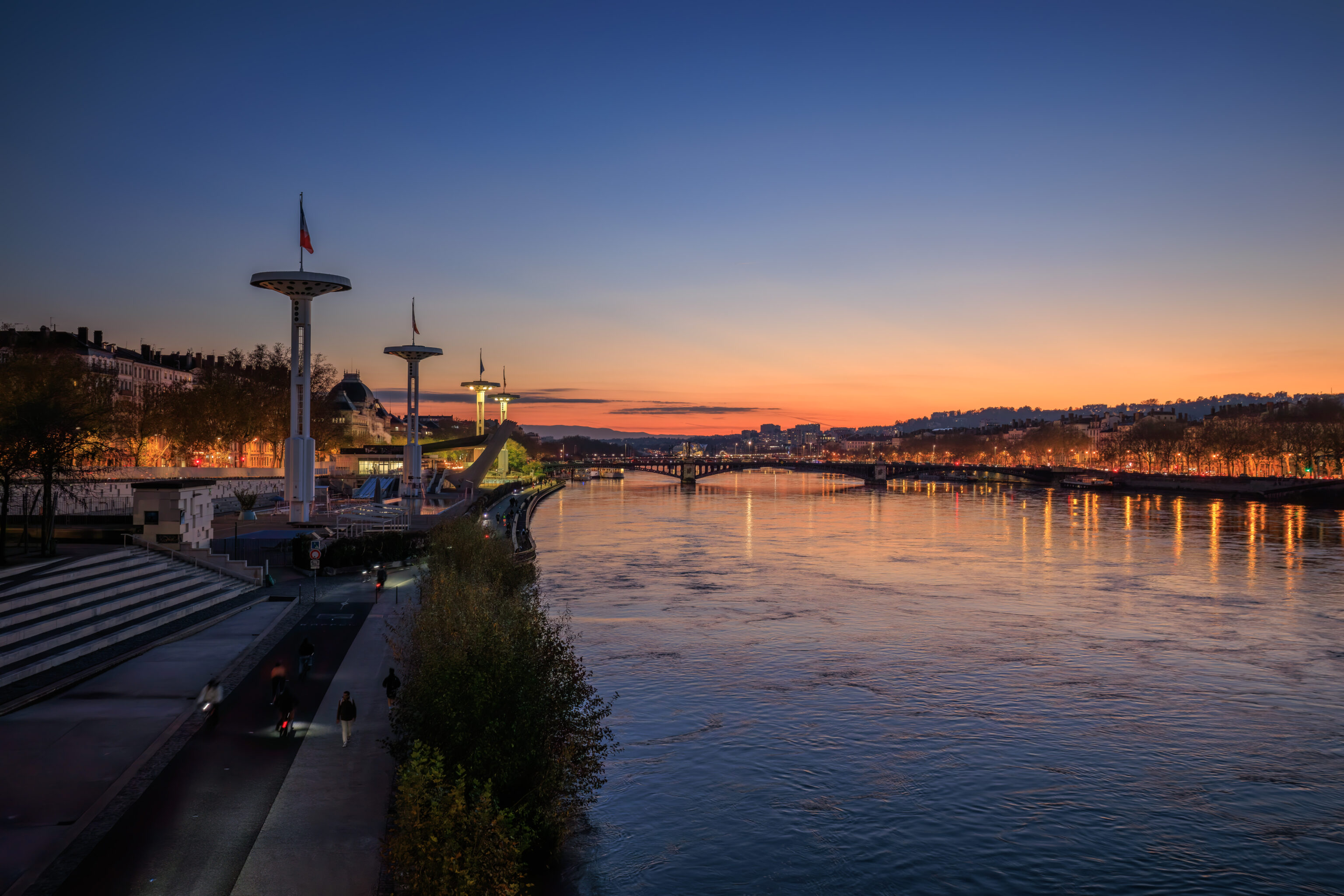
After returning to Lyon, we walked west over the Rhône via the Pont de la Guillotière. We caught the end of a beautiful sunset as we walked across!

We visited the CoCo near the Hotel-Dieu again to get some tea. We got two, a cold Tropical Special and a hot Matcha Latte, which we finished back at the InterContinental.
Later on in the evening, we headed out for dinner at around 7:30pm. We wanted to try Bouchon Tupin but it was fully reserved. So, we headed to the nearby Le Bouchon des Cordeliers.
A few slices of charcuterie, what would probably called salami in English and saucisson sec in French, were provided.
We decide to order two menus, named the Menu des Canuts here (Silk Workers’ Menu). In this context, the French menu is what we’d refer to in the US as prix-fixe, which is simply French for fixed price. There are three courses, appetizer, main, and dessert, and you can pick one from each category, all for the same price.
The pâté was excellent, better than the one we had on Monday at Beaune.
We weren’t sure what we were getting here with pigs feet and snails. It was excellent, particularly with the bacon wrapped around it!
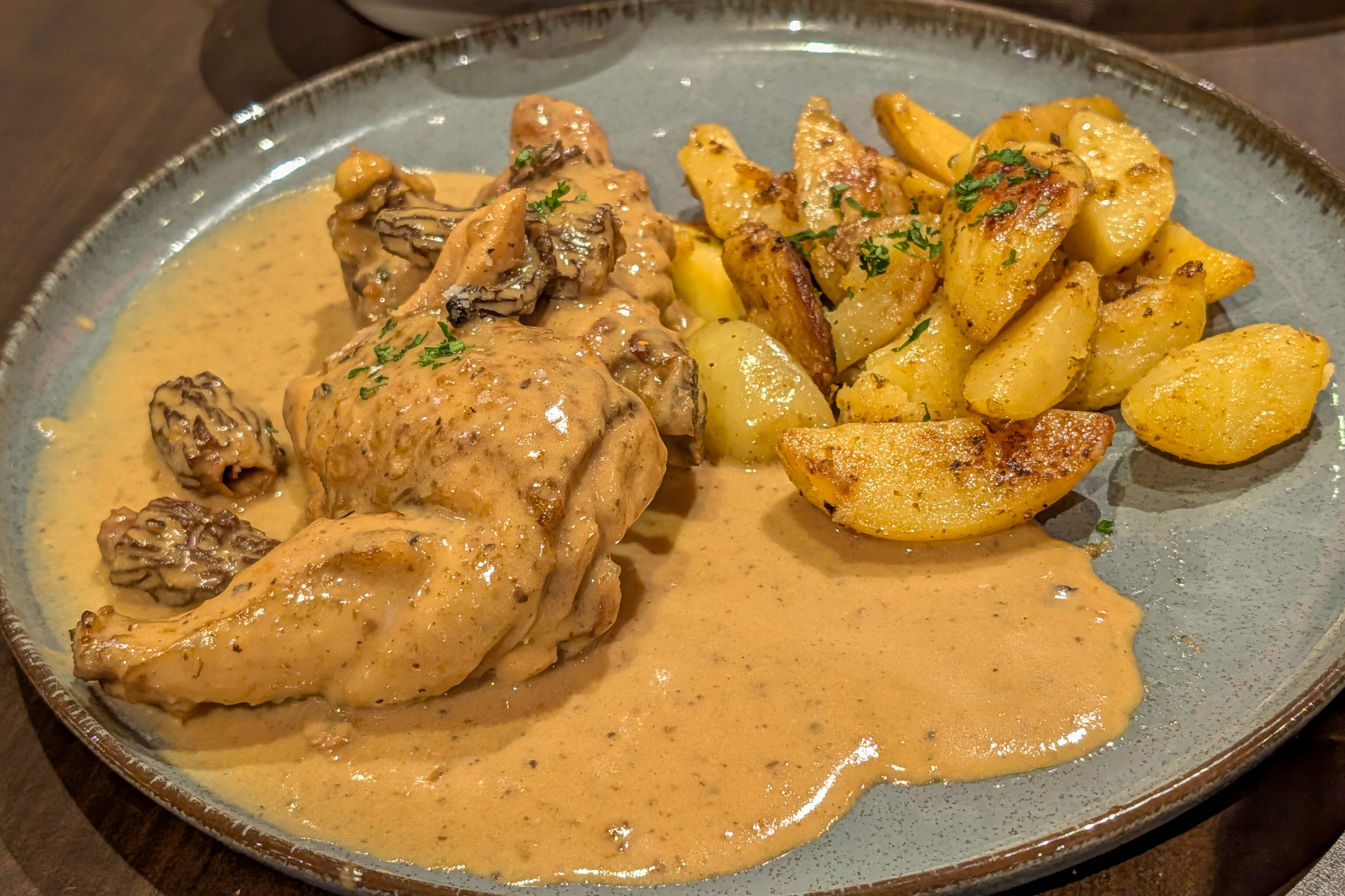
For one of our mains, we ordered the plat du jour, which was something like farmer’s chicken. It also had the word black, beyond that, we don’t recall. It was again excellent. The chicken was well cooked and the sauce was fantastic.
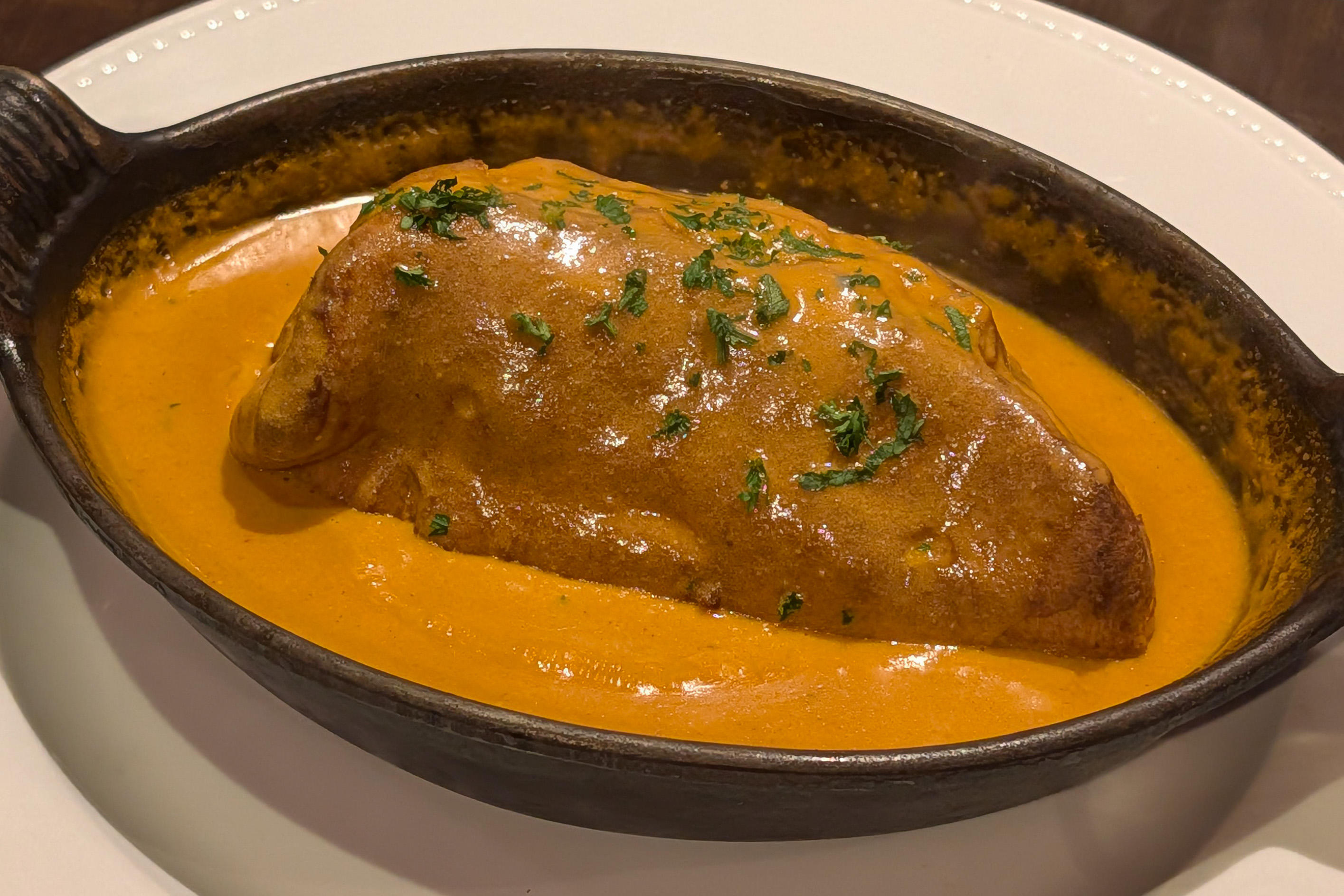
The quenelle was also excellent!
The quenelle came with rice pilaf, which was good with the sauce from the quenelle.
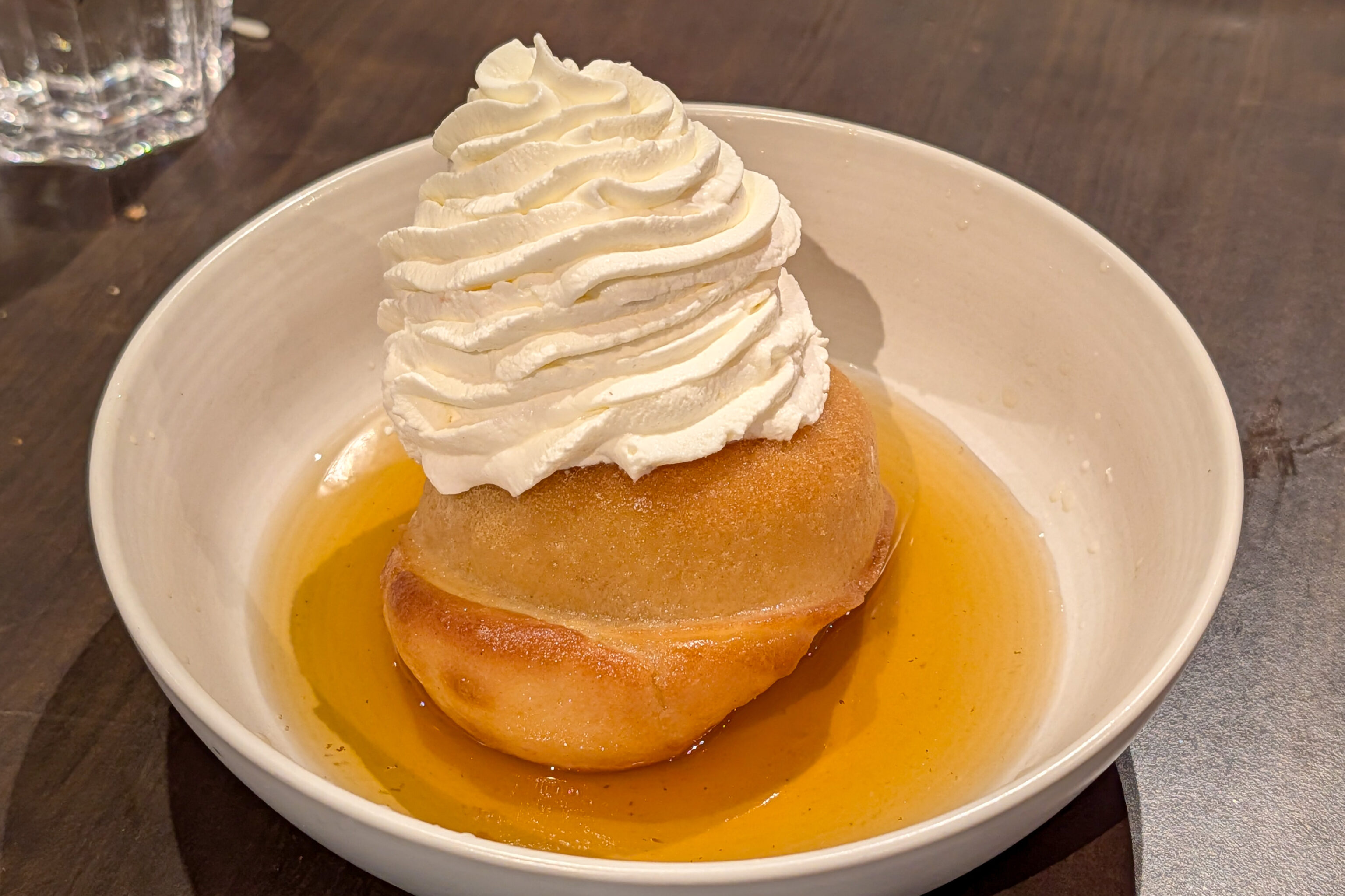
We had no idea what this would be. It is served as a cake with cream. Rum is poured into it upon serving. This was done from a huge old Champagne bottle!
The pear crumble was pretty straightforward and what we expected. An excellent dinner ending our last full day here in Lyon.