
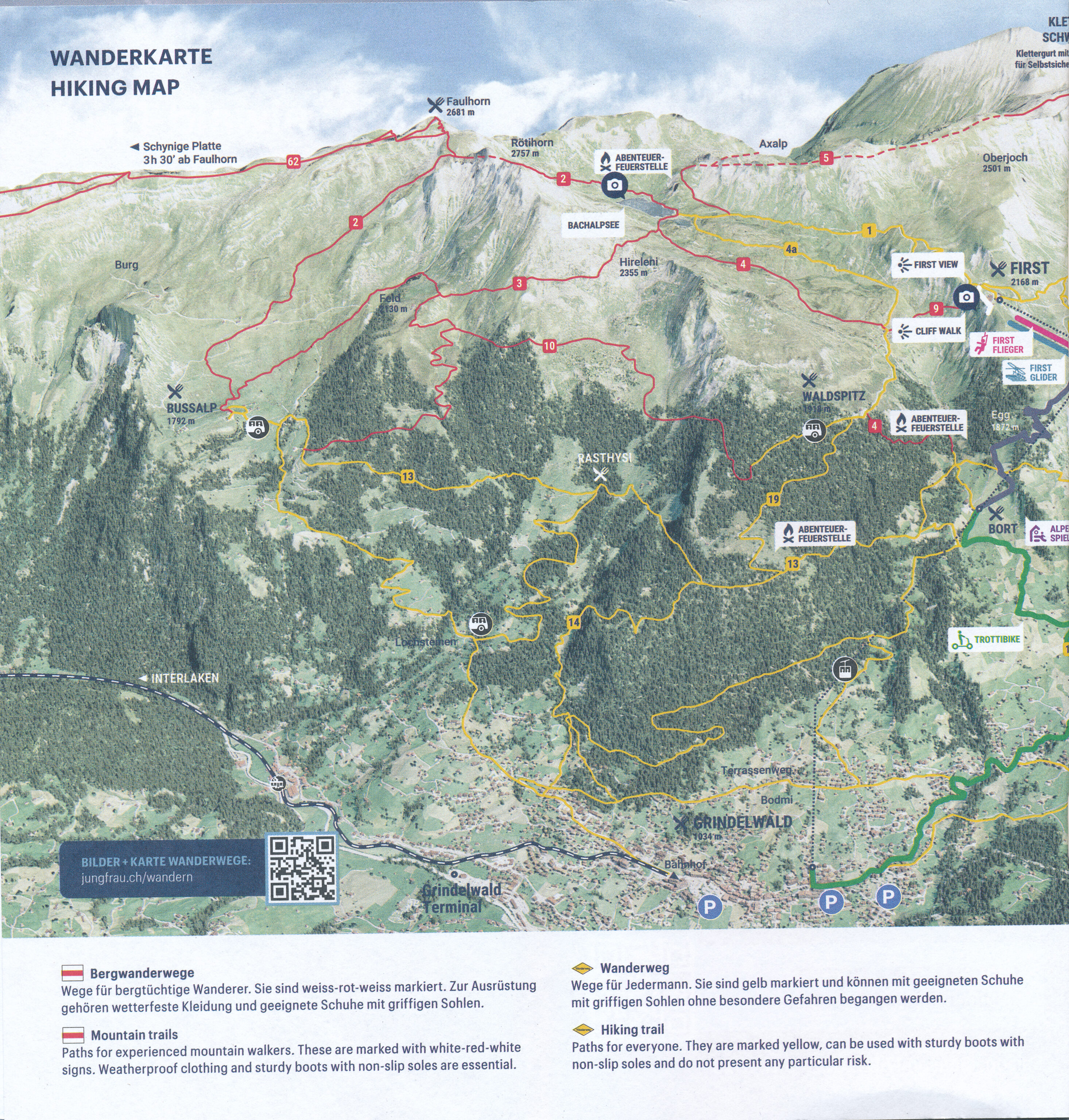
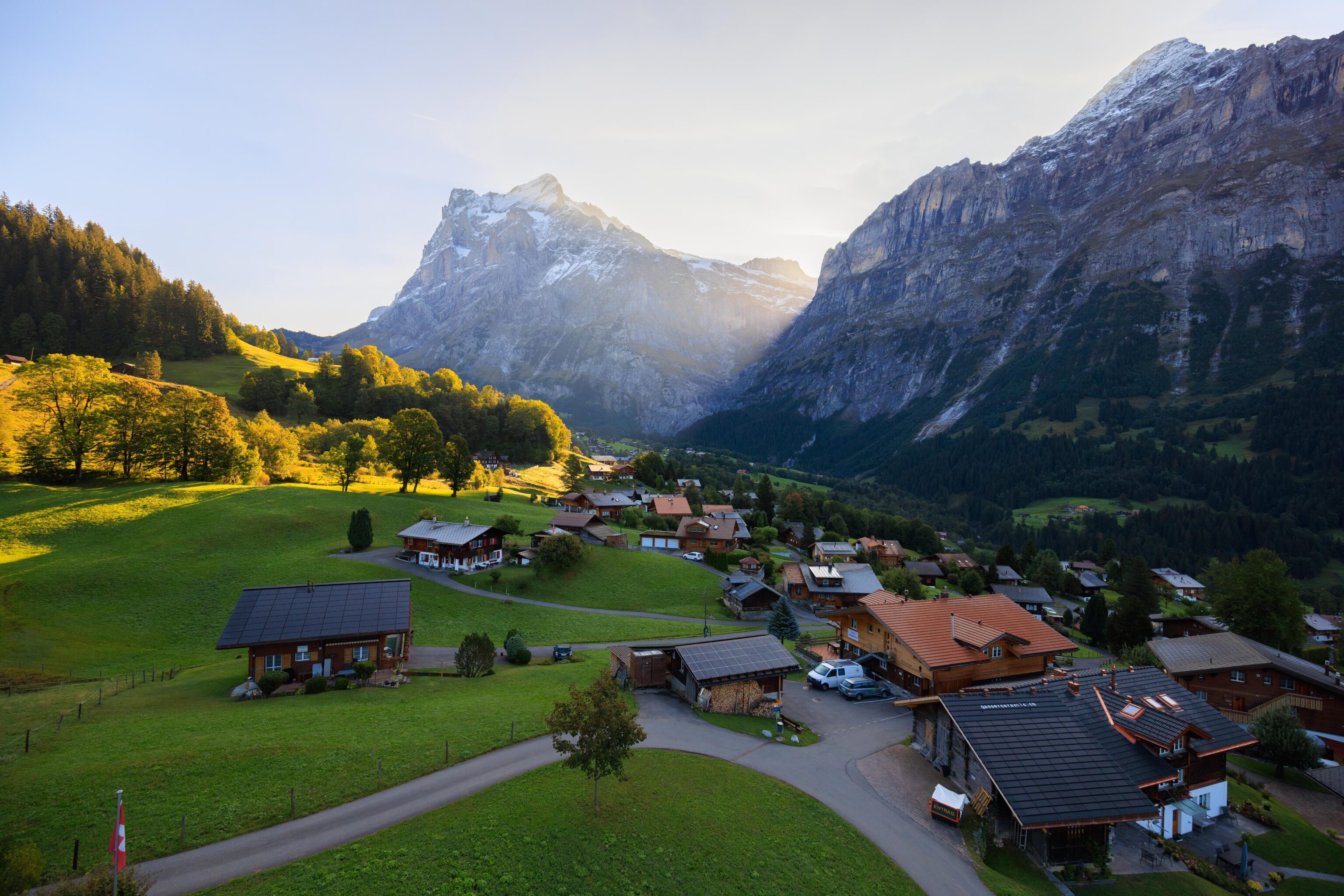
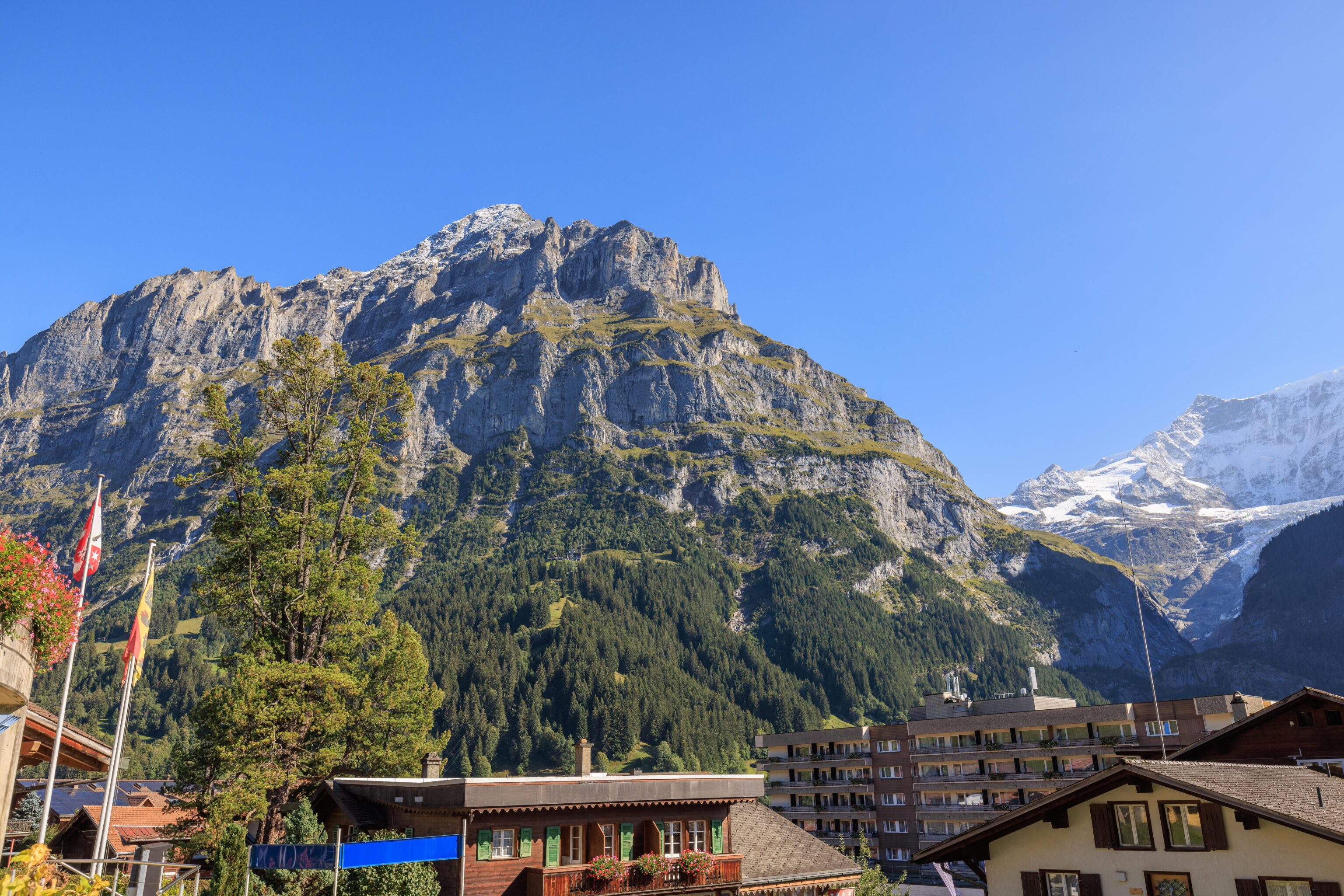
After a nice breakfast at the Hotel Belvedere, we walked over to the Grindelwald First gondola and took it up to First. From there, we checked out the scenery from the First View platform and then did the First Cliff Walk. Next, we hiked over to the Bachalpsee, a pair of alpine lakes. From there, we returned to First and took the gondola back down to Grindelwald where we had dinner and ended our day.
We woke up in time to make it to breakfast right after it started at 6:30am. We were able to sit next to the windows.
There was a good selection of items, many of them from the local region. The breads, from a local bakery, were excellent. The few hot items that they had were very good as well. There were also some local yogurts with interesting flavors. Overall, a great start to the morning.
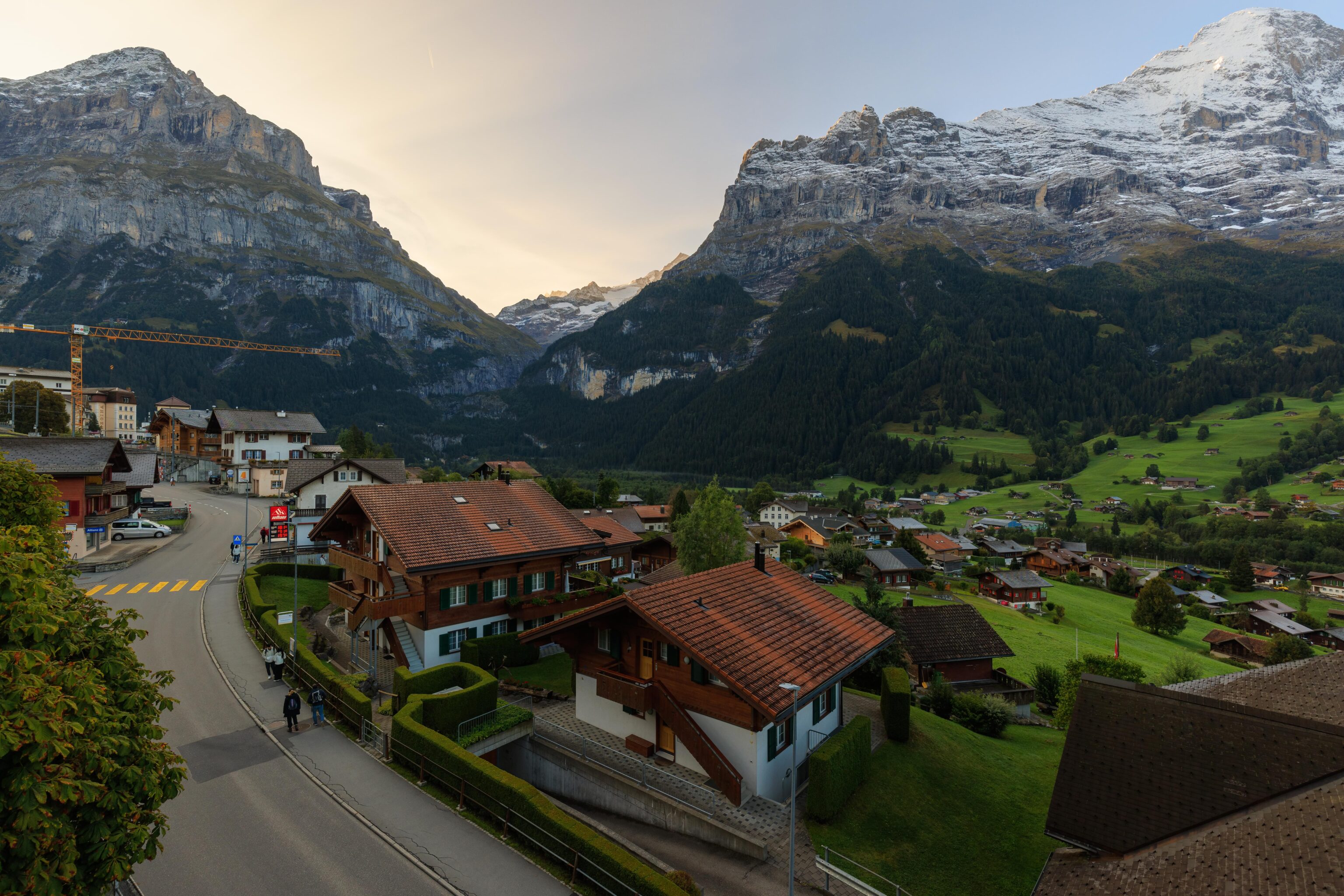
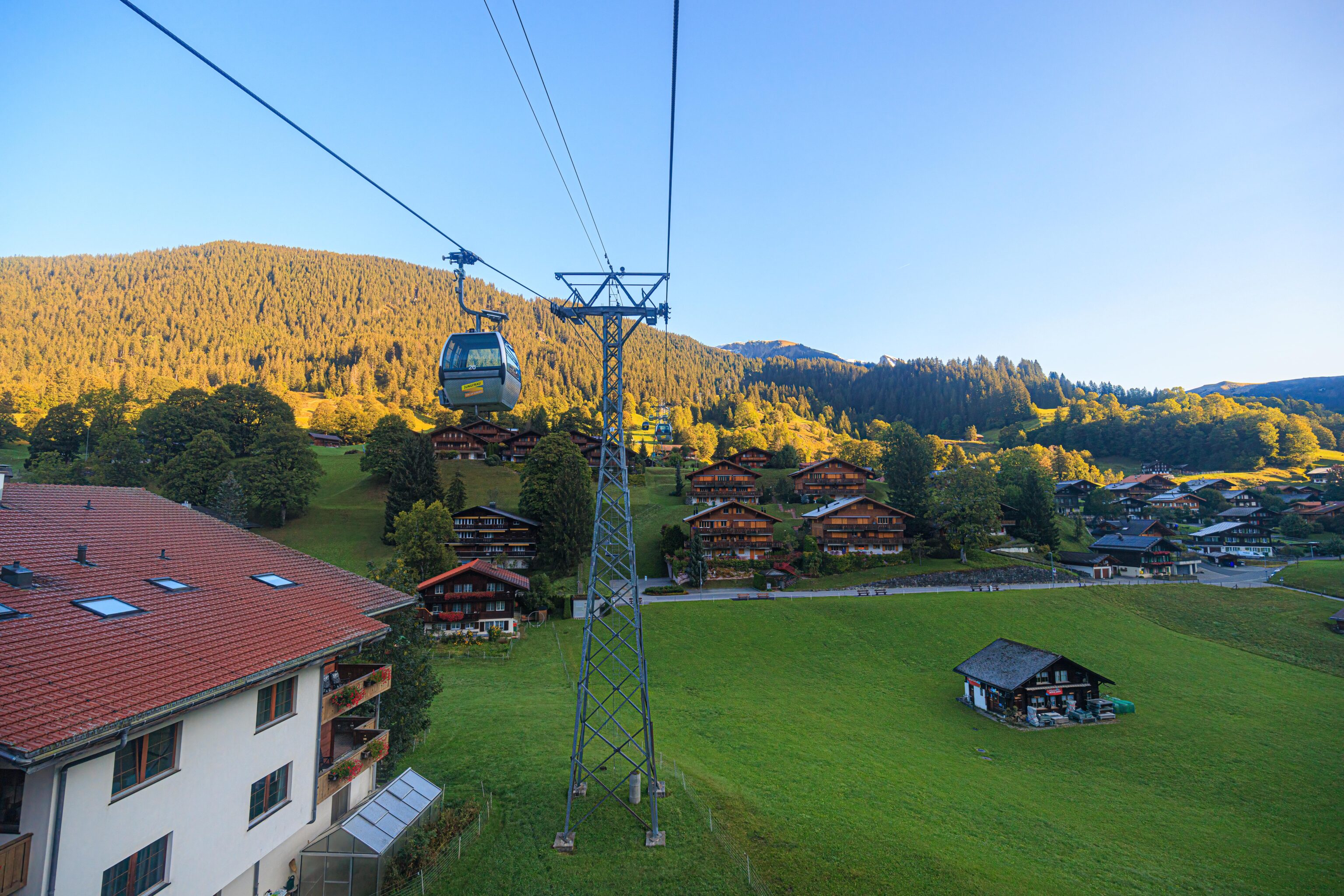
We headed out shortly after breakfast. The sun was still hidden behind the mountains to the east as we walked over to the Grindelwald First gondola station.
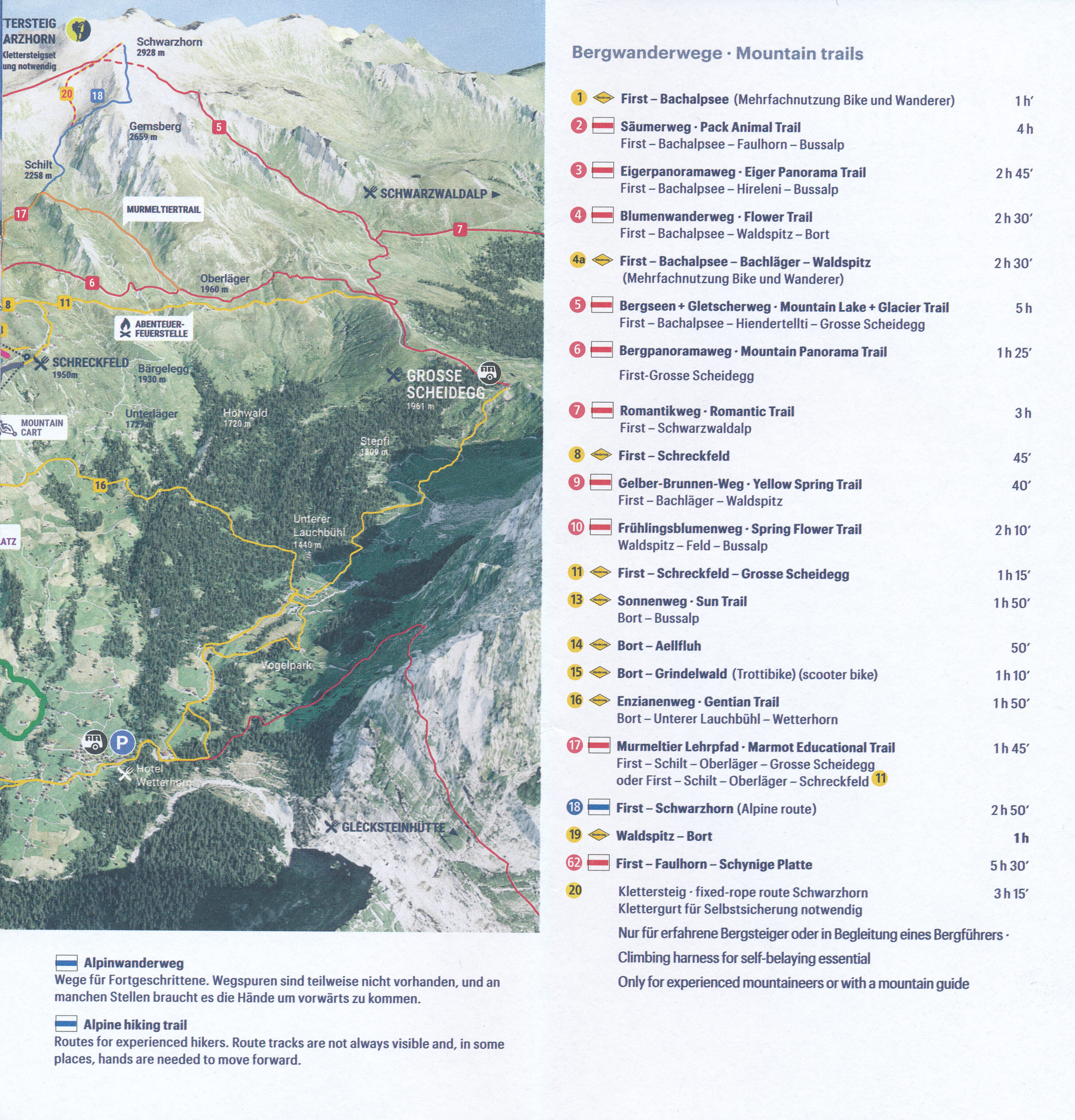
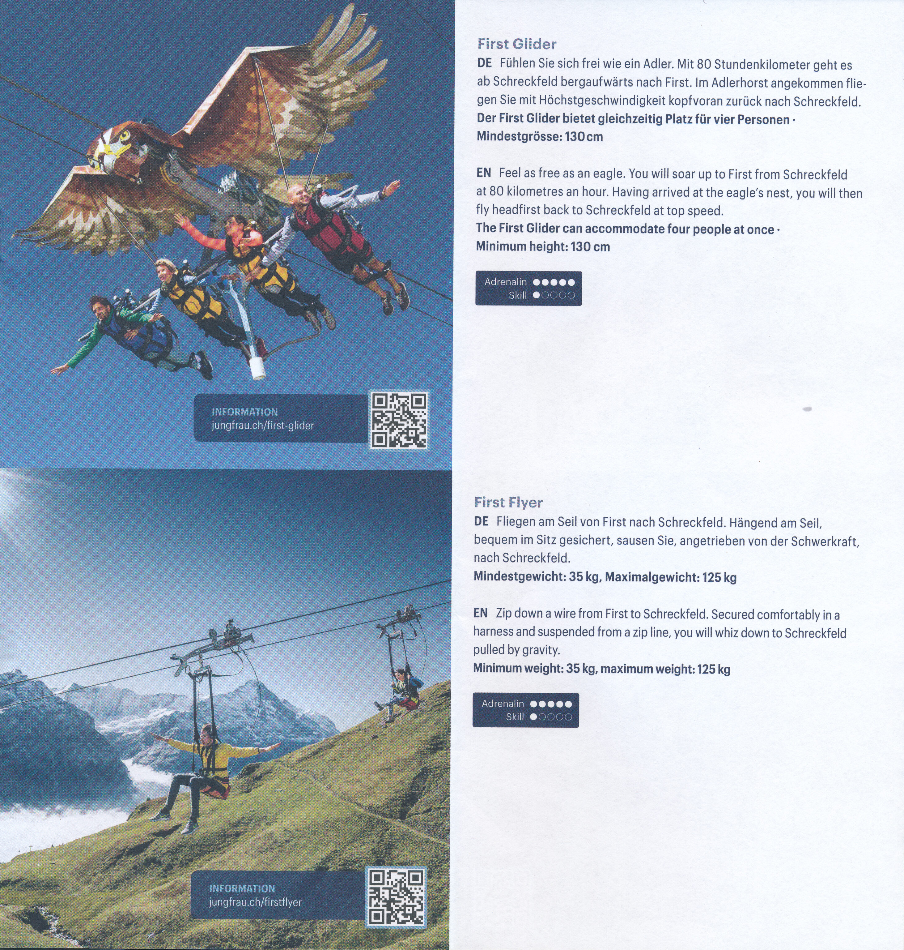
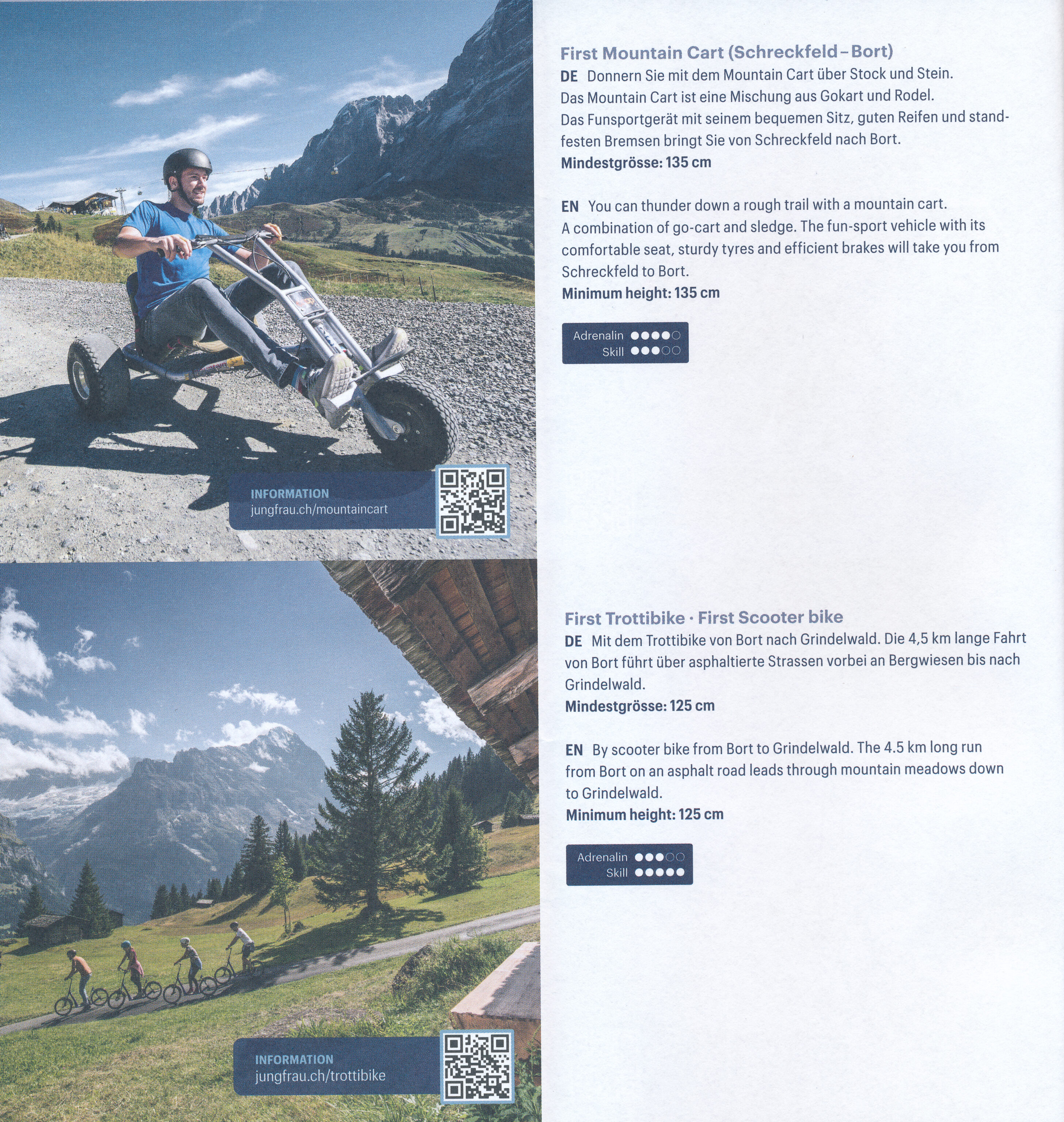
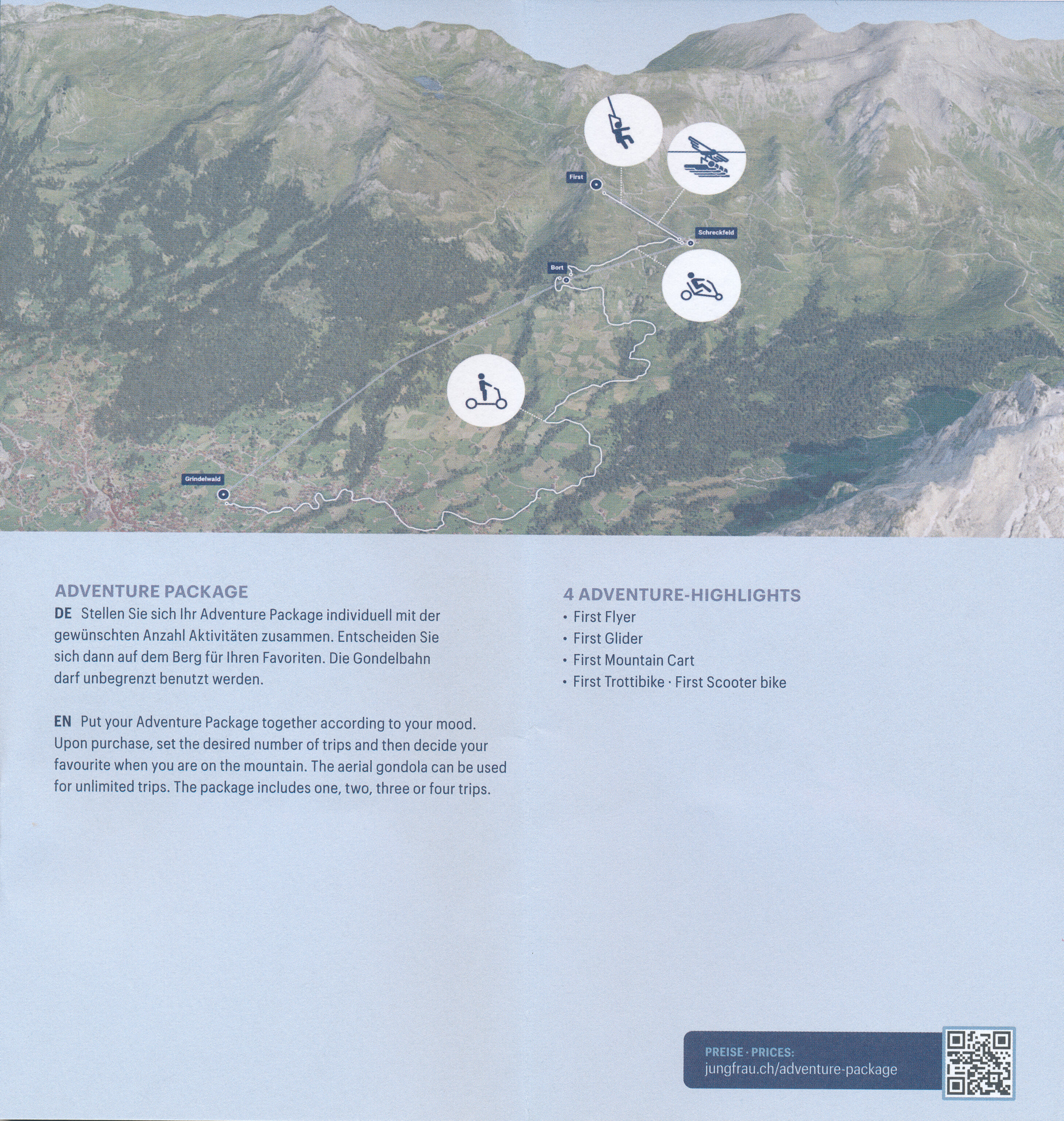
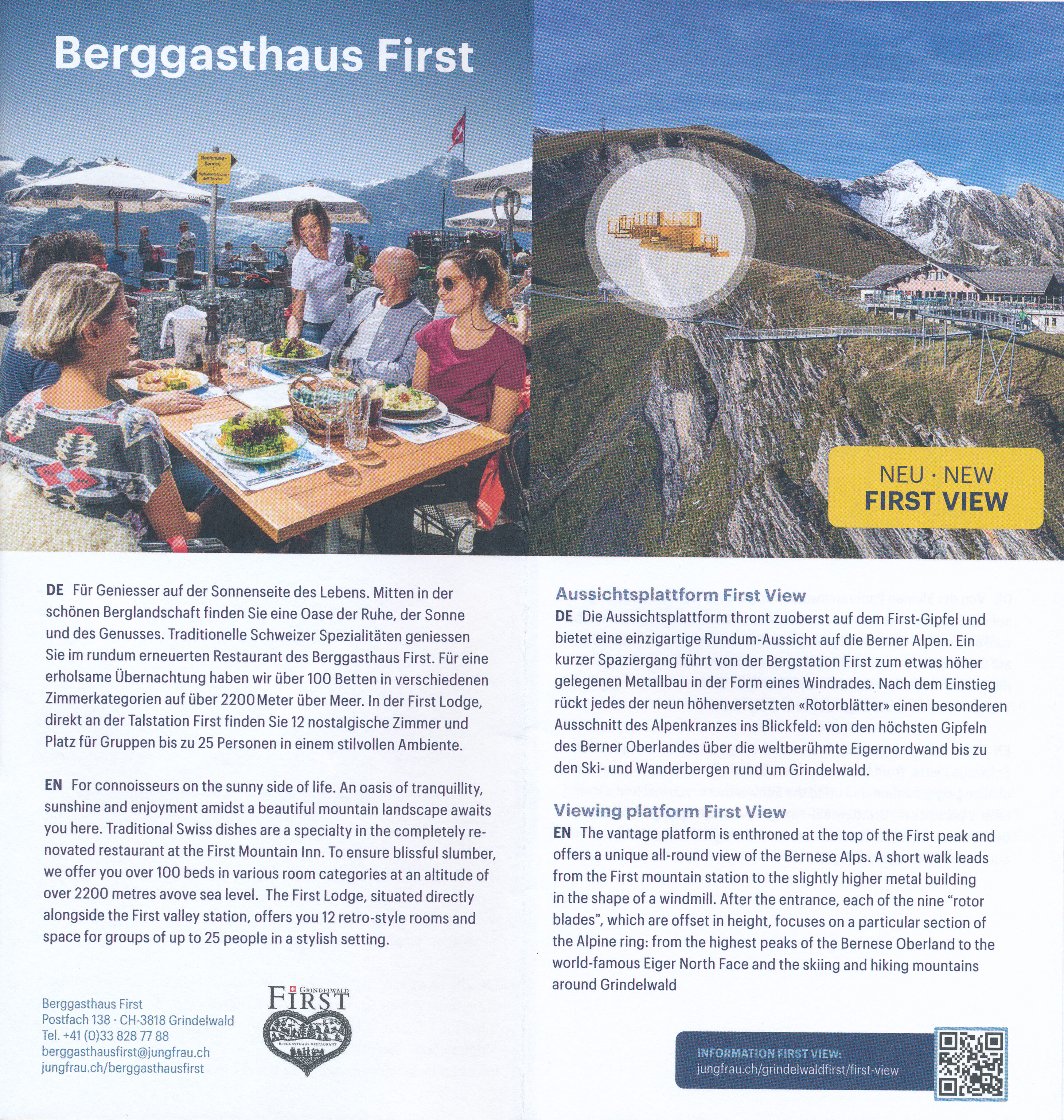
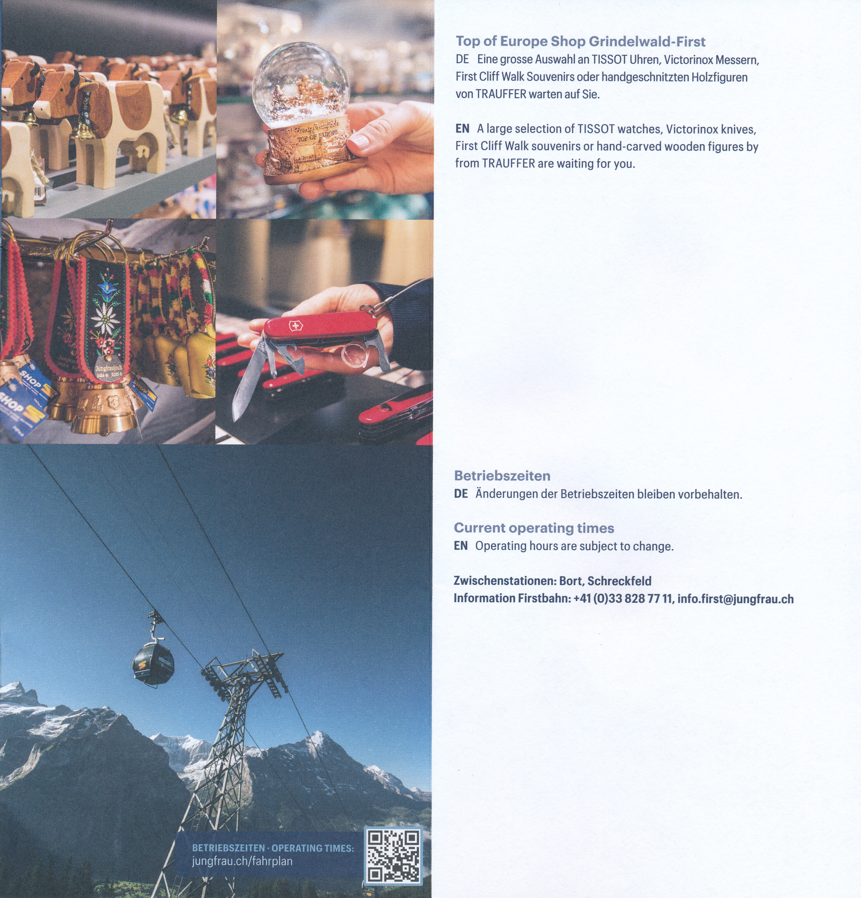
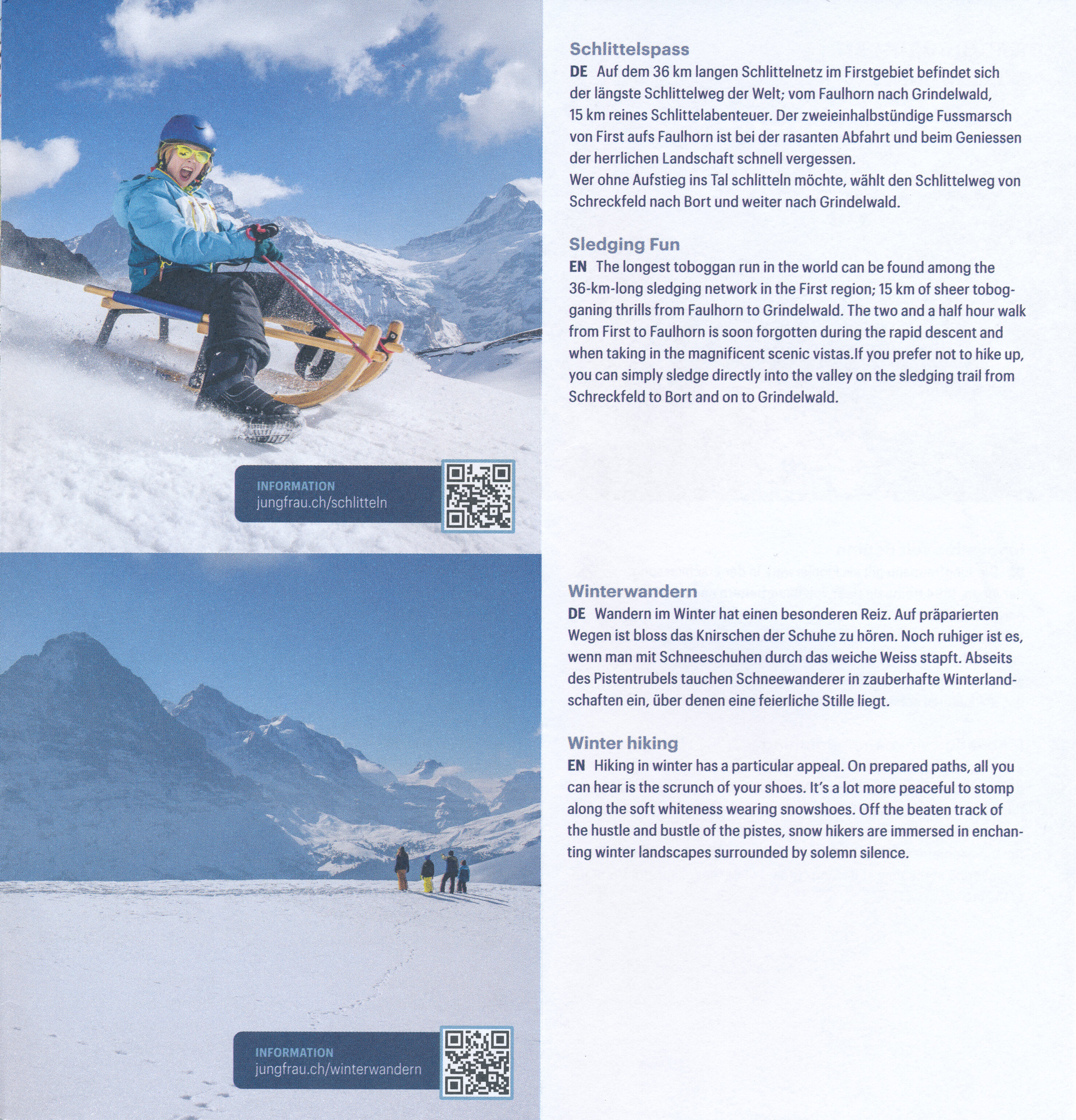
There is a lengthy brochure that covers some of the activities available at Grindelwald First.
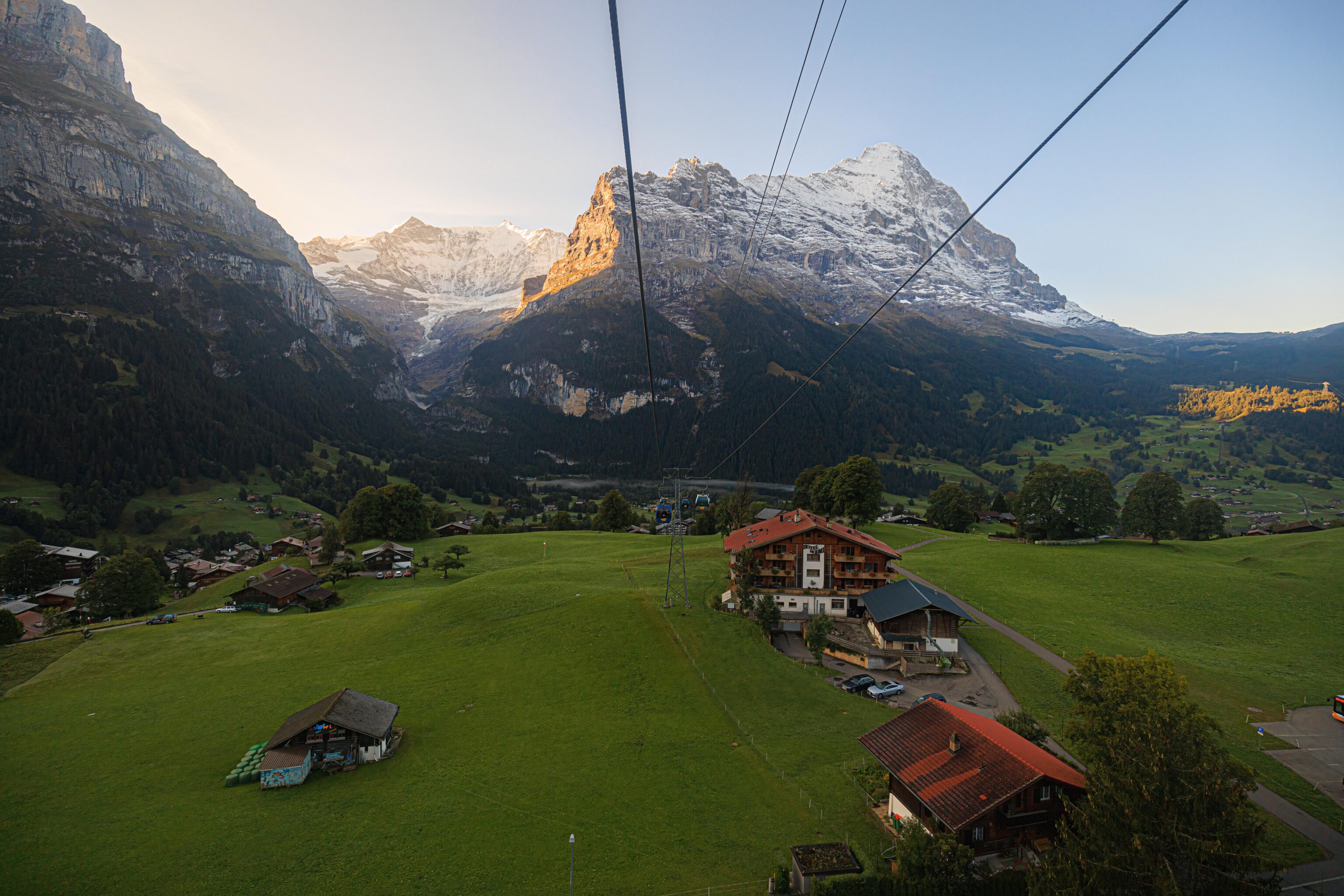
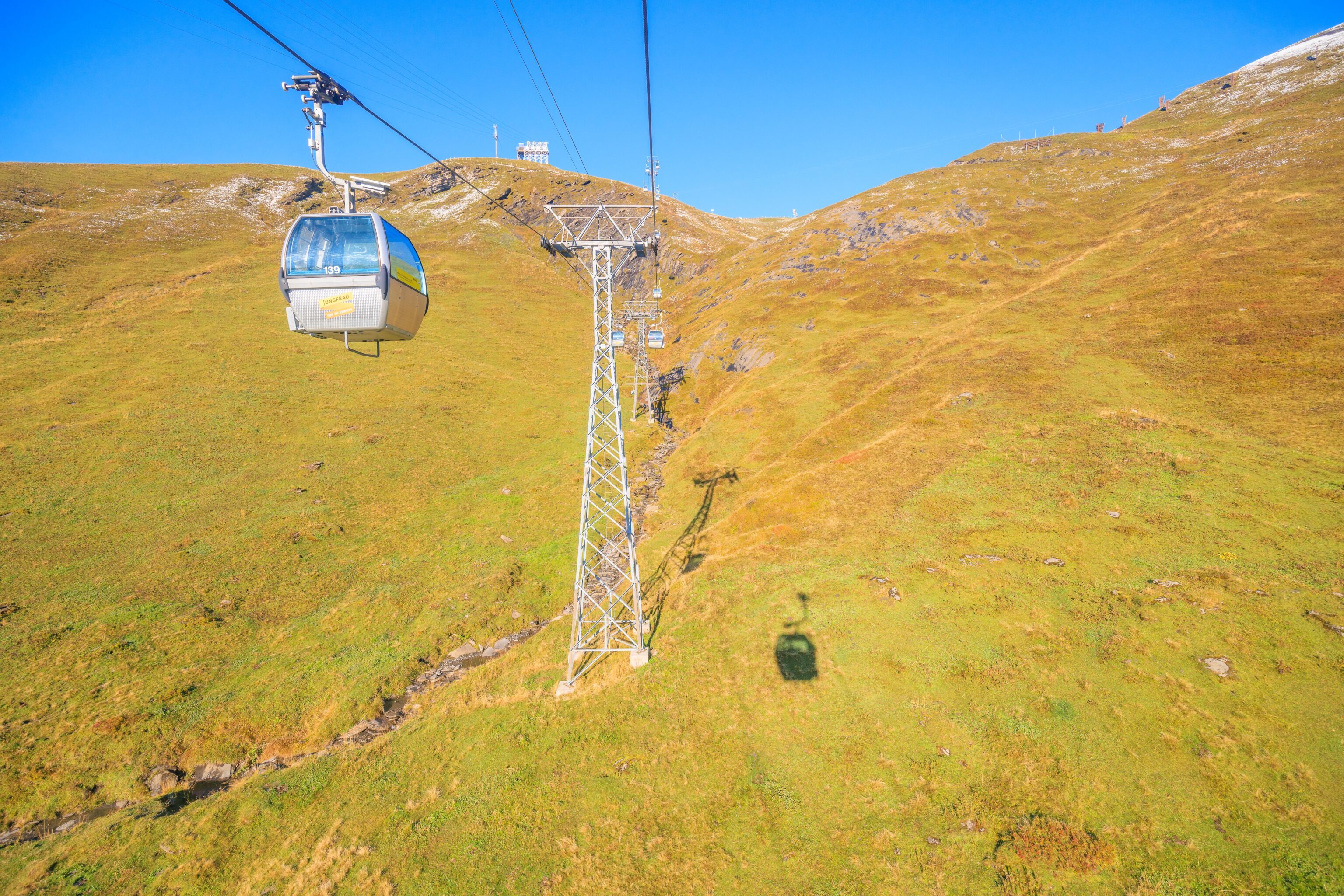
We were able to get our own gondola for the ride up as it wasn’t busy. As is often the case, the gondola’s windows weren’t great for photography, but we did the best we could! We could see the sun shining from behind the mountains as we started our ascent above Grindelwald.
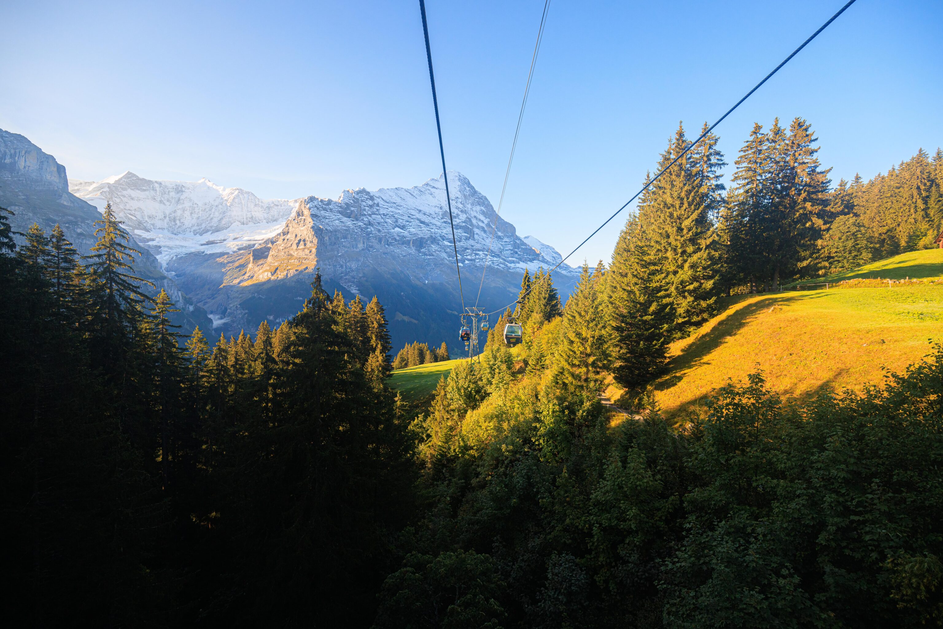
The gondola ride up to First can be done without having to change gondolas. However, the route has three intermediate stations. Each station has a change in direction and results in the gondolas being detached and reattached to a new cable. The lowest intermediate station doesn’t seem to allow passengers to enter or exit but all the others do.
We soon saw the Sun come out from behind the mountains!
It took about sixteen minutes to reach the final segment.
There was a 120 degree or so turn to the left at the Schreckfeld station.
From here, the gondola climbed steeply upwards.
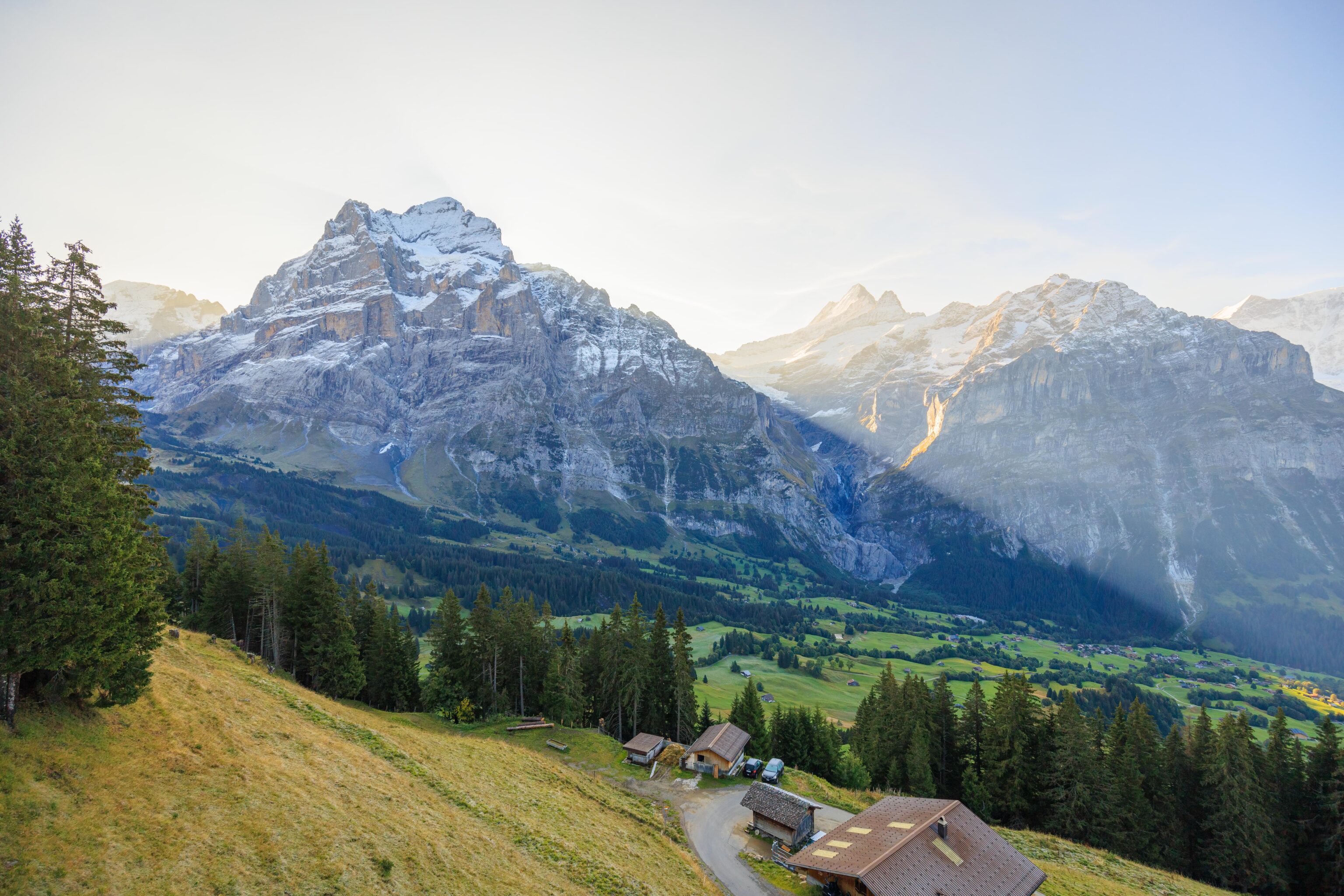
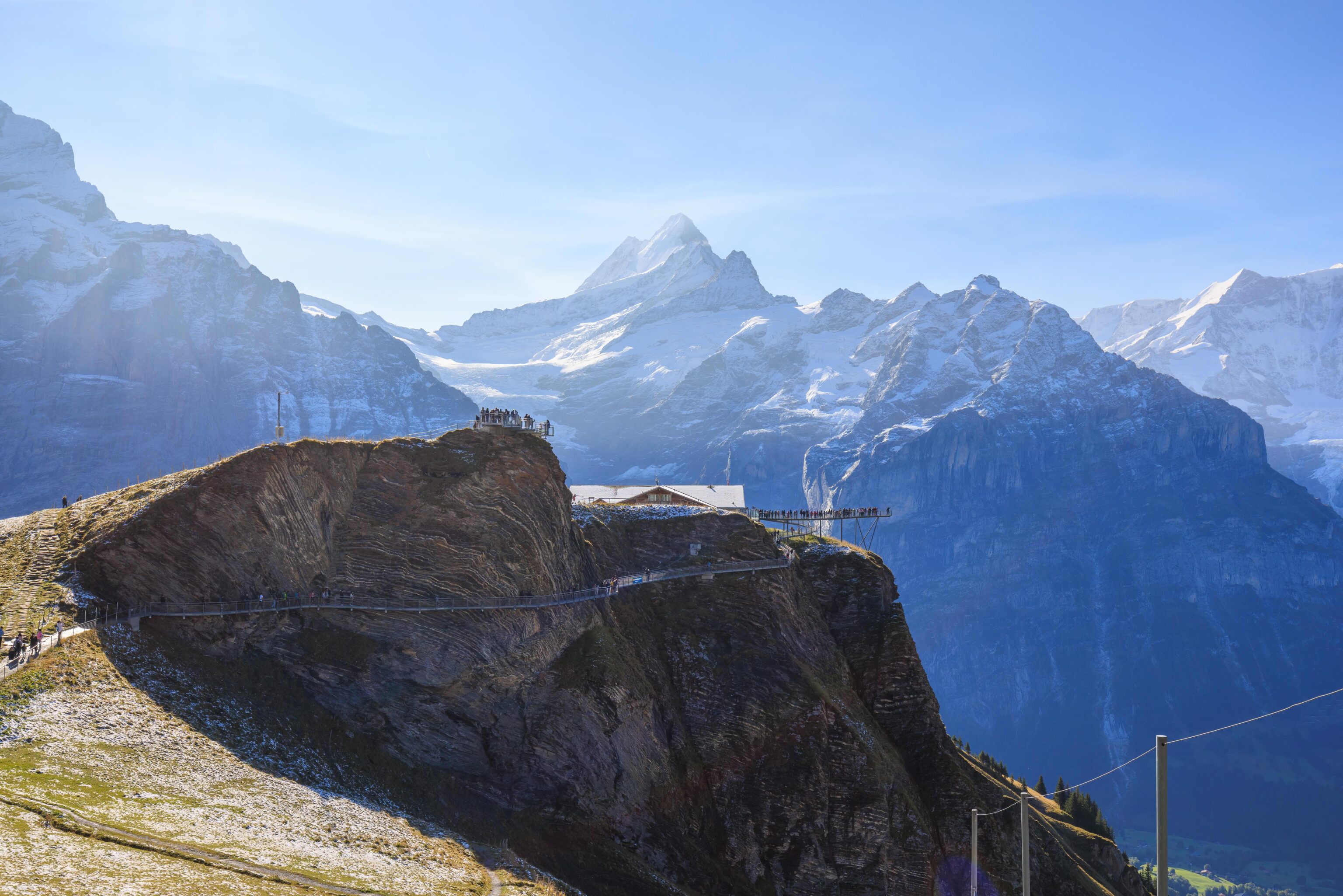
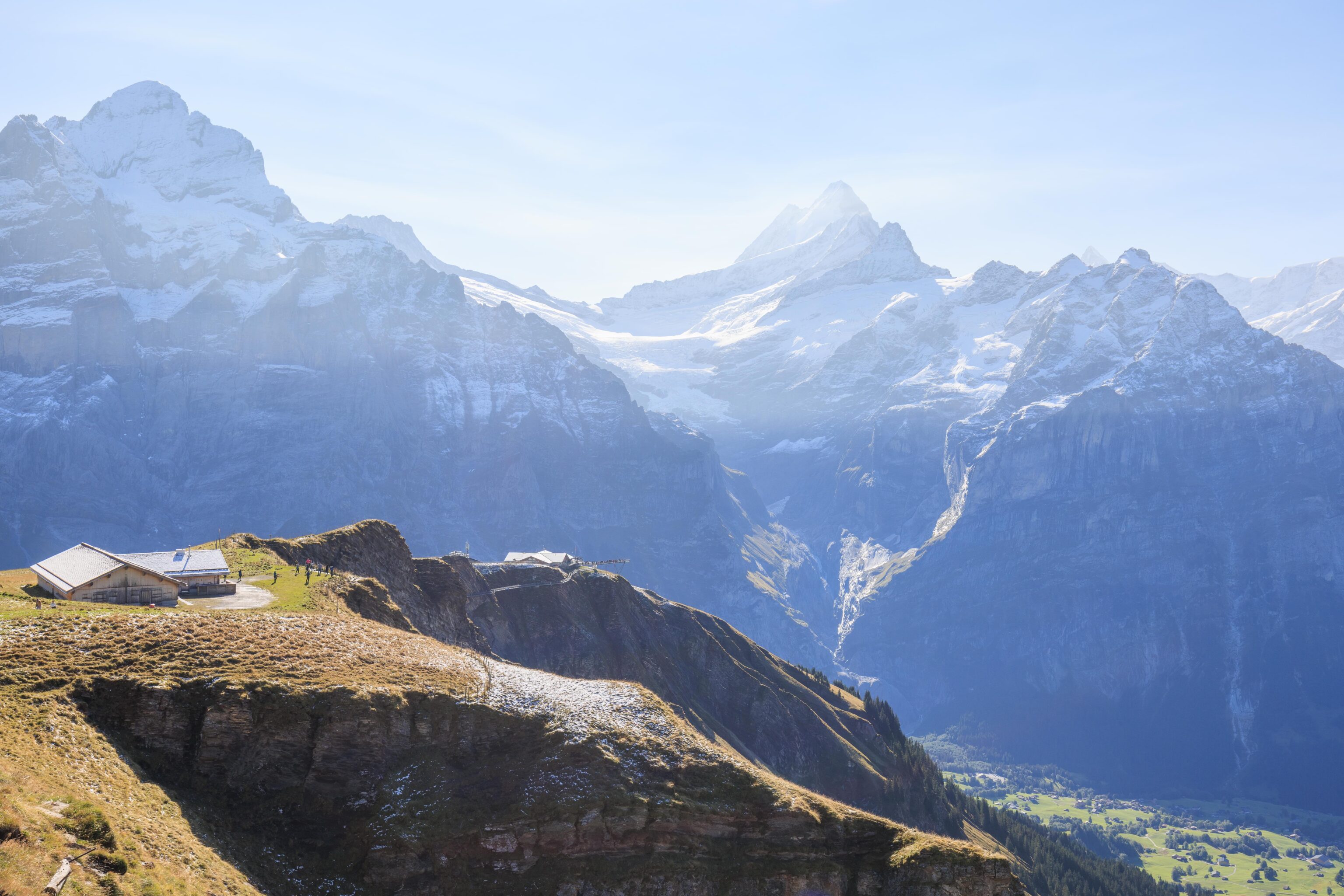
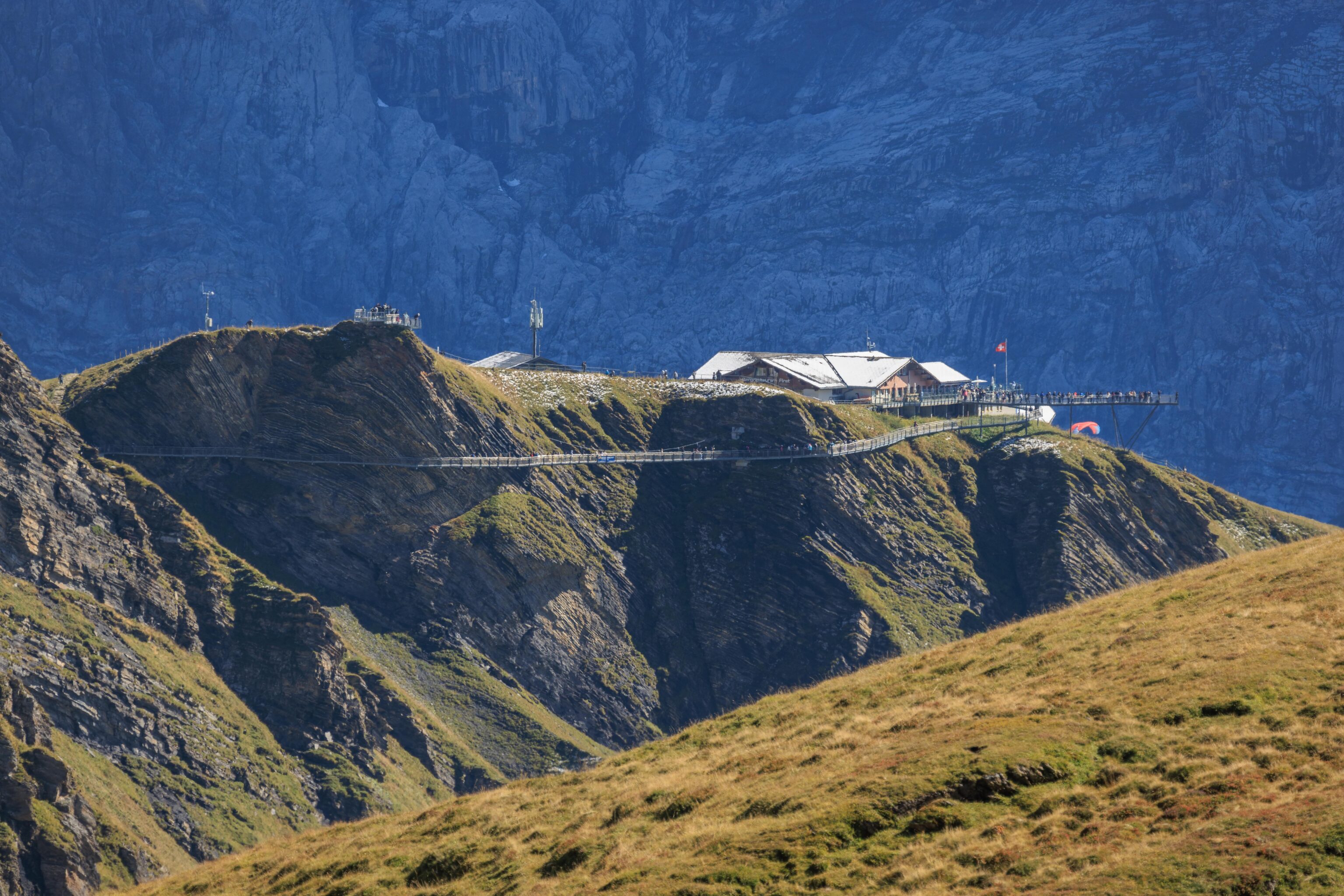
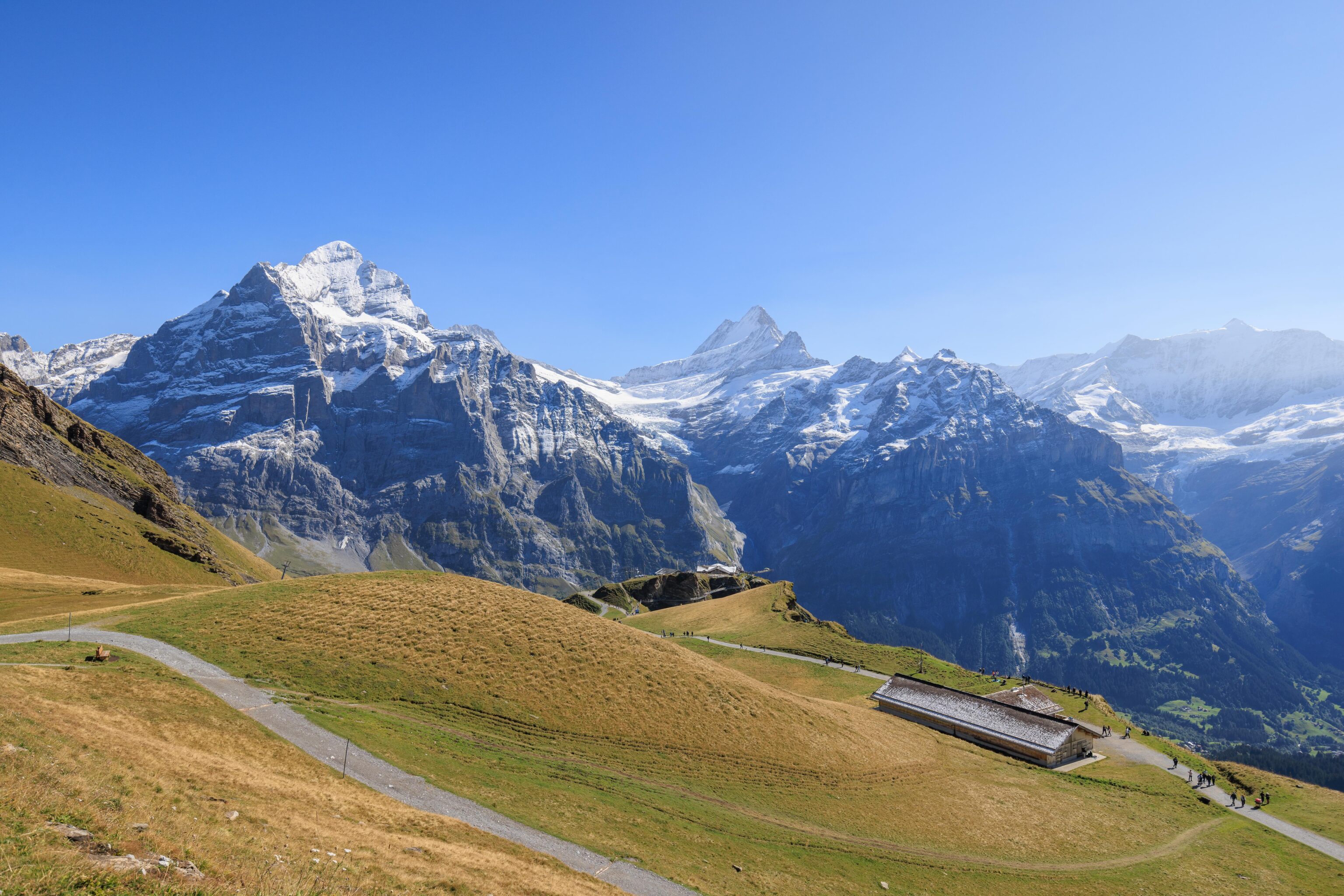
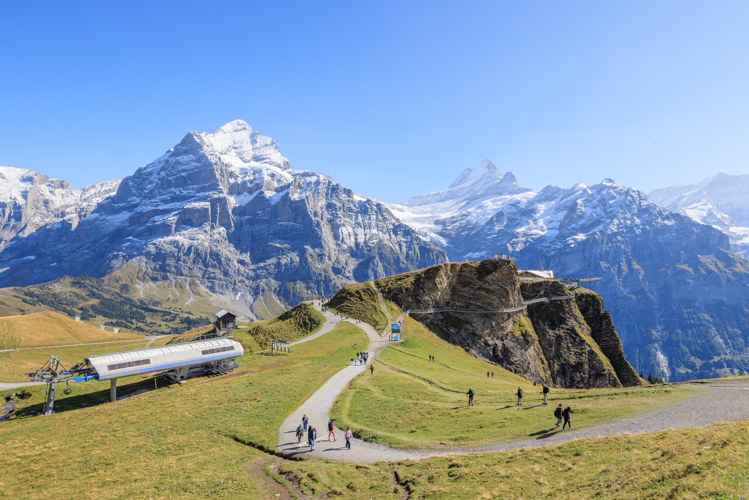
After arriving at First, we walked outside and took a look around. There was a path that led up above the station. We decided to go up there first. Looking down, we could see the metal walkway of the First Cliff Walk below us.
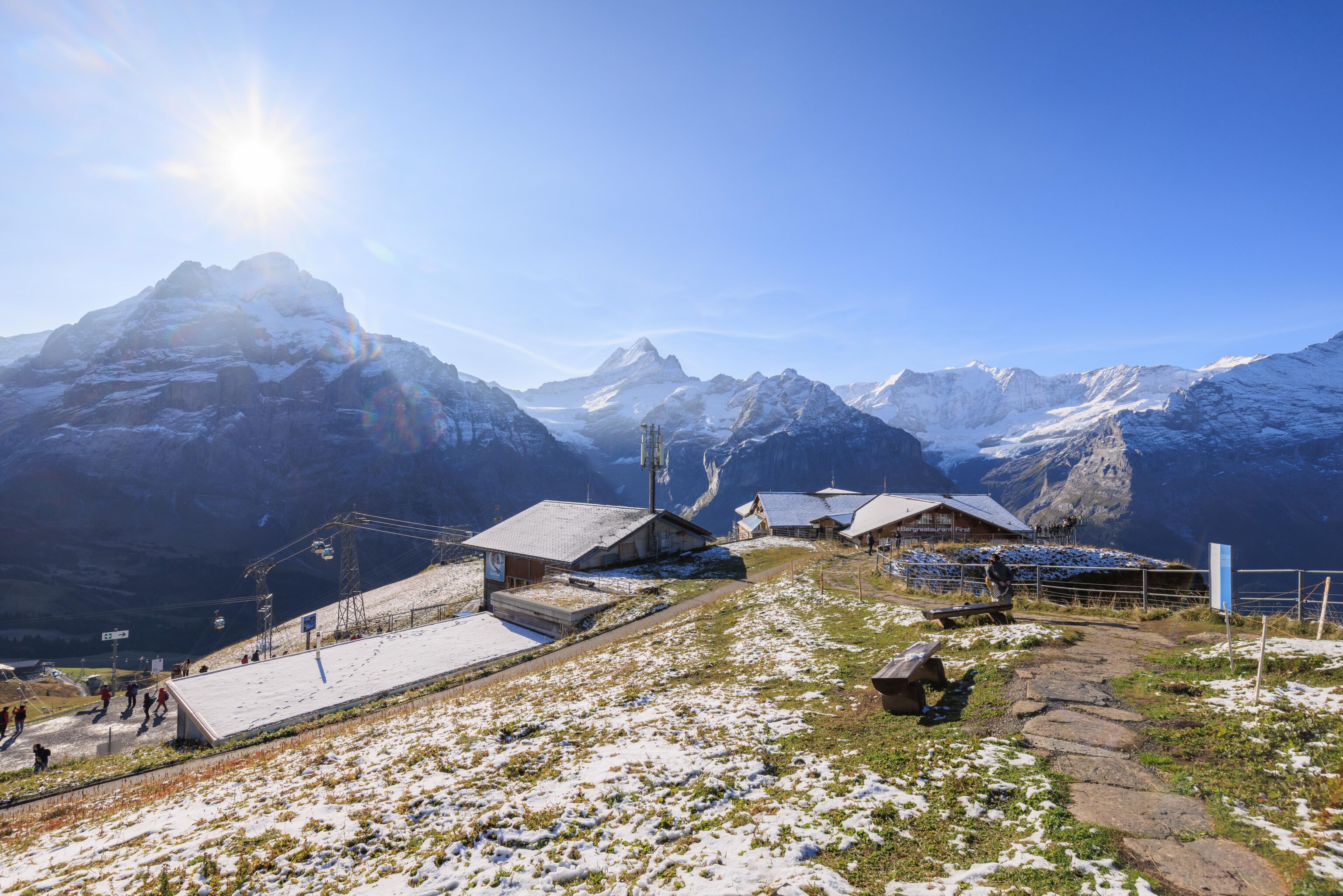
From this elevated position, we could see a number of buildings that make up the First station. There are various dining options available here. We seemed to be right at the beginning of yesterday’s snow line.
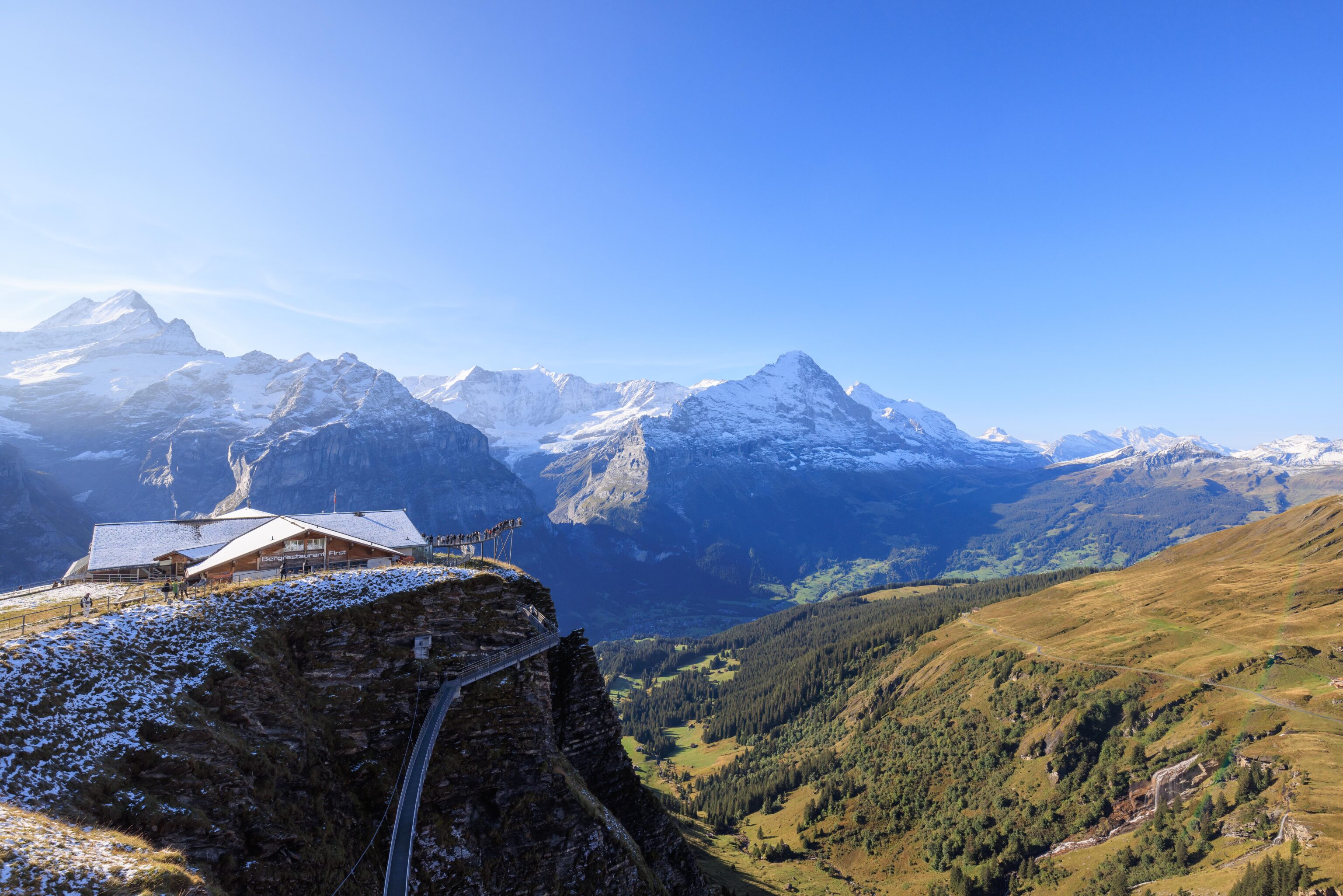
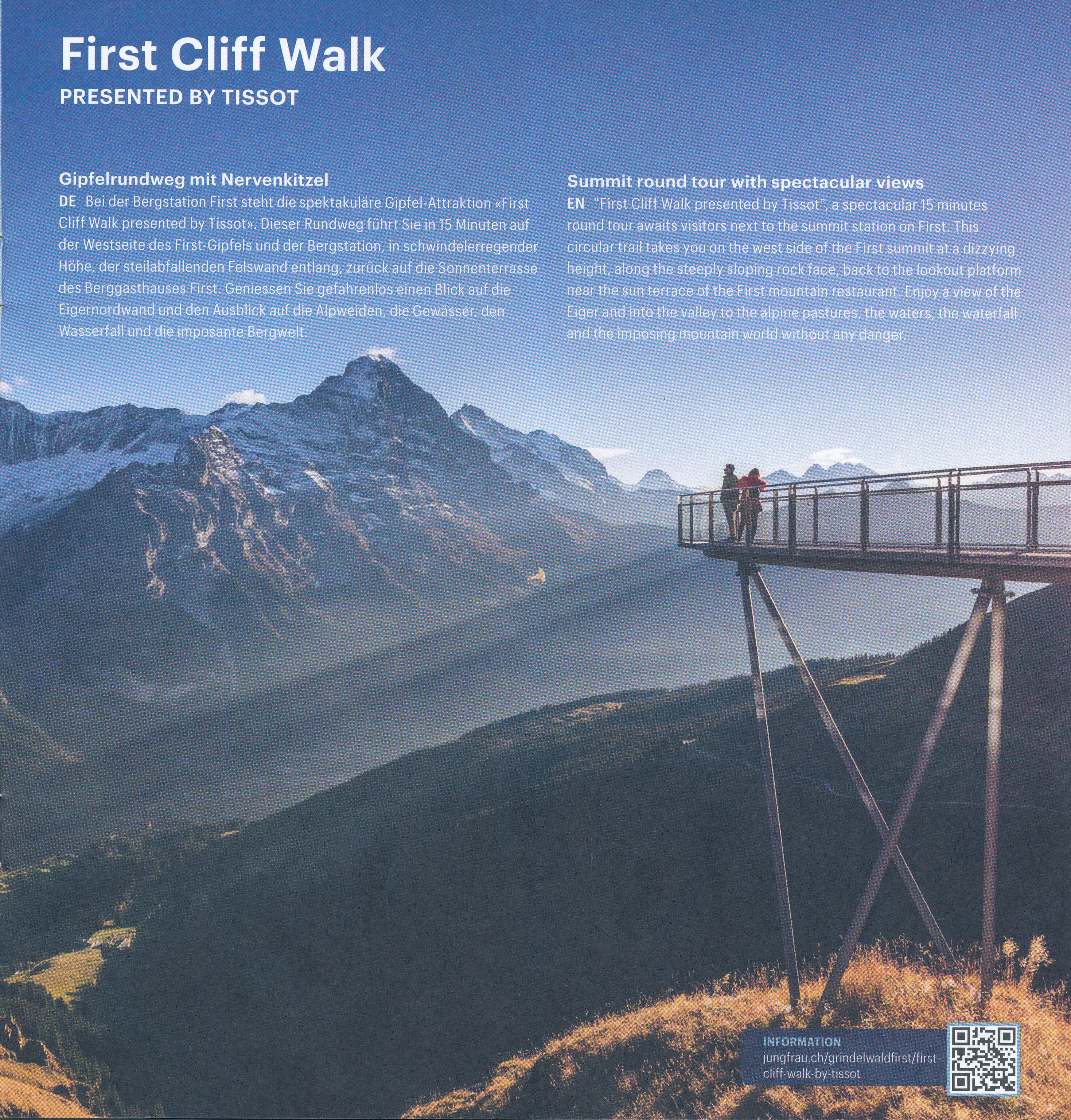
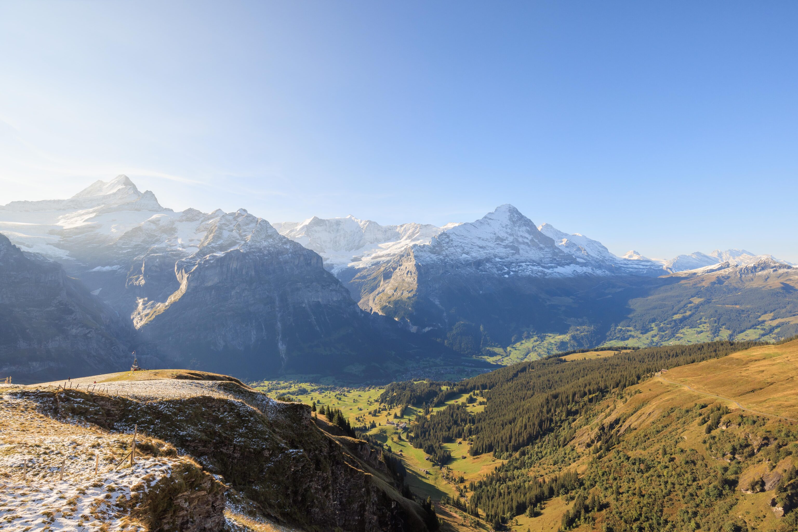
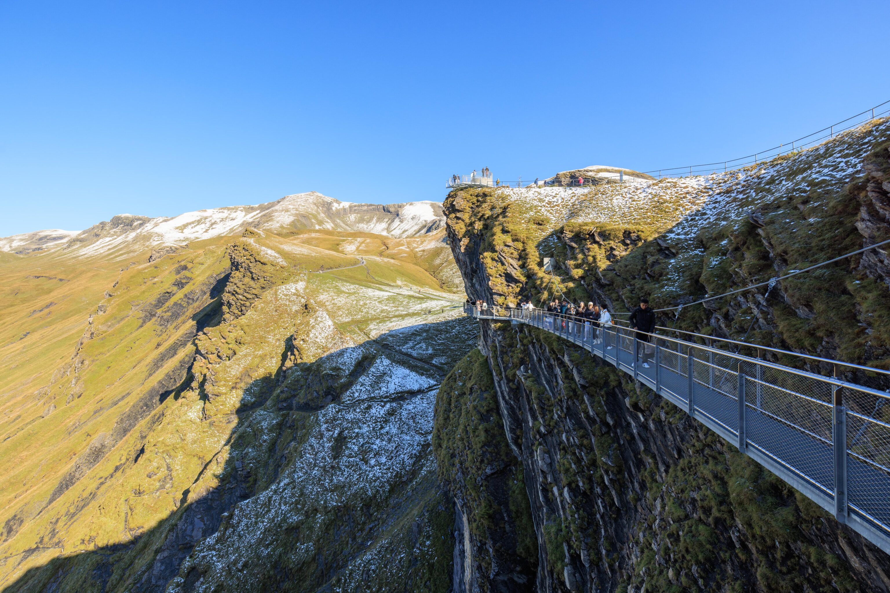
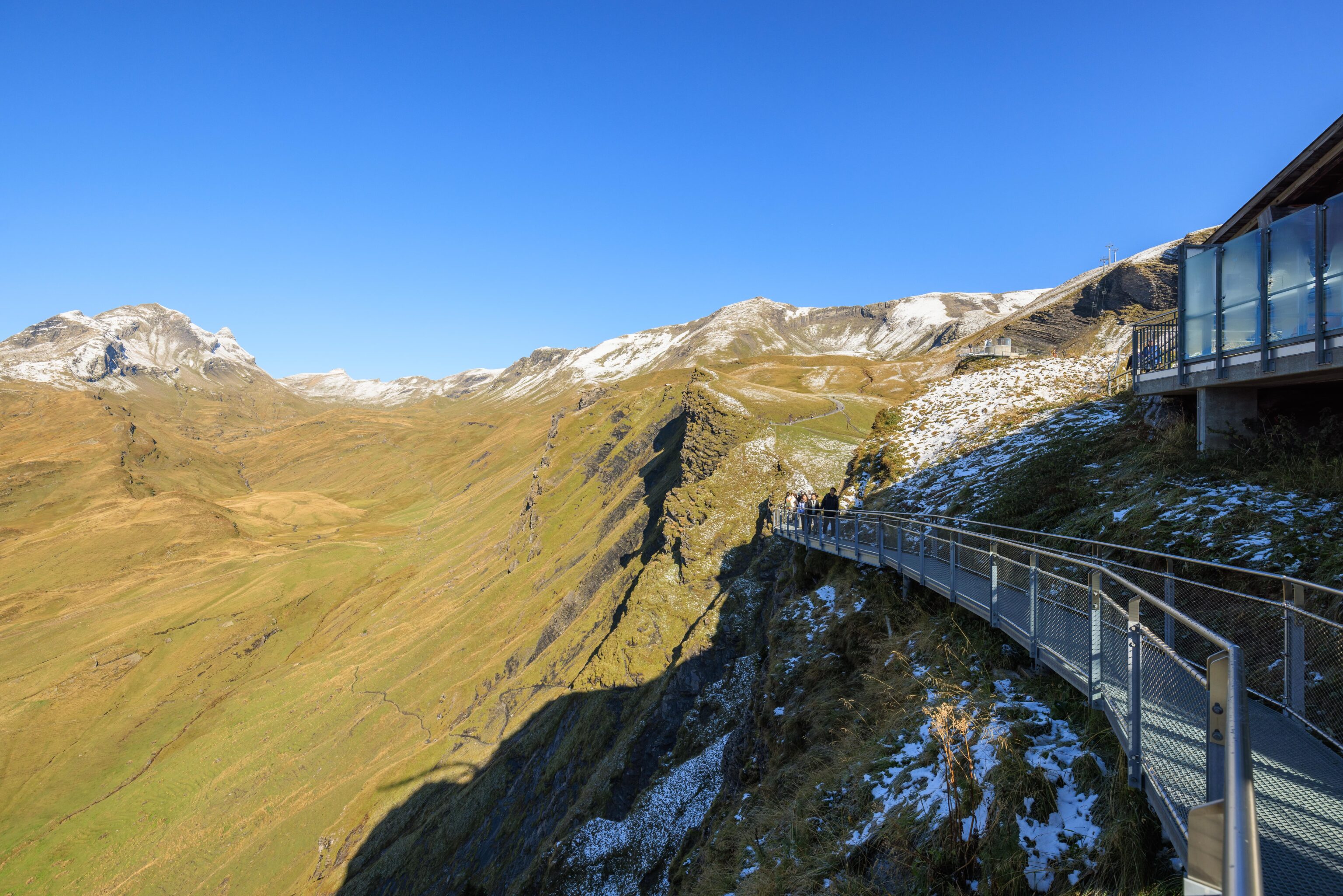
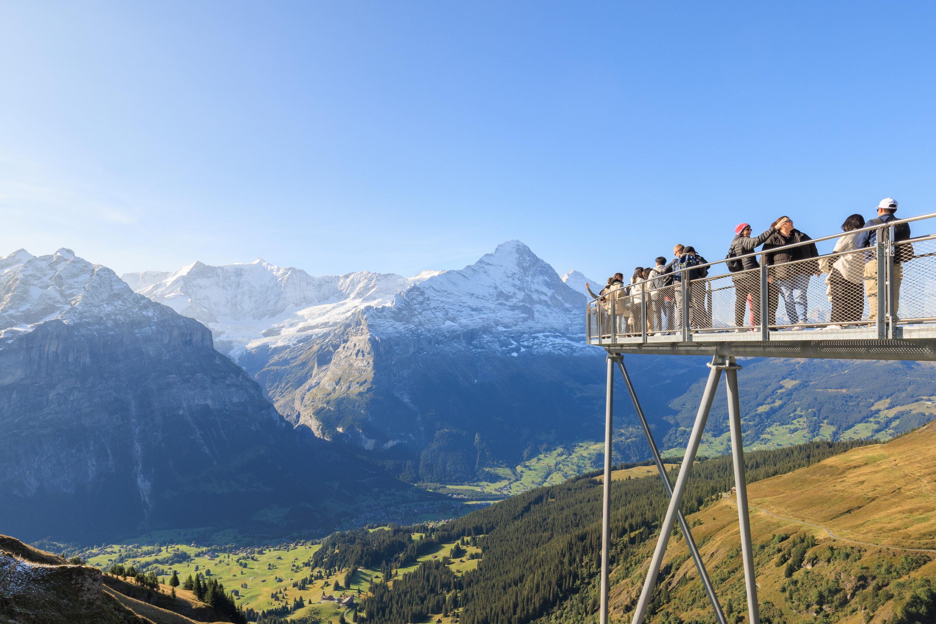
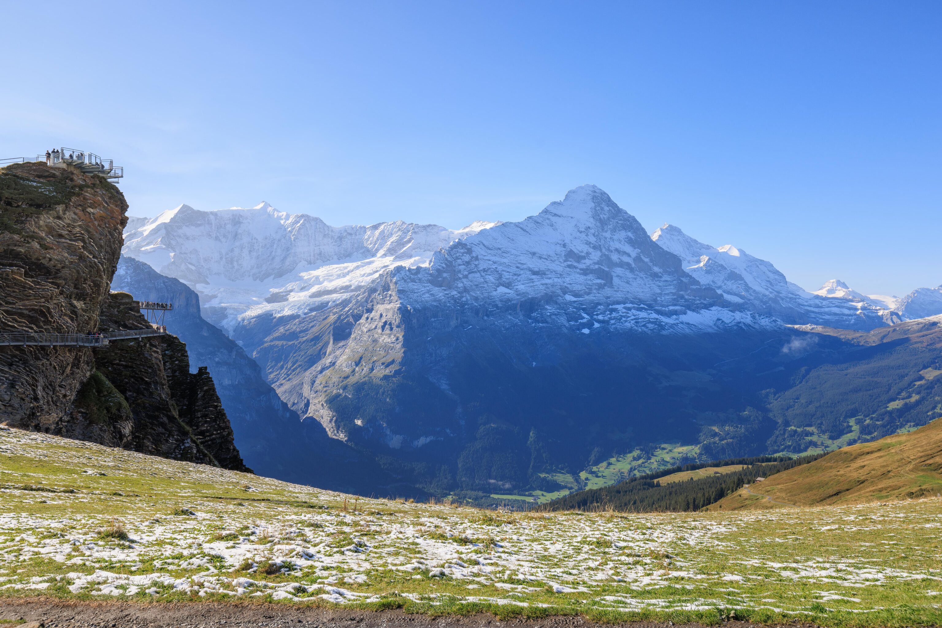
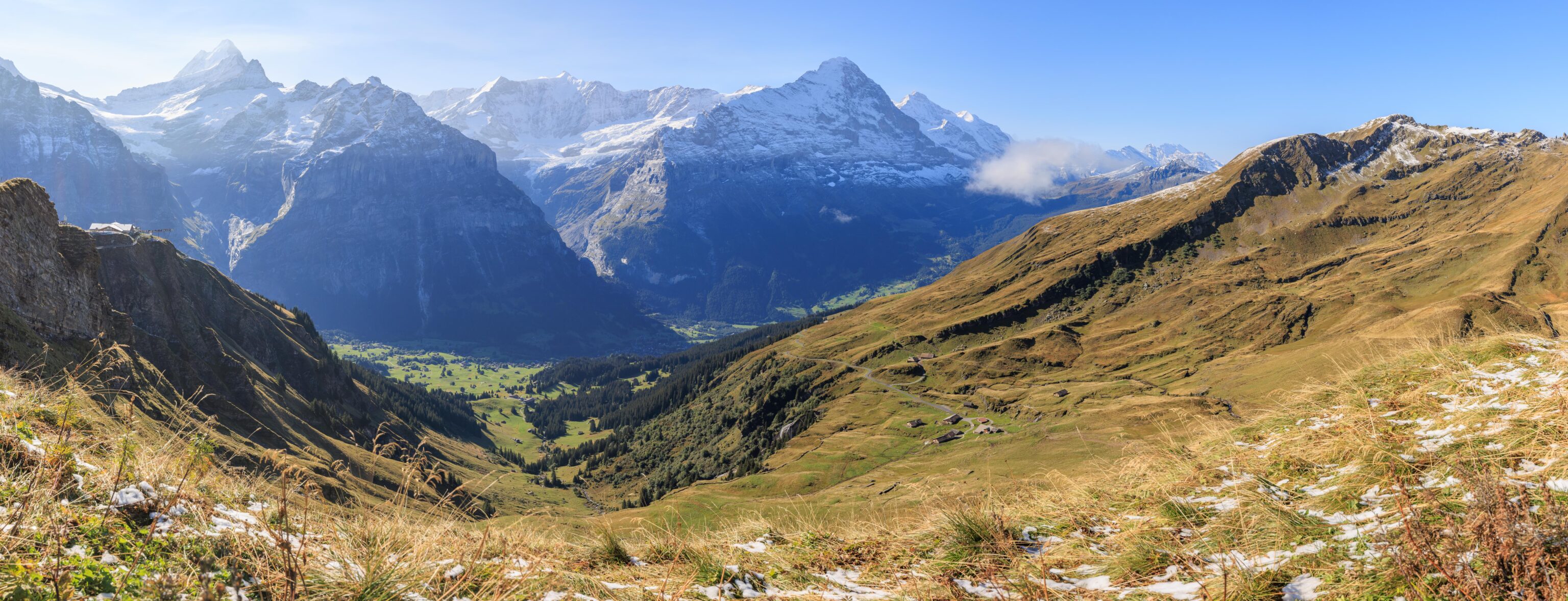
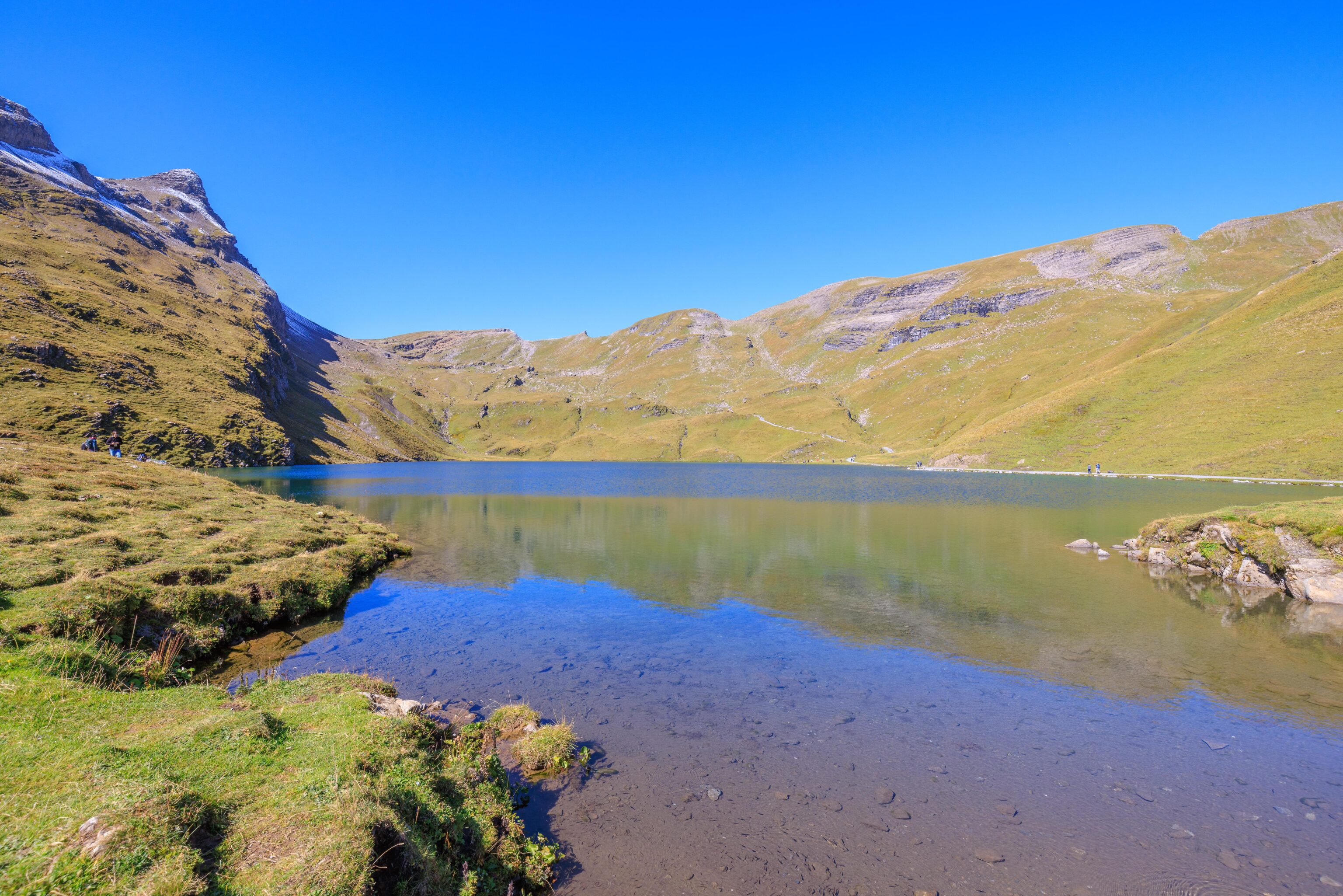
We walked over to the First View, a metal viewing platform built at the highest point above a cliff. From here, we could once again look down and see the First Cliff Walk. It didn’t seem too busy at this relatively early hour. We could also clearly see all the mountain peaks on the other side of Grindelwald. We also noticed another platform that juts out above the cliffside. There were many people queued to take photos at the very end.
Looking to the west, we could see the hiking trail that leads to the Bachalpsee. The actual alpine lakes could not be seen though.
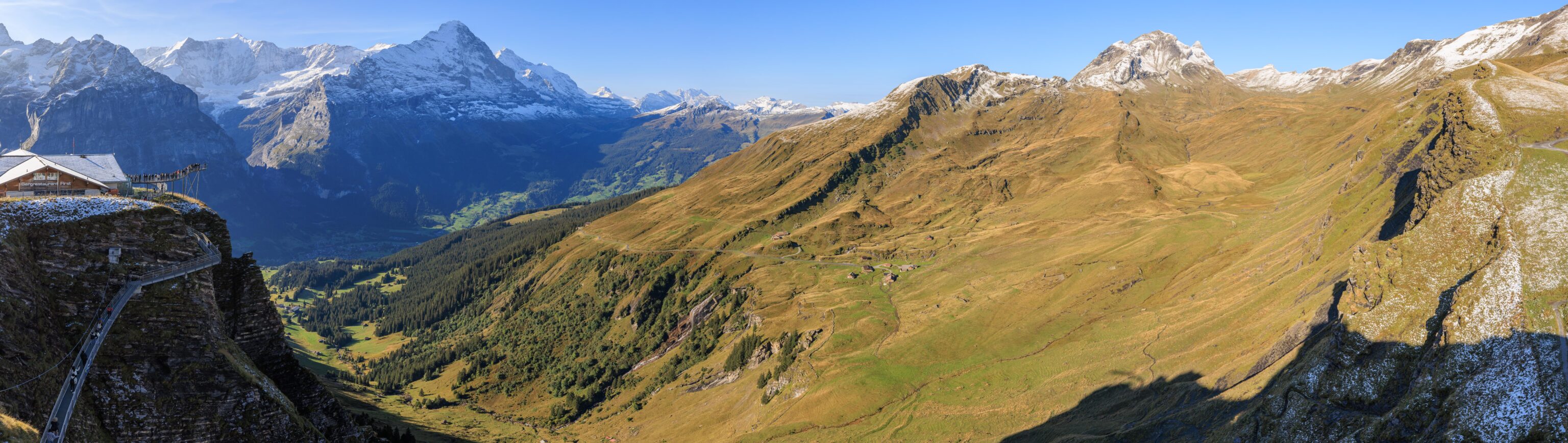
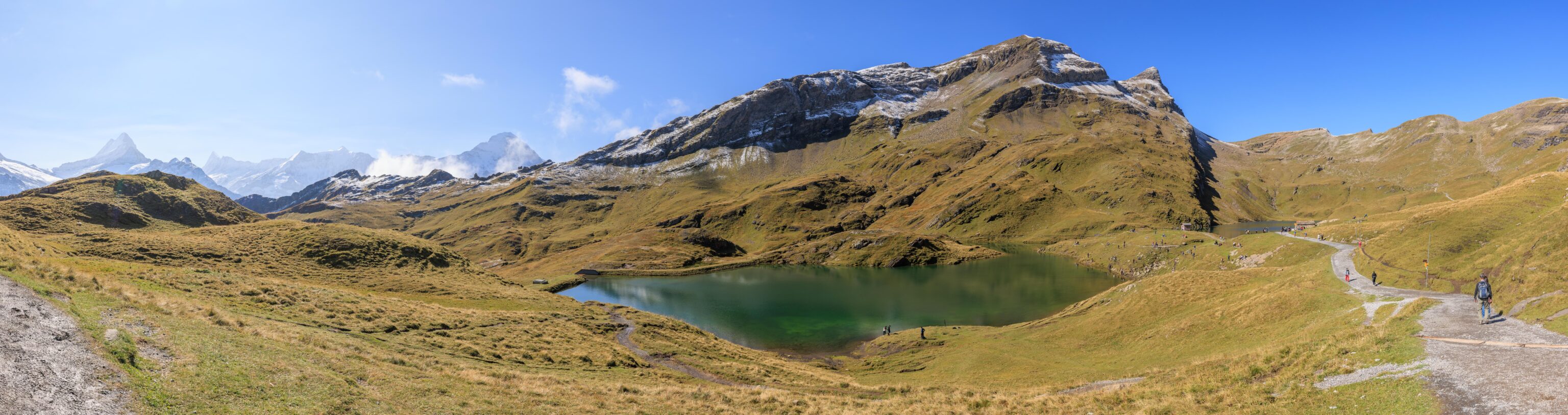
We took a panorama of the scene from First View. Unfortunately, we never actually photographed First View itself. The design is quite clever as it provides many different places for people to enjoy the view.
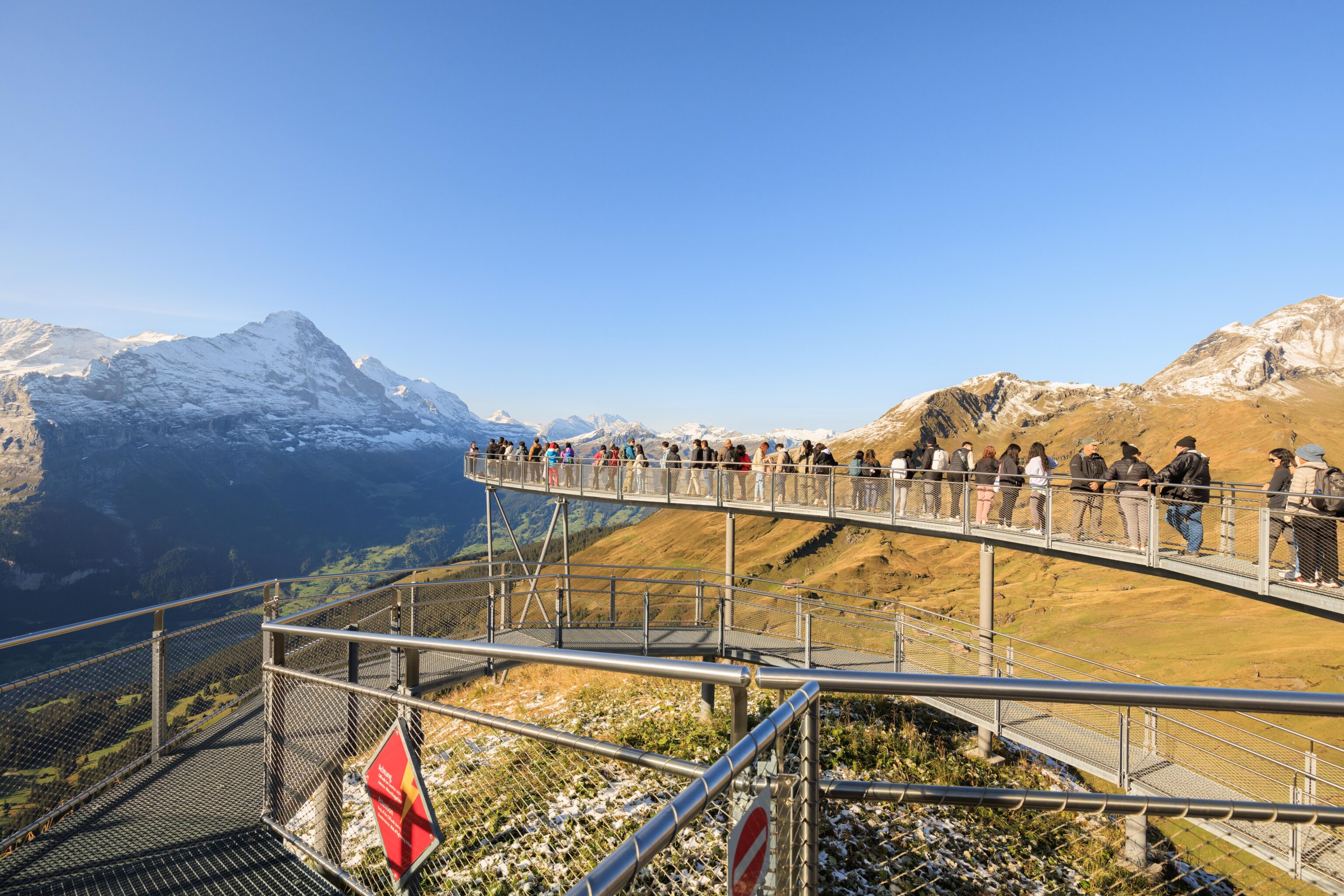
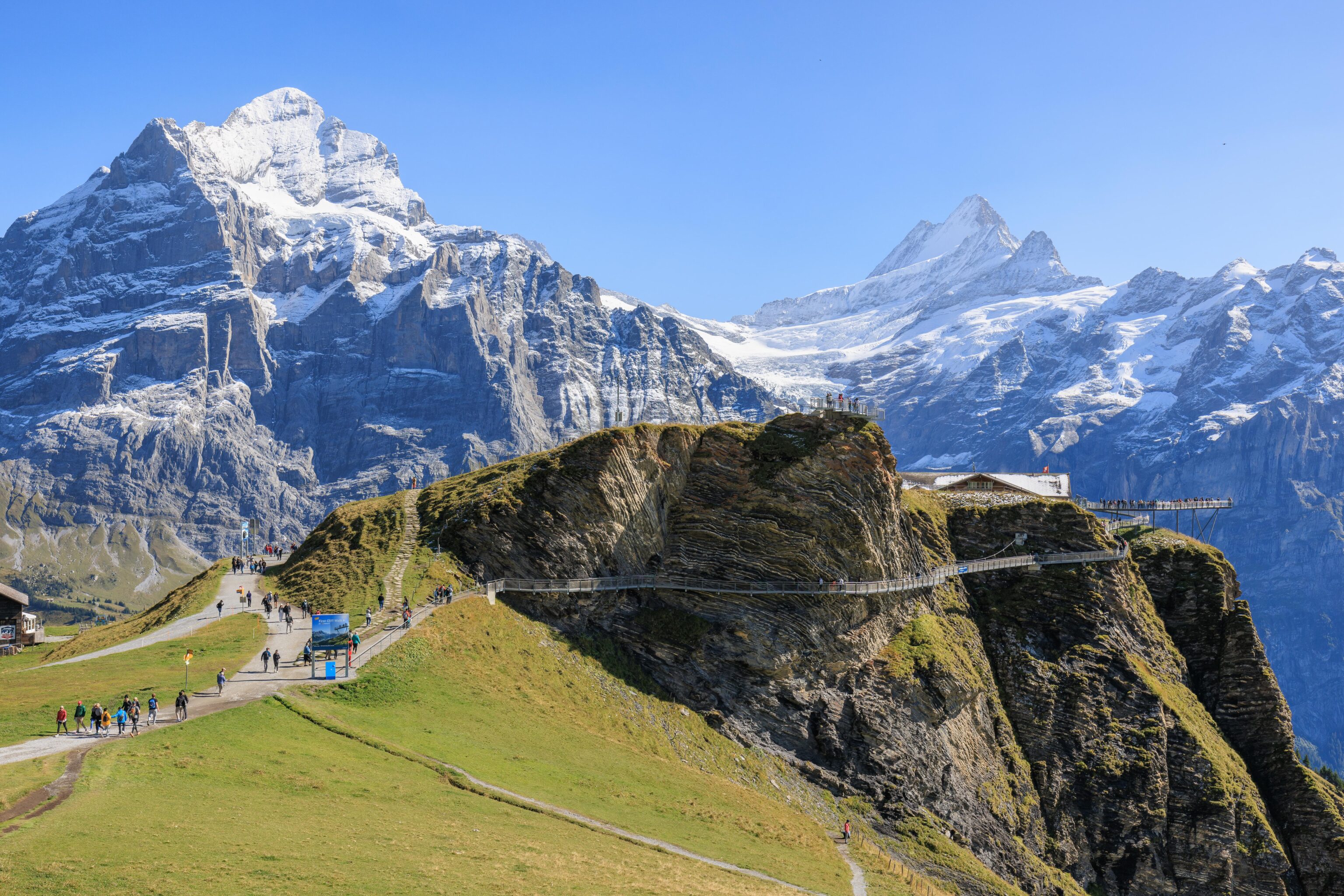
We walked to the south to check out the platform with all the people on it. The queue seemed to move very slowly as the people at the head posed for photographs and selfies. We decided to move on. While the platform is certainly an interesting novelty, the view isn’t substantially different from other vantage points nearby.
This was taken just to the left, or east, of the platform. Quite a beautiful view! We had intended to enter the Cliff Walk from here but we found out it was one way. So, we had to go around to the north side of the station to find the entrance.
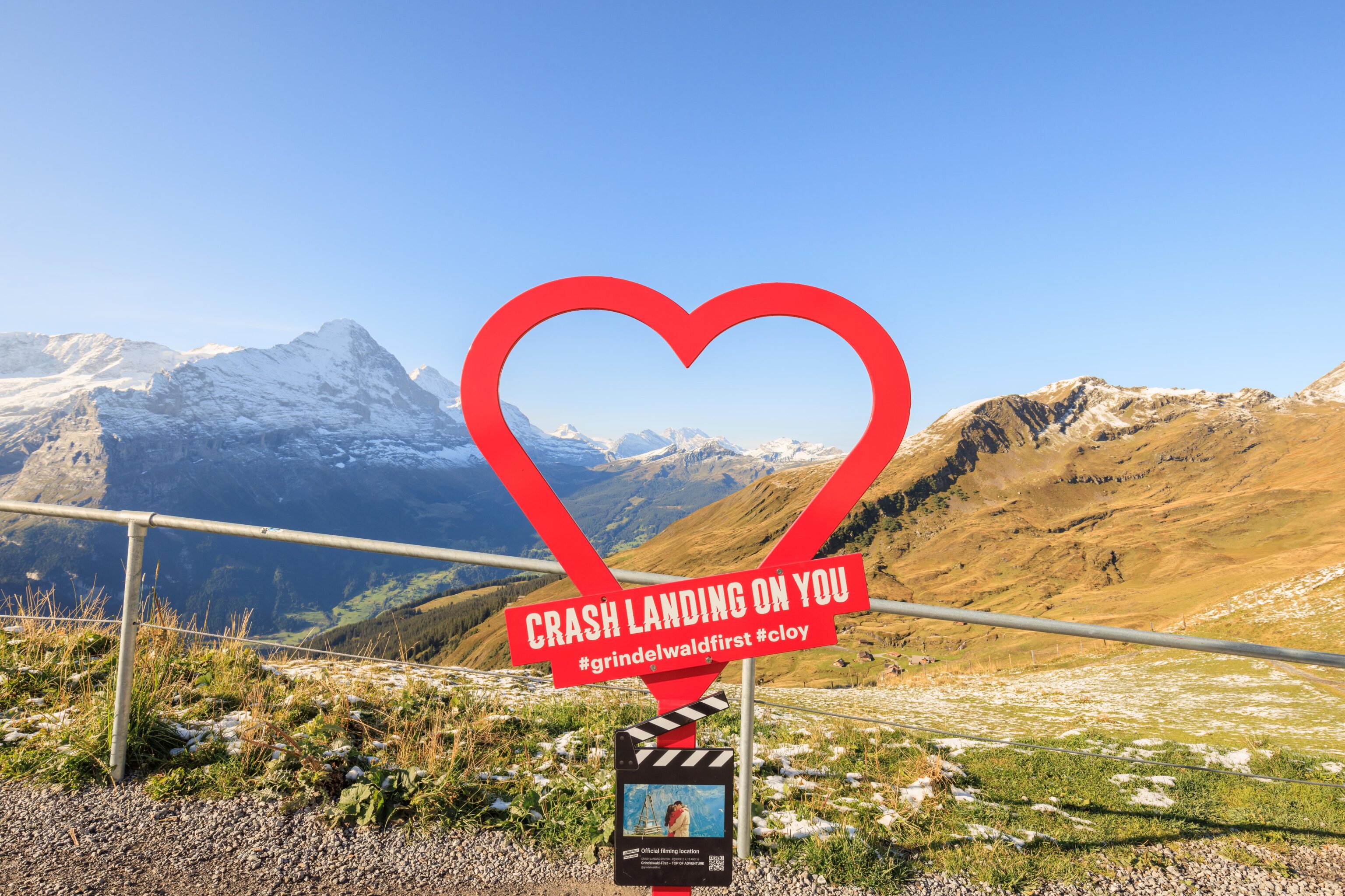
We found another Crash Landing on You photo sign! At the time, we weren’t sure exactly where the scene was filmed. It unfortunately isn’t actually by this sign. We did see the location, though we didn’t realize it at the time.
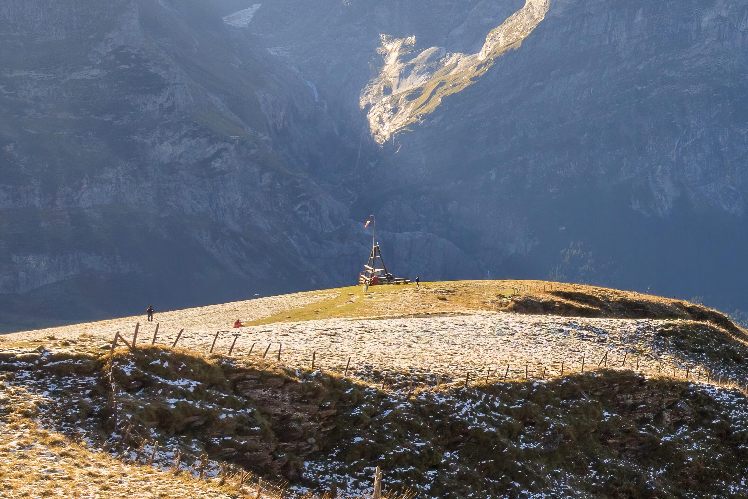
It was at the bottom left quadrant of the previous photo! The wooden structure holding the wind sock can be seen in the still frame that is on the sign. The same structure briefly appears in the actual episode as well.
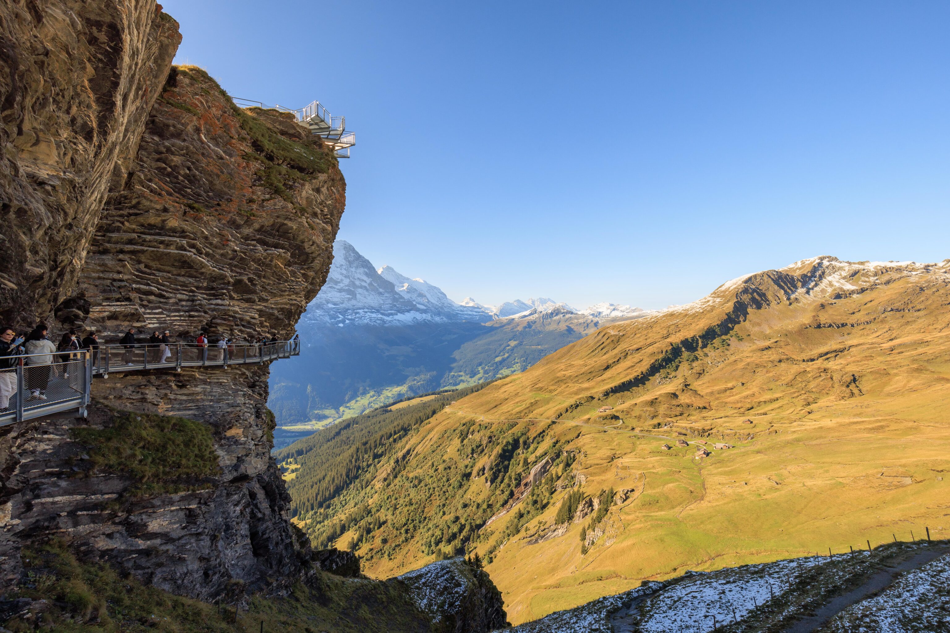
The entrance to the Cliff Walk was right by the sign. It was busier than before, primarily due to what seemed like a tour group that had arrived.
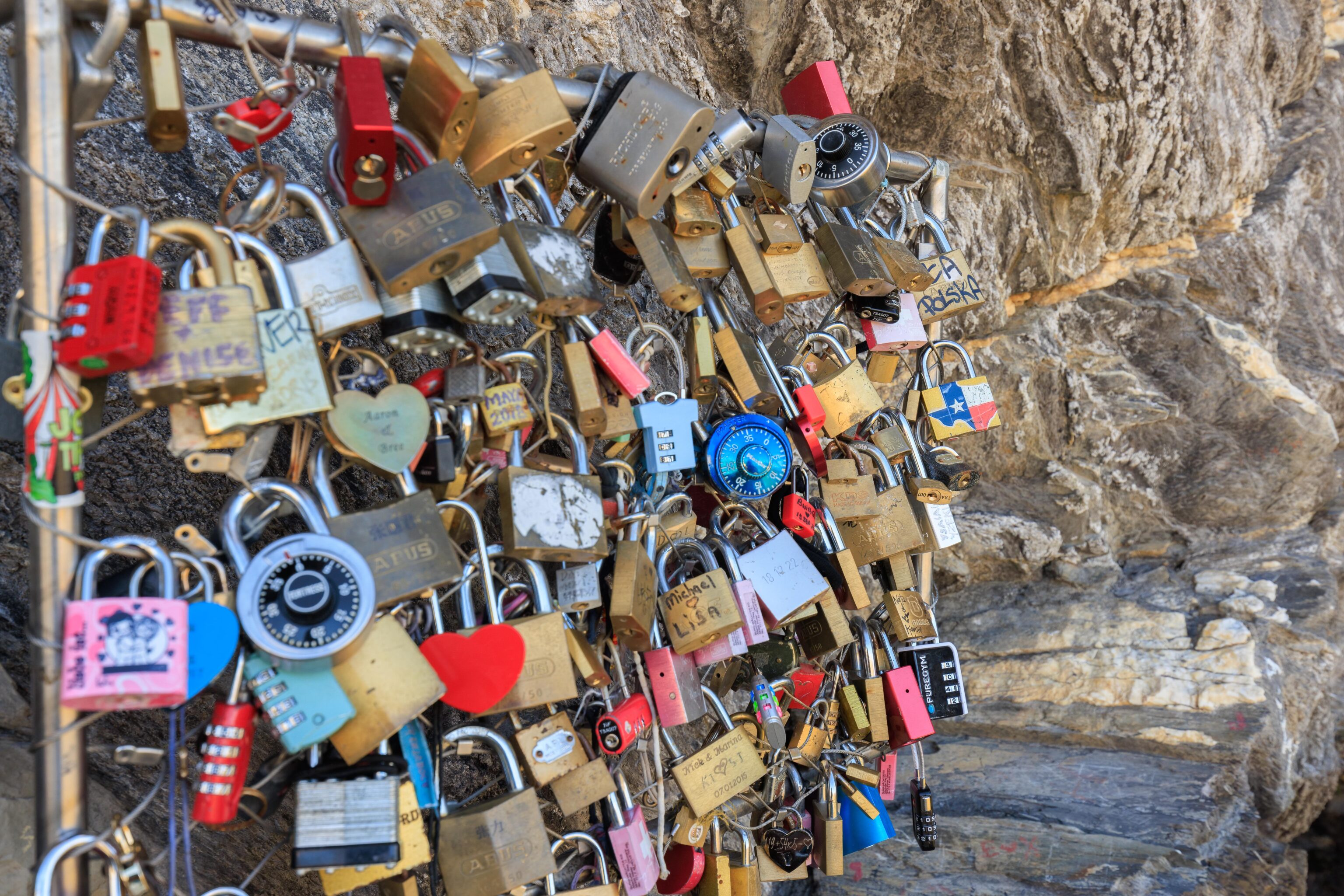
There was a small section of fence installed by the cliff for people to attach locks.
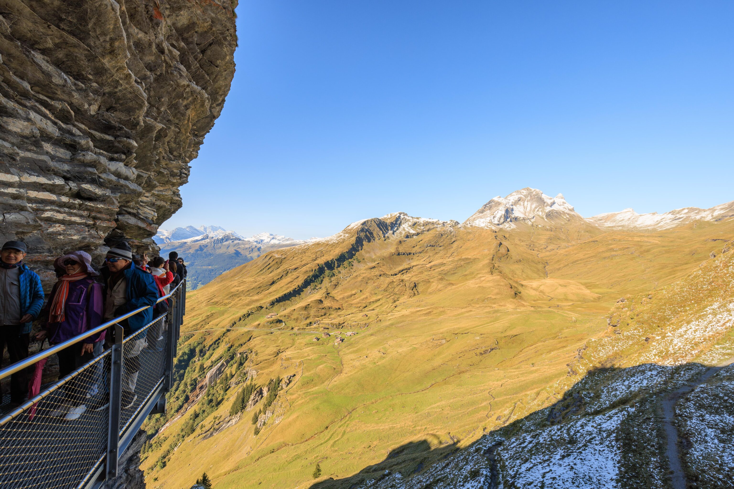
The group was taking photos, seemingly every few feet, which clogged up the entire narrow path.
The view was beautiful, though identical to the view from above.
While most of the walkway is directly anchored into the cliff face, part of the path was a suspension bridge. It bounced a bit as we walked across. The Cliff View is perched above, this was probably the best photo we got of it.
Looking back once again near the end of the walkway.
We passed under the elevated platform that we saw earlier, still with a large number of people queued. Once again, we decided to skip it.
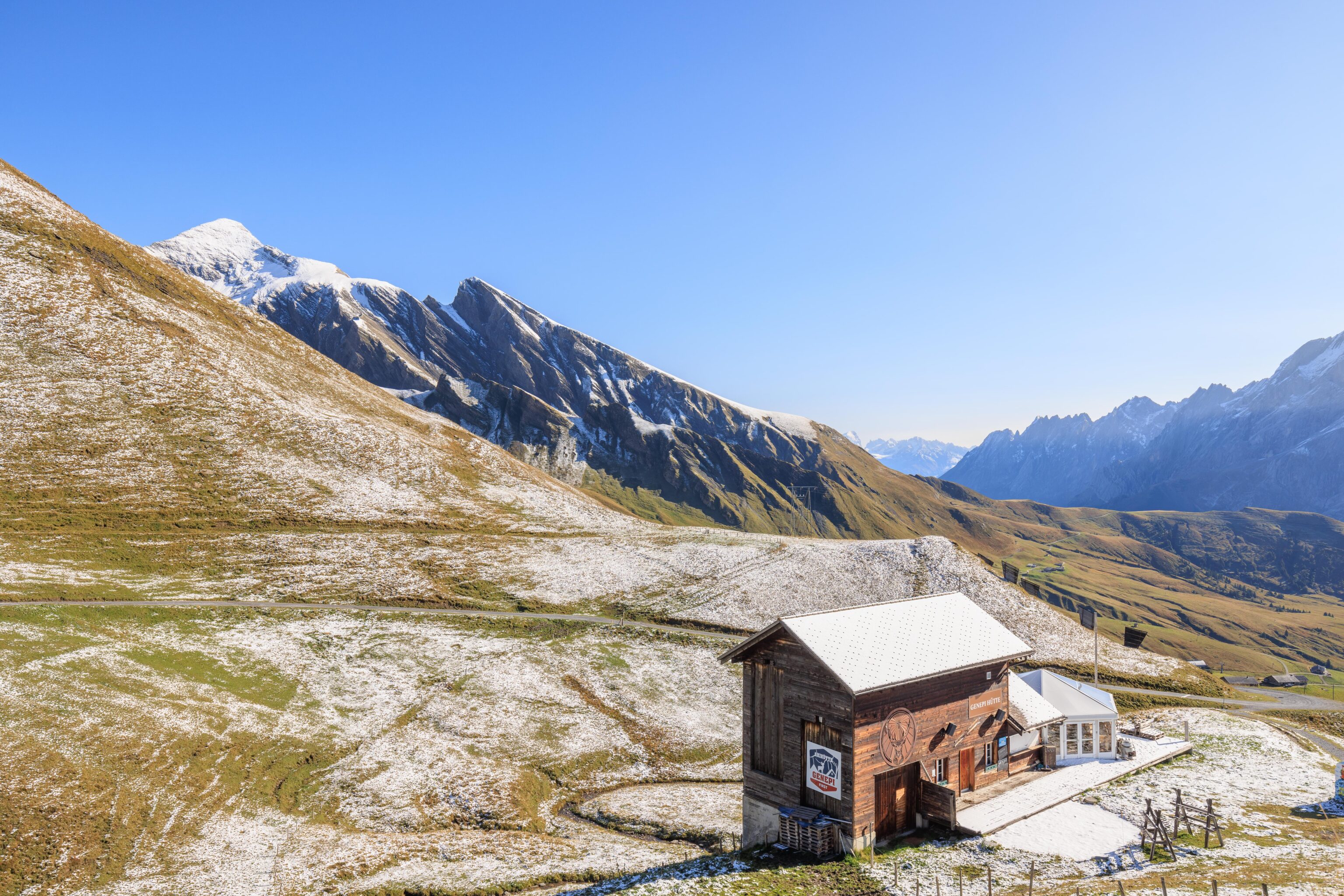
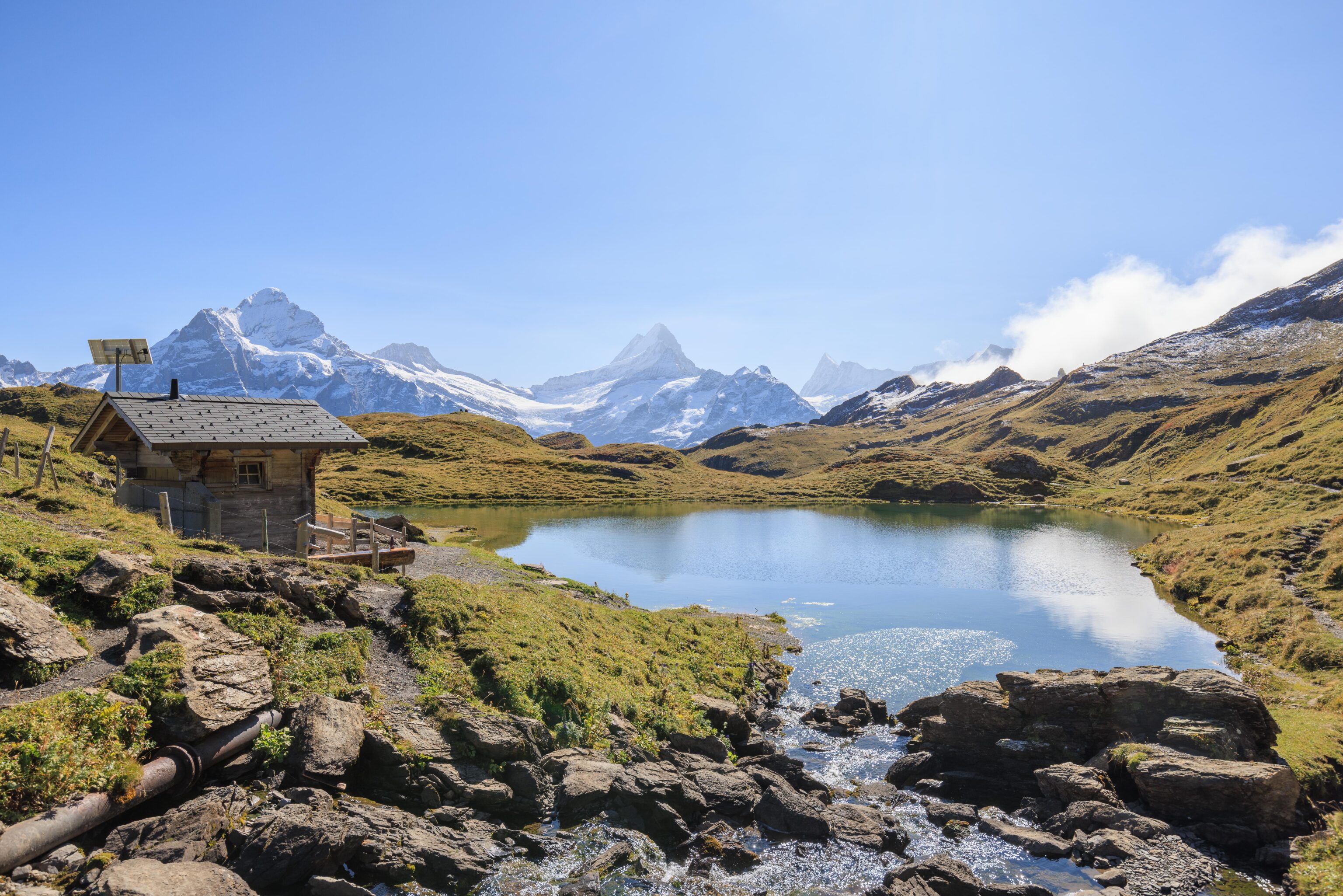
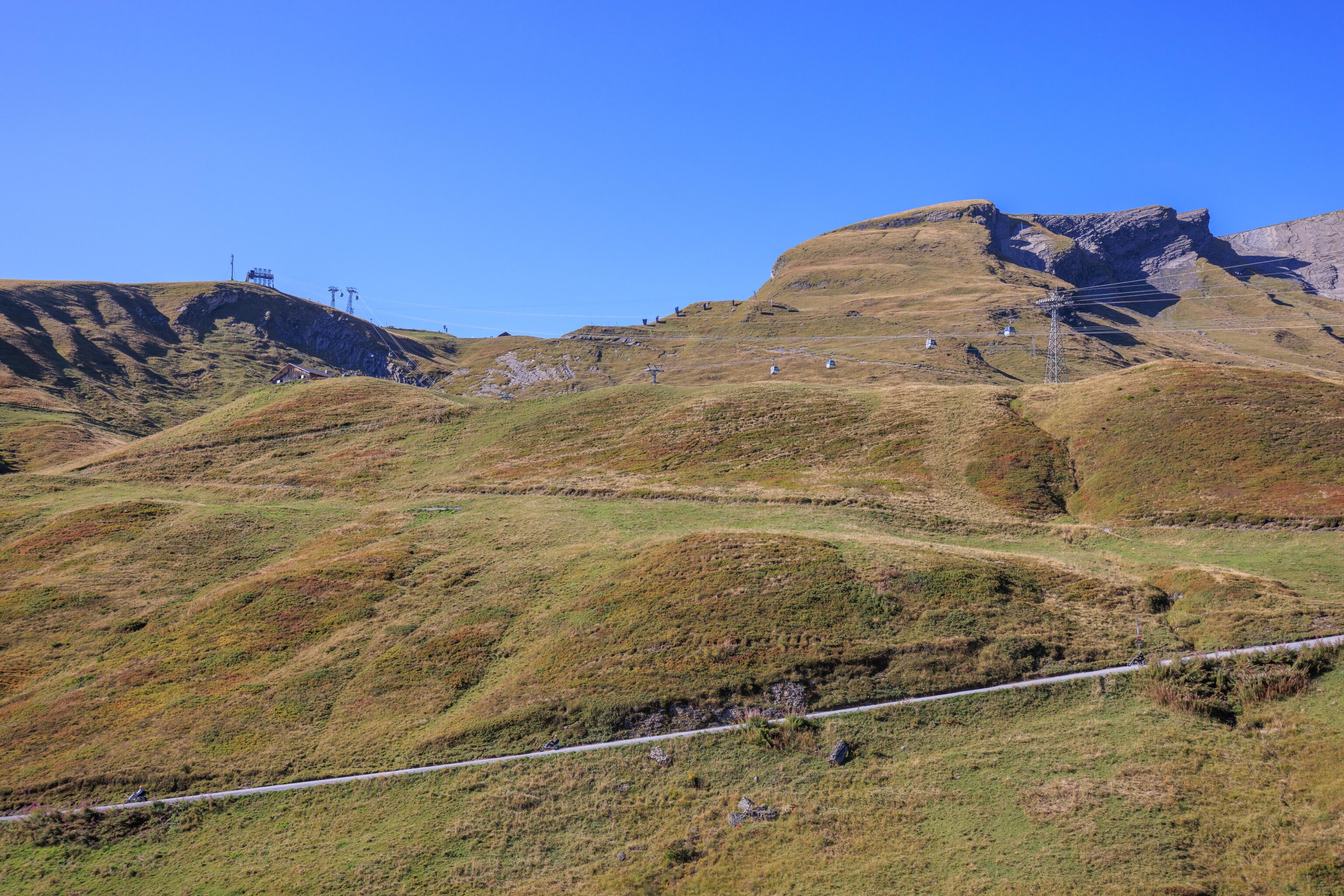
Much of the infrastructure that we saw was for winter activities, including skiing, like the hut below.
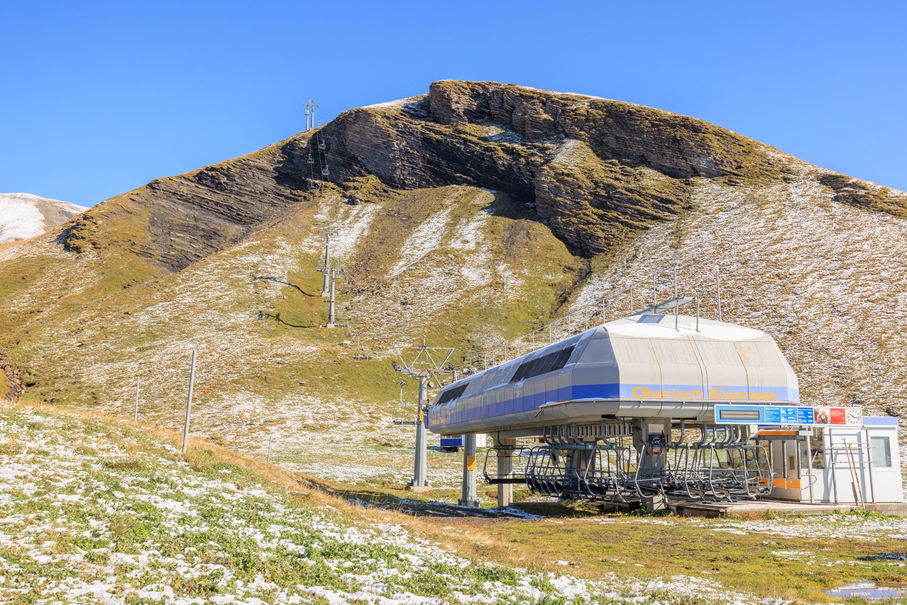
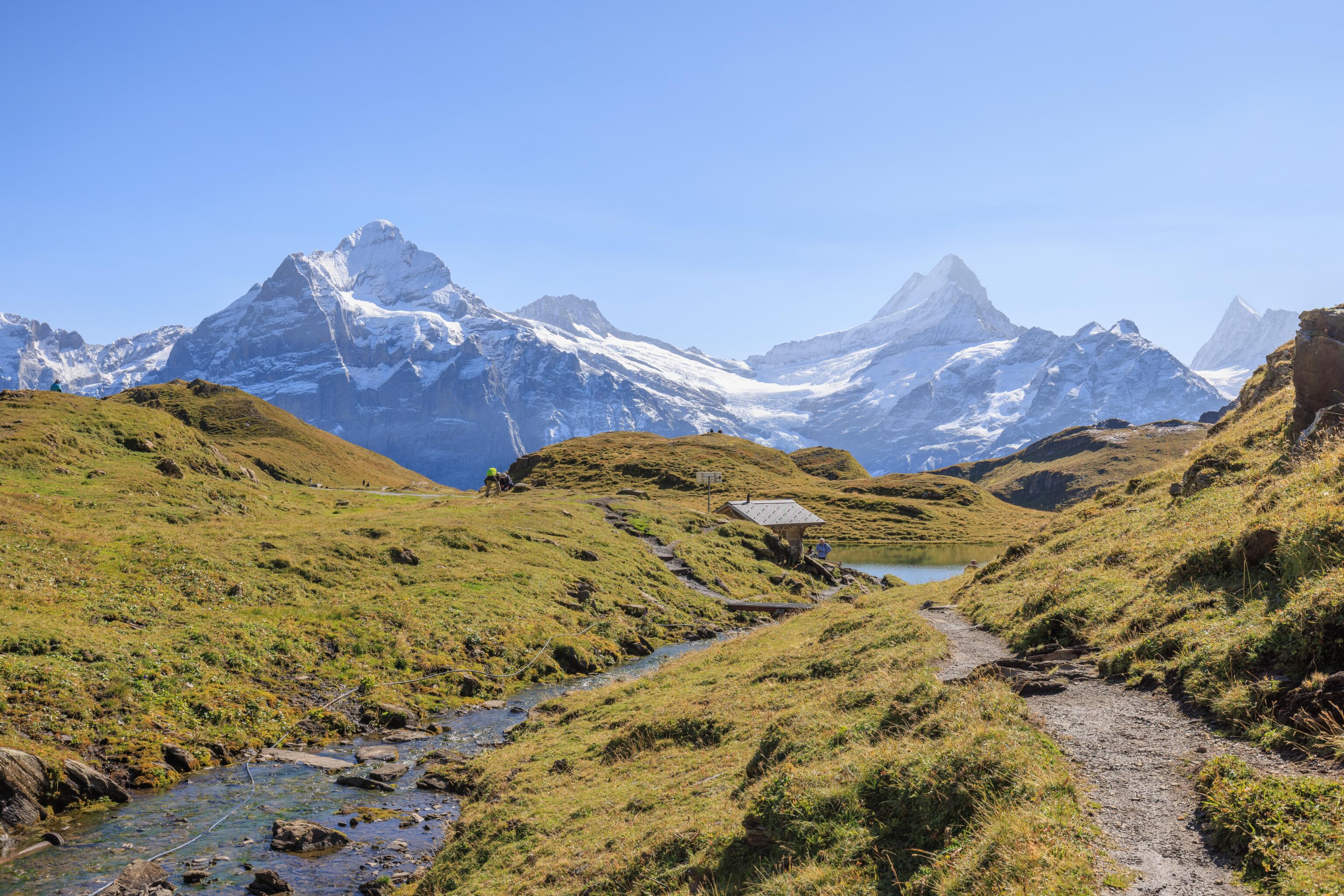
We passed by this ski lift as we began to hike to the Bachalpsee.
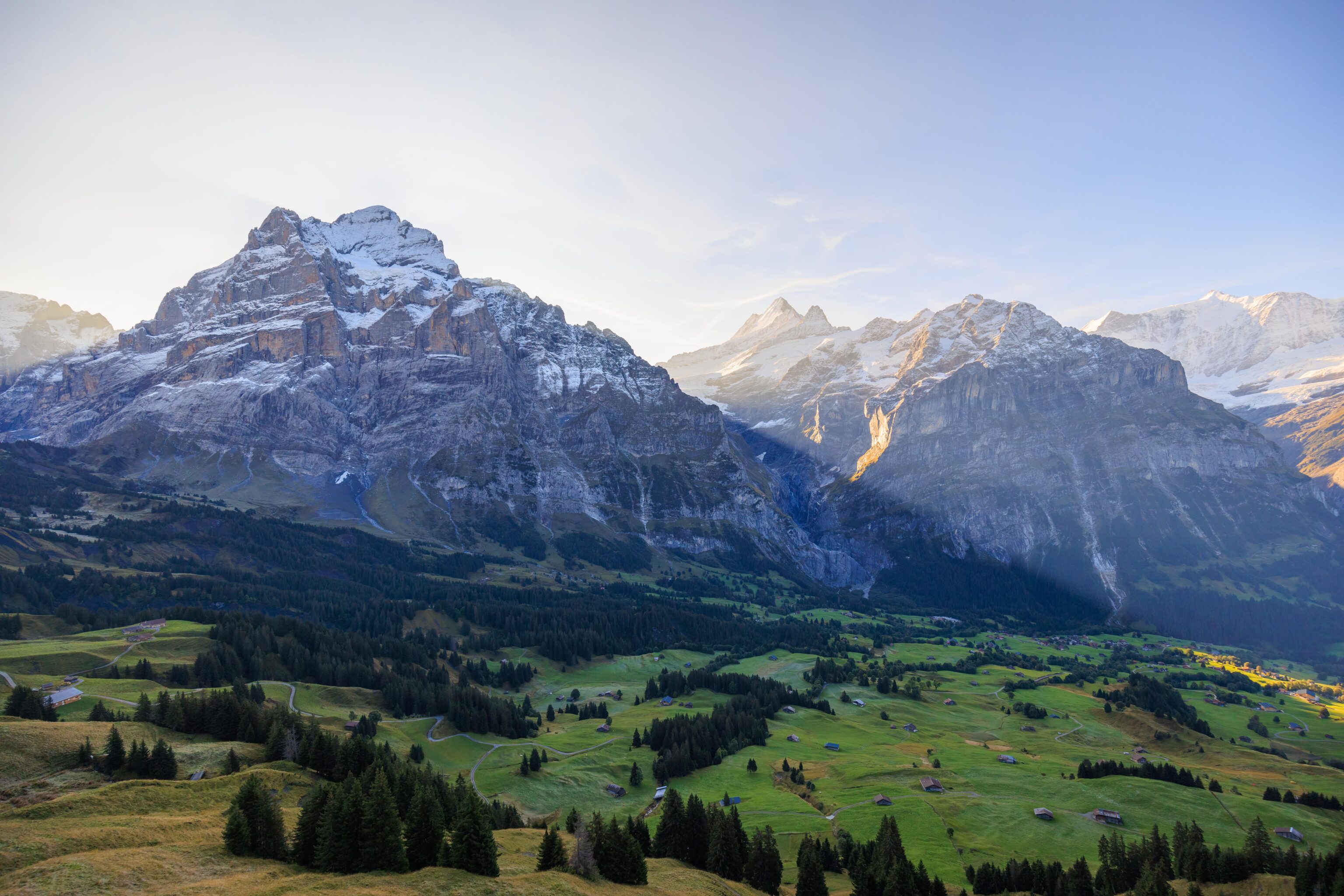
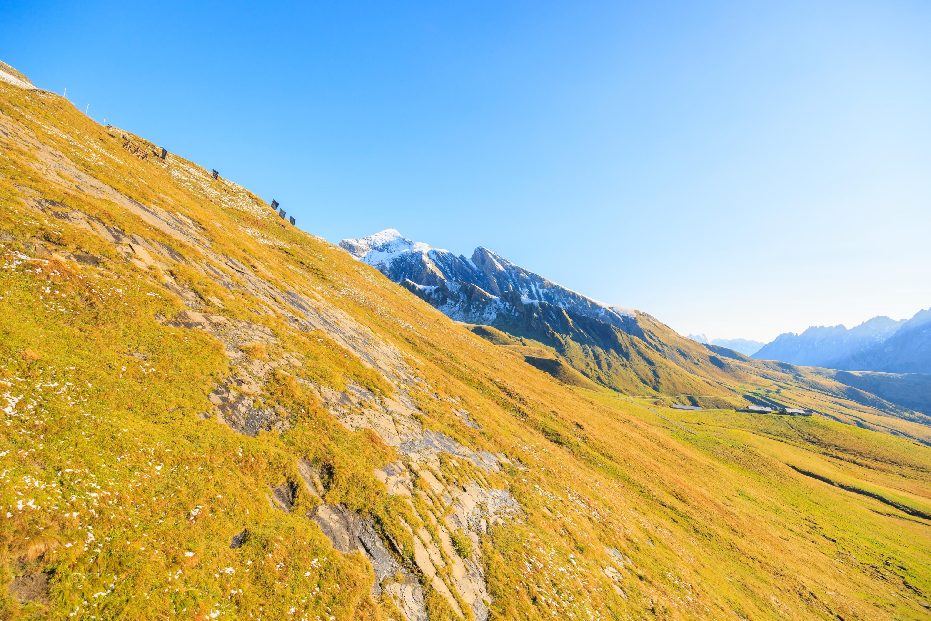
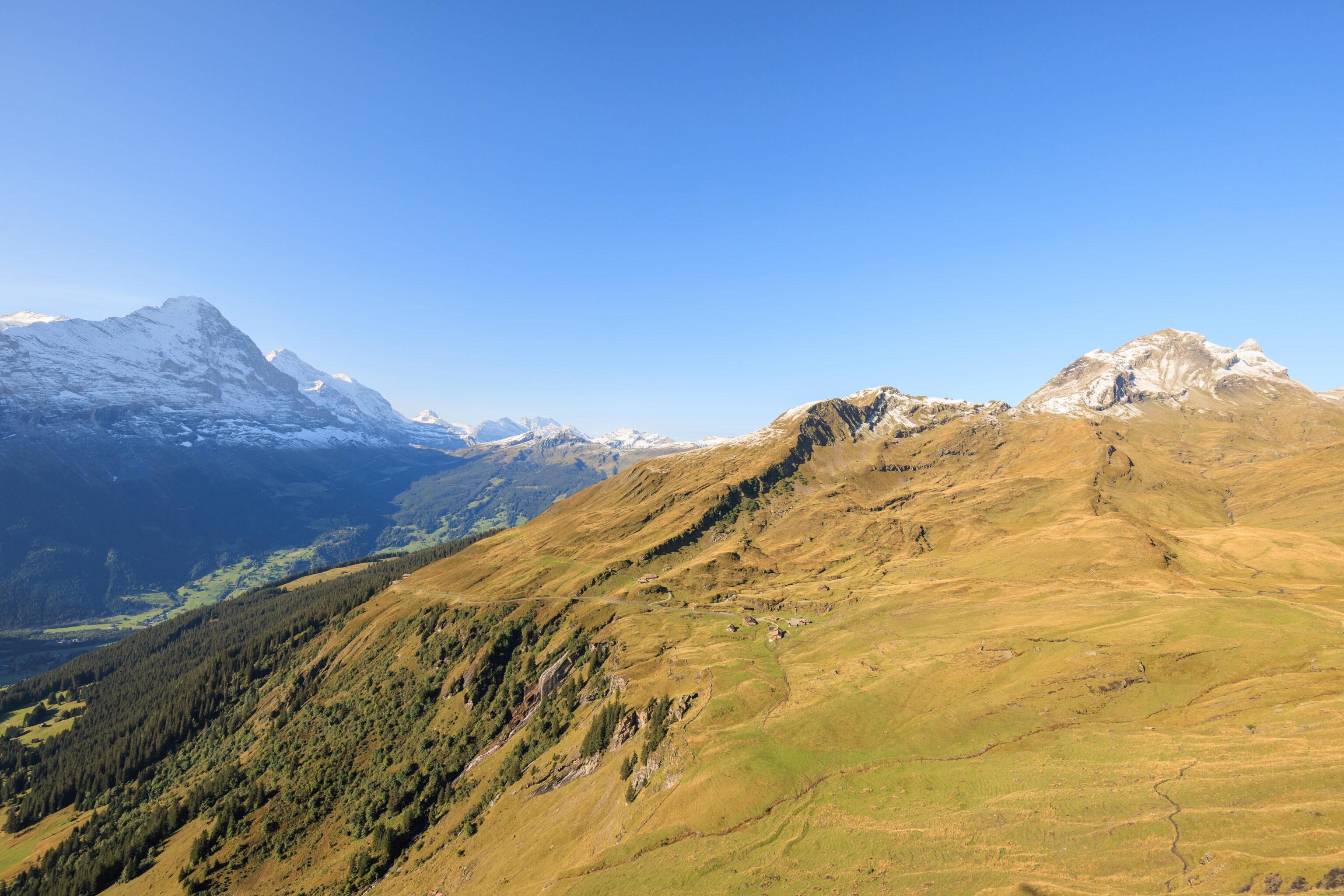
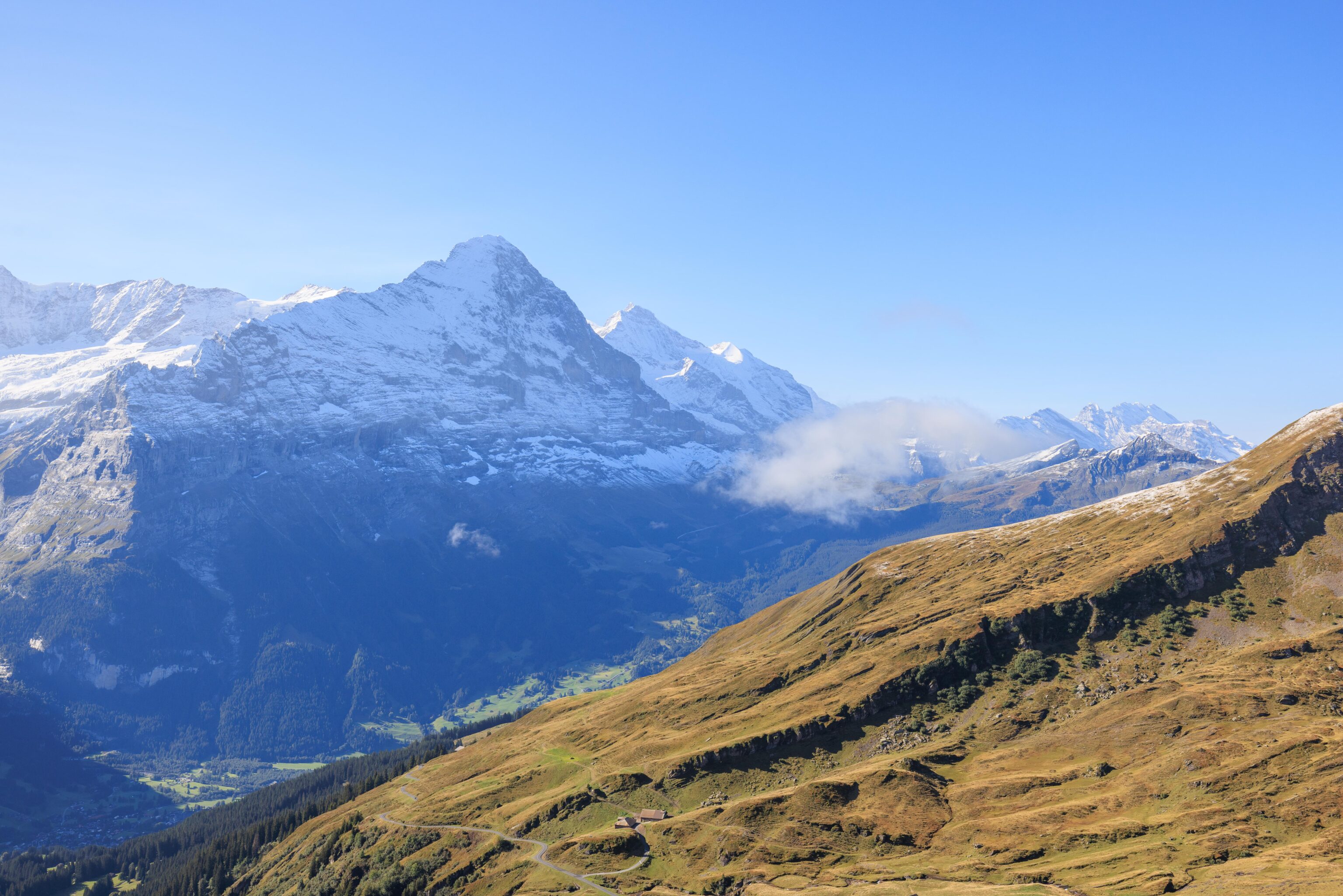
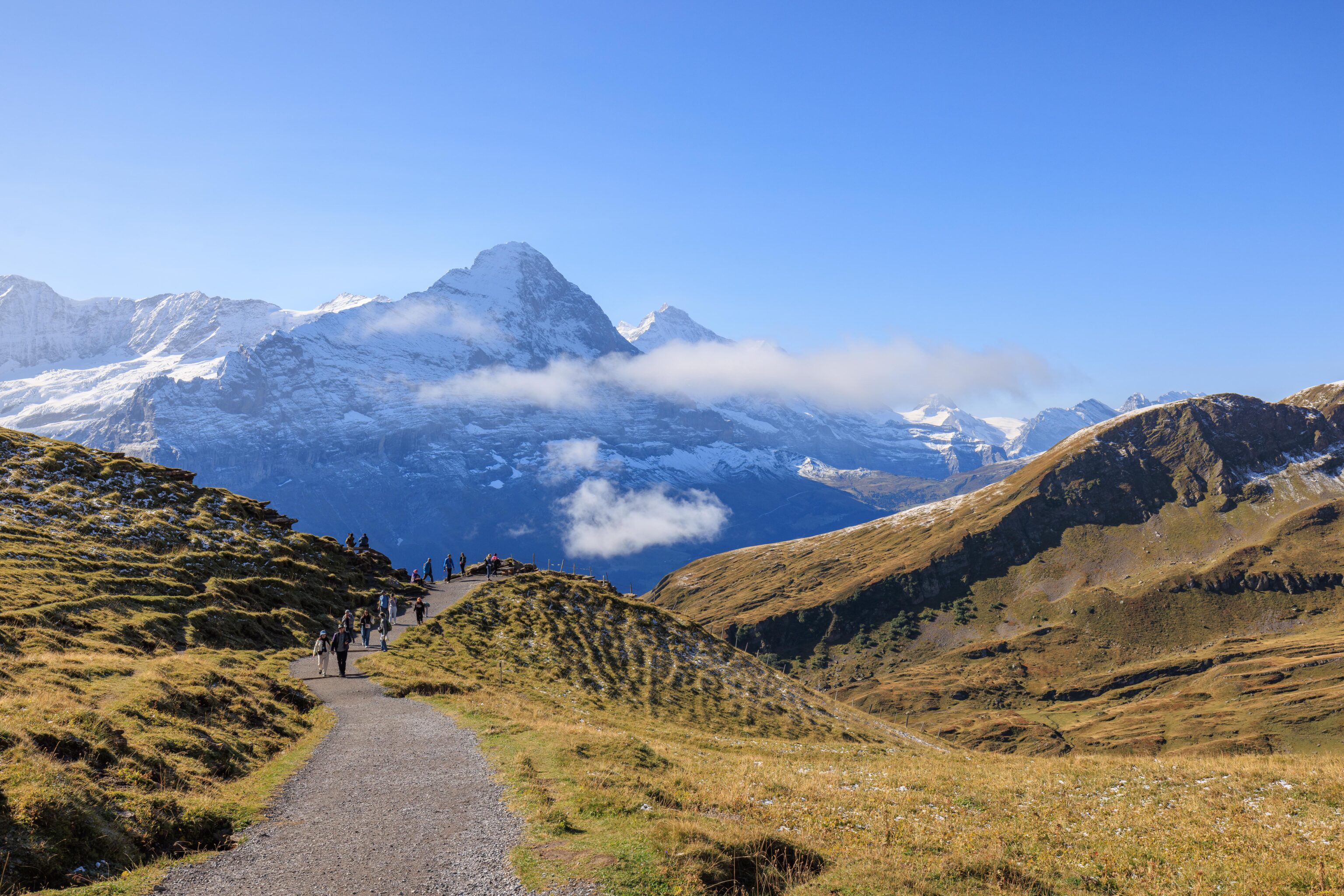
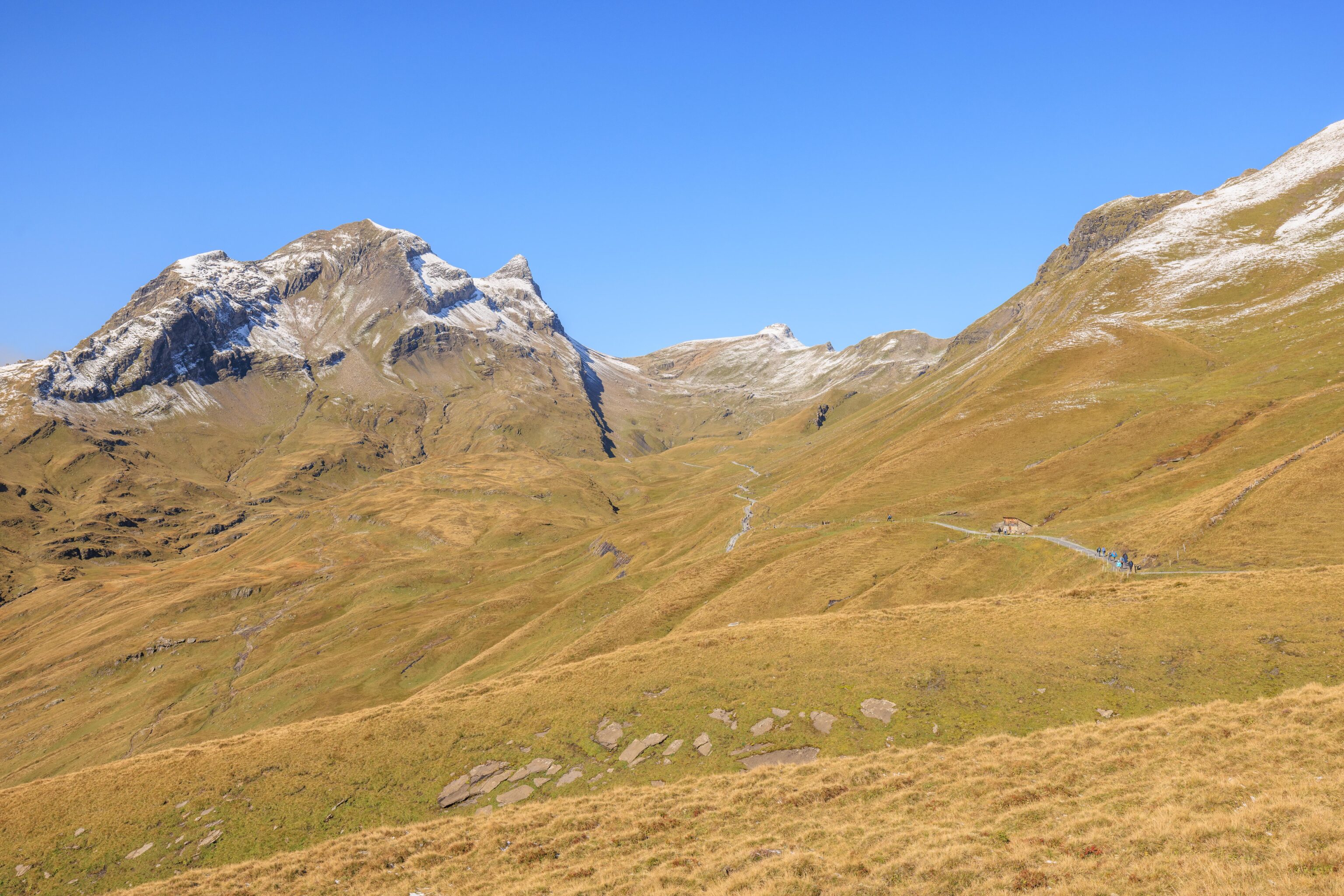
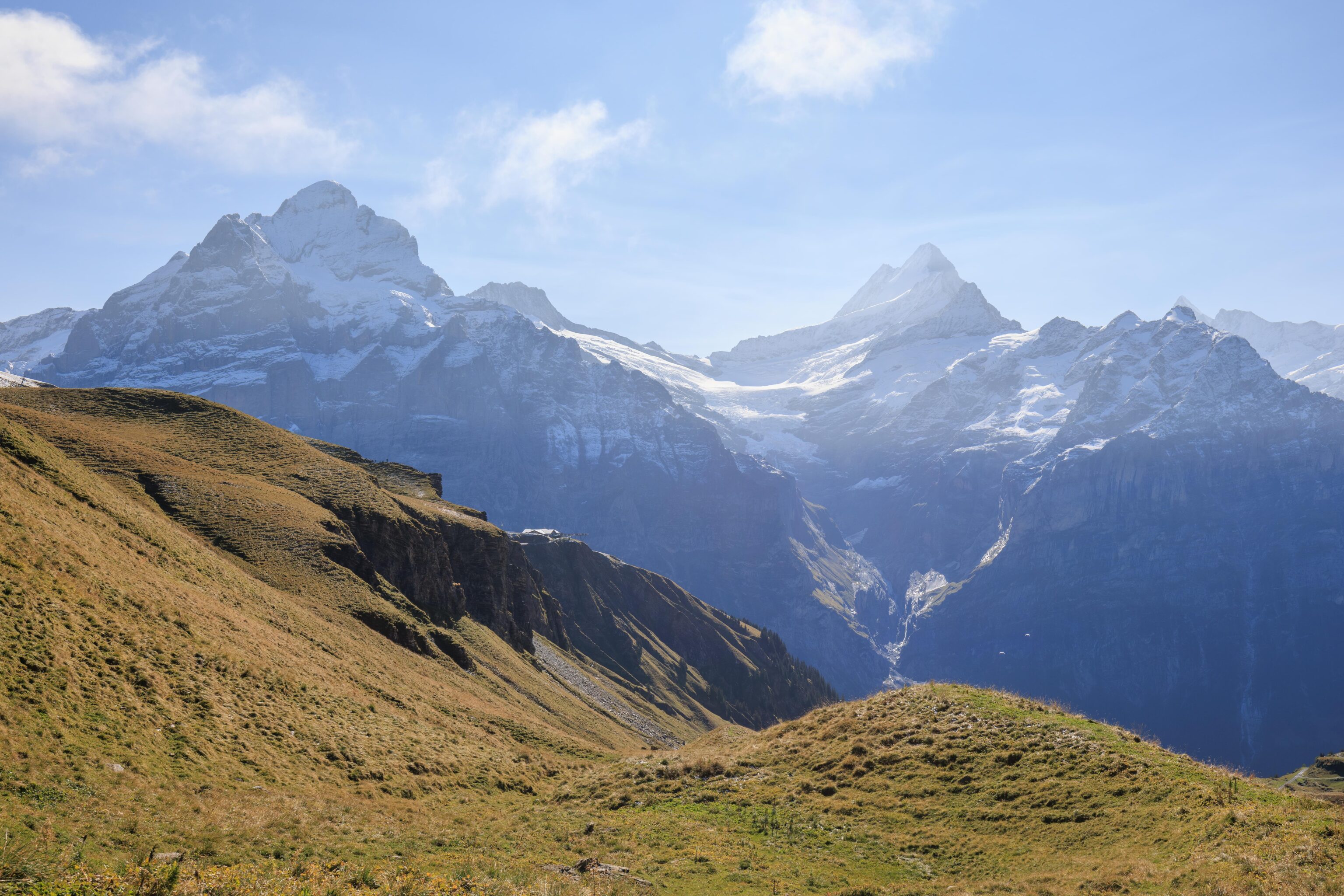
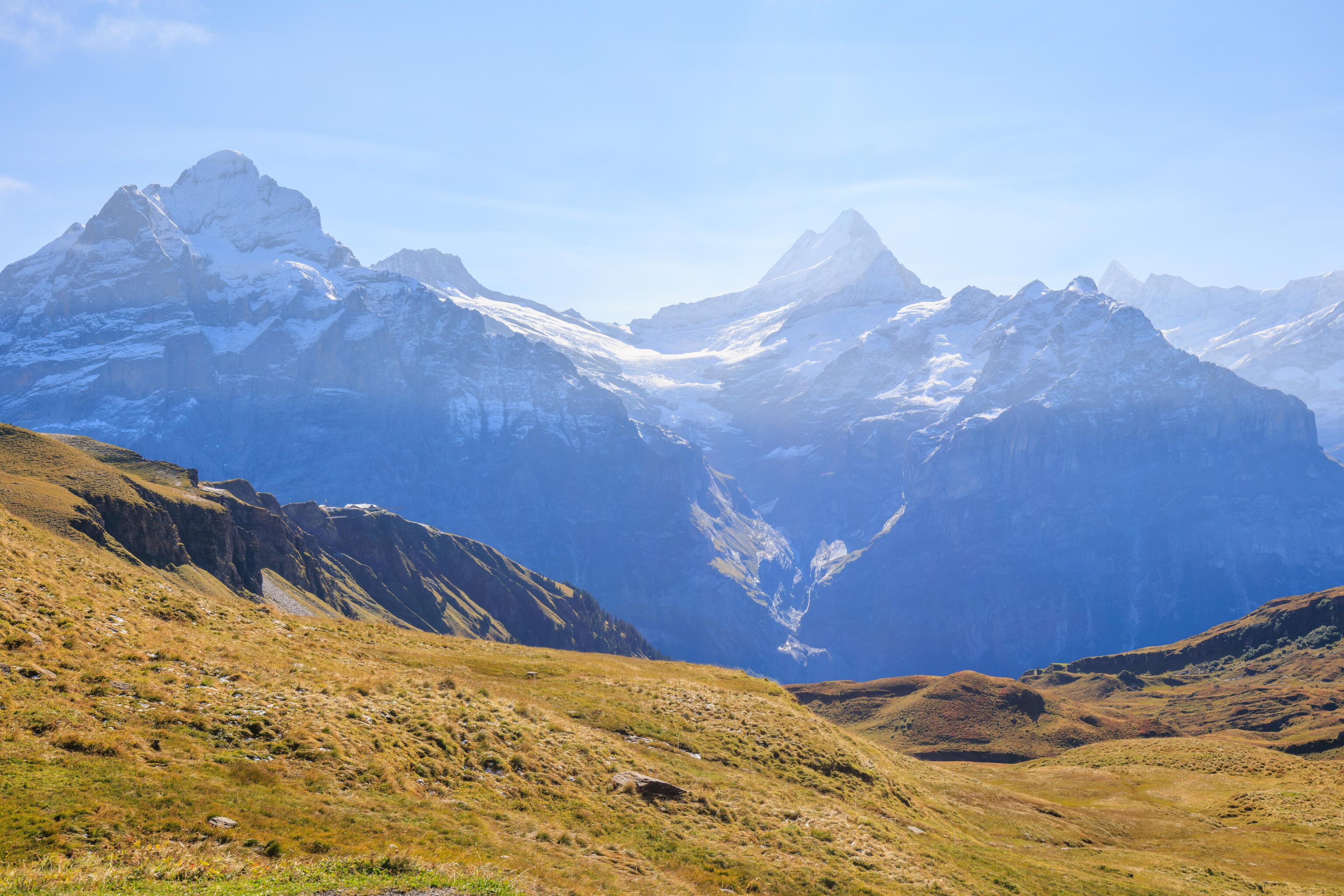
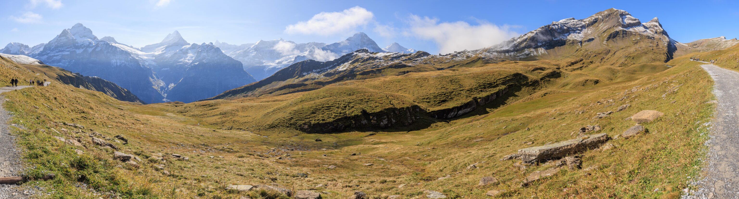
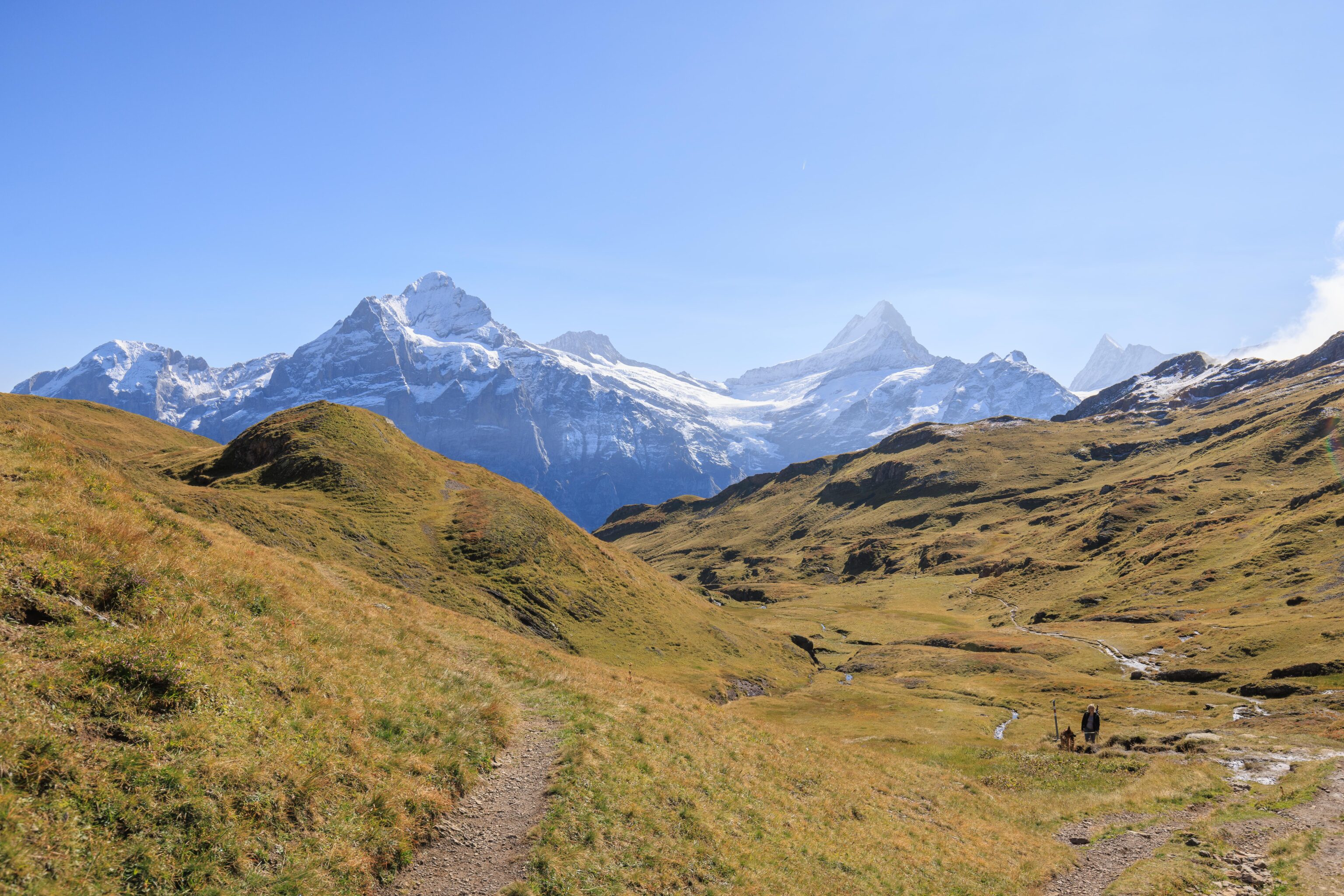
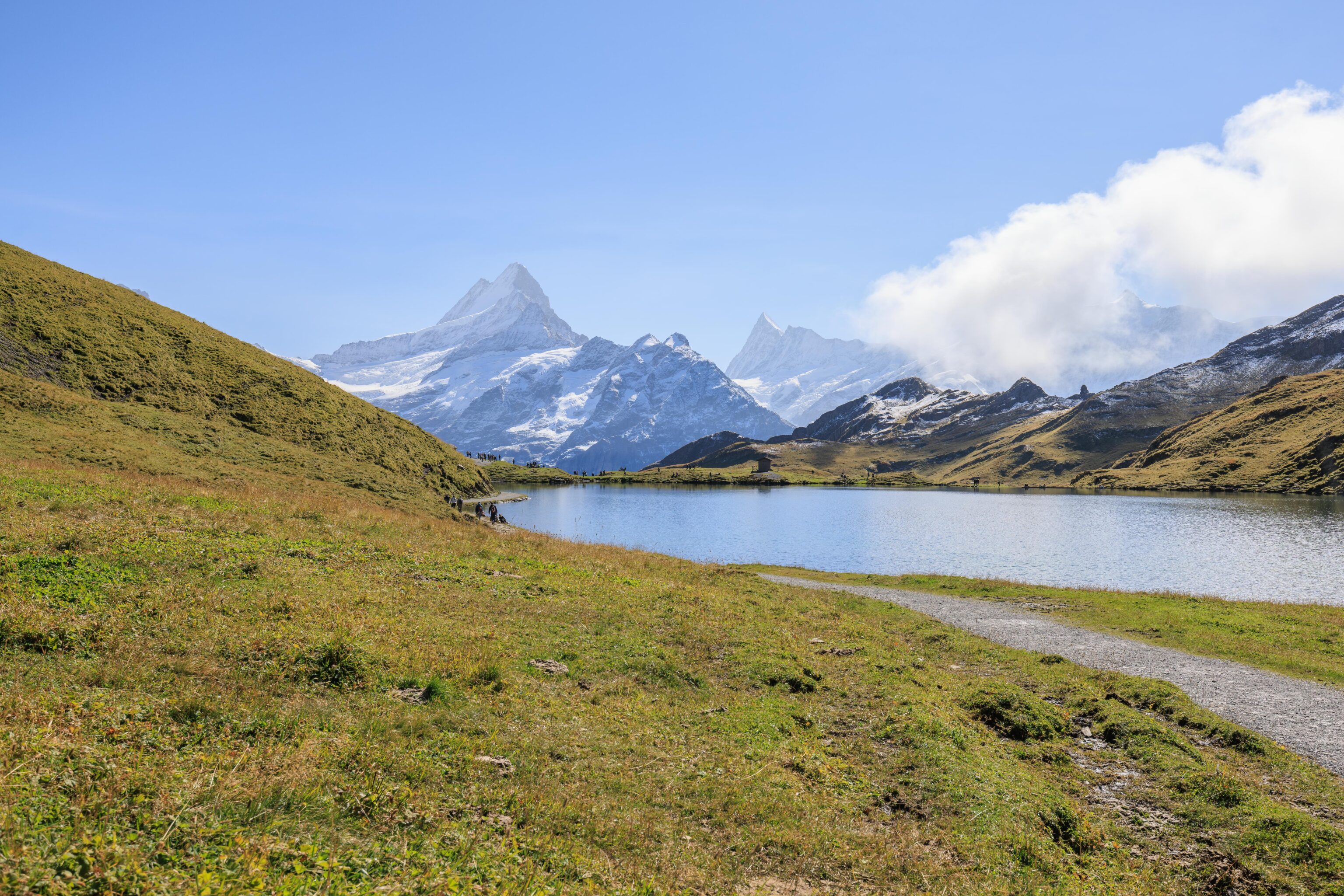
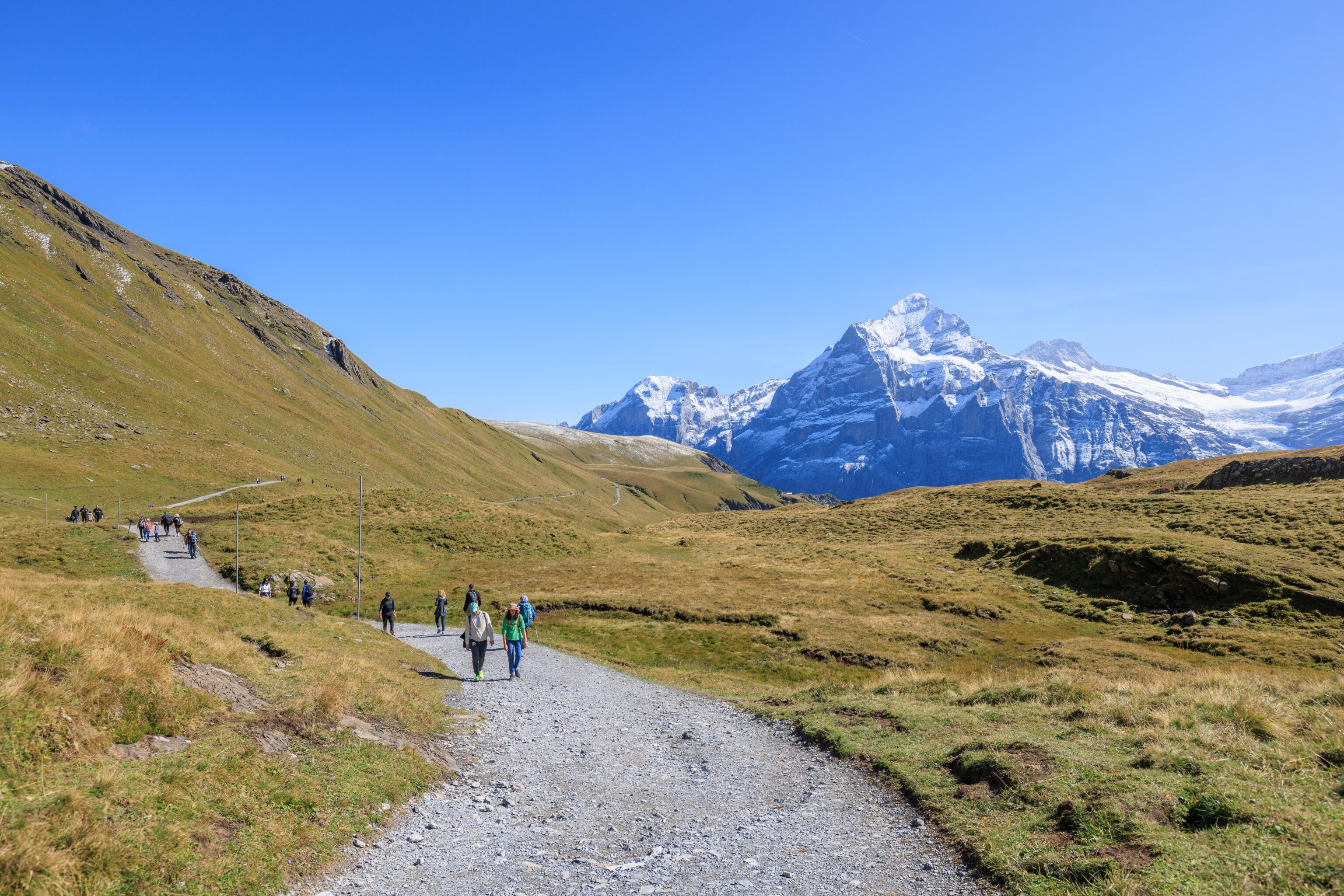
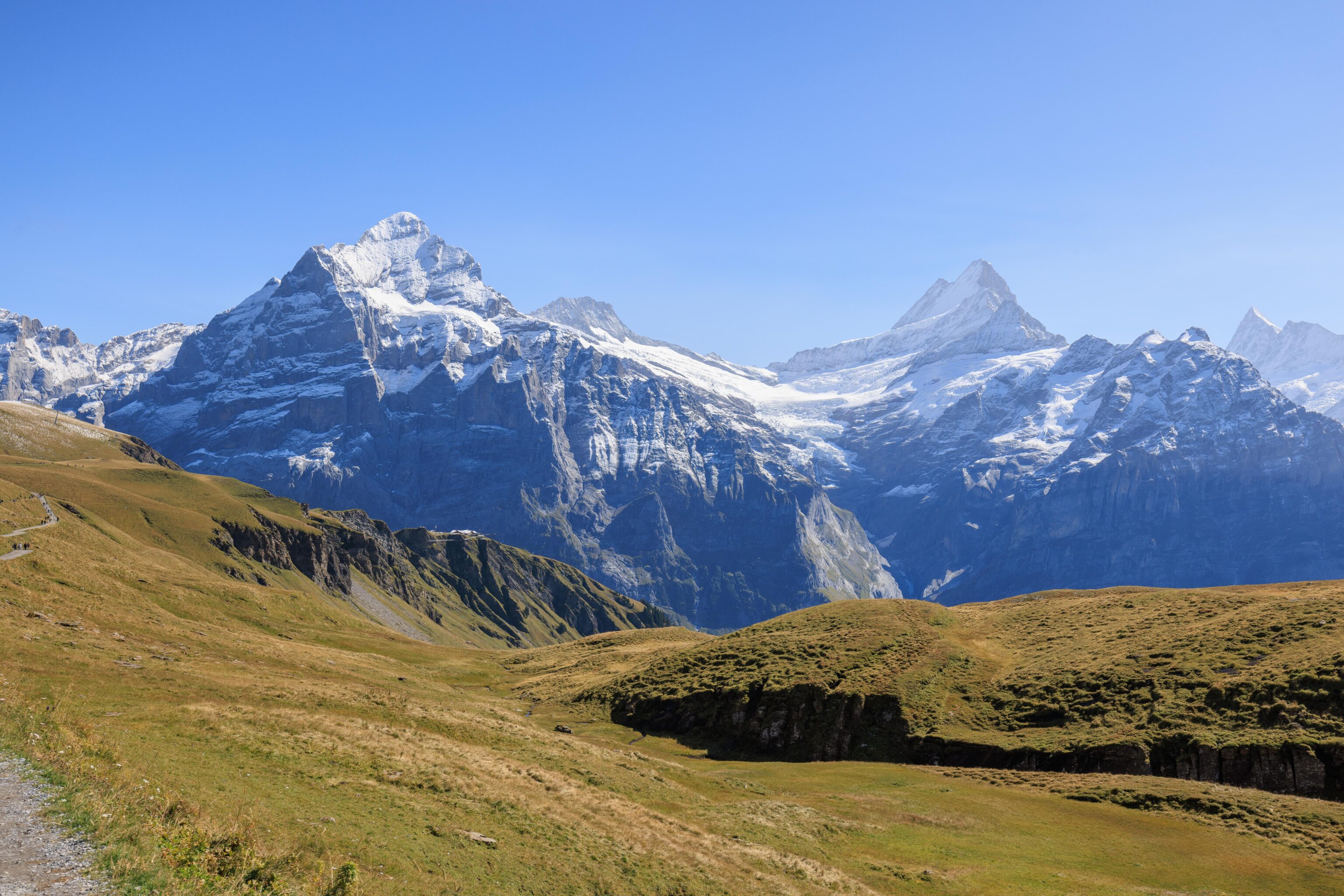
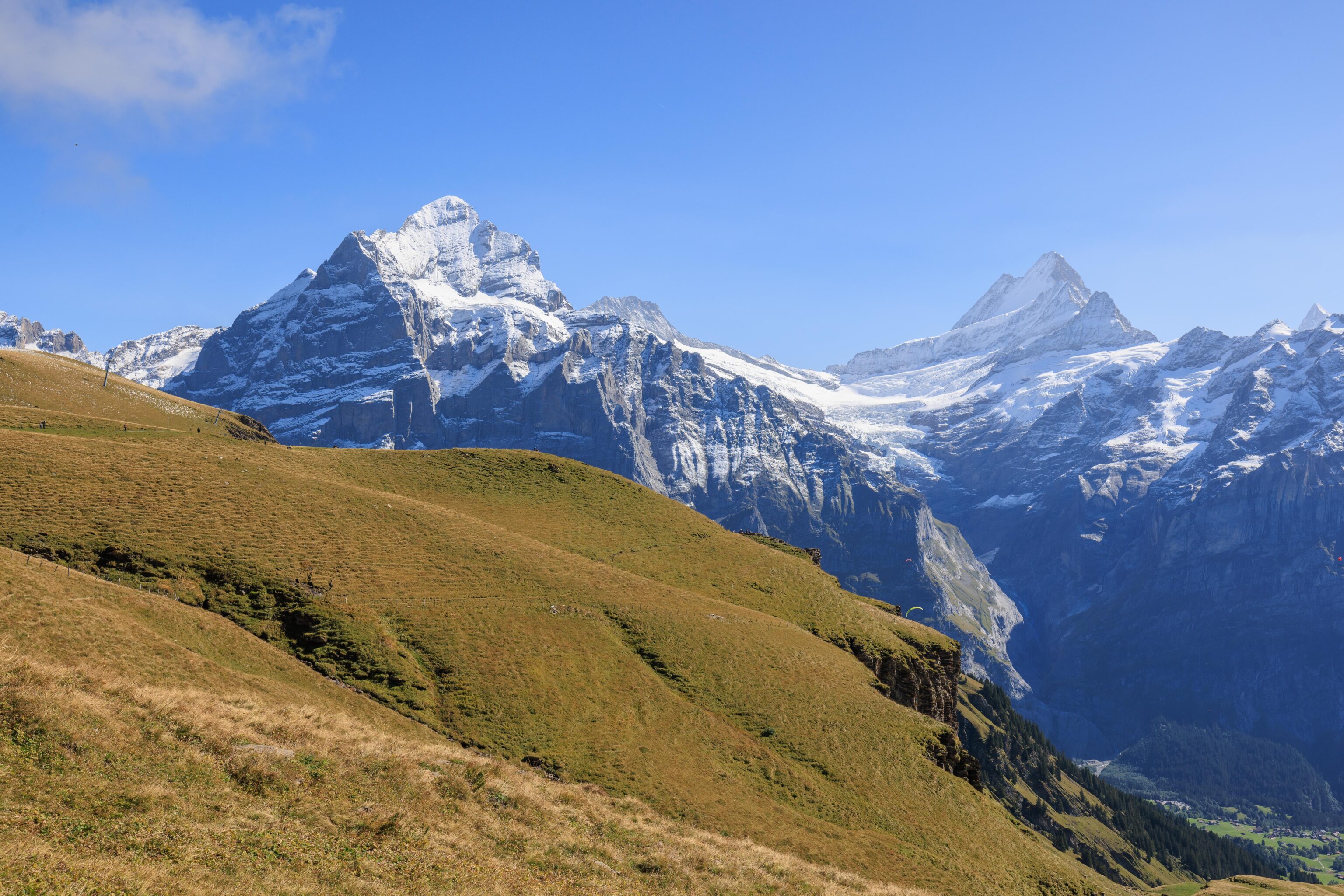
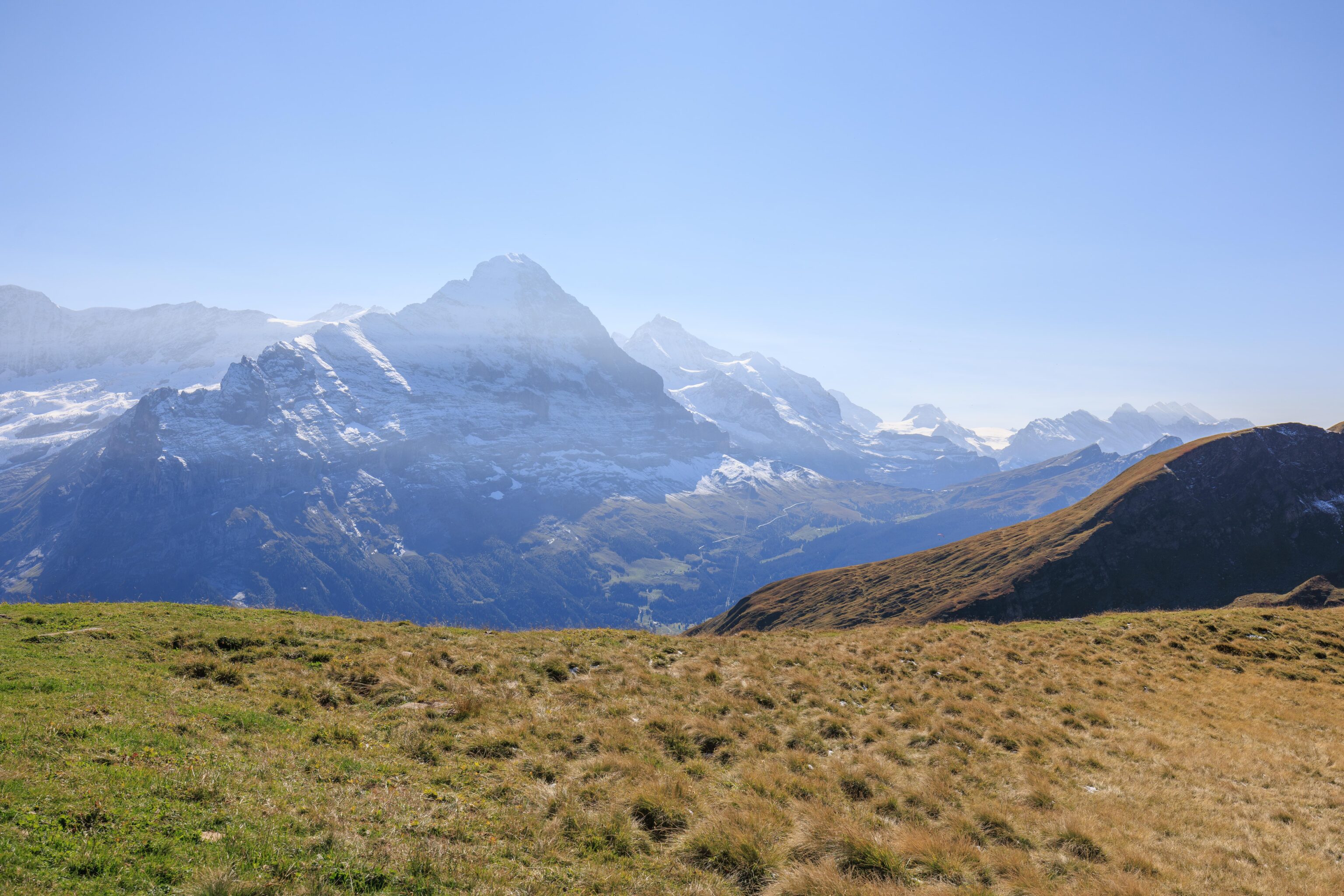
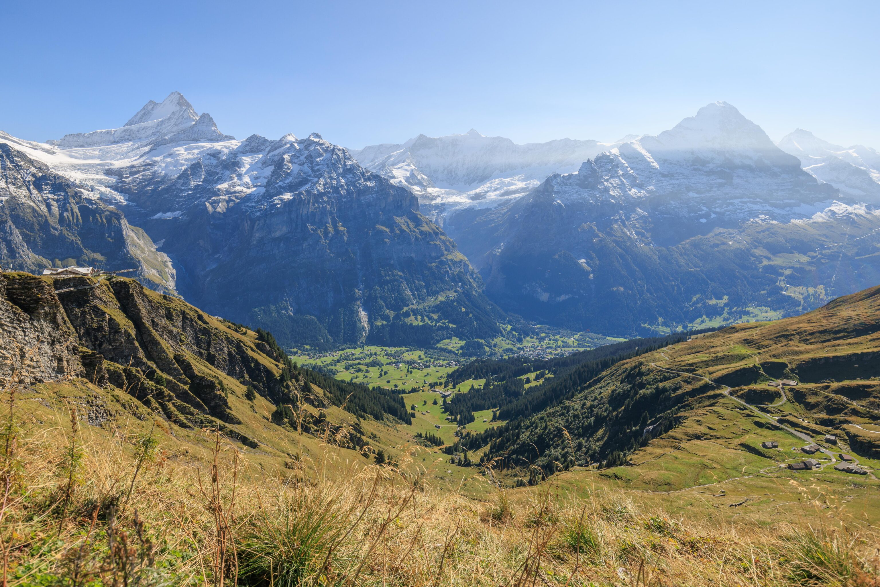
From just beyond the start of the trail, we could see the First View and First Cliff Walk. The three big mountains in the region are Eiger, Mönch, and Jungfrau. Eiger towers over the valley in between and appears to the tallest, though that is due to it being the closest to First. Jungfrau, the actual tallest mountain here, is the peak just to the right of Eiger. It appears smaller because it is further away. Mönch sits between Eiger and Jungfrau and is hidden by Eiger from this perspective.
To the right of Eiger, we could see Klein Scheidegg, which we briefly visited yesterday. It sits in the saddle between Eiger and Lauberhorn, which is out of view but would be on the right. The Eigergletscher station is visible as well, at the snow line on the right side of Eiger, though it is a bit hard to make out as it is in the mountain’s shadow. Some of the Eiger Express towers and cables are visible as well, particularly in the sunlit part of the valley. Grindelwald is hidden by the mountain that we are on but is basically down in front of us.
From just a little bit along, we could see nearly all of the Cliff Walk. The Crash Landing on You sign is just out of view on the left along the path leading to the Cliff Walk.
We stopped in front of a building, labelled Anja’s Skibar on Google Maps. It was closed for the summer. Looking to the west, we could see where the trail is going. The Bachalpsee is somewhere out there, before the mountain peaks in the distance.
Although the weather was excellent, there were still some clouds that moved by. The previously mentioned Lauberhorn should be the peak that is at the very right side of the cloud, extending above Klein Scheidegg below.
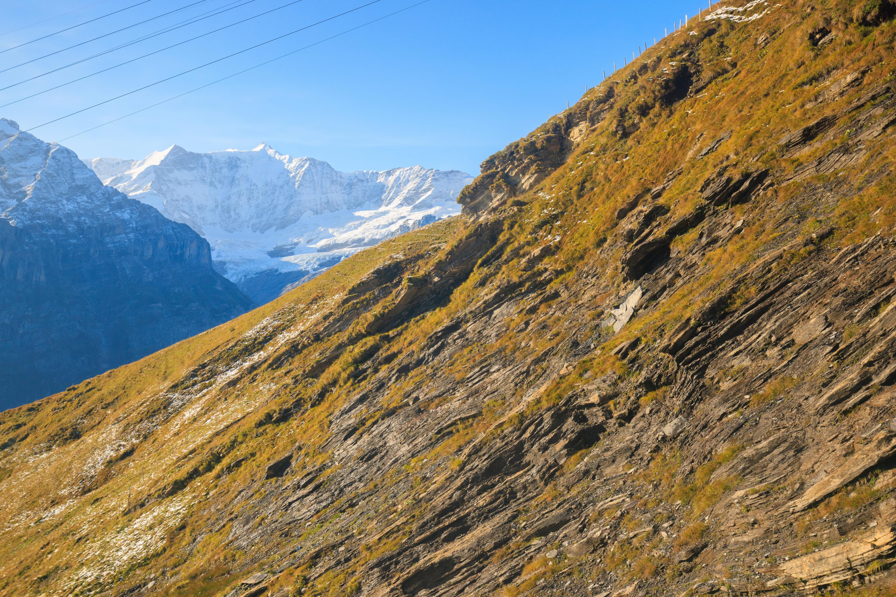
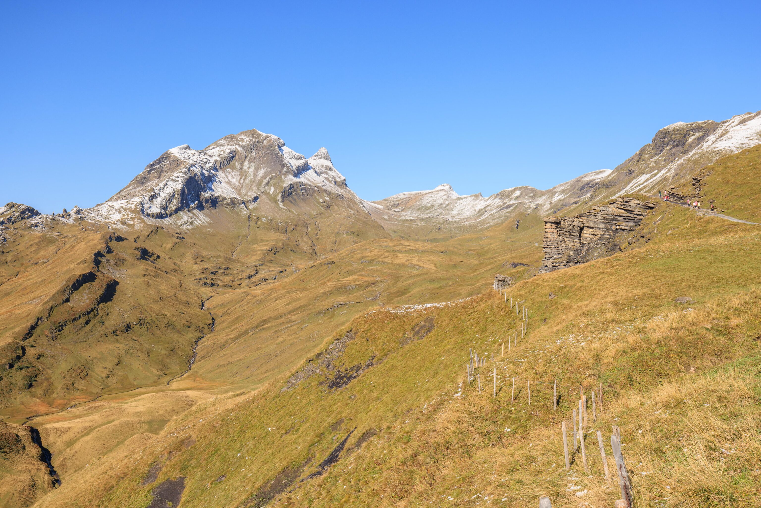
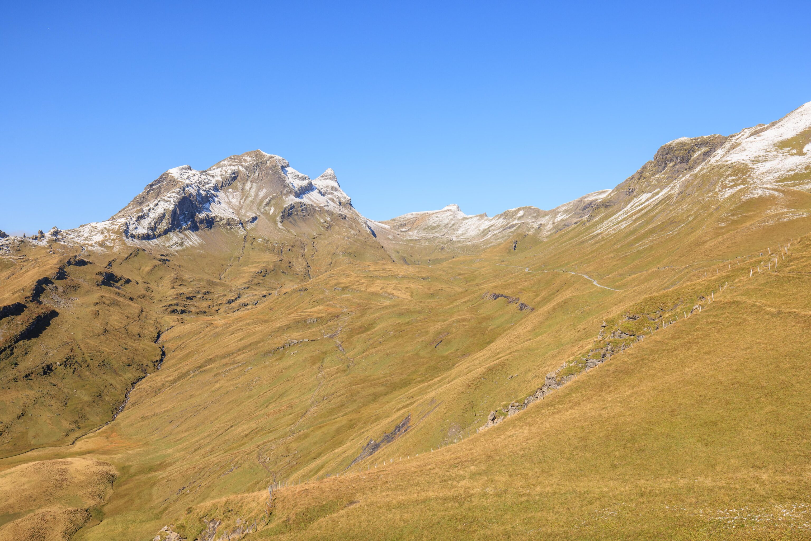
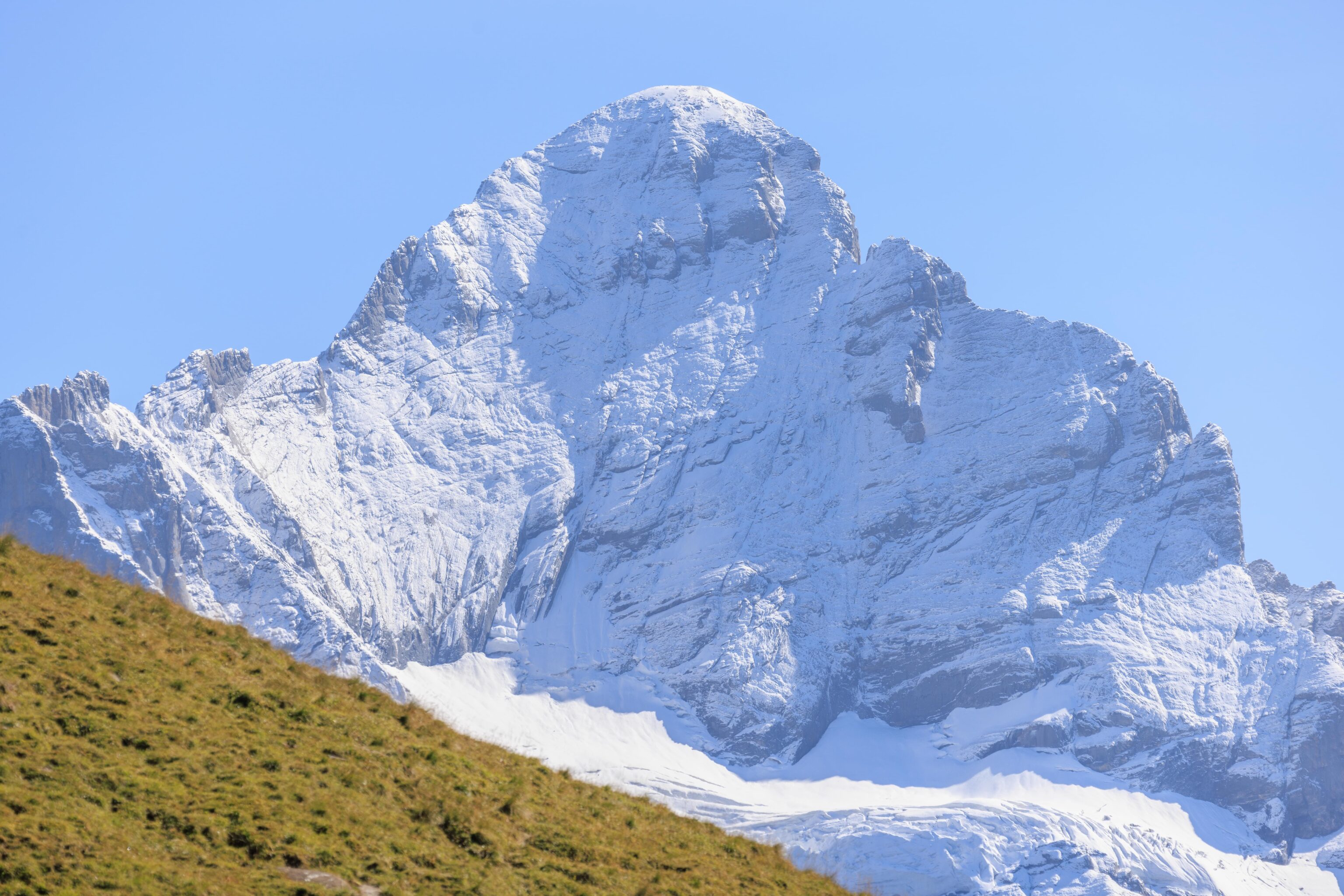
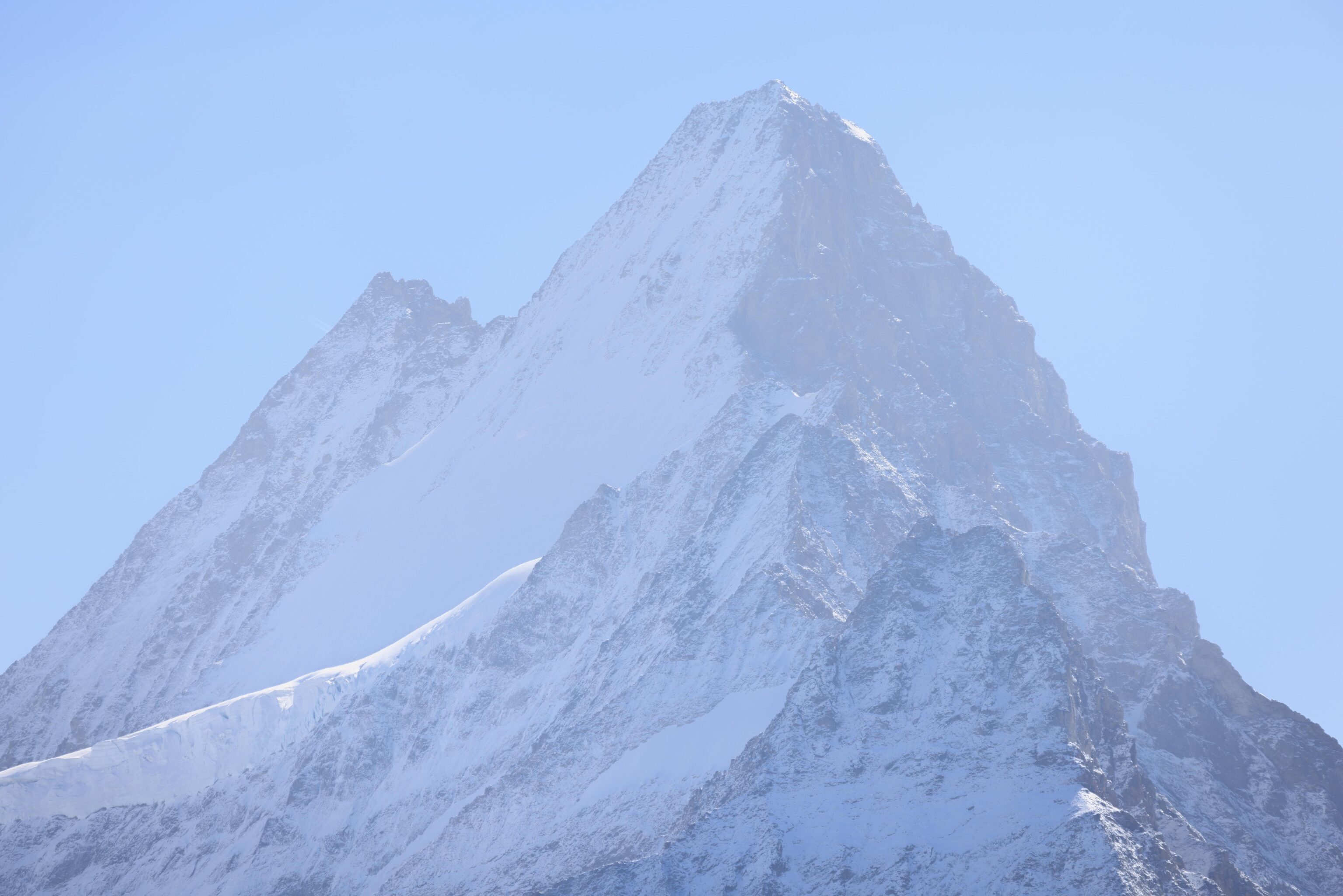
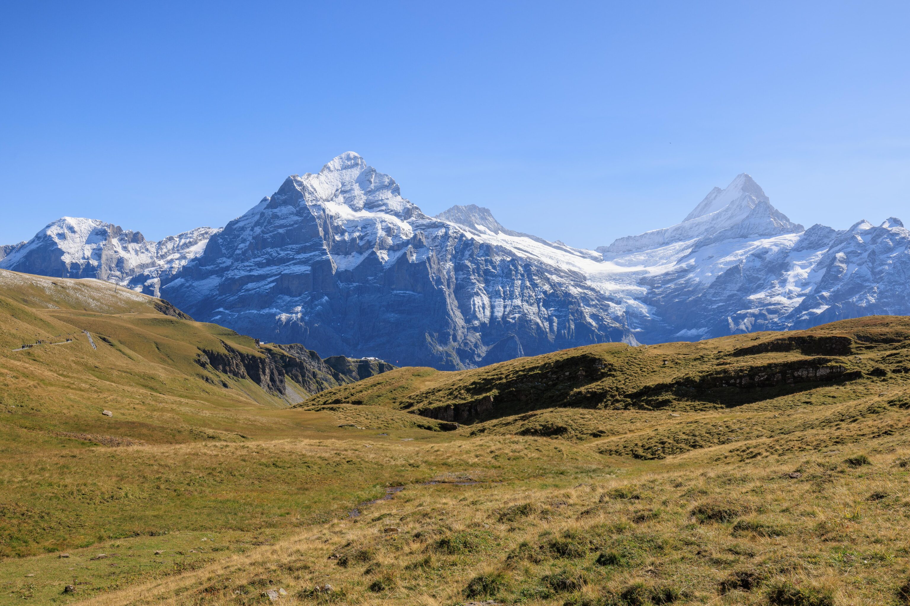
We took a panorama from here. The tallest looking peak here, on the left, seems like it should be the Schreckhorn. It is taller than Eiger but not as tall as Monch or Jungfrau. It is a little closer to us than Eiger.
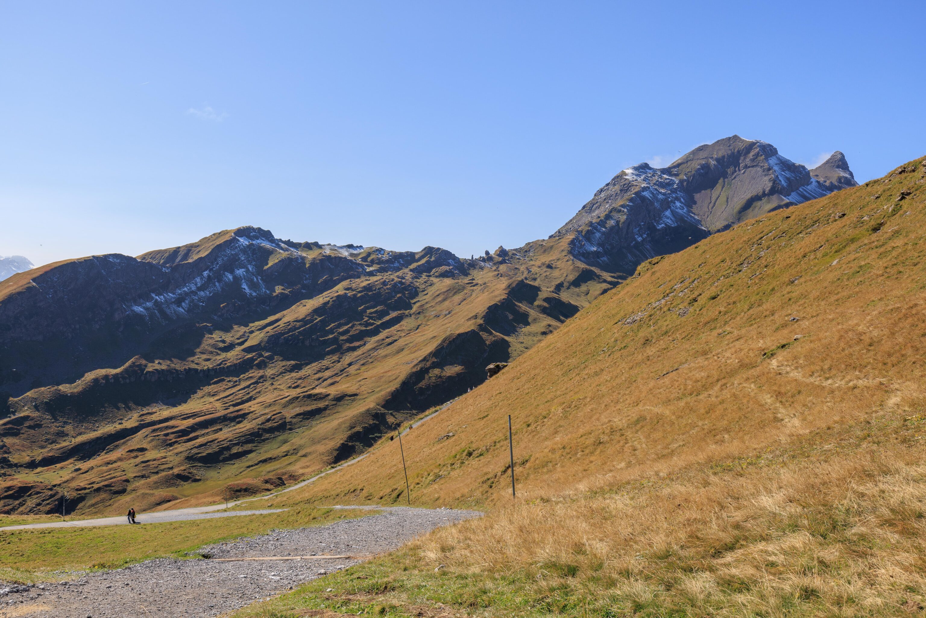
We continued onward, soon approaching a junction, not visible in the photo, and a rocky formation further ahead on the trail. A sign indicated that the proper trail was straight ahead, so we continued onward.
Eiger and Jungfrau from the junction. It looks pretty much the same as it did just a few minutes ago.
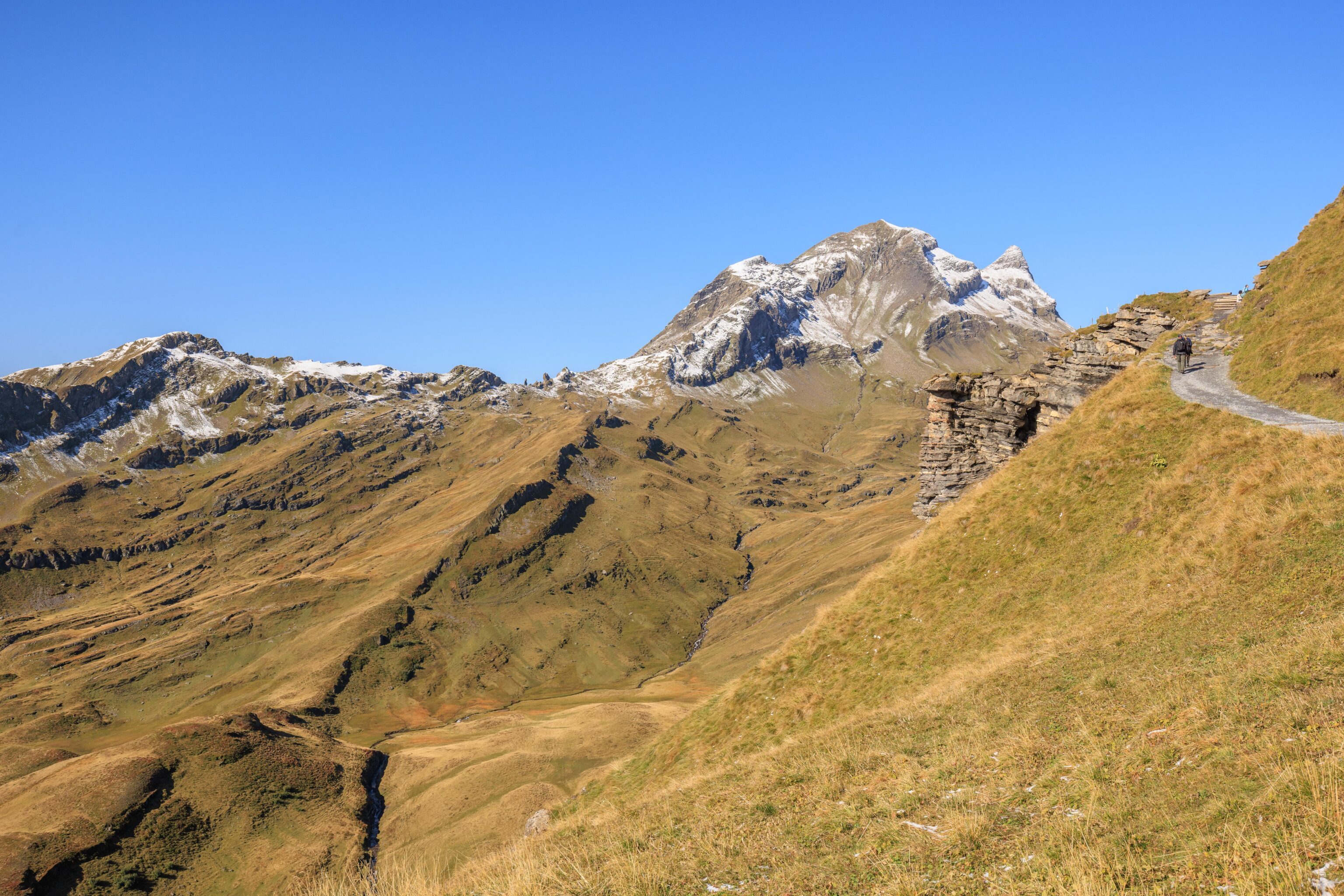
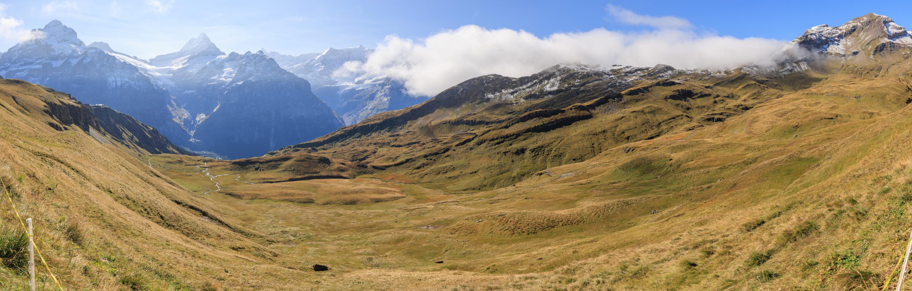
We continued to reach the top of the rocky formation that we saw from the junction. The rocks made for convenient sitting places, and there was a bench as well. Looking ahead, we could see the trail as it headed into what looks like a basin surrounded by mountains on all sides. Likely where the Bachalpsee is.
Looking back, we could see Anja’s Skibar on the left. The visitor complex at First was now starting to appear quite small in the distance, though we could still make out the First View and First Cliff Walk. The mountain on the left seems like it should be the three peak Wetterhörner. It isn’t nearly as tall as the Schreckhorn to the right but is closer to us so appears taller.
As we continued onward, we looked back to see the rocky formation where we had rested for a short time. It was a nice spot!
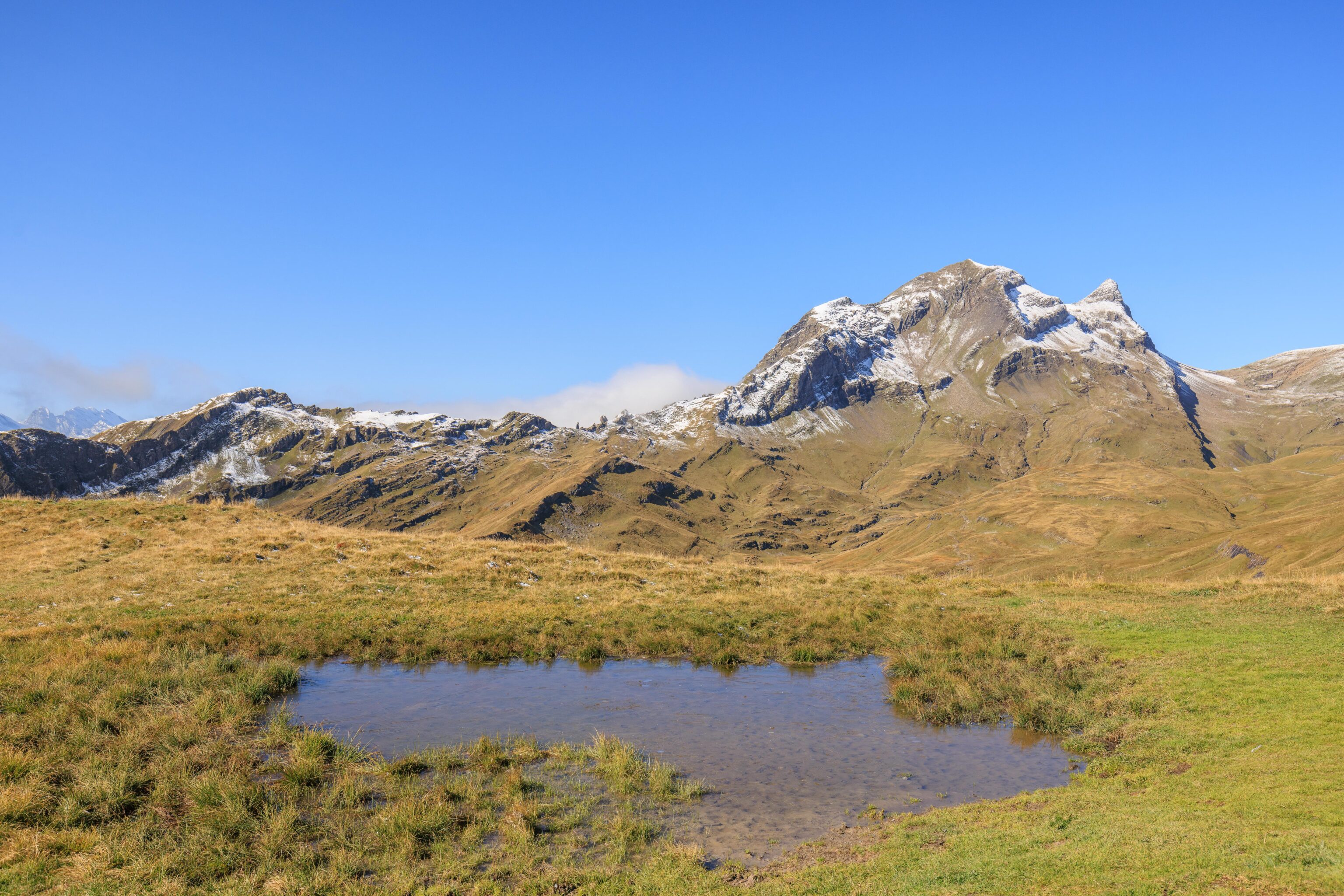
Just a little random pool of water that we passed by. This was just past another junction in the trail. We think the other path at the junction we saw earlier probably leads here.
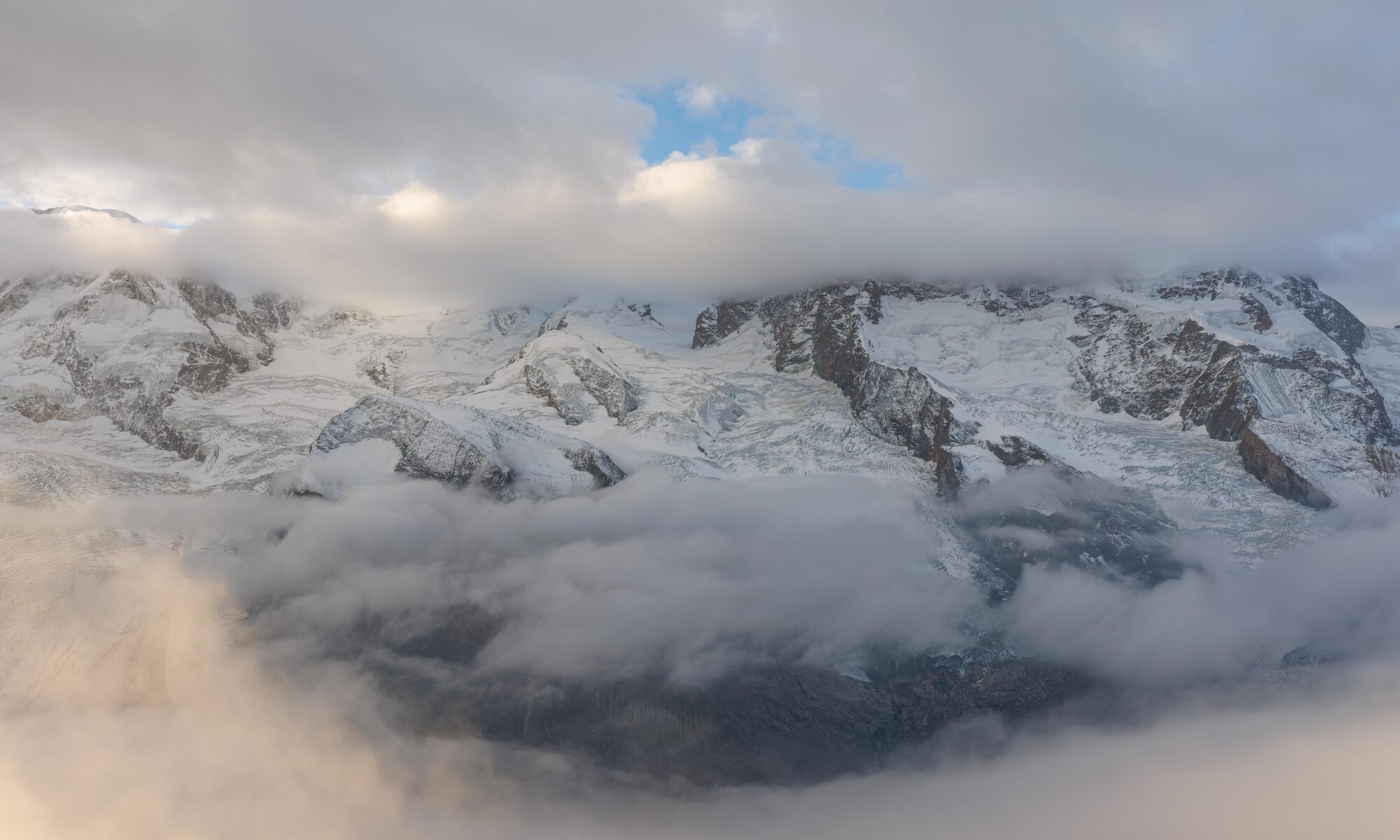
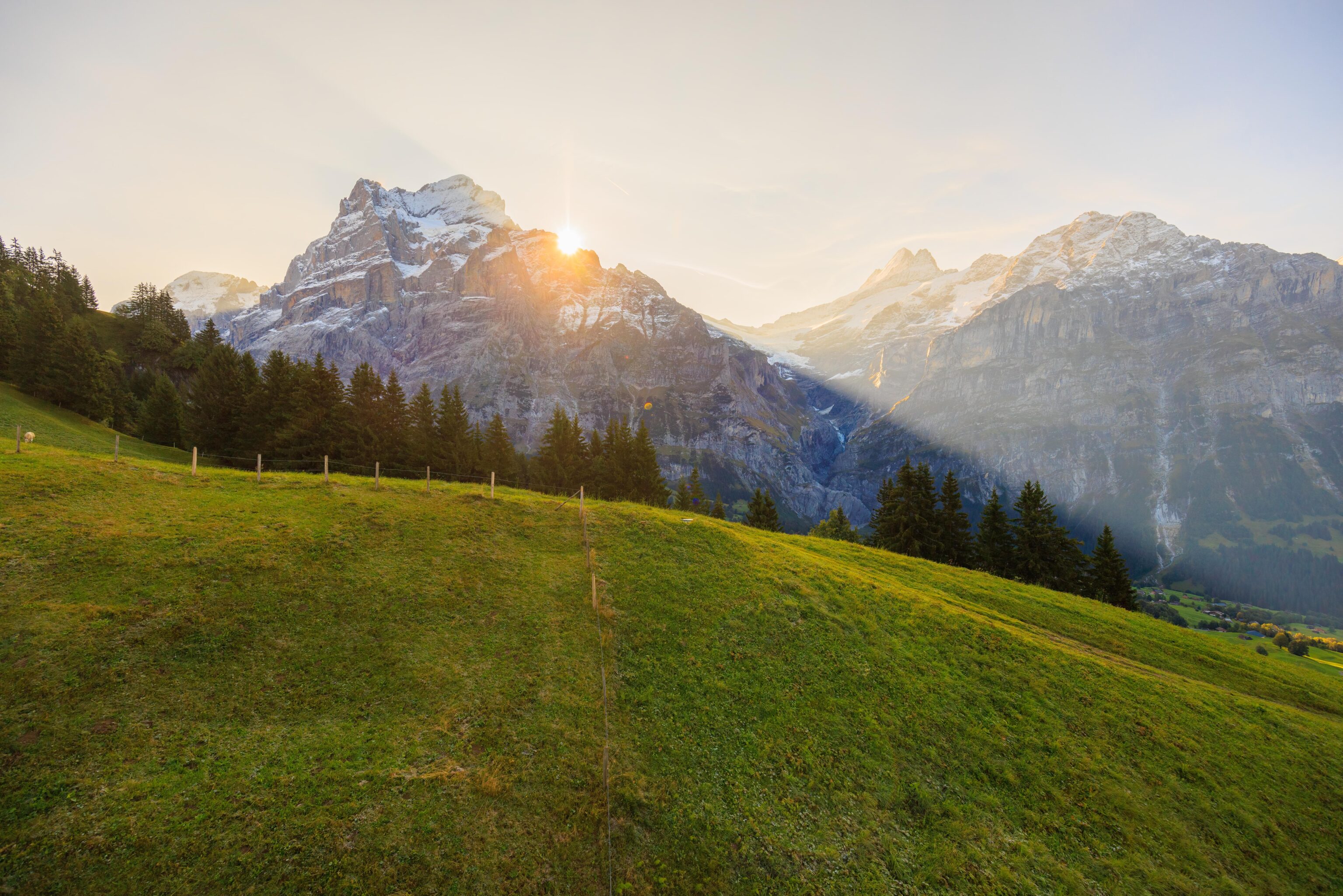
Looking back once again from next to the little pool. We could see a paraglider down below. The clouds seemed to be getting a bit larger. We also noticed that there was a very light cloud layer above the mountain peaks, perhaps from all the moisture from yesterday’s snow?
A similar scene looking ahead.
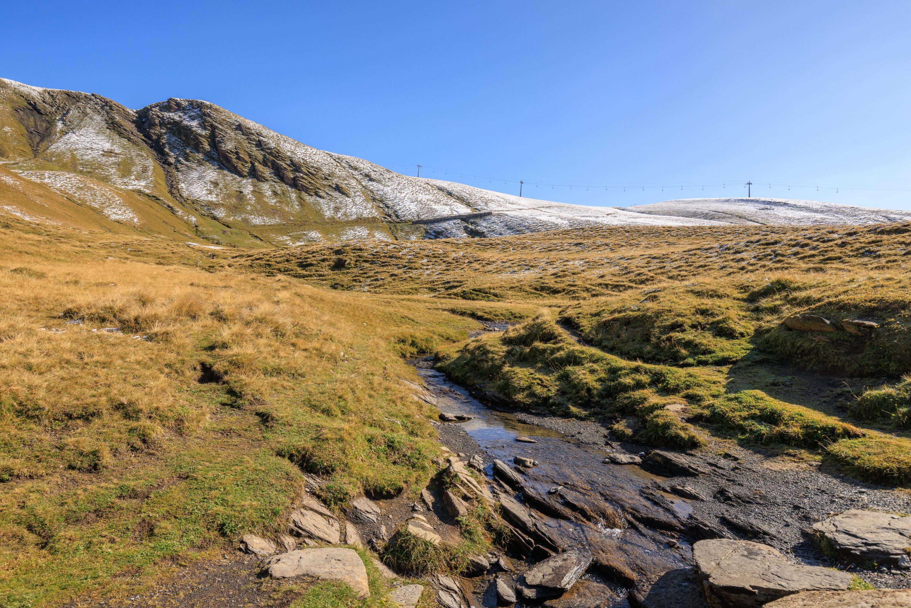
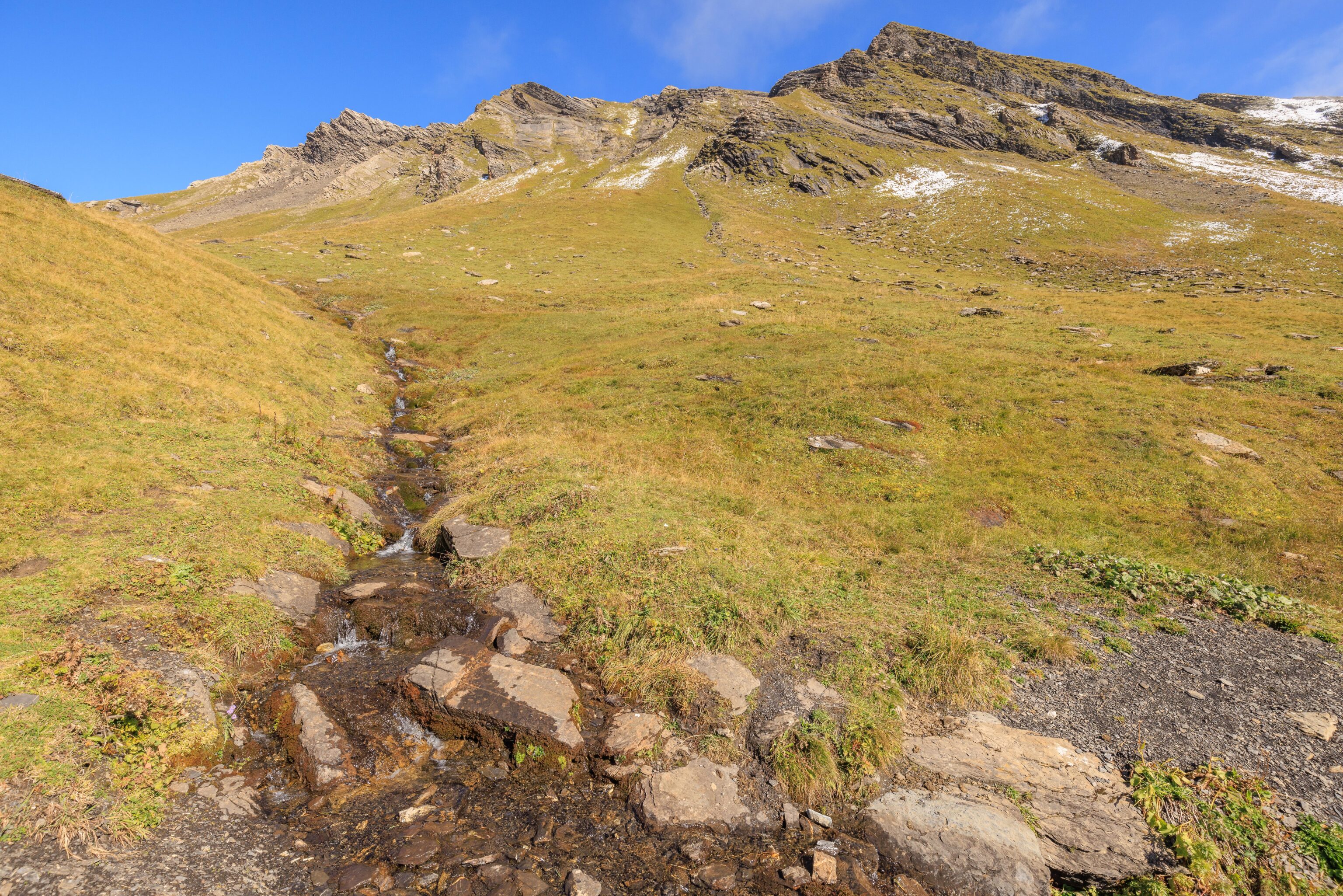
We passed by a small stream, perhaps freshly flowing with snowmelt from yesterday?
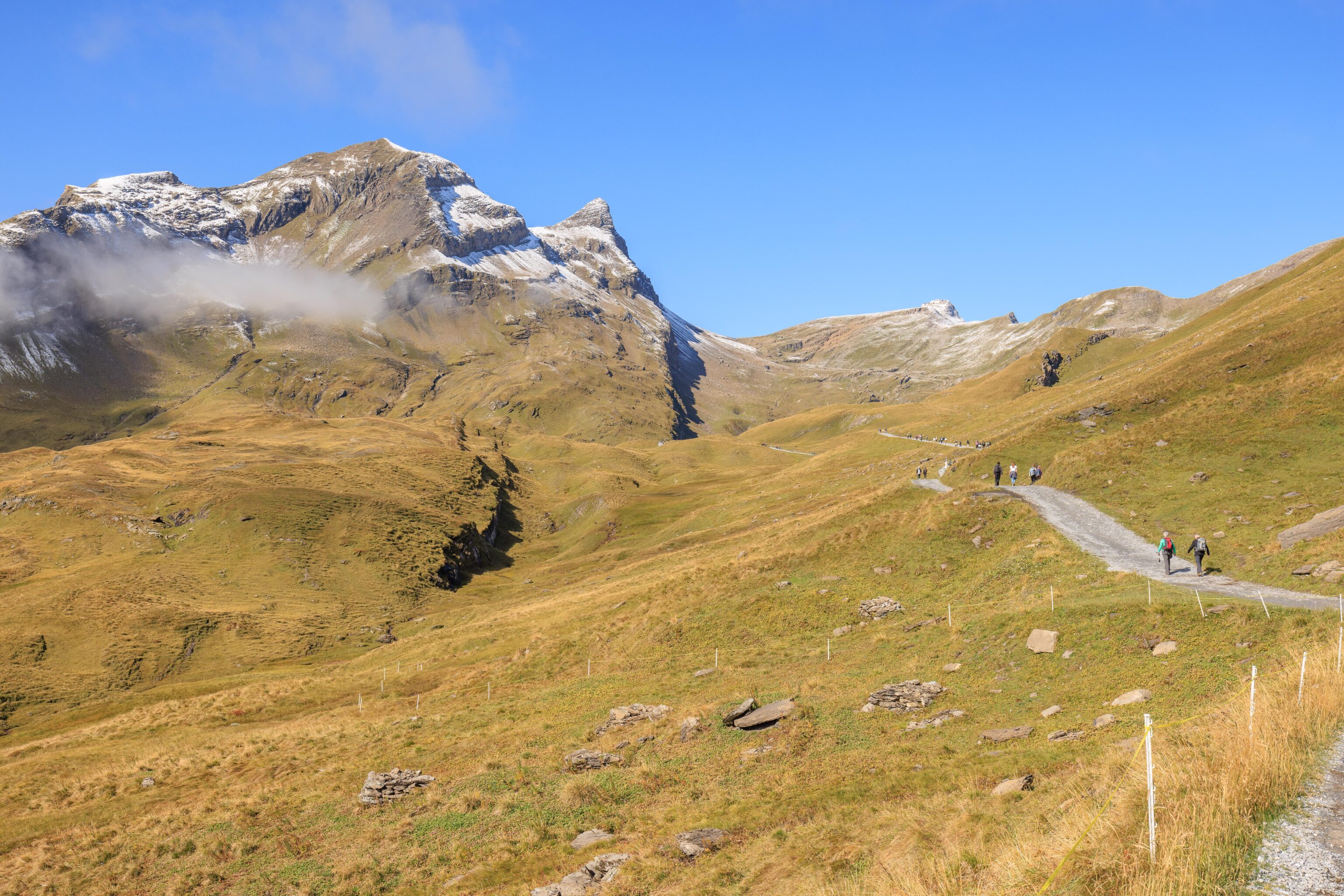
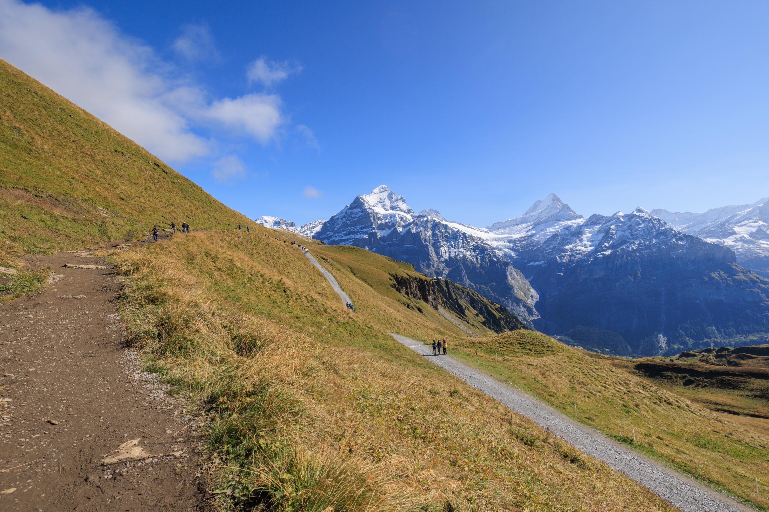
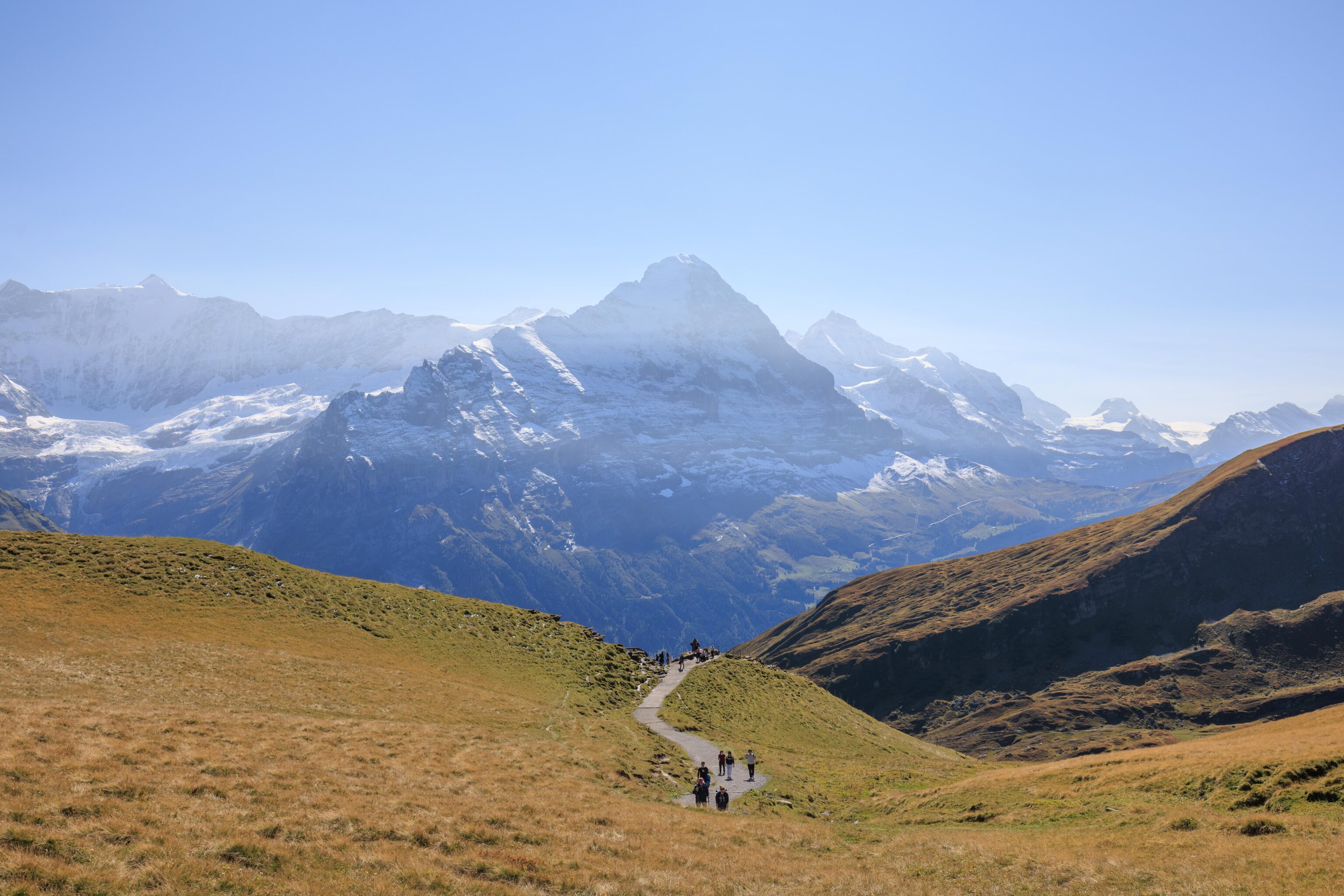
The view, roughly to the southeast across the valley below. Just ahead of this point, there was a choice of paths. A wider, gravelly path descended up a bit and ascended before rejoining the other very narrow option. The narrow path was flatter but looked quite muddy. We took the safer option, going down and then back up.
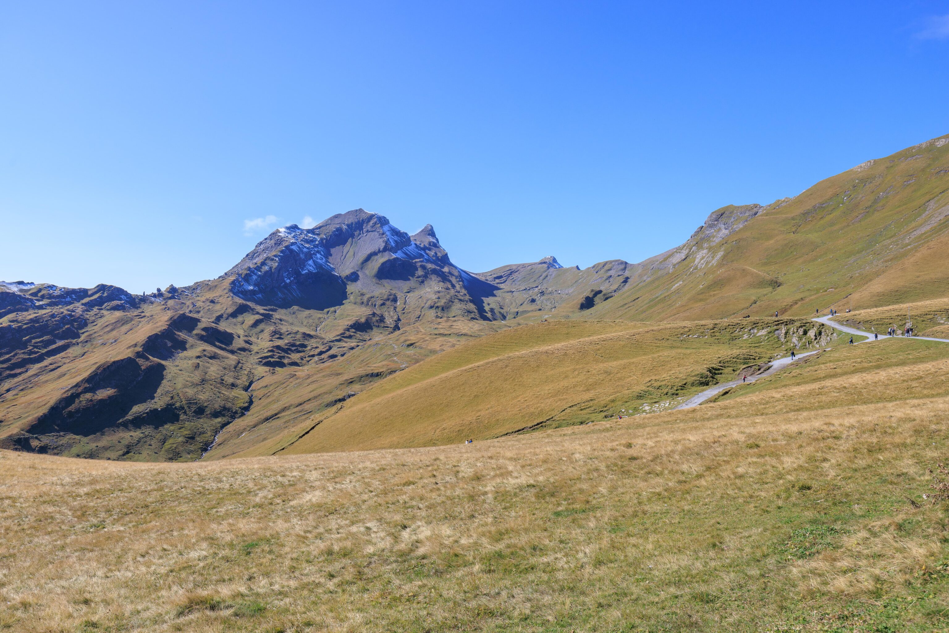
A similar view from a bit further along the trail, and looking more to the east. We could still see First from here.
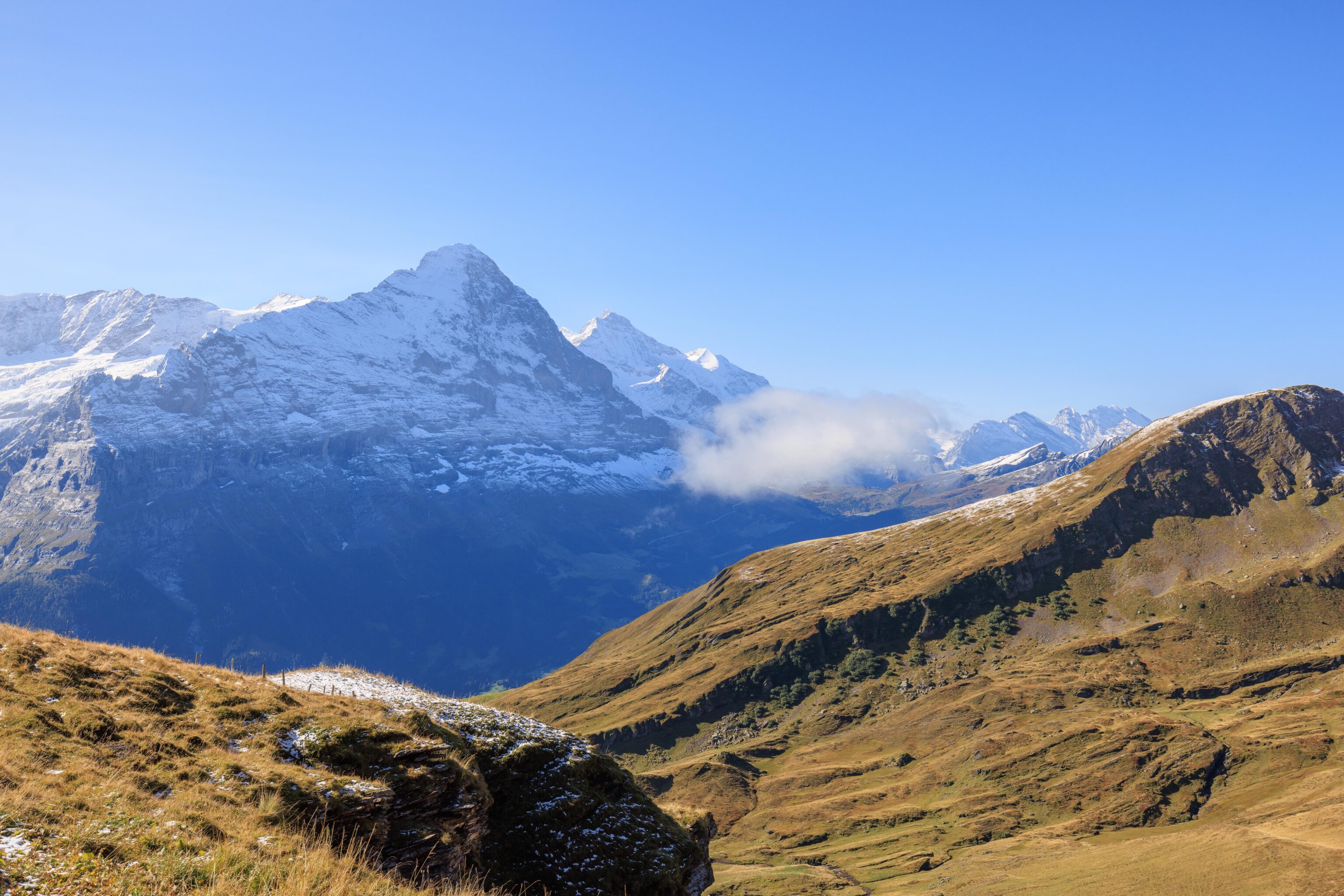
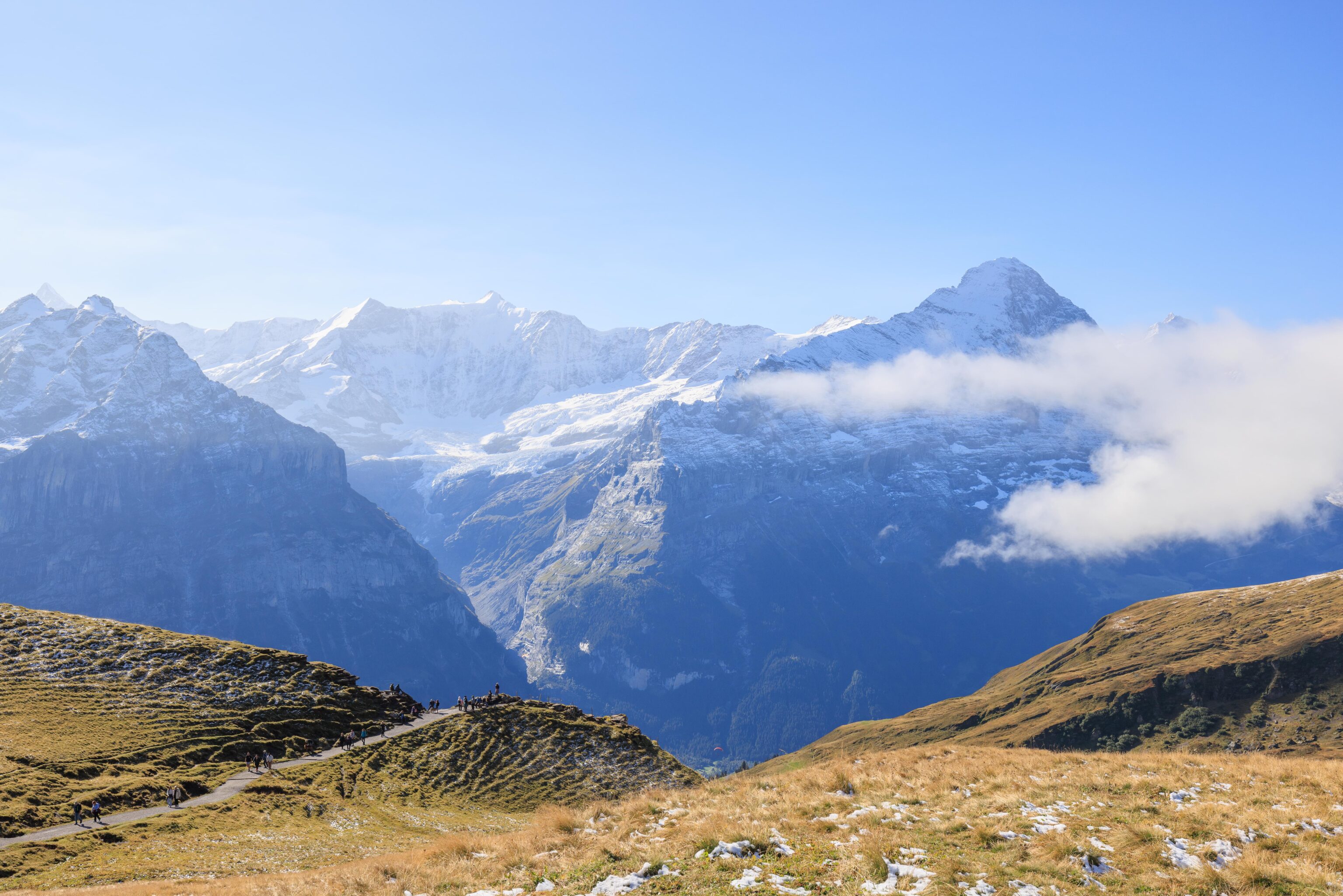
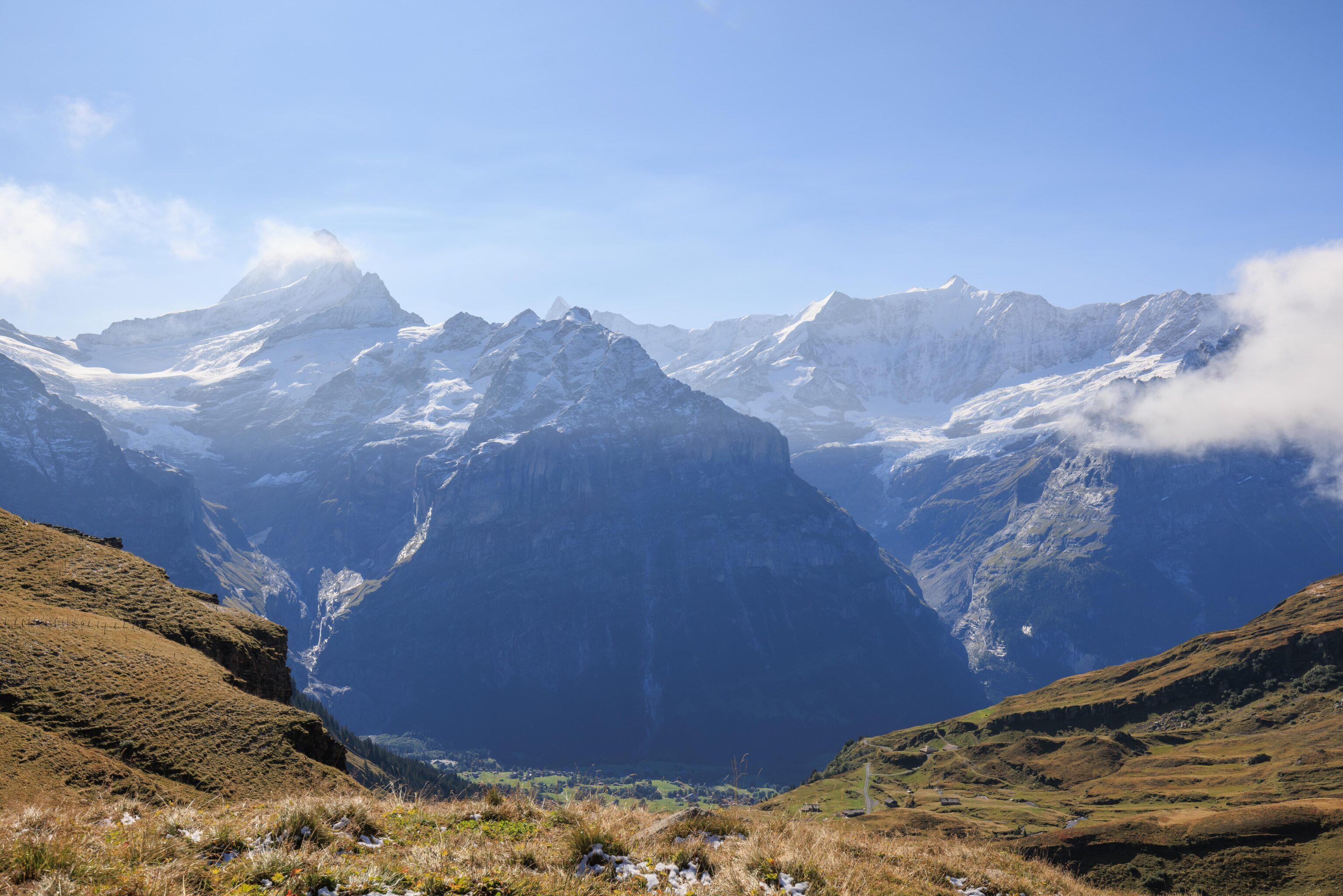
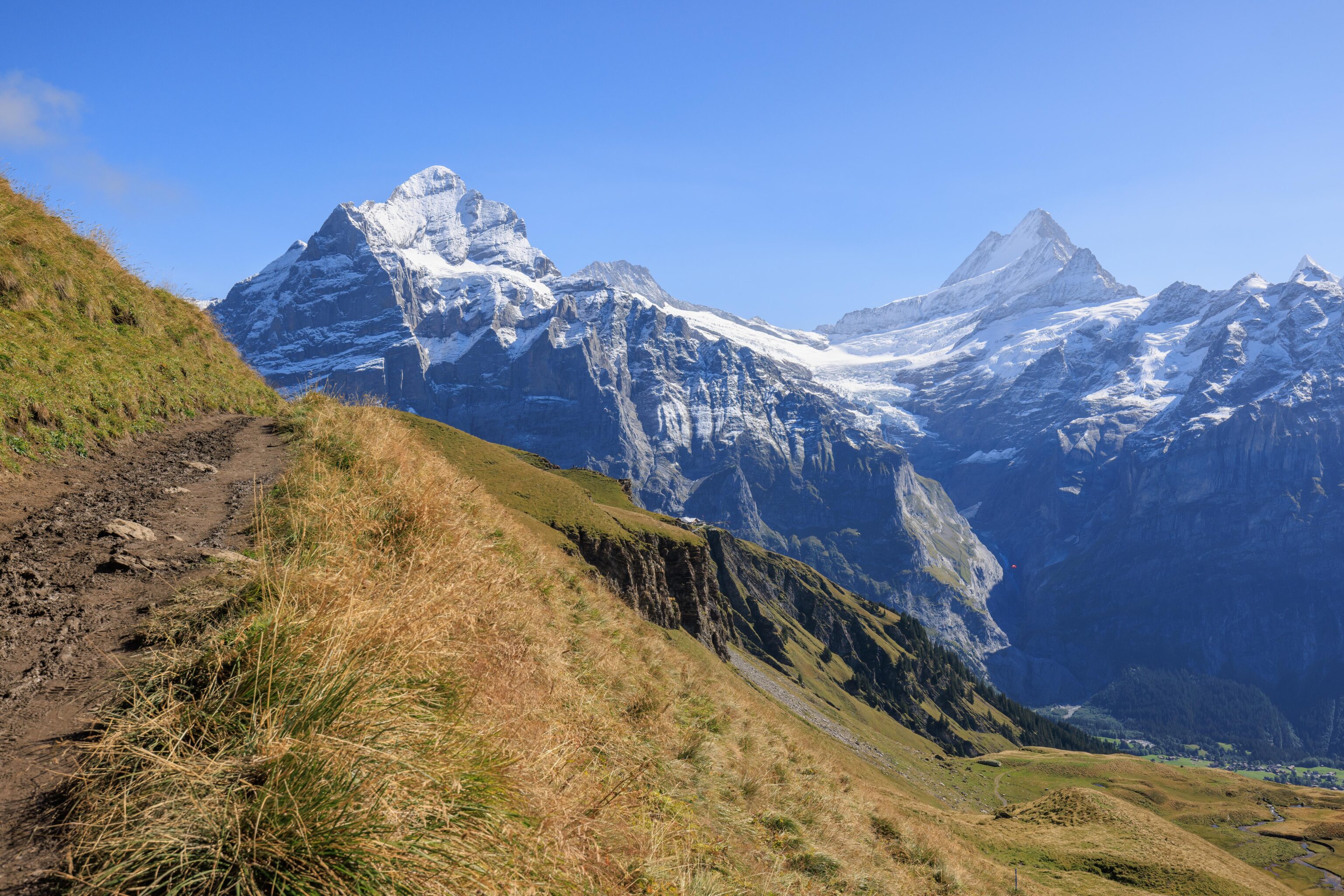
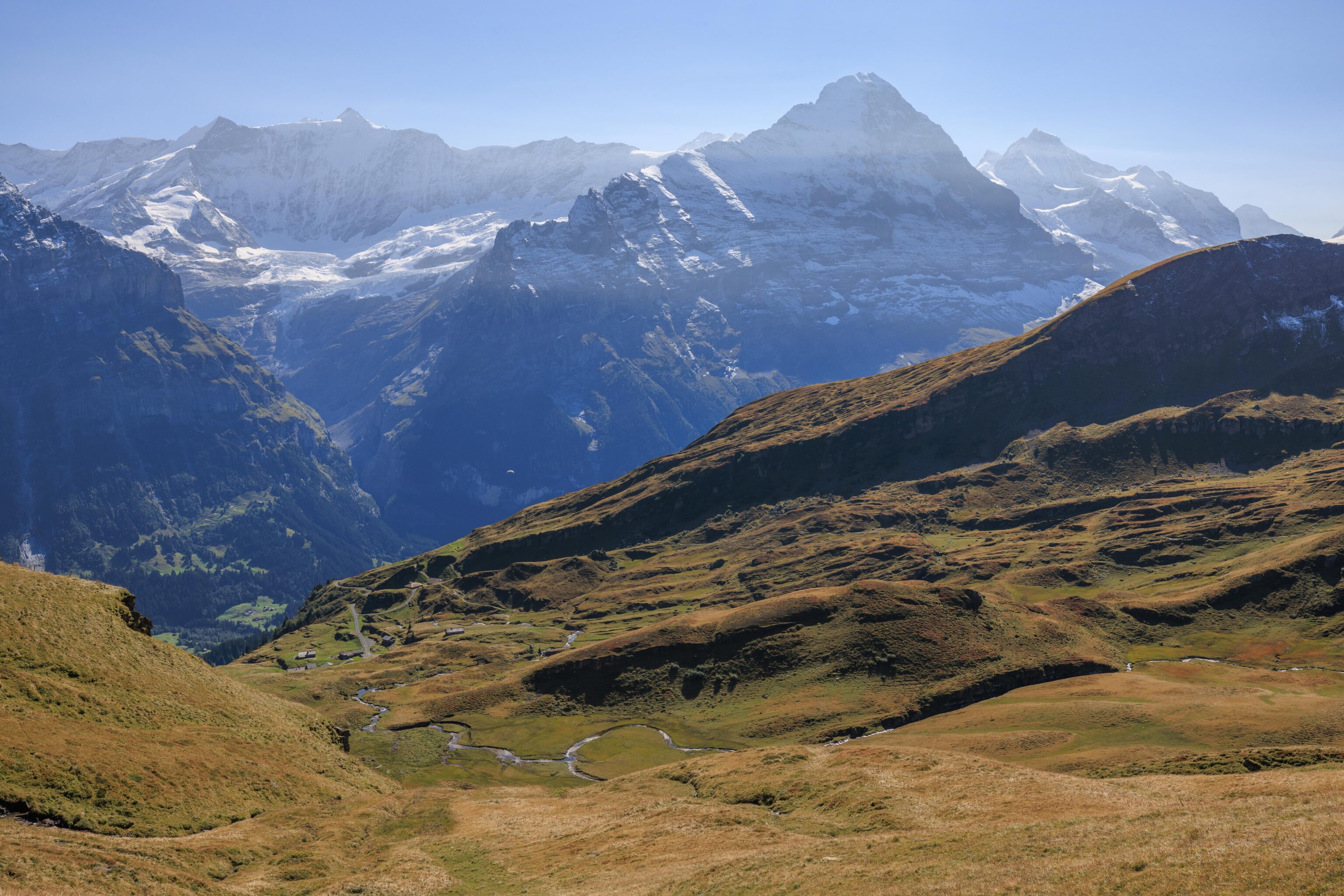
Another panorama a few minutes later. Eiger and Jungfrau were no longer in view, hidden by clouds.
Looking ahead once again, still no sign of the Bachalpsee, but the mountains in the distance were now much closer.
A familiar scene…
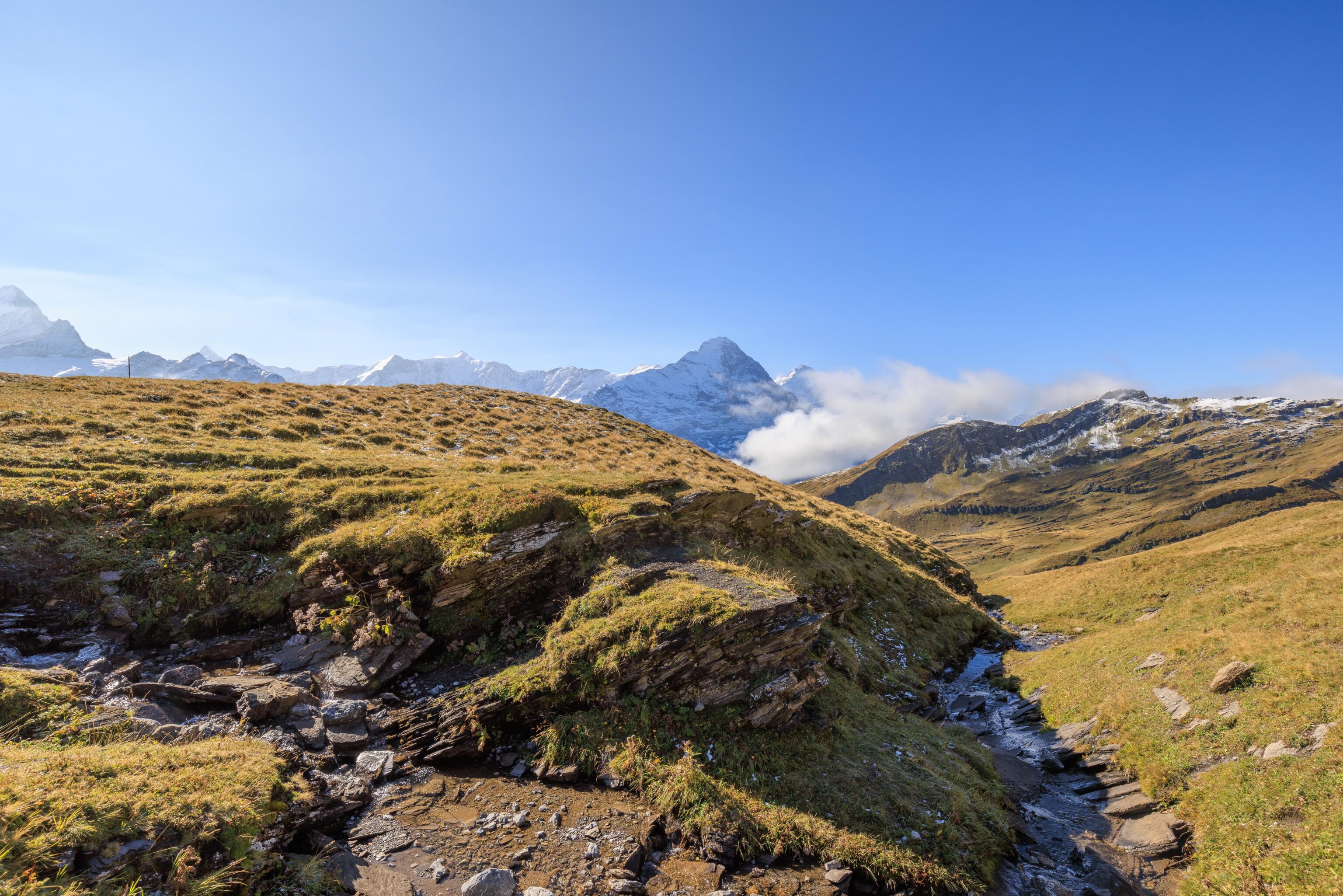
We stopped to make another panorama. The clouds had dissipated a bit, revealing Eiger and Jungfrau once again.
We passed another small stream…
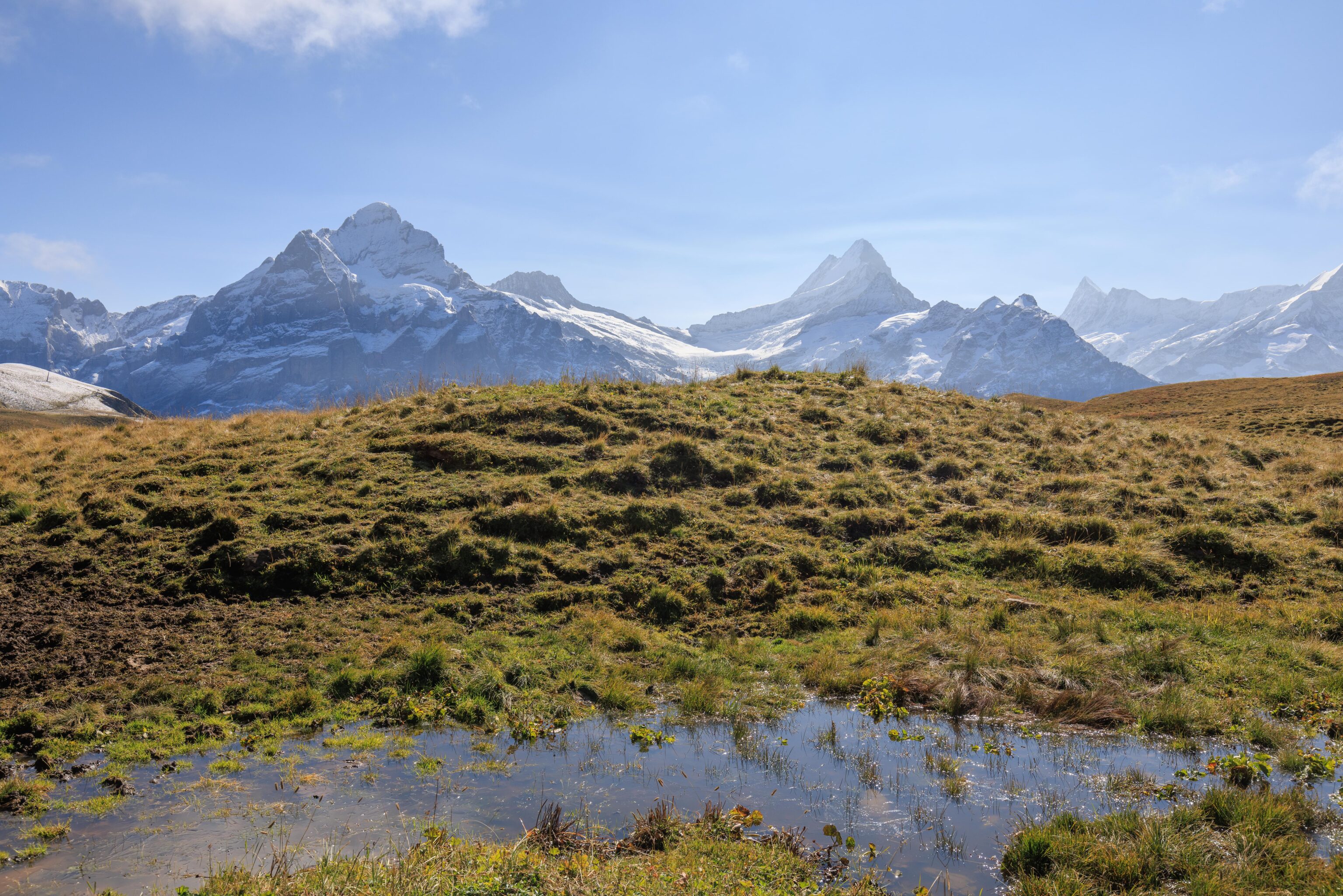
And another small pool of water…
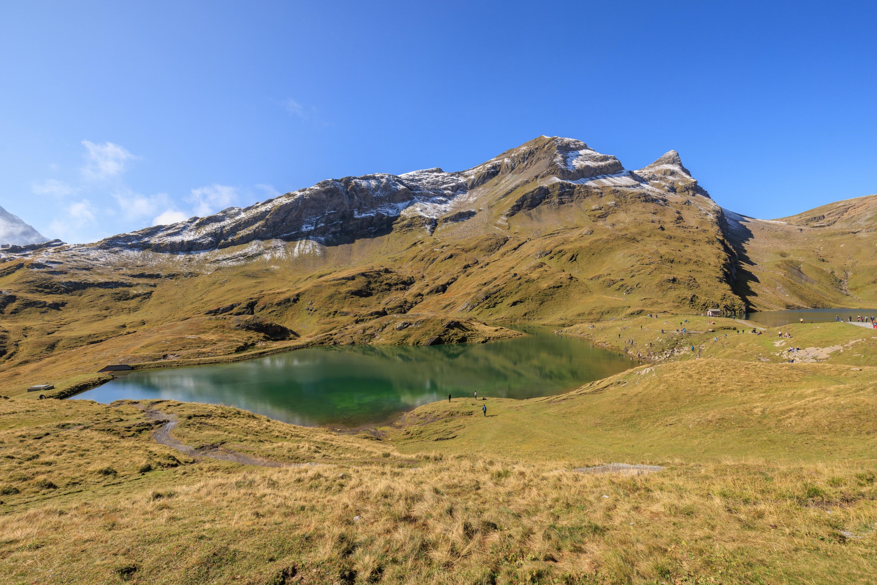
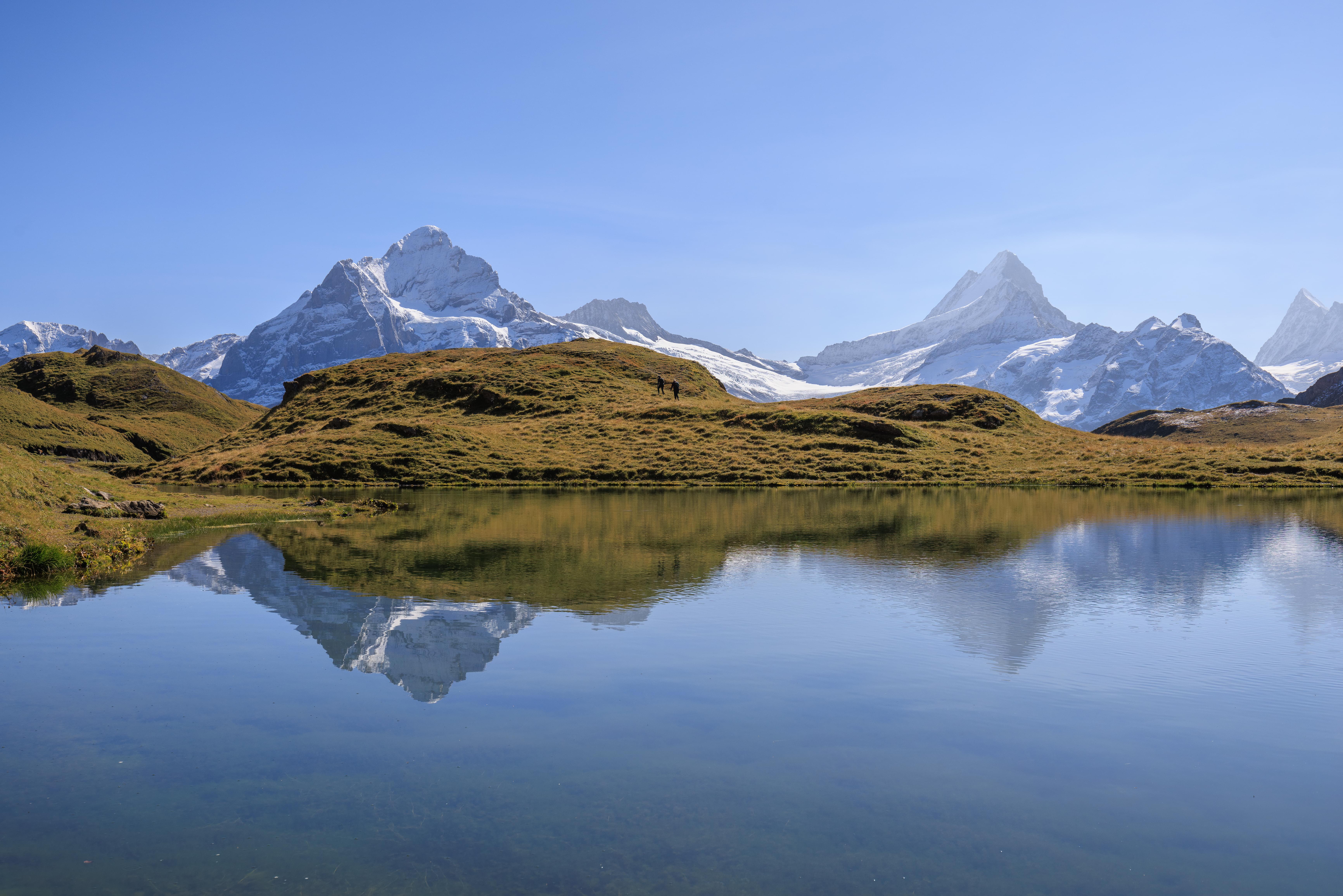
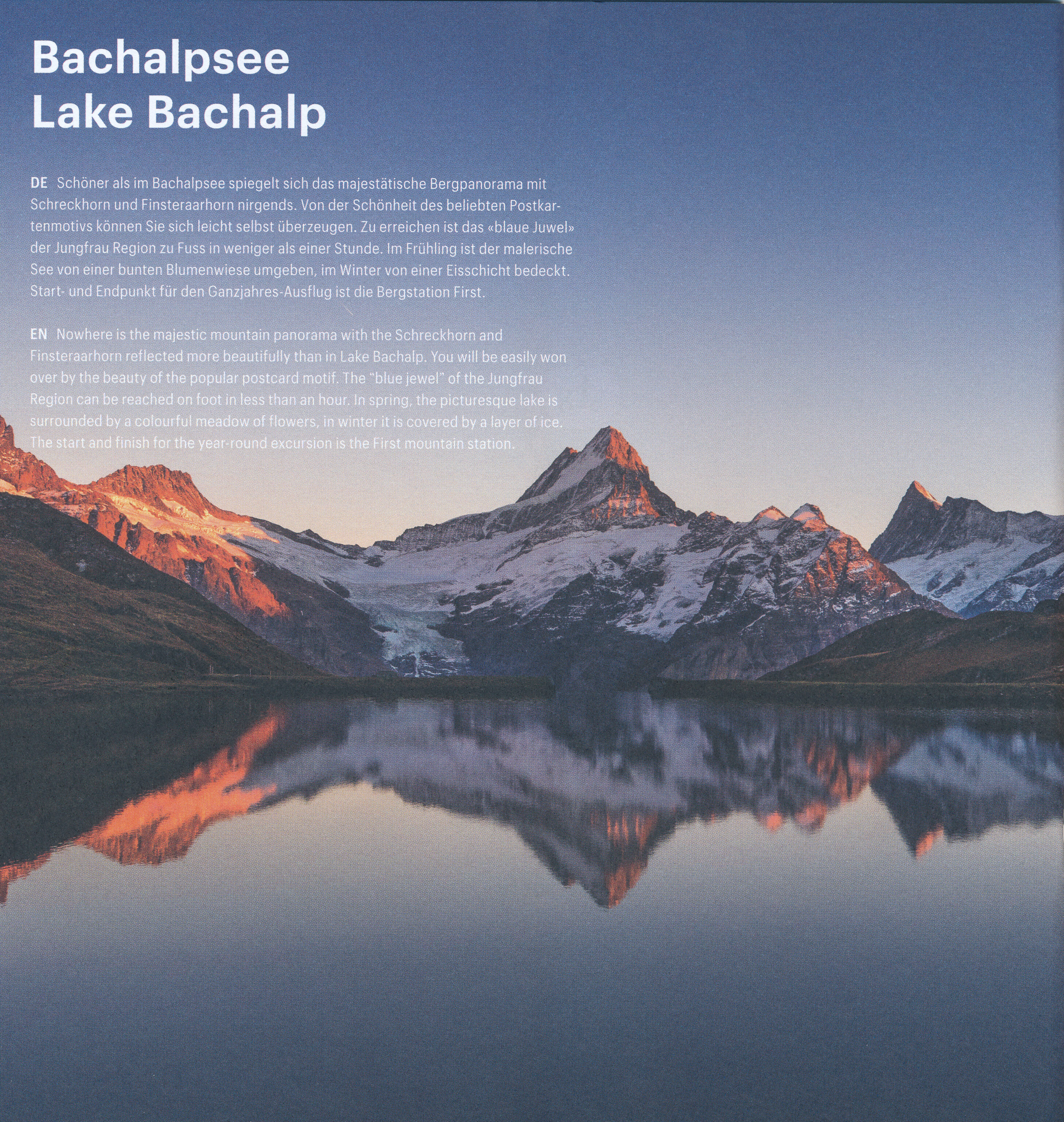
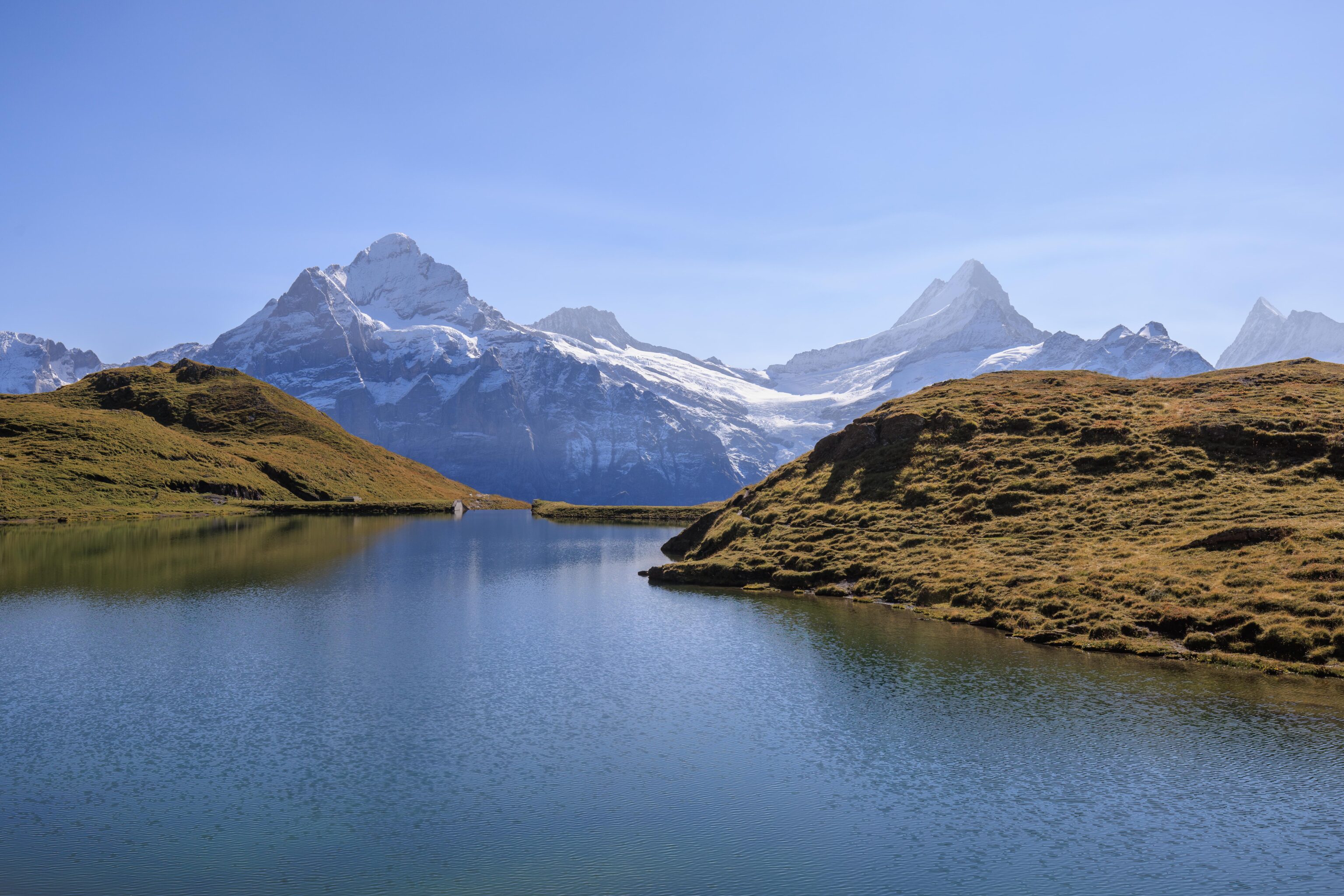
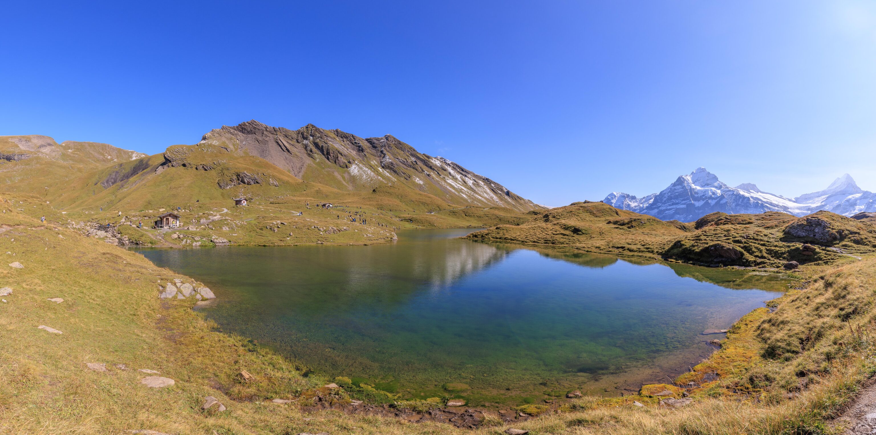
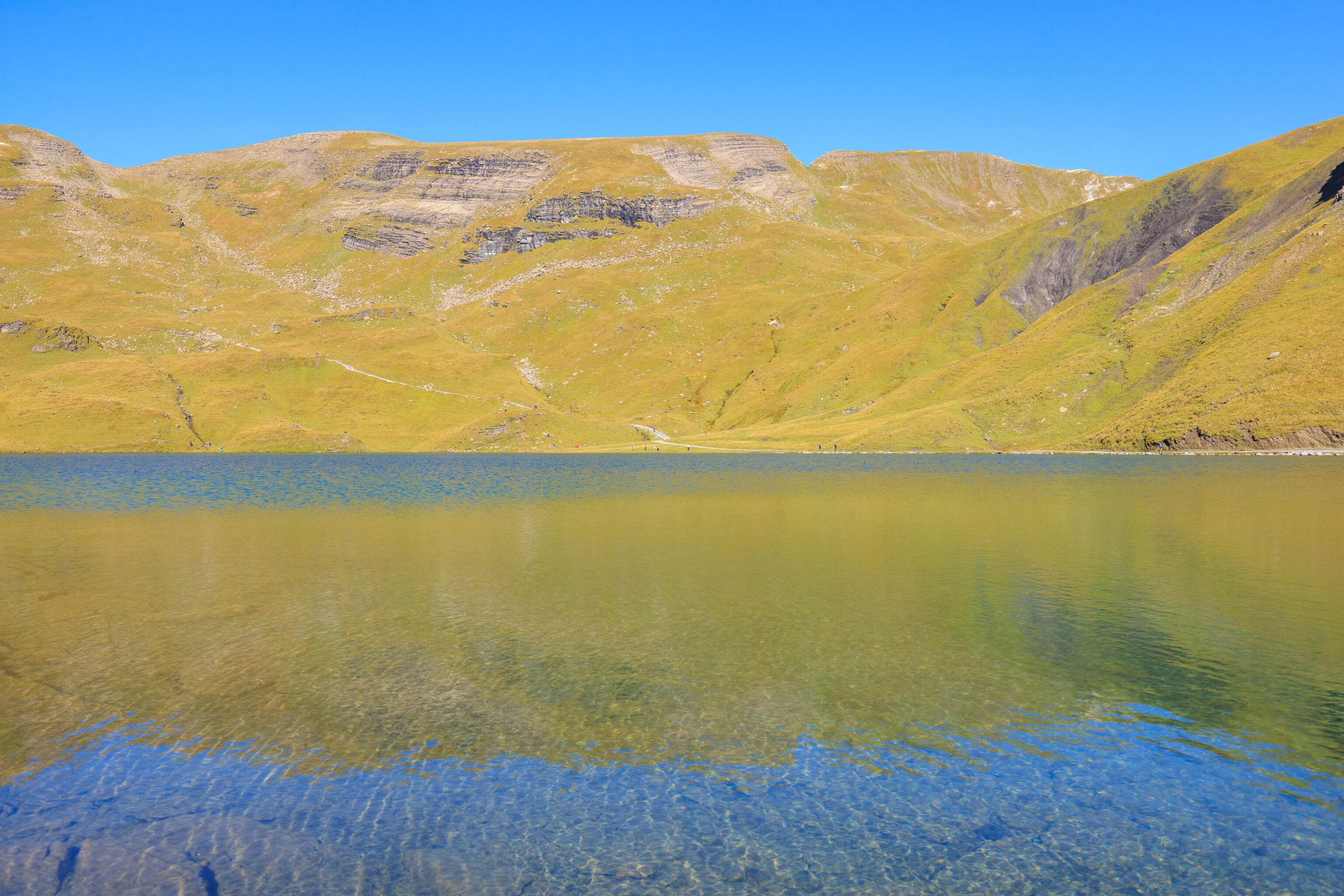
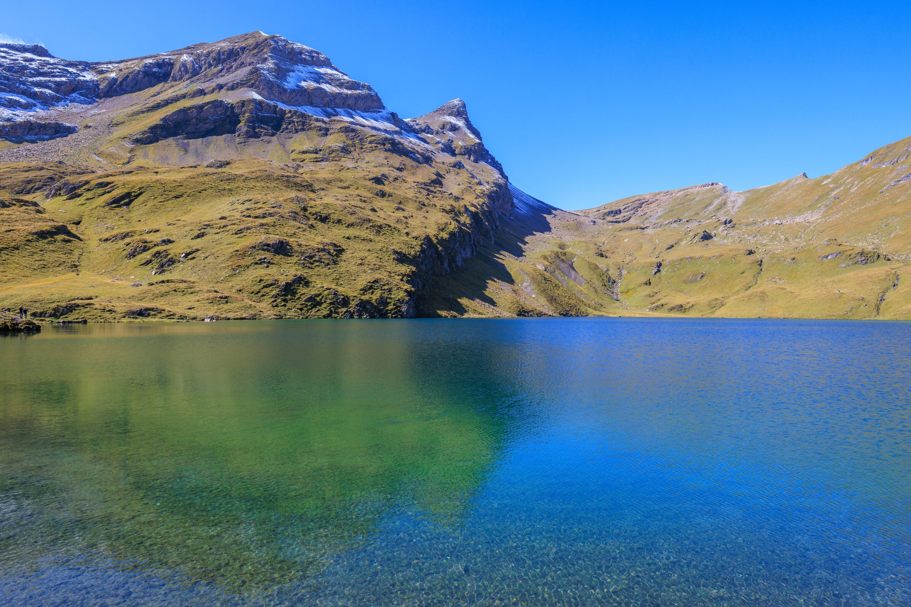
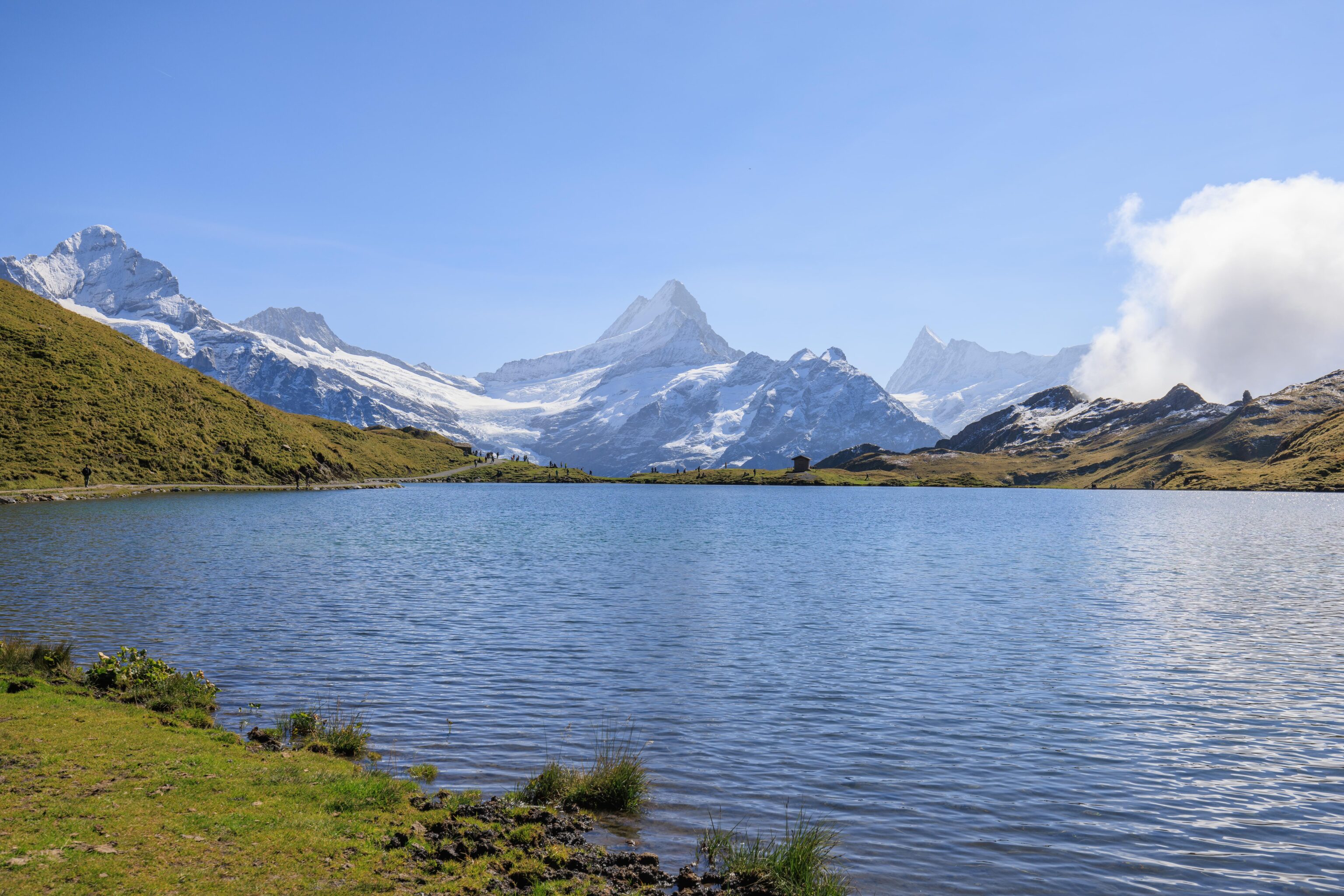
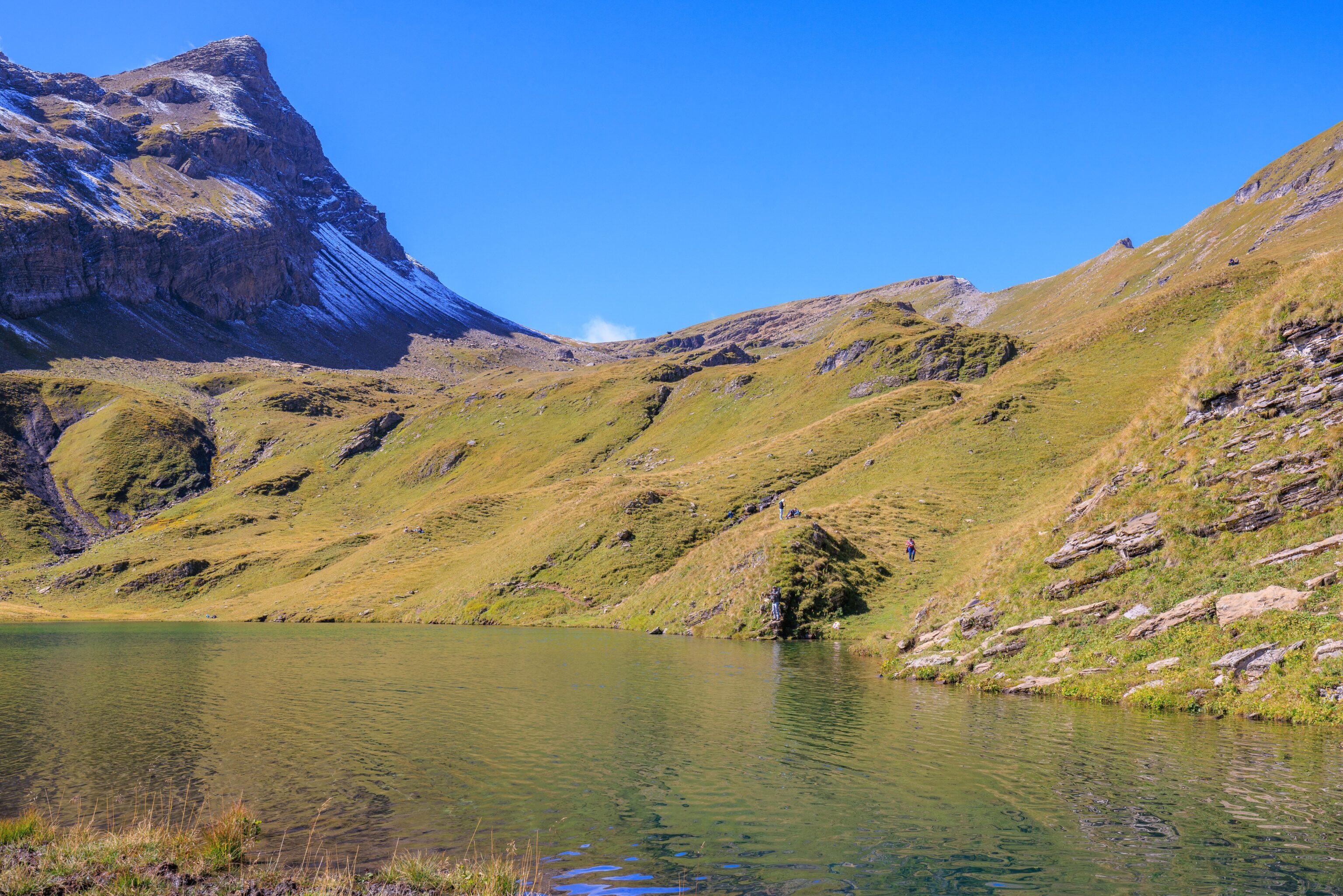
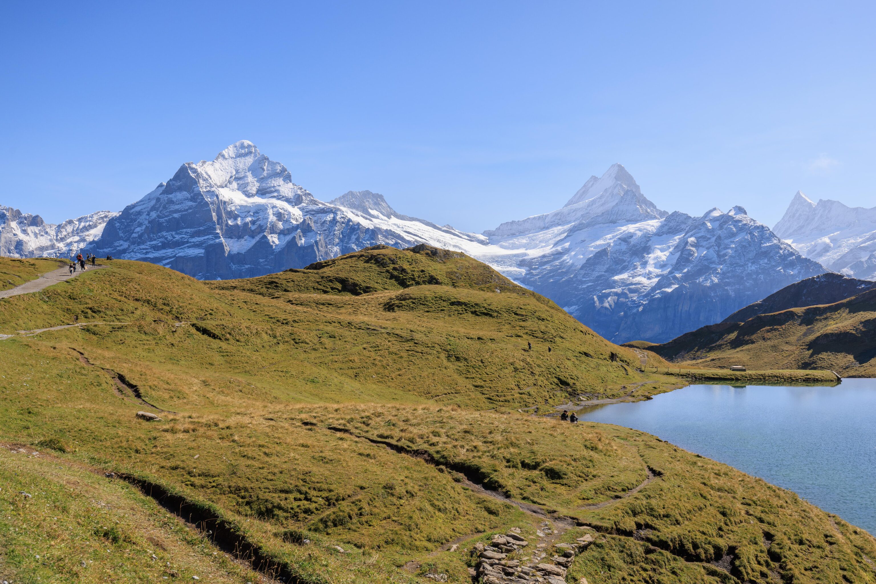
Finally, the Bachalpsee! This alpine lake is actually two lakes joined by a little stream. The German language Wikipedia page offers a brief description (Google Translated)1:
The Bachalpsee - common name for the Bachsee - is a picturesque small mountain lake on the First above Grindelwald in the Swiss canton of Bern. It is located in the Bernese Alps at 2266 m above sea level and consists of two parts, separated by a small natural dam, with the lower part being almost eight meters lower.
A panorama view of the Bachalpsee and mountain peaks in the background.
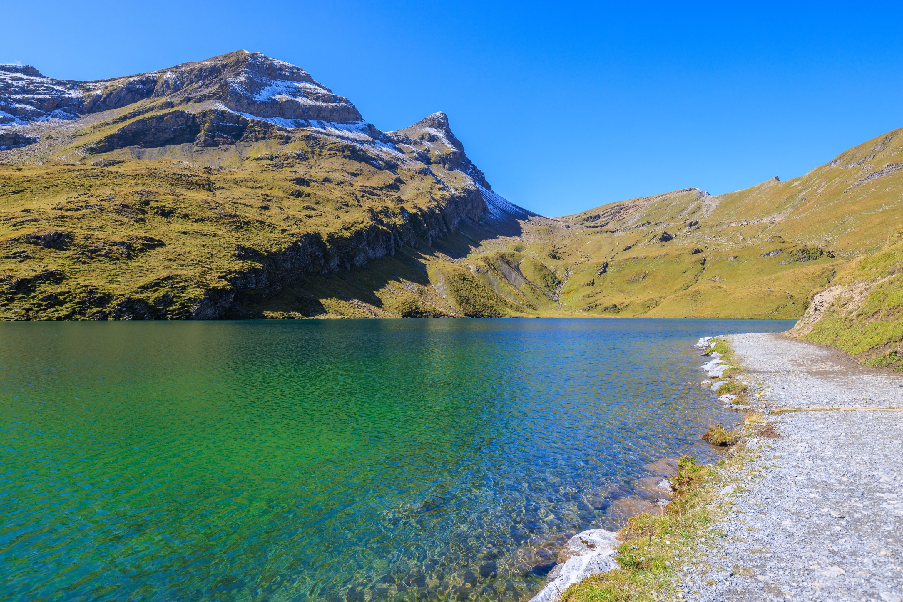
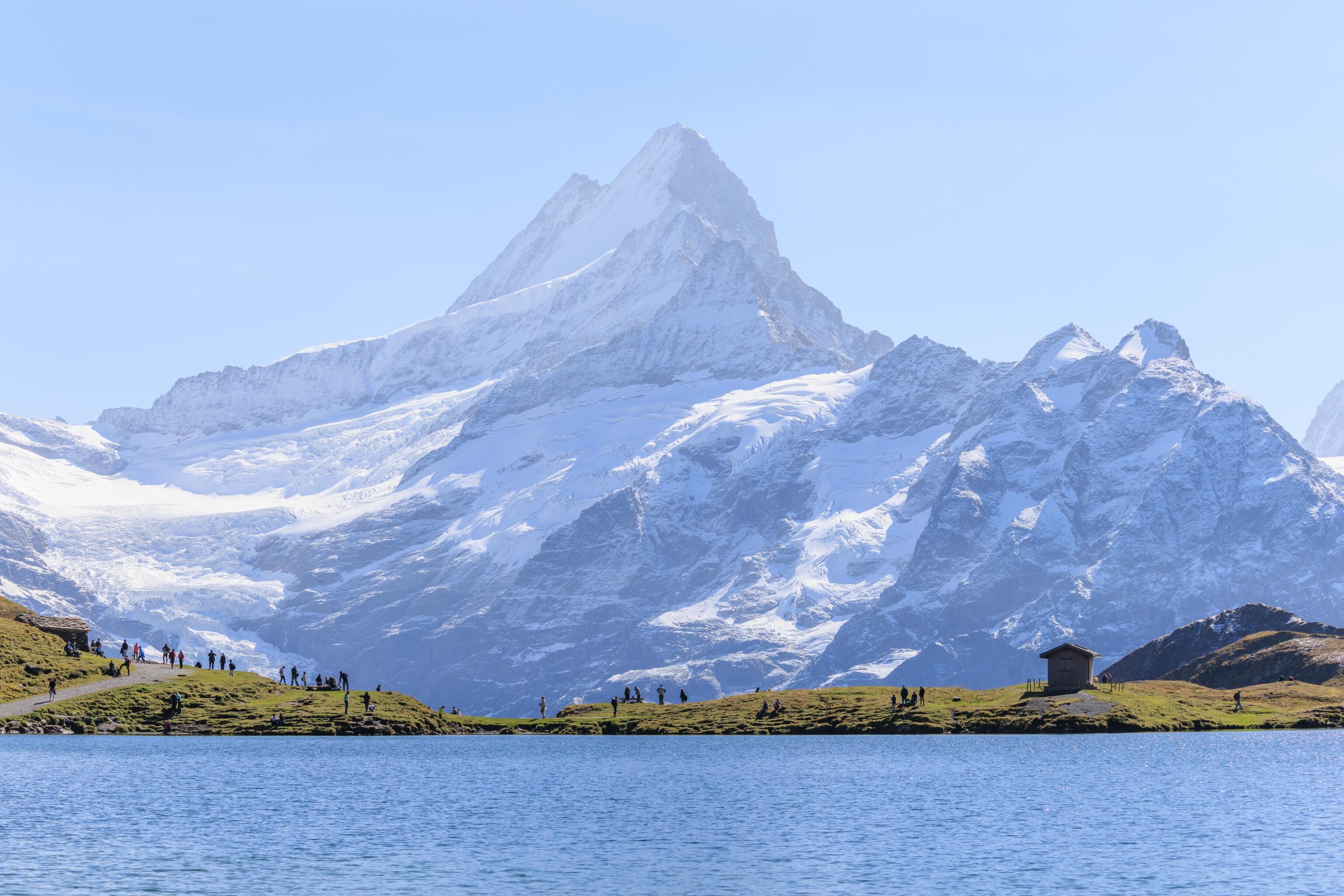
We walked to the west side of the lower lake to take a look at the view with the Schreckhorn and Wetterhörner in the background. We found a nice rock to sit on and rested for a bit here. While it wasn’t windy, there was enough of a breeze to make the water’s surface a bit ripply. The water’s color is also quite different from this perspective.
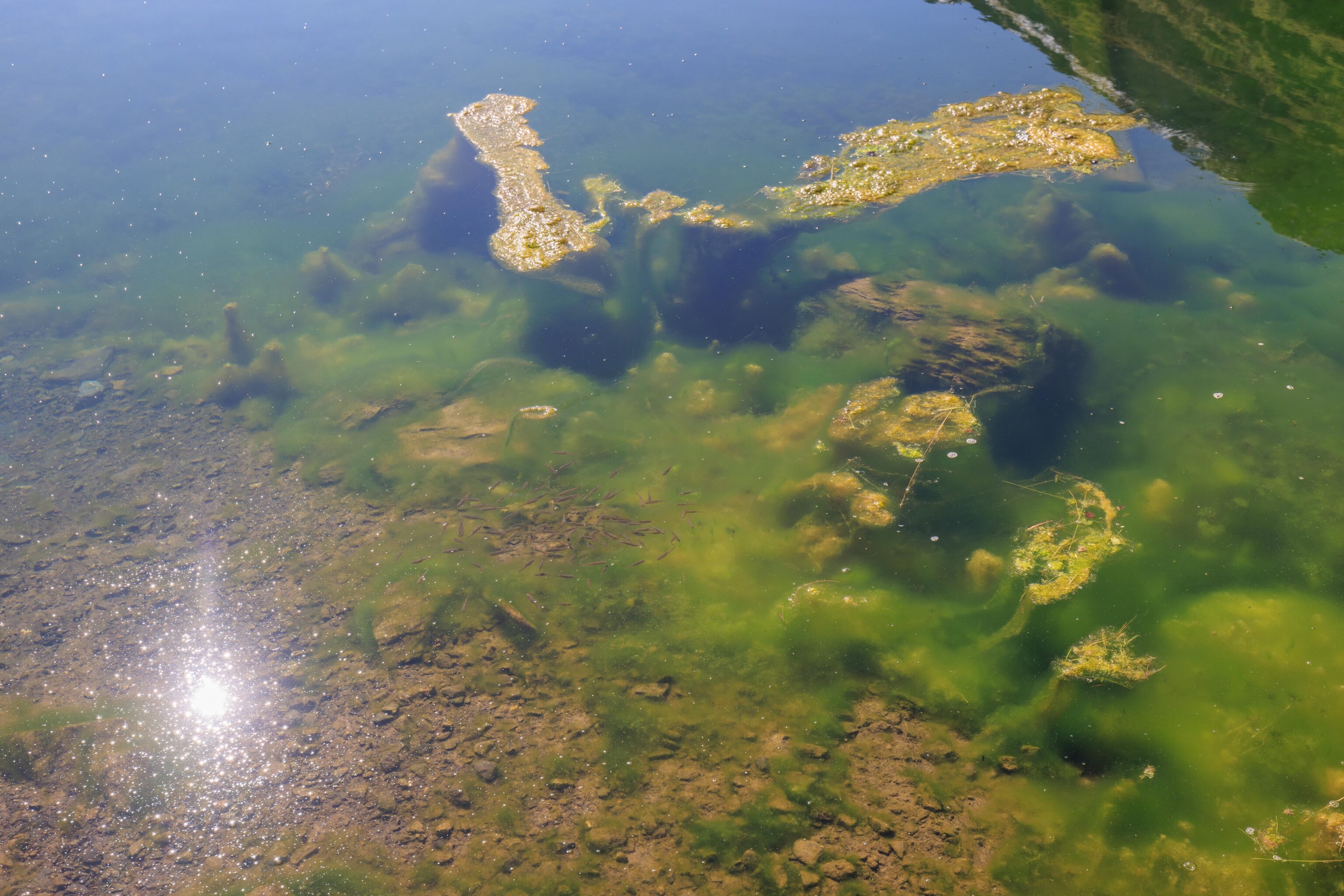
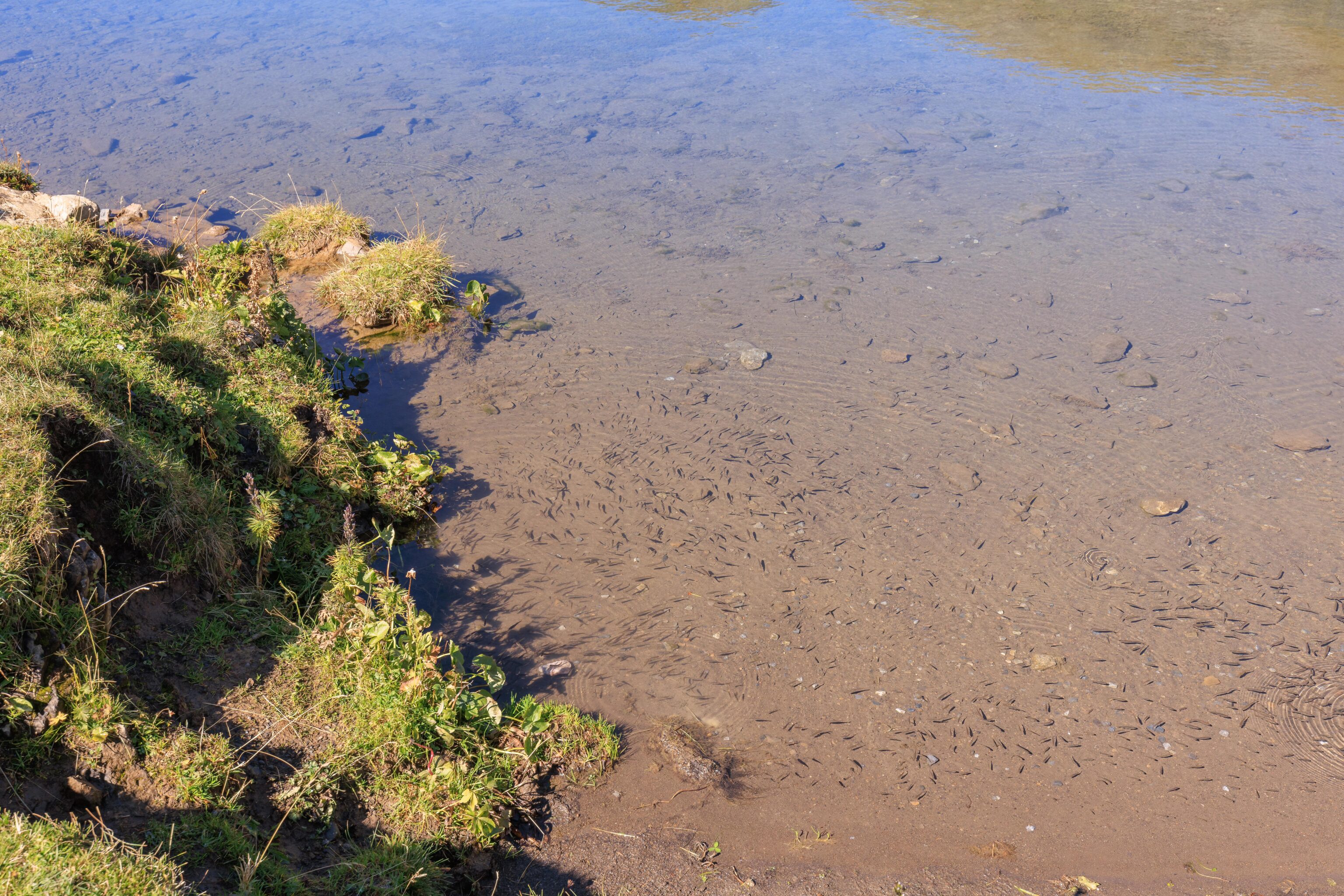
We could see many tiny fish in the water by the shore.
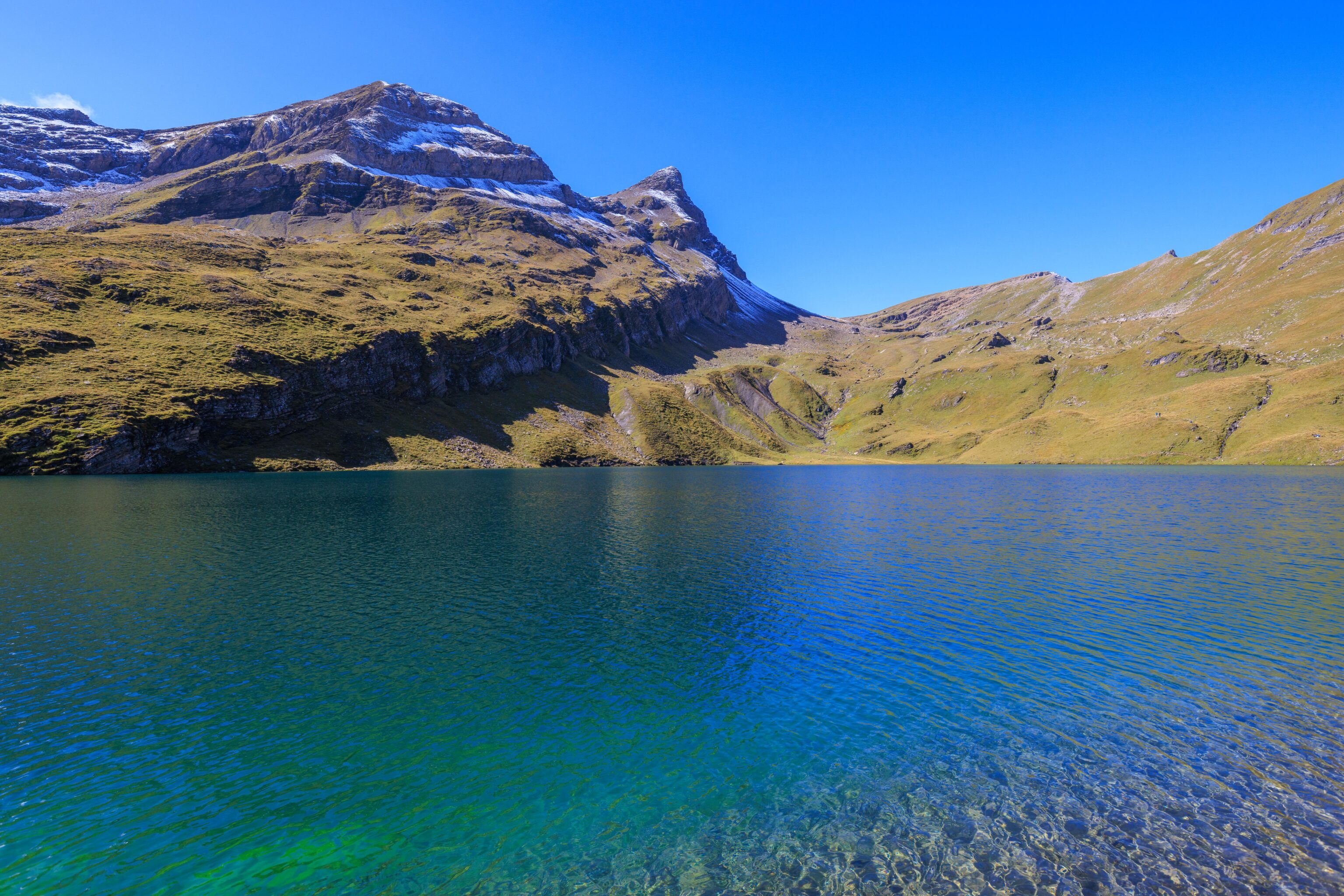
We walked to the very western tip of the lake where the water was calmer, probably due to the shape of the lake and the terrain blocking the wind.
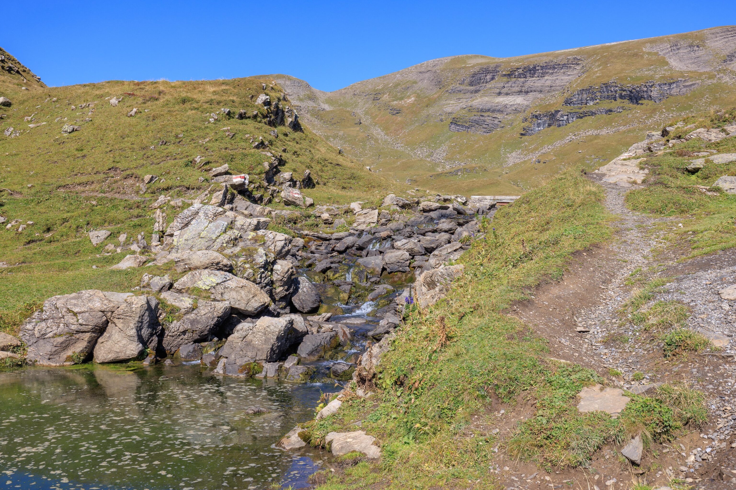
A small, rocky stream sits between the upper and lower halves of the Bachalpsee.
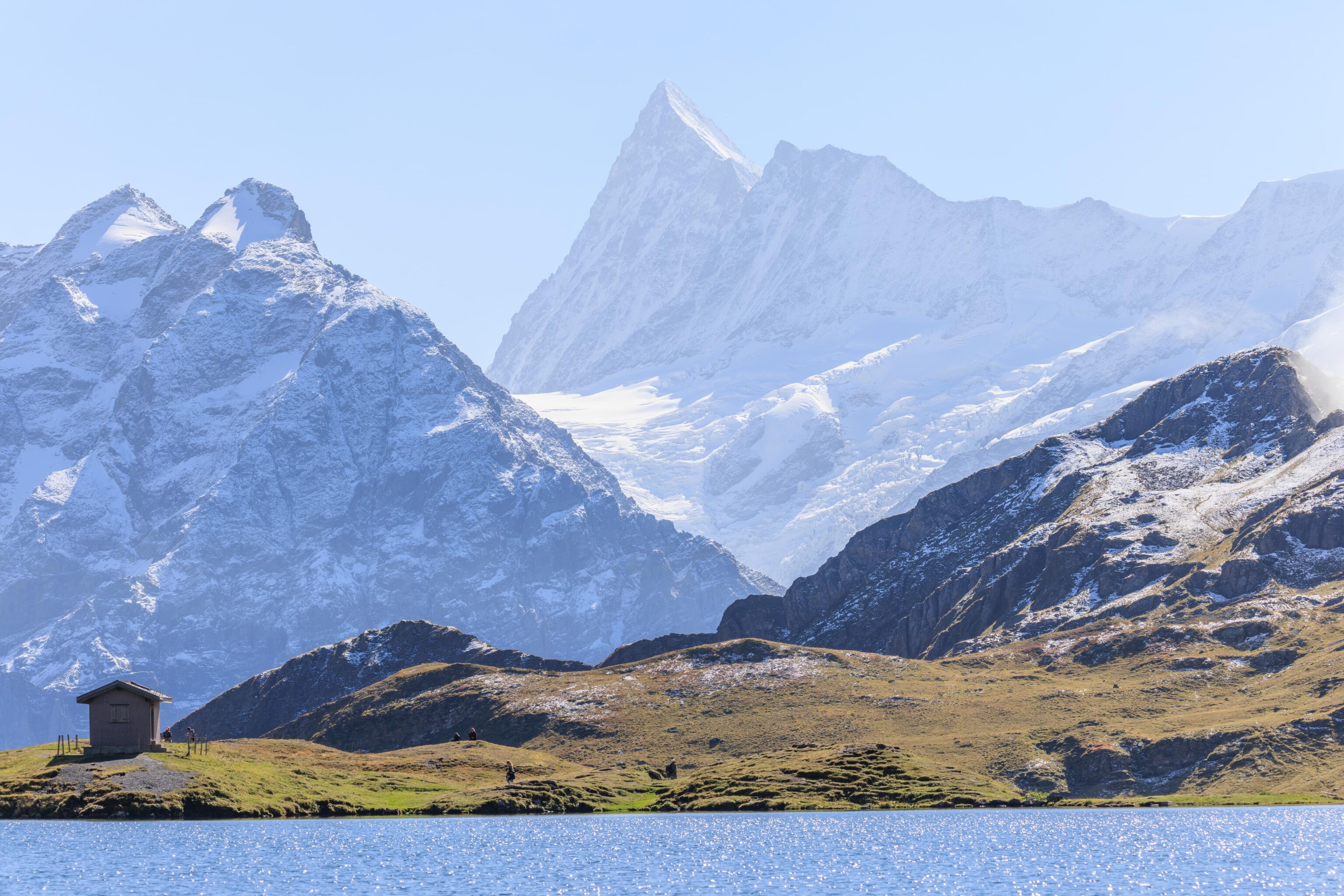
We walked a bit up path by the stream. Looking back, we could see the small building that contains the bathrooms. There is running water, fed by a pipe and hose from the upper lake, though it is not safe to drink.
A panorama of the western tip of the lower lake, looking primarily to the northeast. As is common, most people were clustered near the trail and didn’t venture too far away.
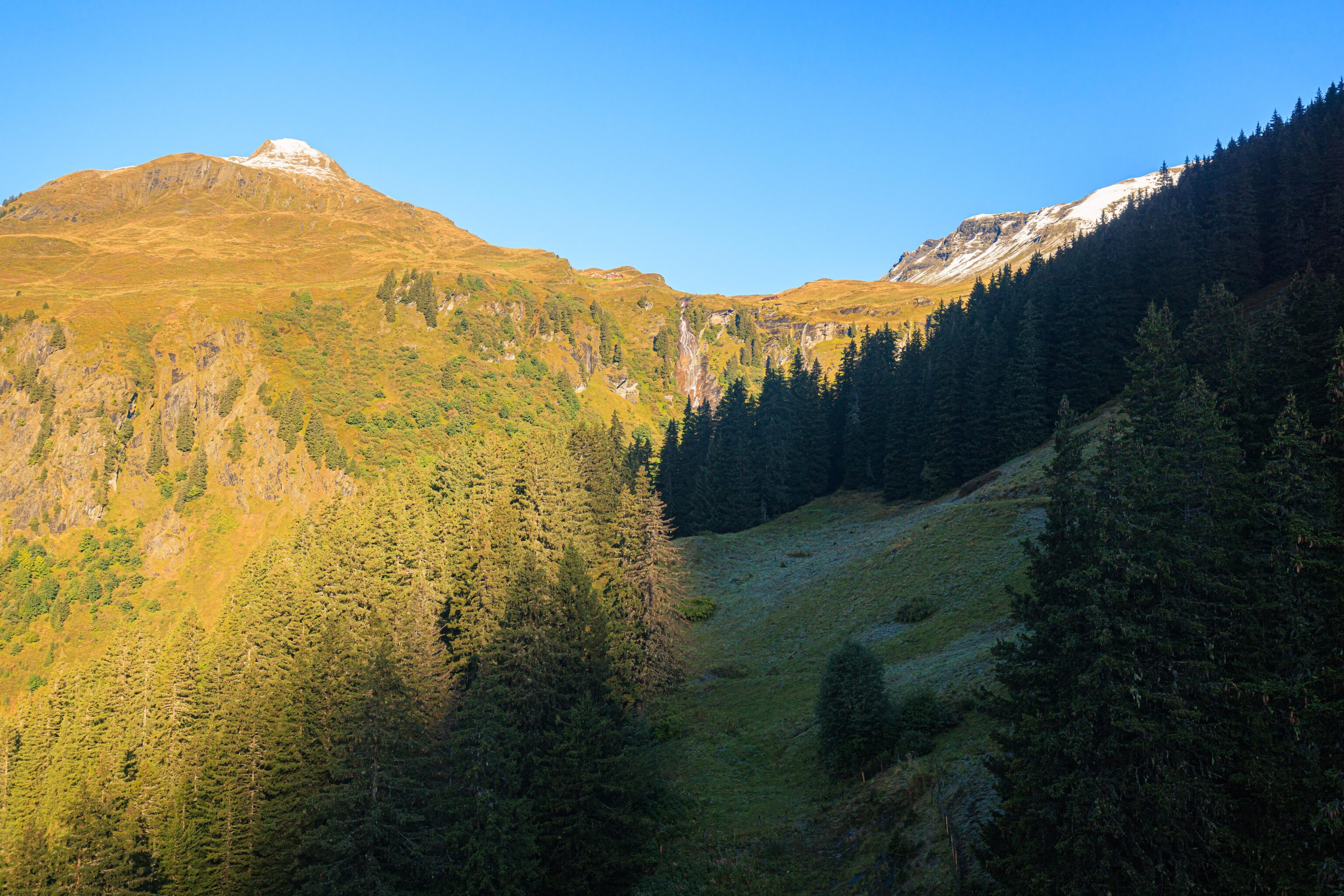
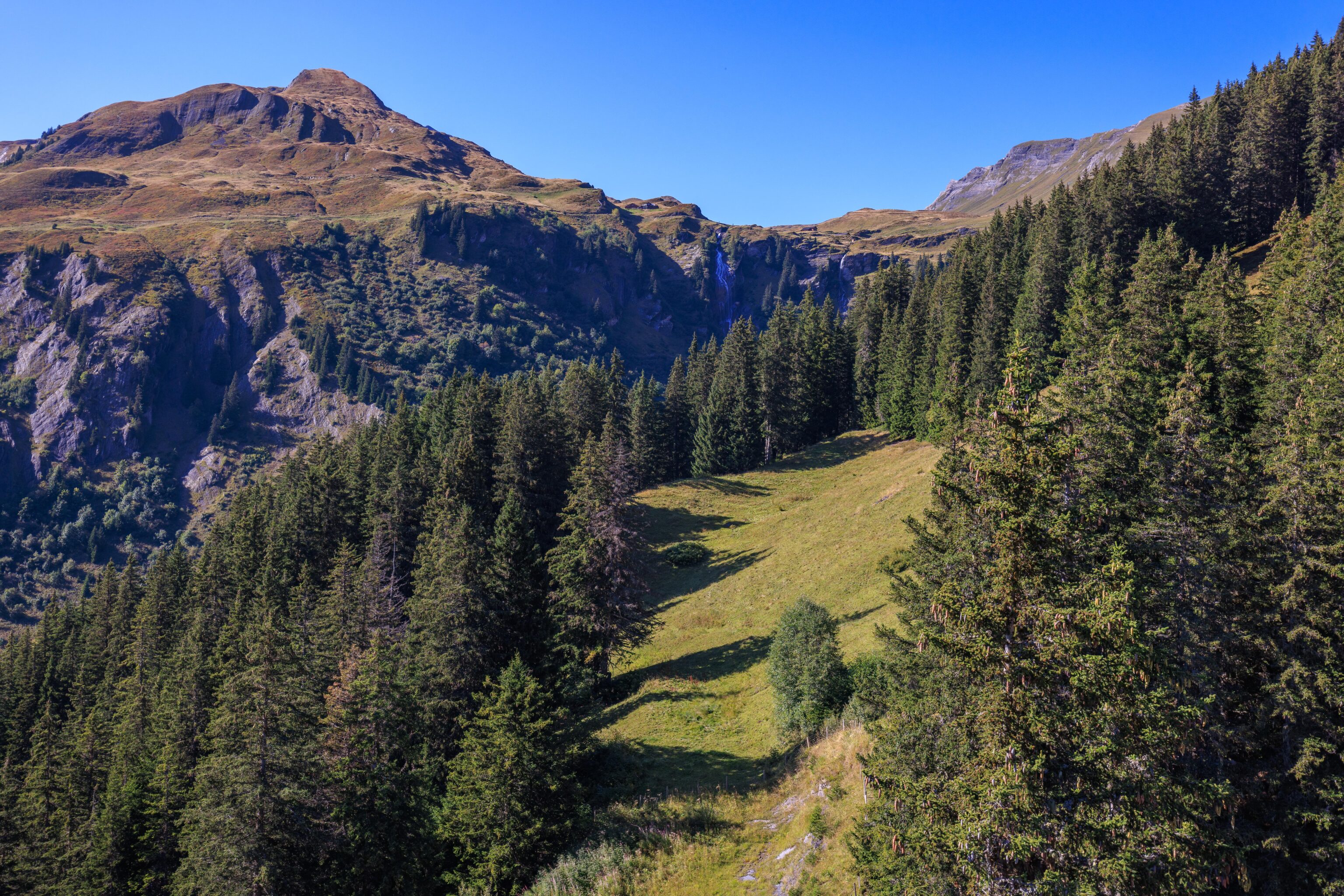
From here, there is a trail that leads down below First and runs through a small cluster of buildings by the Bachlägerwasserfall. From there, it seems possible to hike steeply back up to First or continue down, eventually ending up in Grindelwald. There is also a trail leading to the top of the mountain peak directly to the south of the lake. This is as far as we went in this direction, we mainly wanted to just check out the view from here.
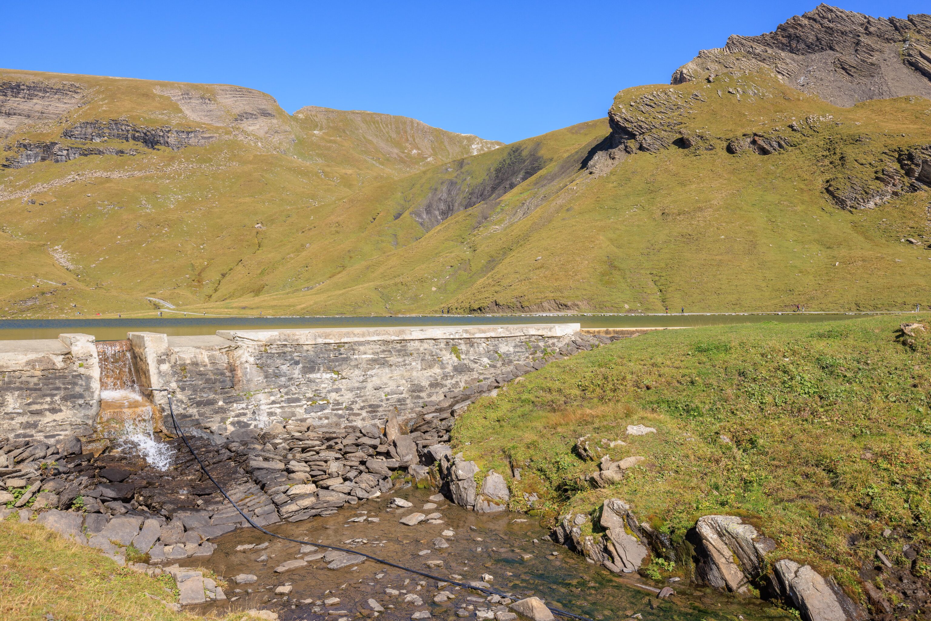
We backtracked and followed the path by the stream leading up to the upper lake. The stream is actually dammed. This was something of a dead end as there was no trail on the south side of the upper lake. It is possible to walk across the dam, but that requires jumping across the gap which allows water to spill over.
The upper half of the Bachalpsee is much larger. We briefly sat on the dam before moving on.
We headed back down to the lower half of the lake to loop around to the north side of the upper lake.
The shallow water by the shore was pretty calm but the rest of the lake’s surface was a bit ripply, just like the lower lake.
We also saw lots of tiny fish here.
We walked on the trail on the northeast side of the lake. It wasn’t very busy as most people stayed by the lower lake.
There was a muddy piece of land on the far side of the lake. We walked out onto it to get a view of the mountains in the background.
The water was unfortunately not still enough for the Schreckhorn to reflect on the water’s surface. This scene is reminiscent of how the Matterhorn looks from the far side of the Stellisee, though when we visited last year, it was extremely cloudy so we didn’t get the postcard view.
The very pointy peak seems to be Finsteraarhorn. Wikipedia provides a useful description of the mountain2:
The Finsteraarhorn (4,274 m (14,022 ft)) is a mountain lying on the border between the cantons of Bern and Valais. It is the highest mountain of the Bernese Alps and the most prominent peak of Switzerland. The Finsteraarhorn is the ninth-highest mountain and third-most prominent peak in the Alps. In 2001 the whole massif and surrounding glaciers were designated as part of the Jungfrau-Aletsch World Heritage Site.
It is further away than the other mountains here in the Jungfrau region, about half way to the valley to the south.
The top of the Wetterhörner.
A closer look at the Schreckhorn.
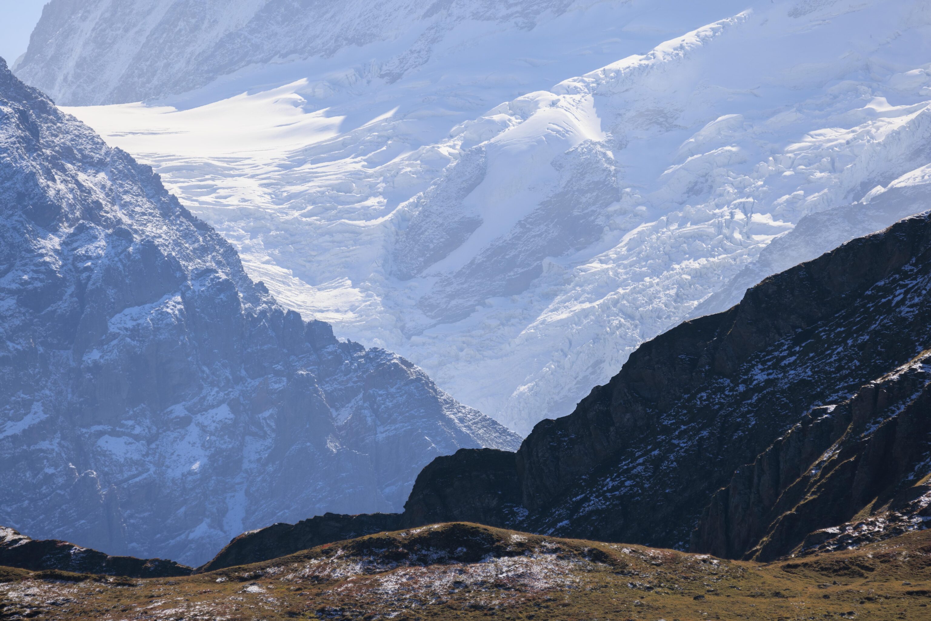
What seems like the bottom of a glacier below the Finsteraarhorn.
We didn’t quite go to the very end of the lake.
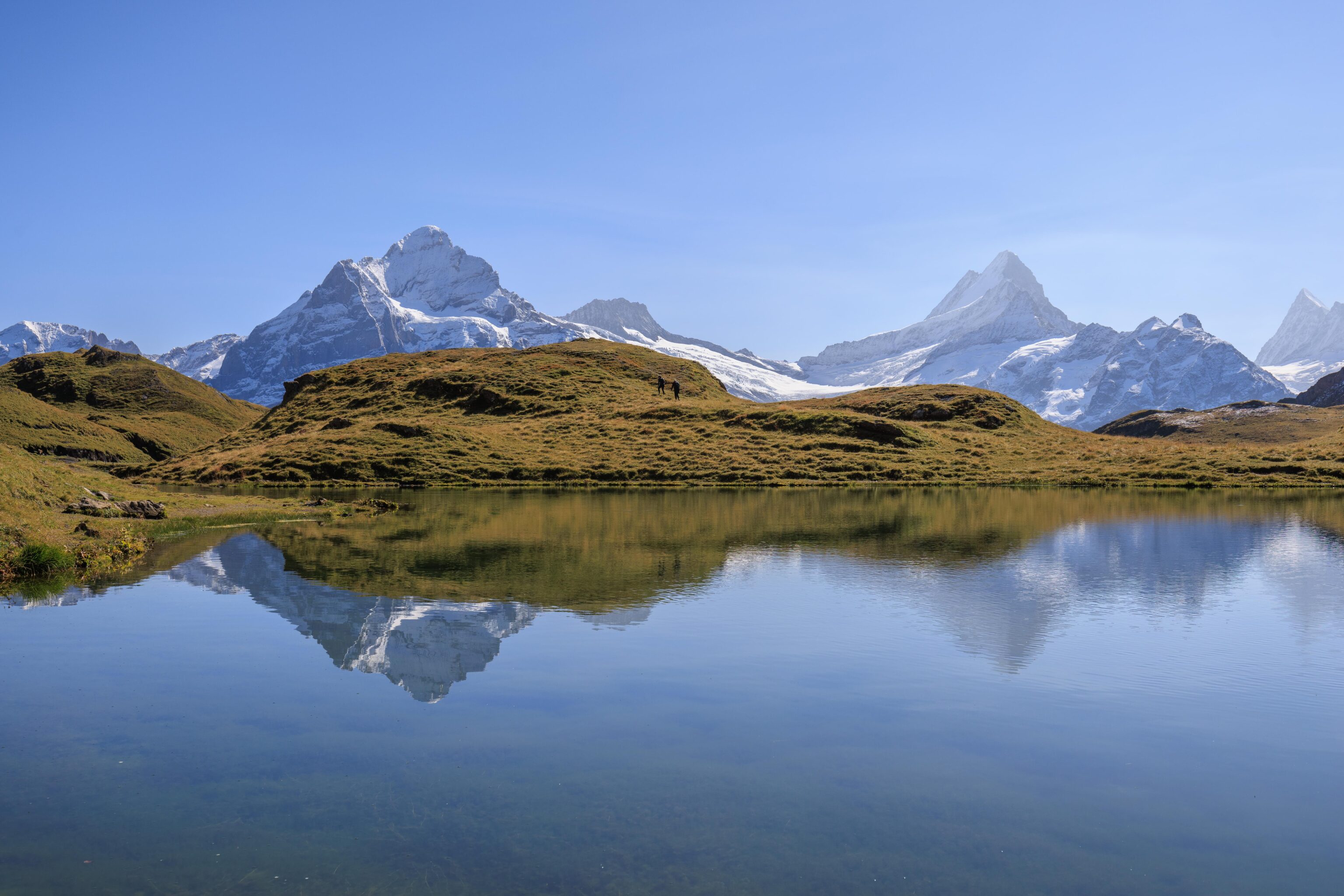
We started to make our way back to First. We saw one woman go into the upper lake. It must have been quite cold! She didn’t stay in for long!
We soon reached the lower lake.
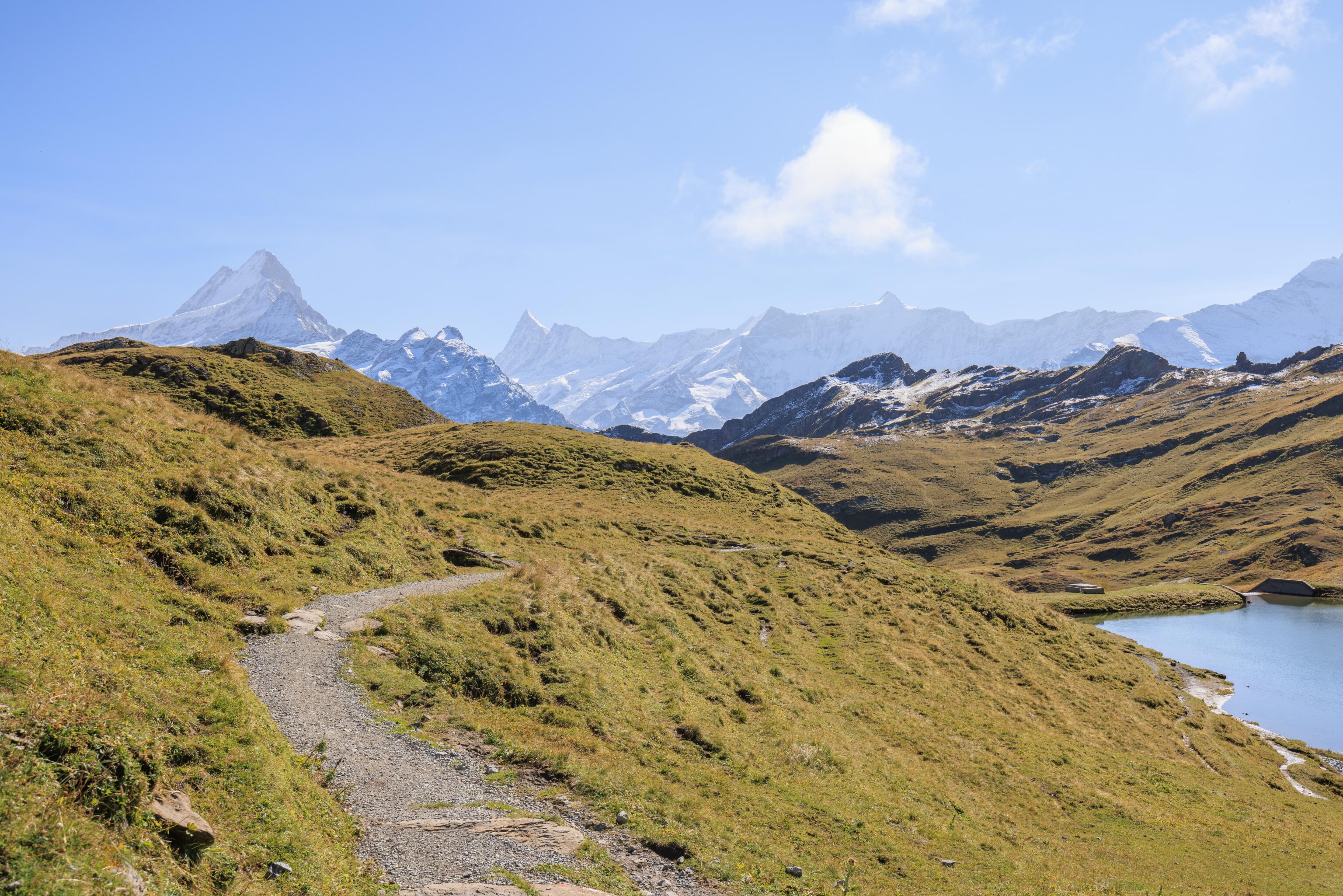
It isn’t possible to see First from the lakes.
Just two minutes later though, we could start to see a building in the distance. It seems like it is Anja’s Skibar rather than First though.
A few minutes later, we could see First. And, a paraglider.
Somewhere around hear, we heard what sounded like marmots alerting to danger. We briefly spotted two up above us to the north. We switched to the telephoto lens, hoping to photograph them, but could not find them again. We did frequently hear the sound of marmots but there is simply too much terrain to be able to easily find them unless they are somewhere nearby in the open. Marmots do like to sun themselves on rocks but unfortunately we didn’t see any doing so.
We left the telephoto lens on for awhile as we walked. While we ultimately failed to photograph any marmots, we did photograph First again. The Cliff Walk looks quite long from this perspective! It seems much longer than it actually was while we were walking on it earlier in the day.
We switched back to our wide angle lens after a short time, realizing that finding marmots was going to be extremely difficult.
This time, we took the upper, flatter path. It seemed to be much drier than it was earlier when we passed by in the opposite direction.
We continued on…
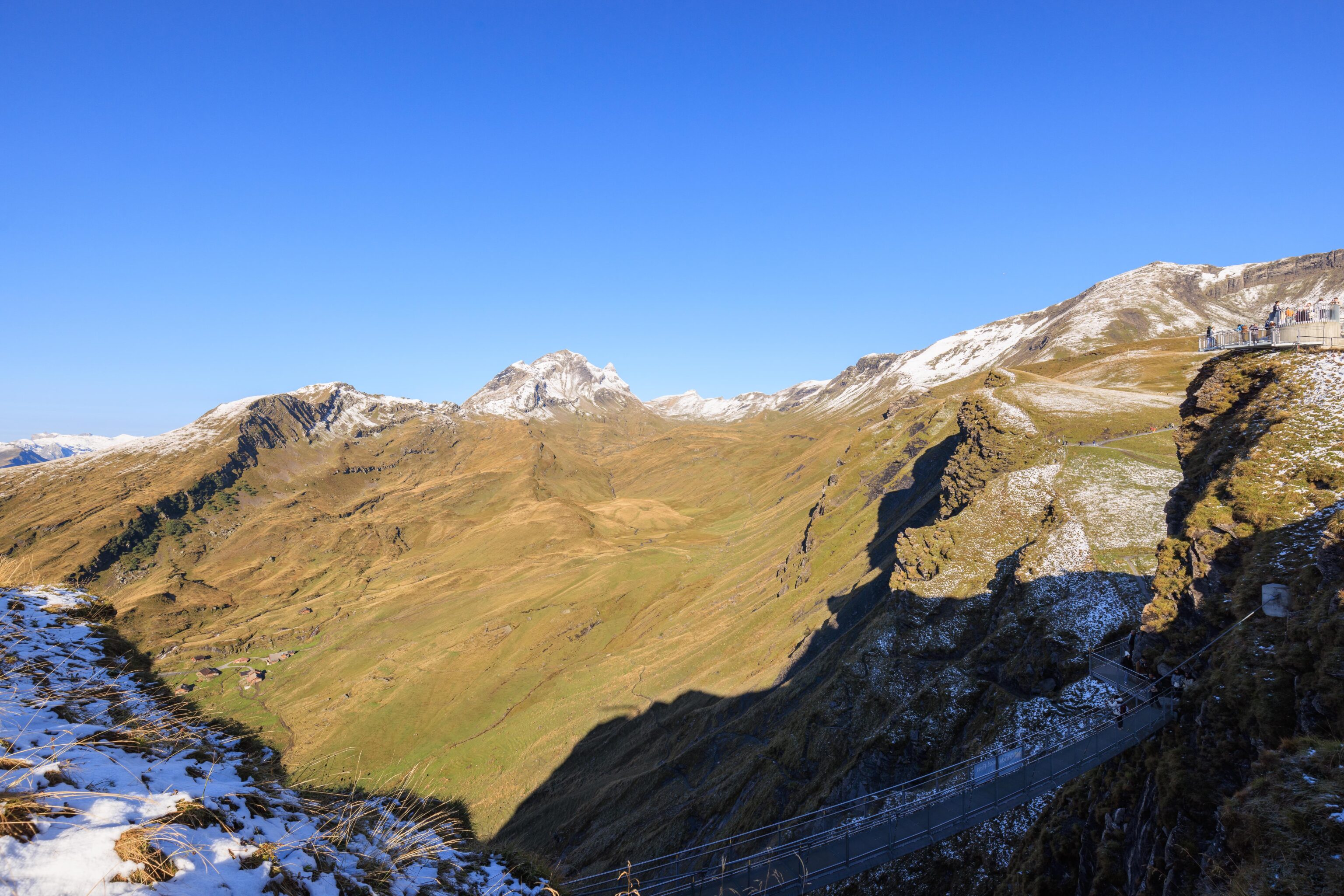
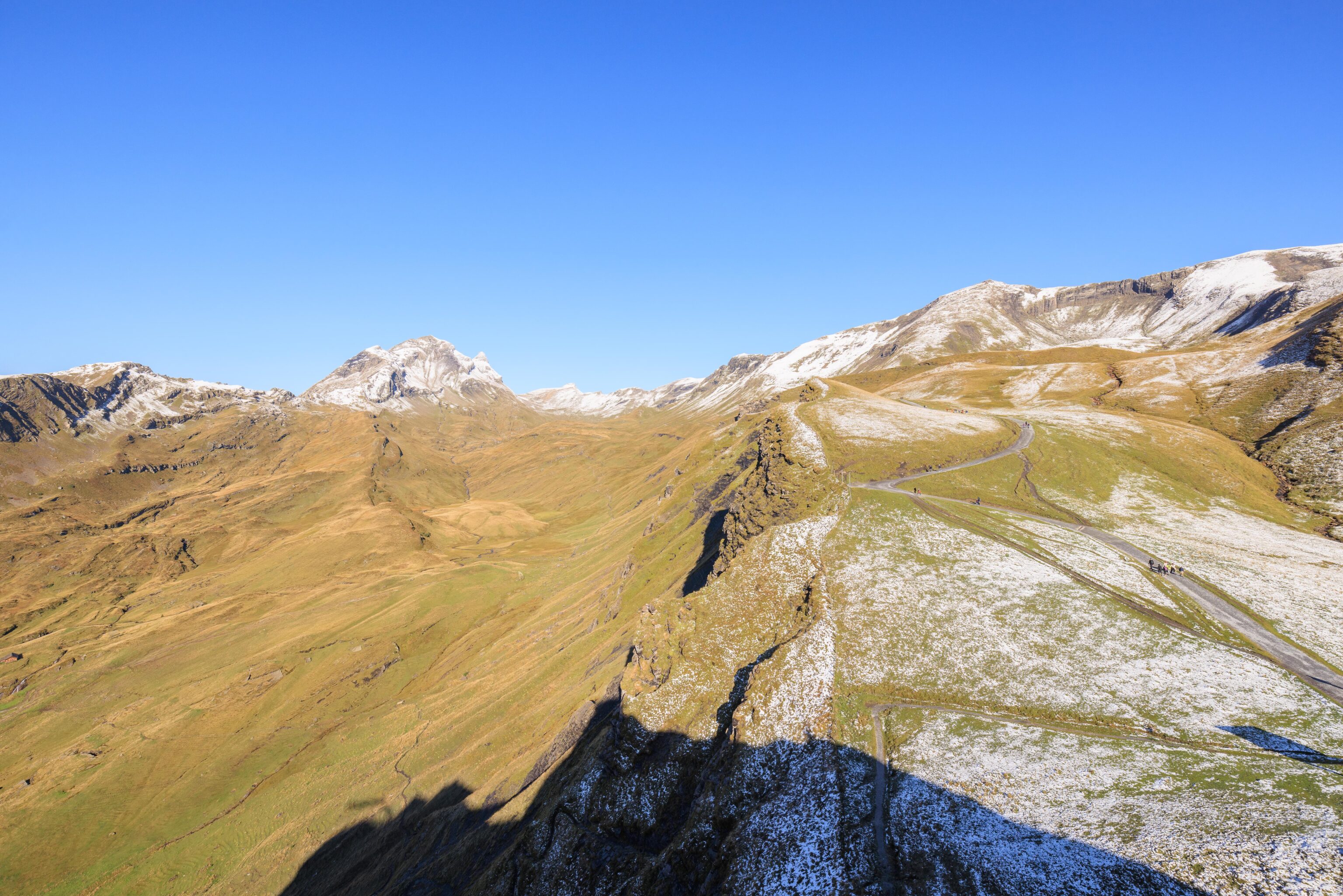
We continued on, eventually reaching another junction. We decided to take the upper route this time as our digital map showed that it would rejoin the main trail. We could see the rocky formation below that we had briefly rested at earlier in the day.
The view looking back. The junction that we took is visible on the right.
The view from the highest point that we reached on this alternate path. The sky was clear of clouds but there was definitely quite a bit of moisture in the air. We could see the metal cables of the Eiger Express below us as they reflected the sunlight coming from above.
Looking ahead, we could see a somewhat steep path leading back down to rejoin the main trail. Most of the snow that was on the ground earlier in the morning had melted, though there was still a bit on north facing building surfaces and some of the ground at First.
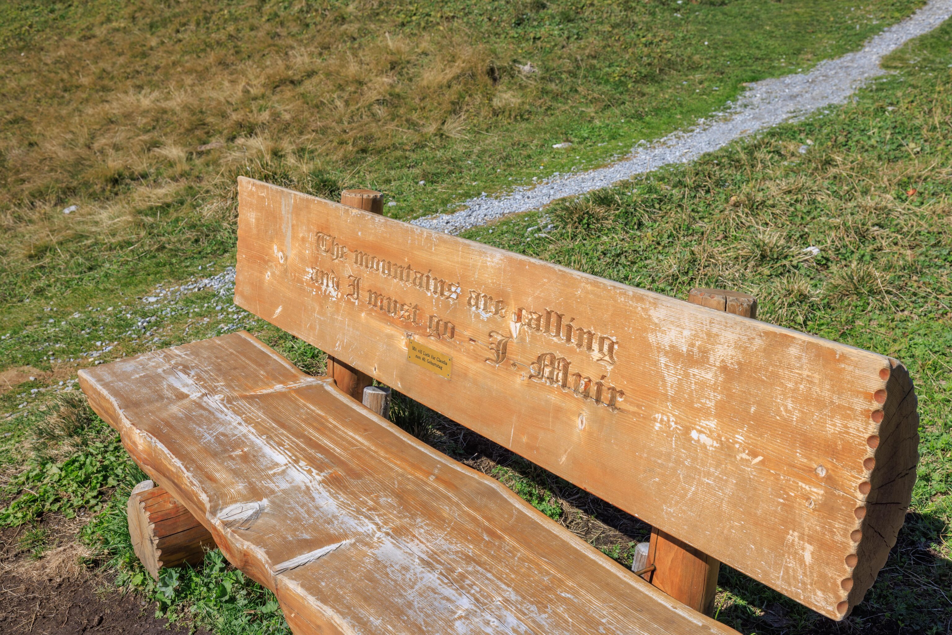
There was a bench here with a famous quote from John Muir, an American activist for the preservation of natural lands and considered to be the father of the American national parks.
The mountains are calling and I must go
We walked down the slope beyond the bench.
The view from Anja’s Skibar.
We continued on the last section of trail back to First.
Soon, we were approaching the entrance to the Cliff Walk. The small trail that leads down is the path to the buildings by the Bachlägerwasserfall.
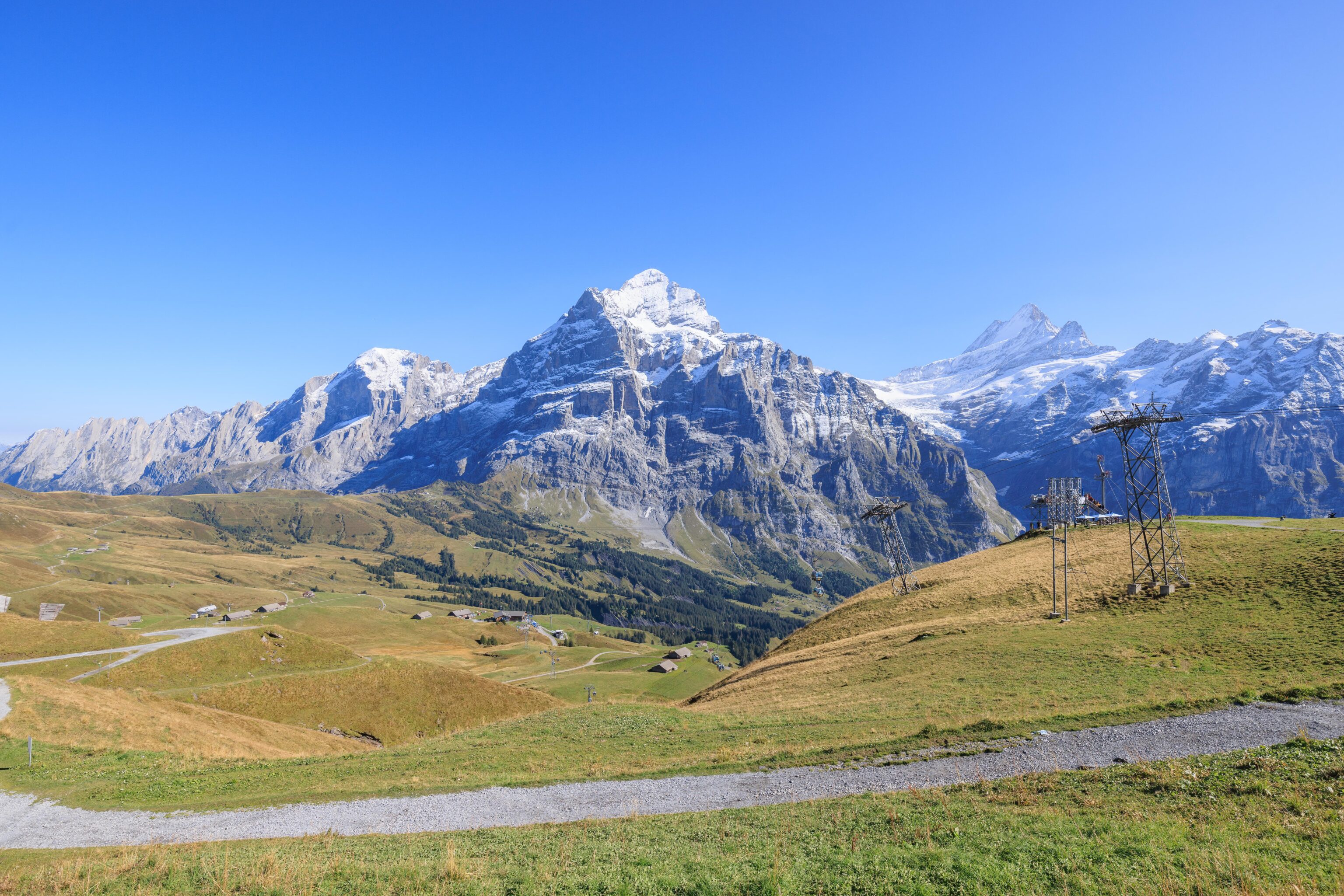
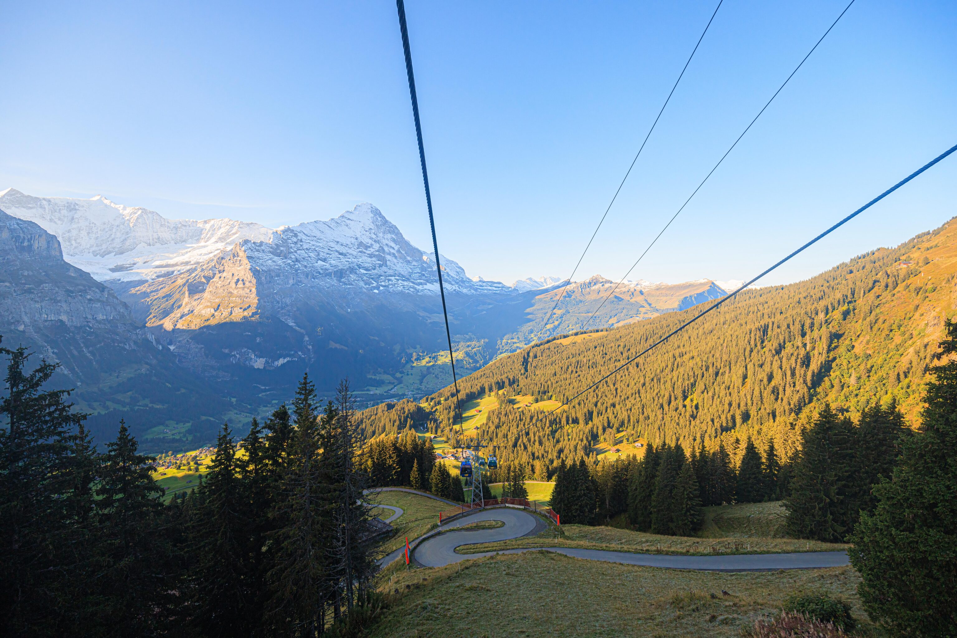
Looking down at the gondola route to Schreckfeld, where it makes a sharp turn to head further down to Grindelwald.
We considered eating up at First but decided to head back down to Grindelwald and eat there.
There was a brief pause in the operation of the gondola for some unknown reason. A queue had built up during that time, though it went quickly once the gondola started moving again. We shared the gondola with another two people on the way down.
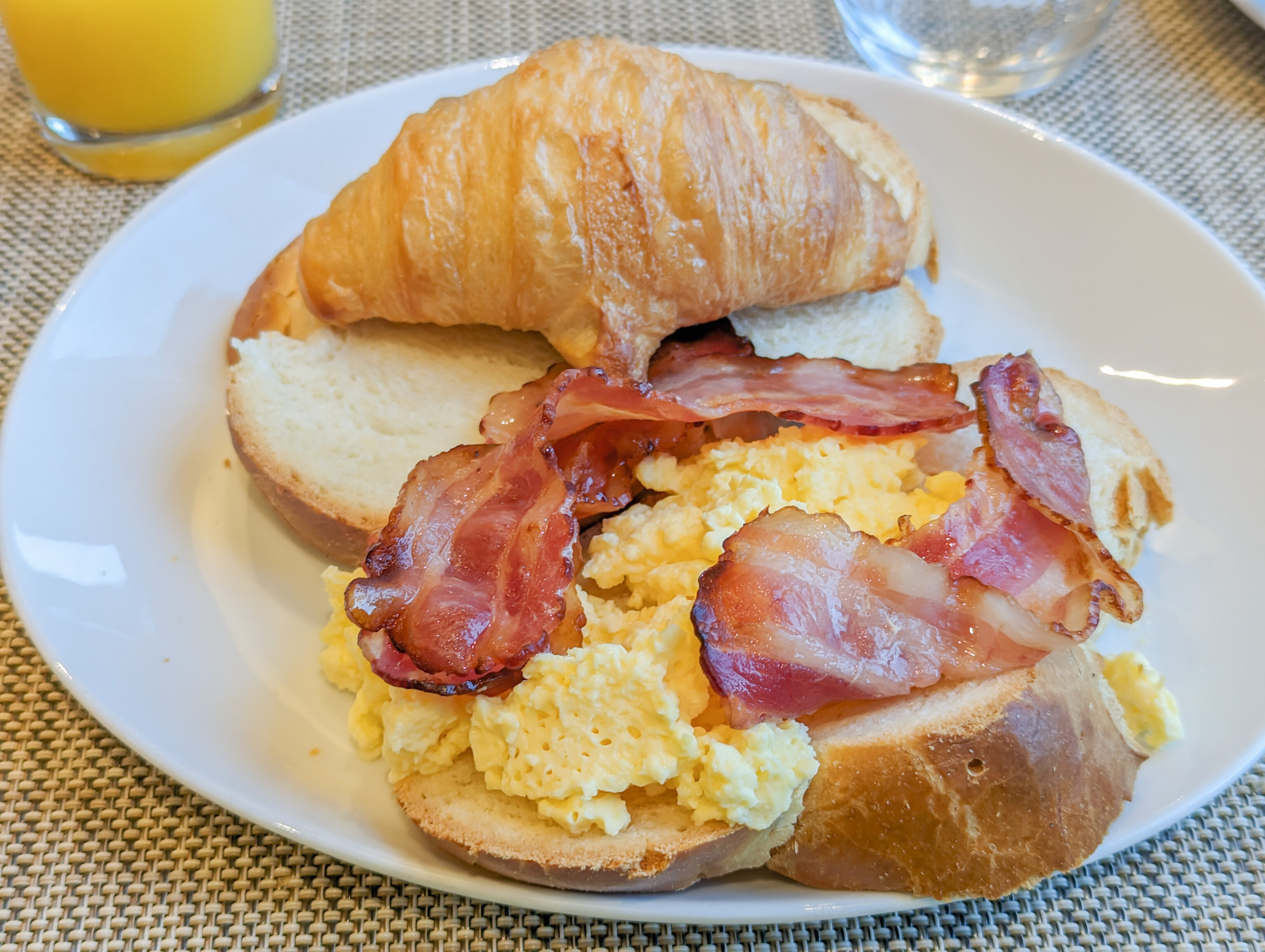
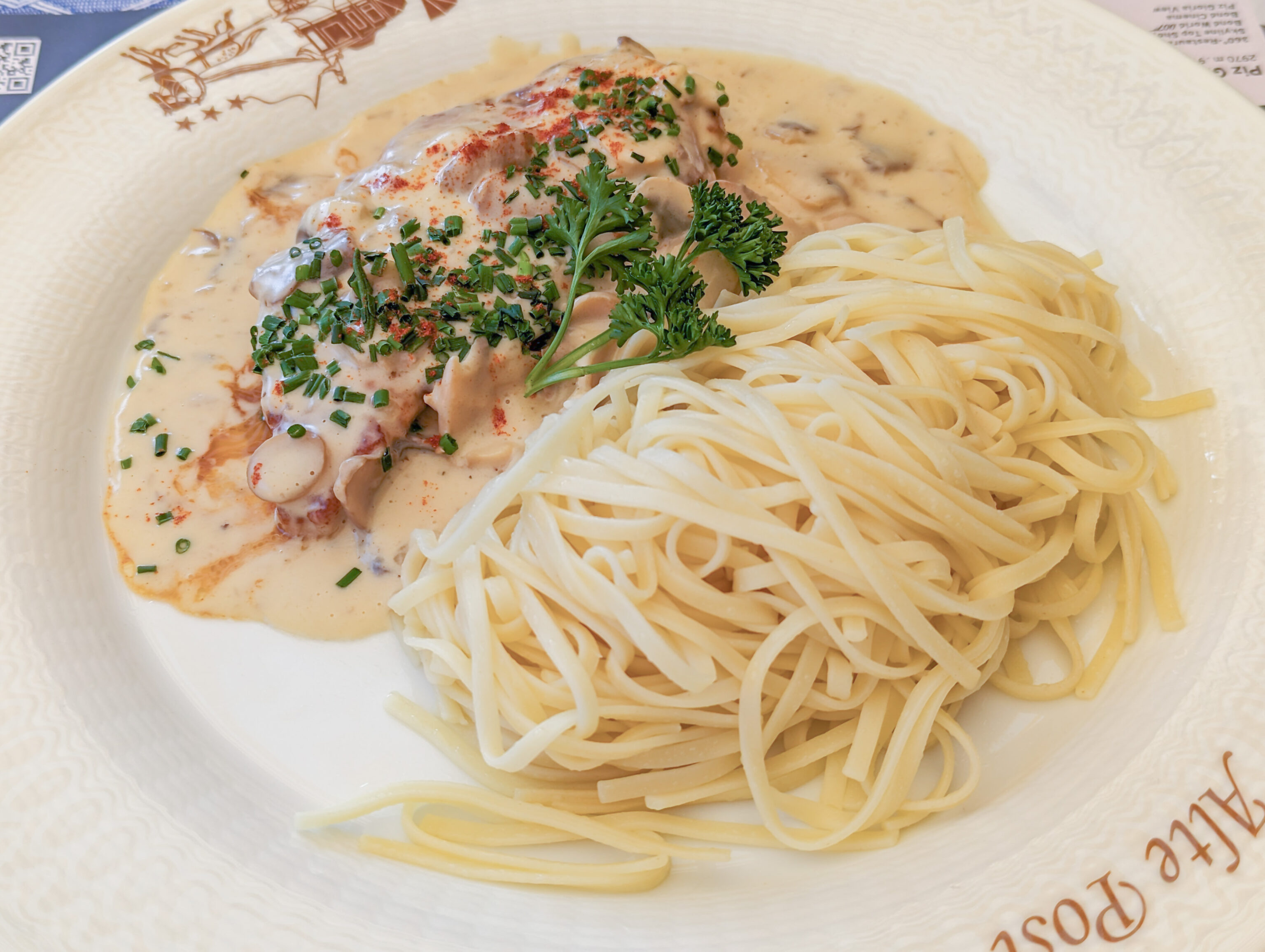
Soon, we returned to Grindelwald. We decided to eat at Alte Post, the restaurant that we had briefly looked at yesterday but passed over in favor of Adlerstube. We decided to order two things that we haven’t had before.
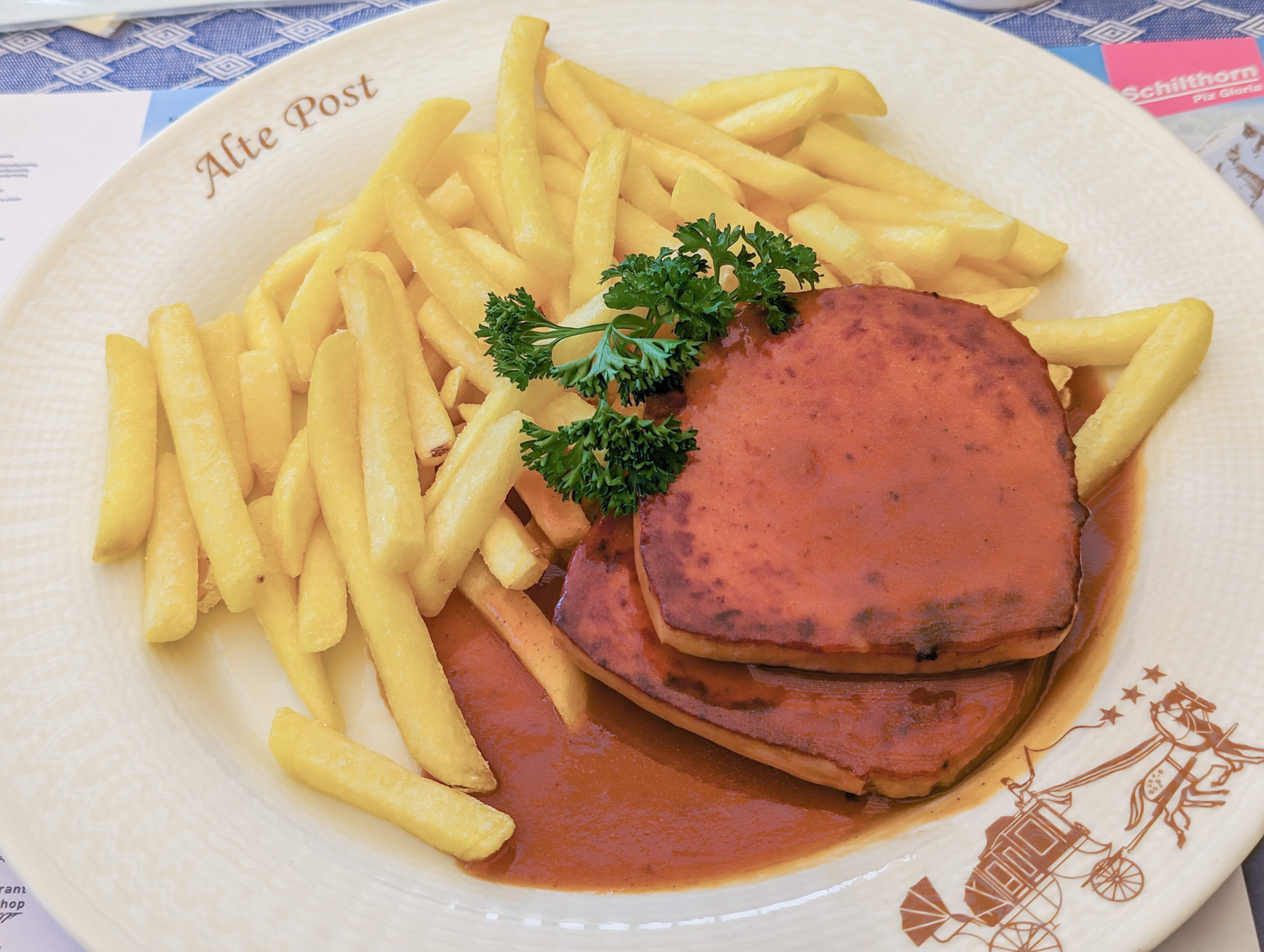
The first is Fleischkäse, it was the daily special. It looks very much like a big piece of grilled SPAM, like one would find in a musubi. The taste and texture can be best described in American English as being something like a hot dog. It tastes better than it sounds.
The second was “Rahmschnitzel mit Nudeln / Creamed „Schnitzel“ with mushrooms and noodles.” It is basically schnitzel meat without the breading in a mushroom sauce. The noodles are just noodles without any flavor. A bit more sauce would have been nice.
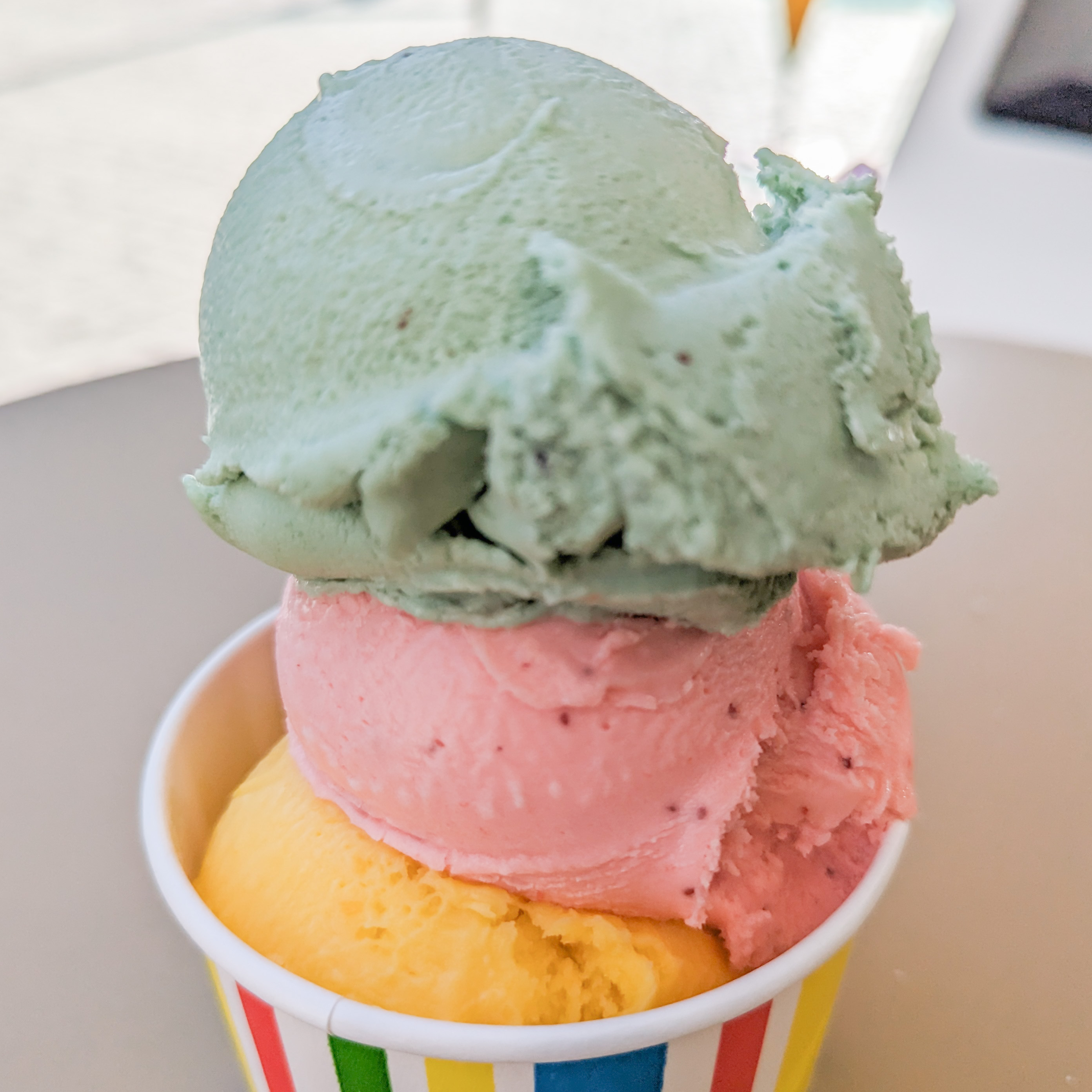
After our late lunch/early dinner, we had gelato from a shop next door. They had a good variety with some interesting flavors. Based on some Google Maps reviews, their gelato is from Sicily. We had, from top to bottom, kiwi, strawberry, and orange.
Kiwi is a flavor one doesn’t really encounter for gelato. It was definitely an interesting flavor, not quite like eating a good kiwi though. The strawberry was lightly flavored. The orange was very strong and very good. Why is it such a rare flavor?
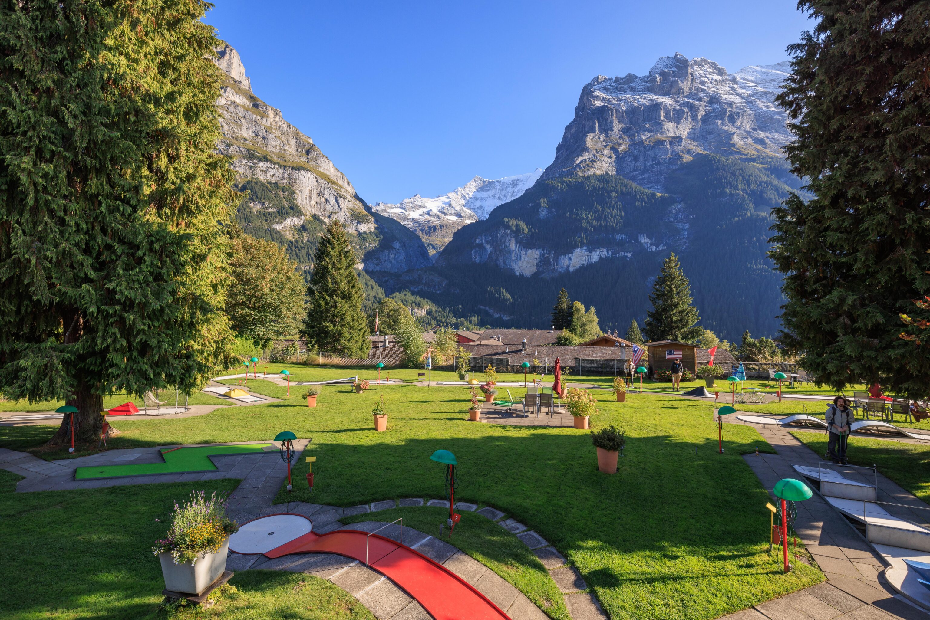
After finish our gelato at the only table in front of the shop, which happened to be available, we started to walk back to the Belvedere. We passed by this mini golf place. They had some American flags, is mini golf considered to be an American thing?

It definitely seemed to be busier today compared to yesterday.
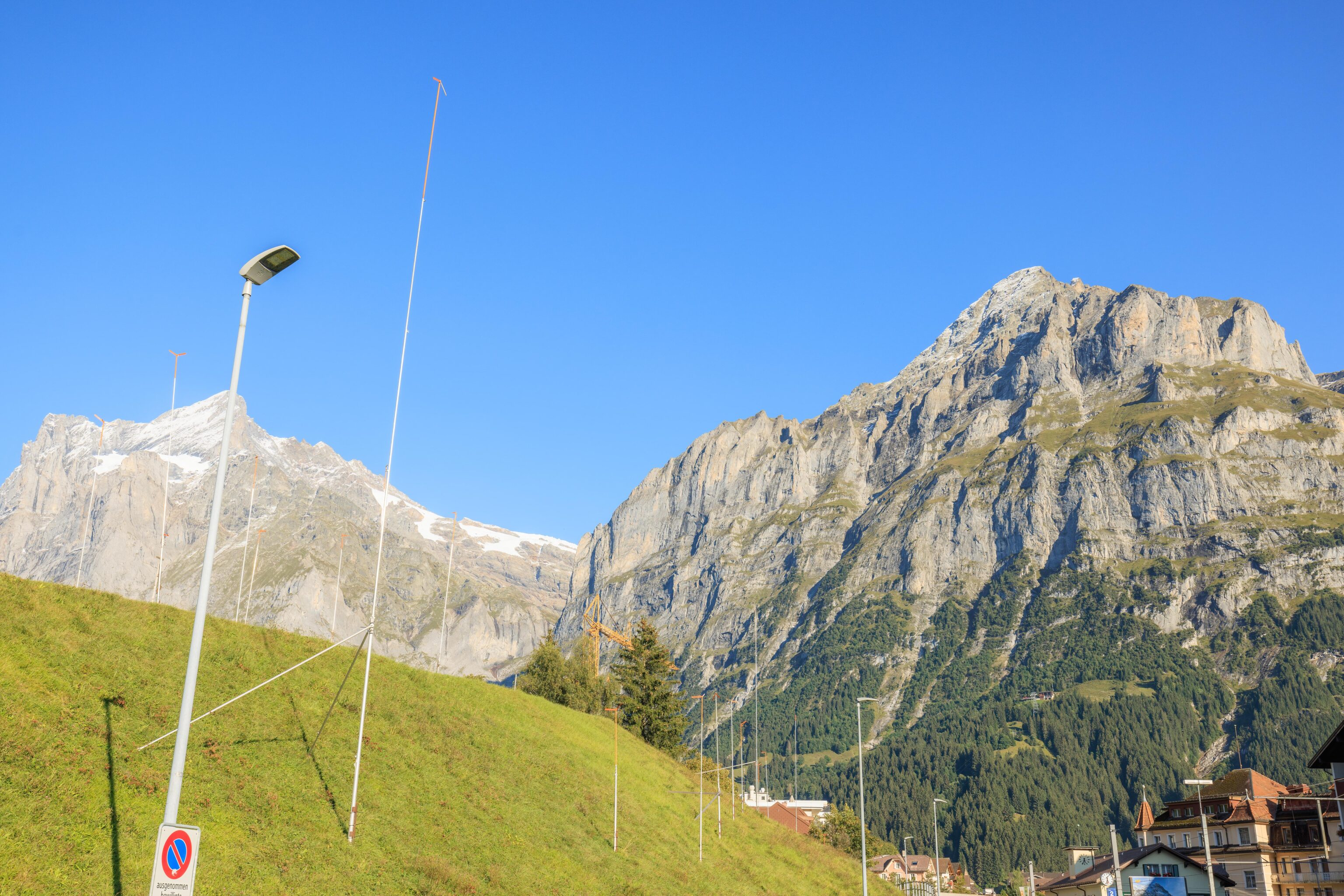
We noticed this hill with poles across the from train station. What is going on here?
Thankfully, “Switzerland hill with poles” turns out to be a pretty useful Google search query, though only if you click on one of the photos that comes up. The first photo was from Newly Swissed which explains3:
The Swiss building code requires any new building or major addition to an existing building to be outlined. For a certain period before construction begins, these "ghost buildings", as the Guardian has aptly called them, help residents to envision how the landscape will be affected.
The actual Google search results are rubbish as they all are for trekking poles, with the Newly Swissed page not appearing until the 21st result!
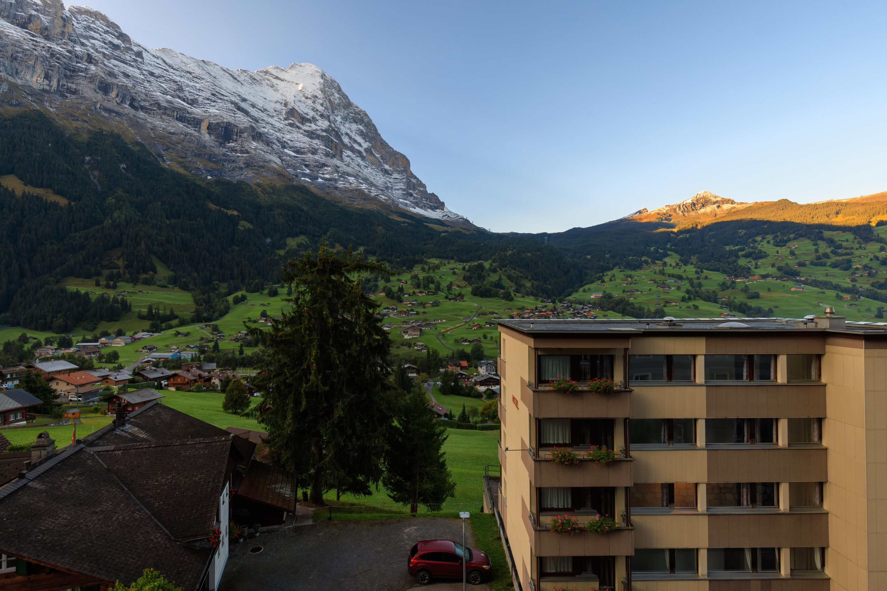
Finally, back at the Belvedere! We ended our day by enjoying the hot tubs at the spa facilities at the hotel.
Footnotes
- https://de.wikipedia.org/wiki/Bachalpsee ↩︎
- https://en.wikipedia.org/wiki/Finsteraarhorn ↩︎
- https://www.newlyswissed.com/building-poles-dotting-swiss-landscapes/ ↩︎