

Today, we mostly visited portions that remain of the Berlin Wall. While doing so, we also saw Checkpoint Charlie, the most famous crossing between East and West Berlin. And we spent some time at the Topography of Terror, a Dokumentationszentrum (Documentation Center) that covers the Nazis’ rise to power and the evils that they committed. There is also some special focus on this particular site as it is where the Gestapo headquarters was located.
Checkpoint Charlie
We started out the day by taking the U-Bahn two stops to Kochstraße, the closest station to Checkpoint Charlie. It was a former border crossing between East and West Berlin. At this particular checkpoint, the north side was East Germany and the south side was West Germany.
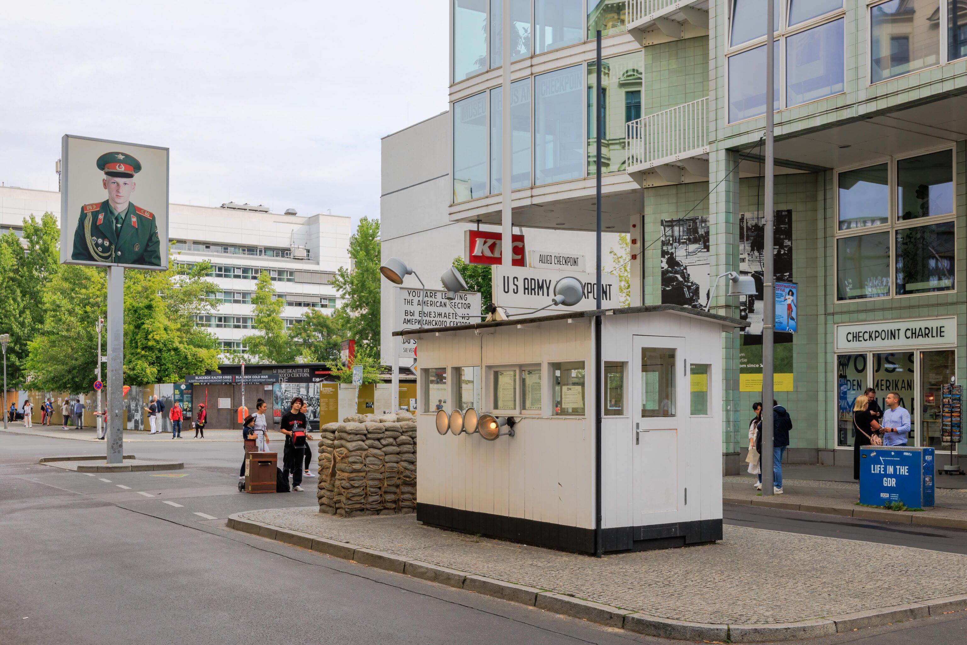
This was our first look at the checkpoint as we approached from the south. Everything here is a reproduction. The original guard house, or at least, the one that existed upon reunification, is in a museum.
It was pretty quiet, though not particularly early at around 9:45am. There were only a few tourists here and there. There was one kid selling photos, though he was extremely not aggressive and completely passive. There were double decker tourist bus salespeople on the far corner, one again, they did not appear to harass anyone.
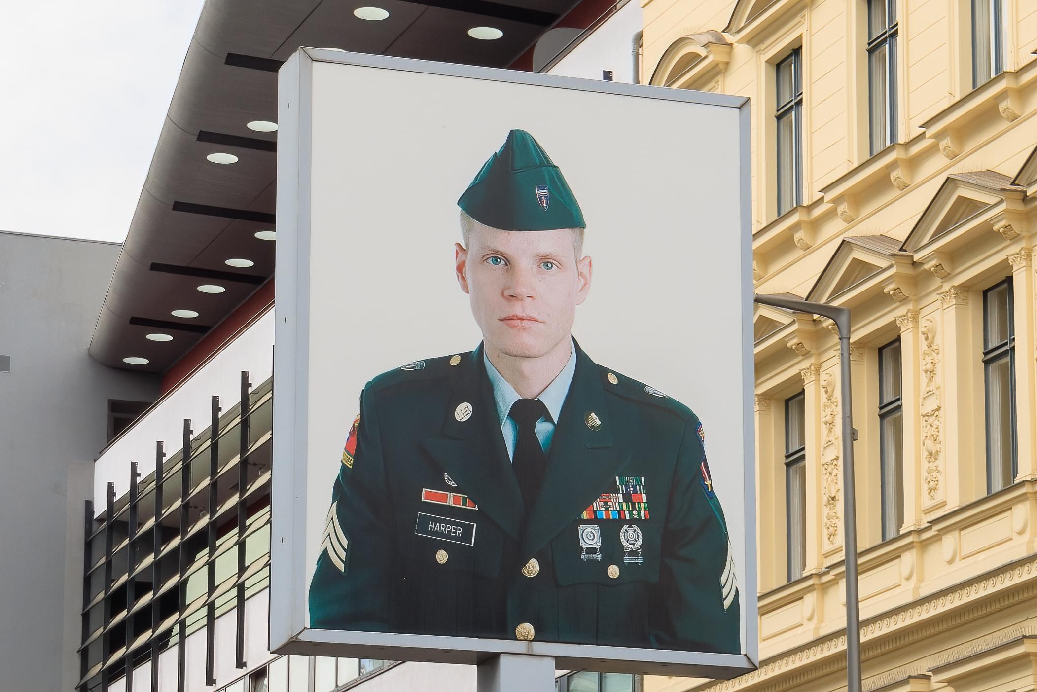
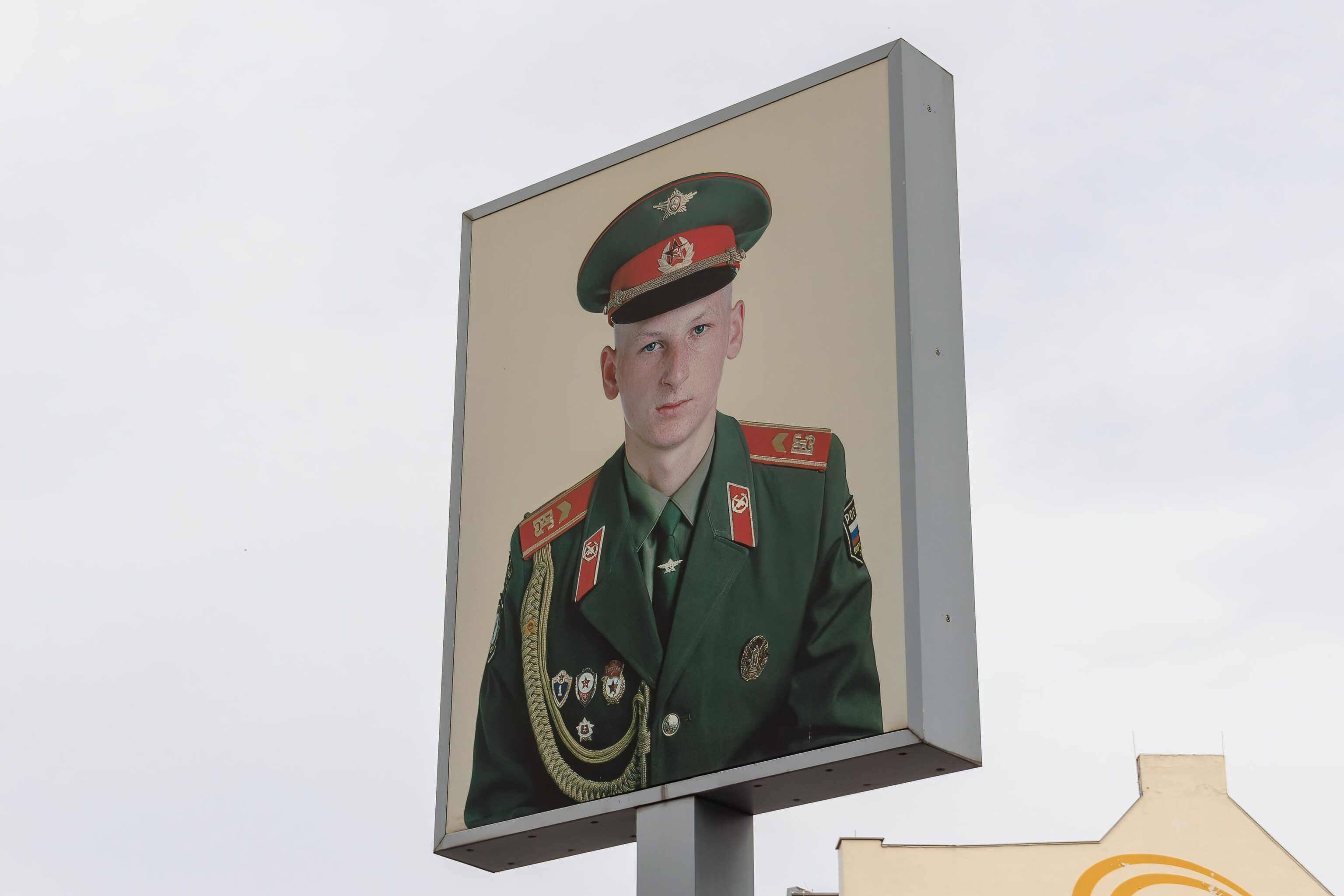
There are portraits of a Soviet and American soldier up on a pole. The American is Bill Harper, a former Sargent with the US Army. CBS News wrote an article about him and his portrait. There don’t seem to be any easily discovered sources that identify the Soviet soldier.
Topography of Terror
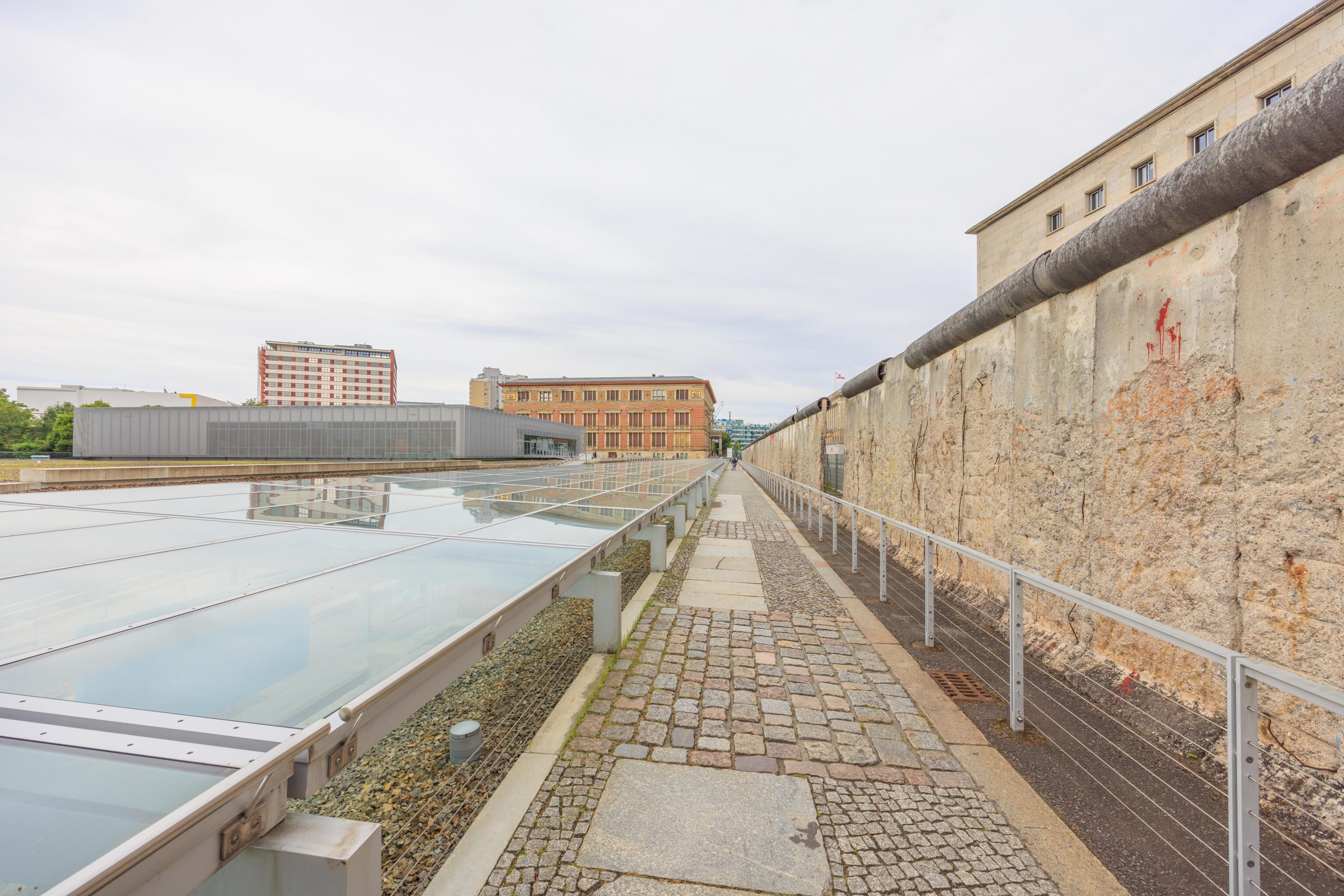
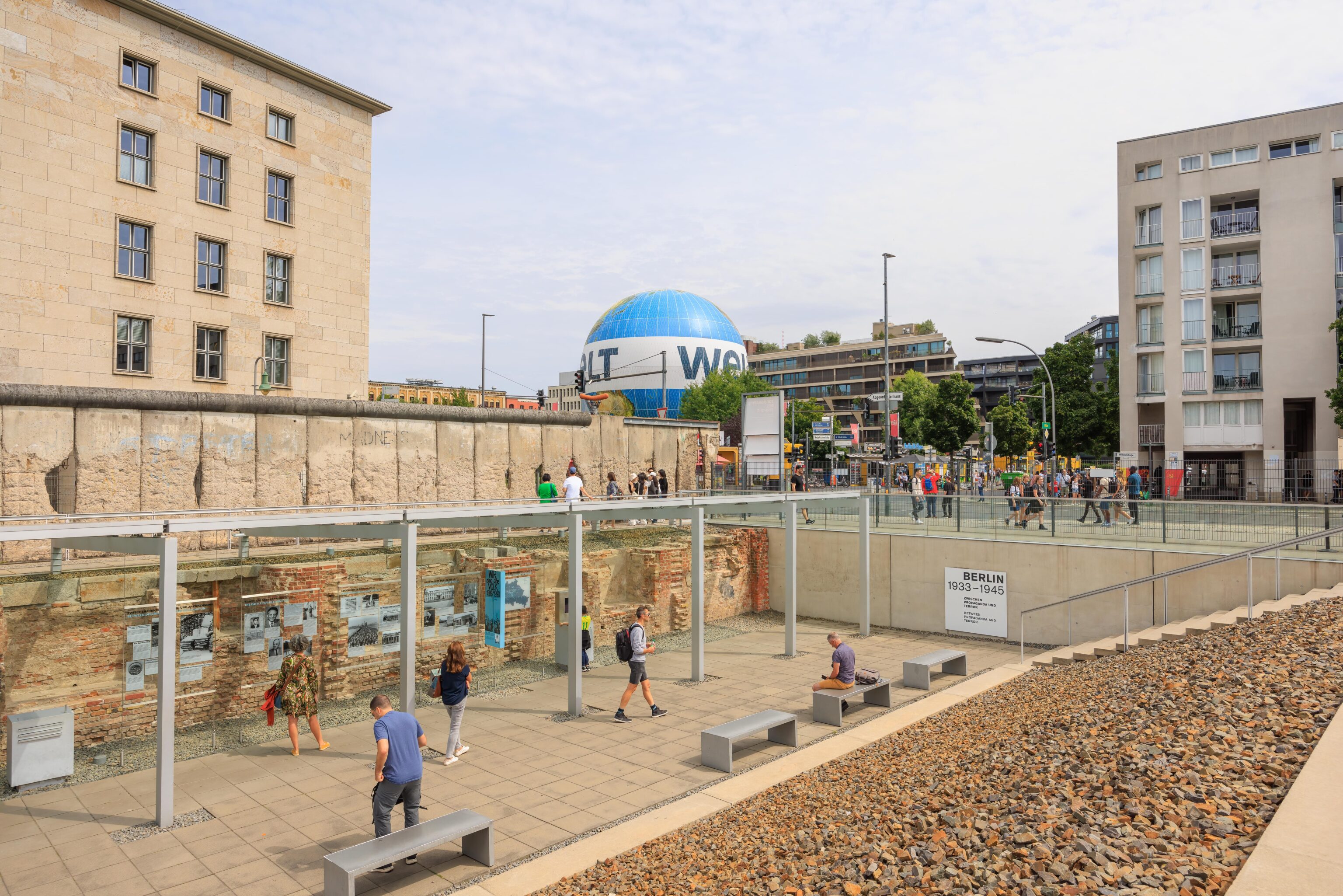
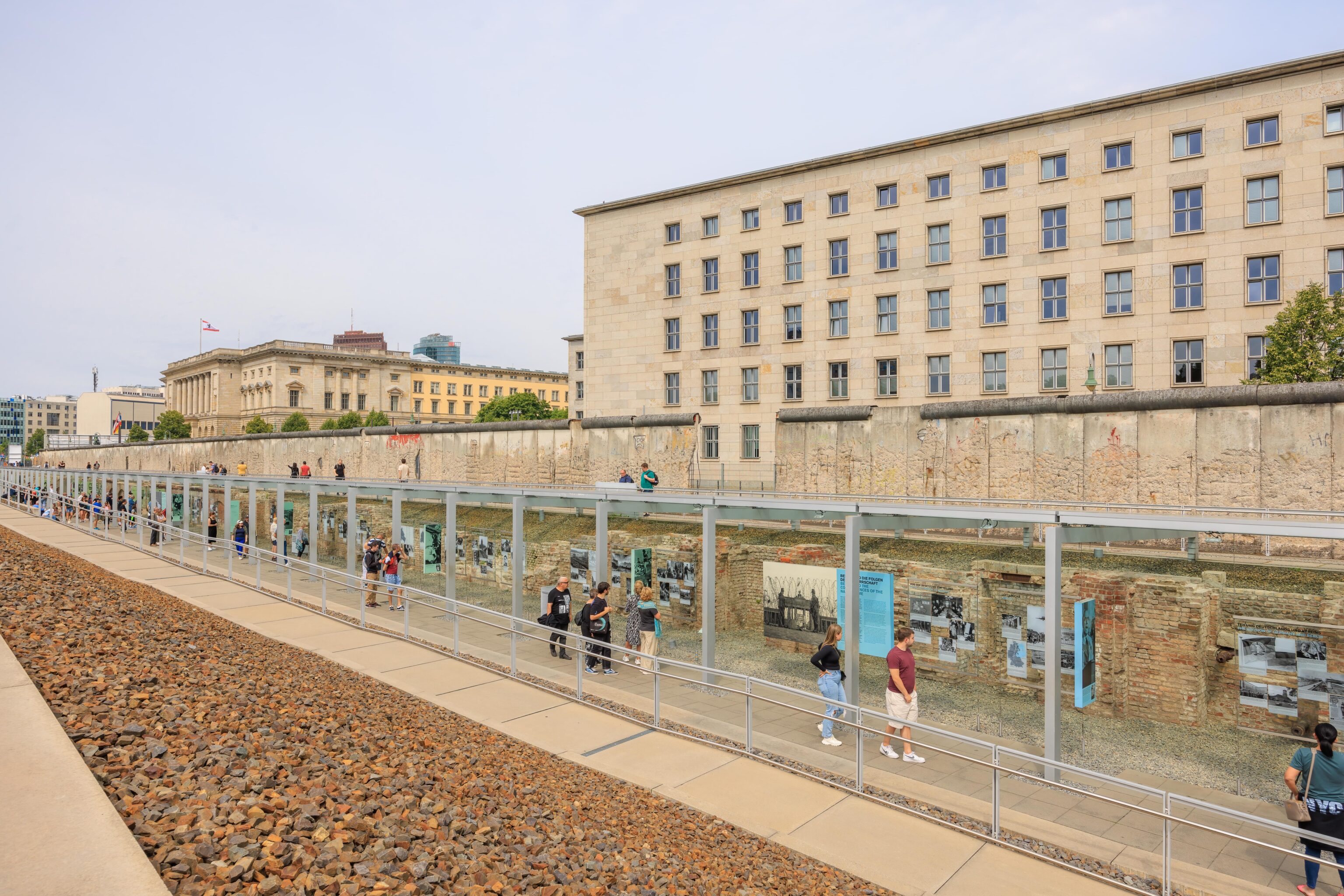
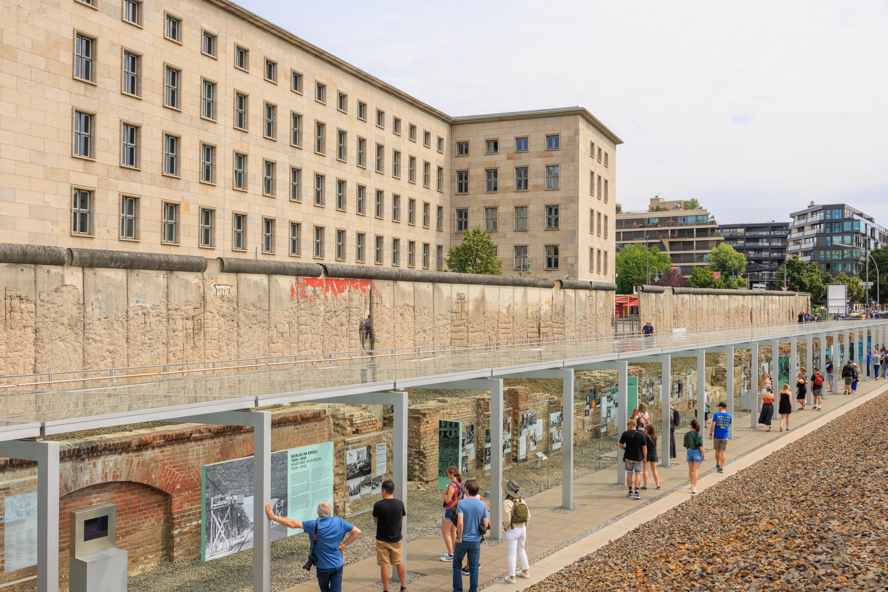
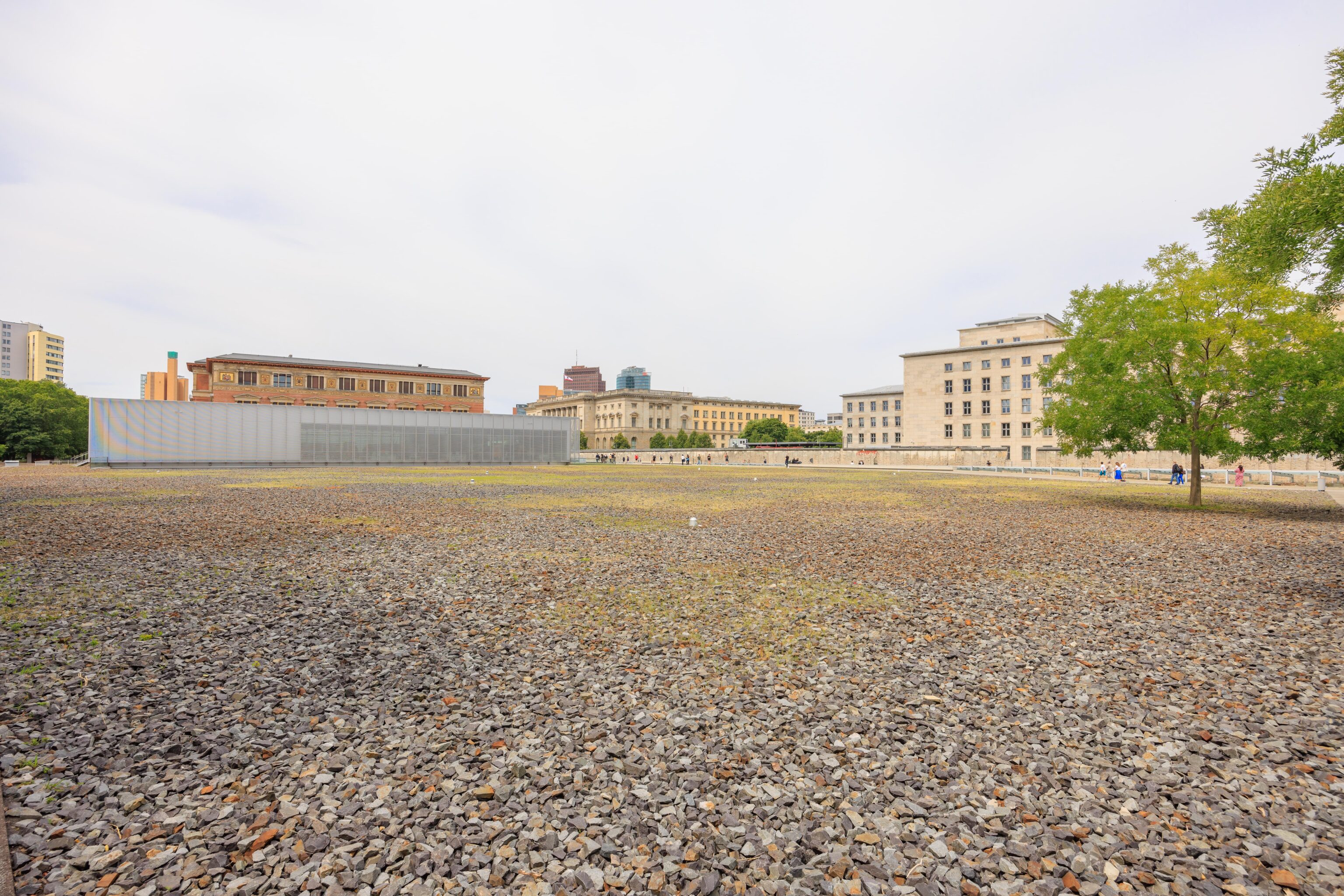
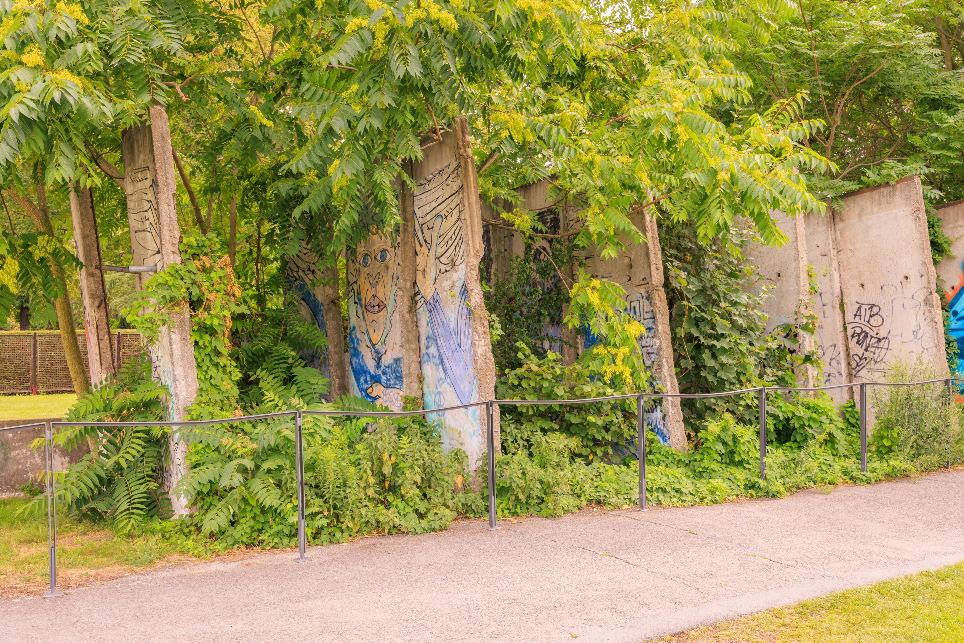
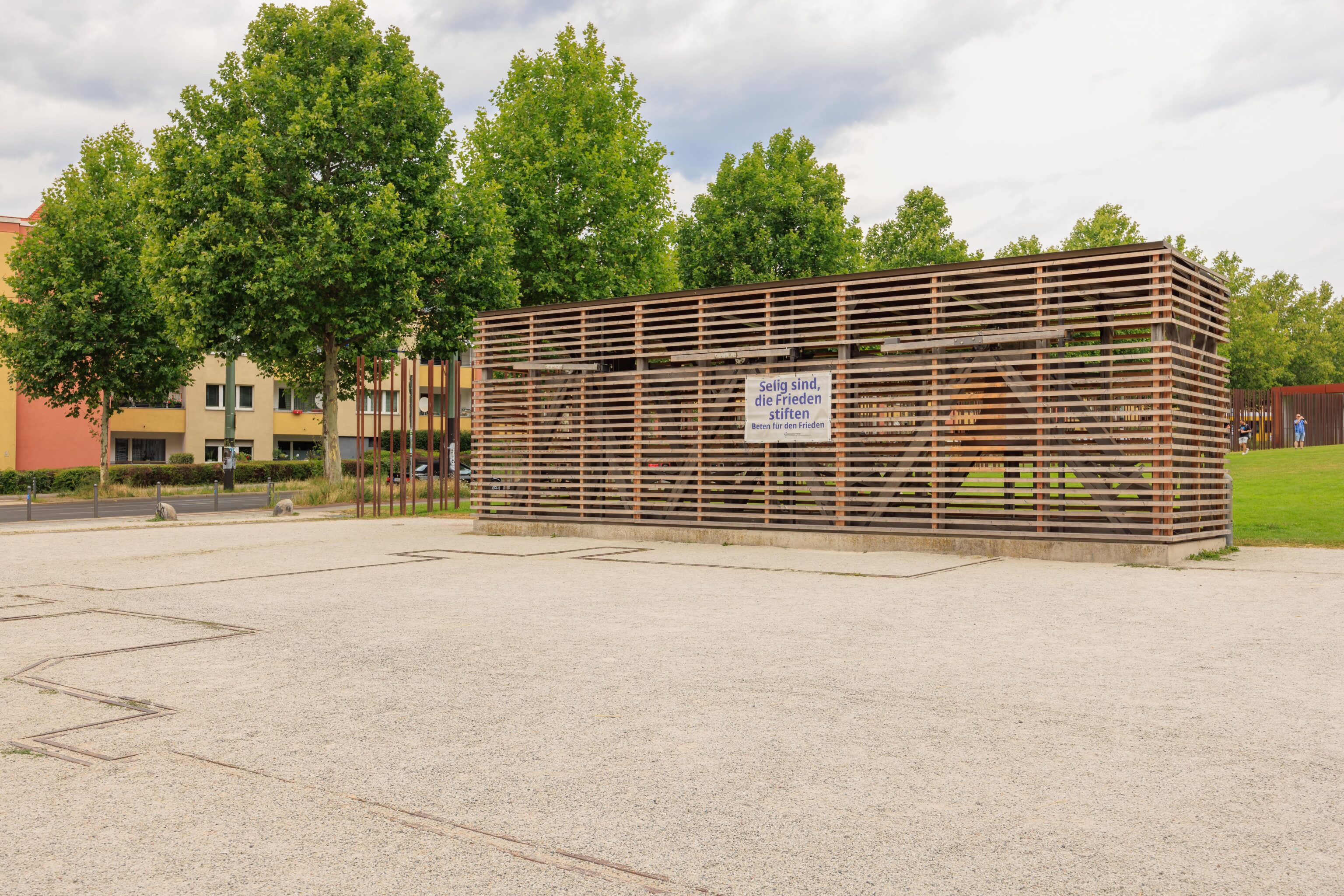
We next headed west to the Topography of Terror. The site holds a section of the Berlin Wall as well as the actual Dokumentationszentrum (Documentation Center).
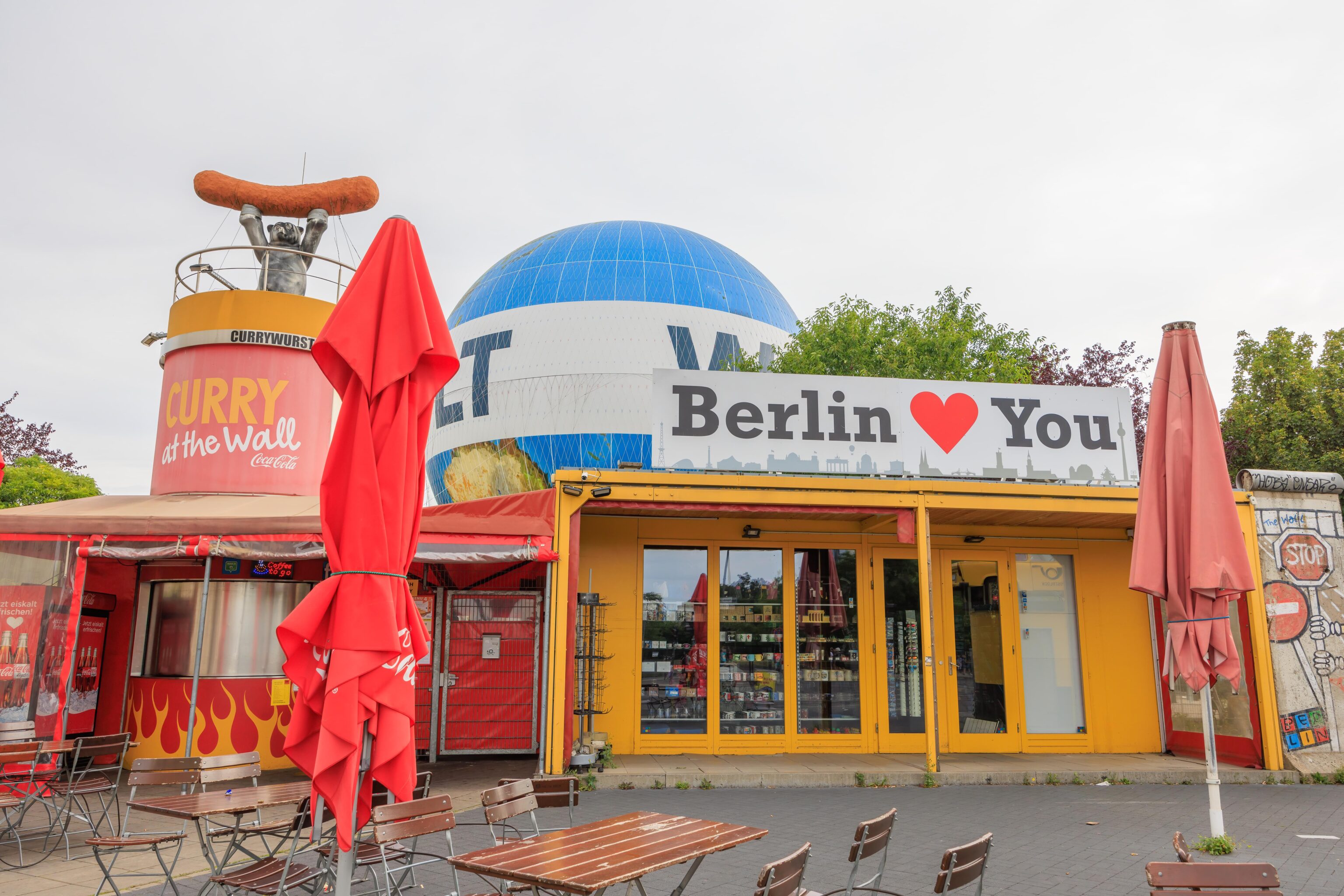
The first thing one sees when approaching from the east is this very touristy site. It has a souvenir shop, currywurst stand, and a balloon.
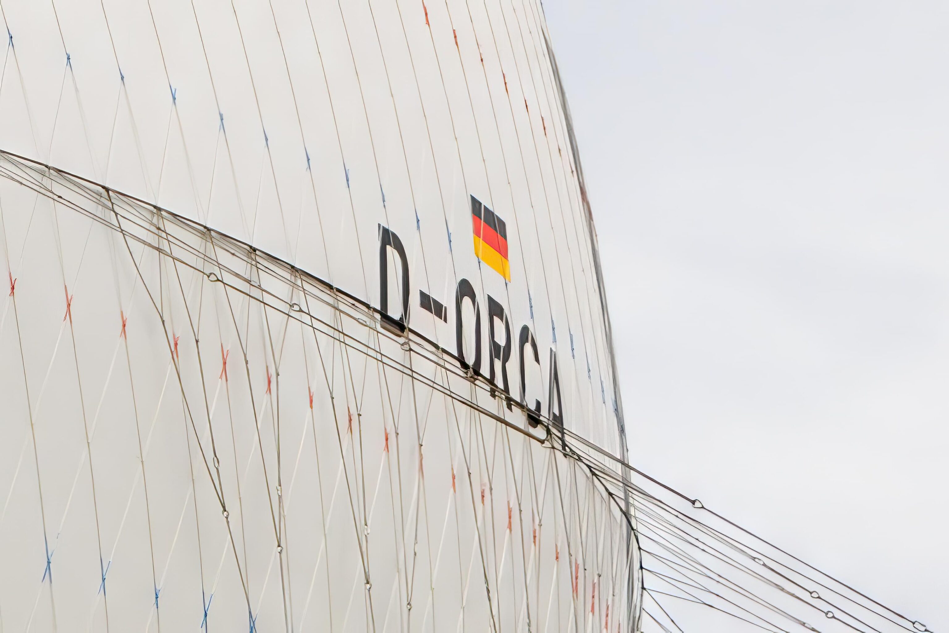
The balloon, Die Welt (The World) is anchored to the ground and carries the registration D-ORCA. It floats up to 150 meters while tethered.
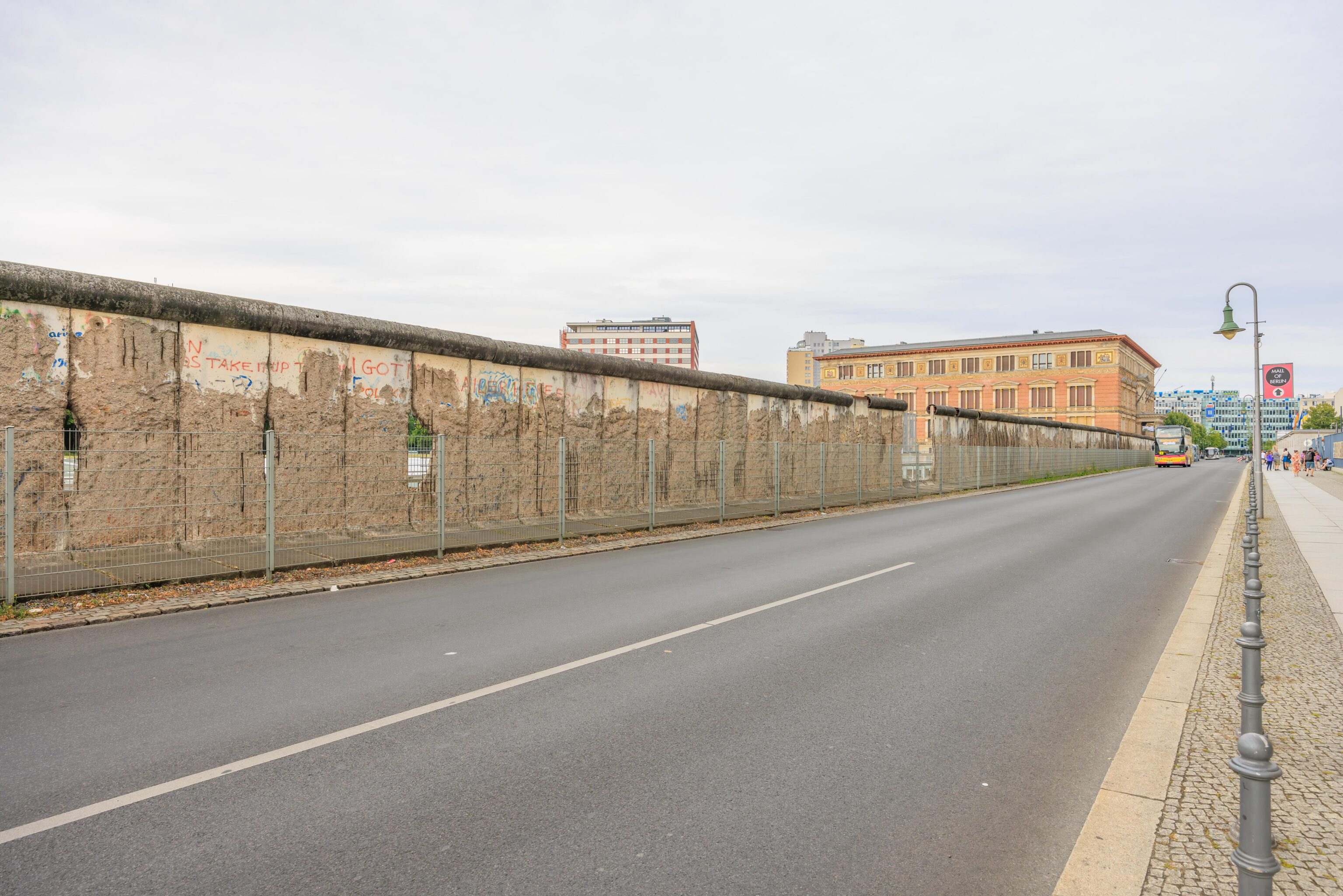
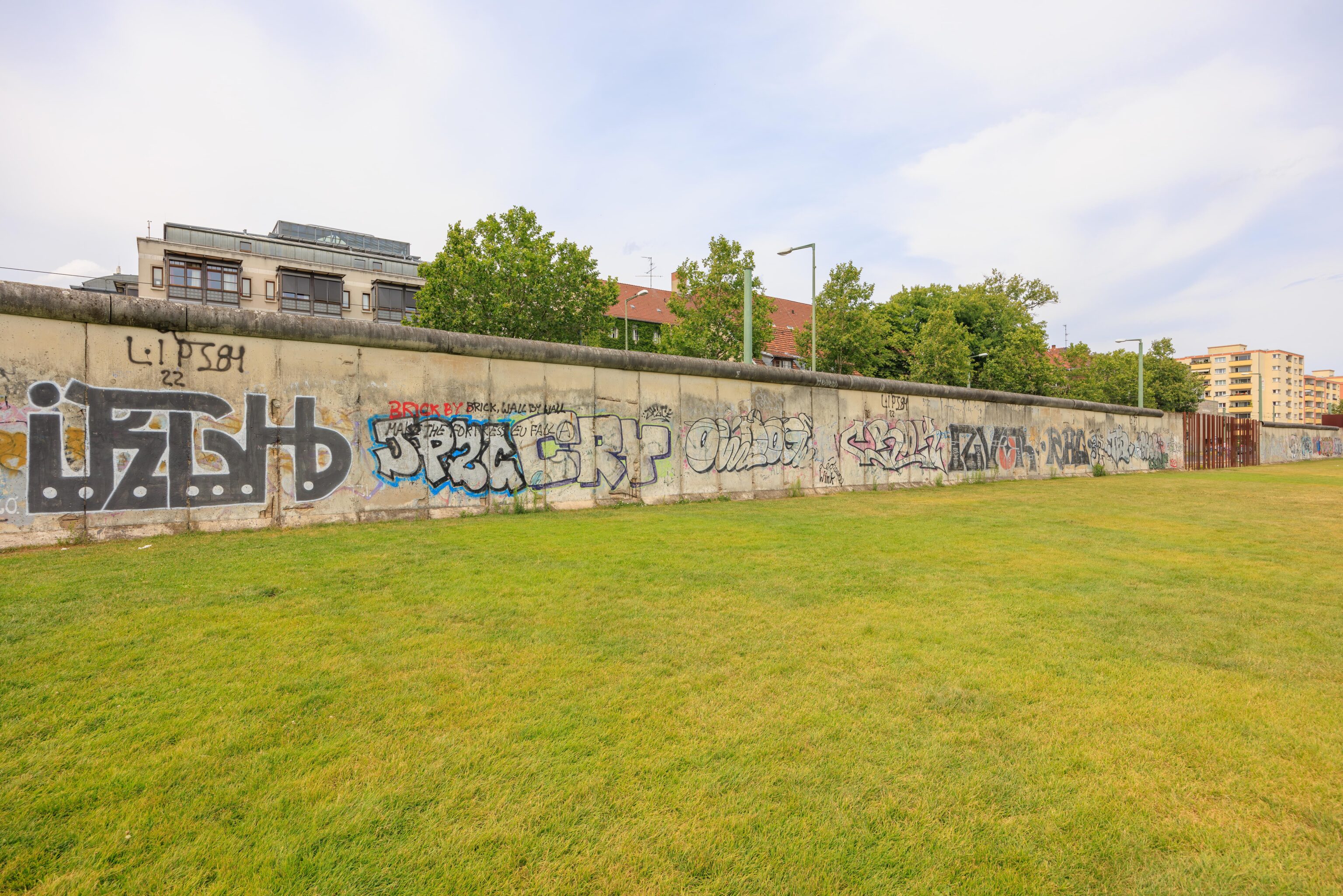
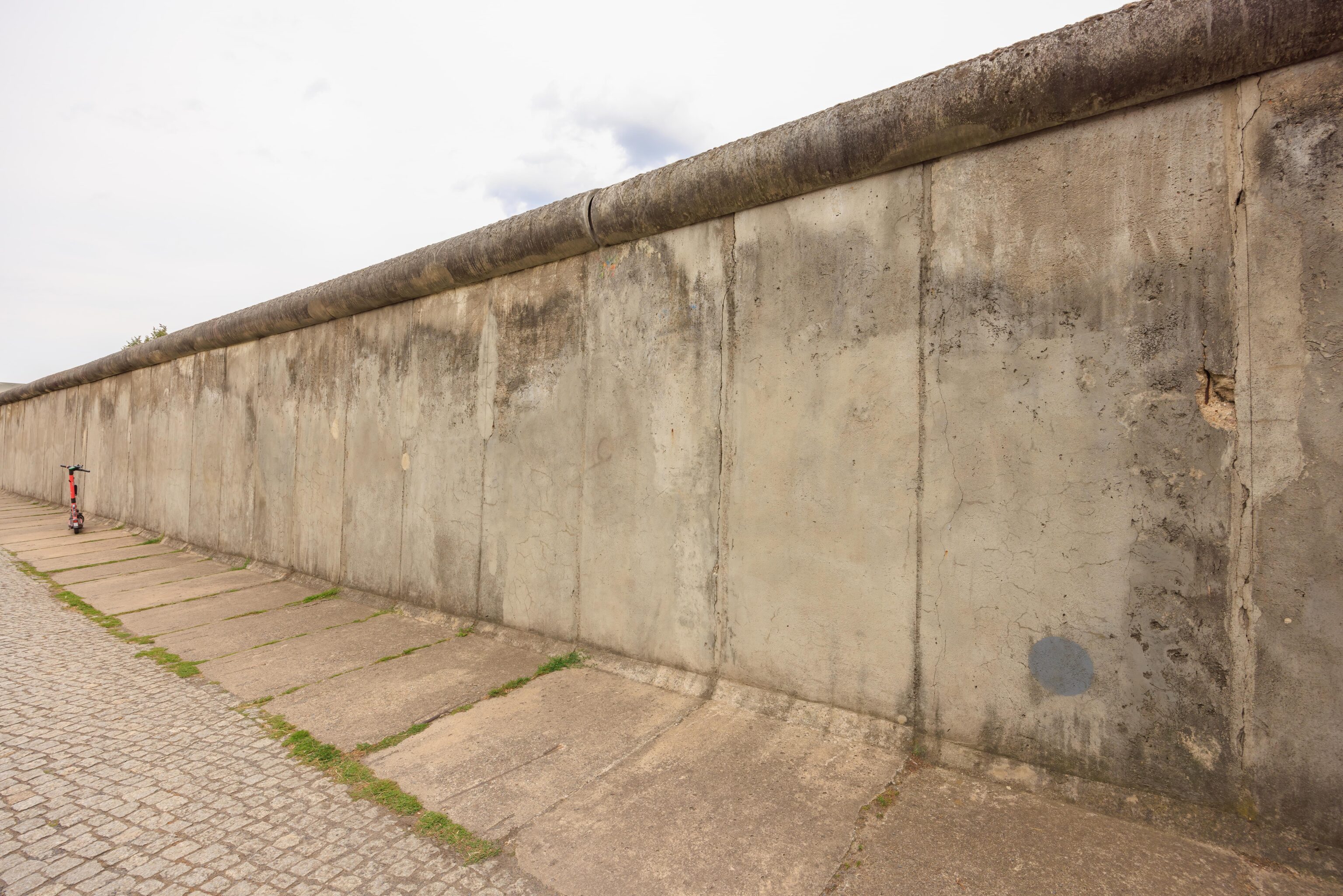
The Berlin Wall segment begins at the opposite corner. Like at Checkpoint Charlie, which is only one very long block away, the north side would have been East Berlin and the south side West Berlin. The wall is fenced in on the street side.
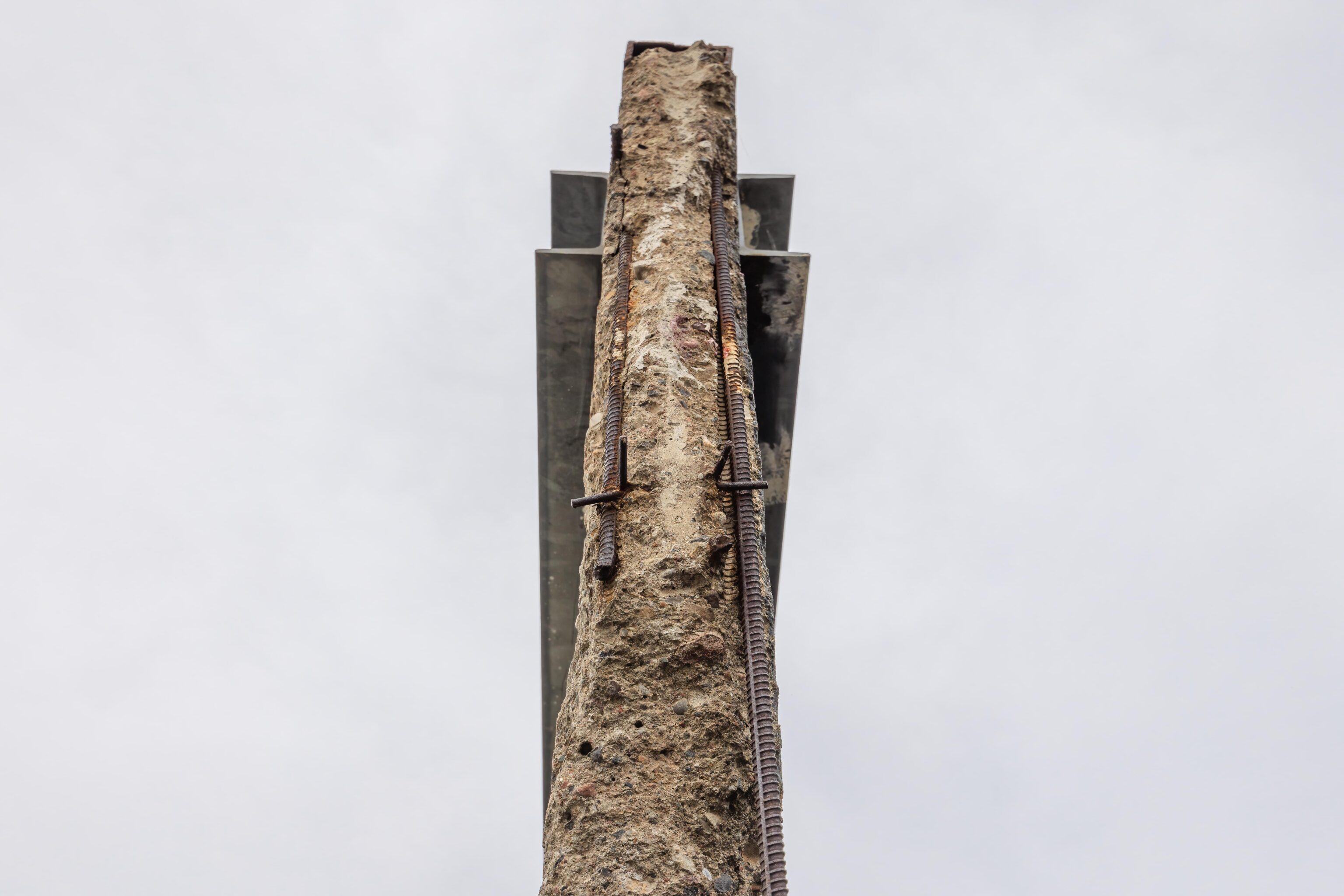
The actual wall panels are very thin.
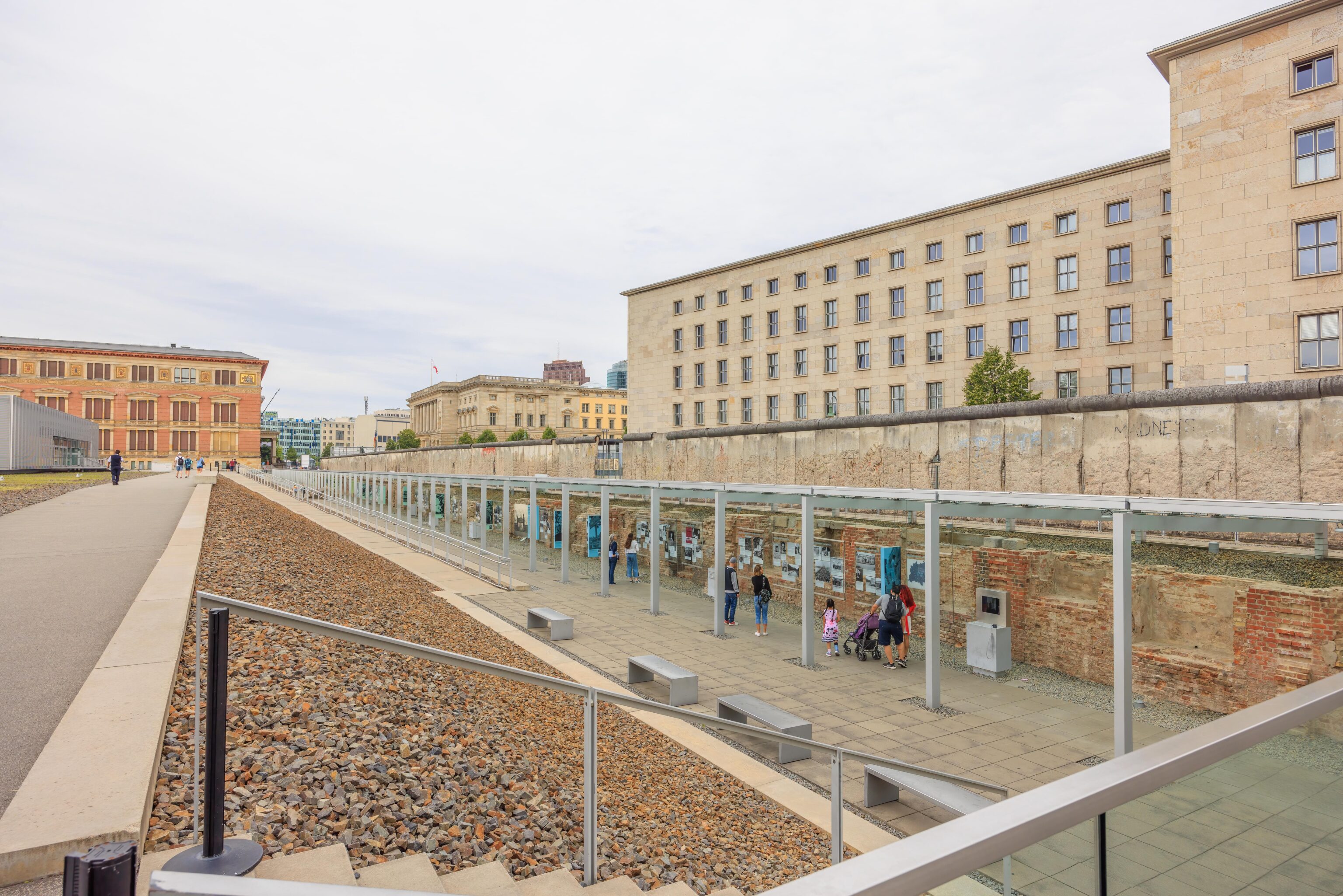
The south side of the wall has information panels that are below grade. The panels start on the west, or far, side. We decided to walk to the west side so that we could start from the beginning.
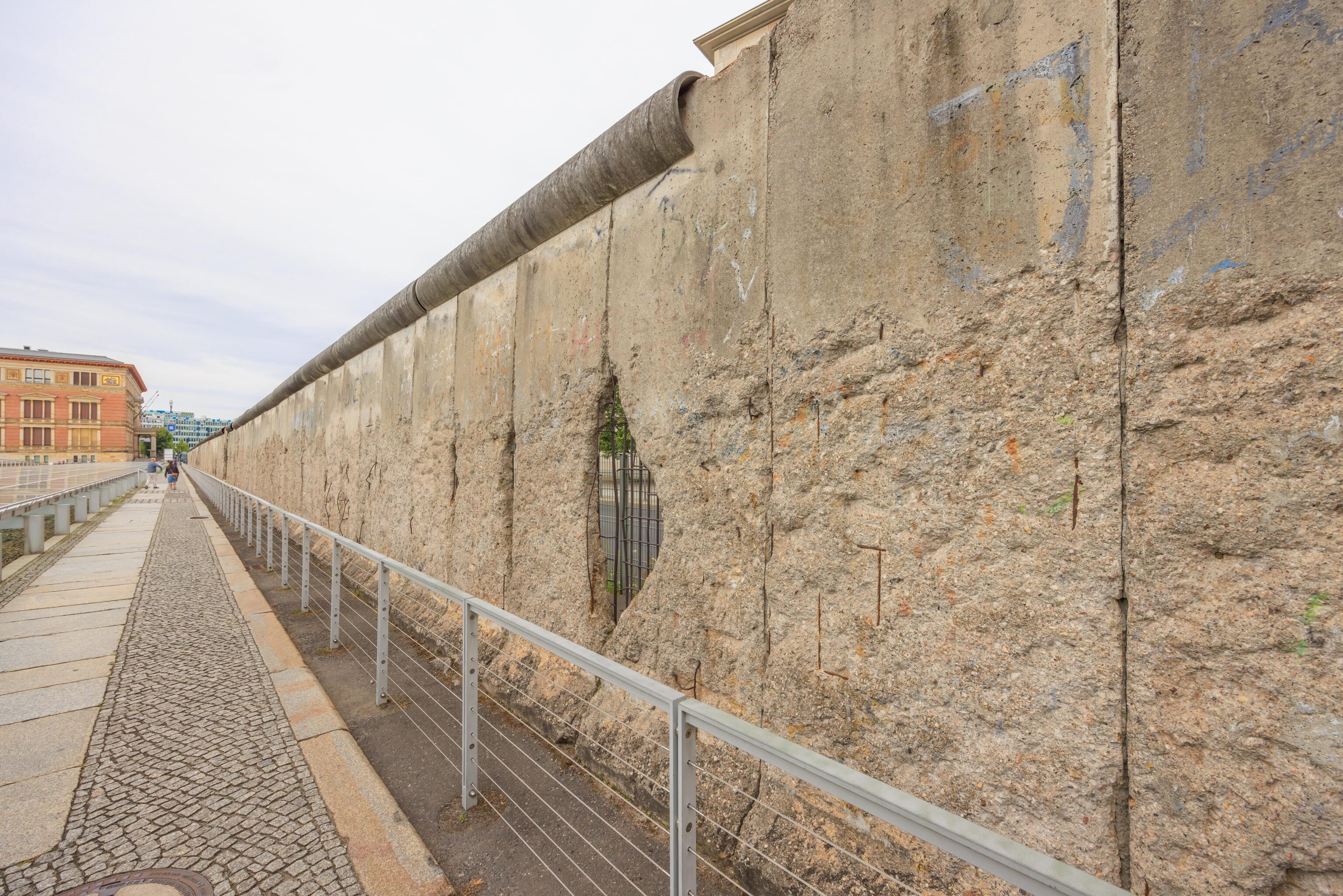
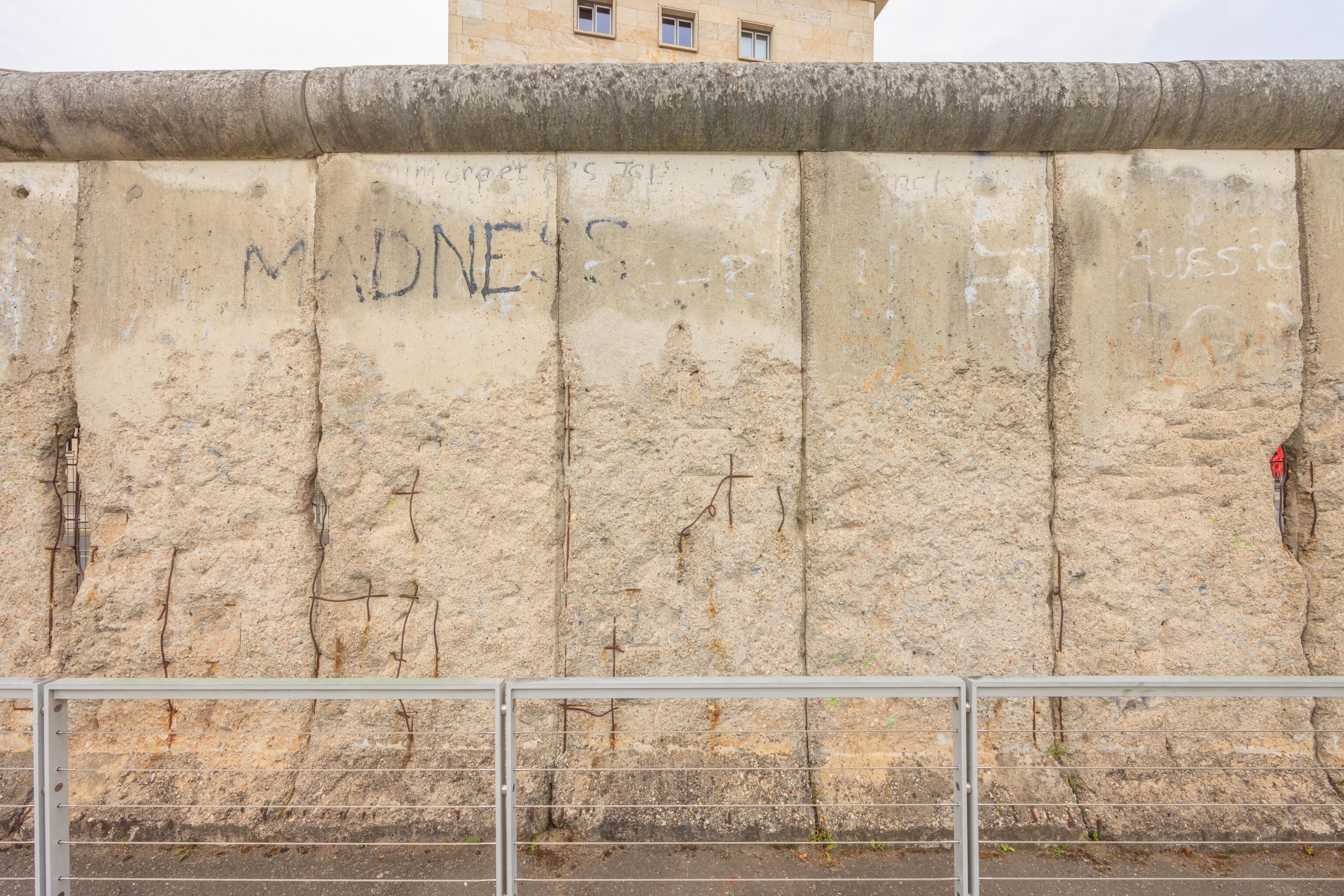
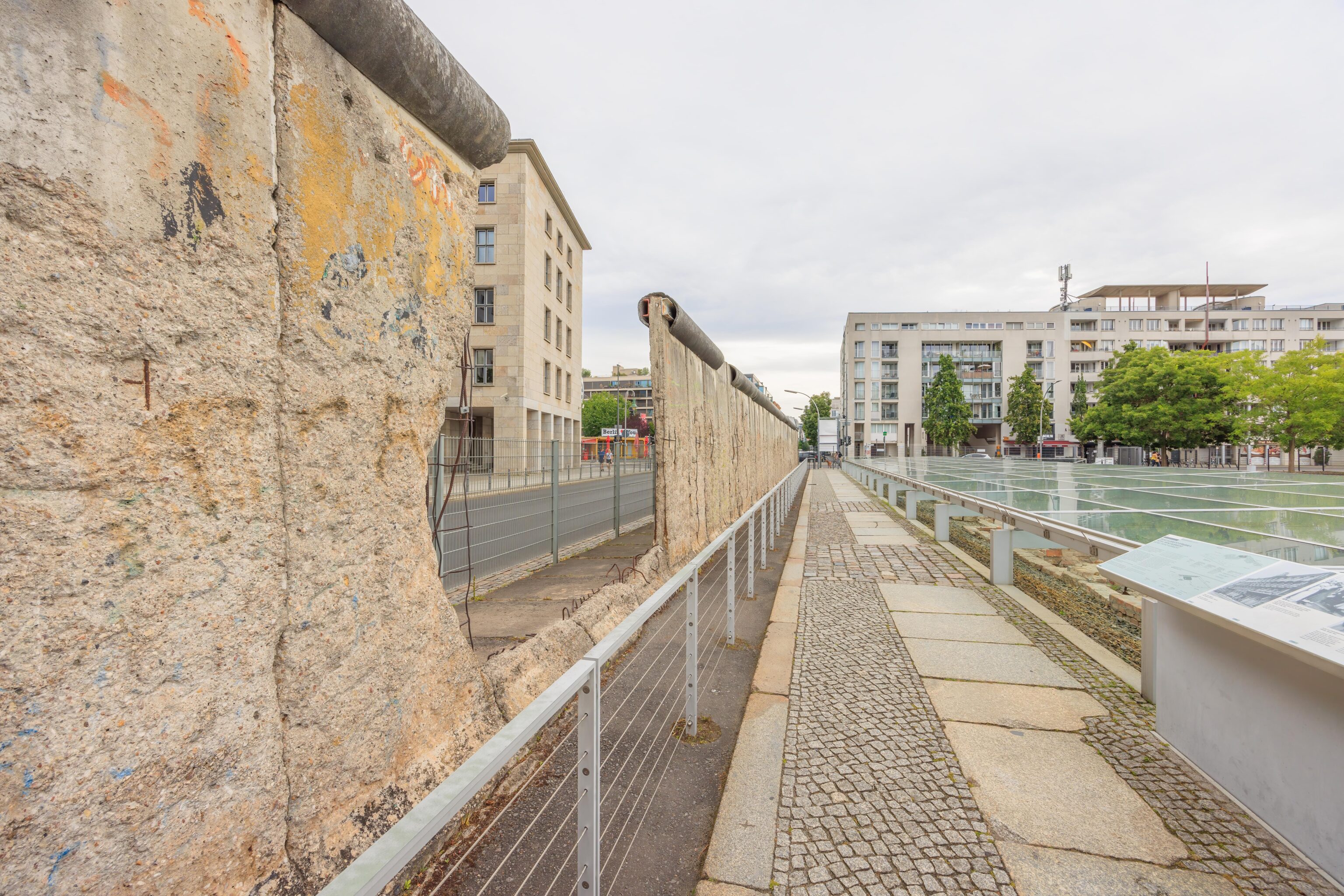
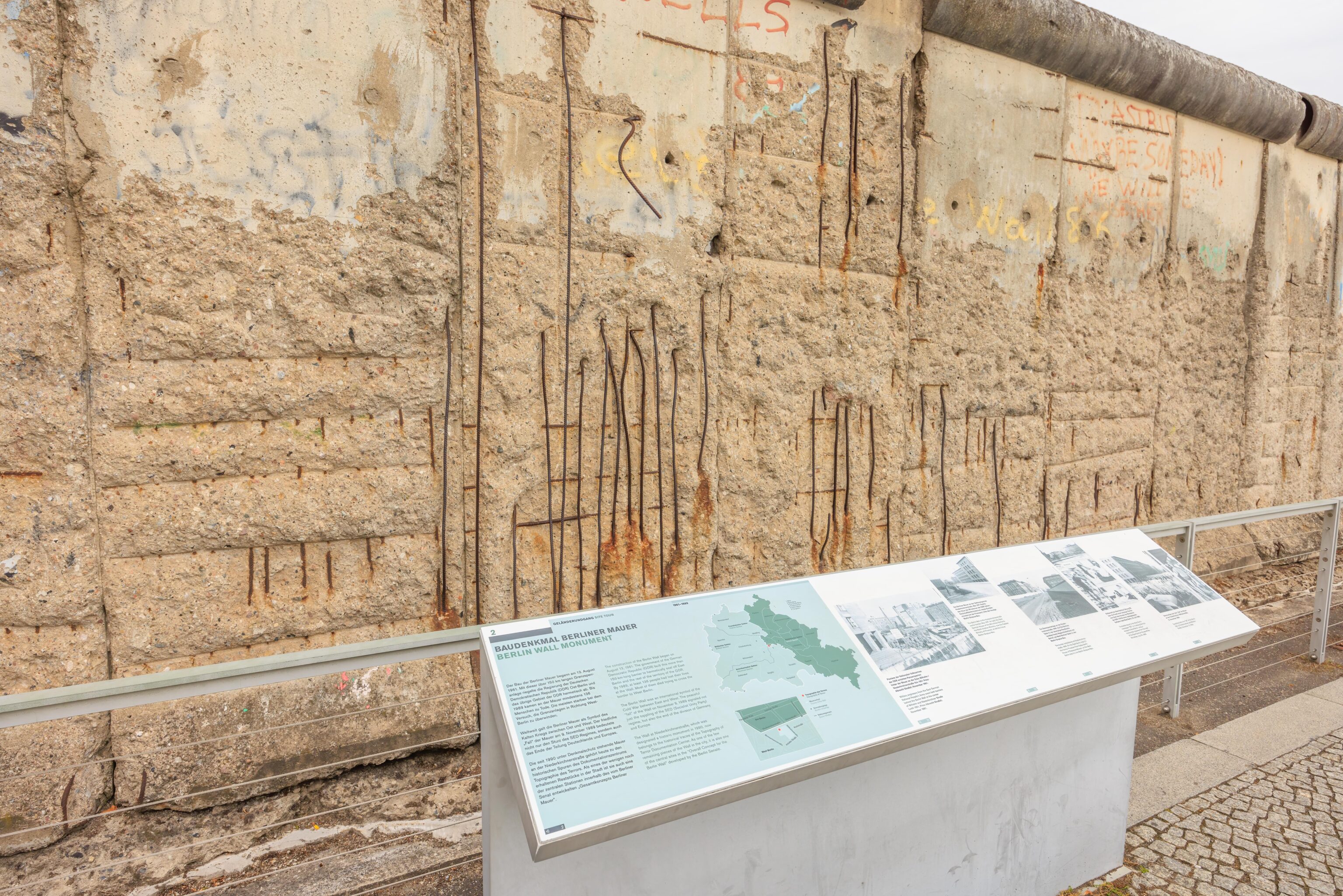
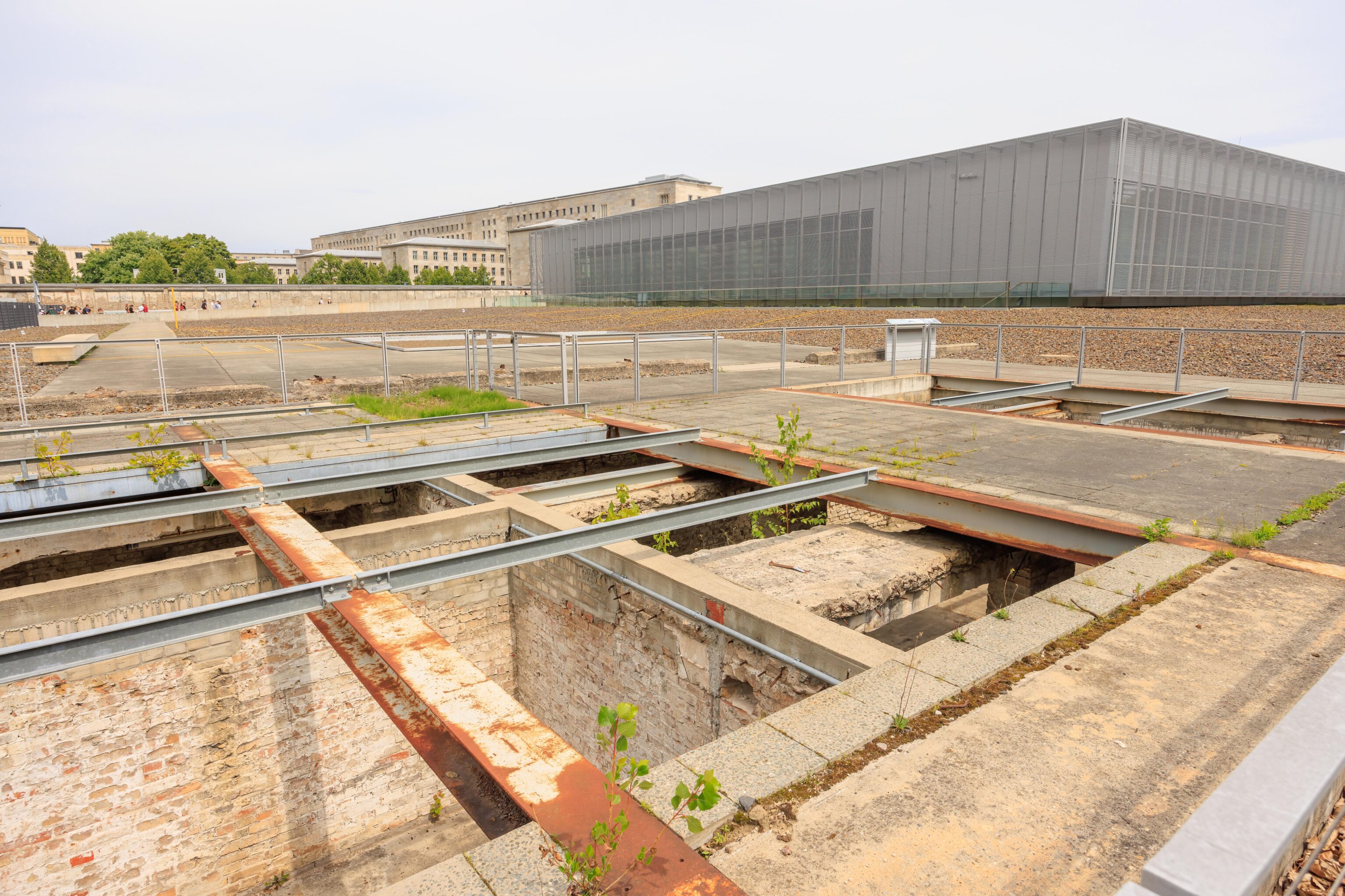
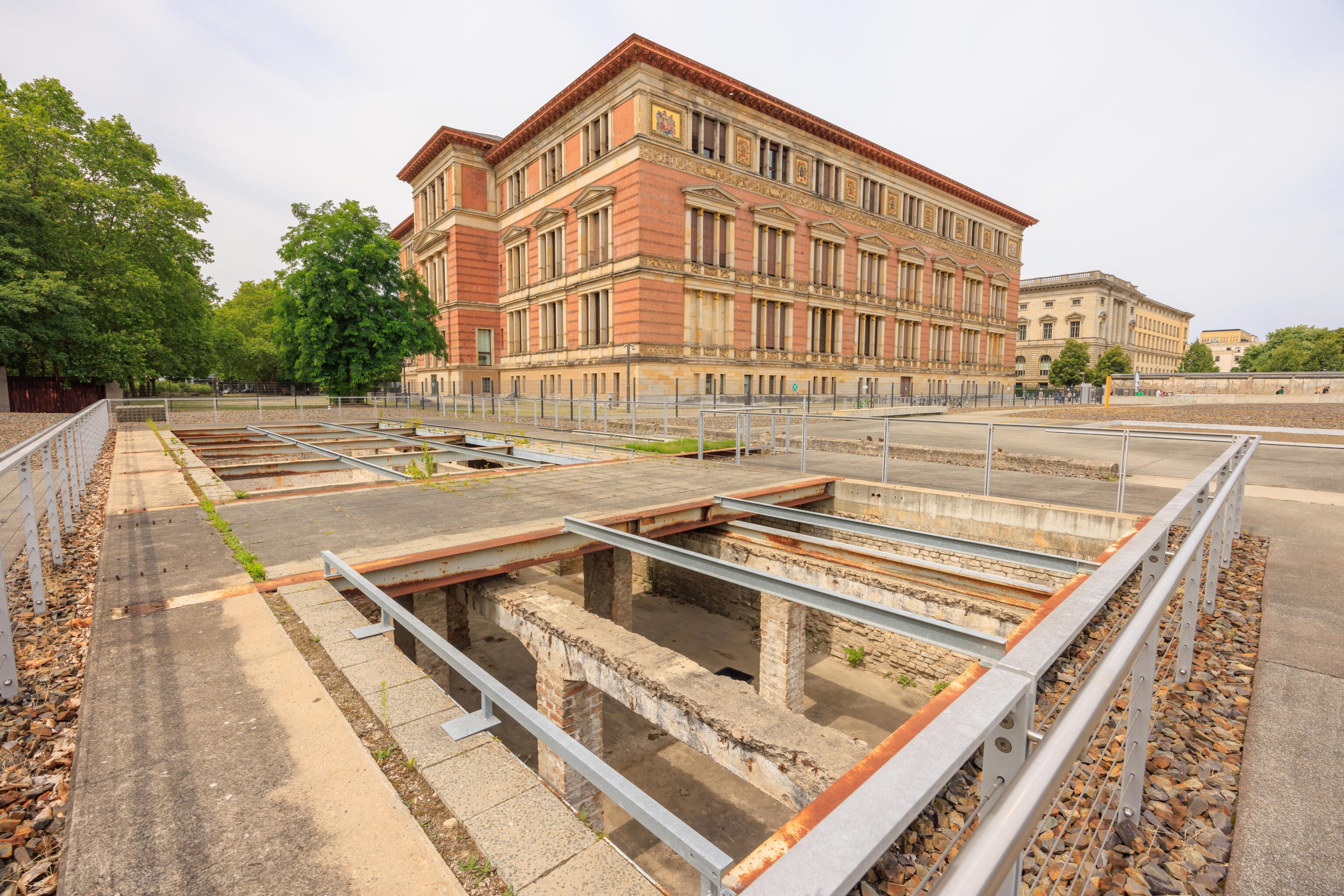
The wall segments are in varying condition. Some of them are mostly missing and others have large gaps. The rebar within the concrete was exposed in places.
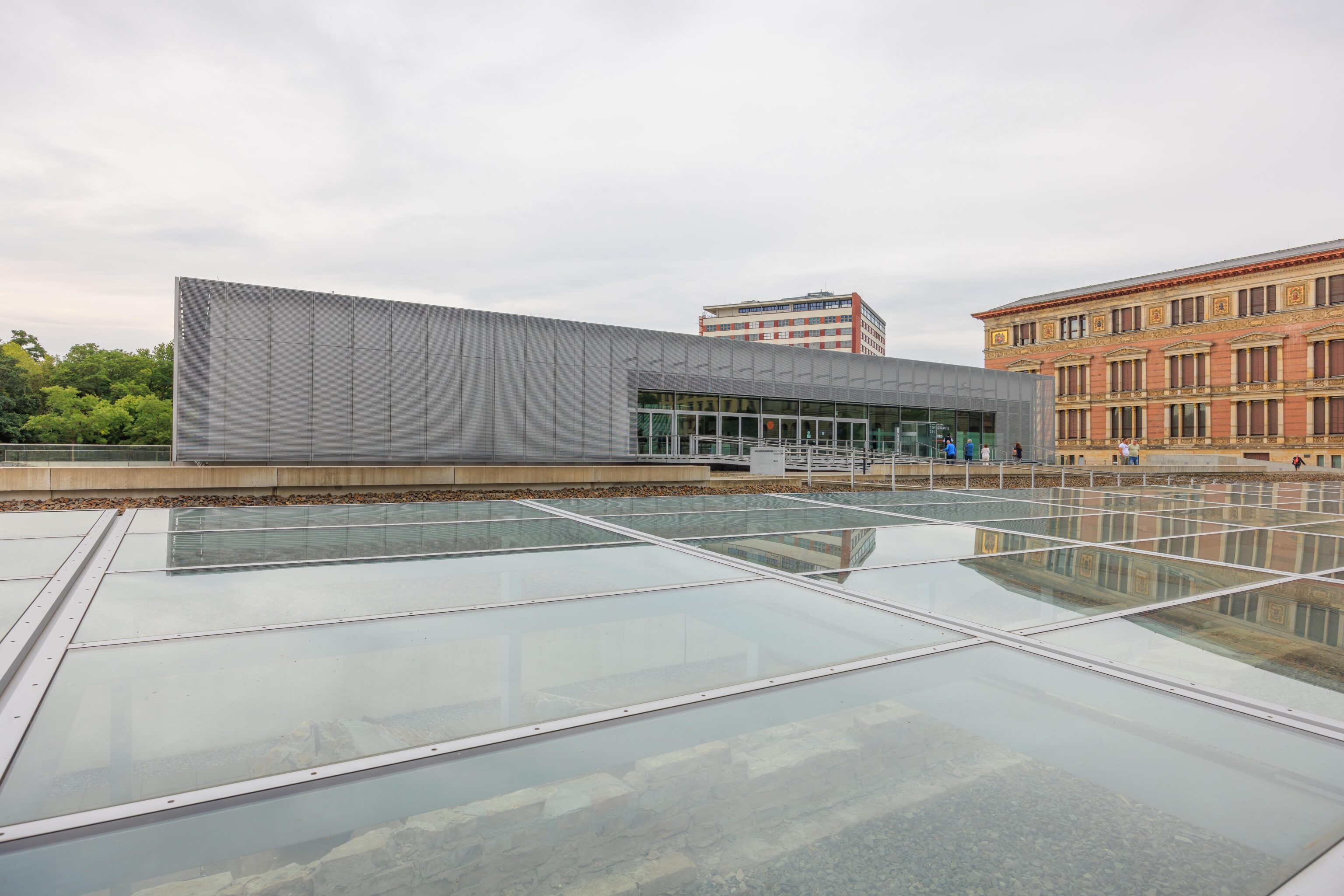
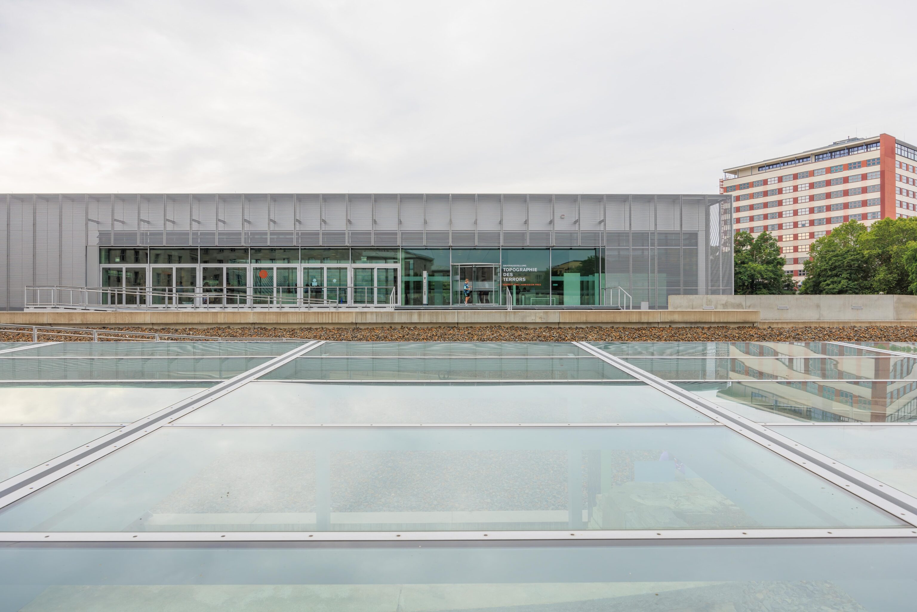
The Documentation Center is housed within the modern building in the background.
Once we reached the west end, we started walking to the east while reading some of the displays. There is quite a lot of text. It would take a long time to read absolutely everything.
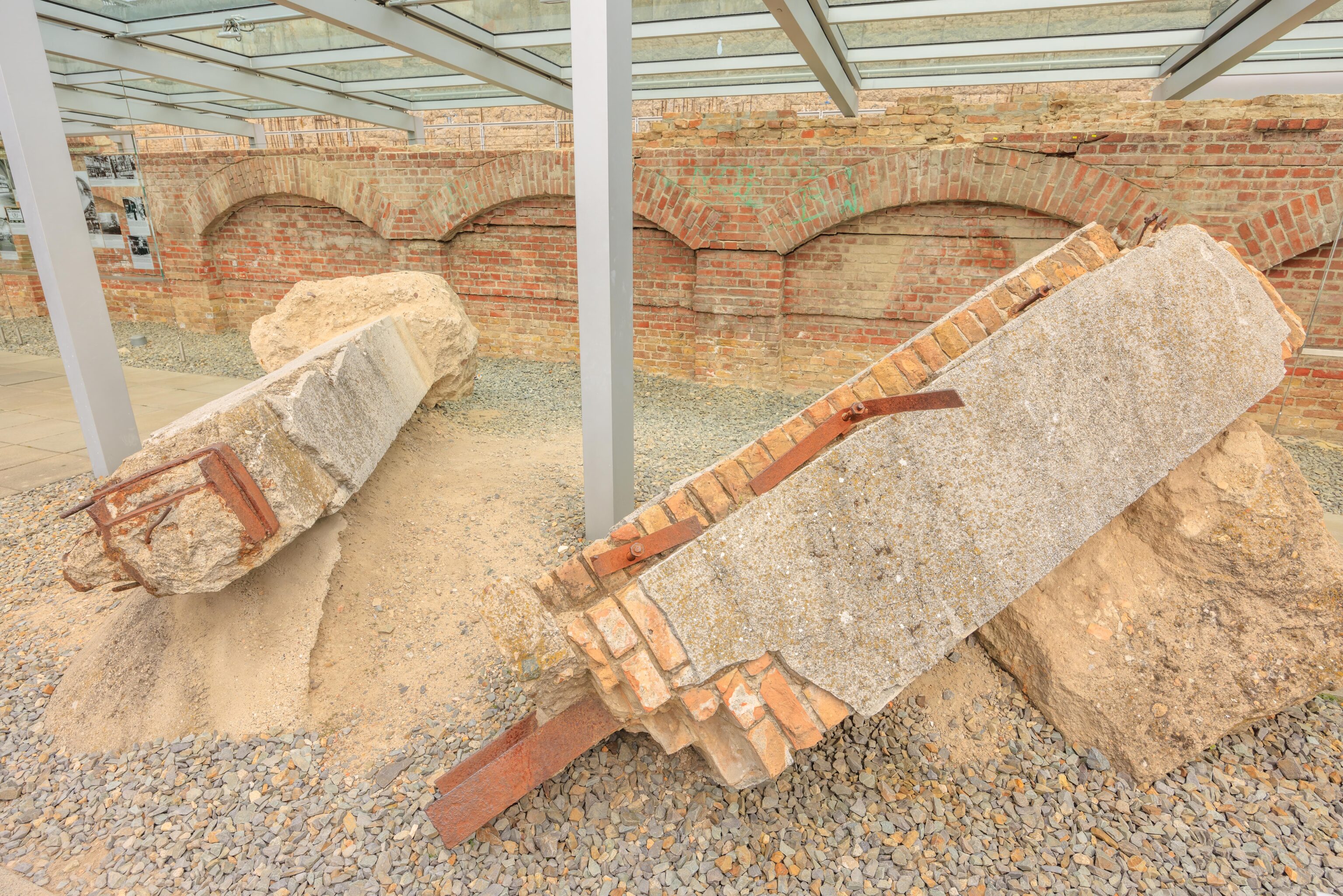
These pieces of rubble are remnants of the entrance into the Gestapo headquarters which was located here. We ended up spending a bit more than an hour walking through and reading the displays.
Some Internet sources refer to the section that we walked through as the exhibition trench. The Wikipedia article about this site briefly mentions that the trench was a former cellar. A map on one of the panels indicates that this would have been the SS Main Office. Before the Nazis rose to power, the building that stood here may have been the Hotel Prinz Albrecht, originally the Hotel Römerbad (Roman Bath). The sign that we photographed only identifies the building functions during the war.
After reaching the east end, we backtracked to head to the Documentation Center. We didn’t photograph anything in the building as it is essentially a huge number of very detailed displays. The trench outside is essentially an overview of the material contained within the building. It would be quite an undertaking to read absolutely everything.
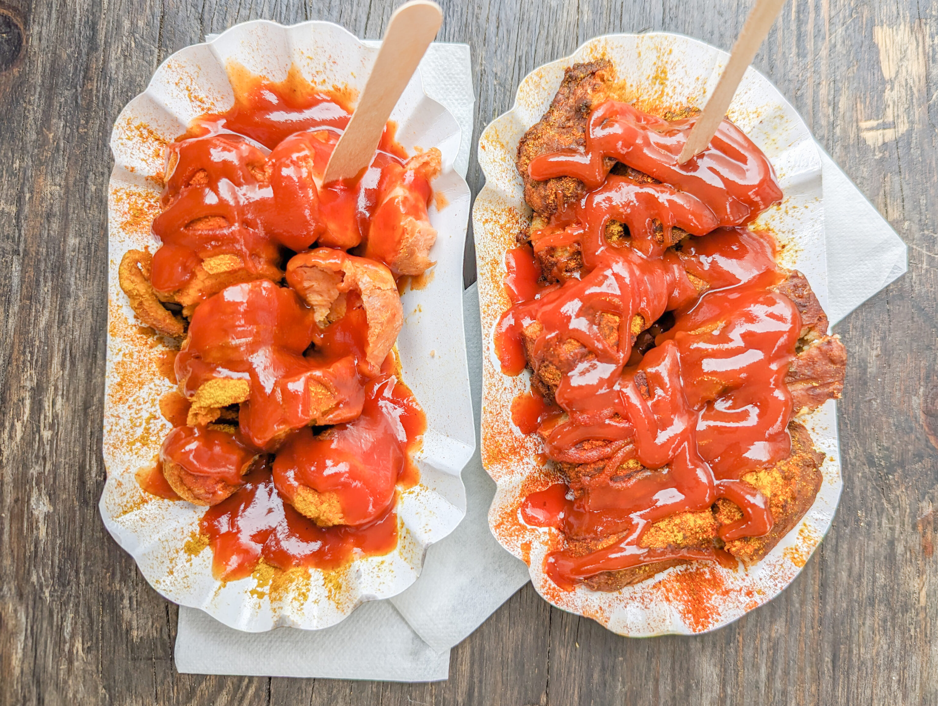
We skimmed through some of the panels but there was just too much to read. It was almost noon so we decided to get lunch. But where? There weren’t many options here. It turns out that the super touristy currywurst stand, Curry at the Wall, actually has decent reviews on Google Maps!
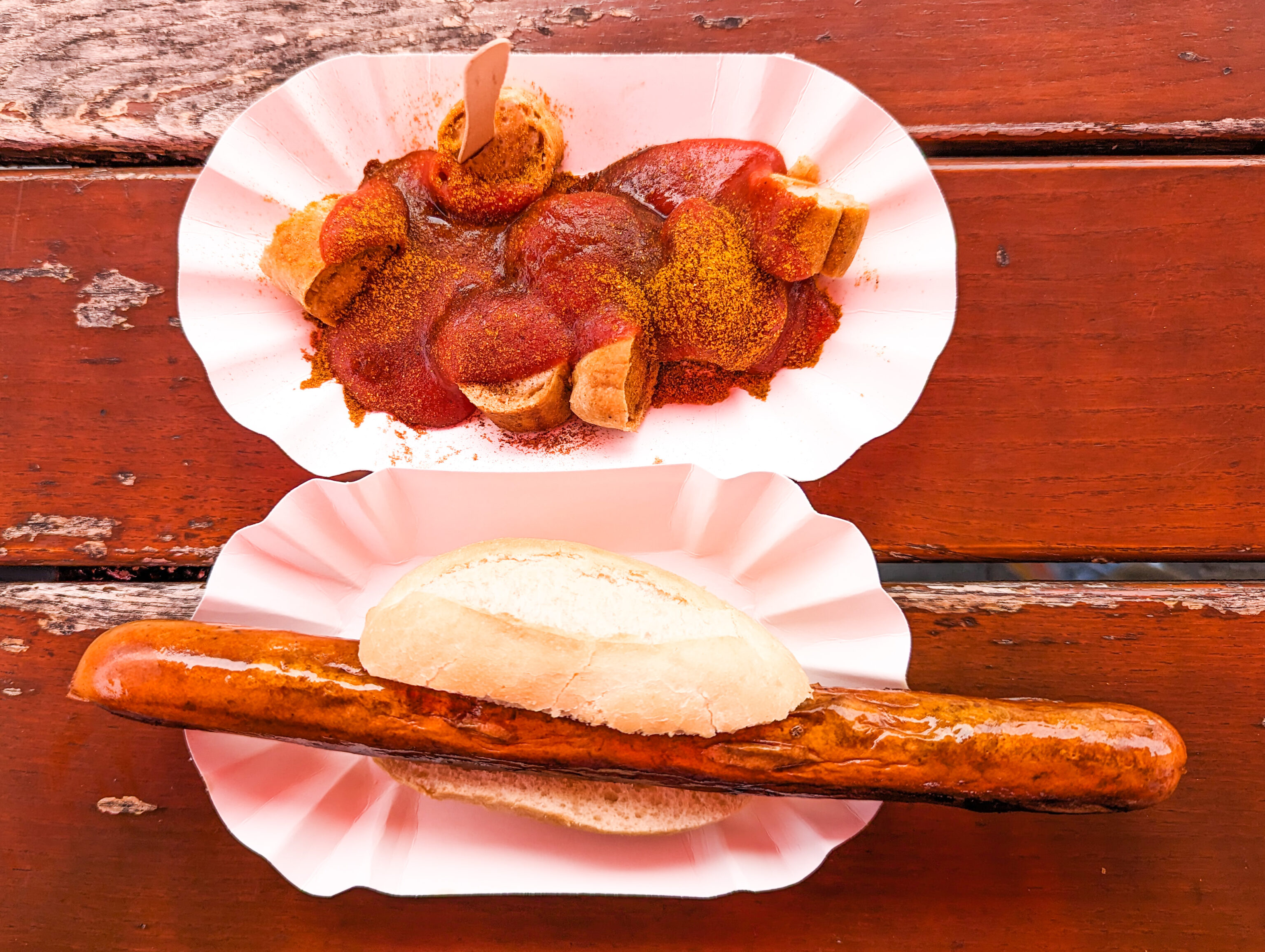
We ended up getting a currywurst and a bratwurst. Both were good and the currywurst was particularly saucy! We didn’t order too much as this was really intended to be a snack before moving on.
We walked back through the Topography of Terror site, hoping to end up at the southwest corner where we saw a parking lot on the map. However, it turns out that it is not actually possible to go that way as the parking lot was unrelated to the memorial site. We ended up looping around the back of the Documentation Center building to end up on its west side.
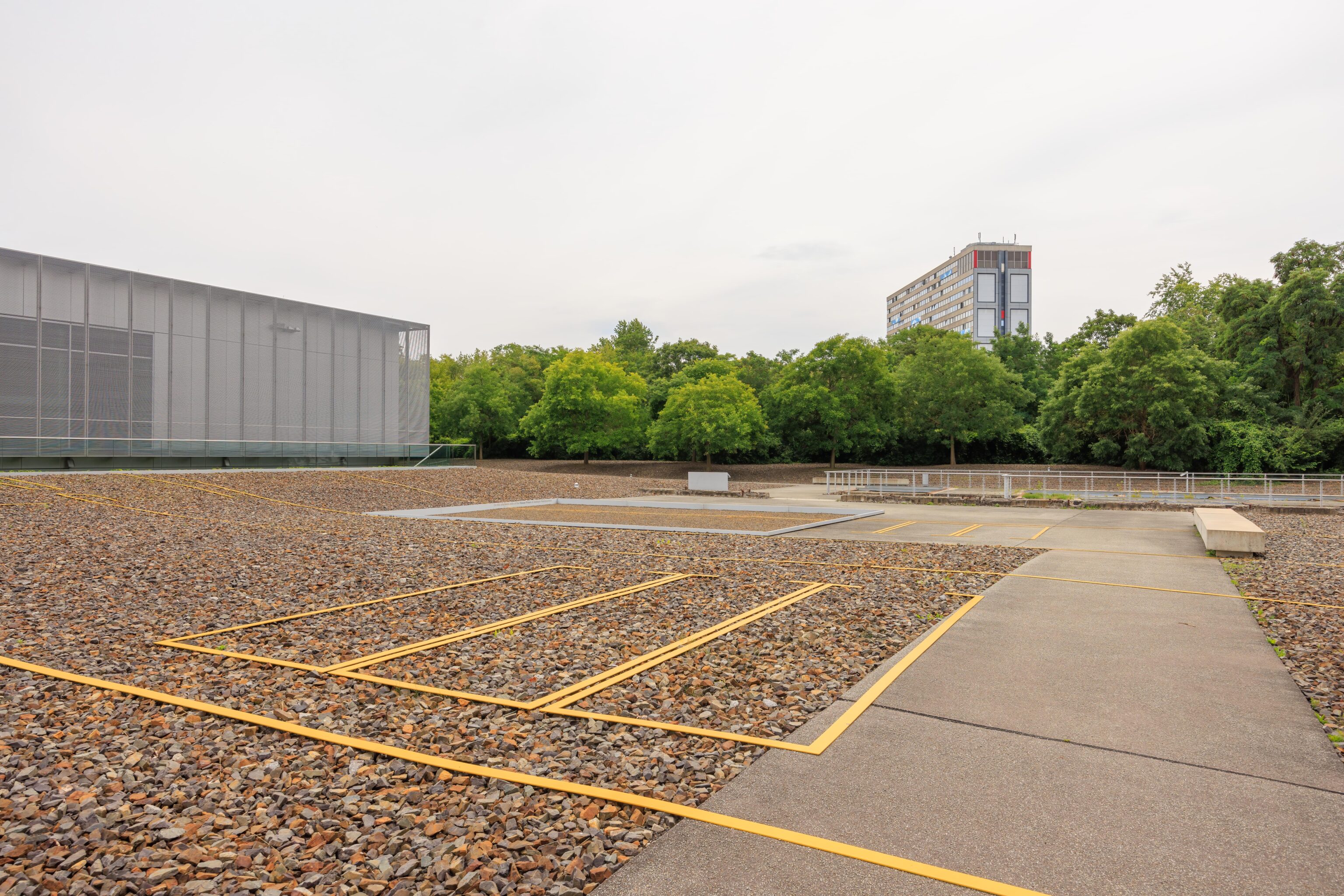
While the German signs are often very detailed, they can be rather confusing. The yellow lines marked on the ground appear to be the outline of cells in the Gestapo prison that was once here at this spot. It was excavated and filled back in.
Are these, which are adjacent to the yellow lines, actual cells that were excavated and preserved? There is a map which seems to indicate that something different was here.
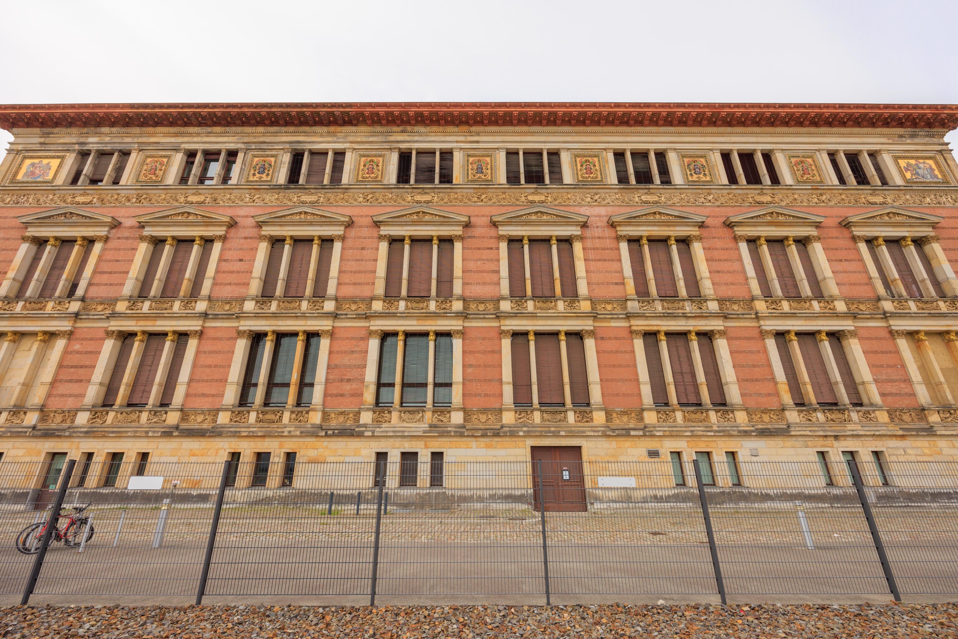
This fancy building is the Martin-Gropius-Bau, opened in 1891 as the Museum of Applied Arts. It is currently used as an art exhibition space.
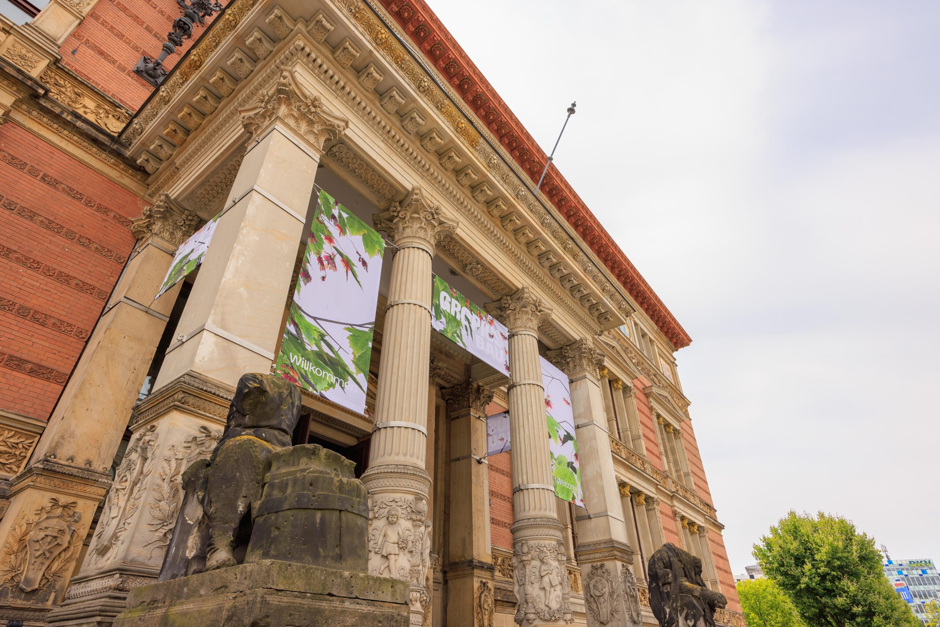
The front entrance has some headless statues. The building has some fine detailing!
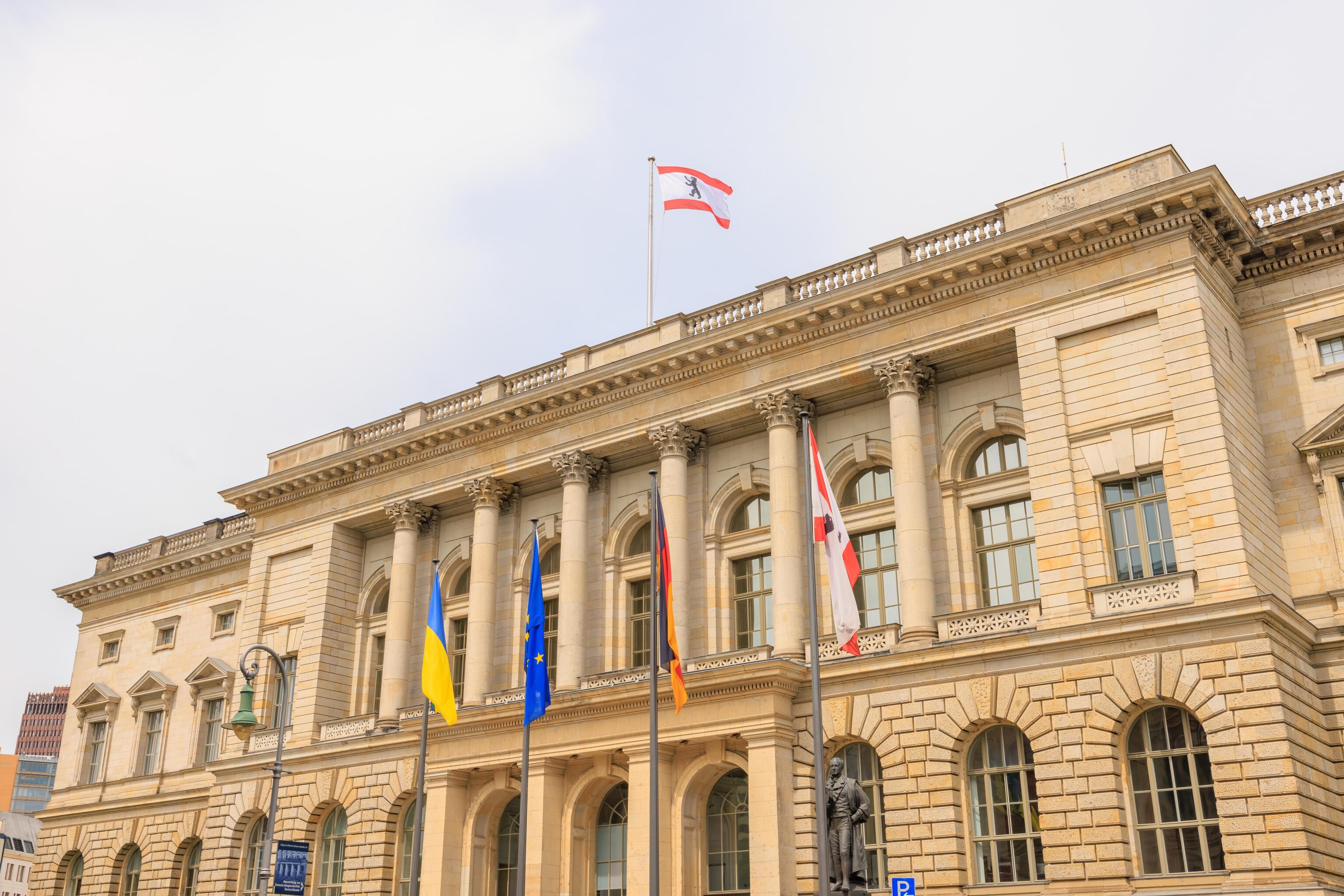
The building across the street contains the Berlin State Parliament as Berlin is a city at the state level. The building originally housed the Prussian House of Representatives, though the official Berlin website’s page about the building seems to imply differently.
Due to our navigational error with the parking lot, we ended up in proximity to a wurst stand, Wurstbar Berlin.
We had another lunch snack. We decided to get a currywurst and a currybulette. The bulette was new to us, it was like a briefly fried wurst patty, though cut into pieces. Everything was good here too, and with seemingly larger portions than the previous place. Something happened with the pricing here which could have been a mistake or on purpose, no way to know for sure. Anyway, at least we weren’t hungry!
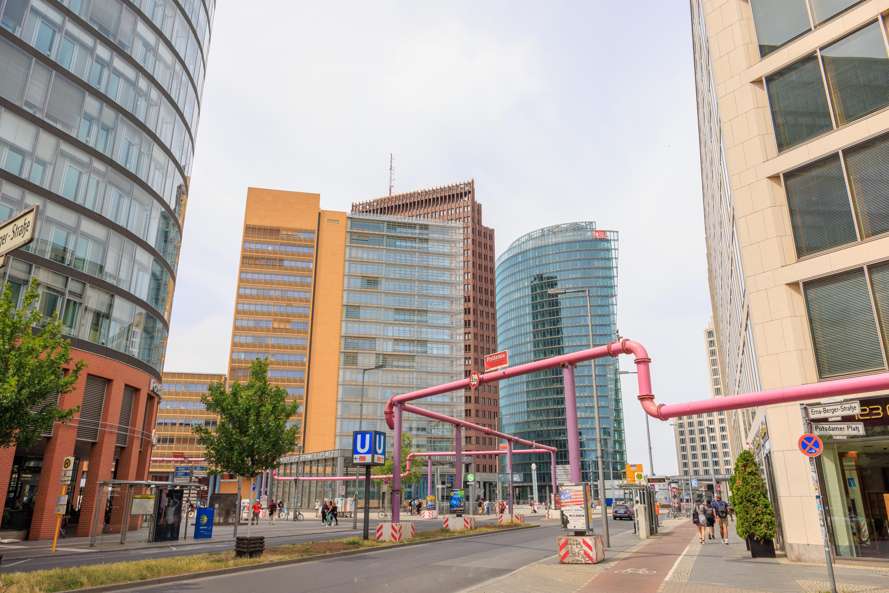
We soon reached Potsdamer Platz‘s S and U-Bahn station. Our original plan was to take the S-Bahn up to the Nordbanhof (North Station). There was some issue with the S-Bahn and the trains were all going out of service upon arrival at Potsdamer Platz. It wasn’t clear what was happening so we ended up taking a non-stop bus to the Hauptbahnhof where we caught a tram to the Nordbanhof.
Berlin Wall Memorial
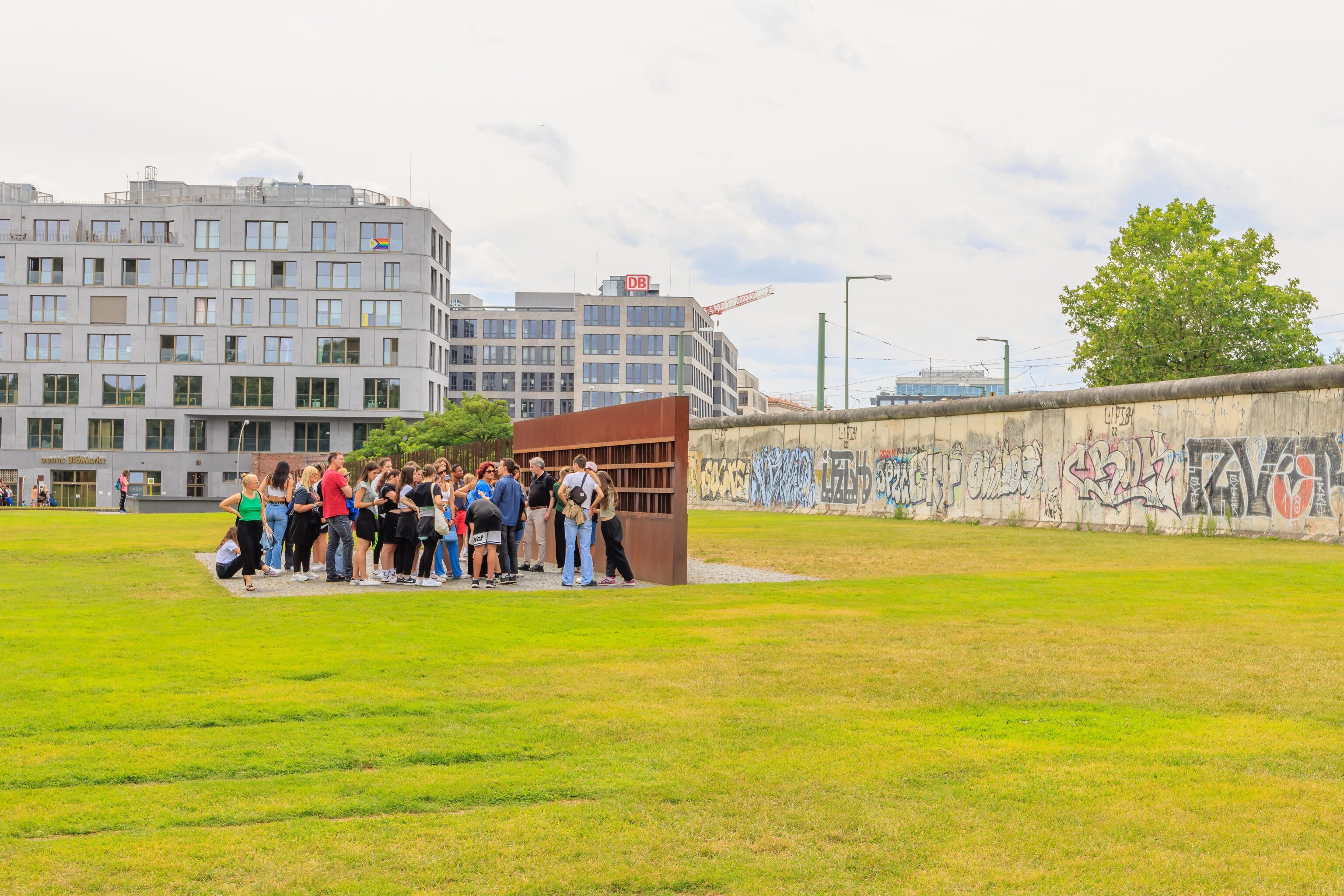
After finally arriving at the Nordbanhof significantly later than we hoped, we walked to the adjacent start of the Berlin Wall Memorial. This 1.5km section of park contains various wall segments and informational displays.
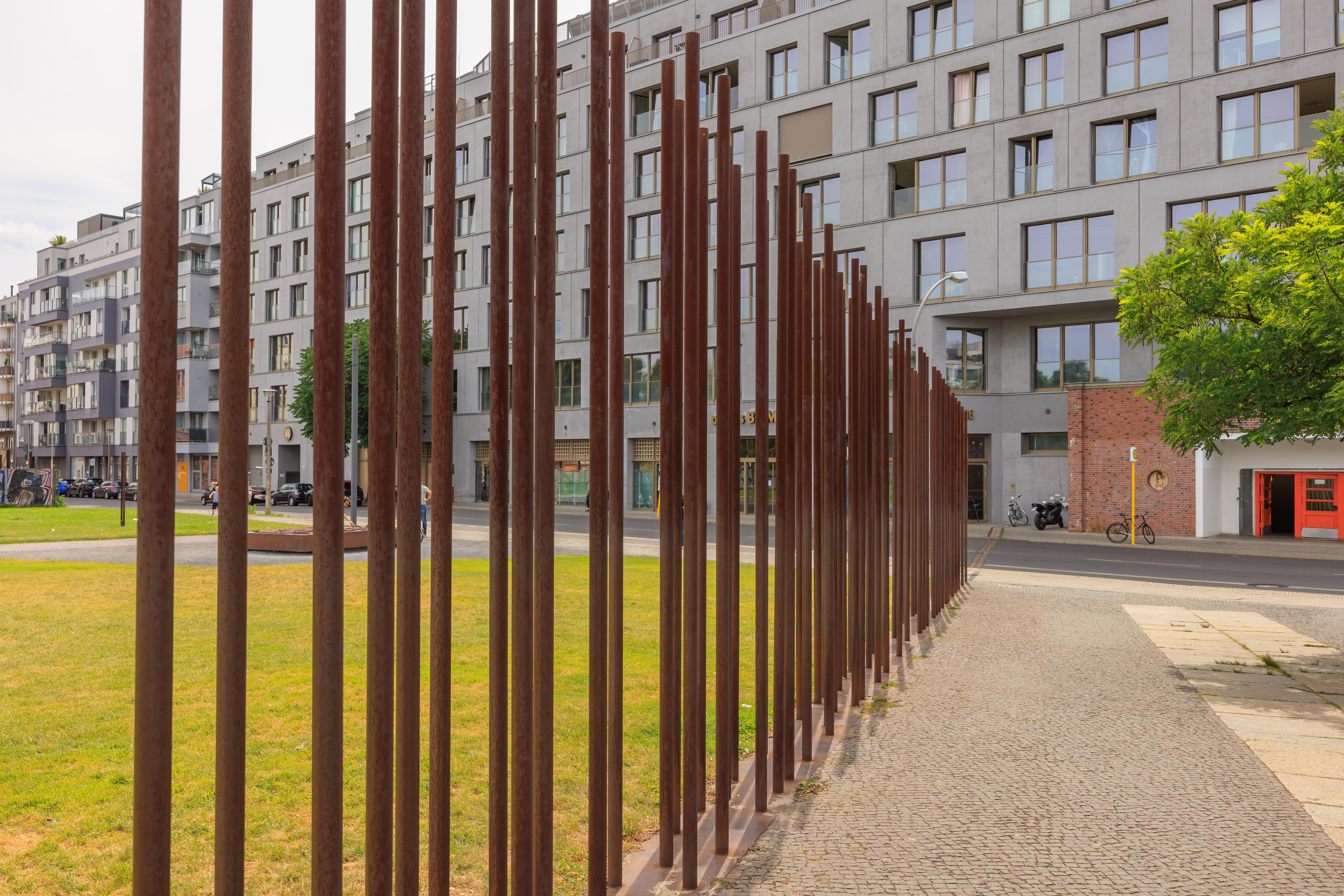
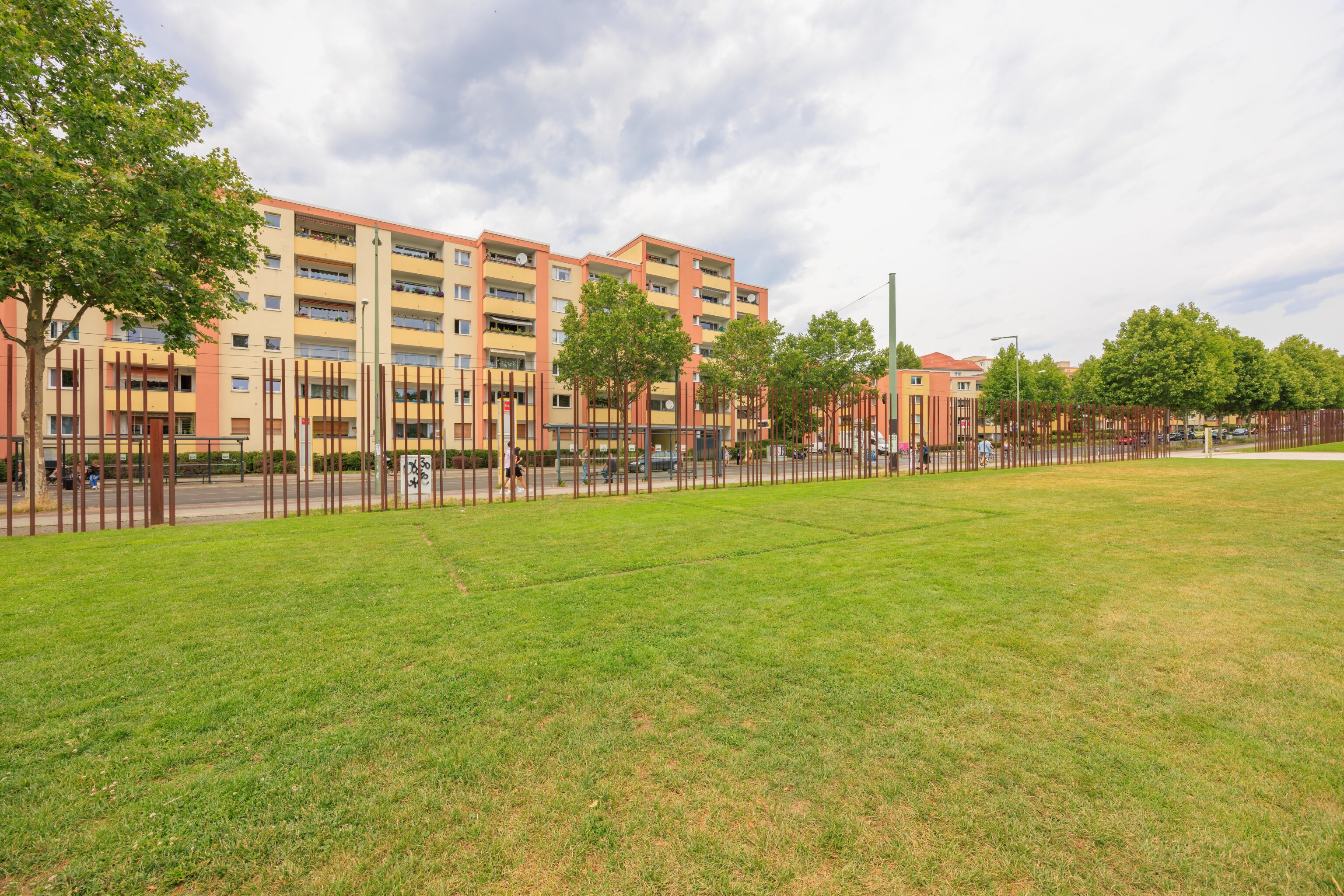
In some places, the location of the wall is indicated by these metal posts.
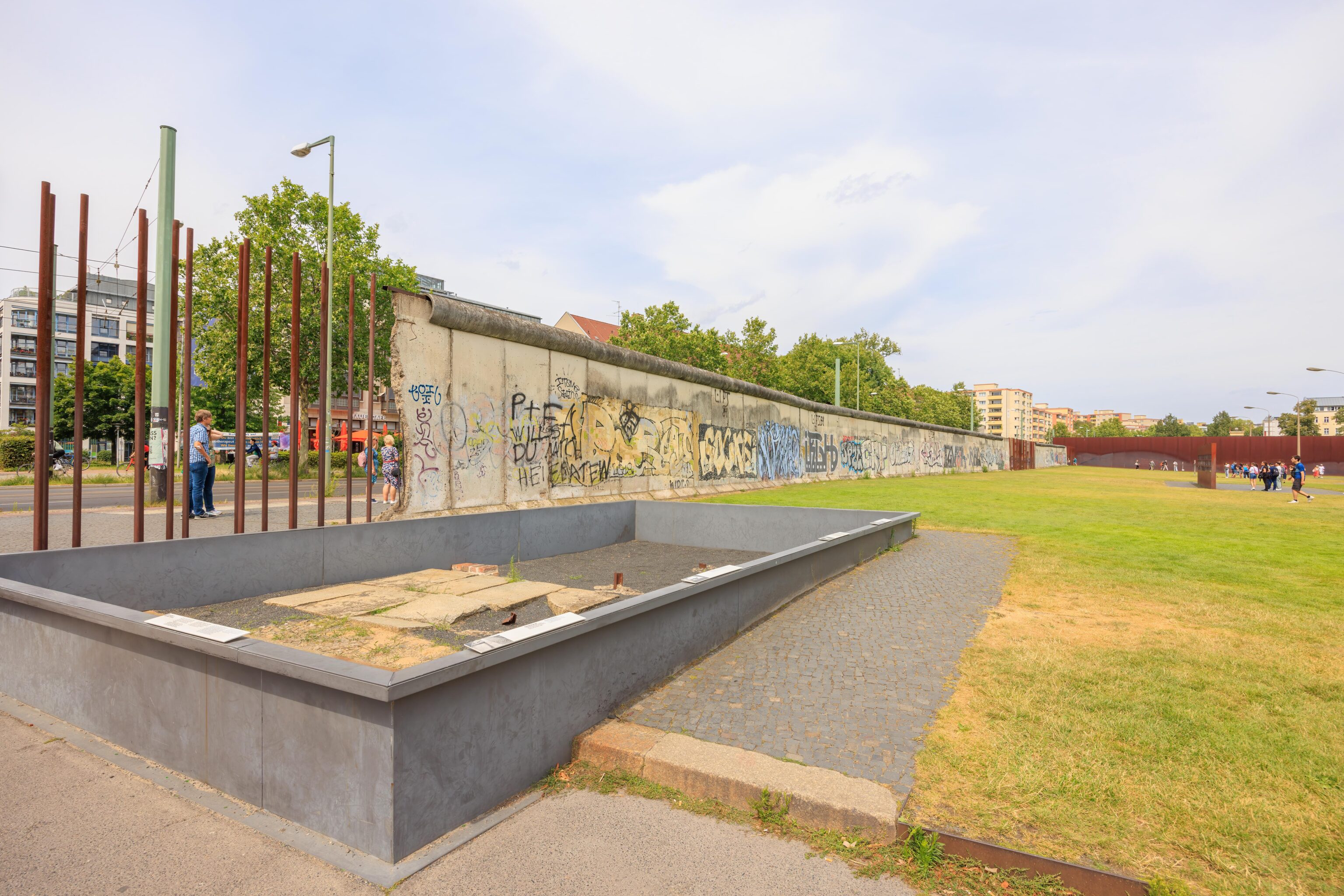
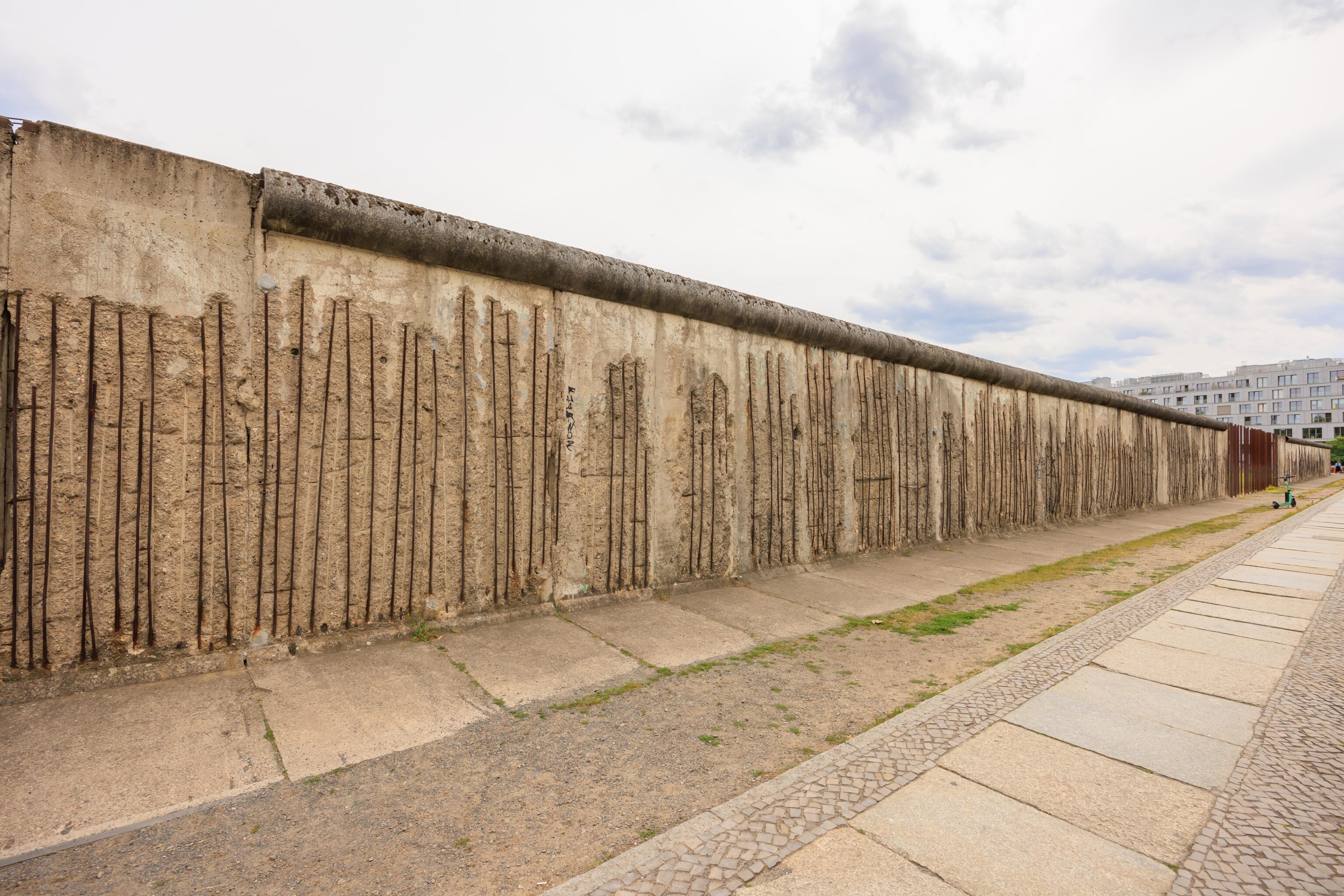
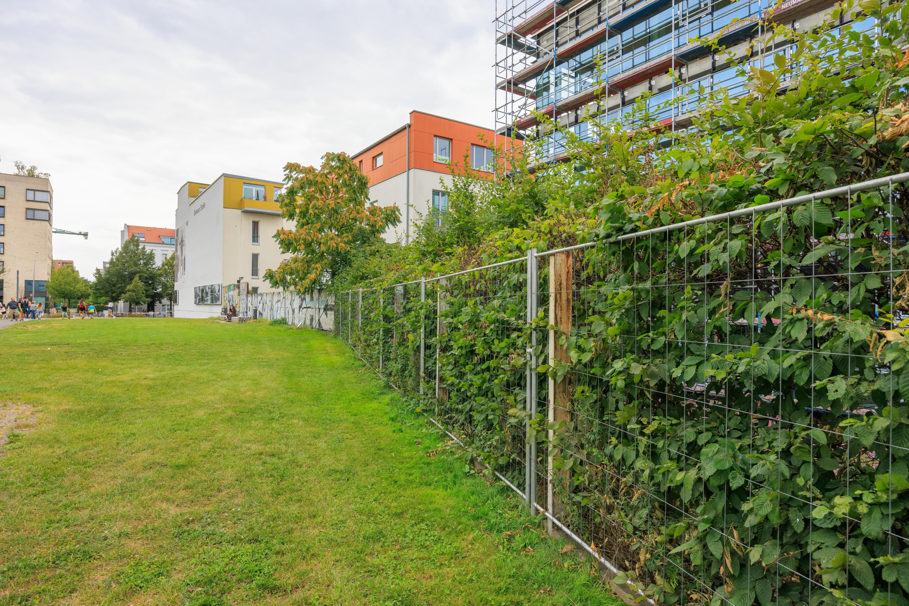
Long sections of the wall are still present. In this area, the wall runs next to Bernauer Straße. The south side was East Berlin while the north side, containing the street, was West Berlin.
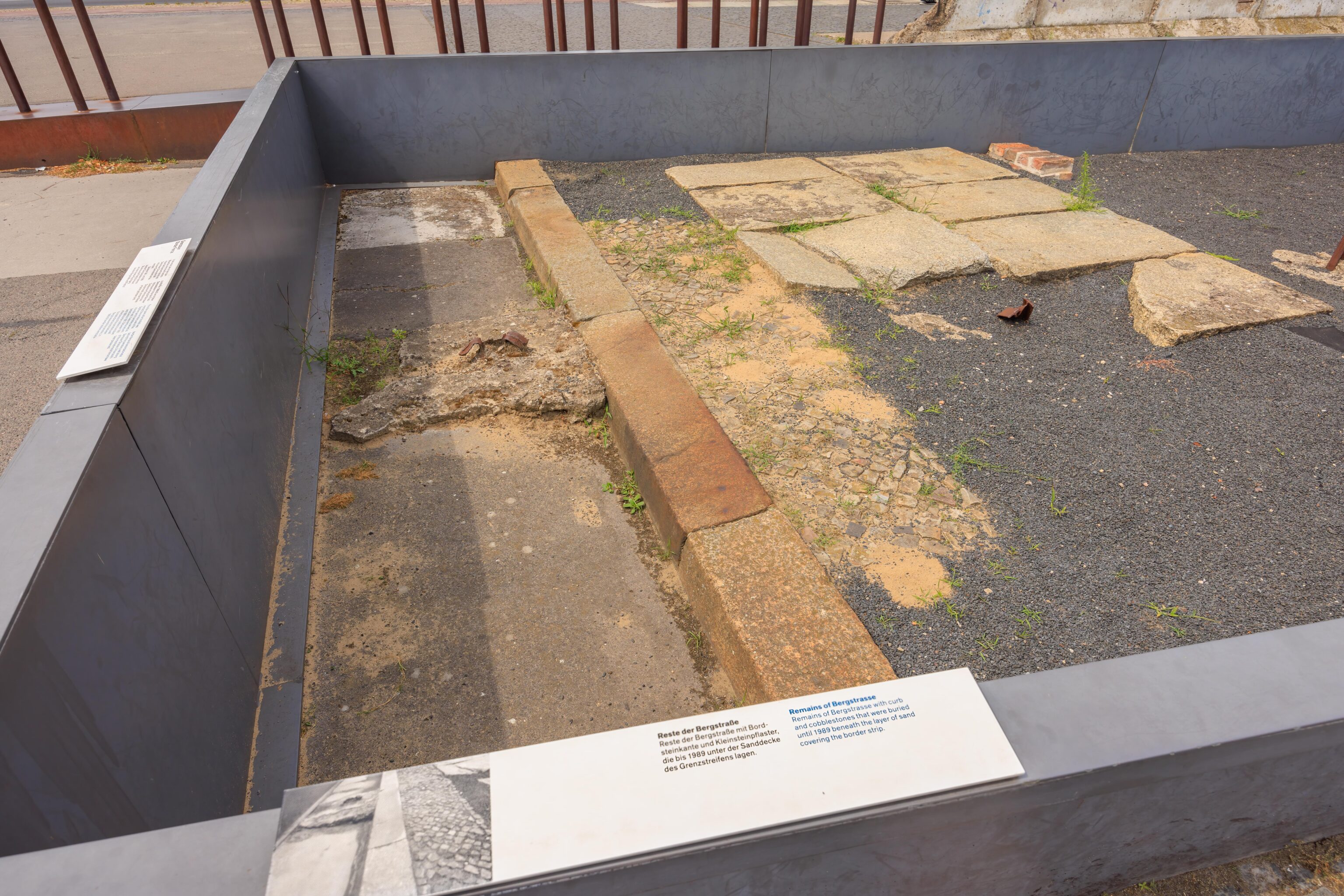
This area contains the preserved section of a curb and adjacent road and sidewalk. It was buried under sand until 1989.
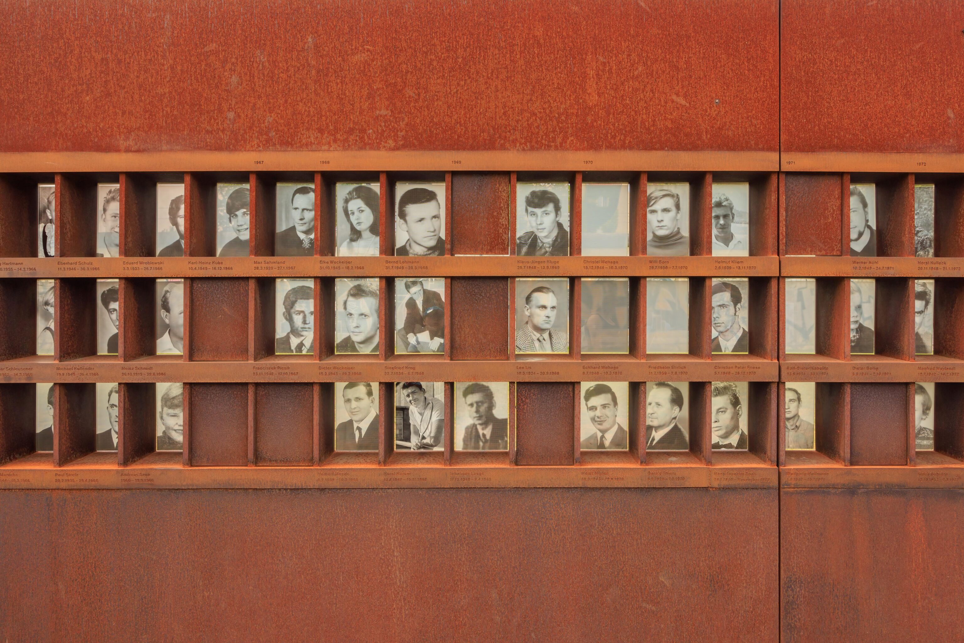
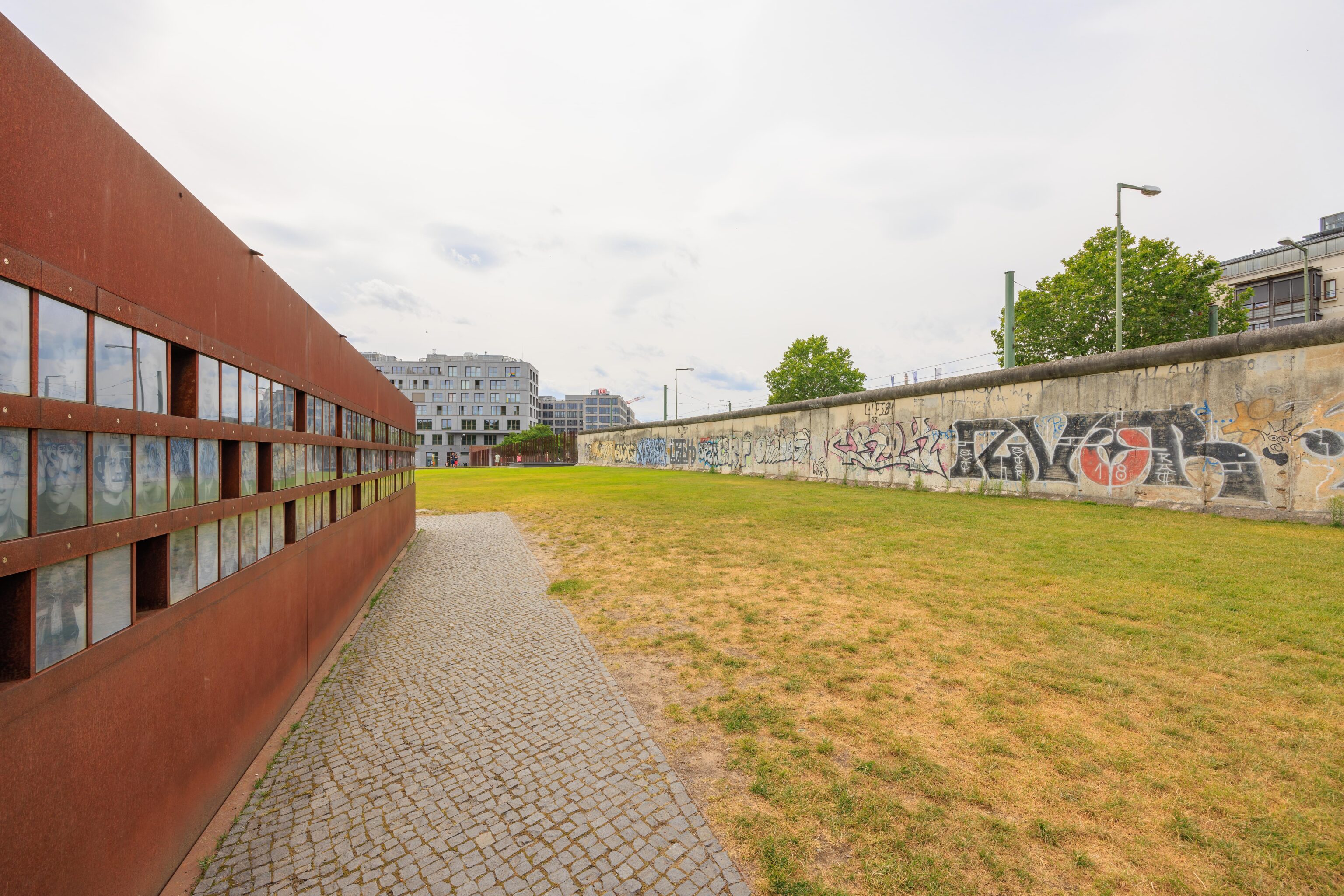
This a section of a memorial to people who died at the Berlin Wall. There are 140 people known to have died. The majority of those deaths were while trying to escape to the West.
There were multiple layers of defenses on the East to keep people in. These wall sections indicate the location of a second inner wall. It wasn’t clear if the wall pieces that are here now were inner wall sections or just outer wall sections placed here for display.
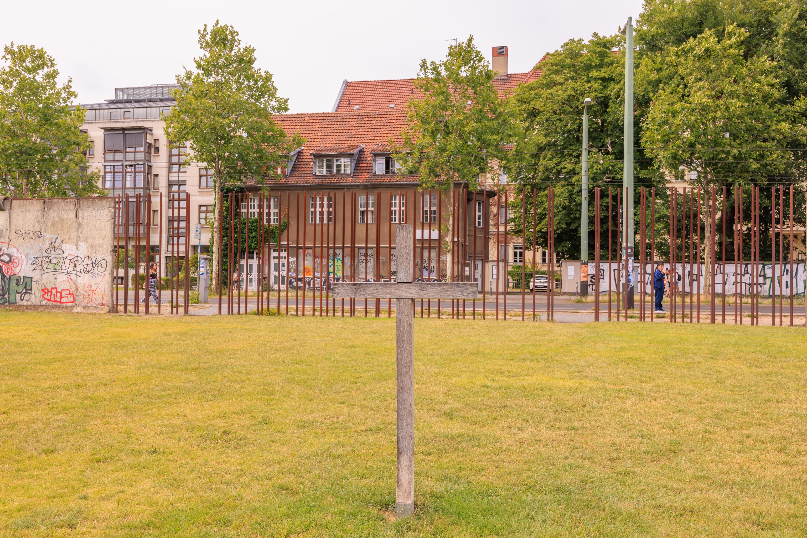
There was originally a church here as well as a graveyard. The graves were moved but there seems to be a belief that some who died during World War II air raids are still here, under the former border. A small sign here reads, in English:
Approximately a thousand graves had to be moved when the border strip was developed. It is, however, possible that the graves of World War II bomb victims were not exhumed and that the border grounds were built over the graves. This cross commemorates them.
There were tour groups of varying sizes in the area, though generally it was never very busy in the park.
A section of the wall as seen from the sidewalk along Bernauer Straße.
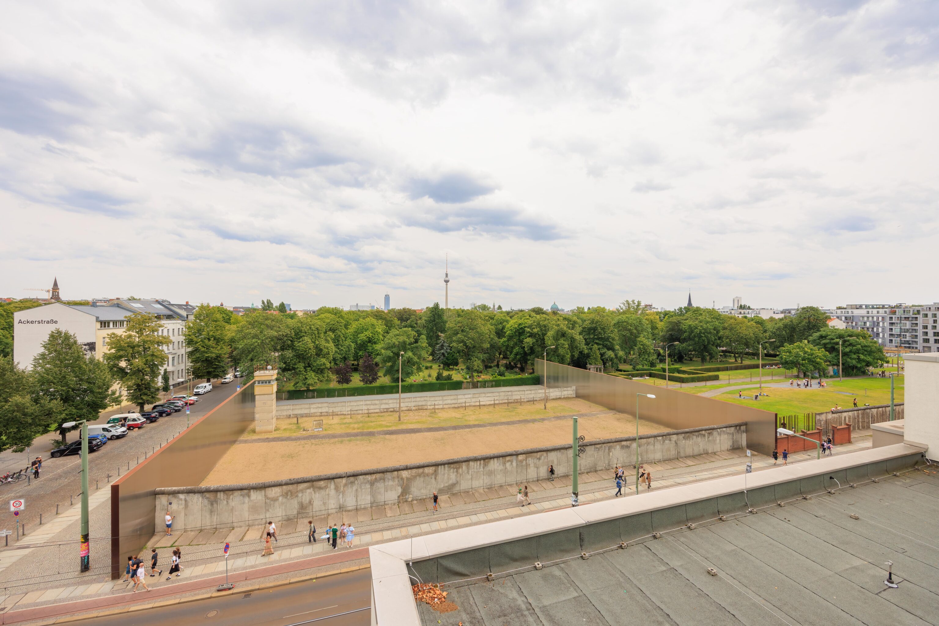
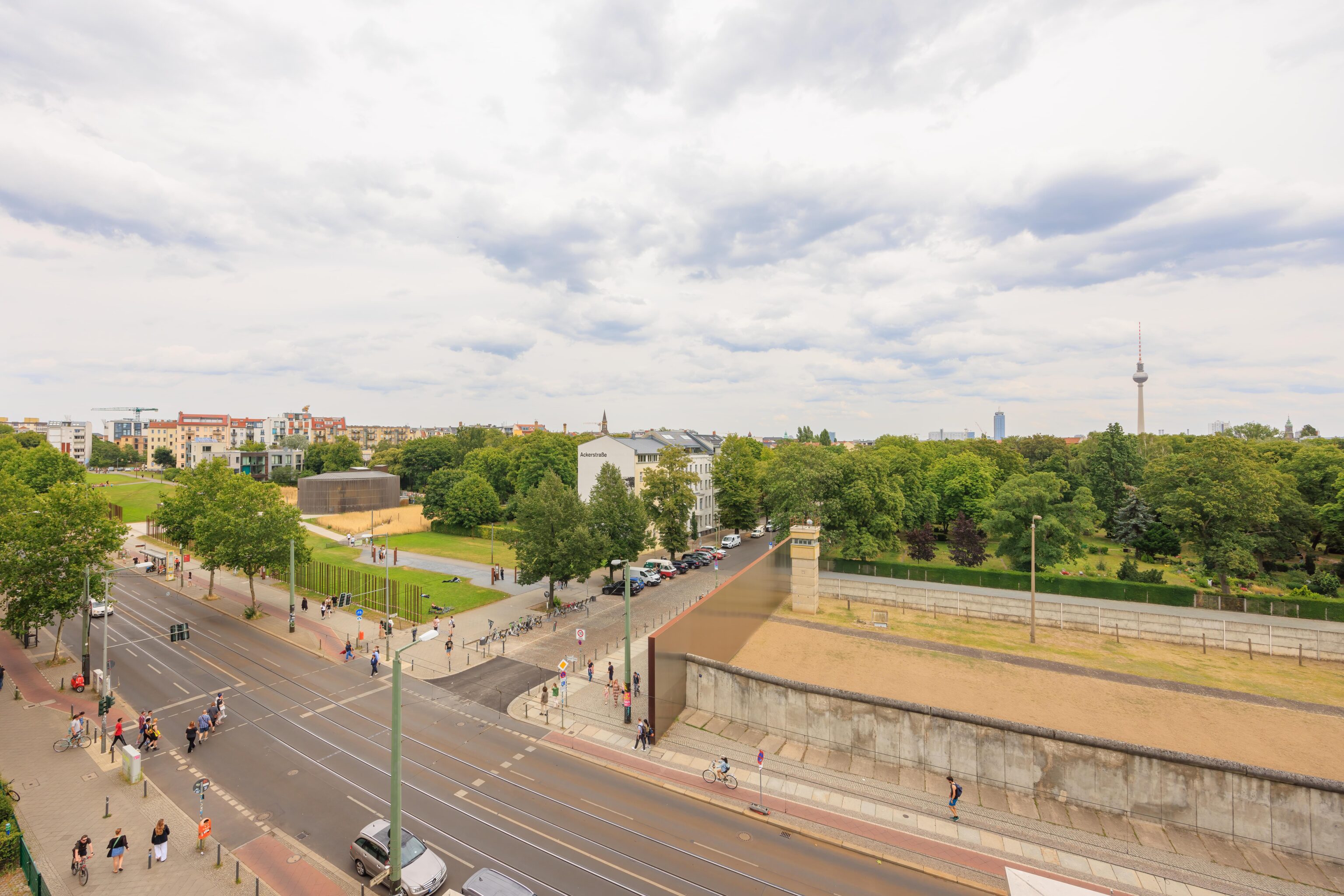
There is a small museum, the Dokumentationszentrum Berliner Mauer (Berlin Wall Documentation Center), at the intersection of Bernauer Straße and Ackerstraße. We noticed its observation platform from afar. The museum hoses some informational displays, again with lots of text. The platform is mounted atop the building and can be accessed via stairs. There is an elevator though it requires staff to open and to use.
The view overlooks Bernauer Straße. There is a section of wall that is blocked off and includes an East Berlin guard tower and what seems to be a portion of inner wall. Presumably, the border looked something like this?
We continued walking east through the park.
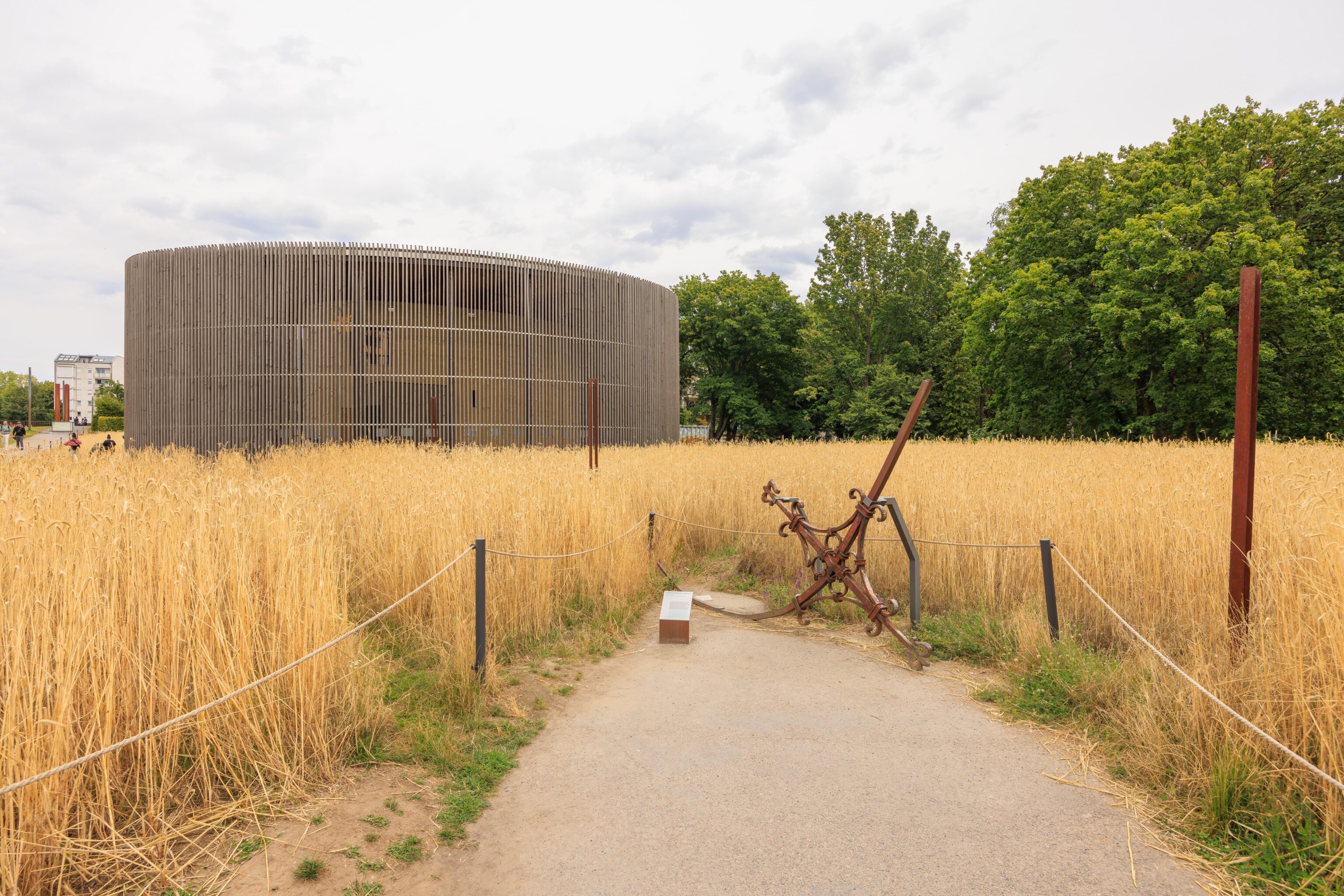
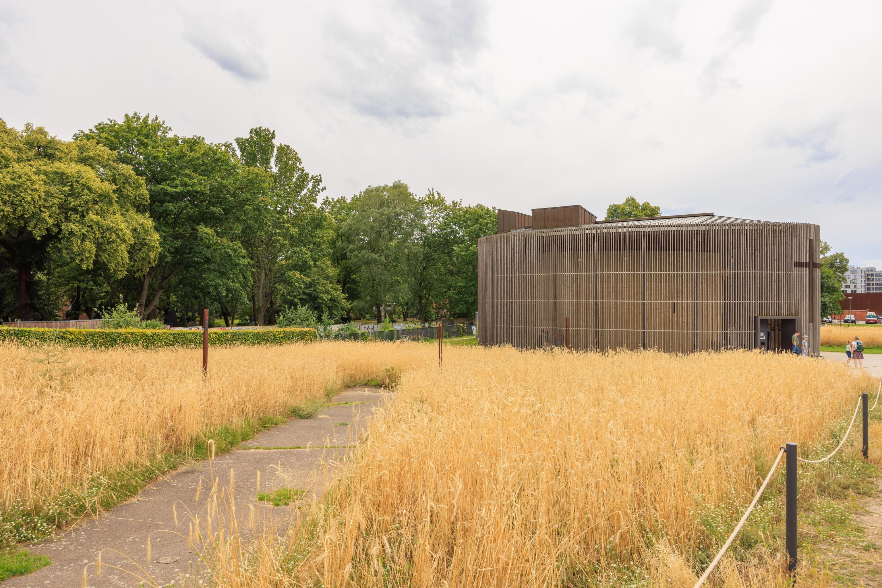
We eventually reached this building in a field of rye. A small sign explains the rye field:
This rye field was initiated 2005 as an art event by the Protestant Reconciliation Parish together with Michael Spengler / Atelier Denkwerk. It is maintained under the metaphor "Where it is possible to sow, there is peace." The field is monitored scientifically, and therefore services also as a sing of transience of the former border strip into a commemorative space.
Another small sign at the end of the path explains the item on the ground:
The SED leadership had the Reconciliation Church blown up in January 1985. During the demolition of the church tower on January 28, this cross broke off the spire. Cemetery workers preserved it secretly beyond 1989. On the Day of Repentance in 1995, the cross that had been bent out of shape during the demolition was returned to the parish.
The SED was the Socialist Unity Party of Germany, the East German communist party and the only party in East Germany. Basically, the East German government.
There were various informational signs that told the story of the church. There is a German Wikipedia article about the original structure. The first paragraph of the article reads (translated via Google Translate):
The Church of Reconciliation was a Protestant church located at Bernauer Strasse 4 in the Mitte district of Berlin. It was built in 1892 and blown up in 1985 at the instigation of the GDR government.
The building in the background here is a chapel built upon the former location of the church.
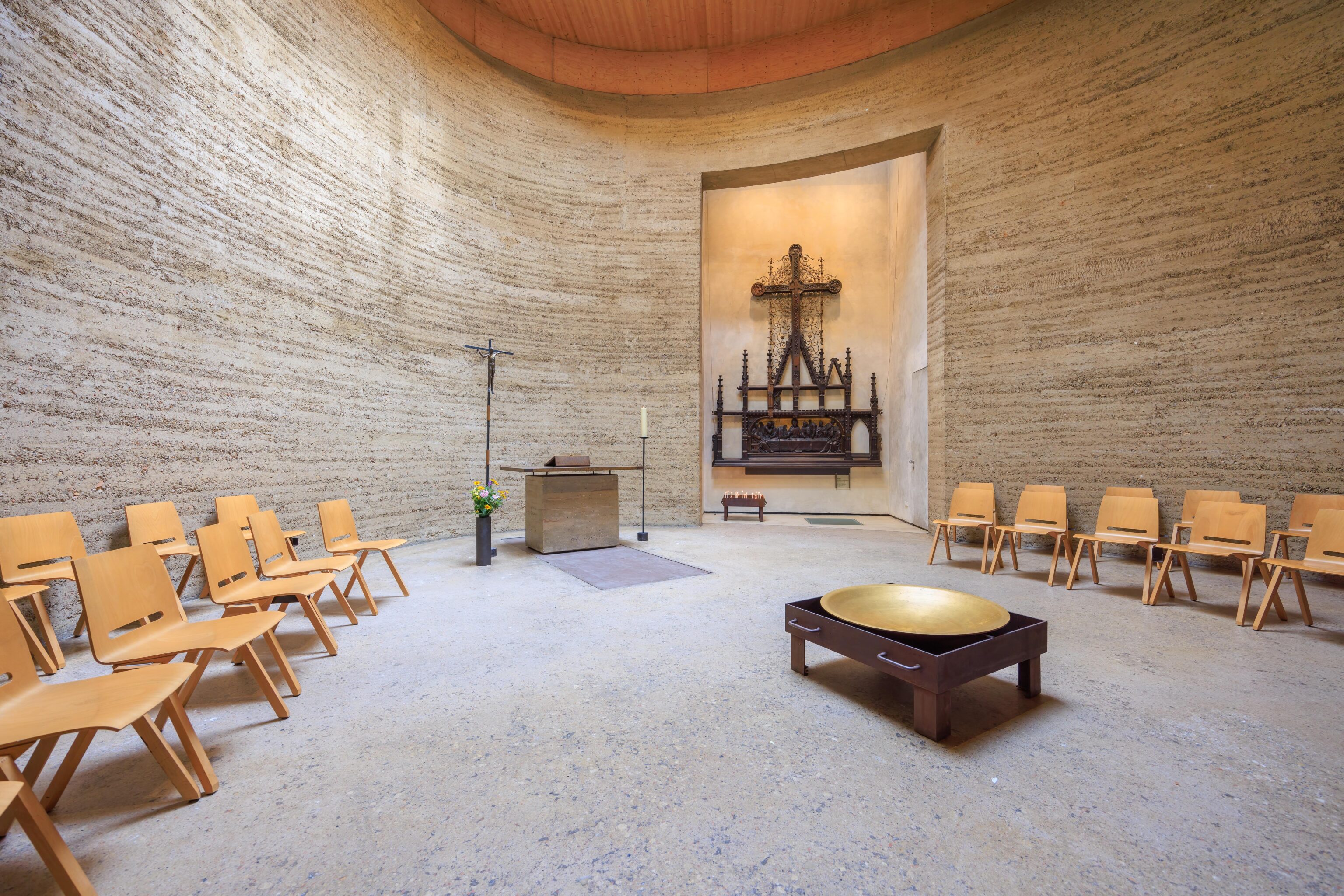
The chapel is more or less a single circular room. It is actually an earthen building rather than concrete.
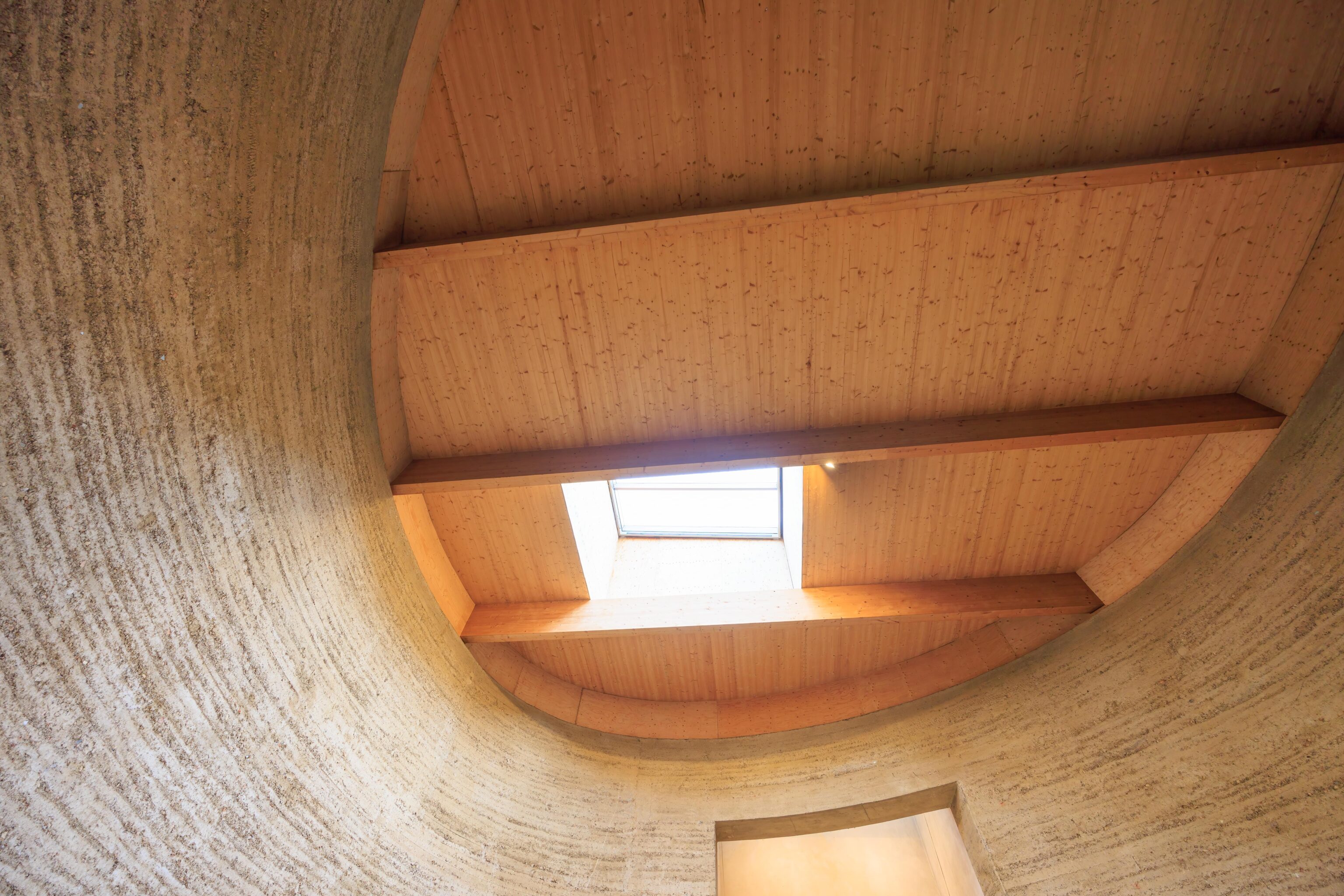
The ceiling is wood with a single skylight.
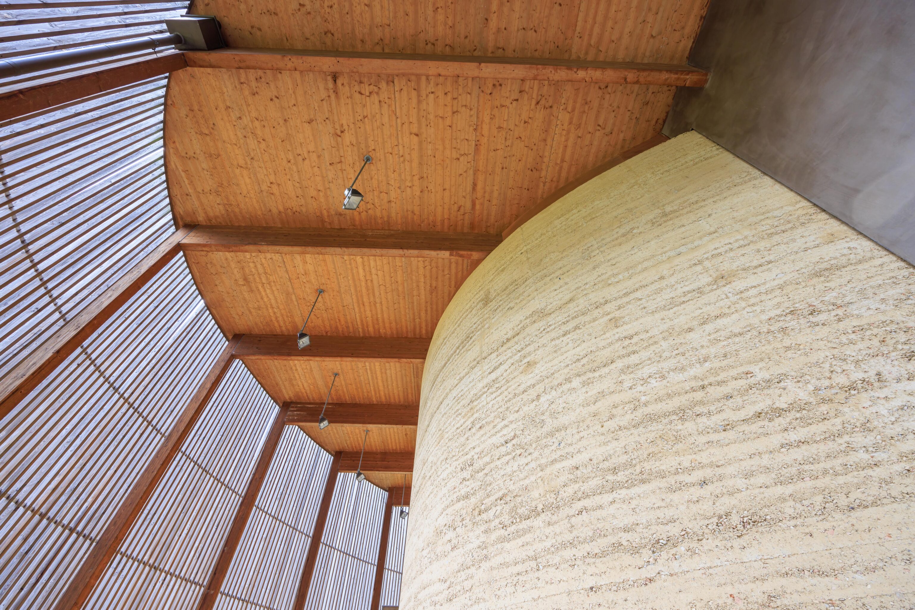
The exterior is similar to the interior.
The sign reads, in English:
Blessed are those who make peace, pray for peace
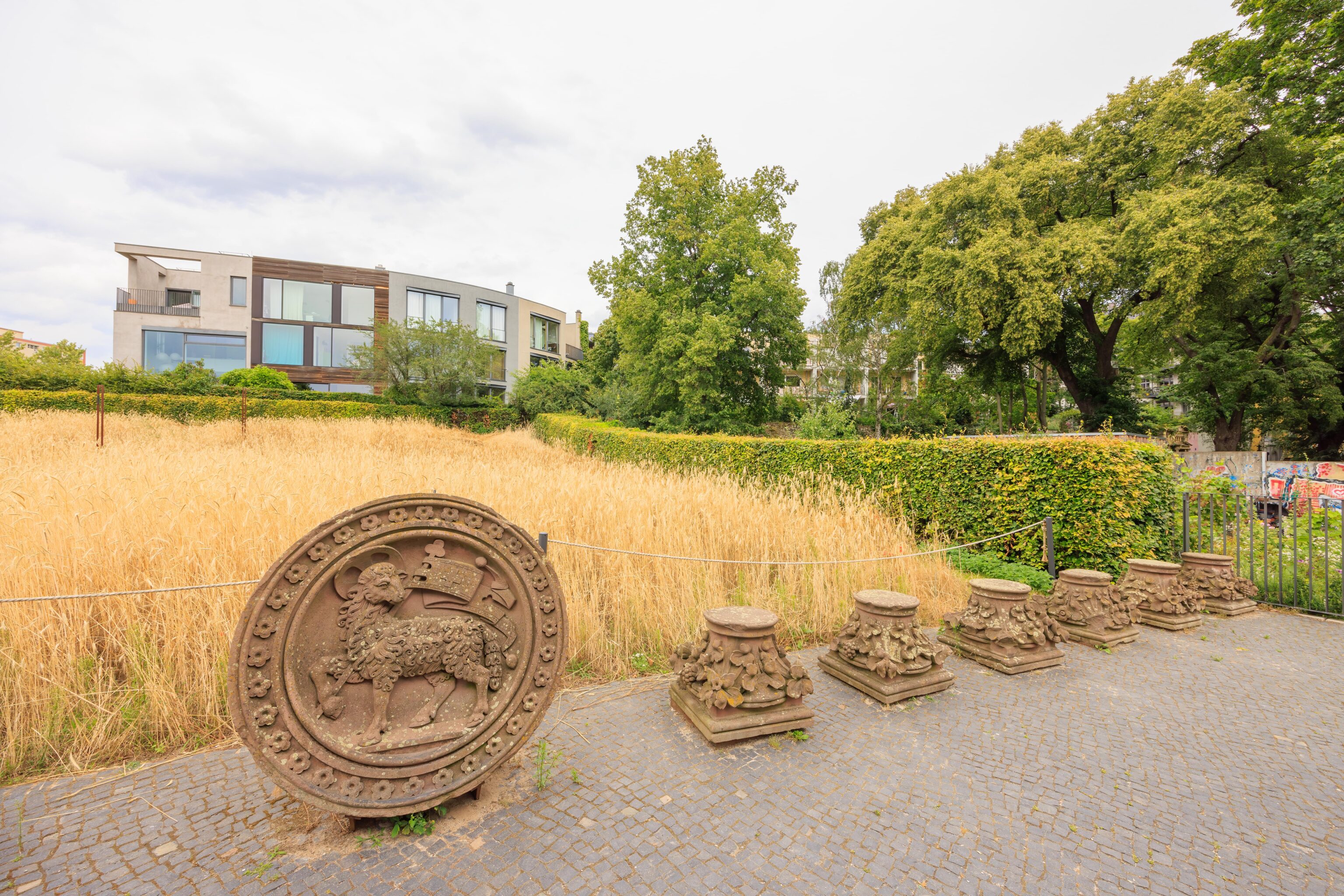
There were some artifacts on display from the original church.
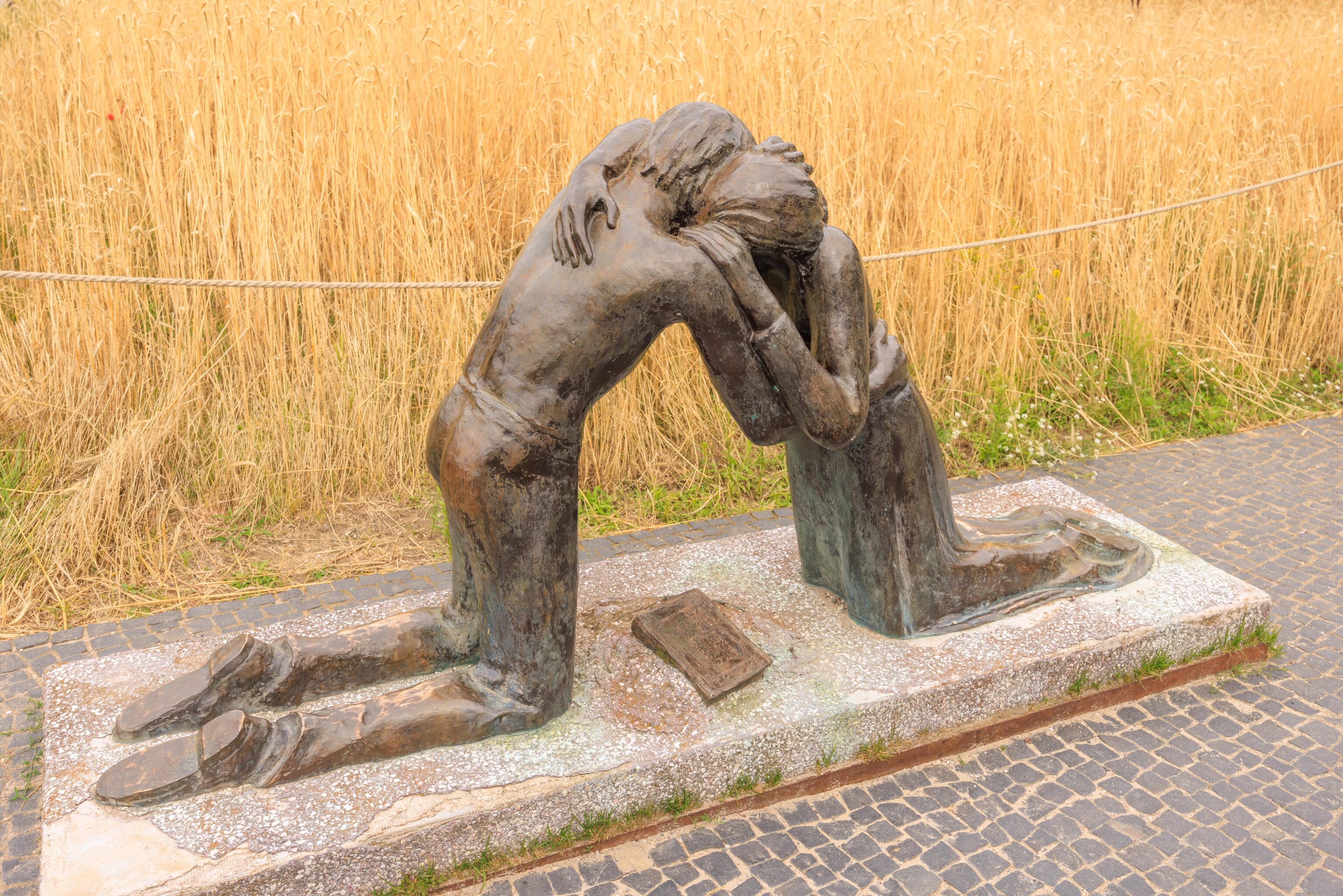
This is the Reconciliation Sculpture. A small sign nearby reads:
The sculpture created by the sculptor Josefina de Vasconcellos is a call for reconciliation following the devastation of the Second World War. Copies exist at sites that were deeply affected by the war: in the Coventry cathedral, in the Hiroshima peace museum - and in the former border strip at the Berlin Wall.
The text is ambiguous – is this the original and the others are copies, including another here in Berlin? Or did the sculptor simply make three of these sculptures?
The chapel from the northeast.
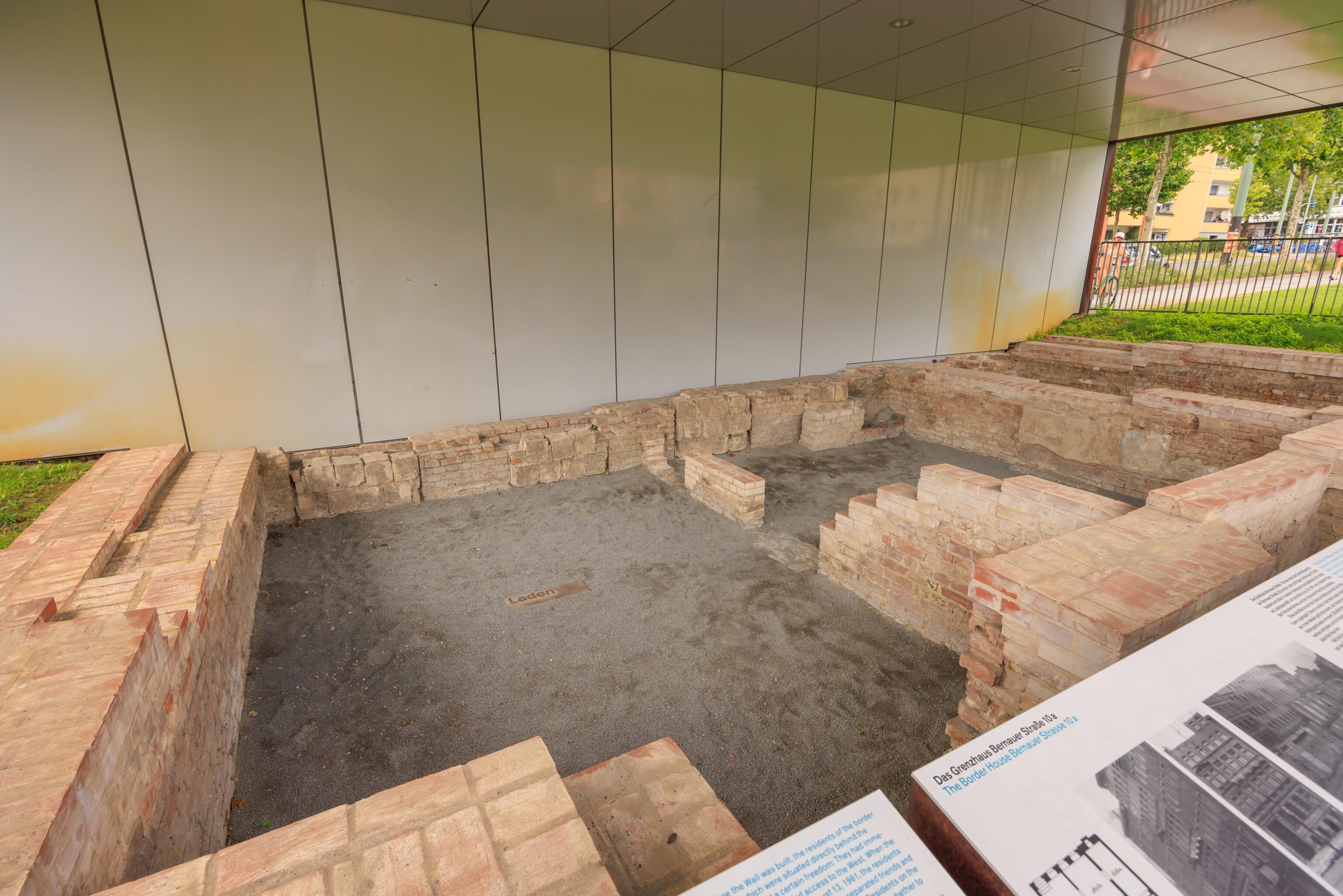
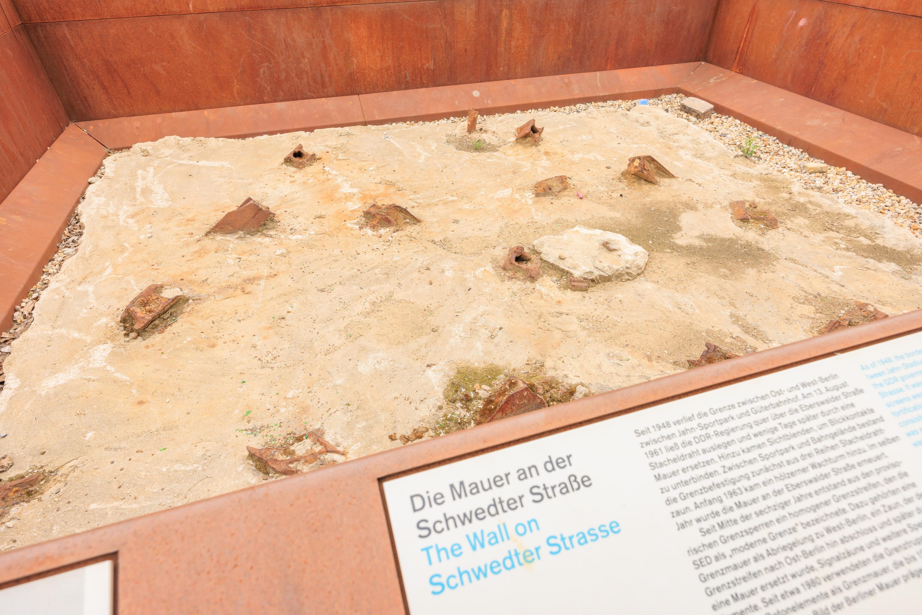
These are the remains of a building that was destroyed to build the wall. The memorial’s website’s outdoor exhibition page briefly mentions this particular set of remains:
The buildings were demolished in the mid-1960s to make room for the border fortifications. Today, the outlines of the buildings are marked in the ground and identified by house number. The cellar rooms of the building at Bernauer Str. 10a have been excavated.
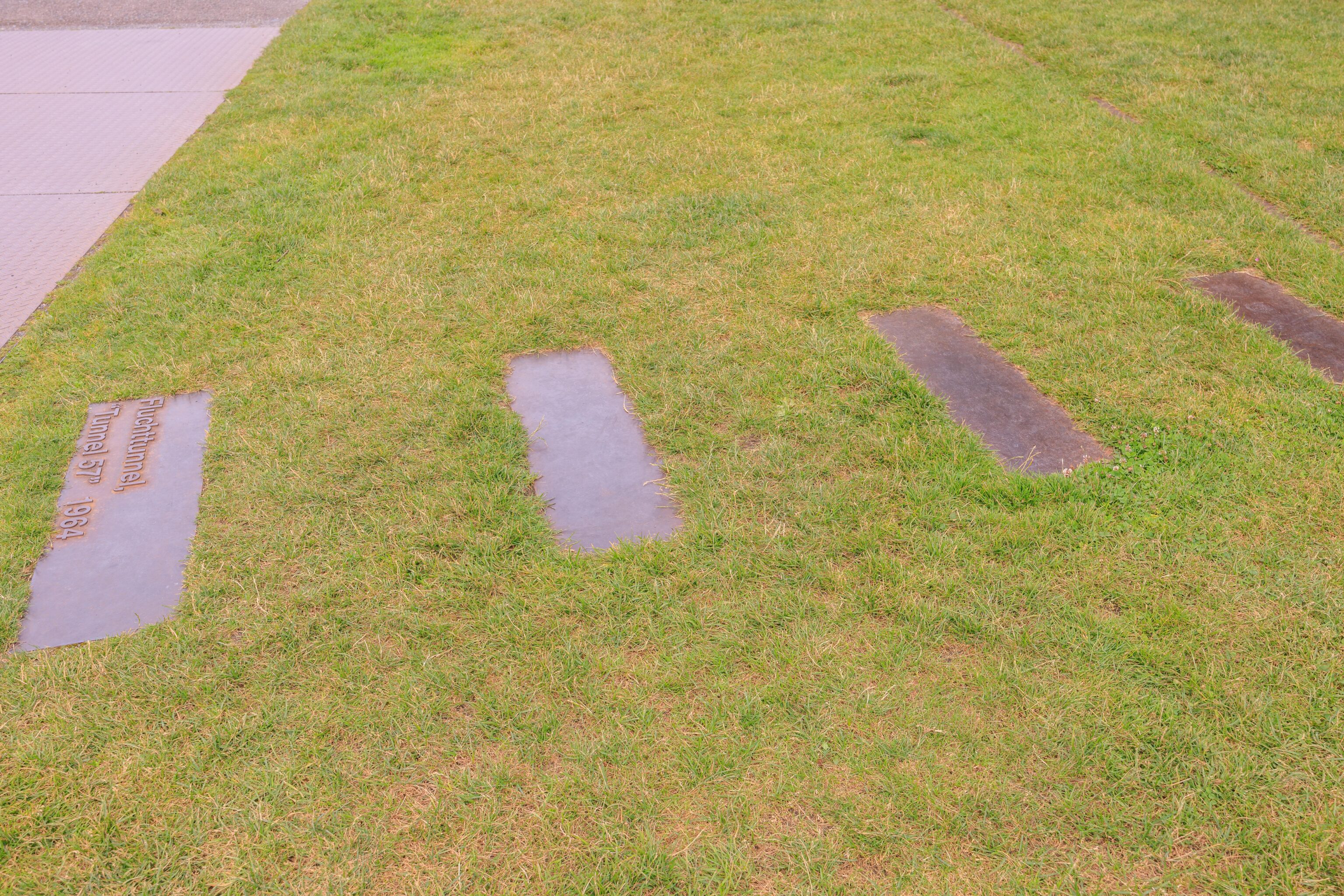
Markers on the ground were placed where tunnels were dug under the wall.
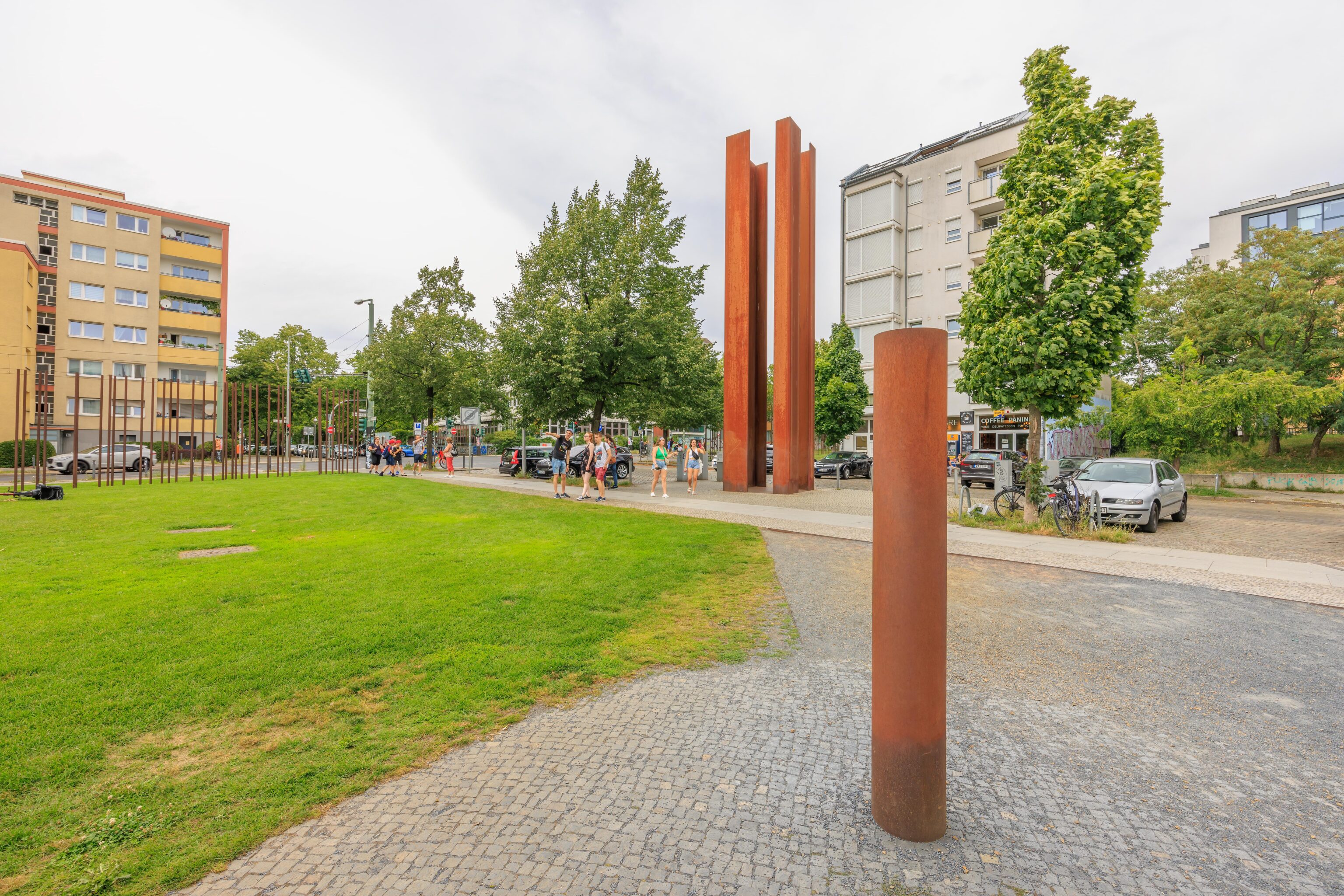
We didn’t find any signs that explain the four tall metal columns by the road. Was there a guard tower there?
We briefly visited a cafe here, Café Libre Berlin. It was good to be able to sit a bit and to drink some coffee.
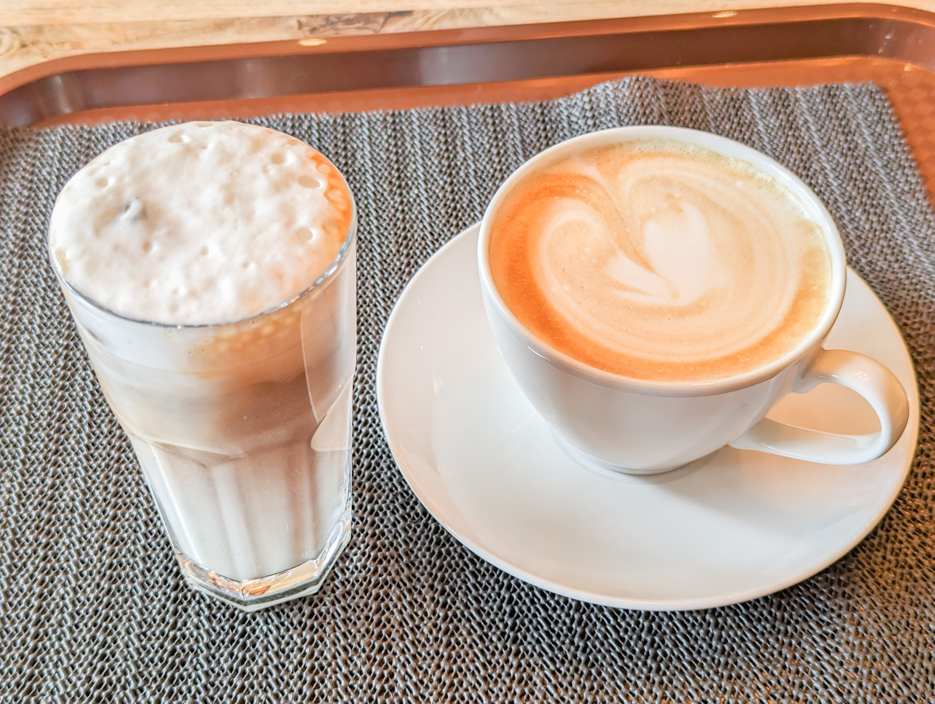
We had both hot and cold coffee products.
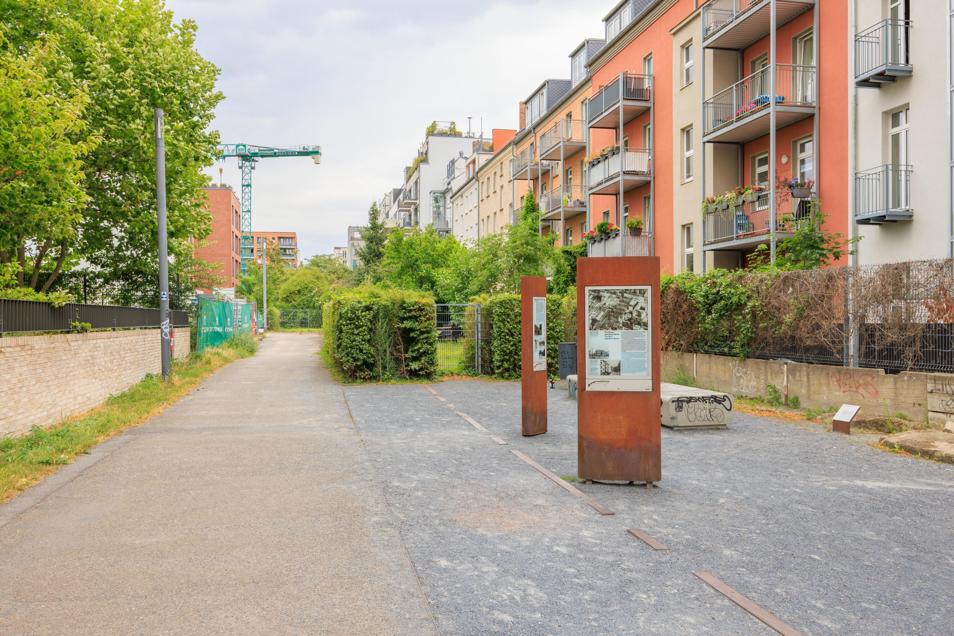
The next section of park was narrower without any remaining wall segments. The park runs behind buildings that were built on Bernauer Straße, presumably where the outer wall once stood. For whatever reason, when the inner wall was torn down, some posts were left standing. A small sign reads:
The district of Mitte erected a three meter high inner wall between Strelitzer and Brunnenstrasse around 1975. It was the first obstacle from the East Berlin side and blocked the border strip from view. It was torn down in 1990, but several posts were left standing.
The rusting post behind the modern fence is one of the inner wall posts.
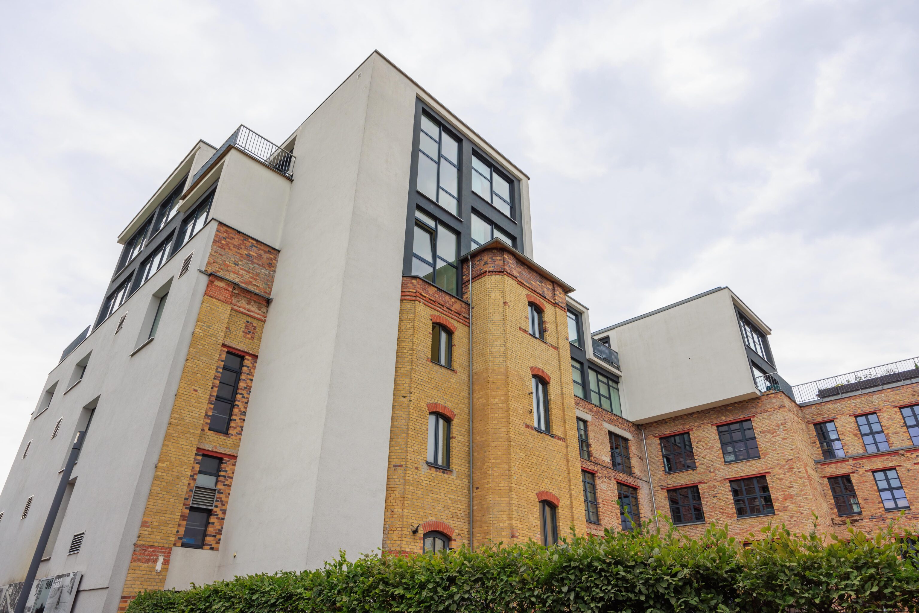
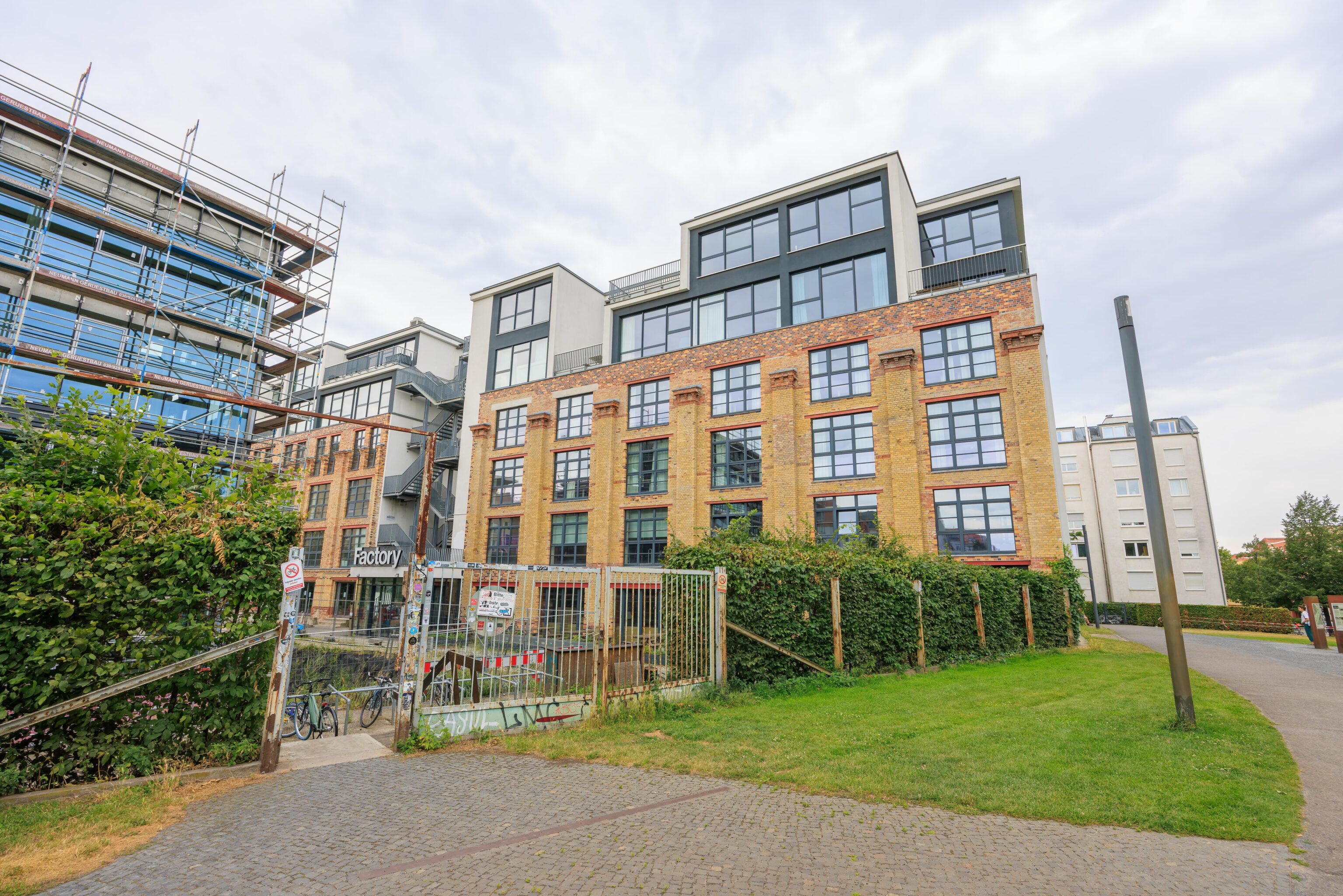
Some of the buildings appear to have been renovated and have an interesting mix of old and new. We also saw some construction in progress.
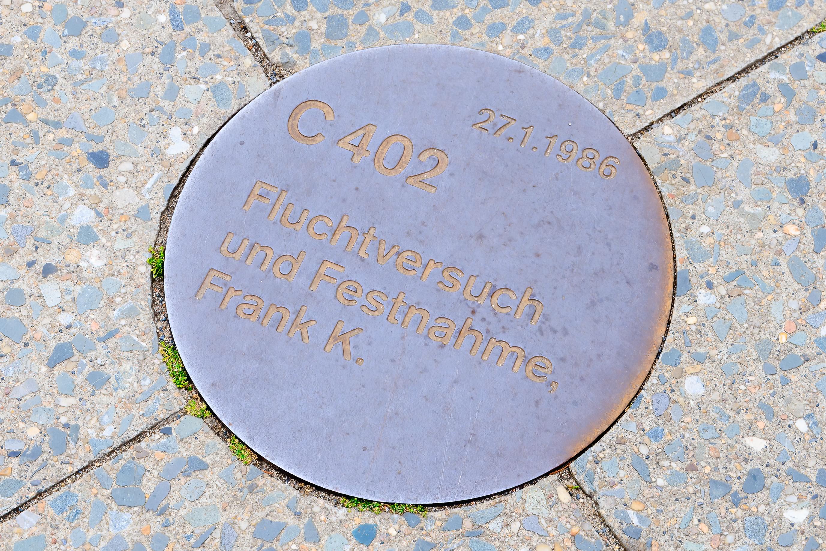
Markers on the ground indicate victims of the wall. This one marks an attempted escape and arrest in 1986.
At this point, we were getting hungry. We found a döner restaurant nearby, Brunnen Dönerhaus, that had good ratings on Google Maps.
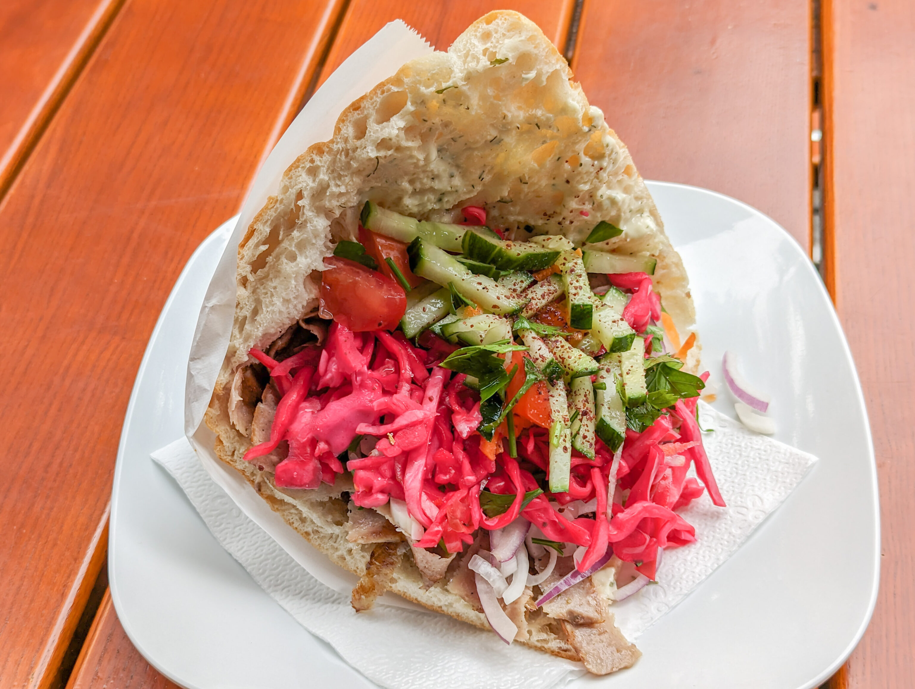
It was very good, though you can’t really see any of the meat in the photo under the salad.
A typical section in this part of the park.
The remains of anti-vehicle obstacles.
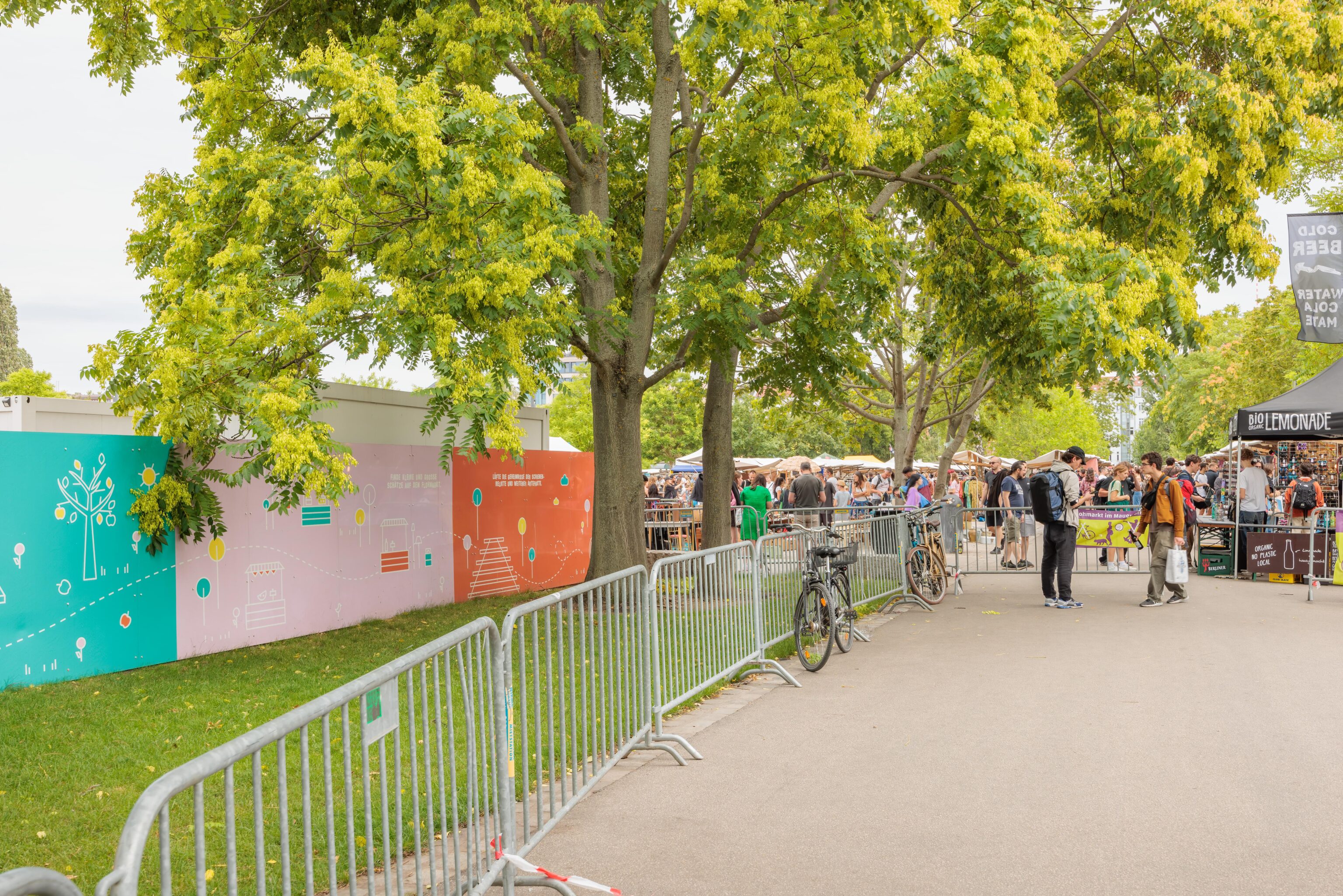
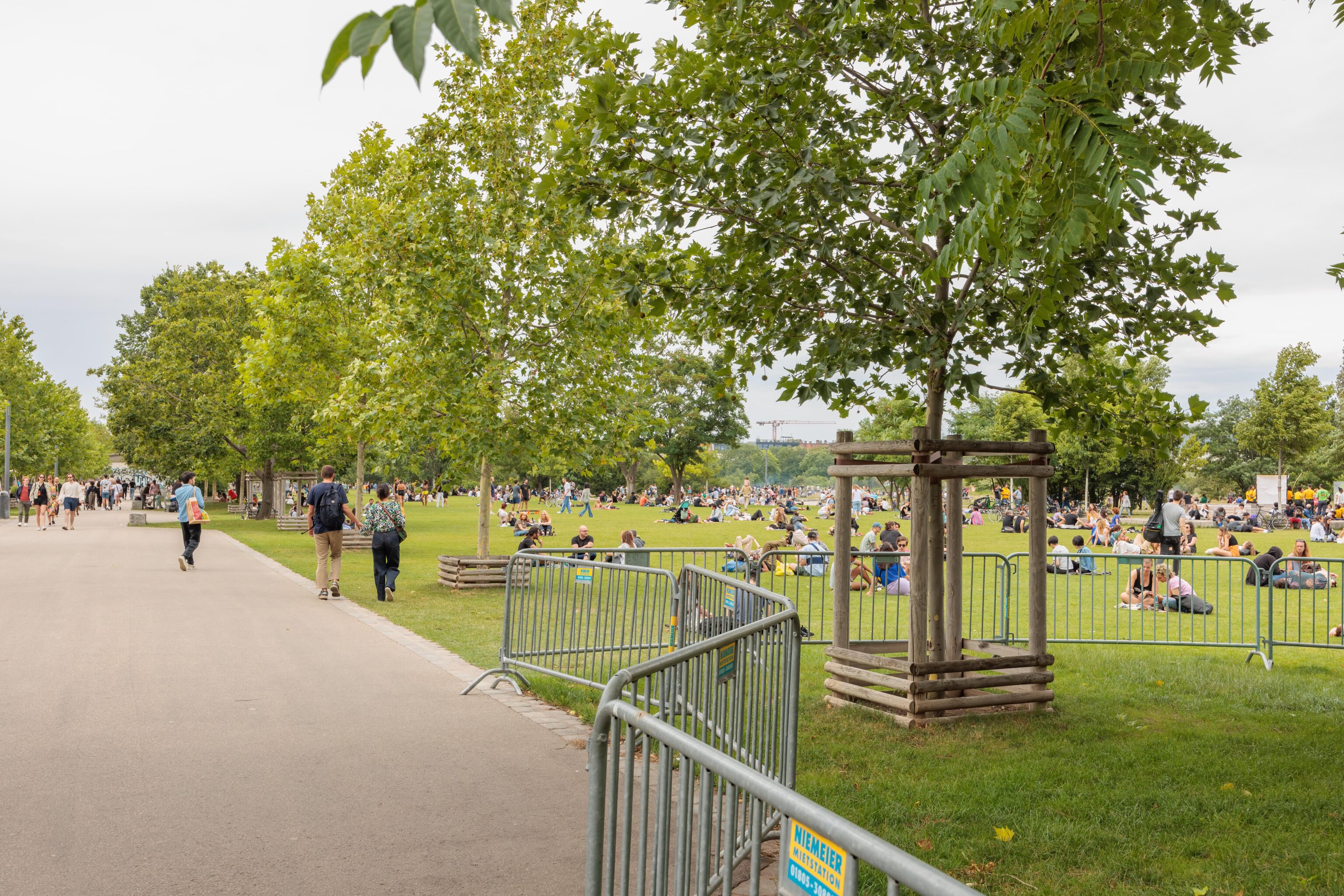
The wall makes a sudden 90 degree turn at Schwedter Straße, heading north/south. This portion of land has been turned to parkland and is the Mauerpark (Wall Park). The corner near the intersection was very busy as there was a flea market. The grassy park north of the market was also quite busy with people enjoying the afternoon.
We decided to head back via tram to the U-Bahn station at Naturkundemuseum and then U-Bahn down to Stadtmitte.
Stadtmitte
After arriving, we headed to Rausch Schokoladenhaus, the chocolatier that we visited just before closing time yesterday. There was plenty of time today so we started out by taking a look at the store on the ground floor. They had some chocolate sculptures on display.
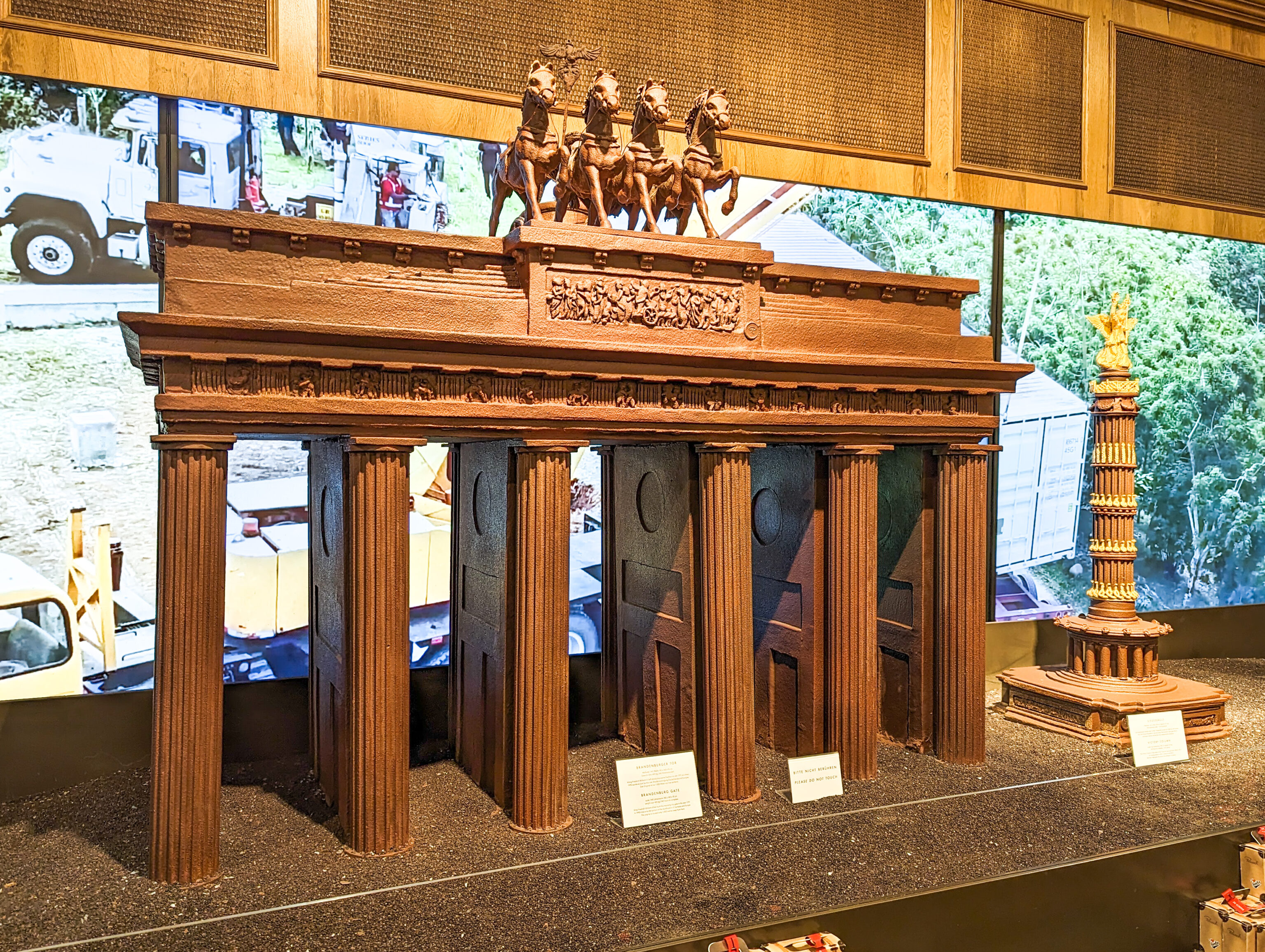
The Brandenburger Tor (Brandenburg Gate), which we saw briefly yesterday. The smaller tower on the right is the Siegessäule (Victory Column). It is a mile or so west of the gate.
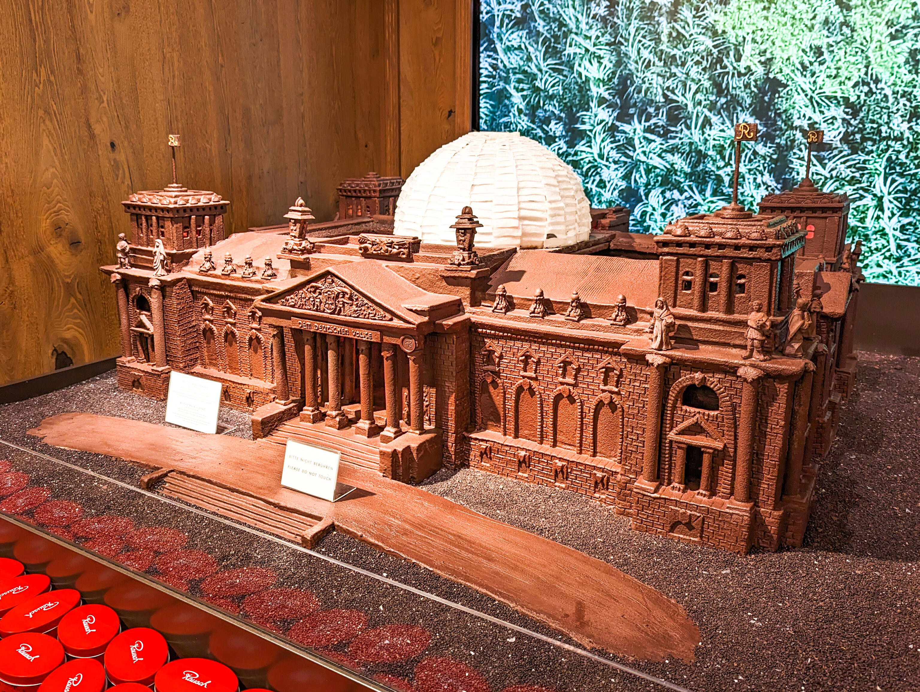
This building is the former Reichstag, now Bundestag, and houses the German Federal Parliament. It is near the Brandenburger Tor and should have been visible yesterday near the Christoper Street Day stage.
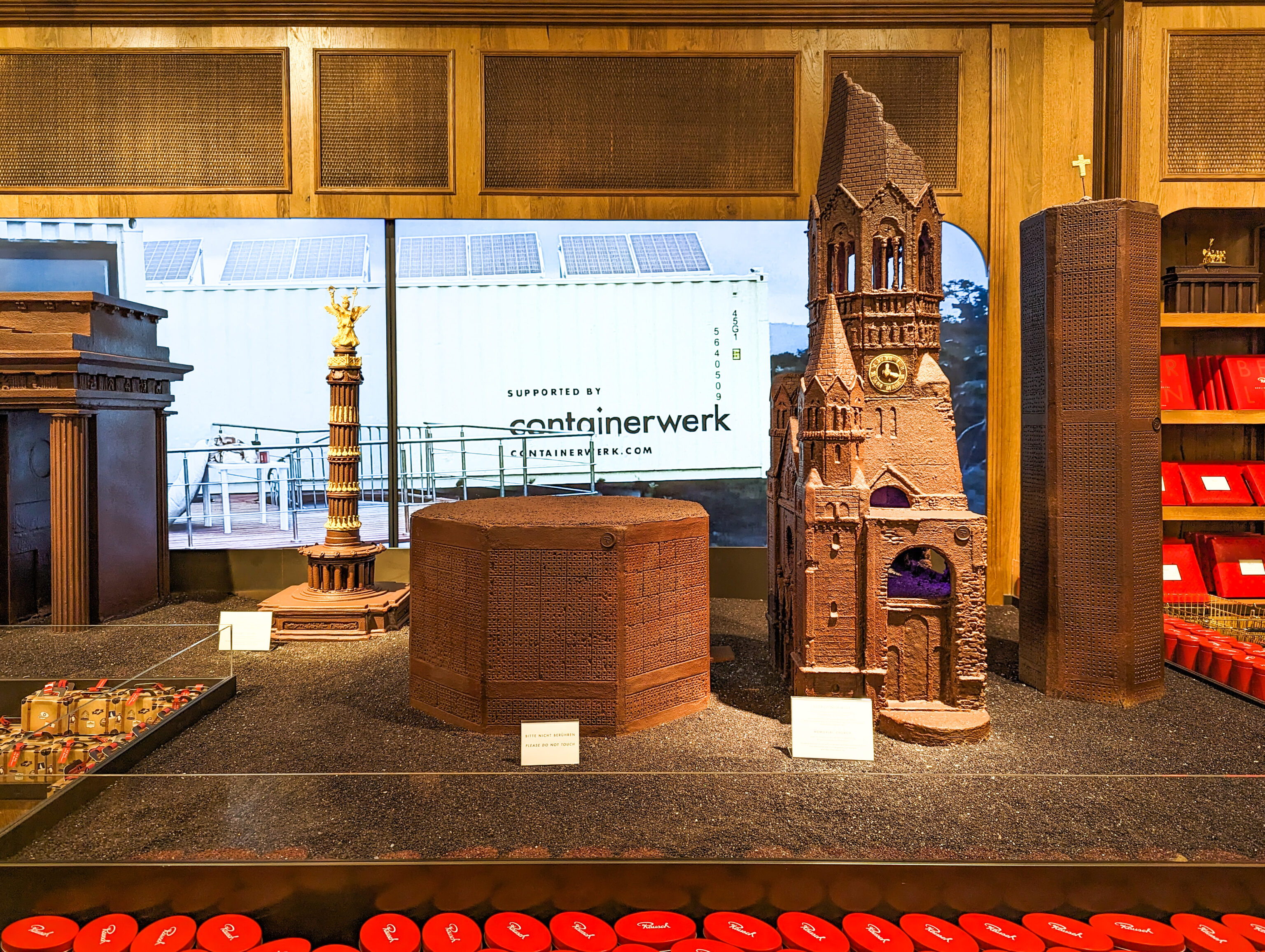
The three buildings from the right make up the Kaiser Wilhelm Memorial Church. We did not see any of these buildings yet.
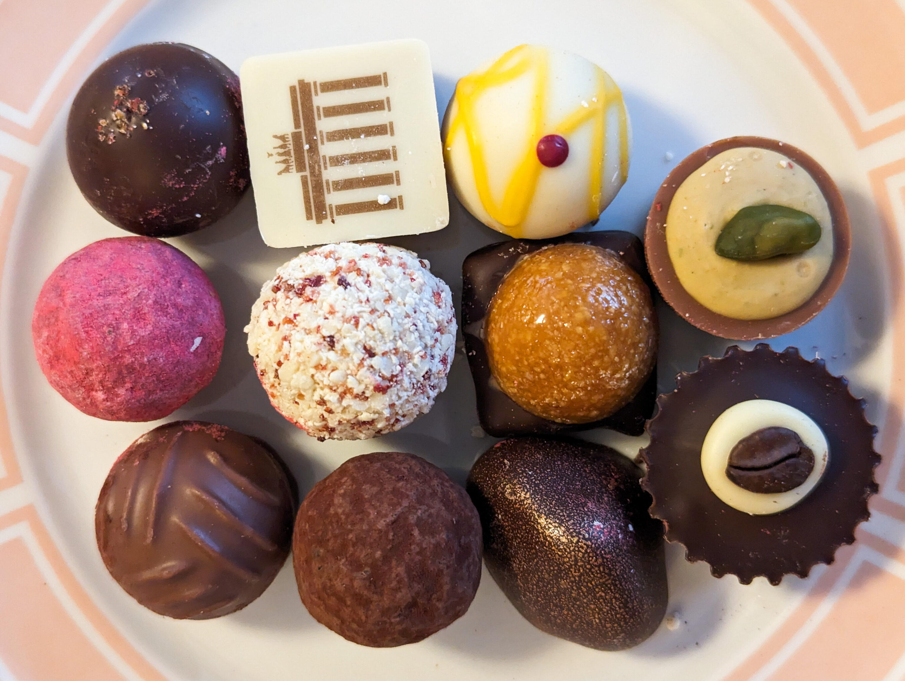
We also bought some chocolates, plated on one of the East German plates in the room for photography after we returned to the hotel. They were very good.
After buying the chocolates, we headed upstairs to the cafe.
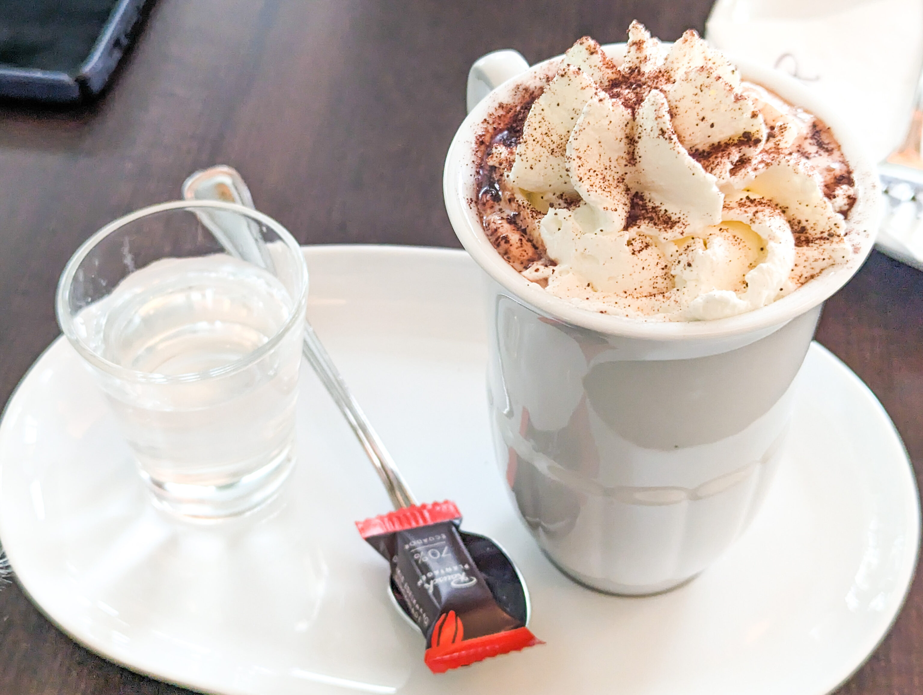
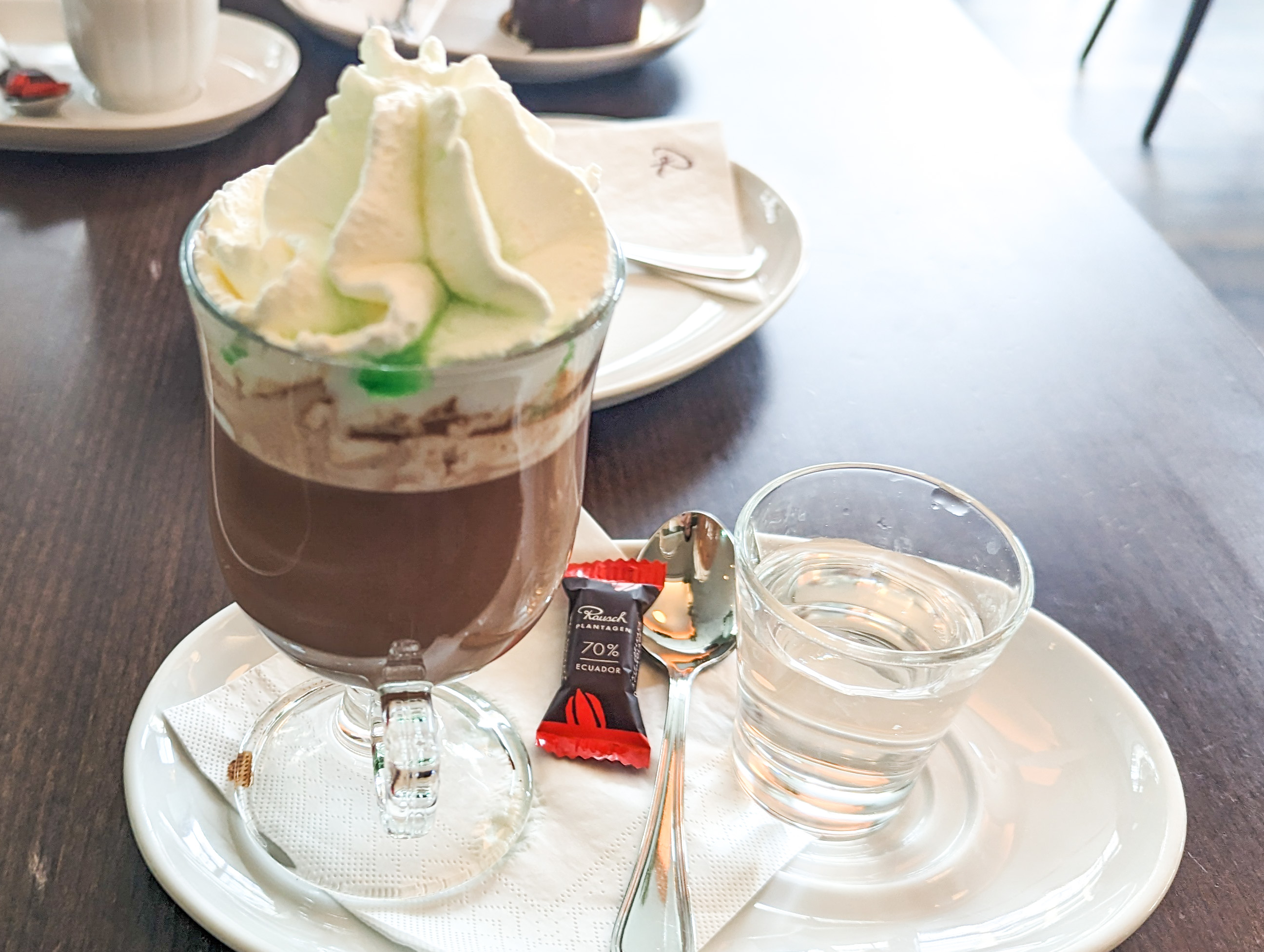
We started out with two chocolate drinks. The menu allows for a selection of chocolate: 43% milk chocolate from Venezuela, 60% dark chocolate from Peru, and 70% dark chocolate from Ecuador. There are are also 8 different flavor options. We opted for the crema, with whipped cream, and mint, with peppermint liqueur and whipped cream.
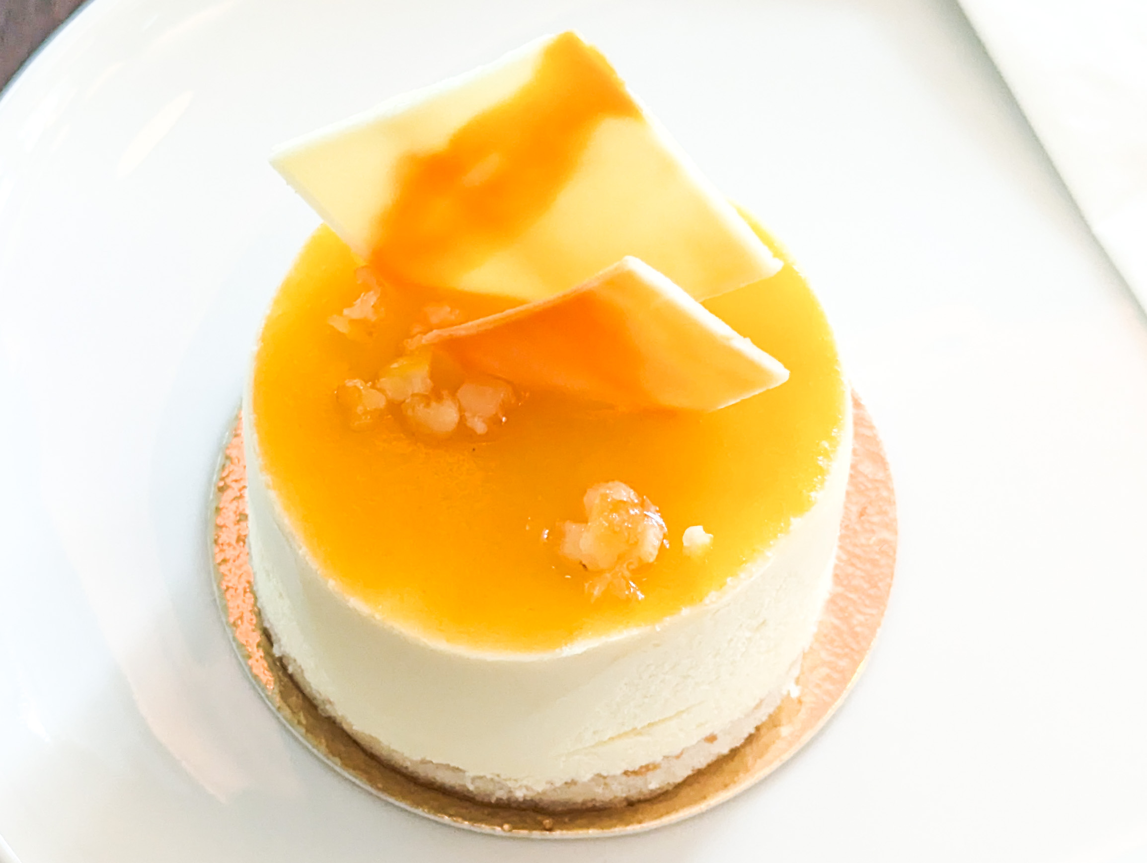
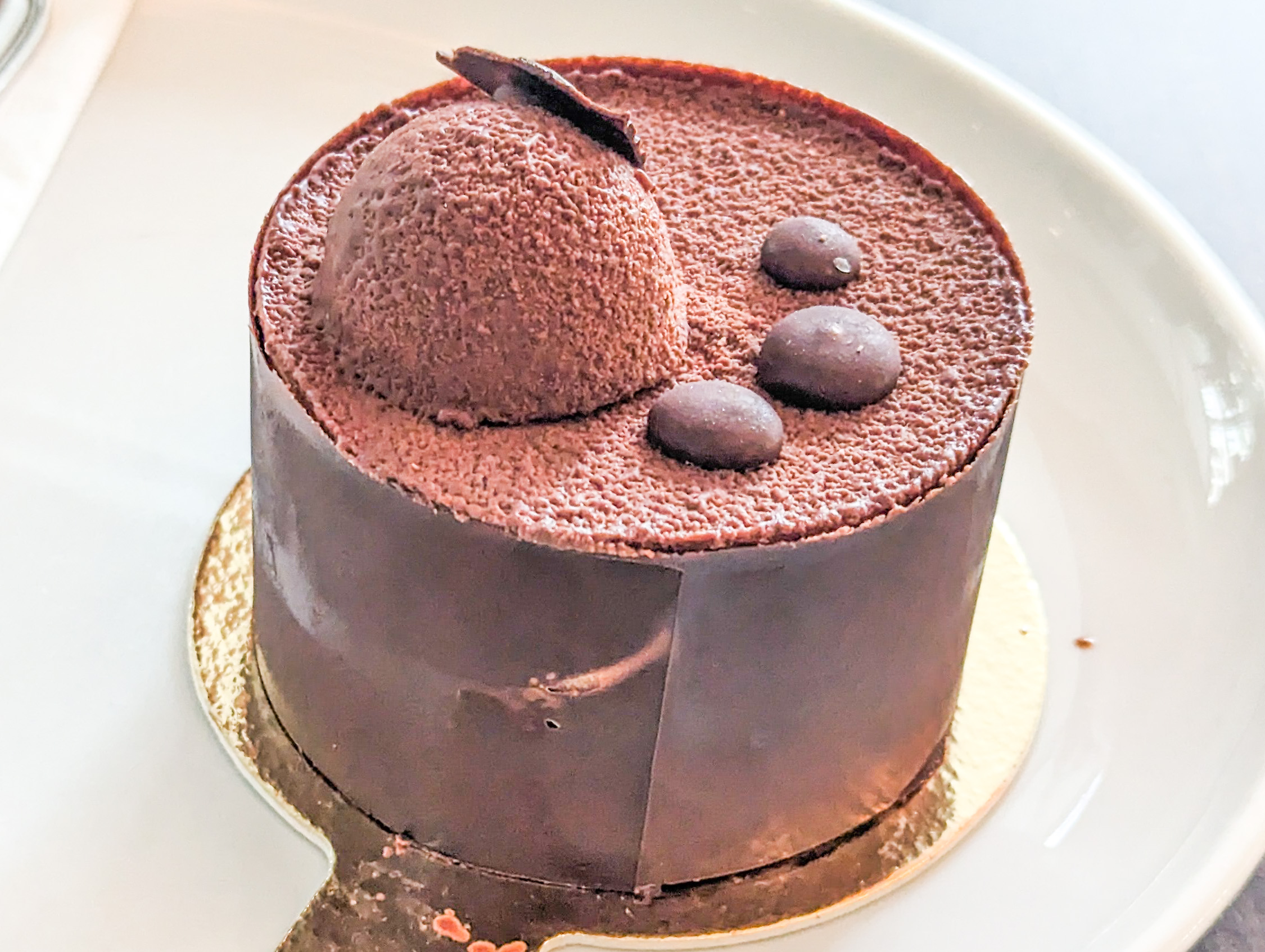
We also got two cakes, or more accurately, tortes. Everything was good! We ended our day here and returned to the hotel.