

After breakfast, we checked out of the Prince Sakura Tower Tokyo, dropped off our bags at Shinagawa Station, and headed to Koraku-en, a garden near Ueno. After walking through the garden, we had lunch nearby and then visited the Meiji Jingu‘s inner garden. We then had an afternoon snack in Omotesando before taking the Shinkansen to Kyoto where we checked into the Hyatt Place Kyoto.
Morning
The sky was cloudy but overall it didn’t look too bad when we woke up.
Soon, it began raining.
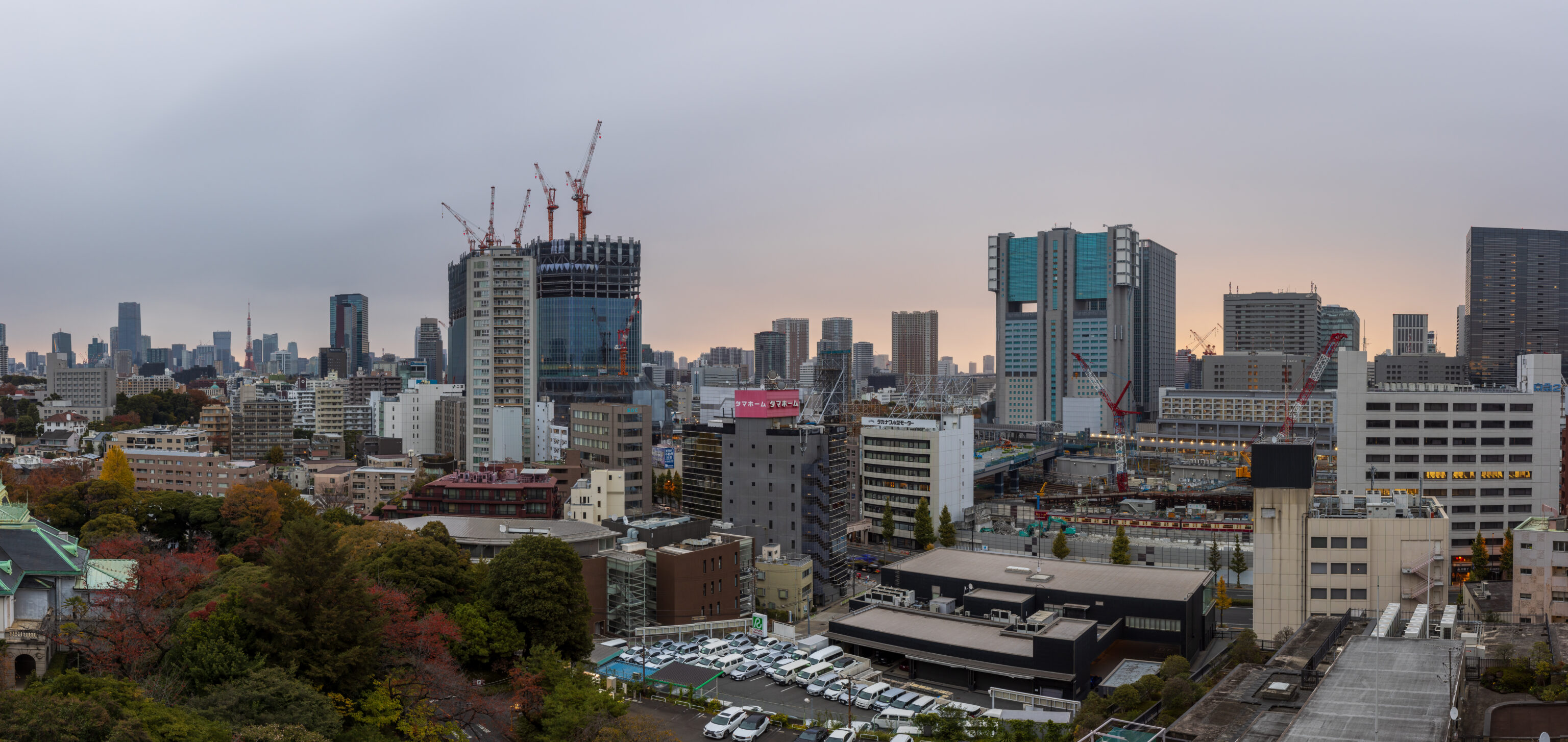
We headed down to have breakfast in the executive lounge.
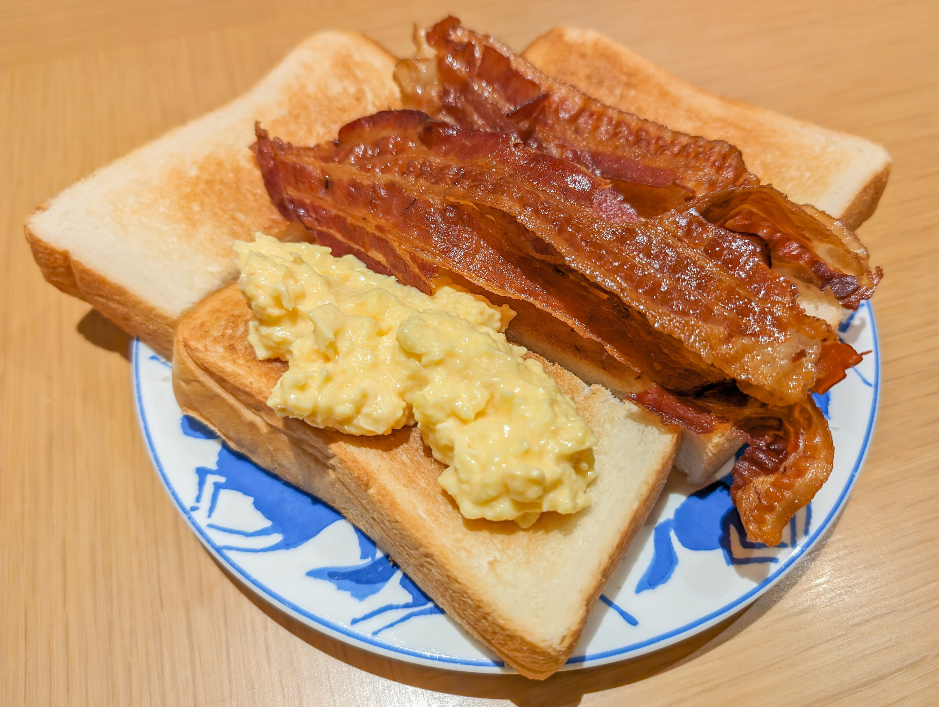
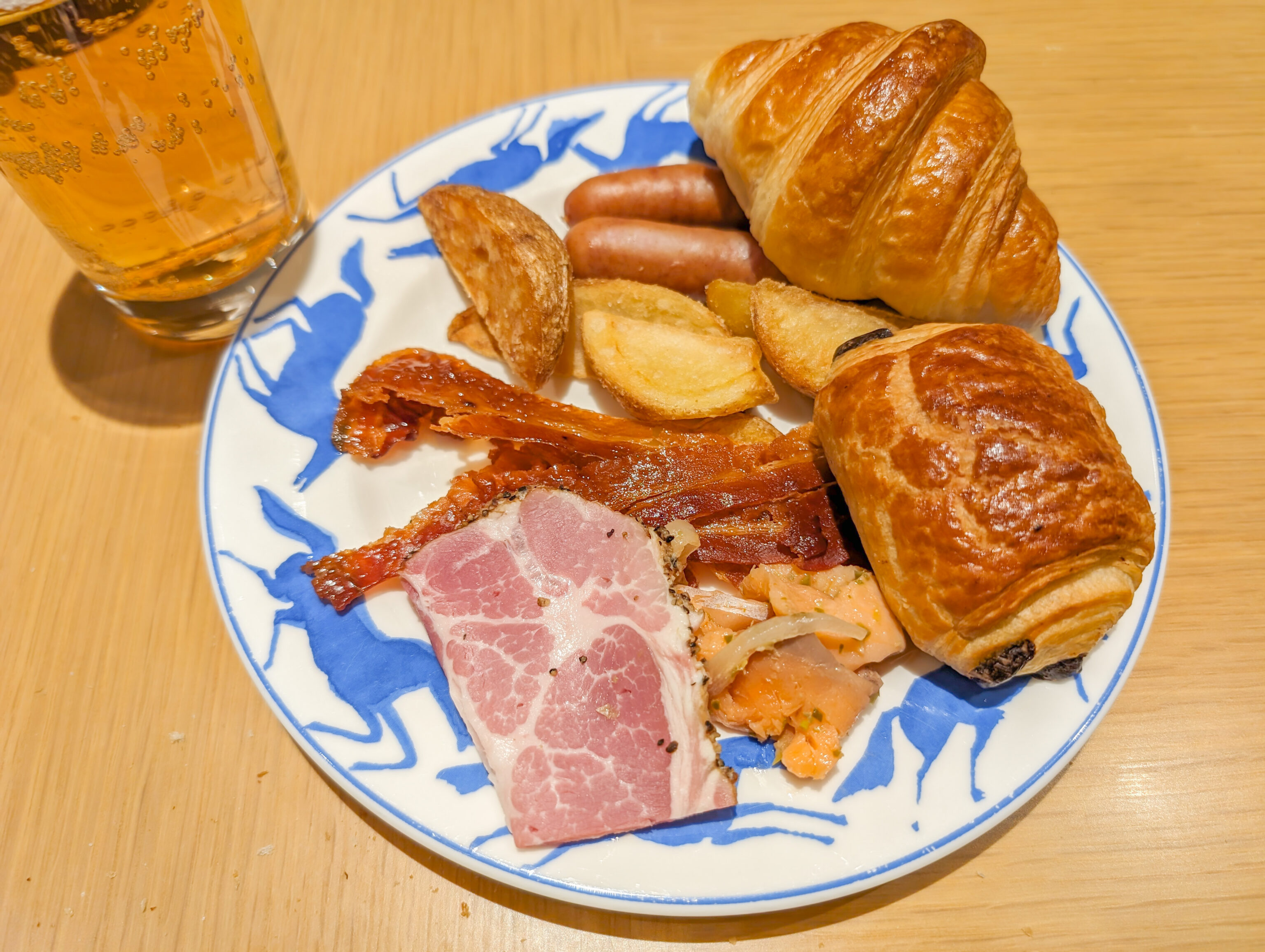
The breakfast in the lounge is limited but what they do have is pretty good. They had Balmuda toasters that steam while toasting to keep the bread from drying out, it was slow but otherwise seemed to work well. This product didn’t exist the last time I stayed at this property! The bacon was nicely done American style, very crispy and extremely thin. The eggs were also nicely done as were the potato wedges.
Koraku-en
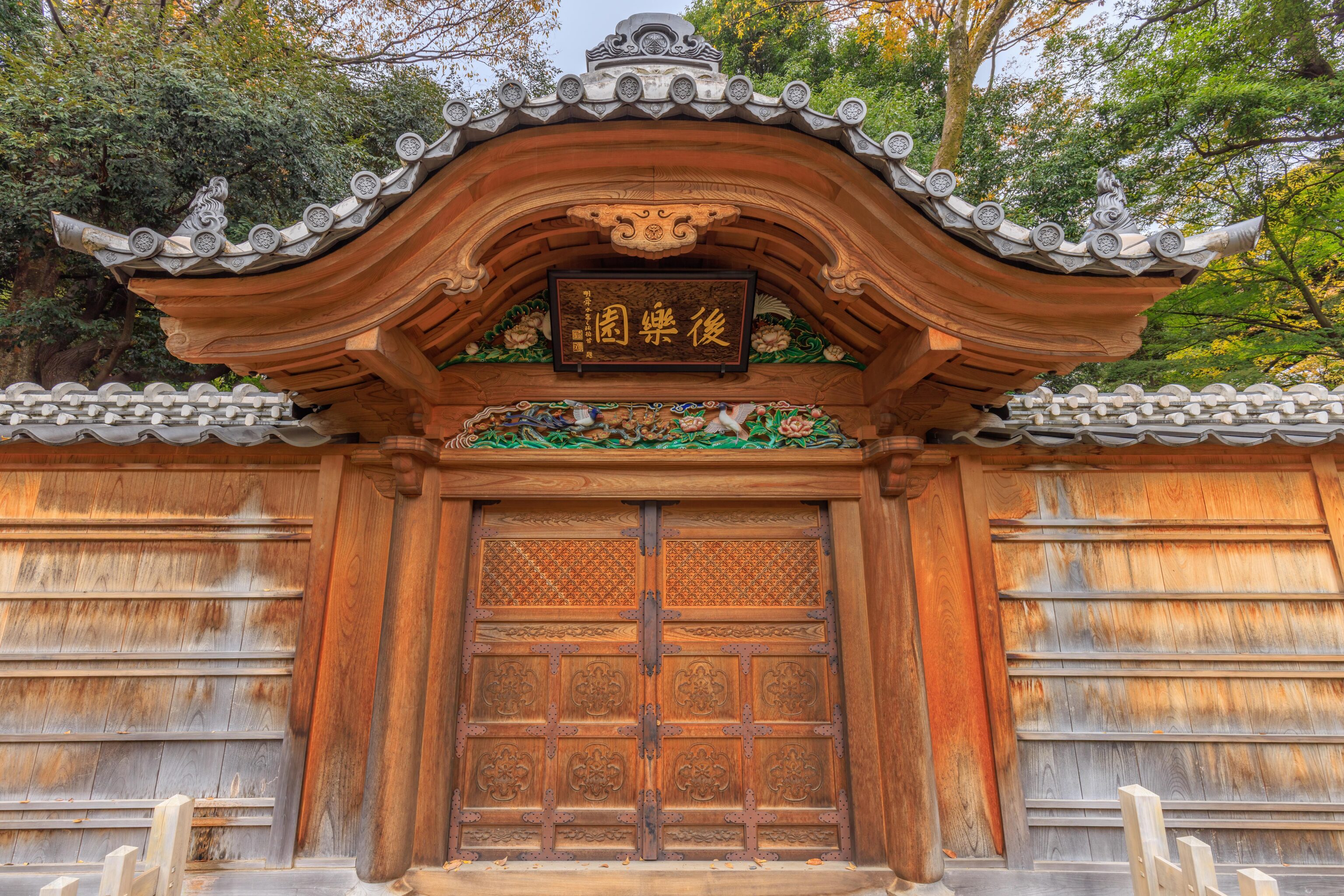
After eating, we checked out and walked over with our luggage to Shinagawa Station. We left two backs in a locker near the Shinkansen entry gates and headed over to take the Yamanote line up to Akihabara. From there, we transferred to the Chuo-Sobu Line for a short ride to Suidobashi Station. We then walked a few minutes to arrive at Koraku-en’s southeast entrance. More properly, Koishikawa Koraku-en as there is also a Koraku-en in Okayama.
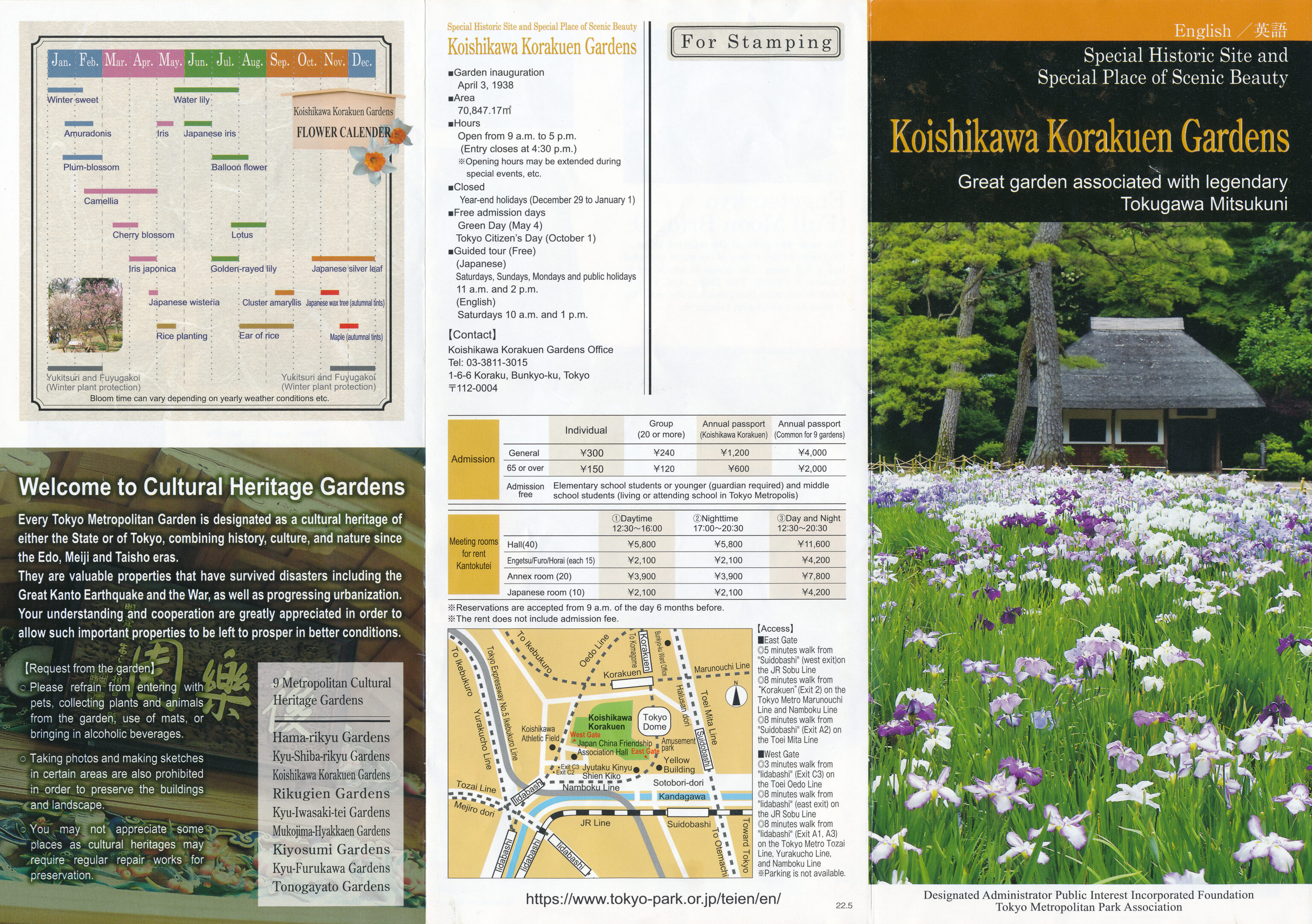
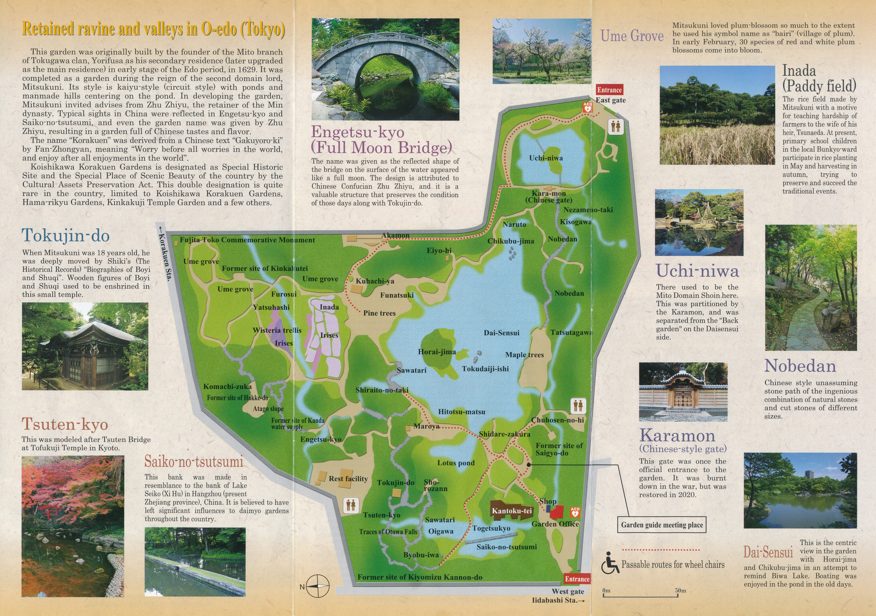
We picked up an English informational pamphlet when entering the garden. The reverse side had a helpful map with a description of some of the notable features. Unfortunately, the map is presented east side up.
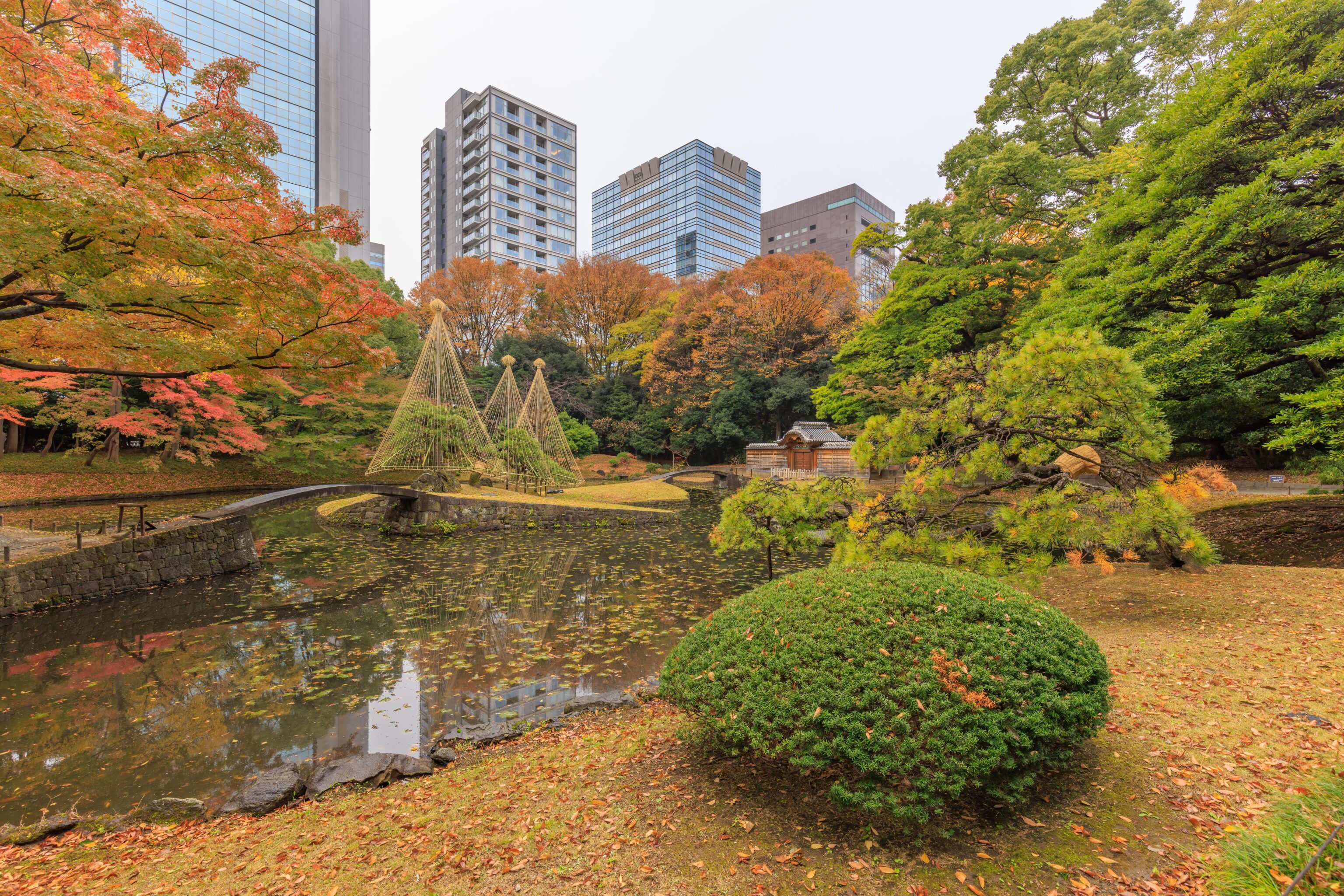
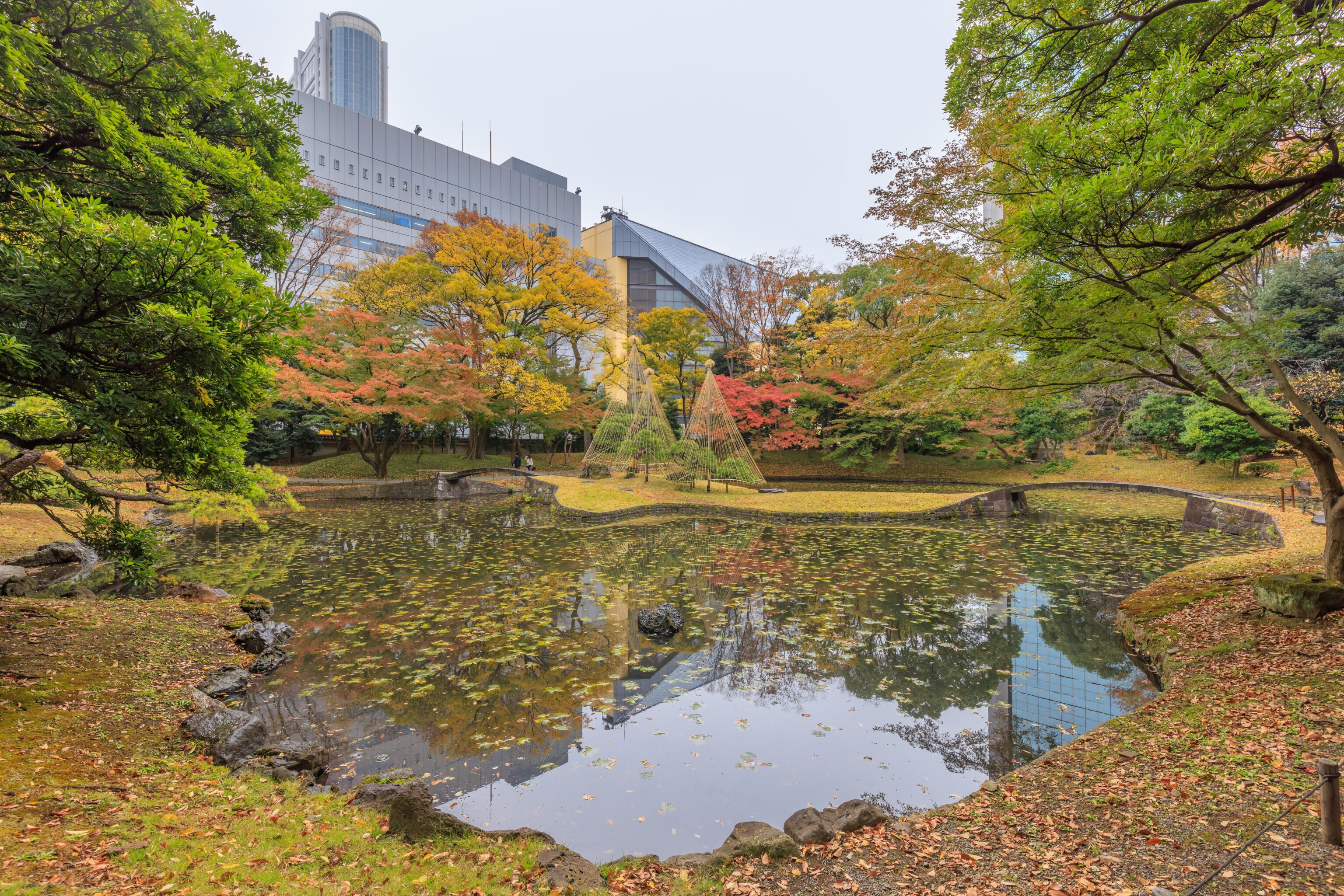
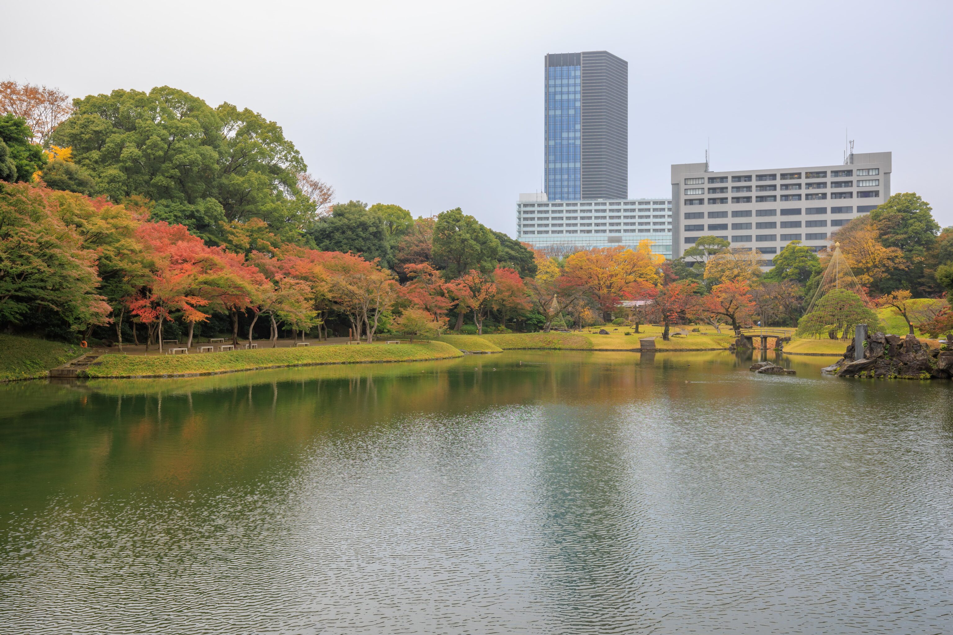
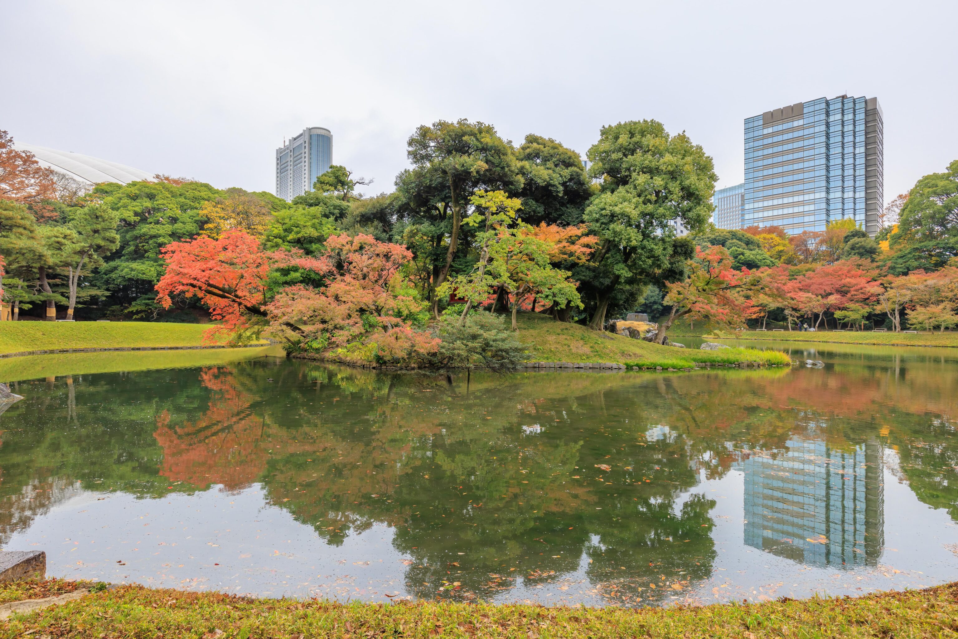
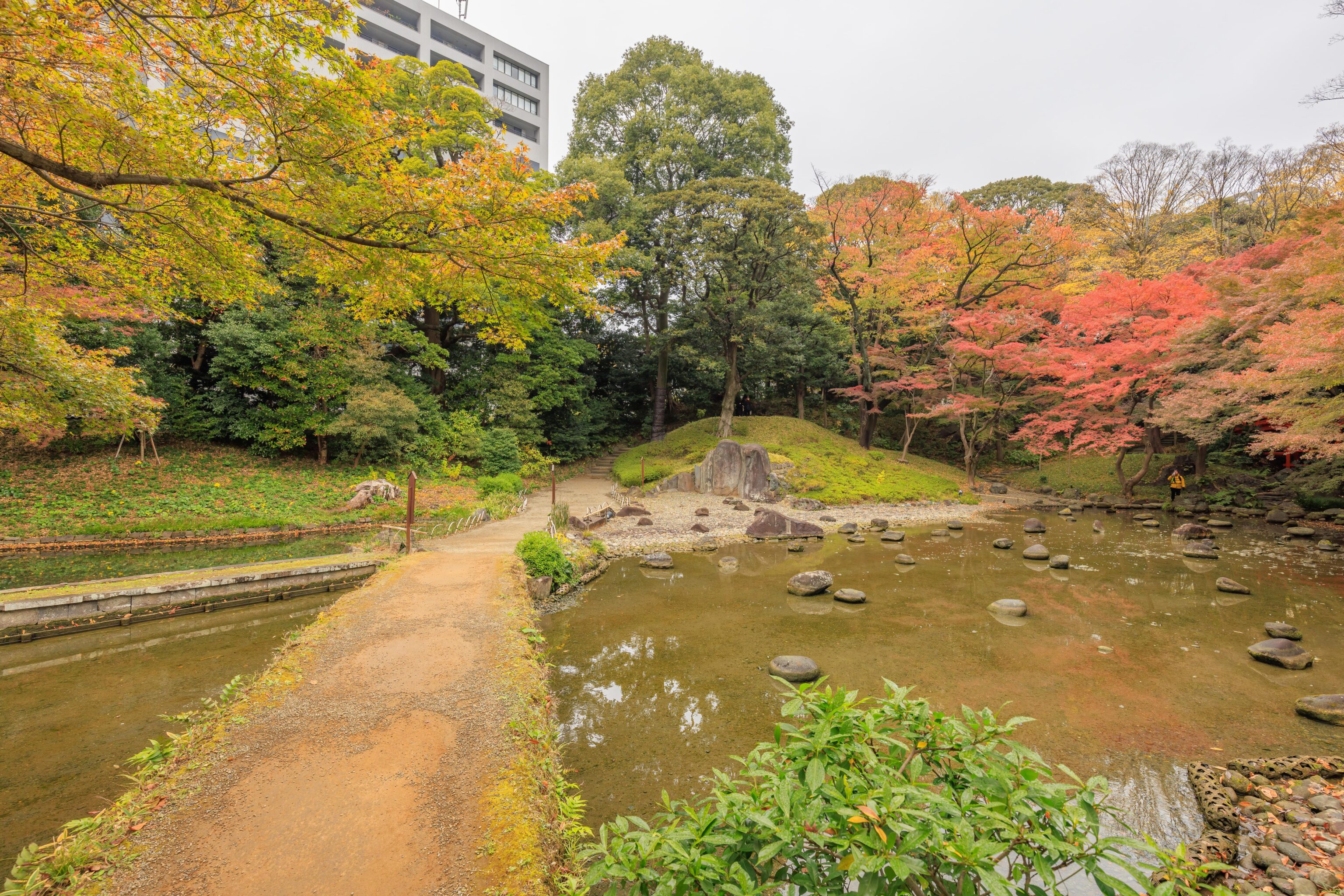
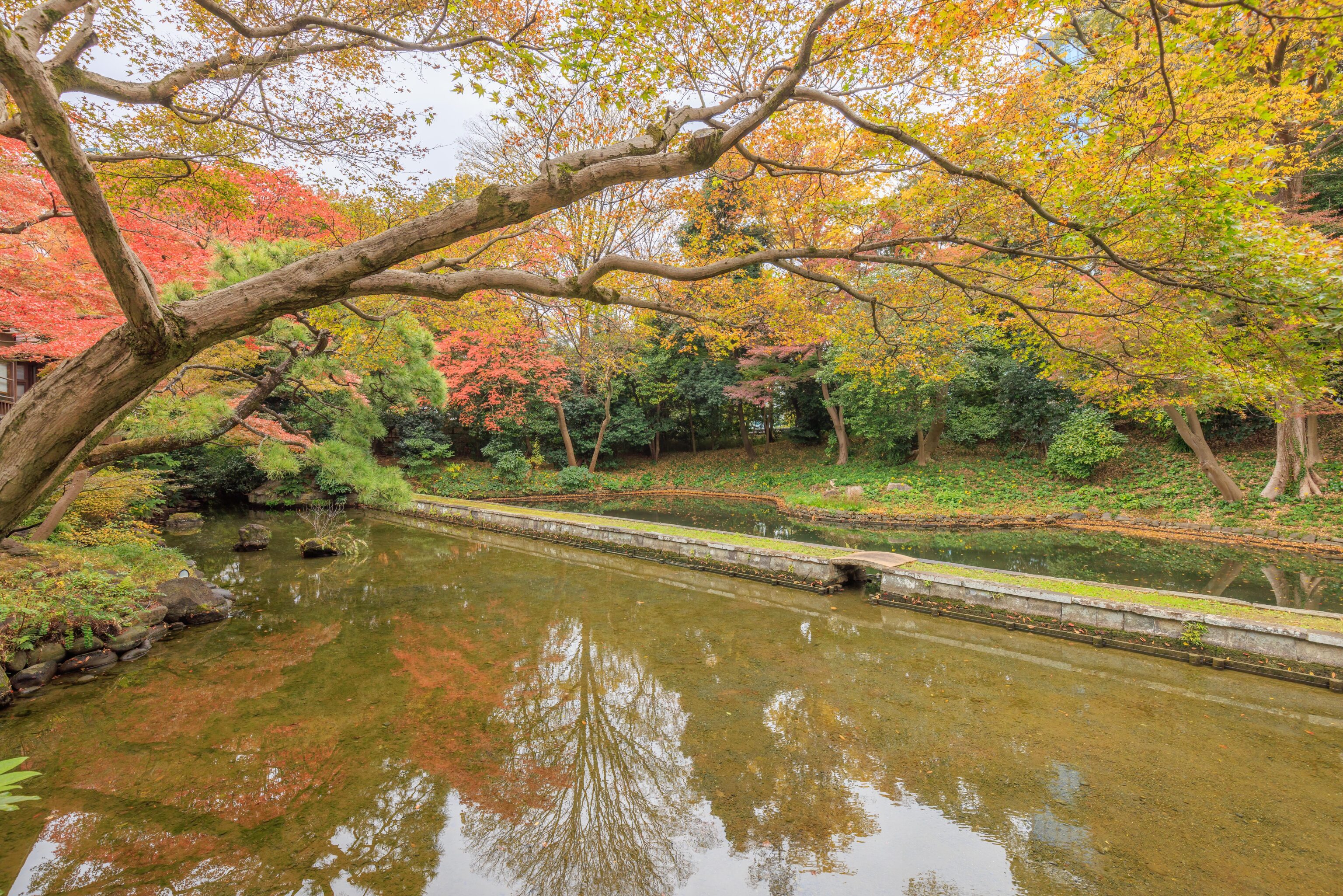
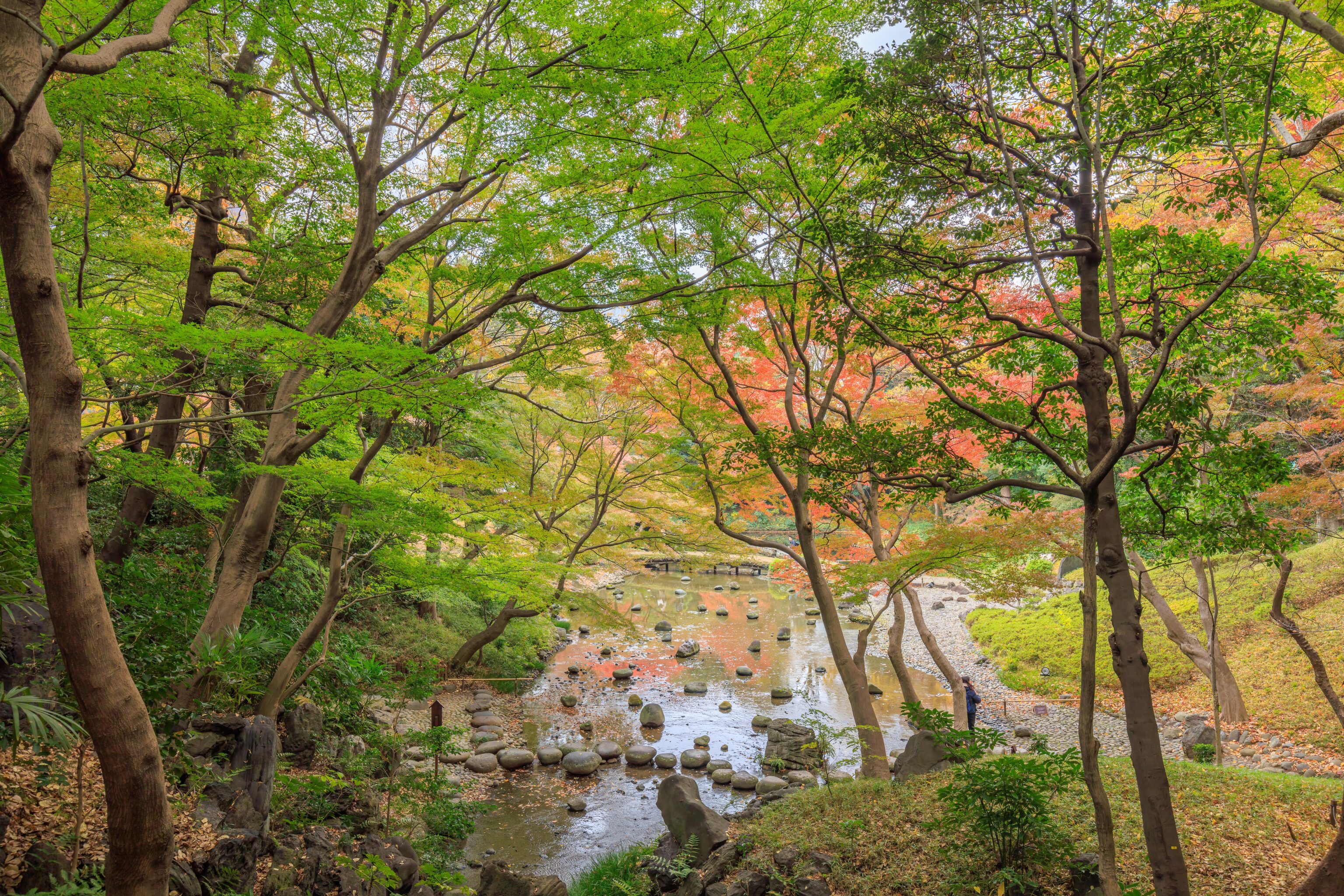
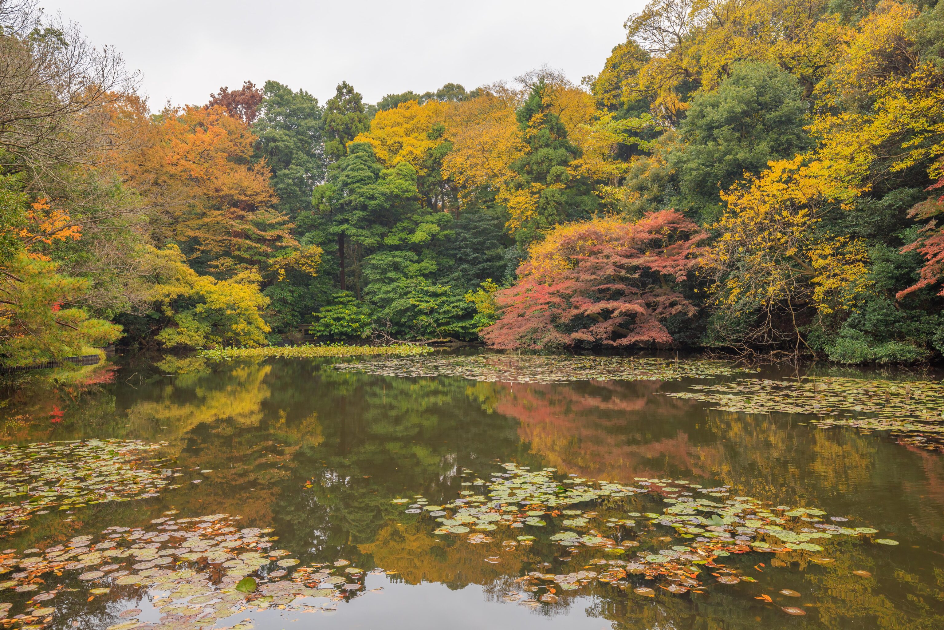
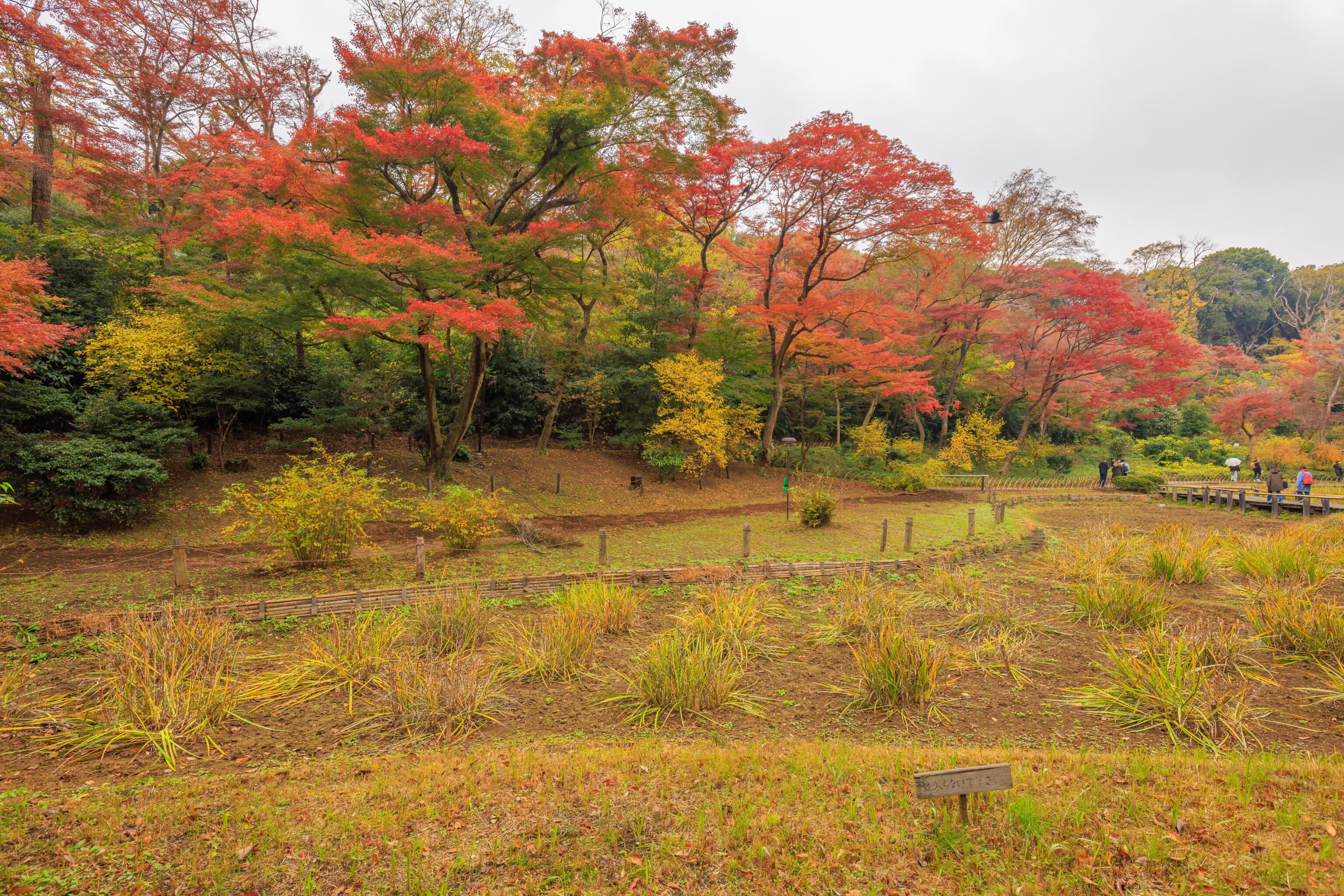
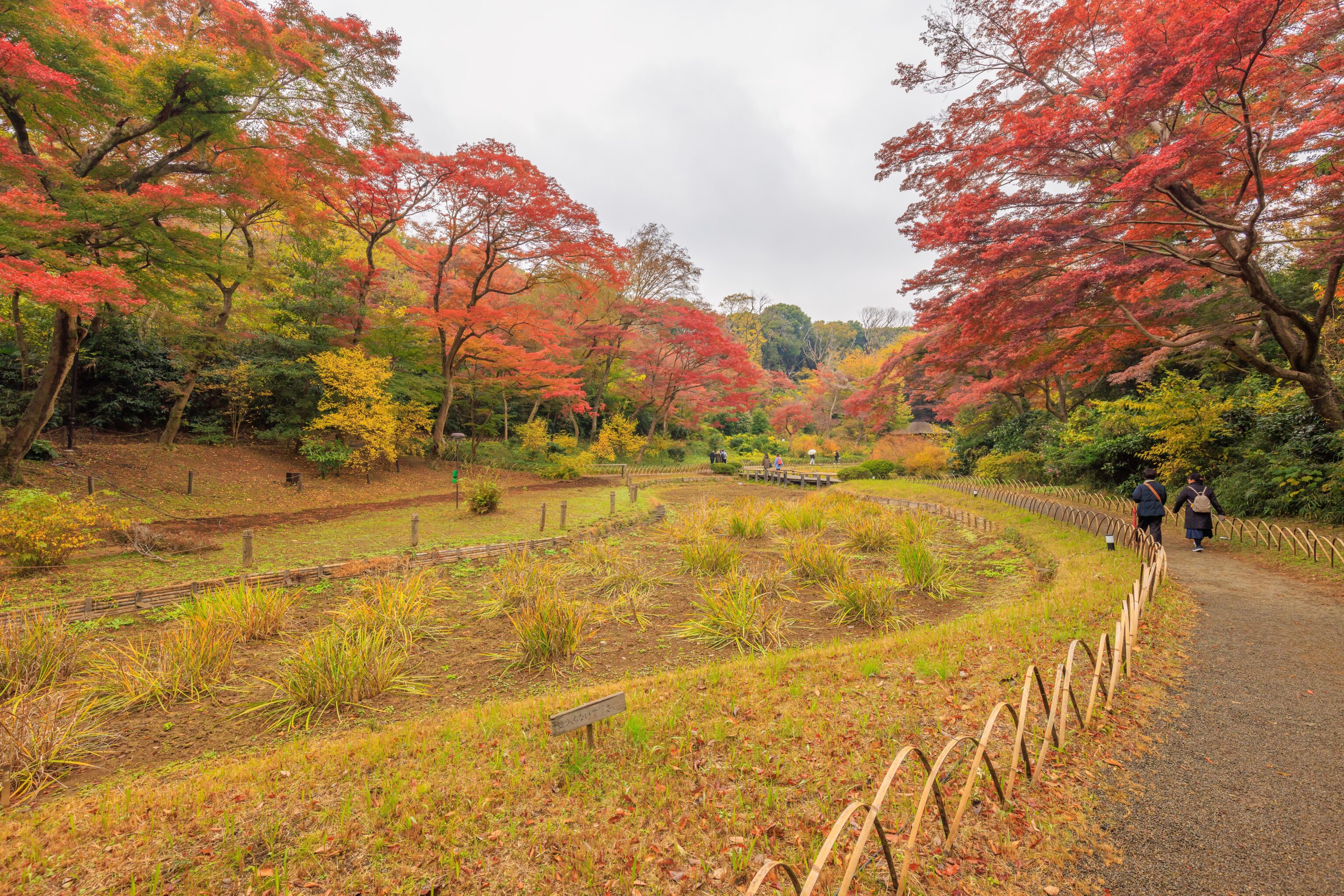
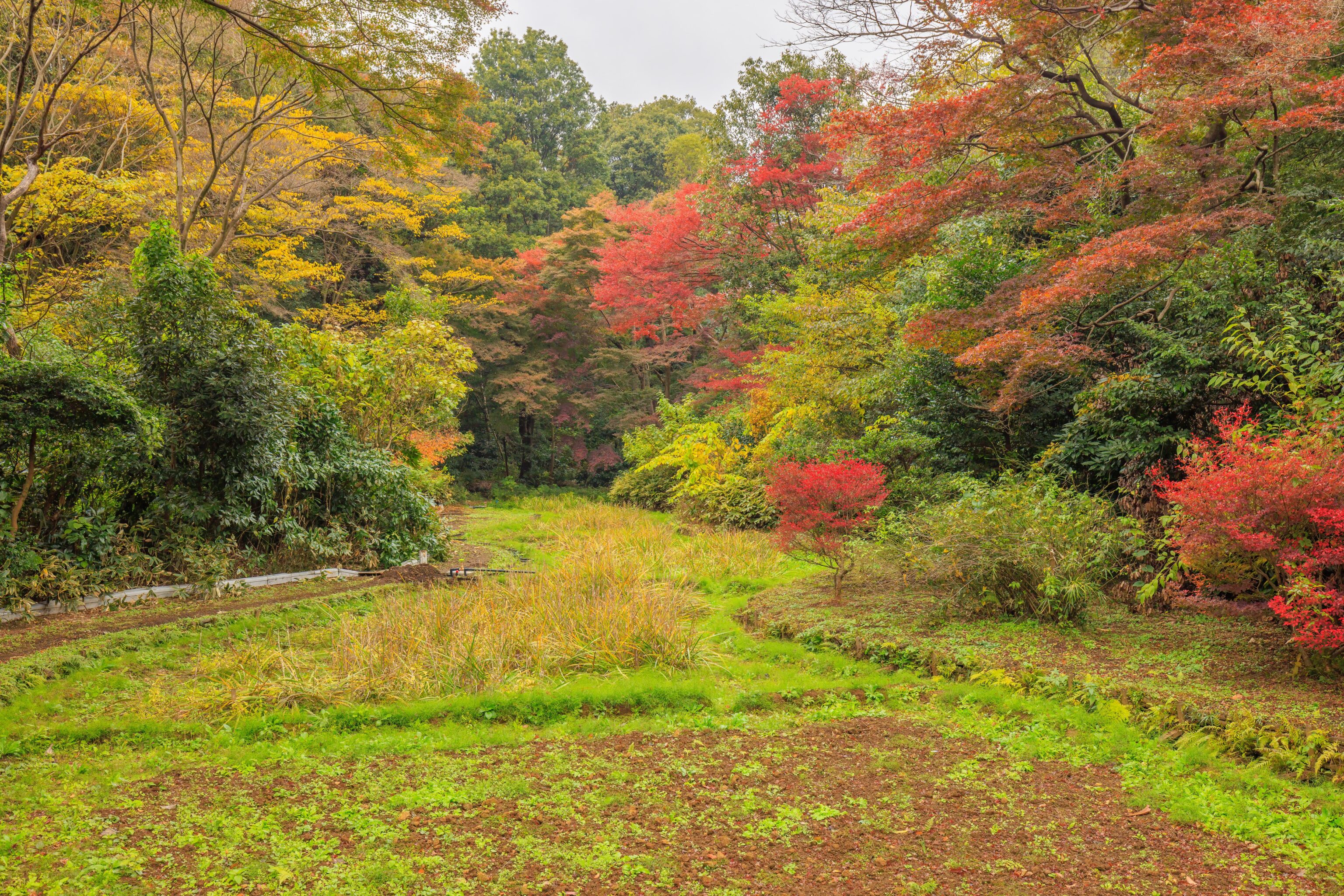
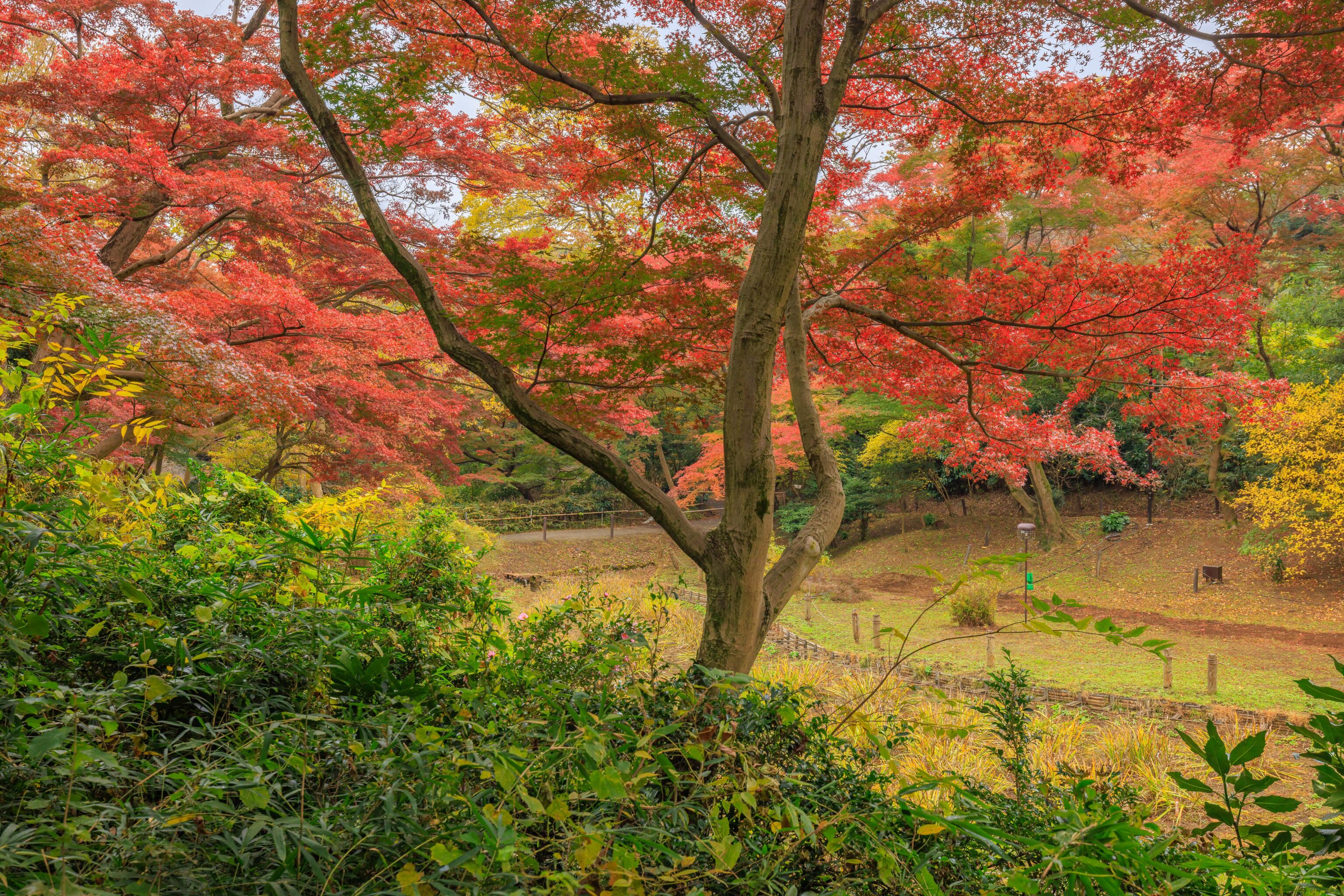
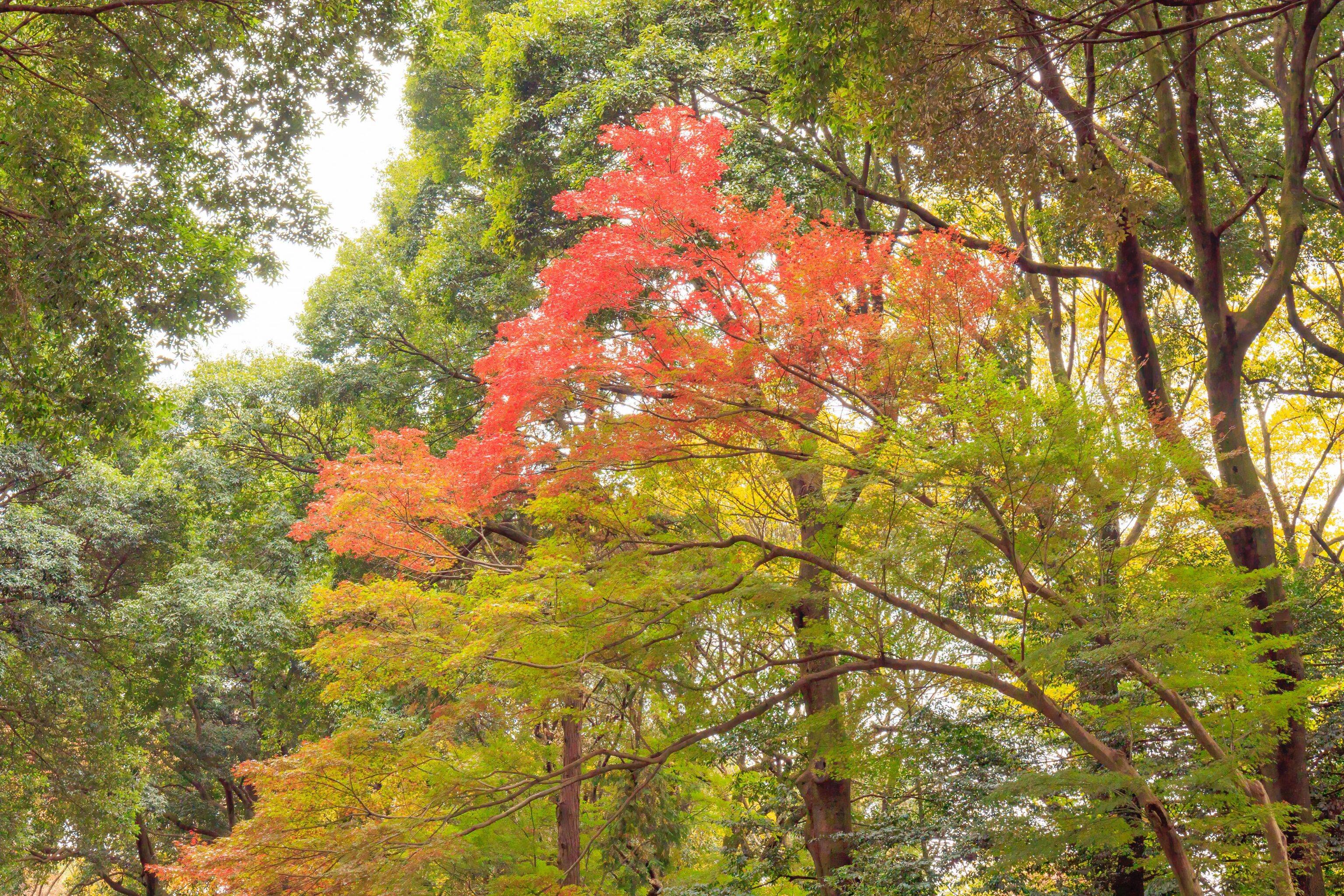
Starting from the labelled east gate on the map, we headed more or less along the red dotted path around Uchi-niwa. The pond’s surface was quite still and reflected the scenery nicely. It was a bit early in the fall season as we saw some colors but quite a bit of green.
We deviated from the suggested, path, walking around the Kara-mon. This gate is a reconstruction from 2020 as the original was burned down during “the war,” according to the map. Presumably, this means World War II.
We walked along the eastern shore of the lake that sits in the middle of the garden.
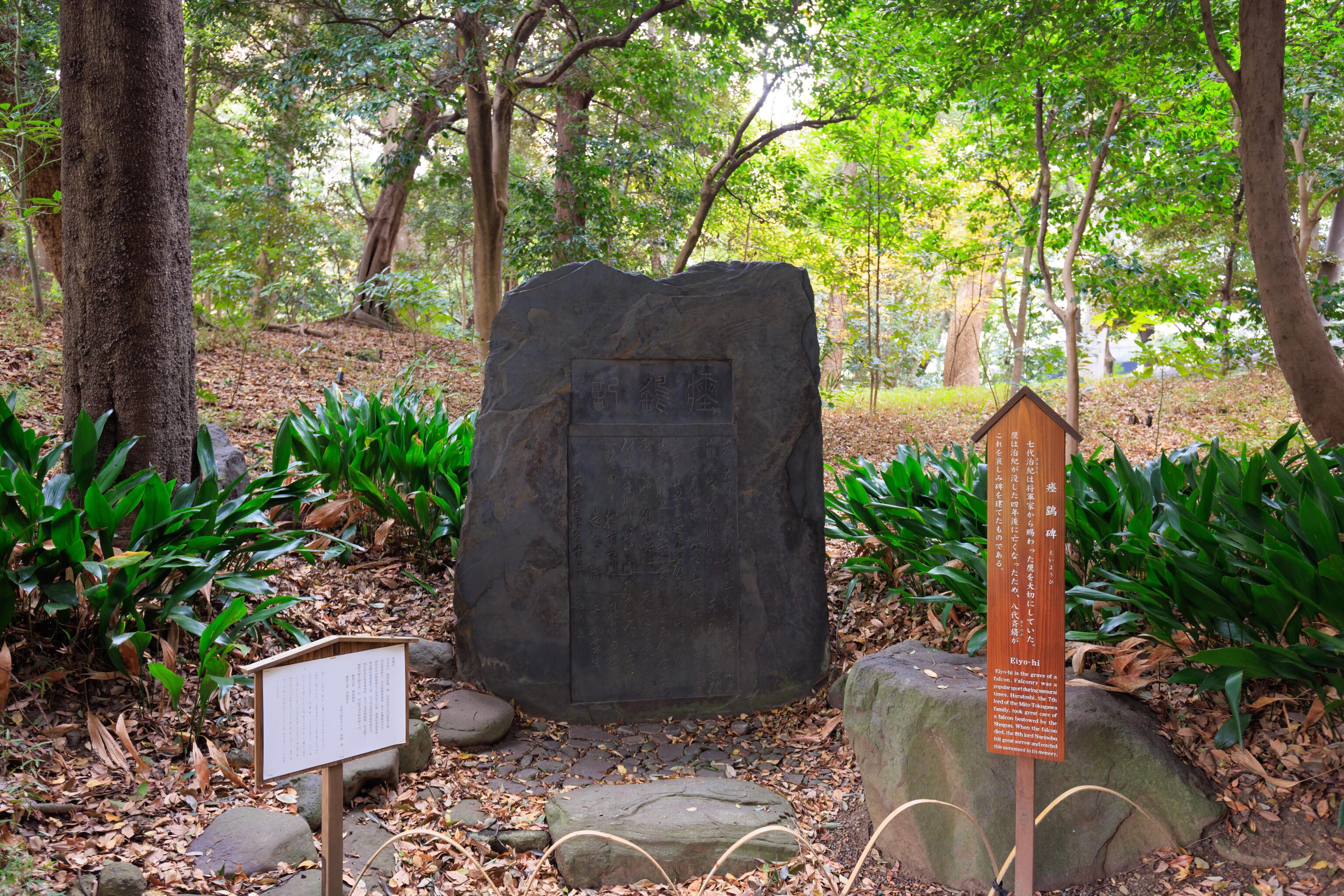
This is the grave of a falcon! The wooden sign reads, in English:
Eiyo-hi is the grave of a falcon. Falconry was a popular sport during samurai times. Harutoshi, the 7th lord of the Mito-Tokugawa family, took great care of a falcon bestowed by the Shogun. When the falcon died, the 8th lord Narinobu felt great sorrow and erected this monument in its memory.
We continued walking, eventually ending up at a small open area with some benches. This place is labelled “Pine trees” on the map.
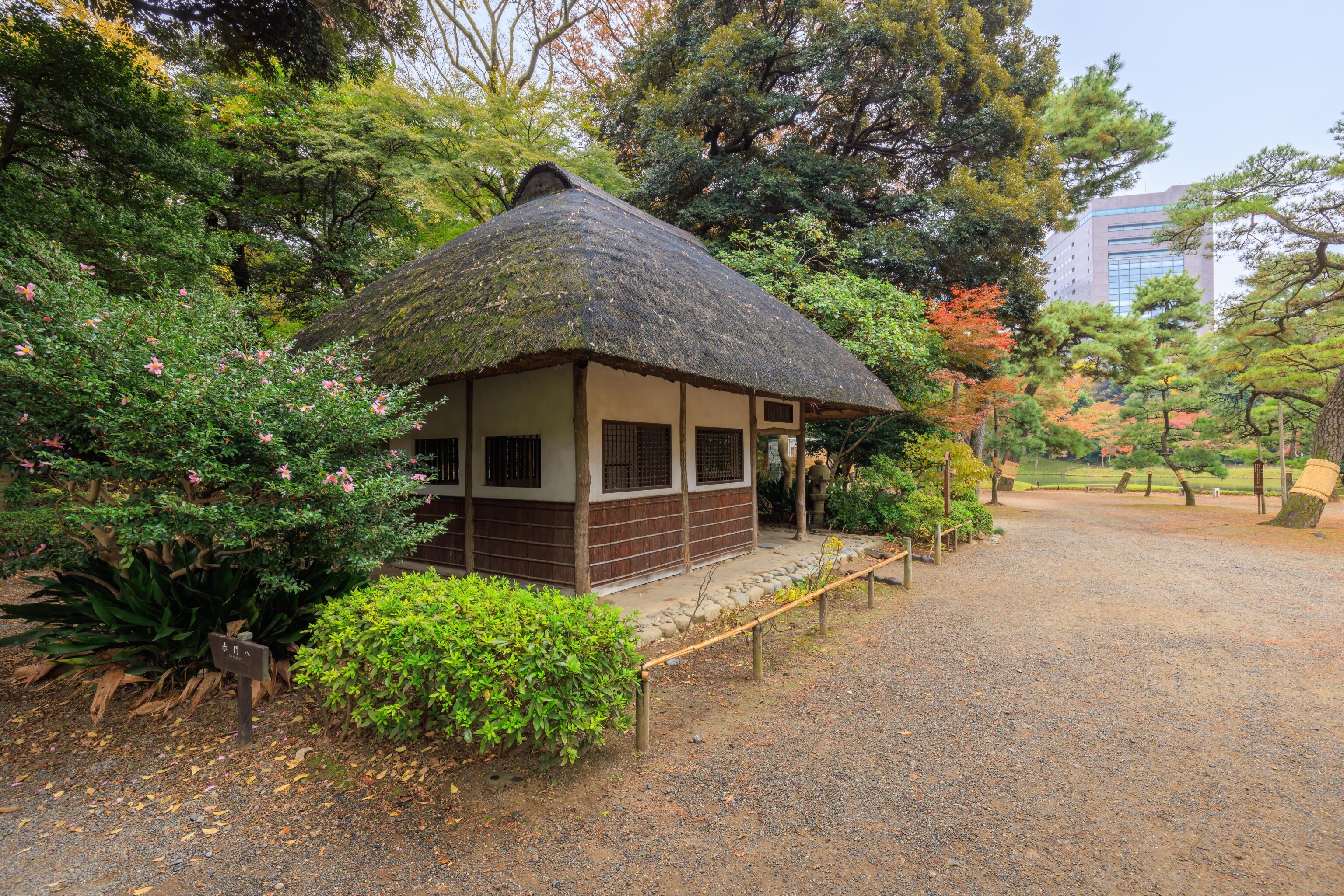
This small building is the Kuhachi-ya. It is described by a sign:
This house is a replica of the elegant Sake houses found in the countryside during the Edo period. Its name, Kuhachi-ya, which is a combination of the Japanese words for nine (ku), eight (hachi), and store (ya), refers to the lesson, "Do not fill Sake-cup to the brim. Nine-tenths in daytime, eight-tenths at night should be enough. It is wise to keep modest attitude toward all things."
Seems sensible!
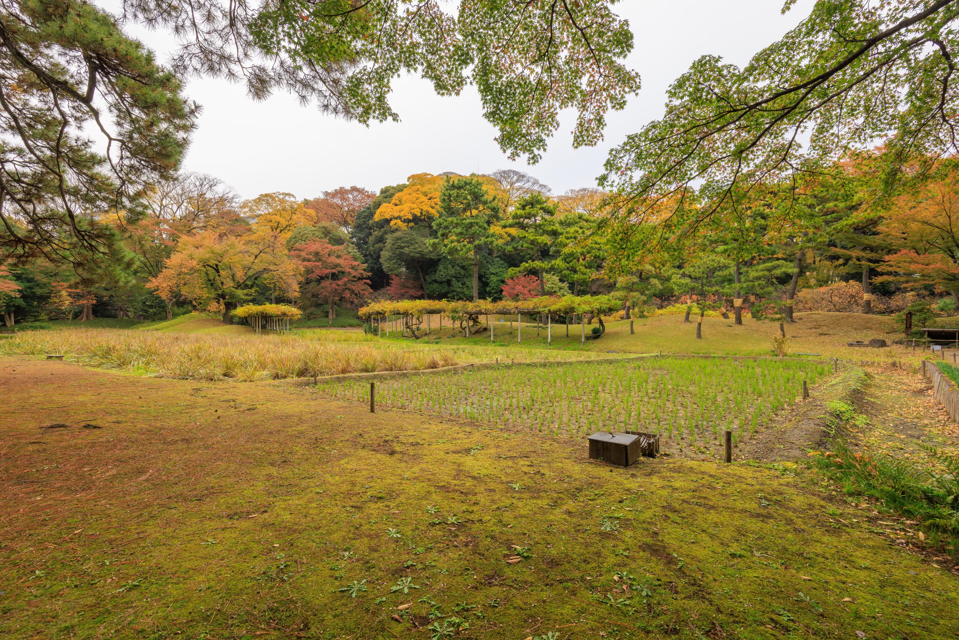
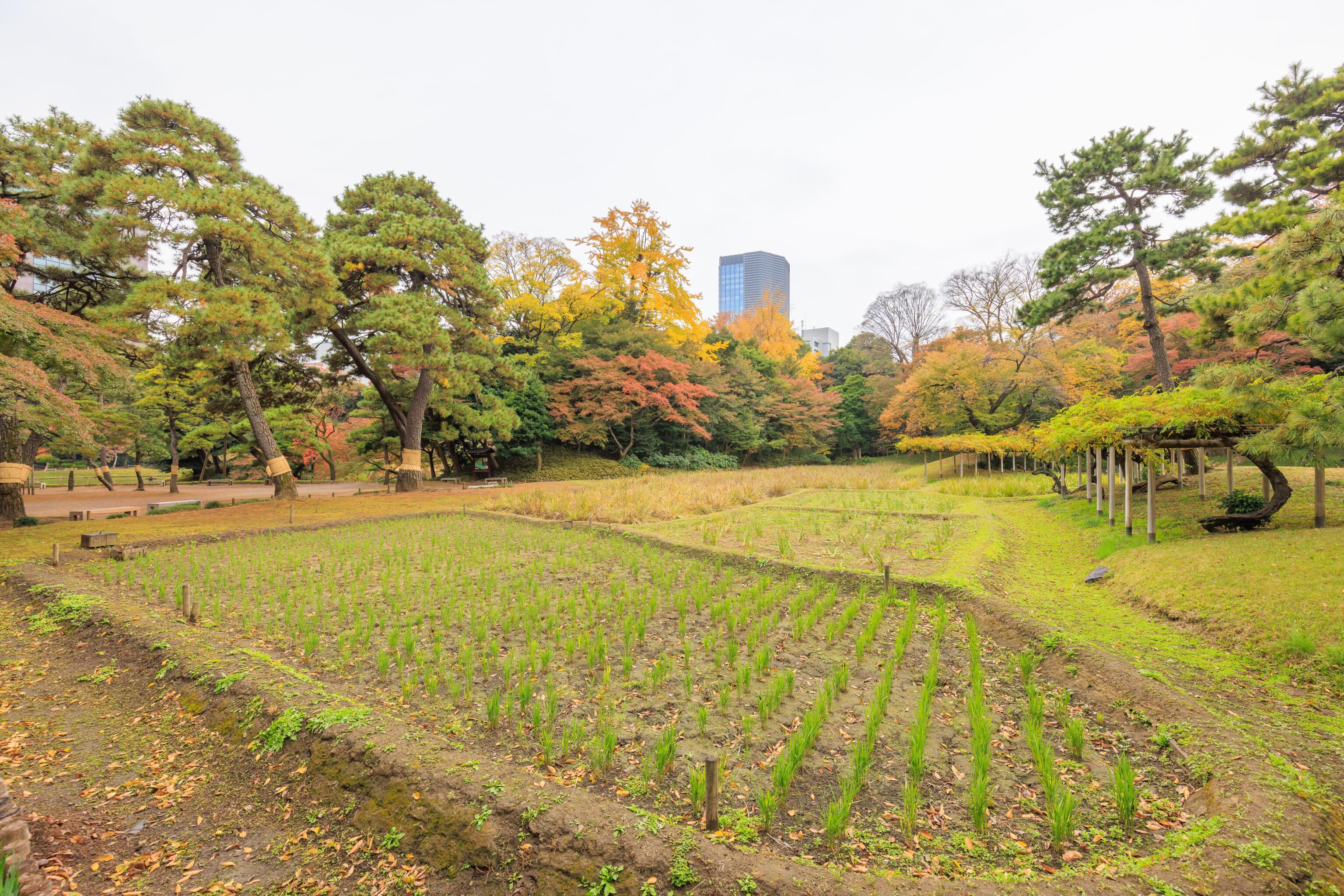
We continued walking to the north, away from the lake. This rice paddy is labelled “Inada” on the map. There is a sign:
Mitsukuni, the 2nd lord of the Mito-Tokugawa family, had this rice field planted to teach the wife of his son and successor about the struggles that farmers endured. Today, the pupils of a nearby elementary school in Bunkyo-ku plant and harvest rice in this field.
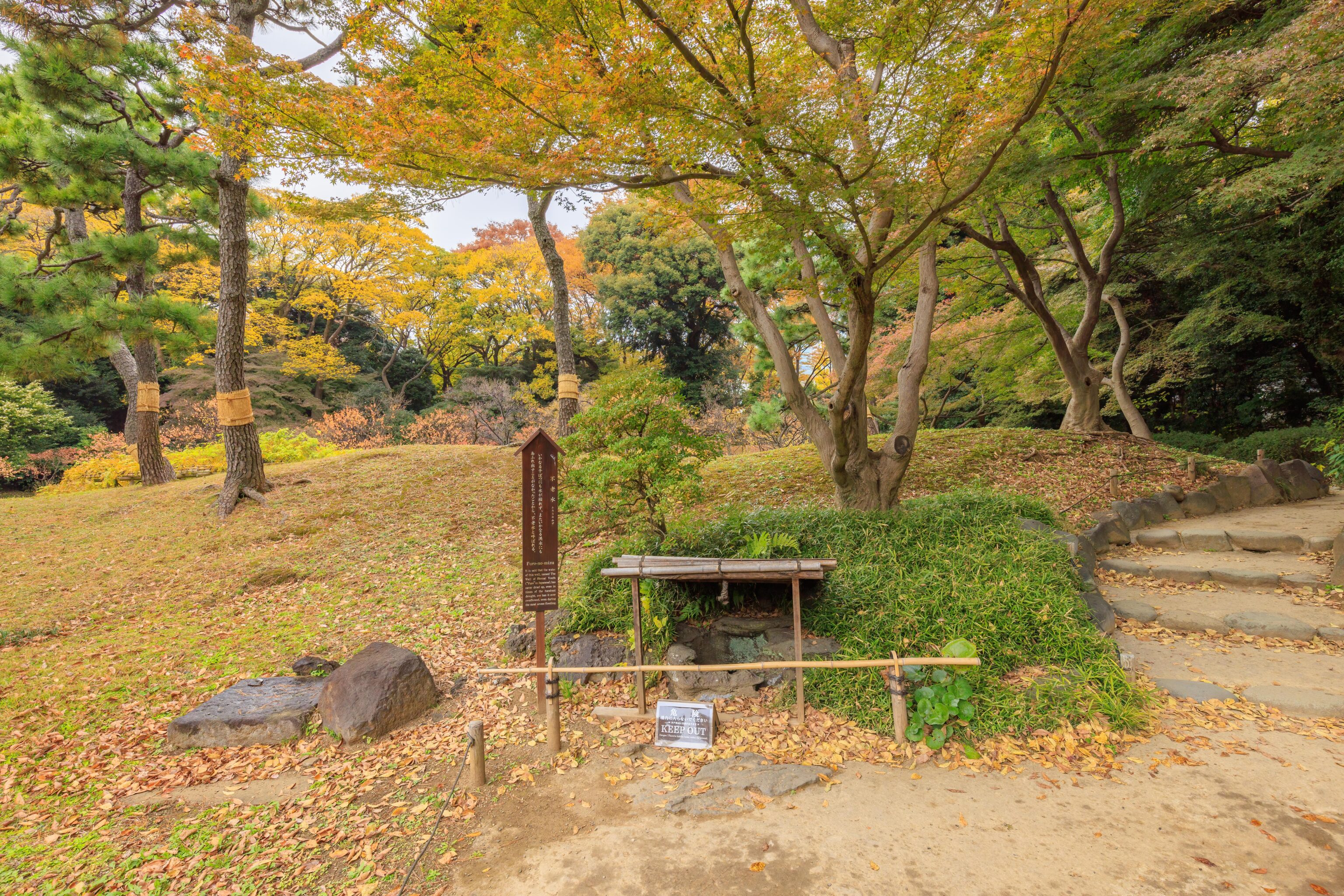
A well, the Furo-no-mizu, is nearby. The wooden sign on the left reads:
It is said that the water of this well, named The Well of Eternal Youth ("Furo" in Japanese), has never dried up, even in times of the harshest drought, nor has it ever overflowed, even during the most severe flooding.
Basically, the most perfect well!
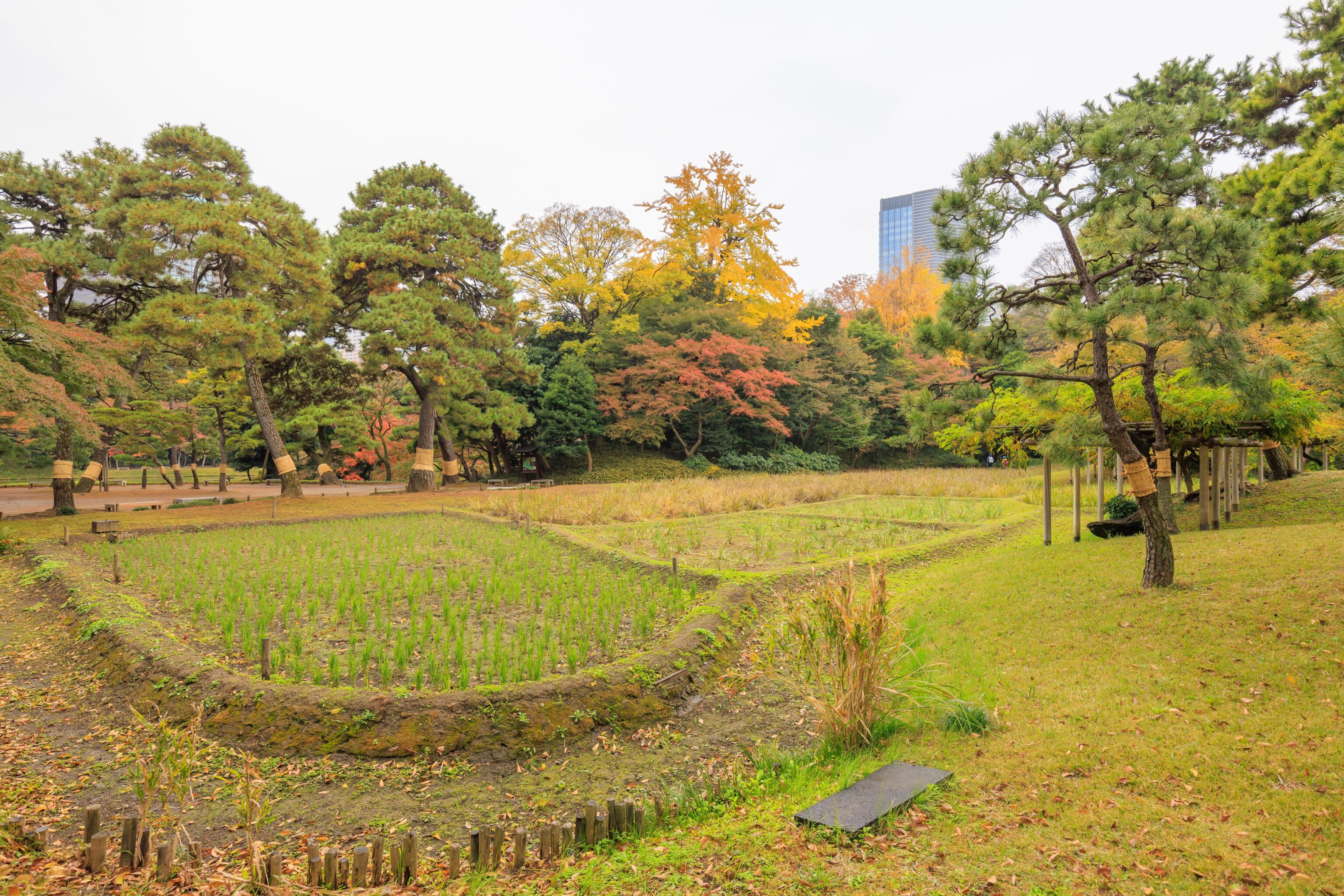
Looking back at the rice paddy and other fields. The map suggests the remaining fields contain iris plants.
We continued walking to the north, passing over a small stream.
This bridge is a Yatsuhashi (Eight Bridge), a concept that comes from literature. Wikipedia explains1:
Eight Bridges (Japanese: 八橋; Romaji: Yatsuhashi) is a design of Japanese bridge that consists of eight overlapping wooden or stone planks. Its eight-part construction was first mentioned in The Tales of Ise, written during the Heian Period, and was for many centuries a well known literary motif in Japan. Over time the motif (which became stylised into a zig-zag shape), was incorporated into a large range of art forms: it could be found on kimonos, writing boxes, screens and porcelain, and in ukiyo-e prints and garden landscapes.
This is an example of its usage in a garden landscape. It is common for Japanese gardens to incorporate scenes from other places or forms of art.
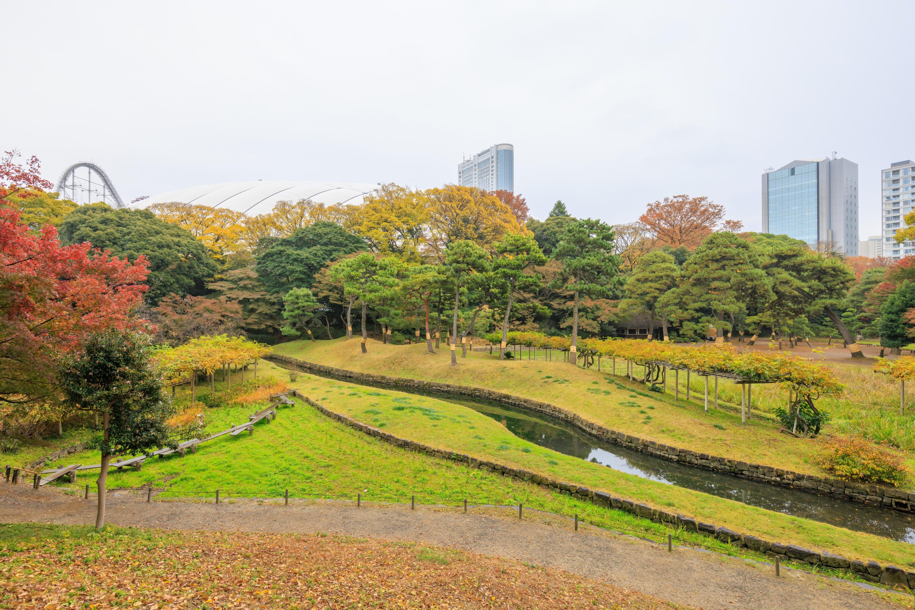
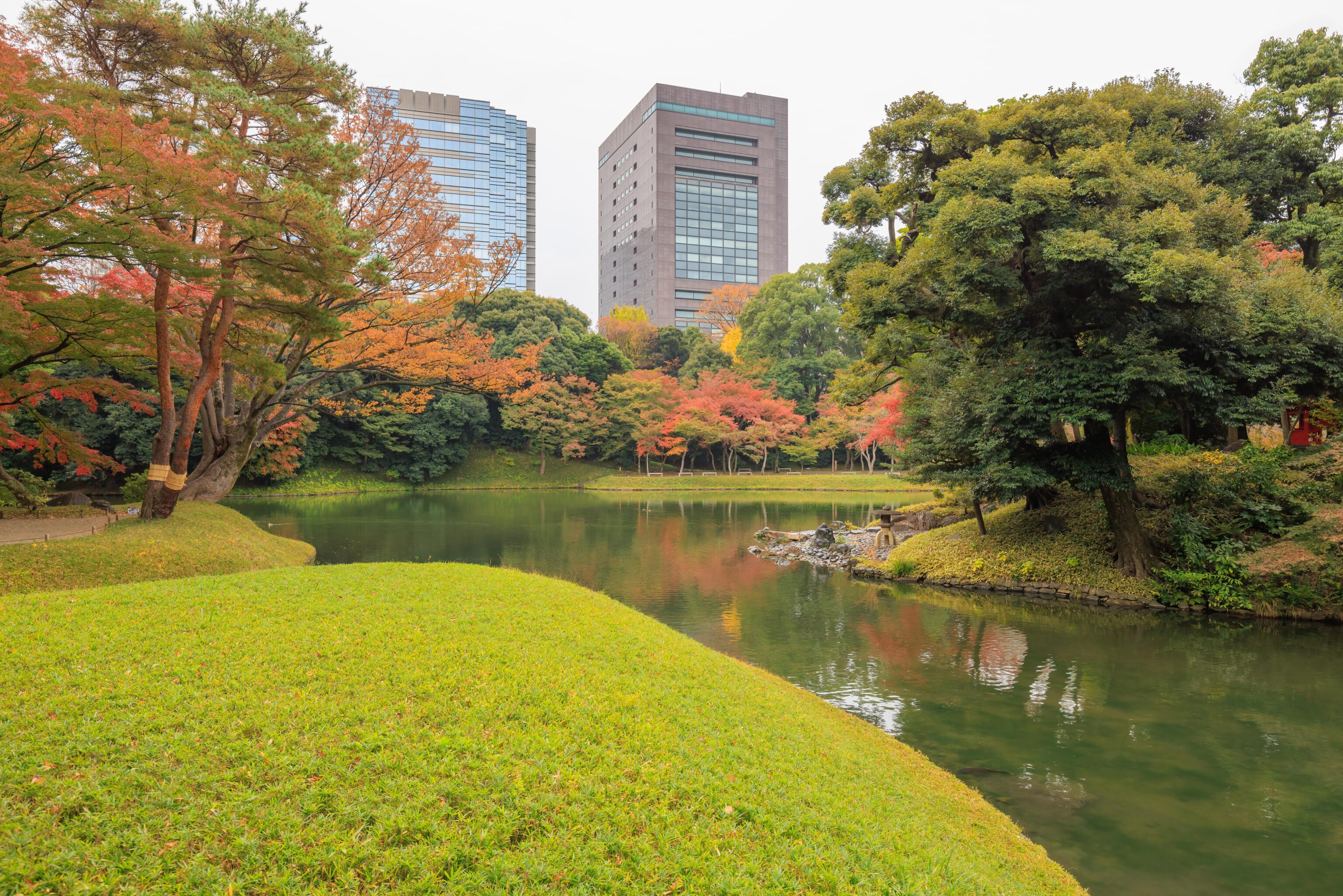
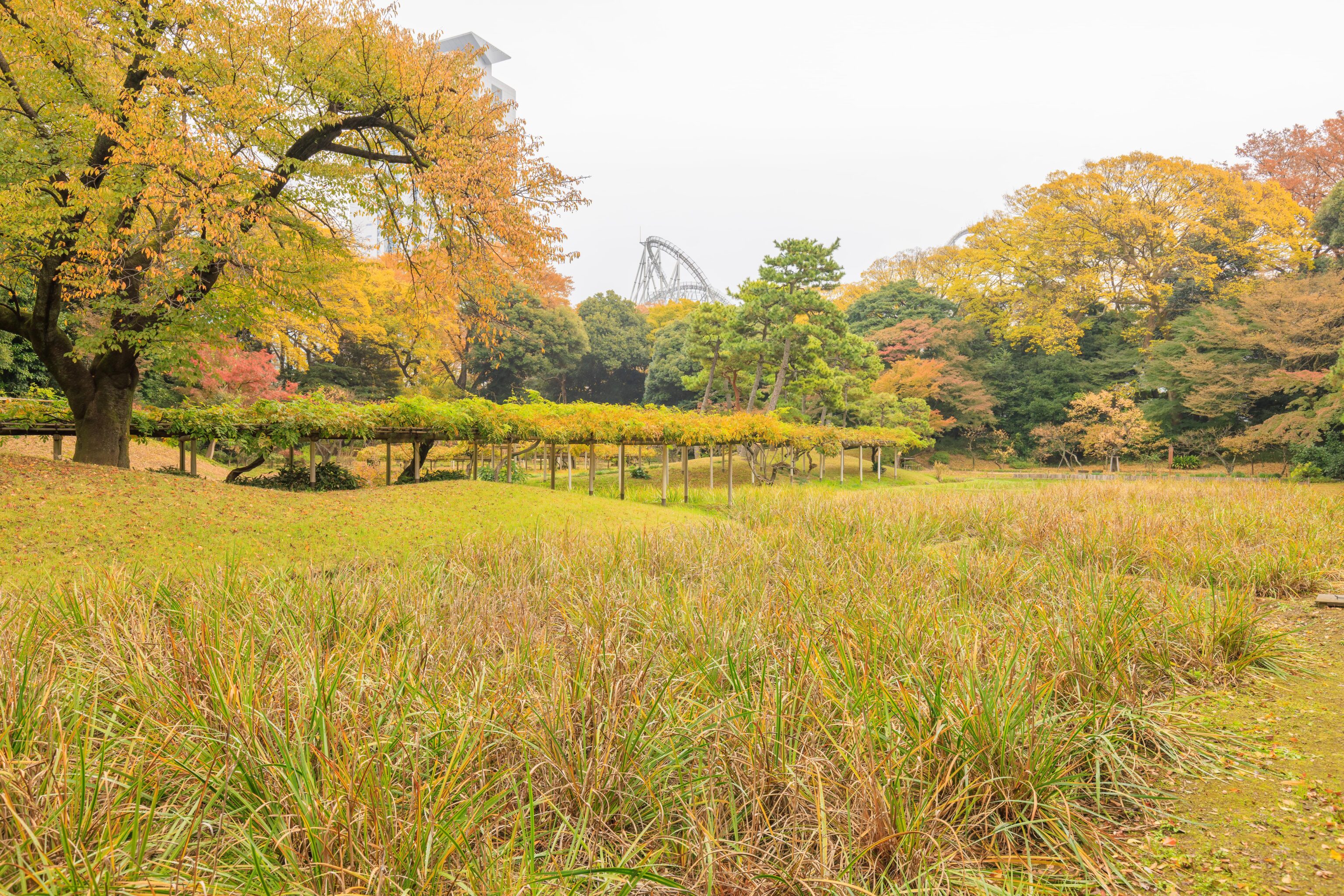
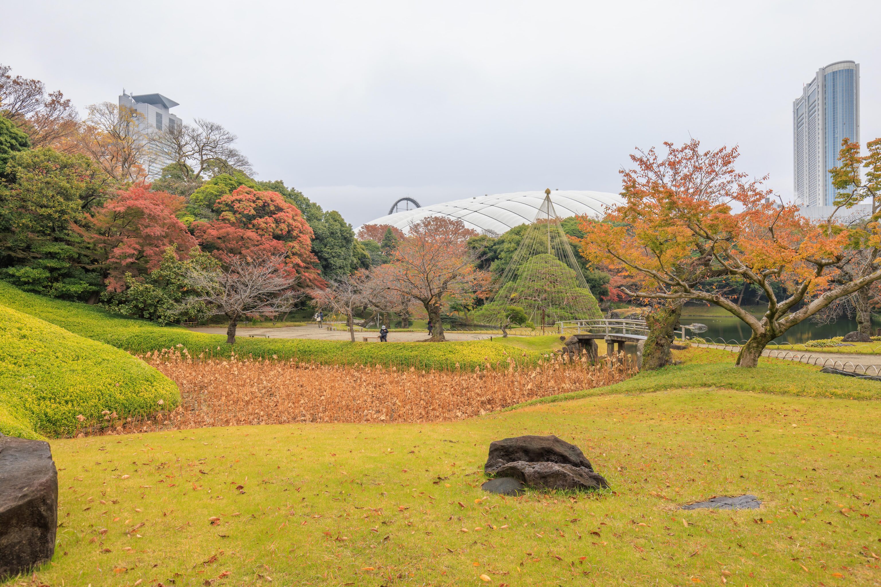
We partly ascended a small hill where we could get a better view. This hill seems to be the “Atago slope” on the map. The Yatsuhashi can be seen below on the left. In the background, we can see the top of the Tokyo Dome as well as a rollercoaster at the very left edge, part of Tokyo Dome City.
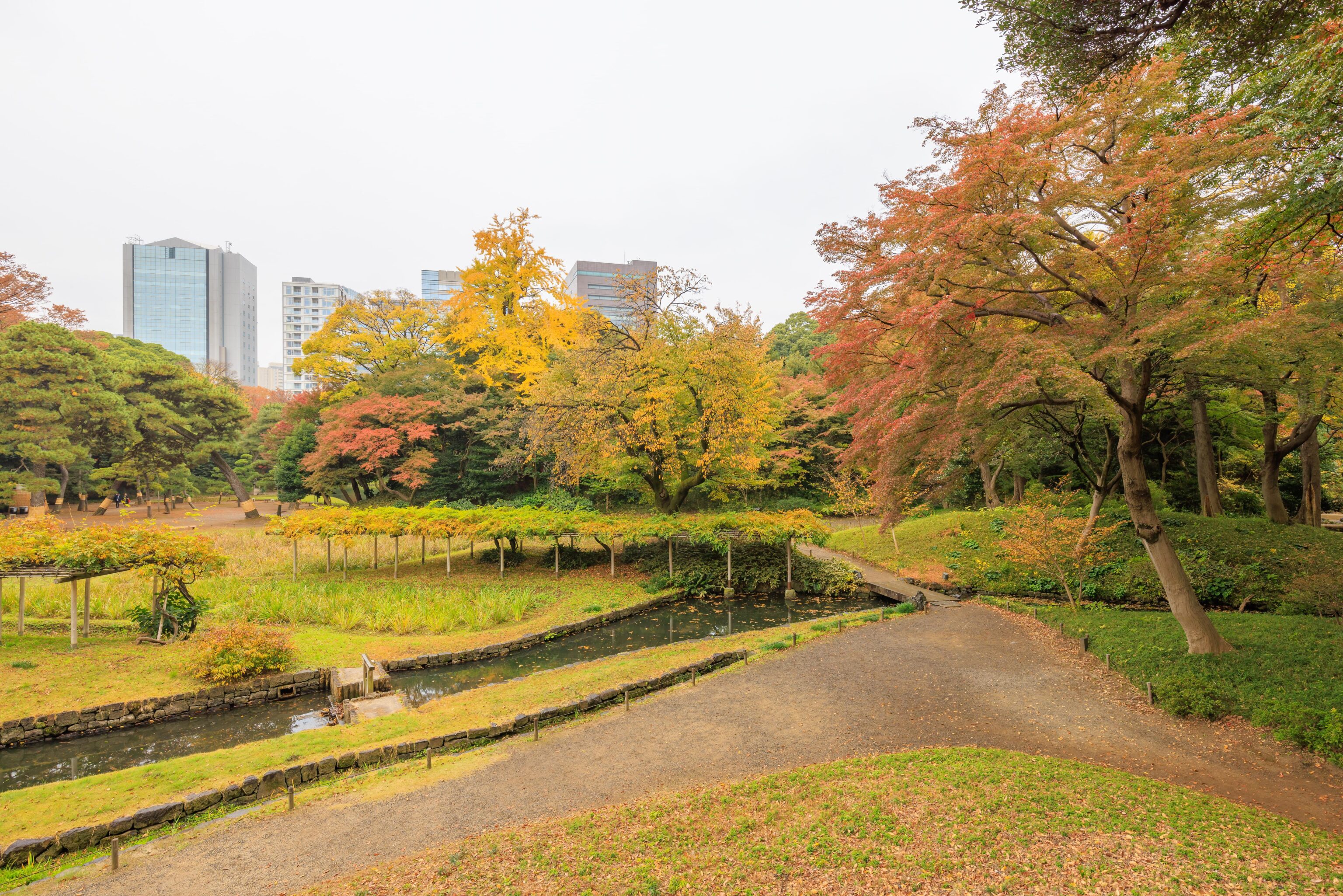
The view to the right, probably south.
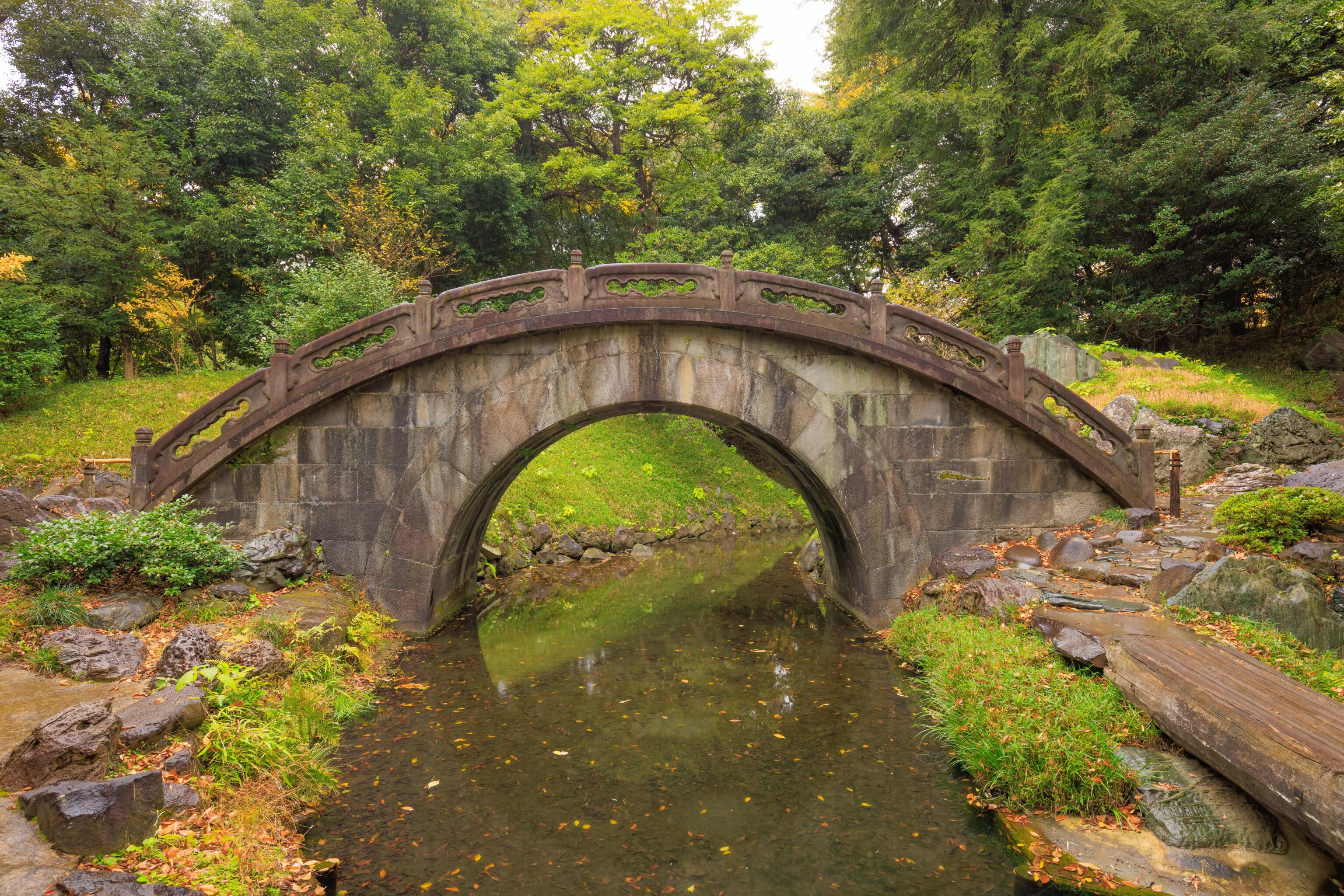
This bridge is the Engetsu-kyo. A sign explains:
This stone bridge is said to have been designed by Zhu Shun Shui, a Chinese Confucian scholar of the 17th century. It was named Engetsukyo (Full Moon Bridge) because the bridge and its reflection in the water form the shape of a full moon. It is one of the oldest stone arch bridges in Japan.
We could see the bridge’s reflection form a complete circle with the bridge itself.
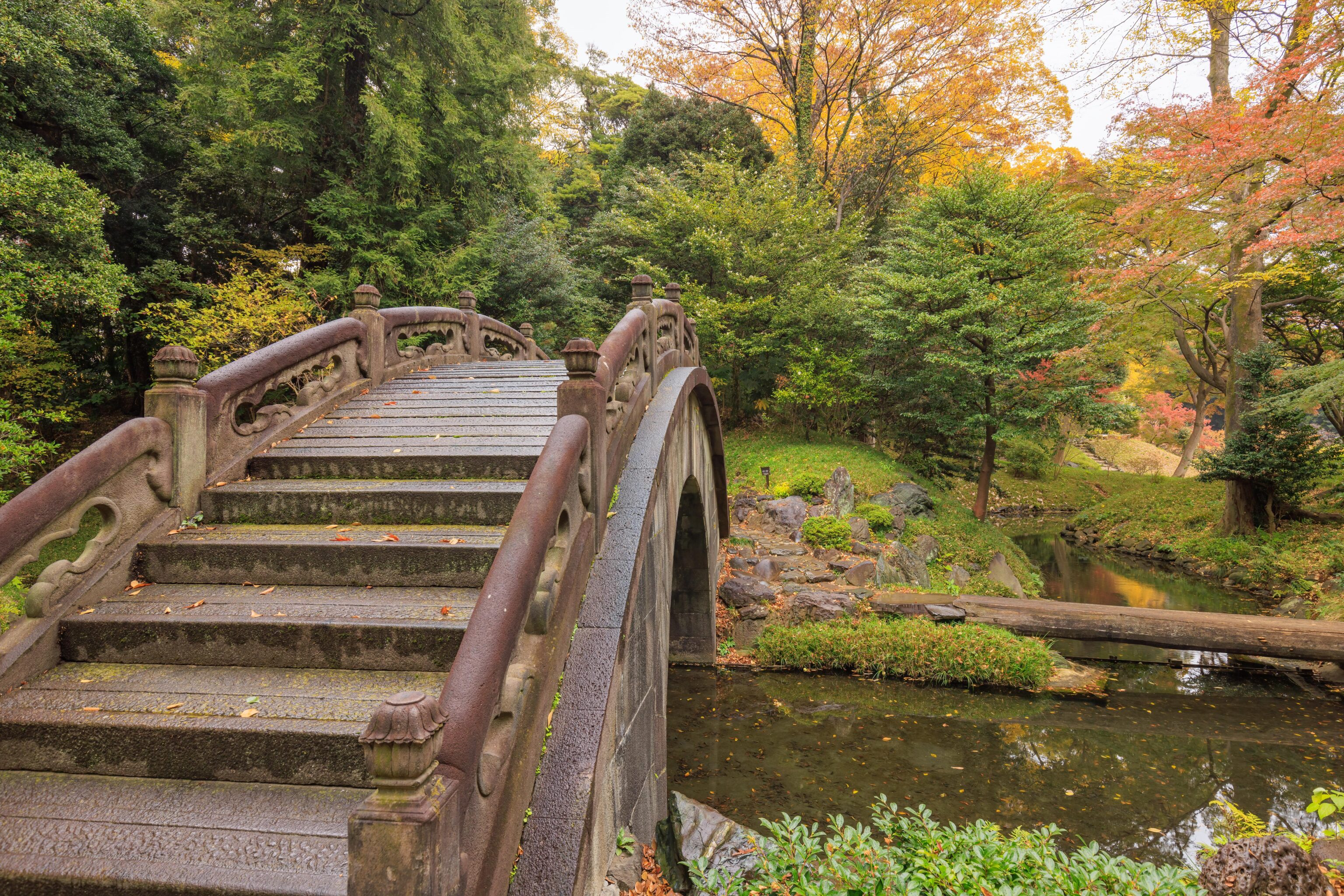
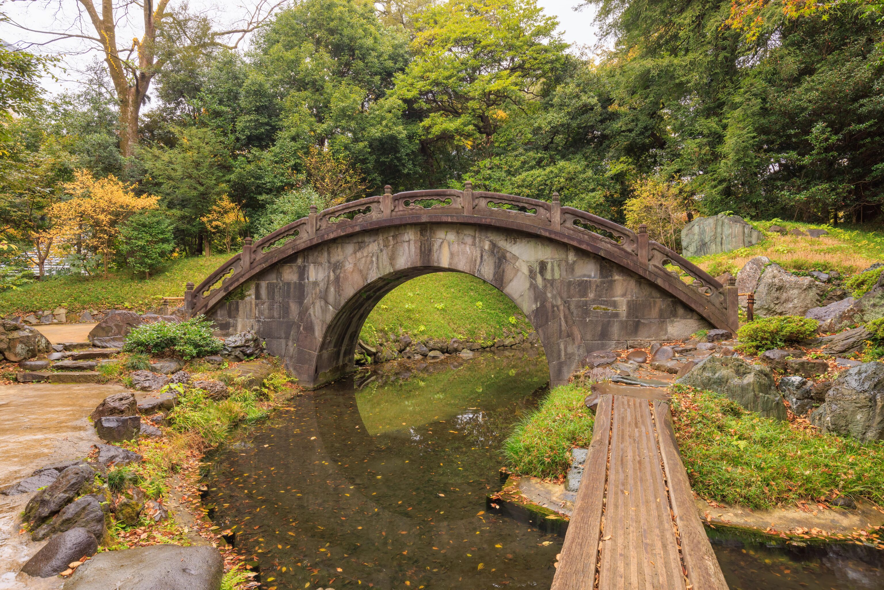
The walking surface of the bridge. It wasn’t possible to cross over as both ends were blocked off by bamboo barriers.
We continued walking, heading south to return to the lake.
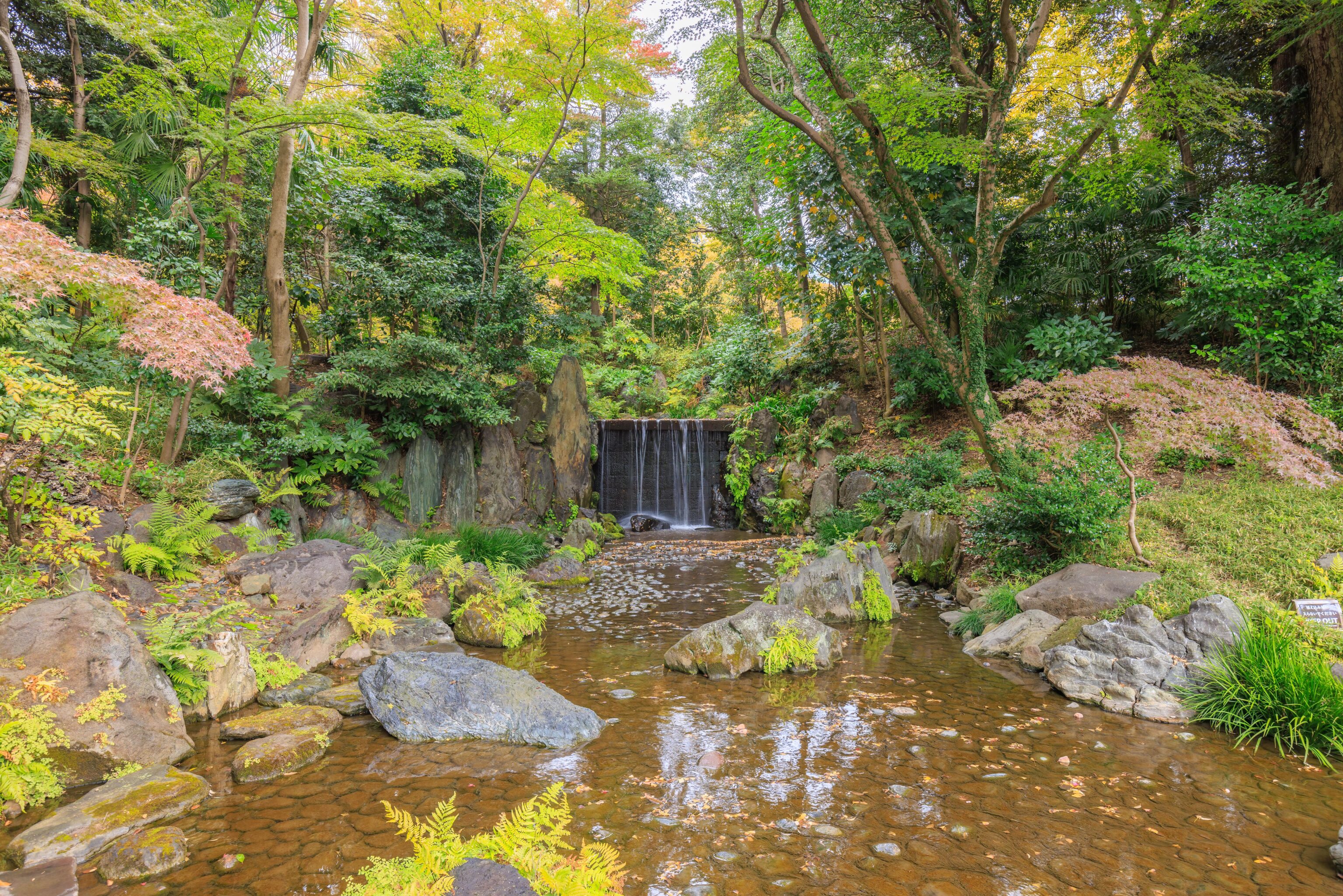
We passed by a small waterfall, the Shiraito-no-taki. A sign explains:
This waterfall was given the name Shiraito-no-taki, which means "white thread falls," for its resemblance to a thousand white threads.
This is a description that can be given to many waterfalls!
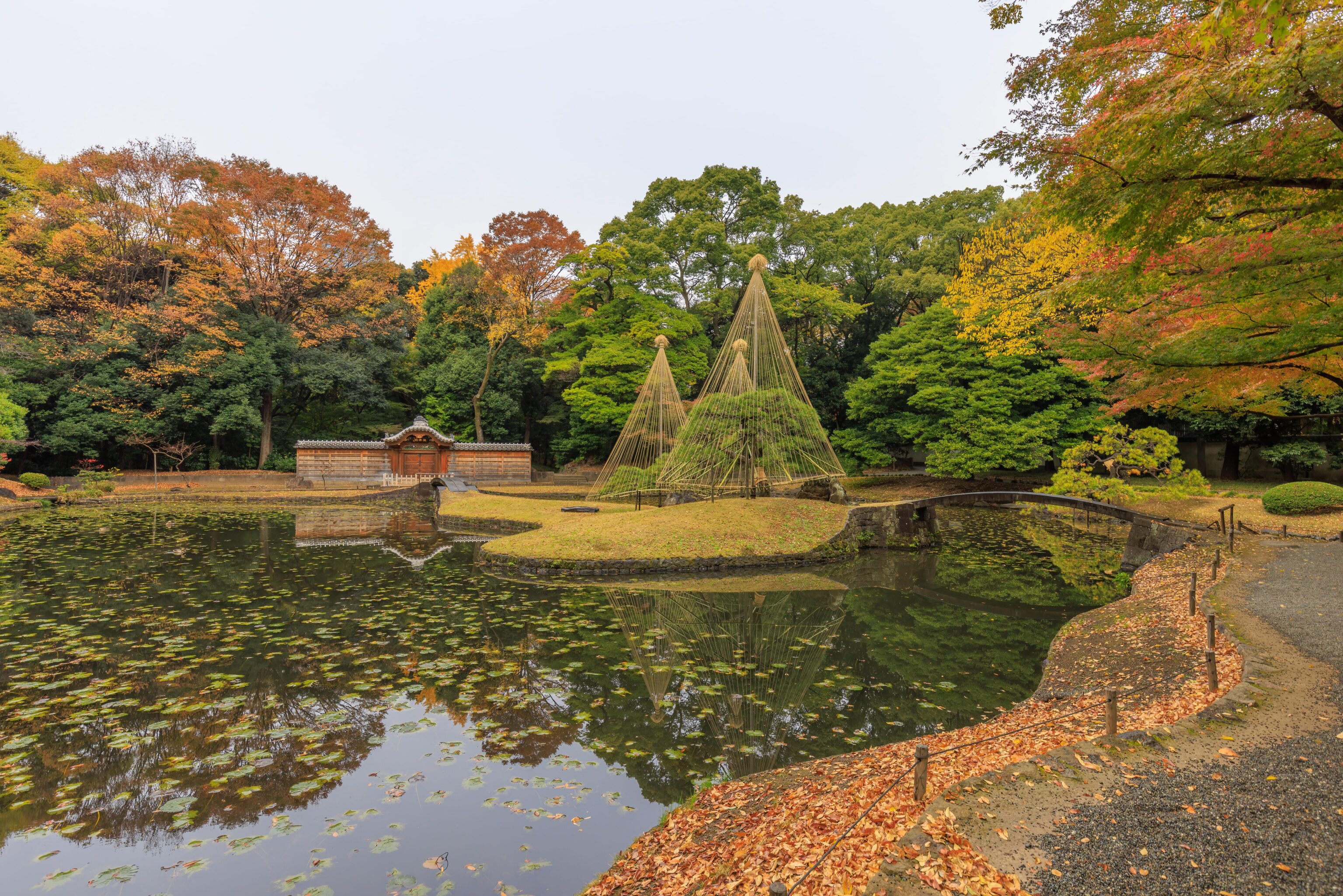
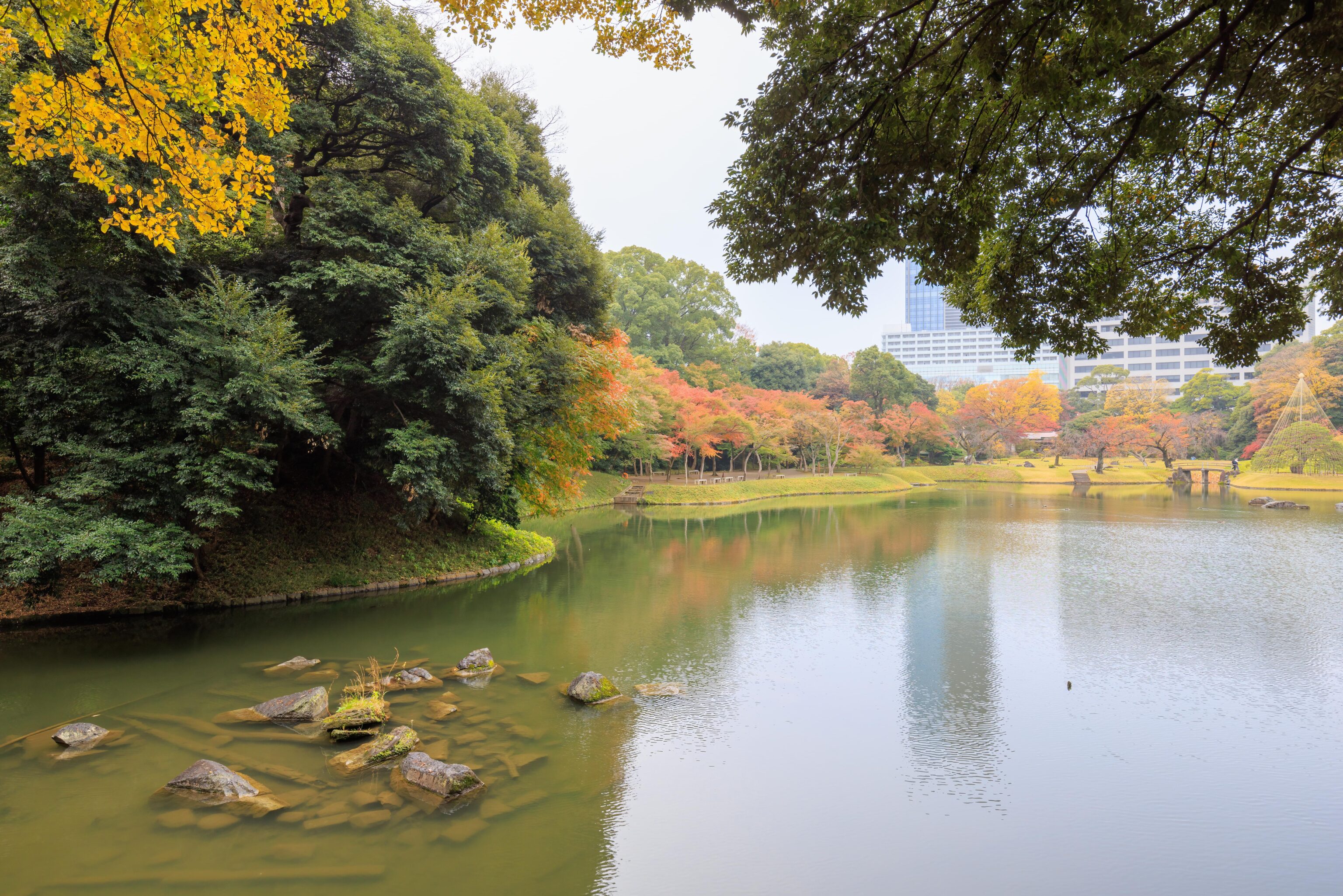
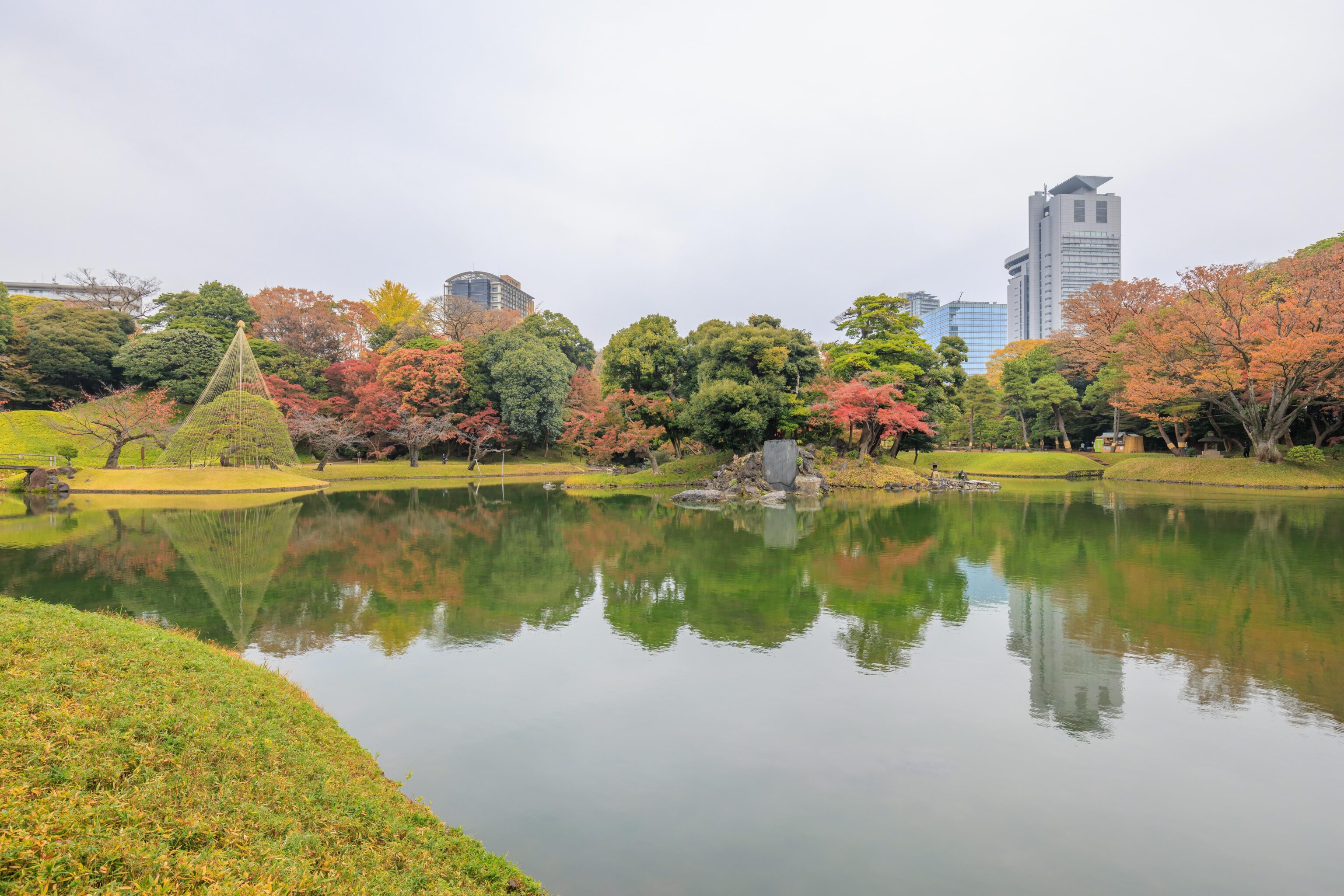
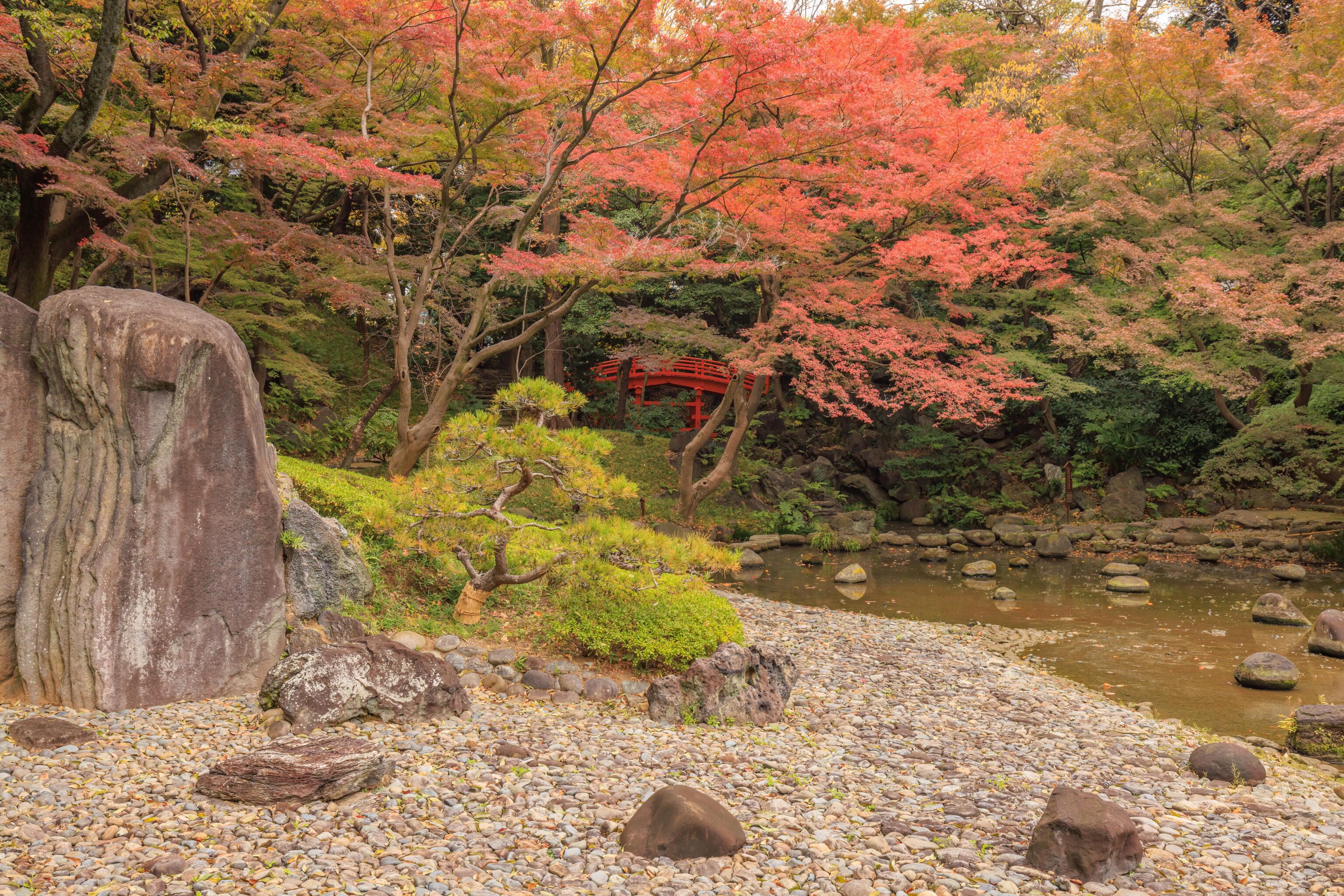
It is hard to tell but the mass of trees at the center of the frame are on a small island in the lake.
A sign explains this scene:
The Daisensui, or great pond, is meant to resemble Lake Biwa, the largest lake in Japan. Hitotsumatsu, the pine tree on its banks, has been likened to Karasaki-no-Hitotsumatsu, the famous Single Pine at Karasaki on the shore of Lake Biwa.
Lake Biwa is on the opposite side of the mountains east of Kyoto. The closest we’ve been to the lake is a few hundred meters away at Hikone Castle.
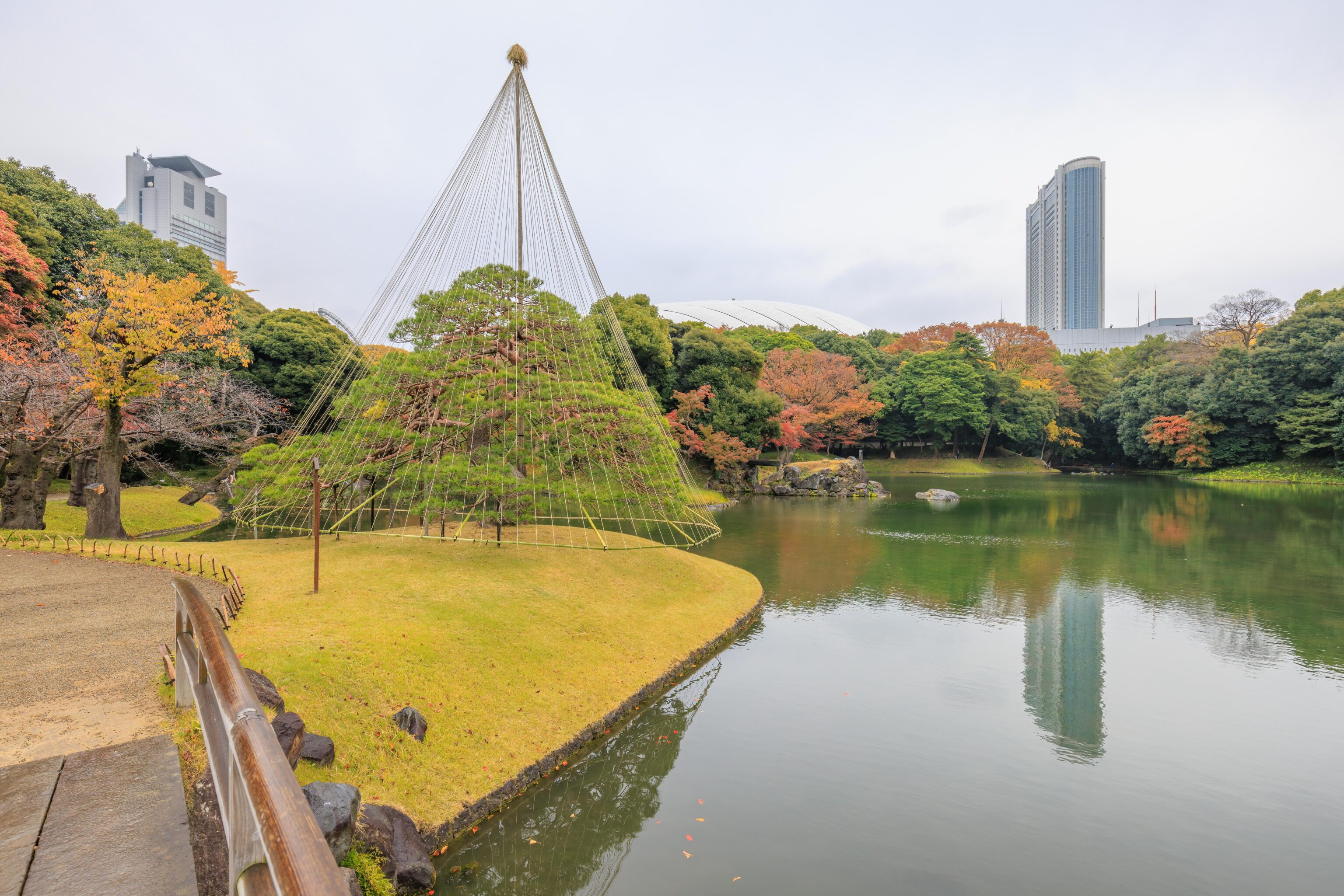
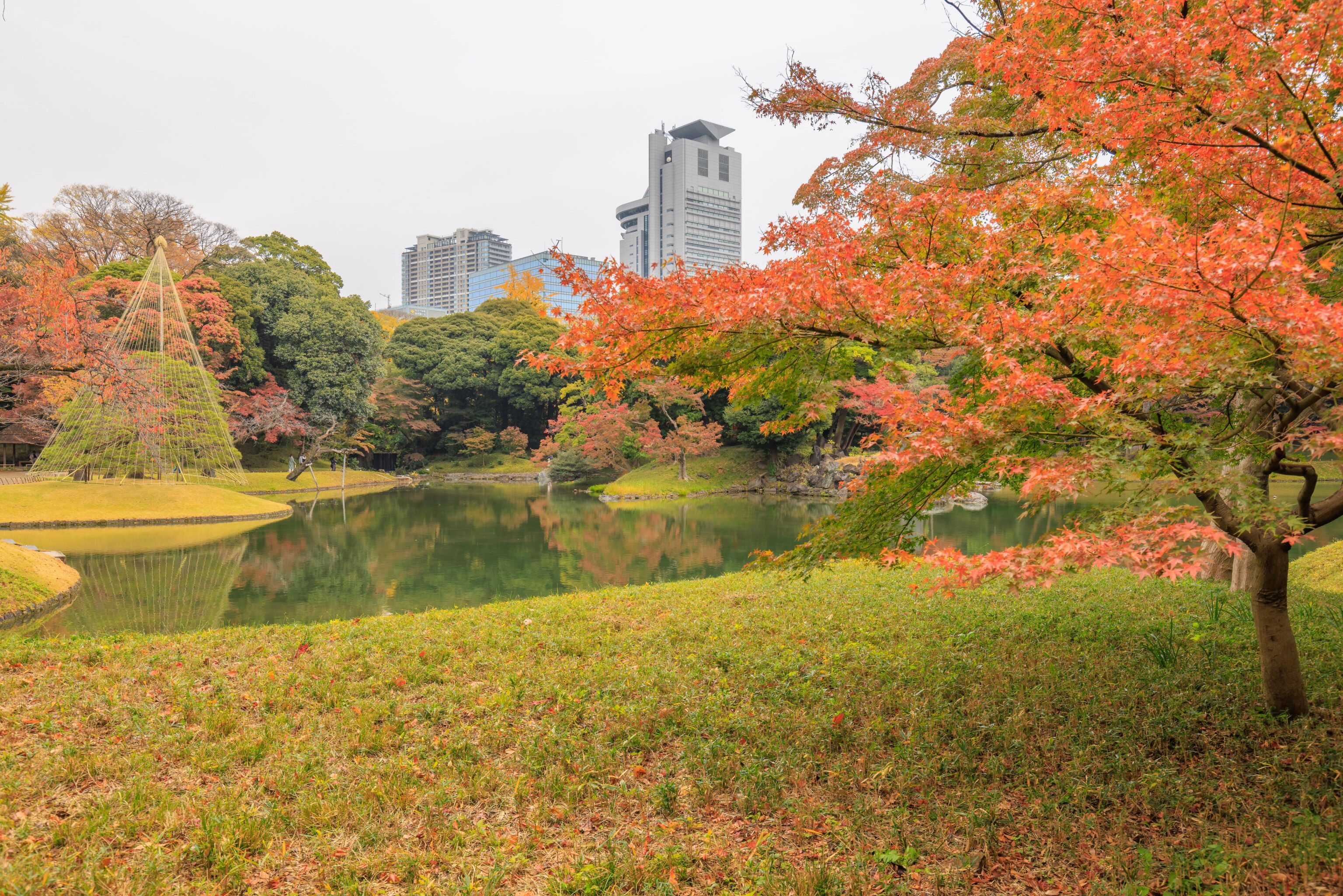
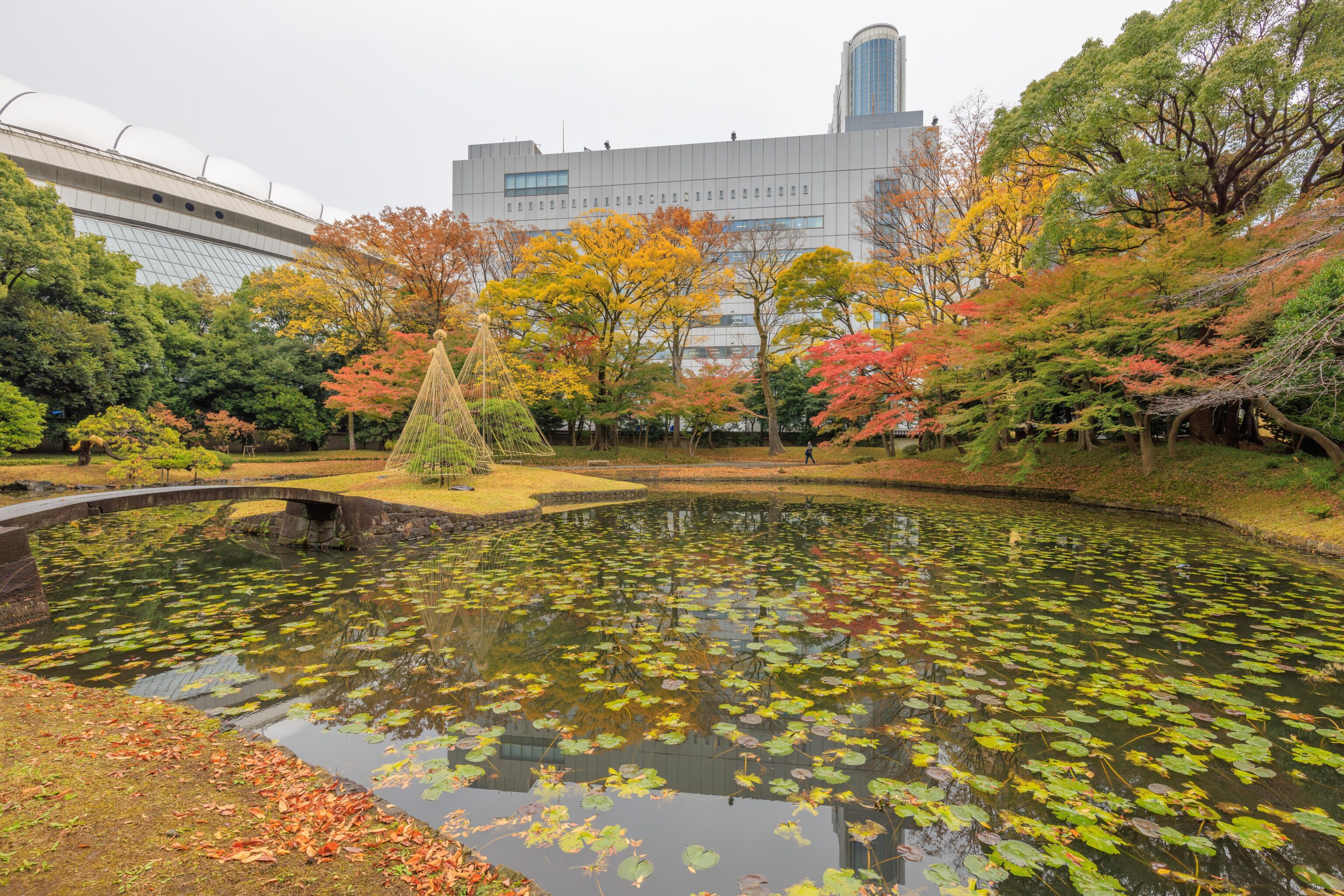
The upside-down cone above the tree is Yukitsuri, a technique for helping to support the branches during heavy snowfall to keep them from breaking.
The scene from a different perspective.
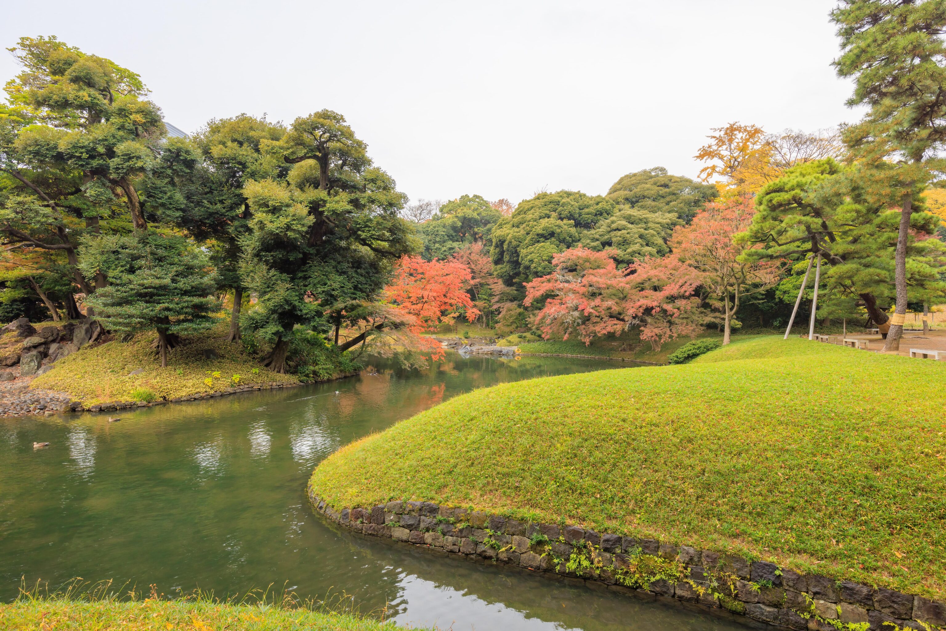
And again, from the south side of the lake.
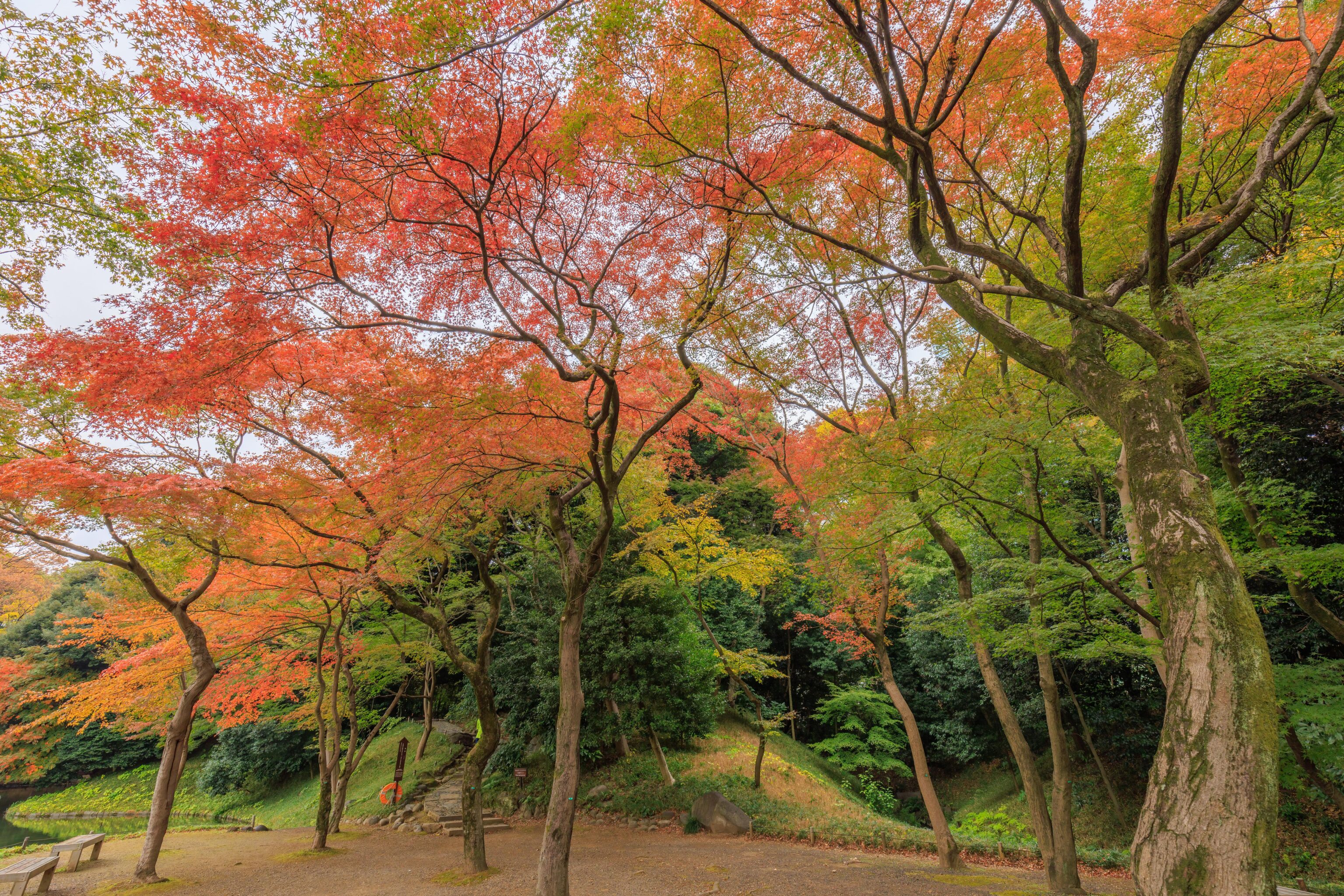
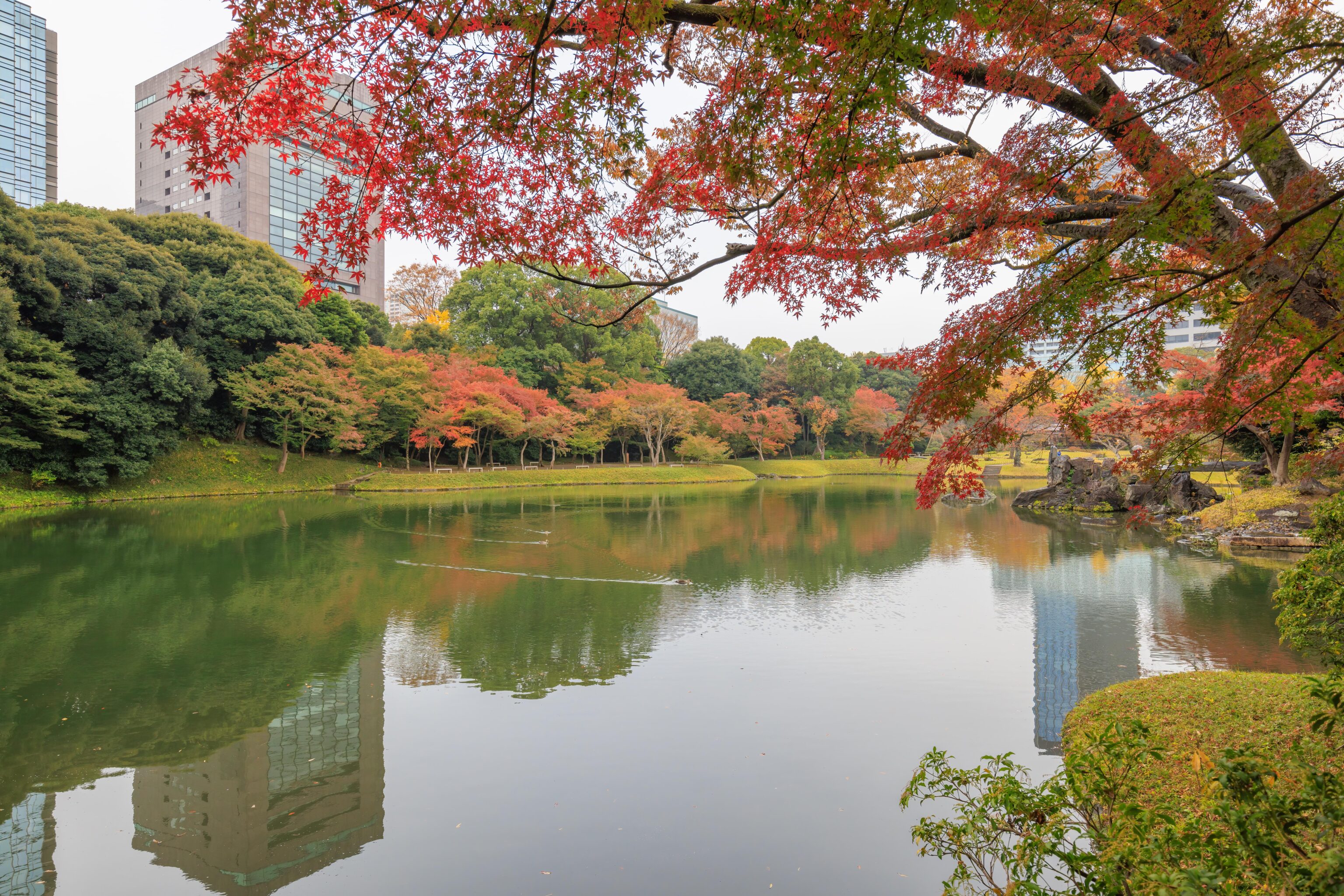
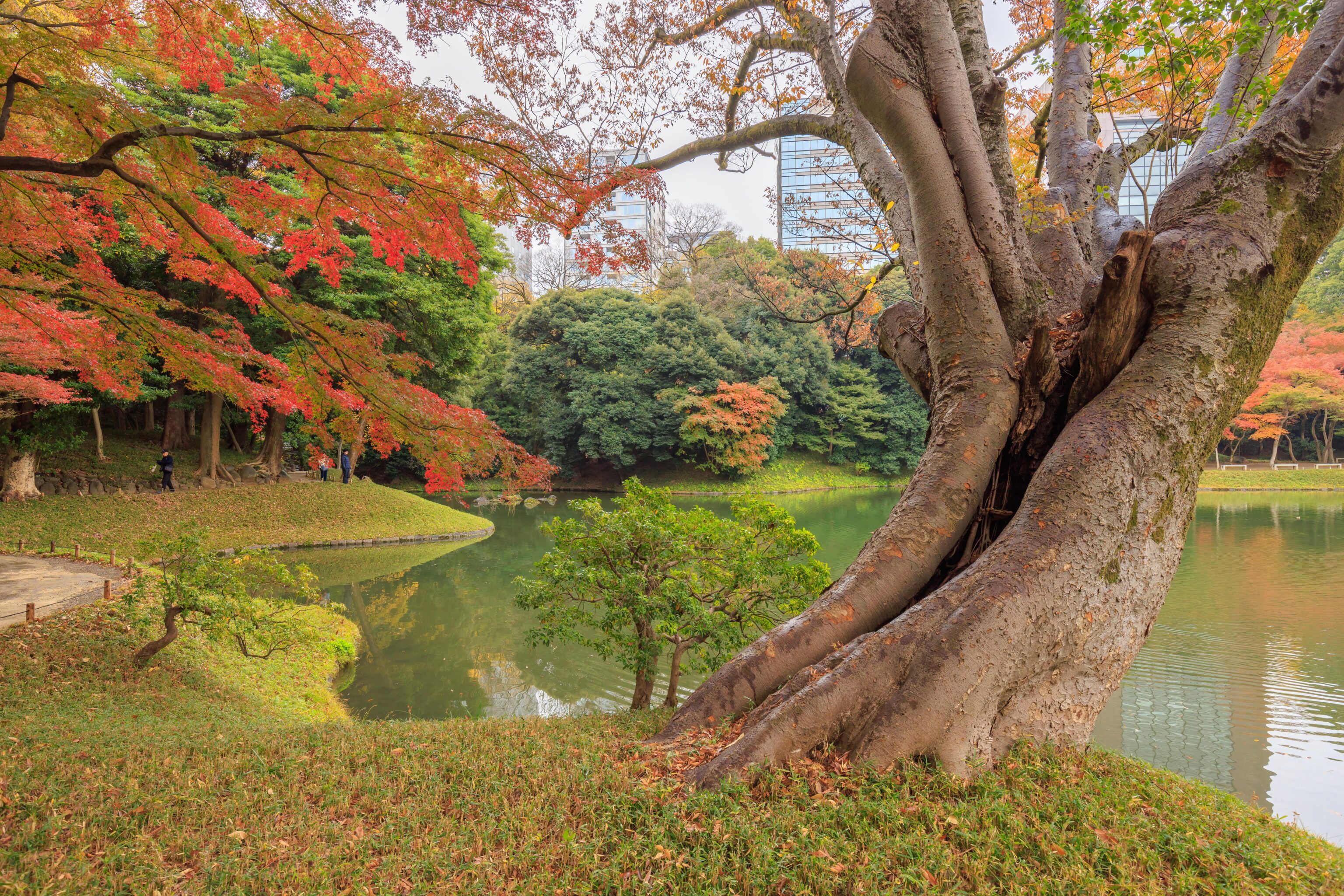
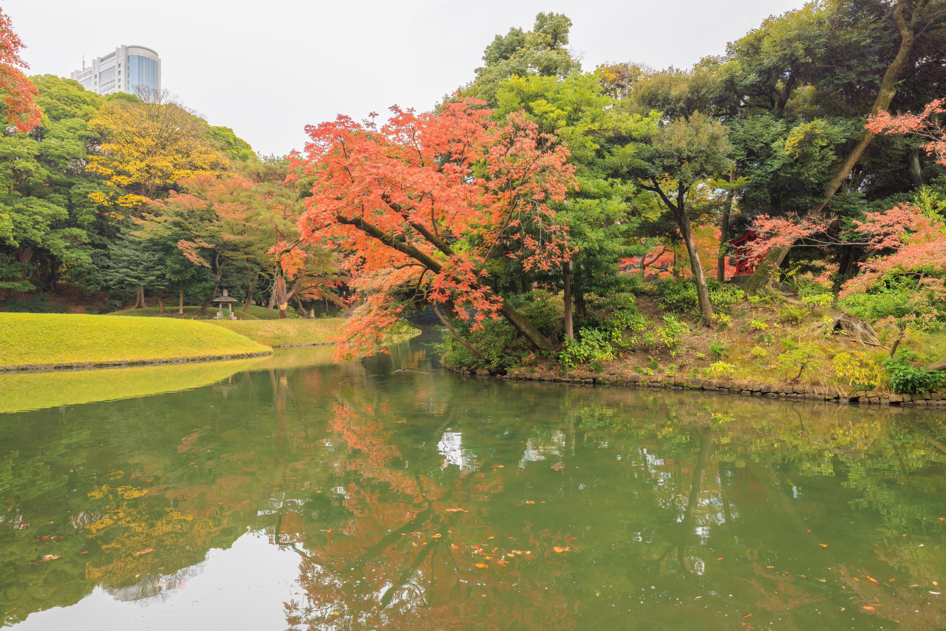
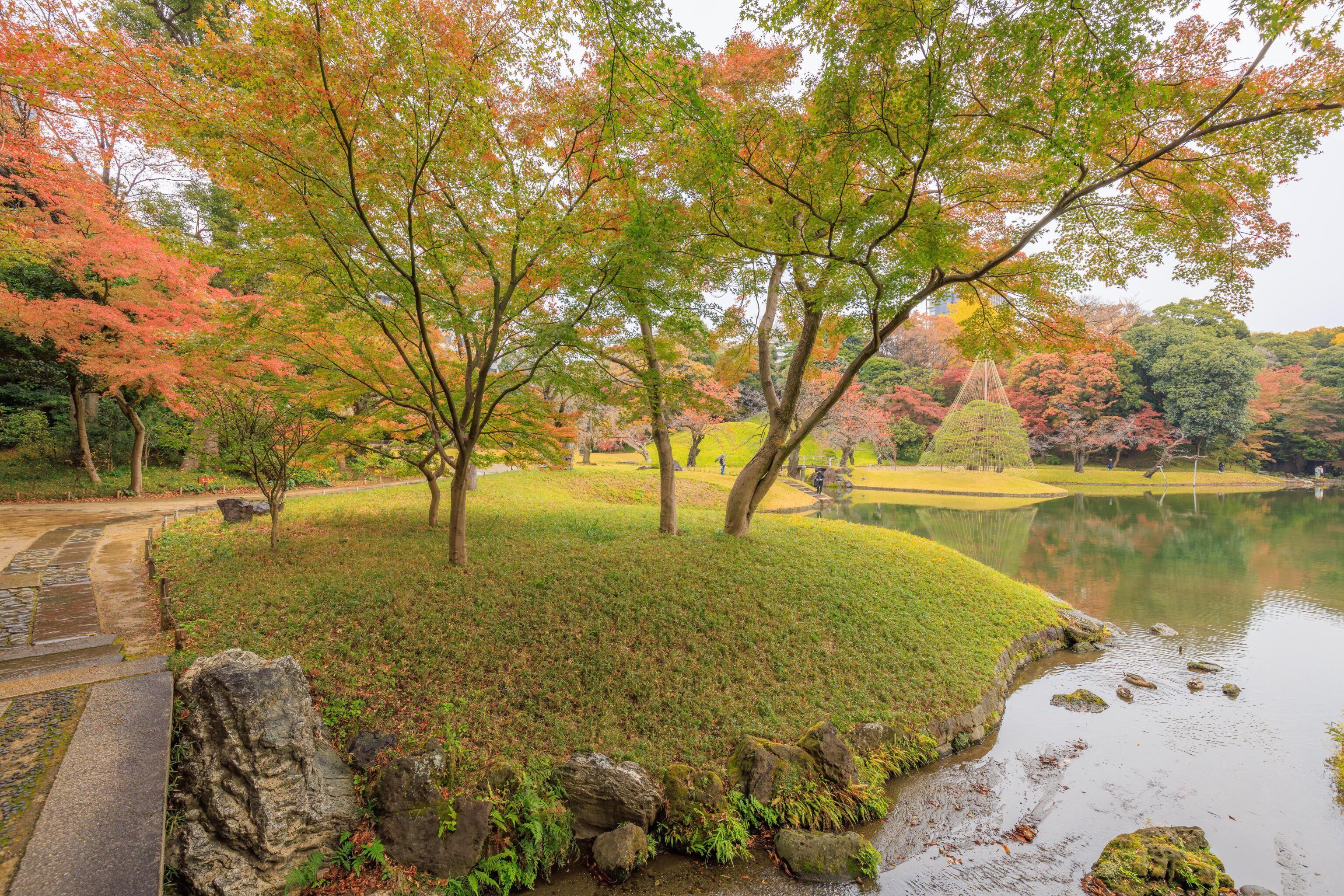
One of our goals for this trip is to see the fall foliage in Japan. Koraku-en isn’t quite there yet, though there are some spots with some red, orange, and yellow.
From here, we can see that there is a large stone standing in front of the island’s south side. It seems like it should contain some text, though we can’t really tell from here.
This stone, as we loop back to the reconstructed gate near the east entrance, does have writing on it.
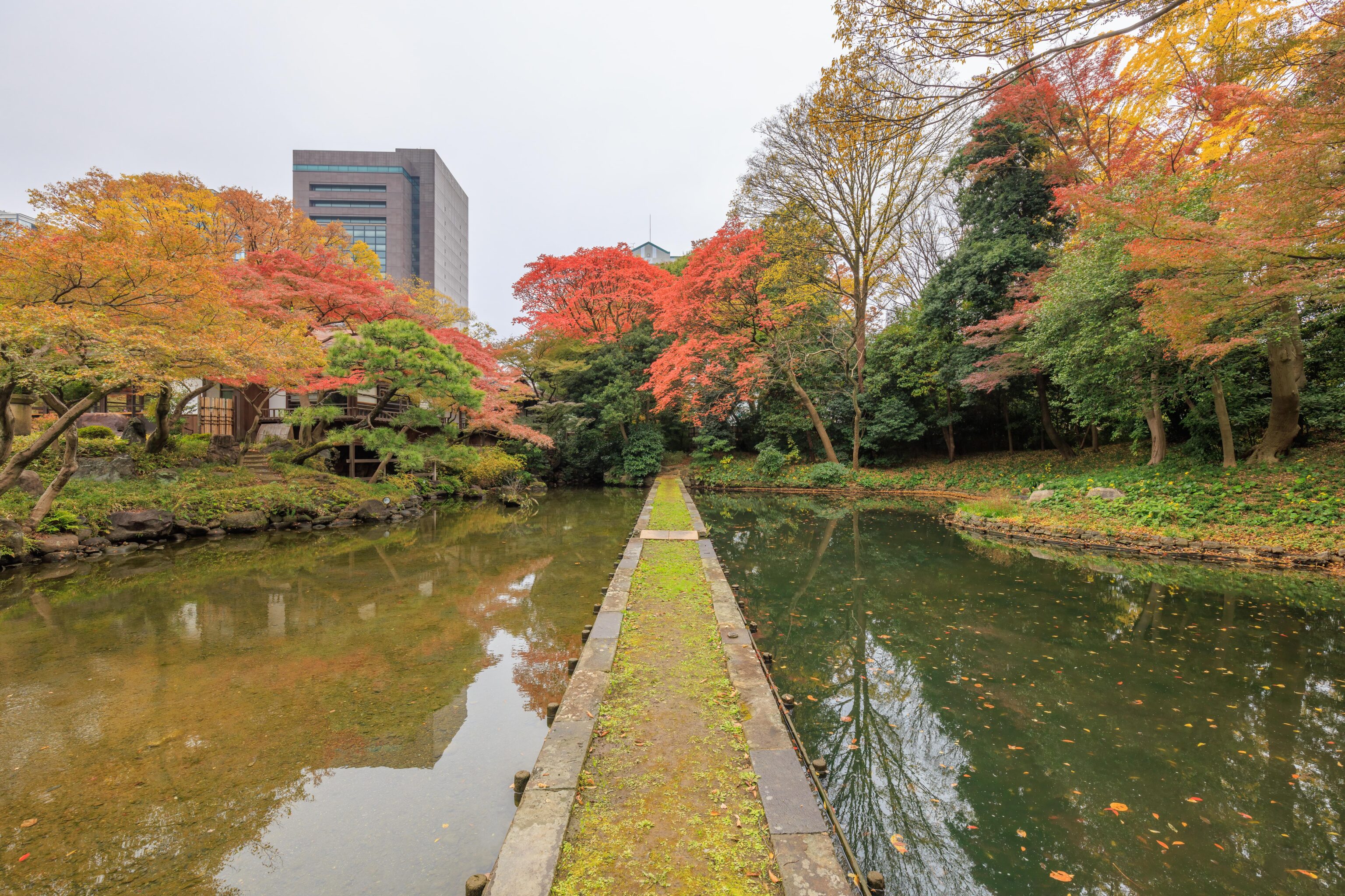
Here we are, back to the pond by the entrance where we started. We returned here to meet a cousin that was joining us for the rest of our day in Tokyo.
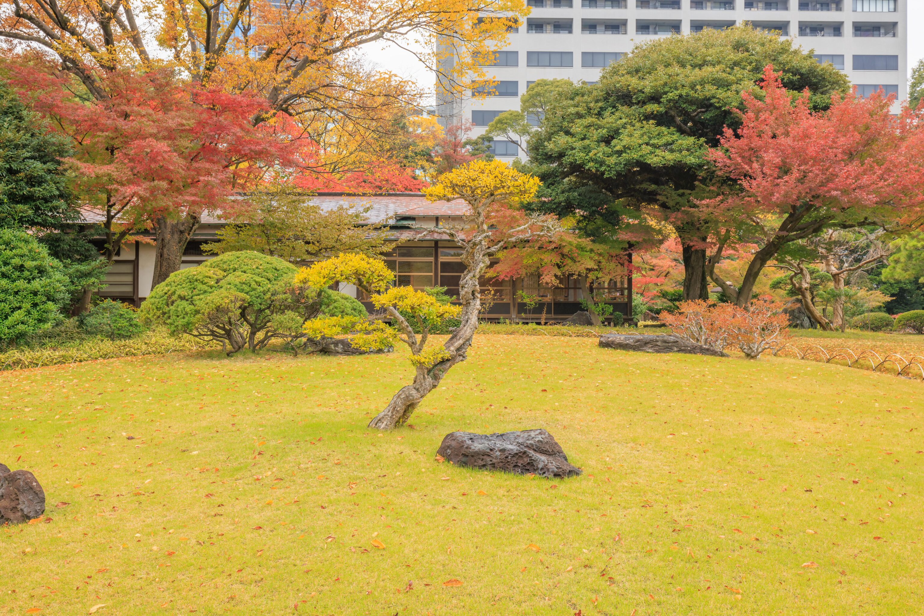
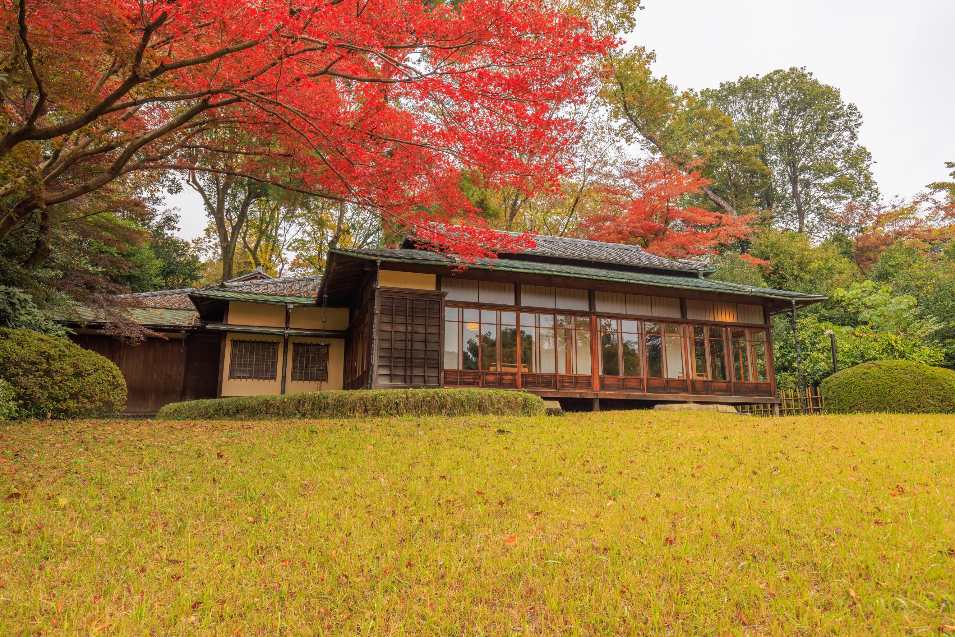
This just seemed like a nice scene with a small tree standing in front of the Kantoku-tei, on the west side of the lake. It is pretty common for Japanese gardens to contain tea houses like this one.
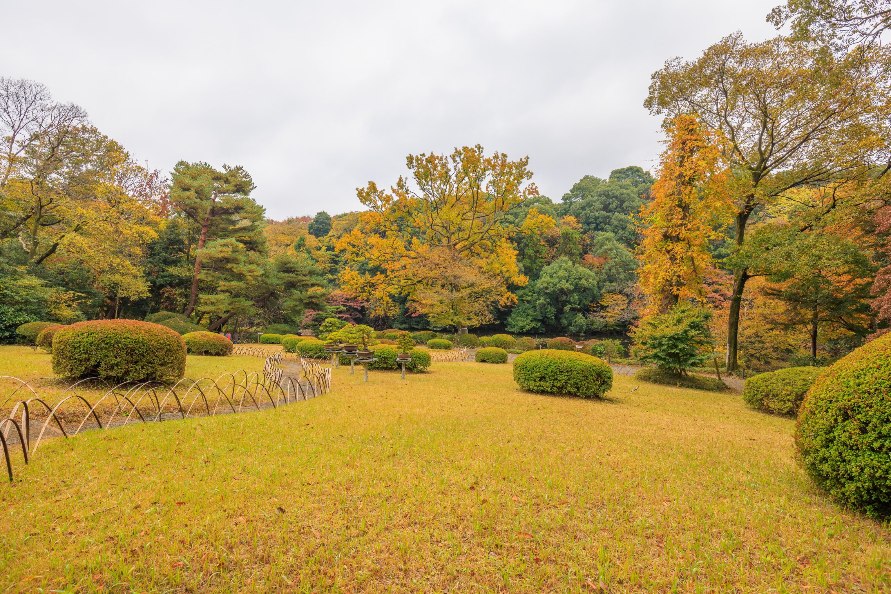
Another nice scene well some different but all very well maintained grass.
Looking back to the east after we continued walking to the west a bit more, we once again see the Hitotsumatsu in the background.
A closer look at the tea house, now to our south.
We continued to the west, quickly reaching this bridge, the Togetsu-kyo. A sign explains:
This bridge was named after the famous Togetsu-kyo bridge in Kyoto's Arashiyama district. It is an earthen bridge, built by erecting timber logs and building them up with earth.
The description here applies to this bridge in front of us. The actual Togetsu-kyo in Kyoto is a wooden bridge. We’ve walked across the actual bridge before and likely will again later on this trip.
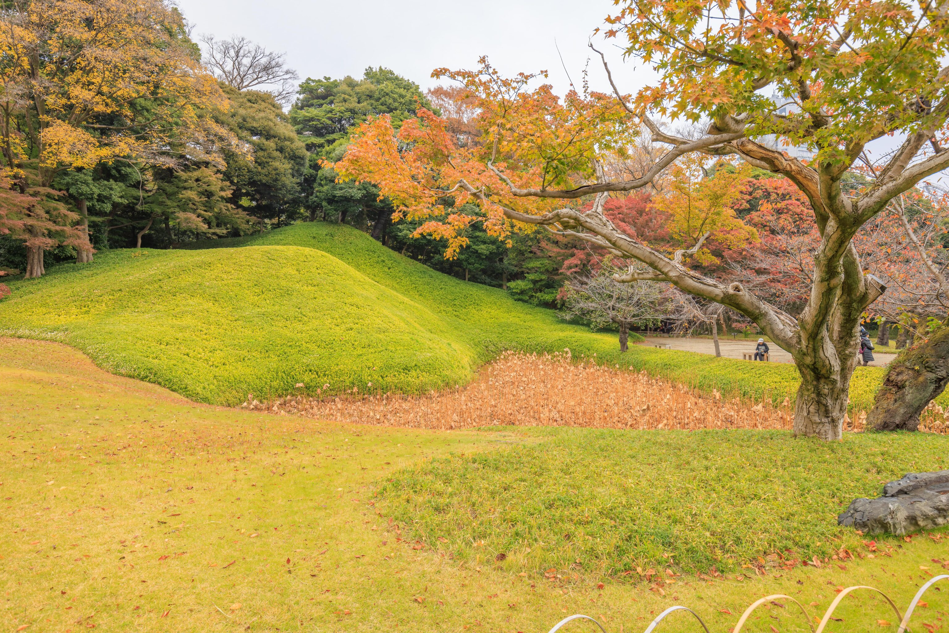
This significantly longer bridge was on the other side of the Togetsu-kyo. This bridge is the Seiko-no-tsutsumi and represents a bridge in China which seems to translate to Su Causeway in English. A sign explains:
These stone steps were created to imitate a famous scenic spot in China in Zhejiang Province ("Seiko" is the Japanese reading of the Chinese characters for West Lake). Many gardens of feudal lords followed this style, but the one here was the pioneer.
This rocky area and adjacent water, by where the two bridges meet, is the Oi-gawa and also has a sign:
This river was named ofter the Oigawa River that runs through Kyoto's Arashiyama district. Both banks of the river are lined with cages filled with stones, to create a sense of deep mountains and rushing waters.
The English here is a bit awkward, presumably, cages is not the term they intended. The Oi-gawa is one of the rivers that feeds the Katsura River2, the biggest river in Arashiyama. It flows under the Togetsu-kyo. The point where the river becomes the Katsura in the river’s Wikipedia article doesn’t match what is currently displayed on Google Maps, the name change seems to be around Hozukyō Station.
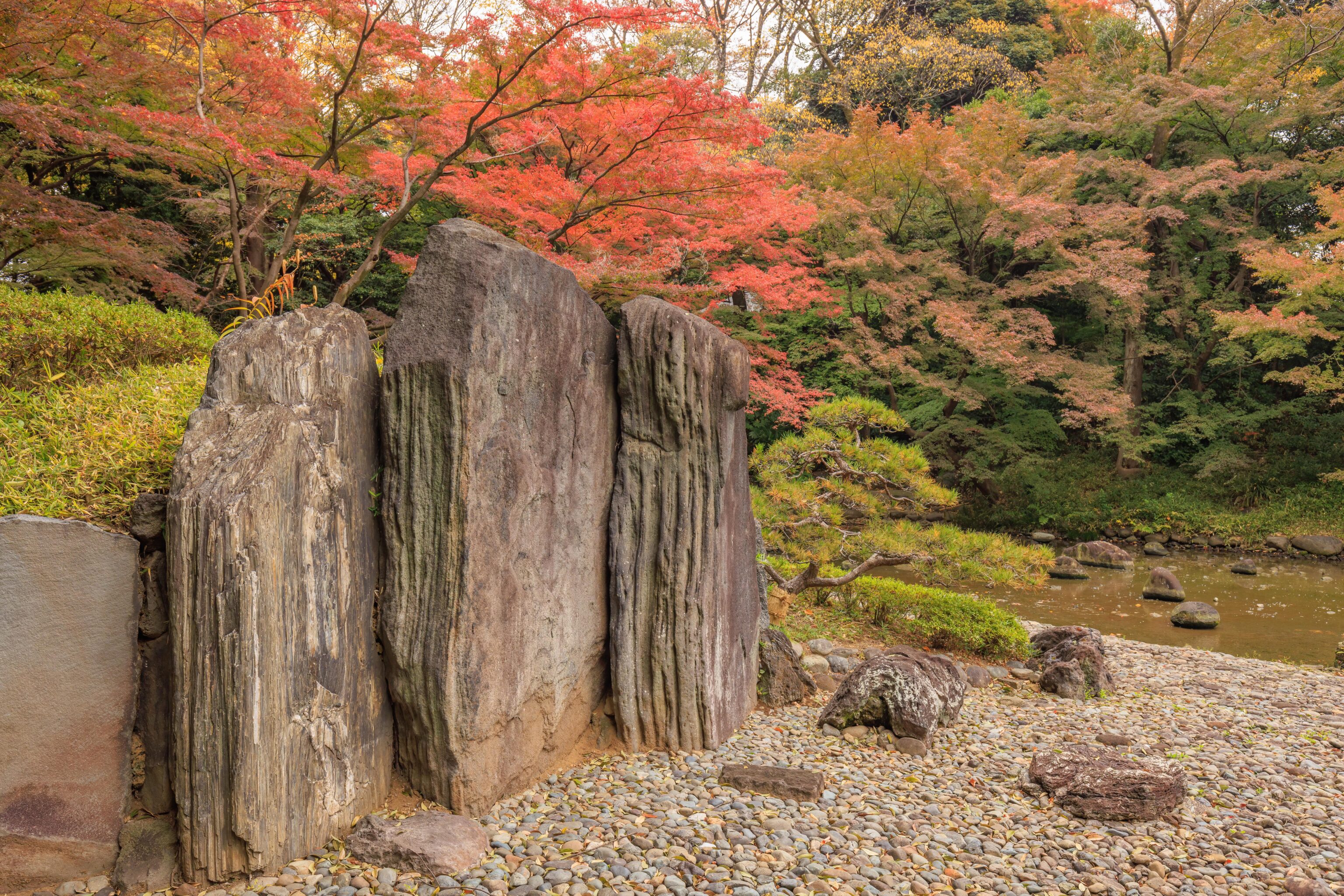
These rocks also have a name, Byobu-iwa, and a sign:
This wide rock is called Byobu-iwa, named after the classical furniture byobu (a folding screen) as it rises vertically like a folding screen.
Presumably, the sign is referring to this set of rocks rather than just one individual.
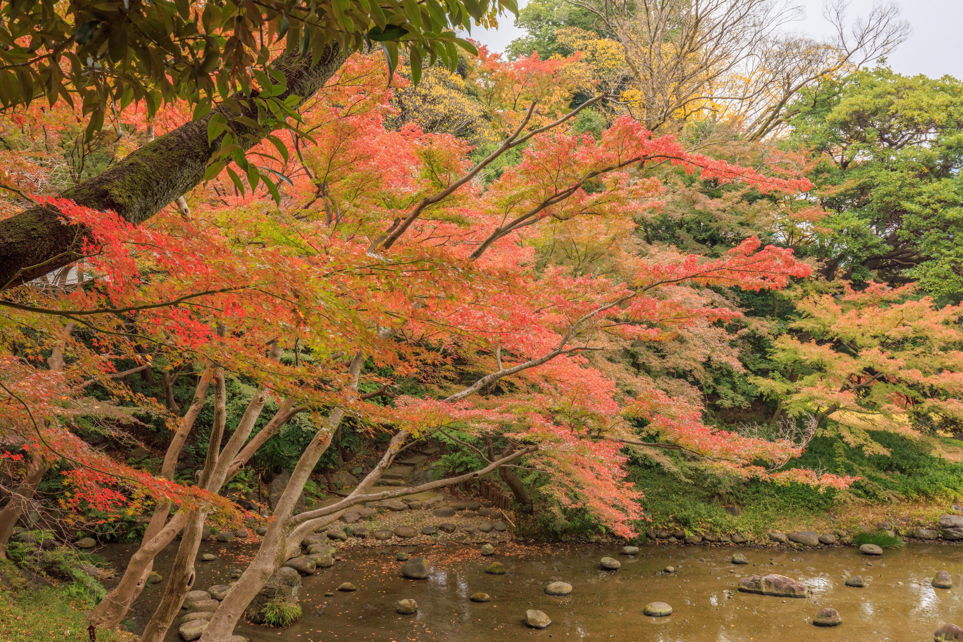
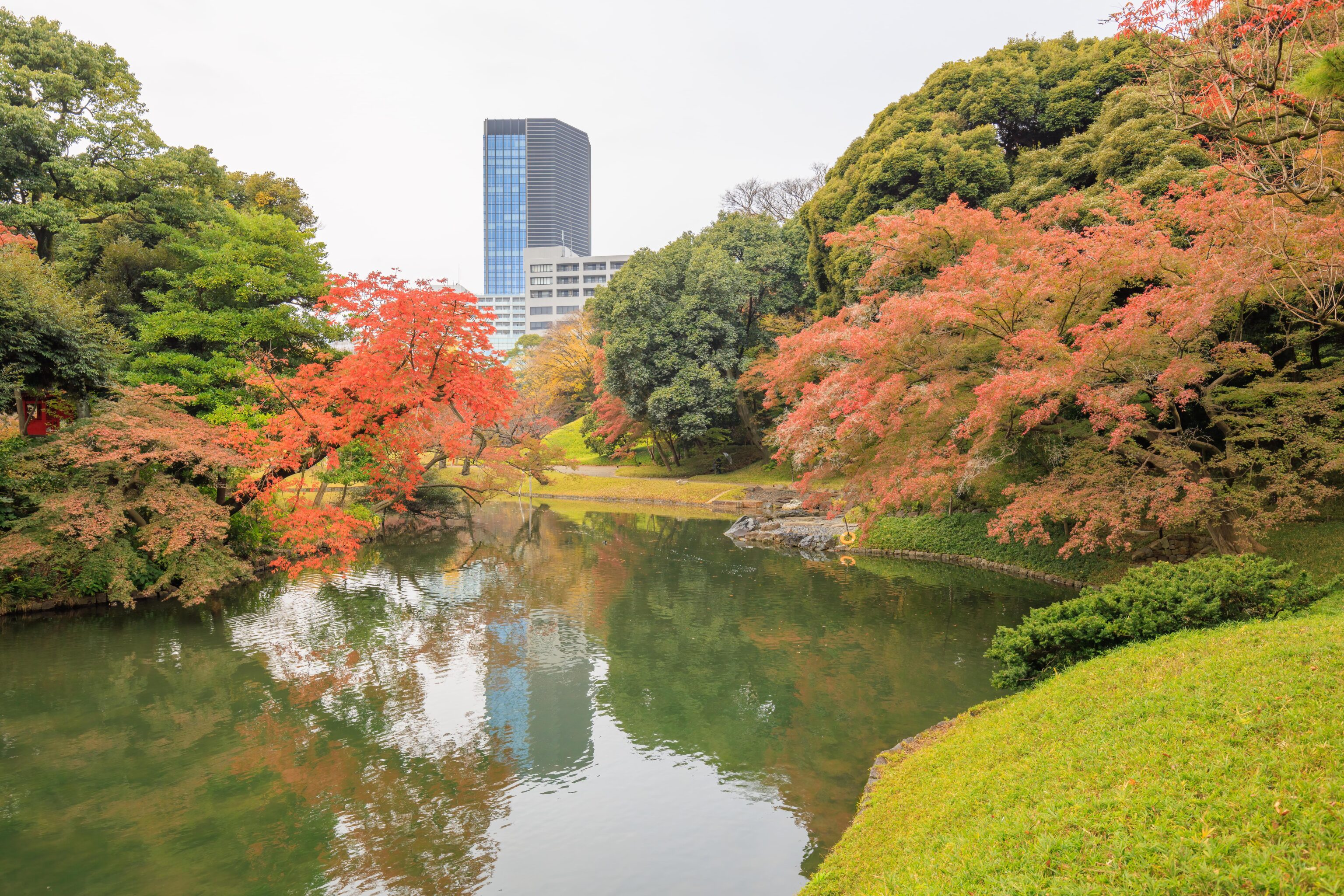
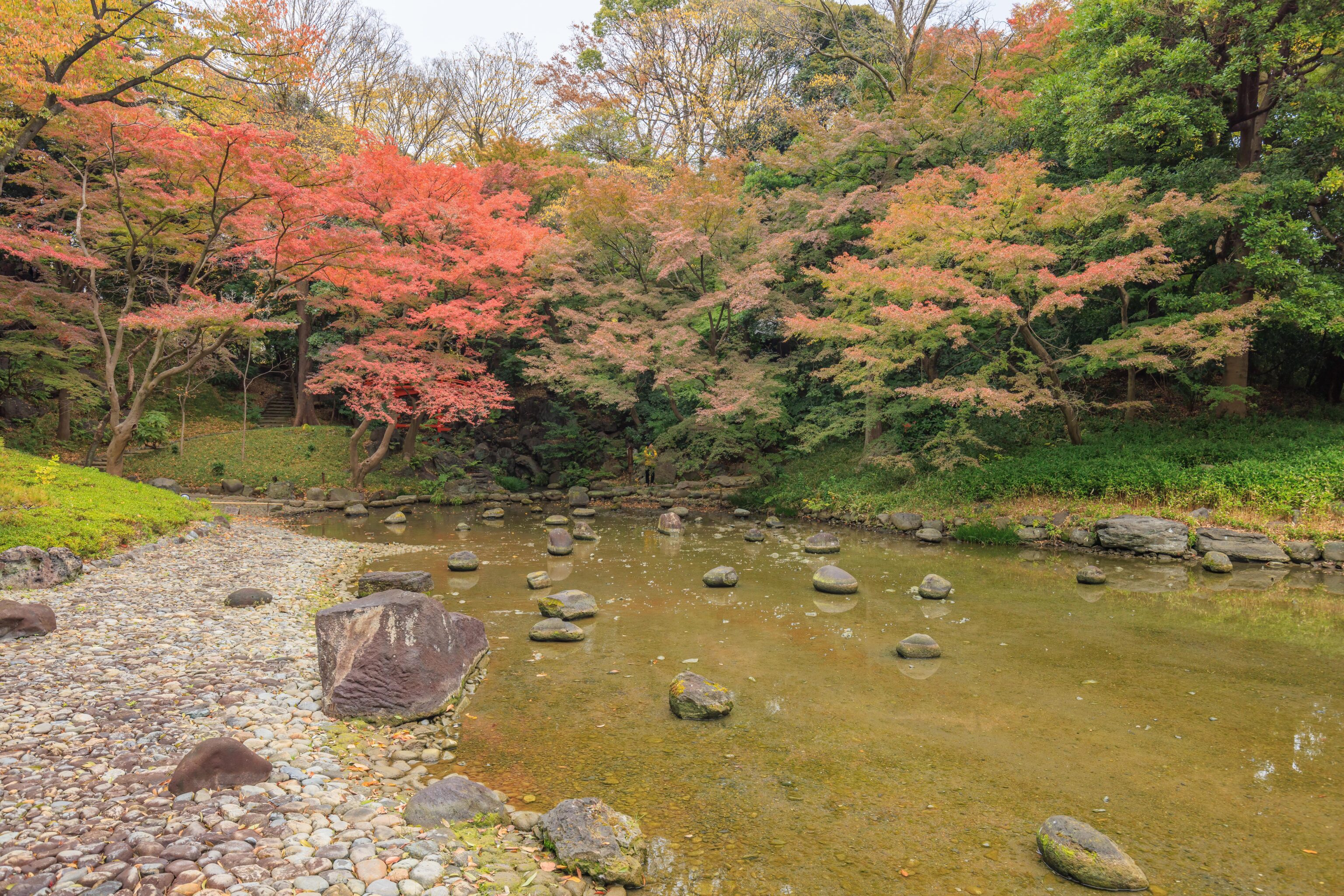
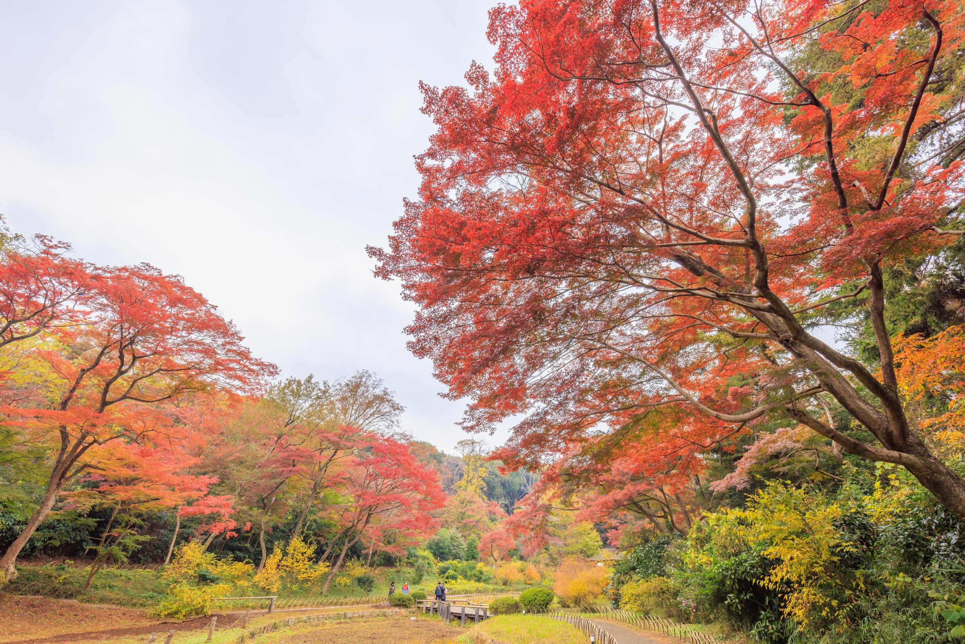
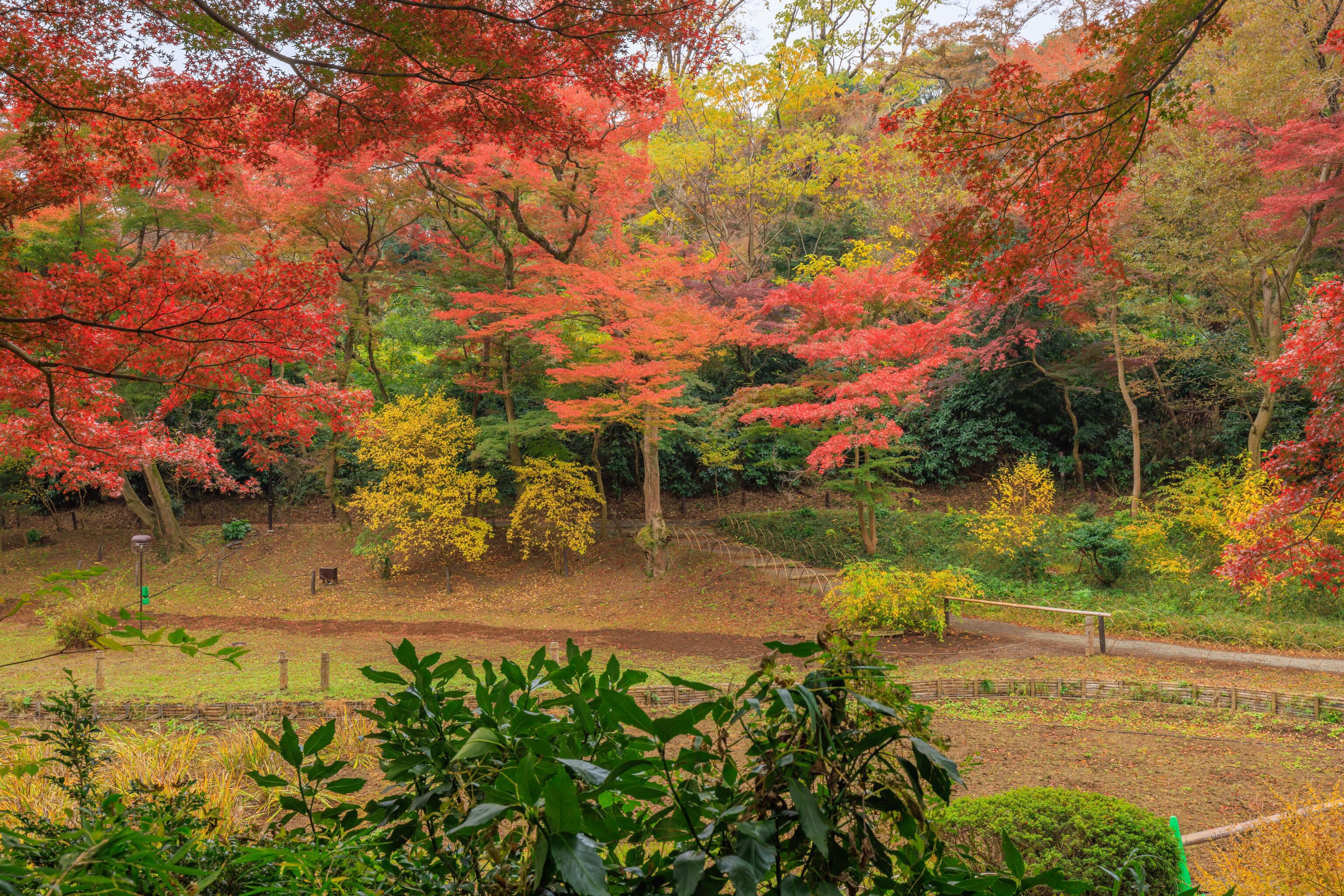
A bit of nice fall colors here, though the dark overcast sky isn’t really helping the scene at all.
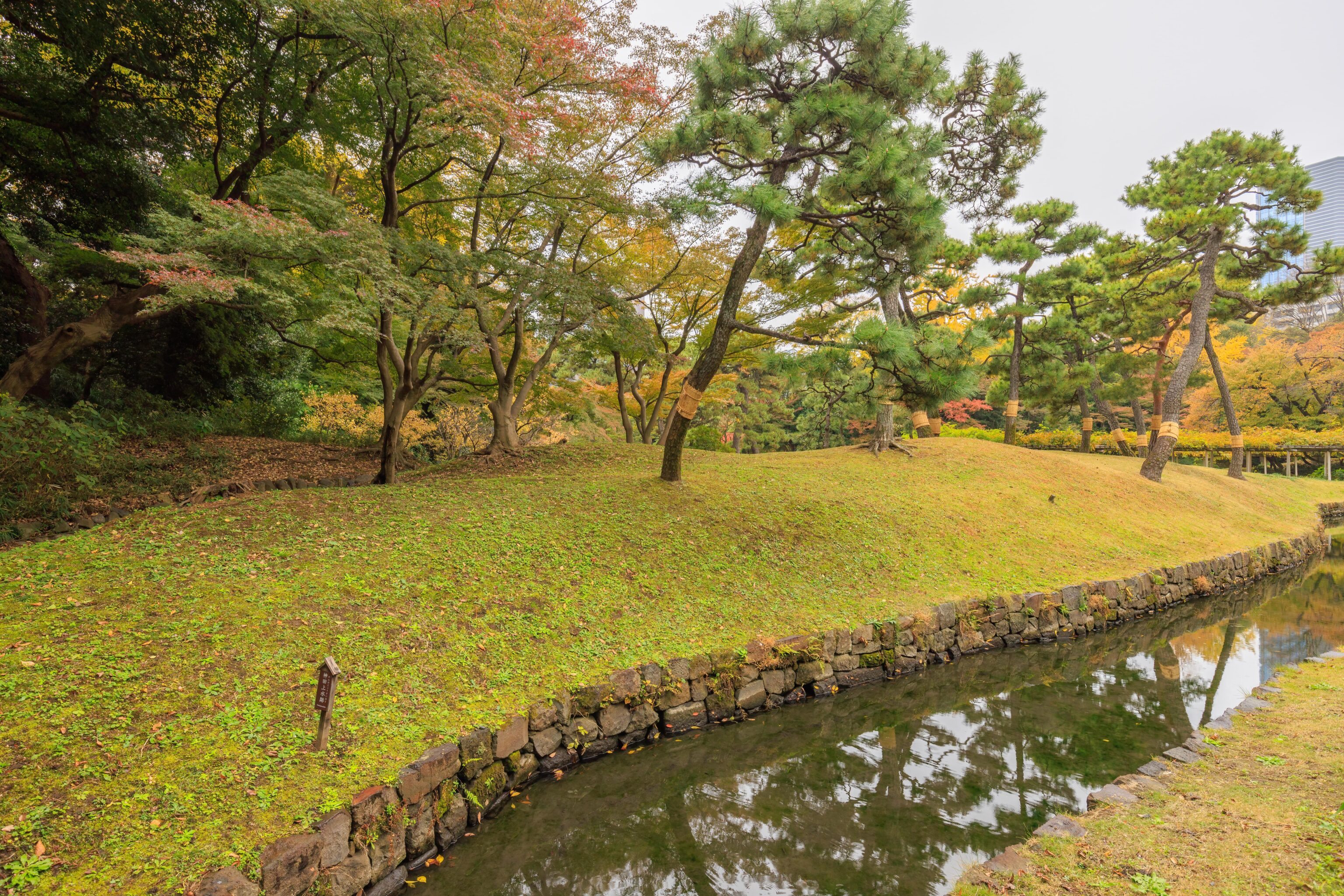
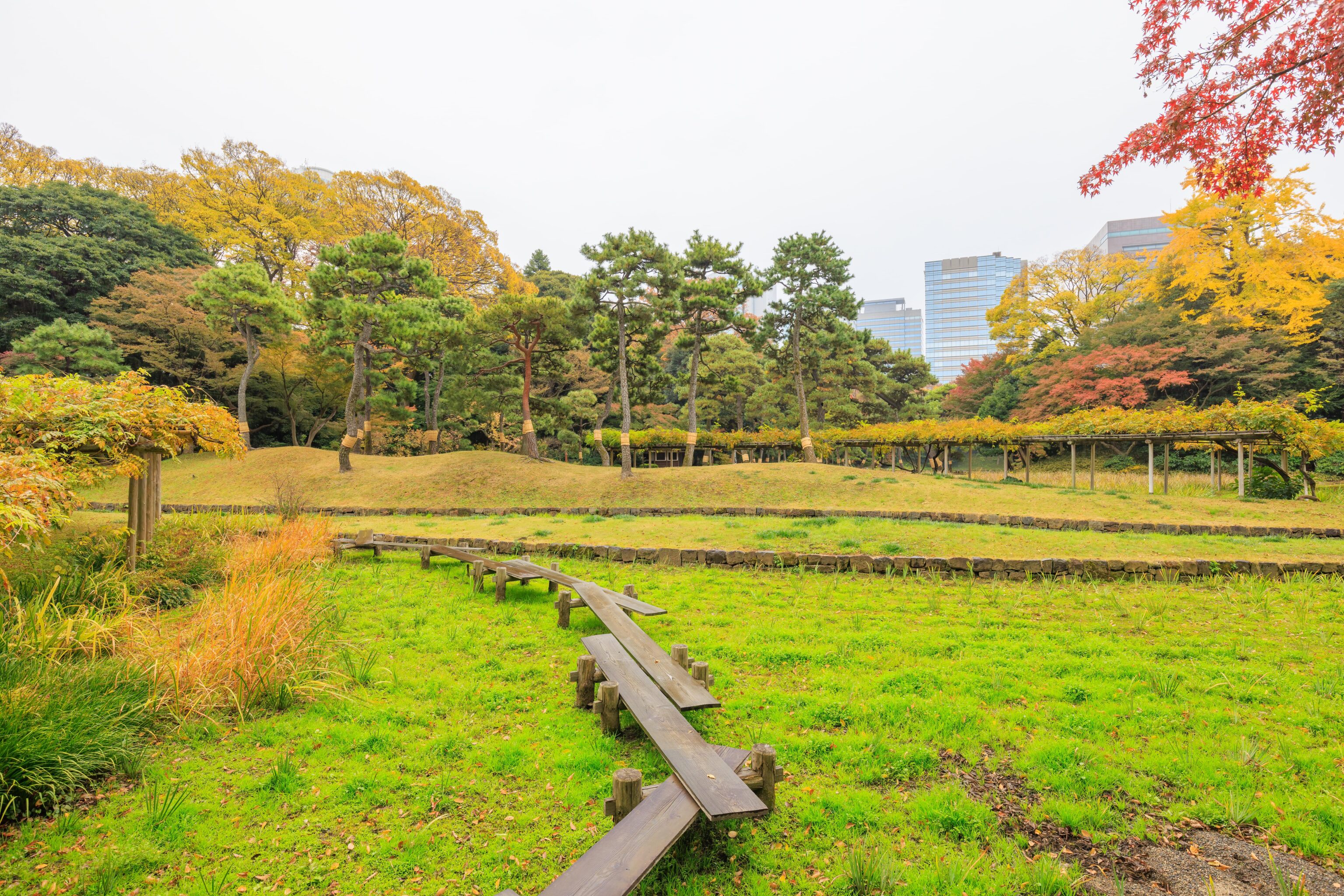
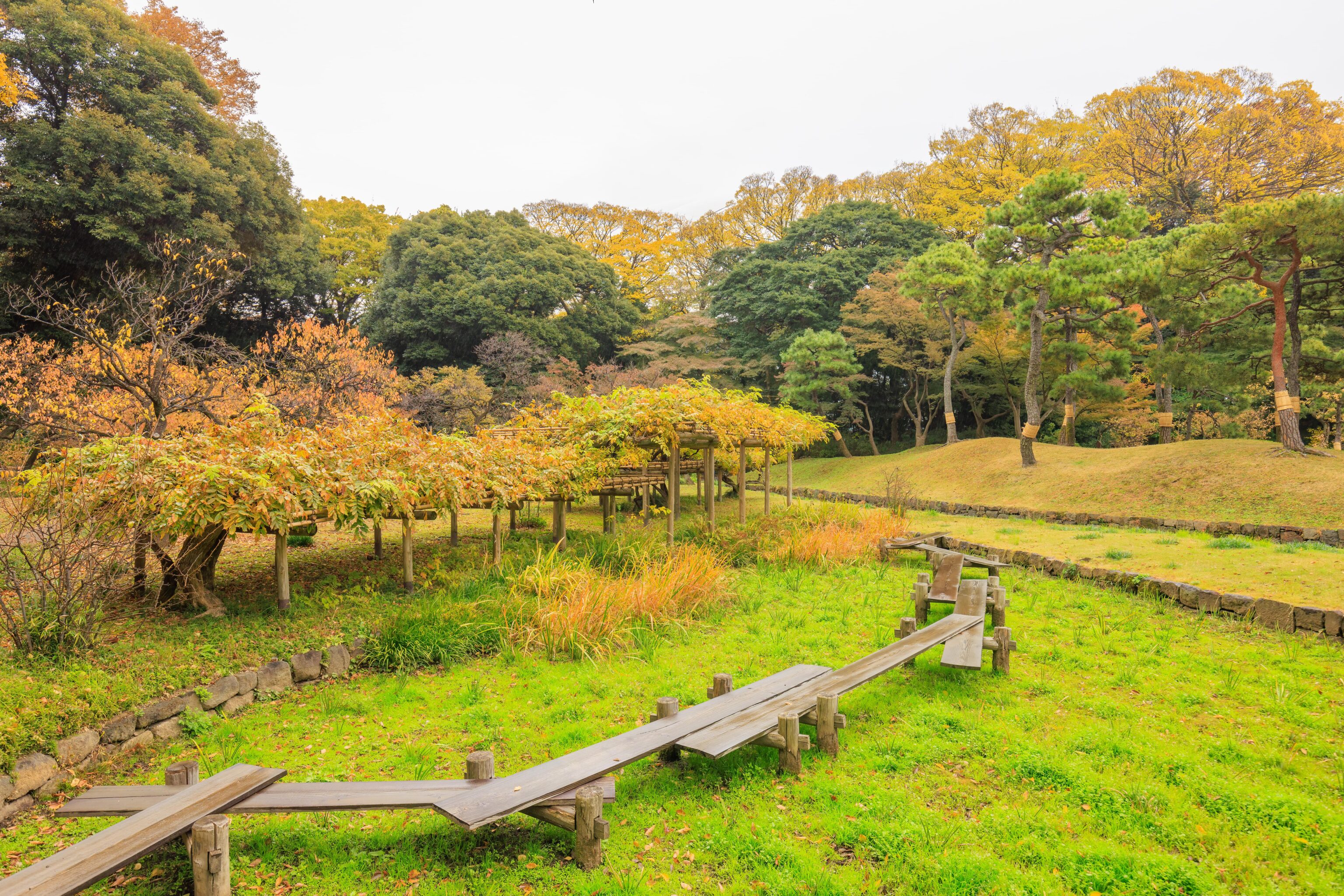
We ended up on a hill…
We could see many of the named features below us in the background, though they can be a bit hard to make out with all the trees in the foreground.
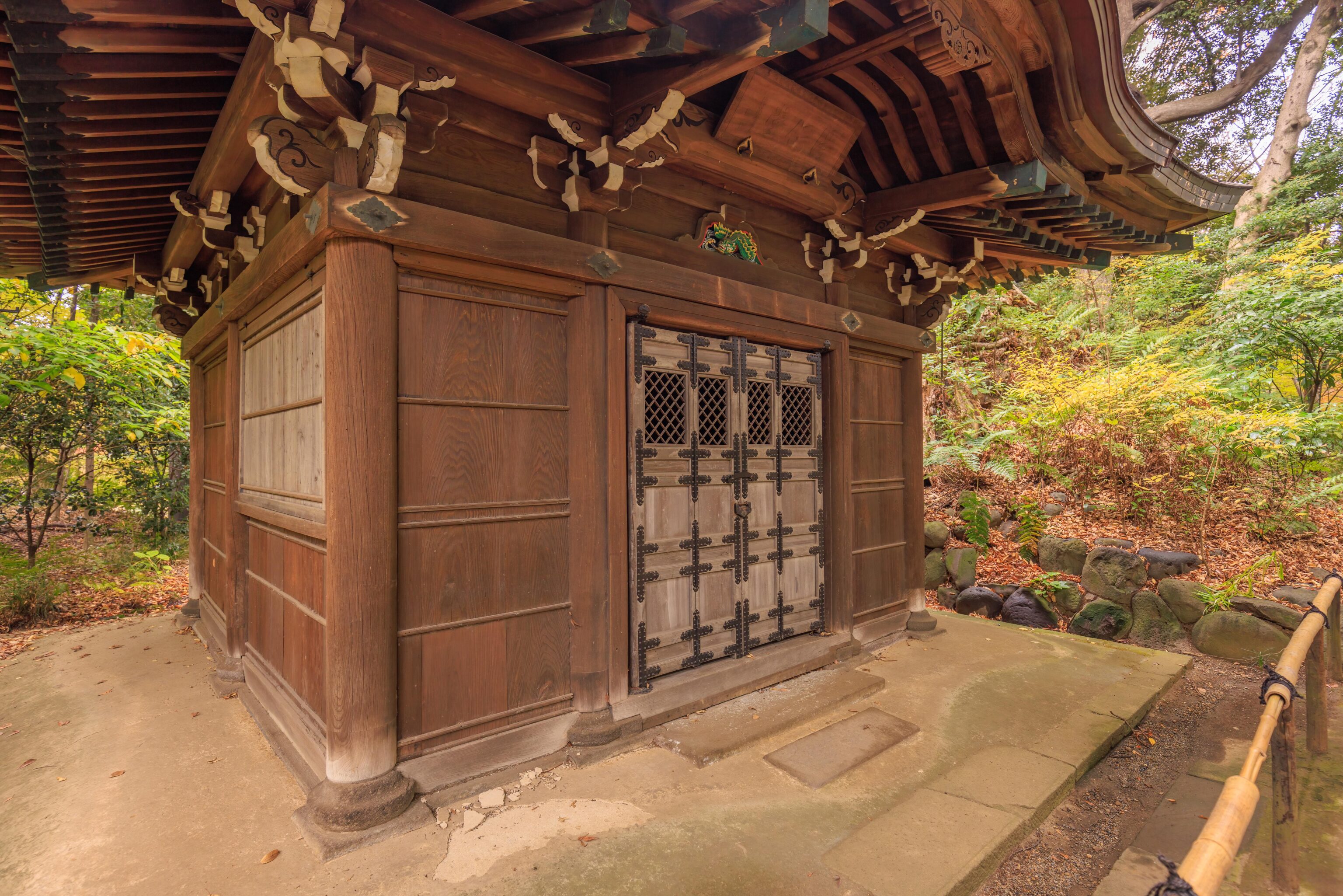
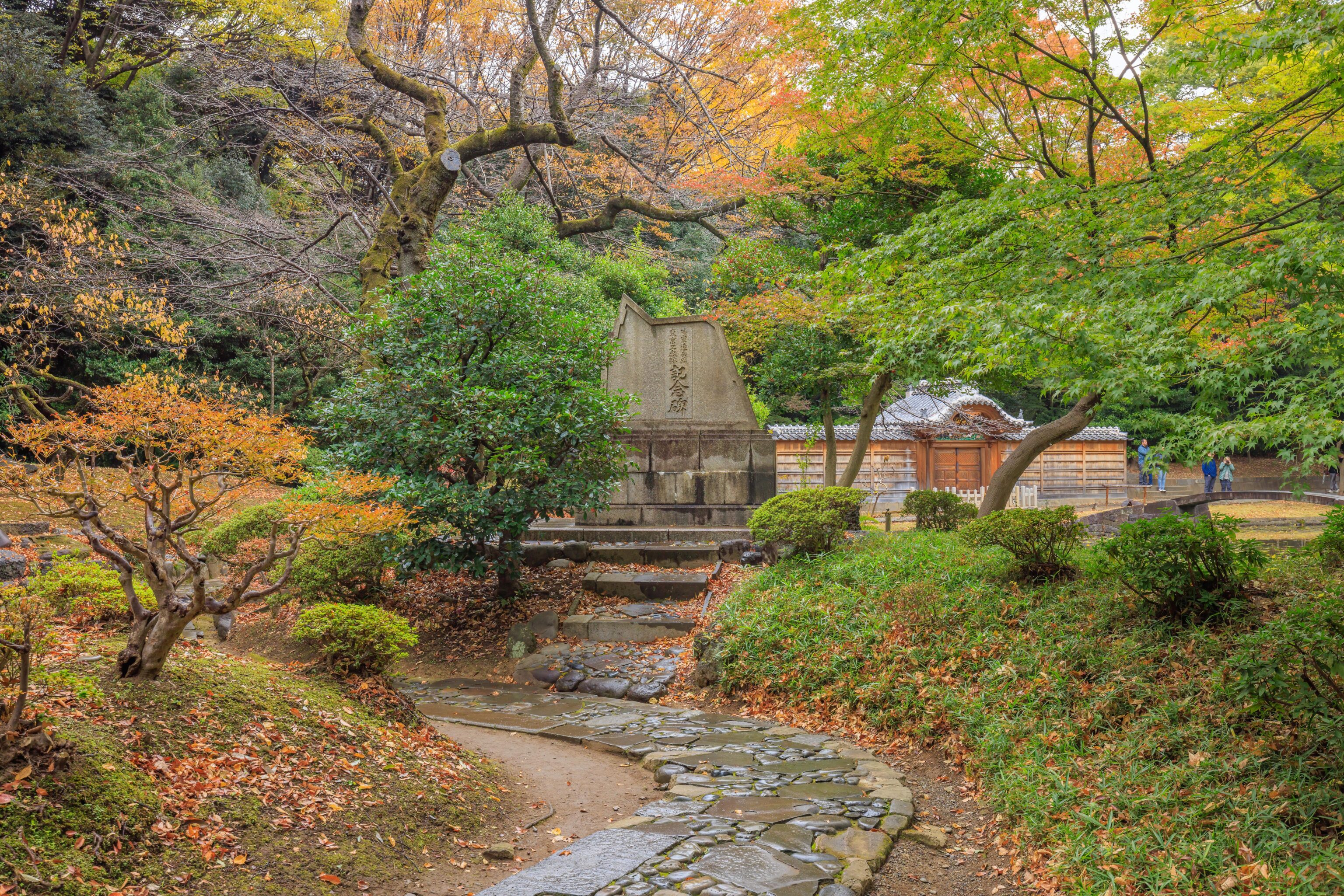
We came across this building, the Tokujin-do. A sign explains:
Tokujin-do is believed to have been built by Mitsukuni, the 2nd lord of the Mito-Tokugawa family. It survived the terrible disasters of the Great Kanto Earthquake and World War II, making it the oldest building in the garden. The name of the temple is derived from the Analects of Confucius.
If this building was indeed built by Mitsukuni, this dates it to the 17th century based upon his lifetime3.
Lunch
We exited Koraku-en via the west entrance, at the park’s southwest corner. We walked for awhile to reach Yoshoku Wine Fritts a few blocks north of the Korakuen metro station. It is a nice little restaurant in a weird location on the second floor of a building, accessed by a small outdoor stairway. While they don’t have a Michelin Star, they are in the Michelin Guide.
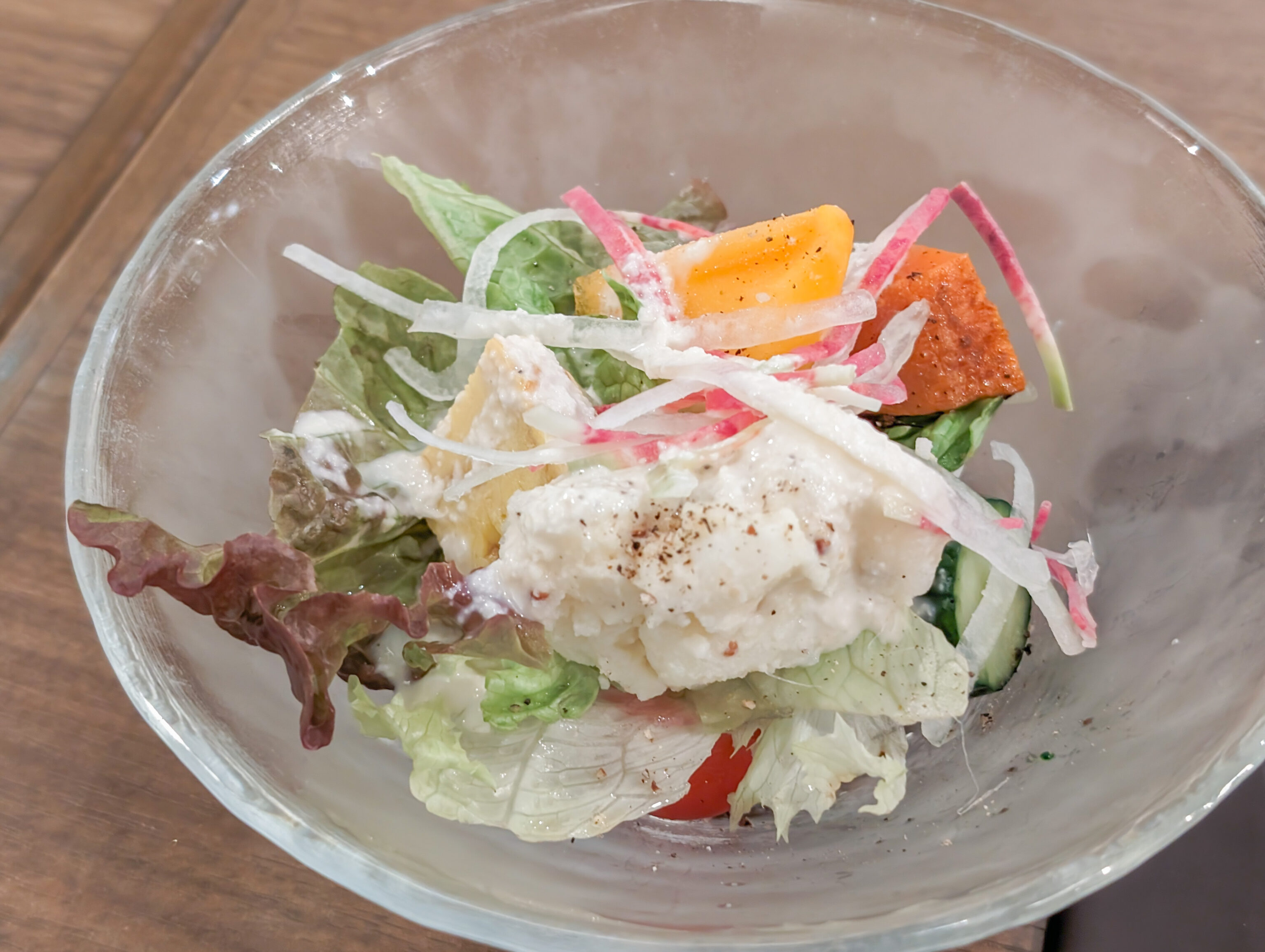
The meals came with a small salad. There were a variety of vegetables and some sauce. It tasted much better than it looks!
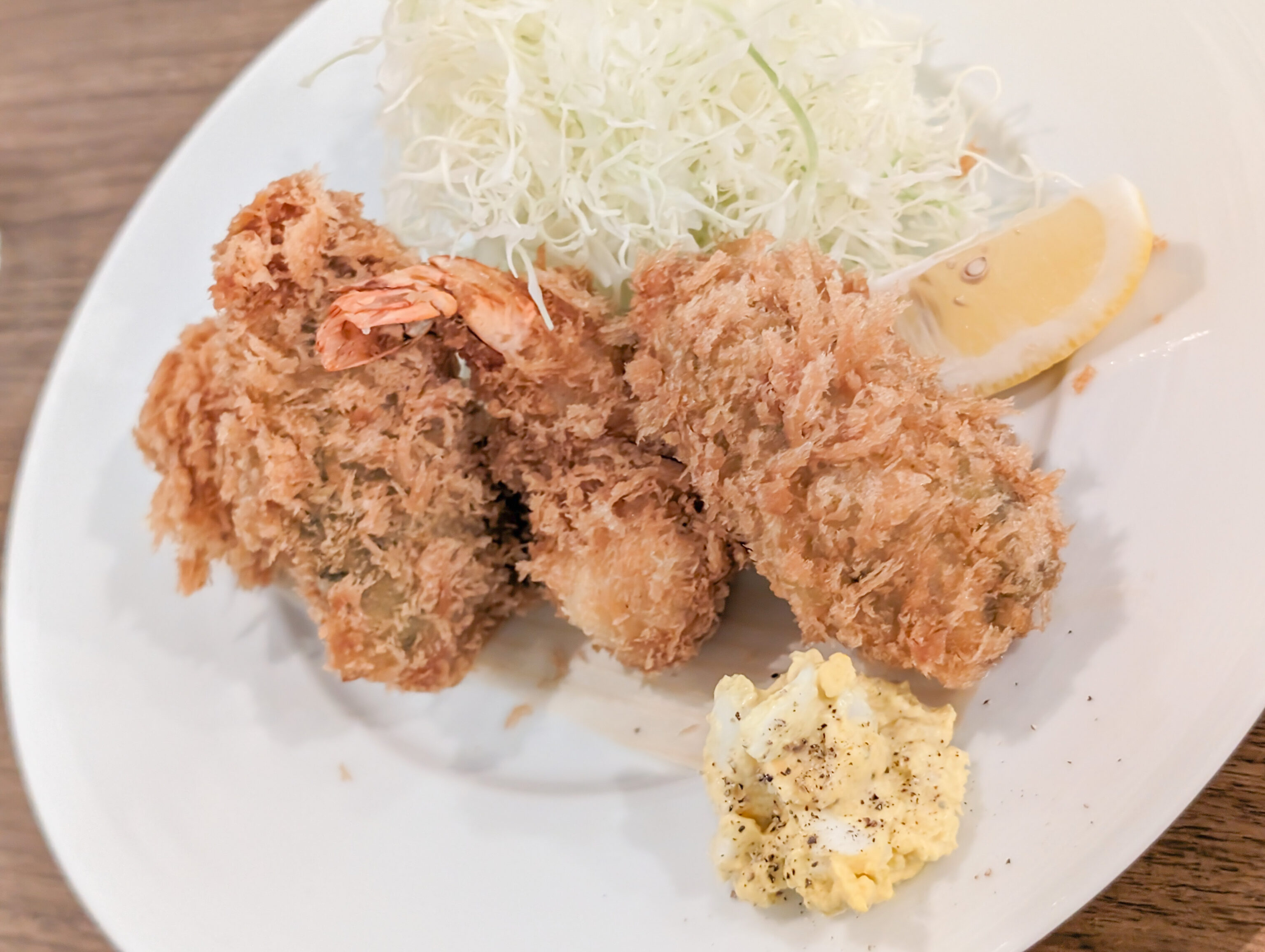
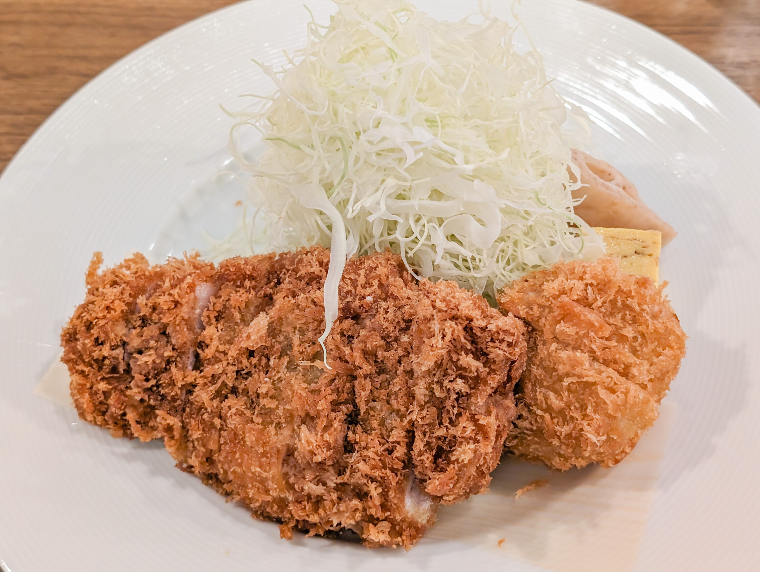
We wanted to get as much variety as possible. We got a seafood set and a pork set. The seafood set contained a small variety of cutlets and croquettes while the pork set contained two different pork cutlets. The pork was juicy and perfectly prepared. The seafood was excellent as well! We should have photographed the menu to have a description of exactly what we ordered!
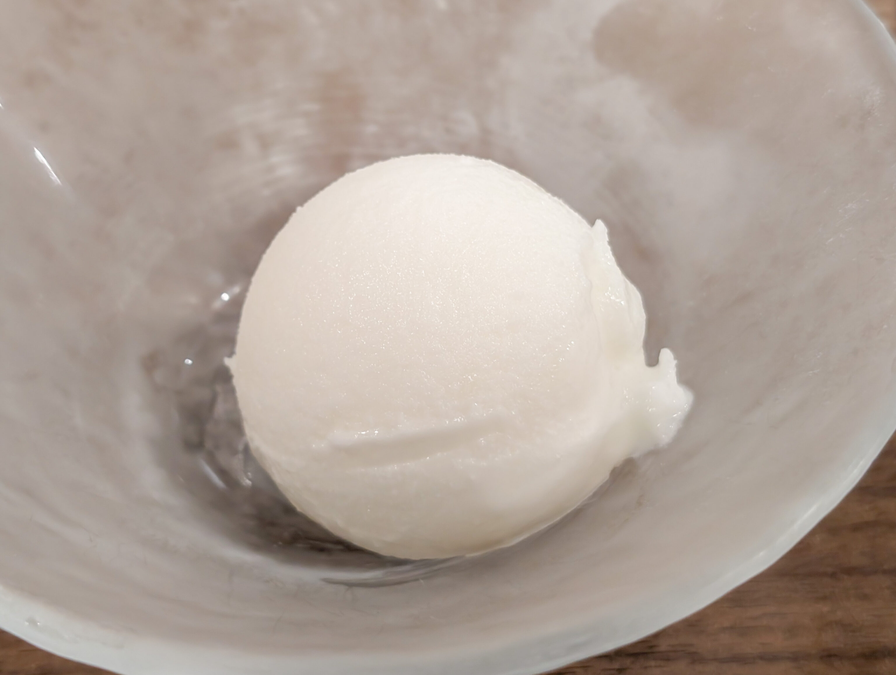
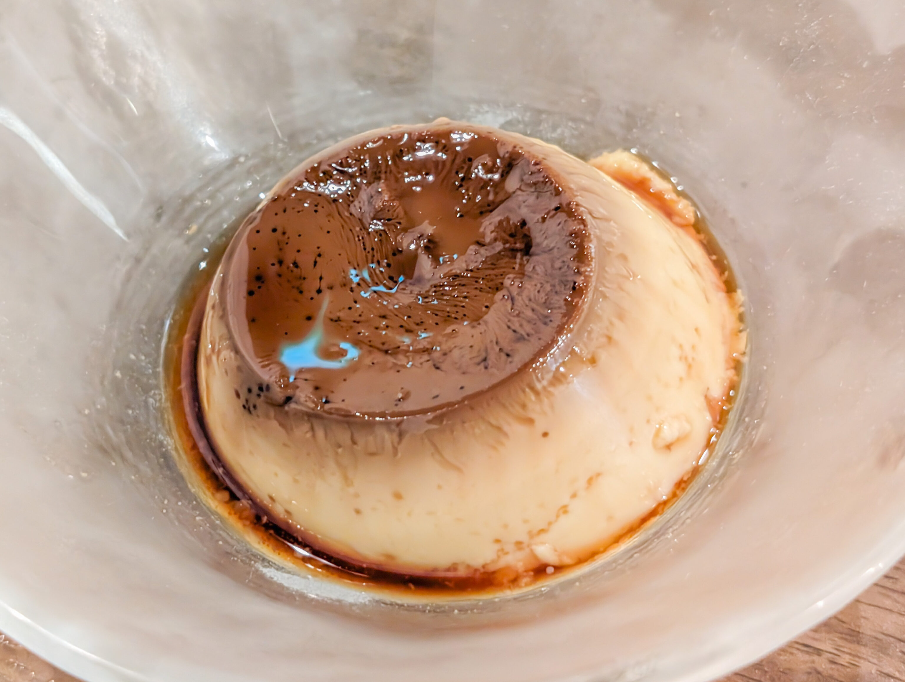
For dessert, we had pudding and yogurt.
Meiji Jingu Inner Garden
After lunch, we headed to Korakuen Station to catch the Tokyo Metro to Ikebukuro, transferring to the JR Yamanote Line to head south to Harajuku. From there, we walked into the sprawling Meiji Jingu. The inner garden was just a short walk away.
Like many Japanese gardens and temples, a informational pamphlet was available. We picked up an English one. Thankfully, the map is oriented north up! We entered via the East Gate, the only entrance that was open today.
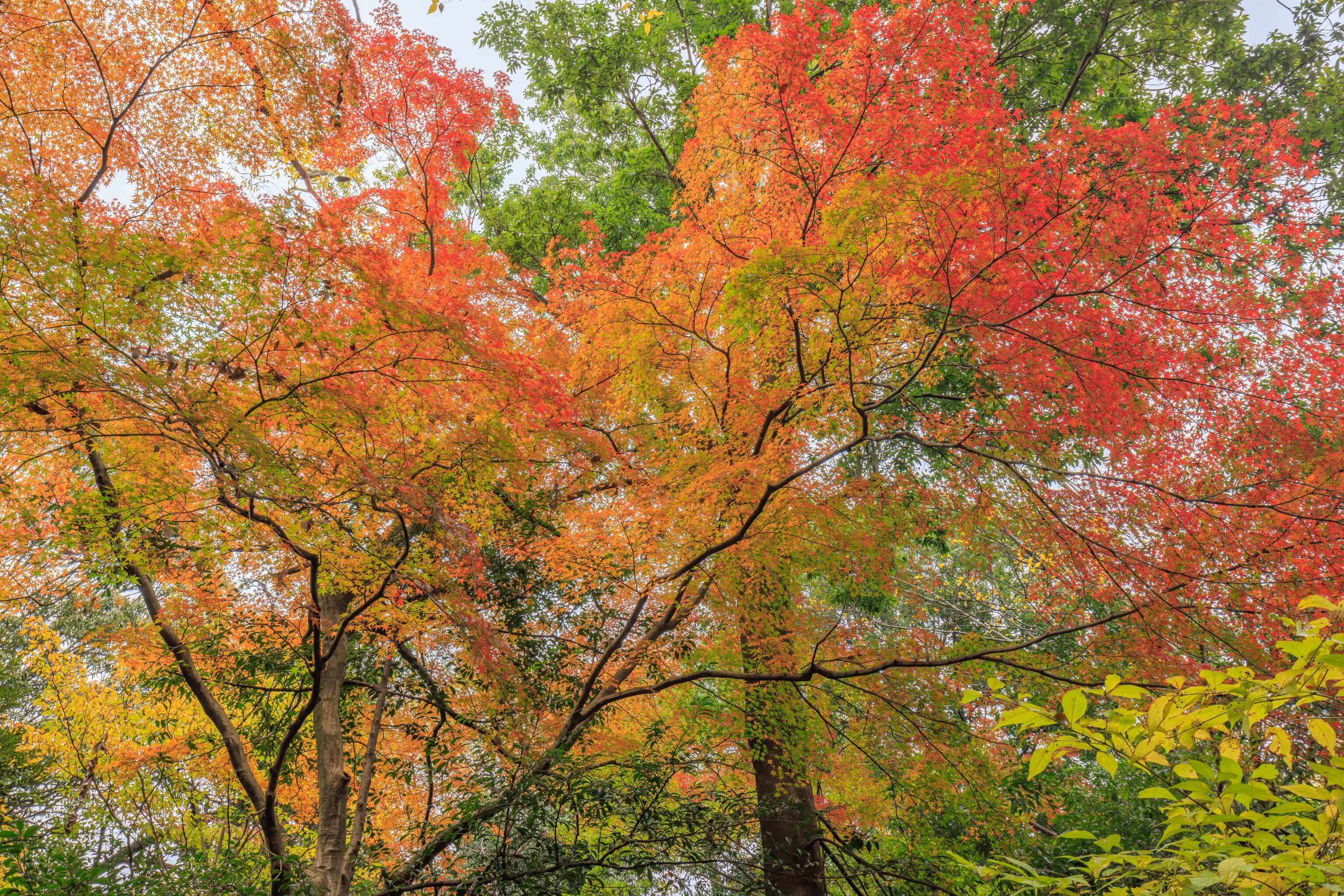
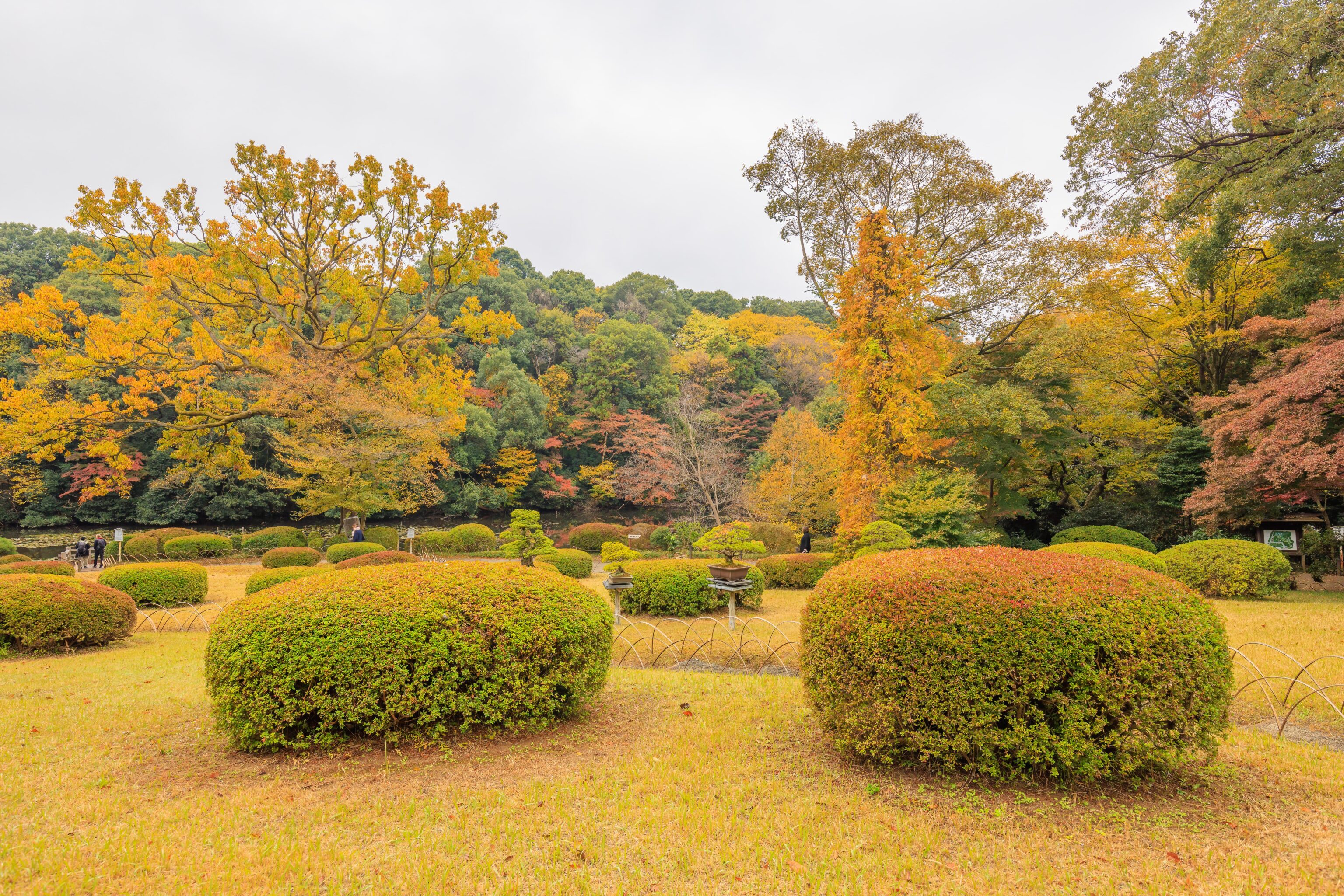
Like Koraku-en, we saw a variety of foliage colors in the garden, though overall it was also a bit early.
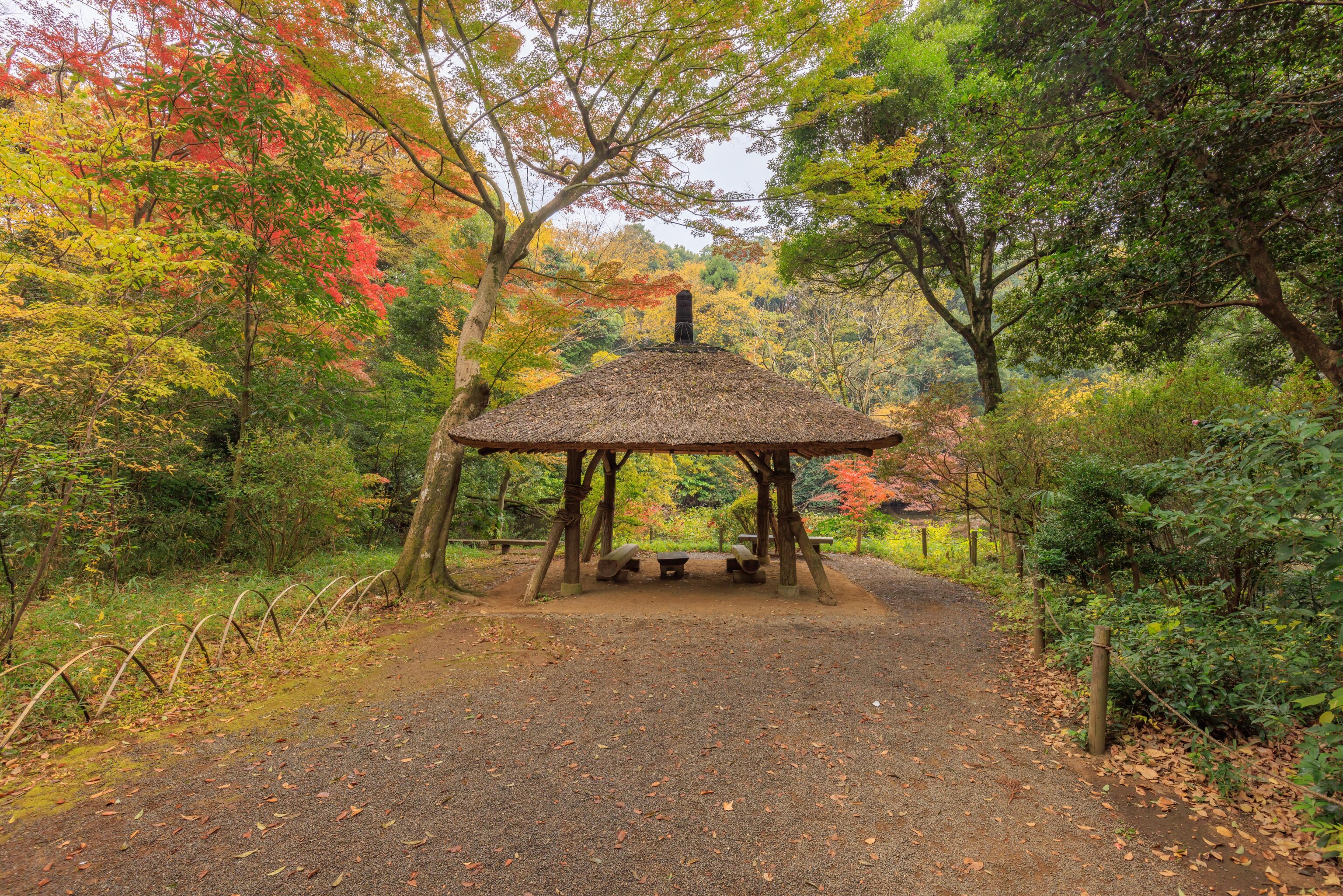
After walking a short distance, we encountered the Azumaya, listed on the map as a gazebo but perhaps more properly a pavilion. It sits on the edge of the South Pond, though it isn’t quite visible in this photo.

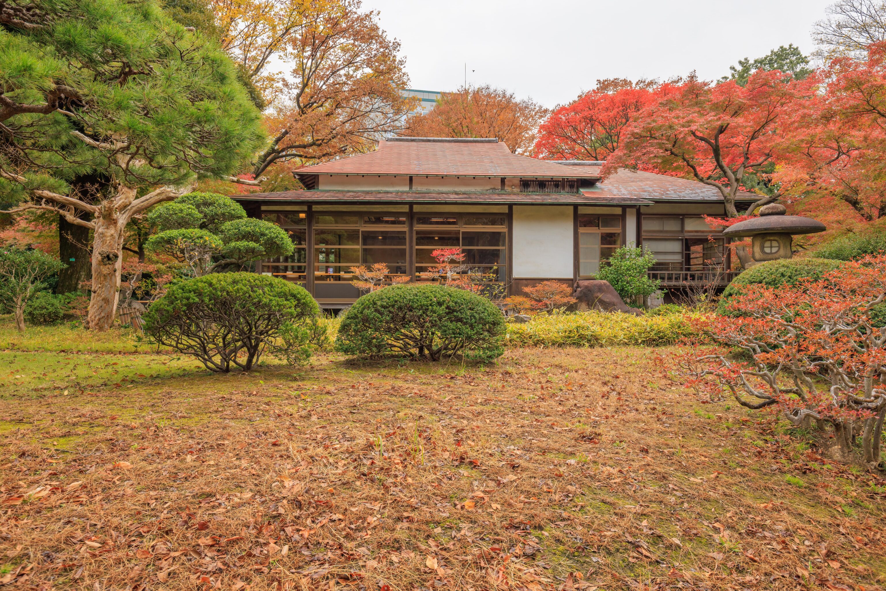
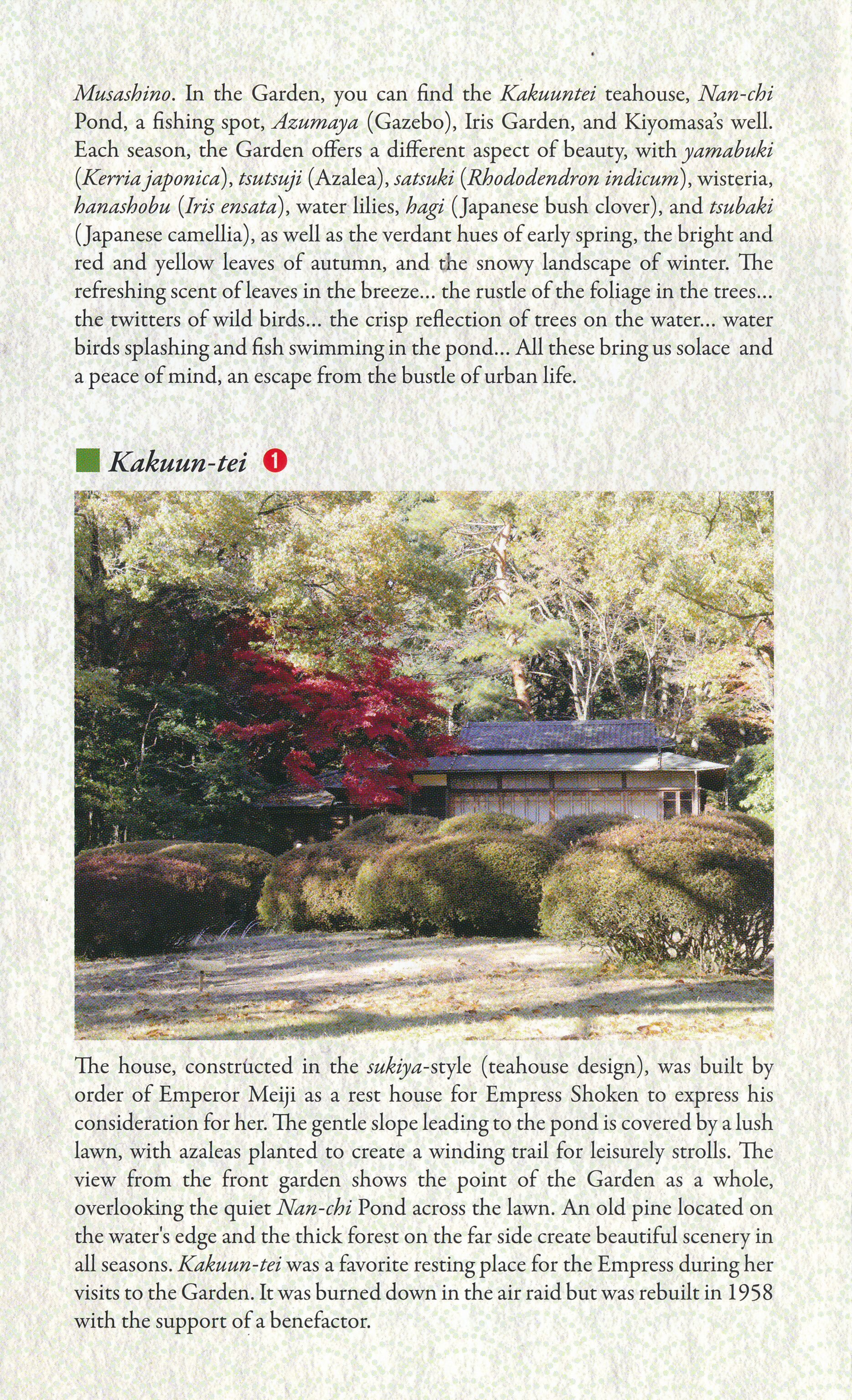
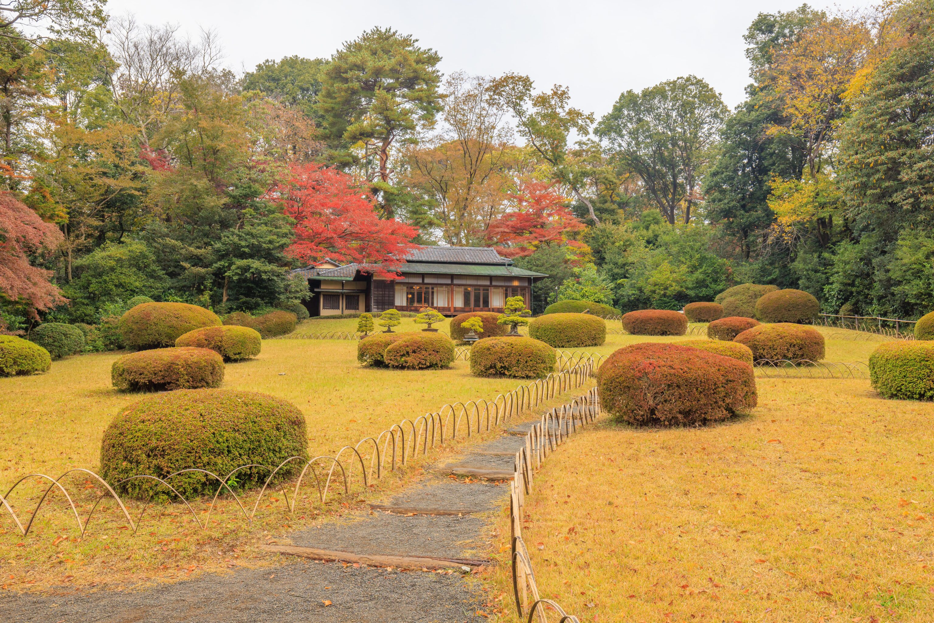
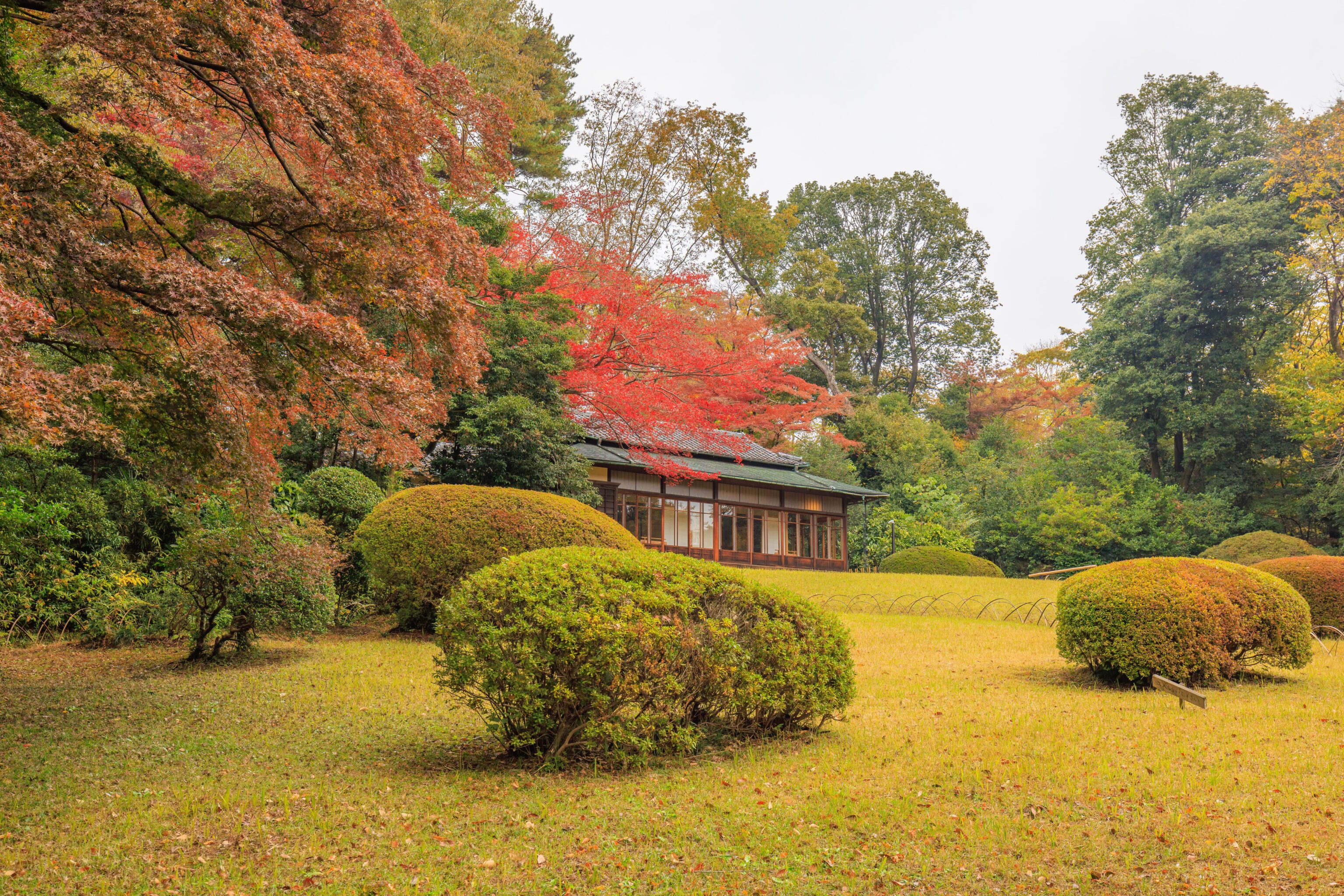
We next headed to the west, passing by the Kakuun-tei. The garden pamphlet provides a good description:
The house, constructed in the sukiya-style (teahouse design), was built by
order of Emperor Meiji as a rest house for Empress Shoken to express his
consideration for her.  The gentle slope leading to the pond is covered by a lush
lawn, with azaleas planted to create a winding trail for leisurely strolls.  The
view from the front garden shows the point of the Garden as a whole,
overlooking the quiet Nan-chi Pond across the lawn.  An old pine located on
the water's edge and the thick forest on the far side create beautiful scenery in
all seasons.  Kakuun-tei was a favorite resting place for the Empress during her
visits to the Garden.  It was burned down in the air raid but was rebuilt in 1958
with the support of a benefactor.
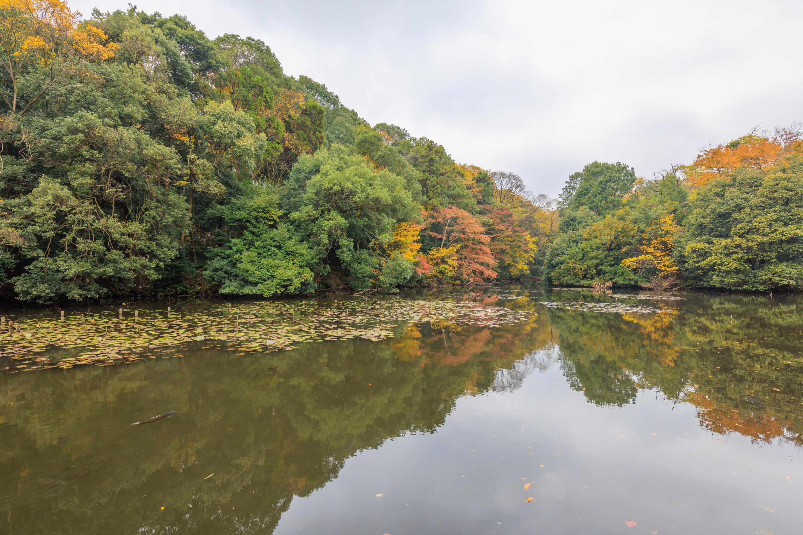
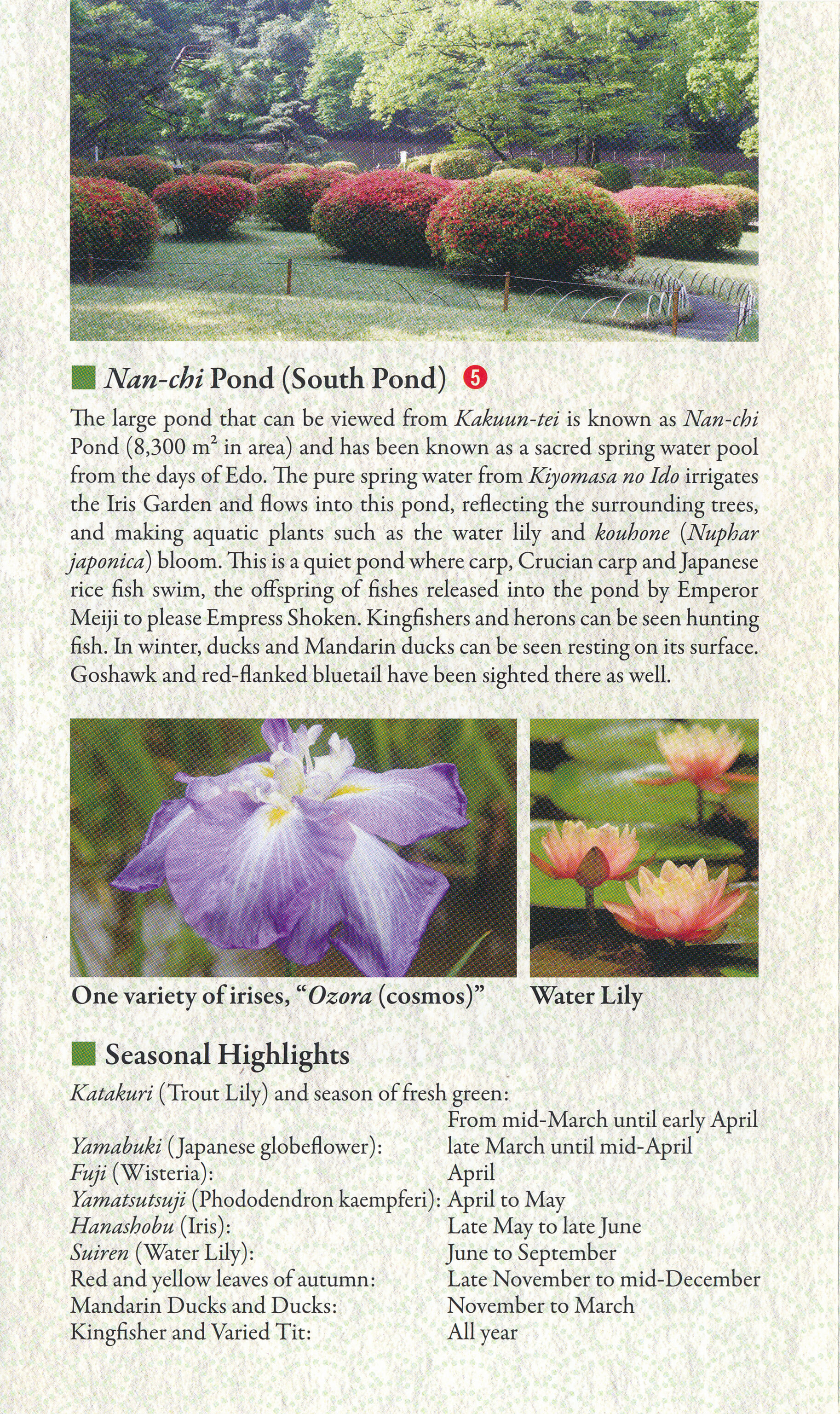
This area in front of the tea house has a great view of the South Pond. The garden pamphlet provides a description:
The large pond that can be viewed from Kakuun-tei is known as Nan-chi Pond (8,300 m2 in area) and has been known as a sacred spring water pool from the days of Edo. T he pure spring water from Kiyomasa no Ido irrigates the Iris Garden and flows into this pond, reflecting the surrounding trees, and makiig aquatic plants such as the water lily and kouhone (Nuphar japonica) bloom. This is a quiet pond where carp, Crucian carp and Japanese rice fish swim, the offspring of fishes released into the pond by Emperor Meiji to please Empress Shoken. Kingfishers and herons can be seen hunting fish. In winter, ducks and Mandarin ducks can be seen resting on its surface. Goshawk and red-flanked bluetail have been sighted there as well.
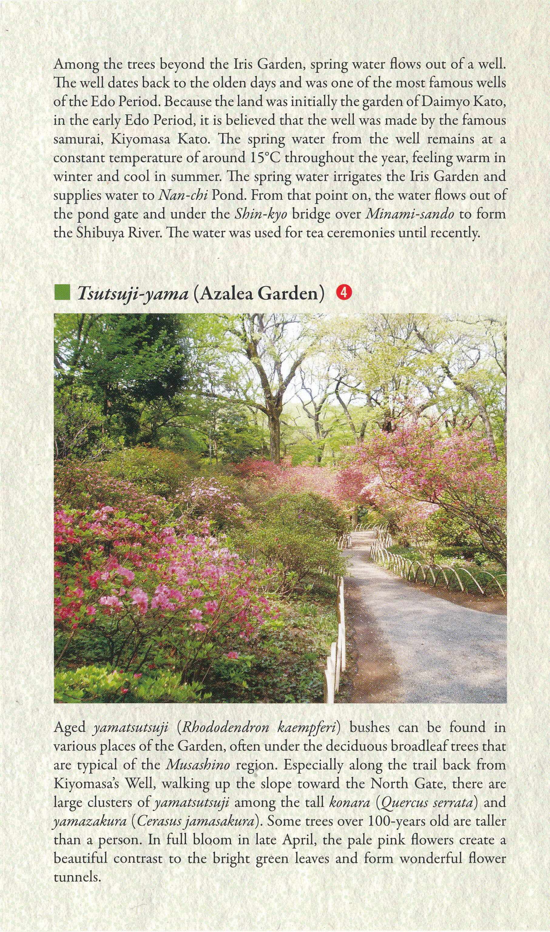
We continued on, passing by the tea house as we headed to the Iris Garden.
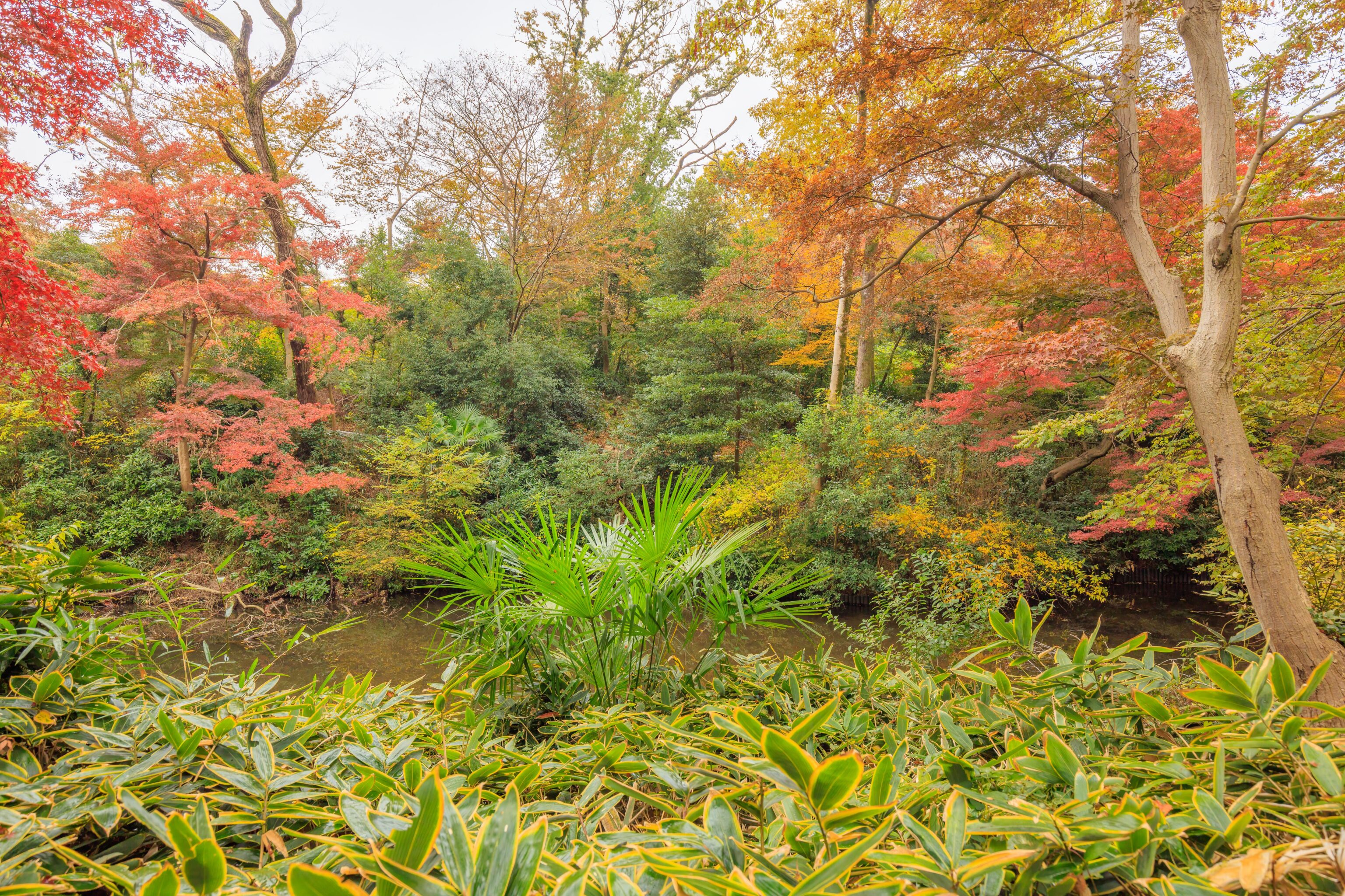
There is a great variety of plants in this garden. It can be somewhat of a messy view compared to the more organized scenes in Koraku-en.
While there were no irises to be seen, we did see more red Japanese maple trees in the Iris Garden.
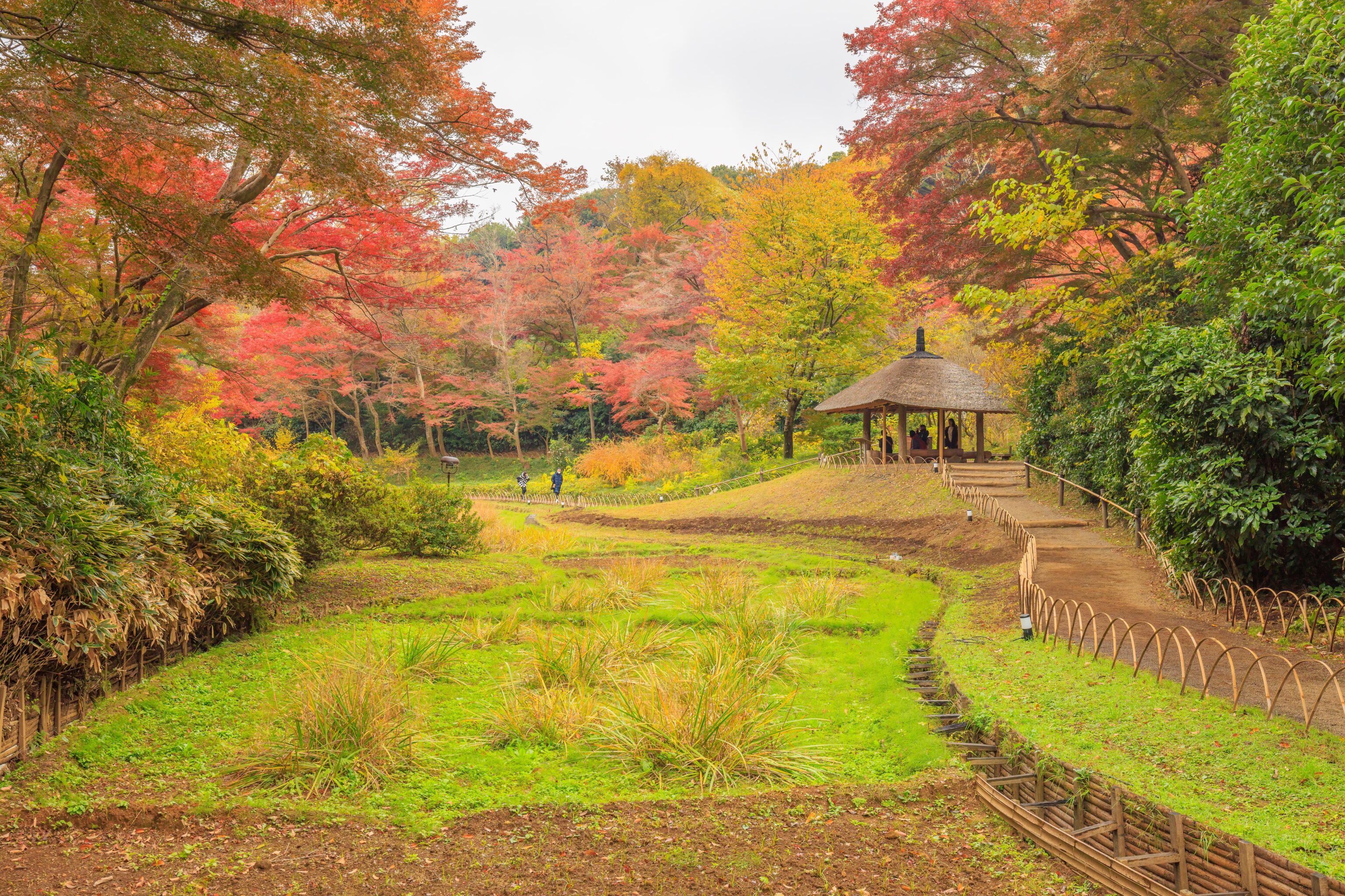
We continued walking, following the path as it curved to the north and passed by another Azumaya.
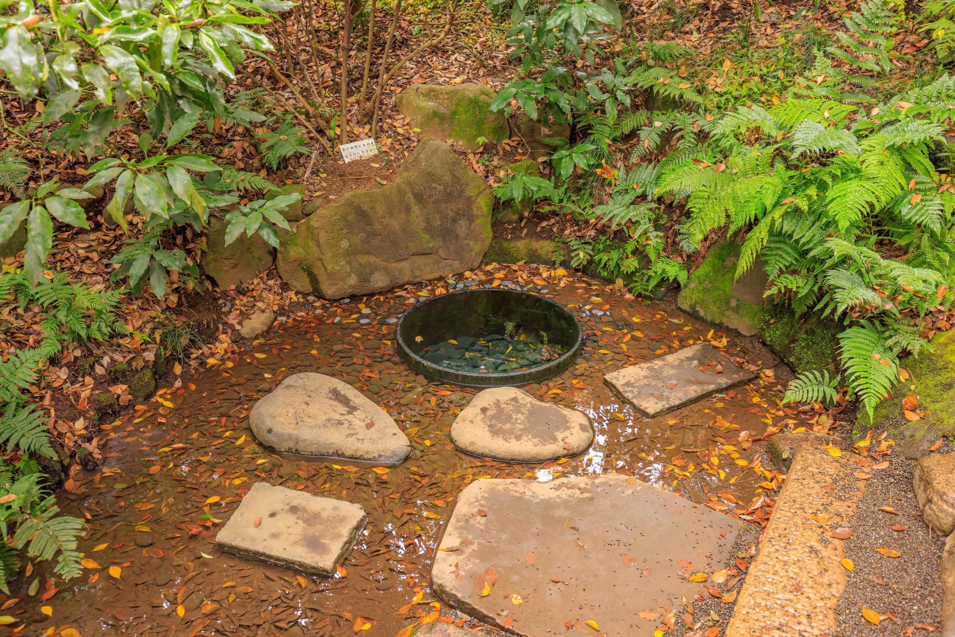
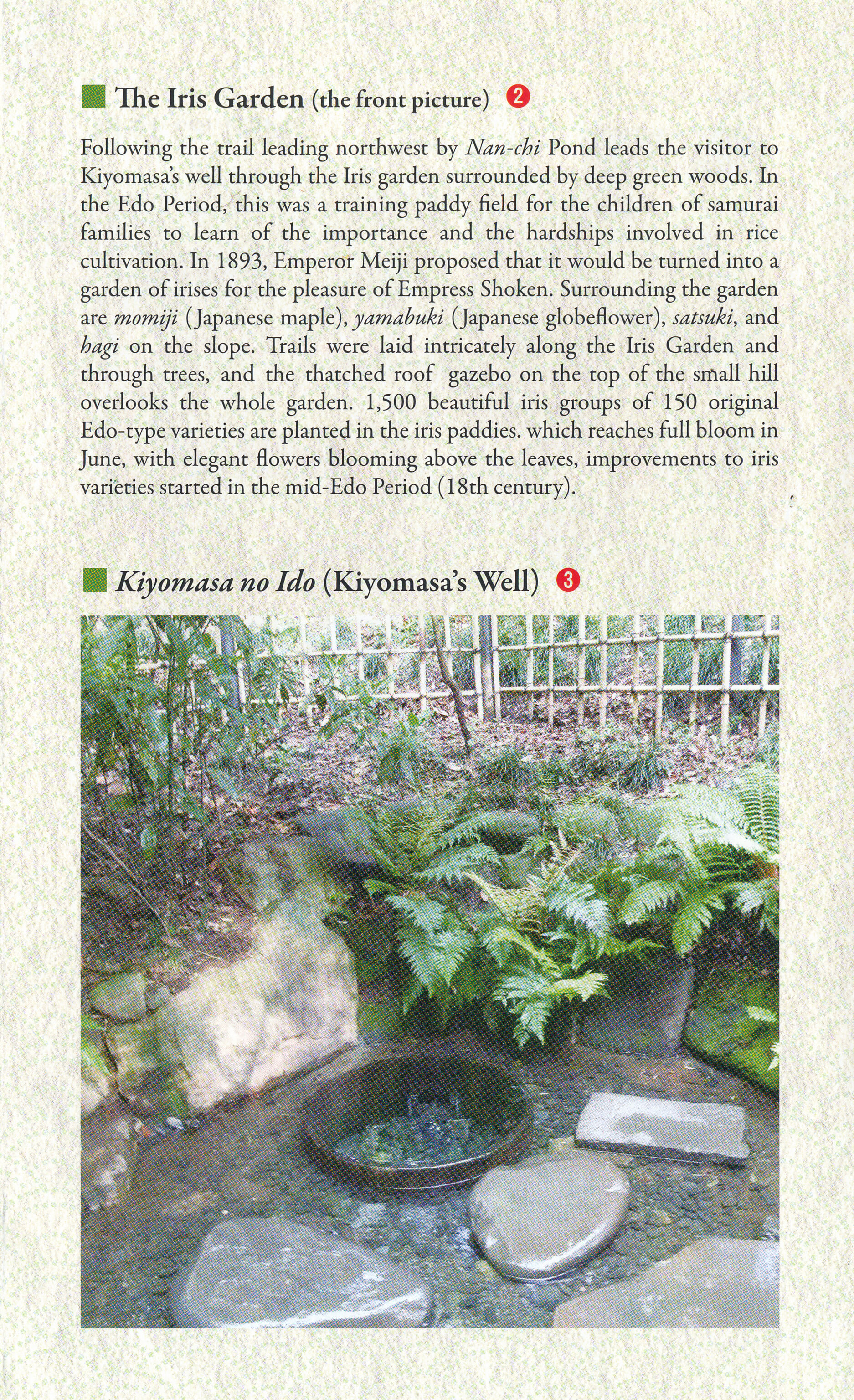
We reached Kiyomasa’s Well, at the northwestern corner of the inner garden. A sign provides a brief description:
The Kiyomasa-Ido Well was first belonged to Lord Kiyomasa Kato during Edo period.  This well is the fountainhead of Nan-Chi (South pond) and the pure water gushes out in a steady flow all the year around.  This well is famous for the ingenious way of sinking and the superiority of water's quality.

No drinking
The water appeared to be exceptionally clear, though we didn’t really notice any water flow. The garden pamphlet provides a longer description with a bit better English:
Among the trees beyond the Iris Garden, spring water flows out of a well. The well dates back to the olden days and was one of the most famous wells of the Edo Period. Because the land was initially the garden of Daimyo Kato, in the early Edo Period, it is believed that the well was made by the famous samurai, Kiyomasa Kato. The spring water from the well remains at a constant temperature of around 15°C throughout the year, feeling warm in winter and cool in summer. The spring irrigates the Iris Garden and supplies water to Nan-chi Pond. From that point on, the water flows out of the pond gate and under the Shin-kyo bridge over Minami-sando to form the Shibuya River. The water was used for tea ceremonies until recently.
After leaving the well, we backtracked via a slightly different path, elevated a bit above the Iris Garden. We passed by in front of the tea house.
We noticed a few bonsai trees on wooden posts between the tea house and South Pond.
On our way back to the East Gate, we passed by this tree. Its top was red, bottom was green, and we could see a very well defined transitional line.
Afternoon Snack
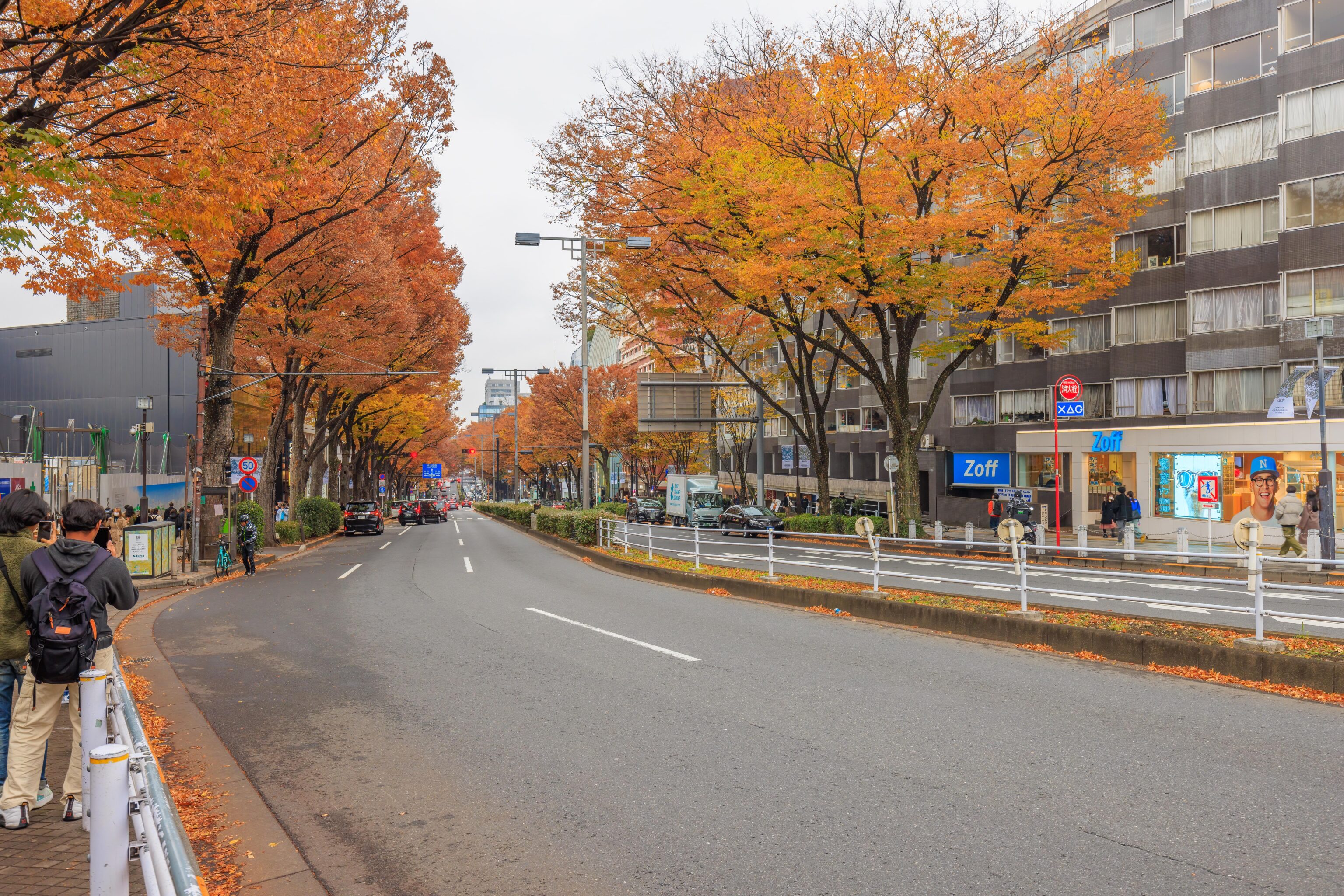
From here, returned to Harajuku Station and kept on going, heading into the Omotesando area, though this could probably still be considered Harajuku? There were quite a few trees with yellow leaves. Perhaps they would have been bright yellow if the sky wasn’t overcast?
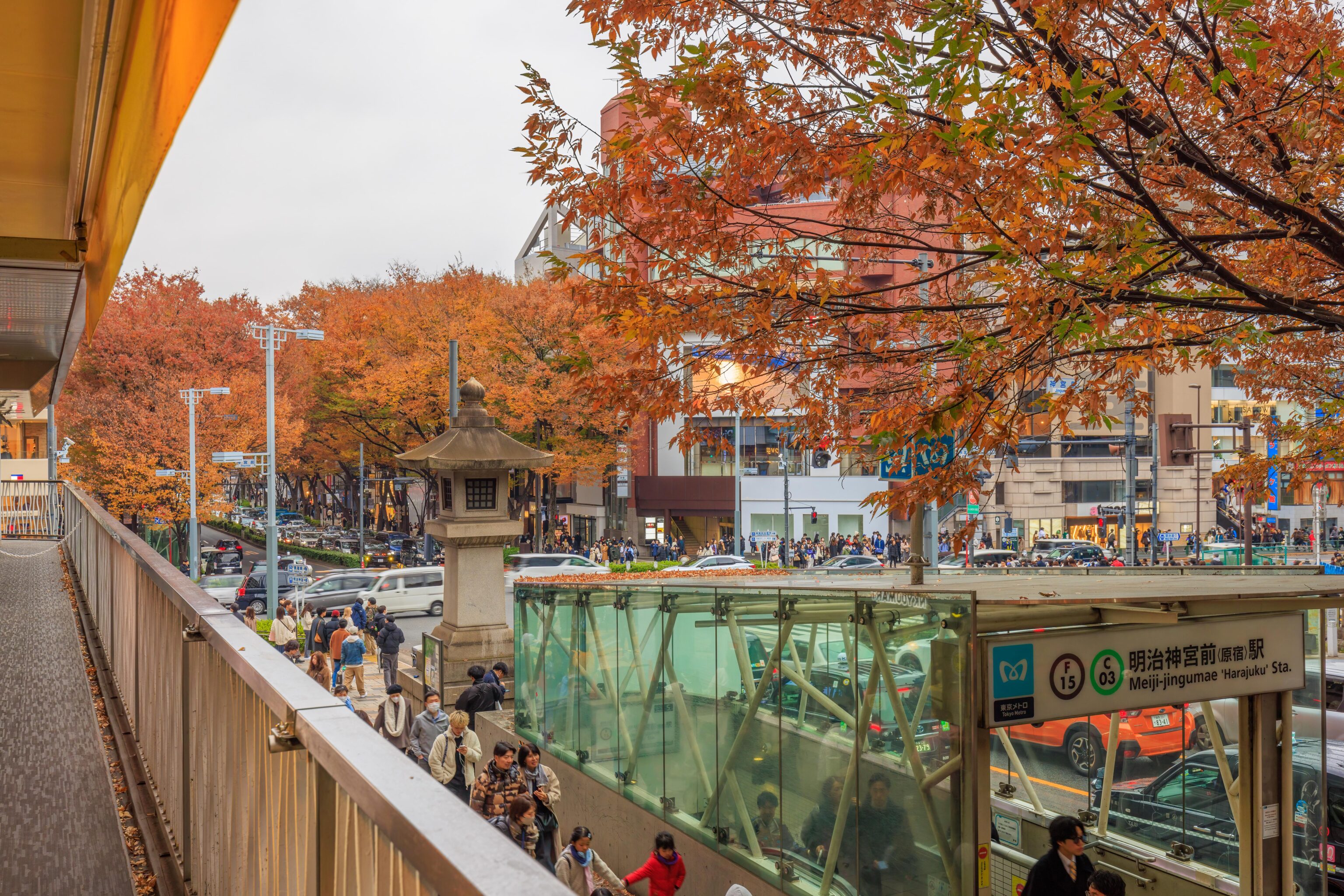
We queued for awhile outside of Double Tall, a small cafe above the Meiji-jingumae metro station. There was a table available outside but we wanted one inside as it was rather chilly, particularly when not walking around.
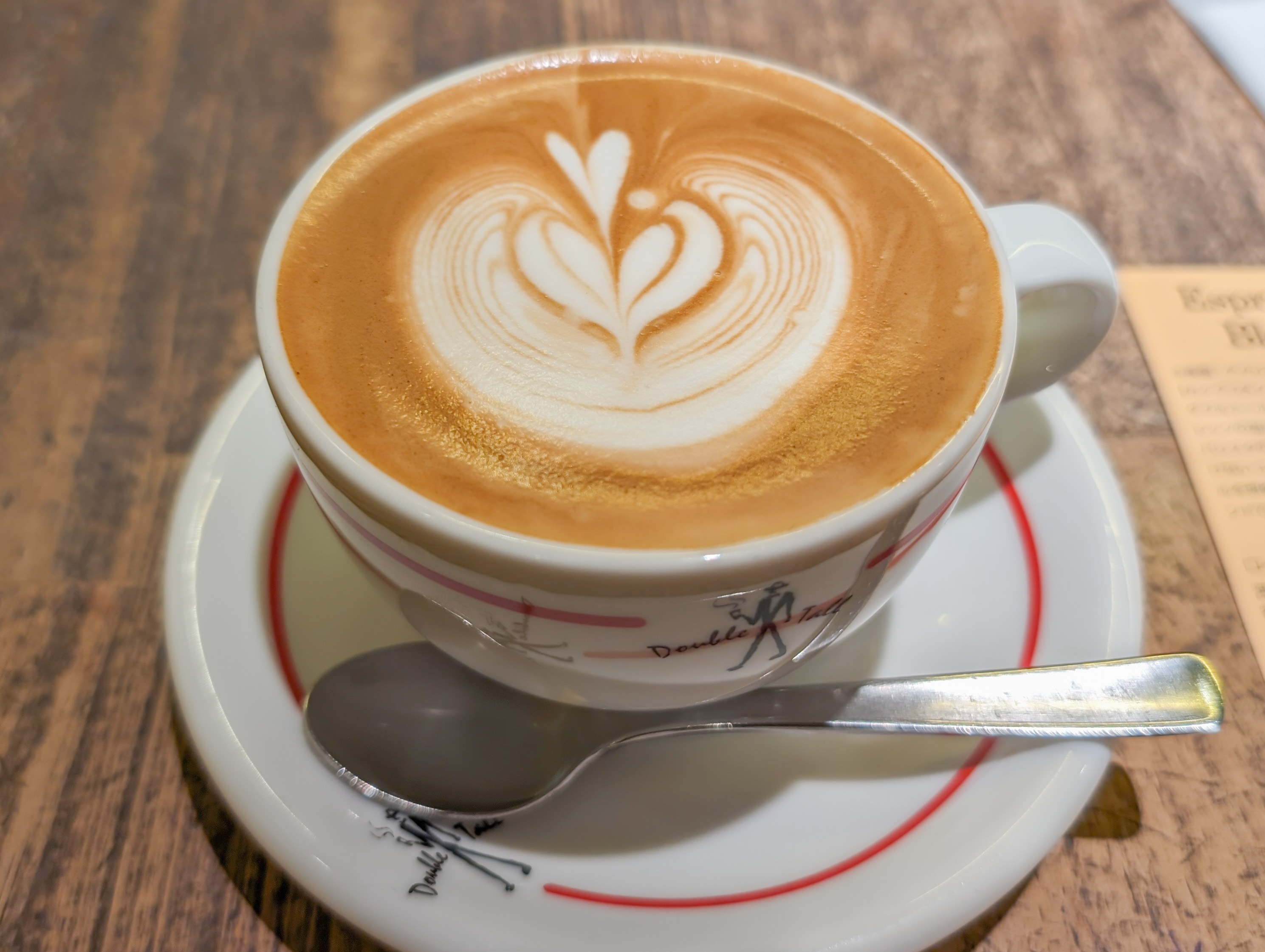
After getting a table, we had a latte…
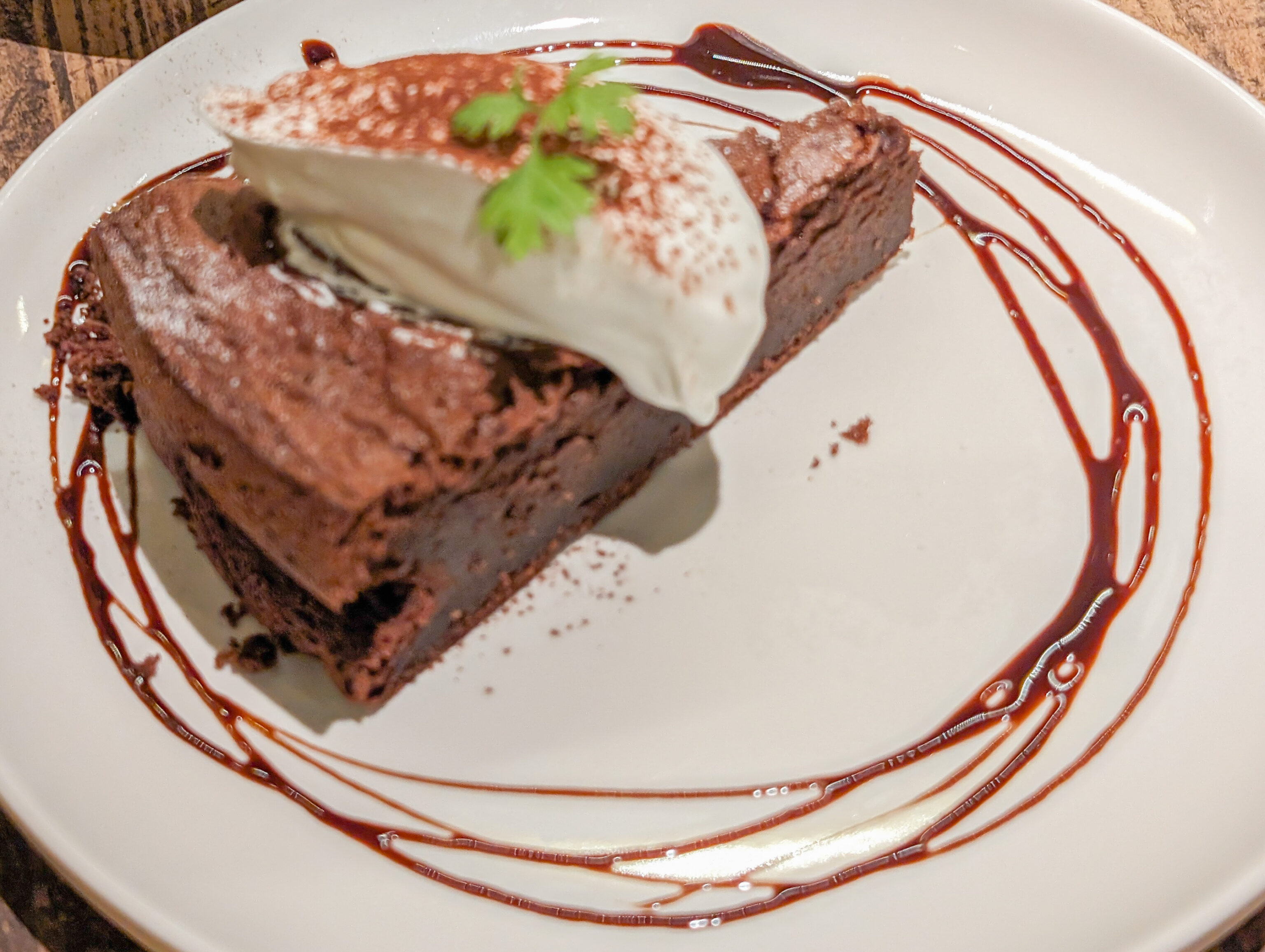
And a slice of cake, more like a brownie, and unfortunately poorly focused…
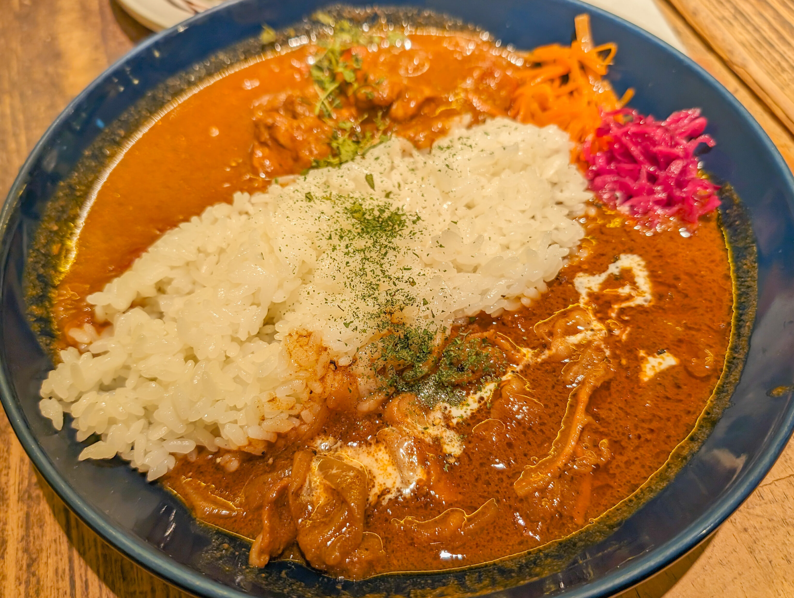
And a plate of curry! It was nice to sit down to rest and eat and drink something warm.
Shinkansen to Kyoto
After our afternoon snack, we headed back to Haneda to meet a different cousin who happened to be flying in with her family today! We took the Yamanote Line counter clockwise to Hamamatsuchō and switched to the Tokyo Monorail. It was definitely a less pleasant ride compared to the Keikyu Line’s limited express service between Shinagawa and Haneda.
After a brief reunion at Haneda, we headed back to Shinagawa via the Keikyu Line. We were a bit early and tried something new – changing our Shinkansen reservations online! Previously, online train reservations were simply not a thing in Japan. But now, there is the smartEX app and website which allows online reservations for a limited number of Shinkansen lines. We were able to make reservations in advance which included discount fares in the green car, a common Japanese term for first class on trains. We had made reservations for this trip via the app and were able to tie it in to our IC cards for easy entry through the fare gates.
Making the actual change didn’t go as smoothly. After selecting a new train and seats, the app seemed to want to validate my payment. The actual fare difference was 0 JPY and the validation never worked. We tried it twice with no luck, getting stuck each time. But I managed to refresh the app and saw that our change did go through! We quickly got our bags out of the locker and entered the fare gates. It worked as expected with the gate outputting a paper slip with our car and seat assignments. Supposedly, this paper slip may be required if a fare inspection occurs, but we’re not 100% sure about that as the reservation details are available in the app.
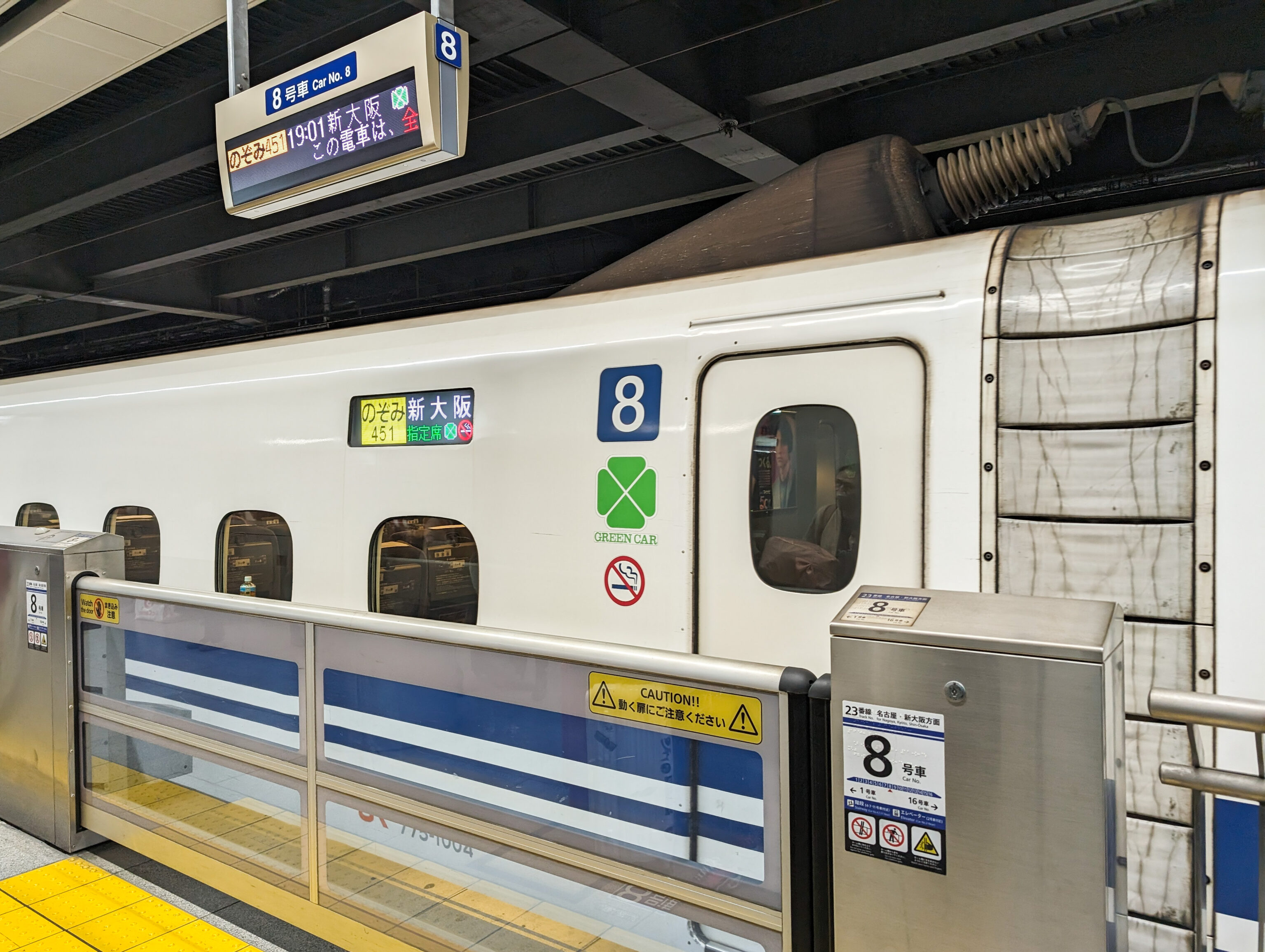
There’s the train and our car! The trip to Kyoto on the Nozomi, the fastest service available due to less stops, took about two hours and was uneventful as is almost certainly the case when there isn’t any unusually severe weather.
Hyatt Place Kyoto
After arriving at Kyoto Station, we took the subway four stops to Marutamachi Station. We took exit 6 and come out from underground right next to the Hyatt Place Kyoto‘s front door! We noticed there was actually a covered path between the station entrance and hotel as we walked in.
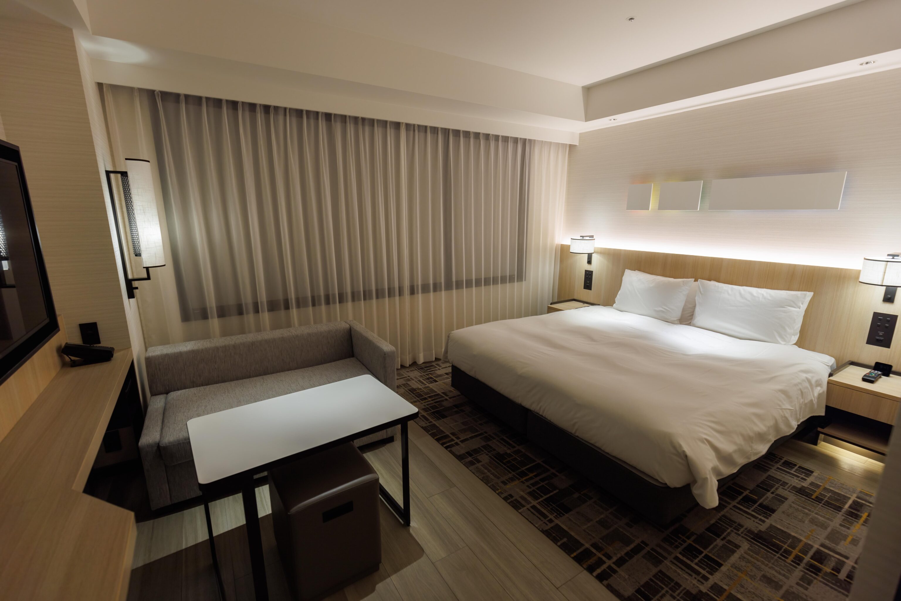
We received a room on the 5th floor. It had no view as the hotel is in a long building with interior rooms on one side facing a tiny central courtyard. The building isn’t really tall enough to have much of a view anyway with its central Kyoto location.
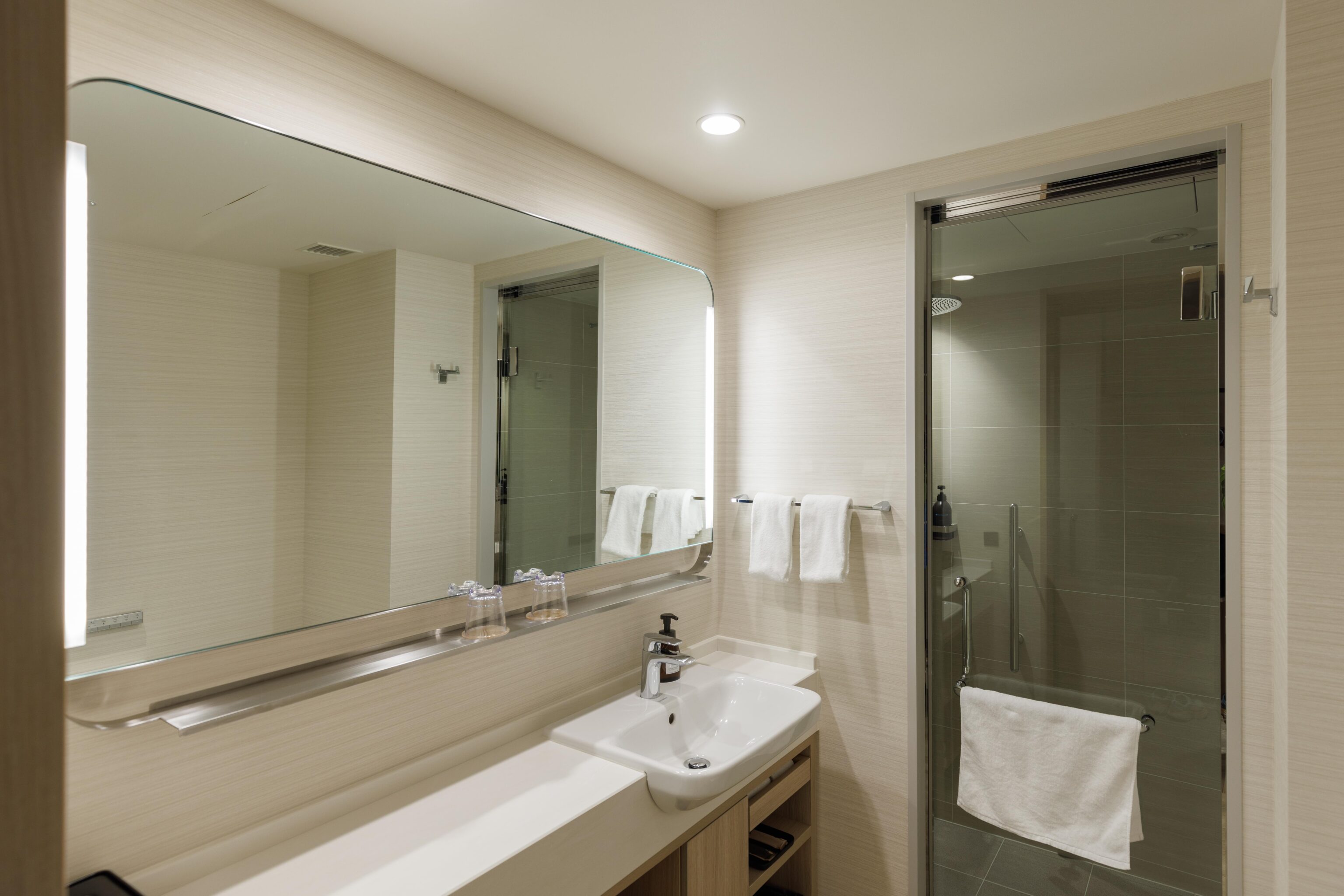
This hotel opened during the pandemic in 2021. It is still in excellent condition, as one would expect for a Japanese property of this age. The interior design is much better than at American properties. The shower actually has a door that properly seals on all sides doesn’t leak!
The only real difference from the typical American Hyatt Place, other than the higher quality construction, is the lack of free breakfast as that benefit requirement was eliminated earlier this year for international Hyatt Places.
The individual rooms lack coffee machines, though two complimentary use Nespresso machines are provided in the lobby. The property is something of a high quality but basic Western style hotel.